j truck terminal, inc. june 14, 2017 - vbgov.com
TRANSCRIPT
DHW Joint Ventures, LLC Agenda Item D2
Page 1
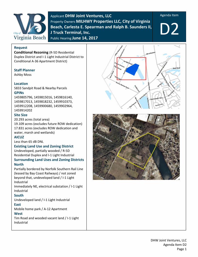
Applicant DHW Joint Ventures, LLC Property Owners MILHWY Properties LLC, City of Virginia Beach, Carlesta E. Spearman and Ralph B. Saunders II, S & J Truck Terminal, Inc. Public Hearing June 14, 2017
Request Conditional Rezoning (R-5D Residential Duplex District and I-1 Light Industrial District to Conditional A-36 Apartment District) Staff Planner Ashby Moss Location 5833 Sandpit Road & Nearby Parcels GPINs 1459805796, 1459815016, 1459816140, 1459817013, 1459818232, 1459910373, 1459912208, 1459900680, 1459902964, 1459914202 Site Size 20.293 acres (total area) 19.109 acres (excludes future ROW dedication) 17.831 acres (excludes ROW dedication and water, marsh and wetlands) AICUZ Less than 65 dB DNL Existing Land Use and Zoning District Undeveloped, partially wooded / R-5D Residential Duplex and I-1 Light Industrial Surrounding Land Uses and Zoning Districts North Partially bordered by Norfolk Southern Rail Line (leased by Bay Coast Railways) / not zoned beyond that, undeveloped land / I-1 Light Industrial Immediately NE, electrical substation / I-1 Light Industrial South Undeveloped land / I-1 Light Industrial East Mobile home park / A-12 Apartment West Tim Road and wooded vacant land / I-1 Light Industrial
Agenda Item D2

DHW Joint Ventures, LLC Agenda Item D2
Page 2
• The applicant proposes to develop a 382-unit apartment complex consisting of seven four-story buildings,
five townhomes, a shared indoor and outdoor recreation area, and 660 parking spaces. Sixty-nine of the spaces are in garages (detached or under the building), and the remaining 591 spaces are in surface parking lots. This total slightly exceeds the minimum requirement of 650 spaces.
• The apartment complex is located on both sides of Tolliver Road. The proposal qualifies for reduced setbacks as specified in Section 283 of the City Zoning Ordinance. Accordingly buildings are located between 12 and 15 feet from the right-of-way (instead of 35 feet), and no parking is placed between the buildings and the street.
• The buildings are designed to have a southern coastal look and feel, with heights of approximately 55 feet. The four-story buildings incorporate balconies, ample windows, shed awnings supported by timber brackets, a varying roofline and vertical plane, and a variation of building materials including brick, composite plank siding and board and batten (cement fiberboard material) in various shades of gray, beige and white.
• The subject area includes the northern tip of Burton Station Lake, which currently serves as a stormwater management facility for the surrounding area. The applicant intends to expand the lake directly north to accommodate stormwater management requirements generated by the apartment development.
• South of the lake is a 1.7-acre partially wooded and wetland area currently owned by the City. No development is currently proposed on this parcel.
• The proposed density comes to 21 units/acre, which is well under the 36 unit/acre maximum permitted by the A-36 Apartment District. However, the exact amount by which the lake must be expanded for stormwater management is unknown at this time. If the amount of land area that qualifies for the density calculation is decreased by two acres, the proposed density will exceed 24 units/acre, thereby requiring the A-36 zoning district.
Zoning History # Request 1 REZ (R-5D to I-1) Approved 06/21/2016 2 STC Approved 09/20/2016 3 CRZ (I-1 to A-1) Approved 08/03/1987
CUP (Mobile Home Park) Approved 08/03/1987 4 CUP (Expansion of an Electric Transformer Station)
Approved 10/07/2014 CUP (Electric Transformer Station) Approved 11/04/1985
5 SVR Approved 06/28/2011 CUP (Mini Warehouse) Approved 06/28/2011 CUP (Truck Wash Facility, Motel, Bulk Storage) Approved 09/10/1996
Application Types CUP – Conditional Use Permit REZ – Rezoning CRZ – Conditional Rezoning
MOD – Modification of Conditions or Proffers NON – Nonconforming Use STC – Street Closure
FVR – Floodplain Variance ALT – Alternative Compliance SVR – Subdivision Variance
Background and Summary of Proposal
1
2
3
5
4
1

DHW Joint Ventures, LLC Agenda Item D2
Page 3
This property is located in the Burton Station Strategic Growth Area (SGA), the master plan for which was adopted by City Council in 2009. Although much of the Plan is still valid, a number of circumstances have changed that have affected key components of the Plan. Primarily, the City of Norfolk decided to close the Lake Wright Golf Course rather than relocate it into Virginia Beach, eliminating a central feature of the Plan. Additionally, the Norfolk Airport Authority decided to rezone their property to I-1 Light Industrial to prepare for future development in the event a parallel runway is constructed. (The parallel runway would allow for closure of the crosswind runway and its associated noise and clear zones.) Despite the loss of the golf course, much of the Plan is still intact. Tolliver Road, originally called “Golf Course Road,” was planned to provide access to several large, landlocked parcels and incentivize new development in the area. In fact, Tolliver Road can now be better utilized with both sides of the road available for development rather than a single-loaded road. The master plan identifies five districts in which more detailed land use and development capacity recommendations are made. The subject site straddles two of these: North Golf Drive and Northampton – Diamond Springs Corridor. As its name suggests, the North Golf Drive District was originally envisioned to border the relocated Lake Wright Golf Course and house a series of office, flex, commercial, and mixed-use buildings on one side of Tolliver Road, capitalizing on views of the golf course. The Northampton – Diamond Springs Corridor District calls for office, commercial, hotel, and 300 apartment units. These apartments are shown in close proximity to the subject site, just southwest of Burton Station Lake. The 2016 Comprehensive Plan recommends an update for the Burton Station SGA Master Plan as a future action item. Staff has begun exploring new options for the areas requiring update, particularly Burton Station Village.
Master Transportation Plan (MTP) and Capital Improvement Program (CIP) Burton Station Road in the vicinity of this application is considered a two-lane undivided collector/local road. Currently, this segment of Burton Station Road is functioning at a capacity of LOS B. Tolliver Road will be a two-lane undivided collector road with a five-foot sidewalk on one side and ten foot multi-use path on the other. • CIP 9-081 - Burton Station Road Improvements - Phase I includes property acquisition for a 70’ right-of-way and full street improvements, including utilities, drainage, curb and gutter, sidewalks and street lights. Water and sanitary sewer have already been installed from Northampton Boulevard to Tim Road and the remaining Burton Station Road street improvements are close to design completion. A new road, Tolliver Road, will intersect Burton Station Road and extend approximately 300 feet in either direction with full street improvements. • CIP 9-091 - Phase III A will extend Tolliver Road with utilities and full street improvements north to the Norfolk Southern Rail line. The City has completed design plans and is ready to put a construction project to bid for Tolliver Road, Phase 3A once all land acquisitions are finalized. Phase III B will continue Tolliver Road from the Norfolk Southern Rail line to Air Rail Avenue and extend Air Rail Avenue north to Thurston Road and south to Barrs Road.
Street Name Present Volume Present Capacity Generated Traffic
Tolliver Road N/A 6,200 ADT 1 (LOS 4 “C”) 9,900 ADT 1 (LOS 4 “D”)
Existing Zoning 2 – 1,328 ADT Proposed Land Use 3 – 2,534 ADT
1 Average Daily Trips 2 based on 17 acres of R-5D and 4 acres of I-1
3 as defined by 381 apartments 4 LOS = Level of Service
Comprehensive Plan Recommendations
Traffic Impacts

DHW Joint Ventures, LLC Agenda Item D2
Page 4
Water and Sewer Eight-inch water and sanitary sewer mains were recently installed on Burton Station Road, from Northampton Boulevard to Tim Road. Additional water and sewer mains and a sanitary sewer pump station will be installed concurrently with the capital projects listed above for Tolliver Road.
School Current Enrollment Capacity Generation 1 Change 2
Bayside Elementary 472 585 42 35
Bayside Middle 659 918 16 12 Bayside High 1,799 1,827 19 12 1 “Generation” represents the number of students that the development will add to the school. 2 “Change” represents the difference between the number of potential or actual students generated under the existing zoning and the number generated under the proposed zoning. The number can be positive (additional students) or negative (fewer students).
Staff recommends approval of this application. The proposal is consistent with the Burton Station SGA Plan and Comprehensive Plan. There is a demand for market-rate apartments in this area, and the new development will add value to adjacent properties and increase contributions to the City’s tax base. The site is well outside of AICUZ around Norfolk Airport, even as projected with a new parallel runway. The multi-family use is compatible even though much of the surrounding area west and south will eventually be developed as light industrial. The I-1 Light Industrial zoning district excludes the most impactful industrial uses such as salvage yards, petroleum processing, and anything involving explosives. Typical I-1 uses consist primarily of office-warehouse, manufacturing and repair uses, all of which must be contained indoors. In addition, the layout of the apartment complex creates distance between buildings and adjacent I-1 properties and the rail line. The closest building is 75 feet from the rail line and 55 feet from the I-1 zoning, while most buildings are placed much farther away. These setbacks coupled with 25-foot landscaped buffer requirements for new light industrial adjacent to residential will mitigate future impacts to the residential development.
The following are proffers submitted by the applicant as part of a Conditional Zoning Agreement (CZA). The applicant, consistent with Section 107(h) of the City Zoning Ordinance, has voluntarily submitted these proffers in an attempt to “offset identified problems to the extent that the proposed rezoning is acceptable,” (§107(h)(1)). Should this application be approved, the proffers will be recorded at the Circuit Court and serve as conditions restricting the use of the property as proposed with this change of zoning.
1. The Property shall be developed in substantial conformity with the site plan entitled "Burton Station Apartments - Site Plan", prepared by Poole and Poole Architecture, LLC, dated March 2, 2017 ("Conceptual Site Plan"), which has been exhibited to the Virginia Beach City Council ("City Council") and is on file with the Virginia Beach Department of Planning ("Planning Department").
Public Utility Impacts
School Impacts
Evaluation and Recommendation
Proffers

DHW Joint Ventures, LLC Agenda Item D2
Page 5
2. The architectural design and building materials of the multi-family dwelling units built on the Property shall be substantially compatible with the architectural style and materials depicted on the building elevation plans entitled "Burton Station Apartments", dated March 2, 2017, prepared by Poole and Poole Architecture, LLC ("Elevation Plans"), which have been exhibited to City Council and are on file with the Planning Department.
3. A minimum of 650 parking spaces shall be provided in the approximate locations depicted on the Conceptual Site Plan.
4. Open space shall be provided in the approximate locations depicted on the Conceptual Site Plan.
5. Further conditions lawfully imposed by development ordinances may be required by the GRANTEE during detailed site plan review and administration of applicable City Codes by City agencies and departments to meet all applicable City Code requirements.
6. The Effective Date of this Agreement shall be the date this Agreement is approved by City Council.
Further conditions may be required during the administration of applicable City Ordinances and Standards. Any site plan submitted with this application may require revision during detailed site plan review to meet all applicable City Codes and Standards. All applicable permits required by the City Code, including those administered by the Department of Planning / Development Services Center and Department of Planning / Permits and Inspections Division, and the issuance of a Certificate of Occupancy, are required before any uses allowed by this Use Permit are valid. The applicant is encouraged to contact and work with the Crime Prevention Office within the Police Department for crime prevention techniques and Crime Prevention Through Environmental Design (CPTED) concepts and strategies as they pertain to this site.

DHW Joint Ventures, LLC Agenda Item D2
Page 6
Proffered Site Plan

DHW Joint Ventures, LLC Agenda Item D2
Page 7
Proffered Site Plan
Proffered Site Plan Proffered Site Plan

DHW Joint Ventures, LLC Agenda Item D2
Page 8
Proffered Building Elevation

DHW Joint Ventures, LLC Agenda Item D2
Page 9
Proffered Building Elevation Proffered Site Plan

DHW Joint Ventures, LLC Agenda Item D2
Page 10
Proffered Site Plan Proffered Site Plan
DHW Joint Ventures, LLC Agenda Item D2
Page 11
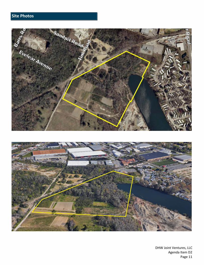
Site Photos

DHW Joint Ventures, LLC Agenda Item D2
Page 12
Site Photos Site Photos

DHW Joint Ventures, LLC Agenda Item D2
Page 13
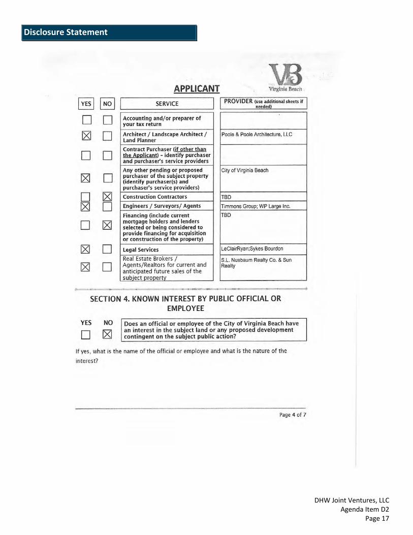
Disclosure Statement Disclosure Statement

DHW Joint Ventures, LLC Agenda Item D2
Page 14
Disclosure Statement

DHW Joint Ventures, LLC Agenda Item D2
Page 15
Disclosure Statement

DHW Joint Ventures, LLC Agenda Item D2
Page 16
Disclosure Statement Disclosure Statement
DHW Joint Ventures, LLC Agenda Item D2
Page 17
Disclosure Statement
DHW Joint Ventures, LLC Agenda Item D2
Page 18
Disclosure Statement

DHW Joint Ventures, LLC Agenda Item D2
Page 19
Disclosure Statement

DHW Joint Ventures, LLC Agenda Item D2
Page 20
Disclosure Statement

DHW Joint Ventures, LLC Agenda Item D2
Page 21
Disclosure Statement
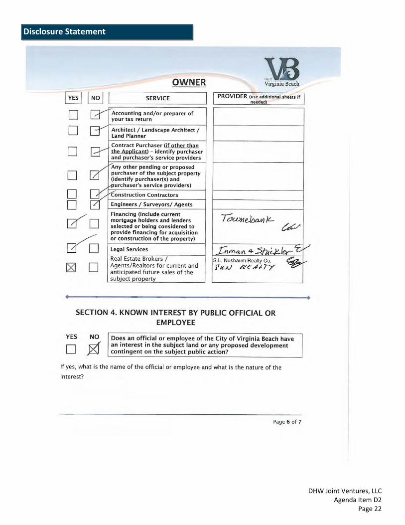
DHW Joint Ventures, LLC Agenda Item D2
Page 22
Disclosure Statement

DHW Joint Ventures, LLC Agenda Item D2
Page 23
Disclosure Statement

DHW Joint Ventures, LLC Agenda Item D2
Page 24
Disclosure Statement

DHW Joint Ventures, LLC Agenda Item D2
Page 25
Disclosure Statement

DHW Joint Ventures, LLC Agenda Item D2
Page 26
Disclosure Statement

DHW Joint Ventures, LLC Agenda Item D2
Page 27
Disclosure Statement
DHW Joint Ventures, LLC Agenda Item D2
Page 28
Disclosure Statement

DHW Joint Ventures, LLC Agenda Item D2
Page 29
Disclosure Statement

DHW Joint Ventures, LLC Agenda Item D2
Page 30
Disclosure Statement

DHW Joint Ventures, LLC Agenda Item D2
Page 31
Disclosure Statement

DHW Joint Ventures, LLC Agenda Item D2
Page 32
Disclosure Statement
DHW Joint Ventures, LLC Agenda Item D2
Page 33
Disclosure Statement

DHW Joint Ventures, LLC Agenda Item D2
Page 34
Disclosure Statement Disclosure Statement

DHW Joint Ventures, LLC Agenda Item D2
Page 35
Disclosure Statement