increase in land price and land use pattern changes …
TRANSCRIPT

Journal of Social Review Volume 3 (1) - December 2014
INCREASE IN LAND PRICE AND LANDUSE PATTERN CHANGES IN THEPOST-DISASTER SITUATIONIN AMPARA DISTRICT, SRI LANKA
S.M.M.Ismail
Abstract
This field research carried out the subject on “Increase in land price and land use patternchanges in the post-disaster situation in Ampara district”. It is one of the major productivitiesunder this project, funded by the NUFU, Norwegian Program for Development Researchand Education. In this research, the land use pattern, its changing trend, the increase in landprice and its significant causes in the post disaster situation, are key components to understandthe real condition of the land usage in the Ampara district. This district has had the misfortuneof facing many disasters in the recent past which created severe impacts on its people. Thisarea has suffered a lot as a result of armed conflict and natural disaster. The effects of bothdisasters have had directed to increase the land price and land use pattern changes in theresearch area considerably. Therefore, this study is significant as it explores how far post-tsunami and post-war scenarios pilots to increase the land price and land use pattern changesin the area of research. This paper has covered the three major workings as land use patternchanges, increase in land prince and the causes for increasing land price respectively. Thispaper is found that the land use pattern has been changed and it impact on agriculture andother economical activities. Further, this study reveals that the land price of coastal regionof Ampara district has been increased rapidly due to many reasons. So, this recent work triesto assess the level of usage of lands and the trend of land price in different locations, and alsothese helps to categorize the varies types of land and land use patterns which experienced bythe people in Ampara district where natural and human-made disasters were placed in largescale.
Journal of Social Review Volume 3 (1)
December 2014 Department of
Social Sciences
Introduction
Land is one of the important necessities ofhuman life. Land use involves themanagement and modification of naturalenvironment or wilderness in the environment such as fields, pastures, andsettlements. It has also been defined as “thearrangements, activities and inputs peopleundertake in a certain land cover type toproduce, change or maintain it”(Guttenberg, Albert Z. 1959). Land use isan understanding of the use of the land andthe management practices within a land use
category, provides valuable informationabout the reasons for change in the conditionof our natural resources. This information inturn can be incorporated into strategicplanning and development at all levels withthe aim of optimizing land use, assessingsuitability, enhancing productivity andultimately achieving sustainable practices. The increase in population, urban expansion,variations in the demand for local agriculturalproducts, development projects initiated by
34

Journal of Social Review Volume 3 (1) - December 2014
zone of the island, receiving rainfall duringthe northeast monsoon and the inter-monsoon season. The distance betweenAmpara and Colombo (the capital city) isnearly 350 km, and this is one of the mainobstacles standing in the way of economics,social and cultural development of thedistrict.
Amapara is a densely populated district,specially in its northern coastal area it has apopulation of 6 percent, with an ethniccomposition of 44% Muslims, 37.5%Sinhalese, 18.3% Tamils according to theinformation released for 2007 by theDepartment of Census and Population. Thereare other ethnic groups such as Burgers andMalays in negligible numbers scatteredaround the district. More than 97% of theMuslims and the Tamils live in the coastalarea comprising the Divisional SecretariatDivisions of Kalmunai, Sainthamaruthu,Karaitivu, Nintavur, Addalaichenai,Akaraipattu, Alayadivampu, Thirukovil,Potuvil, Sammanthurai, Navithanveli andIrakkamam.
Map 1.1: Map of study area
the public and the private sectors, and theeconomic policies followed by thegovernment have caused many changes inthe patterns of land use within the Amparadistrict. And also these series of aspects havecreated a higher demand for all types ofneeds such as land for settlement,cultivation, private and other publicpurposes. This situation increasingly hasmany socio-economical impacts on the lifeof the people in the Ampara district.
Background of the study area
When the reverberations of an underwaterearthquake sent a tsunami wave hurtlingtowards countries in South Asia in 2004, oneof its biggest victims was Sri Lanka, acountry that has been experienced over 3decades of ethnic conflict. The sheer powerof the wall of water have caused the deathsof thousands, destruction of villages, homesand livelihoods, provoking an outpouringof aid and sympathy from countries allaround the world. Sri Lanka was the countrythat was hit severely by the tsunami next toIndonesia, with approximately 36,000people dead and over one million displacedfrom their homes. The Northern and EasternProvinces, were the places that sufferedgreatly, with over 20,000 dead, alsohappened to be the home of a long-runningseparatist struggle.
Ampara is one of the districts situated inthe South Eastern Coast of the EasternProvince of Sri Lanka has had themisfortune of facing many disasters in therecent past that have created a severeimpacts on its people. The Ampara regionwas historically known as Digamadulla inthe ancient time. It is bordered by thedistricts of Batticloa and Polannaruwa onthe North, Hampantota on the South,Moneragala and Badulla on the west andthe Indian Ocean on the East. It covers areaof 4431 sq. km. and is situated in the dry
35
Source : Disaster management Plan, 2006,Divisional Secretariat, Kalmunai Muslim andTamil Division
Increase in Land Price and Land Use Pattern Changes in the Post-Disaster Situation in Ampara District, Sri Lanka

Journal of Social Review Volume 3 (1) - December 2014
The main livelihood of the people in thedistrict is agriculture, fishing and relatedpursuits. Ampara accounts for 25% of therice production in the country. SenanayakaSammuthrarya, located in the western partof the district, supplies water to all irrigationschemes, agricultural and households needsof the entire district. Sandy beaches andlagoons characterized the coastal area. Thetotal extent of Paddy land is nearly 67,500hectares. Those who live along the coastalarea from Panama to Periyaneelavani areengaged in the fishing industry as their mainmeans livelihood. There is a sugar factory,a tile factory, some brick factories, ricemills and garment factories in the district.The indigenous cottage industries are basedon the palm trees and the products fromthese industries can be further improvedwith the application of modern technology.
Ampara has suffered severely during thepast 30 years due to armed conflict. Theeffects of the conflict include: internaldisplacement, damage to houses andinfrastructure, loss of livelihoods and a highpercentage of single-headed households (inparticular, women-headed households). Asa result, more than half of the populationslive below the poverty line. In addition tothe conflict, this district had faced a hugedisaster of Tsunami for the first time thatstruck and shattered the eastern coastal beltof Ampara district. In fact it has causeddeath toll of 10,436, and 75,172 people wereinjured, and 18,810 houses were damaged(www.statistics.gov.lk).
This predominantly low-lying coastal regionis characterized by its sandy beaches andlagoons, and is in the country’s dry zone.Primary land use is shown in the tablebelow:
Table 1.1Land Use Patten in Amparai District
Category
UrbanLand
Agriculture Land
Built upLand
Associated
Non -AgriculturalLand
40,847 40,847
65,97365,973HomesteadsTree &OtherPotentialCorps
Paddy 58,984 58,984Corp Land
AreaFigures(Ha)
Total
(Ha)
10,026 10,026Sparsely-Chena
SugarCane
CorpLand
5,000 5,000
Water-bodiesBarrenland andothers
RangeLand
ForestLand
WetLand
Total Area
Naturalforest
ForestPlantation
Nellikelee
ScrubLandGrasLand
Forested
Nonforested
DenseForest
OpenForest
Mangr -oves
Marsh
99,116
75,630
8,371
1,140
43,839
26,605
292
5,667
51,698
493,188
99,116
75,630
8,371
1,140
43,839
26,605
292
5,667
51,698
493,188
Source: District Statistical Hand Book
36
Increase in Land Price and Land Use Pattern Changes in the Post-Disaster Situation in Ampara District, Sri Lanka

Journal of Social Review Volume 3 (1) - December 2014
Table 1.2Distribution of Sampling (200questionnaires) in Ampara District
Most of the area has been used foragricultural production with major, minorirrigation and rain fed water and forestconservation is maintained highly in thedistrict. Scarcity of urban land has beenutilized for the human settlement and itcaused increases in the density.
Based on this information, this paper triesto understand the land use pattern, increasein land price and its causes and impacts onthe different levels of socio-economicalcondition in the district.
Objectives of the study:
This study was carried out based on thefollowing objectives: to explore how farland use pattern changed during post-disaster situation in Ampara district; to findout how far the government and NGOsmade use of land for housing and otherconstructions and; and to examine thereason for increasing land price in thecoastal belt of Ampara district.
Research Design/Method:
In this study, various methods were usedfor data collection- from primary as well assecondary sources. Secondary data wascollected from officials such as theDivisional Secretariat and MunicipalCouncil, NGO’s records, previouslyconducted research and reports, and otherrelevant documents.
Primary data was collected mainly throughquestionnaire survey, key informantinterviews and Focus Group Discussions(FGDs). As the total number of populationof the district is almost 600,000, householddata was collected, from 200 householdsbased on stratified sampling method as thedistrict comprised of Muslims, Sinhala andTamil communities. The distribution ofsampling (200 questionnaires) is shownbelow in table 1.2.
Muslims
Sinhalese
Tamils
GN Divisions
Total
42
39
19
Percentageof the people
100
84
78
38
200
Sample
Primary data was also collected fromstructured interviews with key informants.25 people were interviewed, as follows:
Land officers : 04Political Leaders : 02Social Activists : 05Administrators : 04Professionals : 04NGOs representatives : 06
In addition to this, at the village level, datawas collected through four (4) focus groupdiscussions (FGD) with the participation oftsunami and war affected people, socialactivists, academics, and religious leaders.These FGDs were conducted using a numberof participatory data collection instrumentsadopted from Participatory Rural Appraisal(PRA).
Three main methods were used (see table 1.3)which consist of six data collection techniques/ instruments to be used in this study.The following table summarizes the keymethods that are used in this study.
Type of data Techniques/instrumentsMethods
QuantitativeandQualitative
Quantitative
Qualitative
Table 1.3: Methods and techniques ofdata collection
Interviews, Discussionsand Appraisals(PRA)
Deskstudies
Surveys
Literature reviewSecondary dataSite visit( observation)
Household Questionnaire and Farmers
Key informant interviewsFocus Group Discussion(Rankings,groupdynamics)
37
Increase in Land Price and Land Use Pattern Changes in the Post-Disaster Situation in Ampara District, Sri Lanka

Journal of Social Review Volume 3 (1) - December 2014
little unused land. In the Central Highlandsaround Kandy, villagers faced with limitedflat land, have developed intricately terracedhillsides where they grow rice. In the 1970sand 1980s, the wet land cultivation area wasexpanding rapidly, as the governmentimplemented large-scale irrigation projectsto restore the dry zone to agriculturalproductivity. In the 1980s, the area drainedby the Mahaweli Ganga changed from asparsely inhabited region to a wet rice areasimilar to the southwest. Through suchprojects, the government of Sri Lanka hasplanned to recreate in the dry zone the lush,irrigated landscape associated with theancient Sinhalese civilization. (http://www.country-data.com/cgi-bin/query/r-13169.html)
The coastal belt, surrounding the island hasa different types settlement pattern evolvedfrom ancient fishing and agricultural villages.Separate fishing settlements have come tobe expanded laterally along the coast, linkedby a coastal highway and a railway. Themobility of the coastal population duringcolonial times and after independence led toan increase in the size and number of villages,as well as to the development of growingurban centers with the facilitation of outsideaspects. In the 1980s, it was possible to drivefor many kilometers along the Southwestcoast without finding a break in the string ofvillages and bazaar centers merging into eachother and into towns.
The land used by man for different purposein the Eastern region of study; perhaps themost significant changes in land use in recentyears have taken place within Amparadistrict. Due to the rapidly increasing demandfor land for settlement and economicactivities, there is a constant struggle goingin uses due to the demand. (Ramraj Narasimhan).
These determine the more significantchanges that took place in the patterns of land
Understanding land use and itspattern changes
This study analyses the land price trendsand the changes in the land use pattern inorder to investigate the causes for the risein the land price and the consequent changesin the land use pattern in the post-disastersituation in Ampara district. And also itfocuses on all the types of changes in theland use pattern while keeping watch on theoverall process of rise in the land price inthis phase. Land use is an importantinstrument for sustainable development inthis century. Possible use of land candirectly influence on land price which isincreased in this research area due to thenatural as well as human-made disasters.Therefore, this chapter deals with clearunderstanding the changes in the land usepattern change and the price of land in widerview.
Understanding of the use of the land andthe changes of land use pattern within a landuse category provides valuable informationabout the causes for change in the conditionof our natural resources. Land use is thefunction of land - what it is used for. Landuse varies from area to area. In ruralsegment (countryside) land use can includeforestry and farming. In urban areas (townsand cities) land use could be housing orindustry and other public purposes. The landin Sri Lanka is used for variety of purposes.A part is used for: agriculture, a part forforestry and wildlife conservation and a partfor human ements, industry, infrastructureetc. (Percy Silva - 2001).
In the 1980s, major parts of the Northernand Eastern plains were sparsely populated,with scattered villages each huddled aroundan artificial lake. The Jaffna Peninsula,although a dry area, is densely populatedand intensively cultivated. The Southwestof Sri Lanka contains most of the people,and the villages are densely clustered with
38
Increase in Land Price and Land Use Pattern Changes in the Post-Disaster Situation in Ampara District, Sri Lanka

Journal of Social Review Volume 3 (1) - December 2014
use in the country during the period 1982to 2010. And it has increased in the posttsunami situation and following tablesdescribe the variability, land use patterns inAmpara district can be categorized intobuilt-up area, wetland, agriculture (paddy,coconut and other crops), and marshy land.At present, Ampara faces the threat of theland and environmental degradation due tothe unplanned urban system. Due to theinfluence of various factors of many origins,land cover has undergone dynamic changes.(Namalie Jayasinghe, 2005).
In such a way, Ampara district also hadreceived a vital attention on land use patternand its changes consequently. In thisresearch, the land use pattern duringdifferent period (from 1980 to 1990 andfrom 2000 to 2010) can be measured ascomputed in the table 1.4:
The urban land is 7.41% and agriculturalland is 32.74% as calculated during the1980s period, because lack of urbanizationand demand was in the period and peopleused the land for the settlement andagriculture. And the mega developmentproject was not initiated by the governmentin time and the people used the land for theirordinary needs based on the traditionalsystem and cultivation and other practices.
But, it has been changed in the followingperiod of 1990s due to the demand andsettlement purposes for the victims of civilwar. So, table 1.5 illustrates the land usepattern prevailed during the period of 1990s.
The use of urban land was augmented by8.55% in this time and agricultural landusage had been reduced to certainpercentage during this period, because suchland had been used for settlement and otherconstruction purposes. Meanwhile, thedisparity had been increased in the land usepattern in the context of the millennium
development goal. The subsequently table1.6shows the land use pattern in the millenniumphase
In the 3rd stage, the use of build up land hasincreased in addition to the used land in theearly period. And agricultural land has beenabridged because it has been used for thehuman settlement, particularly in thisresearch area. So, the change in the land usepattern has reached to a new era because thetsunami disaster has affected the demographyof the area which has made the decisive markon the land to accommodate the people’sdemands in the region of research.
The table 1.7 gives the details of the currentland use pattern in Ampara district. This tableis very important to understand the realcondition of land use pattern changes aftertsunami disaster, especially in the coastal beltof Ampara district.
The table 1.7 describes the changes of landuse pattern in the area. In this phase, the newdemand for the land may seriously effect onthe agricultural and wet land. The area ofhuman influence has drastically increasedduring the study period in the research area.Reductions of paddy land and wetland alsohave taken in to account during the periodof study. The trend of the changes shows thatthe area is getting transformed from naturalenvironment to man-made environment.
In this study, urban land and agriculture landwere given priority to understand the landuse pattern in Ampara district during the postdisaster situation. Prior to the tsunami andconflict, people have used urban lands tobuild houses and commercial buildings fortheir various activities. Further, governmentbuilt several public buildings such ashospitals, schools, parks, playgrounds andother all kind of administrative offices andcivil service buildings for the commercial,administrative, and individual enterprise andfor the betterment of the people in the district.
39
Increase in Land Price and Land Use Pattern Changes in the Post-Disaster Situation in Ampara District, Sri Lanka

Journal of Social Review Volume 3 (1) - December 2014
Even Ampara is one of the most denselypopulated districts in Sri Lanka and itspopulation growth rate is more than 2%. Infact, thousands of people, mostly thefishermen, lived and settled down in thecoastal area; close to the sea-shore. Thesepeople were the severely affected as theysettled down close to the sea shore, by thetsunami disaster in 2004 which devastatedtheir lives, houses, belongings and otherpublic buildings.
Moreover, protracted conflict and civil warthat held over the 3 decades in Sri Lankathat contributed immensely to the loss oflands of civilians in the Ampara District.More than 3883 acres of paddy landsbelonging to Muslims in the Vaddamaduand other areas have been forcibly taken bythe military groups (CCE report).
Government and NGOs were engaged inpost-tsunami reconstruction since 2005. TheGOSL initially declared 200 m as bufferzone from sea shore for this purpose, andthen it was brought down to 60 m. This, infact, this policy change contributed to thereplacement of the construction of publicbuildings, Kovils and Mosques in safeareas- away from buffer zone 60 m limit.The government and NGOs were able tolocate empty land quite easily forreconstruction and relocation in somevillages, but it was not the case in someother area where they were compelled topurchase private paddy lands belonging toindividuals for this purpose.
Thus, GOSL and INGOs were able to locateand settle the tsunami victims, who livedwithin the buffer zone prior to tsunami, inthe new housing scheme under thereconstruction and relocation system.Furthermore, affected people who livedoutside the buffer zone area and non-affected people of tsunami were alsoengaged in purchasing paddy lands and
empty lands away from buffer zone toconstruct houses and other purposes whichresulted in a sudden increase of the land priceand usage in the district.
However, paddy cultivation, after the civilwar and tsunami, has been productive for thefarmers in the Ampara District. As farmershad easiest access to engage in cultivation inall the areas in the aftermath of LTTE’sregime, their production and cultivation hadrisen considerably. Total cultivable land,prior to the tsunami, was 55,000 hectaresproducing 250,000 metric tons per season.But the latest study shows a marginal, if notconsiderable, increase after the tsunami.According to the latest report, both theproduction rate of paddy and the extent ofpaddy lands have been increased. At present(after the tsunami), the total cultivable areaunder paddy is around 65,000 hectares andthe average production is 341,000 metric tonsper season.
In this sense, the types of land and land usepatterns in the research area in the post-tsunami situation are given in the followingview points:
And urban land utilization has increased by30% after tsunami disaster and theagricultural land area is reduced by 1% inthe study area because such land have beendeveloped in to build up pattern.
Urban Agriculture
Residential Paddy
Industrial Home garden
Institutional Other crops
Recreational
Transportation &Infrastructure
40
Increase in Land Price and Land Use Pattern Changes in the Post-Disaster Situation in Ampara District, Sri Lanka

Journal of Social Review Volume 3 (1) - December 2014
Increase in land price in the post-disaster situation in Ampara district,Sri Lanka
This chapter analysis the reason or causesfor increasing land price and its socio-economical impacts on the activities of thepeople in post-disaster situation in Amparadistrict. There are some evidence that landprices have the potential for use as indicator,especially during post-disaster period inorder to evaluate the socio, economiccondition and its future possibilities in theregion. The land prices have been changedsignificantly. More research studies are alsoneeded to estimate the value of the land andthe causes reflecting the price of land. Thisstudy only provides a partial treatment ofland price, since it focuses on land usepattern changes, after the disasters.
Land value is the total monetary worth of apiece of land. This includes upgrades orimprovements that were made to theproperty. The land’s value is important ifwe are trying to sell our property. It can alsobe useful if we need to calculate our capitalgains. According to the Henry GeorgeOrganization, there are three approachesthat are used to determine the value of apiece of land. These include the costapproach, the sales comparison approachand the income capitalization approach. Thecost approach says an informed buyer wouldpay no more for a piece of land than hewould a similar property with a sameattributes. The sales comparison approachuses the actual prices other buyers have paidfor similar properties to determine landvalue. The income capitalization approachtakes into account any future income a buyercould make from the property, anddetermines the land and value based oncurrent market values and expected expenseincreases in the land owner’s business.(Henry George Organization, from http://www.ehow.com/facts_5942534_definition-land-value_.html)
According to this understanding the landprice (value) was decided due to the Demandfor the land and it is drawn closer to twodimensions as face and area. Normally wecan divide the build up land in to three facesas urban, semi urban, and rural. This categoryis classified as of the centre and peripheryapproaches, the urban is denoted Kalmunaimunicipal area, the semi urban symbolizesKaraitivu, Nintavur, Addalaichenai,Akkaraipattu, Sammanthurai, Pottuvil andRural refer to Alayadivampu, Thirukovil,Navithanveli and Irakkamam in the scope ofstudy. The ‘area’ is partitioned in to threecategories in each face: coastal or border,middle and main area based on the goods andservices accessibilities in the region.
The demand is variable in every face and areaperiodically based on the development ofgoods and services delivery; it has beentented due to conflict and tsunami disaster.And these may causes to change the land usePatten and increase the land price in thedistrict. The table 3.1 describes the land pricebased on ‘face’ and ‘area’.
According to the data the land price valuatedin a higher range in the post disaster situationthan before and there was a variable basedon area such coastal/ border, middle and mainin both situation.
Here every price indicators has beencalculated by the mean value of the data inorder to the proposed category and theresults is articulated that land price is higherin the urban area than semi urban and ruralfaces, the land price is in the 2nd range in thesemi urban face than rural face and land pricehas abridged in the coastal area in all faceexcluding Pottuvil and the border area’s landprice is increased such Sammanthurai andAlayadivempu area because the demand wasincreased in the area due to the tsunami. Thedevelopment of tourism may lead to theincrease in land price in Pottuvil area. When
41
Increase in Land Price and Land Use Pattern Changes in the Post-Disaster Situation in Ampara District, Sri Lanka

Journal of Social Review Volume 3 (1) - December 2014
we compare the data of the disaster causeswith the increase in the land price in all overthe area with some certain exclusion.
Why the price of land is increased?
There are many factors that influence onland price in the research area. In the post-war scenario, government had formulatedthe buffer zone policy which is highlyconsidered in this paper as an importantmeasure to understand the factor of landprice. Meantime, population growth, higherdemand for the urban land, end of civil warand peace initiatives, development oftourism industry, expansion of localindustries, higher educational facilities,mega development projects of thegovernment and other social factors that arekey influential and powerful indicators todetermine the land price in post-disaster era.These factors are taken up for discussion indetail.
Higher population growth
Our research in this area shows that this hasbeen the one and only investmentopportunity with a highest investment returnand a zero risk. The result of our randomsurvey conducted in Ampara will give aclear picture of the future trend of real pricesof the land. The main reason for this increasein the rate of prices is the high populationdensity in some areas in the region and thedemand for lands in some other remotevillages. Even Ampara is one of the mostdensely populated districts in Sri Lanka andits population growth rate is more than 2%.So in comparison with other regions in SriLanka, population density in Ampara districtis so high that it forces land price to go upcontinuously.
Kalmunai, Sainthamaruthu are higherdensely populated areas in the district.Therefore, availability of land is not enough
for the need of the people to build housesand other buildings. So, scarcity of land inthese areas is generated the demand of landprice consequently. As a result of this peoplewant to buy urban land (closed to the mainroad) at higher prices for their severalpurposes. According to the questionnairesurvey, in Kalmunai municipality areas, itcosts Rs. 1,000,000.00 to buy a perch of land,and we need Rs. 800,000.00 to buy a perchof land in Sainthamaruthu as well. Thishigher demand of land price is patheticallymaking economical impacts on the life of thepeople.
Clear demarcation of buffer zone
After Tsunami, the Government of Sri Lanka(GOSL) initially declared 200 m as bufferzone from sea shore. Then it was decreasedto 100 m and, finally the GOSL has beendemarcated 60 m as buffer zone for manypurposes. This demarcation is the key reasonof increase of the land price. Because, soonafter the tsunami, people who lived in thebuffer zone area were homeless, and theywere compelled to move to some other areasaway from the buffer zone in order topurchase the land for their lives.
After the buffer zone policy of thegovernment, the price of the land which isaway from the buffer zone area has increaseddue to the demand for land and the lack ofsettlement land. As a result of this,government and the NGOs have resettled theTsunami victims away from the buffer zonearea such as Ismail Puram in Sammanthurai,Pace village in Addappallam, hosing schemein Karaithivu, Maruthamunai and inIslamabath (Kalmunaikkudy). Meantime,people who were affected by the Tsunamihave built the houses and commercialbuildings in some other areas. Because of thispractice, the land price has been increasingmore and more in such locations comparingwith earlier rate.
42
Increase in Land Price and Land Use Pattern Changes in the Post-Disaster Situation in Ampara District, Sri Lanka

Journal of Social Review Volume 3 (1) - December 2014
no freedom to purchase the land due to theunsafe security situations. And most of thelands were not utilized for the cultivation.But after end of the civil war, people werefree to move everywhere and live peacefully.Lands are being opened for cultivation,settlement, construction and more. So, endof the civil war and peace initiatives broughtthe land price very high.
People from Ampara district were feared todo the cultivation in many areas such asAkkaraipattu (bordered land), Pottuvil(Komari) and in Thirukkovil before theterrorism was defeated. But, at present peopleare given freedom for purchasing land,cultivating, establishing industries and livingtogether without any fear and tension. Thispeaceful environment gives opportunities tolive anywhere, and to buy anything in anyregion of the country, especially in the areaof research. So, price of land has beenincreased repeatedly.
Income from foreign employment
The foreign employment is the huge sourceof income of the people in order to meet theirneeds for their livelihoods and face thechallenges in their way of life existed in thepast. This foreign employment has becomea potential wealth and source of income fortheir survival. There are youths, female, maleand the professionals have gone abroad andimproved their living conditions and alsointerested in purchasing land as their futureassets for their generation.
This foreign employment has also givenopportunities for saving money out of theirforeign income. As it always make thempossible to have balance in their income,because of this saving ability of foreignemployees they try to purchase land forpaddy cultivation, and putting up their housefor living and keep the land for their futurepurposes.
Higher demand for urban land in post-disaster period
The price of urban land has already becomevery high due to the commercial and otherbusiness enterprises in some areas namelyKalmunai and Sainthamaruthu. And peoplewho lived near the buffer zone liked to moveto some semi urban areas in order topurchase a land for various purposes. Thiskind of move brought the land price in ahigher rate. In this circumstance, peoplewere compelled to purchase the land inurban, semi urban and other suburb areas.And also most of the people like to live inthe urban areas away from buffer coastalareas in fear of Tsunami.
After 2004, several commercial and otherpublic buildings were constructed by thegovernment and the NGOs for many publicpurposes. In addition to this, many privatebanks and other institutions were alsoestablished in the urban and the semi urbanareas in the coastal parts of Ampara district.Government built markets, factories,hospitals and other service centers in themain part of the towns for the publicwellbeing. These short of constructions werethe causes for the increase in the land price,especially in the case of urban and the semiurban land in the region.
On the other hand, many agricultural landswere used for the public and privateconstruction needs. For instant, hospitalproject in Sainthamaruthu, market complexin Karaithuvi and Nintavur and many privateand government banks etc. can be cited.This creation also piloted to increase the landprice continuously in the research area.
End of civil war and potential for peace
Before the end of civil war the land pricewas very low compared with the presentsituation. During the civil war, people had
43
Increase in Land Price and Land Use Pattern Changes in the Post-Disaster Situation in Ampara District, Sri Lanka

Journal of Social Review Volume 3 (1) - December 2014
Good price for local production
At present the price of local products alsoincreasing, so the people want to get involvein developing cottage industries andproduce more goods. For putting upbuilding for cottage industries they needextra land for utility and run their businessin the market places where there arecompetitors for purchasing land because ofthis they have to pay more and buy the landwhich trend makes price rising in the urbanand rural areas in the region.
Expanding local industries andinvestment opportunities
People in the research area are engaged inmany local and cottage industries and smallscale entrepreneurial activities. Aftertsunami disaster, many NGOs haveprovided facilities and opportunities for selfemployment in order to promote theirlivelihoods. Some organizations haveestablished farms, waste managementcenters, fertilizer and paddy seeds stores,and training centers for preparing villagepeople with skill for self employment.
Booming of local industries in thecoastal area of Ampara districtwith the support of INGOs in or-der to promote the self employ-ment opportunities of the localpeople.
On the other hand many private banks andinsurance corporations also were establishedto provide opportunities to invest in incomegenerating enterprises and to get loan in orderto initiate and produce the localmanufacturing goods and services. As theland is an essential natural resource so inorder to establish these kinds of activities ofman all organizations, public and the privatesectors have tried their best to control theincreasing price of the land, but couldn’t.
Development of tourism industry
As the tourism is one the main source ofincome to a county, the government of SriLanka has taken up many steps to developthe tourism industry in various regions in theisland, especially in the coastal areas of theAmpara district. After civil war, the coastalareas in Ampara are being attracted thetourists by the development of the tourism,especially Arugambay area in Pottuvil. InAmpara district, Pottuvil is one of theeminent tourist places where numbers oftourist are visiting from all over the world.
Arugambay is one of the famous touristplace in Sri Lanka where number oftourists are arriving from several partsof the universe.
The Arugambay was extremely affected bythe tidal wave of the Tsunami. Now it isrebuilt by the government and owners of theprivate restaurants. Arugambay is now
44
Increase in Land Price and Land Use Pattern Changes in the Post-Disaster Situation in Ampara District, Sri Lanka

Journal of Social Review Volume 3 (1) - December 2014
facilitated with scenic beauty for the localand international tourists and visitors. At thesame time, after the end of civil war, thenumber of tourist arrival has been increaseddue to the existing peaceful environment inPottuvil-Arugambay area. Therefore,people are very competitive in purchasingland in the tourist areas in order to buildthe hotels and restaurants for generatingincome.
The development of tourism has caused thesituation to have the land price increasedup to 800,000.00 rupees per perch (atpresent) in the coastal and the main area inPottuvil Divisional Secretariat. So, the landprice is also affected by the developmentof tourism.
University and higher educationalinstitutions
In the research area, there are many highereducational institutions, vocational trainingcenters and technical colleges such as SouthEastern University of Sri Lanka, NationalCollege of education, Government teacher’straining college, two technical colleges (inSammanthurai and Akkaraipattu),Vocational training centre and internationalcolleges. These educational and vocationalinstitutions are playing vital role inimparting education and training to thecommunity to uplift the standard of theireducational and living conditions in thisarea.
South Eastern University of SriLanka is playing vital role in highereducational process.
Therefore, the coastal belt of Ampara districtis becoming an important haven of theEastern province, and this phenomenon hasdirected the demand for the land and theincrease in land price significantly.
Mega Development Projects
Government have initiated some megadevelopment projects with the aims toprovide infrastructural facilities such asharbor, water treatment plant, tourism,electricity, telecommunication and high waynetwork etc. These mega developmentactivities have created higher demand for theland in all the villages in Ampara district.These projects can be considered under thefollowing view points.
A. Infrastructure development
In Ampara district, the infrastructure is beingdeveloped with the support of foreigncountries and nongovernmental organizations. In this way, the houses for resettlement,electricity, water supply and tele communication are in the process of develop ment inAmpara district, especially after Tsunami andthe end of LTTE regime. On the other hand,road network also is developed covering andconnecting all highways routes. It helps allthe people for an easy accessibility, especiallytransportation can be made easily from otherdistrict to Ampara and from Ampara to otherregions.
45
Increase in Land Price and Land Use Pattern Changes in the Post-Disaster Situation in Ampara District, Sri Lanka

Journal of Social Review Volume 3 (1) - December 2014
Water supply is the key indicatorof the infrastructure developmentprogress in post-disaster situationin Ampara district
This post-disaster development activitiesand easy accessibility have givenopportunities to the outside people to comeand live in this district permanently. Thissituation has directly influenced on the priceof land for purchasing.
B. Harbor project in Oluvil
Oluvil area was ones a rural village but nowwith the implementation of harbor projectand the establishment of South EasternUniversity of Sri Lanka, it is becoming theurban environment. The government of SriLanka has purchased many hectares of landfor the construction of harbor to promotethe national development to make Sri Lankaa wonder of Asia. For this purpose, manyacres of land used by the people in Oluvilareas were taken up for the above project.
Master plane of Oluvil harbor which isthe bench mark of the regional and thenational development of Sri Lanka.
Oluvil Port project is underconstruction
Therefore, the people had to move to someother areas away from their residentialplaces. So, they had to buy land for settlingdown in the new places. in this circumstancethey had to spend more to buy the land tomeet their requirement or needs, because ofthis higher demand for lands automaticallybecome necessary. Now the surrounding ofOluvil is becoming an important base forbusiness, education and other essential needs.So, people are interested in purchasing theland before the price increased. Thiscompetitive land purchasing was a maincause for increasing land price.
Resettlement plan
Government and Non governmentalorganizations have used the agricultural landfor the resettlement practices, especially inKalmunai (Tamil and Muslim divisions),Sainthamaruthu, Akkaraipattu andThirukovil areas. And they constructed thepublic buildings such as hospitals, schools,child care centers, town halls, technicalcollege, health centers and so on. Before thatthe agricultural land had already been usedfor public utility services such as playground, fertilizer store, Children Park andcultural centre.
Housing scheme located in Oluvil fordisplaced people due to the harborproject.
46
Increase in Land Price and Land Use Pattern Changes in the Post-Disaster Situation in Ampara District, Sri Lanka
Journal of Social Review Volume 3 (1) - December 2014
This reconstruction programs have madehuge mark on the price of the agriculturalas well as non-agricultural lands in theAmpara district.
Sacred place for religious and traditionalheritage
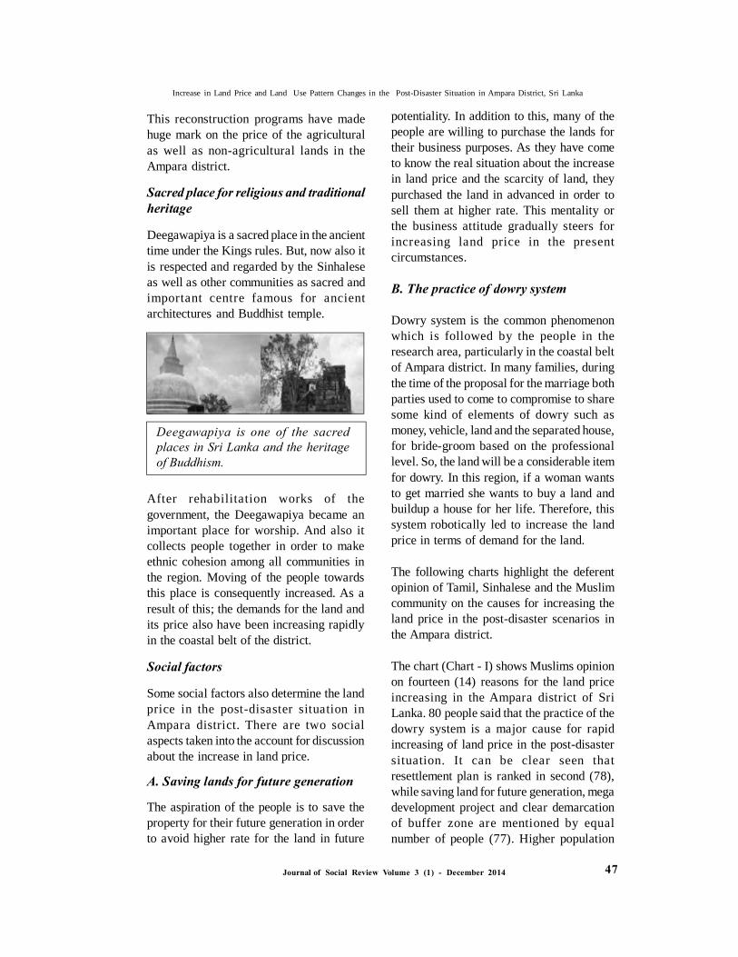
Deegawapiya is a sacred place in the ancienttime under the Kings rules. But, now also itis respected and regarded by the Sinhaleseas well as other communities as sacred andimportant centre famous for ancientarchitectures and Buddhist temple.
Deegawapiya is one of the sacredplaces in Sri Lanka and the heritageof Buddhism.
potentiality. In addition to this, many of thepeople are willing to purchase the lands fortheir business purposes. As they have cometo know the real situation about the increasein land price and the scarcity of land, theypurchased the land in advanced in order tosell them at higher rate. This mentality orthe business attitude gradually steers forincreasing land price in the presentcircumstances.
B. The practice of dowry system
Dowry system is the common phenomenonwhich is followed by the people in theresearch area, particularly in the coastal beltof Ampara district. In many families, duringthe time of the proposal for the marriage bothparties used to come to compromise to sharesome kind of elements of dowry such asmoney, vehicle, land and the separated house,for bride-groom based on the professionallevel. So, the land will be a considerable itemfor dowry. In this region, if a woman wantsto get married she wants to buy a land andbuildup a house for her life. Therefore, thissystem robotically led to increase the landprice in terms of demand for the land.
The following charts highlight the deferentopinion of Tamil, Sinhalese and the Muslimcommunity on the causes for increasing theland price in the post-disaster scenarios inthe Ampara district.
The chart (Chart - I) shows Muslims opinionon fourteen (14) reasons for the land priceincreasing in the Ampara district of SriLanka. 80 people said that the practice of thedowry system is a major cause for rapidincreasing of land price in the post-disastersituation. It can be clear seen thatresettlement plan is ranked in second (78),while saving land for future generation, megadevelopment project and clear demarcationof buffer zone are mentioned by equalnumber of people (77). Higher population
After rehabilitation works of thegovernment, the Deegawapiya became animportant place for worship. And also itcollects people together in order to makeethnic cohesion among all communities inthe region. Moving of the people towardsthis place is consequently increased. As aresult of this; the demands for the land andits price also have been increasing rapidlyin the coastal belt of the district.
Social factors
Some social factors also determine the landprice in the post-disaster situation inAmpara district. There are two socialaspects taken into the account for discussionabout the increase in land price.
A. Saving lands for future generation
The aspiration of the people is to save theproperty for their future generation in orderto avoid higher rate for the land in future
47
Increase in Land Price and Land Use Pattern Changes in the Post-Disaster Situation in Ampara District, Sri Lanka

Journal of Social Review Volume 3 (1) - December 2014
land price in the research area. It expressclearly that higher demand for urban land(31) and the practice of dowry system (31)are mentioned in high and equal number. Thereasosns, saving land for future generation(30) and end of civil war and potential forpeace (29) are marked almost in very closenumber, while university and highereducational insitutions (28) and resttlementplan (28) have shown equal numbers. 24People have ticked on higher populationgrowth and development of tuorism industryas reasons for land price increasment.Although, mage development projects havealso marked by 23 people as an anotherinfluancing factor, neverthless equal numberof people (20) reason out high demand forurban land and good price for localproduction. Further, the chart providesanother two less influencing factors, sacredplace for relgious and traditional heritage andforeign employment. Booming of localindustries and investment opportunities (13)are pointed out by very smaller amount ofpeople.
Conclusion
Land use is an understanding of the use ofthe land and the management practices withina land use category, provides valuableinformation about the reasons for change inthe condition of our natural resources. Thetotal land area of Amparai district is 493,188hectares which is used for a variety ofpurposes. In this study urban and agricultureland were given priority to understand theland use pattern in Ampara district during thepost-disaster period. Prior to the tsunami andviolent conflict, people used urban land forbuilding houses and commercial complexesfor their purposes. The land was used fordifferent purposes in the region; perhaps themost significant changes in land use in recentyears have taken place within the district.
growth is classified (75) as anotherimportant cause for increasing the price ofland. Moreover, end of civil war andpotential for peace is expressed by 67 peopleamong the sample. Higher demand for urbanland has identified by 59 persons.Interestingly, University and highereducational institutions (42) and good pricefor local production (41) are almost similar.The chart indicates almost equal number ofpeople mentioned causes such asdevelopment of tourism industry andforeign employment. The next two reasons,sacred place for religious and traditionalheritage and booming of local industries andinvestment opportunities are explained invery close numbers, 27 and 28 respectively.
The chart (Chart – II) illustrates Sinhaleseopinion on fourteen (14) reasons for the landprice increasing in the Ampara district ofSri Lanka. It can be clear seen thatresettlement plan is ranked in first (74),while sacred place for religious andtraditional heritage (65), clear demarcationof buffer zone (62) and mega developmentproject (61) are indicated, approximately bythe equal number of people. The chart shows50 people reason out the end of civil warand potential for peace as a cause for landprice increasing. Higher demand for urbanland and saving land for future generationare marked, 41 and 45 people respectively.Interestingly, higher population growth (35)and good price for local production (36) arealmost similar number. Average people arementioned following causes; developmentof tourism industry, university and highereducational institutions and booming oflocal industries and investmentopportunities. Lastly, less number ofSinhalese (16) is stated foreign employmentand the practice of dowry system (12) as areason for increasing of land price.
The chart (Chart - III) describes Tamilpeople’s opinion for increasement of the
48
Increase in Land Price and Land Use Pattern Changes in the Post-Disaster Situation in Ampara District, Sri Lanka
Journal of Social Review Volume 3 (1) - December 2014
Reference
Guttenberg, Albert Z.1959.‘A Multiple LandUse Classification System’, Journal of theAmerican Planning Association, 25: 3,
Ramraj Narasimhan, Assessment of theTsunami Recovery Implementation,
Namalie Jayasinghe, 2005, Post-tsunami SriLanka and the Ethnic Conflict Heywood, I,Cornelius , S. and Carver, S. (1998).Introduction to Geographical InformationSystems, Logman, UK.
Wilson Gnanadass, Ampara Success story inPluralism?, The Nation , News online.
Ampara District, People’s Consolation onPost-Tsunami Relief, Recovery &Reconstruction in Sri Lanka 2005. UNDP &Community Extension Center , University ofColombo,
Planning division, 2010, Kachcheri, Amapra.
District Statistical Hand Book, 2004, DistrictSecretariat, Ampara.
E-sources
www.statistics.gov.lk
ht tp : / /www.dpi . vi c . gov.a u/ dp i / vr o/vrosite.nsf/pages/landuse-home
http://www.country-data.com/cgi-bin/query/r-13169.html
“What is definition of land value?”,Available at: http://www.ehow.com/facts_5942534_definition-land-value_.html,Accessed on 07th December 2010
In this study, it can be concluded that theland use pattern has changed due to manycauses in the post-disaster situation. Peoplewilling to move some other places awayfrom the buffer zone, and the demand forthe urban land also directed the people toaccommodate their land in agricultural andother land closed to the bordered villages.Demand for agricultural land also rapidlyincreased, because the many hectares ofagricultural land is situated closed to themain highway roads in the area and it isbetter for the people to have easyaccessibility and other service delivery.
The land price of Ampara district has beenincreased rapidly in the post-disaster period.This study has merged with many factorsthat influence on land price in the area ofresearch. As a result, it can be given thatthe population growth, clear demarcation ofbuffer zone, higher demand for urban land,end of civil war and peace initiatives,income from foreign employment, goodprice for local productions, Expanding localindustries and investment opportunities,development of tourism industry, highereducational facilities, mega developmentprojects of the Sri Lanka government,resettlement plans Sacred place for religiousand traditional heritage and other socialfactors that are key influential figures todetermine the land price in post-disasterscenarios in the Ampara district.
49
Increase in Land Price and Land Use Pattern Changes in the Post-Disaster Situation in Ampara District, Sri Lanka

Journal of Social Review Volume 3 (1) - December 2014
Table 1.4Land Use Patten in Amparai District in 1980
AreaFigures(ha)
TotalPerce-ntage(%)
Category
Urban Land
AgriculturalLand
Forest Land
Range Land
Wet Land
Build up Land
Homesteads
Trees and Other Potential
Crops
Natural Forest
Forest Plantation
Sparse Forest
Revering Dry Forest
Nellikelee
Scrub Land
Grass Land
Forested
Non Forested
Sparse Forest
Non - Agricultural Land
Coconut
Mixed Tree &Other Perennial Crop
Paddy
Sparsely - Chena
Crop Land
High Land Crop
Dense Forest
Open Forest
Mangroves
Marsh
Water Bodies
Baren Land
Other
Total Area
32,927
10,184
56,441
65,783
13,097
98,375
29,262
12,274
51,672
10,160
1,140
31,307
18,374
292
5,667
7,490
444,445
Source: Planning division, Kachcheri, Ampara - 2010
32,927
10,184
56,441
65,783
13,097
98,375
29,262
12,274
51,672
10,160
1,140
31,307
18,374
292
5,667
7,490
444,445
7.41
2.29
12.70
14.80
2.95
22.13
6.58
2.76
11.63
2.29
0.26
7.04
4.13
0.07
1.28
1.69
100.00
Increase in Land Price and Land Use Pattern Changes in the Post-Disaster Situation in Ampara District, Sri Lanka
50

Journal of Social Review Volume 3 (1) - December 2014
Table 1.5Land Use Patten in Amparai District in 1990
AreaFigures(ha)
TotalPerce-ntage(%)
Category
Urban Land
AgriculturalLand
Forest Land
Range Land
Wet Land
Build up Land
Homesteads
Trees and Other Potential
Crops
Natural Forest
Forest Plantation
Sparse Forest
Revering Dry Forest
Nellikelee
Scrub Land
Grass Land
Forested
Non Forested
Sparse Forest
Non - Agricultural Land
Coconut
Mixed Tree &Other Perennial Crop
Paddy
Sparsely - Chena
Crop Land
High Land Crop
Dense Forest
Open Forest
Mangroves
Marsh
Water Bodies
Baren Land
Other
Total Area
37,981
8,813
56,441
63,382
11,891
98,375
29,186
12,274
51,672
10,160
1,140
31,307
18,374
292
5,667
7,490
444,445
Source: Planning division, Kachcheri, Ampara - 2010
37,981
8,813
56,441
63,382
11,891
98,375
29,186
12,274
51,672
10,160
1,140
31,307
18,374
292
5,667
7,490
444,445
8.55
1.98
12.70
14.26
2.68
22.13
6.57
2.76
11.63
2.29
0.26
7.04
4.13
0.07
1.28
1.69
100.00
Increase in Land Price and Land Use Pattern Changes in the Post-Disaster Situation in Ampara District, Sri Lanka
51

Journal of Social Review Volume 3 (1) - December 2014
Table 1.6Land Use Patten in Amparai District in 2000
AreaFigures(ha)
TotalPerce-ntage(%)
Category
Urban Land
AgriculturalLand
Forest Land
Range Land
Wet Land
Build up Land
Homesteads
Trees and Other Potential
Crops
Natural Forest
Forest Plantation
Sparse Forest
Revering Dry Forest
Nellikelee
Scrub Land
Grass Land
Forested
Non Forested
Sparse Forest
Non - Agricultural Land
Coconut
Mixed Tree &Other Perennial Crop
Paddy
Sparsely - Chena
Crop Land
High Land Crop
Dense Forest
Open Forest
Mangroves
Marsh
Water Bodies
Baren Land
Other
Total Area
42,317
8,173
56,441
59,717
9,128
99,053
31,745
12,274
47,763
10,160
1,140
31,307
21,778
292
5,667
7,490
444,445
Source: Planning division, Kachcheri, Ampara - 2010
42,317
8,173
56,441
59,717
9,128
99,053
31,745
12,274
47,763
10,160
1,140
31,307
21,778
292
5,667
7,490
444,445
9.52
1.84
12.70
13.44
2.05
22.29
7.14
2.76
10.75
2.29
0.26
7.04
4.90
0.07
1.28
1.69
100.00
Increase in Land Price and Land Use Pattern Changes in the Post-Disaster Situation in Ampara District, Sri Lanka
52

Journal of Social Review Volume 3 (1) - December 2014
Table 1.7Land Use Patten in Amparai District in 2010
AreaFigures(ha)
TotalPerce-ntage(%)
Category
Urban Land
AgriculturalLand
Forest Land
Range Land
Wet Land
Build up Land
Homesteads
Trees and Other Potential
Crops
Natural Forest
Forest Plantation
Sparse Forest
Revering Dry Forest
Nellikelee
Scrub Land
Grass Land
Forested
Non Forested
Sparse Forest
Non - Agricultural Land
Coconut
Mixed Tree &Other Perennial Crop
Paddy
Sparsely - Chena
Crop Land
High Land Crop
Dense Forest
Open Forest
Mangroves
Marsh
Water Bodies
Baren Land
Other
Total Area
43,576
8,298
56,441
58,498
8,963
99,053
31,745
12,274
47,763
10,160
1,140
292
5,667
7,490
444,445
Source: Planning division, Kachcheri, Ampara - 2010
43,576
8,298
56,441
58,498
8,963
99,053
31,745
12,274
47,763
10,160
1,140
292
5,667
7,490
444,445
9.80
1.87
12.70
13.16
2.02
22.29
7.14
2.76
10.75
2.29
0.26
0.07
1.28
1.69
100.00
Increase in Land Price and Land Use Pattern Changes in the Post-Disaster Situation in Ampara District, Sri Lanka
53

Journal of Social Review Volume 3 (1) - December 2014
Chart – IOpinion of Muslim community
MU
SLIM
S
Questionnaire survey
Hig
h Po
pula
tion
Gro
wth
Hig
h D
eman
d fo
rU
rban
Lan
d
Fore
ign
Empl
ymen
t
Boo
min
g of
Loc
alin
dust
ries..
.
Uni
vers
ity a
ndH
ighe
r...
Res
ettle
men
t Pla
n
Savi
ng L
and
for
Futu
re...
Numbers
Chart – IIOpinion of Sinhalese
SIN
HA
LE
SE
Questionnaire survey
Hig
h Po
pula
tion
Gro
wth
Hig
h D
eman
d fo
rU
rban
Lan
d
Fore
ign
Empl
ymen
t
Boo
min
g of
Loc
alin
dust
ries..
.
Uni
vers
ity a
ndH
ighe
r...
Res
ettle
men
t Pla
n
Savi
ng L
and
for
Futu
re...
Numbers
Increase in Land Price and Land Use Pattern Changes in the Post-Disaster Situation in Ampara District, Sri Lanka
54

Journal of Social Review Volume 3 (1) - December 2014
Chart – IIIOpinion of Tamil community
TA
MIL
S
Questionnaire survey
Hig
h Po
pula
tion
Gro
wth
Hig
h D
eman
d fo
rU
rban
Lan
d
Fore
ign
Empl
ymen
t
Boo
min
g of
Loc
alin
dust
ries..
.
Uni
vers
ity a
ndH
ighe
r...
Res
ettle
men
t Pla
n
Savi
ng L
and
for
Futu
re... Numbers
Increase in Land Price and Land Use Pattern Changes in the Post-Disaster Situation in Ampara District, Sri Lanka
55

Journal of Social Review Volume 3 (1) - December 2014