inaugural session · struction risk institute, inc.’, usa for a two year term ending in may 2010....
TRANSCRIPT

9India Geospatial Forum 2015 /// ProGramme GuIde
0930-0940 hrs Introductory remarks
sanjay kumar Chief Executive Officer, Geospatial Media & Communications
0940-0955 hrs Guest address
dr shailesh nayak Secretary, Ministry of Earth Sciences
0955-1015 hrs keynote address
k. Venkataramanan Chief Executive Officer & Managing Director, Larsen & Toubro
1015-1030 hrs sPecIaL address
r s sharma Secretary, Department of Electronics & Information Technology
1030-1045 hrs Guest address
chris Gibson Vice President, Trimble
1045-1100 hrs Guest address
k. k. singh Chairman & Chief Executive Officer, Rolta India
1100-1115 hrs GeosPatIaL exceLLence awards ceremony
1115-1130 hrs InauGuraL address
n. chandrababu naidu Hon’ble Chief Minister, Andhra Pradesh
10 February, 2015, HICC, HyDERAbADInauGuraL sessIon
G-Revolution!
Them
e

10 Programme guide /// india geospatial Forum 2015
G-Revolution!
Them
e
dr shaILesh nayakSecretary, Ministry of Earth Sciences
k. VenkataramananChief Executive Officer & Managing Director, Larsen & Toubro
Dr. Shailesh Nayak is the Chair, Earth System Science Organization and Secretary to the Government of India for Ministry of Earth Sciences, since August 2008. He has been providing leadership for the programmes related to science of climate change, weather services, polar science, ocean science and modeling, ocean survey, resources, and technology. He chaired an expert group and conceptualized to establish National GIS in the country. Dr. Nayak is recipient of IGU - Hari Narain Lifetime Achievement Award in Geosciences-2013, the ISCA Vikram Sarabhai Memorial Award 2012, the bhaskara Award for 2009, the Indian National Remote Sensing Award for 1994 by the Indian Society of Remote Sensing, Dehradun, and the National Mineral Award for the year 2005. Dr. Nayak has published about 100 papers in International and National journals and atlases.
K. Venkataramanan, a graduate in Chemical Engineering from IIT Delhi, and a Distin-guished Alumni Awardee of IIT Delhi, joined L&T from the campus and was elevated to the board of Directors of the Company in May, 1999, and appointed as Chief Executive Officer and Managing Director in April 2012. Venkataramanan is credited with helping in the transformation of L&T from a fabrication-driven EPC contractor to a technology led player. He also laid the foundations for project engineering & execution as well as conceptualized and designed the water front load-out facility at Hazira (India) for large offshore platforms. Venkataramanan implemented Real Time Strategic Change (RTSC) processes in the Company for high performance team building. He is the first Asian to be appointed Chairman of the board of Directors of the ‘Engineering & Con-struction Risk Institute, Inc.’, USA for a two year term ending in May 2010. He is an Honorary Fellow of the Institute of Chemical Engineers (IChemE), UK – the second Indian to receive this recognition from the world’s most reputed body in chemical en-gineering space.
February 10, 2015 0930-1130 hrs hall 4
Inaugural session

11India Geospatial Forum 2015 /// ProGramme GuIde
G-Revolution!
Them
e
chrIs GIbsonVice President, Trimble, US
Christopher W. Gibson currently serves as vice president for Trimble’s Survey, Geospa-tial, Geographic Information System (GIS), Infrastructure, Rail, Land Administration and Environmental Solutions businesses. Gibson joined Trimble in 1998 as European finance and operations director. In 2009, he was appointed to serve as vice president responsible for Trimble’s Survey Division, and in December 2010, those responsibili-ties were expanded to include oversight of geographic regions and divisions, including building Construction, Construction Tools, and the Hilti joint venture. From 2008 to 2009, Gibson served as the general manager for the Survey Division, and from 2005 to 2008, he was general manager for the Global Services Division. Prior to Trimble, Gibson’s business experience includes a number of financial management roles with Tandem Computers, and financial analyst roles with Unilever subsidiaries.
rs sharma, secretaryDepartment of Electronics and Information Technology Ministry of Communications and Information Technology
Prior to his current assignment, RS Sharma has worked as Chief Secretary to the State Government of Jharkhand. His other assignments include Director General & Mission Director of the Unique Identification Authority of India (UIDAI) where he was respon-sible for overall implementation of this ambitious and challenging project undertaken by the Government of India for providing Unique Identification to all its Residents. Mr. Sharma has held important positions both in the Government of India and State Governments in the past and has been deeply involved in the administrative reforms and leveraging IT to simplify the administrative processes. He has been responsible for implementing a number of Projects relating to ICT Infrastructure, Process Re-engi-neering and Service Delivery in Public Private Partnership mode.
February 10, 2015 0930-1130 hrs hall 4
Inaugural session

12 Programme guide /// india geospatial Forum 2015
G-Revolution!
Them
e
k k sInGhChairman & CEO, Rolta India
K K Singh is the founder Chairman of the Rolta group of companies. He is a first-gen-eration entrepreneur and promoted the Rolta India in early 1980’s. He is recognized as a pioneer in the CAD/CAM/GIS field in India and has over 40 years of experience in all aspects of corporate management including finance, technology and international business. He is a Mechanical Engineer with a Master’s in business Administration. His progressive outlook has enabled Rolta to be recognized globally as an innovative pro-vider of cutting-edge solutions built around Rolta’s own IP. Mr. Singh is the Honorary Consul-General of Ukraine. He is a National Executive Committee member of FICCI, and Governing Council of Indo French Chamber of Commerce & Industry. He is a mem-ber of the National GIS Advisory board, National Committee of Government of India’s Spatial Data Infrastructure and board of Governors of NITIE Mumbai, board of Gover-nors of Indian Institute of Information Technology West bengal, board of Governors of Indian Institute of Information Technology Kerala. He is the Honorary Chairman of the “Association of Geospatial Industries”. Mr. Singh has been conferred with Geospatial World Leadership Award by the Honorable 11th President of India, Dr. APJ Abdul Kal-am, at Geospatial World Forum 2012.
Inaugural session
February 10, 2015 0930-1130 hrs hall 4

13India Geospatial Forum 2015 /// ProGramme GuIde
G-Revolution!
Them
e
InauGuraL address
shri n chandrababu naiduHon’ble Chief Minister
Government of Andhra Pradesh
February 10, 2015 0930-1130 hrs hall 4
14 Programme guide /// india geospatial Forum 2015
G-Revolution!
Them
e
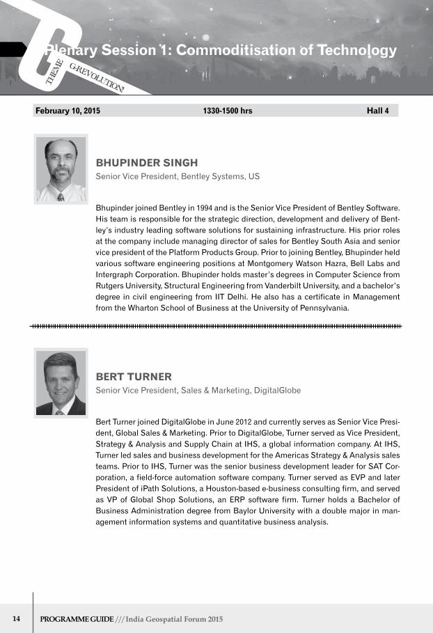
bhuPInder sInGh Senior Vice President, bentley Systems, US
bert turner Senior Vice President, Sales & Marketing, DigitalGlobe
bhupinder joined bentley in 1994 and is the Senior Vice President of bentley Software. His team is responsible for the strategic direction, development and delivery of bent-ley’s industry leading software solutions for sustaining infrastructure. His prior roles at the company include managing director of sales for bentley South Asia and senior vice president of the Platform Products Group. Prior to joining bentley, bhupinder held various software engineering positions at Montgomery Watson Hazra, bell Labs and Intergraph Corporation. bhupinder holds master’s degrees in Computer Science from Rutgers University, Structural Engineering from Vanderbilt University, and a bachelor’s degree in civil engineering from IIT Delhi. He also has a certificate in Management from the Wharton School of business at the University of Pennsylvania.
bert Turner joined DigitalGlobe in June 2012 and currently serves as Senior Vice Presi-dent, Global Sales & Marketing. Prior to DigitalGlobe, Turner served as Vice President, Strategy & Analysis and Supply Chain at IHS, a global information company. At IHS, Turner led sales and business development for the Americas Strategy & Analysis sales teams. Prior to IHS, Turner was the senior business development leader for SAT Cor-poration, a field-force automation software company. Turner served as EVP and later President of iPath Solutions, a Houston-based e-business consulting firm, and served as VP of Global Shop Solutions, an ERP software firm. Turner holds a bachelor of business Administration degree from baylor University with a double major in man-agement information systems and quantitative business analysis.
February 10, 2015 1330-1500 hrs hall 4
Plenary session 1: commoditisation of technology

15India Geospatial Forum 2015 /// ProGramme GuIde
Quah benG chIehHead of Marketing -Asia Pacific, FARO Technologies
Quah beng Chieh is Head of Marketing at FARO Asia Pacific (headquartered in Sin-gapore). He spearheads the marketing function across Asia Pacific (including region-al offices in China, India Japan and South Korea), with responsibilities in marketing, communications, public relations, market intelligence, product marketing and mar-ket development. Quah has an extensive background in marketing and branding high technology products. Prior to joining FARO, he held various marketing management positions in product marketing, regional marketing, business development, and chan-nel marketing with Hypertherm Asia, Creative Technology, Sony Marketing Asia-Pacif-ic, and Hexon Technology.
February 10, 2015 1330-1500 hrs hall 4
G-Revolution!
Them
e
Plenary session 1: commoditisation of technology

16 Programme guide /// india geospatial Forum 2015
r s PawarChairman and Managing DirectorNIIT Technologies
Rajendra S Pawar is the Chairman and Co-Founder of NIIT Group that encompasses NIIT Limited, a leading Global Talent Development Corporation, and NIIT Technolo-gies Limited, the software and services arm. As a co-founder of the NIIT Group, Pawar has not only revolutionized the IT training industry, but is also recognized as a global technology thought leader. As the Chairman of India’s IT industry body- National As-sociation of Software and Service Companies (NASSCOM), Pawar has led several ICT industry initiatives, giving voice to the sector’s aspirations and goals. Acknowledging his contribution to the IT industry in India, Pawar has been awarded the country’s prestigious civilian honor, Padma bhushan by the President of India in 2011. Pawar is a member of the Prime Minister’s National Council on Skill Development and has served the Prime Minister’s National Task Force (1998) commissioned to develop India into an IT superpower.
Plenary session 2: empowering Government & enterprises
J satyanarayanIT Advisor-Government of Andhra Pradesh
J Satyanarayan retired from the Indian Administrative Service, the permanent civil service of In-dia, after 37 years of service. He is a pioneer in the design and implementation of e-Government programs and projects in India. He has been associated with the design and implementation of over 20 major e-government projects at the state and national levels. He is best known as the founder of eSeva, a one-stop-shop for citizen services, in the State of Andhra Pradesh, India. He has been instrumental in the design of a number of policies in the ICT sector at the national level in India. These include, the National ICT Policy; National Electronics Policy; National Cyber Security Policy. In this current position as Advisor to the Government of Andhra Pradesh, since June 2014, Satyanarayan has guided the design and notification of blueprint of IT, Electronics and e-Governance; AP IT Policy 2014; AP Electronics Policy 2014; AP Innovation and Startup Policy 2014 and AP State Enterprise Architecture for e-Governance.
February 10, 2015 1600-1730 hrs hall 4
G-Revolution!
Them
e

17India Geospatial Forum 2015 /// ProGramme GuIde
Plenary session 2: empowering Government & enterprises
dr P G dIwakarDy Director, Remote Sensing Applications Area National Remote Sensing Centre
V somasundaramMember (Air Navigation Services ), Airports Authority of India
V. Somasundaram, the board Member – Air Navigation Services in Airports Author-ity of India, is spearheading AAIs initiatives in modernizing CNS/ATM infrastructure in line with ICAO plans for enhancing Safety, Efficiency and capacity of Airports and Airspace. Airports Authority of India has made rapid strides in the field of CNS/ATM under the stewardship of Somasundaram particularly with respect to development and implementation of satellite based navigation, total surveillance coverage, data link communication, GbAS, PbN implementation ,ADS-b implementation to name a few. An extra-ordinary moment of achievement has just dawned in the annals of air navigation services as Somasundaram, Member (ANS), has won the prestigious bharat Ratna JRD Tata Award instituted by Aeronautical Society of India for the year 2013 for his outstanding contribution in the field of civil aviation in India among aero-nautic professionals.
Dr P G Diwakar, Deputy Director, RSAA, NRSC is a Doctorate in Participatory Geo-matics from National Institute of Technology (NIT), Suratkal. He has held the posts of Director, Earth Observation Systems, Member Secretary, Planning Committee – National Natural Resources Management System and Programme Director, Disaster Management Support Program in Indian Space Research Organisation, Bangalore. • As a Team Leader, played key roles in delivering many important applications solutions like bhuvan Web Portal and IT tools for Sujala Watershed Development Programme. Dr. Diwakar is the recipient of many awards which include ISRO awards, national and international recognition for Innovative use of IT and geospatial technologies.
February 10, 2015 1600-1730 hrs hall 4
G-Revolution!
Them
e


11 February

20 Programme guide /// india geospatial Forum 2015
0930-1100
chair & lead speaker
dr anmol kumar, Director General, Forest Survey of India
speakers
ajit Pattnaik, Project Director, Odisha Forestry Sector Development ProjectUse of remote sensing as a tool for forest intervention impact assessment
engr. motaleb hossain sarker, Director Ecology (Ecology, Forestry and biodi-versity) Division, Center for Environmental and Geographic Information Services (CEGIS), bangladesh
shailesh shankar, Sales Engineering (Asia Pacific), DigitalGlobeUse of very high resolution satellite imagery for forest monitoring mechanisms
1330-1500
dr h c mishra, APCCF (IT), Andhra Pradesh Forest Department Assessment of tree outside forests in Andhra Pradesh
Prakash mathema, Director General, Department of Forest Research and Survey, Nepal
dr sandeep tripathi, CEO, Odisha Space Applications Centre
G rajshekar, Scientist “SF”, Forestry Division, National Remote Sensing Centre
1600-1730
Vinod kumar, Director, Indira Gandhi National Forest Academy
r k srivastav ccF It, Karnataka Forest Department
dr sPs kushwaha, Head Forestry & Ecology Department, Indian Institute of Remote Sensing Remote sensing and GIS in sustainable forest management
G r Pramod kumar, SRF, Dept of Environmental Science, bangalore University Assessment of encroachment and consequent anthropogenic impacts on forest of Hassan District using remote sensing & GIS
February 11, 2015 0930-1730 hrs hall G.03
G-Revolution!
Them
eForestry

21India Geospatial Forum 2015 /// ProGramme GuIde
G-Revolution!
Them
e
0930-1100
chair
dr J r sharma, Chief General Manager, RCs National Remote Sensing Centre
speakers
dr m Prithviraj, Executive Secretary, Karnataka State Council for Science and Technology
mohammad monowar hossain, Executive Director, Institute of Water Modelling, bangladesh
d P mathuria, Director, Central Water CommissionGeospatial technology for integrated water resources development
dr mb Joshi, GM-Technical, Sardar Sarovar Narmada Nigam Ltd
1330-1500
dr Venkateshwara rao, Group Director, Water Resources Group National Remote Sensing Centre
s k sinha, Scientist-D, Central Ground Water boardGround water governance - changing perspective
abhineet Jain, Regional Director - Sales Engineering, Asia Pacific region, DigitalGlobe Remote Sensing for water resource management
Paritosh singh chauhan, Consultant, IIC Technologies Aquifer geometry for estimating the ground water resources
1600-1730
m k srinivas, Chief Engineer, National Water Development AgencyApplication of Geospatial technology in Interlinking of rivers
Venu Gopal, director, AP Ground Water Dept
m rajathurai, bentley Systems Smart Water utility: A Pragmatic approach to solve aspects of entire life cycle of a water utility in a modern context.
Jella kiran, Scientist, Telangana State Remote Sensing Applications CentreGIS based Planning and Expansion of Drinking Water Distribution System
P murugan, Scientist/Engineer ‘’SF’’, ISRO Satellite Centre Water quality parameters estimation using hyperpectral satellite data
February 11, 2015 0930-1730 hall G.04
Integrated water resource management
22 Programme guide /// india geospatial Forum 2015
G-Revolution!
Them
e
0930-1100
chair
dr. Prithvish nag, Vice Chancellor, Mahatma Gandhi Kashi Vidhyapeeth
speakers
animesh Pandit, Senior Group Manager, Rolta Changing the paradigm of public safety management
mahesh kumar soni, Country business Manager- Design, HP India
wg cdr P k mishra, Indian Air Force Indigenous aeronautical database and charts
shahid ahmed, Director General of Police, Manipur Police Headquarters
h hemanth kumar, Fellow & Principal Investigator – NRDMS, Karnataka Council for Science & Technology
1330-1500
chair & lead speaker
dr P G diwakar, Dy Director, Remote Sensing Applications Area, National Remote Sensing Centre
speakers
kewal shienmar, Managing Director, Mapcode FoundationMapcode - A Short Address for Any Location on Earth
d k Prabhuraj, Director, Karnataka State Remote Sensing Applications CentreKarnataka GIS Portal, a step towards G-revolution
Vikram Jasrotia, business Development Manager, Elcome Technologies Pvt. LtdNetwork RTK using Master- Auxiliary Concept
shailesh shankar, Sales Engineering (Asia Pacific), DigitalGlobeLeveraging geospatial big data
munish malhotra, Regional Manager- Trimble Infrastructure Solutions Division, India & SAARC Continuous Operating Reference Station Network with Trimble VRS technology offers a new opportunity
February 11, 2015 0930-1730 hrs hall G.05
emerging applications & trends

23India Geospatial Forum 2015 /// ProGramme GuIde
G-Revolution!
Them
e
emerging applications & trends
1600-1730
chair & lead speaker
n n sinha, Principal Secretary, Dept. of IT, Govt. Of Jharkhand
speakers
nirmalandu kumar, Director, Survey of India From spatial data to geo-web Services- what next?
Prof dr. V balakista reddy, Professor of Law and Registrar, NALSAR University of Law Remote sensing and geo-spatial data: emerging legal jargons
Piyush kumar shukla, MTech, IIT KanpurUse of emerging technologies in hostile environments
mohd sajid Idrisi, Conservation biologist, Natural Heritage Division, Indian National Trust for Art and Cultural HeritageFree and open source GIS, mobile GIS, and data collection tools for conservation biologists
aravind as, Scientist, National Remote Sensing Centre 3D Modelling and visualisation of City Objects using GML

24 Programme guide /// india geospatial Forum 2015
G-Revolution!
Them
e
09:30-11:00
orientation session
moderator: dr shahnawaz, Director (S & SE Asia), UNIGIS International University of Salzburg Department for Geoinformatics - Z_GIS Austria
maj Gen dr r siva kumar, Pro Vice Chancellor (R&D), GITAM University
youth Geospatial Professional - sumantra naik, General Manager, Reliance ADAG Group
hr talk: Intergraph
dr. hrishikesh samant, Associate Professor and Head Department of Geology, St. Xavier’s College
11:30-13:00 - G’appz & models: Innovative Geospatial apps
Ganesan, Senior business Analyst, Geokno
alex, Mtech Scholar, bIT Mesra
Mahendran,Student RCAT
Gurminder bharani, Student, Symbiosis Institute of Geoinformatics
er. alekhya datta, Research Associate, The Energy and Resources Institute
adrish kumar mullick, Research Scholar, IIT Roorkee
14:30-16:00 - G ‘Projects: Research project Presentations
Akshithha, GIS analyst DSM Soft,
mrinalni,m tech Scholar Madras University
bharathi G P, M Tech Scholar, Department of Geography, bDU
siddharth chaudhary, M.Tech Student, Indian School of Mines
G.sriram, Student, Anna University
Logeswari, Student, Centre For Water Resources
16:30-17:30 - research Papers
kiranjeet kaur, Student, Punjab Agricultural University
shashidhar.k, Student, Jawaharlal Nehru Technological University
k P naveen kumar, Student, RCAT
17:30-18:00
Interaction and Closing Remarks
11 February, 2015 0930-1800 hrs hall G.06
youth Forum
Partner

25India Geospatial Forum 2015 /// ProGramme GuIde
G-Revolution!
Them
e
The User Workshop on bhuvan is a unique opportunity for participants to familiarize themselves with entire functionalities and utilities of bhuvan, the online Geoportal launched in 2009. It has since then, it has diversified into versatile viewing platform with capabilities such as providing 2D/2.5D and 3D photo-realistic textured models with a unique viewing/animation experience; full-fledged interactive thematic services and free data downloads from NRSC Open Earth Observation Data Archive (NOEDA). More than 20,000 unique visitors logon to bhuvan every month so far about 2,98,000 free products are downloaded by users across the globe.
The workshop aims to increase awareness on bhuvan, share services and collaborative applica-tions, initiate government and other organizations to collaborate with bhuvan and attract Public/Academicians to participate in crowd sourcing. The workshop is planned for novices as well as experienced users. The Workshop comprises of an overview of all the functionalities on bhuvan like visualization, data download, thematic services , satellite and map base sharing from bhuvan for user application development, crowd sourcing, API and will also showcase applications carried out for ministries and state government departments and disaster support services on bhuvan, etc.
speakers
dr Vinod bothale, Group Director, Geoportal and WebGIS Servcies, National Remote Sensing Centre
m arul raj, manager, bhuvan Web Services Development, National Remote Sensing Centre
rajkumar shrivastava, IFS, Dept of Forest. Govt. Of Karnataka
February 11, 2015 0930-1130 hrs hall 1.03
bhuvan user workshop

26 Programme guide /// india geospatial Forum 2015
G-Revolution!
Them
e
chair & Lead speaker
Vinod bothale
Group Director, Geoportal and WebGIS Services National Remote Sensing Centre
speakers
Pramod kumar Parida, Scientist, Odisha Space Applications Centre Generation of Web-based power Atlas for Cuttack Circle, Odisha
siva ravada, Director of Development - Spatial Technologies, Oracle
dwaipayan dighal, Senior Regional Manager, Hexagon GeospatialSmarter Decision by simple citizen action
rajesh Paul, Director, Excel Geomatics Geomarketing for product sales and customer services
marutish Varanasi, Consultant, TriCADData visualization of leading cities in India
February 11, 2015 0930-1100 hrs hall G.01
Geobusiness & Location Intelligence

27India Geospatial Forum 2015 /// ProGramme GuIde
G-Revolution!
Them
e
chair
dr bhoop singh, Head – NRDMS & NSDI Ministry of Science & Technology
speakers
dr P s roy, Geospatial Chair Professor, Center for Earth & Space Sciences, Univer-sity of Hyderabad Land use and land cover change research for global change science
k s rajan, Head - Lab for Spatial Informatics, Associate Professor, International Institute of Information Technology
dr V.balaji, Director, OMCAR Foundation�GIS�mapping�of�submerged�aquatic�vegetations,�associated�fish�assemblage�and�sediment� distribution in Northern Palk Bay, Thanjavur District, Tamil Nadu
dr r sivakumar, Co-ordinator- Earthquake Research Cell & Associate Professor Department of Civil Engineering, Faculty of Engineering & Technology, SRM University Hydrogeomorphological studies of Bellary Taluk, Karnataka through integrated geological and geospatial approach
1600-1730
dr Valli manickam, Chairperson, Environment Area, Administrative Staff College of IndiaOpen government data initiatives - Opportunities and challenges
Prof J s rawat, Director, Centre of Excellence for NRDMS in Uttarakhand; Profes-sor & Campus Head in Geography, Kumaun University Toward development of an Uttarakhand geoportal for decentralised governance in Uttarakhand
Prof Gopal m. naik, Professor & Chairman Board of Studies, Department of Civil Engineer-ing�&�Nodal�Officer�(Academic),�TEQIP-II,�UCE�(A),�&�Joint�Director,� Directorate of Academic Audit Cell, Osmania University Toward development of an Uttarakhand geoportal for decentralised governance in Uttarakhand
dr b.naveenchandra, AGM (GIS), Information Technology Project Circle, bharat Sanchar Nigam Ltd Application of geoinformatics & electrical resistivity survey for the study of disaster impact on earth resources due to lightning
dr b c kusre, Associate Professor (Irrigation and Drainage Engg), College of Agricultural Engg & PHT, Central Agricultural University, Ranipool, East Sikkim
February 11, 2015 1330-1730 hall 1.03
nrdms user meet

28 Programme guide /// india geospatial Forum 2015
G-Revolution!
Them
e
chairperson
dr r nagaraja, Director, NRSC Data Centre
keynote speaker
dr senthil kumar, Group Director, Geophysical and Special Products Group National Remote Sensing Centre
speakers
dr c d murthy, Sr. Div. Director, Rolta Emerging geospatial trends in smart city modelling
dr sultan singh, Senior Scientist, Haryana Space Application Center Establishment of Geodetic Control Network for Land Records in Haryana- A Case Study
Pankaj Gupta, Enterprise Geospatial Manager, Middle East, Africa and SAARC region, Trimble Trimble Photogrammetry Suite including land and aerial mobile mapping solution
P Prakash & aswini kumar das, Asso Project Managers, Telangana State Remote Sensing Applications Centre Development of open source Web GIS based geospatial application for rural water supply & sanitation
dr n Prabhakaran, Professor, Pandian Saraswathi yadav Engineering College Landslide hazard zonation mapping using remote sensing and GIS in Kodaikanal taluk, Dindigul district
remote sensing & Photogrammetry
February 11, 2015 1600-1800 hrs hall G.03
29India Geospatial Forum 2015 /// ProGramme GuIde
G-Revolution!
Them
e
technology tracks
trimble - Innovating sensors and software for Geospatial Industry
by integrating sensors, field applications, real-time communications, field and back-of-fice processing, modeling, and analytics, Trimble Geospatial solutions facilitate a high quality, productive workflow and data exchange to drive efficiency, productivity, safety and value in organizations of all sizes. The result is rich accurate data that can be trans-formed into the intelligence required to make informed decisions. Trimble has been a innovators in the Geospatial hardware and Software solution with integrated workflow for different applications like Cadastral, Mining, Watershed, Utilities etc.
Presenter: ashwani rawat, Solution Manager - Geospatial Division, SAARC Region, Trimble
trimble 0930-1100 hrs hall G.02

30 Programme guide /// india geospatial Forum 2015
G-Revolution!
Them
e
rolta safety and security solutions for smart & secure cities
This session will give an overview on Rolta Safety and Security Solutions for Smart Cities, which will cover wide spectrum of Rolta Homeland Security Solutions with Sa-fecity framework. The primary focus of the presentation is to showcase Rolta IPR which enables automation, intelligence and interoperability to achieve coordinated response by multi-agencies to manage incidences such as attack on Critical
Infrastructure, Fire Emergency including situations like 26/11 (Taj, Mumbai incident).
Presenter: Dr. C. R. bannur, Sr. Div. Director, EGDS, Rolta
enterprise GIs for smart cities
The session will cover how Enterprise GIS solutions when deployed across domains can address a wide range of business problems encountered. The seminar will high-light how Rolta Platform focuses on planning, building, and managing the next-gen-eration solutions – featuring extremely innovative Information interoperability, IT / OT Integrations, ERP, GIS, Mobility, Social, Cloud, big Data Analytics and Security technol-ogies for driving business Excellence.
Presenter: Saurabh bagaria, Div. Director, GPTS, Rolta
emerging trends & technologies for smart cities
The session will underscore on emerging trends & technologies for Smart Cities and how the use of GIS can act as a crucial ingredient in strengthening the four pillars of the Smart City namely Physical Infrastructure, Social Infrastructure, Institutional Infra-structure and Economic Infrastructure.
Presenter: Milin D’Silva, Group Mgr., GIS Service, Rolta
technology track
rolta 1100-1230 hrs hall G.01

31India Geospatial Forum 2015 /// ProGramme GuIde
G-Revolution!
Them
e
shoreline monitoring using laser scanner
Shoreline erosion / deposition plays major role in the coastal development by coastal processes. It also adds positive / negative impact due to human intervention. For sus-tainable shoreline, monitoring or mapping the shoreline in periodically will helpful to protect the damage. Coast monitoring in a larger area with traditional surveying meth-od would be time consuming.
National Institute of Ocean Technology was involved in study of an eroding beach – rea-sons for such loss and engineering intervention to arrest the erosion. The focus of the present study was selected in RK beach, Vishakhapatnam. This beach has evidence of coastal erosion and shoreline changes. The scanner survey was carried out before the cyclone (HudHud) as baseline data. Post survey also was taken in the same area. The presentation will carry the features of data sets captured by Faro 3D laser scanner and changes in the shoreline due to cyclone.
Presenter: V Suseetharan, Scientist-D, CEE Group National Institute of Ocean Technology (NIOT)
utilization of Laser scanning technology for 3d modeling of world heritage monu-ments of hampi, karnataka state
Digital heritage offers several advantages to promote historical research, research on architecture, culture, virtual tourism, restoration and reconstruction of monuments by the custodians of the heritage site. This paper highlights the importance of the pro-ject undertaken as part of Indian Digital Heritage(IDH)-Hampi programme initiated by Department of Science and Technology, Government of India, which aims to generate a high resolution 3D Model of world heritage monuments through Laser scanning and digital Geo-spatial database generation using Remote sensing and GIS. This initi-ative is aimed at capturing the geometric surface of the monuments for rendering 3D modelling using advanced technologies like Laser scanning, LiDAR, Remote sensing and Geospatial technologies to support the various research groups to learn, analyse and reconstruct the history of heritage sites through different periods of time. Laser scanning provides highly accurate 3D images by sweeping a laser beam over a scene or object. It is able to capture millions of 3D points of surface geometry enabling to ex-perience and work directly with real world conditions by viewing and manipulating rich point-clouds in computer-aided design software. FARO FOCUS 3D X130 Laser scanner has been used to render 3D models of monuments in world heritage site at Hampi.
Presenter: Vijay U T, Karnataka State Council for Science & Technology Indian Institute of Science
technology track
Faro 1330-1500 hrs hall G.02


12 February

34 Programme guide /// india geospatial Forum 2015
G-Revolution!
Them
e
0930-1100
chairperson and Lead speaker
dr akhilesh Gupta, Adviser Department of Science & Technology
speakers
dr Graeme kernich, Deputy CEO, Cooperative Research Centre for Spatial Information, Australia Coastal digital elevation modelling and inundation risk assessment in Australia and the Pacific�Islands�
a J kurian, Joint Secretary & HoD National Authority Chemical Weapons Conven-tion (NACWC), Cabinet Secretariat, Government of India
dr hussein o. Farah, Director General, Regional Centre for Mapping of Resources for Development (RCMRD), Kenya RCMRD’s programmes in disaster risk reduction: Achievements and opportunities for future collaboration
1200-1330
dr s satapathy, Scientist F, Climate Change Programme, Ministry of Environment & Forests
dr c s Jha, Group Director, Forest & Ecology Group, National Remote Sensing Centre
dr kausalya ramachandran, Principal Scientist & ICAR National Fellow, Central Research Institute for Dryland AgricultureClimate Change Hazard to Rainfed Agriculture in India
birendra bajracharya, Regional Programme Manager Mountain Environment Re-gional Information System (MENRIS) Technical Coordinator - SERVIR Himalaya International Centre for Integrated Mountain Development, Nepal
1430-1600
milind mujumdar, Scientist – D, Centre for Climate Change Research, Indian Institute of Tropical MeteorologyThe high resolution regional Climate projections for south Asia
V suseentharan, Scientist – D, Coastal Environmental Engineering Group, National Institute of Ocean Technology, Ministry of Earth SciencesClimate Change & Environment
dr Vaani, Assistant Professor (Senior), Centre for Disaster Mitigation and Management, VIT University, Vellore Development of self education knowledge product on Basics of geomatics and its application in disaster management and climate change
February 12, 2015 0930-1600 hall G.01
climate change, weather services & hazard management
Partners
Ministry of Earth SciencesGovernment of India
Department of Science and Technology Government of India

35India Geospatial Forum 2015 /// ProGramme GuIde
G-Revolution!
Them
e
chairperson & Lead speaker
P srinivasulu, Group Head, Aerial Services and Digital Mapping Area, National Remote Sensing Centre
speakers
sunil krishnan, Manager Geospatial, Trimble Navigation IndiaSpeed�and�flexibility�in�3D�scanning�applications�
anil n P, Distribution Manager, FARO IndiaFARO�Workflow�in�3D�Documentation
adesh dhar, Product Manager, Elcome Technologies Pvt. LtdBenefits�of�high-definition�surveying
cdr sanjeev sharma, IN (Retd), Head Hydrography, IIC TechnologiesLidar bathymetry for coastal zone management
david Jonas, business Development Manager – Asia, AAM Pty LimitedCapturing and Deploying Challenging Aerial and Mobile LiDAR Data in Asia
michael mayer, Assistant Director International Sales, RIEGL Laser Measurement Systems GmbH, Austria UAS-based laser scanning: case study of typical applications
hannu korpela, Sales Manager, Terrasolid Ltd, Finland LiDAR in city modelling - Different approaches and deliveries
February 12, 2015 0930-1130 hrs hall G.02
Laser scanning

36 Programme guide /// india geospatial Forum 2015
G-Revolution!
Them
e
1200-1330
session chair & speaker:
mark noort, Editor- Geospatial World The connected farm
speakers
dr mVr sesha sai, Group Director, ASAG, National Remote Sensing Centre
dr r s hooda, Chief Scientist, Haryana Remote Sensing CentreApplications of Geo-informatics in Agricultural Resources Management in Haryana
dr brijendra Pateriya, Director, Punjab Remote Sensing Centre
dr a arunachalam, Pr. Scientific Officer to Secretary (DARE) & DG (ICAR)e-Governance vis-à-vis e-Agriculture’’
1430-1600
dr John ahlrichs, Vice President, International Sales, blackbridgeA high resolution commercial imaging program for agricultural monitoring
rakesh kumar kadian, bD Manager Agriculture Division, Trimble NavigationPrecision farming technologies for farmers in SAARC region
dr d raji reddy, Director-Research, PJTSAU, HyderabadMonitoring and assessment of rainfall and crop conditions using geospatial technology
Geospatial media & communications -report Presentation
February 12, 2015 1200-1600 hall G.02
Geoagri
Partners

37India Geospatial Forum 2015 /// ProGramme GuIde
G-Revolution!
Them
e
February 12, 2015 0930-1600 hall G.03
mining
0930-1100
keynote speakers
surender mohan b, CMD, Neyveli Lignite Corporation
Gopal singh, CMD, Central Coalfields Ltd
speakers
b d sharma, Addl Surveyor General, Survey of India�Large�scale�digital�topographic�database�for�sustainable�planning�&�scientific�design� of coal mining
b n rao, AVP - Lidar & Photogrammetry, ADCC InfocadLidar: A technological approach for mining exploration
1200-1330
chair & Lead speaker
dr Vishnu chandra, HOG-Mining, National Informatics Centre
speakers
d u Vyas, General Manager (Geo & Tech.), Gujarat Mineral Development Corporation
Usage of Geospatial Technology - A case study of GMDC
rajneesh kumar, Chief Manager (Remote Sensing), Central Mine Planning & Design Institute LtdGeospatial technology for solving land acquisition problems in coal mining areas
alok Porwal, Prof – Centre of Studies in Resources Engineering, IIT bombayGIS-based mineral potential modelling
dr dr Patel, Dept of Geology & Mining, Chattisgarh
1430-1600
chair & Lead speaker
dr Vinod kumar, Group Head, Geosciences Group, National Remote Sensing Centre
speakers
dr ashutosh roul, Sr. Manager – Mines, National Aluminium Company LimitedGps�based�truck�dispatch�system�(TDS)�in�highly�mechanized�bauxite�mines�.�a�case�study.
rohtash agarwal, Technical Director, KK GeosystemsMining Solutions with Faro Laser Scanner X Series, FARO
dr dheeraj kumar, Associate Professor, Indian School of Mines Developments in geospatial enabled automated tools and techniques for improving safety and productivity in metal mines
Partners

38 Programme guide /// india geospatial Forum 2015
G-Revolution!
Them
e
12 February, 2015 0930-1600 hall G.04+G.05
nsdI 2015
0930-1100 hrs: Inaugural, overview and Provision of GIs assets
P s acharya, Scientist G and CEO, NSDI, Department of Science & Technology Overview of the present status of NSDI
r n nanda, NSDI/ Survey of IndiaStatus of provision of GIS data assets of Survey of India
sunil kumar bohra, Geological Survey of IndiaGeological data assets of Geological Survey of India and the data content standards
sunil chandra, Forest Survey of India, Dehradun GIS data assets of Forest Survey of India and forest data content standards
smriti upadhayay, Central Pollution Control board, Delhi An approach to re-engineering environmental management data and provision of data services
1130-1330: Perspectives of end users of nsdI and state sdI services
h.hemanth kumar, Karnataka State Council for Science & Technology Development of GIS applications for end users using OGC web services on Karnataka Geoportal
dr sandeep tripathy, Odisha Space Applications Centre Data Sharing Policy in support of an SDI and a State GIS in Odisha
Prof n L sarda, Advanced Lab on GISE, IIT bombay Relevance of National Data Registry in the Development of GIS applications using NSDI Data Services
b P aawasthi, Chief Engineer (TMS), Northern Railway, Ministry of Railways Use of standards-based spatial data and services in improving management of Indian Railways assets and passenger services
representative, TCIL
Use of NSDI Data Services in the delivery of Telecom Services
representative, ONGC Utilisation of Spatial data services in the construction and maintenance of oil and gas pipeline network
1430-1600: Industry session/Panel discussion
Partners
Department of Science and Technology Government of India

39India Geospatial Forum 2015 /// ProGramme GuIde
G-Revolution!
Them
e
moderator
dr. shahnawaz, Director (S & SE Asia), UNIGIS International University of Salzburg Department for Geoinformatics - Z_GIS Austria
0930 – 1100-Framework Presentation by hr professionals and geospatial experts
dr. Ps roy, Chair professor, Centre for Earth and Space Sciences, Hyderabad
young Geospatial Professional - devdatta tengshe, Technical Lead, Webonise Labs
HR representative, Infotech
1200 –1330-student Presentations
V. sakthi kirthi, Post Graduate Student, Centre For Water Resources
Gopi Padmanabhan, Student, MSc in GISc, University of Madras, University of Salzburg
natasa chowdhury, Student, Symbiosis Institute of Geoinformatics
m. charu, Student, Anna University
Prashant Persai, MANIT
14:30-16:00-Panel-scope of improvement
Interaction with Experts
Results
12 February, 2015 0930-1600 hall G.06
youth Forum
Partner