how to use arcview and develope nfe-gis - accu · how to use arcview and develope nfe-gis ... 1....
TRANSCRIPT

How to use ArcView and DevelopeNFE-GIS
How to use How to use ArcViewArcView and and DevelopeDevelopeNFENFE--GISGIS
Capacity Building Workshop for Literacy Resource Centres for Capacity Building Workshop for Literacy Resource Centres for Girls and Women (LRC) in Asia and the Pacific Girls and Women (LRC) in Asia and the Pacific
( 2001 CBW , 13 ( 2001 CBW , 13 –– 24 February 2001, Kathmandu, Nepal )24 February 2001, Kathmandu, Nepal )
Presented by U THEIN HTUT Presented by U THEIN HTUT GEOCOMP MYANMAR ENGINEERING AND SURVEY AUTOMATION BUREAU SERVICEGEOCOMP MYANMAR ENGINEERING AND SURVEY AUTOMATION BUREAU SERVICESS

Introduction to Introduction to Myanmar NFEMyanmar NFE--GISGIS


Demonstration on how to use Demonstration on how to use ArcViewArcView GIS softwareGIS software

Menus, Buttons, ToolsMenus, Menus, ButtonsButtons, Tools, ToolsWindow Title Bar: Use to select a window and
move windows around the screen
Menu Bar: ContainsArcView pull-down menus grouped by
function type.
Tool Bar: Click a tool and it becomes active (pushed in). Apply the tool inside a document to execute the
function.
Button Bar:Contains ArcView
command buttons. Click a button once to execute a function.
Tool Tips: Hold the mouse pointer over a Button or Tool to get its name. Also look in the Status
Bar

ArcView Project WindowArcViewArcView Project WindowProject Window
•• A Project is a file that organizes all the information you A Project is a file that organizes all the information you need to do your work.need to do your work.
•• It lists the icons for It lists the icons for ArcViewArcView’’s s five main documents.five main documents.
Your documents are listed here.
Choose a document type from these icons.
You open, print or create documents
using these buttons.

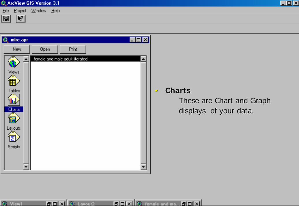
ArcView DocumentsArcViewArcView DocumentsDocuments
•• ViewsViews -- Contain the map data or Contain the map data or ThemesThemes. . •• TablesTables -- Tables show the attribute dataTables show the attribute data
attached to your map data.attached to your map data.•• ChartsCharts -- These are Chart and Graph displaysThese are Chart and Graph displays
of your data.of your data.•• LayoutsLayouts -- Layouts are where you assembleLayouts are where you assemble
your map for printing your map for printing -- itit’’s your final printed page.s your final printed page.
•• ScriptsScripts -- These are used to enter Avenue codeThese are used to enter Avenue codeto customizeto customize ArcViewArcView..

•• ViewsViewsContain the map data or Contain the map data or ThemesThemes..
•• TablesTablesTables show the attribute data Tables show the attribute data attached to your map data.attached to your map data.
•• ChartsChartsThese are Chart and Graph These are Chart and Graph displays of your data.displays of your data.
•• LayoutsLayoutsLayouts are where you assembleLayouts are where you assembleyour map for printing your map for printing itit’’s your final printed page.s your final printed page.
•• ScriptsScriptsThese are used to enter Avenue These are used to enter Avenue code to customizecode to customize ArcViewArcView..

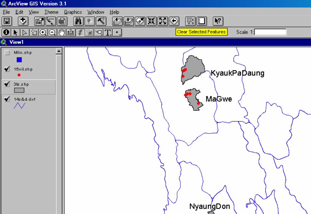
The View DocumentThe View DocumentThe View Document
•• Document where your working map is Document where your working map is displayed.displayed.
•• You can: You can: –– pan and zoompan and zoom–– create and edit featurescreate and edit features–– perform queriesperform queries–– and moreand more

••ViewsViews -- Contain the map data or Contain the map data or ThemesThemes..

•• TablesTablesTables show the attribute data Tables show the attribute data attached to your map data.attached to your map data.

•• TablesTablesTables show the attribute data Tables show the attribute data attached to your map data.attached to your map data.

The Table DocumentThe Table DocumentThe Table Document
•• Contains all the table manipulation controls.Contains all the table manipulation controls.
•• Manipulate, edit or create attribute data.Manipulate, edit or create attribute data.
•• You can:You can:–– join tablesjoin tables–– perform queriesperform queries–– summarize statisticssummarize statistics–– and moreand more……

••TablesTables -- Tables show the attribute data attached Tables show the attribute data attached to your map data.to your map data.
•• ChartsChartsThese are Chart and Graph These are Chart and Graph displays of your data.displays of your data.
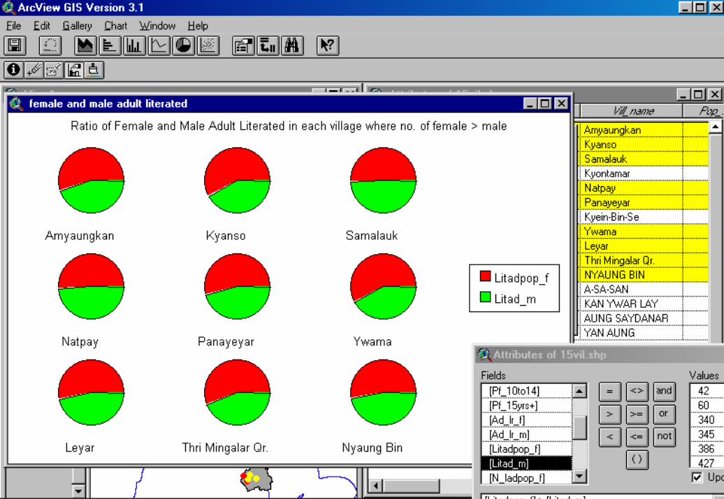
The Chart DocumentThe Chart DocumentThe Chart Document
•• Charts are dynamically linked to tables and Charts are dynamically linked to tables and views.views.
•• This document displays tabular data This document displays tabular data graphically.graphically.

••ChartsCharts -- These are Chart and Graph displays of your data.These are Chart and Graph displays of your data.

•• LayoutsLayoutsLayouts are where you assembleLayouts are where you assembleyour map for printing your map for printing itit’’s your final printed page.s your final printed page.

The Layout DocumentThe Layout DocumentThe Layout Document
•• Assemble all components of your project for Assemble all components of your project for printing.printing.
•• You can:You can:–– insert frames for views, tables, chartsinsert frames for views, tables, charts–– add a scale bar and north arrowadd a scale bar and north arrow

••LayoutsLayouts -- Layouts are where you assemble your map Layouts are where you assemble your map for printing for printing -- itit’’s your final printed page.s your final printed page.

•• ScriptsScriptsThese are used to enter Avenue These are used to enter Avenue code to customize ArcView.code to customize ArcView.

•• This where you can write Avenue scripts This where you can write Avenue scripts that will allow you to customize ArcView.that will allow you to customize ArcView.
•• Some functions in ArcView are accessible Some functions in ArcView are accessible through the script document.through the script document.
•• Mostly for advanced users.Mostly for advanced users.
The Script DocumentThe Script DocumentThe Script Document

••ScriptsScripts -- These are used to enter Avenue code These are used to enter Avenue code to customizeto customize ArcViewArcView..


ArcView - The “Active” GISArcViewArcView -- The The ““ActiveActive”” GISGIS
•• The The ““ActiveActive”” DocumentDocument::–– Document window that you are currently Document window that you are currently
working with (View, Tableworking with (View, Table……))–– The menus, buttons, and tools will look different The menus, buttons, and tools will look different
with each document.with each document.
•• Make documents Make documents ““activeactive”” by:by:–– SingleSingle--click on the document windowclick on the document window–– Choose document name from Choose document name from WindowWindow menumenu

ArcView - The “Active” GISArcViewArcView -- The The ““ActiveActive”” GISGIS
•• The The ““ActiveActive”” Theme:Theme:–– Not to be confused with Not to be confused with ““VisibleVisible””–– Before you Before you workwork with a theme, it needs with a theme, it needs
to be to be ““activeactive””..–– Some tools only work with Some tools only work with ““activeactive””
themes (e.g.. Identify tool). themes (e.g.. Identify tool).
Active
Not Active
Visible Not Visible

Setting Theme StatusSetting Theme StatusSetting Theme Status
•• Setting Visible or Active Status:Setting Visible or Active Status:–– To make a theme To make a theme ““VisibleVisible””, single, single--click click
on the Visibility Selectoron the Visibility Selector–– To make a theme To make a theme ““ActiveActive””, single, single--click on click on
the Theme Namethe Theme Name
Table of Contents
Theme NameView Area (map)
Visibility Selector Window Title Bar

Data EditingData EditingData Editing
•• Data stored in tables (spreadsheets)Data stored in tables (spreadsheets)–– Tables composed of Tables composed of RecordsRecords–– Records composed of Records composed of FieldsFields
•• New tables can be created, and data New tables can be created, and data added and changed...added and changed...

Joining TablesJoining TablesJoining Tables•• Some data is stored external Some data is stored external
databasesdatabases•• To be used by a GIS, these tables To be used by a GIS, these tables
must be joined to a map.must be joined to a map.

Table QueryTable QueryTable Query
•• ArcView can answer questions about ArcView can answer questions about the attribute data...the attribute data...–– How many countries will have a population of How many countries will have a population of
more than 30 million in the year 2000?more than 30 million in the year 2000?

••LayoutsLayouts -- Layouts are where you assemble your map Layouts are where you assemble your map for printing for printing -- itit’’s your final printed page.s your final printed page.
LAYOUTLAYOUTLAYOUT

How to develop NFEHow to develop NFE--GIS GIS with use of line maps of selected with use of line maps of selected
three townships/provincesthree townships/provinces

1.1. Create NFE database (Tables) filesCreate NFE database (Tables) filesof 3 selected villages for of 3 selected villages for
a. village levela. village levelb. basic literacy classb. basic literacy classc. postc. post--literacy classliteracy classd. postd. post--literacy learnersliteracy learnerse. facilities e. facilities
(Non Graphic (Non Graphic ––data )data )

2. 2. Create blank maps of 3 selected townshipsCreate blank maps of 3 selected townships( where your LRC activities operate )( where your LRC activities operate )
3. District and State level blank maps which3. District and State level blank maps whichinclude No.2 above.include No.2 above.
-- Scan the blank maps Scan the blank maps -- Vectorise Vectorise the scanned maps the scanned maps
(by R2V or any other CAD (by R2V or any other CAD softawresoftawreegeg. AutoCAD , CorelDraw etc.). AutoCAD , CorelDraw etc.)
( Making Graphic data )( Making Graphic data )

Using Using ArcView ArcView
4. 4. -- import Graphic data as Themes orimport Graphic data as Themes orFeatures in VIEW documentFeatures in VIEW document
5. 5. -- import Tables (.dbf) data import Tables (.dbf) data in TABLE documentin TABLE document
6. 6. -- Join or Link Attributes of Themes withJoin or Link Attributes of Themes withTables Tables
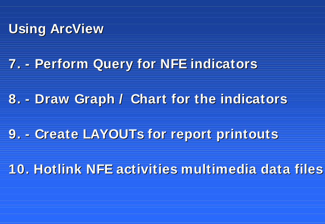
Using Using ArcView ArcView
7. 7. -- Perform Query for NFE indicatorsPerform Query for NFE indicators
8. 8. -- Draw Graph / Chart for the indicatorsDraw Graph / Chart for the indicators
9. 9. -- Create Create LAYOUTs LAYOUTs for report printoutsfor report printouts
10. Hotlink NFE activities multimedia data files10. Hotlink NFE activities multimedia data files

••THE ENDTHE END