gulfport gis committee - gulfport-ms.gov | the official …€¦ · · 2008-06-10gulfport gis...
TRANSCRIPT

Gulfport GIS Committee
January 30, 2008
Introduction
GIS Defined– Components
– Uses
Organization– Personnel
– Software
– Policy
Data Catalog– Data Sources
– Imagery Data Sets
– Spatial Database Engine
Current Supported Applications– ArcMap, ArcExplorer, CityWorks, Crimeview, CIMS, IMS,
Hurrevac, MUNIS Maplink*
GIS Defined
Geographic Information System
– Comprised of five main components
Data, Software, Hardware, Methods and
People
– Used to Correlate Information Spatially
Links together data sets by location
Any data set with an address or parcel number
can be mapped
Organization
Personnel
– 2 GIS Analysts, 1 Sr GIS Analyst
– Over 16 years experience
Software
– ArcGIS 9.1, IMS, SDE, ArcPad, ArcExplorer
ESRI based – CityWorks, Crimeview, MUNIS Maplink*
Almost 50 full licenses – General Admin, Urban Development, Public Works, Police
Using ArcExplorer – Fire, General Admin, General Finance, Water
Gulfport On-Line Atlas (GOLA)
Hurrevac – Hurricane Tracking and Evacuation Timing
CIMS - Cemetery Information Management System
Policy
– Harrison County Digital Plat Submission Policy
Data Catalog
Federal Agencies
– FEMA, U.S. Census, NWI, USGS, NRCS
DFIRM, ABFE, Census, Wetlands, LIDAR
State and County
– Harrison County Tax Assessor’s Office, MDEQ
Parcels, Lots, Planimetric Maps, Environmental Models, Imagery
In House
– Division of GIS
Street Centerline, Address Points, Zoning, Water, Sewer,
Drainage, Hydrology, Impervious Surfaces, Edge of Pavement,
Building Footprints, Police Districts, Fire Response Zones, Voting
Precincts, School Districts, Political Boundaries, and Much More
Many other data sets developed as needed
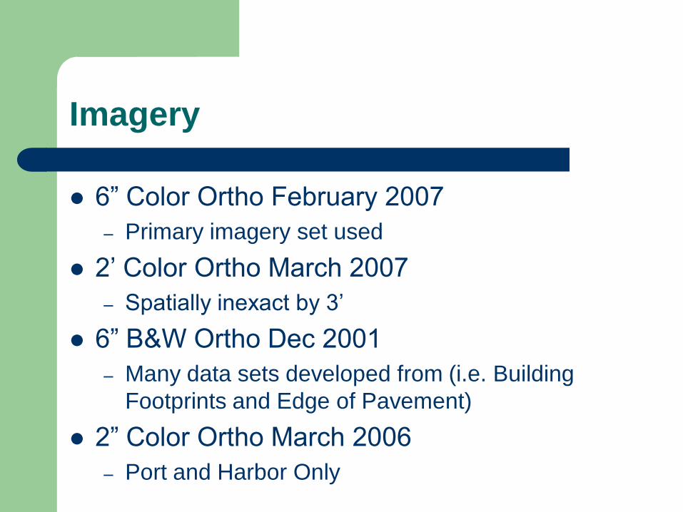
Imagery
6” Color Ortho February 2007
– Primary imagery set used
2’ Color Ortho March 2007
– Spatially inexact by 3’
6” B&W Ortho Dec 2001
– Many data sets developed from (i.e. Building
Footprints and Edge of Pavement)
2” Color Ortho March 2006
– Port and Harbor Only
Spatial Database Engine (SDE)
Implemented February 2007
Central Location For Data
High Performance (Vector & Imagery)
Multi-User

Gulfport Online Atlas
GOLA - Gulfport On-Line Atlas
Allows anyone with an internet connection to
browse GIS data with only a browser
New tools (buffer & full extent) and new layers
(Elevation, NRCS Soil, etc.)
*New version will be On-Line within a few weeks
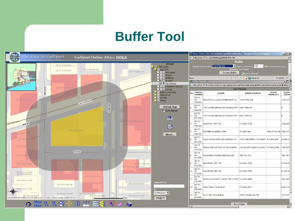
Buffer Tool
Cityworks
Public Works’ GIS-based Asset Maintenance
Management System
Manages infrastructure with tools for creating
and tracking maintenance activities
associated to assets and/or addresses
Current Public Works GIS Projects
Development of a sewer geometric network
Development of a water geometric network
Development of a complex drainage model
GPS data collection for traffic signs
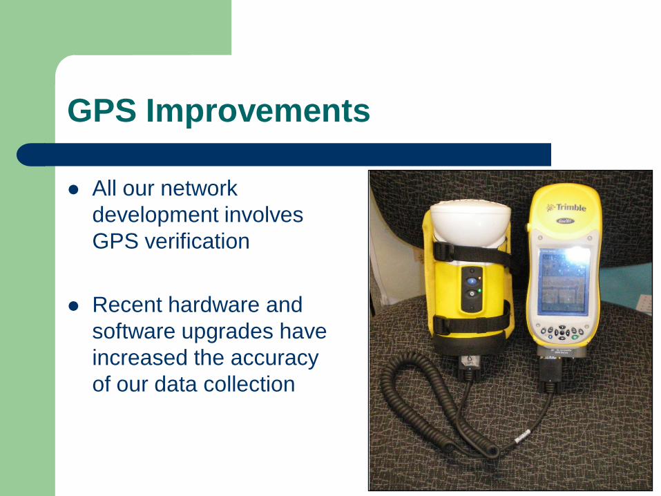
GPS Improvements
All our network
development involves
GPS verification
Recent hardware and
software upgrades have
increased the accuracy
of our data collection
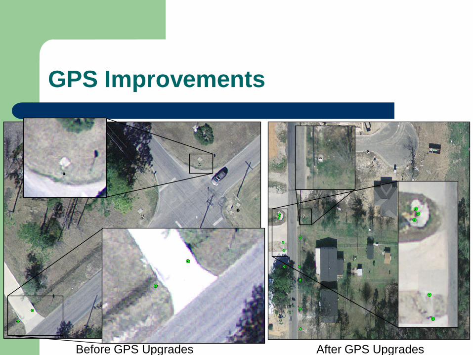
GPS Improvements
Before GPS Upgrades After GPS Upgrades
CIMS
Leisure Services’ Cemetery Management
Software
Self Contained GIS
MUNIS Maplink*
MUNIS MapLink enables MUNIS Users to view data stored in the City’s (GIS) database
*Coming Soon
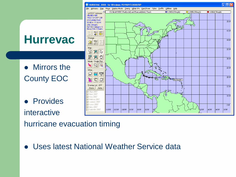
Hurrevac
Mirrors the
County EOC
Provides
interactive
hurricane evacuation timing
Uses latest National Weather Service data
Dialogic
Provides automated mass calling that allows
the City of Gulfport to communicate with the
community in the event that Public Works
repairs that may require a break in service
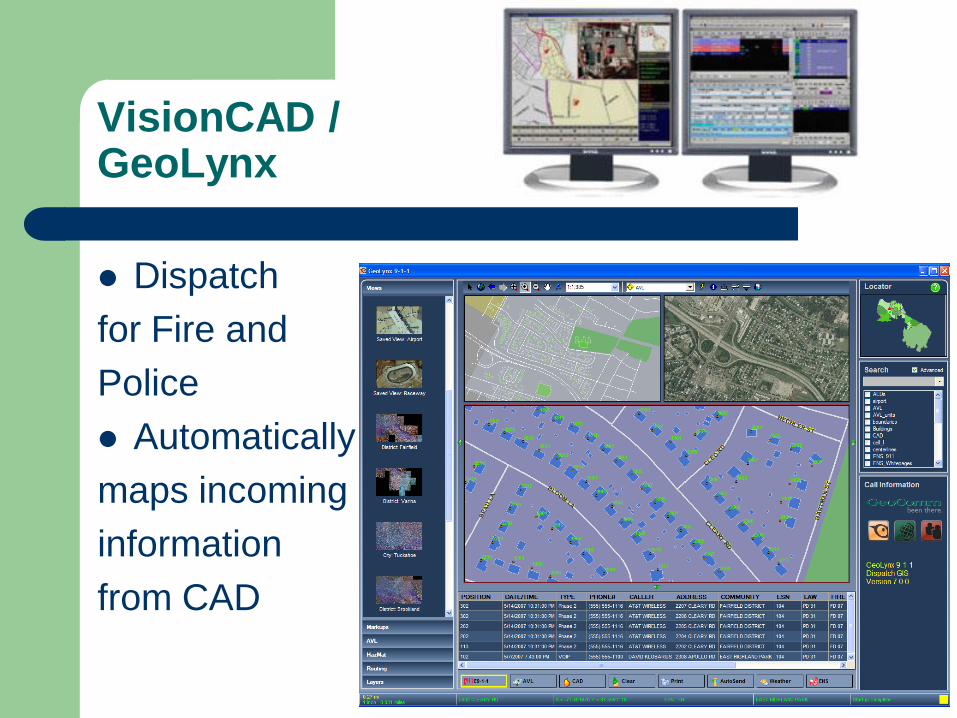
VisionCAD /GeoLynx
Dispatch
for Fire and
Police
Automatically
maps incoming
information
from CAD
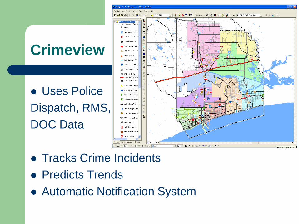
Crimeview
Uses Police
Dispatch, RMS,
DOC Data
Tracks Crime Incidents
Predicts Trends
Automatic Notification System
Future Developments
Enterprise License Agreement
– ArcGIS Desktop
ArcView
ArcEditor
ArcInfo
– All extensions
– ArcGIS Server (Enterprise and Standard) and all extensions
– ArcIMS
– ArcGIS Engine
– Includes online training and support credits
*Gulfport will be one of the first local governments to adopt ELA
Future Developments
Unlike Microsoft Office not everyone will need ArcMap, but it will be available to everyone that does at no further cost
ArcExplorer will be replaced with ArcMap, expanding the capabilities of those already accessing GIS information
Departments that use third party softwares (like Crimeview and Cityworks) that require an ArcMap license for their mapping component will no longer be required to pay this extra expense per seat
Thank you!
Mike Miller
Senior GIS Analyst, City of Gulfport
1422 23rd Ave, Trl D3
Gulfport, MS 39501-2055
Tel: 228.868.2179
Fax: 228.868.0323