governors island board of directors presidents report
TRANSCRIPT

Governors Island Board of Directors Presidents Report
May 12, 2015

2
Overview
• Public Access 2015: Our 10th year
• Resiliency Update
• The Hills

10

4
In 10 years, Governors Island has become New York City’s shared space for art and play.

11
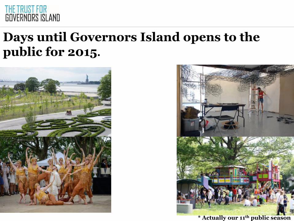
Days until Governors Island opens to the public for 2015.
* Actually our 11th public season

8,000

In 2005, total number of visitors. In 2013 and 2014, average number of weekend visitors per day 8-10,000.

0
50,000
100,000
150,000
200,000
250,000
300,000
350,000
400,000
450,000
500,000
2006 2007 2008 2009 2010 2011 2012 2013 2014
To
tal
Vis
ita
tio
n
Year
Annual visitation

101

Public access ferries per week in 2014.

Public access ferries per week in 2006.

557

Total number of days Governors Island open to the public in its 10 year history. Open only on weekends until 2014.
Now open 7 days per week.

0
50
100
150
200
250
300
350
400
Governors Island Museums City Parks
Days Open to the Public Annually (Average)

104

Organizations creating public programs and exhibits.


700
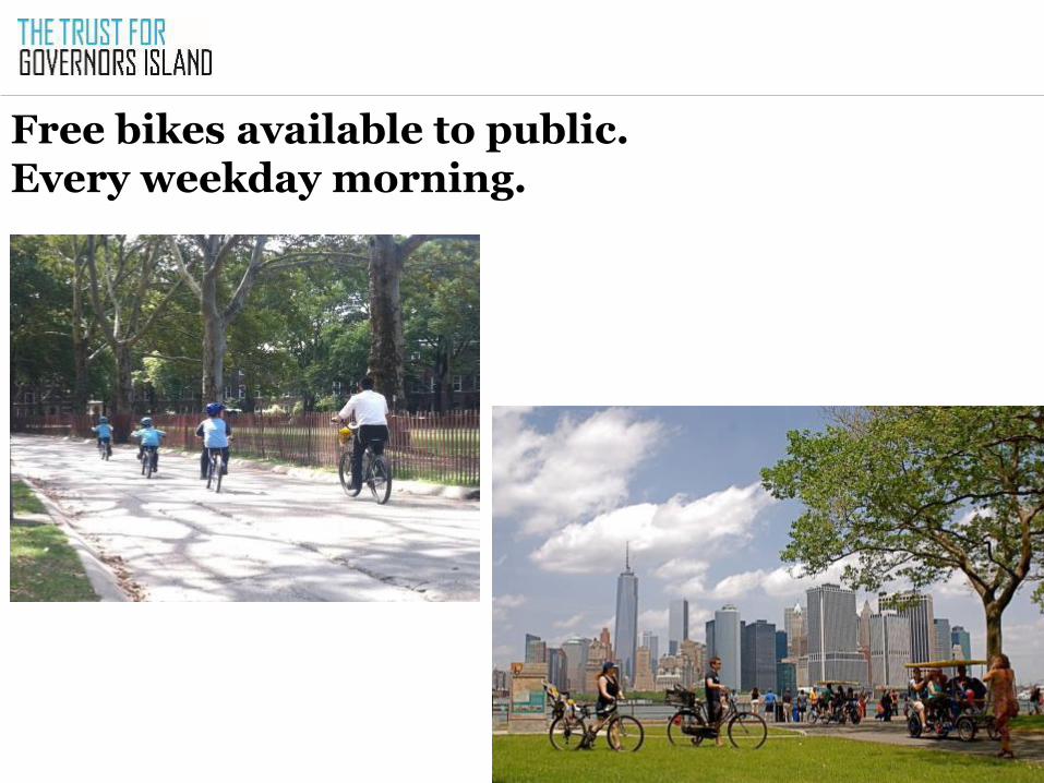
Free bikes available to public. Every weekday morning.

50

Hammocks in Hammock Grove.

350,000

Ice cream cones served.

11,500,000

Oysters grown and placed in New York Harbor.

4,690

Artists sharing their work with the public.

150,000

Square feet of free indoor space.
Plus 25 acres of outdoor space

175,000

Cubic yards of clean fill to construct 30 acres of park.

25

Ladies of the Dreamland Follies.

Jazz Age Lawn Party, 2006

Jazz Age Lawn Party, 2015


How do you measure love for an Island?

39
2015 promises to be the best season yet
• Open seven days a week for a 129 day season
• Eclectic array of arts, cultural, recreational and educational programs for visitors to enjoy
• More than 90 permit applications received to date over last year’s record breaking season

40
Goals for 2015
• Welcome more visitors than ever before.
• Welcome more programs than ever before.
• Maintain 100% visitor happiness rates.

41
OpenHouseGI continues to grow
• Twice as many indoor exhibits as in 2014
• Created two “seasons” to accommodate more organizations than before
• 30% more outdoor events and programs than in past years
• National model for free space and open platform
• Serves organizations and the public

New this season
42
• Festivals • Art Kibbutz’s Shmita Festival
• Performances • HERE’s artist residency and works in
progress • Site specific staged reading of “The
Plantation”
• New exhibitions • Empire Historic Arts presents “Lost
Amusement Parks of NYC” • Dysfunctional Theater Collective’s
poetry, photography and theater exhibit and workshops

Billion Oyster Project
43
• Using Nolan Park house to educate visitors about how they are restoring oysters to the Harbor
• Exhibit about how oysters are grown and placed on artificial reefs in waterways around the City
• Live feed from reef off of Governors Island
• Workshops and hands on activities for visitors

River to River Festival
44
• Island is featured location for River to River Festival, presented by LMCC
• Three site specific dance performances
• Open studios allow visitors to see work in progress
• Open studio discussions with artists

Old favorites are also returning
45
• National Park Service programs
• FIGMENT’s miniature golf course and
sculpture garden • “Here to There”
• African Film Festival
• Make Music New York • Holocenter and other indoor exhibits

Art CommissionsGI
46
• Trust program that commissions site specific pieces in new park and public spaces
• Curated by Tom Eccles and Ruba Katrib
• New this year, The Visitors uses
performances, sculpture, objects and script to create narratives visitors will experience throughout the Island
• Continuing projects: Mark Handforth’s Sidewalk Island and Susan Philipsz’ Day is Done

11 Days until our season begins!
47

48
Overview
• Public Access 2015: Our 10th year
• Resiliency Update
• The Hills

Sea level rise was an Island reality pre-Sandy
Sea level and storm resiliency have been part of our thinking for years
Park Master Plan elevated the new park spaces
Seawall designed for over-topping and revetment withstands high water
Core utility systems designed to resist/avoid/recover from seawater
•

Hundreds of thousands of cubic yards of general fill, up to 16’ above the seawall, imported to serve as the foundation of the future park.
Park design anticipated rising sea level
50
Increasing “base” elevation: • Protects plantings • Elevates electrical and other utilities • Establishes a new “edge elevation” at the adjacent development zones
Protecting edges with cast-concrete seating
Using “over-planting” to speed up healthy and sturdy root development

• Island was impacted by high winds and water flooding over the seawall around the Island and at the ferry terminal
• Considerable debris – including shipping
containers washed over fence – and high water marks indicate 11+ foot surge
• Minimal damage to historic fabric of Trust-owned buildings; only the Fort Jay eagle sculpture sustained damage
• Loss of only 8 trees, of 1,600 Island-wide
Superstorm Sandy: Immediate impact
51

• At the time Sandy hit, general fill already in place at park site, raising topography of the Island
• Park site remained intact after the storm
• Construction vehicles parked on top of fill allowed Trust to restart construction the next day
• West 8-designed park has become a model of smart, resilient design in era of rising sea levels and climate change
New Park design withstood the test as designed

• Validated both the strategy and the elevation of South Island fill
• Tree survival validated Hammock Grove planting strategy
• Water surge validated seawall designs
• Water surge also validated underground utility
designs and exposed existing vulnerabilities
Superstorm Sandy as Stress-test
53

• Trust is well coordinated with local efforts to adapt historic buildings in the floodplain
• Major areas of the Historic District, Nolan Park and Colonels Row, lie above 100 year flood plain
• Historic district buildings will require gut rehab, so where required, systems can be elevated within buildings or outside, as they would be elsewhere in NYC
• Historic district and DOB regulations are clear and well established
•
North Island invites thoughtful adaptive re-use on par with the rest of the City

West 8’s master plan raises most of the South Island out of the projected 100-year flood plain in 2100
The blue line shows the limits of Sandy’s storm surge – the partially complete Phase 1 Park was protected
55
The Park-Development Zone edge allows for seamless, resilient development on the South Island

56
Development zone edge is elevated out of the floodplain to match park edge

57
Overview
• Public Access 2015
• Resiliency and Governors Island
• The Hills

The Hills are on schedule to be completed by the end of 2016. • Demolition debris has been reused. • New fill barged down the Hudson. • Hills in place and sculpted. • Trees and plants selected in nurseries. • Soils approved.

Grassy Hill

Slide Hill

Discovery Hill

Liberty Moment

Outlook Hill

64
Public hard hat tours will be given all season.


We think people may want to do a jig when they get to the top. Or perhaps even more…..


