florida by fay, liz, & marcela. florida the sunshine state 1,200 miles of coast 53% consist of...
TRANSCRIPT
Florida by Fay, Liz, & Marcela

Florida
The sunshine state1,200 miles of coast53% consist of
barrier island4,500 islands greater
than 10 acres663 miles of beachesState fish: Tarpon
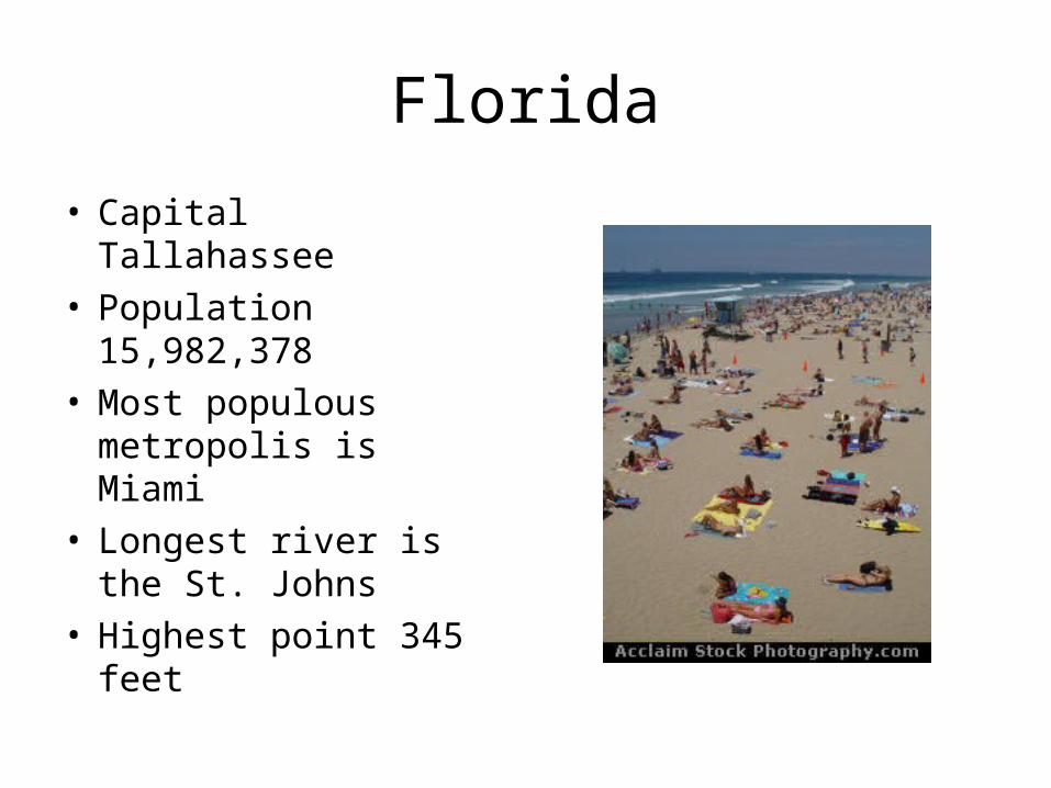
Florida
• Capital Tallahassee• Population
15,982,378• Most populous
metropolis is Miami• Longest river is the
St. Johns• Highest point 345 feet

Development of the shoreline
• Coastline has been changed from natural wetland and beach front to residential, commercial and recreational use
• Coastal population has increased from 4.8 million in 1960 to 12.8 million in 1990
• 79% of Florida’s population live within the coastal zone
Florida Tides
• Tidal range is microtidal ( 2m) throughout Florida except NE, where ranges may be greater

Pensacola (Gulf coast)
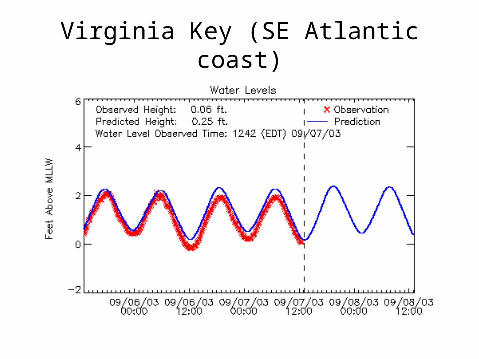
Virginia Key (SE Atlantic coast)

Fernandina Beach (NE Atlantic coast)
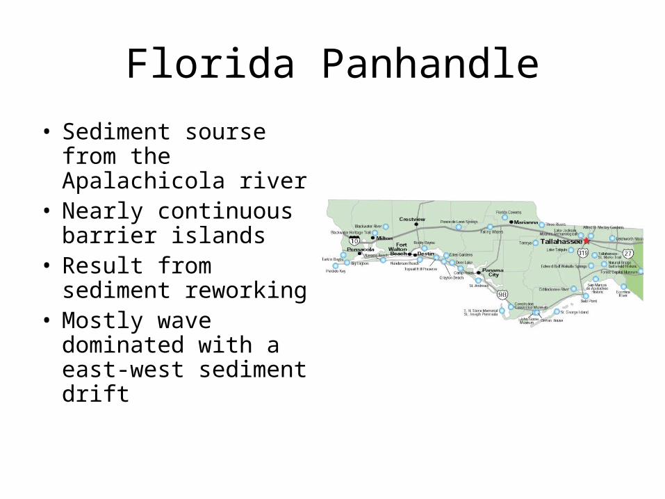
Florida Panhandle
• Sediment sourse from the Apalachicola river
• Nearly continuous barrier islands
• Result from sediment reworking
• Mostly wave dominated with a east-west sediment drift

Florida Panhandle
• Perdito Key is a 247 acre island in which half is preserved and half is covered by upscale development
• Santa Rosa barrier island is 40 miles long and is mostly protected by the Gulf Island National Seashore
santa rosa island

Florida Panhandle
• Okaloosa Island • High ocean washover• Owned mostly by
Eglin Air Force Base• Devistated by
hurricane Opal
Okalossa Island
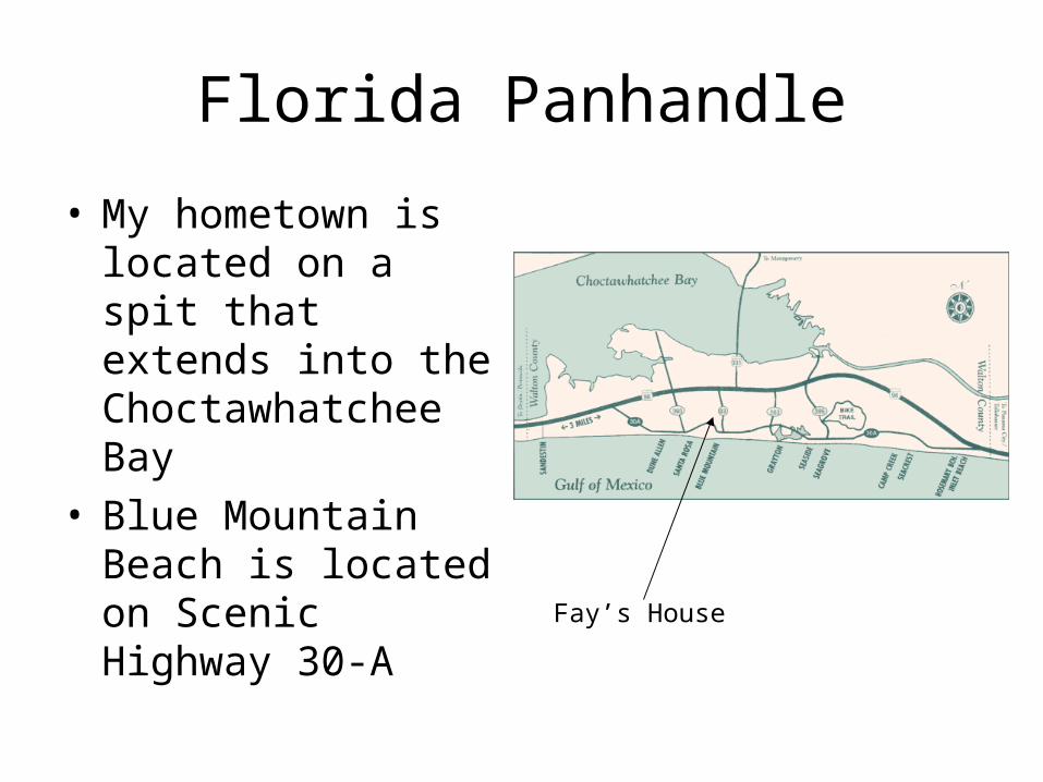
Florida Panhandle
• My hometown is located on a spit that extends into the Choctawhatchee Bay
• Blue Mountain Beach is located on Scenic Highway 30-A
Fay’s House
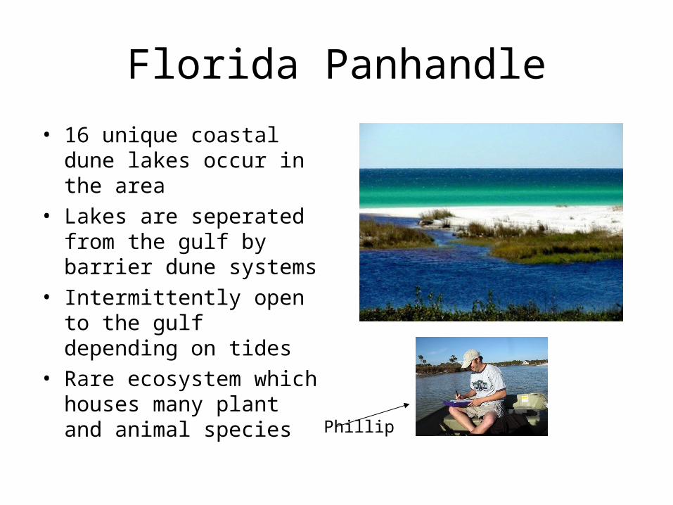
Florida Panhandle
• 16 unique coastal dune lakes occur in the area
• Lakes are seperated from the gulf by barrier dune systems
• Intermittently open to the gulf depending on tides
• Rare ecosystem which houses many plant and animal species
Phillip

Florida Panhandle
• Many barrier islands are formed in the Apalachicola area from sediments deposited by the river
• Cape San Blas partly ensloses St. Josephs Bay
Florida Panhandle
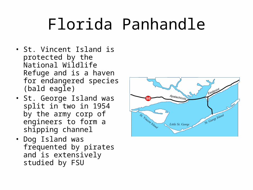
• St. Vincent Island is protected by the National Wildlife Refuge and is a haven for endangered species (bald eagle)
• St. George Island was split in two in 1954 by the army corp of engineers to form a shipping channel
• Dog Island was frequented by pirates and is extensively studied by FSU
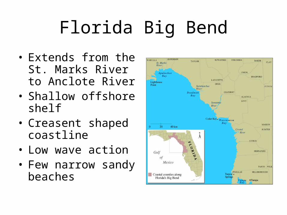
Florida Big Bend
• Extends from the St. Marks River to Anclote River
• Shallow offshore shelf • Creasent shaped
coastline• Low wave action• Few narrow sandy
beaches
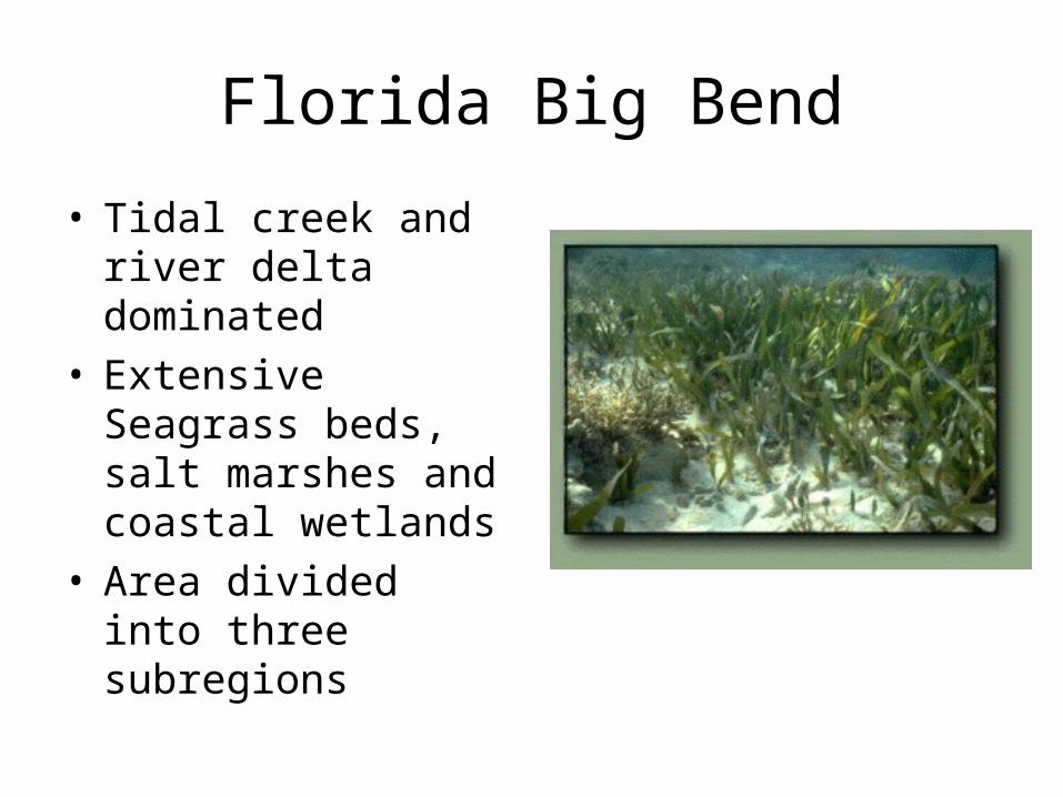
Florida Big Bend
• Tidal creek and river delta dominated
• Extensive Seagrass beds, salt marshes and coastal wetlands
• Area divided into three subregions
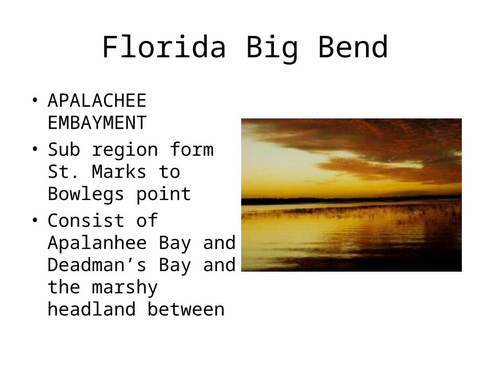
Florida Big Bend
• APALACHEE EMBAYMENT
• Sub region form St. Marks to Bowlegs point
• Consist of Apalanhee Bay and Deadman’s Bay and the marshy headland between

Florida Big Bend
• SUWANNEE COAST• Extends from
Bowlegs point to the Withlacoochee river
• Includes the Cedar Keys which consist of twelve small barrier islands
Florida Big Bend
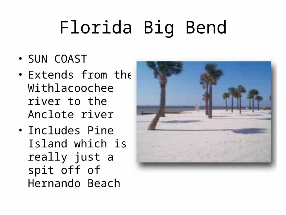
• SUN COAST• Extends from the
Withlacoochee river to the Anclote river
• Includes Pine Island which is really just a spit off of Hernando Beach
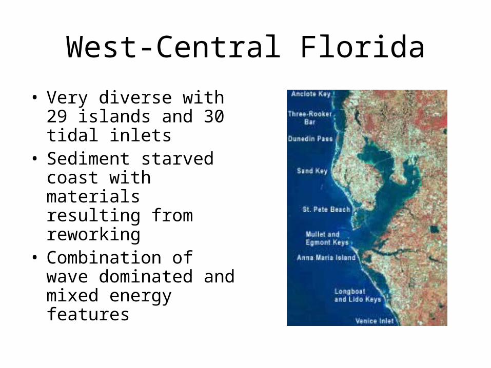
West-Central Florida
• Very diverse with 29 islands and 30 tidal inlets
• Sediment starved coast with materials resulting from reworking
• Combination of wave dominated and mixed energy features
West-central coast
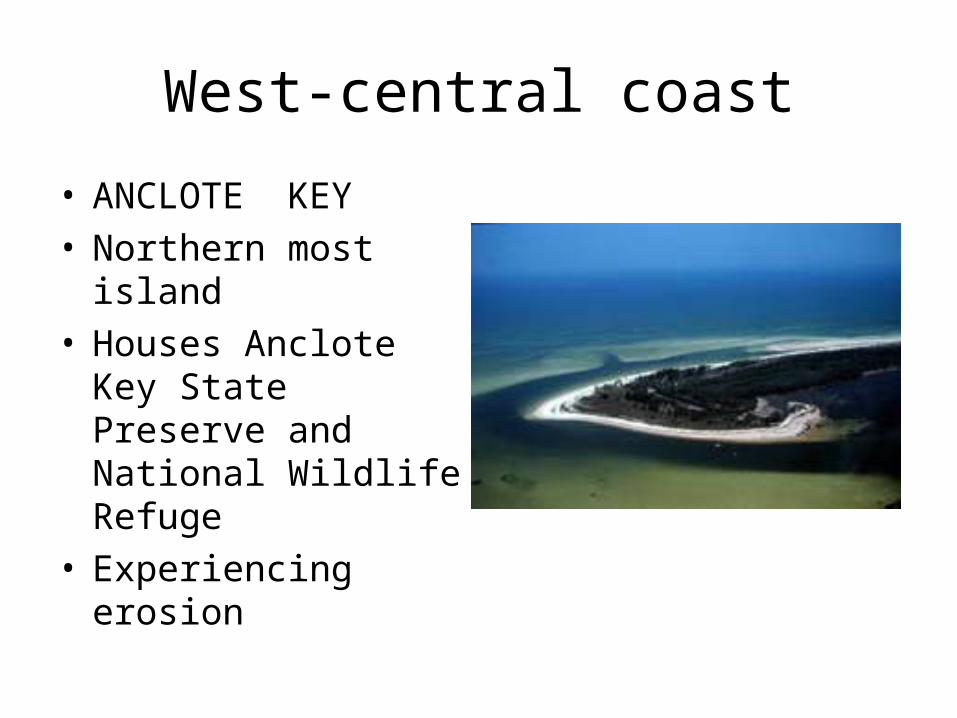
• ANCLOTE KEY• Northern most island• Houses Anclote Key
State Preserve and National Wildlife Refuge
• Experiencing erosion
West-Central Florida
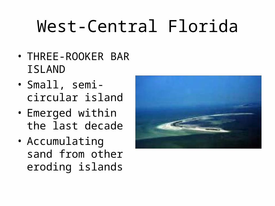
• THREE-ROOKER BAR ISLAND
• Small, semi-circular island
• Emerged within the last decade
• Accumulating sand from other eroding islands
West-Central Florida
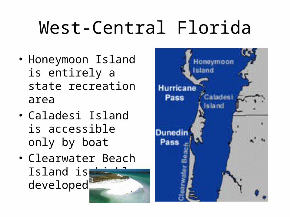
• Honeymoon Island is entirely a state recreation area
• Caladesi Island is accessible only by boat
• Clearwater Beach Island is highly developed

West-Central Florida
• SAND KEY• Highly Developed• Many beach
renourishment projects
• High erosion
West-Central Florida
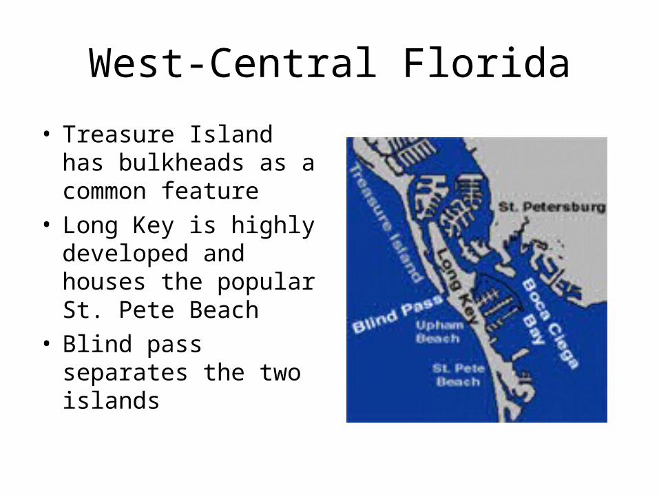
• Treasure Island has bulkheads as a common feature
• Long Key is highly developed and houses the popular St. Pete Beach
• Blind pass separates the two islands

West-Central Florida
• ANNA MARIA ISLAND
• 1st major island south of Tampa Bay
• Highly developed• Nearshore transverse
bars• Originated as a
elongate shoal

West-Central Florida
• Longboat Key• 10 miles long• Lido Key• Formed artificially in
the 20’s when a series of mangrove islands was filled with dredge material
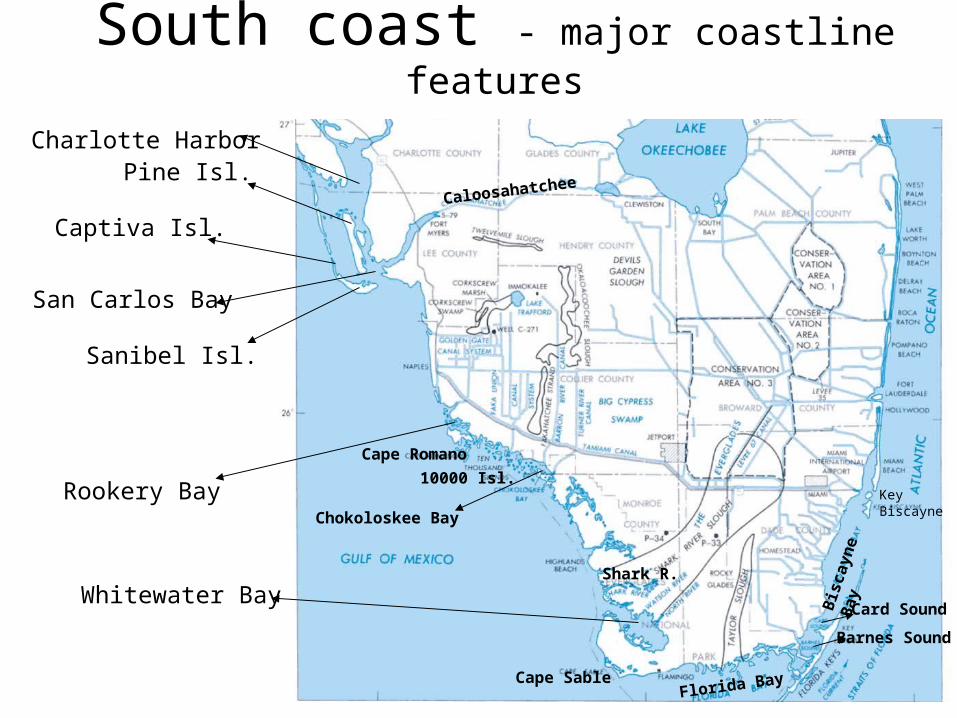
South coast - major coastline features
Charlotte HarborPine Isl.
Captiva Isl.
San Carlos Bay
Sanibel Isl.
Whitewater Bay Bis
cayn
e B
ay
Florida Bay
Cape Romano
Cape Sable
Key Biscayne
Caloosahatchee
10000 Isl.
Chokoloskee Bay
Rookery Bay
Shark R.
Card Sound
Barnes Sound

South coast
• mangrove coasts and associated salt marshes
• barrier islands• sandy beaches• Florida Keys
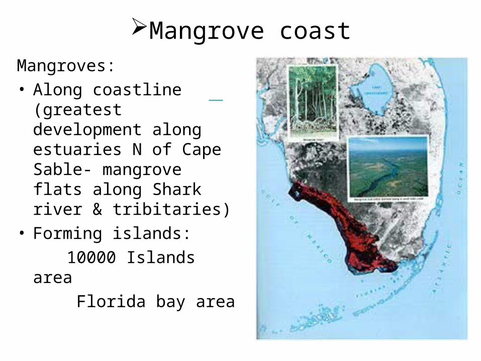
Mangrove coast
Mangroves:• Along coastline
(greatest development along estuaries N of Cape Sable- mangrove flats along Shark river & tribitaries)
• Forming islands:
10000 Islands area
Florida bay area

Ten Thousand Islands
• Extend northward from the NW corner of Everglades Natl Park for about 60 miles
• Mangroves build upon oyster bars that grow perpendicular to the tidal flow , giving the islands their characteristic shape
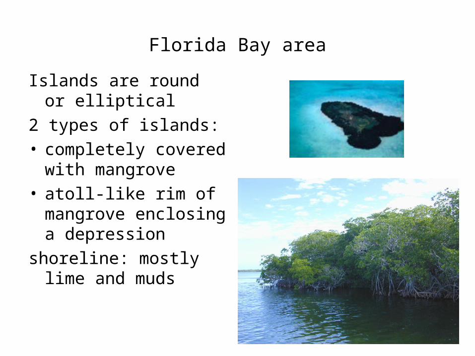
Florida Bay area
Islands are round or elliptical
2 types of islands:• completely covered
with mangrove• atoll-like rim of
mangrove enclosing a depression
shoreline: mostly lime and muds
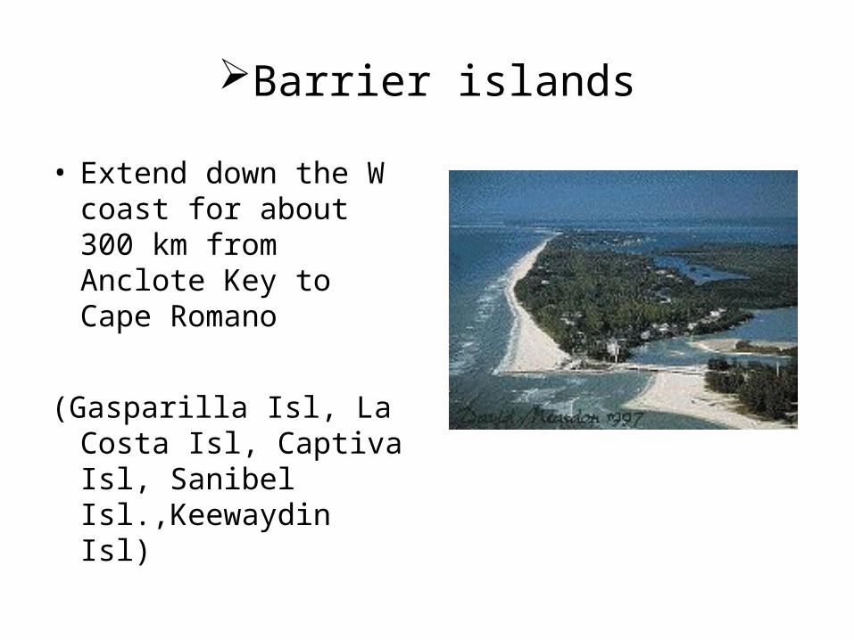
Barrier islands
• Extend down the W coast for about 300 km from Anclote Key to Cape Romano
(Gasparilla Isl, La Costa Isl, Captiva Isl, Sanibel Isl.,Keewaydin Isl)

Cape Sable
Sanibel Isl.
Captiva Isl.
Pine Isl.
Gasparilla Isl.

Sandy beaches
• Poorly developed S of Key Biscayne but some occur as small pockets in the Florida Keys and shallow bays behind the Keys
• Most extensive beaches of SW Fl are the 16 km long beach on Cape Sable and the 10 km long Highlands beach
Cape Sable

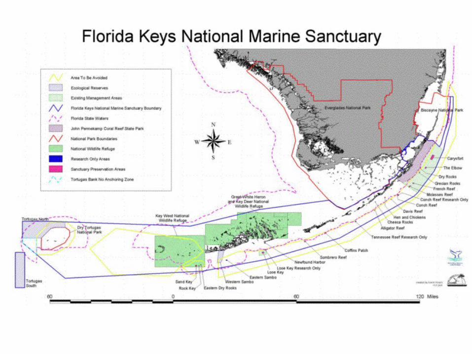
Florida Keys
• 1700 islands• NE-SW arc,
240 km long • From Soldier
key to Key West
• Upper Keys (Bahia Honda northwards)
• Lower Keys (Pig Pine Key)
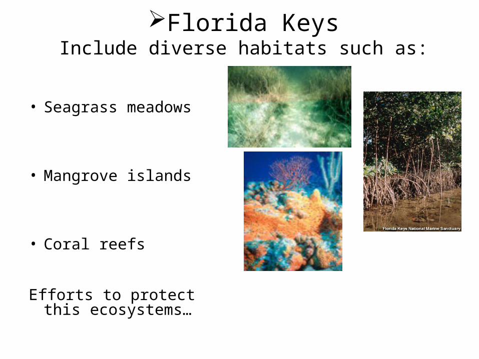
Florida KeysInclude diverse habitats such as:
• Seagrass meadows
• Mangrove islands
• Coral reefs
Efforts to protect this ecosystems…

Florida Keys
• One half on the area covered by mangrove swamps
• Shoreline: mostly rock or muddy intertidal flats that border mangrove shoreline
• Only a few sandy beaches
• Offshore: coral reefs forming banks and channels
Bahia Honda

East Coast Florida
• 550 miles of barrier islands and coastal inlets
• Contains both Mesotidal and Microtidal environments
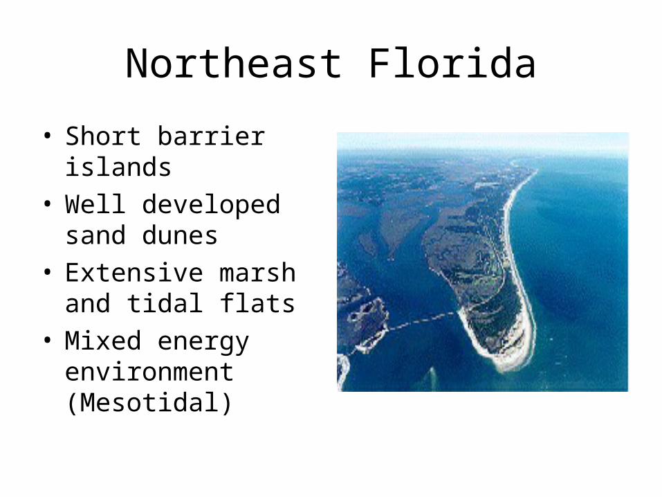
Northeast Florida
• Short barrier islands
• Well developed sand dunes
• Extensive marsh and tidal flats
• Mixed energy environment (Mesotidal)

Central –Southern Florida
• Wave dominated• Barrier islands
have long, continuous dunes
• Little marsh development
• Lagoons contain fresh water away from inlets

Major Rivers and Water Features
• St. John’s River– 285 miles
(longest river in Florida
– Flows Northward• St. Mary’s River
– 185 miles– Border between
GA and FL

Water (cont)
• Indian River Lagoon– 150 mi long– Bordered by
Canaveral Island National Seashore (N), Cape Canaveral (E), Jupiter Island (S), and mainland FL (W)
– North America’s most diverse estuary
– Contains 6 inlets

Sebastian Inlet
• Outflow for Indian River• Located between Melbourne and Vero
Beach

Jupiter Inlet
• Outflow for the Loxahatchee River
• Small and narrow• Shoaling and fast
currents make it dangerous
• Considered unnavigable by U. S. Coast Guard
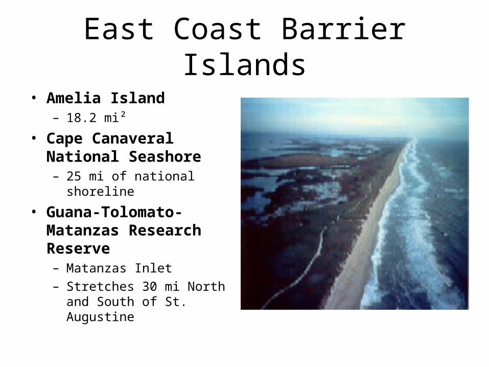
East Coast Barrier Islands
• Amelia Island – 18.2 mi²
• Cape Canaveral National Seashore– 25 mi of national
shoreline
• Guana-Tolomato-Matanzas Research Reserve – Matanzas Inlet– Stretches 30 mi North
and South of St. Augustine
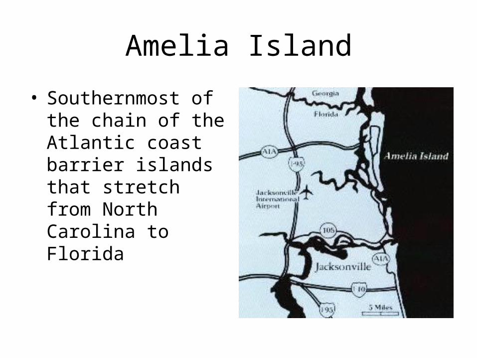
Amelia Island
• Southernmost of the chain of the Atlantic coast barrier islands that stretch from North Carolina to Florida

Cape Canaveral National Seashore
• Contains ocean, beach, hammock, lagoon, saltmarsh and pine flatland habitats
• 58,000 acres of barrier island
• Relatively stable barrier beach backed by a productive lagoon system (Indian River Lagoon)

Matanzas National Estuarine Research Reserve
• Contains saltmarshes, mangrove tidal wetlands, oyster bars, estuarine lagoons, and offshore seas in NE Florida
• Matanzas Inlet– Unaltered inlet– Provides/supports
commercial and recreational fish

References• University of Florida Geology Department: Geology of the Florida Coast
http://www.clas.ufl.edu/users/guerry/GLY4155/coast.htlm• Pensacola’s Pristine Beaches http://goflorida.about.com.library/weekly/aa0131a.htm• Chactawhatchee Basin Alliance http://basinalliance.org/cdlakes.htm• Apalachicola Islands http://www.baynavigator.com/TheIslands/main.cfm• Florida Division of Historical Resources, US census Bureau, Atlas of Florida, (c) 1992.• Florida Department of Environmental Protection, Big Bend Gulf Coast Subregions, 2000• USGS Barrier Island Studies http://pubs.usgs.gov/of/2001/0f01-303/island.htlm• Sanibel-Captiva Conservation Foundation http://www.sccf.org/Education/barrierislands.html• Barrier Island Accretion and Geomorphological Evolution of Keewaydin Island, Collier County,
Florida http://keck.carleton.edu/archives/symposium/00/novakowski.pdf• Florida Keys http://www.sanctuaries.nos.noaa.gov/oms/omsflorida/omsflorida.html• Geology and Hydrology of the Florida Keys
http://sofia.usgs.gov/publications/papers/keys_geohydro/index.html• Florida Keys National Marine Sanctuary
http://www.fknms.nos.noaa.gov/visitor_information/welcome.html• Tides on line http://tidesonline.nos.noaa.gov/geographic.html• National Audubon Society: A Field Guide to Florida• National Geographic Guide Map: Florida• http://www.floridaoceanographic.org/Indian_River.htm• http://www.capecanaveral.com• http://www.nps.gov/cana/• http://www.ameliaisland.com/• http://www.ocrm.nos.noaa.gov/nerr/reserves/nerrgtm.html• http://www.dep.state.fl.us./coastal/sites/northeast/gtmnerr/info.htm
•