floodplain management ready reference · ready reference 2 may 2014 notes to the user this ready...
TRANSCRIPT

Floodplain Management
Ready Reference
Iowa Department of Natural Resources
May 2014

Ready Reference 2 May 2014
Notes to the User
This Ready Reference is a companion to the Floodplain Management Desk Reference, which provides the information and lists of additional resources that can be used to effectively administer a local floodplain management program at the community level. Both publications are available free from the Iowa Department of Natural Resources.
The responsibility for reducing flood losses is shared by all levels of government (local, state, and federal) and the private sector. Successfully fulfilling this responsibility depends on having the knowledge and skills to plan and implement needed floodplain management measures. While any interested party may use these reference manuals, both are written specifically for the local official responsible for administering community floodplain management programs and regulations. Therefore, references to “you” make the assumption that you are a local official.
Commonly Used Acronyms
The acronyms below are frequently used throughout the Ready Reference and the Floodplain Management Desk Reference.
BFE: Base Flood Elevation
CFR: Code of Federal Regulations
CRS: Community Rating System
DNR: Iowa Department of Natural Resources
FEMA: Federal Emergency Management Agency
FIRM: Flood Insurance Rate Map
FIS: Flood Insurance Study
LOMA: Letter of Map Amendment
LOMR: Letter of Map Revision
NFIP: National Flood Insurance Program
SFHA: Special Flood Hazard Area
Ready Reference 3 May 2014
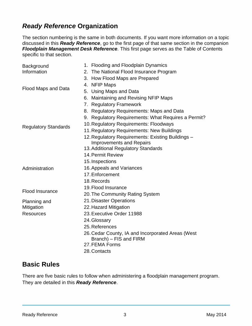
Ready Reference Organization
The section numbering is the same in both documents. If you want more information on a topic discussed in this Ready Reference, go to the first page of that same section in the companion Floodplain Management Desk Reference. This first page serves as the Table of Contents specific to that section.
Background Information
1. Flooding and Floodplain Dynamics
2. The National Flood Insurance Program
Flood Maps and Data
3. How Flood Maps are Prepared
4. NFIP Maps
5. Using Maps and Data
6. Maintaining and Revising NFIP Maps
Regulatory Standards
7. Regulatory Framework
8. Regulatory Requirements: Maps and Data
9. Regulatory Requirements: What Requires a Permit?
10. Regulatory Requirements: Floodways
11. Regulatory Requirements: New Buildings
12. Regulatory Requirements: Existing Buildings – Improvements and Repairs
13. Additional Regulatory Standards
Administration
14. Permit Review
15. Inspections
16. Appeals and Variances
17. Enforcement
18. Records
Flood Insurance 19. Flood Insurance
20. The Community Rating System
Planning and Mitigation
21. Disaster Operations
22. Hazard Mitigation
Resources 23. Executive Order 11988
24. Glossary
25. References
26. Cedar County, IA and Incorporated Areas (West Branch) – FIS and FIRM
27. FEMA Forms
28. Contacts
Basic Rules
There are five basic rules to follow when administering a floodplain management program.
They are detailed in this Ready Reference.

Ready Reference 4 May 2014
Rule #1: You must use the latest maps and flood data published by the FederalEmergency Management Agency (FEMA).Section 8 reviews the requirements on using maps and data and ordinanceadministration.
Rule #2: A permit is required for all development in the Special Flood Hazard Area(SFHA) as shown on your community’s Flood Insurance Rate Map (FIRM).Sections 9 and 14 cover permit requirements.
Rule #3: Development must not increase the flood hazard on other properties.Section 10 discusses the requirements for accessing the impacts of proposeddevelopment on other properties and the area designated as a regulatory floodway.
Rule #4: New buildings must be protected from damage by the base flood.Section 11 discusses the regulatory requirements for new buildings.
Rule #5: If the cost of improvements or the cost to repair building damageexceeds 50 percent of the market value of a building located within the SFHA, itmust be brought up to current floodplain management standards.Section 12 covers the rules for existing buildings.
For More Information
Iowa Department of Natural Resources
Land Quality Bureau – Flood Plain Management & Dam Safety Wallace State Office Building 502 E 9th St Des Moines, IA 50319-0034
http://www.iowadnr.gov/InsideDNR/RegulatoryLand/FloodPlainManagement
For information about:
Flood Plain Permits, Dam Safety, Floodplain Mapping and the NFIP: 1-866-849-0321
Sovereign Land Program Coordinator: 515-725-8464 Water Quality Certification: 515-725-0341
Recreational Boat Docks: 515-725-8200 Sand and Gravel Permits: 515-725-8460
Federal Emergency Management Agency
Federal Emergency Management Agency Region VII 9221 Ward Pkwy Ste 300 Kansas City, MO. 64114-3372
Phone: 816-283-7061

Ready Reference 5 May 2014
1. Flooding and Floodplain Dynamics
Floods are part of the Earth’s natural hydrologic cycle. The cycle circulates water throughout the environment to maintain an overall balance between water in the air, on the surface, and in the ground. When there is too much water on the ground, there’s a flood – that’s natural.
What Is a Watershed?
A watershed is an area that drains into a lake, stream, or other body of water.
Watersheds vary in size. Larger ones can bedivided into sub-watersheds.
What happens in a watershed will affectevents and conditions downstream.
Common Types of Flooding
Flooding that occurs along a defined channel is called riverine flooding. The most common type of flooding in Iowa is called overbank flooding. Overbank flooding occurs when a downstream channel receives more rain or snowmelt from the watershed than can be handled, or a channel is blocked by an ice jam or debris.
A severe storm that drops substantial rainfall in a short time can generate a flash flood. All flash floods strike quickly and end swiftly.
Other types of flood hazards include:
Sheet flow – occurs after an intense or prolonged rainfall during which the rain cannotsoak into the ground.
Urban drainage – most of the man-made systems built were typically designed tohandle the amount of water expected during a 10-year or smaller storm. Larger stormsoverload them, and the resulting backed-up sewers and overloaded ditches produceflooding.
Levee and dam failures – Levees and dams are intended to hold back large amountsof water. If they fail or are overtopped, they can produce a dangerous flood situationbecause of the high velocities and large volumes of water released.
Ice jams – Levees and dams are intended to hold back large amounts of water. If theyfail or are overtopped, they can produce a dangerous flood situation because of the highvelocities and large volumes of water released.

Ready Reference 6 May 2014
Debris dams – Debris, such as logs, can collect at shallow parts of a stream, sharp bends, bridges, and other “choke points” similar to the places that form ice jams. If the channel is not kept clear, the debris will build up and form a dam. If the debris dam breaks during high flows (or anytime), the result can be a flood.
Closed basin lakes – Seasonal increases in rainfall can cause a closed basin lake’s level to rise faster than it can drain. As a result they are subject to large fluctuations in water surface elevation. Floodwaters trapped in a closed basin lake can result in increased lake elevations for weeks, months, or even years.
Building in floodplains exposes people to safety and health hazards.
Even slow moving floods can be life threatening.
Floodwaters destroy food and medicine.
Flooding can shut down water and wastewater treatment facilities.
Flooding impacts people’s mental health.
Flooding affects livestock and domesticated pets.
Building in floodplains exposes new development to flood damage.
Buildings can be damaged by debris, current, and other moving hazards.
Floods and walls can collapse from hydrostatic pressure.
Wallboard, insulation, wood and contents are destroyed by being wet.
Building in floodplains increases flood problems for others.
Development anywhere in the watershed can increase the amount of stormwater runoff that goes to the rivers and streams, increasing flood heights.
Fill and buildings in the floodplain can obstruct flood flows.
Floodplain development reduces the amount of room available to store floodwaters, increasing flood heights.
Floodplain development can destroy habitat and other natural floodplain functions.

Ready Reference 7 May 2014
2. The National Flood Insurance Program
The National Flood Insurance Program (NFIP) was created to:
Transfer the costs of private property flood losses from the taxpayers to floodplain property owners through flood insurance premiums;
Provide floodplain residents and property owners with financial aid after floods, especially smaller floods that do not warrant Federal disaster aid;
Guide development away from flood hazard areas; and
Require that new, substantially improved and substantially damaged (improvements or repairs will exceed 50% of the market value) buildings be constructed in ways that would minimize or prevent damage in a flood.
The NFIP is administered by the Federal Emergency Management Agency (FEMA).
How the NFIP Works
The NFIP is based on a mutual agreement between the Federal Government and the community. Federally guaranteed flood insurance is made available in those communities that agree to regulate development in their mapped floodplains. If the communities do their part in making sure future floodplain development meets certain criteria, FEMA makes flood insurance available for properties in the community.
There are three basic parts to the NFIP—mapping, insurance, and regulations. These three parts are interconnected and mutually supportive.
Mapping
FEMA prepares a Flood Insurance Rate Map (FIRM) for a community. The maps and data are used for several purposes and are explained in greater detail in Sections 3- 6:
Communities, States, and Federal agencies use them as the basis for regulating new construction and substantial improvements in a flood hazard area;
Insurance agents use them when rating flood insurance policies; and
Lenders and Federal agencies use them to determine when flood insurance must be purchased as a condition of a loan or financial assistance.
National Flood Insurance Program Legislation
National Flood Insurance Act of 1968
Flood Disaster Protection Act of 1973
National Flood Insurance Reform Act of 1994
Flood Insurance Reform Act of 2004
Biggert-Waters Flood Insurance Reform Act of 2012
Homeowners Flood Insurance Affordability Act of 2014

Ready Reference 8 May 2014
Insurance
NFIP flood insurance can be purchased to cover any building located in a community participating in the NFIP—even buildings not located in a mapped floodplain. Insurance coverage is limited to losses incurred due to a “flood.” A flood is defined by the NFIP as a general and temporary condition of partial or complete inundation of normally dry land areas from:
“The overflow of inland or tidal waters”; or
“The unusual and rapid accumulation or runoff of surface waters from any source.”
Flood insurance and more detail regarding its relation to construction regulations are discussed in Section 19.
Regulations
In order to join the NFIP, the community has to agree to regulate future development in the floodplain shown on the FIRM. The community’s floodplain regulations are designed to ensure that new buildings will be reasonably protected from damage by flooding and that development within the flood hazard area will not increase the flood hazard. The NFIP underwrites flood insurance coverage only in those communities that adopt and enforce floodplain regulations that meet or exceed the NFIP minimum requirements.
NFIP Roles and Responsibilities
The NFIP is founded on a mutual agreement between the Federal Government and each participating community. Local, State, and Federal governments, and private insurance companies must share roles and responsibilities to meet the goals and objectives of the NFIP.
Community: The community’s role is of paramount importance. Residents and property owners can get NFIP flood insurance only if the community carries out its responsibility to enforce its adopted floodplain regulations.
State: Each governor has selected a state coordinating Division for the NFIP. In Iowa it is the DNR.
Federal: FEMA administers the NFIP through its Regional Offices and the FIMA in Washington, DC. There are 10 FEMA Regional Offices, each with an Insurance and Mitigation Division that coordinates the NFIP with States and communities. Region VII covers the States of Iowa, Missouri, Kansas, and Nebraska.
Compliance
If a community doesn’t uphold its part of the agreement and fails to adequately enforce its floodplain management regulations, the following may apply: New buildings may be built subject to damage from the base flood;

Ready Reference 9 May 2014
Insurance on a new improperly constructed may be very expensive;
FEMA can put the community on probation; or
FEMA can suspend the community.
In the case of probation, FEMA formally notifies the community that the community’s floodplain management program is non-compliant with the NFIP criteria and also notifies all policyholders of the impending probation, telling them that an additional $50 premium will be charged on policies sold or renewed during the probation period. The objective of this surcharge is to bring the policyholders’ attention to the fact that their community is not compliant and failure to correct the problems may lead to suspension.
If, after a period of probation, a community fails to remedy its program deficiencies, it will be suspended from the NFIP. Suspension means the community is no longer in the NFIP.
Sanctions for Non-participation
A community that
a) does not join the NFIP once FEMA has mapped SFHAs within the community,
b) has withdrawn from the program, or
c) is suspended from it faces the sanctions in the box to the right.
These sanctions can be severe on any community with a substantial number of buildings in the floodplain. Most communities with a flood risk have joined the NFIP and are in full compliance with their regulatory obligations.
Sanctions Flood insurance will not be available.
Existing flood insurance policies will not be renewed.
No direct Federal grants or loans for development may be made in identified flood hazard areas under programs administered by Federal agencies such as the Department of Housing and Urban Development, the Environmental Protection Agency, and the Small Business Administration. State agencies may also deny financial assistance for floodplain properties.
Federal disaster assistance will not be provided to repair insurable buildings located in identified flood hazard areas for damage caused by a flood.
No Federal mortgage insurance or loan guarantees may be provided in identified flood hazard areas.
Federally insured or regulated lending institutions, such as banks and credit unions, must notify applicants seeking loans for insurable buildings in flood hazard areas that:
o There is a flood hazard; and o The property is not eligible for Federal
disaster relief.
Ready Reference 10 May 2014
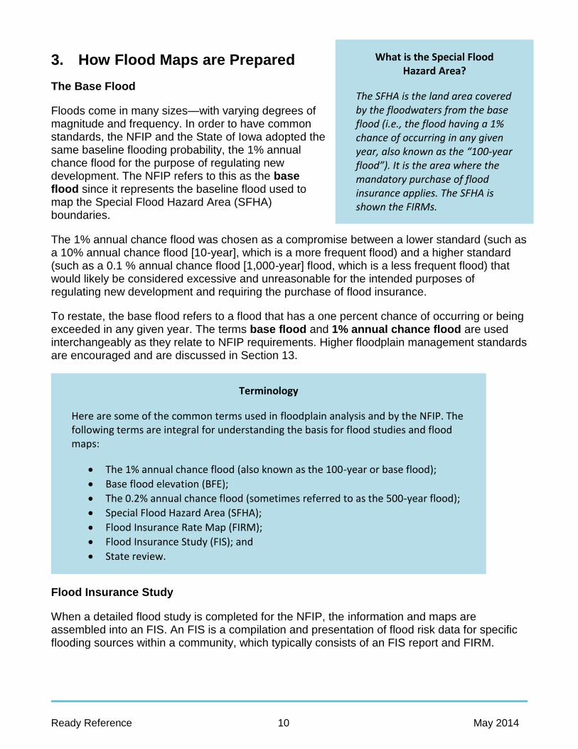
What is the Special Flood Hazard Area?
The SFHA is the land area covered by the floodwaters from the base flood (i.e., the flood having a 1% chance of occurring in any given year, also known as the “100-year flood”). It is the area where the mandatory purchase of flood insurance applies. The SFHA is shown the FIRMs.
3. How Flood Maps are Prepared
The Base Flood
Floods come in many sizes—with varying degrees of magnitude and frequency. In order to have common standards, the NFIP and the State of Iowa adopted the same baseline flooding probability, the 1% annual chance flood for the purpose of regulating new development. The NFIP refers to this as the base flood since it represents the baseline flood used to map the Special Flood Hazard Area (SFHA) boundaries.
The 1% annual chance flood was chosen as a compromise between a lower standard (such as a 10% annual chance flood [10-year], which is a more frequent flood) and a higher standard (such as a 0.1 % annual chance flood [1,000-year] flood, which is a less frequent flood) that would likely be considered excessive and unreasonable for the intended purposes of regulating new development and requiring the purchase of flood insurance.
To restate, the base flood refers to a flood that has a one percent chance of occurring or being exceeded in any given year. The terms base flood and 1% annual chance flood are used interchangeably as they relate to NFIP requirements. Higher floodplain management standards are encouraged and are discussed in Section 13.
Flood Insurance Study
When a detailed flood study is completed for the NFIP, the information and maps are assembled into an FIS. An FIS is a compilation and presentation of flood risk data for specific flooding sources within a community, which typically consists of an FIS report and FIRM.
Terminology
Here are some of the common terms used in floodplain analysis and by the NFIP. The following terms are integral for understanding the basis for flood studies and flood maps:
The 1% annual chance flood (also known as the 100-year or base flood);
Base flood elevation (BFE);
The 0.2% annual chance flood (sometimes referred to as the 500-year flood);
Special Flood Hazard Area (SFHA);
Flood Insurance Rate Map (FIRM);
Flood Insurance Study (FIS); and
State review.

Ready Reference 11 May 2014
The FIRM delineates the 1% and sometimes the 0.2% annual chance floodplains and establishes BFEs for portions of the 1% annual chance floodplain that have been studied by detailed methods. It might also include the delineation of a regulatory “floodway” for some detailed study stream reaches. The FIRM serves as the basis for rating flood insurance and for regulating floodplain development and carrying out other floodplain management measures.
Some older FIS (produced prior to 1985) include a separate Flood Boundary and Floodway Map that depicts (among other things) the regulatory floodway. Since 1985, the floodway and other flood study data have been included on the FIRM.
The FIS report includes supplemental information about the technical analysis used to perform the flood study and a summary of the community’s flooding history and floodprone areas. Other specific components of the FIS report include the following.
The purpose of the flood study;
The area and streams studied;
The engineering methods employed;
Tables summarizing the data used to produce the FIRM; and
Computed flood profiles for each detailed studied stream or tributary usually showing the recurrence probabilities for the 10%, 4%, 2%, and 0.2% annual chance floods.
Floodplain: Floodway and Fringe
The floodway is the stream channel and that portion of the adjacent floodplain which must remain open to permit passage of the 1% annual chance flood. Floodwaters generally are deepest and swiftest in the floodway, and anything in this area is at the greatest risk during a flood.
The remainder of the floodplain is called the floodway fringe where water may be shallower and slower. NFIP minimum standards provide that areas outside the boundaries of the floodway can be developed. Consequently, most communities permit development in the floodway fringe if the development is elevated or otherwise protected to the 1% chance flood level (or any higher State or local standards).

Ready Reference 12 May 2014
4. NFIP Maps
Types of Maps
As the NFIP has evolved, so have the flood map products used for it. The first flood maps published in the early days for the NFIP were intended to provide only a rough approximation of the flood risk areas within individual communities. Over the years, the quality and complexity of flood map products increased, with the latest generation of Federal Emergency Management Agency (FEMA) flood map products being produced under the Risk Mapping, Assessment, and Planning (Risk MAP) program providing seamless digital flood hazard information for an entire watershed.
General Map Features
All flood maps are prepared with an Index Map Panel (when a community is mapped on more than one panel) to show the area of the community covered by each map panel. Each map panel also contains similar general features or elements that include:
The community name and NFIP number;
A title block;
A legend (or key) to identify the features shown on the map;
Map panel information;
An arrow pointing north on the map;
A map scale to relate horizontal distance on the ground to distance on the map;
Bench marks (new format) or elevation reference marks (old);
An effective date or revision date information; and
On newer FIRMs, Notes to Users containing basic information on use of the map and how it was developed (see Section 4.2.7).
Flood Hazard Boundary Maps (FHBMs) were initially prepared in order to provide an identification of flood risk for many communities in a short period of time. They were published in the 1970s and early 1980s without benefit of detailed studies or hydraulic analyses for more than 21,000 flood-prone communities in the nation. In most cases, they were intended for interim use until more detailed studies could be performed for communities.
In some cases FEMA simply converted the FHBM to a Flood Insurance Rate Map (FIRM) by issuing a letter to the community stating that the

Ready Reference 13 May 2014
FHBM shall be considered a FIRM without printing a new map. This process is called a “special conversion”—converting the community from the Emergency Phase (initial phase of participation under which limited flood insurance coverage is made available) to the Regular Phase of the NFIP under which full flood insurance coverage is made available.
The Flood Insurance Rate Map (FIRM) is the official FEMA map for communities in the Regular Phase of the NFIP. Smaller cities can fit on one panel. But, many communities, especially counties, are geographically too large to fit on one map panel at a usable scale. Since the mid-1990s, FEMA has replaced many of those earlier maps with countywide mapping products that include all of the communities within the county boundaries. Whenever a community requires more than one panel, a map index is prepared for the FIRM.
Each panel has a title block with important NFIP information. The title block is located in the lower right portion of each unopened index and FIRM panel. The items included in the title block are demonstrated below.
The community name, in this case the county since this is a countywide study;
The map panel number;
The names of the individual communities shown on this panel;
The six-digit CID numbers for the communities shown on the panel (i.e., 190050 and 190058) followed by the panel number 0211;
Map panel suffix – a letter, e.g., A, B, C, etc.;
Map number – For a countywide FIRM the sixth digit is always a “C”; and
Map effective or map revision date – August 19, 2013, for Cedar County, Iowa and Incorporated Areas.
New Format FIRMs
Increasingly user-friendly flood maps have been designed over the years since the first flood maps were issued. These changes have included:
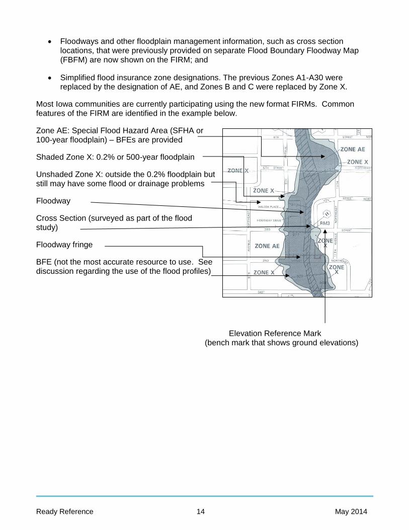
Ready Reference 14 May 2014
Floodways and other floodplain management information, such as cross section locations, that were previously provided on separate Flood Boundary Floodway Map (FBFM) are now shown on the FIRM; and
Simplified flood insurance zone designations. The previous Zones A1-A30 were replaced by the designation of AE, and Zones B and C were replaced by Zone X.
Most Iowa communities are currently participating using the new format FIRMs. Common features of the FIRM are identified in the example below.
Zone AE: Special Flood Hazard Area (SFHA or 100-year floodplain) – BFEs are provided
Shaded Zone X: 0.2% or 500-year floodplain
Unshaded Zone X: outside the 0.2% floodplain but still may have some flood or drainage problems
Floodway
Cross Section (surveyed as part of the flood study)
Floodway fringe
BFE (not the most accurate resource to use. See discussion regarding the use of the flood profiles)
Elevation Reference Mark
(bench mark that shows ground elevations)

Ready Reference 15 May 2014
5. Using Maps and Data
Locating a Site
How easily you can locate a site on an NFIP map depends on your familiarity with streets and properties in your community and on the level of detail shown on the flood maps.
To locate a specific property on a FIRM the following steps are helpful. Remember to always check the north arrow and the map scale. The top of the map is not always north and map scales vary.
1. If your community has more than one map panel, use the steps above on the MSC and/or use the map index to determine which panel to use. Use map landmarks—highways, streets, or streams—to find the site on the index.
2. Find the map panel for the area containing the site. Be sure the map panel represents the most recent flood hazard information. Remember, in some communities, panels may have different effective dates due to revisions that do not affect the whole community. There could also be LOMCs affecting the area. This can be determined using the MSC website. When viewing the list of available map items for a community, a
symbol will be found under the “LOMC” header beside any map panel affected by a LOMC.
If there is an asterisk on the panel number on the map index, either no flood hazard has been identified in that area or it is entirely one flood zone and the panel was not printed. There will be a reason for the asterisk printed on the index, usually at the bottom left or right hand side. Most likely the panel’s area is all Zone C, D or X with no SFHAs identified.
3. Locate the site as accurately as possible. Use a detailed street or road map as well as a parcel map such as a tax assessor’s plat map to identify the property boundaries as necessary.
4. For situations near the SFHA boundary, you may have to use an aerial image or obtain the distance on the ground between the site and one or more identifiable points, such as the centerline of a road or street, a bridge, or some other feature on the map. Locate these points on the FIRM.

Ready Reference 16 May 2014
5. Once you have located the site and the identifiable point, convert the distances to the map scale and plot the site on the map.
Locating the Floodway Boundary
1. Locate the site on the map and select the correct engineer’s scale for the map scale.
2. Using an engineer’s scale, measure the distance from the floodway boundary to a nearby feature on the ground. For streets, use either the right of way or the center of the street; just be sure to use the same approach on the map and on the ground.
3. Run the same measurement on the ground to locate the floodway boundary at the site.
4. If any portion of the site is determined to be within the floodway, then the floodway provisions of your ordinance apply.
Determining BFEs
There are four ways to find a BFE. Described below, the FDT and the FIRM database/National Flood Hazard Layer (NFHL) dataset are the most accurate and the FIRM is the least accurate.
FDT
If a site is at or very close to a cross section, you can use the information in the FDT to obtain an accurate BFE.
Note: You may be called on by a bank or lender to determine if a property is in or out of the SFHA. Communities should be aware that lenders are legally responsible for determining if a flood insurance policy is required for a loan.
Under the National Flood Insurance Reform Act, if someone other than a lender provides map information to decide if a flood insurance policy is required as a condition for a loan, the information must be guaranteed. This information is usually provided on FEMA’s Standard Flood Hazard Determination Form. Note that if you are asked to sign such a form, you are guaranteeing the accuracy of the determination, so you may assume some liability for your action.

Ready Reference 17 May 2014
Using the FIRM database/NFHL dataset
For communities with digital map products, the “S_XS” cross section data layer is part of the NFHL or FIRM database and includes the BFE value at each lettered cross section (to the 0.1 of a foot) and can be used in place of the FDT to obtain the most accurate BFE at cross section locations.
Flood profiles
Here are the steps to determine the BFE for a site using the flood profiles found in the FIS report:
1. Using the FIRM (or the FBFM for an older FIS), locate features near the site that appear on the flood profile, such as a bridge or cross section.
2. Follow the stationing procedures described in the previous section to determine the site’s distance (in feet) from a cross section or other feature that appears on the flood profile.
3. Find the feature(s) on the flood profile for that stream.
4. Check the scale used for the flood profile and using an engineer’s scale, measure the distance from the feature(s) to the site.
5. Find the site’s location on the appropriate flood profile line and read the elevation on the Y axis. You can draw a straight line to the left or right edge of the graph, count squares, or use an engineer’s scale. Remember to use a different scale if the scale on your Y axis is different than the scale for the X axis.
Use of the FIRM
The fourth way to determine the BFE is directly from the FIRM. The wavy lines (BFE lines) represent whole foot BFEs. This method should only be used to verify that you did not make a one foot or ten foot error when you read the profile or in rare instances when a flood is not available in the FIS report.
400'
713.1'
H I
720
715
710
720
715
710

Ready Reference 18 May 2014
6. Maintaining and Revising NFIP Maps
National Flood Insurance Program (NFIP) maps—referred to as Flood Insurance Rate Maps (FIRMs)—are vital to effective enforcement of a community’s floodplain management responsibilities. They are also key to accurate flood insurance rating and fair determinations of the flood insurance purchase requirement.
No map is perfect and no flood situation is static. From time to time, the Federal Emergency Management Agency (FEMA), communities, or individuals may find it necessary for a FIRM to be updated, amended, or changed.
Correcting errors in non-flood-related features;
Including better ground elevation data;
Reflecting changes in ground elevation in the floodplain;
Reflecting new flood data; and
Incorporating a new flood control project.
Types of Map Changes
FEMA uses two methods to make flood map changes. The first method is to redraw the map and publish a new FIRM. This approach is more costly and is performed only if the change is significant and affects a large area or numerous FIRM panels.
The more common and less costly method is to issue a document that describes the map change. These are called a Letters of Map Change (LOMCs). There are six types of LOMCs, each of which is described below.
LOMCs include the following:
Letter of Map Amendment (LOMA) and electronic LOMA (eLOMA) – Section 6.2.1;
Conditional Letter of Map Amendment (CLOMA) – Section 6.2.2;
Letter of Map Revision Based on Fill (LOMR-F) – Section 6.2.3;
Conditional Letter of Map Revision Based on Fill (CLOMR-F) – Section 6.2.4;
Letter of Map Revision (LOMR) – Section 6.2.5; and
Conditional Letter of Map Revision (CLOMR) – Section 6.2.6.

Ready Reference 19 May 2014
Requesting Map Changes
FEMA’s maps are based on the best available information at the time the study was completed. As better information becomes available or as changes are proposed in the floodplain, the floodplain maps should be updated. The applications and a list of the necessary supporting information can be downloaded on the Forms page of FEMA’s website.
The following sections outline the steps to follow when requesting map changes:
Step 1: Obtain FEMA forms;
Step 2: Prepare needed information;
Step 3: (Specific to LOMR or CLOMR) Submit the request to DNR;
Step 4: Submit FEMA forms and necessary attachments by mail or online; and
Step 5: FEMA forwards the request.
Maintaining Maps
As the primary repository for NFIP maps and studies, it is important that your community maintains adequate copies, keeps them updated, and makes them available for public review. You should have at least one master copy that includes all the changes, annexations, map revisions, and other pertinent information. Because LOMAs amend and LOMRs revise the effective NFIP
map, they are public records that the community must maintain. LOMAs and LOMRs should be noted on the community’s copy of the FIS report and/or FIRMs and filed by panel number in an accessible location.
It is also important to keep copies of old, superseded maps and studies. They provide a historical record of what was known and the basis of what was required in the past.
LOMCs can be found online tied to the FIRM panel they
affect on FEMA’s Map Service Center website.

Ready Reference 20 May 2014
7. Regulatory Framework
The Legal Basis
Designing and administering a floodplain management program is essentially a job of writing and enforcing the law. In some communities, legal challenges have prevented implementation of well-planned programs. Therefore, we must know some basics about the law of regulating what people can do on their property.
“Statutory authority” means the powers given to a community by State law. In Iowa, city and county home rule amendments to the constitution were passed by voters in 1968 and 1978, respectively.
An ordinance can exceed minimums set forth in State statutes but cannot prohibit an act specifically permitted by State statute or permit an act specifically prohibited by the State.
To show that a regulation has a sound legal basis, it is a good idea to include the statutory authority for the regulations at the beginning of the ordinance.
Communities with zoning should include their zoning authority: Chapter 414 for cities and Chapter 335 for counties (formerly Chapter 358A). The authority for counties to zone (Chapter 335) exempts certain agricultural activities. However, that exemption specifically excludes floodplain development.
Home rule communities can add their home rule authority as granted by the Iowa Legislature.
The Ordinance
The Ready Reference and Floodplain Management Desk Reference assume that your community has a floodplain regulation ordinance in effect and that it is based on one of the DNR models.
If you have not adopted an ordinance, please refer to the Contacts in Section 28.
If you want to change your floodplain management ordinance, contact the DNR for guidance before doing so. Keep in mind your legally enforceable ordinance must be approved by FEMA in order for your community to remain in the NFIP.
Delegated and Non-Delegated Communities
Certain communities are considered “delegated” communities by the DNR. They have authority to issue permits without waiting for a DNR permit for the project. Any change to a delegated community’s ordinance must have DNR approval.
Non-delegated communities are not required to get DNR approval of ordinance changes, but it is advisable. DNR can double-check that your proposed provisions will still comply with State and NFIP requirements.
Ready Reference 21 May 2014
If a community wants or has DNR delegation, a draft of the ordinance or amendment should be submitted before it is adopted. The approval will be subject to the following conditions:
1. Approval from the DNR shall be obtained prior to undertaking any amendment to the approved ordinance and prior to granting variances from the approved ordinance;
2. The issuance of the approval shall not subject the State of Iowa or the DNR to any legal or financial responsibility arising from the enforcement of the approved ordinance; and
3. Approval from the DNR must be obtained prior to any floodplain construction (e.g., channel alterations, flood control levees, bridges) not specifically addressed in the approved ordinance.
Types of Ordinances
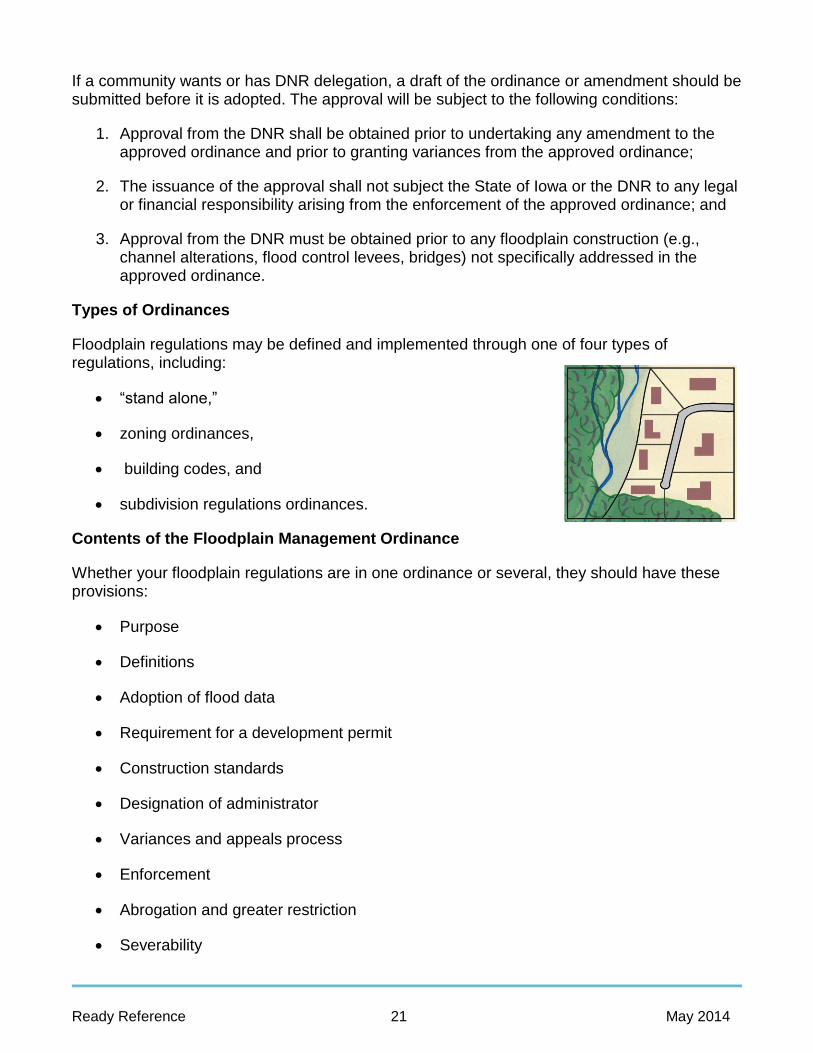
Floodplain regulations may be defined and implemented through one of four types of regulations, including:
“stand alone,”
zoning ordinances,
building codes, and
subdivision regulations ordinances.
Contents of the Floodplain Management Ordinance
Whether your floodplain regulations are in one ordinance or several, they should have these provisions:
Purpose
Definitions
Adoption of flood data
Requirement for a development permit
Construction standards
Designation of administrator
Variances and appeals process
Enforcement
Abrogation and greater restriction
Severability

Ready Reference 22 May 2014
Duties of the Floodplain Administrator
In general, the administrator is responsible for ensuring that development activities comply with the floodplain management regulations and other applicable codes and ordinances.
Duties of the administrator vary depending on the kind, size, and characteristics of the community. However, certain responsibilities are common to all ordinance administrators.
Understand the regulations (Sections 8-12)
Ensure that permit application processes are followed (Section 9 and 14)
Correct violations (Sections 15 and 17)
Process permit applications (Section 14)
Coordinate with other programs (Section 9)
Ensure projects are built according to approved permits (Sections 14 and 15)
Take enforcement actions (Section 17)
Keep records (Section 18)
Maintain and update flood data and maps (Section 6)
Update the ordinance (Section 8)
Dealing with the Public
As you administer your ordinance, you will be interacting with the residents, engineers, surveyors, builders, developers, and public officials. It is important that you convey the need to abide by the floodplain regulations for their safety and others in the community. This will encourage voluntary compliance and reduce the number of problems you may face.
You are, in effect, the public relations manager for floodplain management in your community. If you explain the rules showing the positive side (flood damage prevented, lives saved), you will be more successful than if people think you are grudgingly enforcing some unwelcome Federal mandate.
You can use your website, brochures, newsletters, and newspaper articles to help educate the general public and permit applicants. You can also order a number of pamphlets from FEMA that explain the threat of flooding or the reasons to buy flood insurance. As shown in the figure to the right, some communities develop their own pamphlets or mailings to explain the reasons for their floodplain ordinances and the importance of the protecting the floodplain and the drainage system from improper development.

Ready Reference 23 May 2014
8. Regulatory Requirements: Maps and Data
Basic rule #1: You must use the effective maps and flood data published by FEMA.
NFIP Maps and Data
Flood maps and flood data are discussed in Sections 3 and 4 of the Floodplain Management Desk Reference. A community must adopt and enforce floodplain management regulations based on data provided by the Federal Emergency Management Agency (FEMA) (44 CFR 60.2(h)). This includes the floodplain boundaries, 1% annual chance flood elevations (also known as the Base Flood Elevation or BFE), Flood Insurance Rate Map (FIRM) zones and floodway boundaries shown on your effective FIRM, and/or Flood Insurance Study (FIS) if available.
Exceptions
The basic rule does not cover every situation. Three occasions where a community may vary from the data provided by FEMA are:
1. When the FEMA data disagree with ground elevations;
2. When FEMA has provided draft revised data; and
3. When FEMA provides “advisory” flood hazard data.
Approximate A Zones
Regulating development in approximate or unnumbered A Zones is one of the tougher jobs floodplain administrators will face, especially in counties that have large areas of such zones. 44 CFR Section 60.3(b)(4) requires that you make every effort to use any flood data available in order to achieve a reasonable measure of flood protection.
As noted in Section 4, these are mapped floodplains where FEMA did not provide flood elevations or floodways. DNR has jurisdiction over the following areas:
Incorporated areas where the drainage area is 2 square miles, and
Unincorporated areas where the drainage area is 10 square files or greater.
The applicant for a permit in an approximate A Zone is required to provide the data necessary for DNR staff to calculate the BFE.
In areas outside DNR’s jurisdiction, communities are required to use the best available data. Section 8.4 of the Floodplain Management Desk Reference provides details on how to do this. If a development is greater than 50 lots or 5 acres, the permit applicant must conduct a flood study.

Ready Reference 24 May 2014
9. Regulatory Requirements: What Requires a Permit?
Basic rule #2: A permit is required for all development in the SFHA [Special Flood Hazard Area] shown on your FIRM [Flood Insurance Rate Map].
Communities participating in the National Flood Insurance Program (NFIP) have adopted regulations that require floodplain development permits for any development occurring in the identified SFHA.
Key Floodplain Development Permit Review Questions
The permit reviewer has to check many things. The key questions are:
Is the site near a watercourse?
Is the site in the mapped Federal Emergency Management Agency (FEMA) SFHA?
Is the site in the mapped floodway?
Have other Federal permits been obtained?
Is the site reasonably safe from flooding?
Does the site plan show the flood zone, Base Flood Elevation (BFE), and building location?
Is an improvement or addition to an older building proposed?
Will new buildings and utilities be elevated properly?
Do the plans show an appropriate and safe foundation?
Will the owner/builder have to submit an as-built Elevation Certificate?
Development Permit
The NFIP requirements are keyed to “development” in the floodplain. “Development” means “any manmade changes to improved or unimproved real estate.” This includes, but is not limited to:
Construction of new structures
Modifications or improvements to existing structures.
Fencing
Land clearing and excavation

Ready Reference 25 May 2014
Filling, grading, and paving
Drilling and driving of piles
Mining and dredging
Permanent storage of materials and/or equipment.
Permits from Other Agencies
44 CFR 60.3(a) (2) requires all NFIP communities to ensure that other Federal and State permits have been obtained. You should not issue your local permit until you are certain that the other agencies’ requirements are met. Also, check with other local offices such as those listed below:
Building department Planning department Zoning department Sanitation department Fire marshal Engineer Public works, streets, or highways.
Then check with other local governments. The local authorities that may have jurisdiction over some aspects of floodplain development are:
The County and adjacent municipalities (pursuant to intergovernmental agreements);
Drainage districts;
Levee district;
Sanitary district;
River conservancy district;
Park district; and
County health or sanitation department.
DNR Floodplain Permit and Flood Data Approval Requirements
The DNR administers permit programs for any construction, excavation, or filling in a stream, lake, river, wetland, or floodplain. While there may be no requirement for a DNR floodplain permit, other DNR, State, and Federal permits may be required.

Ready Reference 26 May 2014
Flood data and delegation status
Incorporated areas Unincorporated areas
Drainage area ≥ 2 sq. miles
Drainage area < 2 sq. miles
Drainage area ≥ 10 sq. miles
Drainage area < 10 sq. miles
No detailed study (AO & approximate A Zones)
No delegation of DNR floodplain authority
Permit application and flood data needed
No DNR floodplain permit required
Permit application and flood data needed
No DNR floodplain permit required
DNR floodplain authority delegated to community
DNR approves flood data
No DNR floodplain permit required
DNR approves flood data
No DNR floodplain permit required
Detailed data available (AE, AO, and AH Zones)
No delegation of DNR floodplain authority
Permit application needed
No DNR floodplain permit required
Permit application needed
No DNR floodplain permit required
DNR floodplain authority delegated to community
Permit needed only for bridges and flood protection systems
No DNR floodplain permit required
Permit needed only for bridges and flood protection systems
No DNR floodplain permit required

Ready Reference 27 May 2014
10. Regulatory Requirements: Floodways
Basic rule #3: Development must not increase the flood hazard on other properties.
If you have a floodway map (see Section 4), then the floodway rules apply only in the mapped floodway. If you don’t have a floodway map, then these rules apply throughout your jurisdiction.
The floodway is the channel of a river or other watercourse and the adjacent land area that must be reserved to pass the 1% annual chance flood elevation (aka 100-year or base flood) without increasing the base flood more than one foot.
The designation of a regulatory floodway and the resulting map are based on the following legal concepts:
Property owners should be allowed to develop their land provided they do not obstruct flood flows and cause damage to others. The base flood may be allowed to increase but not if significant damage would result.
Properties on both sides of a stream must be treated equitably. The degree of obstruction permitted for one must also be permitted for the other.
Floodway maps are adopted to designate those areas where flood flows are most sensitive to changes brought by development. Communities must regulate development in a floodway to ensure that there are no increases in upstream flood elevations.
Community Responsibility
The community is responsible to ensure that NFIP floodway rules are met in the following
situations:
Delegated communities with detailed studies are responsible for permitting development in the mapped floodway.
Communities (delegated and non-delegated) with approximate floodplain maps need to contact the DNR to seek help delineating a floodway when a permit application is submitted. The community is then responsible for permitting development in the mapped floodway.
Non-delegated communities are responsible for areas outside DNR’s jurisdiction (see chart on page 28).

Ready Reference 28 May 2014
11. Regulatory Requirements: New Buildings
Basic rule #4: New buildings must be protected from damage caused by the base flood event.
One objective of your floodplain ordinance is to protect new buildings. The term building is the same as the term structure in the National Flood Insurance Program (NFIP) regulations. Your ordinance may use either term. It means a walled and roofed building, including a gas or liquid storage tank, that is principally above ground, as well as a manufactured [factory-built] home. The term building or structure does not include open pavilions, bleachers, carports, and similar structures that do not have at least two rigid walls and a roof.
Flood Protection Elevation
The flood protection elevation is a term used in this reference for the BFE plus applicable freeboard. It is the minimum protection level your ordinance requires for new buildings in the floodplain. In the State of Iowa, the level must be at least one foot above the BFE.
Elevation
Elevating a building above the flood protection elevation is the most common and secure way to protect a building from flood damage. It is the only way allowed for residential buildings, except for those few communities that have been granted floodproofed basement exceptions by the Federal Emergency Management Agency (FEMA).
New construction and substantial improvements of residential structures must be elevated so that the lowest floor (including the basement) is elevated to or above the flood protection elevation. This can be done in one of three ways:
Elevation on fill (where permissible);
Elevation on piles, posts, or columns; or
Elevation on walls or a crawlspace.
Enclosures
Enclosures, as referenced here, are areas created by continuous foundation walls below the flood protection elevation. They deserve special attention for two reasons:
The walls of enclosed areas are subject to flood damage from hydrostatic and hydrodynamic forces; and
Owners are tempted to convert enclosures into finished space that will sustain significant monetary losses when damaged in a flood.

Ready Reference 29 May 2014
Does an enclosure under an elevated floor just go to waste? It need not - allowable uses include:
Building access;
Vehicle parking; and
Storage of materials that have low flood damage potential.
Floodproofing
Non-residential buildings must be elevated or floodproofed. If they are elevated, they must meet the same standards as the residential buildings that were just reviewed. Elevation is the preferred method because it is more dependable. Elevated commercial and industrial buildings can often be designed so that they can continue to operate during a flood, reducing or eliminating business disruptions.
Walls are watertight (substantially impermeable to the passage of water);
Structural components can resist hydrostatic and hydrodynamic loads and effects of buoyancy; and
Utilities are protected from flood damage.
Most floodproofing is appropriate only where floodwaters are less than three feet deep, since walls and floors may collapse under higher water levels. A licensed professional engineer or architect must prepare the building plans and certify the floodproofing measures, preferably using the FEMA Floodproofing Certificate
Other Provisions
AO Zones
AO Zones are shallow flooding areas where FEMA provides a 1% annual chance flood (also known as 100-year or base flood) depth. Since there is no 1% annual chance flood elevation, the rules read a little differently. In AO Zones, all new construction and substantial improvements of residential structures shall have the lowest floor (including basement) elevated above the highest adjacent grade: at least one foot above the depth number specified in feet on the community’s FIRM; or at least two feet if no depth number is specified.
Basements
The definition of the lowest floor includes basements and the definition of basement includes any floor level below grade on all sides. Note that “walkout basements,” “daylight basements,” or “terrace levels” are usually sub grade on only three sides, with the

Ready Reference 30 May 2014
downhill side at or above grade. Thus, they are not considered basements for either floodplain management or flood insurance rating purposes (but they are still the lowest floor of a building for floodplain management and insurance rating purposes).
Anchoring
Both elevated and floodproofed buildings must be properly anchored to stabilize them against flood forces. This means anchoring the building to its foundation and ensuring that the foundation won’t move. Therefore, you need to make sure there is adequate protection against hydrostatic and hydrodynamic forces and erosion and scour that can undercut the foundation.
Flood-resistant material
Whether a building is elevated or floodproofed, it is important that all building materials exposed to floodwaters be made of flood-resistant materials.
“Flood-resistant materials” include any building product capable of withstanding direct and prolonged contact with floodwaters without sustaining significant damage. “Prolonged contact” means at least 72 hours, and “significant damage” is any damage requiring more than low-cost cosmetic repair (such as painting).
Accessory structures
Certain accessory structures may not qualify as “buildings.” Open structures, such as gazebos and picnic pavilions that do not have at least two rigid walls, are not “buildings” and do not have to be elevated or floodproofed.
In certain cases, agricultural buildings can be granted waivers to the full requirements for flood protection. However, a variance would be needed. This is discussed in Section 16, Appeals and Variances. The building should still meet the wet floodproofing requirements spelled out in Section 11.6.2. An alternative to issuing a variance every time (which is not a good practice) is to adopt the appropriate specifications in your ordinance. Have the DNR and FEMA review the draft language before the ordinance is amended to ensure it meets their requirements.
Factory-built homes
A factory-built home includes a building that is transportable, a mobile home, or a “double wide” home on a permanent chassis as per the NFIP regulations. The term does not include a “recreational vehicle,” which is defined in section 11.7.4. Under Iowa law, “manufactured home” does not include mobile homes, therefore, this reference and the DNR model ordinances use the term “factory-built home.”
Factory-built homes must meet the same flood protection requirements as “stick built” or conventional housing, as they are usually residential buildings and they must be elevated so the lowest floor is at or above the flood protection elevation.

Ready Reference 31 May 2014
12. Regulatory Requirements: Existing Buildings – Improvements and Repairs
Basic Rule #5: If the cost of improvements or the cost to repair the damage equals or exceeds 50 percent of the market value of the building, it must be
brought up to current floodplain management standards. This requirement also applies when the original floor area of a building is increased by 25 percent.
Substantial Improvement
Under the Iowa model ordinance, the definition of substantial improvement also includes:
“any addition which increases the original floor area of a building by 25 percent or more. All additions constructed after the Flood Insurance Rate Map (FIRM) date shall be added to any proposed addition in determining whether the total increase in original floor space would exceed 25 percent.”
All building improvement projects worthy of a permit must be considered. These include:
Remodeling projects;
Rehabilitation projects;
Building additions; and
Repair and reconstruction projects (these are addressed in more detail in Section 12.4 on substantial damage).
If your community does not require permits for minor maintenance, such as reroofing, or projects under a certain dollar amount, then such projects are not subject to the substantial improvement requirements. However, if you have a larger project that includes reroofing, etc., then you must include the cost of all of the improvements in the cost of the project.
The cost of the project equals 50 percent of the building’s value, so it is a substantial improvement. The floodplain regulations for new construction apply and the building must meet the post-FIRM construction requirements. If the project is an addition that meets the criteria discussed in Sections 12.3.3 and 12.3.4, only the addition has to be elevated.
To determine substantial improvement, you need a detailed cost estimate for the project, prepared by a licensed general contractor, professional construction estimator, or your office.
A project is a substantial improvement if:
Cost of improvement project
Market value of the building ≥ 50

Ready Reference 32 May 2014
Historic Structures
Many older buildings are not considered historic, so the first thing to check is whether the structure proposed for an exemption is historic. Look for it on a list maintained by:
The National Register of Historic Places;
The State Historical Society of Iowa’s Historic Site Inventory; or
A federally certified local historic preservation board.
The State historic preservation office in the Iowa Department of Cultural Affairs or a federally certified local historic preservation board should be consulted to determine if a structure proposed for the historic exemption is indeed historic.
Substantial Damage
“Substantial damage” means damage of any origin sustained by a structure whereby the cost of restoring the structure to its before damaged condition would equal or exceed 50 percent of the market value of the structure before the damage occurred.
The damage can be from any cause—flood, fire, earthquake, wind, rain, or other natural or human-induced hazard.
The substantial damage rule applies to all buildings in a flood hazard area, regardless of whether the building was covered by flood insurance.
The formula is essentially the same as for substantial improvements:
Cost to repair
Pre-damage market value of the building 50
Market value is calculated in the same way as for substantial improvements. Use the pre-damage market value.
Exceptions
The substantial improvement and substantial damage requirements affect all buildings regardless of the reason for the improvement or the cause of the damage. There are three possible exceptions:
Exempt expenses;
Historic buildings; and
Projects required by code.

Ready Reference 33 May 2014
13. Additional Regulatory Standards
The Federal Emergency Management Agency (FEMA) has established minimum floodplain management requirements for communities participating in the National Flood Insurance Program (NFIP). In Iowa, communities must also enforce more restrictive requirements due to State laws. Iowa communities should also consider enacting regulations that exceed the minimum State and Federal criteria.
The following are identified in Section 13 of the Floodplain Management Desk Reference.
Prohibiting development makes sense in high hazard areas, such as area prone to ice jam and overbank ice floes or along a narrow floodplain in a stream valley that is susceptible to flash flooding.
Encouraging or requiring subdivisions to avoid the floodplain or design use best management practices such as low impact development, planned unit development (PUD), cluster subdivision design, or conservation subdivisions.
Through subdivision and planning regulations, mandate that a certain portion of a development be set aside as open space for recreation or stormwater management purposes.
Establish minimum setback standards that structures must be positioned—set back—from river channels. Setbacks can be defined by vertical heights or horizontal distances.
Adopt provisions prohibiting the placement of factory built or manufactured homes in the flood hazard area.
Zone floodplains for agricultural or other low-density use to reduce the number of new structures.

Ready Reference 34 May 2014
Require critical facilities to have dry-land access during a flood.
Require developers to remove an equal or greater amount of fill than they put in the floodplain to compensate for lost floodwater storage (“compensatory storage”).
Prevent filling and draining of wetlands.

Ready Reference 35 May 2014
14. Permit Review
Once the ordinance is in force, any development or change in land use requires authorization, generally in the form of a permit from the local administrator or agency. “Development” and what needs a permit is discussed in Section 9.
This section reviews a standard process. It is not a mandatory process, but it does ensure that all of your State and NFIP requirements will be met. Even if your community has a permit process that has proven successful, you should review this section to see if there are things you would want to add to your process.
You cannot exempt activities by your own community government. Just because the public works department doesn’t get a permit from the building department does not mean that it doesn’t have to follow the NFIP rules that govern all development within your statutory authority.
You do have some discretion to exempt obviously insignificant activities from the permit requirement—such as planting a garden, putting up a mailbox, or erecting a flagpole. Other projects, such as reroofing and replacing siding, will not affect flood flows or be labeled substantial improvements (see the discussion in Section 9.1.7).
Step One – Review for Completeness
Submission of a development permit application starts the permit process.
Make sure all administrative forms are completed. satisfactorily and properly signed.
Check site plan for completeness.
Check building plan for completeness.
Ensure that all necessary certifications are included and properly signed. The applicant must provide all completed certifications needed for the permit review.
Ensure that all necessary Federal and State permits are being obtained. You must review the application package to determine whether Federal and State permits are necessary [44 CFR 60.3(a) (2)].
Circulate for others to review.
Step Two – Review for Compliance
Examine site information.
Review building plans.

Ready Reference 36 May 2014
Review engineering documents.
Step Three – Application Approval or Denial
Approval
If the proposed development is in compliance with regulations, issue a permit.
The day a permit is issued is the date of the “start of construction,” provided construction begins within 180 days.
Somewhere in the permit record, such as the approved plans, the application form, or the permit form itself, a record should be kept of the Base Flood Elevation and the required floor elevation. There should also be a general statement that all construction will be in accordance with all codes and ordinances.
Denial
If the application is not in compliance with local regulations, the permit should be denied. The applicant then can choose to:
Withdraw the permit application;
Redesign the project to bring it into compliance with regulations;
Appeal to the Board of Adjustments or Board of Supervisors; or
Ask for a variance to the regulations.
While you may not be formally required to disclose the reasons for denying an application, it is good policy to do so in writing. This tells the applicant what areas are noncompliant so that if he or she wishes to resubmit the application, appropriate corrections can be made.
Appeals and variances are covered in Section 16. Clarifying the deficiencies for the applicant also can help reduce the number of appeals of administrative and regulatory decisions you make.

Ready Reference 37 May 2014
15. Inspections
The most effective way to ensure compliance is to inspect the site frequently during construction. This is particularly important in the early phases of work on a building because that is when errors in the location or elevation of the lowest floor can be found and corrected. An inspection program also puts builders, developers, and property owners on notice that the community will insist that projects are completed in compliance with regulations.
A series of at least three inspections is recommended for every project, especially any project that involves construction of a building:
1. Pre-construction inspection;
2. Elevation inspection; and
3. Final inspection.
It is recommended that with each inspection site photographs are taken to document existing conditions.
It is also recommended that you consider using some means of withholding approval if the permit conditions have not been met. A certificate of occupancy is an example of this. The certificate would be issued upon final approval. If a certificate has not been issued, some communities withhold services such as water or power.
Pre-construction Inspection
Do the pre-construction inspection before ground is broken. Ideally, this site visit should be after the site is staked out to allow you to check the plans in relation to the ground and lot boundaries. With plans in hand, you should determine that the site as identified on the proposed plans is consistent with actual ground conditions and check the following:
The location of the floodplain and floodway boundaries;
Setbacks from lot lines, channel banks, etc.;
Floodway encroachments, if applicable; and
Proposed elevation if building is surveyed and staked out.
Elevation Inspection
Schedule your second inspection of a project involving a new building or addition to a building just before installation of the lowest floor.
Ensure that the lowest floor will be built at the height stipulated in the permit application, and that the foundation is the type specified in the plans.

Ready Reference 38 May 2014
Whether any placement of fill meets the necessary compaction, slope, and protection standards contained in your regulations;
The building’s location matches the permit application plans;
The number and size of crawlspace or enclosure openings; and
Whether any part of the project encroaches into the floodway.
Final Inspection
The final inspection is conducted as the project nears completion. The purpose of this inspection is to:
Ensure that the foundation and floor elevations have not been altered since the second inspection and are elevated as per the permit;
Obtain an as-built Elevation Certificate or Floodproofing Certificate;
Verify that enclosures below the lowest floors have adequate openings;
Ensure that nothing subject to flood damage, such as a furnace, air conditioning unit, electrical, or ductwork, has been located below the lowest floor;
Check for floodway encroachments, and if a DNR permit was issued, make sure the construction is in compliance with the permit; and
Check the anchoring system used in securing manufactured (factory-built) homes.
Certificate of Occupancy
After the project passes final inspection, many communities issue a document called a certificate of occupancy, certificate of compliance, or use permit.
This document allows the owner to move in to the newly constructed building or addition. Usually a new building cannot be sold until the seller has this document. Some utility companies will not start service until the document is presented. Therefore, if the project does not comply with the permit requirements, withholding the certificate of occupancy, certificate of compliance, or use permit can prevent the owner from using or occupying the building.

Ready Reference 39 May 2014
16. Appeals and Variances
Appeals, special uses, and variances require judgment calls involving several people, as ordinances typically do not allow only one person to decide these issues. Here is when they can occur and how they are usually handled.
Appeals
Ambiguous language or differing interpretations can lead the applicant and permit office to disagree. Your ordinance should have a process for referring these disagreements to a board, such as a Board of Adjustment, County Board of Supervisors, or City Council, which will interpret the ordinance and settle the dispute.
Conditional or Special Uses
Some regulations use the conditional use, special use, or special exception process to allow some use of the floodplain. This process allows a community to review the project completely and place special conditions on the permit. An example of conditional uses in a floodway would be a carnival, which could be limited in the number of days it is open, or a marina, which could be limited in the size and use of any structures. A zoning board or other governing board is responsible for reviewing such requests.
Variances
Zoning ordinances, building codes, and floodplain management regulations cannot be written to anticipate every imaginable situation. A process for issuing variances gives an applicant a way to seek permission to vary from the letter of the rules because of a special situation.
A variance can mean that the minimum standards of the National Flood Insurance Program (NFIP) may not be met by a project due to a special local circumstance. Because of this, most of this section is devoted to variances.
A variance is a grant of relief by a community from the terms of a land use, zoning, or building code regulation. Because a variance can create an increased risk to life and property, variances from elevating above the flood protection elevation or other requirements in the flood ordinance should be rare.
Granting variances is a local decision that requires approval from the DNR. The variance must be based on State law, NFIP criteria, and other provisions the community may wish to require. Your community’s review board must consider the fact that every newly constructed building adds to the local government’s responsibilities and remains a part of the community for the indefinite future.
Hardship Test
Variances are based on the general principal of zoning law that they pertain to a piece of property and are not personal in nature. In general, a variance is granted for a parcel with physical characteristics so unusual that complying with the ordinance would create an

Ready Reference 40 May 2014
exceptional hardship to the applicant or surrounding property owners. Those characteristics must:
Be unique to that property and not shared by adjacent parcels; and
Pertain to the land, not to any structure, its inhabitants, or the property owners.
The concept of unnecessary hardship is the cornerstone of all variance standards, whether or not the floodplain is involved. It is based on decisions reached through the courts. Strict adherence to this concept across the country has limited the granting of variances. The applicant has the burden of proving unnecessary hardship. Reasons for granting the variance must be substantial; the proof must be compelling. The claimed hardship must be exceptional, unusual, and peculiar to the property involved. Financial hardship, inconvenience, aesthetic considerations, physical handicaps, personal preferences, or the disapproval of one’s neighbors do not qualify as exceptional hardships. Nor do problems caused by previous action of the applicant or property owner.
Flood Insurance Rates
While a variance may allow deviation from building standards specified in a local ordinance, flood insurance rates and the flood insurance purchase requirement—which must be enforced by lending institutions—cannot be waived. This can create severe financial consequences for a property owner, as insurance rates for a building built below the BFE can be substantially higher than those for elevated buildings.
Historic Structures
A variance may be issued for the reconstruction, rehabilitation or restoration of historic structures if the variance is the minimum necessary to preserve the historic character and design of the structure.
Functionally Dependent Use
A variance may be issued for new construction, substantial improvements, and other development necessary for the conduct of a functionally dependent use. A functionally dependent use is one that must be located or carried out close to water—such as a docking or port facility necessary for the unloading of cargo or passengers, shipbuilding, and ship repair.
A functionally dependent use variance could be issued provided that:
There is good and sufficient cause for providing the relief;
The variance will be the minimum necessary to provide relief; and
The variance does not cause a rise in the 1% annual chance flood level within a regulatory floodway.
The structure or other development must be protected by methods that minimize flood damage, such as elevating mechanical equipment, locating offices above the flood protection elevation, or using ground fault interrupt electrical circuits.

Ready Reference 41 May 2014
17. Enforcement
Adequate, uniform, and fair enforcement means two things:
All development in a floodplain must have a permit; and
All development with a permit must be built according to the approved plans.
To ensure that development is meeting these requirements, you must monitor the floodplain, and where necessary, conduct an inspection of a property.
The Code of Iowa allows cities and counties to appoint enforcement officers to enforce ordinances. If you are the local enforcement officer and you discover development activities without permits or contrary to the approved plans, you must enforce your ordinance. You have several methods for enforcing your ordinance.
Voluntary Compliance
The best approach is to convince the developer that complying with the ordinance is in his or her own best interest. This may take some explanation of the flood hazard and how the rules protect the property (or neighboring properties) from that hazard.
1. Contact the property owner or building contractor (“responsible party”) in person or by telephone to explain your concerns. Give them a deadline to respond to your concerns.
2. Follow up with a written notice, including the date by when you expect a specific response (a floodplain permit application, for example, or an Elevation Certificate). In this written notice, you do not need to mention the possibility of court action. However, in subsequent notices you must notify the responsible party that court action may be pursued. This many involve a Notice of Violation or Stop Work Order.
Legal Recourses
If the administrative measures identified above or outlined in your code of ordinances do not bring results, go back to your community’s attorney and discuss the next steps. Generally, the attorney will write a letter listing the violations and how the owner can comply. Your attorney may also pursue a municipal infraction or other claim that will be taken to court.
Fine - A violation of the floodplain ordinance is classified as a misdemeanor. The DNR model ordinances provide for the use of fines as a means of enforcement.
Recordation - Depending on your ordinance’s authority, you may be able to record the violation in the property’s deed records. This will inform potential purchasers as well as “cloud the deed,” making it hard for the owner to sell the property.
Restraining orders - A restraining order is an order to stop further non-compliant conduct. A County Board of Supervisors may issue such an order if construction is in violation of any ordinances or other regulation (Code of Iowa, Section 335.23). A City Board of Adjustments must have a restraining order issued through the courts (Code of Iowa, Section 414.16).

Ready Reference 42 May 2014
Citations - A citation is like a traffic ticket. It contains a fine and cites the specific section of zoning code or ordinance that was violated. It is a common approach for enforcing local zoning regulations and may be used to enforce floodplain regulations.
Section 1316
Section 1316 of the National Flood Insurance Act authorizes FEMA to deny flood insurance to a property declared in violation of the community’s ordinance.
Section 1316 is used when the community has exhausted all other legal means to remedy the violation and the structure is still non-compliant. Section 1316 is designed to supplement your enforcement work, not replace it. Check with DNR or the FEMA Regional Office on how 1316 has been used.
If invoked under Section 1316, denying flood insurance means:
The property may be difficult to sell, and impossible to sell for those who rely on a federally insured loan to purchase the property;
The market value of the property may fall;
The cost of suffering flood damage without insurance may be too great a risk for the property owner;
Lending institutions holding the property’s mortgage may threaten to foreclose; and
Any permanent reconstruction will not be eligible for Federal disaster assistance. (Note: State funds might still be used if it is in a community’s best interest to remove the structure from the flood hazard area, in spite of any preceding violations of the floodplain regulations.)
Help
You are not alone in wanting your ordinance enforced. Help in dealing with violations is often available from other sources. Your first point of contact can be DNR. The staff will work with you to determine the best way to deal with a particular violation and to provide expert advice.
It is important that you keep DNR and FEMA appraised or your problems and progress. DNR and FEMA staff can assist you in pursuing a violation.
Ready Reference 43 May 2014
18. Records
Records show what you approved and what you told the developer, forming a paper trail needed for administrative or legal proceedings related to development projects. Such records are vital in case the project is built in violation of your ordinance or the conditions of a permit. They also give future owners information about the property.
Records are also checked by the Federal Emergency Management Agency (FEMA) or the Iowa Department of Natural Resources (DNR) to determine if your community is in full compliance with the National Flood Insurance Program (NFIP). Good record keeping is also part of the criteria used to award points in the Community Rating System (CRS) program.
Permit File
Your community should have a permit record system that is keyed to a geographical identifier (not just a building permit number) such as: street address, subdivision, lot and block number, township, section and range, or county assessor’s property ID number.
You should have a unique identifier for each permit application. The identifier may be a permit number or a case number. Permit files and electronic records should contain copies of these items, as appropriate:
The permit application form and all attachments, including the site plan;
All correspondence pertinent to the project;
Flood and floodway data prepared by the developer;
Engineering analyses of floodway encroachments and watercourse alterations;
Special engineering designs for enclosures below the 100-year flood (also known as the 1% annual chance or base flood);
Any variances or appeals proceedings;
Records of inspections of the project while under construction;
Documentation of the “as-built” lowest floor elevation of all new and substantially improved buildings (ideally in the form of a FEMA Elevation Certificate);
Documentation of the area of openings below the lowest floor, for structures built on crawl-spaces and small accessory structures;
Certification of the elevation to which any nonresidential building has been floodproofed; and
Certificates of compliance or occupancy.

Ready Reference 44 May 2014
Keeping these records is a requirement to participate in the NFIP; there is no statute of limitations as to how long they should be kept. You may want to keep a separate log, record, or file of floodplain permits so you can readily retrieve those floodplain projects to show FEMA or the DNR staff for CRS credit.
Elevation Certificate
Your permit file needs an official record that shows how high new buildings and substantial improvements were elevated. This is needed both to show compliance with the ordinance and for the owner to obtain a flood insurance policy.
The FEMA Elevation Certificate is a 17-page packet, with 12 pages dedicated to how to complete it.
The Elevation Certificate is used for the purposes of certifying compliance with floodplain regulations for elevating and floodproofing; it is used to establish flood insurance premiums for structures in flood hazard areas; and it is used to obtain a Letter of Map Amendment (LOMA) when a property owner believes that a structure is incorrectly categorized as being in a flood hazard area. In cases where a property owner wants to apply for a LOMA, the Elevation Certificate only needs to record two elevations: the elevation of the lowest grade around the structure (Lowest Adjacent Grade, or LAG) and the elevation of the 1% chance annual flood.
The local permit official is responsible for ensuring that an Elevation Certificate is obtained from the property owner for all new or substantially improved buildings. Part or all of the form may be completed by a land surveyor, engineer, architect, or local official authorized by ordinance to provide floodplain management information. A registered surveyor must complete Section C – Building Elevation Information, and provide her or his certification in Section D.
The permit official should review the certificate to ensure that it is complete and that Sections A and B (on property and map information) are correct. This is especially important for local officials in CRS communities. A community with a record of accepting incomplete and/or erroneous Elevation Certificates is at risk of losing CRS credits and potentially CRS eligibility if a clear pattern of issues are uncovered. Although it is optional, the local permit official may consider completing Section G as it contains information that helps determine if a building is compliant.

Ready Reference 45 May 2014
19. Flood Insurance
One of the primary reasons for your community participating in the National Flood Insurance Program (NFIP) is to make insurance available for people who want to protect themselves financially from flood hazards. This section reviews how the insurance aspect of the NFIP works and how rates and coverage are dependent on how well buildings comply with the requirements of your ordinance. It also covers flood insurance policies: what’s covered, what’s not covered, when a policy must be bought, and other rules. This is important information for the local permit administrator to know because some construction decisions affect what is eligible for insurance coverage.
Types of Coverage
Flood insurance coverage is provided for insurable buildings and their contents.
Building coverage
Building coverage is for the structure. This includes all things that typically stay with the building when it changes ownership, including: utility equipment, such as a furnace or water heater; wall-to-wall carpeting; built-in appliances; and wallpaper and paneling.
Contents coverage
Contents coverage is for the removable items inside an insurable building. A renter can purchase a policy for contents coverage, even if there is no structural coverage.
Enclosures
There is limited coverage in enclosures below the lowest floor of an elevated post-FIRM [Flood Insurance Rate Map] building (including factory built housing). It is therefore in the best interest of the permit official to ensure that furnaces and other items that can be damaged by floodwater are not allowed in a crawlspace or other enclosure below an elevated lowest floor.
Check out these resources for more information:
Answers to Questions about the National Flood Insurance Program (questions 21–66 cover the topics in this section).
Local insurance agents should have additional references, including FEMA’s NFIP Flood Insurance Manual and Agents.FloodSmart.gov.
The general public should use www.FloodSmart.gov to assist in finding an agent and for general insurance information.

Ready Reference 46 May 2014
20. The Community Rating System
Introduction
The National Flood Insurance Program’s (NFIP) Community Rating System (CRS) recognizes floodplain management and outreach activities performed by communities that exceed the NFIP minimum standards. CRS, a voluntary program, recognizes these efforts by reducing the cost of flood insurance premiums by 5 to 45 percent for flood insurance policies in communities that participate in the CRS.
Objective
The objective of the CRS is to recognize, encourage, and reward communities that are doing more than meeting minimum NFIP requirements. The CRS encourages, by the use of flood insurance premium adjustments, community and State activities beyond those required by the NFIP to:
Reduce and avoid flood damage to insurable property both inside and outside mapped floodplains;
Strengthen and support the insurance aspects of the NFIP;
Foster comprehensive floodplain management.
The Application Process
The CRS application is a multi-step process that includes coordination with the Iowa Department of Natural Resources (DNR), the Federal Emergency Management Agency (FEMA) Region VII, and Insurance Services Office, Inc. (ISO). The overall application timeframe will vary based upon the extent and timeliness of follow-up activities required. However, at a minimum the entire process is likely to take one year to complete. Detailed information about the application process, including specific steps, is provided in the CRS Toolkit for Iowa communities.
The DNR has developed a CRS Toolkit (Iowa CRS Toolkit) to help Iowa’s communities determine whether the CRS program may be a good fit for them. The Toolkit contains a workbook with information on the estimated level of effort and necessary documentation for each creditable activity. The workbook also calculates the potential CRS class rating based on the activities the community identifies as applicable.
Download the CRS Toolkit for Iowa Communities from the Iowa Floodplain and Stormwater Management Association’s website today!

Ready Reference 47 May 2014
21. Disaster Operations
Floodplain managers agree: It is not if your community will be flooded. It is when.
Those who have been hit by a flood or other disaster usually regret they were unprepared. Whether it is your house or your community, you can take steps to be ready for a flood event.
After a disaster you can expect everyone to want you to respond quickly and efficiently, without regard to other priorities. You will have to take on emergency post-disaster responsibilities, often at the expense of not performing your normal duties.
To help you prepare for disaster scenarios, your permit office should prepare procedures that will ensure full and fair enforcement of your regulations during this time of stress, confusion, and controversy. Mapping out your procedures will allow you to focus on the solutions to problems without having to draft the decision-making steps you will use to enforce your floodplain management ordinance. The Iowa Flood Response Toolkit, a quick reference tool designed to help communities prepare, respond, and recover from flood emergencies
Rebuilding Safer and Stronger
Floods create a window of opportunity to increase awareness of flood risk. Use this opportunity to encourage your residents to build back safer and stronger. Seize the opportunity to encourage property owners to voluntarily elevate utilities and other mechanical devices or even their entire home higher than the required elevation to keep them safe from future flooding.
The following resources will help you and your residents rebuild safer and stronger:
FEMA P-312, The Homeowner’s Guide to Retrofitting: Six Ways to Protect Your Home From Flooding, is a valuable resource that can be used by residents to learn how to rebuild safer to avoid future flood losses. FEMA’s Building Science web page has many additional resources to help you and residents build safer following a flood.
The FEMA publication Mitigation Ideas: A Resource for Reducing Risk from Natural Hazards is available to help communities identify and evaluate potential mitigation actions for reducing risk from natural hazards and disasters.
You can also learn about best practices that have been implemented by other communities during flood recovery through FEMA’s Mitigation Best Practices search web page or FEMA’s catalog of mitigation fact sheets.

Ready Reference 48 May 2014
22. Hazard Mitigation
While the Floodplain Management Desk Reference focuses on regulations directed toward new construction in the floodplain, most communities are more concerned about existing flood problems. This section tackles the bigger issue—reducing flood losses and making sure other activities do not make things worse.
Many communities deal with flooding with only one or two flood protection activities. Every community in the National Flood Insurance Program (NFIP) regulates new development to make sure flooding does not get worse. Many communities tackle their local drainage problems with storm sewer or drainage construction projects. Communities in high hazard areas usually have flood warning and evacuation programs.
However, many communities do not realize how many other flood protection activities they could implement; nor do they know of all the other Federal, State, local, and private agencies or organizations that can help them with flood problems.
While flooding cannot always be stopped—and in many cases, should not be prevented—flood hazards can be reduced. As its definition attests, the phrase “hazard mitigation” means taking measures that minimize or reduce the impacts of flooding on human development.
One of the most legally defensible ways to manage your floodplain is to use the No Adverse Impact (NAI) approach. This approach is based on the premise that your floodplain management regulations are not taking away property rights, rather the regulations are protecting them.
More information on the NAI approach to floodplain management can be found in the paper titled Property Rights and Community Liability – The Legal Framework for Managing Watershed Development, published by the Association of State Floodplain Managers.
Mitigation Planning
Floodplain residents and property owners are not always aware of things that are being done to protect them from flooding, nor are they aware of things they can do to protect themselves or how they can contribute to community efforts. Developing a flood hazard mitigation plan is one of the best ways to correct these shortcomings.
The objective of planning is to produce a program of activities that will best tackle the
community’s flood problem and meet other community needs.

Ready Reference 49 May 2014
President’s Executive Order 11988 and Critical Facilities
The Federal Emergency Management Agency’s (FEMA) 8-step decision-making process for complying with Executive Order 11988 must be applied before Federal disaster assistance is used to repair, rehabilitate, or reconstruct damaged existing critical facilities in the 0.2% annual chance floodplain, also known as the “500-year” floodplain.
23. Executive Order 11988
Executive Order 11988 sets minimum requirements for Federal agencies to follow when they build in the floodplain, fund projects in the floodplain, or are otherwise responsible for floodplain development. The Order does not prohibit floodplain development. It requires agencies to “consider alternatives to avoid adverse effects and incompatible development in the floodplains.”
Most agencies follow the guidelines published by the U.S. Water Resources Council (which has since been disbanded). Those guidelines recommend an 8-step decision-making process, which is included in Section 23.2 of the Floodplain Management Desk Reference.
24. Glossary
Section 24 of the Floodplain Management Desk Reference includes technical terms used in the document. Those that are not as commonly used throughout multiple sections include the section of the Floodplain Management Desk Reference where the term is described in more detail. Note that the local floodplain management ordinance will likely have its own definitions section. The definitions in the legal ordinance take precedence over those in this section.
25. References
Most of the documents listed in the Floodplain Management Desk Reference are available online or for free through government publication resource centers. Available websites are noted. Those with a “.pdf” extension require Adobe Acrobat Reader, which is free software available from www.adobe.com/acrobat.
Many FEMA publications can be ordered by calling 800-480-2520 or faxing your order to 301-362-5335. Hard copy or CD/DVDs are available for commonly requested publications but many other publications are only available online. Easy access to FEMA publications is available through FEMA’s Resource & Documents Library. The search function on the site allows you to enter keywords and filter by media type and a number of selection criteria.
The publications cited in the Floodplain Management Desk Reference, as well as other resources useful to local officials are listed in Section 24 in order by publication title. Where applicable, links where the publication can be found online are provided.

Ready Reference 50 May 2014
26. Cedar County, IA and Incorporated Areas (West Branch) – FIS and FIRM
This section of the Floodplain Management Desk Reference supports the Flood Insurance Rate Map (FIRM) and Flood Insurance Study (FIS) report exercises found in Section 5. It includes portions of the old format FIRM and Flood Boundary Floodway Map (FBFM) for the City of West Branch and portions of the new format countywide FIRM on which the City of West Branch is now shown for comparison. It also includes a comparison of the old format for including Elevation Reference Marks and the approach used on new FIRMs.
This section concludes with the Flood Insurance Study for Cedar County, IA and Incorporated Areas, which includes the City of West Branch.
27. FEMA Forms
There are five FEMA forms that are useful to a local regulatory program.
Title block – FIRM map index for Cedar County, IA and Incorporated Areas
Title block – FIRM panel 211 for Cedar County, IA and Incorporated Areas

Ready Reference 51 May 2014
MT-EZ –Application Form for Single Residential Lots or Structure Letter of Map Amendment explained in Section 6. http://www.fema.gov/library/viewRecord.do?id=2328
MT-1 – Application Forms and Instructions for Conditional and Final Letters of Map Amendment and Letters of Map Revision Based on Fill explained in Section 6. http://www.fema.gov/library/viewRecord.do?id=1492
MT-2 – Application Forms and Instructions for Conditional Letters of Map Revision and
o Letters of Map Revision o http://www.fema.gov/library/viewRecord.do?id=1493
The FEMA Elevation Certificate is explained in Section 18. It can be downloaded from
o FEMA’s web site at http://www.fema.gov/library/viewRecord.do?id=1383
The FEMA Floodproofing Certificate is explained in Section 18. It can be downloaded from FEMA’s web site at http://www.fema.gov/library/viewRecord.do?id=1600

Ready Reference 52 May 2014
28. Contacts
Because names, offices and phone numbers change, this Desk Reference has listed all contacts in one separate section. This section will be updated periodically.
Iowa Department of Natural Resources
Serves as the primary contact for your community for ordinance administration and National Flood Insurance Program technical guidance.
Land Quality Bureau – Flood Plain Management & Dam Safety Wallace State Office Building 502 E 9th St Des Moines, IA 50319-0034
Website: http://www.iowadnr.gov/InsideDNR/RegulatoryLand/FloodPlainManagement
For information about:
Flood Plain Permits, Dam Safety, Floodplain Mapping and the NFIP: 1-866-849-0321
Sovereign Land Program Coordinator: 515-725-8464
Water Quality Certification: 515-725-0341
Recreational Boat Docks: 515-725-8200
Sand and Gravel Permits: 515-725-8460
Download DNR permit forms and the Joint Application Form at:
http://www.iowadnr.gov/InsideDNR/RegulatoryLand/FloodPlainManagement/FloodPlainDevPermits.aspx
Iowa Association of Code Officials (IowACE)
Website: http://www.iowace.com
For technical assistance on ordinances and the NFIP:
Bill Cappuccio 515-725-8342
Fax: 515-725-8202 [email protected]

Ready Reference 53 May 2014
Iowa Homeland Security & Emergency Management
Camp Dodge, Bldg W-4 7105 NW 70th Ave Johnston, IA 50131
Phone: 515-725-3231 Website: http://www.iowahomelandsecurity.org
Iowa State Hazard Mitigation Officer
Dennis Harper Iowa Division of Emergency Mgmt. 7900 Hickman Rd Ste 500 Windsor Heights, IA 50324
Phone: 515-725-9348 E-mail: [email protected]
Iowa State Extension (post disaster materials)
Website: http://www.extension.iastate.edu/Pages/communications/recovery/
Federal Emergency Management Agency
Federal Emergency Management Agency Region VII 9221 Ward Pkwy Ste 300 Kansas City, MO 64114-3372
Phone: 816-283-7061
Ordinance and NFIP questions Mapping and Engineering questions Roger Benson Rick Nusz Phone: 816-283-7031 Phone: 816-283-7907 E-mail: [email protected] E-mail: [email protected]
CRS Coordinator
Connie Wisniewski Phone: 816-283-7013 E-mail: [email protected]
FEMA Map Information Exchange (FMIX)
Toll free call center for flood map related inquiries 1-877-336-2627

Ready Reference 54 May 2014
FEMA map product orders or access to online products
For ordering FIRMs, FIS, and DFIRM databases:
Federal Emergency Management Agency FEMA Map Service Center PO Box 1038 Jessup, MD 20794-1038
Phone: 800-358-9616 Fax: 800-358-9620 E-mail: [email protected] Website: http://www.msc.fema.gov
NFIP online resources
The NFIP regulations can be found on this website: http://www.fema.gov/plan/prevent/fhm/frm_docs.shtm
The NFIP’s Community Status Book that lists the current status of every community in the NFIP is found at: http://www.fema.gov/cis/IA.pdf
MT-EZ – Application Form for Single Residential Lots or Structure Letter of Map Amendment, LOMA’s, is explained in Section 6. It can be downloaded from FEMA’s website at: http://www.fema.gov/library/viewRecord.do?id=2328
MT-1 – Application Forms and Instructions for Conditional and Final Letters of Map Amendment and Letters of Map Revision Based on Fill http://www.fema.gov/library/viewRecord.do?id=1492
MT-2 – Application Forms and Instructions for Conditional Letters of Map Revision and Letters of Map Revision http://www.fema.gov/library/viewRecord.do?id=1493
FEMA Elevation Certificate is explained in Section 18. It can be downloaded from FEMA’s website at http://www.fema.gov/library/viewRecord.do?id=1383
FEMA Floodproofing Certificate is explained in Section 18. It can be downloaded from FEMA’s website at http://www.fema.gov/library/viewRecord.do?id=1600
Hardcopy forms and publications
LOMC Clearinghouse 7390 Coca Cola Dr Ste 204 Hanover, MD 21076
FEMA publications warehouse:
1-800-480-2520 Orders can be faxed to: 301-362-5335

Ready Reference 55 May 2014
FEMA’s Emergency Management Institute
For NFIP related training:
301-447-1000 or 800-238-3358 Website: http://training.fema.gov/EMIWeb
Community Rating System
ISO/CRS Specialist for Iowa
Christina Groves 163 Drury St Graham, KY 42344
Phone: 270-338-1930 E-mail: [email protected] Website: http://training.fema.gov/EMIWeb/CRS/
Order CRS publications from:
William L. Trakimas, CFM E-mail: [email protected]
U.S. Army Corps of Engineers
Omaha District (Corps permits for the Missouri River, its contiguous wetlands, and Carter Lake)
US Army Engineer District Omaha Corps of Engineers PO Box 5 Omaha, NE 68102
Phone: 402-221-4133
Rock Island District (Corps permits for all other areas of Iowa)
US Army Engineer District Rock Island Corps of Engineers Clock Tower Building PO Box 2004 Rock Island, IL 61204-2004
Phone: 309-794-5376 Website: http://www2.mvr.usace.army.mil/Regulatory
See also the Iowa DNR website for the DNR – Corps of Engineers Joint Application Form:
Website: http://www.iowadnr.com/water/floodplain/fpforms.html
Ready Reference 56 May 2014
Association of State Floodplain Managers
ASFPM 575 D’Onofrio Dr Ste 200 Madison, WI 53719
Phone: 608-828-3000 Website: http://www.floods.org
IFSMA
Iowa Chapter of ASFPM Iowa Floodplain and Stormwater Management Association
Website: http://www.iowafloods.org/
Repair contractor certification programs
International Institute for Cleaning and Restoration Certification 2715 E Mill Plain Blvd Vancouver, WA 98661
Phone: 360-693-5675
Association of Specialists in Cleaning and Restoration 10830 Annapolis Junction Rd Ste 312 Annapolis Junction, MD 20701
Phone: 301-604-4411

Ready Reference 57 May 2014
Floodplain Permit Quick Check