expert missions to indian ocean countries to assess ...€¦ · expert missions to indian ocean...
TRANSCRIPT

Intergovernmental Oceanographic Commission
EXPERT MISSIONS TO INDIAN OCEAN COUNTRIES TO ASSESS REQUIREMENTS AND CAPACITY FOR AN EFFECTIVE AND DURABLE
NATIONAL TSUNAMI WARNING AND MITIGATION SYSTEM
Mission Report No 19 UNESCO
Mozambique
Maputo, 4-7 July 2005

2
EXPERT MISSIONS TO INDIAN OCEAN COUNTRIES TO ASSESS REQUIREMENTS AND CAPACITY FOR AN EFFECTIVE AND DURABLE
NATIONAL TSUNAMI WARNING AND MITIGATION SYSTEM
Mozambique
Maputo, 4-7 July 2005
Mission Report No 19 UNESCO 2005

IOC Mission Report No 19 Paris, 29 November 2005
English only1 The Report was based on the results of Expert Missions funded through the UN/OCHA project “Evaluation and Strengthening of Early Warning Systems in Countries Affected by the 26 December 2004 Tsunami in South East and South Asia” submitted by IOC and UN/ISDR (TSU-REG-05/CS06-REGION). The Report was prepared by the UNESCO-IOC, UN-ISDR/PPEW, and WMO, with assistance from IRG-Tetra Tech JV under the U.S. Indian Ocean Tsunami Warning System Program; USAID Contract Task Order EPP-I-02-04-00024-00. The views expressed in this Report do not necessarily reflect the views of the United States Agency for International Development or the United States Government. The designations employed and the presentation of the material in this publication do not imply the expression of any opinion whatsoever on the part of the Secretariats of UNESCO-IOC, UN-ISDR and WMO concerning the legal status of any country or territory, or its authorities, or concerning the delimitation of the frontiers of any country or territory. For bibliographic purpose, this document should be cited as follows:
UNESCO-IOC; UN-ISDR/PPEW; WMO. Expert Missions to Indian Ocean Countries to Assess Requirements and Capacity for an Effective and Durable National Tsunami Warning and Mitigation System, Mozambique. Maputo, 4-7 July 2005. Paris, UNESCO 2005. IOC Mission Report No 19.
Published electronically by the United Nations Educational, Scientific and Cultural Organization 7 Place de Fontenoy, 75 352 Paris 07 SP, France © UNESCO 2005
1 In electronic only. A consolidated report of the 16 expert missions undertaken in countries affected
by the 26 December 2004 Indian Ocean tsunami is published as UNESCO-IOC; UN-ISDR; WMO. Assessment of Capacity Building Requirements for an Effective and Durable Tsunami Warning and Mitigation System in the Indian Ocean: Consolidated National and Regional Report for 16 Countries Affected by the 26 December 2004 Tsunami. Paris, UNESCO 2005. IOC/INF-1219

Figure: Participants in the meeting
IOTWS – National Assessment Mission – Mozambique Page 1
Table of Contents 1. OPENING OF THE MEETING .................................................................................. 4 2. OBJECTIVES OF THE MISSION.............................................................................. 4 3. PRESENTATIONS BY VISITING EXPERTS .......................................................... 4 4. PRESENTATIONS BY NATIONAL EXPERTS ....................................................... 8 5. MEETING WITH THE UN DISASTER MANAGEMENT TEAM, MAPUTO..... 8 6. COUNTRY ASSESSMENT INTERVIEW - SUMMARY ........................................ 8 7. CONCLUSIONS AND RECOMMENDATIONS....................................................... 9 ANNEXES ANNEX I: LIST OF PARTICIPANTS ANNEX II: COUNTRY ASSESSMENT QUESTIONNAIRE ON TSUNAMI
WARNING AND MITIGATION ACTIVITIES

IOTWS – National Assessment Mission – Mozambique Page 2
2
MISSION SUMMARY SHEET EXECUTIVE SUMMARY: In the framework the establishment of an Indian Ocean Tsunami Warning and Mitigation System (IOTWS), and at the request of the Government of Mozambique, an assessment mission coordinated by UNESCO/IOC was conducted in Maputo, Mozambique (4-7 July 2005) to: (i) inform national stakeholders on the requirements for the establishment and operation of a tsunami warning and mitigation system; (ii) to assess the available resources; and (iii) to identify capacity building needs. Experts from UNESCO/IOC and WMO integrated the mission. The assessment mission succeeded to reach its goals as defined above and recommended technical assistance being provided through INAM. This technical assistance should first address serious technical gaps of the Mozambique seismic network. The mission found that while the national disaster management system is well established, the technical coordination for the operational management of disaster prevention and mitigation could be further reinforced. The mission recommended the creation of a National Tsunami Warning Committee as an advisory body to INGC. TSUNAMI INTERIM FOCAL POINT (at the time of the mission, see questionnaire for up to date information): Mussa Mustafa Head of Weather Forecast Dept. Instituto Nacional de Meteorologia Rua Mukumbura 164, PO Box nr. 256 Maputo, Mozambique EXPERT TEAM:
• Tsunami Expert, from UNESCO/IOC/ITIC: Mrs. Laura KONG (Hawaii, USA) • UNESCO/IOC: Mr Bernardo ALIAGA (Paris, France) • World Meteorological Organization (WMO): Mr. Henri SAVINA (Toulouse, France)
(Full addresses are given in Annex 1) NATIONAL EXPERTS AND AGENCIES PARTICIPATING:
Jafar Ruby, Instituto Nacional de Meteorología (INAM) Tiago de Valladares Pacheco, European Union (Delegation of the EU to Mozambique) Filipe Lúcio, Instituto Nacional de Meteorología (INAM) Mussa Mustafa, Instituto Nacional de Meteorología (INAM) Elias Daudi, Directorado Nacional de Geología (DNG) Lucas José Cipriano, Escola Superior de Ciencias Nauticas SCN (EN) Frederico Dias, SAFMAR Sinibaldo Jesús, Instituto Nacional de Hidrografia e Navigacao (INAHINA) Cândida Sete, Instituto Nacional de Hidrografia e Navigacao (INAHINA) Verónica Dove, Universidade Eduardo Mondlane UEM/ FISICA Fernando Victor Saide, Universidade Eduardo Mondlane UEM/ FISICA Fialho P.J. Nehema, Universidade Eduardo Mondlane UEM/ FISICA Jacinto Mubetei, Instituto Nacional de Meteorología (INAM) Humberto Pita, Instituto Nacional de Meteorología (INAM) Hélder Sueia, Instituto Nacional de Meteorología (INAM)
IOTWS – National Assessment Mission – Mozambique Page 3
Silvano Langa, Instituto Nacional de Gestao de Calamidades (INGC) Esselina Muzima, Instituto Nacional de Gestao de Calamidades (INGC) Severino Marcos. Directorado Nacional de Geología (DNG)
(Full addresses are given in Annex 1) AGENDA: Day 1: Arrival and protocol meeting Day 2: Presentations by visiting experts and national experts Day 2: Interviews and discussions of survey, visit to facilities, meeting with UN local team Day 3: Final discussions and way forward

IOTWS – National Assessment Mission – Mozambique Page 4
4
1. OPENING OF THE MEETING
Dr Filipo Lucio, Director of the Mozambique National Meteorological Institute, opened the meeting and welcomed the participants. He stressed the clear commitment from the INAM and the Mozambican Government to the establishment of a national tsunami warning system as well their support to the establishment of a regional network for the Indian Ocean. 2. OBJECTIVES OF THE MISSION The purpose of each national assessment mission is:
i. to inform national stakeholders on the requirements (organizational, infrastructural and human resources) for the establishment and operation of a tsunami warning and mitigation system;
ii. to assess the available resources (organization, infrastructure, human resources); iii. to identify capacity building needs .
3. PRESENTATIONS BY VISITING EXPERTS Organization: UNESCO/IOC Bernardo Aliaga, Programme Specialist
In his introduction Mr. Aliaga recalled that the objectives of the Indian Ocean Tsunami Warning and Mitigation System (IOTWS) will be (i) to assess national tsunami risk; (ii) to establish national and regional warning systems against local, regional and ocean-wide tsunamis; and (iii) to promote preparedness and risk reduction against tsunami hazard.
He then informed the meeting that IOC, in collaboration with ISDR had obtained US$ 3.5 million within the framework of the first UN/OCHA Flash Appeal. These funds were intended to enable (i) organization of two international coordination meetings; (ii) organization of national coordination meetings and expert advisory missions; (iii) preparation and distribution of pamphlets to promote awareness and preparedness at the regional level; (iv) support for national awareness and preparedness activities; (v) establishment of operational sea-level gauges network; (vi) provision of interim tsunami bulletin service; and (vii) organization of training courses. He also explained that a second proposal had been submitted, for US$ 12 million that would expand and further develop the actions accomplished under the first project.
Mr. Aliaga then described the accomplishments of the two international coordination meetings that had taken place in Paris, France between 3-8 March 2005, and in Grand Baie, Mauritius between 14-16 April 2005 respectively and that had contributed to development of a governance system for the IOTWS.
The Paris meeting had resulted in a Communiqué. Mr. Aliaga summarized the highlights as follows: (i) the System will be built and established through international cooperation under a UN umbrella; IOC will provide the international coordination mechanism and will work in close partnership with other (specialized) agencies; (ii) the System shall be owned and managed by the Member States of the Indian Ocean region, and will be built on national capabilities and centres; (iii) the System will “plug-in” into existing natural disaster management systems. The Paris Communiqué further called for the establishment of an Intergovernmental Coordination Group (ICG/IOTWS) with IOC as the Secretariat. The Communiqué further stressed that the system should be a coordinated network of national systems and that data sharing would be crucial for the operation of the System. It was further

IOTWS – National Assessment Mission – Mozambique Page 5
agreed that PWTWC and JMA would provide an interim tsunami advisory information service.
The Mauritius Meeting had re-affirmed the commitment of the countries of the region and informed the countries of the work plan as detailed in the first UN/OCHA project document.
The Meeting had further invited countries to assess their requirements and capacity
building needs by July 2005, to be followed by the drafting of national strategic plans. During the Mauritius meeting, several donors had pledged support (Finland, Belgium, Norway, Germany, Italy) for the development of the IOTWS.
Mr. Aliaga then recalled the objectives of the mission, as described in 2 above. He noted that so far 16 countries had requested an assessment mission and that 2 teams would visit these during the period June-August 2005. A pre-mission information gathering through online and paper questionnaires precedes each mission. Each mission would have duration of approximately 3 working days and would be composed of 4-5 members. The teams would include IOC, WMO, and ISDR experts and possibly also an expert from an operational tsunami warning center or disaster management center with experience on tsunamis (Japan or USA). Each mission team would prepare a report.
The national reports would enable countries to more clearly identify their capacity building needs that could be addressed from national resources or could lead to project proposals for submission to donors. Mr Aliaga explained that further assistance could be provided, in cooperation with relevant agencies, to develop such proposals, as needed.
It was expected that the consolidated report for all missions would provide a detailed overview of existing and required capacity for the entire region that would enable the partner organizations and participating countries to effectively plan and implement the regional elements of capacity building activities such as training courses, public awareness materials etc. IOC/technical expert (from UNESCO/IOC ITIC) Dr. Laura Kong, Director, International Tsunami Information Center, UNESCO/IOC, Hawaii, Honolulu, USA.
Dr. Kong provided a comprehensive overview of the important components of an effective tsunami warning and mitigation programme using examples and experiences from the IOC’s 40-year experience in the Pacific. Tsunamis, which can occur at any time and cannot be predicted, are a global, high-fatality, low-frequency hazard that can strike in minutes, and cause damage for hours and over an entire ocean basin. An effective tsunami early warning system is achieved when all persons in vulnerable coastal communities are prepared and respond appropriately, and in a timely manner, upon recognition that a potentially destructive tsunami is coming. For regional and distant events, timely tsunami warnings issued by an officially-recognized tsunami warning center are essential. When these warning messages are received by the officially-designated government agency, national tsunami emergency response and preparedness components must already be in place so that well-known and practiced actions are immediately taken to evaluate the scientifically-based warning, and communicate an appropriate course of action to ordinary citizens. Tsunami preparedness programmes must already have started so that good decisions can be made without delay.
Although a tsunami cannot be prevented, its impact can be mitigated through
community and emergency preparedness, timely warnings, effective response, and public

IOTWS – National Assessment Mission – Mozambique Page 6
6
education. An effective warning system will be achieved when the following activities are undertaken:
·Identification of the tsunami hazard, assessment of risk, and mitigation to reduce
wave impact. Tsunami evacuation maps which show where flooding is likely are based on this information
·Issuance of timely warnings. For a distinct tsunami, real-time earthquake and sea level monitoring to confirm the generation of a destructive tsunami, followed by immediate dissemination to the public, is critical. For a local tsunami where there may not be time for an official warning, people must already know a tsunami's natural warning signals (earthquake , sea receeding...) and respond immediately.
·Continuous and sustained awareness activities to sustain preparedness. Education is fundamental to building an informed citizenry and to ensure that the next generation of people are equally prepared. Political support, laws and regulations, and institutional responsibility are key contributions.
In order to achieve an effective system, the activities must be conducted at the same
time and actively engage and inform in an understandable manner all stakeholders from the highest government officials to households and disadvantaged and transient populations. Coordination and open information sharing are essential, and an effective mechanism such as a national tsunami warning coordination or review committee to oversee all activities should be established. National Disaster Management Organizations - Roles and Responsibilities
In her presentation, Dr. Kong described the emergency operating center procedures
that are immediately carried out after receiving a tsunami warning from the Pacific Tsunami Warning Center. She used Hawaii, USA as a case example, suggesting that Hawaii’s challenges in mitigating against a distant tsunami threat may be similar to those in Mozambique. Specifically, she indicated that awareness and the importance of preparedness in Hawaii prior to the 26 December tsunami was relatively low because it had been 45 years since the last destructive teletsunami had hit Hawaii in 1960. This may be similar to Mozambique which does not have a known history of tsunami impact in spite of the fact that nations to the north and south had suffered damage in the 26 December tsunami. She also reminded the group that the PTWC acts as a local tsunami warning center since Hawaii has a local tsunami threat caused by large earthquakes associated with Hawaii island. She further indicated that the activities of Hawaii are also good examples because Mozambique also has local seismicity. She suggested, however, that since the recurrence interval and nature of earthquake faulting are not well constrained, further scientific research is needed to monitor and investigate the nature of the seismicity within the Mozambique channel.
In Hawaii, the State Civil Defense (SCD) is responsible for all activities prior and
after a disaster. An integrated, comprehensive emergency management addresses all hazards, including pre-event mitigation and preparedness to reduce the disaster’s impact and improve readiness at all levels of government, response activities during the event to protect life and property, and post-event recovery activities including funding and other assistance to help restore the social and economic well-being of the community. Its success depends on the establishing of partnerships of stakeholders, and an example of this coordination is SCD’s Tsunami Technical Review Committee which brings together scientists, engineers, the warning center, emergency management, and other government agencies and non--government response and relief agencies to coordinate and inform on stakeholders’ actions during a tsunami emergency.
During a distant tsunami emergency, SCD opens its Emergency Operations Center
(EOC), coordinates siren soundings statewide, and activates the emergency alert system

IOTWS – National Assessment Mission – Mozambique Page 7
through radio and television to immediately broadcast information on what the event is and what the public should do. Internally, reliable, redundant, and dedicated emergency communication channels, all of which are tested daily or regularly, are used to share information. If evacuations are ordered, police and fire officials will set up roadblocks to prevent people from entering the unsafe areas near the coast and public buses help to transport people to designated safe shelters. Dr. Kong stressed that while the PTWC may cancel its tsunami warning when dangerous waves stop arriving, local emergency authorities are responsible for issuing the “All-Clear” signal that says the public may safely return to their homes. This all-clear signal depends on the impact of the tsunami wave, and in devastated areas, the all-clear signal may be moot because all structures have collapsed making it uninhabitable. Because of the infrequent occurrence of tsunamis, she stressed that exercises are important tools that allow participants to review and validate their tsunami response procedures. She discussed the important role, and the need to continually educate, the media as they shape public opinion. She concluded by stating that the PTWC and Hawaii is an example of an end-to-end system in which hazard assessments have resulted in the publication of tsunami evacuation maps in telephone books, that education programs are in place including an annual “tsunami awareness month,” that tsunami warnings are issued and the public notified by multiple means to ensure reliability, that public preparedness exists through TsunamiReady communities and government preparedness through pre-established procedures that are exercised, that stakeholder coordination is conducted through an inclusive Tsunami Technical Review Committee, and that during emergencies, Tsunami Advisors are immediately and always present at the EOC to provide scientific expert advice to ensure the best understanding of the tsunami phenomena. WMO Henri Savina, Meteo-France Toulouse, France Summary of presentation Mr Savina explained that in relation to the setting up of an Indian Ocean Tsunami Warning System, WMO had two goals. One was to enhance the national alert and response mechanisms of the countries concerned by assisting the National Meteorological and Hydrological Services (NMHSs) to build up their capacity for timely dissemination of effective tsunami early warnings within a multi-hazard framework and for raising public awareness of risk through Education and Public Outreach Programmes. The other goal was to upgrade the WMO Global Telecommunication System to address information exchange needs for tsunami related data and warnings. For this mission, an assessment would be made on the capabilities and the needs for enhancement of INAM’s capability for timely warning dissemination, on capabilities and requirements for effective cross-training between meteorologists and decision-makers and on requirements to create greater public awareness for multiple hazards, their prevention and mitigation, so that action could be taken to address those needs. Mr Savina then reported on the progress made in upgrading the WMO GTS. Through the multidisciplinary workshop in Jakarta, Indonesia on 14-18 March 2005, twelve out of 27 countries around the Indian Ocean had been identified to be in need of assistance. WMO/GTS expert missions were being planned to carry out a technical assessment of the current status of the GTS components in each of these countries, to identify the urgent GTS upgrade needed for the interim phase of the Indian Ocean Tsunami Warning System and to prepare technical specifications for the national GTS upgrade project. He indicated that Mozambique had not been included in these missions as the GTS components in Mozambique were adequate for supporting the tsunami warning system.

IOTWS – National Assessment Mission – Mozambique Page 8
8
Mr. Savina provided a comprehensive overview of the Global Maritime Distress and Safety System (GMDSS), the integrated communications system implemented by International Maritime Organization (IMO) to ensure that no matter where a ship is in distress, aid can be dispatched. This System ensures also the provision of Maritime Safety Information (MSI), both meteorological and navigational information, on a global basis at sea. From 1 February 1999 all SOLAS vessels (passenger and all cargo ships of 300 gross tonnage and upwards) must comply with the GMDSS, and be fitted with all applicable communications GMDSS equipment (International NAVTEX and/or SafetyNET Inmarsat) according to the sea area(s) in which the ship operates. The Joint IOC/WMO Commission for Oceanography & Marine Meteorology (JCOMM) is responsible for the coordination of the provision of meteorological information within this framework. The need to provide appropriate tsunami warnings to ships in ports or in coastal waters (or who may plan to sail in such threatened areas), both for SOLAS and non-SOLAS vessels, is straightened. IMO authorise since February 2005 the dissemination of tsunami warnings via SafetyNET directly by TWC, not only for mariners but also, if needed and applicable, for local government offices in regions expected to be affected (COMSAR/Circ. 36). For efficiency and consistency in the provision of such information within the GMDSS framework, the importance of the coordination with the Issuing Service of the ad-hoc Metarea, i.e. the NMHS responsible for the area (Metarea VII for Mozambique – Issuing Service: South Africa) is of major importance. 4. PRESENTATIONS BY NATIONAL EXPERTS Organization: National Institute of Meteorology (INAM) Dr Filipo Lucio, Director INAM (Information to be provided) Organization: National Institute of Disaster Management (INGC) (Information to be provided) Organization: National Institute of Oceanography and Hydrography (INAHINA) (Information to be provided) Organization: National Directorate for Geology (DNG) (Information to be provided) 5. MEETING WITH THE UN DISASTER MANAGEMENT TEAM, MAPUTO. The assessment team met with the UN Disaster Management Team at the World Food Programme (WFP) facilities on 6 July (11:45 a.m.). Mrs Van Rynbach, WFP representative in Mozambique welcomed the mission and provided information on the work in progress with INAM and with INGC in the field of disaster mitigation in Mozambique. Mr. Aliaga made an introductory presentation on purpose and objectives of the assessment mission in the framework of the IOTWS. Special mention was made on the key role INGC plays in disaster management in Mozambique. 6. COUNTRY ASSESSMENT INTERVIEW - SUMMARY Two questionnaires were available for review and discussion:
- Preliminary WMO questionnaire for National Meteorological and Hydrological Services for development of tsunami early warning and mitigation system in the Indian Ocean
- IOC country assessment questionnaire on tsunami warning and mitigation activities
IOTWS – National Assessment Mission – Mozambique Page 9
The information obtained prior to the Mission was reviewed extensively during the Meeting and corrected or complemented as necessary. The revised version of the IOC questionnaire results is available in Annex II. Conclusions and Recommendations for this Chapter are summarized and listed under Section 7. 7. CONCLUSIONS AND RECOMMENDATIONS Based upon the discussions during the Meeting, the experts formulated the following conclusions and recommendations for further action. These were discussed during the last day of the mission. A copy was provided to the host country as it may assist in the process of the establishment of the National Tsunami Coordination Committee and Tsunami Warning Centre. 7.1 AUTHORITY AND COORDINATION The government of Mozambique has cumulated experience in the last 5 years in dealing comprehensively with natural disasters, like floods, droughts and cyclones. National Institute of Disaster Management (INGC) is the lead agency for disaster management in Mozambique. The technical lead and the responsibility for issuing warnings are with the National Institute of Meteorology (INAM), which has been declared as the Focal Agency for issuing warnings concerning tsunamis. INAM capabilities in forecasting and issuing warnings for natural disasters other than tsunamis are well recognized within the government of Mozambique. The National Institute of Oceanography and Hydrography (INAHINA) operates sea level measurements equipments in cooperation with the GLOSS programme of UNESCO/IOC. INGC and INAM are well placed to lead the establishment of a National Tsunami Warning and Mitigation System, while INAHINA has good capacities to deliver sea level data. 7.2 TSUNAMI WARNINGS AND TSUNAMI MONITORING Under the coordination of the INAM as the Tsunami Focal Point and National Tsunami Warning Centre (NTWC), and the INGC as the identified focal point for the dissemination of a public-actionable advisory based on the tsunami warning issued by the NTWC, Mozambique should take proactive steps to clearly establish a national tsunami response plan that describes the actions to be taken upon receipt of a tsunami warning advisory message from the PTWC or JMA. The response plan should include Standard Operating Procedures and Protocols that will be followed.. 7.3 TSUNAMI WARNING RESPONSE AND EMERGENCY PREPAREDNESS Standard Operating Procedures and Protocols to be prepared should identify the actions that will take place (including the definition of criteria if needed), the organizations and individuals that will be involved and their roles and responsibilities, the means by which they will be contacted, including phone numbers and other essential emergency contact information, the timeline and urgency that will be assigned to the action, and finally the means by which ordinary citizens will be alerted to evacuate. An appropriate protocol should also be prepared to review periodically the response plan, including in particular tests to check the operational contacts, the telecommunication systems, the procedures and protocols, but also the knowledge and ability of people involved. The development of this plan can be most easily accomplished through the meeting of national tsunami coordination committee; the members of this committee should be those agencies and individuals that will implement and be held accountable for the required actions. When existing, plans, procedures or

IOTWS – National Assessment Mission – Mozambique Page 10
10
protocols already available for other natural hazards could also inspire – but also take benefit from – the response plan. For specific parts or the plan, appropriate procedures could be prepared by ad-hoc groups of experts lead by the appropriate agency of the national tsunami coordination committee, for submission to the committee. For example, SAFMAR could propose the procedures dealing with the dissemination and preparedness for ports and non-SOLAS vessels. Regarding the dissemination of tsunami warnings to SOLAS vessels, contact and cooperation with South Africa is needed to ensure that the appropriate information will be available for coastal areas of Mozambique within the GMDSS framework. 7.4 TSUNAMI HAZARD AND RISKS Mozambique should take action to immediately identify the needed technical and institutional capacity, and further the types of expert assistance, it critically and urgently needs to accomplish to evaluate the science-based warning and translate this into a public safety advisory, and further to develop the capacity to teach and prepare communities for the tsunami threat. Central to this is first the identification of vulnerable communities, and then for those communities, the development and implementation of tsunami-prepared communities. This process should engage and involve the community and its leaders, and as appropriate international and non-governmental organizations such as the UN Disaster Management Programme and the National Red Cross Societies, with the goal of identifying a focal point and means by which they will receive the public safety advisory and then developing a plan that will enable their community to evacuate in an efficient, pre-established, and pre-exercised manner.
IOTWS – National Assessment Mission – Mozambique Page 11
ANNEX I
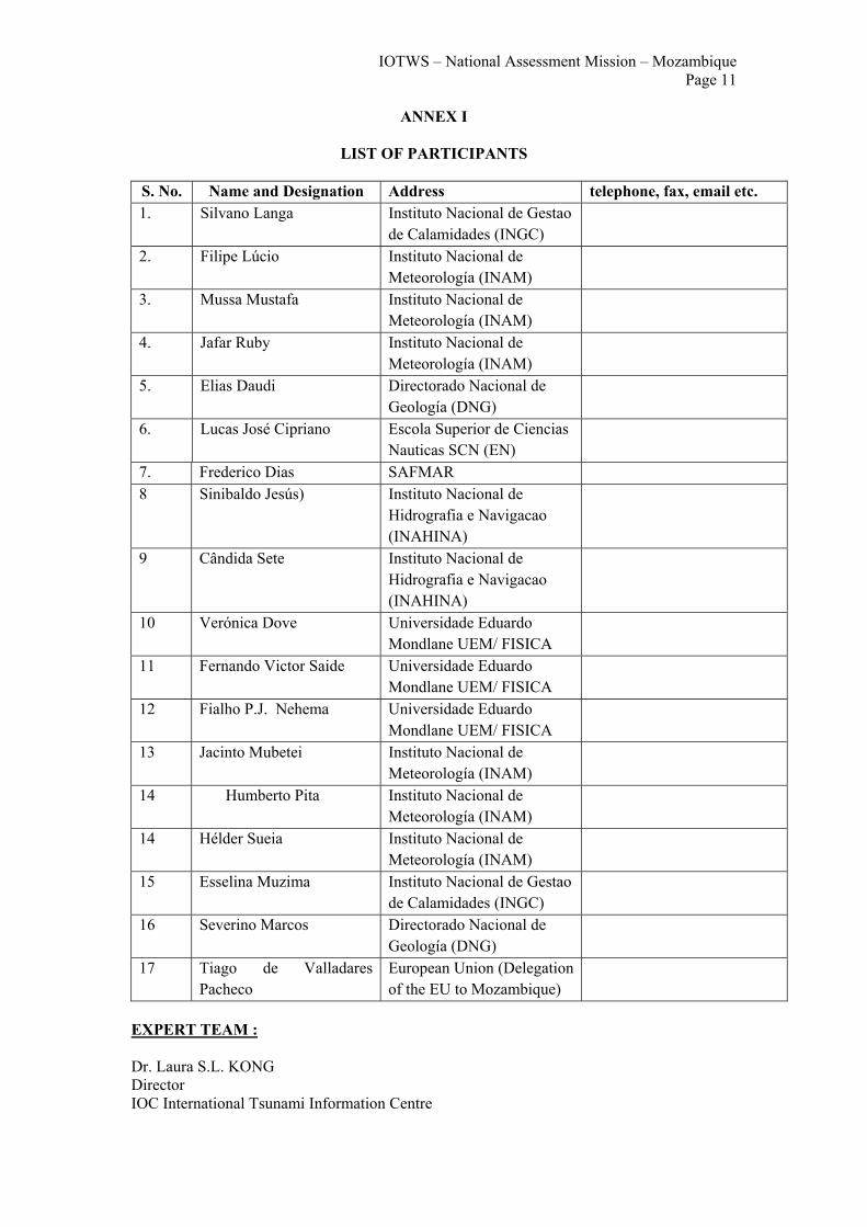
LIST OF PARTICIPANTS
S. No. Name and Designation Address telephone, fax, email etc. 1. Silvano Langa Instituto Nacional de Gestao
de Calamidades (INGC)
2. Filipe Lúcio Instituto Nacional de Meteorología (INAM)
3. Mussa Mustafa Instituto Nacional de Meteorología (INAM)
4. Jafar Ruby Instituto Nacional de Meteorología (INAM)
5. Elias Daudi Directorado Nacional de Geología (DNG)
6. Lucas José Cipriano Escola Superior de Ciencias Nauticas SCN (EN)
7. Frederico Dias SAFMAR 8 Sinibaldo Jesús) Instituto Nacional de
Hidrografia e Navigacao (INAHINA)
9 Cândida Sete Instituto Nacional de Hidrografia e Navigacao (INAHINA)
10 Verónica Dove Universidade Eduardo Mondlane UEM/ FISICA
11 Fernando Victor Saide Universidade Eduardo Mondlane UEM/ FISICA
12 Fialho P.J. Nehema Universidade Eduardo Mondlane UEM/ FISICA
13 Jacinto Mubetei Instituto Nacional de Meteorología (INAM)
14 Humberto Pita Instituto Nacional de Meteorología (INAM)
14 Hélder Sueia Instituto Nacional de Meteorología (INAM)
15 Esselina Muzima Instituto Nacional de Gestao de Calamidades (INGC)
16 Severino Marcos Directorado Nacional de Geología (DNG)
17 Tiago de Valladares Pacheco
European Union (Delegation of the EU to Mozambique)
EXPERT TEAM : Dr. Laura S.L. KONG Director IOC International Tsunami Information Centre
IOTWS – National Assessment Mission – Mozambique Page 12
12
737 Bishop St., Suite 2200 Honolulu, HI 96813-3213 USA Tel: 1 808 532 6423 Fax: 1 808 532 5576 E-mail: [email protected] URL: http://www.tsunamiwave.info Henri Savina Meteo-France Direction de la Prévision Division Marine et Oceanographie 42 Avenue Gaspard Coriolis 31057 TOULOUSE Cedex Tel.:+33561078291 Fax: +33687864568 E-mail: [email protected] Bernardo Aliaga Programme Specialist Intergovernmental Oceanographic Commission/UNESCO 1 Rue Miollis 75732 Paris CEDEX 15 Tel: +33 (0) 1 45 68 39 80 Fax: +33 (0) 1 45 68 58 10 (or 12) Email: [email protected] http://ioc.unesco.org

IOTWS – National Assessment Mission – Mozambique Page 13
ANNEX II
COUNTRY ASSESSMENT QUESTIONNAIRE ON TSUNAMI WARNING AND MITIGATION ACTIVITIES
SECTION 1: CONTACT INFORMATION (NAME, ADDRESS, PHONE, FAX, E-MAIL) Question 1: Please identify or confirm the National Points-of-Contact who we can work with for tsunami mitigation activities in your country. Mitigation activities include tsunami warning and emergency response and preparedness, and education and outreach. Typical agencies involved in these activities are the national emergency response agency, meteorological services, and universities or other technical agencies operating seismic and/or sea level networks or conducting numerical modelling or other engineering studies. Answer: Filipe Domingos Freires Lúcio P.R of Mozambique with WMO Instituto Nacional de Meteorologia Rua Mukumbura 164, PO Box 256 Maputo, Mozambique Phone: 258 21 493193 Fax: 258 21 491150 Email: [email protected] Helder Boaz Paulo Sueia Meteorologist Instituto Nacional de Meteorologia Rua Mukumbura 164, PO Box 256 Maputo, Mozambique Phone/Fax: 258 21 491150 / 490148 Email: [email protected] Rogerio Manguele Position Instituto Nacional de Gestao de Calamidades Rua da Resistencia 1746 Maputo, Mozambique Phone: 258 21 416007/8 417577 Fax: 258 21 417575 / 6 Mobile: 258 82 316 120 0 Email: [email protected] SECTION 2: AUTHORITY AND COORDINATION Scope: Please outline your country’s situation regarding Authority and Coordination. Below are some questions that should be considered in providing a description. 2A: LEGAL FRAMEWORK Question 2: Does your country have laws which designate specific government agencies to provide science-based warnings to specific government agencies, disseminate public warnings instructing the public to take or prepare to take actions, and to provide appropriate emergency response after a destructive tsunami to the affected communities? Please briefly describe these, listing the laws or administrative rules or similar legislation, the agencies designated, and their roles and responsibilities.

IOTWS – National Assessment Mission – Mozambique Page 14
14
Answer: The resolution 30/89 created the National Institute of Meteorology (INAM), whose mission is among others:
• Planning and establishment of national meteorological observation network; • Coordinating and promoting all meteorological and related activities in the country; • Promote training and research in the field of meteorology and climatology; • Cooperate with regional and international specialized Centers or organizations in the
field of meteorology; • Issue and disseminate early warnings, awareness building and educate the society for
the case of extreme weather events and natural disasters;
The resolution 38/99 created the National Institute of Disaster Management (INGC), whose mission is among others:
• Coordination of multi-sectorial activities, including prevention and preparedness, relief assistance and rehabilitation of infrastructures damaged by disasters;
• Promote training and research on disaster management; • Mobilization of resources for post-disaster rehabilitation and reconstruction;
o Propose to the Government legislative action concerning disasters and ratification of international conventions on natural disaster.
The resolution 16/89 created the National Directorate of Geology (DNG), whose mission is among others:
• To manage and coordinate in the field of Geophysics, all studies and activities related to Geophysical observations, namely geomagnetism, seismology and gravimetery.
The resolution 40/89 created the National Institute of Hydrography and Navigation ( INAHINA ), whose mission is among others:
• To perform technical and scientific activities in the national waters, aiming to contribute for marine navigation safety and environmental protection.
• Specific responsibilities include among others, the coordination, promotion and development of research activities in the fields of Hydrography, Oceanography, Navigation and Sea Mapping.
2B: NATIONAL PLATFORM FOR DISASTER REDUCTION Question 3: Does your country have a National Platform or other mechanism for guiding disaster risk reduction in general? Answer: Yes, INGC establishes contingency plans on annual basis according to seasonal forecast (rainfalls) received from INAM. Question 4: With respect to tsunamis, for example, has your country established a National Tsunami Warning and Mitigation Coordination Committee or some other coordination mechanism? Answer: No because the Technical Council CTGC under INGC includes all relevant agencies dealing with tsunami, now including the National Directorate of Geology (NDG), from Ministry of Mineral Resources. INAM, under the Ministry of Transport and Communications has been indicated as the National coordinating agency in connection to the establishment of the IOTEWS.

IOTWS – National Assessment Mission – Mozambique Page 15
Vice-Minister
Communications
Economy & Inv Infrastructure Surface Transp Marine
Adm. & Finance
Aeronautical School
Nautical School
Communications
Sea Waters
Marine Safety
Development Corridors Unity
Civil Av. Road Transp
Meteorology
International Relations
HR Air Transport
Civil Aviation
Comt. TranspInspection
P. Secretary Cabinet Advisers
Minister
Legal
Provincial Directorates
Hydrog. & Nav
Diagram of the Ministry of Transport and Communications
National Directorates
Departments
National Institutes

IOTWS – National Assessment Mission – Mozambique Page 16
Question 5: Does your country have similar coordination mechanisms at the community level? Answer: Not yet but there are some local committees for emergencies. Some problems of coordination and communication remains to be solved. Question 6: Who (types of persons and agencies) are members of this Committee? Answer: N/A Question 7: What authority does this Committee have (decision-making, policy-making, advisory (if yes, to whom), independent reporting to one agency, etc? Answer: [response from INGC]
2C: NATIONAL ORGANIZATIONS Question 8: What are the important organizations, both government and non-government, for the implementation of a tsunami early warning and mitigation system? Answer:
• National Institute of Meteorology (INAM ) • National Directorate of Geology (DNG). • National Institute for Disaster Management (INGC) • National Institute of Hydrology (DNA) • National Institute of Hydrography and Navigation (INAHINA ) • Eduardo Mondlane University (UEM ) • Maritime Safety Authority (SAFMAR) • National Red Cross Society
Question 9: What roles will they play? Please specifically include the roles, responsibilities and authorities of the National Meteorological Service and the National Disaster Management Organization, or their equivalent monitoring, warning evaluation, and warning dissemination agencies. These, in fact, may be the same as those that comprise your Coordination Committee above. Answer: See Legal Framework under section 2 (for INAM, DNG and INGC) INAHINA – Observation and monitoring oceanic processes (e.g. tides, waves, surges, currents) UEM –The UNESCO Chair of Marine Sciences and Oceanography - Assessing vulnerability and risk, developing predictive and forecasting models, education and training, awareness.
IOTWS – National Assessment Mission – Mozambique Page 17
DNA: Red Cross: 2D: PRIORITIES Question 10: What are your priorities for implementation of an effective tsunami warning and mitigation system? For example, by topic and sub-topic (assessment, warning, emergency response/preparedness/awareness, public/government or technical capacity building, etc), by level (national, province, community, individual), by urgency (urgent, short-term, long-term, and time frame for action). Answer: Technical capacity building for monitoring and warning, assessment of vulnerability and risk at national level, urgent. Question 11: What major activities are currently taking place to address these priorities? Answer:
• Participation in the 1st and 2nd coordination meetings for IOTEWS. • Testing of the communication system for tsunami advisory information received from
PTWC and JMA; • Awareness to the authorities at different levels on IOTEWS (reporting, lectures and
publication of articles); • Satellite transmission tide gauges were installed in Pemba and Inhambane by
INAHINA • UEM –The UNESCO Chair of Marine Sciences and Oceanography is developing an
oceanographic buoy that will transmit data via satellite 2E: INTERNATIONAL STANDARDS ASSISTANCE Question 12: Do you require assistance to harmonize existing standards and protocols in data collection, evaluation, and warning communication with those utilized by the global system to ensure interoperability? Answer: Yes. There is a big gap to be covered on seismic data collection and processing. INAHINA would need continued assistance to modernize sea level data collection. 2F: REGIONAL COOPERATION – EARLY WARNING Question 13: Does your country currently cooperate with any neighboring country when evaluating earthquakes and monitoring tsunamis in real-time, or for tsunami warning services, or other mitigation activities? If yes, please describe recent activities and the nature of the cooperation. Answer: The only cooperation existing is limited to data exchange with the Council for Geoscience of South Africa in which Mozambique observes the data and the Council process them every other week. Geosciences of South Africa provides feedback after several months; Through IOCWIO (IOC for West Indian Ocean) and the ODINAFRICA project INAHINA cooperates with the regional and global programmes related to oceanography (sea level) 2G: REGIONAL COOPERATION – ASSESSMENT & MITIGATION Question 14: Does your country participate in any regional partnerships for assessing and responding afterward to earthquake and/or tsunami disasters? If yes, Please describe.

IOTWS – National Assessment Mission – Mozambique Page 18
18
Answer: In the field of earthquakes with the Council for Geosciences of South Africa Mozambique cooperates with South Africa. For Marine Search and Rescue Mozambique cooperates with neighboring countries (South Africa, Madagascar, etc)
2H: RESEARCH EXPERTISE Question 15: Does your country have active researchers in seismology or tsunamis? If yes, please describe recent activities. Answer: Dr. A.M.Hoguane, Physical Oceanographer, hydrodynamic models. Mr. Alberto Mavume on a Ph.D. programme, expert in storm surge modeling. There is no research activity on seismology or tsunamis. Question 16: Does your government have a government-sponsored research organization that can provide products or services to strengthen your tsunami warning and mitigation system? Answer: No. SECTION 3: TSUNAMI WARNINGS AND TSUNAMI MONITORING Scope: Please outline your country’s situation regarding Tsunami Warnings and Tsunami Monitoring. Below are some questions that should be considered in providing a description. 3A: RECEPTION OF WARNINGS FROM INTERIM SYSTEM Question 17 : Does your country currently receive international tsunami warnings for teletsunamis from the Pacific Tsunami Warning Center and/or from the Japan Meteorological Agency? Answer: Yes Question 18: If yes, by what method and who receives it? Answer: GTS, Fax and email by INAM Question 19: Is there a back-up, or alternative method, for receiving the warning messages? Answer: -Yes, fax and email of INGC Question 20: Does this agency provide 24-hours-a-day, 7-days-a-week services? Answer: Yes. Question 21: If your country does not currently receive international tsunami warnings for teletsunamis from the Pacific Tsunami Warning Center and/or from the Japan Meteorological Agency then would your country like to receive these and by what method. Available methods include E-mail, Fax, EMWIN, GTS (Global Telecommunications System with WMO headers), AFTN/NADIN. Answer: N/A 3B: NATIONAL TSUNAMI WARNING CENTRE Question 22: Does your country operate, or intend to operate, a national or regional tsunami warning center to monitor and warn of regionally- or locally-generated tsunami? Answer: leading by INAM, in cooperation with INAHINA and DNG, intend to operate and monitor a national seismic and sea level network and provide local earthquake evaluation. INAM also attend to receive information on regional seismicity, confirmation of tsunami and raw data, in a later stage, from other centers.

IOTWS – National Assessment Mission – Mozambique Page 19
Question 23: If yes, please provide information on the system (data networks, evaluation methods, and message dissemination processes). Answer: INAM/DNG and INAHINA request technical assistance to implement the relevant networks. Question 24: Does the warning center have staff that is always present in the operations center 24-hours-a-day, 7-days-a -week, or are staff on an on-call basis through automated processes which notify the on-duty staff through a phone message or pager. Answer: Yes. The INAM’s Forecasting Center operates on 24/7 basis. But there is not yet any response procedure to alert the relevant authorities on a 24/7 basis. INGC is not a 24/7 centre. 3C: TSUNAMI WARNING ALARM INFRASTRUCTURES Question 25: Does your country use alarms and other types of paging systems to notify staff of tsunami alarm events? Answer: No. Question 26: Are these dedicated notification systems, or do they use commercial services? Answer: N/A Question 27: If so, who is notified, and does this include both warning center staff and emergency response officials? Answer: N/A 3D: SEISMIC NETWORK Question 28 : Does your country operate any seismographic stations or seismograph networks to monitor regional seismicity? Answer: Yes, the National Directorate of Geology operates four seismographic stations, but only two (Nampula and Changalane) are currently operational. Question 29 : If yes, please describe the system or institution, including location, instrumentation and telecommunications and analysis. Answer: 4 Seismic stations from the 60s at Changalane, Tete, Nampula and Manica need upgrading to modern instruments and digital data recording and transmission. No national capacity for data processing is available. Analysis is currently made in South Africa. Mozambique would like to develop its own capacity. Power supply and communication methods (phone) are problems for extending the program. Solar power units could be considered. Technical assistance is requested.

IOTWS – National Assessment Mission – Mozambique Page 20
20
Given the historical seismicity (see figure above) and to further understand the nature of earthquake faulting in the Mozambique channel, scientific research experiments could be undertaken using ocean bottom seismographs and/or collaborative land based seismic stations in Mozambique and Madagascar. This would provide information on whether the earthquakes would generate tsunamis. Question 30: Are the data available in real-time in your center ? Answer: No. Question 31: Can you provide these data in real time and how? Answer: No. Question 32 : Does your country operate any seismographic stations or seismograph networks to monitor local seismicity? Answer: No. 3E: UTILIZATION OF SATELLITE SYSTEMS FOR MONITORING, DATA COLLECTION AND DISSEMINATION Question 33: Is your country aware of the satellite capabilities offered through different countries in the region? Answer: Information not available Question 34: What is the current capacity (equipment to receive, technical ability to access and interpret, etc) of your country in utilizing satellites for hazard monitoring, data collection and exchange? Answer: Information not available Question 35: Please describe through which satellite systems you are receiving data? What kind of data and how? Answer: Information not available Question 36: What are the major obstacles faced by your country with respect to the use of satellites for hazard monitoring, data collection and exchange? If they are not used,please specify why (lack of technical expertise, lack of funds, lack ofequipment)

IOTWS – National Assessment Mission – Mozambique Page 21
Answer: Information not available 3F: SEA LEVEL NETWORK Question 37: Does your country operate any sea level stations (coastal or deep-ocean instruments) to monitor sea level. Answer: Yes, five coastal stations as for the figure below.
- One in Maputo harbour (analog) - One in Nacala harbour (analog)
- One in Pemba harbour (digital) - One in Pemba (analog) - One in Inhambane (digital
Question 38 : Are these stations available real-time to the central monitoring site, or available in near real-time to the PTWC/JMA for use in the IOTWS? Answer: Near real time (INAHINA) UNESCO/IOC has recently provided two gauges for Inhambane and Pemba. The gauges were purchased by IOC before the 26 December 2004 tsunami, and installed by the South African Hydrographic Office in April 2005. Both were brought on line and now report data in near real time via the Orbcomm satellite system, at the following URLs: http://www.pol.ac.uk/ntslf/sadata_african_ntslf_radar.php?code=1002&span=1 http://www.pol.ac.uk/ntslf/sadata_african_ntslf_radar.php?code=1001&span=1 The latency is about two hours which is not good for tsunami monitoring. But it is expected that geostationary satellite transmitters will be installed later this year. It should be stressed that the equipment was purchased before the tsunami event, shipped shortly thereafter, and before there was the added emphasis on tsunami monitoring from sea level gauges. The gauges are equipped with an Orbcomm satellite data transmitter (Low earth orbit satellite). The latency of data delivery with the Orbcomm to an international warning center or the GLOSS Data Center at POL is 2-3 hours. For tsunami monitoring 15 minute data

IOTWS – National Assessment Mission – Mozambique Page 22
22
transmission frequency (or better) is now the norm, and the Orbcomm should be replaced with a geostationary satellitte transmitter. We expect to be able to provide that latter this year for the Pemba and Inhambane sites. While IOC has provided two gauges to Mozambique, Mozambique has purchased a third one for Maputo and this has formed the basis for a very modern national tide gauge network. Question 39: Do these stations sample sea levels frequently enough and transmit their data frequently enough to resolve short-wavelength tsunami (e.g., do they sample at 1 min or less intervals, and transmit their data every 15 minutes or less to a central site or by satellite)? Answer: see above Question 40 : If yes, please describe the system or institution, including location, instrumentation and telecommunications and analysis. Answer: see above Question 41: If other digital data are available in your center, can you provide these data to the PTWC/JMA? Answer: N/A 3G: INTERNATIONAL COORDINATION Question 42: Are there international agencies, besides the IOC of UNESCO, or through bi-lateral or other assistance, any countries, universities or other technical institutions that are you coordinating, working with, or who are providing services to strengthen your tsunami monitoring, evaluation, warning capabilities? Answer: None but UNESCO/IOC and its partners WMO, UN-ISDR. SECTION 4: TSUNAMI WARNING RESPONSE AND EMERGENCY PREPAREDNESS Scope: Please describe your country’s situation regarding Tsunami Warning Response and Emergency Preparedness. Below are some questions that should be considered in providing a description. 4A: WARNING DISSEMINATION AGENCY Question 43: Who is the designated agency for receiving and acting upon the tsunami advisory message from the tsunami warning center? Answer: INAM receives advisory messages from the PTWC and JMA. If INAM decides it warrants attention, it sends the message, without translation, to INGC, Cabinet, media; protocols still need to be refined and procedures agreed upon and refined. Question 44: Does this agency have authority by law? Answer: Yes Question 45: Does this agency issue public evacuations? Answer: No. This is done by INGC. Question 46: If not, who are the responsible agencies. Answer: INGC
IOTWS – National Assessment Mission – Mozambique Page 23
4B: CAPACITY BUILDING ASSESSMENT Question 47: Have you assessed your existing disaster management system and identified the requirements of individuals and institutions for training and capacity building? Answer: Yes
• DNG needs: o Training of 1 individual for seismic data processing and 8 individuals for seismic
data analysis. o Upgrading of all existing 4 seismic stations to allow real time transmission of
data o Procurement and installation of 4 land seismic stations, and 3 underwater seismic
stations • INAHINA needs:
o Three radar tide gauge for permanent measurements (Beira, Quelimane and Angoche) with real time transmission of data
o One wave and Tidal Recorder o 2 deep ocean buoys for different sensors o Two Recording Current Meter o One Air pressure sensor o Mapping of coastal bathymetry and topography;
• INAM needs: o Upgrading of 2 Upper Air stations at Maputo and Beira, and consumables. o Establishment/strengthening of national analysis, processing and warning center; o Development and implementation of awareness and education programmes. o Equipping of national centre to enable it to develop national vulnerability/risk
assessment o Strengthening of communication system to reach local authorities and people in
risk areas. • INGC needs:
o Upgrading communication facilities in institutions and authorities handling hazard warning
o Generation of coastal inundation and vulnerability maps o Preparation of preparedness and emergency responses
4C: TSUNAMI RESPONSE PROCEDURE (DISTANT OR REGIONAL TSUNAMI) Scope: After receiving an international tsunami advisory message (distant tsunami), what are the procedures for responding? Response procedures should typically answer the following questions: Question 48: What criteria are used by the designated emergency authority to determine whether an evacuation should be issued, i.e., how is the science-based tsunami warning message translated into public guidance? Answer: No formal criteria has been determined yet. Framework needs to be established; code of conduct and responsibilities are to be developed as a very high priority action by the Technical Disaster Management Committee chaired by the INGC. INAM responsibilities do not currently include tsunami warnings; this will be formally designated in the near future. Question 49: How is that information disseminated to the public? Are there sirens, or other emergency broadcast methods for immediately broadcasting warning messages? Are these ‘all-hazard’; specific to a certain hazard, or tsunami-specific? If an early warning notification system exists to alert communities, please briefly describe.

IOTWS – National Assessment Mission – Mozambique Page 24
24
Answer: In the dissemination of all hazard events, media, community based communication systems, central and local authorities, NGO’s, are involved. Presently, INAM and Mozambique radio and television have agreed to broadcast emergency warnings immediately; additional means of dissemination could be considered for tsunami warning dissemination. INAM recognizes the need to establish more detailed procedures taking into account the time-sensitiveness of the tsunami response.
Question 50: Are there tsunami emergency plans, tsunami evacuation plans and/or signage indicating evacuation routes to safety or higher ground? Answer: No, it is recognized as a priority to identify the vulnerable communities and to work with them to develop these plans. Question 51: Are there marine warnings, and is there guidance or instructions for marine vessels, harbors and ports? Answer: No. INAM provides marine warnings in case of extreme weather events over the sea. For example, in the case of tsunami warnings for mariners, INAM would inform SAFMAR who would then use their existing mechanisms to reach the and individuals at risk. Currently, SOLAS ships have facilities for emergency receipt of warnings, but non-SOLAS ships currently do not. Discussions should be undertaken to find the appropriate methods and organizations to ensure wider reception of important emergency information. INAM should consider other dissemination methods that provide marine warnings to small fishing vessels through appropriate and effective channels. Question 52: When an evacuation is issued, is the public required by law to evacuate or is it an evacuation advisory only? Answer: It is an evacuation advisory only. Question 53: Are there procedures or criteria for when it is safe for responders or the public to return? Answer: Yes. INGC to provide procedures and criteria, who makes this determination, and how it is broadcast 4D: ISSUANCE OF WARNINGS FOR MARINE SAFETY Question 54: Does the National Meteorological and Hydrographical Service (NMHS) have a mechanism for warning mariners (e.g communication system NAVTEX, access to INMARSAT Safety-Net)? Please specify current capabilities. Answer: Information not available Question 55: Do the NMHSs issue marine forecasts and warnings (e.g. storm and gale warnings, weather bulletins, etc) to the mariners and coastal zone users in their region, and how? (e.g. GMDSS fax, facsimile and radio/ Answer: Information not available Question 56: How are the contents of the warnings for mariners formulated?Are these developed withing the NMHS or in collaboration with other agencies? Answer: Information not available Question 57: Are these warning effective and timely? What are the weaknesses associated with the current marine warning systems that you utilize in your organization?

IOTWS – National Assessment Mission – Mozambique Page 25
Answer: Information not available Question 58: In light of the short time window for tsunami warnings what are the strengths and weaknesses of the current warning mechanisms you utilize for issuance of warnings to mariners and coastal zone users? Do you need assistance in formulation of the warnings, enhancement of your communication mechanisms etc to address specific requirements for tsunami warnings. Answer: Information not available 4E: DISSEMINATION PROCEDURE (LOCAL TSUNAMI) Question 59 : For the case of a regional- or locally-generated tsunami, do you have procedures for responding? Answer: No 4F: DISSEMINATION PROCEDURE (LOCAL EARTHQUAKE) Question 60: Does your country have response procedures for earthquakes? If so, do these include tsunamis? Answer: No. 4G: RESPONSE PROCEDURE DRILLS/EXERCISES Question 61: Are your procedures tested or exercised to improve the response through better planning and preparedness? Answer: No INGC to provide further information regarding evacuation procedures for other hazards such as floods and cyclones Question 62: If yes, please describe how this is done, who is involved, and whether it is done regularly. Answer: 4H: CONSIDERATION OF CRITICAL INFRASTRUCTURE Question 63 : Have you identified critical infrastructure and lifeline support facilities (hospital, ports and marine facilities, land transportation, energy utilities, telecommunications, etc) and made plans to ensure minimal government services after a destructive tsunami, or other natural disaster? Answer: No. 4I: OTHER LOCAL CONTACTS Question 64: Please provide Local Reporting Contacts that the PTWC/JMA can contact during a tsunami alarm to confirm that a tsunami has occurred. Eyewitness observations or other local information are especially important for monitoring the destructiveness of the tsunami as it propagates across the Indian Ocean. Answer: INAM, 24-hour contact information exist. Other 24-hours-day contacts exist, such as SAFMAR, and INAM will provide detailed information 4J: POST TSUNAMI SCIENCE SURVEYS Question 65: After a damaging earthquake and/or tsunami, does your country carry out post-event data surveys to assess damage and collect tsunami run-up/inundation data?

IOTWS – National Assessment Mission – Mozambique Page 26
26
Answer: There has not been a need to conduct tsunami surveys to date. Such surveys have been conducted after flooding events; in this case, each department makes assessments, including high level water marks, and reports to the INGC. Question 66: If yes, what organization(s) usually carry out this task? Answer: N/A 4K: INTERNATIONAL COORDINATION Question 67: Are there international agencies, besides the IOC of UNESCO, or through bi-lateral or other assistance, any countries or other institutions that are you coordinating, working with, or who are providing services to strengthen your tsunami warning response? If yes, please indicate who and describe the assistance. Answer: Not yet. SECTION 5. TSUNAMI HAZARD AND RISKS Scope:Please describe your country’s situation regarding Tsunami Hazards and Risks, including tsunami numerical modeling. Below are some questions that should be considered in providing a description. 5A: TSUNAMI HAZARD STUDIES Question 68: Have studies been done to document the tsunami hazard in your country or region (either before or after 26 December 2004)? Answer: No. Question 69: Do you have a good historical record of past earthquakes and tsunamis? Answer: No. Question 70: If yes, please provide references to those studies Answer: N/A 5B: TSUNAMI VULNERABILITY STUDIES Question 71: Have studies been done to identify vulnerabilities and then to document the tsunami risk in your country or region? Answer: No. Potential tsunami prone areas have been identified by the INGC by inference taking into accounts the low land areas and river mouths. Furthermore, given the historical seismicity of Mozambique channel further investigation is needed to understand the tsunami generating potential of channel located earthquakes. Question 72: If yes, please provide references to those studies, and generally describe your tsunami risks. Answer: N/A 5C: NUMERICAL MODELING STUDIES Question 73: Have numerical modeling studies been done to calculate inundation from tsunamis in your country? Answer: No Question 74: If yes, please provide references to those studies and indicate where the studies were conducted.

IOTWS – National Assessment Mission – Mozambique Page 27
Answer: N/A Question 75: If no inundation modeling has been done, does your country plan to do this in the future? Answer: Yes. Question 76: Is technical training required to build this capacity? Answer: Yes. Master Degree (5) and PhD (5) Fellowships in numerical modelling Question 77: Does accurate bathymetry and topography data exist for the coastlines (30 m grid resolution or better), or does data need to be collected first? Answer: Need to be collected. Locations: Maputo Port and Maputo Bay (2003), Quelimane Port (1999) Scales: 1/25000 1/20000 and 1:50000 Format: ntx 5D: GIS USE Question 78: Are graphical information systems (GIS) used as a decision support tool during emergency response? Answer: Yes. Question 79: If yes, are building inventory, critical infrastructure, demographics, emergency response and evacuation, bathymetry and topography, tsunami, earthquake or other hazard or risk data layers available? Answer: Yes to a certain extent with regard to flooding and cyclone disasters. Data layers are available for hit zones: roads, bridges, population density and food security. Several databases do exist funded by different organizations (WFP, USAID). INGC has been the recipient of some of these databases. There is a GIS lab at the Dept. of Geography of the University Eduardo Mondlane, supported by USAID (FEWSNET project). 5E: INTERNATIONAL COOPERATION Question 80: Are there international agencies, or through bi-lateral or other assistance, any countries, universities, or other technical institutions that are you coordinating, cooperating with, or who are providing services for conducting tsunami hazard and risk assessments, and/or numerical modelling? Answer: No Question 81: If yes, please indicate who and describe the assistance. Answer: N/A 5F: POST-TSUNAMI SURVEYS Question 82: Have post-tsunami impact assessments been conducted in your country? Answer: No. Question 83: If yes, what types of data were collected. For example, structural and non-structural physically damage, run-up and inundation, geological, geophysical, and oceanographic tsunami signatures, emergency response, public perceptions of hazard and response. Answer: N/A SECTION 6: TSUNAMI PUBLIC AWARENESS AND PREPAREDNESS, AND COMMUNITY LEVEL ACTIVITIES:

IOTWS – National Assessment Mission – Mozambique Page 28
28
Scope: Please describe your country’s situation regarding Tsunami Public Awareness and Preparedness. Below are some questions that should be considered in providing a description. 6A: ASSESSMENT OF LOCAL GOVERNMENT PREPAREDNESS AND EMERGENCY RESPONSE Question 84 : Have you assessed your local government disaster preparedness and emergency response? For example, are there local emergency operations centers, alert systems, incident command processes for response? Answer: Yes, INGC for all hazards. INGC to provide information on existing operations centers and further requirement to enhance efectivenness. Question 85: How have you ensured, or will you ensure, that the information given to ordinary citizens during a warning is understood and then acted upon in an appropriate and timely manner (for example, by meetings, mass media, schools, drills, community activities, etc)? Answer: By meetings and training of trainers and use of mass media. INAM together with INGC (FEWSNET) have been actives on building community awareness for tropical cyclones and also for rain seasonal forecast. The focus of these activities is on local authorities (training of trainers). Brochures and a weekly full page in a national circulation newspaper are being maintained by INAM focused on public awareness and education. Simple colour codes have been developed by INGC/INAM to reach a larger segment of the population (illiteracy) with tropical cyclone warnings. 6B: ASSESSMENT OF COMMUNITY PREPAREDNESS AND EMERGENCY RESPONSE Question 86: Have you assessed your community and ordinary citizen disaster preparedness and emergency response? Is there public awareness of tsunami hazard and risk? Answer: Not yet. Tsunami are of low awareness. Question 87: Is the public aware of what a tsunami is, and how to respond to both locally-generated and distant tsunamis? Answer: No. Question 88: Are there any community-level education and preparedness programmes for national hazards or tsunamis? Answer: Yes, for national hazards. Question 89: If yes, please describe how the awareness preparedness was achieved (for example, through brochures, education, meetings, etc). Answer: Through brochures, education, meetings, weekly articles in newspapers by INAM and other agencies, CTGC meetings at central, provincial and local levels. Question 90: What types of outreach have been conducted and who conducts them? Answer: see above. Question 91: What is planned for the future to increase or sustain the awareness and preparedness? Answer: Strengthening of awareness building involving radio and television.

IOTWS – National Assessment Mission – Mozambique Page 29
6C: COMMUNITY PARTICIPATION Question 92: Do local authorities engage in community-level, citizen-based, stakeholder participation in developing and deciding risk avoidance and mitigation activities? Answer: Yes. INAM has in house capacities to produce multimedia education and awareness material. Question 93: Is community-based, risk based decision making used? In other words, at the community level, are tsunami mitigation and emergency response decisions based on knowledge of the known local risks and the potential impacts of tsunami on the specific community? Answer: No but discussion has taken place to identify shelters. Schools have been suggested to play this role. The Mozambique government is discussing ways to identify natural hazard risks and to inform the community of the risks so that they can decide how much risk they are willing to tolerate. After floods of 2000, safe shelters were identified in southern Mozambique. Immediate aid could then be channeled to these places. Question 94: Informed people at the community level may the ones best suited to make decisions for their own communities on the risk level they are willing to tolerate or retain, and the risk level they want to transfer to someone else. Have local risk assessments been carried out, or are they necessary? Answer: There is a need. 6D: PEOPLE-CENTERED EARLY WARNING MECHANISMS Question 95: Do non-government, people-centered, community-based organizations, such as the local Red Cross/Red Crescent Society, play a role in the receipt and delivery of tsunami or multi-hazard early warnings to people at the local level? Answer: They have never played a role before in Tsunami. They play a role in other disasters such as floods, tropical cyclones and droughts. However, they can be engaged in Tsunami warnings. Question 96: If yes, please describe their role and activities. Answer: Information not available Question 97: If no, is there an interest in involving these organizations as an early warning mechanism that carries messages from national authorities to communities and into households - please specify which organizations. Answer: Information not available 6E: PEOPLE-CENTERED PREPAREDNESS MECHANISMS Question 98: Do non-government, people-centered, community-based organizations, such as the local Red Cross/Red Crescent Society, play a role in the early warning preparedness and community outreach and education to people at the local level? Answer: Not in Tsunami warning. The Red cross is an example which has been involved in the education, preparedness and community outreach for e.g tropical cyclones and floods. Question 99: If yes, please describe their role and activities. Answer: Question 100: If no, is there an interest in involving these organizations as a preparedness mechanism to reach communities and households - please specify which organizations. Answer:

IOTWS – National Assessment Mission – Mozambique Page 30
30
6F: EDUCATIONAL MODULES OF THE TSUNAMI NATIONAL FOCAL POINTS Question 101: As the designated national tsunami focal point, do you have a Tsunami Education and Public Outreach Programme, in currently in place or planned for the future? If yes, please describe and provide implementation time line if planned. Answer: Information not available Question 102: How does the plan address the different stakeholders (e.g., risk managers, media, schools)? Answer: Information not available Question 103: Are other natural hazards, such as tropical cyclones, storm surges, earthquakes, and volcanoes, covered in this programme plan? Answer: Information not available Question 104: How are educational materials distributed? Answer: Information not available Question 105 : Do you have training programmes for the media on tsunami hazards, mitigation, warning, and preparedness? If yes, please describe. Answer: Information not available Question 106: Do you have training programmes for the media on other hazards and their vulnerability? If yes, please describe. Answer: Information not available Question 107: Would availability of educational modules and training sessions customized to your particular culture/infrastructure be helpful to your organization and to raising public awareness in your country? Answer: Information not available Question 108: Through what mechanisms do you interact with you major stakeholders? Would you benefit from assistance/guidance/on-going contact with your national and regional partners through seminars and workshops? Answer: Information not available Question 109: Would you benefit from on-going regional training activities strengthening the linkages of key organizations involved in the Early Warning Process (Technical agencies, Media, Risk Managers, etc.)? Answer: Information not available 6G: EDUCATIONAL CURRICULUM Question 110 : Are earthquake and tsunami hazards and preparedness part of the educational curricula taught to school children? If yes, please describe. Answer: No. There is still very little information in school texts about all hazards and nothing exists for tsunamis. DNG has some materials on earthquakes but not in the curricula. It should be for INGC to initiate discussions with Education include disaster preparedness in school curricula. INAM and other national agencies can produce specific materials if requested. 6H: OTHER OUTREACH PROGRAMMES Question 111: Are there other funded programmes which have provided outreach, or is there a need for such programmes?

IOTWS – National Assessment Mission – Mozambique Page 31
Answer: No other programmes known. Yes there is a need. Question 112: If yes, what types of outreach are needed? For example, public awareness briefings, technical training or education, informational material (printed brochures, video, computer, etc), materials targeted for children, decision-makers, general public or targeted segments of the populations, indigenous populations. Answer: N/A 6I: TSUNAMI MEMORIALS AND MUSEUMS Question 113: Are there any tsunami memorials, museums, interpretative signage or other public reminders of past tsunami impacts to your country? Answer:No. Question 114: Do you have plans to establish such reminders? If yes, please describe. Answer: No. 6J: STRUCTURAL MITIGATION EFFORTS Question 115: Has your country implemented any structural mitigation to reduce tsunami impact? Examples might be sea walls, tsunami evacuation shelters or other man-made high platforms, building codes for earthquake-resistant, flood-prone, or typhoon-resistant structures, or vertical evacuation guidance? If yes please describe. Answer: No. 6K: NON-STRUCTURAL MITIGATION INCLUDING LAND USE Question 116: Has your country implemented any non-structural mitigation, such as land-use policies regarding the location and building of structures or public utilities in potentially hazardous coastal areas, vegetative sea barriers, or the retaining or rebuilding of key features of the natural landscape or ecosystem that can serve to buffer the effects of future national disasters? If yes, please describe. Answer: No. 6L: EVACUATION ISSUES Question 117: Have tsunami evacuation maps, evacuation routes, and evacuation signage been developed for any part of your country? Answer: No Question 118: If yes, please indicate where and how they were assembled. Answer: N/A Question 119: If no, does your country plan to do this in the future? Answer: Yes. Question 120: Is training required to build this capacity? Answer: Yes. 6M: INTERNATIONAL COOPERATION FOR AWARENESS Question 121: Question: Are there international agencies, or through bi-lateral or other assistance, any countries, universities, or other technical institutions that are you coordinating, cooperating with, or who are assisting in the development of materials or the deployment of information to the relevant institutions and/or the public?

IOTWS – National Assessment Mission – Mozambique Page 32
32
Answer: No Question 122: If yes, please indicate who and describe the assistance. Answer: N/A 6N: INTERNATIONAL COOPERATION FOR STRUCTURAL AND NON-STRUCTURAL MITIGATION Question 123: Are there international agencies, or through bi-lateral or other assistance, any countries, universities or other technical or humanitarian assistance institutions that are you coordinating, working with, or who are providing services to strengthen your structural and non-structural tsunami mitigation activities at the local levels? Answer: No Question 124: If yes, please indicate who and describe the assistance. Answer: N/A SECTION 7: TSUNAMI RESPONSE TO 28 MARCH 2005 M8.5 EARTHQUAKE OFF SUMATRA, INDONESIA Scope: Please describe your country’s response to this earthquake which did not generate a destructive basin-wide tsunami. 7A: PREPAREDNESS Question 125: Was your country more aware and your public better prepared to respond appropriately? Please describe how you ascertained this. Answer: No. Question 126: Did they respond appropriately? Answer: No. 7B: ADVISORY Question 127: Did your country receive an internationally tsunami advisory message from the PTWC or JMA? Answer: Yes Question 128: How timely was this? Answer: Information not available 7C: MONITORING SYSTEMS Question 129: Did your country have national monitoring systems in place that detected and evaluated the earthquake? Answer: The seismograph stations do not work properly. Question 130: How timely was this? Answer: Information not available 7D: NATIONAL RESPONSE PLAN Question 131: Did your country have a national tsunami response plan in place, and was it exercised? Answer: No.

IOTWS – National Assessment Mission – Mozambique Page 33
Question 132: How did it perform? Answer: Information not available Question 133 : What went well and what are areas still needing coordination and improvement? Answer: Information not available SECTION 8: OVERALL ENHANCEMENT OF YOUR NATIONAL CAPABILITIES TO MITIGATE THE IMPACT OF HAZARDS Question 134: Is your country addressing the establishment of the Tsunami Early Warning capabilities including response within your national boundary, with a multi-hazard framework? If (yes) please explain. Answer: Information not available Question 135: In the absence of a tsunami, how can you benefit from with the capacities and linkages being developed in your country, to better respond to other hazards?(e.g. improved dissemination, coordination and response to all hazards affecting your country) Answer: Information not available Question 136: We would especially appreciate if you could comment further on critical areas where the international community can provide additional specialized technical or capacity building assistance. Answer: Information not available