exhibit c- appellants section 2 notes for basis for
TRANSCRIPT

Section 2 Notes for Basis for Environmental Assessment Summary T2-2019-12701
1. Need for an Environmental AssessmentSee exhibit A, B , C for consultation from USFWS regarding the threatened species in our area,see map
Exhibit A page 9 below Species list from the USFWS for woodard/seidl rd areaOregon Fish And Wildlife Exhibit B page 18 below Ipac planning and consultation for environmental impact on wildlife Exhibit C page 30 below Best Practices for Cell tower siting. USFWS
Notes about NEPA and that an interested party can raise aesthetic concerns” see below”
1/ Case referenced from NEPA regarding cell tower opposition for lack of EA https://docs.fcc.gov/public/attachments/DA-16-223A1_Rcd.pdf
2/ FCC notes on why/criteria for a EA must be done.
Email response from FCC From: Erica Rosenberg <[email protected]> To: [email protected] Cc: Belinda Nixon <[email protected]> Date: 09/11/2020 2:30 PM Subject: questions about approval for an Environmental Assessment or review
Dear Ms. Vincent:
Our NEPA process categorically excludes all facilities from environmental review unless certain extraordinary circumstances are present. See generally 47 CFR §§1.1301 et seq. We have delegated the initial environmental review (“the NEPA checklist”) to our applicants and licensees. If any of the enumerated circumstances of §1.1307 (a) and (b) are present, the applicant must submit an environmental assessment (EA) for the FCC’s review. If the applicant is not required to submit an EA, the FCC generally does not require the applicant to provide documentation of its review. If the applicant determines that none of the enumerated EA triggers are present, and the FCC does not determine that there may be a significant environmental effect (not limited to those enumerated in § 1.1307(a)-(b)) either in response to allegations made by an interested member of the public or on its own motion, the facility is deemed categorically excluded and no EA is required. See 47 CFR § 1.1307(a)-(d); https://www.fcc.gov/wireless/bureau-divisions/competition-infrastructure-policy-division/tower-and-antenna-siting.
Facility owners are required to consider potential effects to species protected by the Endangered Species Act (ESA) (16 U.S.C. § 1531 et seq.) as part of their pre-construction NEPA checklist review. See 47 CFR § 1.1307(a)(3). If the applicant’s review does not result in a determination of no effect or no adverse effect to ESA-protected species, then an EA is required. Please note that ESA-protected species may be present in the general project vicinity (e.g., at the county level), but not in the specific project location, or may be present in the project location but the project will not adversely affect that species.
Exhibit C- Appellants
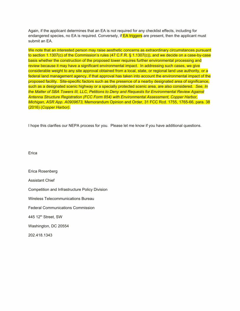
Again, if the applicant determines that an EA is not required for any checklist effects, including for endangered species, no EA is required. Conversely, if EA triggers are present, then the applicant must submit an EA.
We note that an interested person may raise aesthetic concerns as extraordinary circumstances pursuant to section 1.1307(c) of the Commission’s rules (47 C.F.R. § 1.1307(c)), and we decide on a case-by-case basis whether the construction of the proposed tower requires further environmental processing and review because it may have a significant environmental impact. In addressing such cases, we give considerable weight to any site approval obtained from a local, state, or regional land use authority, or a federal land management agency, if that approval has taken into account the environmental impact of the proposed facility. Site-specific factors such as the presence of a nearby designated area of significance, such as a designated scenic highway or a specially protected scenic area, are also considered. See, In the Matter of SBA Towers III, LLC, Petitions to Deny and Requests for Environmental Review Against Antenna Structure Registration (FCC Form 854) with Environmental Assessment, Copper Harbor, Michigan, ASR App. A0909673, Memorandum Opinion and Order, 31 FCC Rcd. 1755, 1765-66, para. 38 (2016) (Copper Harbor).
I hope this clarifies our NEPA process for you. Please let me know if you have additional questions.
Erica
Erica Rosenberg
Assistant Chief
Competition and Infrastructure Policy Division
Wireless Telecommunications Bureau
Federal Communications Commission
445 12th Street, SW
Washington, DC 20554
202.418.1343
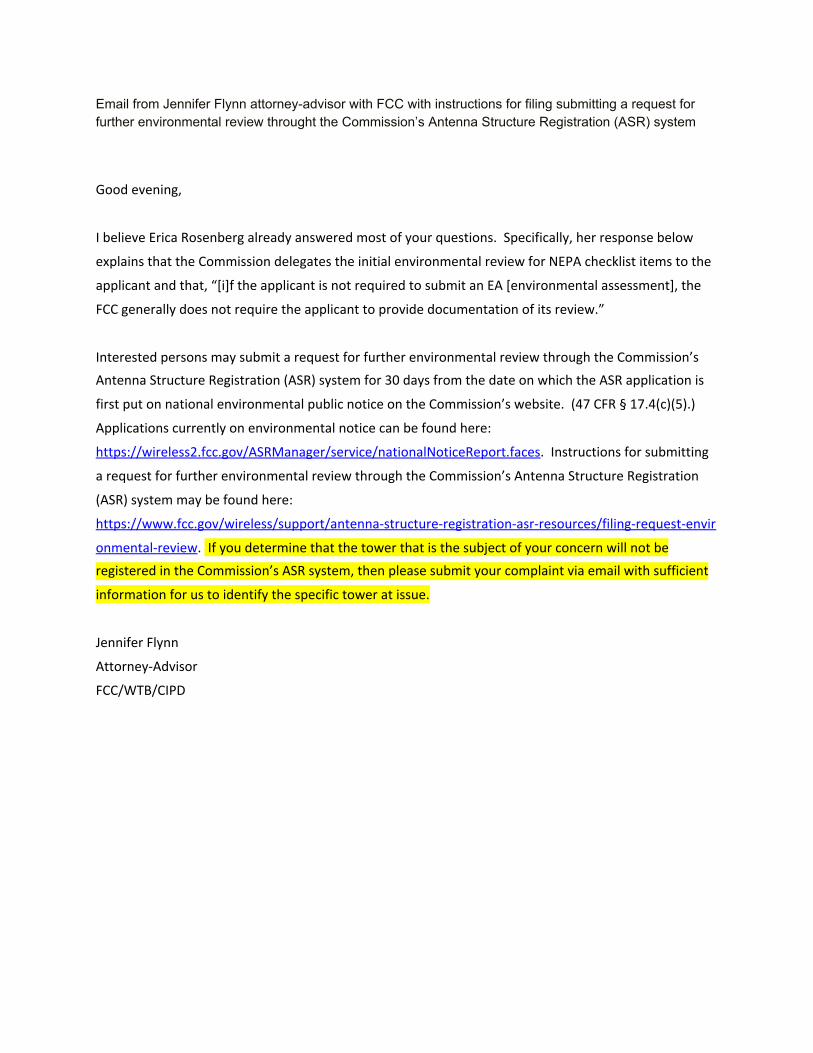
Email from Jennifer Flynn attorney-advisor with FCC with instructions for filing submitting a request for further environmental review throught the Commission’s Antenna Structure Registration (ASR) system
Good evening,
I believe Erica Rosenberg already answered most of your questions. Specifically, her response below
explains that the Commission delegates the initial environmental review for NEPA checklist items to the
applicant and that, “[i]f the applicant is not required to submit an EA [environmental assessment], the
FCC generally does not require the applicant to provide documentation of its review.”
Interested persons may submit a request for further environmental review through the Commission’s
Antenna Structure Registration (ASR) system for 30 days from the date on which the ASR application is
first put on national environmental public notice on the Commission’s website. (47 CFR § 17.4(c)(5).)
Applications currently on environmental notice can be found here:
https://wireless2.fcc.gov/ASRManager/service/nationalNoticeReport.faces. Instructions for submitting
a request for further environmental review through the Commission’s Antenna Structure Registration
(ASR) system may be found here:
https://www.fcc.gov/wireless/support/antenna-structure-registration-asr-resources/filing-request-envir
onmental-review. If you determine that the tower that is the subject of your concern will not be
registered in the Commission’s ASR system, then please submit your complaint via email with sufficient
information for us to identify the specific tower at issue.
Jennifer Flynn
Attorney-Advisor
FCC/WTB/CIPD
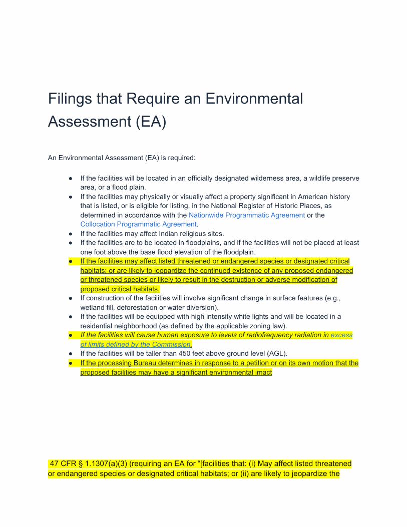
Filings that Require an Environmental Assessment (EA)
An Environmental Assessment (EA) is required:
● If the facilities will be located in an officially designated wilderness area, a wildlife preservearea, or a flood plain.
● If the facilities may physically or visually affect a property significant in American historythat is listed, or is eligible for listing, in the National Register of Historic Places, asdetermined in accordance with the Nationwide Programmatic Agreement or theCollocation Programmatic Agreement.
● If the facilities may affect Indian religious sites.● If the facilities are to be located in floodplains, and if the facilities will not be placed at least
one foot above the base flood elevation of the floodplain.● If the facilities may affect listed threatened or endangered species or designated critical
habitats; or are likely to jeopardize the continued existence of any proposed endangeredor threatened species or likely to result in the destruction or adverse modification ofproposed critical habitats.
● If construction of the facilities will involve significant change in surface features (e.g.,wetland fill, deforestation or water diversion).
● If the facilities will be equipped with high intensity white lights and will be located in aresidential neighborhood (as defined by the applicable zoning law).
● If the facilities will cause human exposure to levels of radiofrequency radiation in excessof limits defined by the Commission.
● If the facilities will be taller than 450 feet above ground level (AGL).● If the processing Bureau determines in response to a petition or on its own motion that the
proposed facilities may have a significant environmental imact
47 CFR § 1.1307(a)(3) (requiring an EA for “[facilities that: (i) May affect listed threatened or endangered species or designated critical habitats; or (ii) are likely to jeopardize the

continued existence of any proposed endangered or threatened species or likely to result in the destruction or adverse modification of proposed critical habitats, as determined by the Secretary of the Interior pursuant to the Endangered Species Act of 1973”
(2)
(i) Mobile and portable transmitting devices that operate in the
Commercial Mobile Radio Services pursuant to part 20 of this chapter;
the Cellular Radiotelephone Service pursuant to part 22 of this chapter;
the Personal Communications Services (PCS) pursuant to part 24 of this
chapter; the Satellite Communications Services pursuant to part 25 of
this chapter; the Miscellaneous Wireless Communications Services
pursuant to part 27 of this chapter; the Upper Microwave Flexible User
Service pursuant to part 30 of this chapter; the Maritime Services (ship
earth stations only) pursuant to part 80 of this chapter; the Specialized
Mobile Radio Service, the 4.9 GHz Band Service, and the 3650 MHz
Wireless Broadband Service pursuant to part 90 of this chapter; the
Wireless Medical Telemetry Service (WMTS), the Medical Device
Radiocommunication Service (MedRadio), and the 76-81 GHz Band
Radar Service pursuant to part 95 of this chapter; and the Citizens
Broadband Radio Service pursuant to part 96 of this chapter are subject
to routine environmental evaluation for RF exposure prior to equipment
authorization or use, as specified in §§ 2.1091 and 2.1093 of this
chapter.
(ii) Unlicensed PCS, unlicensed NII, and millimeter-wave devices are
also subject to routine environmental evaluation for RF exposure prior to
equipment authorization or use, as specified in §§ 15.255(f) , 15.257(g) ,15.319(i) , and 15.407(f) of this chapter.
(iii) Portable transmitting equipment for use in the Wireless Medical
Telemetry Service (WMTS) is subject to routine environmental
evaluation as specified in §§ 2.1093 and 95.2385 of this chapter.
(iv) Equipment authorized for use in the Medical Device
Radiocommunication Service (MedRadio) as a medical implant device or
body-worn transmitter (as defined in subpart I of part 95 of this chapter)
is subject to routine environmental evaluation for RF exposure prior to
equipment authorization, as specified in §§ 2.1093 and 95.2585 of this
chapter by finite difference time domain (FDTD) computational modeling
or laboratory measurement techniques. Where a showing is based on
computational modeling, the Commission retains the discretion to
request that supporting documentation and/or specific absorption rate
(SAR) measurement data be submitted.
(v) All other mobile, portable, and unlicensed transmitting devices are
categorically excluded from routine environmental evaluation for RF
exposure under §§ 2.1091 , 2.1093 of this chapter except as specified in
paragraphs (c) and (d) of this section.
(3) In general, when the guidelines specified in § 1.1310 are exceeded in
an accessible area due to the emissions from multiple fixed transmitters,
actions necessary to bring the area into compliance are the shared
responsibility of all licensees whose transmitters produce, at the area in
question, power density levels that exceed 5% of the power density
exposure limit applicable to their particular transmitter or field strength
levels that, when squared, exceed 5% of the square of the electric or
magnetic field strength limit applicable to their particular transmitter.
Owners of transmitter sites are expected to allow applicants and licensees
to take reasonable steps to comply with the requirements contained in §1.1307(b) and, where feasible, should encourage co-location of
transmitters and common solutions for controlling access to areas where
the RF exposure limits contained in § 1.1310 might be exceeded.
(i) Applicants for proposed (not otherwise excluded) transmitters,
facilities or modifications that would cause non-compliance with the
limits specified in § 1.1310 at an accessible area previously in
compliance must submit an EA if emissions from the applicant'stransmitter or facility would result, at the area in question, in a power
density that exceeds 5% of the power density exposure limit applicable
to that transmitter or facility or in a field strength that, when squared,
exceeds 5% of the square of the electric or magnetic field strength limit
applicable to that transmitter or facility.
(ii) Renewal applicants whose (not otherwise excluded) transmitters or
facilities contribute to the field strength or power density at an
accessible area not in compliance with the limits specified in § 1.1310
must submit an EA if emissions from the applicant's transmitter or
facility results, at the area in question, in a power density that exceeds
5% of the power density exposure limit applicable to that transmitter or
facility or in a field strength that, when squared, exceeds 5% of the

square of the electric or magnetic field strength limit applicable to that
transmitter of facility.
(c) If an interested person alleges that a particular action, otherwise
categorically excluded, will have a significant environmental effect, the
person shall submit to the Bureau responsible for processing that action a
written petition setting forth in detail the reasons justifying or circumstances
necessitating environmental consideration in the decision-making process.
(See § 1.1313 ). The Bureau shall review the petition and consider the
environmental concerns that have been raised. If the Bureau determines
that the action may have a significant environmental impact, the Bureau will
require the applicant to prepare an EA (see §§ 1.1308 and 1.1311), which
will serve as the basis for the determination to proceed with or terminate
environmental processing.
(d) If the Bureau responsible for processing a particular action, otherwise
categorically excluded, determines that the proposal may have a significant
environmental impact, the Bureau, on its own motion, shall require the
applicant to submit an EA. The Bureau will review and consider the EA as in
paragraph (c) of this section.
Note to paragraph (D):
Pending a final determination as to what, if any, permanent measures should
be adopted specifically for the protection of migratory birds, the Bureau shall
require an Environmental Assessment for an otherwise categorically
excluded action involving a new or existing antenna structure, for which an
antenna structure registration application (FCC Form 854) is required under
part 17 of this chapter, if the proposed antenna structure will be over 450
feet in height above ground level (AGL) and involves either: 1. Construction
of a new antenna structure; 2. Modification or replacement of an existing
antenna structure involving a substantial increase in size as defined in
paragraph I(C)(1)(3) of Appendix B to part 1 of this chapter; or 3. Addition
of lighting or adoption of a less preferred lighting style as defined in §
17.4(c)(1)(iii) of this chapter. The Bureau shall consider whether to require
an EA for other antenna structures subject to § 17.4(c) of this chapter in
accordance with § 17.4(c)(8) of this chapter. An Environmental Assessment
required pursuant to this note will be subject to the same procedures that
apply to any Environmental Assessment required for a proposed tower or
modification of an existing tower for which an antenna structure registration
application (FCC Form 854) is required, as set forth in § 17.4(c) of this
chapter.
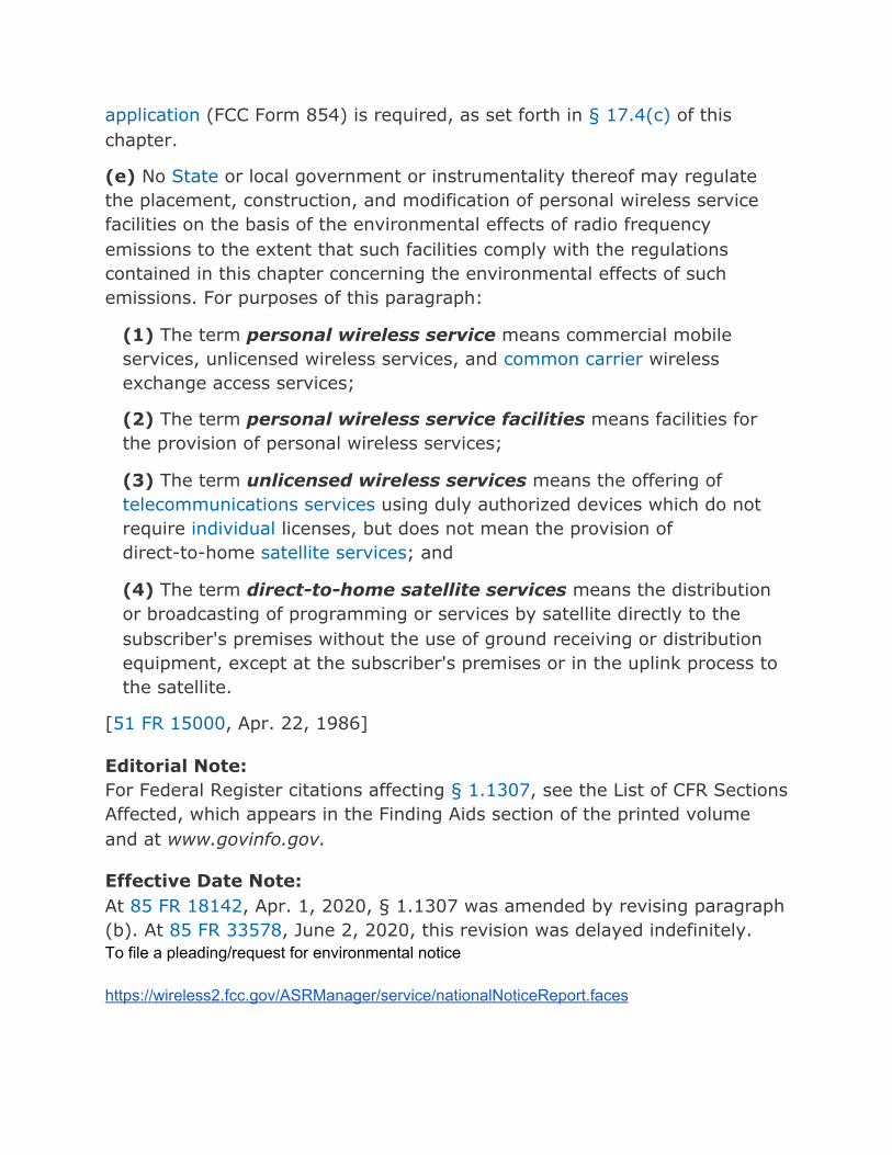
(e) No State or local government or instrumentality thereof may regulate
the placement, construction, and modification of personal wireless service
facilities on the basis of the environmental effects of radio frequency
emissions to the extent that such facilities comply with the regulations
contained in this chapter concerning the environmental effects of such
emissions. For purposes of this paragraph:
(1) The term personal wireless service means commercial mobile
services, unlicensed wireless services, and common carrier wireless
exchange access services;
(2) The term personal wireless service facilities means facilities for
the provision of personal wireless services;
(3) The term unlicensed wireless services means the offering of
telecommunications services using duly authorized devices which do not
require individual licenses, but does not mean the provision of
direct-to-home satellite services ; and
(4) The term direct-to-home satellite services means the distribution
or broadcasting of programming or services by satellite directly to the
subscriber's premises without the use of ground receiving or distribution
equipment, except at the subscriber's premises or in the uplink process to
the satellite.
[51 FR 15000, Apr. 22, 1986]
Editorial Note:
For Federal Register citations affecting § 1.1307 , see the List of CFR Sections
Affected, which appears in the Finding Aids section of the printed volume
and at www.govinfo.gov.
Effective Date Note:
At 85 FR 18142, Apr. 1, 2020, § 1.1307 was amended by revising paragraph
(b). At 85 FR 33578, June 2, 2020, this revision was delayed indefinitely.
To file a pleading/request for environmental notice
https://wireless2.fcc.gov/ASRManager/service/nationalNoticeReport.faces

We have a list from the USFWS of threatened species known to be in the the area
Exhibit A
United States Department of the Interior
FISH AND WILDLIFE SERVICE Oregon Fish And Wildlife Office
2600 Southeast 98th Avenue, Suite 100 Portland, OR 97266-1398
Phone: (503) 231-6179 Fax: (503) 231-6195 https://www.fws.gov/oregonfwo/articles.cfm?id=149489416
In Reply Refer To: Consultation Code: 01EOFW00-2020-SLI-0595
Event Code: 01EOFW00-2020-E-01240 Project Name: WCF woodard/seidl properties September 22, 2020
Subject: List of threatened and endangered species that may occur in your proposed project location, and/or may be affected by your proposed project
To Whom It May Concern:
The enclosed species list identifies threatened, endangered, proposed and candidate species, as well as proposed and final designated critical habitat, that may occur within the boundary of your proposed project and/or may be affected by your proposed project. The species list fulfills the requirements of the U.S. Fish and Wildlife Service (Service) under section 7(c) of the Endangered Species Act (Act) of 1973, as amended (16 U.S.C. 1531 et seq.).
New information based on updated surveys, changes in the abundance and distribution of species, changed habitat conditions, or other factors could change this list. Please feel free to contact us if you need more current information or assistance regarding the potential impacts to federally proposed, listed, and candidate species and federally designated and proposed critical habitat. Please note that under 50 CFR 402.12(e) of the regulations implementing section 7 of the Act, the accuracy of this species list should be verified after 90 days. This verification can be completed formally or informally as desired. The Service recommends that verification be completed by visiting the ECOS-IPaC website at regular intervals during project planning and implementation for updates to species lists and information. An updated list may be requested through the ECOS-IPaC system by completing the same process used to receive the enclosed list.
The purpose of the Act is to provide a means whereby threatened and endangered species and the ecosystems upon which they depend may be conserved. Under sections 7(a)(1) and 7(a)(2) of the Act and its implementing regulations (50 CFR 402 et seq.), Federal agencies are required to utilize their authorities to carry out programs for the conservation of threatened and endangered species and to determine whether projects may affect threatened and endangered species and/or designated critical habitat.
09/22/2020 Event Code: 01EOFW00-2020-E-01240 2
A Biological Assessment is required for construction projects (or other undertakings having
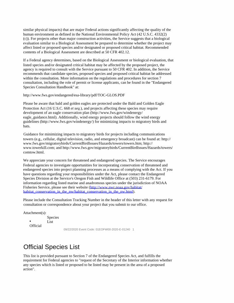
similar physical impacts) that are major Federal actions significantly affecting the quality of the human environment as defined in the National Environmental Policy Act (42 U.S.C. 4332(2) (c)). For projects other than major construction activities, the Service suggests that a biological evaluation similar to a Biological Assessment be prepared to determine whether the project may affect listed or proposed species and/or designated or proposed critical habitat. Recommended contents of a Biological Assessment are described at 50 CFR 402.12.
If a Federal agency determines, based on the Biological Assessment or biological evaluation, that listed species and/or designated critical habitat may be affected by the proposed project, the agency is required to consult with the Service pursuant to 50 CFR 402. In addition, the Service recommends that candidate species, proposed species and proposed critical habitat be addressed within the consultation. More information on the regulations and procedures for section 7 consultation, including the role of permit or license applicants, can be found in the "Endangered Species Consultation Handbook" at:
http://www.fws.gov/endangered/esa-library/pdf/TOC-GLOS.PDF
Please be aware that bald and golden eagles are protected under the Bald and Golden Eagle Protection Act (16 U.S.C. 668 et seq.), and projects affecting these species may require development of an eagle conservation plan (http://www.fws.gov/windenergy/ eagle_guidance.html). Additionally, wind energy projects should follow the wind energy guidelines (http://www.fws.gov/windenergy/) for minimizing impacts to migratory birds and bats.
Guidance for minimizing impacts to migratory birds for projects including communications towers (e.g., cellular, digital television, radio, and emergency broadcast) can be found at: http:// www.fws.gov/migratorybirds/CurrentBirdIssues/Hazards/towers/towers.htm; http:// www.towerkill.com; and http://www.fws.gov/migratorybirds/CurrentBirdIssues/Hazards/towers/ comtow.html.
We appreciate your concern for threatened and endangered species. The Service encourages Federal agencies to investigate opportunities for incorporating conservation of threatened and endangered species into project planning processes as a means of complying with the Act. If you have questions regarding your responsibilities under the Act, please contact the Endangered Species Division at the Service's Oregon Fish and Wildlife Office at (503) 231-6179. For information regarding listed marine and anadromous species under the jurisdiction of NOAA Fisheries Service, please see their website (http://www.nwr.noaa.gov/habitat/ habitat_conservation_in_the_nw/habitat_conservation_in_the_nw.html).
Please include the Consultation Tracking Number in the header of this letter with any request for consultation or correspondence about your project that you submit to our office.
Attachment(s):
▪ Official
Species List
09/22/2020 Event Code: 01EOFW00-2020-E-01240 1
Official Species List This list is provided pursuant to Section 7 of the Endangered Species Act, and fulfills the requirement for Federal agencies to "request of the Secretary of the Interior information whether any species which is listed or proposed to be listed may be present in the area of a proposed action".

This species list is provided by:
Oregon Fish And Wildlife Office 2600 Southeast 98th Avenue, Suite 100 Portland, OR 97266-1398 (503) 231-6179
09/22/2020 Event Code: 01EOFW00-2020-E-01240 2
Project Summary Consultation Code: 01EOFW00-2020-SLI-0595
Event Code: 01EOFW00-2020-E-01240
Project Name: WCF woodard/seidl properties
Project Type: LAND - PRESERVATION
Project Description: migratory birds in our region and the impact of a 156'lighted cell tower on their flight patterns, habitat, breeding, etc
Project Location: Approximate location of the project can be viewed in Google Maps: https:// www.google.com/maps/place/45.524900839474896N122.36085055784976W
Counties: Multnomah, OR 09/22/2020 Event Code: 01EOFW00-2020-E-01240 3
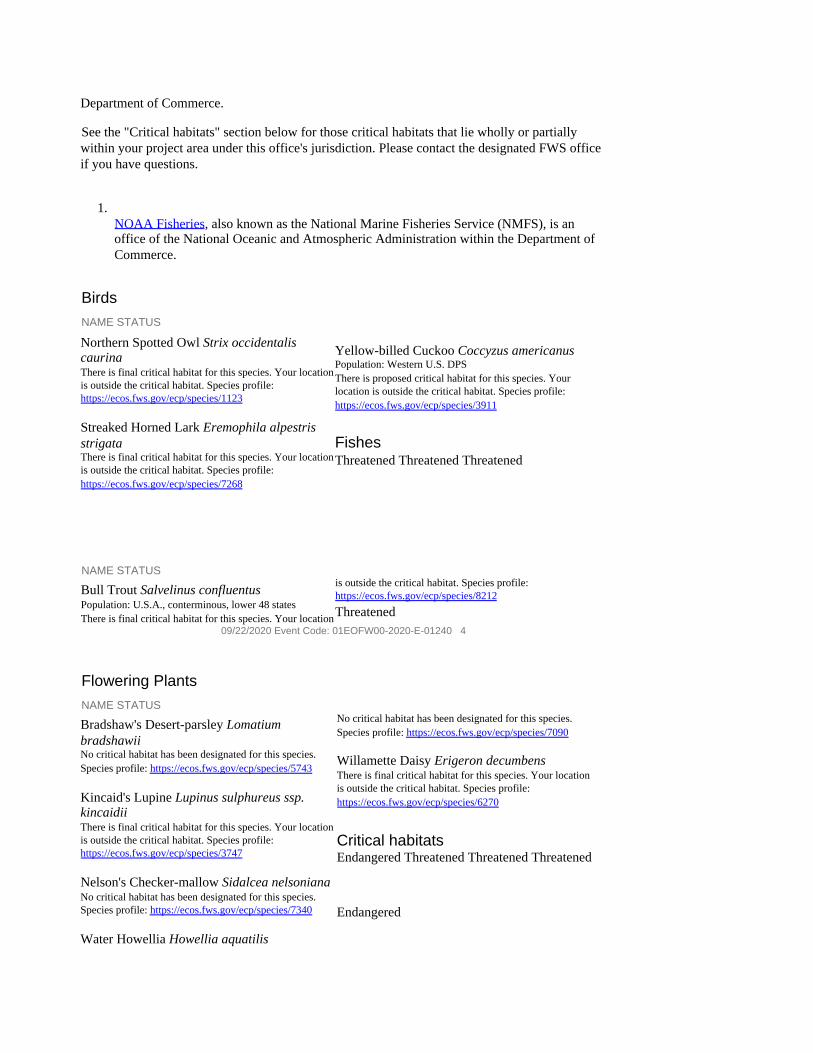
Endangered Species Act Species There is a total of 9 threatened, endangered, or candidate species on this species list.
Species on this list should be considered in an effects analysis for your project and could include species that exist in another geographic area. For example, certain fish may appear on the species list because a project could affect downstream species.
IPaC does not display listed species or critical habitats under the sole jurisdiction of NOAA 1
Fisheries , as USFWS does not have the authority to speak on behalf of NOAA and the
Department of Commerce.
See the "Critical habitats" section below for those critical habitats that lie wholly or partially within your project area under this office's jurisdiction. Please contact the designated FWS office if you have questions.
1. NOAA Fisheries, also known as the National Marine Fisheries Service (NMFS), is an office of the National Oceanic and Atmospheric Administration within the Department of Commerce.
Birds NAME STATUS
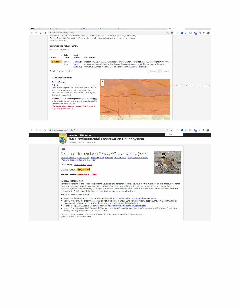
Northern Spotted Owl Strix occidentalis caurina There is final critical habitat for this species. Your location is outside the critical habitat. Species profile: https://ecos.fws.gov/ecp/species/1123
Streaked Horned Lark Eremophila alpestris strigata There is final critical habitat for this species. Your location is outside the critical habitat. Species profile: https://ecos.fws.gov/ecp/species/7268
Yellow-billed Cuckoo Coccyzus americanus Population: Western U.S. DPS There is proposed critical habitat for this species. Your location is outside the critical habitat. Species profile: https://ecos.fws.gov/ecp/species/3911
Fishes Threatened Threatened Threatened
NAME STATUS
Bull Trout Salvelinus confluentus Population: U.S.A., conterminous, lower 48 states There is final critical habitat for this species. Your location
is outside the critical habitat. Species profile: https://ecos.fws.gov/ecp/species/8212 Threatened
09/22/2020 Event Code: 01EOFW00-2020-E-01240 4
Flowering Plants NAME STATUS
Bradshaw's Desert-parsley Lomatium bradshawii No critical habitat has been designated for this species. Species profile: https://ecos.fws.gov/ecp/species/5743
Kincaid's Lupine Lupinus sulphureus ssp. kincaidii There is final critical habitat for this species. Your location is outside the critical habitat. Species profile: https://ecos.fws.gov/ecp/species/3747
Nelson's Checker-mallow Sidalcea nelsoniana No critical habitat has been designated for this species. Species profile: https://ecos.fws.gov/ecp/species/7340
Water Howellia Howellia aquatilis
No critical habitat has been designated for this species. Species profile: https://ecos.fws.gov/ecp/species/7090
Willamette Daisy Erigeron decumbens There is final critical habitat for this species. Your location is outside the critical habitat. Species profile: https://ecos.fws.gov/ecp/species/6270
Critical habitats Endangered Threatened Threatened Threatened
Endangered

THERE ARE NO CRITICAL HABITATS WITHIN YOUR PROJECT AREA UNDER THIS OFFICE'S JURISDICTION.
USFWS guidance/ Exhibit B https://ecos.fws.gov/ecp/report/species-listings-by-current-range-county?fips=41051 Threatened species in mult co.

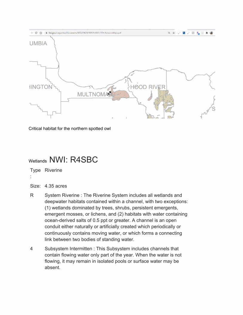
Critical habitat for the northern spotted owl
Wetlands NWI: R4SBC Type:
Riverine
Size: 4.35 acres
R System Riverine : The Riverine System includes all wetlands and deepwater habitats contained within a channel, with two exceptions: (1) wetlands dominated by trees, shrubs, persistent emergents, emergent mosses, or lichens, and (2) habitats with water containing ocean-derived salts of 0.5 ppt or greater. A channel is an open conduit either naturally or artificially created which periodically or continuously contains moving water, or which forms a connecting link between two bodies of standing water.
4 Subsystem Intermitten : This Subsystem includes channels that contain flowing water only part of the year. When the water is not flowing, it may remain in isolated pools or surface water may be absent.

SB Class Streambed : Includes all wetlands contained within the Intermittent Subsystem of the Riverine System and all channels of the Estuarine System or of the Tidal Subsystem of the Riverine System that are completely dewatered at low tide.
C Class Seasonally Flooded : Surface water is present for extended periods especially early in the growing season, but is absent by the end of the growing season in most years. The water table after flooding ceases is variable, extending from saturated to the surface to a water table well below the ground surface.
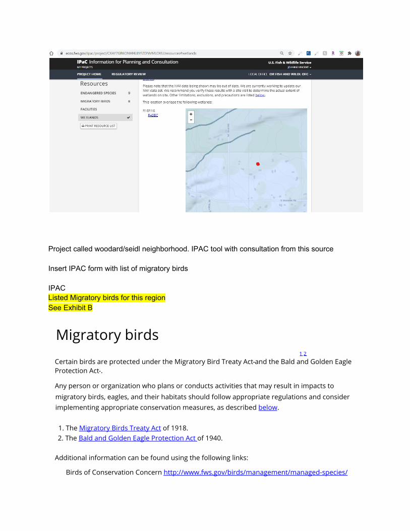
Project called woodard/seidl neighborhood. IPAC tool with consultation from this source Insert IPAC form with list of migratory birds IPAC Listed Migratory birds for this region See Exhibit B
Migratory birds 1 2
Certain birds are protected under the Migratory Bird Treaty Act and the Bald and Golden Eagle Protection Act .
Any person or organization who plans or conducts activities that may result in impacts to migratory birds, eagles, and their habitats should follow appropriate regulations and consider implementing appropriate conservation measures, as described below.
1. The Migratory Birds Treaty Act of 1918. 2. The Bald and Golden Eagle Protection Act of 1940.
Additional information can be found using the following links:
Birds of Conservation Concern http://www.fws.gov/birds/management/managed-species/
birds-of-conservation-concern.php Measures for avoiding and minimizing impacts to birds http://www.fws.gov/birds/management/project-assessment-tools and-guidance/ conservation-measures.php Nationwide conservation measures for birds http://www.fws.gov/migratorybirds/pdf/management/nationwidestandardconservationmeasures.pdf
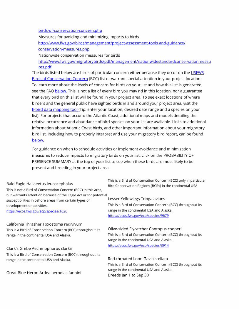
The birds listed below are birds of particular concern either because they occur on the USFWS Birds of Conservation Concern (BCC) list or warrant special attention in your project location. To learn more about the levels of concern for birds on your list and how this list is generated, see the FAQ below. This is not a list of every bird you may nd in this location, nor a guarantee that every bird on this list will be found in your project area. To see exact locations of where birders and the general public have sighted birds in and around your project area, visit the E-bird data mapping tool (Tip: enter your location, desired date range and a species on your list). For projects that occur o the Atlantic Coast, additional maps and models detailing the relative occurrence and abundance of bird species on your list are available. Links to additional information about Atlantic Coast birds, and other important information about your migratory bird list, including how to properly interpret and use your migratory bird report, can be found below.
For guidance on when to schedule activities or implement avoidance and minimization measures to reduce impacts to migratory birds on your list, click on the PROBABILITY OF PRESENCE SUMMARY at the top of your list to see when these birds are most likely to be present and breeding in your project area.
Bald Eagle Haliaeetus leucocephalus This is not a Bird of Conservation Concern (BCC) in this area, but warrants attention because of the Eagle Act or for potential susceptibilities in oshore areas from certain types of development or activities. https://ecos.fws.gov/ecp/species/1626
California Thrasher Toxostoma redivivum This is a Bird of Conservation Concern (BCC) throughout its range in the continental USA and Alaska.
Clark's Grebe Aechmophorus clarkii This is a Bird of Conservation Concern (BCC) throughout its range in the continental USA and Alaska.
Great Blue Heron Ardea herodias fannini
This is a Bird of Conservation Concern (BCC) only in particular Bird Conservation Regions (BCRs) in the continental USA
Lesser Yellowlegs Tringa avipes This is a Bird of Conservation Concern (BCC) throughout its range in the continental USA and Alaska. https://ecos.fws.gov/ecp/species/9679
Olive-sided Flycatcher Contopus cooperi This is a Bird of Conservation Concern (BCC) throughout its range in the continental USA and Alaska. https://ecos.fws.gov/ecp/species/3914
Red-throated Loon Gavia stellata This is a Bird of Conservation Concern (BCC) throughout its range in the continental USA and Alaska. Breeds Jan 1 to Sep 30

Breeds Jan 1 to Jul 31 Breeds Jan 1 to Dec 31 Breeds Rufous Hummingbird selasphorus rufus This is a Bird of Conservation Concern (BCC) throughout its range in the continental USA and Alaska. https://ecos.fws.gov/ecp/species/8002
USFWS oce(s) with jurisdiction in the dened project area. Please read the introduction to each
Project information NAME
WCF woodard/seidl properties
LOCATION
Multnomah County, Oregon
DESCRIPTION
migratory birds in our region and the impact of a 156'lighted cell tower on their flight patterns, habitat, breeding, etc
Local oce Oregon Fish And Wildlife Oce
(503) 231-6179 (503) 231-6195
2600 Southeast 98th Avenue, Suite 100 Portland, OR 97266-1398
https://www.fws.gov/oregonfwo/articles.cfm?id=149489416
Endangered species

This resource list is for informational purposes only and does not constitute an analysis of project level impacts.
The primary information used to generate this list is the known or expected range of each species. Additional areas of influence (AOI) for species are also considered. An AOI includes areas outside of the species range if the species could be indirectly affected by activities in that area (e.g., placing a dam upstream of a sh population, even if that sh does not occur at the dam site, may indirectly impact the species by reducing or eliminating water ow downstream). Because species can move, and site conditions can change, the species on this list are not guaranteed to be found on or near the project area. To fully determine any potential effects to species, additional site-specific and project-specific information is often required.
Section 7 of the Endangered Species Act requires Federal agencies to "request of the Secretary information whether any species which is listed or proposed to be listed may be present in the area of such proposed action" for any project that is conducted, permitted, funded, or licensed by any Federal agency. A letter from the local oce and a species list which fails this requirement can only be obtained by requesting an official species list from either the Regulatory Review section in IPaC (see directions below) or from the local eld oce directly.
For project evaluations that require USFWS concurrence/review, please return to the IPaC website and request an ocial species list by doing the following:
1. Log in to IPaC. 2. Go to your My Projects list. 3. Click PROJECT HOME for this project. 4. Click REQUEST SPECIES LIST.
1
Listed species and their critical habitats are managed by the Ecological Services Program office 2
(USFWS) and the sheries division of the National Oceanic and Atmospheric Administration (NOAA Fisheries ).
Species and critical habitats under the sole responsibility of NOAA Fisheries are not shown on this list. Please contact NOAA Fisheries for species under their jurisdiction.
1. Species listed under the Endangered Species Act are threatened or endangered; IPaC also shows species that are candidates, or proposed, for listing. See the listing status page for more information.
2. NOAA Fisheries, also known as the National Marine Fisheries Service (NMFS), is an oce of the National Oceanic and Atmospheric Administration within the Department of Commerce.
The following species are potentially aected by activities in this location:

Birds NAME STATUS
Northern Spotted Owl Strix occidentalis caurina There is nal critical habitat for this species. Your location is outside the critical habitat. https://ecos.fws.gov/ecp/species/1123
Streaked Horned Lark Eremophila alpestris strigata There is nal critical habitat for this species. Your location is outside the critical habitat. https://ecos.fws.gov/ecp/species/7268
Yellow-billed Cuckoo Coccyzus americanus There is proposed critical habitat for this species. Your location is outside the critical habitat. https://ecos.fws.gov/ecp/species/3911
Fishes Threatened Threatened Threatened
NAME STATUS Bull Trout Salvelinus conuentus There is nal critical habitat for this species. Your location is outside the critical habitat. https://ecos.fws.gov/ecp/species/8212
Flowering Plants
Threatened
NAME STATUS
Bradshaw's Desert-parsley Lomatium bradshawii No critical habitat has been designated for this species. https://ecos.fws.gov/ecp/species/5743
Kincaid's Lupine Lupinus sulphureus ssp. kincaidii There is nal critical habitat for this species. Your location is outside the critical habitat.
https://ecos.fws.gov/ecp/species/3747
Nelson's Checker-mallow Sidalcea nelsoniana No critical habitat has been designated for this species. https://ecos.fws.gov/ecp/species/7340
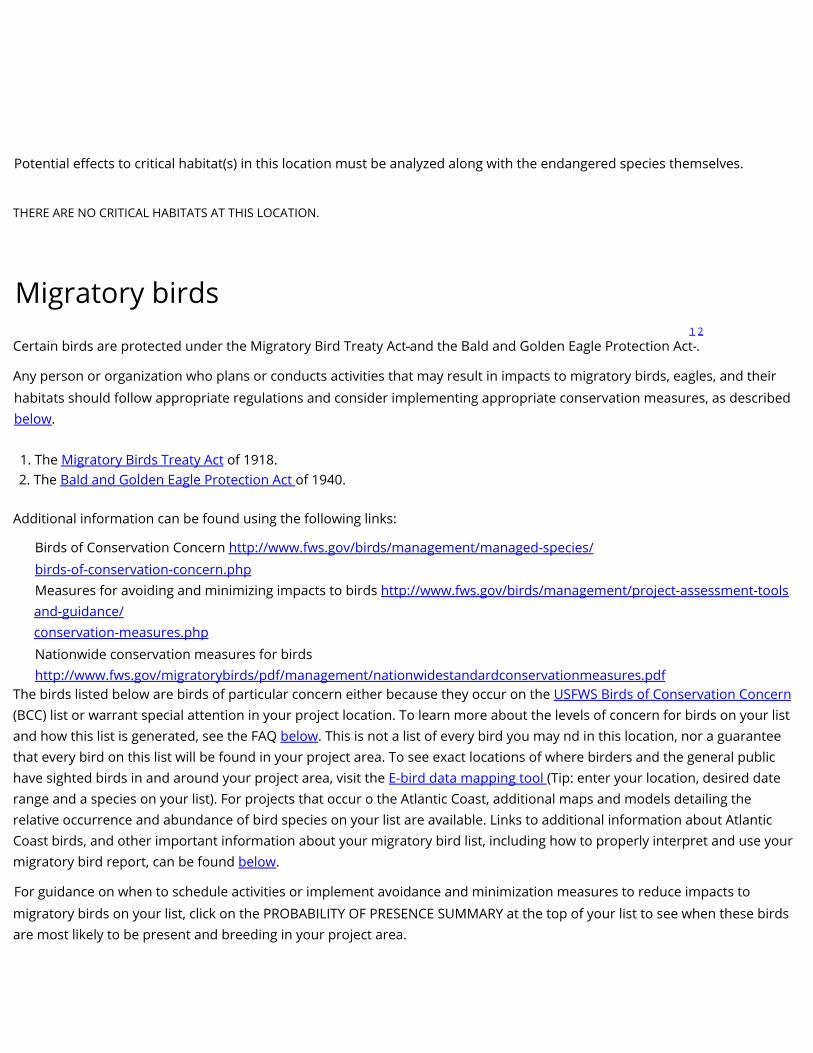
Potential effects to critical habitat(s) in this location must be analyzed along with the endangered species themselves.
THERE ARE NO CRITICAL HABITATS AT THIS LOCATION.
Migratory birds 1 2
Certain birds are protected under the Migratory Bird Treaty Act and the Bald and Golden Eagle Protection Act .
Any person or organization who plans or conducts activities that may result in impacts to migratory birds, eagles, and their habitats should follow appropriate regulations and consider implementing appropriate conservation measures, as described below.
1. The Migratory Birds Treaty Act of 1918. 2. The Bald and Golden Eagle Protection Act of 1940.
Additional information can be found using the following links:
Birds of Conservation Concern http://www.fws.gov/birds/management/managed-species/ birds-of-conservation-concern.php Measures for avoiding and minimizing impacts to birds http://www.fws.gov/birds/management/project-assessment-tools and-guidance/ conservation-measures.php Nationwide conservation measures for birds http://www.fws.gov/migratorybirds/pdf/management/nationwidestandardconservationmeasures.pdf
The birds listed below are birds of particular concern either because they occur on the USFWS Birds of Conservation Concern (BCC) list or warrant special attention in your project location. To learn more about the levels of concern for birds on your list and how this list is generated, see the FAQ below. This is not a list of every bird you may nd in this location, nor a guarantee that every bird on this list will be found in your project area. To see exact locations of where birders and the general public have sighted birds in and around your project area, visit the E-bird data mapping tool (Tip: enter your location, desired date range and a species on your list). For projects that occur o the Atlantic Coast, additional maps and models detailing the relative occurrence and abundance of bird species on your list are available. Links to additional information about Atlantic Coast birds, and other important information about your migratory bird list, including how to properly interpret and use your migratory bird report, can be found below.
For guidance on when to schedule activities or implement avoidance and minimization measures to reduce impacts to migratory birds on your list, click on the PROBABILITY OF PRESENCE SUMMARY at the top of your list to see when these birds are most likely to be present and breeding in your project area.

NAME BREEDING SEASON (IF A BREEDING SEASON IS INDICATED FOR A BIRD ON YOUR LIST,
THE BIRD MAY BREED IN YOUR PROJECT
AREA SOMETIME WITHIN THE TIMEFRAME
SPECIFIED, WHICH IS A VERY LIBERAL
ESTIMATE OF THE DATES INSIDE WHICH
THE BIRD BREEDS ACROSS ITS ENTIRE
RANGE. "BREEDS ELSEWHERE" INDICATES
THAT THE BIRD DOES NOT LIKELY BREED IN
YOUR PROJECT AREA.)
Bald Eagle Haliaeetus leucocephalus This is not a Bird of Conservation Concern (BCC) in this area, but warrants attention because of the Eagle Act or for potential susceptibilities in offshore areas from certain types of development or activities. https://ecos.fws.gov/ecp/species/1626
California Thrasher Toxostoma redivivum This is a Bird of Conservation Concern (BCC) throughout its range in the continental USA and Alaska.
Clark's Grebe Aechmophorus clarkii This is a Bird of Conservation Concern (BCC) throughout its range in the continental USA and Alaska.
Great Blue Heron Ardea herodias fannini This is a Bird of Conservation Concern (BCC) only in particular Bird Conservation Regions (BCRs) in the continental USA
Lesser Yellowlegs Tringa avipes This is a Bird of Conservation Concern (BCC) throughout its range in the continental USA and Alaska. https://ecos.fws.gov/ecp/species/9679
Olive-sided Flycatcher Contopus cooperi This is a Bird of Conservation Concern (BCC) throughout its range in the continental USA and Alaska. https://ecos.fws.gov/ecp/species/3914
Red-throated Loon Gavia stellata This is a Bird of Conservation Concern (BCC) throughout its
range in the continental USA and Alaska. Breeds Jan 1 to Sep 30
Breeds Jan 1 to Jul 31 Breeds Jan 1 to Dec 31 Breeds
Mar 15 to Aug 15 Breeds elsewhere
Breeds May 20 to Aug 31 Breeds elsewhere
Rufous Hummingbird selasphorus rufus This is a Bird of Conservation Concern (BCC) throughout its range in the continental USA and Alaska. https://ecos.fws.gov/ecp/species/8002
Probability of Presence Summary Breeds Apr 15 to Jul 15

The graphs below provide our best understanding of when birds of concern are most likely to be present in your project area. This information can be used to tailor and schedule your project activities to avoid or minimize impacts to birds. Please make sure you read and understand the FAQ “Proper Interpretation and Use of Your Migratory Bird Report” before using or attempting to interpret this report.
Probability of Presence ( )
Each green bar represents the bird's relative probability of presence in the 10km grid cell(s) your project overlaps during a particular week of the year. (A year is represented as 12 4-week months.) A taller bar indicates a higher probability of species presence. The survey eort (see below) can be used to establish a level of condence in the presence score. One can have higher condence in the presence score if the corresponding survey eort is also high.
How is the probability of presence score calculated? The calculation is done in three steps:
1. The probability of presence for each week is calculated as the number of survey events in the week where the species was detected divided by the total number of survey events for that week. For example, if in week 12 there were 20 survey events and the Spotted Towhee was found in 5 of them, the probability of presence of the Spotted Towhee in week 12 is 0.25.
2. To properly present the pattern of presence across the year, the relative probability of presence is calculated. This is the probability of presence divided by the maximum probability of presence across all weeks. For example, imagine the probability of presence in week 20 for the Spotted Towhee is 0.05, and that the probability of presence at week 12 (0.25) is the maximum of any week of the year. The relative probability of presence on week 12 is 0.25/0.25 = 1; at week 20 it is 0.05/0.25 = 0.2.
3. The relative probability of presence calculated in the previous step undergoes a statistical conversion so that all possible values fall between 0 and 10, inclusive. This is the probability of presence score.
To see a bar's probability of presence score, simply hover your mouse cursor over the bar.
Breeding Season ( ) Yellow bars denote a very liberal estimate of the time-frame inside which the bird breeds across its entire range. If there are no yellow bars shown for a bird, it does not breed in your project area.
Survey Eort ( ) Vertical black lines superimposed on probability of presence bars indicate the number of surveys performed for that species in the 10km grid cell(s) your project area overlaps. The number of surveys is expressed as a range, for example, 33 to 64 surveys.
To see a bar's survey eort range, simply hover your mouse cursor over the bar.
No Data ( )

A week is marked as having no data if there were no survey events for that week.
Survey Timeframe Surveys from only the last 10 years are used in order to ensure delivery of currently relevant information. The exception to this is areas o the Atlantic coast, where bird returns are based on all years of available data, since data in these areas is currently much more sparse.
probability of presence breeding season survey eort no data
SPECIES JAN FEB MAR APR MAY JUN JUL AUG SEP OCT NOV DEC Bald Eagle Non-BCC Vulnerable (This is not a Bird of Conservation Concern (BCC) in this area, but warrants attention because of the Eagle Act or for potential susceptibilities in oshore areas from certain types of development or activities.)
California Thrasher BCC Rangewide (CON) (This is a Bird of Conservation Concern (BCC) throughout its range in the continental USA and Alaska.)
Clark's Grebe BCC Rangewide (CON) (This is a Bird of Conservation Concern (BCC) throughout its range in the continental USA and Alaska.)
Great Blue Heron BCC - BCR (This is a Bird of Conservation Concern (BCC) only in particular Bird Conservation Regions (BCRs) in the continental USA)
Lesser Yellowlegs BCC Rangewide (CON) (This is a Bird of Conservation Concern (BCC) throughout its range in the continental USA and Alaska.)
Olive-sided Flycatcher BCC Rangewide (CON) (This is a Bird of Conservation Concern (BCC) throughout its range in the continental USA and Alaska.)
Red-throated Loon BCC Rangewide (CON) (This is a Bird of Conservation Concern (BCC) throughout

its range in the continental USA and Alaska.)
Rufous Hummingbird BCC Rangewide (CON) (This is a Bird of Conservation Concern (BCC) throughout its range in the continental USA and Alaska.)
Tell me more about conservation measures I can implement to avoid or minimize impacts to migratory birds.
Nationwide Conservation Measures describes measures that can help avoid and minimize impacts to all birds at any location year round. Implementation of these measures is particularly important when birds are most likely to occur in the project area. When birds may be breeding in the area, identifying the locations of any active nests and avoiding their destruction is a very helpful impact minimization measure. To see when birds are most likely to occur and be breeding in your project area, view the Probability of Presence Summary. Additional measures and/or permits may be advisable depending on the type of activity you are conducting and the type of infrastructure or bird species present on your project site.
What does IPaC use to generate the migratory birds potentially occurring in my specied location?
The Migratory Bird Resource List is comprised of USFWS Birds of Conservation Concern (BCC) and other species that may warrant special attention in your project location.
The migratory bird list generated for your project is derived from data provided by the Avian Knowledge Network (AKN). The AKN data is based
on a growing collection of survey, banding, and citizen science datasets and is queried and ltered to return a list of those birds reported as occurring in the 10km grid cell(s) which your project intersects, and that have been identied as warranting special attention because they are a BCC species in that area, an eagle (Eagle Act requirements may apply), or a species that has a particular vulnerability to oshore activities or development. Again, the Migratory Bird Resource list includes only a subset of birds that may occur in your project area. It is not representative of all birds that may occur in your project area. To get a list of all birds potentially present in your project area, please visit the AKN Phenology Tool.
What does IPaC use to generate the probability of presence graphs for the migratory birds potentially occurring in my specied location?
The probability of presence graphs associated with your migratory bird list are based on data provided by the Avian Knowledge Network (AKN). This data is derived from a growing collection of survey, banding, and citizen science datasets .
Probability of presence data is continuously being updated as new and better information becomes available. To learn more about how the probability of presence graphs are produced and how to interpret them, go the Probability of Presence Summary and then click on the "Tell me about these graphs" link.
How do I know if a bird is breeding, wintering, migrating or present year-round in my project area?
To see what part of a particular bird's range your project area falls within (i.e. breeding, wintering, migrating or year-round), you may refer to the following resources: The Cornell Lab of Ornithology All About Birds Bird Guide, or (if you are unsuccessful in locating the bird of interest there), the Cornell Lab of Ornithology Neotropical Birds guide. If a bird on your migratory bird species list has a breeding season associated with it, if that bird does occur in your project area, there may be nests present at some point within the timeframe specified. If "Breeds elsewhere" is indicated, then the bird likely does not breed in your project area.
What are the levels of concern for migratory birds?

Migratory birds delivered through IPaC fall into the following distinct categories of concern:
1. "BCC Rangewide" birds are Birds of Conservation Concern (BCC) that are of concern throughout their range anywhere within the USA (including Hawaii, the Pacic Islands, Puerto Rico, and the Virgin Islands);
2. "BCC - BCR" birds are BCCs that are of concern only in particular Bird Conservation Regions (BCRs) in the continental USA; and 3. "Non-BCC - Vulnerable" birds are not BCC species in your project area, but appear on your list either because of the Eagle Act requirements (for eagles) or (for non-eagles) potential susceptibilities in offshore areas from certain types of development or activities (e.g. offshore energy development or longline shing).
Although it is important to try to avoid and minimize impacts to all birds, efforts should be made, in particular, to avoid and minimize impacts to the birds on this list, especially eagles and BCC species of rangewide concern. For more information on conservation measures you can implement to help avoid and minimize migratory bird impacts and requirements for eagles, please see the FAQs for these topics.
Details about birds that are potentially affected by offshore projects
For additional details about the relative occurrence and abundance of both individual bird species and groups of bird species within your project area o the Atlantic Coast, please visit the Northeast Ocean Data Portal. The Portal also oers data and information about other taxa besides birds that may be helpful to you in your project review. Alternately, you may download the bird model results les underlying the portal maps through the NOAA NCCOS Integrative Statistical Modeling and Predictive Mapping of Marine Bird Distributions and Abundance on the Atlantic Outer Continental Shelf project webpage.
Bird tracking data can also provide additional details about occurrence and habitat use throughout the year, including migration. Models relying
on survey data may not include this information. For additional information on marine bird tracking data, see the Diving Bird Study and the nanotag studies or contact Caleb Spiegel or Pam Loring.
What if I have eagles on my list?
If your project has the potential to disturb or kill eagles, you may need to obtain a permit to avoid violating the Eagle Act should such impacts occur.
Proper Interpretation and Use of Your Migratory Bird Report
The migratory bird list generated is not a list of all birds in your project area, only a subset of birds of priority concern. To learn more about how your list is generated, and see options for identifying what other birds may be in your project area, please see the FAQ “What does IPaC use to generate the migratory birds potentially occurring in my specified location”. Please be aware this report provides the “probability of presence” of birds within the 10 km grid cell(s) that overlap your project; not your exact project footprint. On the graphs provided, please also look carefully at the survey eort (indicated by the black vertical bar) and for the existence of the “no data” indicator (a red horizontal bar). A high survey eort is the key component. If the survey eort is high, then the probability of presence score can be viewed as more dependable. In contrast, a low survey eort bar or no data bar means a lack of data and, therefore, a lack of certainty about presence of the species. This list is not perfect; it is simply a starting point for identifying what birds of concern have the potential to be in your project area, when they might be there, and if they might be breeding (which means nests might be present). The list helps you know what to look for to confirm presence, and helps guide you in knowing when to implement conservation measures to avoid or minimize potential impacts from your project activities, should presence be confirmed. To learn more about conservation measures, visit the FAQ “Tell me about conservation measures I can implement to avoid or minimize impacts to migratory birds” at the bottom of your migratory bird trust resources page.
Facilities

National Wildlife Refuge lands Any activity proposed on lands managed by the National Wildlife Refuge system must undergo a 'Compatibility Determination' conducted by the Refuge. Please contact the individual Refuges to discuss any questions or concerns.
THERE ARE NO REFUGE LANDS AT THIS LOCATION.
Fish hatcheries
THERE ARE NO FISH HATCHERIES AT THIS LOCATION.
Wetlands in the National Wetlands Inventory Impacts to NWI wetlands and other aquatic habitats may be subject to regulation under Section 404 of the Clean Water Act, or other State/Federal statutes.
For more information please contact the Regulatory Program of the local U.S. Army Corps of Engineers District.
Please note that the NWI data being shown may be out of date. We are currently working to update our NWI data set. We recommend you verify these results with a site visit to determine the actual extent of wetlands on site.
This location overlaps the following wetlands:
RIVERINE
R4SBC
A full description for each wetland code can be found at the National Wetlands Inventory website
Data limitations
The Service's objective of mapping wetlands and deepwater habitats is to produce reconnaissance level information on the location, type and size of these resources. The maps are prepared from the analysis of high altitude imagery. Wetlands are identified based on vegetation, visible hydrology and geography. A margin of error is inherent in the use of imagery; thus, detailed on-the-ground inspection of any particular site may result in revision of the wetland boundaries or classification established through image analysis.
The accuracy of image interpretation depends on the quality of the imagery, the experience of the image analysts, the amount and quality of the collateral data and the amount of ground truth verification work conducted. Metadata should be consulted to determine the date of the source imagery used and any mapping problems.
Wetlands or other mapped features may have changed since the date of the imagery or eld work. There may be occasional differences in polygon boundaries or classifications between the information depicted on the map and the actual conditions on site.

Data exclusions
Certain wetland habitats are excluded from the National mapping program because of the limitations of aerial imagery as the primary data source used to detect wetlands. These habitats include seagrasses or submerged aquatic vegetation that are found in the intertidal and subtidal zones of estuaries and nearshore coastal waters. Some deepwater reef communities (coral or tubercid worm reefs) have also been excluded from the inventory. These habitats, because of their depth, go undetected by aerial imagery.
Data precautions
Federal, state, and local regulatory agencies with jurisdiction over wetlands may dene and describe wetlands in a different manner than that used in this inventory. There is no attempt, in either the design or products of this inventory, to dene the limits of proprietary jurisdiction of any Federal, state, or local government or to establish the geographical scope of the regulatory programs of government agencies. Persons intending to engage in activities involving modifications within or adjacent to wetland areas should seek the advice of appropriate federal, state, or local agencies concerning specific agency regulatory programs and proprietary jurisdictions that may affect such activities
Exhibit C Siting guidance for areas know to have migratory birds
Recommended Best Practices for Communication Tower Design, Siting, Construction, Operation, Maintenance, and Decommissioning
Migratory Bird Program
U. S. Fish and Wildlife Service
Falls Church, Virginia April 2018
NOTE: These recommendations replace all previous recommendations for communication tower construction and operation. These recommendations have been modified and updated from previous versions to incorporate the state of the science and the 2015 Federal Aviation Administration Obstruction Marking and Lighting Advisory Circular AC 70/7460-1L.
Communication towers are some of the tallest structures across the landscape and birds are regularly found dead around these towers (Longcore et al. 2012a). It is not definitively understood why this mortality occurs, but evidence suggests that night-migrating songbirds are either attracted to or
disoriented by tower obstruction warning lighting systems, especially during overcast (i.e., low cloud ceiling), foggy, or other low visibility conditions (Cochran and Graber 1958, Avery et al. 1976, Ball et al. 1995, Erickson et al. 2005, Evans et al. 2007, Manville 2014, Gehring et al. 2009 and 2011, Longcore et
al. 2012a). Birds aggregate in larger numbers at towers with non-flashing lights compared to those with flashing lights, although birds aggregate at flashing lights during the “on” phase, they disperse during the “off” phase (Larkin and Frase 1988; Gauthreaux and Belser 1999, 2006; Evans et al. 2007; Poot et al.
2008). Additionally, birds moving across the landscape at night (e.g., owls and seabirds) can collide with communication tower wires when they are placed in high movement areas.
Given the height, structural engineering needs (i.e., guy wires), and obstruction lighting requirements, communication towers may cause direct and indirect bird mortality through:
1. Collisions - Birds that are attracted to tower lights and aggregate in the lighting zone, circle the tower and collide with the tower, guy wires, other birds, or fall to the ground from exhaustion (Longcore et al. 2012b, Gauthreaux and Belser 2006, Erickson et al. 2005).
2. Construction, operation, and maintenance activities - Adults, eggs, or nestlings can experience direct mortality through:

a. Trauma or death during vegetation removal;
b. Trauma or death during tower maintenance; and
c. Death of eggs or nestlings when actions or activities cause adults to abandon nests. 3. Significant loss of fat reserves in adults due to the energy expenditure of circling towers, leading to reduced survival during long migrations (Norris and Taylor 2006, Gehring and Walker 2012).
The following avoidance and minimization measures, when used comprehensively, reduce the risk of bird mortality at communication towers:
SITING AND CONSTRUCTION OF NEW TOWERS
1. Contact with USFWS Field Office. Communicate project plans to nearest USFWS Field Office. www.fws.gov/offices/index.html
2. Co-location. Co-locate communications equipment on existing communication towers or other structures (e.g., billboard, water and transmission tower, distribution pole, or building mounts). This recommendation is intended to reduce the number of towers across the landscape.
1 3. Placement. All new towers should be sited to minimize environmental impacts to the maximum extent practicable.
a. Place new towers within existing "antenna farms" (i.e., clusters of towers) when possible; b. Select already degraded areas for tower placement;
c. Towers should not be sited in or near wetlands, other known bird concentration areas (e.g., state or federal refuges, staging areas, rookeries, and Important Bird Areas), or in known
migratory bird movement routes, daily movement flyways, areas of breeding concentration, in habitat of threatened or endangered species, key habitats for Birds of Conservation Concern, or near the breeding areas (“leks”) of prairie grouse;
d. Towers should avoid ridgelines, coastal areas, wetlands or other known bird concentration areas; and
e. Towers and associated facilities should be designed, sited, and constructed so as to avoid or minimize habitat loss within and adjacent to the tower "footprint". In addition, several shorter, un-guyed towers may be preferable to one, tall guyed, lit tower.
4. Construction. During construction, the following considerations can reduce the risk of take of birds: a.
Schedule all vegetation removal and maintenance (e.g., general landscaping activities,
trimming, grubbing) activities outside of the peak bird breeding season to reduce the risk of
bird take. Breeding seasons can be determined using online tools (e.g., Avian Knowledge
Network [AKN], Information for Planning and Conservation system [IPaC], Birds of North
America Online) or by contacting qualified experts (e.g., local Audubon or birding groups); b.
When vegetation removal activities cannot avoid the bird breeding season, conduct nest clearance surveys:
i. Surveys should be conducted no more than five days prior to the scheduled activity to
ensure recently constructed nests are identified;
ii. Timing and dimensions of the area to be surveyed vary and will depend on the nature of
the project, location, and expected level of vegetation disturbance; and
iii. If active nests are identified within or in the vicinity of the project site, avoid the site until
nestlings have fledged or the nest fails. If the activity must occur, establish a buffer zone
around the nest and no activities will occur within that zone until nestlings have fledged.
The dimension of the buffer zone will depend on the proposed activity, habitat type, and
species present. The buffer should be a distance that does not elicit a flight response by
the adult birds and can be 0.5 – 1 mile for hawks and eagles.
c. Prevent the introduction of invasive plants during construction to minimize vegetation
community degradation by:
i. Use only native and local (when possible) seed stock for all temporary and permanent
vegetation establishment; and
ii. Use vehicle wash stations prior to entering sensitive habitat areas to prevent accidental

introduction of non-native plants.
5. Tower Design. Tower design should consider the following attributes:
a. Tower Height. It is recommended that new towers should be not more than 199 ft. above
ground level (AGL). This height increases the mean free airspace between the top of the tower
and average bird flight height, even in weather conditions with reduced cloud ceiling;
2
b. Guy Wires. We recommend using free standing towers such as lattice towers or monopole
structures. If guy wires are required for tower design:
i. The minimum number of guy wires necessary should be used; and
ii. Guy wired towers that are proposed to be located in known raptor or waterbird
concentrations areas, daily movement routes, major daytime migratory bird movement
routes, staging areas, or stopover sites should have daytime visual markers or bird flight
diverters installed on the guy wires to attempt to prevent daytime collisions.
c. Lighting System. Lights are a primary source of bird aggregation around towers, thus
minimizing all light is recommended:
i. No tower lighting is the preferred option if Federal Aviation Administration (FAA)
regulations and lighting standards (FAA 2015, Patterson 2012) permit.
ii. For some towers, the FAA can permit an Aircraft Detection Lighting System (ADLS), which
maintains a communication tower of any height to be unlit until the ADLS radars detect
nearby aircraft, at which time the tower lighting system is triggered to illuminate until the
aircraft is out of radar range.
iii. If taller (> 199 ft. AGL) towers requiring lights for aviation safety must be constructed, the
minimum amount of pilot warning and obstruction avoidance lighting required by the FAA
should be used. Unless otherwise required by the FAA, only white or red flashing lights
should be used at night, and these should follow FAA obstruction and marking standards
with regards to the minimum number of lights, minimum intensity (< 2,000 candela), and
minimum number of flashes per minute (i.e., longest duration between flashes and "dark
phase"). Avoid using non-flashing warning lights at night (FAA 2015, Patterson 2012).
Owners of existing towers lit with lighting systems that include non-flashing lights should
submit plans to the FAA explaining how and when they will transition to the new standards.
iv. Security lighting for on-ground facilities, equipment, and infrastructure should be motion-
or heat-sensitive, down-shielded, and of a minimum intensity to reduce nighttime bird
attraction and eliminate constant nighttime illumination while still allowing safe nighttime access to the site.
OPERATION AND MAINTENANCE OF ALL TOWERS
1. Existing Tower Lighting. We recommend that towers be unlit, when allowed by FAA regulations. Light impacts can be minimized by:
a. Extinguishing L-810 non-flashing red lights (USFWS 2007, 2011) on towers >350 ft. AGL or reconfiguring L-810 non-flashing red lights to flash at 30 FPM (+/- 3 FPM) in synchrony with other flashing obstruction lights on towers 150-350 ft. AGL (FAA 2015);
b. Extinguishing L-810 red lights and reprogramming LED L-810 lights; this can be done from the tower transmission building or remotely and does not require climbing the tower (FCC 2015).
A “lighting deviation” can be used to extinguish or eliminate L-810 steady-burning side lights from an existing registered tower taller than 350 ft. AGL and to reprogram L-810 steady-burning side
lights to flash on registered towers 150-350 ft. AGL.1 The following steps are necessary: 2 1. File a Marking and Lighting study electronically with the FAA
(https://oeaaa.faa.gov/oeaaa/external/portal.jsp) requesting the elimination or omission of steady-3

burning lights (L-810) or requesting that steady-burning lights flash with Form 7460-1, Notice of
Proposed Construction or Alteration. Designate structure type: “Deviation from Red Obstruction Light Standards.”
2. Once the FAA has approved the request and assigned a FAA Study Number, file Form 854 with the
FCC via the Antenna Registration System (ASR). Please select “MD – Modification” and choose the
appropriate FAA Lighting Style.3 The FCC typically will approve the application and modify the registration within 24 hours.
3. Once the lighting change for a tower has been granted by the FCC via ASR, the L-810 steady- burning side lights can be extinguished on towers taller than 350 ft. AGL and reprogramed to flash in
concert with L-864 lights on towers 150-350 ft. AGL. Extinguishing L-810 lights and reprogramming lights are typically accomplished in the tower transmission building and do not ordinarily require climbing the tower. Per the FAA requirements, flashing red lights should flash at 30 FPM (+/- 3 FPM).
2. Infrastructure Lighting. We recommend that existing infrastructure be unlit. If associated buildings require security or operational lighting, minimize light trespass using motion sensors and down-
shielding with minimum intensity light (USFWS 2011; Poot et al. 2008; Manville 2013; FCC 2014).
3. Vegetation Management. When management of facility infrastructure is required: a.
Schedule all vegetation removal and maintenance (e.g., general landscaping activities, trimming, grubbing, etc.) activities outside of the peak bird breeding season to reduce the risk of bird take. Breeding seasons can be determined using online tools (e.g., Avian Knowledge Network [AKN], Information for Planning and Conservation system [IPaC], Birds of North
America Online) or by contacting qualified experts (e.g., local Audubon or birding groups); b. When vegetation removal activities cannot avoid the bird breeding season, conduct nest clearance surveys:
i. Surveys should be conducted no more than five days prior to the scheduled activity to ensure recently constructed nests are identified;
ii. Timing and dimensions of the area to be surveyed should depend on the nature of the project, location, and expected level of vegetation disturbance; and
iii. If active nests are identified within or in the vicinity of the project site, the site should be avoided until nestlings have fledged or the nest fails. If the activity must occur, a buffer zone should be established around the nest and no activities should occur within that
zone until nestlings have fledged. The dimension of the buffer zone depends on the proposed activity, habitat type, and species present. The buffer should be a distance that does not elicit a flight response by the adult birds and can be 0.5 – 1 mile for hawks and eagles.
4. Birds Nesting on Towers: If birds are nesting on communication towers that require maintenance activities, contact the state natural resource protection agency and/or the USFWS for permits,
recommendations, and requirements. Schedule construction and maintenance activities around the nesting and activity schedule of protected birds. Minimize excess wires and securely attach wires to the tower structure to reduce the likelihood of birds becoming entangled on the tower. Consider installing a bird nest exclusion device on the towers where birds frequently nest.
5. Tower Access: Representatives from the USFWS or researchers should be allowed access to the site
to evaluate bird use, conduct dead-bird searches, and conduct other research, as necessary.
DECOMMISSIONING
4 Tower Removal. Towers no longer in use, not re-licensed by the FCC for use, or determined to be
obsolete should be removed from the site within 12 months of cessation of use, preferably sooner.
REFERENCES Avery, M., P.F. Springer, and J.F. Cassel. 1976. The effects of a tall tower on nocturnal bird migration – a
portable ceilometer study. Auk 93: 281-292.
Ball, L.G., K. Zyskowski, and G. Escalona-Segura. 1995. Recent bird mortality at a Topeka television

tower. Kansas Ornithological Society Bulletin 46: 33-36.
Cochran, W.W. and R.R. Graber. 1958. Attraction to nocturnal migrants by lights on a television tower. Wilson Bulletin 70: 378-380.
Erickson W.P., G.D. Johnson, and D.P. Young. 2005. A summary and comparison of bird mortality from anthropogenic causes with emphasis on collisions. USFS Tech. Rep. PSWGTR-191. Pp. 1029-1042.
Evans, W.R., Y. Akashi, N.S. Altman, and A.M. Manville. 2007. Response of night-migrating songbirds in
cloud to colored and flashing light. North American Birds 60(4): 476-488.
Federal Aviation Administration. 2015. Obstruction marking and lighting. Advisory Circular AC 70/7460-
1L. U.S. Department of Transportation.
Federal Aviation Administration. 2016. FAA Acts to Reduce Bird Fatalities. http://www.faa.gov/news/updates/?newsId=85204
Federal Communications Commission. 2015. Opportunities to reduce bird collisions with communication towers while reducing tower lighting costs. http://wireless.fcc.gov/migratory-
birds/Light_Changes_Information_Update_120415.pdf
Gauthreaux, S.A. and C.G. Belser. 1999. The behavioral responses of migrating birds to different lighting systems on tall towers. In Transactions of the proceedings of the workshop on avian mortality at communication towers (eds. W.R. Evans and A.M. Manville).
Gauthreaux, S.A. and C.G. Belser. 2006. Effects of artificial night lighting on migrating birds. In Ecological Consequences of Artificial Night Lighting (eds. C. Rich and T. Longcore), pp. 67-93. Covelo, California: Island Press.
Gehring, J., P. Kerlinger, and A.M. Manville. 2009. Communication towers, lights, and birds: Successful
methods of reducing the frequency of avian collisions. Ecological Applications 19(2): 505–514.
Gehring, J., P. Kerlinger, and A.M. Manville. 2011. The role of tower height and guy wires on avian
collisions with communication towers. Journal of Wildlife Management 75(4): 848-855.
Gehring, J. and K. Walter. 2012. Studies of avian collisions with communication towers: a quantification
of a bird night flight calls at towers with different structural supports and the use of acoustics as an index of tower fatalities. Progress Report for U.S. Fish and Wildlife Service. MNFI Report Number: 2012- 29.
5 Larkin, R.P. and B.A. Frase. 1988. Circular paths of birds flying near a broadcasting tower in cloud. Journal of Comparative Psychology 102: 90-93.
Longcore, T., C. Rich, P. Mineau, B. MacDonald, D.G. Bert, L.M. Sullivan, E. Mutrie, S.A. Gauthreaux, M.L. Avery, R.L. Crawford, A.M. Manville, E.R. Travis, and D. Drake. 2012a. An estimate of avian mortality at
communication towers in the United States and Canada. PLoS One 7(4): 1-17.
Longcore, T., C. Rich, P. Mineau, B. MacDonald, D.G. Bert, L.M. Sullivan, E. Mutrie, S.A. Gauthreaux, M.L.
Avery, R.L. Crawford, A.M. Manville, E.R. Travis, and D. Drake. 2012b. Avian mortality at communication towers in the United States and Canada: which species, how many, and where? Biological Conservation 158: 410-419.
Manville, A.M. 2009. Towers, turbines, power lines, and buildings – steps being taken by the U.S. Fish and Wildlife Service to avoid or minimize take of migratory birds at these structures. In Tundra to
tropics: Connecting habitats and people. Proceedings of the 4th International Partners in Flight Conference (eds. T.D. Rich, C. Arizendi, D. Demarest, and C. Thompson). Pp. 1-11.

Manville, A.M. 2013. Recommended Lighting Standards and Lighting Protocols for Structures Requiring
Pilot Warning Lighting, and for Security Lighting Purposes. Technical Report, Division of Migratory Bird Management, U.S. Fish and Wildlife Service.
Manville, A.M. 2014. Status of U.S. Fish and Wildlife Service developments with communication towers with a focus on migratory birds: Updates to Service staff involved with tower issues. Webinar Summary Talking Points. Pp. 14.
Norris, D.R. and C.M. Taylor. 2006. Predicting the consequences of carry-over effects for migratory populations. Biology Letters 2006(2): 148-151.
Patterson, J.W. 2012. Evaluation of new obstruction lighting techniques to reduce avian fatalities. Technical Note: DOT/FAA/TC-TN12/9.
Poot, H., B.J. Ens, H. de Vries, M.A.H. Donners, M.R. Wernand, and J.M. Marquenie. 2008. Green light for
nocturnally migrating birds. Ecology and Society 13(2): 47.
U.S. Fish and Wildlife Service. 2007. Comments of the U.S. Fish and Wildlife Service Submitted
Electronically to the FCC on 47 CFR Parts 1 and 17, WT Docket No. 03-187, FCC 06-164, Notice of Proposed Rulemaking, "Effects of Communication Towers on Migratory Birds." February 2, 2007. 32 pp.
U.S. Fish and Wildlife Service. 2011. Comments of the U.S. Fish and Wildlife Service’s Division of Migratory Bird Management Filed Electronically on WT Docket NO. 08-61 and WT Docket No. 03-187, Regarding the Environmental Effects of the Federal Communication Commission’s Antenna Structure
Registration Program. January 14, 2011. 12 pp.
6