estimating water demands for irrigation districts on the lower colorado river david kracman...
TRANSCRIPT
Estimating Water Demands for Irrigation Districts on the
Lower Colorado River
David Kracman
University of Texas at Austin
December 7, 2000
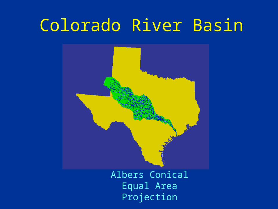
Colorado River Basin
Albers Conical Equal Area Projection
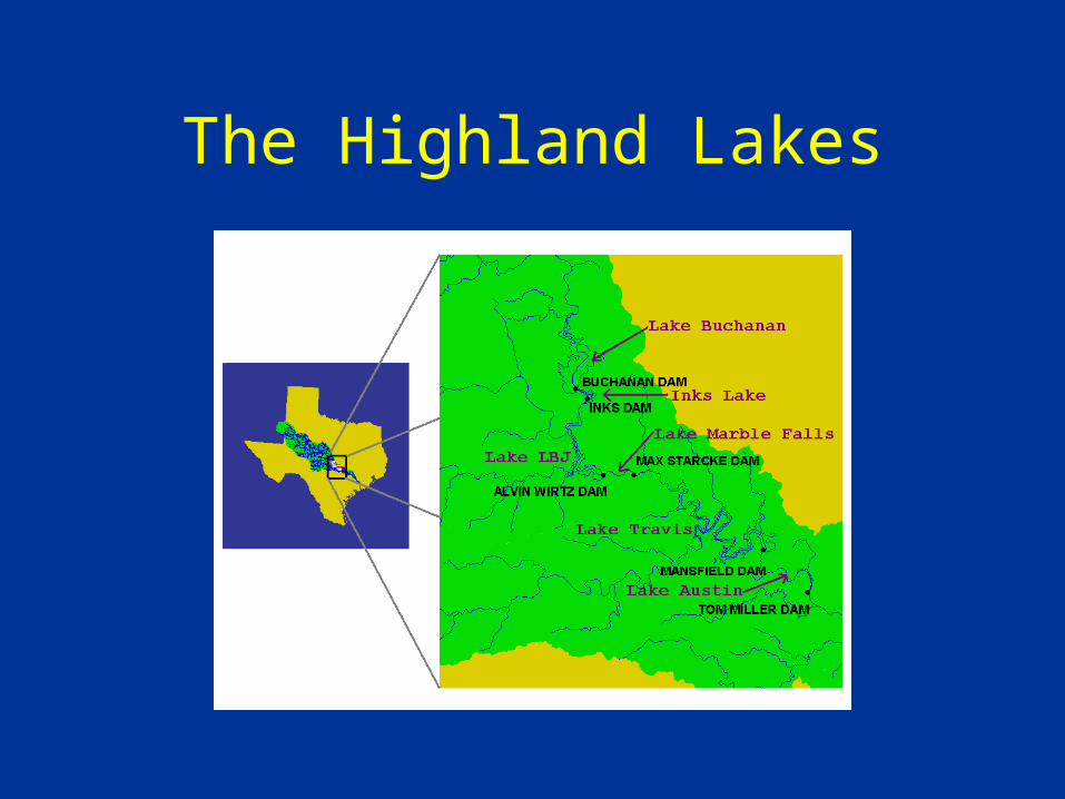
The Highland Lakes
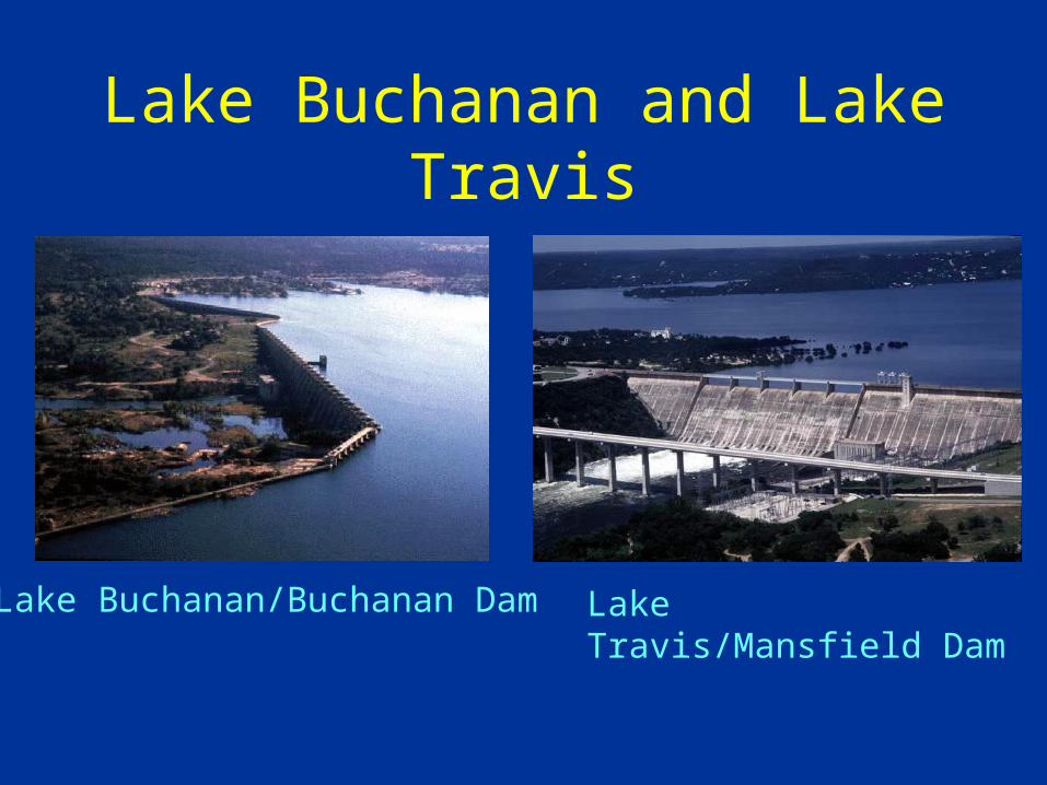
Lake Buchanan and Lake Travis
Lake Buchanan/Buchanan Dam Lake Travis/Mansfield Dam
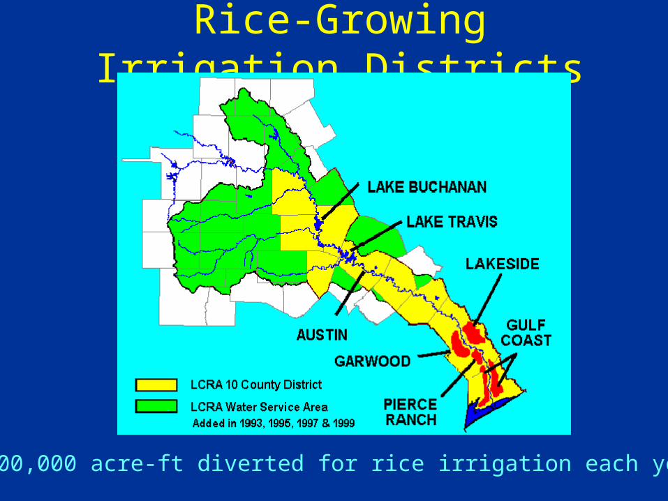
Rice-Growing Irrigation Districts
500,000 acre-ft diverted for rice irrigation each year
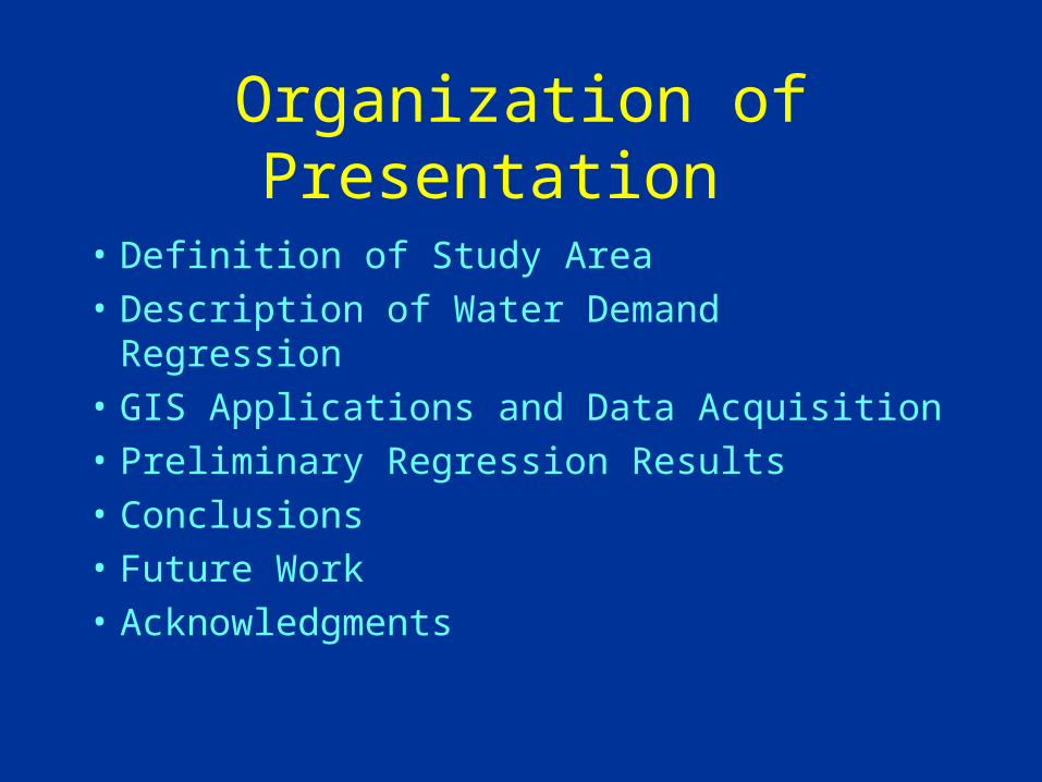
Organization of Presentation
• Definition of Study Area
• Description of Water Demand Regression
• GIS Applications and Data Acquisition
• Preliminary Regression Results
• Conclusions
• Future Work
• Acknowledgments
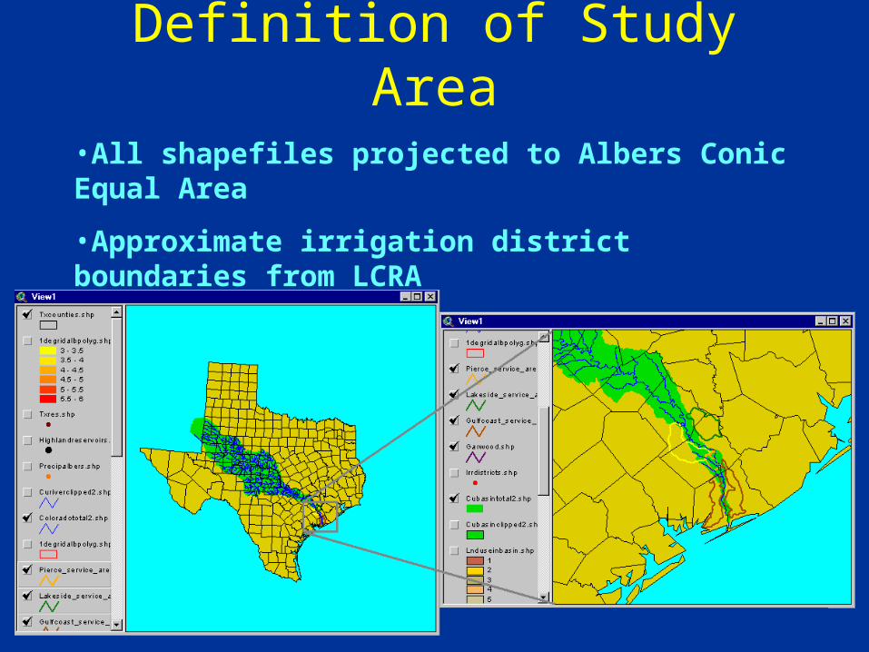
Definition of Study Area
•All shapefiles projected to Albers Conic Equal Area
•Approximate irrigation district boundaries from LCRA
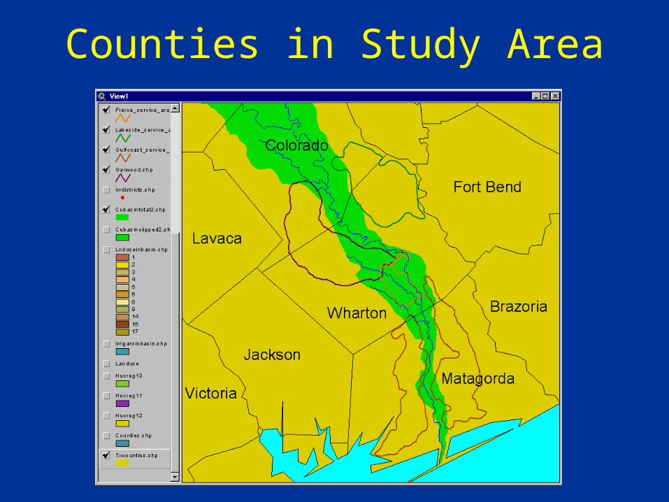
Counties in Study Area
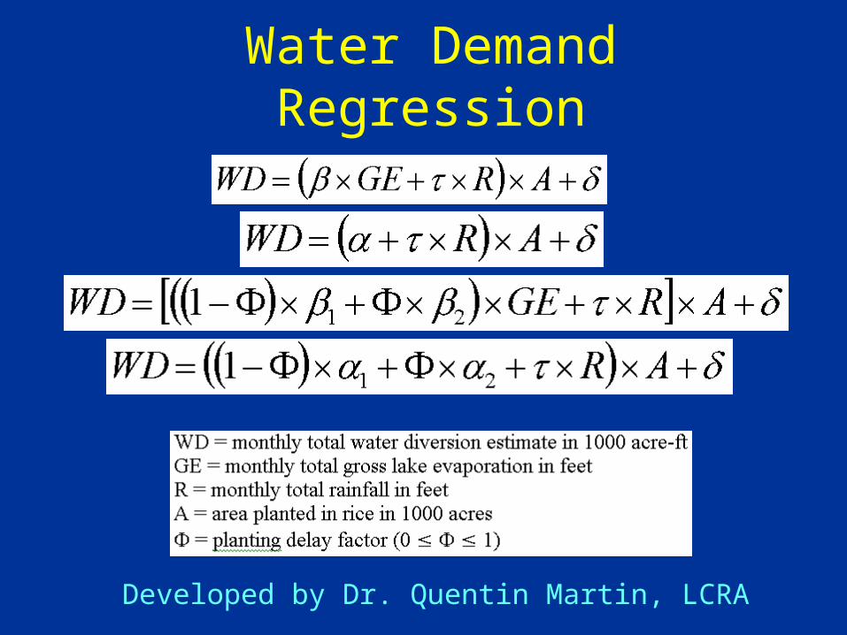
Water Demand Regression
Developed by Dr. Quentin Martin, LCRA
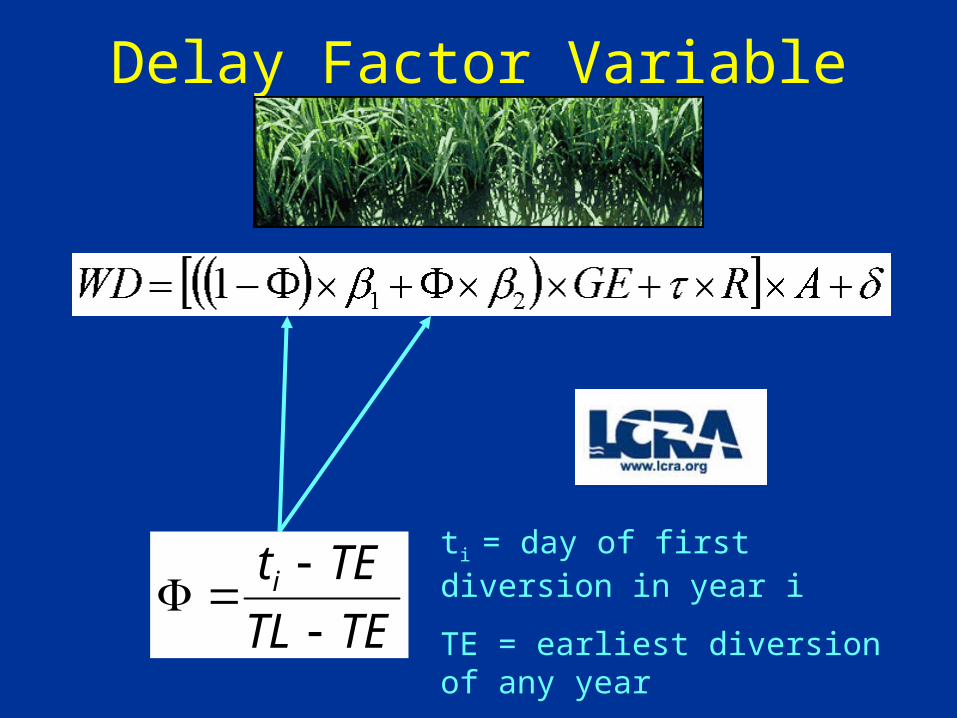
TETL
TEt i
Delay Factor Variable
ti = day of first diversion in year i
TE = earliest diversion of any year
TL = latest first diversion of any year
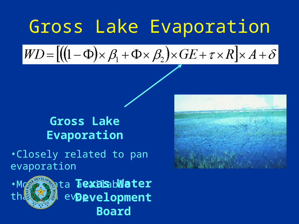
Gross Lake Evaporation
Gross Lake Evaporation
•Closely related to pan evaporation
•More data available than pan evap
Texas Water Development Board

Rainfall
Rainfall
•4 National Weather Service stations near study area
•Used data from nearest station to fill data gaps
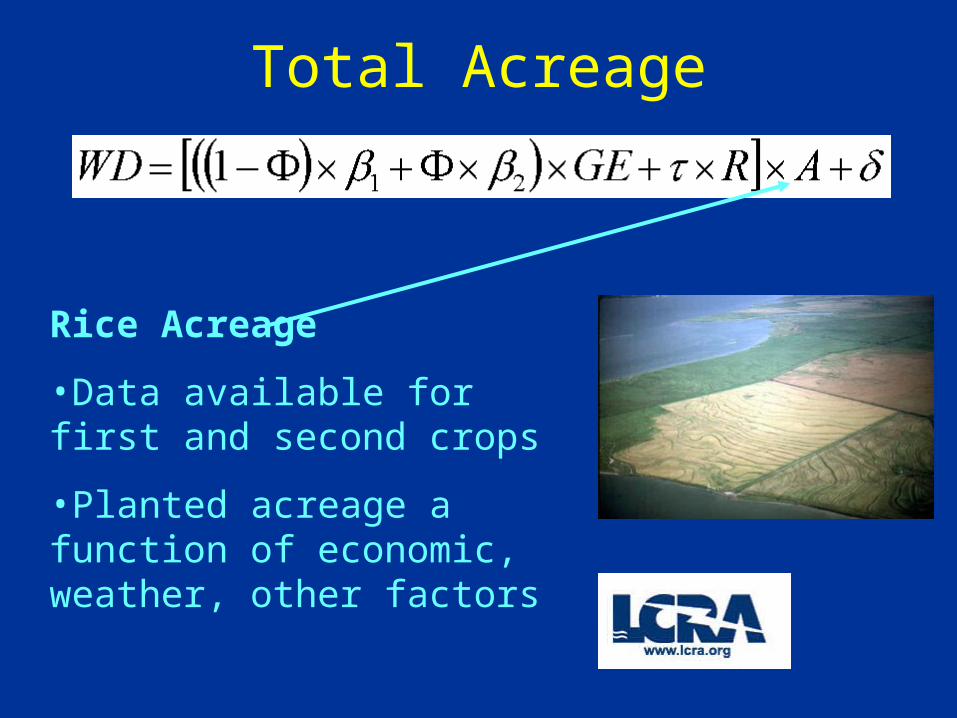
Total Acreage
Rice Acreage
•Data available for first and second crops
•Planted acreage a function of economic, weather, other factors
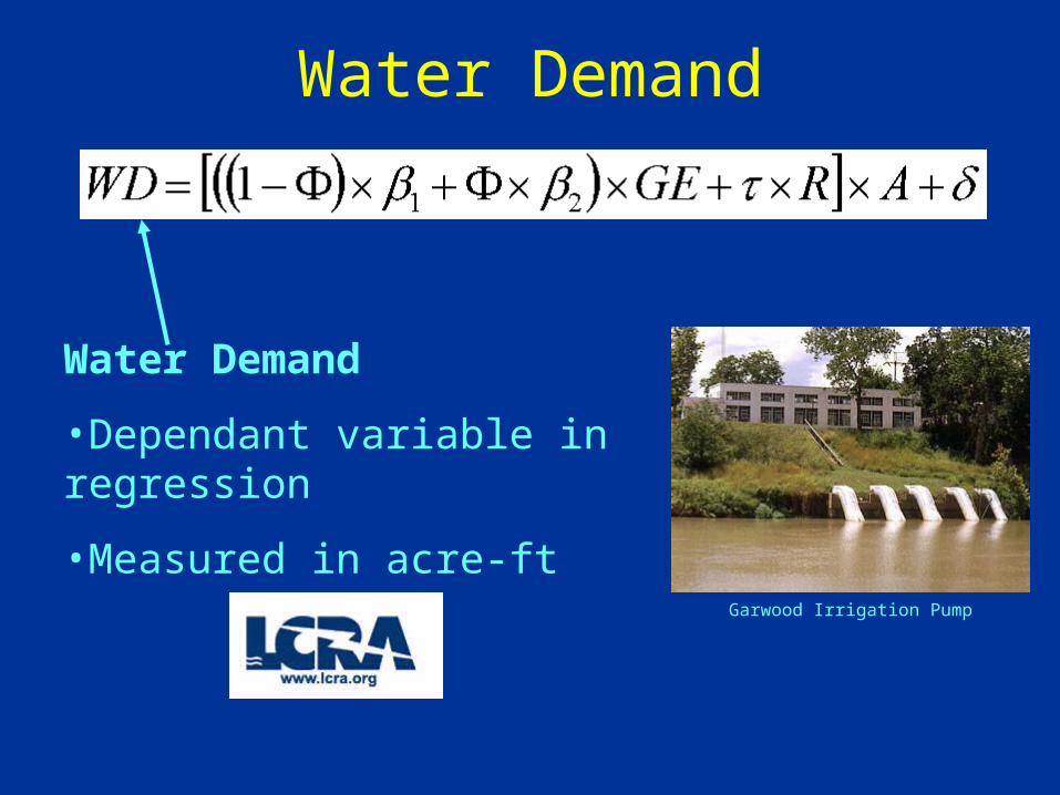
Water Demand
Water Demand
•Dependant variable in regression
•Measured in acre-ft
Garwood Irrigation Pump
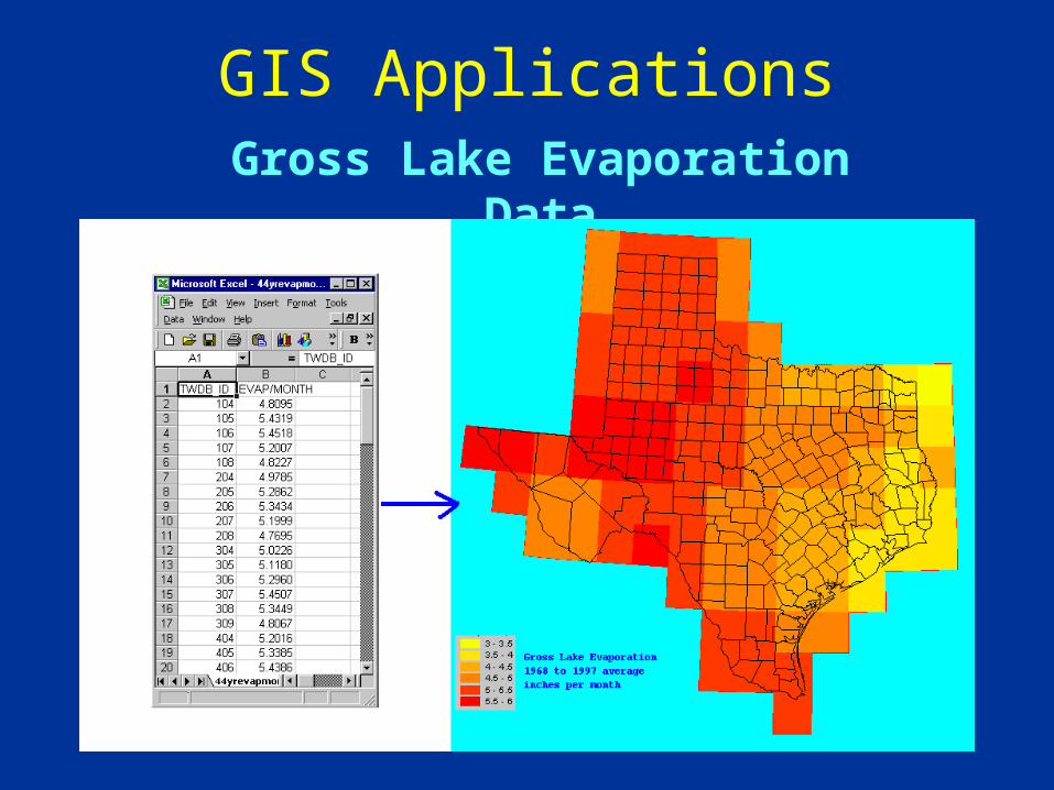
GIS ApplicationsGross Lake Evaporation Data

GIS ApplicationsNational Weather Service Station Locations
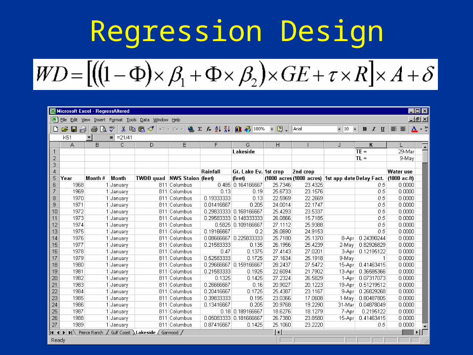
Regression Design
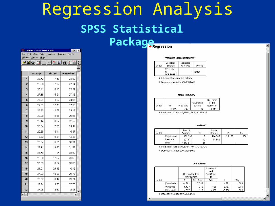
Regression AnalysisSPSS Statistical Package
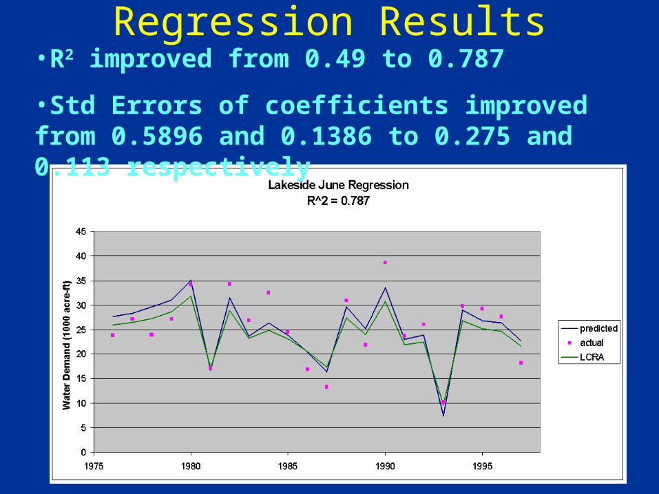
Regression Results•R2 improved from 0.49 to 0.787
•Std Errors of coefficients improved from 0.5896 and 0.1386 to 0.275 and 0.113 respectively
Conclusions
• GIS can aid in development of regression for predicting water use in rice-growing irrigation districts
• These regressions have potential to improve existing regressions, and may be incorporated into optimization models

Future Work
• Develop regressions for other irrigation districts, for all relevant months
• Incorporate results into optimization model
• Continue to fill data gaps
Questions?
(My niece, Molly)