environmental management system using gis at upr río piedras … · 2018-08-23 · agenda...
TRANSCRIPT
Environmental Management System
Using GIS at UPR Río Piedras Campus
Presented by: Johnny Lugo Vega, (OPASO), UPR RPand
Jorge L. Nina Espinosa, Environmental Health DepartmentUPR RCM

Agenda
Introduction to EMS/GIS
Objectives
Purpose
Components
UPREMIS Outlook
Academic Component Architecture
Operational Component Architecture
Phase I: Chemical Inventory Control and Base Data System Management
Phase II: Pilot Laboratory: GIS Approach (Simulation)
Phase III: Risk Assessment and Risk Profile
RP Communities Emergency Communication System
Emergency scenario (Simulation)
Summary
References
Acknowledgements

Introduction EMS
EMS
Follows AM/FM industrial management systems
Also, USEPA HZW reduction guidelines
Information system and procedures standardization
Report process (audits)
Based on P2 and Sustainability
EMIS:
With Geographical Information Systems incorporation
Scale modification to Risk Assessment and new perspective for
planning
UPREMIS is based but not limited to three single components:
Operational, Academic and Community

Objectives
Integrate prevention and sustainable strategies
within an environmental structure
Improve occupational safety and environmental
standards compliance (ISO14000)
Designs an micro-architecture as a model of
source reduction under a sustainable perspective
Temperate project for real issues such as PR’s
solid waste problems.

Purpose
Integration of different fundamental
components into a holistic
environmental structure developed in
a sustainable perspective

Sustainability
Source
Reduction
Pollution Prevention
Holistic Approach

Source: http://www.epa.gov/epaoswer/osw/vision.pdf
USEPA Vision (Compatibility
with UPREMIS)

Compliance Approach
Source: http://www.epa.gov/p2/

Green Chemistry Approach
Source: http://www.epa.gov/oppt/greenchemistry/
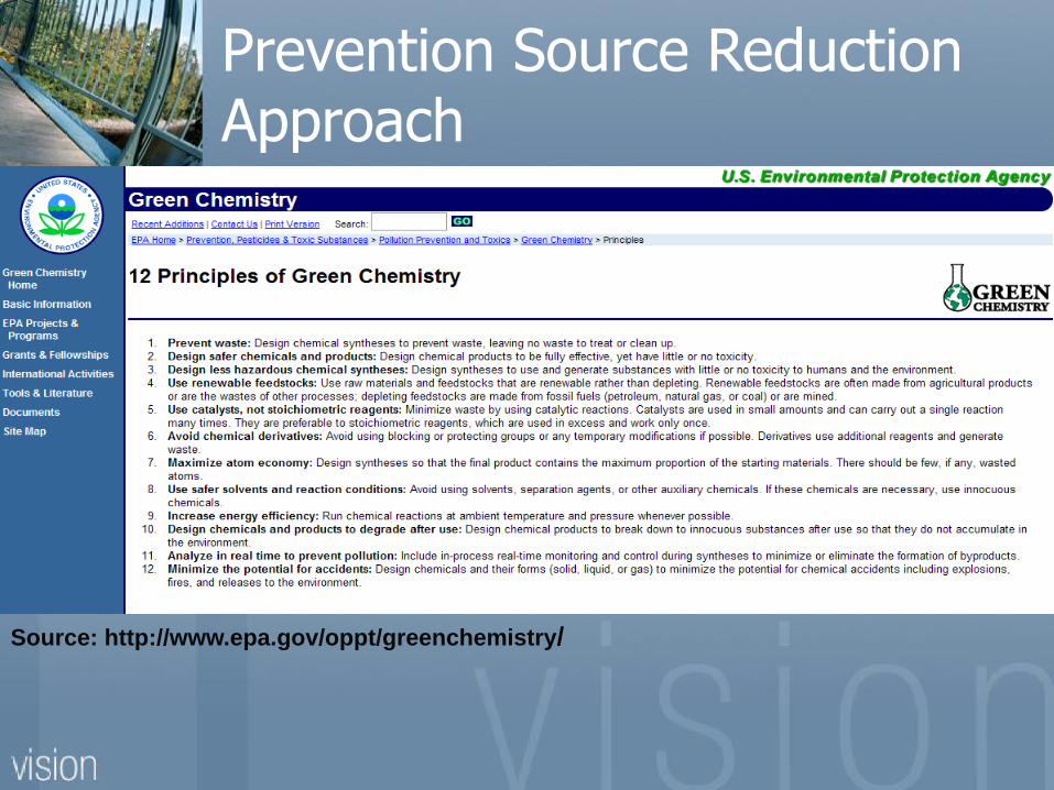
Source: http://www.epa.gov/oppt/greenchemistry/
Prevention Source Reduction Approach

UPREMIS
Operational
PHASE I
Academic
PHASE II
Community
PHASE I,II
COMPLIANCE SUSTAINABILITY
PREVENTION
& COMMUNITY
ACTION
Risk Assessment
Components Architecture

Advantages (Academic)
Integrates technology innovation “hands-on”
to Natural Sciences Curriculum students
Sustainable strategies as part of quality
standards for professional experience
Green Chemistry and other initiatives as part
of normal curriculum

Faculties
Natural
Sciences
Social
SciencesArchitecture
Green
Chemistry
Sustainability
and
Geosociety
Humanities
Pollution
Prevention
Green
Buildings
Environmental
History
Academic Component: Undergraduate

Faculties
Natural
Sciences
Social
SciencesArchitecture
Biodiesel
and Bioethanol
Socio Economic
Planning and
(Caribe)
Humanities
Fuel CellsGreen
Buildings
Environmental
History
Academic Component: Graduate

Advantages (Community)
Assess chemical emergency planning
Compliance with EPCRA’s guidelines
Facilitate accurate information and risk
assessment sustainable strategies
Integrate community actions into UPREMIS
operational strategies

GIS: Components
[2] http://erg.usgs.gov/isb/pubs/gis_poster/

Advantages (Operational)
Accurate data and information (SOP’s)
Facilitates and improves intra agency
compliance (OSHA,EPA,JCA, DOT)
Incorporate sustainable strategies as high
quality operational activities
Focus on HZW reduction** and cost effective
systems attached to chemical substances
inventory reduction ** Based on Veolia/UPR RP 1991-2005 Hazardous Waste Statistics

Architecture and
Methodology
GIS
UPR MAPPING
SystemBase Data Chem. Inventory
Laboratory CPU Units
Barcode (input)
UPR Waste
Management
System (Data Interfase)
Air Dispersion
Models
METADATA, Meteo
USGS,NOAA,OSHA,
JP,JCA,USEPA
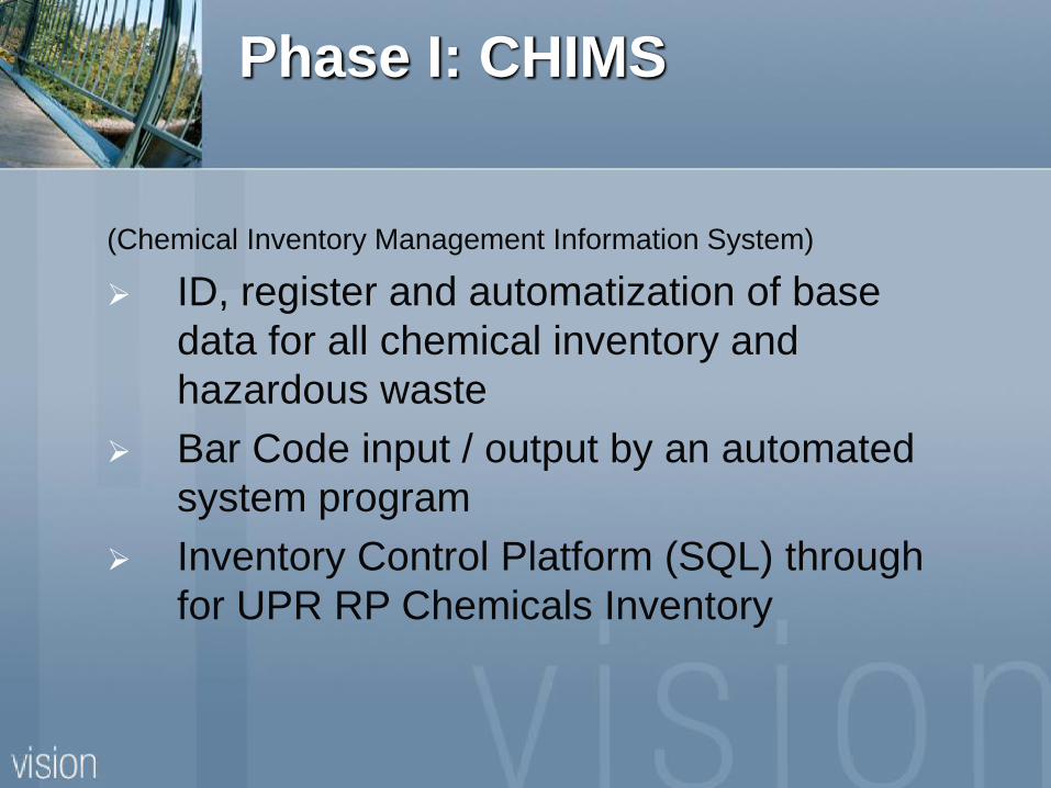
Phase I: CHIMS
(Chemical Inventory Management Information System)
ID, register and automatization of base
data for all chemical inventory and
hazardous waste
Bar Code input / output by an automated
system program
Inventory Control Platform (SQL) through
for UPR RP Chemicals Inventory
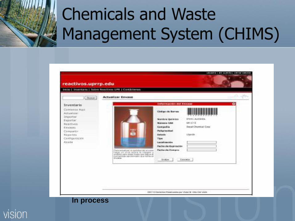
Chemicals and Waste Management System (CHIMS)
In process


75%
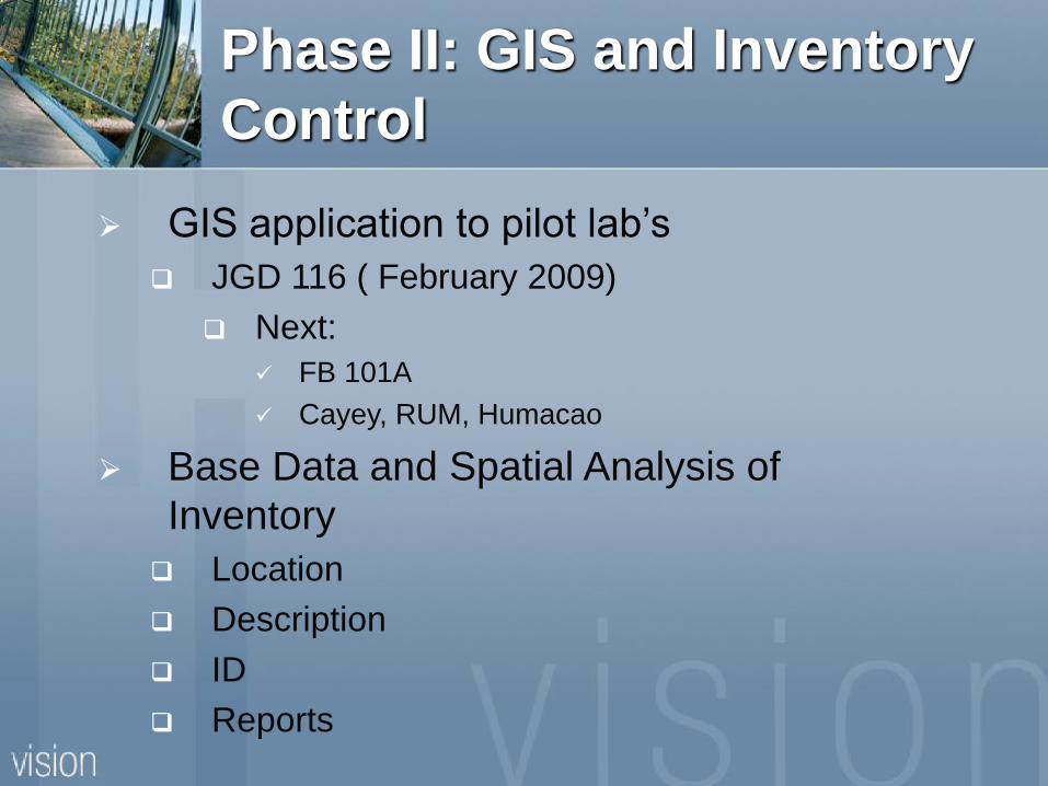
Phase II: GIS and Inventory
Control
GIS application to pilot lab’s
JGD 116 ( February 2009)
Next:
FB 101A
Cayey, RUM, Humacao
Base Data and Spatial Analysis of
Inventory
Location
Description
ID
Reports

Desktop ArcGIS 9.7
Arc Pad 9.0
Proposed Hardware and
Software
IPAQ PAD Wi
Fi
Web Base or Mobile
GIS

GIS Applied to Inventory
Control
SIG aplicado al control de inventario

Phase III: RP Communities HZ
Communication System
Spatial Analysis Using GIS Base Data and:
Meteo/Weather Data
Air Pollutant Data (Air Dispersion Modeling)
Traffic
Estimated population at UPR and Buildings and Labs.
Complies with:
29 CFR Part 1910 § 120
OSHA 29 CFR § 1200
1450, EPCRA 304,311-314
NIMS REP (HSPD-5, 2005)

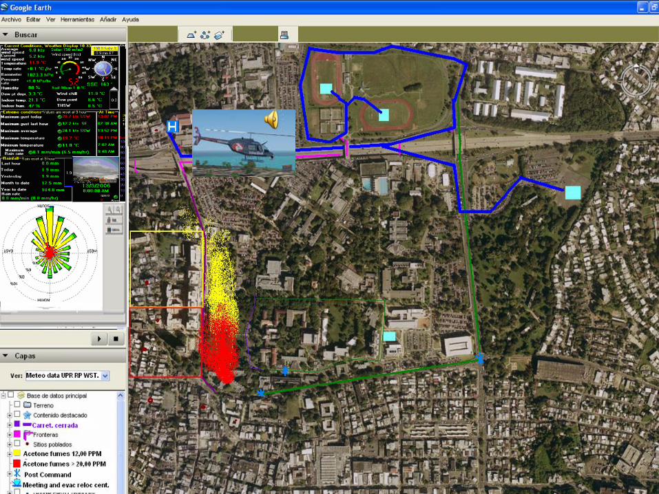
Cont. Phase III: Emergency
Response, Risk Analysis, Base Data
Simulated Scenario
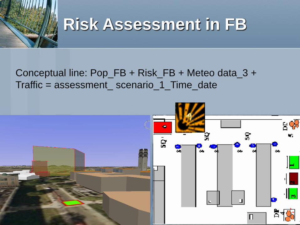
Risk Assessment in FB
Conceptual line: Pop_FB + Risk_FB + Meteo data_3 +
Traffic = assessment_ scenario_1_Time_date


Risk Assessment (FB)
Integrated risk assessment aims at combining more than one approach, more than one source, and both source and receptor.
This includes internal and external considerations; aspects of Physical environment assessment Regulatory and safety assessment
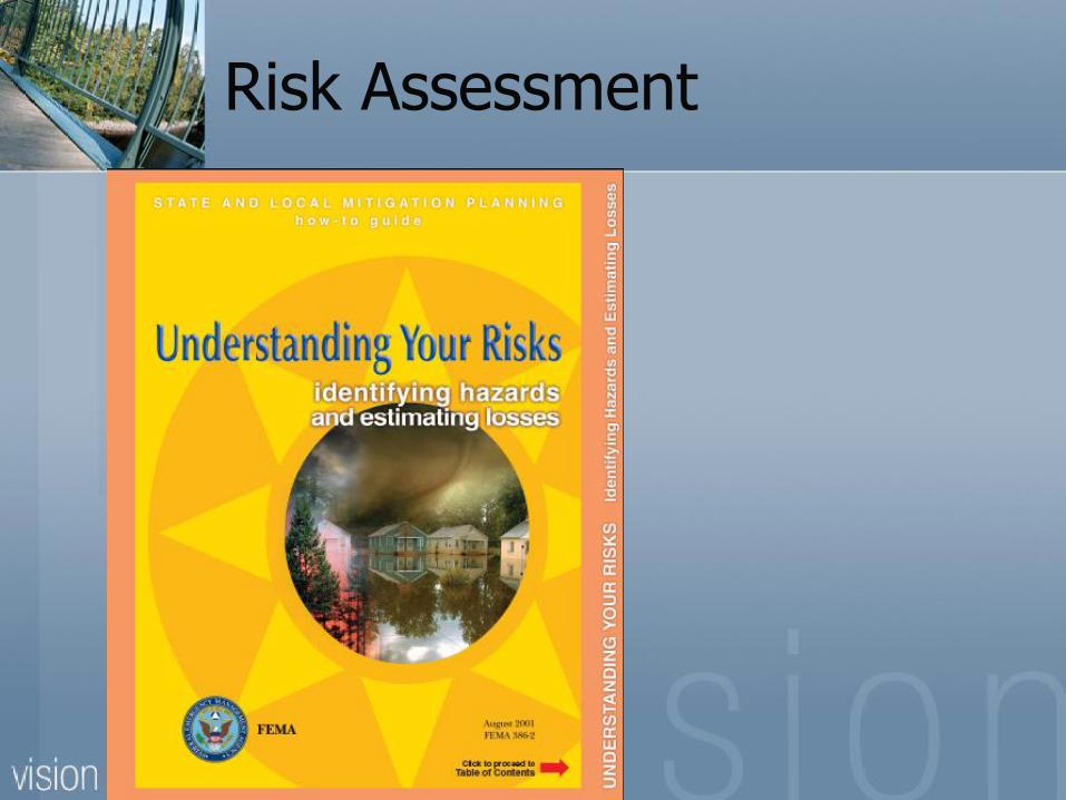
Following FEMA guidelines (FEMA 386) Planning Risk assessment Emergency response management
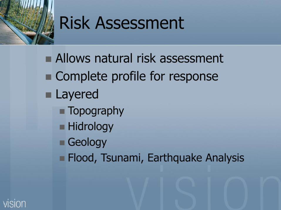
Risk Assessment
Allows natural risk assessment
Complete profile for response
Layered
Topography
Hidrology
Geology
Flood, Tsunami, Earthquake Analysis
Risk Assessment

Risk Profile (FEMA 436) internal SOP

Summary
Environmental Management System using
GIS represents the right perspective tool for
a sustainable university
The first step to follow in our challenge to
protect life and environment
Why not beginning with our University, our
community at Puerto Rico?

References and Links:
ESRI
El Instituto de Investigación de Sistemas Ambientales (Environmental Systems Research Institute) fue
fundado en 1969 como una compañía de consultoría privada que se especializaba en el análisis de usos de
suelos. http://www.Esri.com
Wagner, M.W., The Eastern Municipal Water District AM/FM/GIS project,Proceedings, Conference
XII, AM/FM International, New Orleans, April 1989, pp. 526-541.
http://www.JP.gobierno.pr
Whiterell and Hahn: http://gis.esri.com/library/userconf/proc00/professional/papers/PAP767/p767.htm. 1999
GIS
GIS.com es un portal de información sobre los sistemas de información geográfica creado por ESRI. Esta
página intenta educar a todo aquel que este interesado en la tecnología de GIS, ofreciendo actividades
diarias y diferentes recursos a los usuarios de GIS
GeoCommunity™
GeoCommunity es el lugar para profesionales dentro del campo de Sistemas de Información Geográfica,
CAD, Mapping y estudiantes.
GISPortal
El GISPortal (también conocido como Great GIS Net Sites!) es una de las principales páginas de Internet en
la industria de los Sistemas de Información Geográfica. http://www.gis.gobierno.pr

Acknowledgements
Dr. Eddie Laboy, invitation
University of Turabo, SUAGM, reception
Support at UPR
Sr. Jorge Ramos, Office Director, OPASO
Dr. Jose Seguinot Barbosa
Sr. Daniel Díaz- GIS Lab. UPRRP
Dr. Noel Motta- UPR Dept. Chemistry
Sr. Víctor Ortiz- Computer Science Engineer UPR RP

Thank You!
Jorge L. Nina Espinosa, MSEH
Johnny Lugo Vega, EH&S II
Cel. (787) 943-8380
(787) 479-1172
E-mail’s: [email protected]

Questions?