enhancing situational awareness through visualization of interior spaces seth peery, sr. gis...
TRANSCRIPT

Enhancing Situational Awareness through Visualization
of Interior Spaces
Seth Peery, Sr. GIS ArchitectEnterprise GIS
CTSSR Tech Showcase :: September 2, 2015

Overview
• What is interior space data?• Significance for situational awareness• Data and processes > User Interfaces• Stakeholders• Data management (laying the groundwork)• Interior Space data in GIS• Making the data usable and accessible• Visualization and user experience examples• Demo

What is Interior Space Data?

Interior Space Data and Situational Awareness
• Interior Space data is the canvas or “base map” on which we overlay information about things that happen inside.– Historically, GIS = outside, CAD = inside
• “Situational awareness” applies to daily business operations as well as emergencies
• Situational awareness is advanced when– GIS data reflects current, authoritative data– User interfaces are intuitive, relevant and secure
• The development of an interior space system involves– Process discovery and improvement– Development of databases that can be reused across contexts– Development of user interfaces

Business Process Considerations
• Identify:– Systems of record
• HokieServ• CAD• GIS
– Use cases• Space
planning and mgmt
• Emergency mgmt
• Interior Routing
– Stakeholders• Stratification of systems
… avoid one size fits all approach
Space Data Producers
ArcSDE (Enterprise GIS)
VPAS T:\ Drive
DWGs
PDFs
HokieServ Space Module
Drawings in Web Viewer
Building and Room Attribute Data (Oracle DB)
space.facilities.vt.edu
DWGs
PDFs
[Oracle attributes accessed from AIM
directly]
LaserFiche
DWGs
PDFs
Central IT Systems
Room GIS Polygons
Room Attribute Data (Oracle DB)
Edits to Floor plans (FS::EO)
VPAS Systems
ATLAS (CNS)
Building and Room Attributes
Space Data Consumers
Detailed Data Creation and Interoperability Workflows
1
LEGEND
Data product,Native Format
Data product, Derived Copy
Data product, to be removed
Established Workflow, working OK
Workflow to be created or improved
Workflow to be terminated
Data use relationship
2
3
4
5
6
7
Internal VPAS UsersAnyone with CAS
(Faculty, Staff, Students, Alumni, guest PIDs, etc.)
FIS Space/GIS
OUP
Administrative Units
Academic Units
911 Center
NI&S
1) Engineering Ops updates local DWG master file. Saves DWG to T:\drive, saves PDF to T:\ drive, uses AimCAD to “publish” to AIM as part of the update workflow. Per (2) below, EO will also manually push DWG and PDF updates to LaserFiche going forward.
2) We plan to establish an SOP for manual data replication between T:\ Drive and LaserFiche. Meetings were held 2/26, 3/5 on this topic. The Laserfiche software limits opportunities for automated replication.
3) Need to improve the process by which CAD updates get propagated to GIS. How is GIS notified?
4) An automated script copies PDF files from T:\drive to space.facilities.vt.edu. Also copies DWG files, but they’re not used.
5) space.facilities.vt.edu website accesses attribute data directly from HokieServ.6) DB links are used to replicate attribute data to Enterprise GIS. (Currently this link is still pointing to Archibus)
7) Enterprise GIS subsequently replicates data to NI&S ATLAS DB.8) Right now there is no replication to Banner from the DB of record for space data (currently HokieServ)
** Note: With the removal of DWGs from space.facilities.vt.edu, Laserfiche becomes the most likely point for their distribution. During the course of planning for this increased volume of users, it may be an opportune time to revisit Laserfice access policies and SOPs.
GIS Users
Banner
Space/Fixed Assets Tables
Building GIS Polygons
Contractors
8
Space Data Systems, Workflows and Users at Virginia Tech, as of March 13, 2013

Stakeholders
• VPAS– Office of University Planning
• GIS• CAD
– Office of Emergency Management / VT Police– IT for Administrative Services
• HokieServ• VPIT
– Enterprise GIS– DBAA
• Academic– Office of the Provost: Academic Space– Deans/Departmental Space Managers

Interior Space ETL Process• Geometry:
– CADGIS– Vertex3’s Gizinta
Sync Engine– Scheduled Task– Multiple output
products• Room/floor polys• Room points• Stacked floor
views• Attributes:
– Database links– Views– ITAS/DBAA/EGIS
collaboration

Interior Space ETL Outputs
Pictome try 2013
Legend
Int er ior Sp ac e Poin ts
Flo or Pla n Lin e s
Roo ms b y Dep ar tmen t
<a ll o th er va lu es >
BIO CHEM IS TR Y
BIO LO GI CAL SCI ENCES
COL L EGE OF N ATU RAL RESO UR CES
COM M U NIC AT IO NS NETWO RK SERVI CES
DEPARTM ENT N OT ASSI GN ED
ENTOM O LO G Y
FI SH AN D W IL DLI F E CO NSER VATIO N
FO O D SC IENC E AND TECH NO LO GY
FR ALI N H ALL O PERATIO NS
FR ALI N L IFE S CIEN CE I NST ITUT E
PLAN T PATHO L OG Y, PHYS , & WEED SCI .
REG IST RAR
Flo or Ar ea s
• Multiple GIS feature classes are created by Sync Engine– Floor outlines– CAD linework– Room points– Room polygons
• Room Polygons are joined to HokieServ room attributes

Spatial Views and Symbology• We can style
the map based on any attribute we can associate with a room via a view
• Consistency of cartography is important this context
• Standardized representations can be shared across multiple apps
Leg end
Depart ment
<a ll o th er v a lu es >
dep artm en t
ARC H IT EC T UR E
CO M M U NI CAT I O NS NE T WO R K SER VIC ES
DEPA RT M E NT NO T AS SIG N ED
F S - F AC IL IT I ES O PER AT IO N S
PRI NT I NG SER VIC ES
PRO V OS T - AD M IN IS T RAT IO N
REG I ST R AR
ST UD EN T AC T IV IT IE S
UN DE RG R ADU AT E A DM I SSI O NS
VIC E P RE SID EN T F O R O UT REA CH - AD M IN
VP S T UD EN T AF F AI RS - AD M IN .
Leg end
Description
<a ll o th er v a lu es >
des criptio n
ADVA NC E VT O PE N OF F ICE AR EA
AUD IT O R IU M E NT R Y
BRE AK RO O M / S T OR AG E RO O M
CL ASS L AB ST O R AG E
CL ASS RO O M
CL ASS RO O M ST O RA GE
CL O SET
CN S C L O SET
CO AT R O O M
CO N F ERE NC E RO O M
CO N F ERE NC E RO O M / S EM IN AR R O O M
CO N F ERE NC E RO O M S T O RAG E
CO PY / F IL E / S UPP LY RO O M
CO PY CE NT E R 1
CO PY RO O M
CO R RID O R
DEPA RT M E NT HEA D'S O F F IC E
DEPA RT M E NT AL ST O R AG E
DIG I TA L M ED IA S ER VIC ES
DIR EC T O R'S O F F IC E
DIS TA NC E LE AR NI NG C L ASS RO O M
DR ESS IN G RO O M
EL ECT RIC AL C L O SET
EL ECT RIC AL E QU IP M EN T R O OM
EL ECT RIC AL R O O M
EL EVAT O R
EL EVAT O R M EC HAN IC AL R O O M
ENT R Y
EQ UI PM EN T R O O M
F IL E R O O M
GR AD UAT E O F F IC E
GR AD UAT E O F F IC E A RE A
HAL L WAY
INT E RI O R OF F ICE C O RR ID O R
INT E RI O R OF F ICE H AL LW AY
INT E RI O R OF F ICE L O BBY
INT E RI O R OF F ICE VE ST I BUL E
JAN IT O R
JAN IT O R SU PP LY CL O SET
KIT C HE N
LO BB Y
M AIL R O O M
M EC HAN IC AL E QU IP M EN T R OO M
M EC HAN IC AL R O O M
M EN 'S EN T R Y
M EN 'S R EST R O O M
OF F I CE
OF F I CE AR EA
OF F I CE ST O R AG E
PIP E C HA SE
PRO D UC T IO N O F F I CE
REC EP T IO N
REC EP T IO NI ST
SEC RE TA RY
SEC RE TA RY / R EC EP T IO NI ST
STA G E
STA G E C O RR ID O R
STA G E M E N'S R EST R O O M
STA G E W O M EN 'S RES T RO O M
STA IR S
ST UD EN T S TO R AG E
ST UD IO / S EM I NAR R O O M
SWI T CH R O O M
TO I LE T
T RAS H RO O M / L O AD IN G D OC K
T UN NE L
VEN DI NG M AC HIN ES
VEST I BU L E
VIC E- PR ESI DE NT 'S O F F IC E
WO M EN 'S LO U N GE
WO M EN 'S RE ST R OO M
Leg end
Usage
<a ll o th er v a lu es >
usa ge_ co de
GE N A DM I N
INS TRU C TIO N
OP /M AI NT
OTH ER I NS T ACT
STUD EN T S ERV IC E
VA CA NT
Leg end
Room Accessibility
<a ll o th er v a lu es >
roo m_a cces sibi li ty
0 - CO M P LE T ELY AC CES SIB L E
1 - BU IL DI NG NO T AC CE SSI BL E
2 - F LO O R N O T AC CES SIB L E
3 - RO O M N O T AC CE SSI BL E
4 - NO WO R KST AT IO N S/R O O M I S AC C ESSI BL E
Leg end
Senior Management Areas
<a ll o th er v a lu es >
sr_m gmt_ area
ARC H IT EC T UR E & U R BAN S T UD IES
INS T IT U T IO N N OT ASSI G NE D
SR. VI CE PR ES ID ENT AND P RO VO S T
VIC E P RE S- OU T R EAC H & IN T RN T L A F F RS
VIC E P RE SID EN T F O R ST U D ENT A F F AIR S
VIC E P RE SID EN T -I NF O T E CH N OL O G Y
VP AD M I NI ST RAT I O N
Leg end
Room Function
<a ll o th er v a lu es >
roo m_fu n ctio n
0 - UN ASS IG N ED AND N O N- AS SIG N AB LE AR EAS
1 - IN STR UC TIO N
4 - A DM I NI STR ATIO N AN D G E NE RAL
7 - PH YSI CAL P LA NT O PER ATIO N S AN D M AI NTE NA NC E
8 - A UX IL IAR Y ENTE RP RI SES
Department Usage Function
Sr. Mgmt Accessibility Description
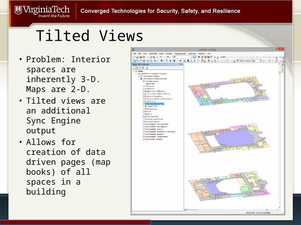
Tilted Views
• Problem: Interior spaces are inherently 3-D. Maps are 2-D.
• Tilted views are an additional Sync Engine output
• Allows for creation of data driven pages (map books) of all spaces in a building

Visualization: 3D (ArcScene)

But you GIS people have all the fun…

Architecture
Interior SpaceGIS DB
CAD GIS ETL
HokieServ Data
Other room-level attributes
ArcGIS Server
ArcGIS Desktop
Portal for ArcGIS
Invision FM
instance 1
Invision FM
instance 2Custom Apps
Reporting Tools
. . .

Invision FM : A Web-based Interior Space Viewer
• Requirements:– Web Interface– Floor Awareness (3D
problem)– Ability to display
multiple cartographic representations
– Reduced learning curve
– CAS integration– Reporting tools for
space planning– Multiple instances for
specific use cases (space management, emergency planning, etc.)

Invision FM Query and Analysis• For space
management use cases, visualization is necessary but insufficient.
• The UI enables selection based on any field in the database
• Selections can be combined for sophisticated space utilization studies

Invision FM Reporting
• Invision FM enables the generation of space metrics in summary form
• Reports can be run campus wide, based on a selection, or a specific building
• Report capabilities are evolving and driven by user feedback
• … let us know what you need!

Visualization: Mobile Clients
• Interior space data needs to be accessible on multiple device form factors
• Invision RCV is the off-the-shelf viewer we implemented for mobile devices
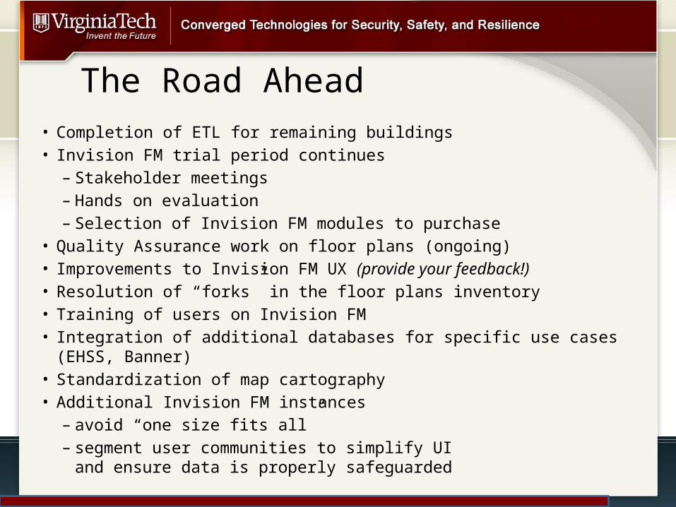
The Road Ahead• Completion of ETL for remaining buildings• Invision FM trial period continues
– Stakeholder meetings– Hands on evaluation– Selection of Invision FM modules to purchase
• Quality Assurance work on floor plans (ongoing)• Improvements to Invision FM UX (provide your feedback!)• Resolution of “forks” in the floor plans inventory• Training of users on Invision FM• Integration of additional databases for specific use cases (EHSS, Banner)• Standardization of map cartography• Additional Invision FM instances
– avoid “one size fits all” – segment user communities to simplify UI
and ensure data is properly safeguarded

INVISION FM DEMO
• Kiosk set up for hands-on interaction• … please provide comments and sign the sheet if you’d like
your PID to have access to Invision FM

Contact Information
Seth PeerySenior GIS Architect Enterprise GIS (0214)
1700 Pratt Dr.Blacksburg, VA 24061
(540) [email protected] http://gis.vt.edu