donington le heath conservation area … le heath conservation area character appraisal &...
TRANSCRIPT
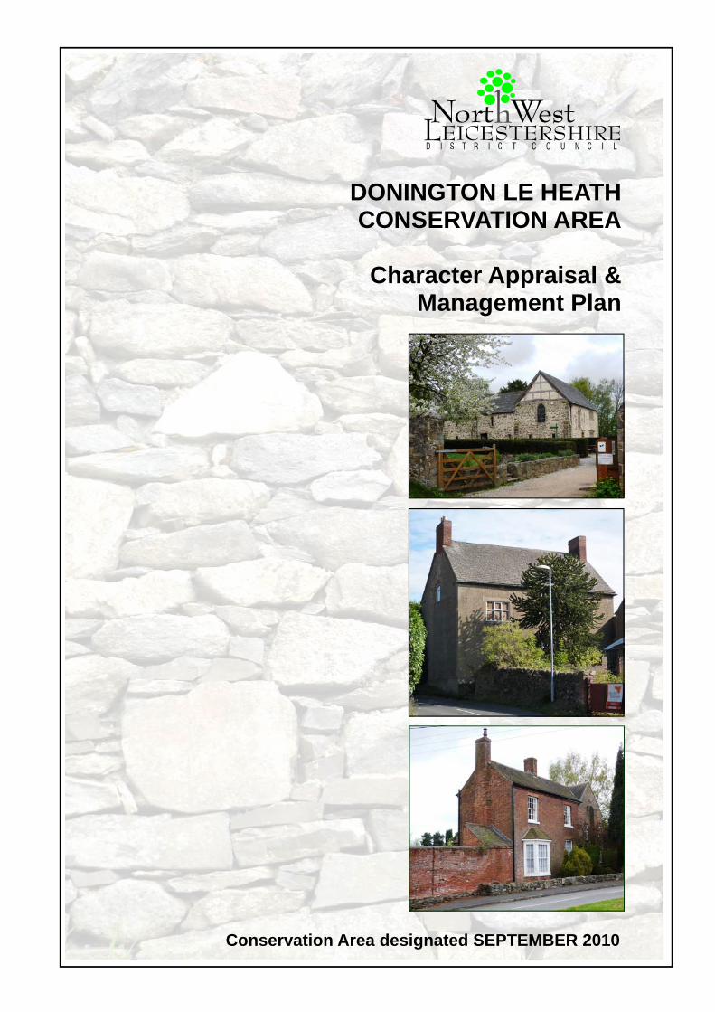
Conservation Area designated SEPTEMBER 2010
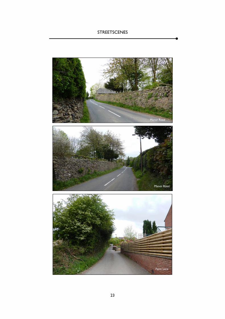
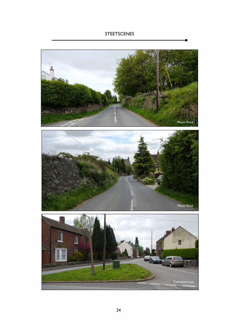
DONINGTON LE HEATH CONSERVATION AREA
Character Appraisal &
Management Plan
2
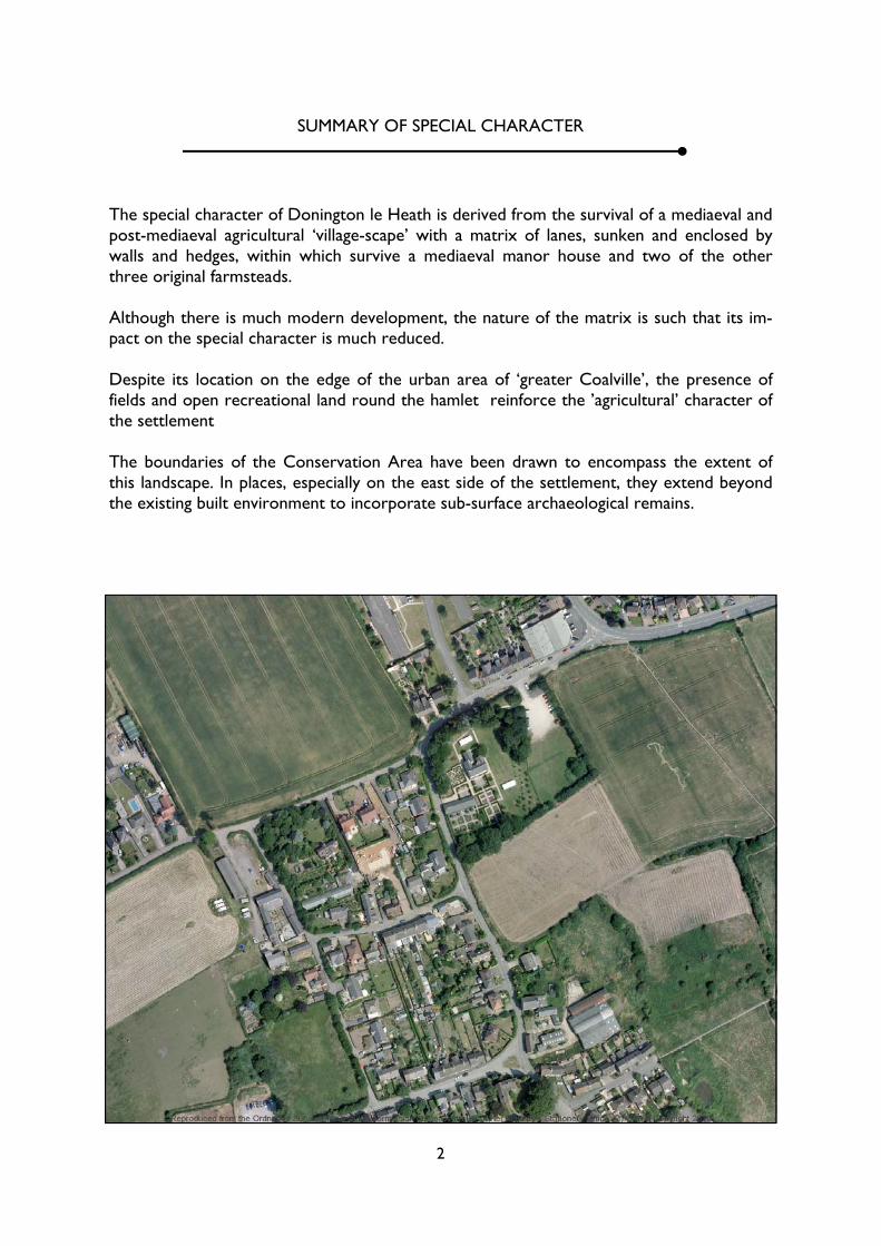
The special character of Donington le Heath is derived from the survival of a mediaeval and post-mediaeval agricultural ‘village-scape’ with a matrix of lanes, sunken and enclosed by walls and hedges, within which survive a mediaeval manor house and two of the other three original farmsteads. Although there is much modern development, the nature of the matrix is such that its im-pact on the special character is much reduced. Despite its location on the edge of the urban area of ‘greater Coalville’, the presence of fields and open recreational land round the hamlet reinforce the ’agricultural’ character of the settlement The boundaries of the Conservation Area have been drawn to encompass the extent of this landscape. In places, especially on the east side of the settlement, they extend beyond the existing built environment to incorporate sub-surface archaeological remains.
SUMMARY OF SPECIAL CHARACTER
3
PREFACE
Conservation Area are defined as “areas of special architectural or historic interest the character or appearance of which it is desirable to preserve or enhance” (Section 69 (1)(a) of the Planning (Listed Buildings and Conservation Areas) Act 1990)
The District Council has a duty under the same Act to determine which parts of the District have that special architectural or historic interest, to desig-nate those parts as Conservation Areas, and to keep the Conservation Areas under review.
In fulfillment of that duty and in response to request from the public, the possibility of designating Don-ington le Heath has been examined.
In assessing the feasibility of a Conservation Area for Donington, the main task is define and evaluate what ‘special character or appearance’ survives in the area and then assess whether that quality is suf-ficient to warrant preservation or enhancement as a Conservation Area.
This Conservation Area Appraisal forms part of that process. It was considered by the Council’s cabinet on 21 September 2010 when it was resolved to des-ignate the Donington le Heath Conservation Area and to adopt this Appraisal as a document of the Council.
4
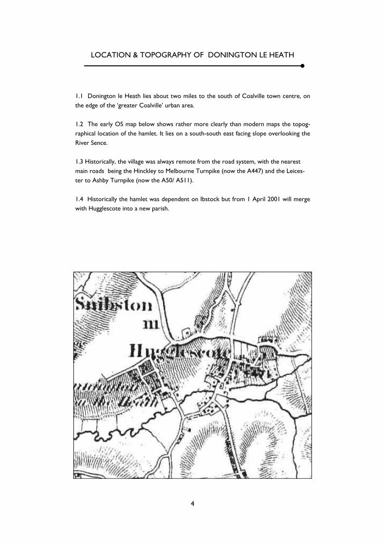
LOCATION & TOPOGRAPHY OF DONINGTON LE HEATH
1.1 Donington le Heath lies about two miles to the south of Coalville town centre, on the edge of the ‘greater Coalville’ urban area. 1.2 The early OS map below shows rather more clearly than modern maps the topog-raphical location of the hamlet. It lies on a south-south east facing slope overlooking the River Sence. 1.3 Historically, the village was always remote from the road system, with the nearest main roads being the Hinckley to Melbourne Turnpike (now the A447) and the Leices-ter to Ashby Turnpike (now the A50/ A511). 1.4 Historically the hamlet was dependent on Ibstock but from 1 April 2001 will merge with Hugglescote into a new parish.
5
ORIGINS & HISTORICAL DEVELOPMENT OF DONINGTON LE HEATH
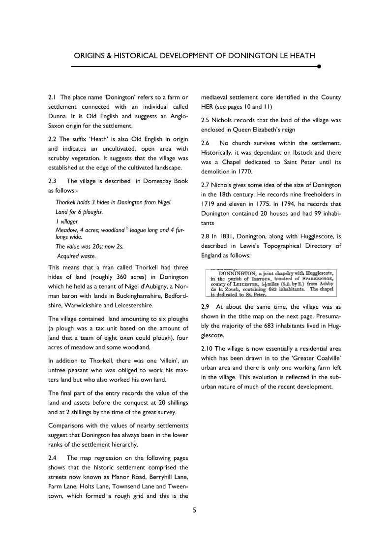
2.1 The place name ‘Donington’ refers to a farm or settlement connected with an individual called Dunna. It is Old English and suggests an Anglo-Saxon origin for the settlement.
2.2 The suffix ‘Heath’ is also Old English in origin and indicates an uncultivated, open area with scrubby vegetation. It suggests that the village was established at the edge of the cultivated landscape.
2.3 The village is described in Domesday Book as follows:-
Thorkell holds 3 hides in Donington from Nigel. Land for 6 ploughs. 1 villager Meadow, 4 acres; woodland ½
league long and 4 fur-longs wide. The value was 20s; now 2s. Acquired waste.
This means that a man called Thorkell had three hides of land (roughly 360 acres) in Donington which he held as a tenant of Nigel d’Aubigny, a Nor-man baron with lands in Buckinghamshire, Bedford-shire, Warwickshire and Leicestershire.
The village contained land amounting to six ploughs (a plough was a tax unit based on the amount of land that a team of eight oxen could plough), four acres of meadow and some woodland.
In addition to Thorkell, there was one ‘villein’, an unfree peasant who was obliged to work his mas-ters land but who also worked his own land.
The final part of the entry records the value of the land and assets before the conquest at 20 shillings and at 2 shillings by the time of the great survey.
Comparisons with the values of nearby settlements suggest that Donington has always been in the lower ranks of the settlement hierarchy.
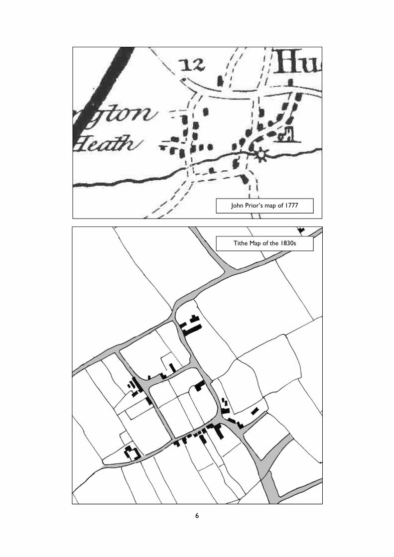
2.4 The map regression on the following pages shows that the historic settlement comprised the streets now known as Manor Road, Berryhill Lane, Farm Lane, Holts Lane, Townsend Lane and Tween-town, which formed a rough grid and this is the
mediaeval settlement core identified in the County HER (see pages 10 and 11)
2.5 Nichols records that the land of the village was enclosed in Queen Elizabeth’s reign
2.6 No church survives within the settlement. Historically, it was dependant on Ibstock and there was a Chapel dedicated to Saint Peter until its demolition in 1770.
2.7 Nichols gives some idea of the size of Donington in the 18th century. He records nine freeholders in 1719 and eleven in 1775. In 1794, he records that Donington contained 20 houses and had 99 inhabi-tants
2.8 In 1831, Donington, along with Hugglescote, is described in Lewis’s Topographical Directory of England as follows:
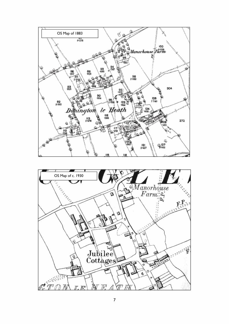
2.9 At about the same time, the village was as shown in the tithe map on the next page. Presuma-bly the majority of the 683 inhabitants lived in Hug-glescote.
2.10 The village is now essentially a residential area which has been drawn in to the ‘Greater Coalville’ urban area and there is only one working farm left in the village. This evolution is reflected in the sub-urban nature of much of the recent development.
6
John Prior’s map of 1777
Tithe Map of the 1830s
7
OS Map of c. 1930
OS Map of 1883
8
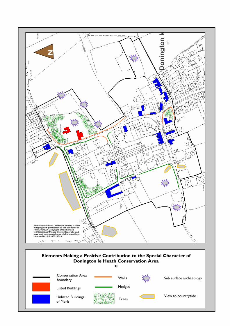
THE CHARACTER OF THE CONSERVATION AREA
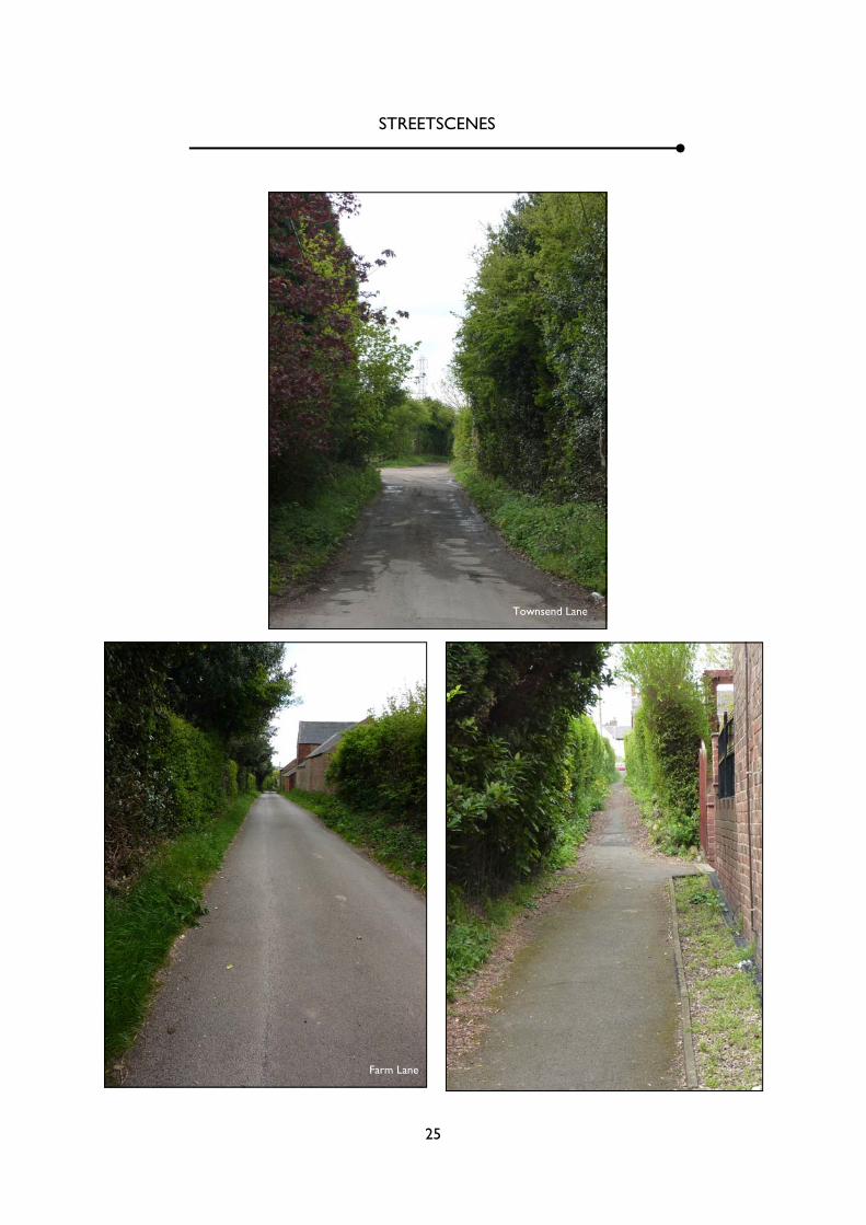
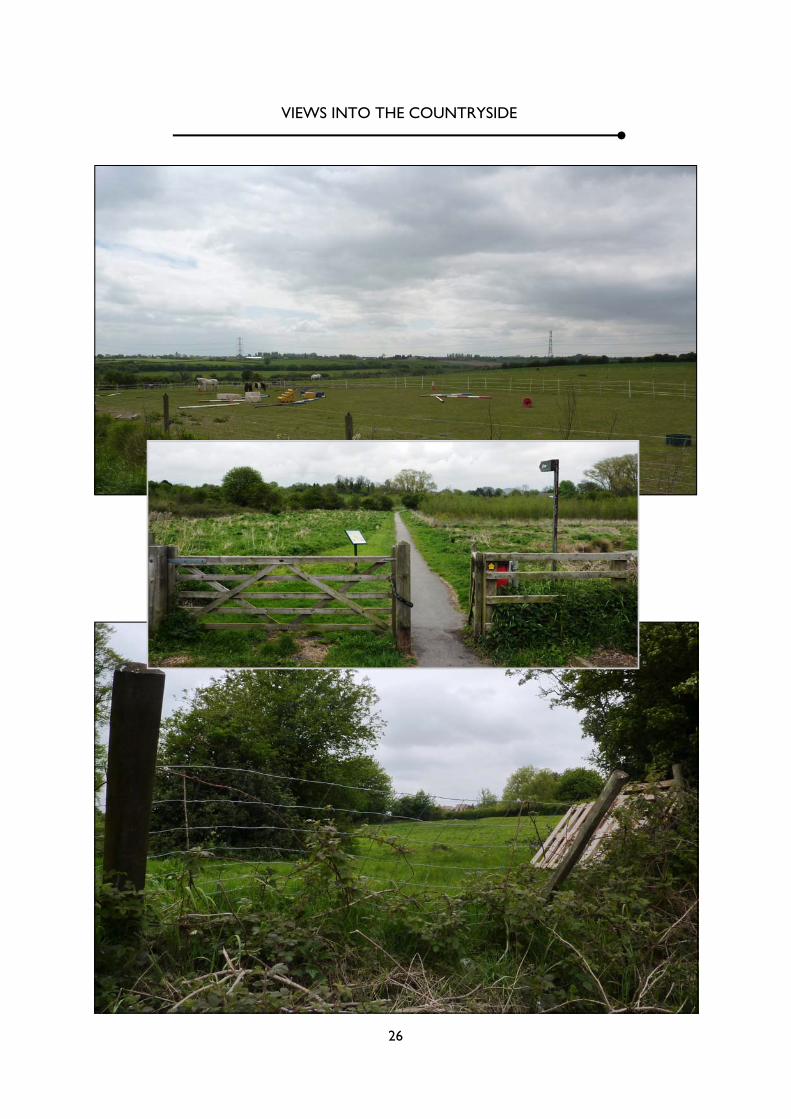
3.1 The individual elements which contribute posi-tively to the special character of the Conservation Area are identified on a map on the back page of this document. 3.2 The hamlet sits on the edge of the urban area and there is open land on all sides. This is agricul-tural land to the north, west and south and recrea-tional land to the east. There are important views out from the hamlet over this land and these are significant in establishing the rural feel and setting of the settlement. 3.3 The village streets form a simple grid pattern defining two blocks of land and there is a general fall in levels from north-west to south-east, reflecting the topographical positions of the village. A signifi-cant element in the area's particular character is the sunken nature of these lanes which, along with walls, hedges, trees and some buildings, produces a strong sense of enclosure in much of the village (see the ‘streetscene’ photographs in the Photographic Sur-vey) 3.4 There are important groups of trees around the Manor House, in the north west corner of the vil-lage, and in the garden of Donington House; the last of these are covered by a Tree Preservation Order. 3.5 The absence of pavements, with the lanes having simple grass verges, emphasise the rural nature of the area, as does the manner in which several of the lanes head out into the countryside as unmade tracks. 3.6 Donington le Heath does, therefore, have a strong and distinctive framework but lacks an obvi-ous focus. The small triangular area of grass at the junction of Townsend Lane and Manor Road, with a backdrop formed by Donington House, The Farm , and the buildings of Townsend Lane, is the nearest to a focal point in the village. Currently it accommo-dates a telegraph pole, control box, and street light.
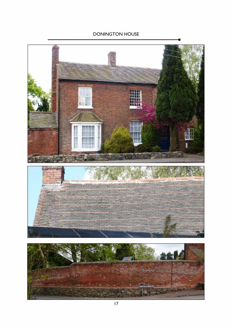
3.7 The telegraph pole is the central point of an extensive array of wires which form quite an intru-sive element in the character of the Conservation Area. 3.8 There are a number of key buildings sitting within the matrix but, with some notable excep-tions, buildings are not particularly prominent. 3.9 The most important historic building is the Manor House, a Grade II* listed building (a list de-scriptions can be found on page 12), which has its origins in the late 13th century. The building is now operated as a museum by Leicestershire County Council. (See the Photographic Survey ). 3.10 The one other listed building within the Con-servation Area is the mediaeval barn associated with the Manor House and which is now the tea room for the museum. This is Grade II listed. (Illustrated in the Photographic Survey) 3.11 Both buildings are constructed of Charnwood granite rubble, with Swithland slate on the roofs, and are quite distinctive in appearance. 3.12 In addition to the two listed buildings, there are other which, though not listed, do make a positive contribution to the character of the conservation area; these are listed along with some comments on pages 13 & 14, marked in blue on the map on the back page, and illustrated in the Photographic Sur-vey. 3.13 Donington House is perhaps the most architec-turally significant post-mediaeval house within the settlement. It is an attractive two storey structure of L plan. The short branch of the L faces the road and is a two-bay structure of Flemish Garden Wall bond brickwork and a clay tile roof. It has 8-over-8 pane sashes at first floor and an added bay and 6-over-6 pane sash at ground floor. To the west, at right angles, is the long arm of the L, which presents a gable to the road, and which has an unusual poly-
9
chromatic roof. The boundary wall of brick on a stone base is a very important element in the vil-lagescape, something which is emphasised by the manner in which it follows the road at the main junction within the village. 3.14 The survival of two farm groups in addition to the Manor House is testimony to the agricultural origins of the village. That known simply as 'The Farm' stands at the junction of Manor Road and Townsend. The farm house sits at right angles to the lane, presenting a blank gable which sits right on the verge. Now rendered, the building retains its chimneys, which are 'eye catchers' when proceeding down Manor Road, and a Swithland slate roof. One of the farm buildings also sits right on the verge, albeit parallel with it, and presents a blank elevation to the external elevation, reinforcing the sense of enclosure and identity of the group as a farmstead. Between the two is another stretch of stone walling. 3.15 Smiths Farm stands at the north-west corner of the village and is also a quite typical inward-looking
farm group, built largely of brick in this instance. The occurrence of some stone probably indicates the existence of earlier buildings on the site but the surviving buildings are largely 19th and early 20th century. Planning permission exists for the conver-sion of these buildings into dwellings and the con-struction of new buildings on the northern part of the site. 3.16 As the map regression has shown, the village had relatively few buildings until the later 19th cen-tury. A further farm group, in the south west, is shown on the 1930s OS Map but has since disap-peared. This is identified as a potential archaeologi-cal site on the character map. 3.17 Period cottages survive on Manor Road, Holts Lane and Farm Lane, albeit rather altered, and these have been identified as positive elements in the Conservation Area. 3.18 The 19th century contributed a number of buildings, mostly brick terraces of typical Vicorian
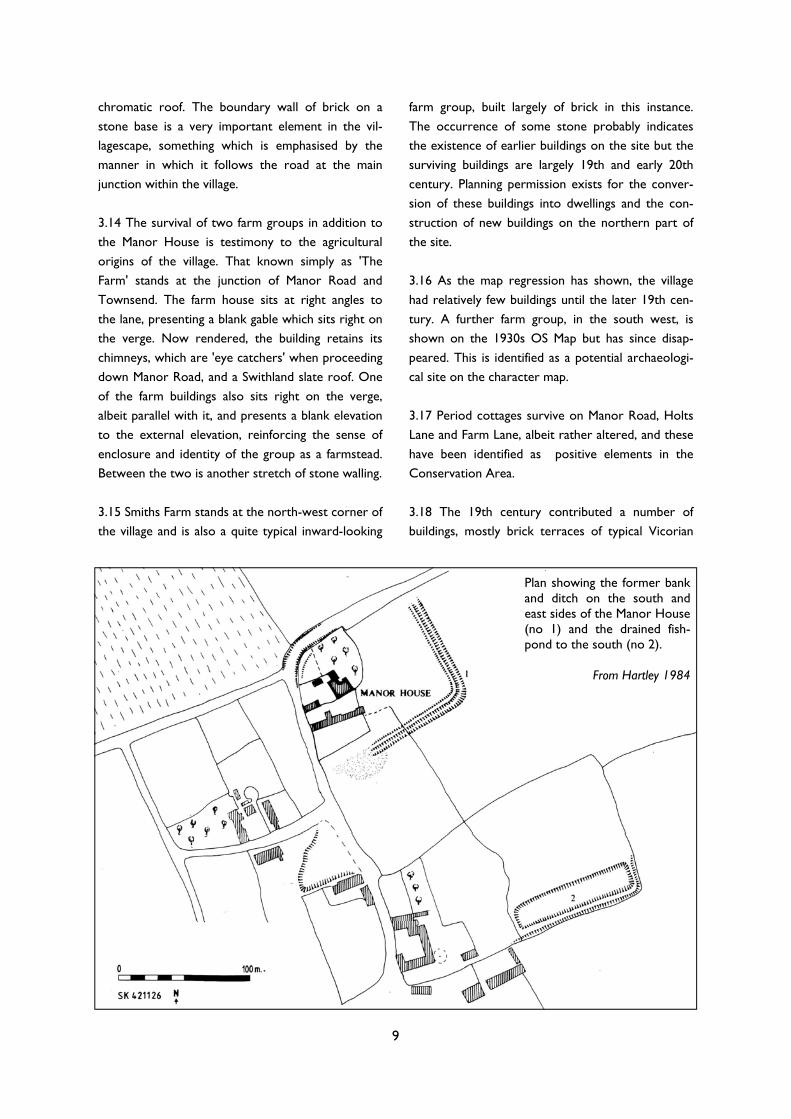
Plan showing the former bank and ditch on the south and east sides of the Manor House (no 1) and the drained fish-pond to the south (no 2).
From Hartley 1984

10
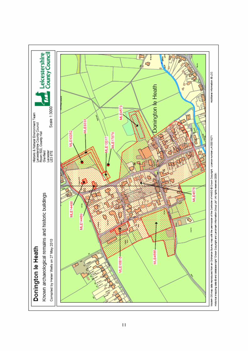
form. Those on the north side of Tweentown ap-pears on the 1883 map and must therefore predate that, albeit not by much, and there are other exam-ples on Townsend Lane, Manor Road and Holt Lane. Most have seen some changes but those which re-tain their fundamental form/design have been iden-tified as making a positive contribution to the char-acter of the Conservation Area. The potential for enhancement with the reinstatement of traditional joinery and materials is recognised in the ‘Management Plan’. 3.19 The special interest of Donington includes a significant archaeological component. The Leicester-shire Historic Environment Record (HER) contains ten entries for the area, as follows:- MLE4565 - Earthworks to the west of Donington le Heath MLE4573 - Fishpond south-east of Donington Manor House MLE4576 - Historic settlement core of Donington le Heath MLE833 - Bank and ditch surrounding Donington Manor House. MLE10017 - Possible gatehouse, Donington Manor House. MLE10052 - Neolithic/Bronze finds MLE14488 - Manor House MLE14489 - Barn adjoining the Manor House MLE16816 - Smiths Farm MLE17878 - Prehistoric flint scatter south of the Manor House 3.20 With the exception of the two ‘findspots’ of prehistoric material, these all represent survivals of a mediaeval landscape. The Manor House and barn are, of course, the most visible components of this landscape but other elements include various fea-tures linked to the Manor House, including a ditch or dry (?) moat enclosing it, a possible gatehouse to the enclosure, and fishponds to the south-east. 3.21 Visible earthworks survive on the western side of the village and these may, in part at least, be related to the farmstead that formerly existed in this part of the village.
3.22 The rather loose nature of historic develop-ment within the village left many spaces for 20th and 21st century development and the village now ac-commodates a lot of rather mediocre residential development. However, the nature of the matrix within which this development occurred, which was explored above, has significantly reduced its impact on the quality of the area; only on the east side of Farm Lane can it said to be visually dominant.
3.23 The following sources have been used in the preparation of this document:-
• Dornier, A., 1972, ‘Donington le Heath’,
Transactions of the Leicestershire Archaeological & Historical Society 47, 22-42
• Hartley, R F, 1984, The Mediaeval Earthworks
of North West Leicestershire. A Survey, Leices-tershire Museums, Art Galleries and Records ServiceLiddle, P., 1983, A Guide to Twenty Archaeological Sites in Leicestershire, Leicester-shire Museums, Art Galleries and Records Service
• Nichols, J., 1811, The History and Antiquities of
the County of Leicester, Vol IV Part II, London
• Sheppard, R., 2007, An Archaeological Building
Assessment of a Proposed Development at Smith’s Farm, Donington le Heath, Leicestershire, 2007, unpublished report, Trent and Peak Archaeology, Nottingham
• Welding, J.D. (ed.), 1984, Leicestershire in
1777. An edition of John Prior’s map of Leicester-shire, Leicestershire Libraries and Information Service
SOURCES
11
12
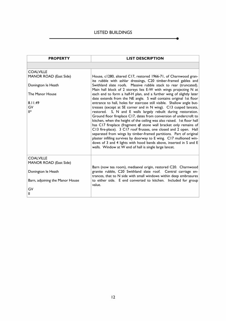
PROPERTY LIST DESCRIPTION
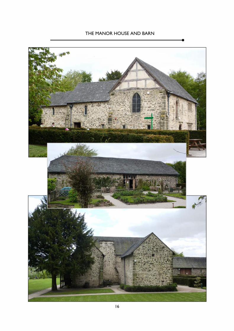
COALVILLE MANOR ROAD (East Side) Donington le Heath The Manor House 8.11.49 GV II*
(*
House, c1280, altered C17, restored 1966-71, of Charnwood gran-ite rubble with ashlar dressings, C20 timber-framed gables and Swithland slate roofs. Massive rubble stack to rear (truncated). Main hall block of 2 storeys lies E-W with wings projecting N at each end to form a half-H plan, and a further wing of slightly later date extends from the NE angle. S wall contains original 1st floor entrance to hall, holes for staircase still visible. Shallow angle but-tresses (except at SE corner and in N wing). C13 cusped lancets, restored. S, N and E walls largely rebuilt during restoration. Ground floor fireplace C17, dates from conversion of undercroft to kitchen, when the height of the ceiling was also raised. 1st floor hall has C17 fireplace (fragment of stone wall bracket only remains of C13 fire-place). 3 C17 roof trusses, one closed and 2 open. Hall separated from wings by timber-framed partitions. Part of original plaster infilling survives by doorway to E wing. C17 mullioned win-dows of 3 and 4 lights with hood bands above, inserted in S and E walls. Window at W end of hall is single large lancet.
COALVILLE MANOR ROAD (East Side) Donington le Heath Barn, adjoining the Manor House GV II
Barn (now tea room), mediaeval origin, restored C20. Charnwood granite rubble, C20 Swithland slate roof. Central carriage en-trances, that to N side with small windows within deep embrasures to either side. E end converted to kitchen. Included for group value.
LISTED BUILDINGS
13
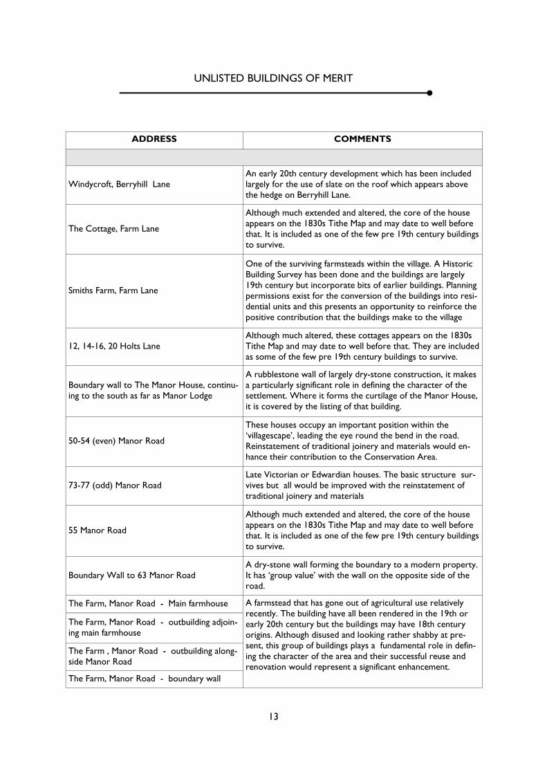
UNLISTED BUILDINGS OF MERIT
ADDRESS COMMENTS
Windycroft, Berryhill Lane An early 20th century development which has been included largely for the use of slate on the roof which appears above the hedge on Berryhill Lane.
The Cottage, Farm Lane
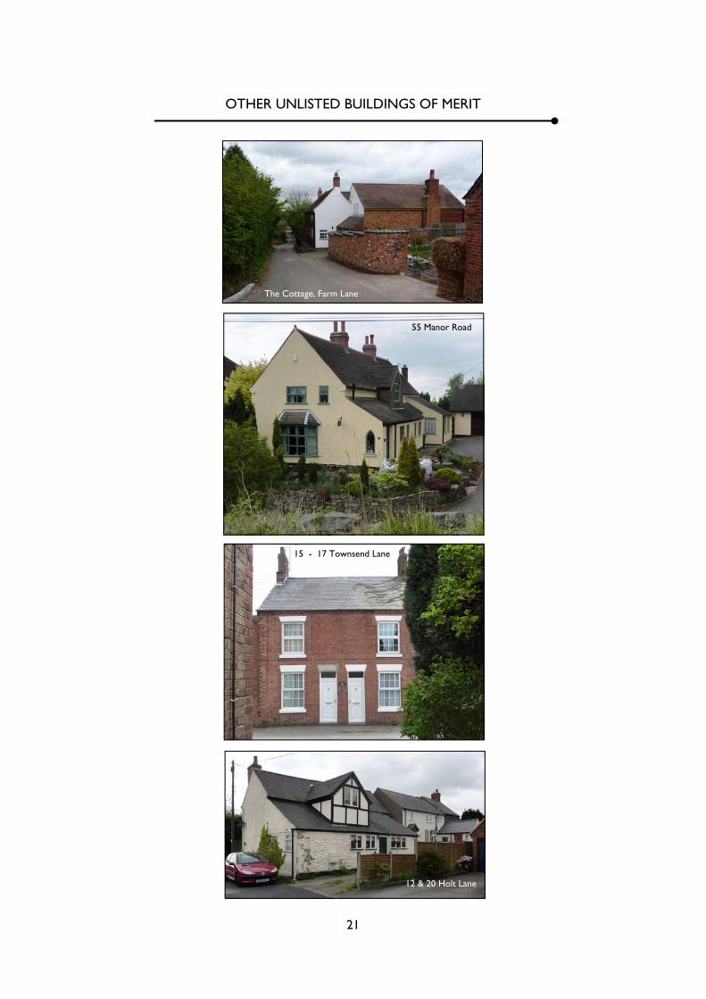
Although much extended and altered, the core of the house appears on the 1830s Tithe Map and may date to well before that. It is included as one of the few pre 19th century buildings to survive.
Smiths Farm, Farm Lane
One of the surviving farmsteads within the village. A Historic Building Survey has been done and the buildings are largely 19th century but incorporate bits of earlier buildings. Planning permissions exist for the conversion of the buildings into resi-dential units and this presents an opportunity to reinforce the positive contribution that the buildings make to the village
Although much altered, these cottages appears on the 1830s Tithe Map and may date to well before that. They are included as some of the few pre 19th century buildings to survive.
Boundary wall to The Manor House, continu-ing to the south as far as Manor Lodge
A rubblestone wall of largely dry-stone construction, it makes a particularly significant role in defining the character of the settlement. Where it forms the curtilage of the Manor House, it is covered by the listing of that building.
50-54 (even) Manor Road
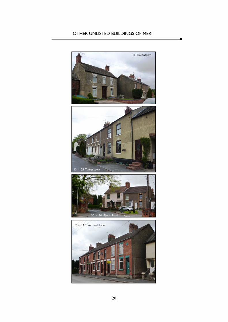
These houses occupy an important position within the ‘villagescape’, leading the eye round the bend in the road. Reinstatement of traditional joinery and materials would en-hance their contribution to the Conservation Area.
73-77 (odd) Manor Road Late Victorian or Edwardian houses. The basic structure sur-vives but all would be improved with the reinstatement of traditional joinery and materials
55 Manor Road
Although much extended and altered, the core of the house appears on the 1830s Tithe Map and may date to well before that. It is included as one of the few pre 19th century buildings to survive.
Boundary Wall to 63 Manor Road A dry-stone wall forming the boundary to a modern property. It has ‘group value’ with the wall on the opposite side of the road.
The Farm, Manor Road - Main farmhouse A farmstead that has gone out of agricultural use relatively recently. The building have all been rendered in the 19th or early 20th century but the buildings may have 18th century origins. Although disused and looking rather shabby at pre-sent, this group of buildings plays a fundamental role in defin-ing the character of the area and their successful reuse and renovation would represent a significant enhancement.
The Farm, Manor Road - outbuilding adjoin-ing main farmhouse
The Farm , Manor Road - outbuilding along-side Manor Road
The Farm, Manor Road - boundary wall
12, 14-16, 20 Holts Lane
14
2-14 (even) Townsend Lane All late Victorian or Edwardian red –brick terraced houses. The basic structure of all survives but equally all would be improved with the reinstatement of traditional joinery and materials
15-17 Townsend Lane
1-3 Tweentown
The houses have been much altered and would benefit from the reinstatement of traditional joinery and roof materials, and the removal of the garage. Nevertheless, they stand in a prominent corner position and the ivy covering No 1 makes an attractive ‘green’ contribution which helps to soften the villagescape at this point.
11 Tweentown
A three bay two-storey house set back from the road, which was rendered at some point in the late 19th or 20th centuries. Although the house has lost its original fenestration, roof ma-terials and boundary treatment, these could be reinstated to produce an attractive house.
13-21 (odd) Tweentown
Like No 11, this terrace has been rendered and would benefit from the reinstatement of original fenestration and roof mate-rials. The end property has been more extensively altered and is not included.
9A Townsend Lane
Considerably altered, and not for the better, this house bears a date plaque of 1786 and has been included mainly for the apparent antiquity of some of the fabric which survives be-neath all the inappropriate alterations.
Donington House, 1 Townsend Lane
The house is one of the most significant historic buildings within the village and, along with its boundary wall, makes an important contribution to the character and appearance of the Conservation Area. This is emphasised by it prominent corner position. Boundary wall to Donington House
15
PHOTOGRAPHIC SURVEY
16
THE MANOR HOUSE AND BARN
17
DONINGTON HOUSE

18
‘THE FARM’

19
SMITH’s FARM
20
OTHER UNLISTED BUILDINGS OF MERIT
11 Tweentown
13 - 21 Tweentown
50 - 54 Manor Road
2 - 14 Townsend Lane
21
OTHER UNLISTED BUILDINGS OF MERIT
The Cottage, Farm Lane
55 Manor Road
15 - 17 Townsend Lane
12 & 20 Holt Lane

22
OTHER UNLISTED BUILDINGS OF MERIT
9A Townsend Lane
≈
1 - 3 Tweentown
73 - 77 Manor Road
Boundary Wall to 63 Manor Road
23
STREETSCENES
Manor Road
Manor Road
Farm Lane
24
STEETSCENES
Manor Road
Manor Road
Townsend Lane
25
STREETSCENES
Farm Lane
Townsend Lane
26
VIEWS INTO THE COUNTRYSIDE
27
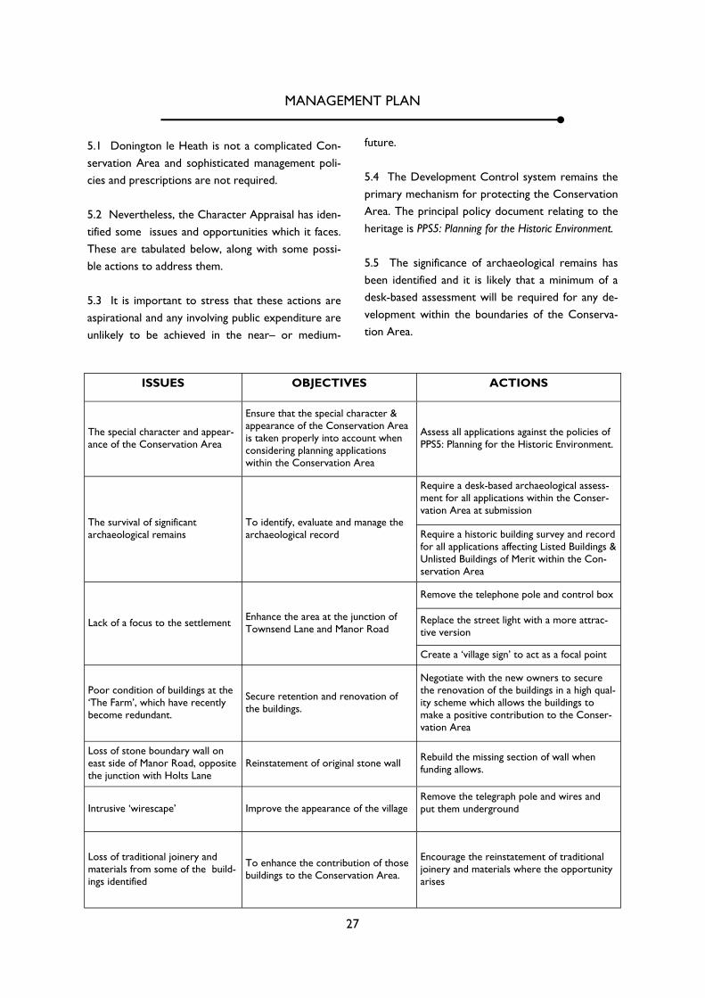
MANAGEMENT PLAN
5.1 Donington le Heath is not a complicated Con-servation Area and sophisticated management poli-cies and prescriptions are not required. 5.2 Nevertheless, the Character Appraisal has iden-tified some issues and opportunities which it faces. These are tabulated below, along with some possi-ble actions to address them. 5.3 It is important to stress that these actions are aspirational and any involving public expenditure are unlikely to be achieved in the near– or medium-
ISSUES OBJECTIVES ACTIONS
The special character and appear-ance of the Conservation Area
Ensure that the special character & appearance of the Conservation Area is taken properly into account when considering planning applications within the Conservation Area
Assess all applications against the policies of PPS5: Planning for the Historic Environment.
To identify, evaluate and manage the archaeological record
Require a desk-based archaeological assess-ment for all applications within the Conser-vation Area at submission
Require a historic building survey and record for all applications affecting Listed Buildings & Unlisted Buildings of Merit within the Con-servation Area
Lack of a focus to the settlement Enhance the area at the junction of Townsend Lane and Manor Road
Remove the telephone pole and control box
Replace the street light with a more attrac-tive version
Create a ‘village sign’ to act as a focal point
Poor condition of buildings at the ‘The Farm’, which have recently become redundant.
Secure retention and renovation of the buildings.
Negotiate with the new owners to secure the renovation of the buildings in a high qual-ity scheme which allows the buildings to make a positive contribution to the Conser-vation Area
Intrusive ‘wirescape’ Improve the appearance of the village Remove the telegraph pole and wires and put them underground
Loss of traditional joinery and materials from some of the build-ings identified
To enhance the contribution of those buildings to the Conservation Area.
Encourage the reinstatement of traditional joinery and materials where the opportunity arises
The survival of significant archaeological remains
Loss of stone boundary wall on east side of Manor Road, opposite the junction with Holts Lane
Reinstatement of original stone wall Rebuild the missing section of wall when funding allows.
future. 5.4 The Development Control system remains the primary mechanism for protecting the Conservation Area. The principal policy document relating to the heritage is PPS5: Planning for the Historic Environment. 5.5 The significance of archaeological remains has been identified and it is likely that a minimum of a desk-based assessment will be required for any de-velopment within the boundaries of the Conserva-tion Area.
28
Listed Buildings
Unlisted Buildings of Merit
Walls
Hedges
Sub surface archaeology
View to countryside Trees
Elements Making a Positive Contribution to the Special Character of Donington le Heath Conservation Area
≈
Conservation Area boundary
N