digimap webinar - urban map data for cad
TRANSCRIPT

Digimap – Urban map data for CAD
25 March 2015
Ian Holmes, EDINA Geo User Support
Viv Mayo James Crone
• What data is available in CAD format?
• Where do I get the data?
• How do I use the data?
• Copyright and Resources
Content

Poll
What is the one thing you most want to learn today?
• What data is available in CAD format?
• How do I get the data from Digimap?
• Tips on using the data in CAD?
• Other
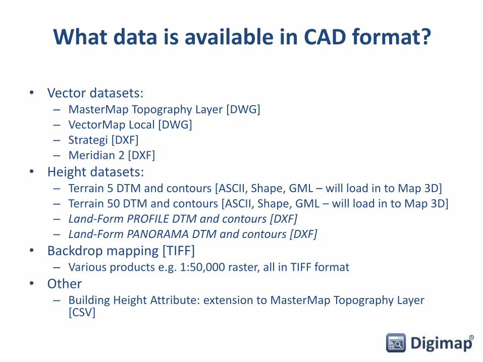
What data is available in CAD format?
• Vector datasets:– MasterMap Topography Layer [DWG]– VectorMap Local [DWG]– Strategi [DXF]– Meridian 2 [DXF]
• Height datasets:– Terrain 5 DTM and contours [ASCII, Shape, GML – will load in to Map 3D] – Terrain 50 DTM and contours [ASCII, Shape, GML – will load in to Map 3D]– Land-Form PROFILE DTM and contours [DXF]– Land-Form PANORAMA DTM and contours [DXF]
• Backdrop mapping [TIFF]– Various products e.g. 1:50,000 raster, all in TIFF format
• Other– Building Height Attribute: extension to MasterMap Topography Layer
[CSV]
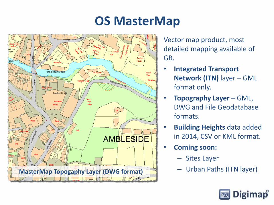
OS MasterMapVector map product, most detailed mapping available of GB.
• Integrated Transport Network (ITN) layer – GML format only.
• Topography Layer – GML, DWG and File Geodatabase formats.
• Building Heights data added in 2014, CSV or KML format.
• Coming soon:
– Sites Layer
– Urban Paths (ITN layer)MasterMap Topogaphy Layer (DWG format)

Vector Map Local data
• Scale 1:10,000
• Includes contours and spot heights
• Formats – GML, DWG, SHP
• Supplied in 5x5km tiles
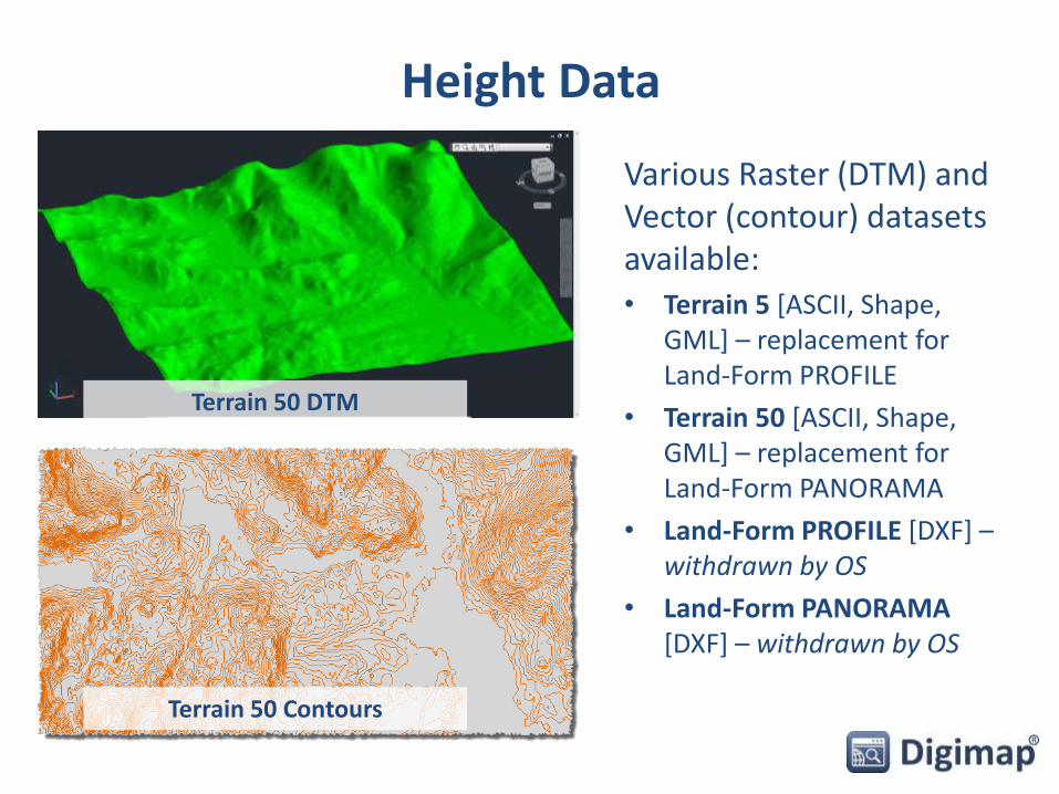
Height Data
Various Raster (DTM) and Vector (contour) datasets available:• Terrain 5 [ASCII, Shape,
GML] – replacement for Land-Form PROFILE
• Terrain 50 [ASCII, Shape, GML] – replacement for Land-Form PANORAMA
• Land-Form PROFILE [DXF] –withdrawn by OS
• Land-Form PANORAMA [DXF] – withdrawn by OS
Terrain 50 Contours
Terrain 50 DTM
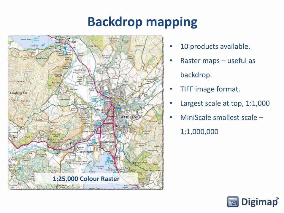
Backdrop mapping
• 10 products available.
• Raster maps – useful as
backdrop.
• TIFF image format.
• Largest scale at top, 1:1,000
• MiniScale smallest scale –
1:1,000,000
1:25,000 Colour Raster

Building Height Attribute data• Released by OS in March 2014
• Enhancement to Topography layer
• Covers around 10,000 km2 of major towns and cities in GB -see where:– http://bit.ly/1zvKI9q
• Alpha release – no guarantee error free
• In future will be included in Topography layer
• CSV or KML format
• EDINA supplies as 5x5km grid tiles

Update FrequencyDigimap > OS Help > Data Information > Data update dates
http://bit.ly/1Ag6R6I

Where do I get the data?
• Data Download –download OS mapping data for use in GIS/CAD

Data Download
• All available OS map data
• Download several map products in one order
• 5 categories of map data
• 3 steps to order map data
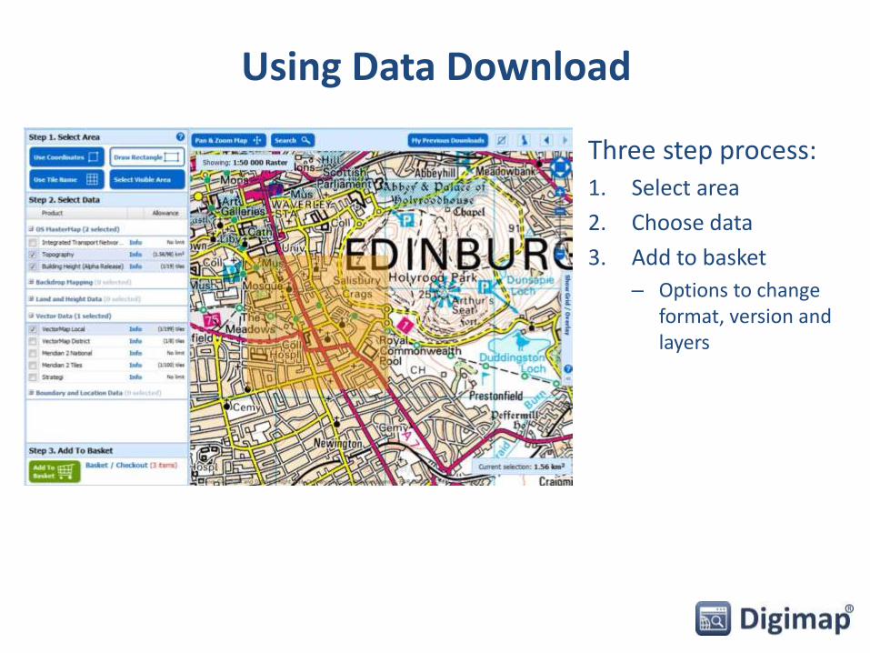
Using Data Download
Three step process:1. Select area
2. Choose data
3. Add to basket
– Options to change format, version and layers

Basket options
• Select version, format and layers in the basket.
• Options vary between map data products.
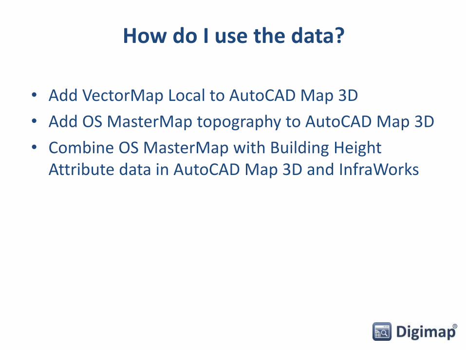
How do I use the data?
• Add VectorMap Local to AutoCAD Map 3D
• Add OS MasterMap topography to AutoCAD Map 3D
• Combine OS MasterMap with Building Height Attribute data in AutoCAD Map 3D and InfraWorks

Poll
What software do you use regularly with map data? Tick ALL that apply.
• AutoCAD
• AutoCAD Map 3D
• VectorWorks
• ArcGIS
• Other
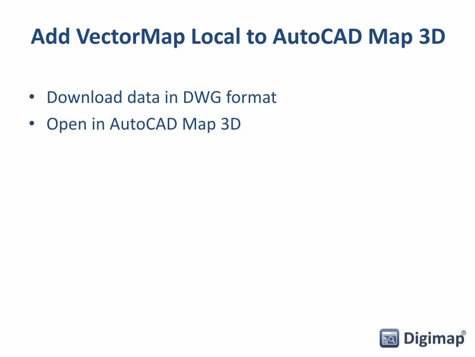
Add VectorMap Local to AutoCAD Map 3D
• Download data in DWG format
• Open in AutoCAD Map 3D
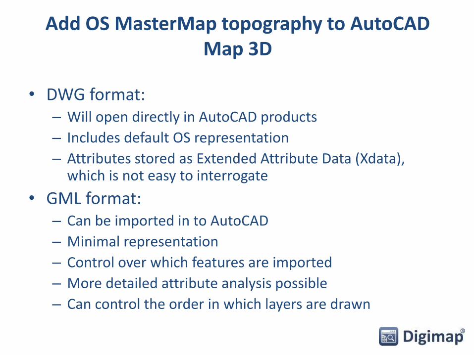
Add OS MasterMap topography to AutoCAD Map 3D
• DWG format:– Will open directly in AutoCAD products
– Includes default OS representation
– Attributes stored as Extended Attribute Data (Xdata), which is not easy to interrogate
• GML format:– Can be imported in to AutoCAD
– Minimal representation
– Control over which features are imported
– More detailed attribute analysis possible
– Can control the order in which layers are drawn
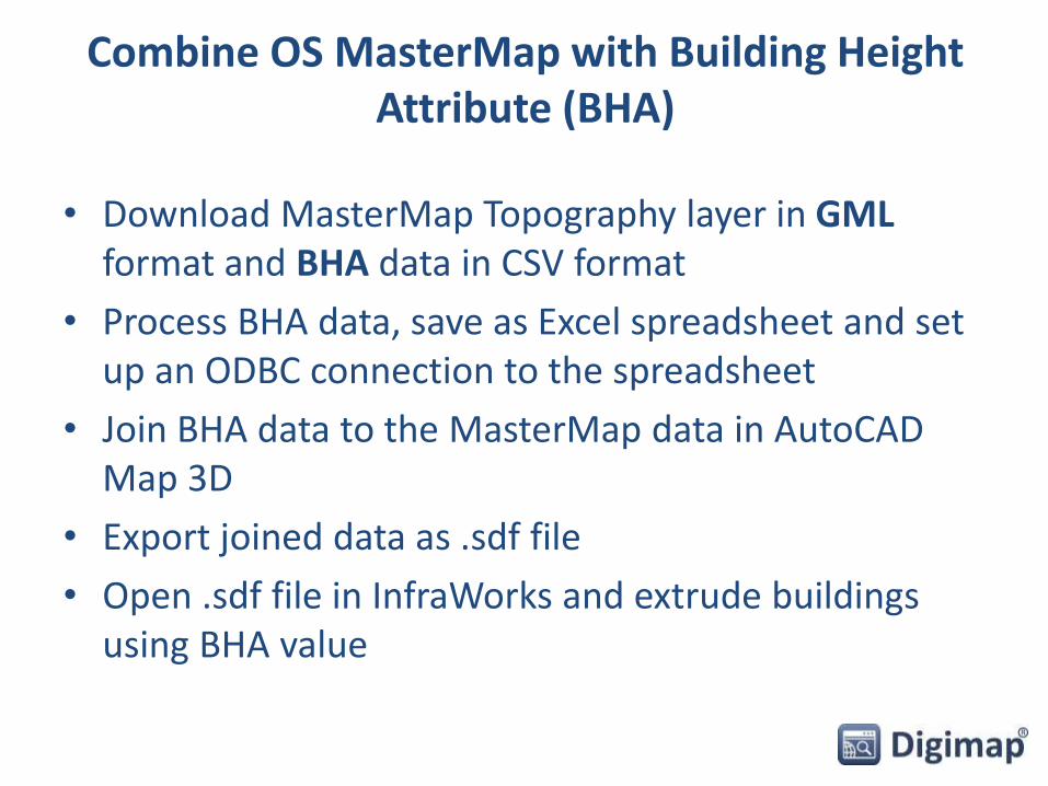
Combine OS MasterMap with Building Height Attribute (BHA)
• Download MasterMap Topography layer in GML format and BHA data in CSV format
• Process BHA data, save as Excel spreadsheet and set up an ODBC connection to the spreadsheet
• Join BHA data to the MasterMap data in AutoCAD Map 3D
• Export joined data as .sdf file
• Open .sdf file in InfraWorks and extrude buildings using BHA value

New datasets – coming soon
OS MasterMap Sites Layer
PointX [points of interest] OS MasterMap ITN - Urban Paths Theme

Future developments
• Outline/plan version OS MasterMap in DWG format
• 3D buildings in DWG format
• OS Terrain 5 and 50 contours in DWG format
If there is anything you would like to see added to the service, please send your suggestions to [email protected]!
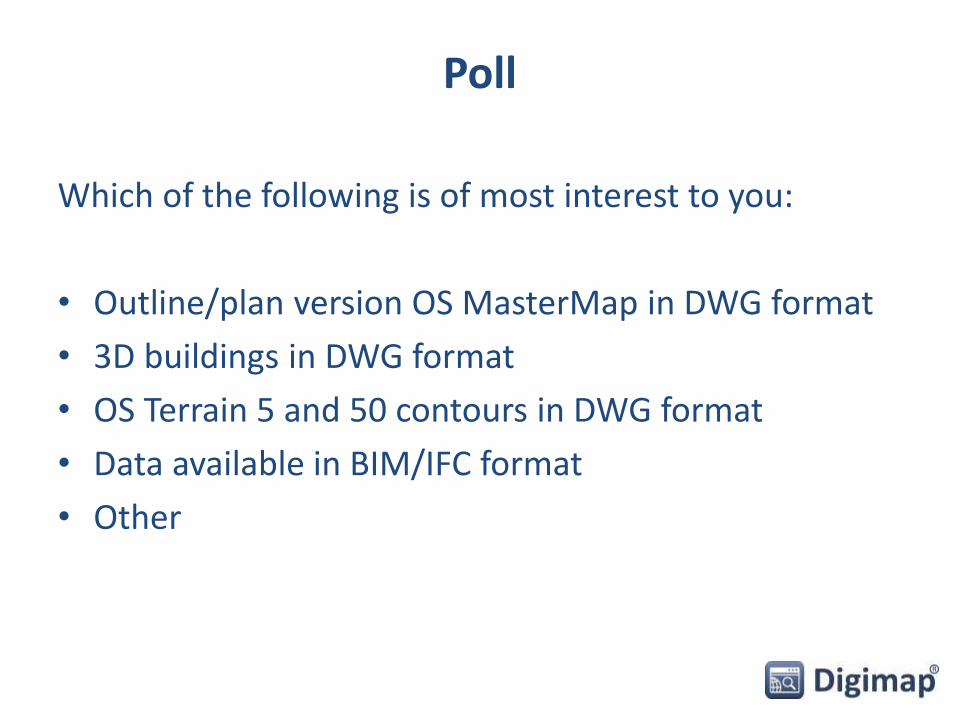
Poll
Which of the following is of most interest to you:
• Outline/plan version OS MasterMap in DWG format
• 3D buildings in DWG format
• OS Terrain 5 and 50 contours in DWG format
• Data available in BIM/IFC format
• Other
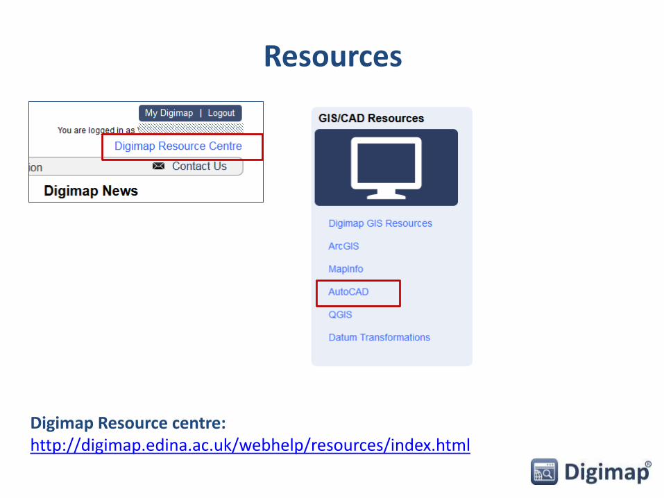
Resources
Digimap Resource centre: http://digimap.edina.ac.uk/webhelp/resources/index.html
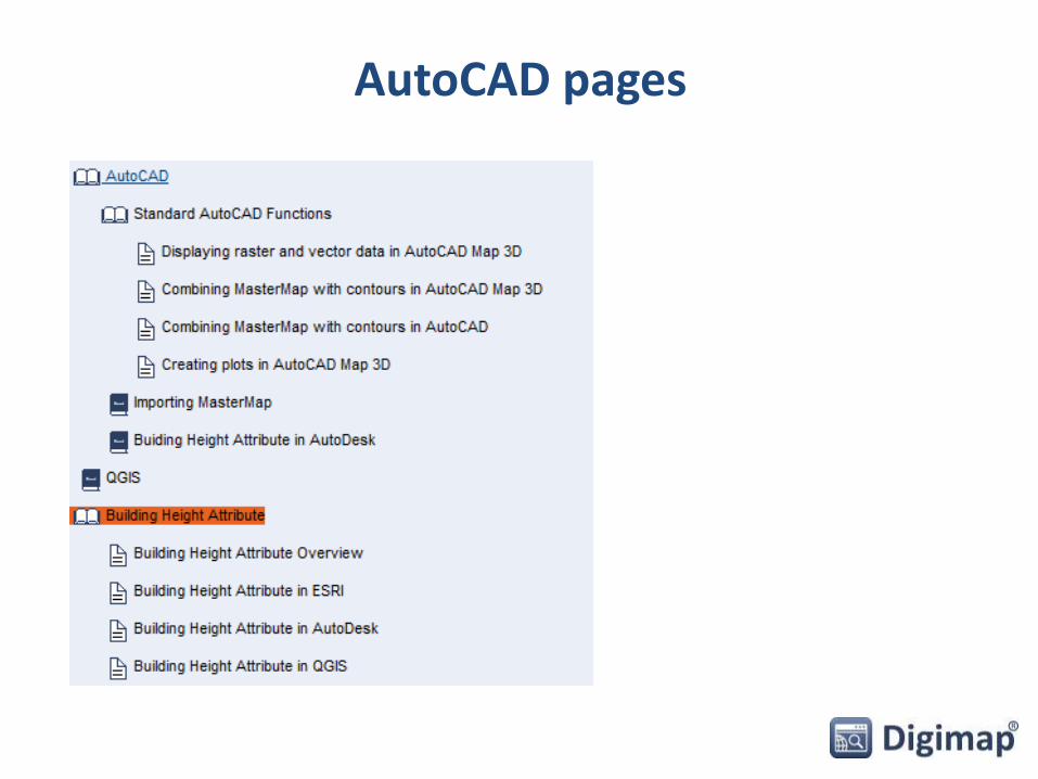
AutoCAD pages

Permitted uses of data from Digimap
• Educational use:
– teaching, learning, academic and sponsored research and/or private study (includes distance learning)
• Limited Administrative Use:– publish mapping images in promotional literature or web, to show
campus location/extent, event locations, directions, promote Digimap service
– Incorporate mapping images in Youtube videos, for demonstration or promotion of the service

Acknowledgement
• Copyright acknowledgement required:
© Crown Copyright and Database Right [insert date]. Ordnance Survey (Digimap Licence)
– Copyright acknowledgement is included on all maps printed from Digimap Collections.
– Remember to include copyright acknowledgement if you download data from Digimap and create maps!

Can I publish my work on the web?
You can:
• Publish copies of works on the web, provided mapping images are:– In a raster format
– Not georeferenced
– No larger than necessary
– Include additional information
– Adequate steps taken to ensure third parties cannot access, use and extract any OS data from such materials
• Post images to Twitter and YouTube, but not Facebook.

Support with copyright
• Lists of Frequently Asked Questions:http://digimap.edina.ac.uk/webhelp/digimapsupport/access/licence_ag
reements.htm
• Your site representative:http://digimap.edina.ac.uk/webhelp/digimapsupport/service_info/site_r
ep_list.htm
• EDINA Help Desk:[email protected]
0131 650 3302

Poll
Today’s webinar:
• I learnt something new
• I didn’t learn anything new
• Was a good use of my time
• Was a poor use of my time
• Other