digimap for schools geography resources mountain rescue! © edina at university of edinburgh 2013...
TRANSCRIPT
Digimap for Schools Geography Resources
Mountain Rescue!
© EDINA at University of Edinburgh 2013This work is licensed under a Creative Commons Attribution – Non-Commercial License

• By estimating the eastings and northings to within 1/10 of the grid interval you can give a 6-figure grid reference that is accurate to within 100 metres on the ground.
Six figure Grid References
See:http://www.ordnancesurvey.co.uk/resources/maps-and-geographic-resources/the-national-grid.html
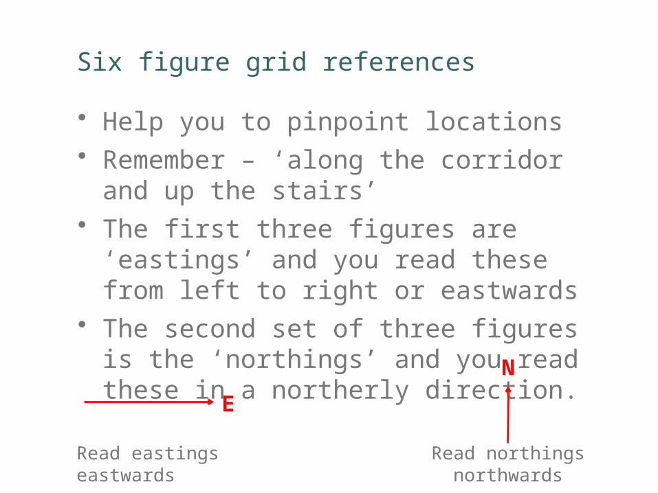
• Help you to pinpoint locations• Remember – ‘along the corridor and up the
stairs’ • The first three figures are ‘eastings’ and you
read these from left to right or eastwards• The second set of three figures is the
‘northings’ and you read these in a northerly direction.
Six figure grid references
Read eastings eastwards Read northings northwards
E
N

Reading a six figure Grid Reference
eastings
Easting 328
Grid Reference: NY 328 088
The first set of figures are the eastings (328)
The second set of figures are the northings (088)
Figures on the map showing numbers 30, 31, 32, 33 are eastings
Start at easting 32 go 8/10 of the way along the distance between 32 and 33 to find 328
Start at northing 08 and go northwards 8/10 of the distance to 09 to find 088
northing 088
northings
See: http://www.ordnancesurvey.co.uk/resources/maps-and-geographic-resources/the-national-grid.html

Use the right scale map to show start and finish
Injured climber
HQ Mountain Rescue Centre