city tourism nainital india … memories of the tourists that do not … 71/english/nainital... ·...
TRANSCRIPT
City Tourism
Nainital India … Memories of the tourists that do not forget ..
By : Khaled Aldhababi, Inida
In the Uttranchal, district of Nainital lies in the Kumaun division. To it's north is Almora district and to its south lies the Udham Singh Nagar district. Champawat district flanks it in the east and
district of Pauri Gahwal is in the west.
It is located approximately in between 80º14' and 78º80' east longitude and 29º00' and 29º05'
north latitude. On the northern side lies the Himalayan ranges while on the southern side lies the plains
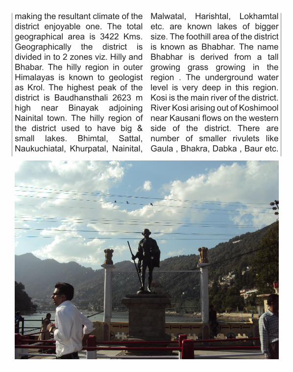
making the resultant climate of the district enjoyable one. The total geographical area is 3422 Kms. Geographically the district is divided in to 2 zones viz. Hilly and Bhabar. The hilly region in outer Himalayas is known to geologist as Krol. The highest peak of the district is Baudhansthali 2623 m high near Binayak adjoining Nainital town. The hilly region of the district used to have big & small lakes. Bhimtal, Sattal, Naukuchiatal, Khurpatal, Nainital,
Malwatal, Harishtal, Lokhamtal etc. are known lakes of bigger size. The foothill area of the district is known as Bhabhar. The name Bhabhar is derived from a tall growing grass growing in the region . The underground water level is very deep in this region. Kosi is the main river of the district. River Kosi arising out of Koshimool near Kausani flows on the western side of the district. There are number of smaller rivulets like Gaula , Bhakra, Dabka , Baur etc.
Most of these have been dammed for irrigation purposes. River Ramganga originates from the Doodha Tauli ranges in district Pauri Garhwal. It enters into district Nainital, before re-entering into district Pauri Garhwal
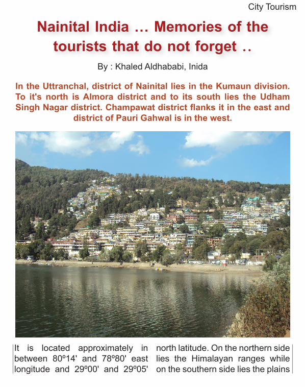
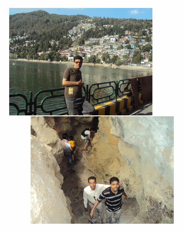
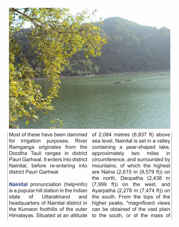
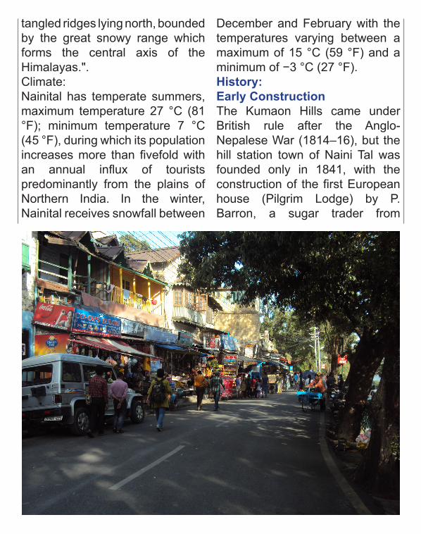
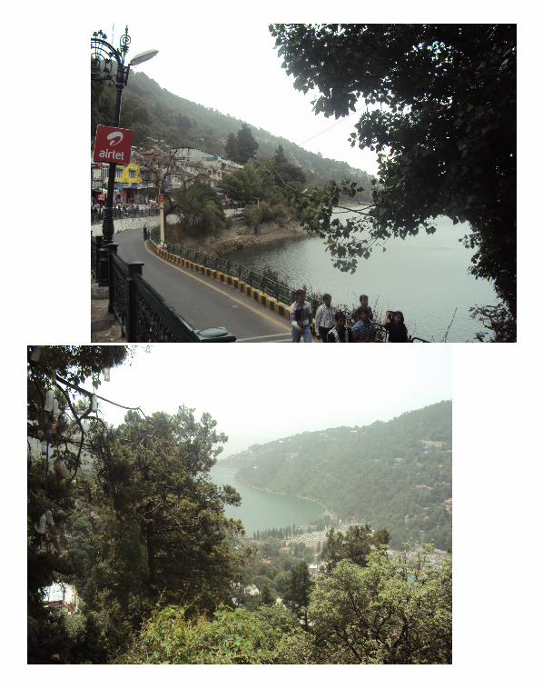
Nainital pronunciation (help•info) is a popular hill station in the Indian state of Uttarakhand and headquarters of Nainital district in the Kumaon foothills of the outer Himalayas. Situated at an altitude
of 2,084 metres (6,837 ft) above sea level, Nainital is set in a valley containing a pear-shaped lake, approximately two miles in circumference, and surrounded by mountains, of which the highest are Naina (2,615 m (8,579 ft)) on the north, Deopatha (2,438 m (7,999 ft)) on the west, and Ayarpatha (2,278 m (7,474 ft)) on the south. From the tops of the higher peaks, "magnificent views can be obtained of the vast plain to the south, or of the mass of
tangled ridges lying north, bounded by the great snowy range which forms the central axis of the Himalayas.".Climate:Nainital has temperate summers, maximum temperature 27 °C (81 °F); minimum temperature 7 °C (45 °F), during which its population increases more than fivefold with an annual influx of tourists predominantly from the plains of Northern India. In the winter, Nainital receives snowfall between
December and February with the temperatures varying between a maximum of 15 °C (59 °F) and a minimum of −3 °C (27 °F).History:Early ConstructionThe Kumaon Hills came under British rule after the Anglo-Nepalese War (1814–16), but the hill station town of Naini Tal was founded only in 1841, with the construction of the first European house (Pilgrim Lodge) by P. Barron, a sugar trader from
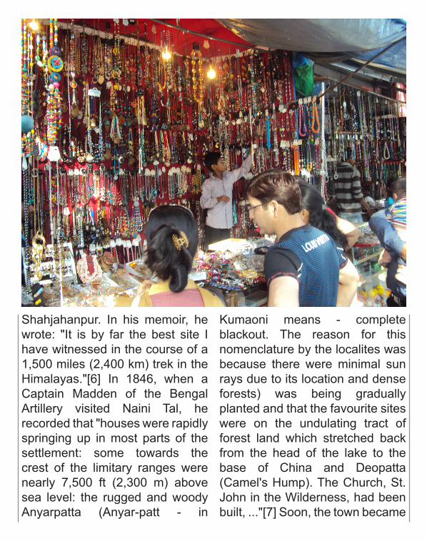
Shahjahanpur. In his memoir, he wrote: "It is by far the best site I have witnessed in the course of a 1,500 miles (2,400 km) trek in the Himalayas."[6] In 1846, when a Captain Madden of the Bengal Artillery visited Naini Tal, he recorded that "houses were rapidly springing up in most parts of the settlement: some towards the crest of the limitary ranges were nearly 7,500 ft (2,300 m) above sea level: the rugged and woody Anyarpatta (Anyar-patt - in
Kumaoni means - complete blackout. The reason for this nomenclature by the localites was because there were minimal sun rays due to its location and dense forests) was being gradually planted and that the favourite sites were on the undulating tract of forest land which stretched back from the head of the lake to the base of China and Deopatta (Camel's Hump). The Church, St. John in the Wilderness, had been built, ..."[7] Soon, the town became
a health resort favoured both by British soldiers and by colonial officials and their families trying to escape the heat of the plains. Later, the town also became the summer residence of the Governor of the United Provinces.
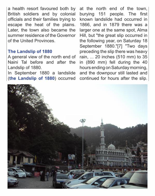
The Landslip of 1880 A general view of the north end of Naini Tal before and after the Landslip of 1880.In September 1880 a landslide (the Landslip of 1880) occurred
at the north end of the town, burying 151 people. The first known landslide had occurred in 1866, and in 1879 there was a larger one at the same spot, Alma Hill, but "the great slip occurred in the following year, on Saturday 18 September 1880."[7] "Two days preceding the slip there was heavy rain, ... 20 inches (510 mm) to 35 in (890 mm) fell during the 40 hours ending on Saturday morning, and the downpour still lasted and continued for hours after the slip.
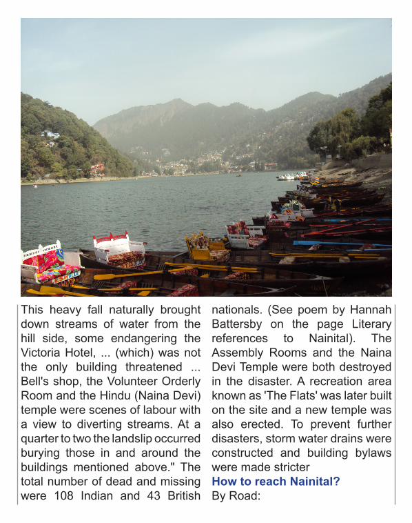
This heavy fall naturally brought down streams of water from the hill side, some endangering the Victoria Hotel, ... (which) was not the only building threatened ... Bell's shop, the Volunteer Orderly Room and the Hindu (Naina Devi) temple were scenes of labour with a view to diverting streams. At a quarter to two the landslip occurred burying those in and around the buildings mentioned above." The total number of dead and missing were 108 Indian and 43 British
nationals. (See poem by Hannah Battersby on the page Literary references to Nainital). The Assembly Rooms and the Naina Devi Temple were both destroyed in the disaster. A recreation area known as 'The Flats' was later built on the site and a new temple was also erected. To prevent further disasters, storm water drains were constructed and building bylaws were made stricterHow to reach Nainital?By Road:
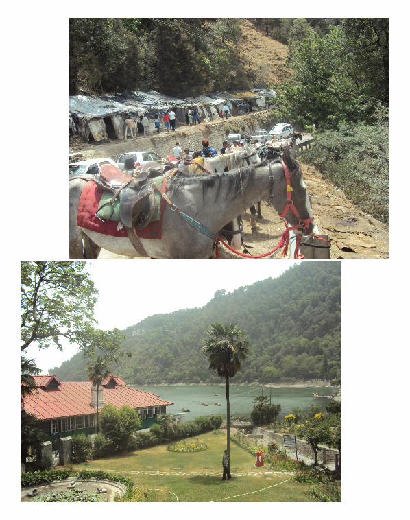
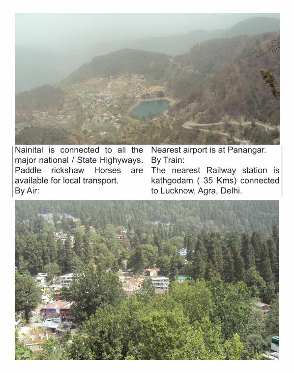
Nainital is connected to all the major national / State Highyways. Paddle rickshaw Horses are available for local transport.By Air:
Nearest airport is at Panangar.By Train:The nearest Railway station is kathgodam ( 35 Kms) connected to Lucknow, Agra, Delhi.