chapter 1 water views - ose.state.nm.us
TRANSCRIPT

Chapter 1 Water Views
21
Chapter ContentsTe a c h e r ’s Notes• Notes on Activities
B a c k g ro u n dI n f o rmation: Water in New Mexico
Student Handout: H i s t o ry of New Mexico Water and Water R i g h t s
Student Handout:C h a rts and Graphs
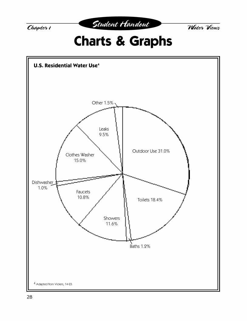
U.S. Residential Water UseNew Mexico Water Use
Activity 1-1: Water Wo r l d
Activity 1-2: A re All Habitats I d e n t i c a l ?
Activity 1-3: Acequias and the C o m m u n i t y
Activity 1-4: Little Wet Jug
Special Interest G roups We b s i t e s
R e s o u rces andR e f e re n c e s
Xeriscape DefinitionXeriscape is water- e fficient landscaping that is appro p r i-
ate to the natural environment. The term xeriscape isderived from the Greek word xeros, which means dry.The goal of xeriscaping is to create visually attractive
landscapes that use water eff i c i e n t l y.
Teacher’s Notes
The purpose of this intro d u c t o rychapter is to set the stage for an
understanding of water distribution andwater rights issues in New Mexico. Thisb a c k g round information will help stu-dents understand the importance of con-s e rving our water re s o u rces. It will alsohelp them understand the historic devel-
opment of attitudes toward the use of water in our state.
Because this chapter serves as background material meantto provide a context within which to discuss water conserv a-tion, there is no Xeriscape Principle, Problem to Solve o rP roject Cover Sheet for this chapter.
Notes on the ActivitiesWater Wo r l d – Students should realize from this lab thatmost of the world’s water is salt water. The amount of avail-able fresh water is very limited because most of the world’sf resh water is found in ice caps and glaciers. Consequently,it is not easily accessible for use by humans. Water that isc o n s i d e red available for use by people is found in fre s h w a t e rlakes, rivers, and gro u n d w a t e r. Yet even these sources arelimited due to pollutants, limited access, and naturallyo c c u rring minerals such as arsenic and salt.
Key ConceptsAvailability of fresh water, semi-arid enviro n m e n t s ,
water rights, interest gro u p s .
Use the Water Wo r l d Student Worksheet todiscuss the availability of water for humanconsumption. Note that all of the world’swater could theoretically become availableas technology such as desalinization is fur-ther developed. On the other hand, availablewater could become “unavailable” due topollution.
A re All Habitats Identical? – This is a veryopen-ended activity that can be extendedfor as long as desired. It should help stu-dents realize that New Mexico consists ofmany local and regional environments, all ofwhich are semi-arid. Rainfall is unevenly dis-tributed (both temporally and geographical-ly). By correlating rainfall and habitats, stu-dents should see the pivotal role that rainfallplays in determining the types of habitatsthat occur. In order to fabricate the model,students will need to study the habitats indetail. The New Mexico State Universitywebsite at http://weather. n m s u . e d u / n m c c-cooperator/index.htm provides a wealth ofdata that can be used for comparing manyweather variables throughout the state.Students will use critical-thinking and deci-sion-making methods to determine four cat-egories of rainfall.
Acequias and the Community – Studentswill re s e a rch diff e rent mechanical, political,and social aspects of the acequia systemand build a model to better understand howthe system works. This can be done in smallg roups or as individual projects. Studentscan determine which aspects of the systemthey are most interested in re s e a rching orthe teacher can make assignments. Themodel-building activity can either be ag roup assignment or a class project.
Little Wet Jug – The purpose of this activityis to stimulate thought and encourage dis-cussion. The students divide into groups torole-play six diff e rent New Mexico speciali n t e rest groups. The assignment for eachg roup is to create a water plan for the state.As current politics in New Mexico indicate,t h e re is little consensus among existingi n t e rest groups competing for water rights.C o n s e q u e n t l y, there is not a “right” or“ w rong” answer for this activity. Studentsshould be evaluated on how well they workas a group, how thorough their re s e a rch is,and the quality of their proposed water plan.Each gro u p ’s plan should be creative butrealistic, and it should attempt to addre s stheir water needs while also recognizing theneeds of the other gro u p s .
Chapter 1 Water Views
22
Teacher’s Notes, continued

The history of water rights in New Mexicois ancient and complex. It began when
p rehistoric Indians constructed irr i g a t i o ncanals to move water to their pueblos. Asearly as 1582, the Acoma people savedwater in marshy areas. Also during the1500s, the early Spanish conquerors intro-duced acequias (community ditches) andthe social rules used to manage them. Onei m p o rtant component of these rules was them a y o rdomo, or ditch master, who grantedthe right to use the water and kept track ofthose who had done theirs h a re of the work to main-tain the acequia. After theinflux of the Spanish, thepueblos blended some ofthe Spanish practices withtheir own ancient irr i g a t i o npractices.
As New Mexico’s populationg re w, so did the demand forw a t e r. The late 1800s sawi n c reased farming and min-ing. Dams were built andm o re land was irr i g a t e d .Soon, land ownership andwater rights became a con-t roversial issue. In 1851, theNew Mexico Te rritorial Legislature estab-lished laws to deal with the expanding needfor water. By 1907, the terr i t o ry had its firstc o m p rehensive surface water laws. The lawsw e re based on the early Indian-Spanishideas of ownership of the irrigation ditchesand public control of surface water. As tech-nology improved, more underg round waterwas tapped and more land was irrigated forc rops. Oil and gas industries also entere dinto the picture and demanded their share ofthe state’s water.
C u rrent New Mexico laws state that all ofNew Mexico’s surface and underg ro u n dwater belongs to the public and is subject toa p p ro p r i a t i o n1. An appropriated water rightis considered pro p e rty (much like equip-ment or furn i t u re), and it can be separatedf rom the land and transferred to anotherlocation subject to legal re q u i rements. Thea p p ropriator “owns” only the right to use thewater and not the “corpus” or body of wateritself. In addition, New Mexico’s water isa d m i n i s t e red under the doctrine of p r i o r
a p p ropriation. This meansthat the first person to takewater and use it in a benefi-c i a l2 way has the right tothat water. Those who comelater do not get to take theirwater until the “first tocome” have gotten theirs h a re.*
The water that flows thro u g hNew Mexico must be appro-priated to many diff e re n tentities in addition to theindividuals who live here .Rivers are part of the sur-face water system, which bylaw must be shared with
neighboring states according to the statecompacts and court rulings. For instance,Colorado and Texas both hold rights to ac e rtain percentage of the water in the RioGrande. In addition, the federal govern m e n t ,which owns about 46 percent of the land inNew Mexico, is guaranteed rights to enoughwater to maintain federal lands for the pub-lic. So a portion of the state’s water rightsbelongs to the United States government tog row trees, fight fires, and maintain fishings t reams, among other uses.
Chapter 1 Water Views
23
B a c k g round Information: Water in New Mexico
A history of acequiasand examples of by-laws are available at
the Office of the StateEngineer’s website athttp://www.seo.state.
nm.us/water-info/acequias.html
* For more information on water rights, see Appendix L.

Native Americans in the state also have sig-nificant water rights. Their re s e rv a t i o n smake up about 10 percent of the land are ain the state, and they own the rights to allthe water they need to use for present andf u t u re purposes on these re s e rvations. There s e rvations also own similar water rights tos t reams that are within their boundaries.
U n f o rt u n a t e l y, New Mexico’s available waterre s o u rces are very limited. The sources thatsupply New Mexico’s water consist of:
• precipitation in the form of rain and snow, • rivers that run through the state, and • gro u n d w a t e r.
In an average year, New Mexico re c e i v e sf rom 7 to 20 inches of precipitation acro s sthe state. Precipitation combined with riverflows in the state provide about 87.7 milliona c re-feet of surface water3 a year. Due to thestate compacts and court rulings for share ds u rface water, New Mexico retains onlyabout 1.2 million acre-feet of usable surf a c ewater a year. About seven percent of thepopulation depends on this surface water forits domestic water needs.
G roundwater is water that moves slowlyt h rough the ground until being naturallys t o red in an underg round aquifer. The state’su n d e rg round water supply is estimated at 20billion acre-feet. That is enough to cover thestate with about 260 feet of water. However,most of this water has high levels of natural-ly occurring minerals such as arsenic andsalt and is not suitable for human use.
Considering how little precipitation, surf a c ew a t e r, and groundwater is truly available, itis no surprise that competition for the state’slimited water is intensifying and the cost for
options is mounting. New Mexico’s popula-tion growth is increasing the demands ona l ready scarce re s o u rces to the point thatwater demands in some of the state’s urbana reas are approaching the available sup-plies. Another result of the growing waterdemand is that the cost of water develop-ment and treatment continues to escalate.Many communities are now faced withexpensive water and wastewater tre a t m e n tfacility expansions to meet individual andindustrial needs. Overall, demand is begin-ning to exceed supply, resulting in diminish-ing re s o u rces and expensive solutions.F o rt u n a t e l y, water conservation can delay,and in some cases actually eliminate, theneed for costly infrastru c t u re expenses.C o n s e rvation is almost always the leastcostly water supply altern a t i v e .
C u rrent Uses of New Mexico’s Wa t e rNew Mexico’swater users con-sist of municipali-ties, farmers andranchers, com-m e rcial and indus-trial facilities, insti-tutions such ashospitals andschools, powergenerating facili-
ties, and re c reational enthusiasts. Added tothis list are water used to sustain fish andwildlife and water needed to account forevaporation from re s e rvoirs, lakes, andponds. In addition, New Mexico must deliverc e rtain amounts of water in its rivers toTexas to meet water demands there (just asColorado must do for New Mexico) underinterstate governmental compacts.
Chapter 1 Water Views
24
B a c k g round Information: Water in New Mexico (continued)
I rrigated agriculture is New Mexico’s larg e s twater user. Agricultural use accounts fora p p roximately 75 percent of the total waterused in the state. Municipalities and otherdomestic water users withdraw about ninep e rcent and evaporation accounts for almost12 percent of the state’s supply. While signif-icant water conservation opportunities existin irrigated agriculture, the system of irr i g a-tion diversions, delivery canals, and re t u rnflows is complex, and there are some bene-fits to the water “waste” that occurs in agri-cultural irrigation – such as gro u n d w a t e rre c h a rge and re t u rn flows crucial to the inter-state delivery re q u i rements. Because of thisc o m p l e x i t y, it will take a significant commit-ment to realize meaningful water conserv a-tion achievements in irrigated agriculture .This realization makes it even more impor-tant that other water users, such as munici-palities, adopt water conservation practicesto make certain that an adequate water sup-ply is maintained.
Nationwide, approximately 47 percent ofU.S. water consumption is used for re s i d e n-tial purposes. Of that residential water use,a p p roximately 31 perc e n t4 is used outdoors.Outdoor use consists mostly of landscapei rr i g a t i o n5, but it also includes car washing,filling swimming pools, and cleaning drive-ways. In New Mexico’s hot and dry summermonths, up to 70 perc e n t6 of all re s i d e n t i a lwater usage is attributed to outdoor use, pri-marily for irrigating landscapes. It is this 70p e rcent of summer outdoor water use uponwhich this curriculum will focus.
Chapter 1 Water Views
25
B a c k g round Information: Water in New Mexico (continued)
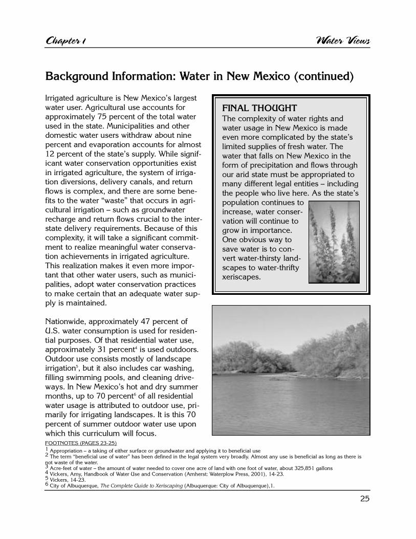
FINAL THOUGHTThe complexity of water rights andwater usage in New Mexico is madeeven more complicated by the state’slimited supplies of fresh water. Thewater that falls on New Mexico in thef o rm of precipitation and flows thro u g hour arid state must be appropriated tomany diff e rent legal entities – includingthe people who live here. As the state’spopulation continues toi n c rease, water conser-vation will continue tog row in import a n c e .One obvious way tosave water is to con-v e rt water-thirsty land-scapes to water- t h r i f t yx e r i s c a p e s .
FOOTNOTES (PAGES 23-25)1 A p p ropriation – a taking of either surface or groundwater and applying it to beneficial use2 The term “beneficial use of water” has been defined in the legal system very bro a d l y. Almost any use is beneficial as long as there isnot waste of the water. 3 A c re-feet of water – the amount of water needed to cover one acre of land with one foot of water, about 325,851 gallons4 Vickers, Amy, Handbook of Water Use and Conservation (Amherst: Waterplow Press, 2001), 14-23.5 Vickers, 14-23.6 City of Albuquerque, The Complete Guide to Xeriscaping ( A l b u q u e rque: City of Albuquerq u e ) , 1 .

26
T he history of wateruse in New
Mexico is ancient andcomplex. It beginswhen the pre h i s t o r i cIndians built irr i g a t i o ncanals to move waterto their pueblos. TheAcoma people camenext and saved waterin marshy areas asearly as 1582. Also inthe 1500s, the earlySpanish conquerors introduced acequias (com-munity ditches) and the social system that ru l e dtheir use. Acequias are still a very popular systemfor irrigation in New Mexico.
As New Mexico’s population gre w, so did thedemand for water. By the late 1800s, more landwas being irrigated to grow crops, and mining fornatural re s o u rces, which re q u i res large amounts ofw a t e r, had begun. Dams were built to incre a s ewater supplies in specific areas and the battlesover who would get the water increased.
In 1851, the New Mexico Te rritorial Legislatureestablished water laws, and by 1907 the terr i t o ryhad its first comprehensive laws governing surf a c ew a t e r. The laws were based on the early Indian-Spanish ideas of ditch (acequia) ownership andpublic control of the water.
Public control of water means that all of NewM e x i c o ’s surface and underg round water belongsto the public and is subject to appropriation orprivate ownership of a water right. An appro p r i a t-ed water right1 is like a piece of equipment or fur-n i t u re. It is considered pro p e rty and can be sepa-rated from the land and transferred to anotherlocation or owner subject to legal re q u i rements.
The basis of New Mexico’s water laws began withthe idea of prior appro p r i a t i o n. This means thatthe first person to take water and use it in a benefi-c i a l2 way has the right to use that water. Think of along line to get into a baseball game or event. Thosefirst in line get the best seats. Those last in line getwhatever seats are left, until they are gone. However,if the people first in line do not sit in their seats(beneficial use) they will lose them, leaving room forthe latecomers. To correlate that back to water rightsand the history of New Mexico, this means that thes t a t e ’s earliest settlers, who were mainly farmers andranchers, had the first right to use the water. If thedescendents of these early settlers continue to uti-lize the water in a beneficial manner, they will main-tain the rights to the water. The newer water users inNew Mexico, such as industries and even some ofthe cities, get whatever water is left.
U n f o rt u n a t e l y, water supplies do not adhere to politi-cal boundaries such as state lines. This means that thewater that flows through New Mexico has to serv ethe people who live here as well as those who live inb o rdering states. For example, the Rio Grande is partof a surface water system thatpasses through Colorado,New Mexico, and Te x a s .All three states haverights to a certain per-centage of the RioG r a n d e ’s water. Thep e rcentages are dis-tributed according toc o u rt rulings calledstate compacts.
Chapter 1 Water ViewsStudent Handout
Do you think thatacequias are an effec-tive way to move water
from one place toanother?
What do you think is abeneficial use of water?What is not a beneficial
use?
H i s t o ry of New Mexico Wa t e rand Water Rights
1 Water Right - a legal right to divert water to a specific beneficial use; waterrights are granted in New Mexico by the Office of the State Engineer 2 The term “beneficial use of water” has been defined in the legal systemv e ry bro a d l y. Almost any use is beneficial as long as there is not waste ofthe water.

27
In addition, a federal law states that the federalg o v e rnment is entitled to enough water to main-tain federal lands.
A p p roximately 46 percent of New Mexico is fed-erally owned. Maintaining federal lands includesfighting fires, supplying water for re c reational usesin national forests, and maintaining water for yourfavorite fishing stream.
The Native Americans in the state also have signifi-cant water rights. Ten percent of New Mexico isre s e rvation land. Native Americans own the rightsto enough water to use for all present and futurepurposes on these lands, including water rights tos t reams that are within their boundaries.
W h a t ’s Going on Now?With all these groups competing for water, it iseasy to see how our water supply could be usedup very quickly. In an average year, we re c e i v eonly 7 to 20 inches of precipitation across thestate. With so much need and so little water, it isi m p o rtant to be aware of how much water we useand to find ways to conserve it.
For many of us, it is difficult to understand howmuch water we use when we perf o rm various
n e c e s s a ry household tasks. Compare the wateryou use to the national average listed below.
Since the largest percentage of residential wateruse (water used in and around the home) is out-door usage (mainly landscapes), we are going tofocus our eff o rts on how to reduce the amount ofwater used outdoors.
Chapter 1 Water ViewsStudent Handout
H i s t o ry of New Mexico Water and Water Rights( c o n t i n u e d )
Residential Water Use3
Outdoor use 3 1 . 0 %To i l e t s 1 8 . 4 %B a t h s 1 . 2 %S h o w e r s 1 1 . 6 %F a u c e t s 1 0 . 8 %D i s h w a s h e r 1 . 0 %Clothes Wa s h e r 1 5 . 0 %L e a k s 9 . 5 %O t h e r 1 . 5 %
3S o u rce: Vickers, 14-23
Final ThoughtThe water that falls on NewMexico in the form of pre c i p i t a-tion (rain and snow) and flowst h rough our arid state must bedistributed to many diff e re n tpeople for many diff e rent uses.
As the state’s population continues toi n c rease, water conservation will continue tog row in importance. One obvious way tosave water is to convert water-thirsty land-scapes to water-thrifty xeriscapes.
W h e re do y o u use the most water?
What are some of the ways y o u can savew a t e r ?
W h e re can y o u make the biggest diff e re n c ein saving water?
Chapter 1 Water ViewsStudent Handout
C h a rts & Graphs
4 Adapted from Vickers, 14-23.
28
U.S. Residential Water Use4
Outdoor Use 31.0%
Toilets 18.4%
Baths 1.2%
Dishwasher 1.0%
Showers 11.6%
Faucets10.8%
Clothes Washer15.0%
Leaks9.5%
Other 1.5%

29
Chapter 1 Water ViewsStudent Handout
C h a rts & Graphs
5 Wilson, Brian and Lucero, Anthony, Water Use by Categories in New Mexico Counties and River Basins, and Irrigated Acreage in 1995(Santa Fe: New Mexico State Engineer Office, 1995), 3-4. A full size copy of both charts is provided in Appendix C.
New Mexico Water Use5
Agriculture 75.38%
Evaporation11.72%
Mining & Power2.95%
Public Water Supply &Self Supplied Domestic
8.51%
Livestock, Commercial& Industrial
1.44%
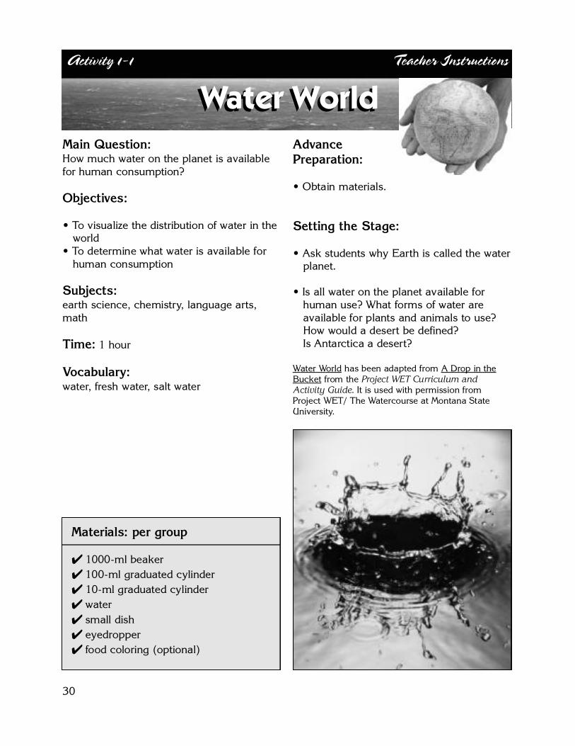
Main Question:How much water on the planet is availablefor human consumption?
Objectives:
• To visualize the distribution of water in thew o r l d
• To determine what water is available for human consumption
S u b j e c t s :e a rth science, chemistry, language art s ,m a t h
Ti m e : 1 hour
Vo c a b u l a ry :w a t e r, fresh water, salt water
Advance P re p a r a t i o n :
• Obtain materials.
Setting the Stage:
• Ask students why Earth is called the water planet.
• Is all water on the planet available for human use? What forms of water are available for plants and animals to use? How would a desert be defined? Is Antarctica a desert ?
Water Wo r l d has been adapted from A Drop in theB u c k e t f rom the P ro j e c t WET Curriculum andActivity Guide. It is used with permission fro mP roject WET/ The Wa t e rcourse at Montana StateU n i v e r s i t y.
Activity 1-1 Teacher Instructions
Water WorldWater World
Materials: per gro u p
✔ 1000-ml beaker✔ 100-ml graduated cylinder✔ 10-ml graduated cylinder✔ w a t e r✔ small dish✔ e y e d ro p p e r✔ food coloring (optional)
30

31
Activity Procedures
Water World
Activity Procedures
Measuring Wa t e r
1. Fill the 1,000-milliliter (ml) beaker with water to the 1,000 ml mark. This re p resents all of the water on the planet (100%).
2. Carefully pour 30 ml into the 100-ml graduated cylinder. The water remaining in the 1,000-ml beaker re p resents all of the salt water on the planet. This is approximately 97% of the eart h ’s total w a t e r. Put three or four drops of blue food coloring into the water remaining in the 1,000 ml beaker.
3. The 30 ml of water in the 100-ml graduated cylinder re p resents all of the fresh water on the planet. Pour 10 ml into the 10-ml graduated cylinder. The water remaining in the 100-ml graduated cylinder re p resents all of the frozen water (glaciers, icecaps) on the planet. Put three to four drops of yellow food coloring into the 100-ml graduated cylinder re p resenting frozen water. This is a p p roximately 2% of the Eart h ’s total.
4. The 10 ml of water in the 10-ml graduated cylinder re p resents all of the non-salt, unfrozen water on the planet, approximately 1%. Using the eyedro p p e r, remove one drop and put it in the small dish.
5. Place three to four drops of red food coloring in the remaining water in the 10-ml graduated c y l i n d e r. This is the fresh, unfrozen water that is unavailable for human consumption. It includes polluted water, brackish gro u n d w a t e r, and water in the soil and atmosphere.
6. The small drop of water in the dish is all of the water on the planet that is actually available for human consumption.
E x t e n s i o n :
• Look at maps for distribution of river systems and lakes. Discuss how access to surface water has limited or encouraged population centers.
• Create a chart or overlay correlating the locations of cities or major concentrations of people with the amount of water available in each are a .
• Explore groundwater maps. Is all groundwater available for human consumption? Why or why not?
• Research desalinization. What parts of the world would benefit from a desalinization plant?
• Determine what wildlife habitats are expected in each area, based upon the amount of water that is available.

32
Student Worksheet
On the chart below check whether the water on earth is available or not available for human consumption. Check all that apply.
Water on Eart h P e rcentage of ✔ If Available for ✔ If Not Available E a rt h ’s Wa t e r Human Consumption for Human Consumption
O c e a n s 9 7 . 2 5 %
I c e c a p s / g l a c i e r s 2 . 0 5 %
G ro u n d w a t e r 0 . 6 8 %
F reshwater Lakes 0 . 0 1 %
S o i l s 0 . 0 0 5 %
A t m o s p h e re 0 . 0 0 1 %
R i v e r s 0 . 0 0 0 1 %
O t h e r 0 . 0 0 3 9 %
To t a l 1 0 0 . 0 0 0 0 %
1. List some of the ways traditionally unavailable water might become available for human use. Be cre a t i v e .
2. List some of the ways water that has traditionally been available for human use has become unavailable.
3. Write a paragraph explaining why it is important that humans use water re s p o n s i b l y.
Water WorldNAME

33
Activity 1-2 Teacher Instructions
Main Question:What are the habitats in New Mexico? How do rainfall and elevation influencethese habitats?
Objectives: • To describe various habitats in
New Mexico • To examine the distribution and size of
these habitats• To recognize the characteristics of various
h a b i t a t s• To correlate rainfall data, vegetation
communities, and elevations
S u b j e c t s : science, geography, languagea rts, art
Ti m e : 1 hour for data comparison; 10 min-utes each group for presentations; 2+ hoursfor model building
Vo c a b u l a ry : vegetation, habitat, topo-graphic map, elevation
A d v a n c eP re p a r a t i o n :
• Obtain state vegeta-tion maps, rainfall data, soil and elevation maps (whatever isavailable). Make an 8 1/2” x 11” base map of New Mexico for each group of students. Information on where to obtain maps is located in Appendix J.
• If there is sufficient time, have students gather the data from the Internet, state agencies, re f e rence books, etc. The National Oceanic and Atmospheric Administration (NOAA) website at w w w. n o a a . g o v is a good re s o u rce.
Setting the Stage:
• Discuss the concept of habitats; describe d i ff e rent types of habitats and their water re q u i re m e n t s .
• Ask students what habitats they have seen in New Mexico.
Materials: per gro u p
✔ state vegetation maps (see Appendix J)✔ state rainfall data (see Appendix C)✔ state topographic map ✔ base map of New Mexico✔ blank overhead transparencies or
tracing paper✔ t r a n s p a rency markers✔ a rt supplies✔ model-building supplies (such as
gravel, dirt, pieces of weeds, toothpicks, clay, etc.)
TEACHER TIP:Tr a n s p a rencies work wellif multiple sets of dataa re to be plotted or if aclass overhead presentation ismade. If only vegetation andrainfall data are to be plotted,then one transpare n-cy and one basesheet are adequate.
Are All Habitats Identical?Are All Habitats Identical?
34
Activity Procedures
A re All Habitats Identical?
Activity Procedures
A. Comparisons of Rainfall and Vegetation Data
1. One at a time, lay a blank transparency over the base map of New Mexico and outline the state onto three transparencies. Label them Precipitation, Vegetation, and Elevation.
2. Use the rainfall data provided in Appendix C or a precipitation map of the state to divide the state into rainfall categories. Decide how many categories are necessary.
3. Chart the data onto the Precipitation transpare n c y.
4. Using a state vegetation map, transfer vegetation data onto the Vegetation transpare n c y.
5. Using topographic information or a topographic map, transfer information to the Elevation t r a n s p a re n c y.
6. Overlay the Precipitation, Vegetation and Elevation transparencies and look for comparisons between the three.
7. Present the data to the class.
B. Class Model of Habitats
1. Review a map of New Mexico that includes the distribution of habitats. National Geographic has a great website that includes printable maps and descriptions of each habitat. h t t p : / / w w w. n a t i o n a l g e o g r a p h i c . c o m / w i l d w o r l d / t e rre s t r i a l . h t m lAdditional information on where to obtain maps is in Appendix J.
2. Divide the class into several groups and assign a habitat to each group. There are five habitats for New Mexico on the National Geographic website. Each group should receive a map of the state showing the assigned habitat. These can also be printed from the National Geographic site.
3. Using art supplies, each group should build a three-dimensional model of its habitat.
4. Have groups use pieces of weeds, gravel, glued-on dirt, toothpicks, clay, etc. to build their models.
5. Using pictures or plastic pieces, include the animals and plants that inhabit the assigned area.
6. Put all of the pieces side-by-side, as they appear on the map, to get an overview of the habitats in the state.
(continued on next page)

35
Activity Procedures
A re All Habitats Identical?
Activity Procedures
E x t e n s i o n :
• Collect historical rainfall and vegetation maps of New Mexico and make overlays to see how the distribution of habitats has changed.
• Correlate ranges of various animals with the distribution of habitats. Each student studies a d i ff e rent animal and examines how it uses the habitat it lives in.
• Map the distribution of habitats in the students’ hometown.
Activity Ti p :Five habitat designations as presented by National Geographic:
1. Western short grasslandsCentral North America, Central United States, eastern New Mexico; Temperate Grasslands, Savannas, and Shrublands
2. Colorado Rockies forests – Central North America, We s t e rn central United States, parts of n o rt h e rn New Mexico; Temperate Coniferous Forests
3. Colorado Plateau shrublands – We s t e rn North America, Southwestern United States, n o rthwest and central New Mexico; Deserts and Xeric Shru b l a n d s
4. Arizona Mountains forests – We s t e rn North America, Southwestern United States, p a rts of eastern New Mexico; Temperate Coniferous Fore s t s
5. Chihuahuan desert – Southern North America, Nort h e rn Mexico into southwesternUnited States, southern New Mexico; Deserts and Xeric Shrublands
Main Question:What role do acequias play in our c o m m u n i t y ?
Objectives: • To trace the development, history and
i m p o rtance of the acequia system in New Mexico
• To describe acequias and how they arec o n s t ru c t e d
• To construct an acequia model• To predict the future of the acequia
system in New Mexico
S u b j e c t s :h i s t o ry, art, language arts, math, geography,s c i e n c e
Ti m e :varies; average of three 45-minute classp e r i o d s
Vo c a b u l a ry :acequia, conservancy district, flow rate
A d v a n c eP re p a r a t i o n :
• Obtain maps of i rrigation systems inthe community, county or the state.
• If possible, arrange for a speaker from thec o n s e rvancy district, county extensions e rvice, a member of a local historical s o c i e t y, or a community member who hasworked with the acequia system, such asa mayord o m o .
Setting the Stage:
• Have the students describe and discussacequia systems with which they may bef a m i l i a r.
• Have any of the students’ grandparents or p a rents used the system? Do any of their families have acequia-irrigated land now? How do they arrange to irrigate it?
36
Activity 1-3 Teacher Instructions
M a t e r i a l s :
✔ school & local library✔ 9” x 14” cake pan✔ modeling clay✔ tape re c o rder (optional)✔ county and state maps✔ small twigs, gravel, weeds✔ jar of water✔ camera (optional)
Acequias & the CommunityAcequias & the Community
37
Activity Procedures
Acequias & the Community
Activity Procedures
A. Researc h1. Divide class into small working groups in order to spread out the use of re f e rence materials.
Each group should choose a topic, such as:• How Acequias Work (mechanics) • The History of Acequias• Current Uses of Acequias • How Acequias Influenced the Culture of the Community• The Political Workings of the Acequia System (mayordomos, watering schedules, etc.)• The Future of the Acequia System (potential improvements, water conservation, future
developments, etc.)
2. Have students keep a list of the re f e rences they use. Student groups may give mini-re p o rts to the class so that information can be shared among gro u p s .
3. Interview officials of the local conservancy district about the history and future of the acequia system. Use a tape re c o rd e r, if possible.
4. Photograph local acequia systems and/or copy pictures from books to make a book or poster to present to the class.
5. The final presentation could be a written or oral re p o rt, a poster presentation that can be displayed in the school library, or a Microsoft PowerPoint® p resentation by each gro u p .
B. Model Building – Community1. Spread modeling clay in the pan to construct an acequia system for a community.
Be sure to slope the ditches so that water can flow downhill. The model should also show the change in ditch size from the main ditch down to the ditches in individual fields. If there is time, include fields, farmhouses and ro a d s .
2. Fill some of the ditches with plants and debris to test the effect on water flow rate. 3. Sprinkle powdered drink mixes on the model to simulate ero s i o n .4. Pour water into the main ditch to test the system.
E x t e n s i o n :• Students could map out the irrigation system in their community then build a model
of it. Is the present system the most effective option? Are there future developments planned that could impact the present system?
• Interview relatives or local citizens who have lived in New Mexico for a long time and compile a vocal or written history of their relationships with acequias.
• Write a story about a day in the life of a farmer using an acequia for irrigation. Read the story to the class.
• Write and perf o rm a play about the annual community clean-out of irrigation ditches.• Math extension: using a ruler and a piece of string, measure the length of the ditches on the maps
p rovided. If information is available from local authorities, calculate the average flow rate and the total amount of water used in a growing season.
38
Main Question:Who has the right to use New Mexico’sw a t e r ?
Objectives:
• To identify the points of view for variousi n t e rest groups
• To practice consensus building
• To examine current and future water p rojections for the state
S u b j e c t s :science, politics, history, debating
Ti m e : 1 to 11/2 h o u r s
Vo c a b u l a ry : i n t e rest group, dro u g h t
Advance Pre p a r a t i o n :
• For each student, makecopies of the information on the New Mexico Office of the State Engineer’s responsibilities located in Appendix L.
• To give the students a diff e rent perspective,copy the newspaper articles in Appendix Dre p resenting the interests of golf courses, municipalities, outdoor re c reation groups, and ranchers. For additional re s e a rch, a list of websites re p resenting various special interest groups is located at the end of this activity.
• Invite speakers re p resenting various intere s tg roups (farmers and ranchers, developers,e n v i ronmentalists, Native Americans, tourism, etc.) to address the students.
Setting the Stage:
• Have each student read the newspaper a rticles, highlight the important points, and list five ideas for how to deal with impending water pro b l e m s .
Activity 1-4 Teacher Instructions
M a t e r i a l s :
✔ newspaper articles about water issues(see Appendix D)
✔ drawing paper✔ m a r k e r s✔ 1 jug of water/gro u p✔ 6 clear cups/gro u p✔ food coloring✔ f u n n e l
Little Wet JugLittle Wet Jug

39
Activity Procedures
Little Wet Jug
Activity Procedures
A. Special Interest Gro u p s
1. Assign each group of students to re p resent a special interest group. Groups are :• Conservation/ Environmental Pro t e c t i o n• Golf Courses• Developers• Farmers & Ranchers• Municipalities• Recreation Groups (fishing, boating, etc)
2. Have students get information about the viewpoints and critical issues facing their group. See Appendix D for newspaper articles.
3. Give each group of students a jug of colored water and six cups. (The cups re p resent each of the six special interest groups.) Make sure there isn’t enough water in the jug to fill all six cups.
4. Label the cups for each of the special interest groups listed above. Pour water into each cupbased upon how much the students think each special interest group should get.
5. Have the students in each group justify their program for water allocation to the class. 6. Class will evaluate programs and distribution of water in cups to come to a consensus on
how to divide up the jug of water.
B. Legislative Plan
1. Reallocate the groups, so that the re p resentatives from diff e rent special interest groups are now mingled into new groups.
2. Each group is now a sub-committee of the New Mexico Legislature that is re q u i red to generate an eight-point plan for how to deal with current water issues. Questions to ask include:• How to deal with continued growth versus limited supply?• What to do in times of dro u g h t ?• Do current water laws fulfill the needs of the state? • Who has the highest priority? • How do we get our plan implemented?
3. Have students make a poster outlining their ideas and present it to the class ( L e g i s l a t u re and Governor) for feedback.
E x t e n s i o n :
• Study the politics of water allocation between New Mexico, Texas, Colorado, and Mexico. Develop a set of guidelines for allocating water from rivers that pass through several countries.
• Repeat Section A: Special Interest Gro u p s with simulated drought conditions in the jug. Decide how the drought would affect allocation of water in the jug.
• Write a class position paper on how New Mexico’s water should be allocated. Present it at a public meeting about water issues.

40
Student Handout
Little Wet JugWebsites for Special Interest Groups
Golf Coursesh t t p : / / w w w. s a n t a a n a g o l f . c o m / – The Santa Ana golf course located north of Albuquerque, along the Rio Grande
h t t p : / / w w w. g o l f n e w m e x i c o . c o m / – A dire c t o ry of New Mexico golf courses
E n v i ronmental Gro u p sh t t p : / / r i o g r a n d e . s i e rr a c l u b . o rg – Rio Grande Chapter of the Sierra Club
h t t p : / / w w w. e a rt h f i r s t . o rg / – Earth First!
M u n i c i p a l i t i e sh t t p : / / w w w. c a b q . g o v / w a t e rc o n s e rv a t i o n / i n d e x . h t m l – City of Albuquerque Water Conservation Off i c e
h t t p : / / w w w. c i . s a n t a - f e . n m . u s / s f w e b / – City of Santa Fe
h t t p : / / w w w. w o r l d p l a c e s . c o m / L a s . Ve g a s . N e w. M e x i c o / – City of Las Ve g a s
Native Americansh t t p : / / w w w. w e s t g o v. o rg / w g a / i n i t i a t i v e s / i w r / – We s t e rn Governors Association Ad Hoc Group on Indian Water Rights
h t t p : / / w w w. b l u e c l o u d . o rg / d a k o t a . h t m l – The American Indian Culture Research Center
Outdoor Recre a t i o nh t t p : / / w w w. k n o w n w o r l d g u i d e s . c o m / – Known World Guide Service, Inc. P rofessional guided white water rafting, mountain biking, fly fishing, hiking/trekking adventures in New Mexico, USA,S o u t h e rn Chile and old Mexico.
h t t p : / / w w w. r i v e rt o u r s . c o m / – Rio Grande River Tours, just south of Taos, New Mexico
We s t e rn Livingh t t p : / / w w w. r a n g e m a g a z i n e . c o m / – RANGE magazine re p resenting issues of the West, its people, lifestyles, lands andw i l d l i f e
h t t p : / / w w w. h c n . o rg / – High Country News

R E S O U R C E S :New Mexico Water Rights, WRRI MiscellaneousR e p o rt No. 15 p rovides a good introduction to theh i s t o ry of water rights in New Mexico. It is not overlytechnical and is within the capabilities of most highschool students. It is available through New MexicoState University, Water Resource Research Institutefor a minimal cost. Contact WRRI at 505-646-1813for more inform a t i o n .
Water: A Never Ending Story teacher guide andvideo contain a collection of hands-on, interd i s c i p l i-n a ry activities organized into a complete curr i c u l u mon water. It is designed to help students cultivate awater conservation attitude. The curriculum is on amiddle-school level and includes sections on water-sheds, water treatment and distribution, and non-point source pollution. Activities incorporate science,math, art, and language arts. The curriculum is avail-able through the New Mexico Office of the StateE n g i n e e r. See Appendix F for ordering information.
C o n s e rve Water Educators’ Guide (ISBN 1-888631-04-X) is written and published by The Wa t e rcourse, an o n p rofit water education group out of Montana StateU n i v e r s i t y. The guide includes activities on waterc o n s e rvation, case studies designed to encouragecritical thinking and decision making, and a separatesection on how to host a water festival at yourschool. The curriculum is available from TheWa t e rcourse at 1-406-994-5392 or order online ath t t p : / / w w w. m o n t a n a . e d u / w w w w a t e r /
A l b u q u e rq u e ’s Environmental Story was written byJoan and Hy Rosner and published by The Friends ofA l b u q u e rq u e ’s Environmental Story, Inc. It provides av e ry complete story of the interaction between manand the environment in the growth of Albuquerq u e .Ideas and suggestions for teachers are included atthe end of each chapter. The complete curriculum ison-line at h t t p : / / w w w. c a b q . g o v / a e s / i n d e x . h t m l.
The New Mexico Office of the State Engineer pro-vides a history of acequias and ditches of NewMexico with information on the history, laws, NewMexico Acequia Commission, Acequia RehabilitationP rogram and water rights information. Also includessample by-laws for acequias. h t t p : / / w w w. s e o . s t a t e . n m . u s / w a t e r- i n f o / a c e q u i a s . h t m l
h t t p : / / w w w. n m . n rc s . u s d a . g o v / d ro u g h t / d ro u g h t . h t m –New Mexico Drought Map, indicates current dro u g h tstatus in an easy-to-use colored map. Provided bythe Natural Resources Conservation Service of theU.S. Department of Agriculture.
h t t p : / / w a t e r. u s g s . g o v / w a t u s e / – Extremely detaileddata on water use in the United States, includingmaps from the United States Geological Surv e y. Adetailed chart of surface and groundwater with-drawals for public water supply use in the UnitedStates is provided as part of the Water Science forS c h o o l s p rogram ath t t p : / / w w w g a . u s g s . g o v / e d u / t a b l e s / d l p s . h t m l.
h t t p : / / w w w. c i a . g o v / c i a / p u b l i c a t i o n s / g l o b a l t re n d s2 0 1 5 / 7 5 4 0 3 3 . g i f – A great visual of the availability off resh water worldwide from the Central IntelligenceA g e n c y. The site includes information from 1980 and2000 along with predictions for 2015.
R E F E R E N C E S :Chilton, et, al. 1984. New Mexico, a New Guide tothe Colorful State. A l b u q u e rque: UNM Pre s s .
DeBuys, William and Harris, Alex. 1990. River ofTraps: A Village Life. Albuquerque: UNM Pre s s .
Ellefson, Connie, et. al., 1992. Xeriscape Gard e n i n g ,Water Conservation for the American Landscape.New York: MacMillan Publishing Company.
H a rris, Linda and Blair, Leslie. 1992. New MexicoWater Rights, WRRI Miscellaneous Report No. 15.Las Cruces: New Mexico Water Resources Researc hInstitute, New Mexico State University.
Wilson, Brian, P.E. 1996. Water Conservation andQuantification of Water Demands in Subdivisions: AGuidance Manual for Public Officials and Developers.Santa Fe: New Mexico State Engineer Off i c e .
Wilson, Brian, P.E. and Lucero, Anthony. 1997. Wa t e rUse by Categories in New Mexico Counties and RiverBasins, and Irrigated Acreage in 1995. Santa Fe:New Mexico State Engineer Off i c e .
Chapter 1 Water Views
41
R e s o urces & Refere nce s

42