border affairs at bay of fundy - 15,000 years of history
TRANSCRIPT
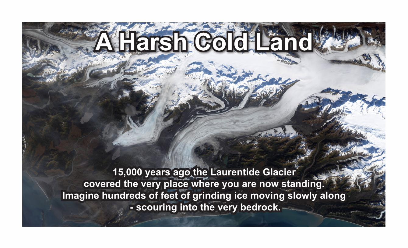
15,000 years ago the Laurentide Glaciercovered the very place where you are now standing.
Imagine hundreds of feet of grinding ice moving slowly along - scouring into the very bedrock.
A Harsh Cold Land
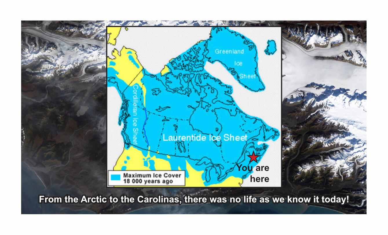
From the Arctic to the Carolinas, there was no life as we know it today!
You arehere
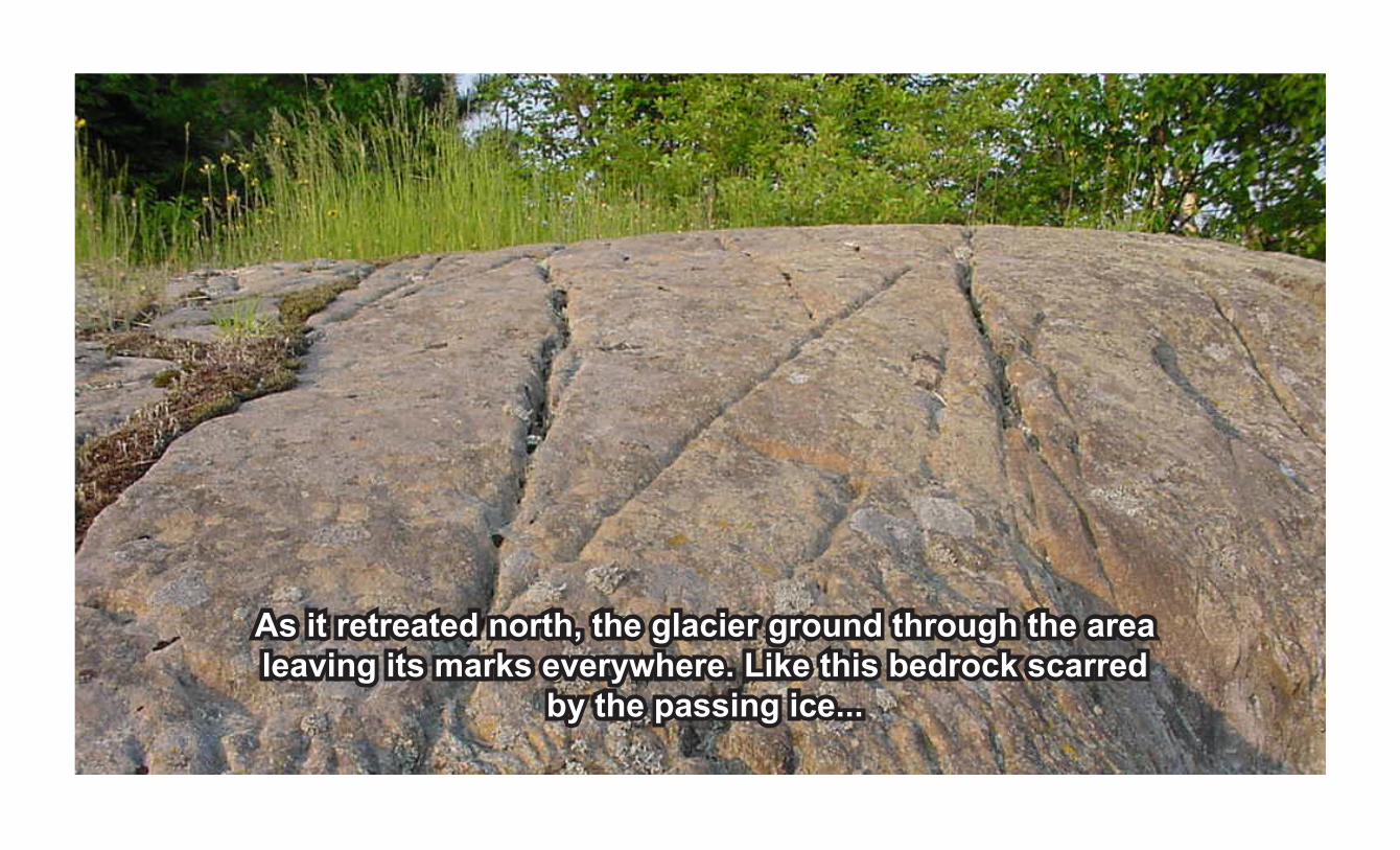
As it retreated north, the glacier ground through the area leaving its marks everywhere. Like this bedrock scarred
by the passing ice...
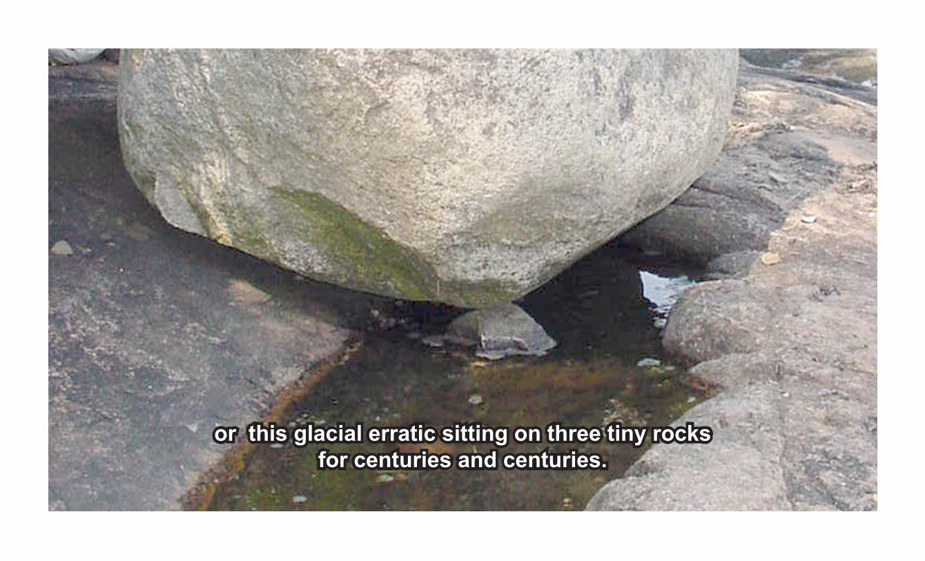
or this glacial erratic sitting on three tiny rocksfor centuries and centuries.
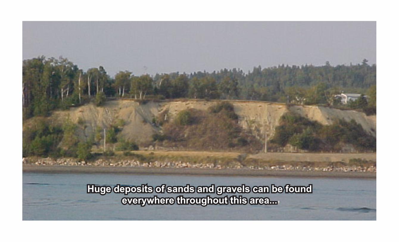
Huge deposits of sands and gravels can be found everywhere throughout this area...

and local river basins, coastal estuaries and baysbear the marks of the powerful glacier that passed this way.
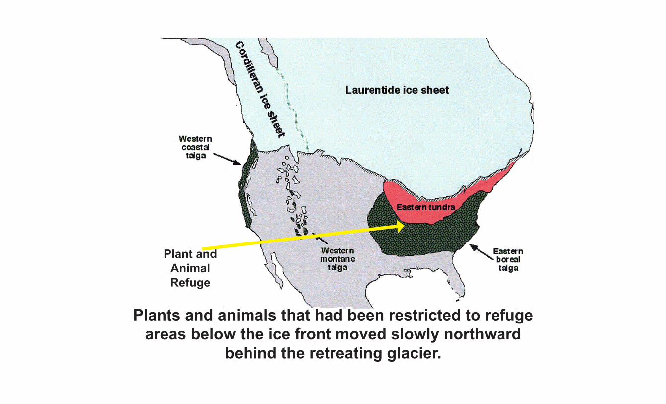
Plants and animals that had been restricted to refugeareas below the ice front moved slowly northward
behind the retreating glacier.
Plant and AnimalRefuge
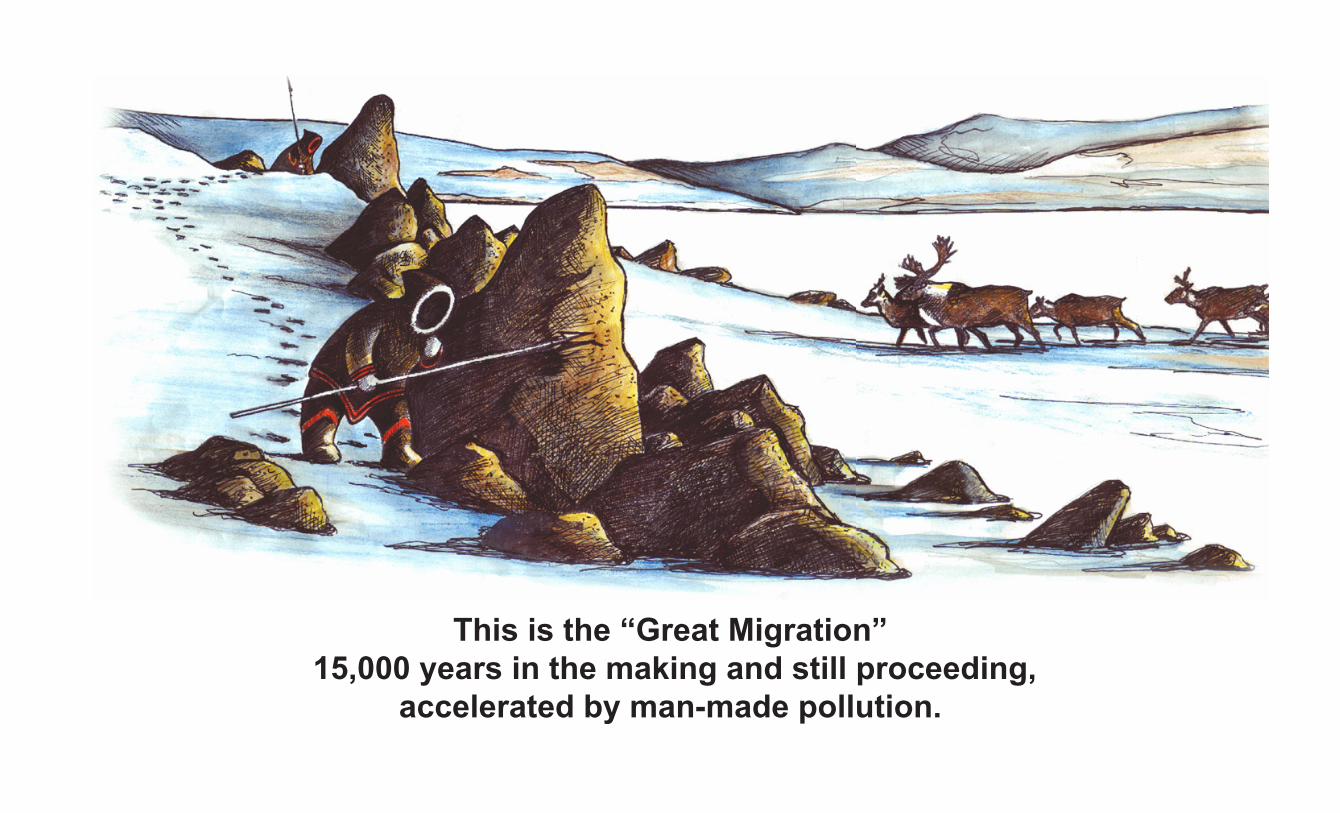
This is the “Great Migration” 15,000 years in the making and still proceeding,
accelerated by man-made pollution.
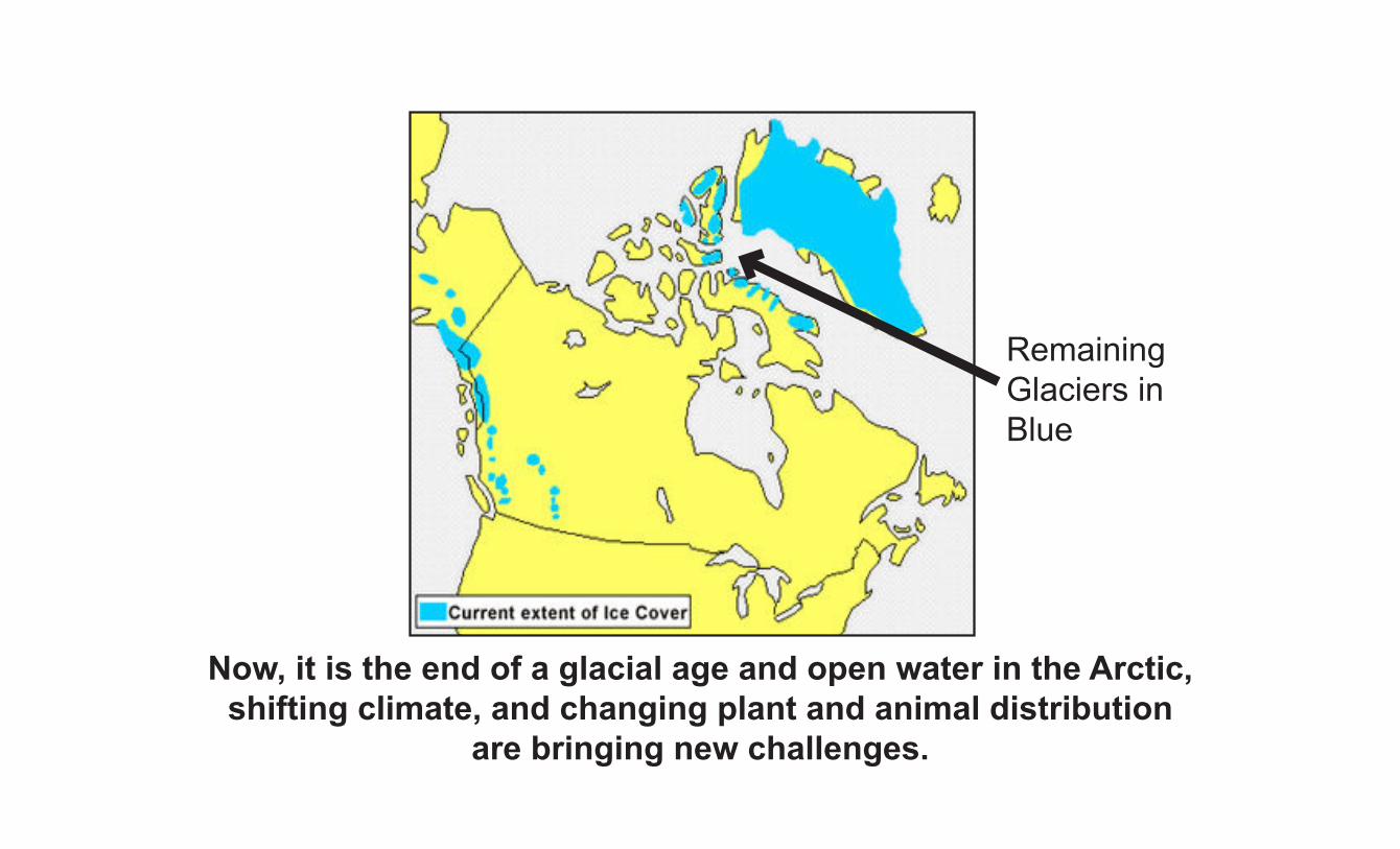
Remaining Glaciers in Blue
Now, it is the end of a glacial age and open water in the Arctic, shifting climate, and changing plant and animal distribution
are bringing new challenges.

A New Future Looms

Tundra to Taiga
As the Laurentide Glacier retreated, the hardy plants of the tundra established themselves and grew in abundance
during the short summer periods.
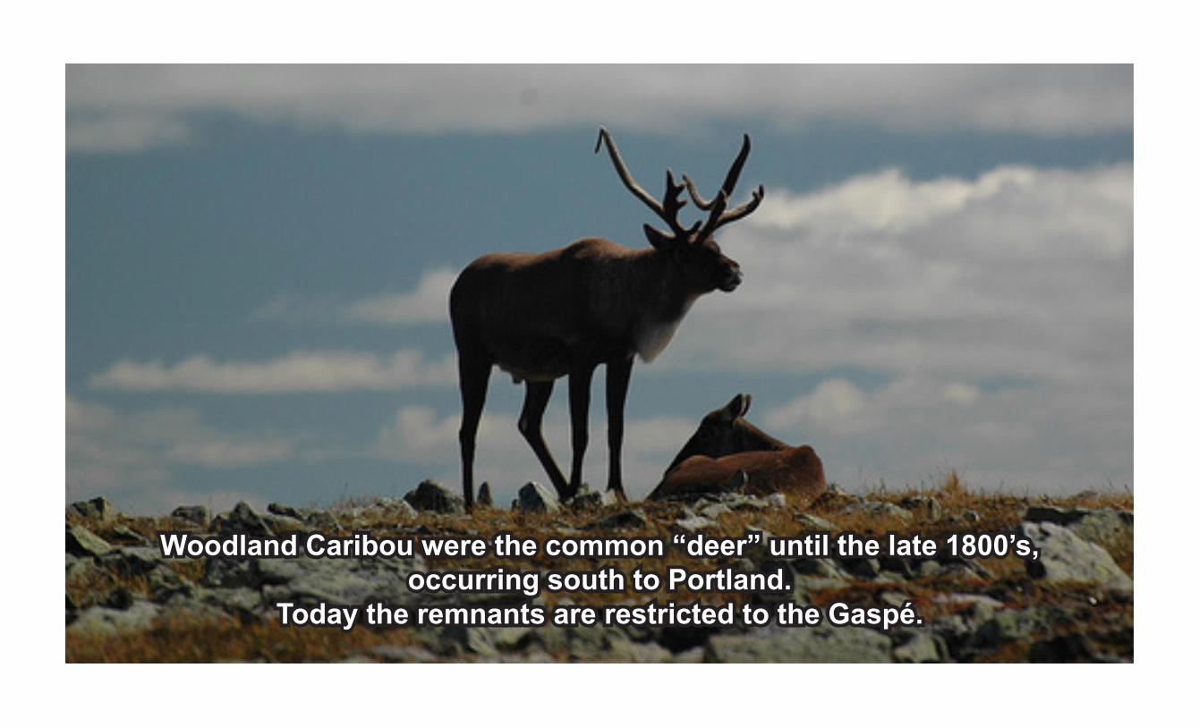
Woodland Caribou were the common “deer” until the late 1800’s,occurring south to Portland.
Today the remnants are restricted to the Gaspé.

Wolf packs followed the caribou herds as they wandered the area.Hunted and harrassed, their food supply diminishing,
they disappeared with the caribou.
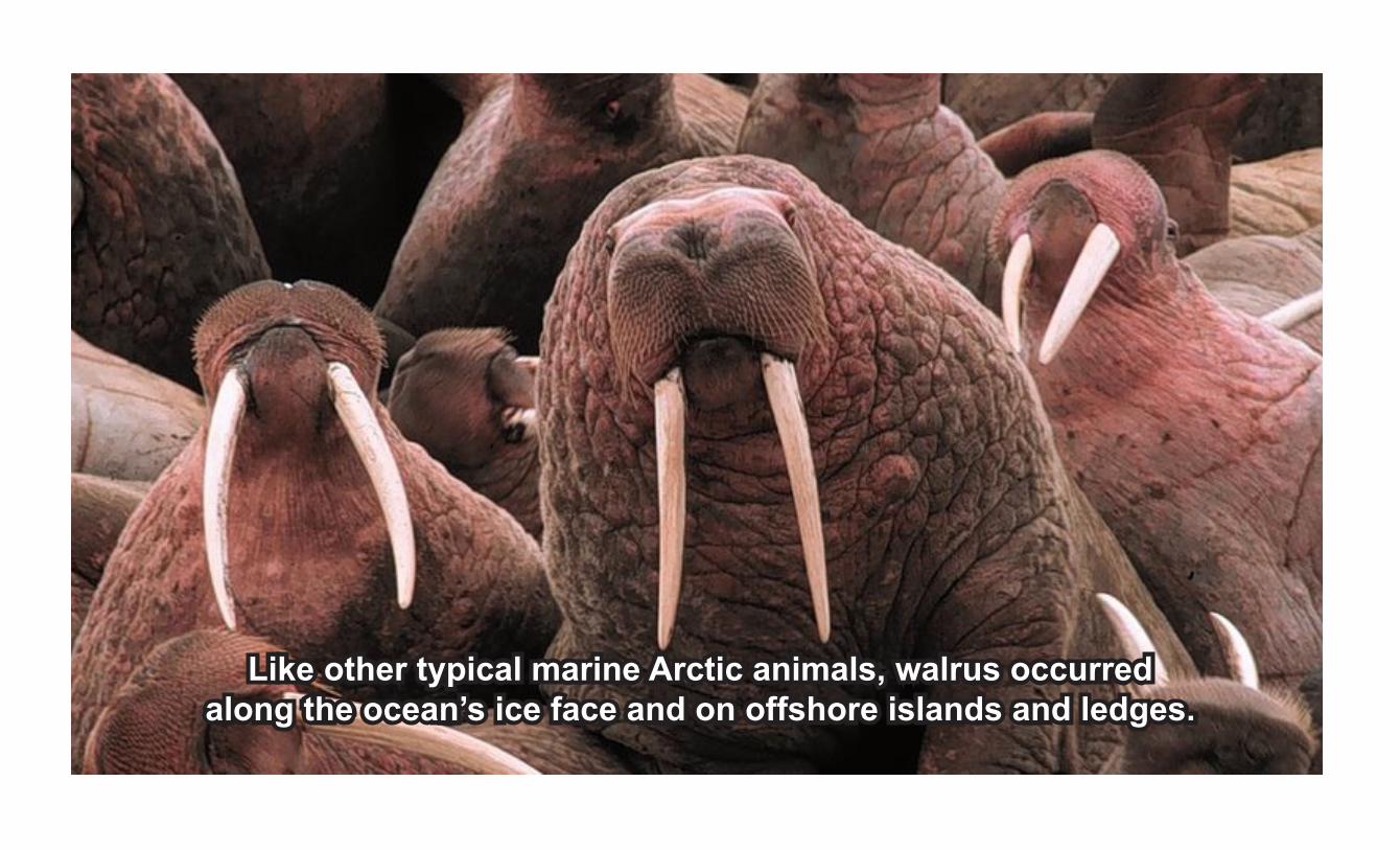
Like other typical marine Arctic animals, walrus occurred along the ocean’s ice face and on offshore islands and ledges.

Polar bears, Arctic foxes, birds of all kinds, and their preythrived in the tundra that followed the glacier north.

Arctic fish, like this male char, entered the cold glacial rivers to spawn.
Remnants are still found in a few Maritime lakes.
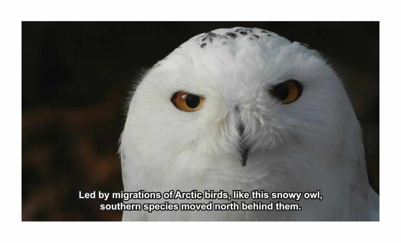
Led by migrations of Arctic birds, like this snowy owl,southern species moved north behind them.

Supported by the abundance of life that preceeded him, man also moved forward to occupy the land.

As the land and climate warmed, the treeline moved northwardforming the taiga forest, dominated by coniferous trees.
Man Arrives to Stay

With the changing environment, came new animals. Polar bears, walrus, seals, and other northern species were
replaced by southern species.
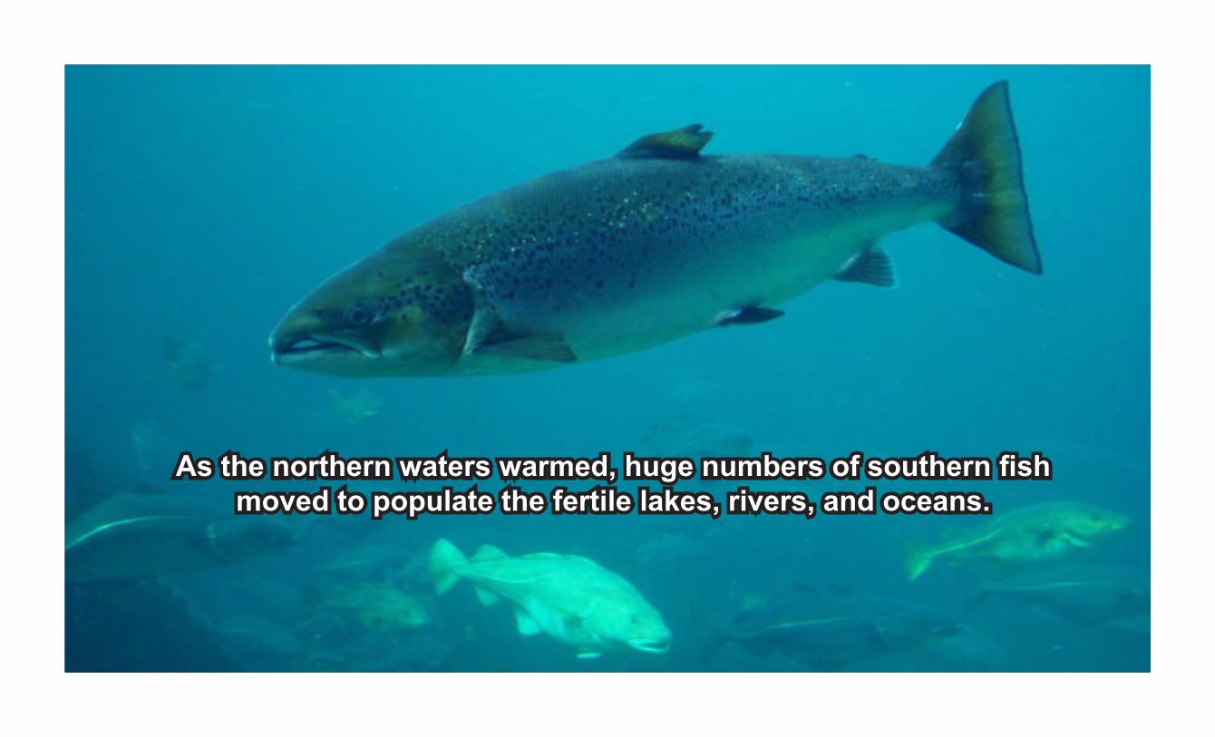
As the northern waters warmed, huge numbers of southern fish moved to populate the fertile lakes, rivers, and oceans.
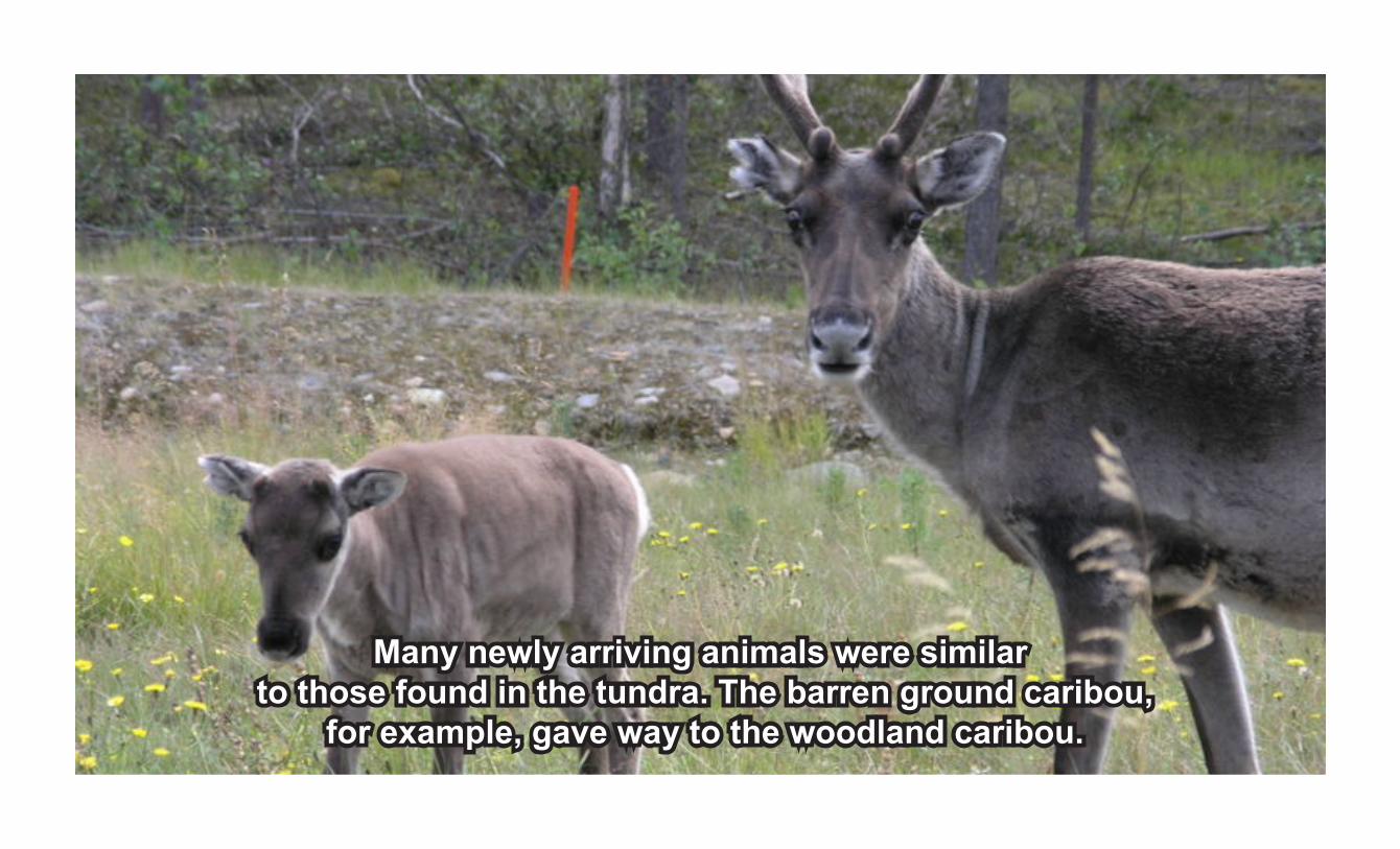
Many newly arriving animals were similar
to those found in the tundra. The barren ground caribou, for example, gave way to the woodland caribou.
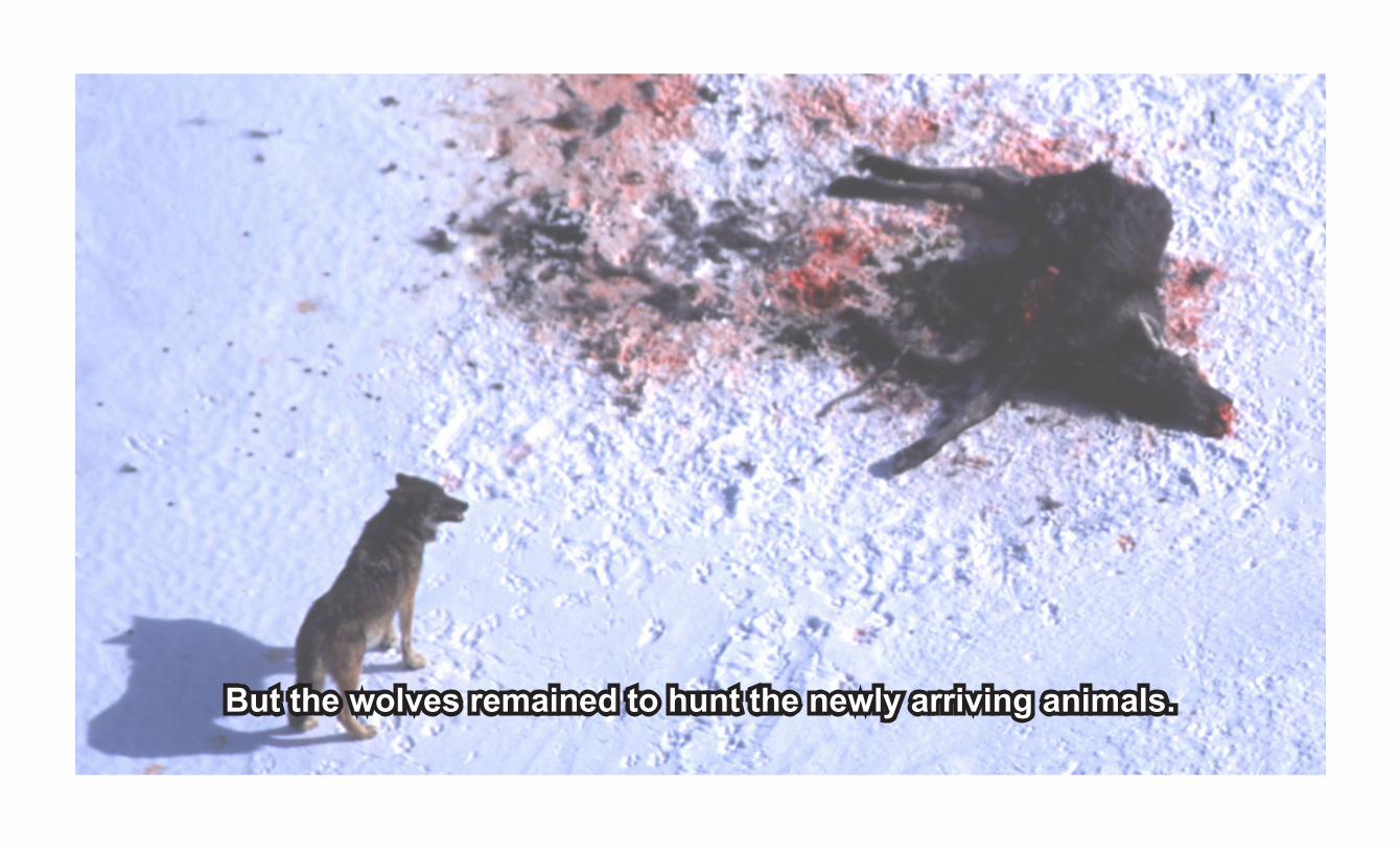
But the wolves remained to hunt the newly arriving animals.

Hardy northern peoples like today’s Cree-Montagnais-Naskapi moved through Quoddy, followed by wandering southern tribes
like the “red-paint” people.
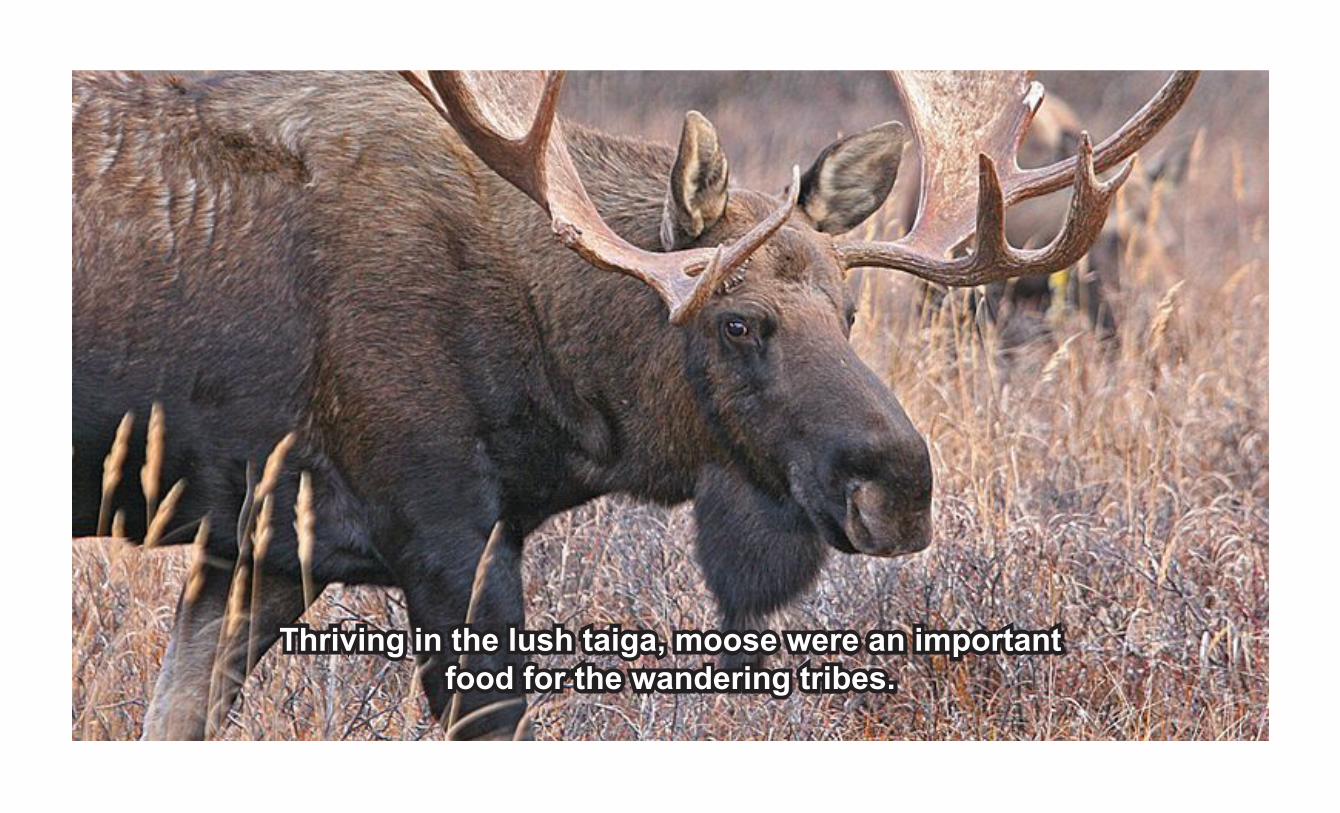
Thriving in the lush taiga, moose were an important food for the wandering tribes.

As the climate became more moderate with the passing of the glacier, temperate plant species
developed into the rich Acadian Forest we know today.

Over time, species like white-tailed deer, red fox, raccoon, and other typical temperate mammals began
to fill the forest.

Of the many bird species that occupied the lakes, rivers and oceans, some, like the great auk and passenger pigeon, occurred in
such great numbers that they were hunted to extinction.
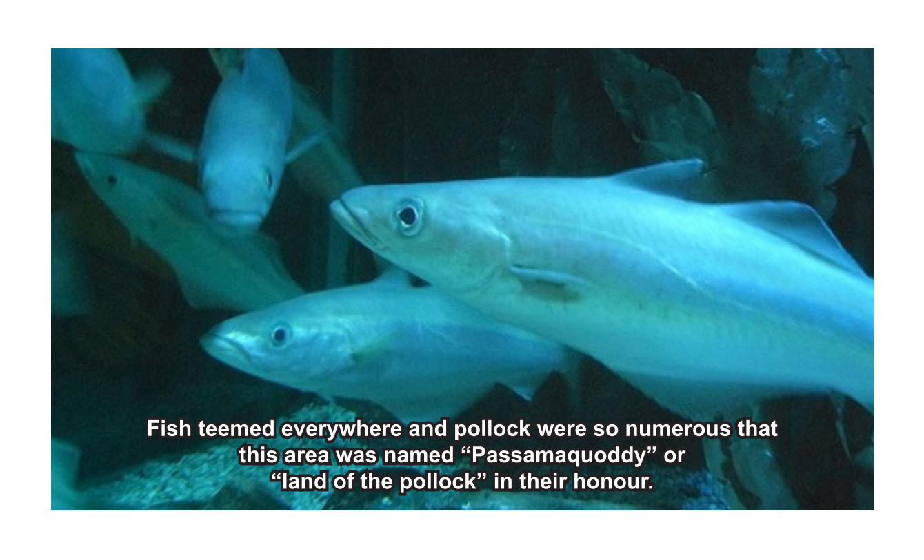
Fish teemed everywhere and pollock were so numerous thatthis area was named “Passamaquoddy” or
“land of the pollock” in their honour.
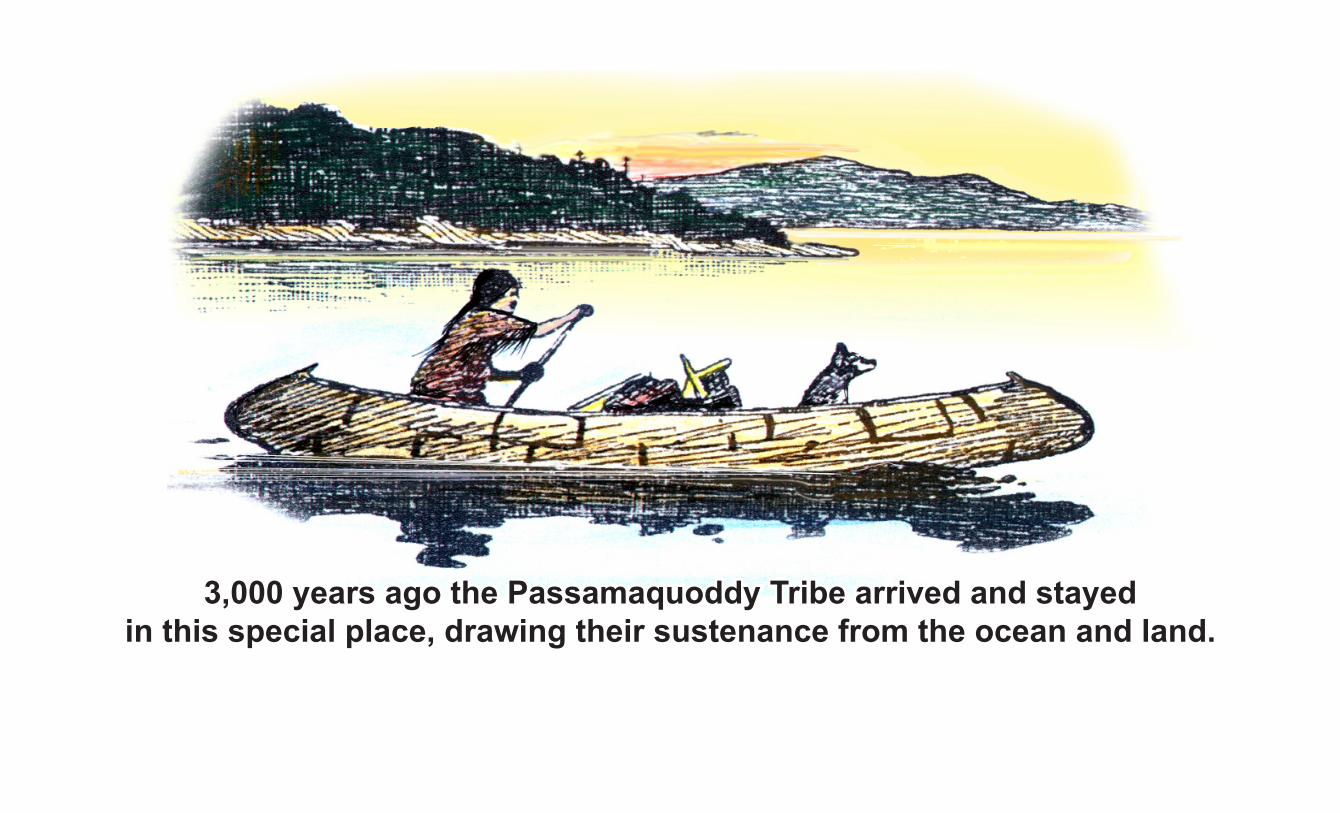
3,000 years ago the Passamaquoddy Tribe arrived and stayed in this special place, drawing their sustenance from the ocean and land.
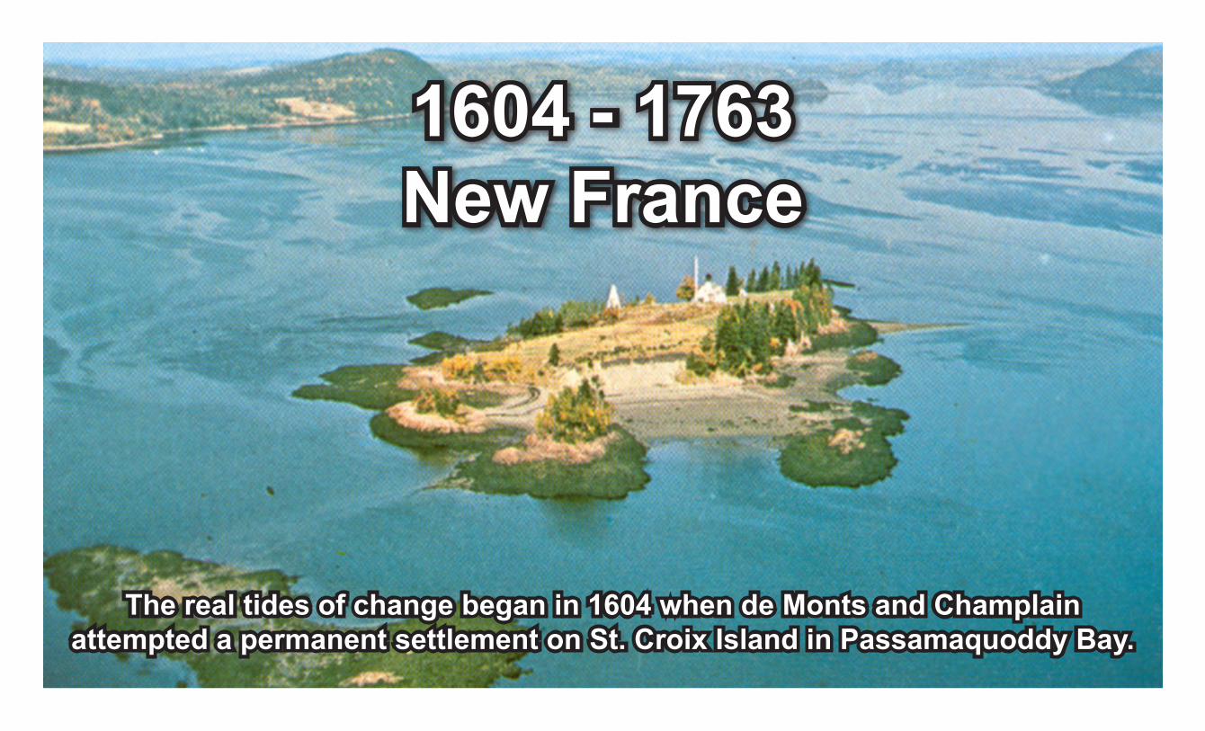
1604 - 1763New France
The real tides of change began in 1604 when de Monts and Champlainattempted a permanent settlement on St. Croix Island in Passamaquoddy Bay.
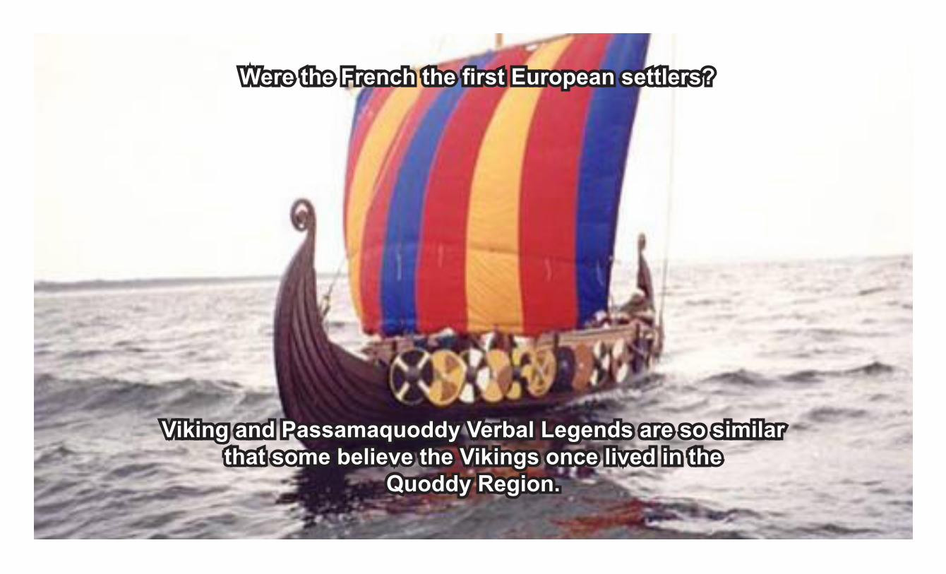
Viking and Passamaquoddy Verbal Legends are so similar that some believe the Vikings once lived in the
Quoddy Region.
Were the French the first European settlers?

Others believe that the Glooscap legend was based on Scottish Prince Henry Sinclair who may have landed
in Nova Scotia in 1398 a hundred years before Columbus.
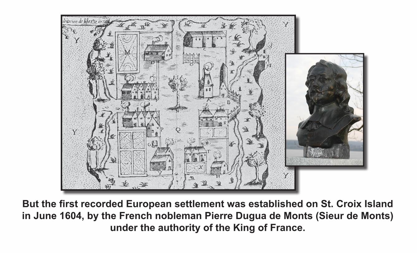
But the first recorded European settlement was established on St. Croix Island in June 1604, by the French nobleman Pierre Dugua de Monts (Sieur de Monts)
under the authority of the King of France.
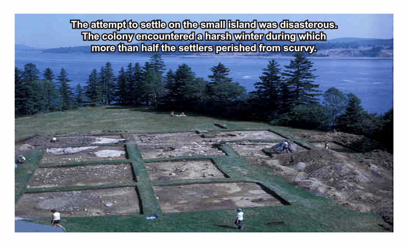
The attempt to settle on the small island was disasterous. The colony encountered a harsh winter during which
more than half the settlers perished from scurvy.
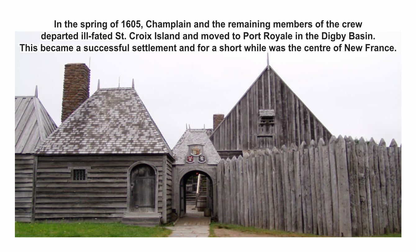
In the spring of 1605, Champlain and the remaining members of the crewdeparted ill-fated St. Croix Island and moved to Port Royale in the Digby Basin.
This became a successful settlement and for a short while was the centre of New France.
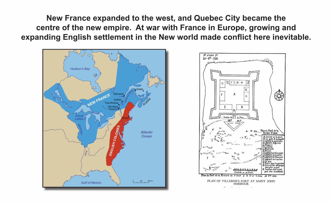
New France expanded to the west, and Quebec City became thecentre of the new empire. At war with France in Europe, growing and
expanding English settlement in the New world made conflict here inevitable.
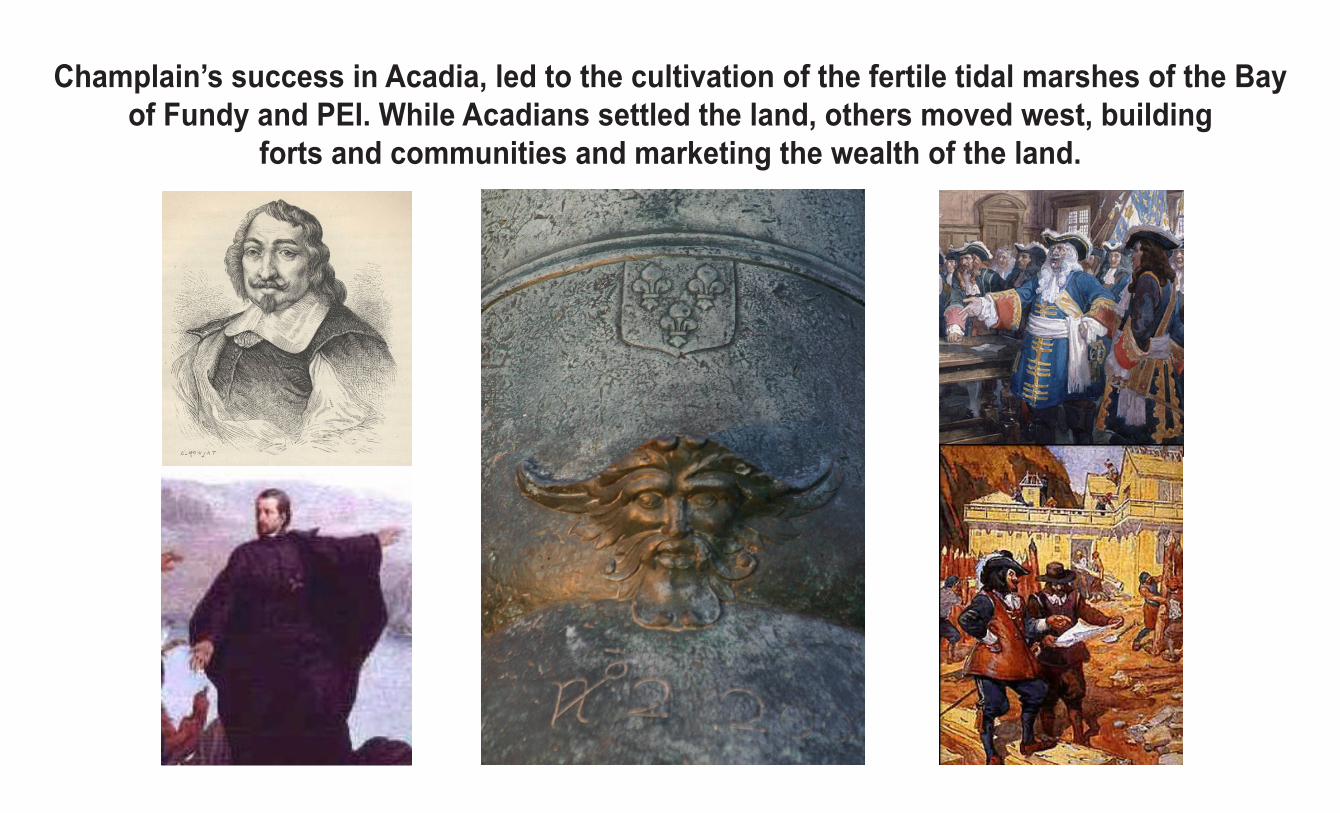
Champlain’s success in Acadia, led to the cultivation of the fertile tidal marshes of the Bay of Fundy and PEI. While Acadians settled the land, others moved west, building
forts and communities and marketing the wealth of the land.

Natives from Quebec, New Brunswick, and Nova Scotia formed allianceswith the French and skirmishes ultimately led to invasion of
English communities to the south and retaliation raids.

The ongoing war in Europe between England and France brought Acadiato the centre of world-scale conflicts.
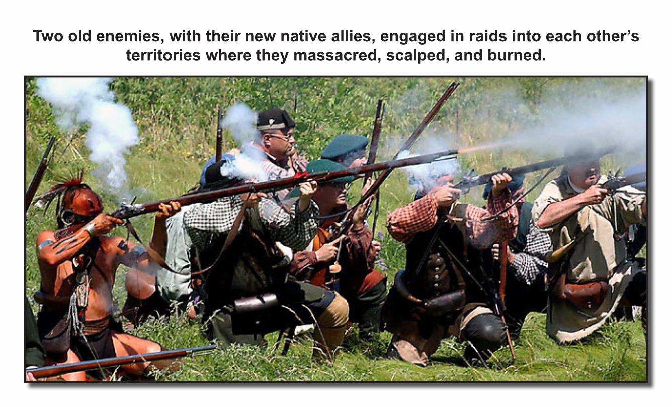
Two old enemies, with their new native allies, engaged in raids into each other’s territories where they massacred, scalped, and burned.
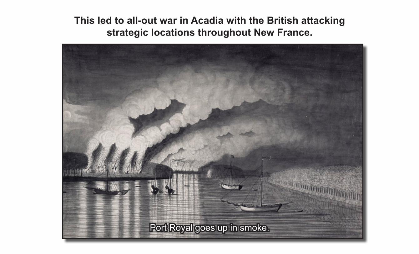
This led to all-out war in Acadia with the British attackingstrategic locations throughout New France.
Port Royal goes up in smoke.

The Seven Years’ War from 1756 to 1763 was the final struggle forEuropean domination of North America. With the British capture
of Fort Beausejour and Fort Gaspereau, and the fall of Louisbourg, French resistance crumbled.
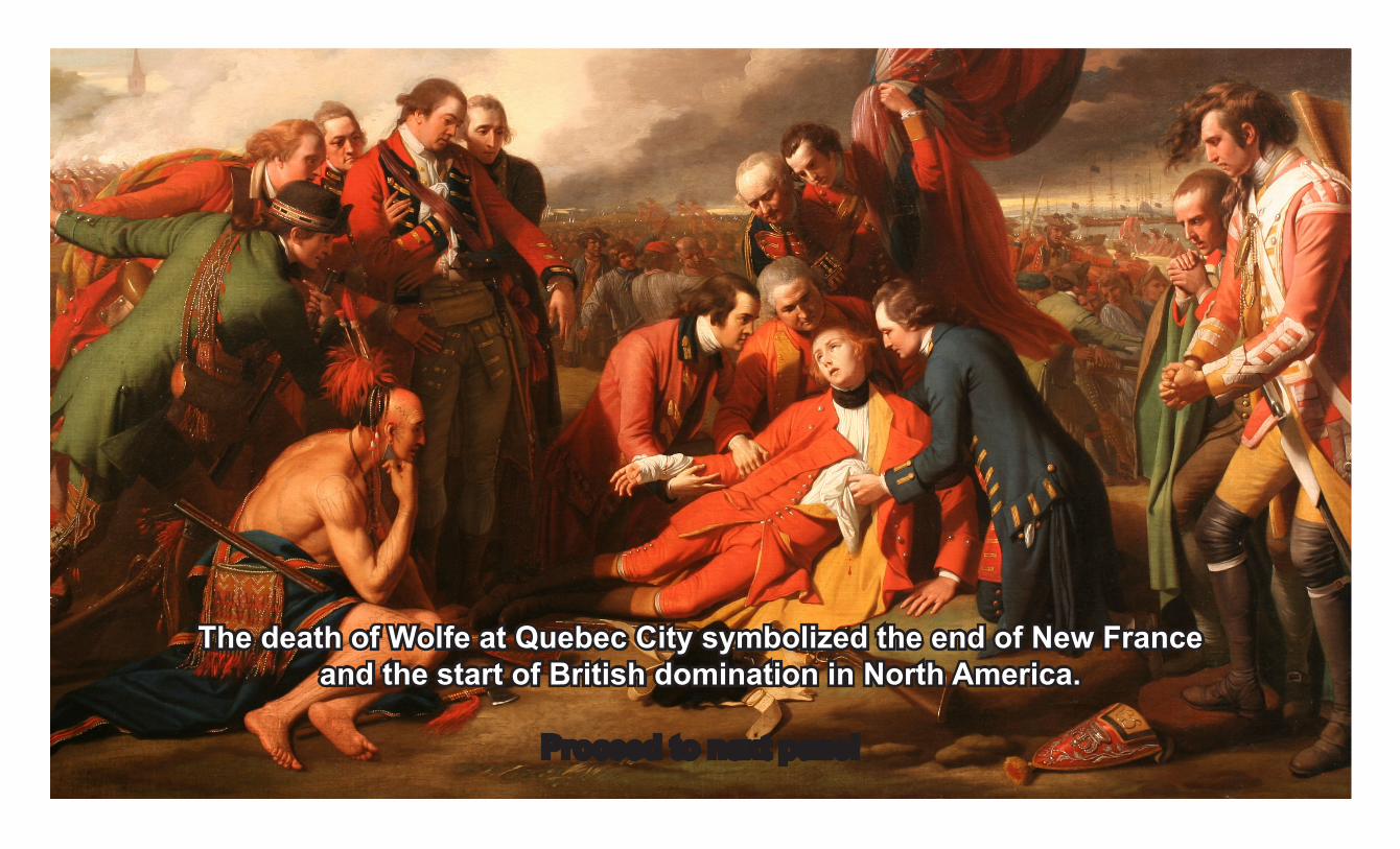
The death of Wolfe at Quebec City symbolized the end of New Franceand the start of British domination in North America.

1776American Revolution
The dream of a British North America fades as the thirteen colonies rebel.

Concerned about control in North America,British Parliament began a series of repressive acts.

The American Revolution refers to the political upheaval during the last half of the 18th century in which the Thirteen Colonies of North America overthrew the governance of the British Empire and then rejected the British monarchy to become the sovereign United States of America.
Colonial politicians and citizens became increasingly concerned.

Tax collectors were violating citizens’ rights leading John Adams to write, "American independence was then and there born.”
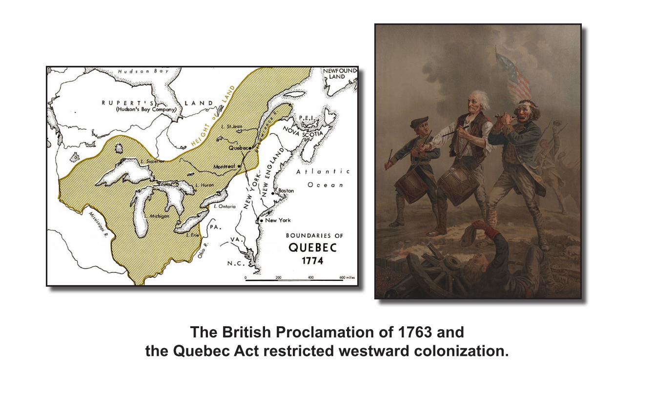
The British Proclamation of 1763 and the Quebec Act restricted westward colonization.
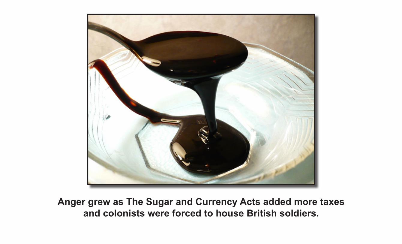
Anger grew as The Sugar and Currency Acts added more taxes and colonists were forced to house British soldiers.

The British demanded the colonies pay defense costs. “No taxation without representation” became a popular cry.
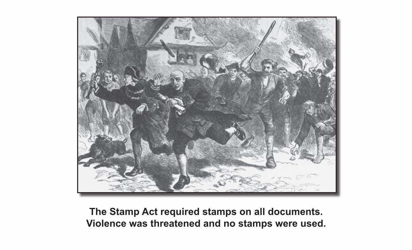
The Stamp Act required stamps on all documents. Violence was threatened and no stamps were used.

More British taxes on paper, glass, and tea led to an attack on British soldiers who shot eleven people.
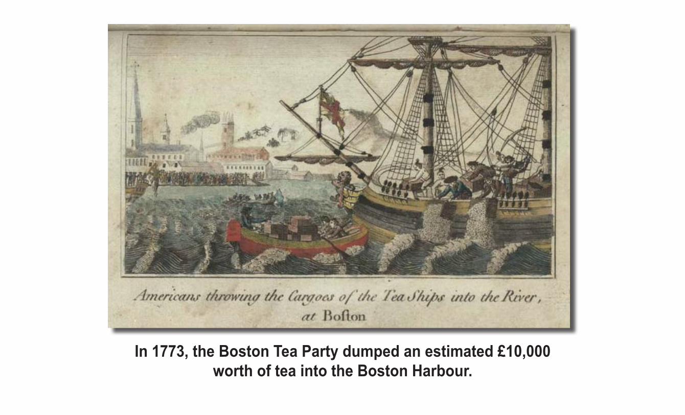
In 1773, the Boston Tea Party dumped an estimated £10,000 worth of tea into the Boston Harbour.
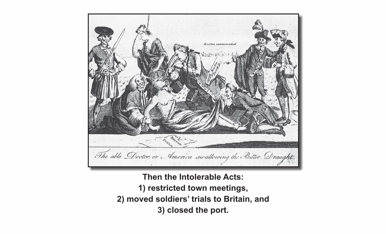
Then the Intolerable Acts: 1) restricted town meetings,
2) moved soldiers’ trials to Britain, and 3) closed the port.
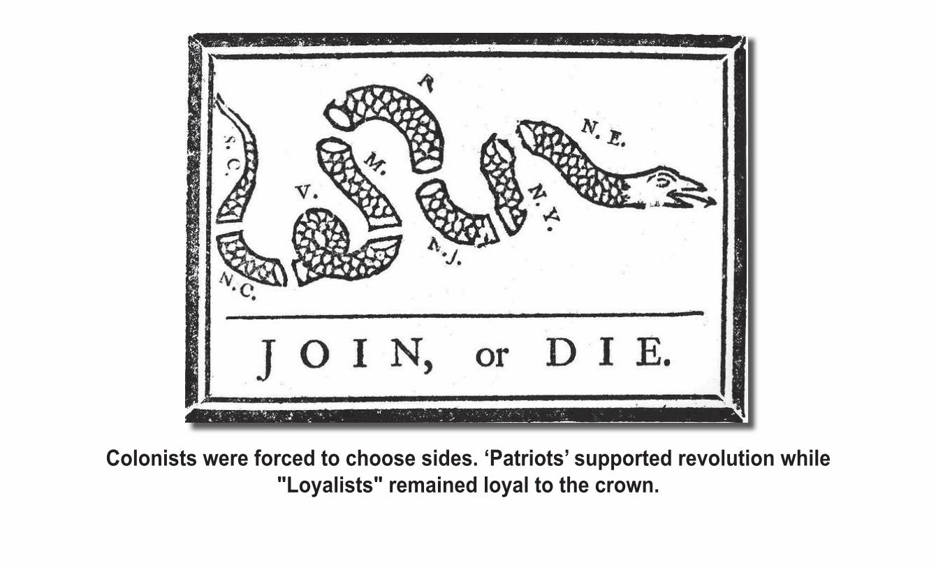
Colonists were forced to choose sides. ‘Patriots’ supported revolution while "Loyalists" remained loyal to the crown.

On July 4, 1776 Congress adopted the Declaration of Independence.Compromise was no longer possible.

Armies were formed and trained and battles began.

1774 * Powder Alarm – September 1, 17741775 * Battles of Lexington and Concord – April 19, * Siege of Boston – April 19, 1775 - Mar. 17 * Capture of Fort Ticonderoga – May 10 * Battle of Chelsea Creek – May 27 - May 28 * Battle of Machias – June 11 - June 12, 1775 * Battle of Bunker Hill – June 17, 1775 * Battle of Gloucester (1775) – August 8 * Battle of Stonington – August 30, 1775 * Siege of Fort St. Jeans – Septr 17 - Nov 3, * Burning of Falmouth – October 18, 1775* * Battle of Kemp’s Landing – November 14, * Battle of Great Bridge – Nov. 28 - Dec. 9, * Battle of Quebec – December 31, 17751776 * Burning of Norfolk – January 1, 1776 * Battle of Moore’s Creek Bridge – Feb.27, * Battle of Nassau – March 2 – March 3, 1776 * Battle of the Rice Boats – March 2 – 3 * Fortification of Dorchester Heights March 4 * Battle of Saint-Pierre – March 25, 1776 * Battle of the Cedars – May 15 – May 16, * Battle of Trois-Rivières – June 8, 1776 * Battle of Sullivan’s Island – June 28, 1776 * Battle of Long Island – August 27, 1776 * Landing at Kip’s Bay – September 15, 1776 * Battle of Harlem Heights – September 16, * Battle of Valcour Island – October 11, 1776 * Battle of White Plains – October 28, 1776 * Battle of Fort Cumberland – Nov. 10 - 28, * Battle of Fort Washington – November 16, * Battle of Fort Lee – November 19, 1776 * Battle of Trenton – December 26, 17761777 * Second Battle of Trenton – January 2, 1777 * Battle of Princeton – January 3, 1777 * Battle of Millstone – January 20, 1777 * Forage War – Winter 1777 * Battle of Bound Brook – April 13, 1777 * Battle of Ridgefield – April 27, 1777 * Battle of Short Hills – June 26, 1777 * Second Battle of Ticonderoga – July 5–6 * Battle of Hubbardton – July 7, 1777
* Battle of Fort Ann – July 8, 1777 * Siege of Fort Stanwix – Aug. 2 – 23, 1777 * Battle of Oriskany – August 6, 1777 * Battle of Bennington – August 16, 1777 * Battle of Staten Island – August 22, 1777 * Battle of Cooch’s Bridge – September 3, * Battle of Brandywine – September 11, 1777 * Battle of the Clouds – September 16, 1777 * Battle of Freeman’s Farm – September 19, * Battle of Paoli – September 21, 1777 * Battle of Germantown – October 4, 1777 * Battle of Red Bank – Oct. 5 to Nov. 25, 1777 * Battle Forts Clinton & Montgomery -Oct.6 * Battle of Bemis Heights – October 7, 1777 * Battle of Fort Mercer – October 22, 1777 * Bombardment of Fort Mifflin - Nov.10 – 15 * Battle of Gloucester (1777) – Nov. 25, 1777 * Battle of White Marsh – Dec. 5 to Dec. 8 * Battle of Matson’s Ford – December 11 * Battle of Saratoga1778 * Battle of Quinton’s Bridge – March 18, 1778 * Battle of Crooked Billet – May 1, 1778 * Battle of Barren Hill – May 20, 1778 * Battle of Freetown – May 25, 1778 * Battle of Monmouth – June 28, 1778 * Battle of Alligator Bridge – June 30, 1778 * Wyoming Massacre – July 3, 1778 * Battle of Ushant (1778) – July 27, 1778 * Battle of Rhode Island – August 29, 1778 * Baylor Massacre – September 27, 1778 * Little Egg Harbor massacre – October, 1778 * Battle of Chestnut Neck – October 6, 1778 * Carleton’s Raid (1778) – Oct. 24 - Nov.14 * Cherry Valley Massacre – November 11 * Capture of Savannah – December 29 * Battle of Beaufort – 3 February 1779 * Battle of Kettle Creek – 14 February 1779 * Battle of Vincennes – Feb. 23 – 25, 1779 * Battle of Briar Creek – March 3, 1779 * Battle of Stono Ferry – 20 June 1779 * Battle of Stony Point – July 16, 1779 * Penobscot Expedition – July 24 - Aug.29, 1779 * Battle of Paulus Hook – August 19, 1779
* Battle of Newtown – August 29, 1779 * Siege of Savannah – Sept.16 – Oct.18 * Battle of Flamborough Head – Sept. 231780 * Battle of Cape St. Vincent – January 16 * Battle of Young’s House – February 3, 1780 * Siege of Charleston – March 29 – May 12 * Battle of Monck’s Corner – April 14, 1780 * Battle of Lenud’s Ferry – May 6, 1780 * Bird’s invasion of Kentucky – May–June * Waxhaw Massacre – May 29, 1780 * Battle of Connecticut Farms – June 6, 1780 * Battle of Ramseur’s Mill – June 20, 1780 * Battle of Springfield – June 7 & June 23 * Battle of Rocky Mount – August 1 * Battle of Hanging Rock – August 6 * Battle of Pekowee – August 8 * Battle of Camden – August 16 * Battle of Fishing Creek – August 18 * Battle of Musgrove Mill - August 18, 1780 * Battle of Kings Mountain – October 7, 1780 * Royalton Raid – October 16, 1780 * Battle of Klock’s Field – October 19, 1780 * Battle of Blackstock’s Plantation – Nov. 20, 1781 * Battle of Jersey – January 6, 1781 * Battle of Cowpens – January 17, 1781 * Battle of Cowan’s Ford – February 1, 1781 * Battle of Haw River – February 25, 1781 * Battle of Wetzell’s Mill – March 6, 1781 * Battle of Guilford Court House – March 15 * Battle of Blanford – April 25 * Battle of Hobkirk’s Hill – April 25, 1781 * Battle of Fort Motte – May 8 – May 12, 1781 * Siege of Augusta – May 22 – June 6, 1781 * Siege of Ninety-Six – May 22 – June 19 * Battle of Spencer’s Ordinary – June 26 * Francisco’s Fight July, 1781 * Battle of Greenspring Farm – July 6, 1781 * Battle of Groton Heights – September 6 * Battle of Eutaw Springs – September 8 * Battle of Cane Creek – September 12, 1781 * Siege of Yorktown – Sept. 28 – Oct. 19 * Battle of Johnstown – October 25, 1781 * Battle of Ushant (1781) – December 12
A seemingly endless series of battles raged across the land.
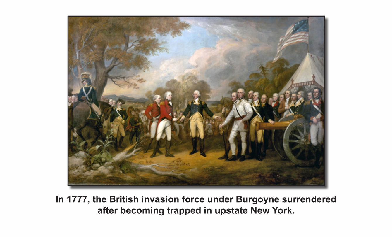
In 1777, the British invasion force under Burgoyne surrendered after becoming trapped in upstate New York.

Cornwallis surrendered at Yorktown in 1781 ending the Revolutionary War.

West’s painting of the Treaty of Paris was never completed because the British refused to pose.
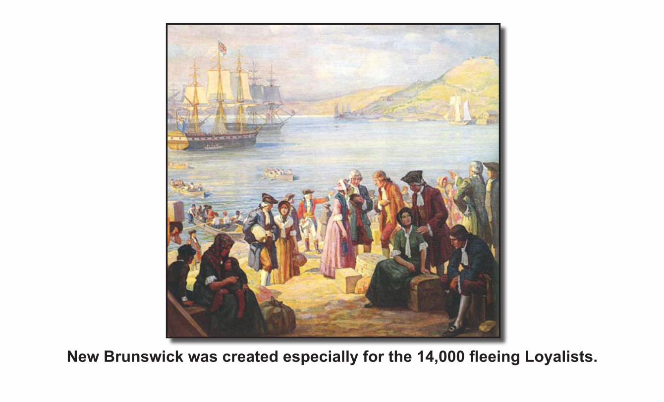
New Brunswick was created especially for the 14,000 fleeing Loyalists.
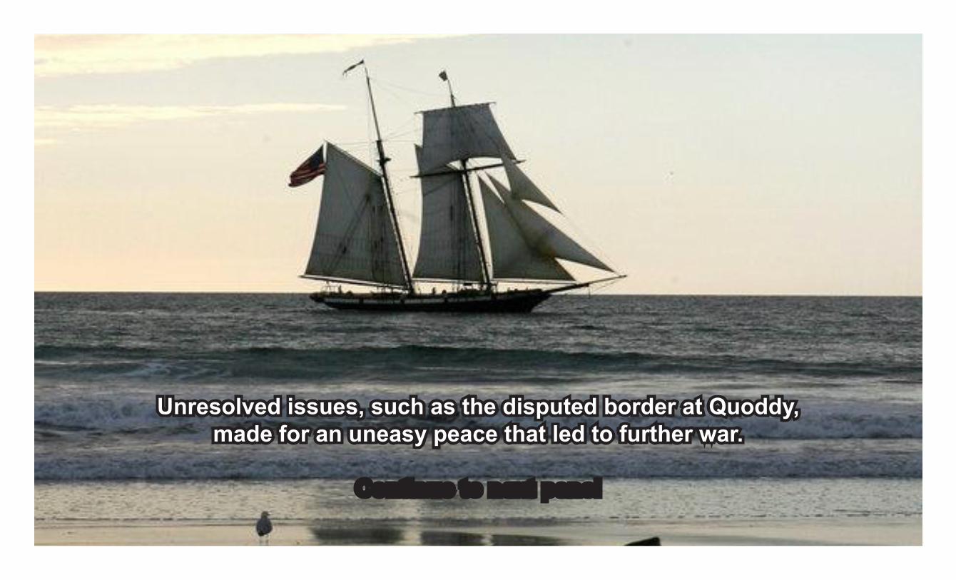
Prelude to war - 1812
Unresolved issues, such as the disputed border at Quoddy,made for an uneasy peace that led to further war.
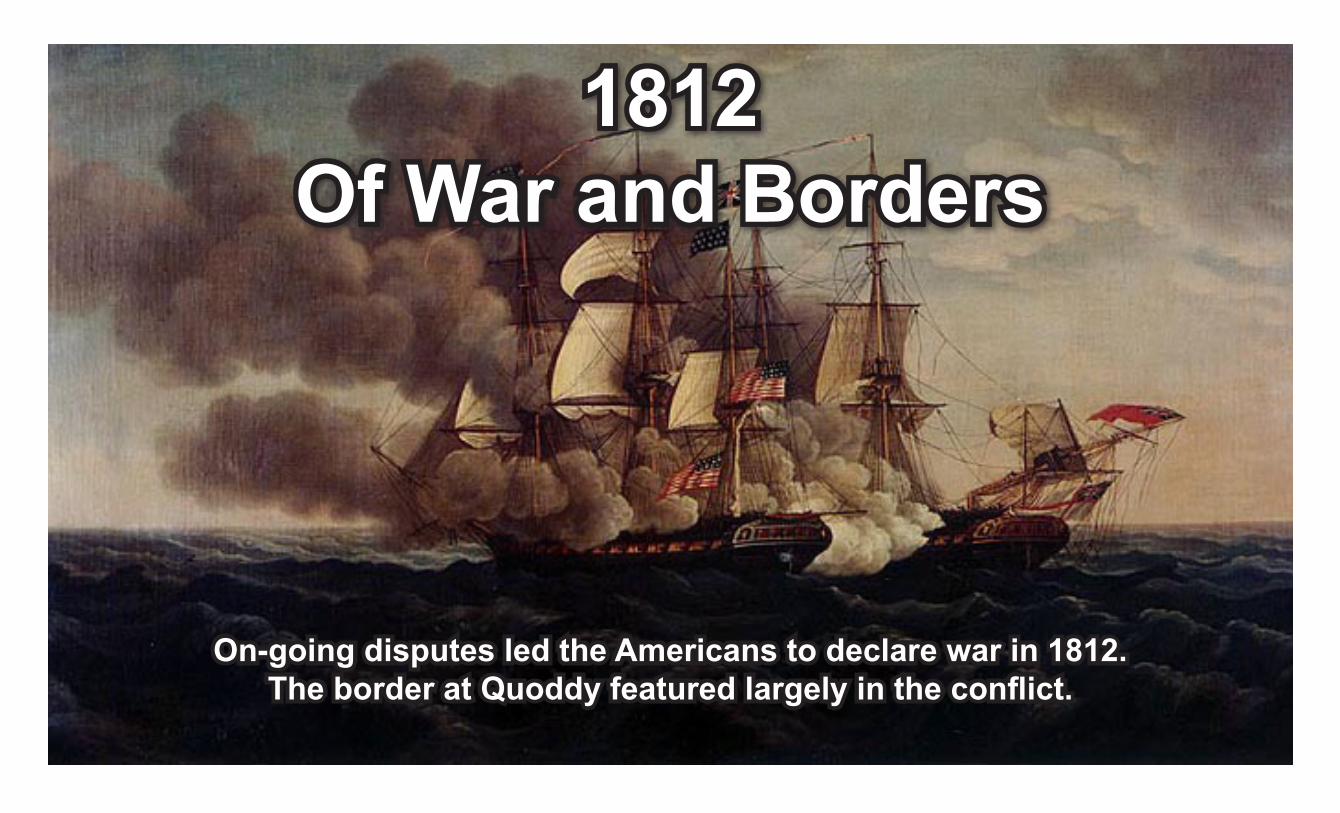
1812Of War and Borders
On-going disputes led the Americans to declare war in 1812.The border at Quoddy featured largely in the conflict.
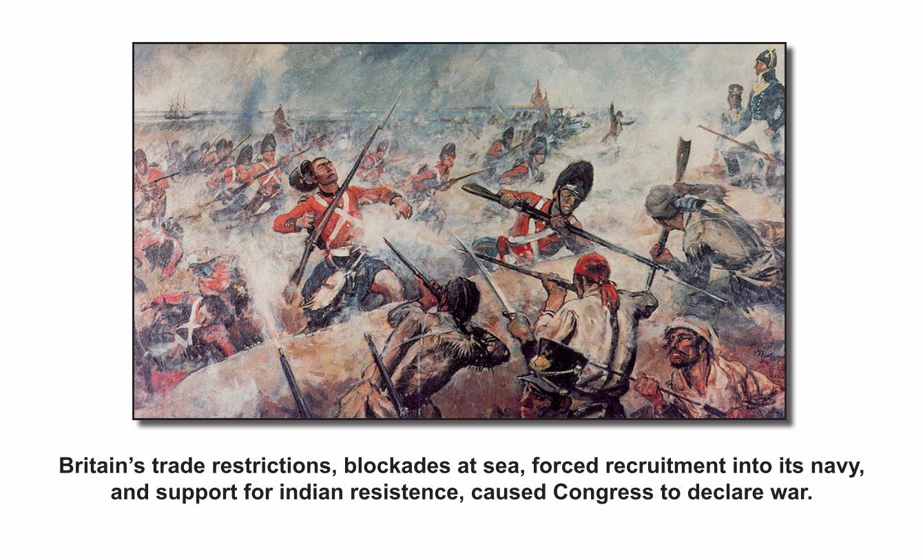
Britain’s trade restrictions, blockades at sea, forced recruitment into its navy, and support for indian resistence, caused Congress to declare war.
A * Raid on Alexandria
B * Battle of Baltimore * Battle of Fort Bowyer * Battle of Hampden * Battle of Pensacola (1812) * Battle of Stuart's Pond * Battle of Beaver Dams * Battle of Big Sandy Creek * Battle of Bladensburg * Battle of Brownstown
C * Campbell's Island, Illinois * Battle of Caulk's Field * Battle of the Chateauguay * Battle of Chippawa * Battle of Cook's Mills * Copus massacre * Battle of Craney Island * Battle of Crysler's Farm
D * Siege of Detroit
E * Raid on Elizabethtown
F * Fort Dearborn massacre * Capture of Fort Erie * Siege of Fort Erie * Battle of Fort George * Battle of Fort Harrison * Siege of Fort Meigs * Capture of Fort Niagara * Battle of Fort Stephenson * Siege of Fort Wayne * Battle of Frenchtown
G * Raid on Gananoque
L * Battle of Lacolle Mills (1812) * Battle of Lacolle Mills (1814) * Battle of Longwoods * Battle of Lundy's Lane
M * Battle of Mackinac Island
* Battle of Mackinac Island (1812) * Battle of Maguaga * Battle of Malcolm's Mills * Battle of the Mississinewa
N * Battle of New Orleans * Battle of North Point
O * Battle of Ogdensburg * Raid on Fort Oswego
P * Battle of Prairie du Chien
Q * Battle of Queenston Heights
S * Battle of Sackett's Harbor * First Battle of Sackett's Harbor * Spur's Defeat * Battle of St. Michaels * Battle of Stoney Creek
T * Tecumseh's War * Battle of the Thames * Battle of Tippecanoe * Tippecanoe Battlefield Park
W * Burning of Washington
Y * Battle of York
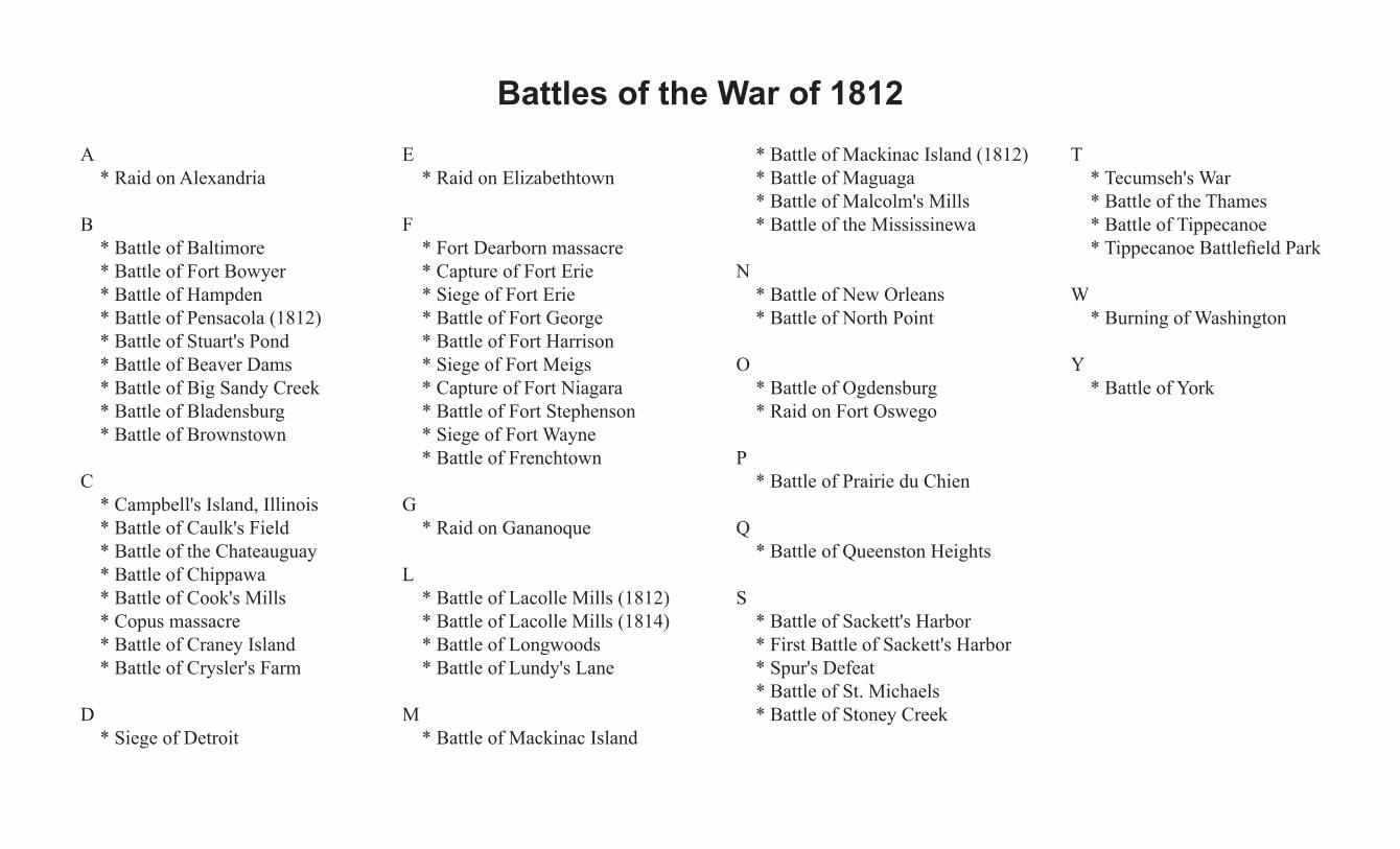
Battles of the War of 1812

The Treaty of Ghent ended the War on December 24, 1814. It was a short conflict that had significant impacts in the Quoddy Region.
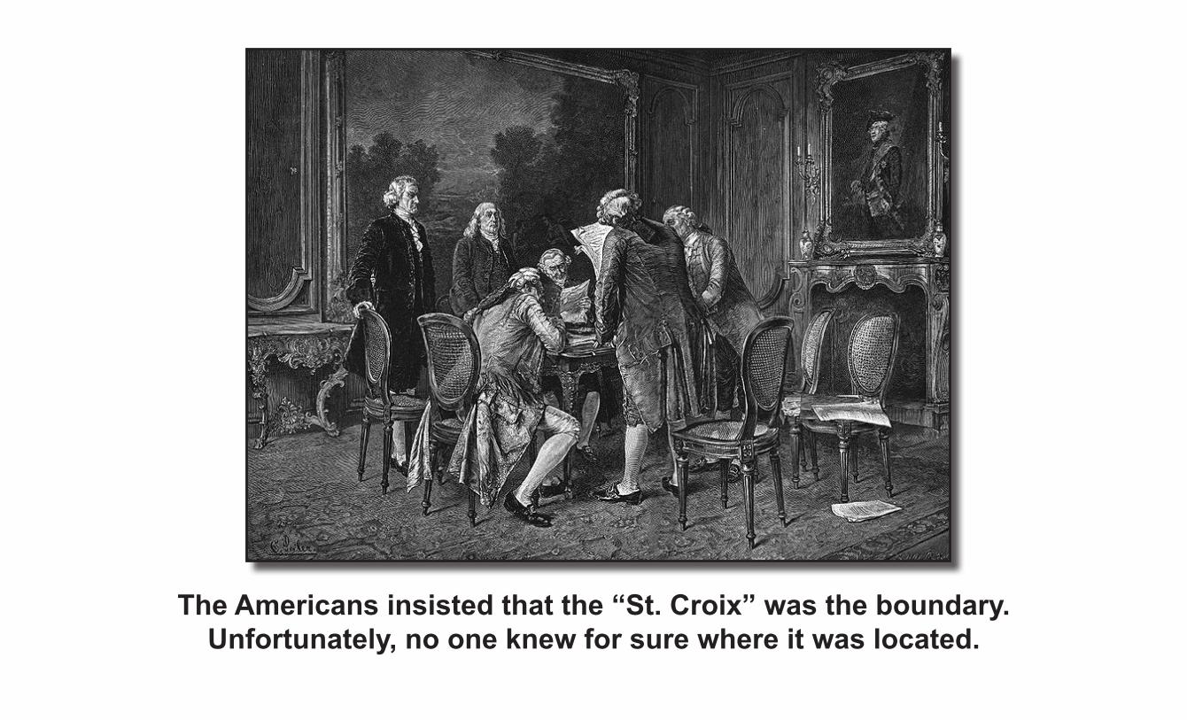
The Americans insisted that the “St. Croix” was the boundary. Unfortunately, no one knew for sure where it was located.
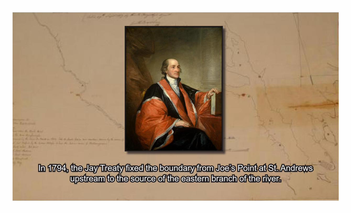
In 1794, the Jay Treaty fixed the boundary from Joe’s Point at St. Andrews upstream to the source of the eastern branch of the river.
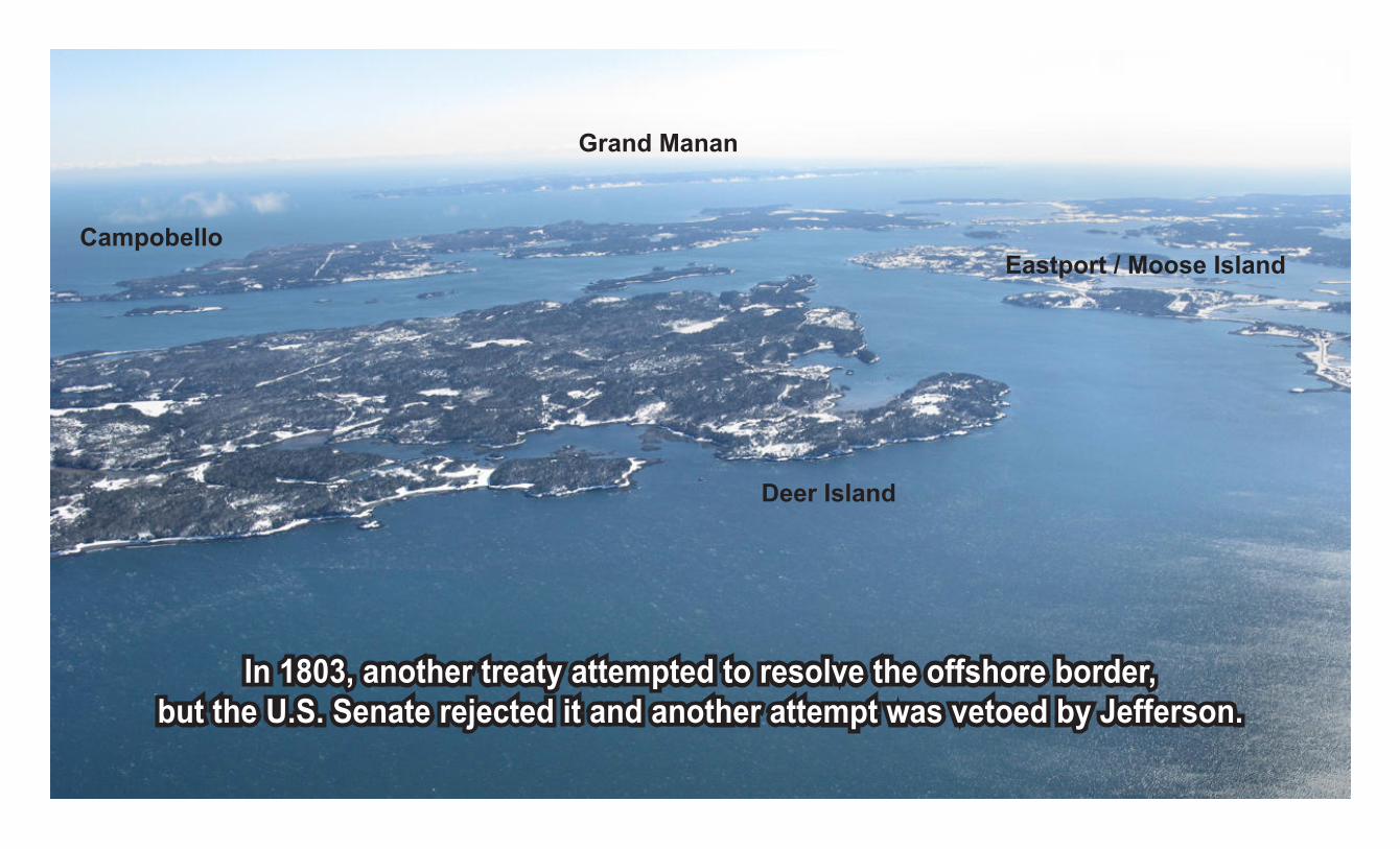
Eastport / Moose Island
Deer Island
Campobello
Grand Manan
In 1803, another treaty attempted to resolve the offshore border, but the U.S. Senate rejected it and another attempt was vetoed by Jefferson.
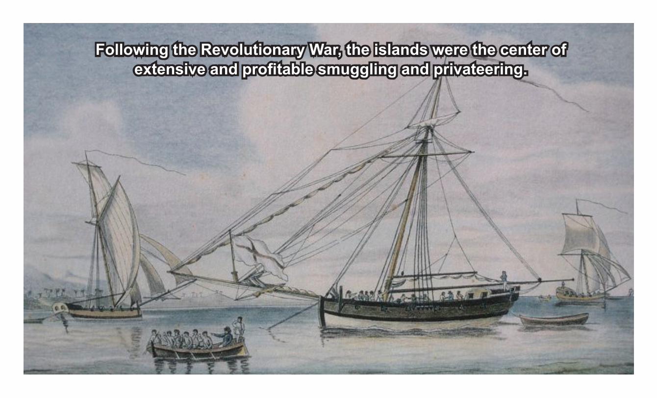
Following the Revolutionary War, the islands were the center of extensive and profitable smuggling and privateering.
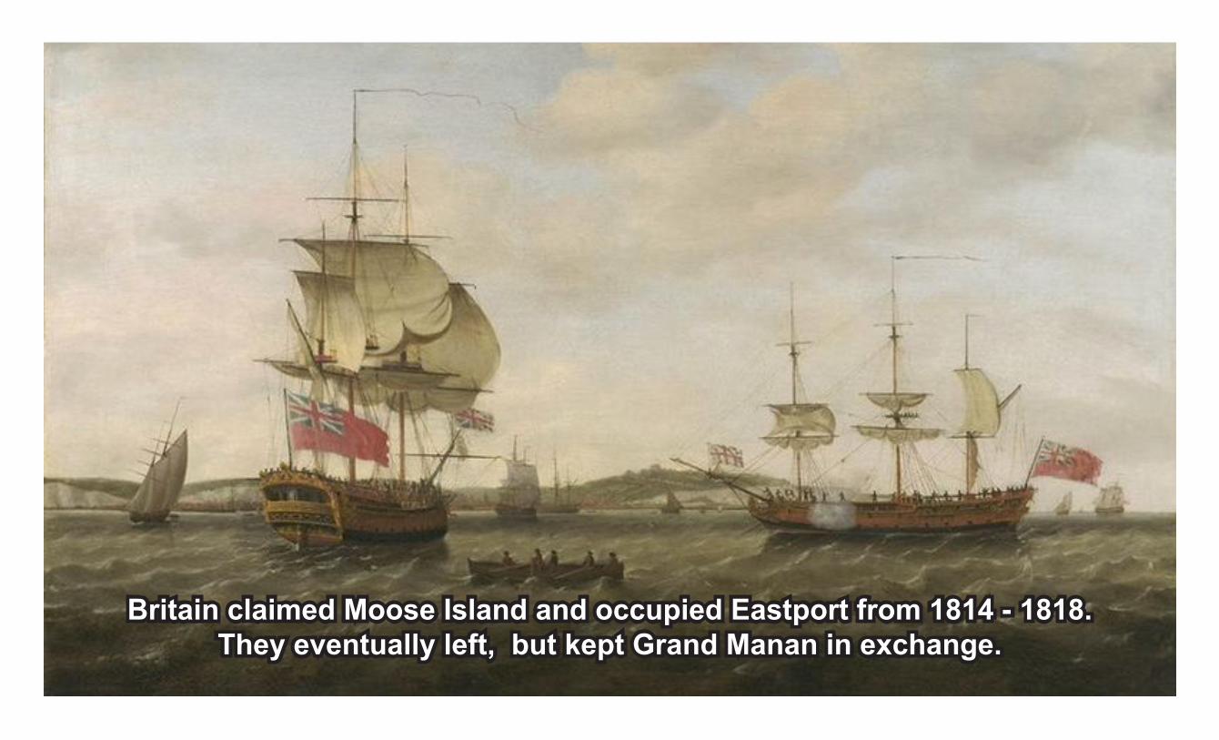
Britain claimed Moose Island and occupied Eastport from 1814 - 1818.They eventually left, but kept Grand Manan in exchange.
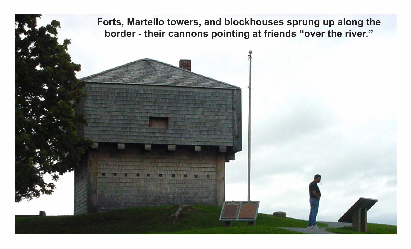
Forts, Martello towers, and blockhouses sprung up along the border - their cannons pointing at friends “over the river.”
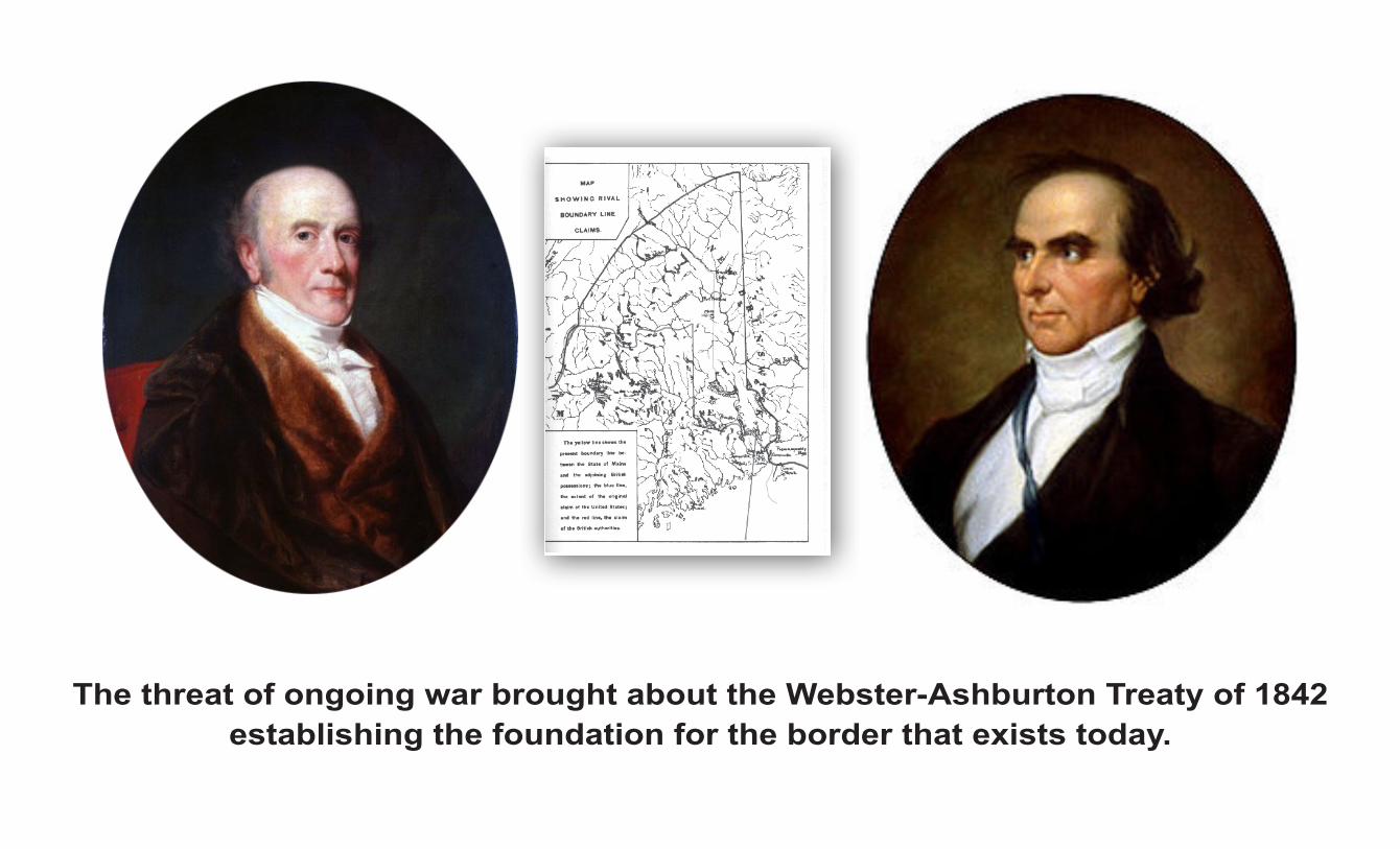
The threat of ongoing war brought about the Webster-Ashburton Treaty of 1842 establishing the foundation for the border that exists today.

Eastport / Moose Island
Deer Island
Campobello
Grand Manan Grey Zone
The offshore section of the new border was only partly settled in recent years.Negotiations were difficult, costly, and time-consuming.
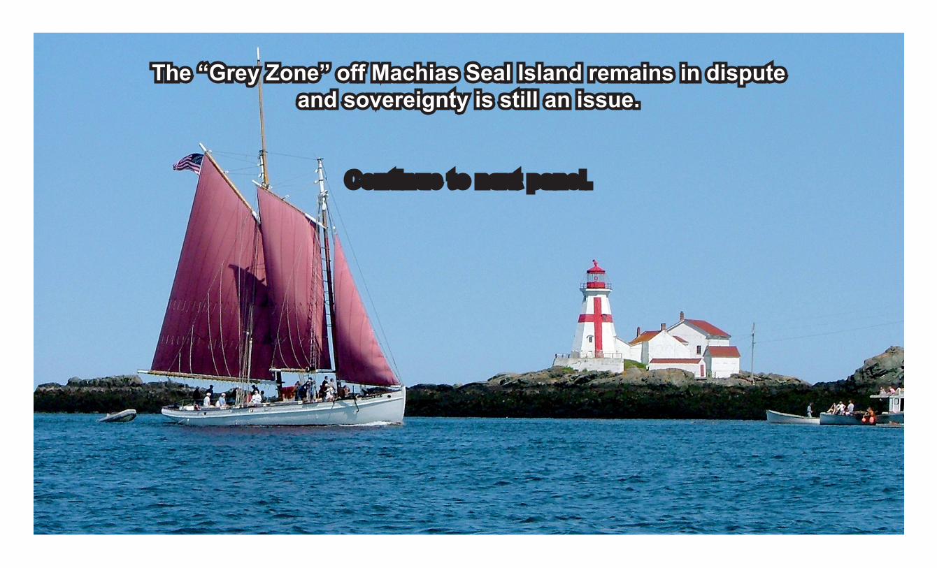
The “Grey Zone” off Machias Seal Island remains in dispute and sovereignty is still an issue.

New Arrivals Profit from Abundant Quoddy Resources
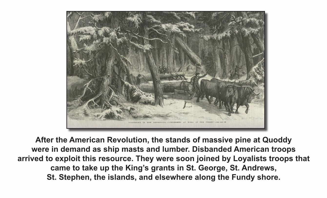
After the American Revolution, the stands of massive pine at Quoddy were in demand as ship masts and lumber. Disbanded American troops
arrived to exploit this resource. They were soon joined by Loyalists troops that came to take up the King’s grants in St. George, St. Andrews,
St. Stephen, the islands, and elsewhere along the Fundy shore.

Loyalist settlers included the Penobscot loyalists from Castine, the 74th Highland regiment, Captain Nehemiah Marks’s Port Maroon Association,
the Cape Ann Association, and representatives of the 42nd, 70th and 72nd regiments, Royal Fencible Americans,
King’s Orange Rangers, Royal Garrison Battalion, Tarleton’s Dragoons, Nova Scotia Volunteers, Regiment of Specht (Hessians) and others.
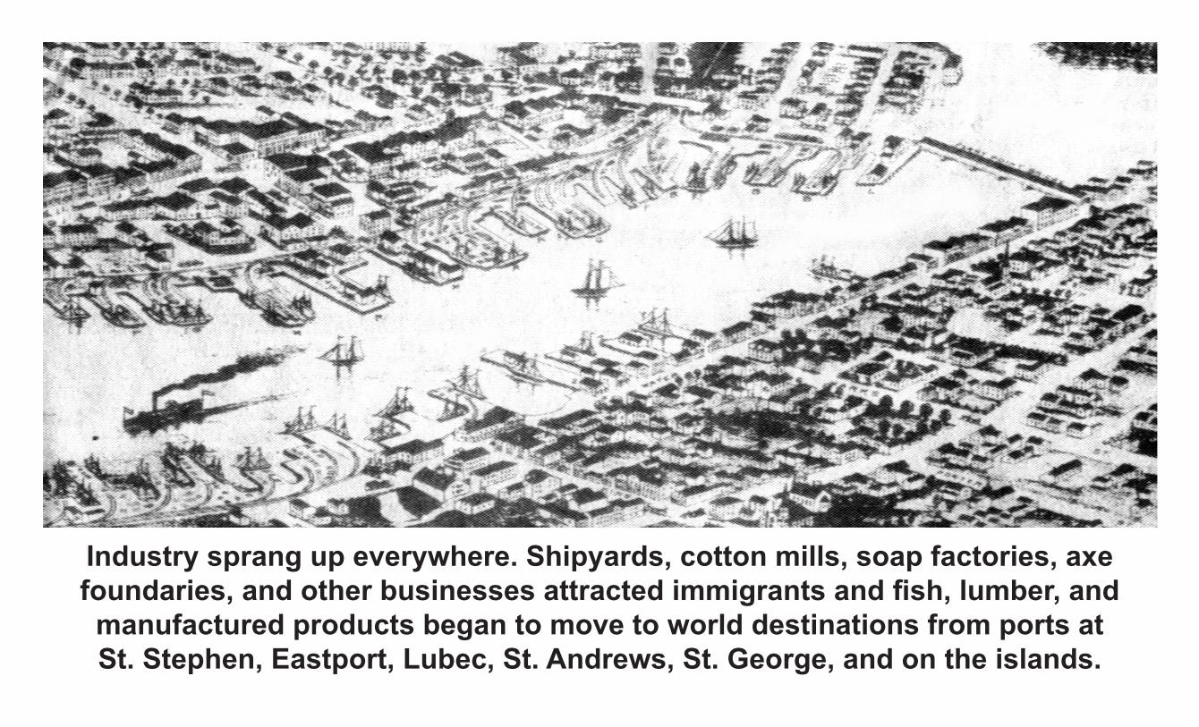
Industry sprang up everywhere. Shipyards, cotton mills, soap factories, axe foundaries, and other businesses attracted immigrants and fish, lumber, and
manufactured products began to move to world destinations from ports at St. Stephen, Eastport, Lubec, St. Andrews, St. George, and on the islands.
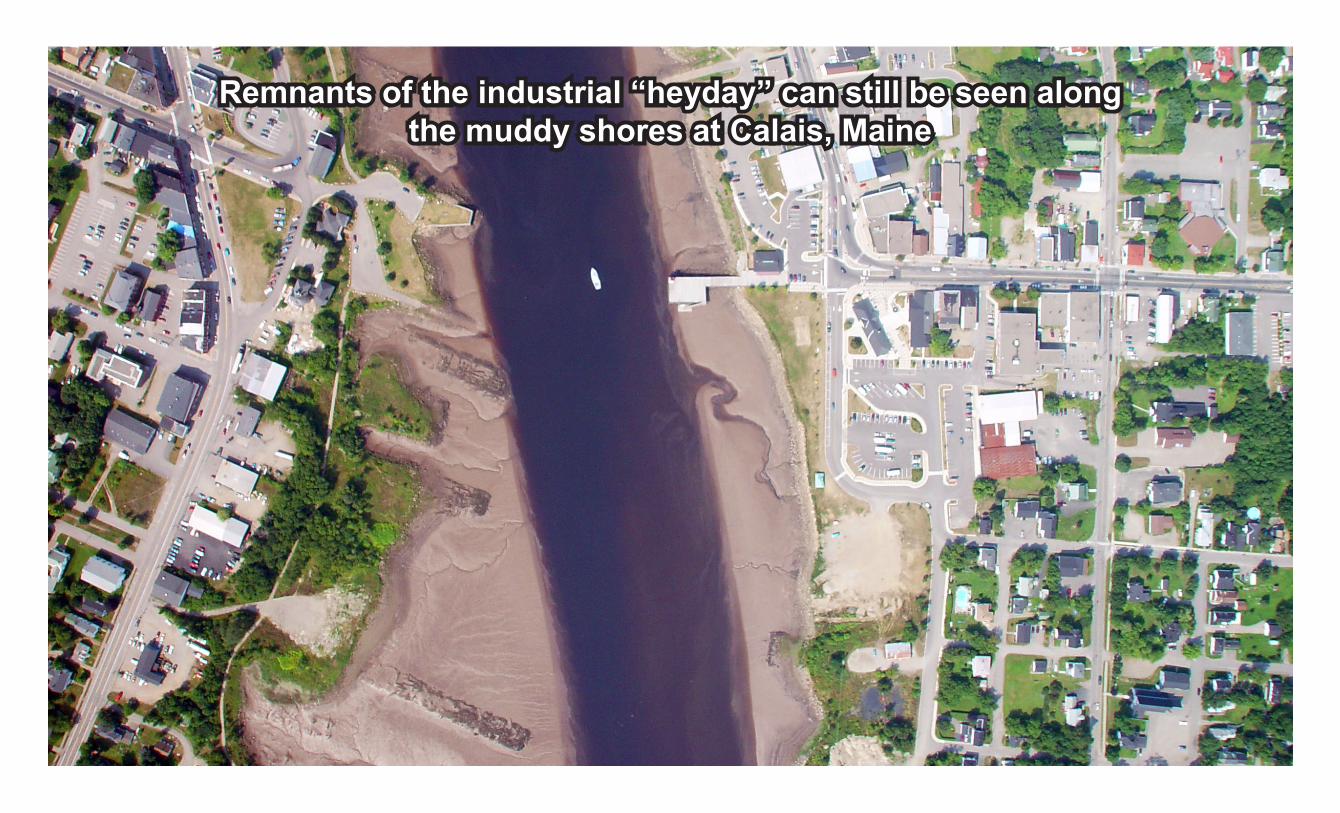
Remnants of the industrial “heyday” can still be seen alongthe muddy shores at Calais, Maine

The forests were clear-cut to feed the demands of the British Navy and customers around the world. Eventually the land was denuded, and today the lumbering
bonanza of the past has given way to the harvesting of smaller trees.
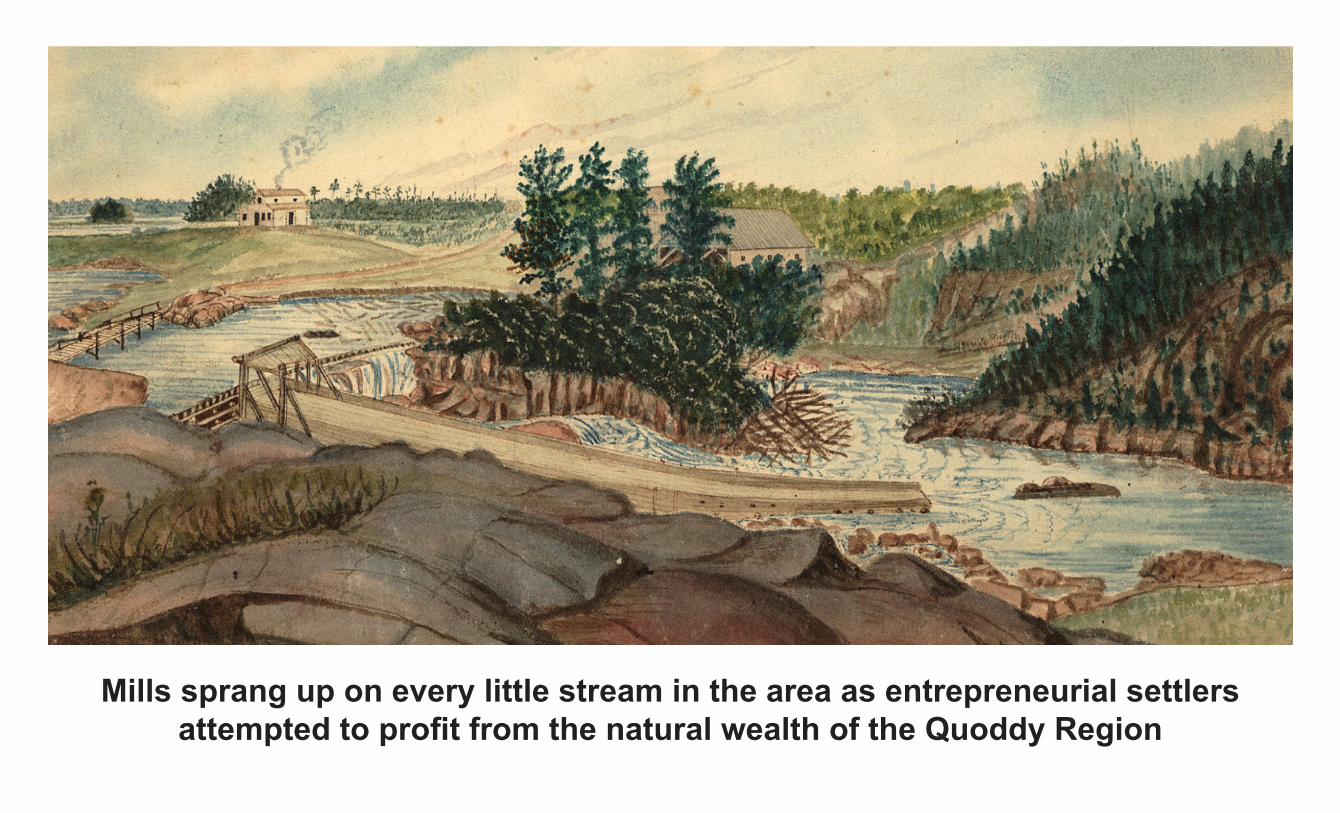
Mills sprang up on every little stream in the area as entrepreneurial settlers attempted to profit from the natural wealth of the Quoddy Region
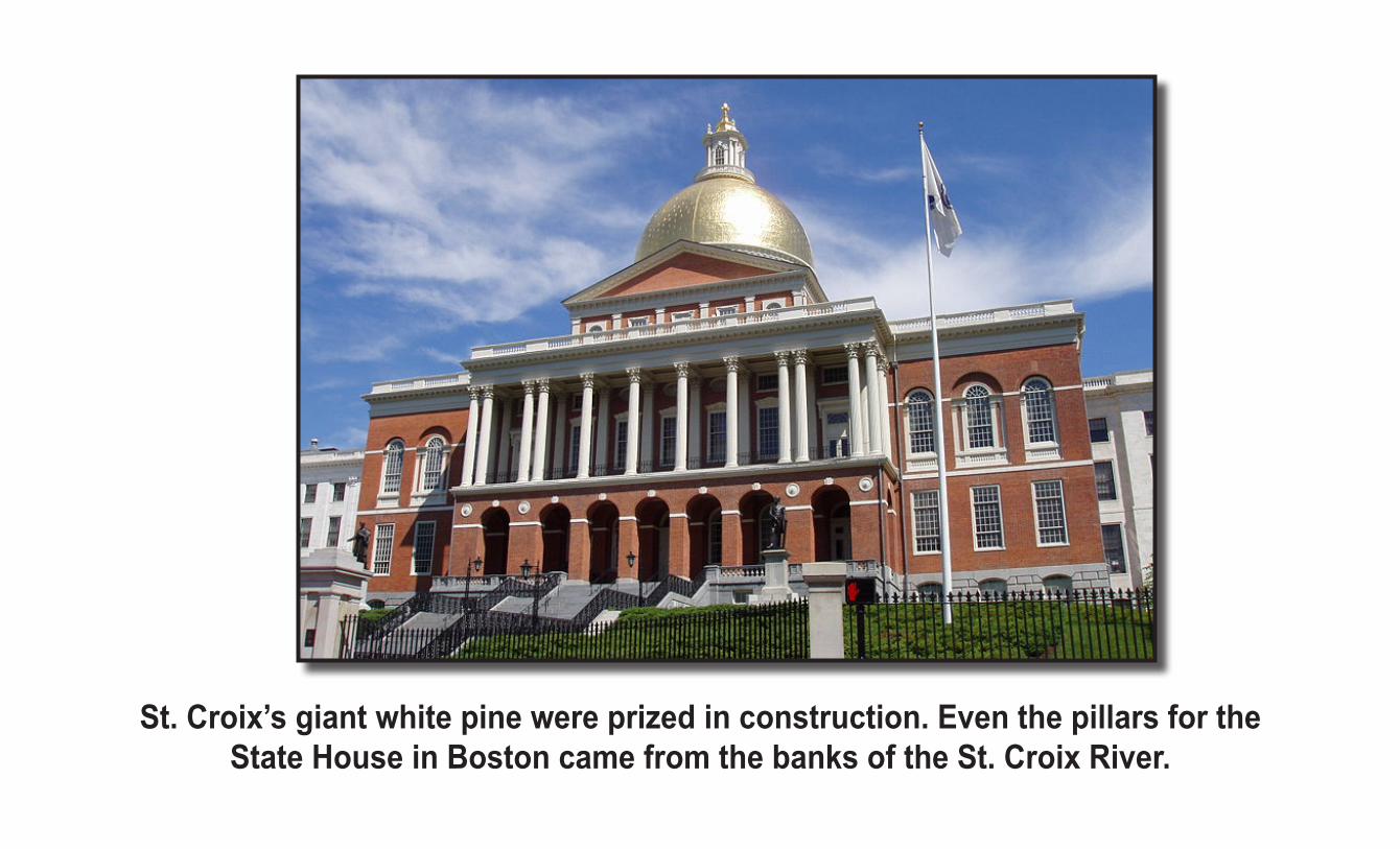
St. Croix’s giant white pine were prized in construction. Even the pillars for the State House in Boston came from the banks of the St. Croix River.
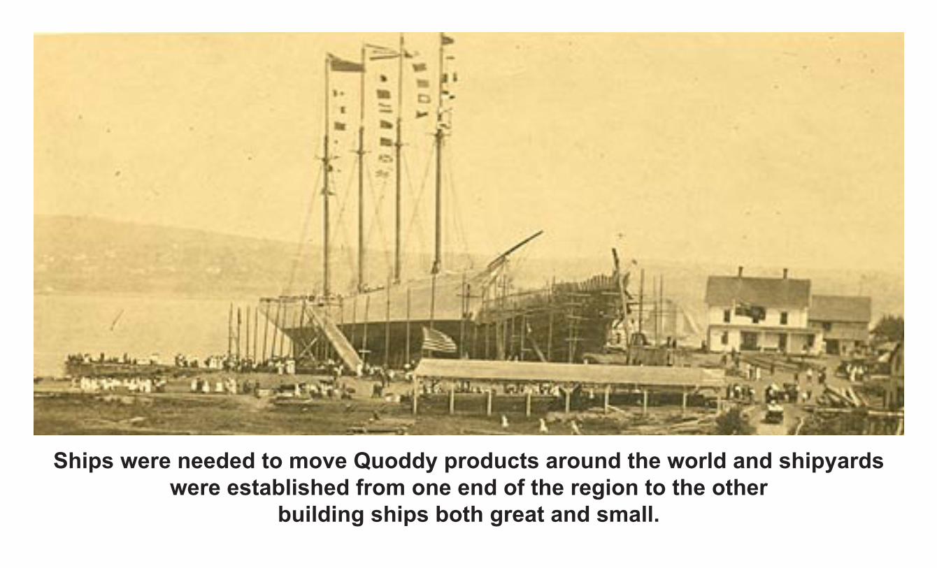
Ships were needed to move Quoddy products around the world and shipyards were established from one end of the region to the other
building ships both great and small.
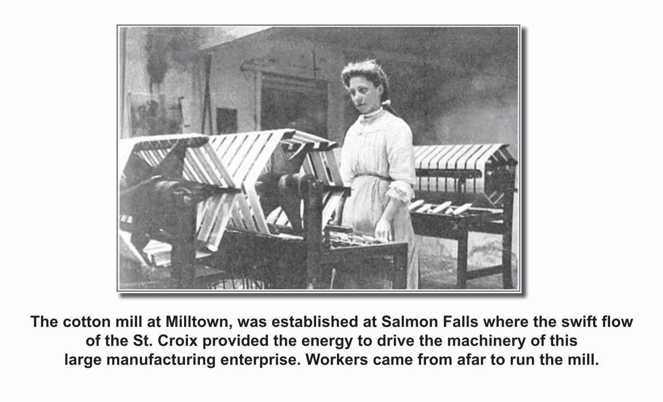
The cotton mill at Milltown, was established at Salmon Falls where the swift flow of the St. Croix provided the energy to drive the machinery of this
large manufacturing enterprise. Workers came from afar to run the mill.
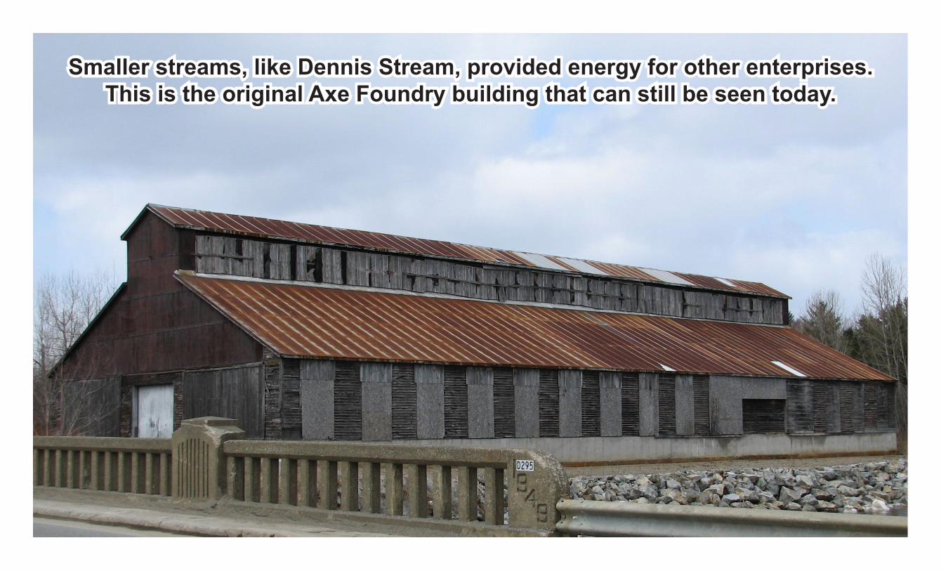
Smaller streams, like Dennis Stream, provided energy for other enterprises. This is the original Axe Foundry building that can still be seen today.
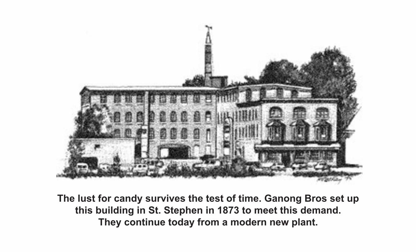
The lust for candy survives the test of time. Ganong Bros set up this building in St. Stephen in 1873 to meet this demand.
They continue today from a modern new plant.
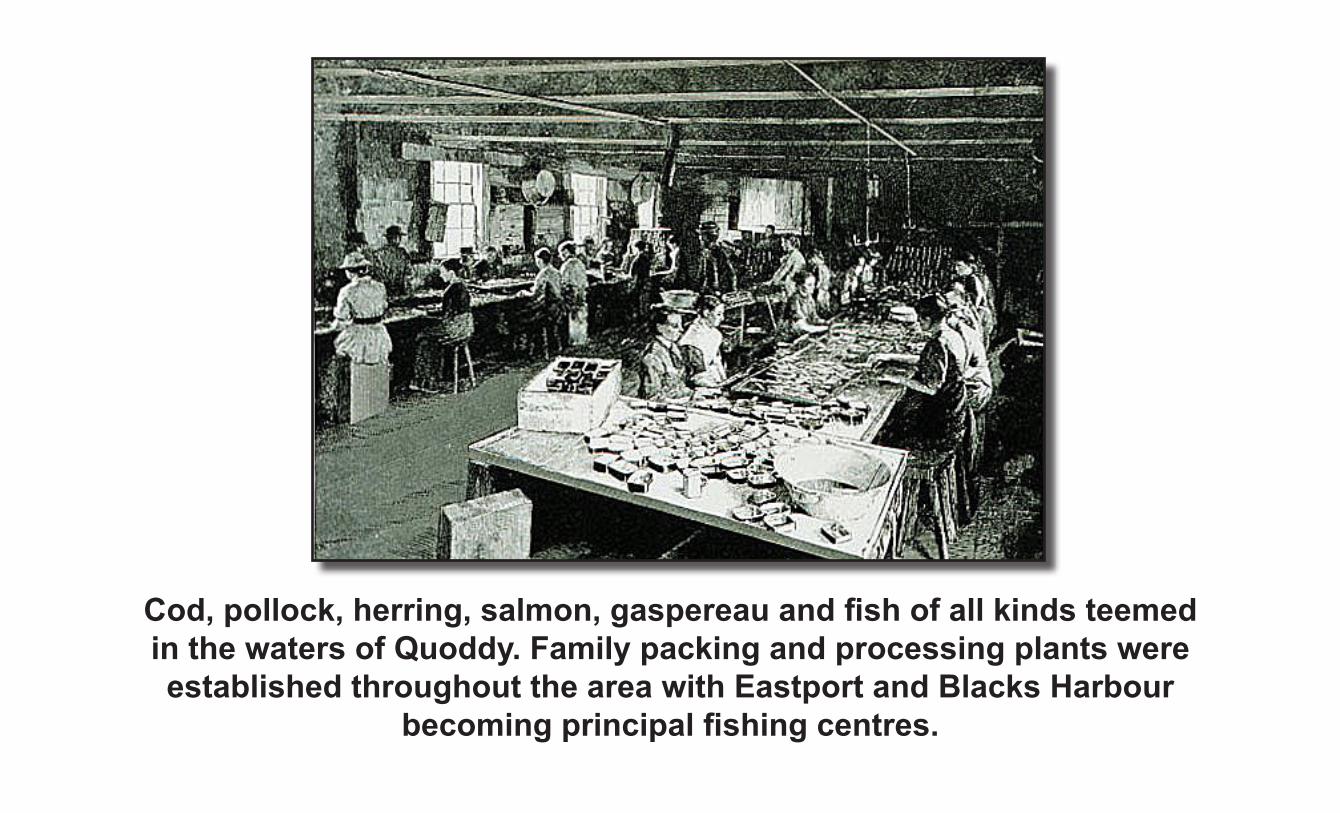
Cod, pollock, herring, salmon, gaspereau and fish of all kinds teemed in the waters of Quoddy. Family packing and processing plants were established throughout the area with Eastport and Blacks Harbour
becoming principal fishing centres.
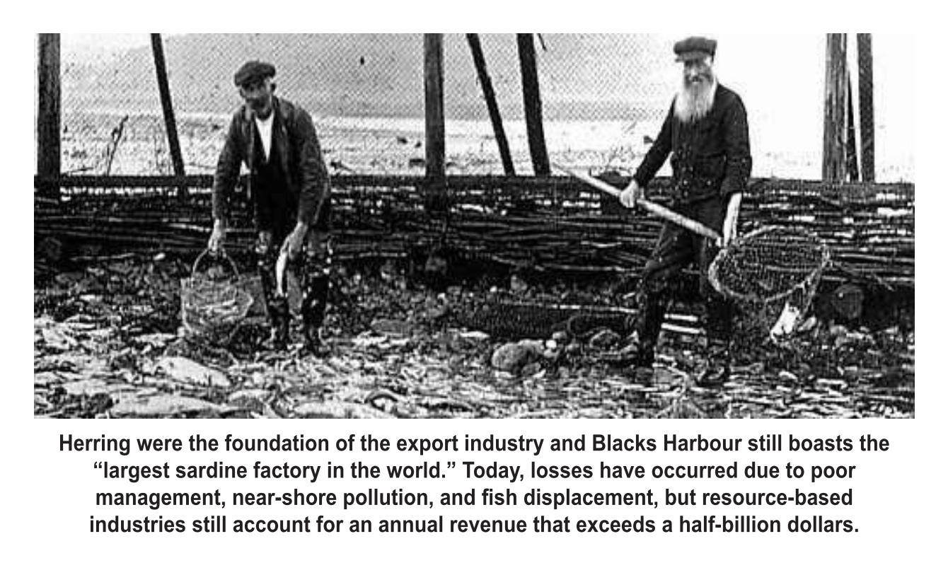
Herring were the foundation of the export industry and Blacks Harbour still boasts the “largest sardine factory in the world.” Today, losses have occurred due to poor management, near-shore pollution, and fish displacement, but resource-based
industries still account for an annual revenue that exceeds a half-billion dollars.
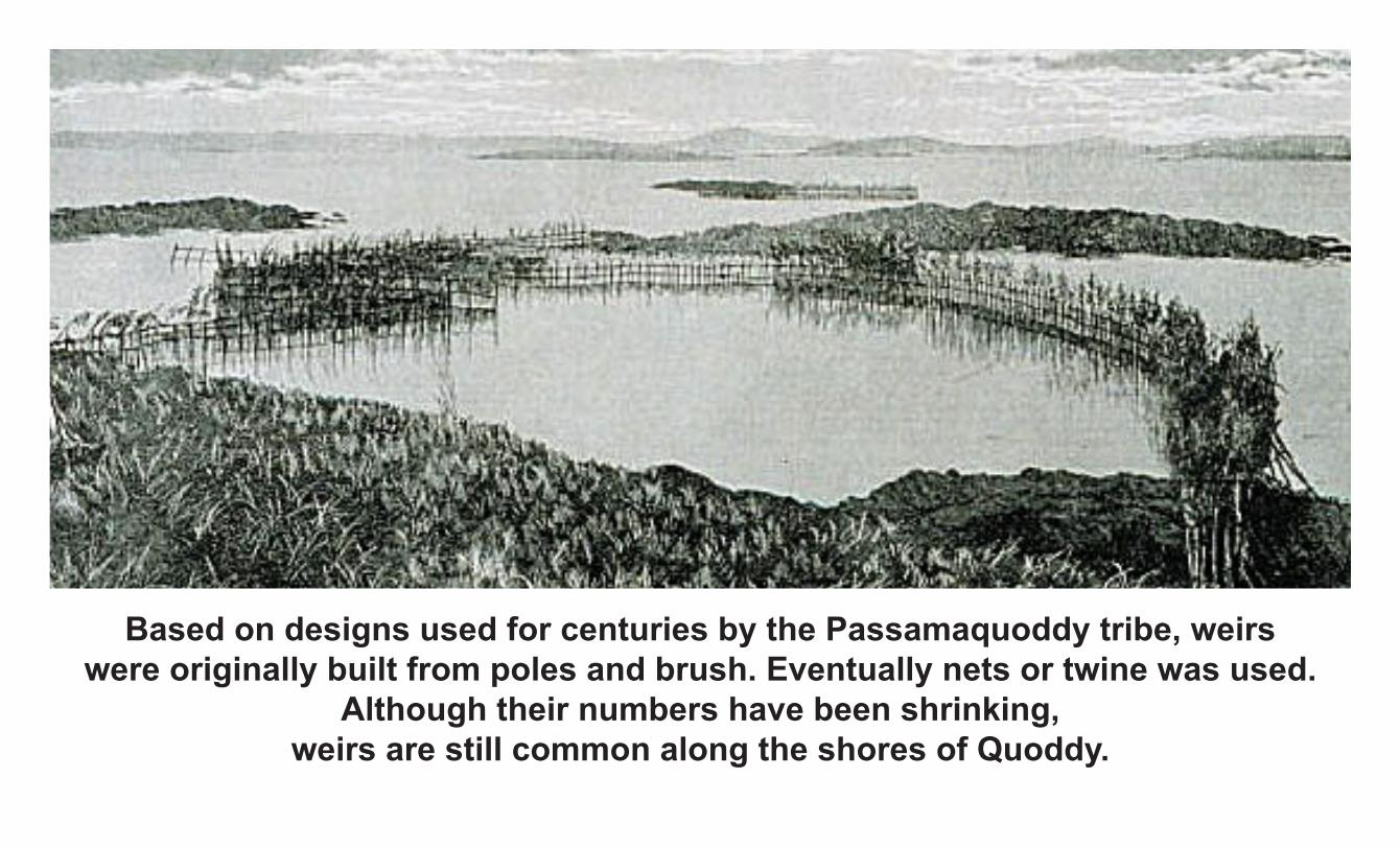
Based on designs used for centuries by the Passamaquoddy tribe, weirs were originally built from poles and brush. Eventually nets or twine was used.
Although their numbers have been shrinking, weirs are still common along the shores of Quoddy.
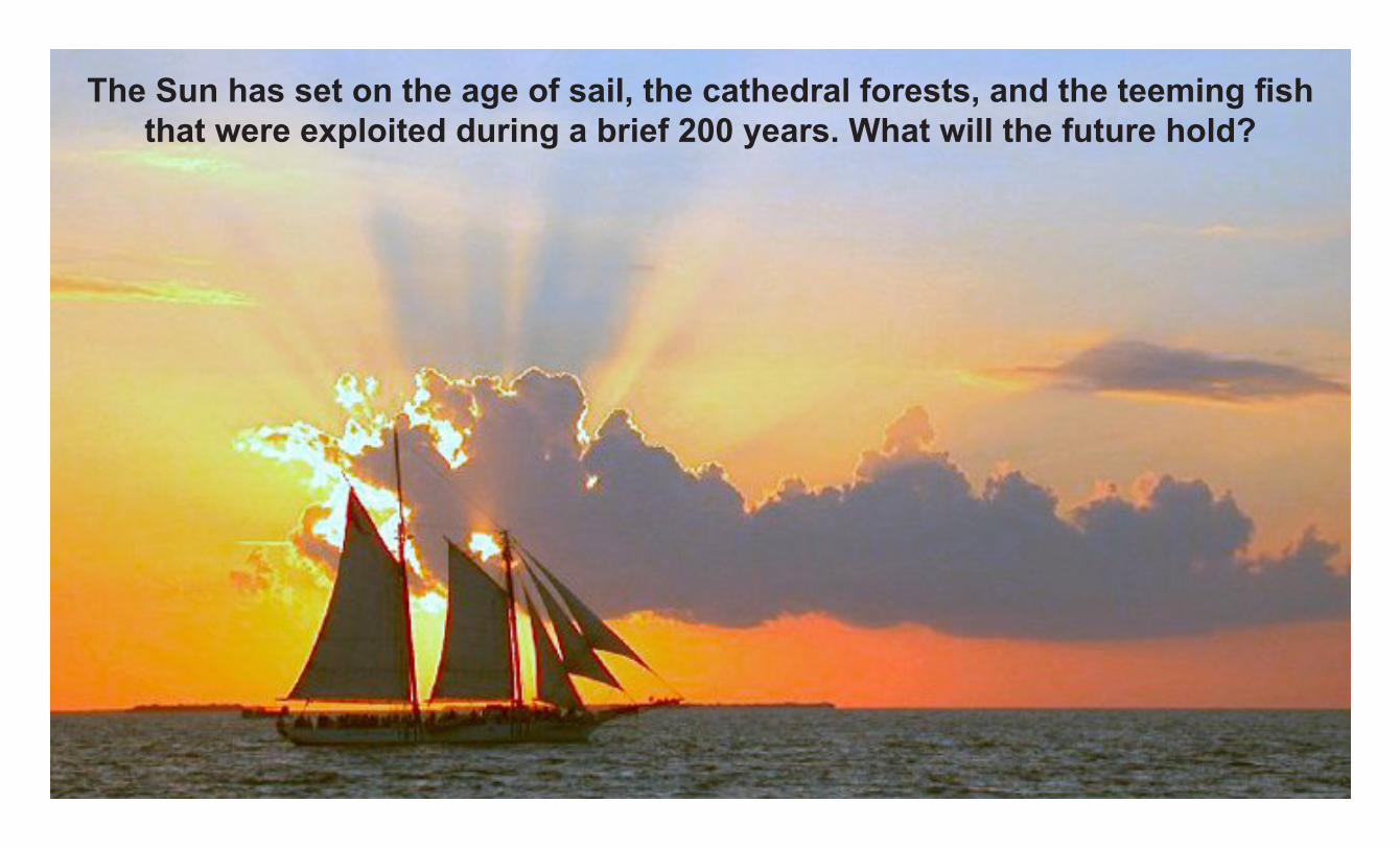
The Sun has set on the age of sail, the cathedral forests, and the teeming fish that were exploited during a brief 200 years. What will the future hold?
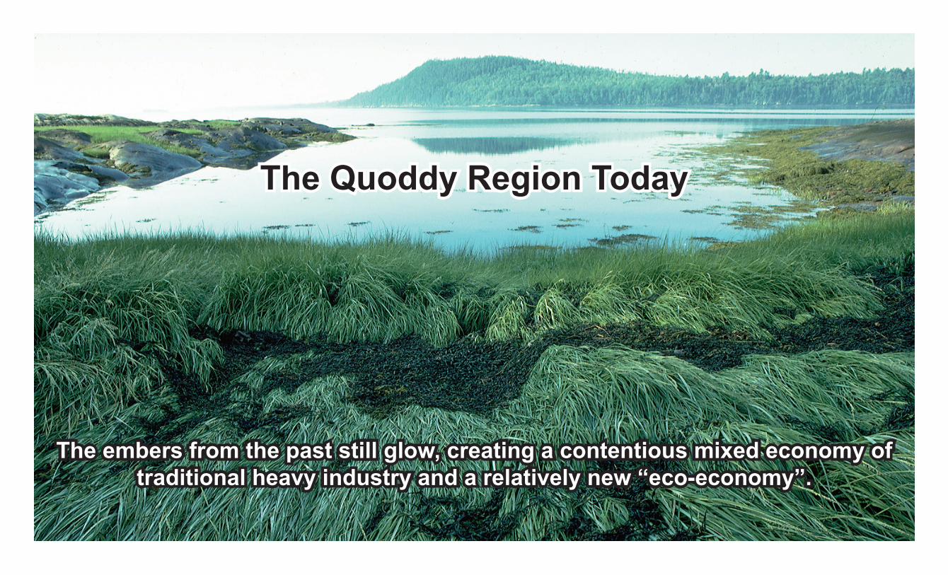
The Quoddy Region Today
The embers from the past still glow, creating a contentious mixed economy of traditional heavy industry and a relatively new “eco-economy”.
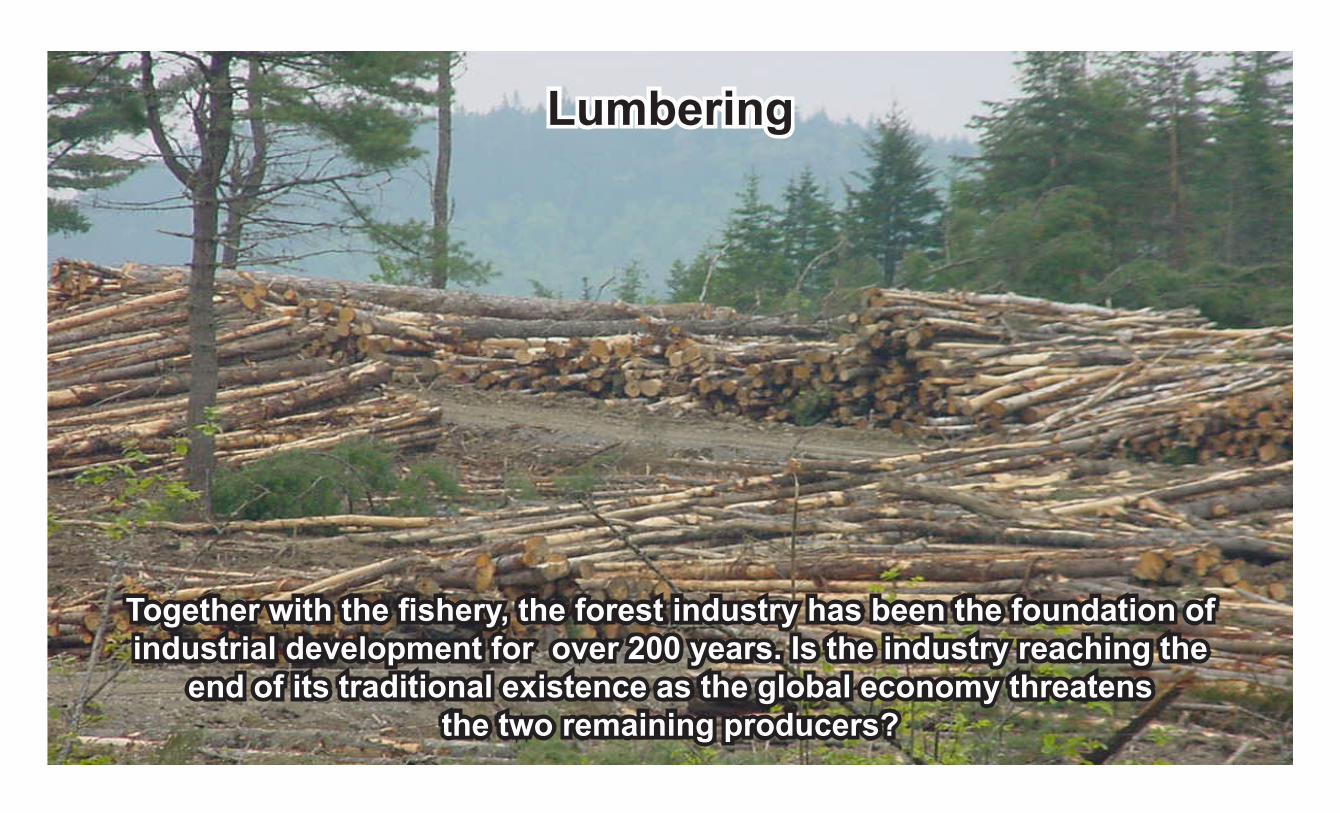
Together with the fishery, the forest industry has been the foundation of industrial development for over 200 years. Is the industry reaching the
end of its traditional existence as the global economy threatens the two remaining producers?
Lumbering

Once a “boutique” port for cruise ships, fish and agricultural products, the Bayside Port is now a quarry that threatens to
expand into the St. Andrews Watershed.
Quarries & Ports

Since 1604, shipping has distributed the resources of Quoddy around the world. Today this once huge industry has been reduced to
two small ports at Bayside and Eastport.
Shipping

Originally, hydro energy powered local industries both large and small from rivers and streams in the Quoddy area.
Today two generators remain at St. Stephen and St. George.
Hyro Power

Local mining goes back to the days of Champlain and the early explorers and old mines and quarries can be found throughout the area. In recent time,
the St. Stephen nickle mine and Mount Pleasant tin mine may be reactivated and gold finds are promising.
Mining

Plans for liquified natural gas (LNG) terminals at three sites along the Maine shore of Passamaquoddy Bay are underway and are the source of contention.
LNG
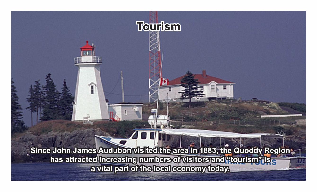
Since John James Audubon visited the area in 1883, the Quoddy Region has attracted increasing numbers of visitors and “tourism” is
a vital part of the local economy today.
Tourism
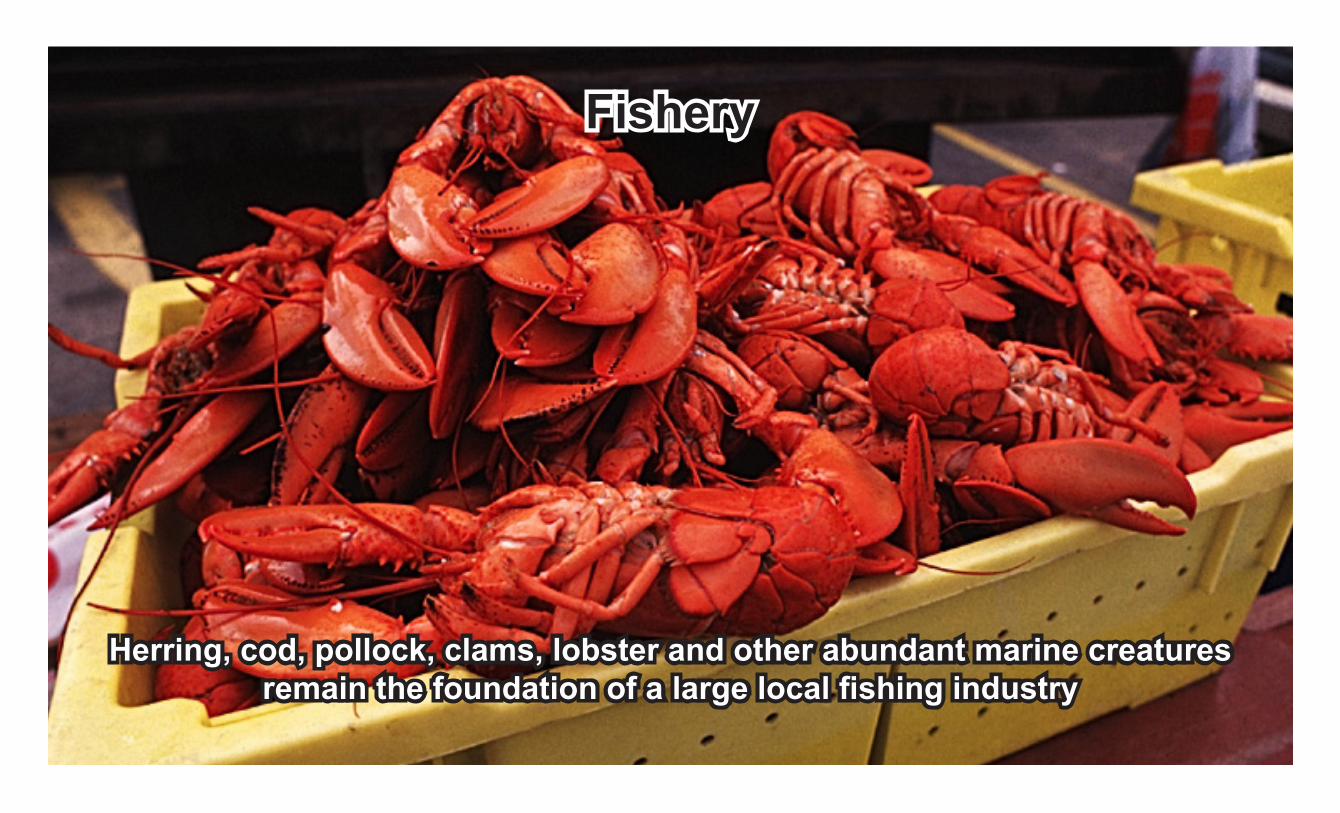
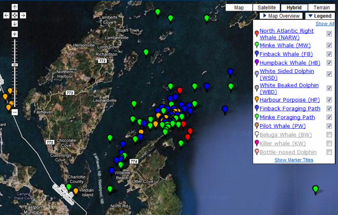
Herring, cod, pollock, clams, lobster and other abundant marine creatures remain the foundation of a large local fishing industry
Fishery

Pervasive, new, and controversial, aquaculture started in 1979 and has grown into an important local industry based primarily on Atlantic salmon.
Aquaculture
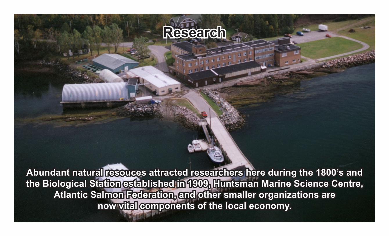
Abundant natural resouces attracted researchers here during the 1800’s and the Biological Station established in 1909, Huntsman Marine Science Centre,
Atlantic Salmon Federation, and other smaller organizations are now vital components of the local economy.
Research
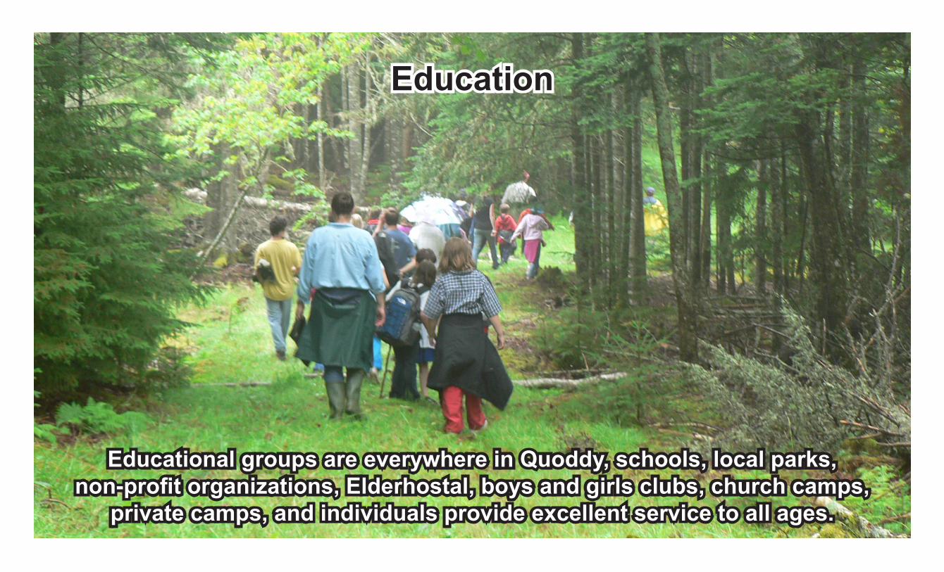
Educational groups are everywhere in Quoddy, schools, local parks, non-profit organizations, Elderhostal, boys and girls clubs, church camps,
private camps, and individuals provide excellent service to all ages.
Education

The business of art and crafts has an important place in the Quoddy Region where artists, sculptors, and craftspeople abound.
Arts & Crafts

A place of beauty and abundance. What will the future hold?
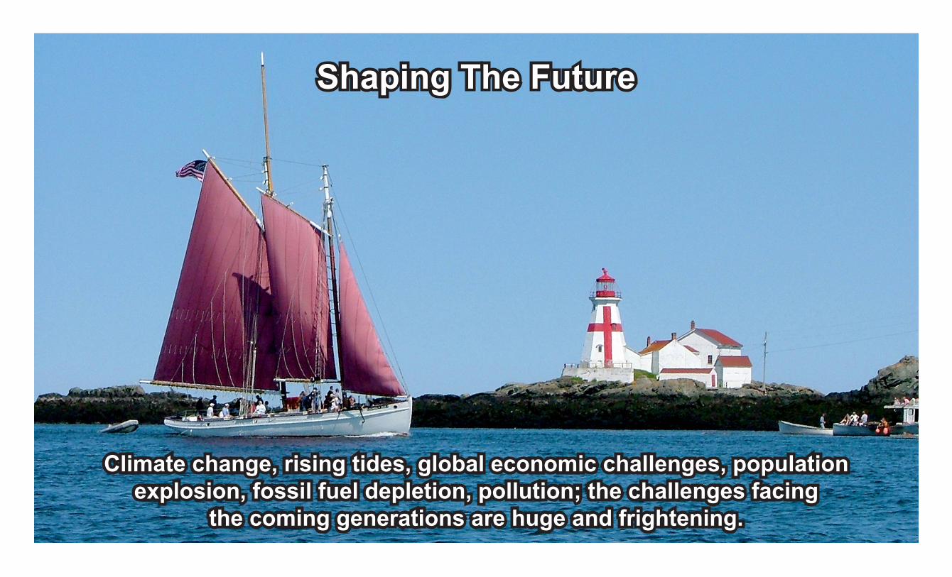
Climate change, rising tides, global economic challenges, population explosion, fossil fuel depletion, pollution; the challenges facing
the coming generations are huge and frightening.
Shaping The Future
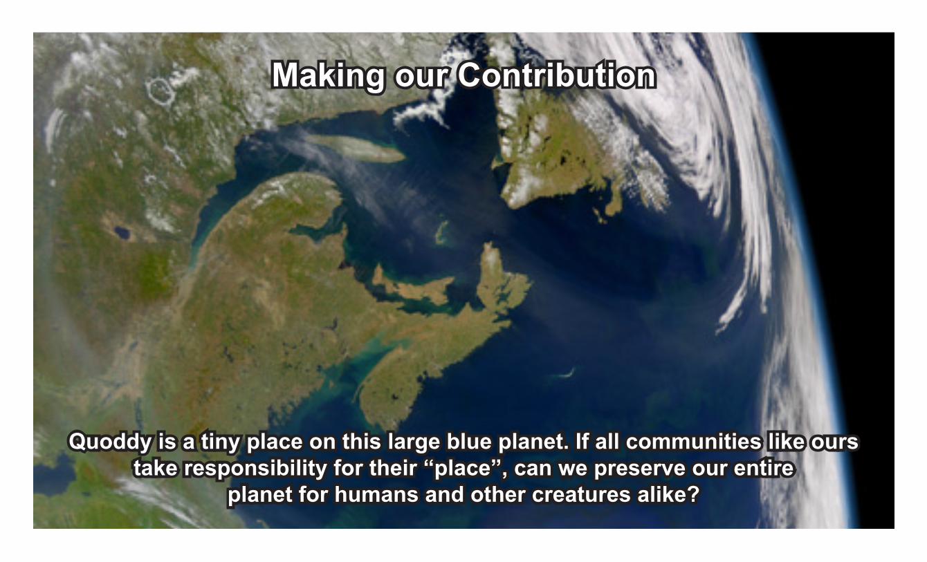
Quoddy is a tiny place on this large blue planet. If all communities like ours take responsibility for their “place”, can we preserve our entire
planet for humans and other creatures alike?
Making our Contribution

This photo shows the end of cruise ships at the Bayside port and the beginning of the quarry that displaced it and other important activities.
It symbolizes the tough choices that must be made in Quoddy
Tough choices
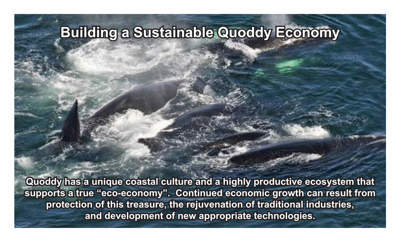
Quoddy has a unique coastal culture and a highly productive ecosystem that supports a true “eco-economy”. Continued economic growth can result from
protection of this treasure, the rejuvenation of traditional industries, and development of new appropriate technologies.
Building a Sustainable Quoddy Economy

Ancient but new, solar energy technologies have continued to develop and represent one of the most
promising sources of electricity and heat.
Alternative Energy - Solar

The Quoddy Region has plenty of wind! Presently, numerous developers are attempting to establish “wind farms” here. Individuals and small operations
are beginning to incorporate small turbines into their energy profile.
Alternative Energy - Wind

With twice-daily tides reaching to almost 30 feet and unique channels like Head Harbour Passage, tidal power has real promise in Quoddy.
But will other sustainable activities, like the fishery, be sacrificed?
Alternative Energy - Tidal

Expensive to build but cheap to run, hydro power spources range from massive dams to small stream-operated generators at a local camp.
This form of energy generation remains promising, but requires new thought.
Alternative Energy - Hydro
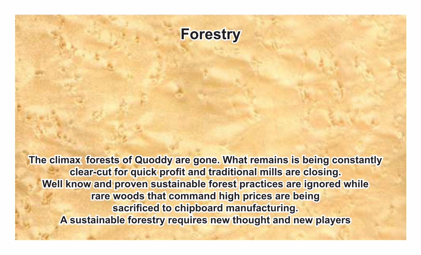
The climax forests of Quoddy are gone. What remains is being constantly clear-cut for quick profit and traditional mills are closing.
Well know and proven sustainable forest practices are ignored while rare woods that command high prices are being
sacrificed to chipboard manufacturing. A sustainable forestry requires new thought and new players
Forestry

Shipping in the Quoddy Region seems to be driven by the economic needs of externally controlled corporations. Is it time for the community to
consider the types and quality of shipping and ports needed in the Quoddy Region?
Ports & Shipping
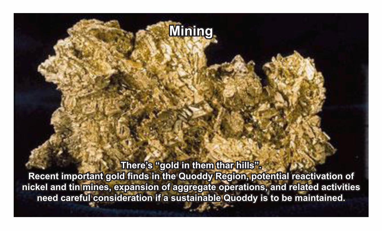
There’s “gold in them thar hills”. Recent important gold finds in the Quoddy Region, potential reactivation of
nickel and tin mines, expansion of aggregate operations, and related activities need careful consideration if a sustainable Quoddy is to be maintained.
Mining
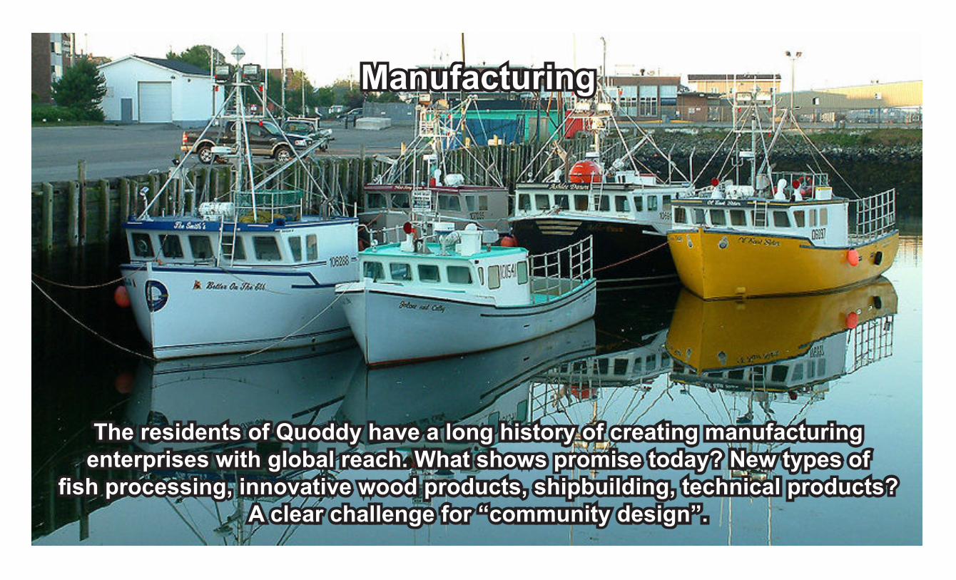
The residents of Quoddy have a long history of creating manufacturing enterprises with global reach. What shows promise today? New types of
fish processing, innovative wood products, shipbuilding, technical products? A clear challenge for “community design”.
Manufacturing

Only one innovative effort of many, beautiful Head Harbour Light Station has been developed into
an attraction that equals the Campobello Roosevelt International Park, the premier local attraction. Tourism will succeed if
we build on our sustainable natural assets.
Tourism
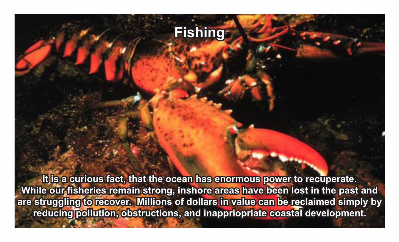
It is a curious fact, that the ocean has enormous power to recuperate. While our fisheries remain strong, inshore areas have been lost in the past and
are struggling to recover. Millions of dollars in value can be reclaimed simply by reducing pollution, obstructions, and inappriopriate coastal development.
Fishing
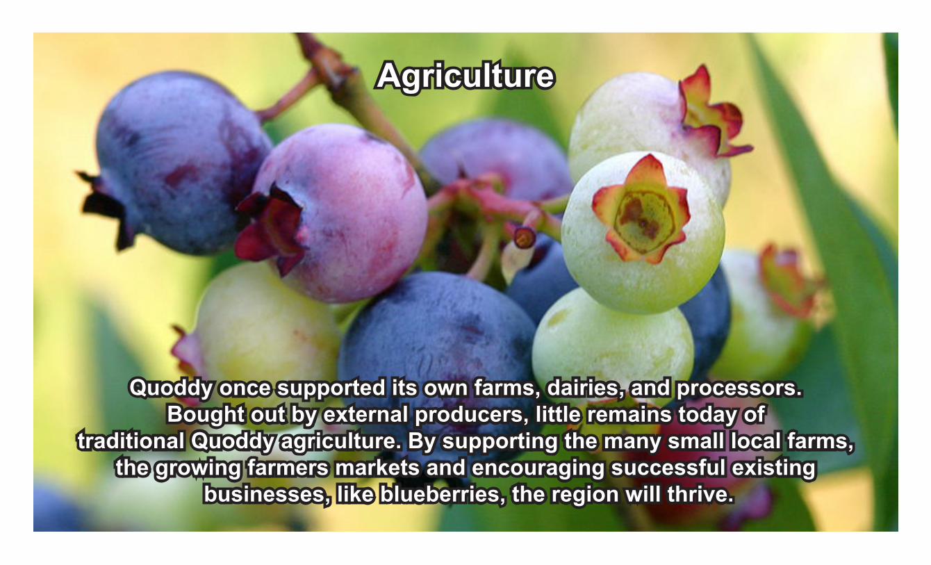
Quoddy once supported its own farms, dairies, and processors. Bought out by external producers, little remains today of
traditional Quoddy agriculture. By supporting the many small local farms, the growing farmers markets and encouraging successful existing
businesses, like blueberries, the region will thrive.
Agriculture

Quoddy developers have shown innovation in the development of salmon aquaculture, but have been slow to adopt smaller community-based methodologies that are non-pollution, sustainable, and “share the weath”.
Aquaculture
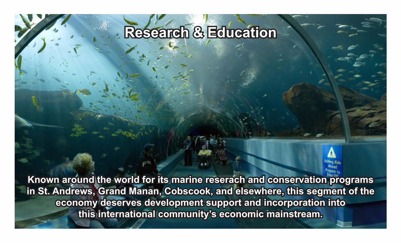
Known around the world for its marine reserach and conservation programs in St. Andrews, Grand Manan, Cobscook, and elsewhere, this segment of the
economy deserves development support and incorporation into this international community’s economic mainstream.
Research & Education
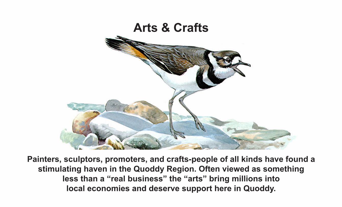
Painters, sculptors, promoters, and crafts-people of all kinds have found a stimulating haven in the Quoddy Region. Often viewed as something
less than a “real business” the “arts” bring millions into local economies and deserve support here in Quoddy.
Arts & Crafts

Available Technologies
The sun and heat from deep within the earth create sunlight,
wind, tides and geothermal heat that generate electricity
and heat through current technologies, including:
SolarWind
OceanHydropower
Biomass & BiofuelsGeothermal
Working and supporting each other in a community context seems difficult for many who fear competition. But the reality is that
co-operation brings success while contention destroys motivation.
Working Together