assessment rpt fasken twp - ontario
TRANSCRIPT
42A02Nweeee 2.5091 FALLON 010
GomiflCD
EXPLORATIONFASKEN PROJECT
NTS: 42-A-10
TIMMINS AREA
ONTARIO
SUBMITTED FOR ASSESSMENT
EASTERN DISTRICT
SEPTEMBER 1982 K.N. HENDRY
a.seai FALLON 010C
TABLE OF CONTENTS
SUMMARY
INTRODUCTION
EQUIPMENT
DATE REPRESENTATION
GEOLOGY
DISCUSSION OF RESULTS
CONCLUSIONS
l
l
1
2
2
2
2
—Q—
LIST OF PLATES
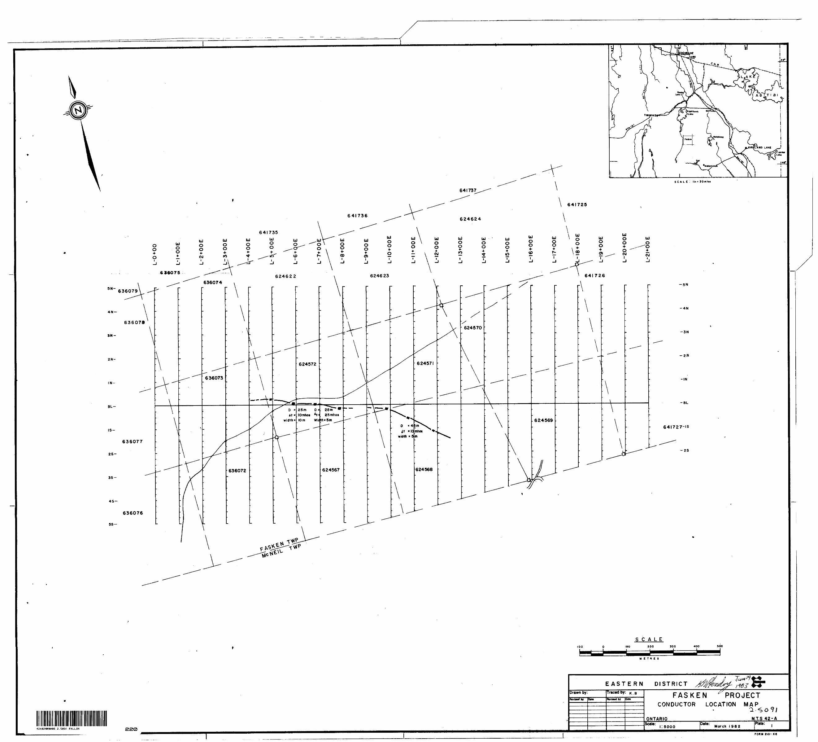
Plate l Conductor Location Map
Plate 2 Magnetic Survey
Plate 3 Horizontal Loop EM kkk HzPlate k Horizontal Loop EM 1777 Hz
Plate 5 Horizontal Loop EM 3555 Hz
COHINCO LTD.
EXPLORATION ASSESSMENT REPORT EASTERN DISTRICT
NTS: A2-A-10 FASKEN PROJECT
TIMMINS AREA
ONTARIO
AUGUST 1982 K.N. HENDRY
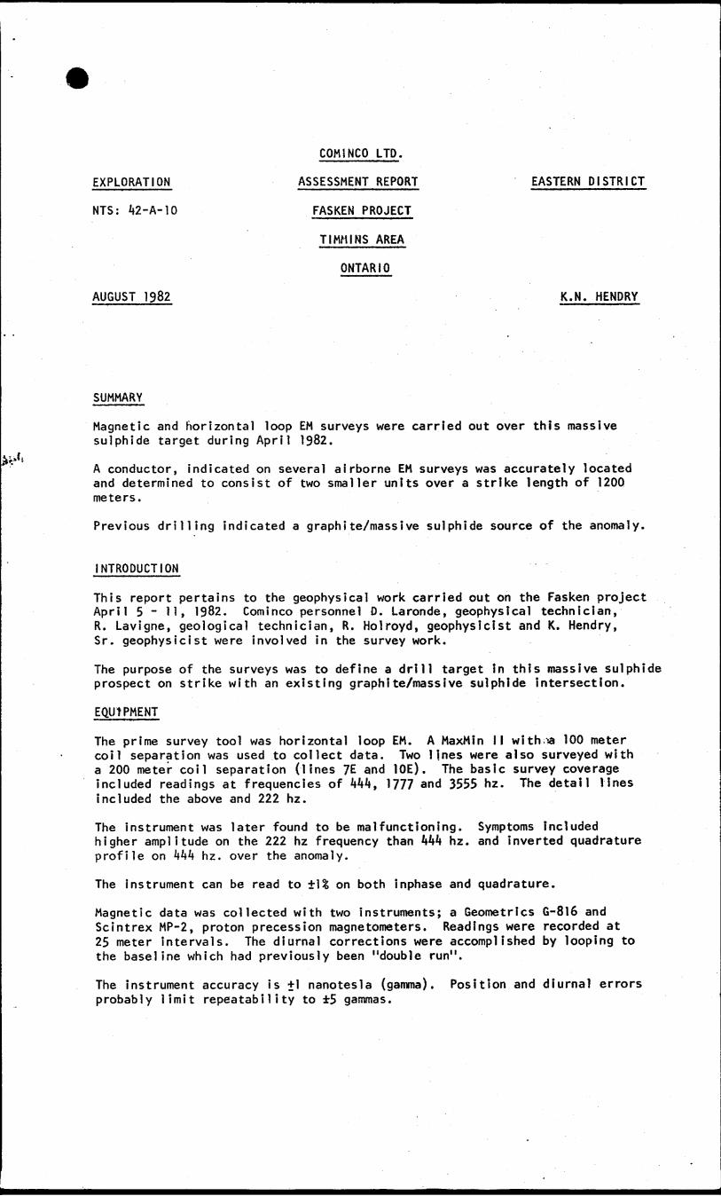
SUMMARY
Magnetic and horizontal loop EM surveys were carried out over this massive sulphide target during April 1982.
A conductor, indicated on several airborne EM surveys was accurately located and determined to consist of two smaller units over a strike length of 1200 meters.
Previous drilling indicated a graphite/massive sulphide source of the anomaly.
INTRODUCTION
This report pertains to the geophysical work carried out on the Fasken project April 5 ~ li, 1982. Cominco personnel D. Laronde, geophysical technician, R. Lavigne, geological technician, R. Holroyd, geophysicist and K. Hendry, Sr. geophysicist were involved in the survey work.
The purpose of the surveys was to define a drill target in this massive sulphide prospect on strike with an existing graphite/massive sulphide intersection.
EQUIPMENT
The prime survey tool was horizontal loop EM. A MaxMSn II with.^-a 100 meter coil separation was used to collect data. Two lines were also surveyed with a 200 meter coil separation (lines ?E and 10E). The basic survey coverage included readings at frequencies of kkk, 1 777 and 3555 hz. The detail lines included the above and 222 hz.
The instrument was later found to be malfunctioning. Symptoms included higher amplitude on the 222 hz frequency than kkk hz. and inverted quadrature profile on Wk h z. over the anomaly.
The instrument can be read to 1^ on both inphase and quadrature.
Magnetic data was collected with two instruments; a Geometrics G-816 and Scintrex MP-2, proton precession magnetometers. Readings were recorded at 25 meter intervals. The diurnal corrections were accomplished by looping to the baseline which had previously been "double run".
The instrument accuracy is +1 nanotesla (gamma). Position and diurnal errors probably limit repeatability to 5 gammas.
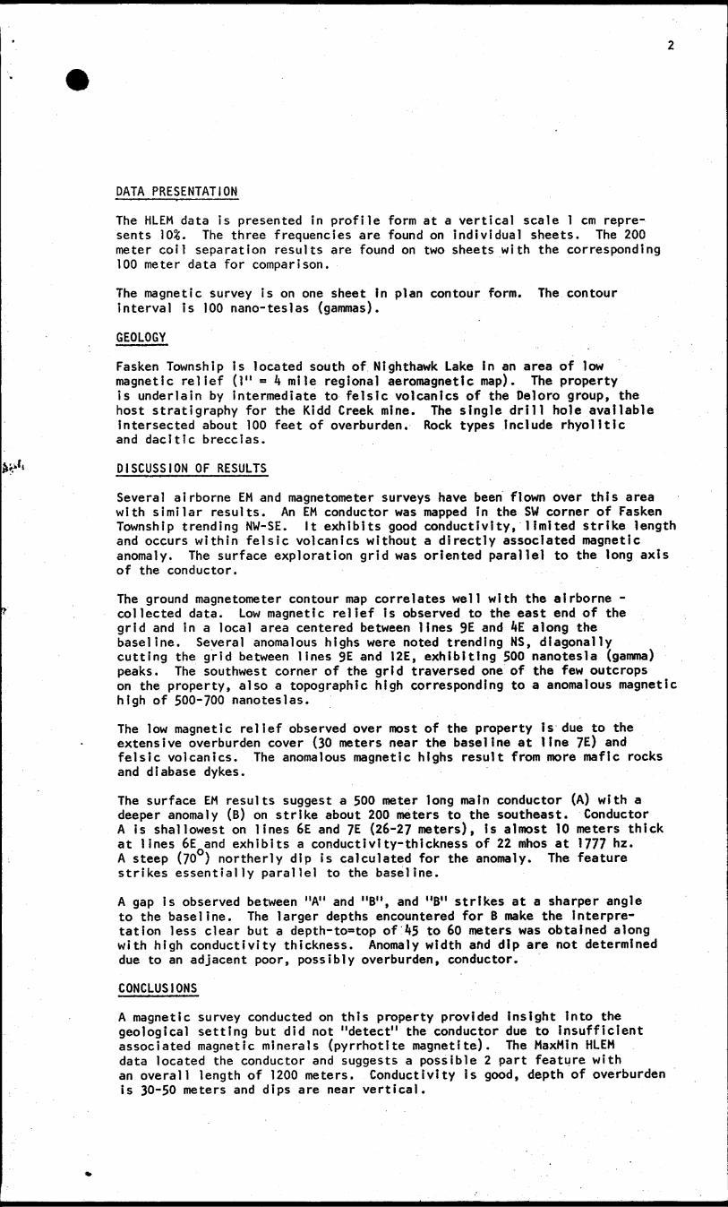
DATA PRESENTATION
The HLEM data is presented in profile form at a vertical scale l cm repre sents 10&. The three frequencies are found on individual sheets. The 200 meter coil separation results are found on two sheets with the corresponding 100 meter data for comparison.
The magnetic survey is on one sheet In plan contour form. The contour interval is 100 nano-teslas (gammas).
GEOLOGY
Fasken Township is located south of Nighthawk Lake in an area of low magnetic relief (l" = A mile regional aeromagnetic map). The property is underlain by intermediate to felsic volcanics of the Deloro group, the host stratigraphy for the Kidd Creek mine. The single drill hole available intersected about 100 feet of overburden. Rock types Include rhyolltlc and dacitic breccias.
DISCUSSION OF RESULTS
Several airborne EM and magnetometer surveys have been flown over this area with similar results. An EM conductor was mapped In the SW corner of Fasken Township trending NW-SE. It exhibits good conductivity, limited strike length and occurs within felsic volcanics without a directly associated magnetic anomaly. The surface exploration grid was oriented parallel to the long axis of the conductor.
The ground magnetometer contour map correlates well with the airborne - collected data. Low magnetic relief Is observed to the east end of the grid and in a local area centered between lines 9E and 4E along the baseline. Several anomalous highs were noted trending NS, diagonally cutting the grid between lines 9E and 12E, exhibiting 500 nanotesla (gamma) peaks. The southwest corner of the grid traversed one of the few outcrops on the property, also a topographic high corresponding to a anomalous magnetic high of 500-700 nanoteslas.
The low magnetic relief observed over most of the property Is due to the extensive overburden cover (30 meters near the baseline at line 7E) and felsic volcanics. The anomalous magnetic highs result from more mafic rocks and diabase dykes.
The surface EM results suggest a 500 meter long main conductor (A) with a deeper anomaly (B) on strike about 200 meters to the southeast. Conductor A is shallowest on lines 6E and 7E (26-27 meters), is almost 10 meters thick at lines 6E and exhibits a conductivity-thickness of 22 mhos at 1777 hz. A steep (700 ) northerly dip is calculated for the anomaly. The feature strikes essentially parallel to the baseline.
A gap is observed between "A" and "B", and "B" strikes at a sharper angle to the baseline. The larger depths encountered for B make the Interpre tation less clear but a depth-toatop of k5 to 60 meters was obtained along with high conductivity thickness. Anomaly width and dip are not determined due to an adjacent poor, possibly overburden, conductor.
CONCLUSIONS
A magnetic survey conducted on this property provided Insight into the geological setting but did not "detect" the conductor due to insufficient associated magnetic minerals (pyrrhotite magnetite). The MaxMin HLEM data located the conductor and suggests a possible 2 part feature with an overall length of 1200 meters. Conductivity is good, depth of overburden is 30-50 meters and dips are near vertical.
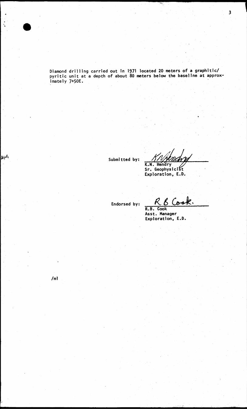
Diamond drilling carried out in 1971 located 20 meters of a graphitic/ pyritic unit at a depth of about 80 meters below the baseline at approx imately 7+50E.
Submitted by:K.N. Hendry Sr. Geophysici Exploration, E.D
Endorsed by:R.B. Cook Asst. Manager Exploration, E.D.
/ml
48A02NW0006 FALLON 300
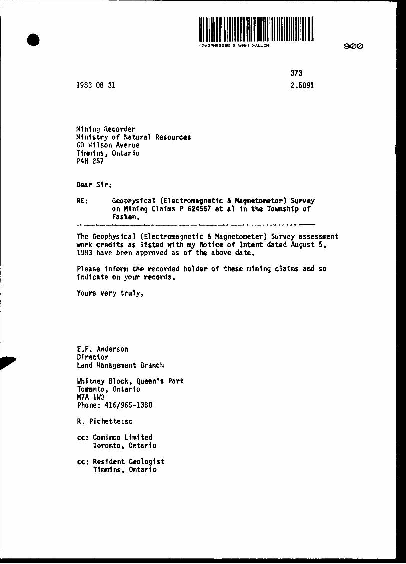
1983 08 31
373
2.5091
Mining RecorderMinistry of Natural Resources60 Wilson AvenueTimmins, OntarioP4N 2S7
Dear Sir:
RE: Geophysical (Electromagnetic 4 Magnetometer) Survey on Mining CI alias P 624567 et al In the Township of Fasken.
The Geophysical (Electromagnetic S Magnetometer) Survey assessment work credits as listed with ray Notice of Intent dated August 5, 1983 have been approved as of the above date.
Please Inform the recorded holder of these mining claims and so Indicate on your records.
Yours very truly,
E.F. AndersonDirectorLand Management Branch
Whitney Block, Queen's ParkTooonto, OntarioM7A 1H3Phone: 416/965-1380
R. P1chette:sc
cc: Comlnco Limited Toronto, Ontario
cc: Resident Geologist Timmins, Ontario
Ministry ofNaturalResources
ano
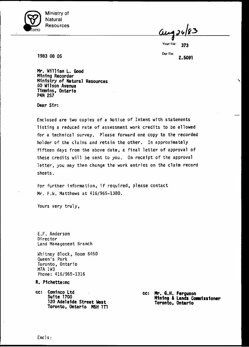
1983 08 05
Your file:
Our file:2.5091
Mr. Will 1am L. GoodMining RecorderMinistry of Natural Resources60 Wilson AvenueTimmins, OntarioP4N 2S7
Dear Sir:
\
Enclosed are two copies of a Notice of Intent with statements listing a reduced rate of assessment work credits to be allowed for a technical survey. Please forward one copy to the recorded holder of the claims and retain the other. In approximately fifteen days from the above date, a final letter of approval of these credits will be sent to you. On receipt of the approval letter, you may then change the work entries on the claim record
sheets.
For further information, if required, please contact Mr. F.W. Matthews at 416/965-1380.
Yours very truly,
E.F. AndersonDirectorLand Management Branch
Whitney Block, Room 6450Queen's ParkToronto, OntarioM7A 1W3Phone: 416/965-1316
R. P1chette:mc
cc: Comlnco Ltd Suite 1700120 Adelaide Street West Toronto, Ontario M5H 1T1
cc: Mr. 6.H. FergusonMining 4 Lands Commissioner Toronto, Ontario
Ends:
Ministry ofNaturalResources
Ontario
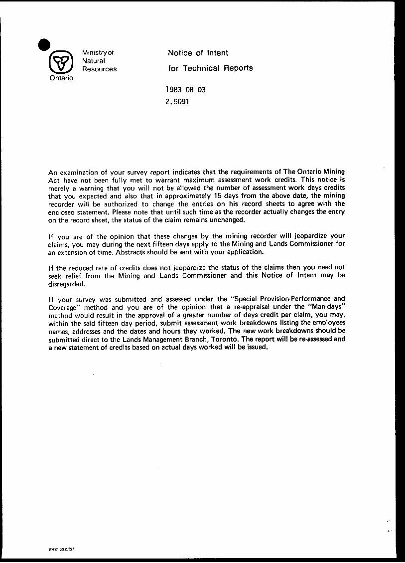
Notice of Intent
for Technical Reports
1983 08 03
2.5091
An examination of your survey report indicates that the requirements of The Ontario Mining Act have not been fully met to warrant maximum assessment work credits. This notice is merely a warning that you will not be allowed the number of assessment work days credits that you expected and also that in approximately 15 days from the above date, the mining recorder will be authorized to change the entries on his record sheets to agree with the enclosed statement. Please note that until such time as the recorder actually changes the entry on the record sheet, the status of the claim remains unchanged.
If you are of the opinion that these changes by the mining recorder will jeopardize your claims, you may during the next fifteen days apply to the Mining and Lands Commissioner for an extension of time. Abstracts should be sent with your application.
If the reduced rate of credits does not jeopardize the status of the claims then you need not seek relief from the Mining and Lands Commissioner and this Notice of Intent may be disregarded.
If your survey was submitted and assessed under the "Special Provision-Performance and Coverage" method and you are of the opinion that a re-appraisal under the "Man-days" method would result in the approval of a greater number of days credit per claim, you may, within the said fifteen day period, submit assessment work breakdowns listing the employees names, addresses and the dates and hours they worked. The new work breakdowns should be submitted direct to the Lands Management Branch, Toronto. The report will be re-assessed and a new statement of credits based on actual days worked will be issued.
(82f5t

/r^v Ministry ot Technical Assess iNVl Natural VV/V Resources Work CreditsOntario
ment * 2.5091
Date Mining Recorder's Report of1983 08 05 w**"*. 373
Recorded Holder
COMINCO LTDTownship or Area
FASKEN TOWNSHIP
Type of survey and number of Assessment days credit per claim
Geophysical 20
Electromagnetic dayt
40Magnetometer dayi
Radiometric dayi
Induced polarization , riayt
Other day*
Section 77 (19) See "Mining Claims AsieiMd" column
Rpnlogira! days
Renrhemiral riayt
Man days D Airborne D
Special provision 23 Ground H
O Credits have been reduced because of partial
coverage of claims.
CD Credits have been reduced because of corrections
to work dates and figures of applicant.
Mining Claims Assessed
FOR ELECTROMAGNETIC ONLY:P 624622
624567-68 624571-72 636072 to 74 inclusive
FOR MAGNETOMETER ONLY:P 624622
624567 to 72 inclusive 636072 to 74 inclusive
Special credits under section 77 (16) for the following mining claims
10 DAYS CREDIT, ELECTROMAGNETIC: 20 DAYS CREDIT, MAGNETOMETER
P 624569-70 P 641726-27
No credits have been allowed for the following mining claims
l*] not sufficiently covered by the survey 1 1 Insufficient technical data filed
FOR ELECTROMAGNETIC ONLY:
P 641726-27
3 Mining Recorder may reduce the above credits if necessary in order that the total number of approved assessment days recorded oneh claim does not exceed the maximum allowed as follows: Geophysical 80; Geological 40; Geochemical 40; Section 77(19) GO:
' (83/6)
MinistryolNaturalResources
Ontario
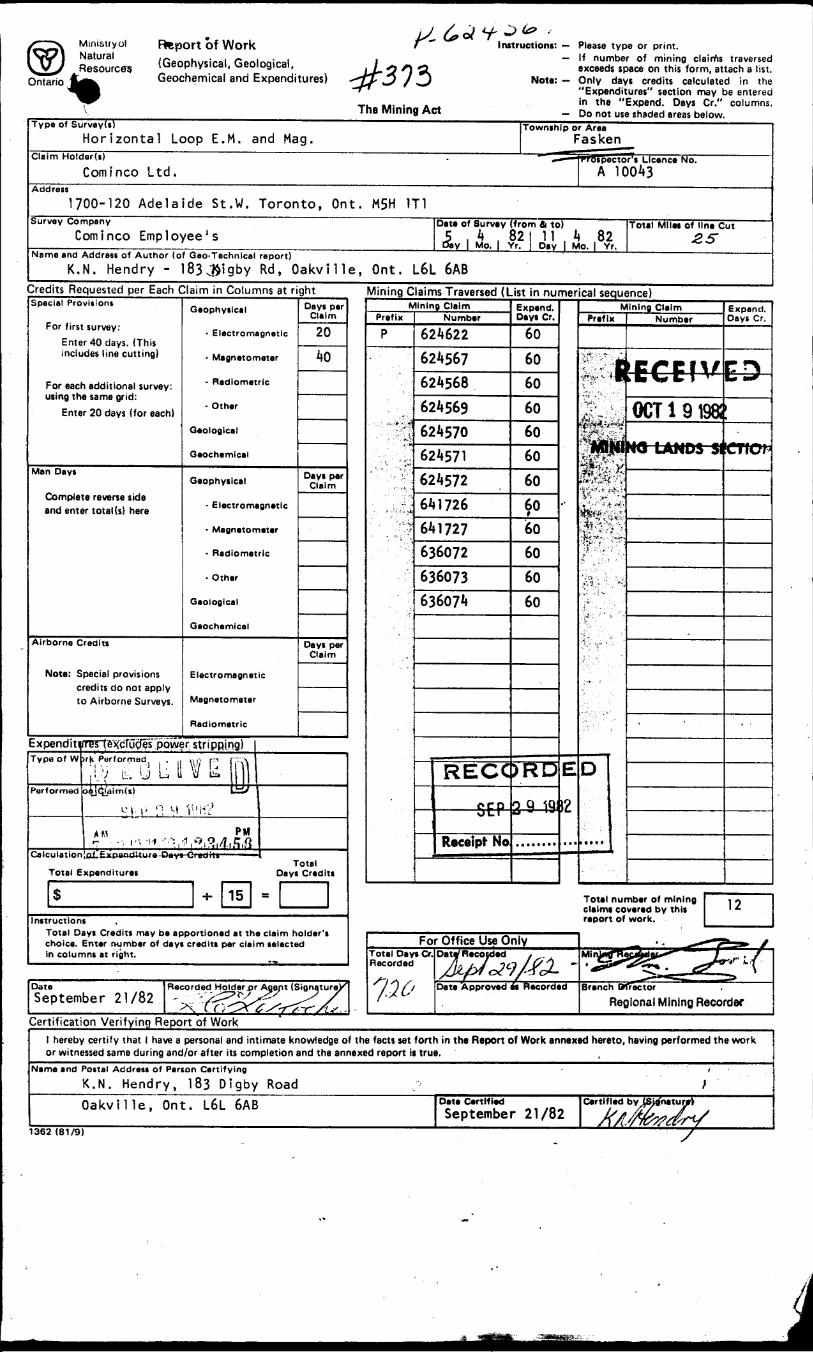
Report of Work(Geophysical, Geological, Geochemical and Expenditures)
The Mining Act
Instructions: Please type or print.— If number of mining claims traversed
exceeds space on this form, attach a list.Note: — Only days credits calculated in the
"Expenditures" section may be enteredin the "Expend. Days Cr." columns.
— Do not use shaded areas below.rype of SurveyU)
Horizontal Loop E.M. and Mag.Township or Area
FaskenClaim Holdar(i)
Cominco Ltd.ector't Licence No.
A 10043
1700-120 Adelaide St.W. Toronto, Ont. M5H 1T1Survey Company
Cominco Employee'sDate of Survey (from Si to)
Day l Mo. j Yr,, 82
Day j Mo, l Yr.
Tot*! Miles of lin* Cut
Name and Address of Author (of Gao-Technlcal report)K.N. Hendry - l83JJigby Rd, Oakville, Ont. L6L 6AB
Credits Requested per Each Claim in Columns at rightSpecial Provisions
For first survey:Enter 40 days. (This includes line cutting)
For each additional survey: using the same grid:
Enter 20 days (for each)
Man Days
Complete reverse side and enter total (s) here
Airborne Credits
Note: Special provisions credits do not apply to Airborne Surveys.
Geophysical
- Electromagnetic
- Magnetometer
- Radiometric
- Other
Geological
Geochemical
Geophysical
- Electromagnetic
- Magnetonlater
- Radiometric
- Other
Geological
Geochemical
Electromagnetic
Magnetometer
Radiometric
Expenditirrer(eKcTua^s"power stri PRing)Type of W ir|t Porformed , ,, ,, ,, rm
ji ;V UJ L li V LPerformed o4Jc^laim(s) li
rv,,,,,,,,,,^,^^.Calc ulation nf.{JKpentftow*-Peyt fltinil'li
Total Expenditures
S H- 15
Days per Claim
20
40
Days per Claim
Days per Claim
Total Days Credits
s
Instructions Total Days Credits may be apportioned at the claim holder's choice. Enter number of days credits per claim selected In columns at right.
Mining Claims Traversed (List in numerical sequence)Mining Claim
Prefix
P
Numb* r
624622624567624568624569624570624571624572641726641727636072636073636074
RECCceporr
Receipt No————————— - ——— ———
Expend. Days Cr.
60
6060
606060
6060606060
60
)RD
29 19
BMMWRMBM
E
12
MMM
Mining ClaimPrefix
ts!iL
it
• *''-:-t' : A * W"
''A:'*'' * " * ~-
X
D
•MMMM 1
Number
FrFfV
OCT1 91981MO LANDS SI
Expand. Jays Cr,
ED•W a
"CTIOf
Total number of mining claims covered by this report of work.
DateSeptember 21/82
For Office Use OnlyTotal Days Cr. Recorded
Date Approved as Recorded Branch
Regional Mining RecorderCertification Verifying Report of Work
l hereby certify that l have a personal and intimate knowledge of the facts set forth in the Report of Work annexed hereto, having performed the work or witnessed same during and/or after its completion and the annexed report i* true.
Nama and Postal Address of Parson Certifying
K.N. Hendry, 183 Digby RoadOakville, Ont. L6L 6AB Date Certified
September 21/82Certified by (Sjtfnatu
1362 (81/9)
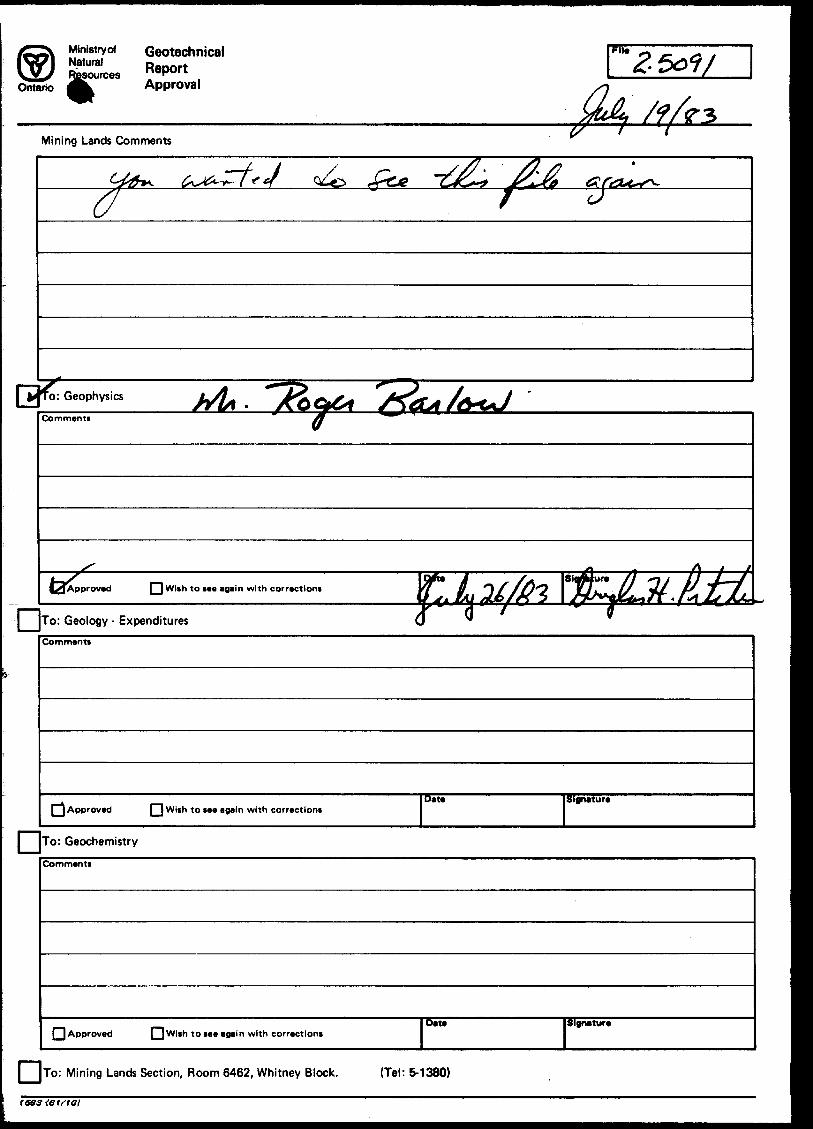
Ministry* Geotechnical JSTces Report
Ontario 4k Approval
File
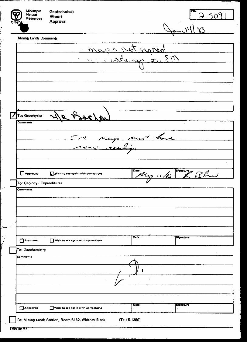
Mining Lands Comments C?
* J
Commenti
To: Geology - Expenditures
L^Aoprovad PH With to ne again with corrections
Commenti
[| Approved [~| W ith to fee again with correctioniDate Signature
l To: Geochemistry
Comments
Approved Q Wish to see again with correctionsDate Signature
l [TO: Mining Lands Section, Room 6462, Whitney Block. (Tel: 5-1380)
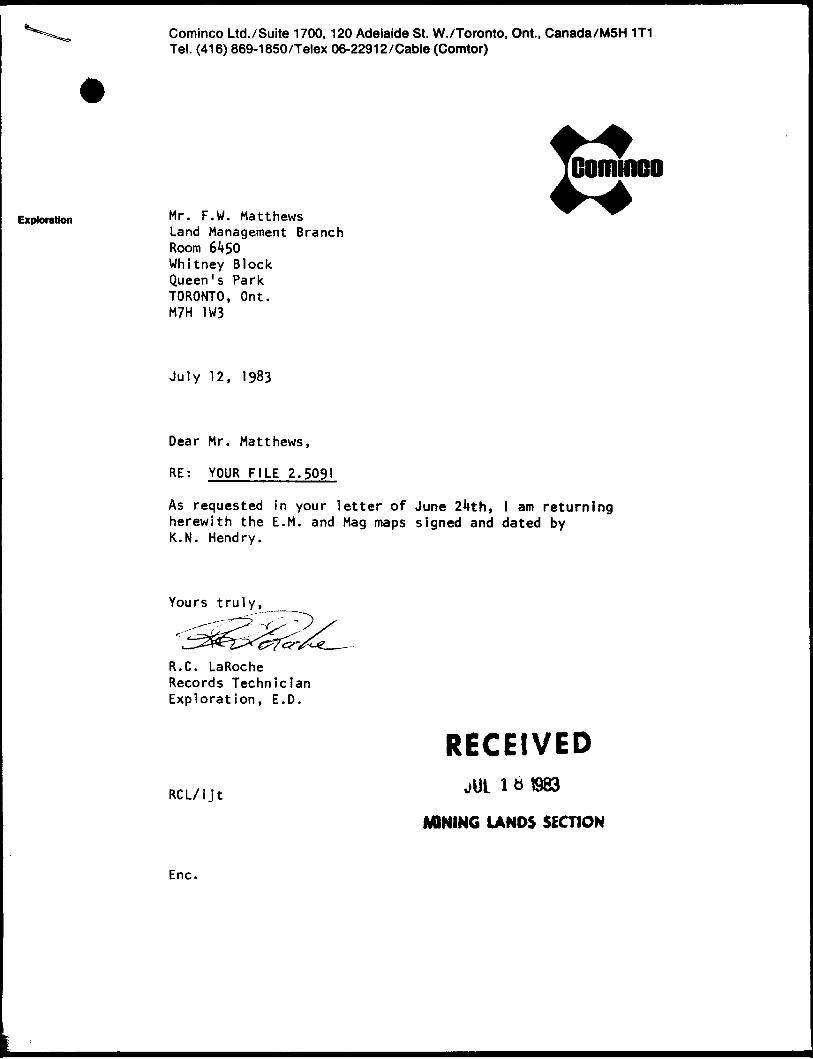
Cominco Ltd./Suite 1700,120 Adelaide St. W./Toronto, Ont.. Canada/MSH 1T1 Tel. (416) 869-1850/Telex 06-22912/Cable (Comtor)
Exploration M r - F- w - MatthewsLand Management Branch Room 6** 50 Whitney Block Queen's Park TORONTO, Ont. M7H JW3
July 12, 1983
Dear Mr. Matthews,
RE: YOUR FILE 2.5091
Cominco
As requested In your letter of June 2^th, l am returning herewith the E. M. and Mag maps signed and dated by K.N. Hendry.
R.C. LaRoche Records Technician Exploration, E.D.
RECEIVEDl tt 1983RCL/ijt
MINING LANDS SECTION
Enc.
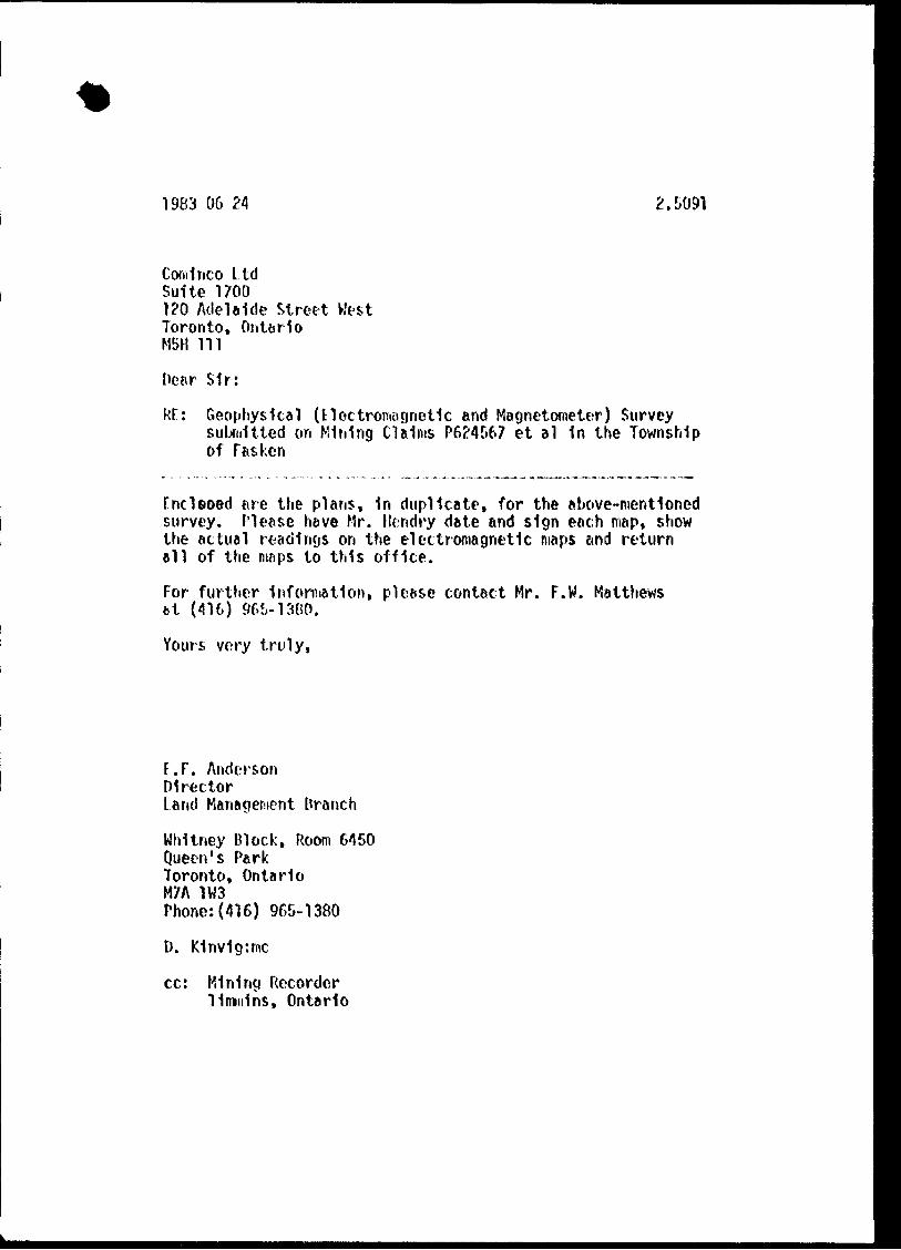
1983 06 24 2.5091
Coni 1 ne o LtdSuite 1700120 Adelaide Street WestToronto, OntarioMSH lil
Dear Sir:
Rf: Geophysical (Electromagnetic and Magnetometer) Survey submitted on Mining Claims P624567 et al in the Township of Tasken
Fncleoed fire the plans, in duplicate, for the above-mentioned survey. Please neve Mr. Hendry date and sign each map, show the actual readings on the electromagnetic maps and return ell of the maps to this office.
For further Information, please contact Mr. F.W. Matthews fct (416) 965-13BO.
Yours very truly,
F.F. AndersonDirectorland Management Branch
Whitney Block, Room 6450Queen's ParkToronto, OntarioM7A 1W3Phone:(416) 965-1380
D. K1nvig:mc
cc: Mining Recorder Timmins, Ontario
Ministry of Geotechnical Natural ReportResources
Approval
Fit*
Mining Lands Comments
\
^x?G Q
\To: Geophysics
Comment*
Q Approved r^lwith to sea again with corractlontData Signature
To: Geology - ExpendituresCo m man tt
Approved f~l With to taa again with corractioniSlgnatura
To: Geochemistry
Comment!
f~| Approved || With to lee again with correctionsSignature
j [To: Mining Lands Section, Room 6462, Whitney Block. {Tel: 5-1380)
1593(61/10)

1982 10 22 2.5091
Mining RecorderMinistry of Natural Reaources60 Wilton AvenueTinmins, OntarioP4N 2S7
Dear Sir:
We have received reporta and maps for a Geophysical (Electromagnetic and Magnetometer) Survey submitted under Special Proviaiona (credit for Performance and Coverage) on Mining Claims P 636072 at al in the Township of Fasken.
This material will be examined and assessed and a atatement of assessment work credits will be issued*
Yours very truly
B.F. AndersonDirectorLand Management Branch
Whitney Block, Room 6450Queen's ParkToronto, OntarioM7A 1W3Phone: 416/965-1380
DW:sc
cc: Cominco Limited120 Adelaide Street WestStreet 1700Toronto, OntarioMSB 1T1Attn: Mr. K.M. Mendry
Ontario
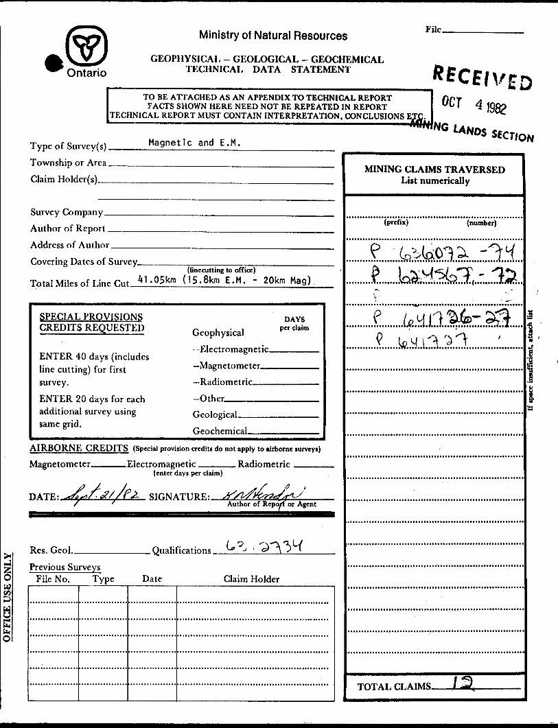
Ministry of Natural Resources
GEOPHYSICAL - GEOLOGICAL - GEOCHEMICAL TECHNICAL DATA STATEMENT
File.
TO BE ATTACHED AS AN APPENDIX TO TECHNICAL REPORTFACTS SHOWN HERE NEED NOT BE REPEATED IN REPORT
TECHNICAL REPORT MUST CONTAIN INTERPRETATION, CONCLUSIONS
ocr
Type of Survey(s).
Township or Area.
Claim Holder(s)_
Magnetic and E.M.
Survey Company -
Author of Report.
Address of Author.
Covering Dates of Survey.(linecutting to office)
Total Miles of Line r..t *"-05km (15.8km E.M. - 20km Mag)
SPECIAL PROVISIONS CREDITS REQUESTED
ENTER 40 days (includes line cutting) for first survey.
ENTER 20 days for each additional survey using same grid.
Geophysical
Electromagnetic.
Magnetometer...
Radiometric
Other-—————
DAYSper claim
Geological.
Geochemical.
AIRBORNE CREDITS (Special provision credits do not apply to airborne lurveyt)
Magnetometer. .Electromagnetic. . Radiometric
DATE:.
(enter days per claim)
SIGNATURE:Author of Report or Agent
Res. Geol.. .Qualifications.
Previous Surveys File No. Type Date Claim Holder
MINING CLAIMS TRAVERSED List numerically
(prefix) (number).Qr~~~~~~"
j
TOTAL CLAIMS-
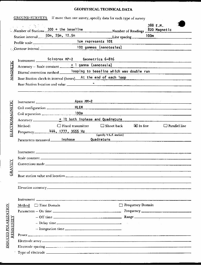
GEOPHYSICAL TECHNICAL DATA
GROUND SURVEYS If more than one survey, specify data for each type of survey
388 E.M..Number of Stations 30Q * t he base1 ! ne___________Number of Readings 820 Magnet le
Station interval 50m, 25m, 12.5m_____________Une sparing 'OO"1———-—— Profile scale________________lcm represents 30*______________________
100 gammas (nanoteslasl*, Contour interval.
M
U, Instrument SclntrexMP-2 Geometries 6-816l—hli, ZO^
Accuracy - Scale constant ± ] 9 amma (nanotesla!Diurnal correction method looping to basel l ne whtch was douBle run
Base Station check-in interval (Hours) At the end o1Rasp Station loration and value
Instrument Apex
Coil configuration ___________HLEH
Coil separation _____________^00m
UH-(
H W Z
3•s.SH
W Frequency_____^^. 1777. 3555 HzM
both tnphase and Quadrature
Method: D Fixed transmitter d Shoot back SI In line CD Parallel line
(specify V.L.F. station)Parameters measured____Inphase______Quadrature
Instrument.Scale constant^*
fcjHH Corrections made.
O station value and location .
Elevation accuracy.
INDUCED POLARIZATION
Method CD Time DomainParameters — On time
^ Off tjmpH > — Helay timeH M — I ntegration timeO) W Power
Electrode array.Electrode spacing ———————————————————Tvne of electrode . ..,... ,........ . ——————————
Q Frequency Domain FrequencyRange
SELF POTENTIAL
Instrument__________________________________________— Range. Survey Method __________________________________________.
Corrections made.
RADIOMETRIC
Instrument.Values measured.
Energy windows (levels)_____________________________________' Height of instrument______________________________Background Count.Size of detector————————————-——————^——^^.^——.......—..——....—.Overburden ——————--———^.^^^^^-——.—.———..—^^^^^^——....—.————^.
(type, depth — include outcrop map)
OTHERS (SEISMIC, DRILL WELL LOGGING ETC.)
Type of survey————————————-————-—————^——^——Instrument .—————————^-——————-———————————————Accuracy.—————————^—^———————-—————-——————-——————Parameters measured.
Additional information (for understanding results).
AIRBORNE SURVEYS
Type of survey(s) ——
Instrument(s) —————(specify for each type of survey)
Accuracy———————^—^———^^(specify for each type of survey)
Aircraft used ________________________^^_^__^______.
Sensor altitude-Navigation and flight path recovery method.
Aircraft altitude_______________________________Line Spacing—— Miles flown over total area__________________________.Over claims only.
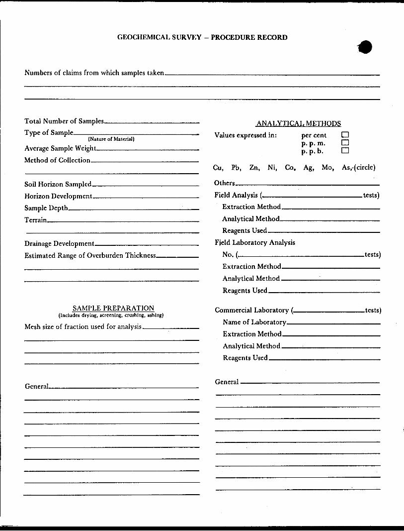
GEOCHEMICAL SURVEY - PROCEDURE RECORD
Numbers of claims from which samples taken.
Total Number of Samples. Type of Sample.
(Nature of Material)
Average Sample Weight——————— Method of Collection————————
Soil Horizon Sampled- Horizon Development- Sample Depth————-Terrain—^^—^—^
Drainage Development———————————— Estimated Range of Overburden Thickness.
ANALYTICAL METHODS Values expressed in: per cent
p. p. m. p. p. b.
D D D
Cu, Pb,
Others—
Zn, Ni, Co, Ag, Mo, As.-(circle)
Field Analysis (.Extraction Method. Analytical Method- Reagents Used——
Fjeld Laboratory AnalysisNo.{—————————.
SAMPLE PREPARATION(Includes drying, screening, crushing, ashing)
Mesh size of fraction used for analysis,———
Extraction Method. Analytical Method - Reagents Used-™—
Commercial Laboratory (- Name of Laboratory— Extraction Method- Analytical Method —— Reagents Used————
.tests)
.tests)
-tests)
General. General.
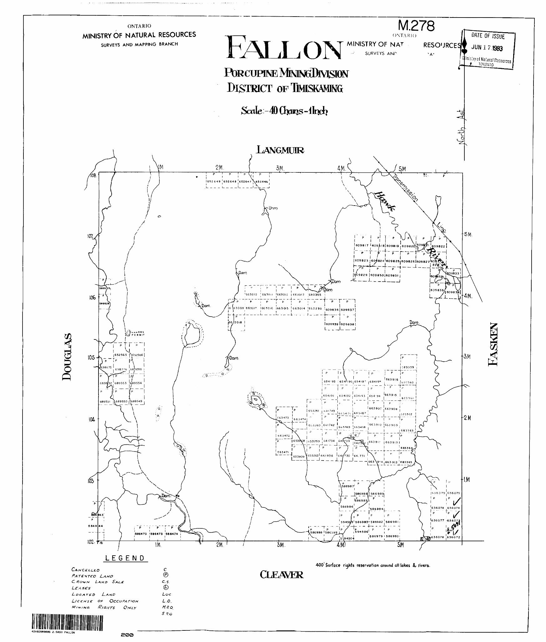
ONTARIO
MINISTRY OF NATURAL RESOURCESSURVEYS AND MAPPING BRANCH
M.278ONTARIO
ON MINISTRY OF NATSURVEYS ANP
RESOURCES
PORCUPINE DISTRICT
Scale -
ISSUE
JUN17.BB3
LANGMUIR
|609830|60983I
-.J.______J
663010 '6630M 166301? 1663013 ' 683355— ~ - J. ,- --. -4-——— ——
16 \63009i663DI7 16G3OIC !fc630l5 '663014 '6fc329i 1 6098 36 609837 1 lil i j T l i l LL..-., j -.-.-.4-
1609839 1609838
L ——l— —— -J
(, |66J-167;- — ~ -^-^ - ---L ,-.- — -- "3 T
l 653260 .641742 '
i (^53259 y |i.J3cn5.— —— — — — —' —— —
|B36 079 .636075
P , P ^
V
1986470 1986473 '586474
102-f*
LEGEND
CLE/WER400'Surface r ights reservation around all lakes ^ rivtra.
Le A
OF OCCUPATION RIGHTS
c. 5.
Loc L.O. W/?, o.5 7.0
^-Jw
42A02NW0C06 2.5091 FALLON200
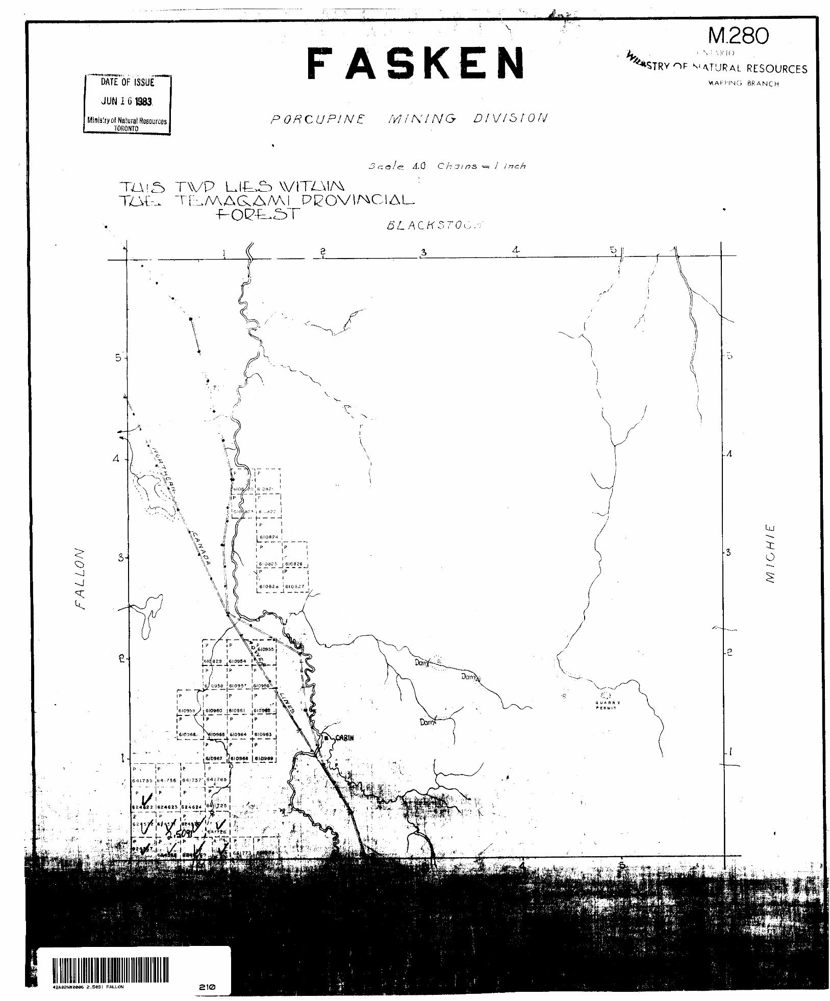
f^
DATE OF ISSUE
JUN16
Minislry of Natural ResourcesTORONTO
lv CL
PORCUPINE: MINING DIVISION
M.280\ : \ RK)
AT'JRAL RESOURCESBRANCH
4-0
TVP LJt^ \VITZ_m TBJWAG.AMI PI^OVl/^CIAU
l 6I08?4 j
, 610520 ' 6108^7 L ^ ^ J ---J/
6/10956 ' 610957 , 610956V .
-eiogss/iefweo j ei^se^ lE^ste^J
. (~~ "* "" *~" "~ ~
641735 .64(756 .54 l 737', 64 l
2.5891 FALLON 210
641737
641736
641725
641735
o o•fo
UJooi
UJo o4-OJ
111oo-4-(O
UJo o+1^^r
1 ^f
UJo o•+1
^-^ IO
UJ
624624
UJo oCOl
UJo o•fO)l
UJo oo
1
u,\0 \o—T
Ulo o
\ T1 B
UJoo•*" JO1
UJ 'o o4-
*^™
UJo o4ini
UJo oi1
UJo o4 1^1
\ 0o\2
1
UJo o42^-1
Ulo o*oCMt
UJo
CM
5N-636079
4N-
3H-
2N-
N-
BL-
SCALE: lin * 20miit*
IS-
2S-
3S-
4S-
5S-
25mlOmhos10 m Width* firn
-5N
-4N
-3N
-IN
-BL
636077
641727-iS
-2S
636076
100
SCALE100 ZOO 300
M E T R C S
400 9OO
42A82NWW86 2.5091 FALLON 220
EASTERN DISTRICTDrawn by:
by DM*
Trac*dby: K. Bby Data FASKEN 'PROJECT
CONDUCTOR LOCATION MAP
ONTARIOScale: i: sooo
N.T.S 42-ADate:
March I982Plate: l
FORM 2IO- K6
6245720/7
6^6073-093
64I727-IS
LEGEND
INSTRUMENT CONTOUR INTERVAL TRUE FIELD VALUE
Scintrex MP-2100 gammas (nanotesla*)Add 59.000 gammas
SCALE
EASTERN DISTRICTrraced by: K p
FASKEN MAGNETIC
PROJECT SURVEY
N.T.S 42-A42A02NW0006 2.5091 FALLON
March 1962
FORM 210- K6
641737
\\ 641725
641736624624
641735
5N-
4N-
3N-
2N-
N-
BL-
ts-
636077
2S-
3S-
4S-
5S
636076
LEGEND
SCALE l in : ZOmiKs
o oo
1-1
63
UJ Oo4-.
-1
i6O75
UJ O O4- OJ
i-J
--^
UJo ofO1 \-A\-
-^ \
UJo o4-
^Jr
UJo o
^ in-i-i
UJo ^ cr
^ 4-to
1-J
^^ \^^0 \
0 V^ \t \i \
\
UJoo00
1-J
Ulooo*
1-1
UJo o4-
o1-J
\ sUJo \ o
L \\
UJo oCVJ
1-J
UJoo4-rOi-1
UJo o4li
UJo o4-IOi.j
UJo o•1-
1-J
UJo o
1-J
', UJ 1 0
oK
\ 51-J., -r"\
UJo o0* ..,
t-J
UJo o4-oCM
1-J
UJo- "O
c\ii-i
-5N
-4N
3N
-2N
-IN
-BL
64I727-IS
-2S
444 Hz IOO metre*
INSTRUMENT •••••••- - . . - -. . -. - . .FREQUENCY----------------'-------..COIL S PACING- ••••- •••••- •••••- - -IN-PHASE (plotted to the left}----- -- - ——— - ——— -OUT-OF-PHASE (plotted to the right) K —— - x-- - PROFILE SCALE----------------- l cm * 10 ^
100
SCALE50O
M E T R E S
2.5091 FALLON 240
Drawn by:Riviitd by Otta
_ 4..
EASTERN DISTRICTTraced by: K BFtoviMd by D*t*
FASKEN PROJECTHORIZONTAL LOOP EM SURVEY
444Hz lOOmc.sONTARIO N.T.S 42-A
Scale: i: 5ooo Date:March 1 982
Plate:
FORM sio- KB
SCALE M n s 20 mile*
641737
641725
5N-636079
4N-
636078*'.'*
3N-
2N-
IN-
BL-
2S-
3S-
4S-
5S
-5N
-4N
-3N
-2N
-IN
-8L
636077
64I727-IS
- 2S
636076
LEGEND
Ma x Win 1C •I777HZ lOOmerres
INSTRUMENT"-- --- - -- --..- - .--FREQUENCY---------------------
COIL SPACING - IN-PHASE (plotted to the left) -———- ——— - OUT-OF-PHAS E (plotted to the right) x-——x———x PROFILE SCALE-" - - - - - - - --- - ----- - lcm * lOVo
100 ieo 200 300 40O 500
METRES
42A92NW0096 2.5C91 FALLON 250
Drawn by:Re vi** d by DO*
EASTERN DISTRICT W 3Traced by: ^ , e
|Dat* FASKEN PROJECT HORIZONTAL LOOP EM SURVEY
1777 H z I00mc.sONTARIO N.T.S42-A
Scale: ; 5ooo Date: March 1982iPlate:
FORM 210- K6
SCALE lin - 2 0 milci
641737
641725
5N-636079
4N-
636-079
641736
641735
O O4O
1
UJoo4
1
UJo o4-
CM 1
UJo o4-rO
UJO O4-
T -
UJo o4
i
UJo
..*cr""^ 4
U)
624624
UJoo4-00 l
UJo o4o*l
UJo oo
1
UJo oi.
1
\ a o
\ i
UJo o4roi
UJo o4
~i~
UJO O4ini
UJ Oo4-(O
1
UJo o4
T
^ o o
\21
UJo o42? ^--
\
UJOO4-O OJi
UJo'O4
OJ
3N-
2N-
IN-
BL
S-
2S
3S
4S-
5S-
636077
-5N
-4N
-3N
-2N
-IN
-BL
636076
641727-is
-2S
L E G E N D
Max Mintt 3555 H z 100 metres
INSTRUMENT --•••- - - - - - - - •FREQUENCY -- -- - -•••••- •••- '•••COIL SPACING .-.- - .............IN-PHASE(plotted to the left) - ——— - ——— - OUT-OF-PHASE(plotfed to the right) x — — x----xPROFILE SCALE • — ""- - - -- - - - - - - - - | C m s I0 0/*
IOO
METRES
500
2.5*91 FALLON 260
Drawn by:R* VIM d by 0*1*
EASTERN DISTRICTTraced by: K B
by DateFASKEN PROJECT
HORIZONTAL LOOP EM SURVEY 3555Hz lOOmc.s
ONTARIO N.T.S 42-AScale: : 5000 Date:
March 1 982Plate:
FORM 2 10- K6