aquifer vulnerability assessments and protocols
TRANSCRIPT

October 2005October 2005
Aquifer Vulnerability Assessments and ProtocolsAquifer Vulnerability Assessments and Protocols-- Intermediate Zone Intermediate Zone --
Shafick Adams and Nebo Shafick Adams and Nebo JovanovicJovanovic
Department of Earth Sciences
University of the Western Cape

OUTLINE
-- ObjectivesObjectives
-- Research ApproachResearch Approach
-- Preliminary ResultsPreliminary Results
-- ProblemsProblems
-- Future OutlookFuture Outlook
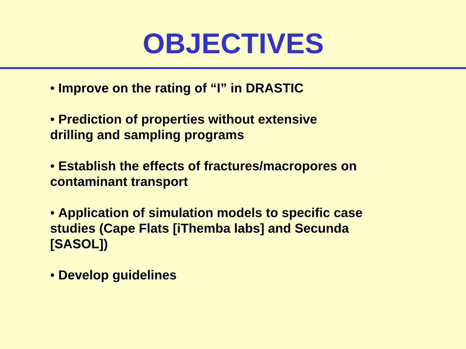
OBJECTIVES•• Improve on the rating of “I” in DRASTICImprove on the rating of “I” in DRASTIC
•• Prediction of properties without extensive Prediction of properties without extensive drilling and sampling programsdrilling and sampling programs
•• Establish the effects of fractures/Establish the effects of fractures/macroporesmacropores on on contaminant transportcontaminant transport
•• Application of simulation models to specific case Application of simulation models to specific case studies (Cape Flats [studies (Cape Flats [iThembaiThemba labs] and labs] and SecundaSecunda[SASOL])[SASOL])
•• Develop guidelinesDevelop guidelines

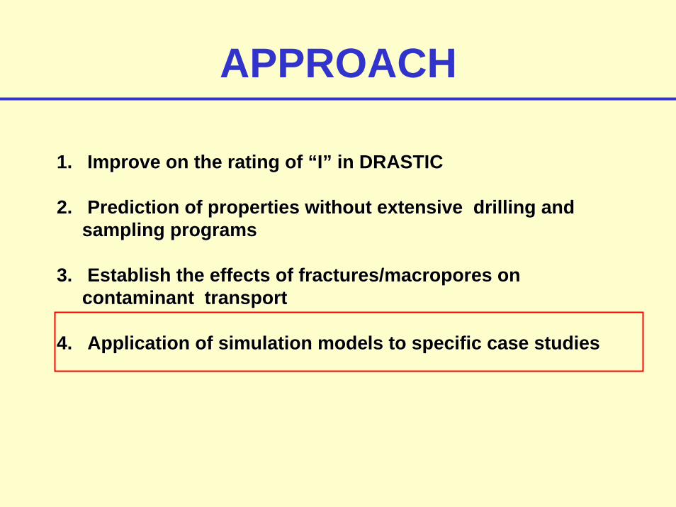
APPROACH
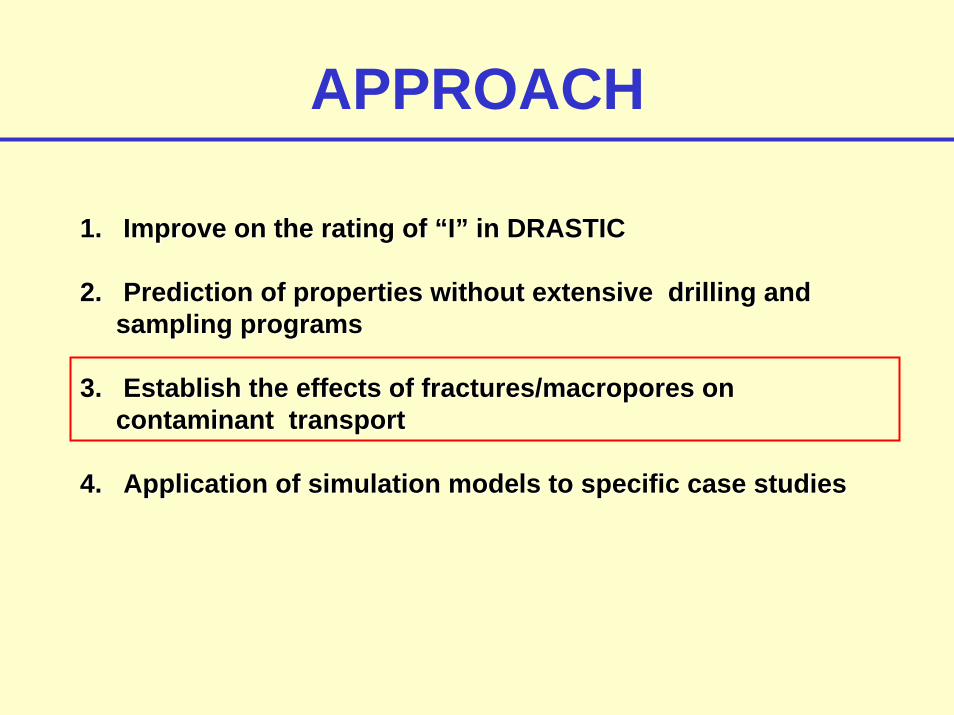
1.1. Improve on the rating of “I” in DRASTICImprove on the rating of “I” in DRASTIC
2.2. Prediction of soil and contaminant properties without Prediction of soil and contaminant properties without extensive drilling and sampling programsextensive drilling and sampling programs
3.3. Establish the effects of fractures/Establish the effects of fractures/macroporesmacropores on on contaminant transportcontaminant transport
4.4. Application of simulation models to specific case studiesApplication of simulation models to specific case studies

1. Improve on the rating of “I” in DRASTICImprove on the rating of “I” in DRASTIC2. Prediction of soil and contaminant properties without extensi2. Prediction of soil and contaminant properties without extensive drilling and sampling ve drilling and sampling programsprograms
•• Identified most important factors affecting vulnerabilityIdentified most important factors affecting vulnerability-- Hydraulic properties of the unsaturated zoneHydraulic properties of the unsaturated zone-- Thickness of the unsaturated zoneThickness of the unsaturated zone-- Topography/SlopeTopography/Slope-- Flow mechanismFlow mechanism-- Drainage/rechargeDrainage/recharge-- Travel timeTravel time-- Sorption capacitySorption capacity-- Contaminant halfContaminant half--lifeslifes
•• Prediction of properties without Prediction of properties without extensive drilling and sampling extensive drilling and sampling programsprograms
-- Existing databasesExisting databases-- Prediction tools (RETC, Rosetta, etc.)Prediction tools (RETC, Rosetta, etc.)

1. Improve on the rating of “I” in DRASTICImprove on the rating of “I” in DRASTIC2. Prediction of soil and contaminant properties without extensi2. Prediction of soil and contaminant properties without extensive drilling and sampling ve drilling and sampling programsprograms
Excel spreadsheet program

1. Improve on the rating of “I” in DRASTICImprove on the rating of “I” in DRASTIC2. Prediction of soil and contaminant properties without extensi2. Prediction of soil and contaminant properties without extensive drilling and sampling ve drilling and sampling programsprograms

CAPE FLATS AQUIFER
Factors Description Comments Impact
Physical Characteristics
Hydraulic properties
1. Sand, minor silt, clay lenses, heterogeneous,
2. K = 15-50 m/day, T = 30-980 m2/day
1. Sieving analysis (UWC)2. Available information Medium
Thickness of the unsaturated zone 1-5m (average 4.6m) Some areas water table at surface High
Flow mechanism Matrix, Fingering 95% matrix flow assumed Medium
Recharge/drainage1.10-13% of MAP (Bredenkamp et al.,
1995). 2. CMB = 10% MAP 3. 60-80 mm/yr
1. Tritium profiling and CMB (Atlantis) 2. CMB (UWC CAT Site) High
Sorption capacity
1. High silica, Ca sands. 2. The fraction of organic carbon of
the sands (0.3-0.4%) is relatively low and sorption will thus be low (Sililo, 1997)
Peat layers can increase Sorption capacity High
Chemical characteristics
Travel time Thickness = 3m; effective porosity 25-40%, K = 15-50 m/day
Foster and Hirata equation:Gross surcharge: <1 dayNatural infiltration: > 3 yearsQuick estimate < 5 days
High
Half-lifes Contaminant specific High travel time, low sorption, thin unsaturated zone
Medium to high vulnerability ratingMedium to high vulnerability rating
APPROACH
1.1. Improve on the rating of “I” in DRASTICImprove on the rating of “I” in DRASTIC
2.2. Prediction of properties without extensive drilling and Prediction of properties without extensive drilling and sampling programssampling programs
3.3. Establish the effects of fractures/Establish the effects of fractures/macroporesmacropores on on contaminant transportcontaminant transport
4.4. Application of simulation models to specific case studiesApplication of simulation models to specific case studies
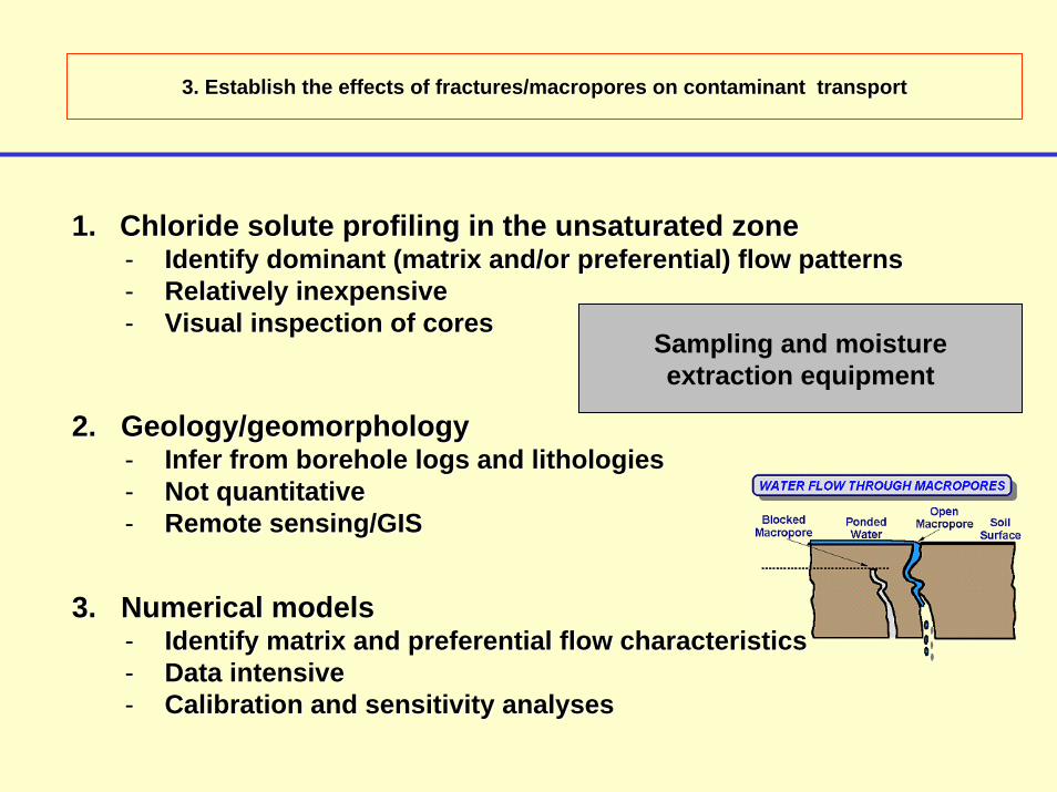
3. Establish the effects of fractures/3. Establish the effects of fractures/macroporesmacropores on contaminant transporton contaminant transport
Sampling and moisture extraction equipment
3. Numerical models3. Numerical models-- Identify matrix and preferential flow characteristicsIdentify matrix and preferential flow characteristics-- Data intensiveData intensive-- Calibration and sensitivity analysesCalibration and sensitivity analyses
2. Geology/geomorphology2. Geology/geomorphology-- Infer from borehole logs and Infer from borehole logs and lithologieslithologies-- Not quantitativeNot quantitative-- Remote sensing/GISRemote sensing/GIS
1.1. Chloride solute profiling in the unsaturated zoneChloride solute profiling in the unsaturated zone-- Identify dominant (matrix and/or preferential) flow patternsIdentify dominant (matrix and/or preferential) flow patterns-- Relatively inexpensiveRelatively inexpensive-- Visual inspection of coresVisual inspection of cores
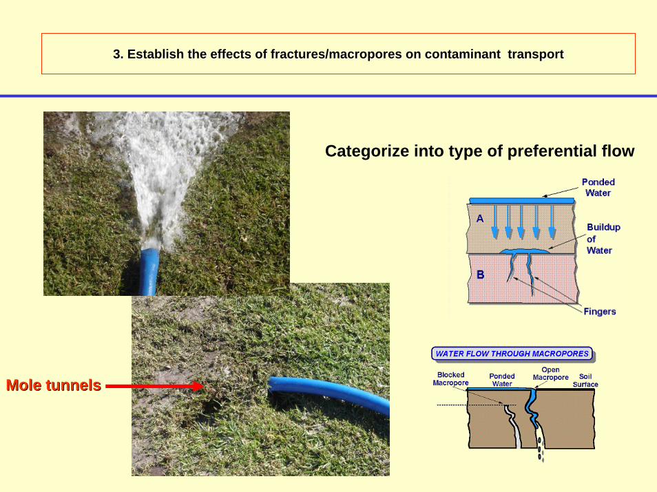
3. Establish the effects of fractures/3. Establish the effects of fractures/macroporesmacropores on contaminant transporton contaminant transport
Categorize into type of preferential flow
Mole tunnelsMole tunnels
APPROACH
1.1. Improve on the rating of “I” in DRASTICImprove on the rating of “I” in DRASTIC
2.2. Prediction of properties without extensive drilling and Prediction of properties without extensive drilling and sampling programssampling programs
3.3. Establish the effects of fractures/Establish the effects of fractures/macroporesmacropores on on contaminant transportcontaminant transport
4.4. Application of simulation models to specific case studiesApplication of simulation models to specific case studies

4. Application of simulation models to specific case studiesApplication of simulation models to specific case studies
1.1. VLEACHVLEACH2.2. MACRO 5.0MACRO 5.0 -- can handle can handle macroporemacropore flow in soilsflow in soils3.3. HYDRUS 2DHYDRUS 2D4.4. SWMS 2DSWMS 2D5.5. SWATSWAT6.6. SWAP SWAP -- preferential flow in cracking/swelling clayspreferential flow in cracking/swelling clays7.7. UGPFUGPF -- GIS based model (BTEX)GIS based model (BTEX)
4. Application of simulation models to specific case studiesApplication of simulation models to specific case studies
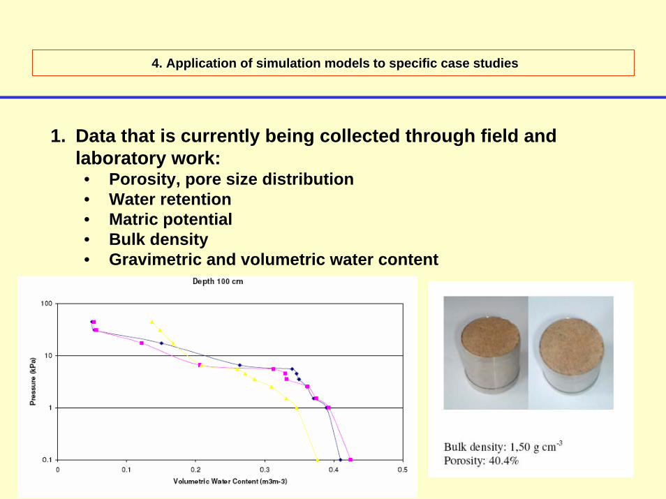
1. Data that is currently being collected through field and laboratory work:• Porosity, pore size distribution• Water retention• Matric potential• Bulk density• Gravimetric and volumetric water content
4. Application of simulation models to specific case studiesApplication of simulation models to specific case studies
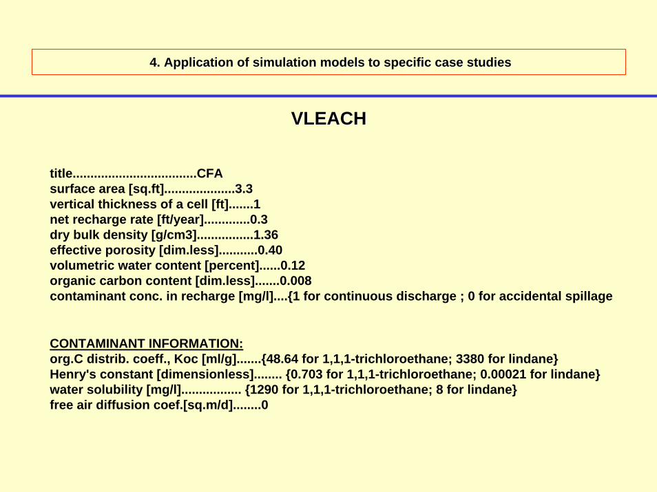
VLEACHVLEACH
title...................................CFAsurface area [sq.ft]....................3.3vertical thickness of a cell [ft].......1net recharge rate [ft/year].............0.3dry bulk density [g/cm3]................1.36effective porosity [dim.less]...........0.40volumetric water content [percent]......0.12organic carbon content [dim.less].......0.008contaminant conc. in recharge [mg/l]....{1 for continuous discharge ; 0 for accidental spillage
CONTAMINANT INFORMATION:org.C distrib. coeff., Koc [ml/g].......{48.64 for 1,1,1-trichloroethane; 3380 for lindane}Henry's constant [dimensionless]........ {0.703 for 1,1,1-trichloroethane; 0.00021 for lindane}water solubility [mg/l]................. {1290 for 1,1,1-trichloroethane; 8 for lindane}free air diffusion coef.[sq.m/d]........0

4. Application of simulation models to specific case studiesApplication of simulation models to specific case studies
VLEACHVLEACH
1.00E-16
1.00E-14
1.00E-12
1.00E-10
1.00E-08
1.00E-06
1.00E-04
1.00E-02
1.00E+00
0 2 4 6 8 10
Time (a)
Con
tam
inat
ion
rate
(g/a
)
1,1,1-Trichloroethane Lindane
Simulated groundwater contamination rate of 2 contaminants applied through recharge (continuous recharge).
1.00E-07
1.00E-05
1.00E-03
1.00E-01
1.00E+01
0 2 4 6 8 10
Time (a)
Con
tam
inat
ion
rate
(g/a
)1,1,1-Trichloroethane Lindane
Simulated groundwater contamination rate of 2 contaminants applied to the surface at the beginning of the simulation (accidental spillage).
Daughter products!Daughter products!
4. Application of simulation models to specific case studiesApplication of simulation models to specific case studies
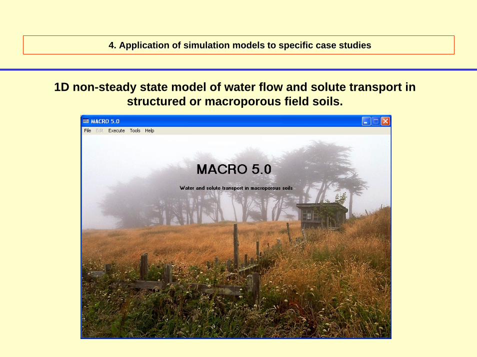
1D non-steady state model of water flow and solute transport in structured or macroporous field soils.
4. Application of simulation models to specific case studiesApplication of simulation models to specific case studies
MACRO 5.0MACRO 5.01. Data requirements:
• Climatic data• Basic soil properties (% sand, silt, clay)• Unsaturated hydraulic conductivity• Solute concentrations
• Can simulate non-reactive tracers, tritium and pesticides• Simulates a full water balance• Model structure enables quantitative evaluation of the impact of
macropore flow on solute transport in structured soils.

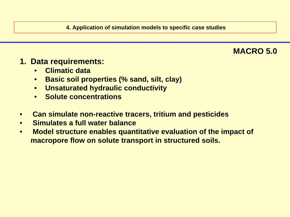
4. Application of simulation models to specific case studiesApplication of simulation models to specific case studies
MACRO 5.0MACRO 5.01. Data requirements:
• Climatic data• Basic soil properties (% sand, silt, clay)• Unsaturated hydraulic conductivity• Solute concentration
• Can simulate non-reactive tracers, tritium and pesticides• Simulates a full water balance• Model structure enables quantitative evaluation of the impact of
macropore flow on solute transport in structured soils.
Preliminary model indicates that >95% of flow occurs in Preliminary model indicates that >95% of flow occurs in microporesmicropores

PROBLEMS•• SUITABLE DATA !!!!!!!SUITABLE DATA !!!!!!!
•• Direct measurements are cumbersome and require a Direct measurements are cumbersome and require a substantial investment in both time and moneysubstantial investment in both time and money
•• 11--D, 2D, 2--D or 3D or 3--D (increasing data requirements)D (increasing data requirements)
•• Upscaling/downscalingUpscaling/downscaling

FUTURE OUTLOOK
•• Run several models for the two study sites (contrast and Run several models for the two study sites (contrast and compare)compare)
•• Refine approachRefine approach
•• Uncertainty analysisUncertainty analysis
•• Develop a spatial databaseDevelop a spatial database

THANK YOUENKOSIDANKIE
??