annex d designer’s response to road safety audit · highways agency – m4 junctions 3 to 12...
TRANSCRIPT
HIGHWAYS AGENCY – M4 JUNCTIONS 3 TO 12 SMART MOTORWAY
ENGINEERING AND DESIGN REPORT ANNEXES DESIGNER’S RESPONSE TO STAGE 1 ROAD
SAFETY AUDIT ANNEX D 27 FEBRUARY 2015
ANNEX D DESIGNER’S RESPONSE TO ROAD SAFETY AUDIT

HIGHWAYS AGENCY – M4 JUNCTIONS 3 TO 12 SMART MOTORWAY
ENGINEERING AND DESIGN REPORT ANNEXES DESIGNER’S RESPONSE TO STAGE 1 ROAD
SAFETY AUDIT ANNEX D 27 FEBRUARY 2015
CONTENTS: 1 INTRODUCTION ................................................................. 1
1.1 DOCUMENT PURPOSE 1
2 DESIGNER’S RESPONSE TO MATTERS ARISING FROM STAGE 1 ROAD SAFETY AUDIT .......................... 2
A GENERAL 2
B LOCAL ALIGNMENT 13
C JUNCTIONS 13
D NON MOTORISED USER PROVISION 22
E ROAD SIGNS, ROAD MARKINGS AND LIGHTING 25
3 CONCLUSIONS ................................................................ 29
ANNEXES: ANNEX A: ERA E2-B1 ANALYSIS (A5.9)
ANNEX B: ERA E1-A1 ANALYSIS (A5.10)
LIST OF TABLES: TABLE 1: EXCEPTIONS TO RSA ....................................... 29

HIGHWAYS AGENCY – M4 JUNCTIONS 3 TO 12 SMART MOTORWAY
ENGINEERING AND DESIGN REPORT ANNEXES DESIGNER’S RESPONSE TO STAGE 1 ROAD
SAFETY AUDIT ANNEX D 27 FEBRUARY 2015
PAGE 1
1 INTRODUCTION
1.1 Document Purpose
This report provides a designers response to the results from a stage 1 road safety audit
(RSA) carried out on the M4 Smart Motorway All Lane Running (MM-ALR) Junction 3 –
Junction 12 scheme at the request of the Project Sponsor, Lynne Stinson (Highways
Agency, Birmingham).
The RSA stage 1 report (Report Ref: 514451-MUH-00-ZZ-RP-HW-300354 dated 7th
January 2015) was received by the design team and the recommendations made in the RSA
report have been reviewed accordingly. The recommendations and exceptions have also
been discussed at the Project Safety Review Control Review Group (PSCRG) held on 5th
February.
This report is set out in the same format as the RSA stage 1 report with the RSA
recommendation explained by the auditor. To show the designer’s response an additional
grey box has been included below the auditor’s recommendation as follows:
RSA RECOMMENDATION: XXX
DESIGNERS RESPONSE: XXXX
Where an exception to the auditor’s recommendation is proposed by the design team then the content of the above box will be displayed as follows:
RSA RECOMMENDATION: XXX
DESIGNERS RESPONSE: Exception - XXXX

HIGHWAYS AGENCY – M4 JUNCTIONS 3 TO 12 SMART MOTORWAY
ENGINEERING AND DESIGN REPORT ANNEXES DESIGNER’S RESPONSE TO STAGE 1 ROAD
SAFETY AUDIT ANNEX D 27 FEBRUARY 2015
PAGE 2
2 DESIGNER’S RESPONSE TO MATTERS ARISING FROM STAGE 1 ROAD SAFETY AUDIT
A GENERAL
A1 DEPARTURES FROM STANDARDS
A list of the Departures from Standards as part of the M4 J3-J12 Smart
Motorway All Lane Running scheme was provided to the audit team. At the time
of carrying out this road safety audit, there is no indication that these have, or
will be approved. However, the majority of the departures relate to the tolerance
restrictions applied to the position of the gantries and the visibility of the signs
mounted on the gantries.
The audit team have reviewed the Departures from Standards Checklist and
can confirm that from the details provided there are no issues that were
considered to be detrimental to the safety of road users.
A2 DRAINAGE
Drawings for this design element were not submitted as part of this stage 1
road safety audit. The below issue was noted during the site inspection.
A2.1 PROBLEM
Drawing(s): N/A
Location: Entire scheme.
Summary: Existing surface water ponding leading to loss of control collisions.
It was noted during the site inspection that water was ponding along the
hardshoulder, junction 4b westbound. If these, and other lengths, of the
carriageway suffer from ponding following the introduction of all lane running
there is an increased risk of loss of control type collisions during periods of
heavy rain.
RECOMMENDATION
During the detailed design stage ensure that the carriageway drains sufficiently
to limit the risk of ponding occurring.
DESIGNERS RESPONSE:
The design team agree with this recommendation. This recommendation will be taken forward as part of the detailed design stage.

HIGHWAYS AGENCY – M4 JUNCTIONS 3 TO 12 SMART MOTORWAY
ENGINEERING AND DESIGN REPORT ANNEXES DESIGNER’S RESPONSE TO STAGE 1 ROAD
SAFETY AUDIT ANNEX D 27 FEBRUARY 2015
PAGE 3
A3 LANDSCAPING
A3.1 PROBLEM
Drawing(s): N/A
Location: Entire scheme.
Summary: Existing vegetation masking signs leading to collisions.
It was noted during the site inspection that areas of verge along the length of
the scheme has mature vegetation coverage. If these areas are not affected by
the works there is a risk that the vegetation may remain leading to new signage,
located in the verge area, to be masked from approaching traffic. If signs are
masked there is an increased risk of collisions occurring due to hesitation or
lane manoeuvres.
RECOMMENDATION
During the detailed design stage ensure that areas of existing vegetation do not
result in proposed signage being masked to approaching drivers or restricted
forward visibility (SSD).
DESIGNERS RESPONSE:
The design team agree with this recommendation. An initial assessment of sight lines and vegetation clearance to Variable Message Signs (VMS) and Emergency Refuge Areas (ERA) has been undertaken. This has been included in the Environmental Statement. Stopping Sight Distance (SSD) for Lane 1 has also been assessed and details are included in the Design Strategy Record (DSR). Any areas where vegetation clearance is required to be maintained for the safe operation of the project will be detailed in the Maintenance Repair Strategy Statement (MRSS), at the detailed design stage.
A4 PUBLIC UTILITIES/SERVICE APPARATUS
Drawings for this design element were not submitted as part of this stage 1
road safety audit.
A5 LAY-BYS
A5.1 PROBLEM
Drawing(s): N/A
Location: Entire scheme.
HIGHWAYS AGENCY – M4 JUNCTIONS 3 TO 12 SMART MOTORWAY
ENGINEERING AND DESIGN REPORT ANNEXES DESIGNER’S RESPONSE TO STAGE 1 ROAD
SAFETY AUDIT ANNEX D 27 FEBRUARY 2015
PAGE 4
Summary: Retention of Maintenance Access Areas (MAA) may increase the
likelihood of collisions occurring.
IAN 161/13 advocates the removal of MAAs unless justification for their
presence can be promoted. There are concerns that if the existing MAAs
remain on the M4 mainline, collisions with other road users in lane 1 may occur
as maintenance vehicles attempt to enter or leave the mainline.
RECOMMENDATION
It is recommended that the existing MAAs along the route are removed from the
MM-ALR scheme unless justification can be agreed. In the case where a MAA
is justified a procedure for entering and leaving the MAAs in a forward gear
should be incorporated into the relevant Safety Operational Manual.
DESIGNERS RESPONSE:
The design team agree with the recommendation. There are no Maintenance Hard Standings (MHS) proposed as part of the scheme.
A5.2 PROBLEM
Drawing(s): N/A
Location: Entire scheme.
Summary: Existing police observation platforms remaining along the M4 may
increase the likelihood of collisions occurring.
Vehicles using the existing police observation platforms will be required to slow
down in advance of the platforms and possibly attempt to reverse from lane 1 in
front of following traffic. This may lead to heavy braking, loss of control and
shunt type collisions involving following traffic.
RECOMMENDATION
Subject to agreement with the Police, remove existing observation platforms. If
facilities are to be retained that there is sufficient hardened space available on
the verge for police vehicles to leave and enter the mainline in a forward gear,
rather than reversing into the refuge from lane 1.
DESIGNERS RESPONSE:
The design team agree with the recommendation. Discussions with the Police have been undertaken through this stage of the design. The Police have advised that they require platforms throughout the scheme. Where platforms are to be included they will be attached to an ERA.

HIGHWAYS AGENCY – M4 JUNCTIONS 3 TO 12 SMART MOTORWAY
ENGINEERING AND DESIGN REPORT ANNEXES DESIGNER’S RESPONSE TO STAGE 1 ROAD
SAFETY AUDIT ANNEX D 27 FEBRUARY 2015
PAGE 5
A5.3 PROBLEM
Drawing(s): N/A
Location: Various ERAs.
Summary: Embankment slope leading to pedestrian falls and injury.
During the site inspection it was noted that a number of ERA will be located
where the M4 is on embankment. If passengers of stationary vehicles seek
refuge on the verge behind these ERAs there is a risk of falls and injuries
occurring due to no protection of the embankments.
RECOMMENDATION
Provide post and wire fencing to protect embankment slopes behind ERA
facilities.
DESIGNERS RESPONSE:
The design team agree with the recommendation. This recommendation will be taken forward as part of the detailed design stage.
A5.4 PROBLEM
Drawing(s): 514451-MUH-ML-ZZ-DR-GA-300329-1D.
Location: Junction 11 diverges.
Summary: Spacing of ERA leading to shunt type collisions.
The drawings provided appear to indicate that the existing hardshoulders
located on both the eastbound and westbound diverge slip roads will be
removed as part of the proposed scheme. However, the spacing of the mainline
ERAs appears to have used the junction diverge slip roads as ERA. IAN 161/13
states that an exit slip with a hardshoulder can be used as a refuge area. If the
hardshoulders on the slip roads are removed it could result in spacing between
ERAs becoming excessive. This would increase the risk of vehicles stopping in
live running lanes leading to shunt type collisions.
RECOMMENDATION
Ensure that spacing between ERAs complies with IAN 161/13 by either
providing hardshoulders on the diverge slip roads or increasing the number of
ERAs on the mainline.
HIGHWAYS AGENCY – M4 JUNCTIONS 3 TO 12 SMART MOTORWAY
ENGINEERING AND DESIGN REPORT ANNEXES DESIGNER’S RESPONSE TO STAGE 1 ROAD
SAFETY AUDIT ANNEX D 27 FEBRUARY 2015
PAGE 6
DESIGNERS RESPONSE:
The design team agree with the recommendation. The spacing between areas of refuge will meet the spacing requirements of IAN 161/13.
The location/provision of an ERA, or safe area, on a slip road is currently included within IAN 161/13. The subject of provision of an ERA or a hard shoulder on the slip road at J11 was discussed at the Project Safety Control Review Group (PSCRG). Originally a grasscrete area was proposed as the preferred option. PSCRG concluded (this included NetServ, TMD and NDD) that the preference was for no provision, as the use of a dedicated area would most likely be misused.
Following on from this it is proposed that IAN 161/15 will allow for non-provision on slip roads, and that whatever decision is made will need to meet the needs of stakeholders and be endorsed at PSCRG.
A5.5 PROBLEM
Drawing(s): 514451-MUH-ML-ZZ-DR-GA-300340-1D & 300341-1D.
Location: Junction 8/9 diverges.
Summary: Spacing of ERA leading to shunt type collisions.
The drawings provided appear to indicate that the existing hardshoulders
located on both the eastbound and westbound diverge slip roads will be
removed as part of the proposed scheme. However, the spacing of the mainline
ERAs appears to have used the junction diverge slip roads as ERA. IAN 161/13
states that an exit slip with a hardshoulder can be used as a refuge area. If the
hardshoulders on the slip roads are removed it could result in spacing between
ERAs becoming excessive. This would increase the risk of vehicles stopping in
live running lanes leading to shunt type collisions.
RECOMMENDATION
Ensure that spacing between ERAs complies with IAN 161/13 by either
providing hardshoulders on the diverge slip roads or increasing the number of
ERAs on the mainline.

HIGHWAYS AGENCY – M4 JUNCTIONS 3 TO 12 SMART MOTORWAY
ENGINEERING AND DESIGN REPORT ANNEXES DESIGNER’S RESPONSE TO STAGE 1 ROAD
SAFETY AUDIT ANNEX D 27 FEBRUARY 2015
PAGE 7
DESIGNERS RESPONSE:
The design team agree with the recommendation. The spacing between areas of refuge will meet the spacing requirements of IAN 161/13.
The location/provision of an ERA, or safe area, on a slip road is currently included within IAN 161/13. The subject of provision of an ERA or a hard shoulder on the slip road at J11 was discussed at the Project Safety Control Review Group (PSCRG). Originally a grasscrete area was proposed as the preferred option. PSCRG concluded (this included NetServ, TMD and NDD) that the preference was for no provision, as the use of a dedicated area would most likely be misused.
Following on from this it is proposed that IAN 161/15 will allow for non-provision on slip roads, and that whatever decision is made will need to meet the needs of stakeholders and be endorsed at PSCRG.
A5.6 PROBLEM
Drawing(s): 514451-MUH-ML-ZZ-DR-GA-300342-1D.
Location: ERA E6-A1.
Summary: Vertical drop leading to personal injuries.
ERA E6-A1 appears to be located at a point where there is limited space and
potential level differences. This may result in vertical drops to the back of the
ERA leading to falls and personal injury.
RECOMMENDATION
Ensure that any vertical drop to the rear of the ERA is adequately protected or
relocate the ERA.
DESIGNERS RESPONSE:
The design team agree with the recommendation. This recommendation will be taken forward as part of the detailed design stage.
A5.7 PROBLEM
Drawing(s): 514451-MUH-ML-ZZ-DR-GA-300345-1D.
Location: Junction 6 westbound diverge.
Summary: Spacing of ERAs leading to shunt type collisions.
HIGHWAYS AGENCY – M4 JUNCTIONS 3 TO 12 SMART MOTORWAY
ENGINEERING AND DESIGN REPORT ANNEXES DESIGNER’S RESPONSE TO STAGE 1 ROAD
SAFETY AUDIT ANNEX D 27 FEBRUARY 2015
PAGE 8
The drawings provided appear to indicate that the existing hardshoulders
located on the westbound diverge slip road will be removed as part of the
proposed scheme. However, the spacing of the mainline ERAs appears to have
used the junction diverge slip road as ERA. IAN 161/13 states that an exit slip
with a hardshoulder can be used as a refuge area. If the hardshoulders on the
slip roads are removed it could result in spacing between ERAs becoming
excessive. This would increase the risk of vehicles stopping in live running
lanes leading to shunt type collisions.
RECOMMENDATION
Ensure that spacing between ERAs complies with IAN 161/13 by either
providing a hardshoulder on the diverge slip road or increasing the number of
ERAs on the mainline.
DESIGNERS RESPONSE:
The design team agree with the recommendation. The spacing between areas of refuge will meet the spacing requirements of IAN 161/13.
The location/provision of an ERA, or safe area, on a slip road is currently included within IAN 161/13. The subject of provision of an ERA or a hard shoulder on the slip road at J11 was discussed at the Project Safety Control Review Group (PSCRG). Originally a grasscrete area was proposed as the preferred option. PSCRG concluded (this included NetServ, TMD and NDD) that the preference was for no provision, as the use of a dedicated area would most likely be misused.
Following on from this it is proposed that IAN 161/15 will allow for non-provision on slip roads, and that whatever decision is made will need to meet the needs of stakeholders and be endorsed at PSCRG.
The level of provision at this junction, if any will form part of the detailed design.
A5.8 PROBLEM
Drawing(s): 514451-MUH-ML-ZZ-DR-GA-300347-1D.
Location: ERA E4-B1 & E4-A1.
Summary: Reduced visibility leading to shunt type collisions.
ERA E4-B1 is located on the inside of a bend and E4-A1 is located just beyond
a MS4 cantilever gantry. For these reasons visibility of, or from, the ERAs could
be reduced resulting in an increased risk of collisions either due to sudden
braking to enter the ERAs or vehicles exiting into the path of oncoming
vehicles.

HIGHWAYS AGENCY – M4 JUNCTIONS 3 TO 12 SMART MOTORWAY
ENGINEERING AND DESIGN REPORT ANNEXES DESIGNER’S RESPONSE TO STAGE 1 ROAD
SAFETY AUDIT ANNEX D 27 FEBRUARY 2015
PAGE 9
RECOMMENDATION
Ensure that the required visibility distance can be attained at these locations.
DESIGNERS RESPONSE
The design team agree with the recommendation. ERA E4-B1 is on the inside of a curve. The visibility has been checked and visibility of 215m to the high object of 1.05m is achieved over the barrier. This is in accordance with IAN 161.
ERA E4-A1 is located on the outside of a right hand bend, which means that sight lines to and from the ERA are unaffected by the gantry, or by any RRS in front of the gantry, and has visibility of over 295m.
A5.9 PROBLEM
Drawing(s): 514451-MUH-ML-ZZ-DR-GA-300351-1D.
Location: ERA E2-B1.
Summary: ERA located after the 1/3 mile ADS leading to collisions.
ERA E2-B1 is located after the 1/3 mile ADS sign. IAN 161/13 states this
should be avoided due to the risk of drivers mistaking the ERA for the junction
exit.
RECOMMENDATION
Reposition either the ERA or ADS such that the sign is located downstream of
the ADS.
DESIGNERS RESPONSE: Exception
The design team have reviewed whether the ERA or ADS could be repositioned.
Appendix A provides further information on the location of the ERA and ADS within the link. This assessment identified greater disbenefit with repositioning the ADS or ERA to achieve the relationship recommended by the auditors.
A5.10 PROBLEM
Drawing(s): 514451-MUH-ML-ZZ-DR-GA-300353-1D.
Location: ERA E1-A1.
Summary: ERA located after the 1/2 mile ADS leading to collisions.
HIGHWAYS AGENCY – M4 JUNCTIONS 3 TO 12 SMART MOTORWAY
ENGINEERING AND DESIGN REPORT ANNEXES DESIGNER’S RESPONSE TO STAGE 1 ROAD
SAFETY AUDIT ANNEX D 27 FEBRUARY 2015
PAGE 10
ERA E1-A1 is located after the 1/2 mile ADS sign. IAN 161/13 states this
should be avoided due to the risk of drivers mistaking the ERA for the junction
exit.
RECOMMENDATION
Reposition either the ERA or ADS such that the sign is located downstream of
the ADS.
DESIGNERS RESPONSE: Exception
The design team have reviewed whether the ERA or ADS could be repositioned.
Appendix B provides further information on the location of the ERA and ADS within the link. This assessment identified greater disbenefit with repositioning the ADS or ERA to achieve the relationship recommended by the auditors.
A5.11 PROBLEM
Drawing(s): 514451-MUH-ML-ZZ-DR-GA-300353-1D.
Location: ERA E1-B1.
Summary: Spacing of ERAs leading to shunt collisions.
ERA E1-B1 is located 2.7km after the preceeding ERA. IAN 161/13 states the
maximum distance between refuge areas should be no greater than 2.5km.
Excessive spacing will increase the risk of shunt collisions due to vehicles
stopping on the mainline.
RECOMMENDATION
Review the positioning of the ERA to reduce the distance between consecutive
ERAs to 2.5km or less.
DESIGNERS RESPONSE:
The design team agree with the recommendation and have reviewed the positioning of the ERAs. The previous area of refuge to ERA E1-B1 is the off-slip at J4. ERA E1-B1 is therefore located 1885m downstream and therefore meets the requirements of the IAN 161/13 standard.
A6 ACCESS
A6.1 PROBLEM
Drawing(s): 514451-MUH-ML-ZZ-DR-GA-300331-1D.

HIGHWAYS AGENCY – M4 JUNCTIONS 3 TO 12 SMART MOTORWAY
ENGINEERING AND DESIGN REPORT ANNEXES DESIGNER’S RESPONSE TO STAGE 1 ROAD
SAFETY AUDIT ANNEX D 27 FEBRUARY 2015
PAGE 11
Location: Existing maintenance building; chainage 52000.
Summary: Accessibility of the existing maintenance building may lead to
collisions between maintenance vehicles and other road users.
There is an existing building located at approximate chainage 52000 within the
eastbound nearside verge that is currently accessed via the mainline
carriageway. If the building and access is required to remain under the
proposed SM-ALR, there are concerns that collisions may occur between road
users travelling within lane 1 and maintenance vehicles as they enter and leave
the carriageway.
RECOMMENDATION
Provide sufficient surfacing for vehicles to enter and leave the mainline in a
forward gear and that the procedure for entering and leaving this area in a
forward gear is incorporated into the relevant Safety Operational Manual.
Alternatively, review the possibility of accessing the building from Lower Earley
Way.
DESIGNERS RESPONSE:
The design team agree with the recommendation. The current design allows for access via the existing bell mouth to the gas site on Lower Earley Way.
A6.2 PROBLEM
Drawing(s): 514451-MUH-ML-ZZ-DR-GA-300327-1D.
Location: Eastbound Motorway Services Area (MSA).
Summary: Late or sudden lane change manoeuvres leading to collisions.
The eastbound MSA is located approximately2km beyond the start of all lane
running (4 lanes). There is a risk that drivers wishing to access the MSA will
continue to run in LBS2 and will not appreciate the need to cross an additional
lane resulting in potential collisions as a result of sudden or late lane change
manoeuvres.
RECOMMENDATION
Ensure that the proposed signage for the MSA takes into consideration the
change in road layout.
DESIGNERS RESPONSE:

HIGHWAYS AGENCY – M4 JUNCTIONS 3 TO 12 SMART MOTORWAY
ENGINEERING AND DESIGN REPORT ANNEXES DESIGNER’S RESPONSE TO STAGE 1 ROAD
SAFETY AUDIT ANNEX D 27 FEBRUARY 2015
PAGE 12
The design team agree with the recommendation. The lane markings at the merge and diverge for the MSA will take into account the change in road layout.
A6.3 PROBLEM
Drawing(s): M4MM-MUH-ST-S2-DR-BD-300001-1A
Location: Maintenance steps.
Summary: Lack of MAA leading to collisions
No MAA have been detailed within the vicinity of the maintenance steps. If
operatives park in a hazardous location there is an increased risk of collisions.
RECOMMENDATION
Ensure safe parking locations are provided on the side roads for operatives
accessing the maintenance steps.
DESIGNERS RESPONSE:
The design team agree with the recommendation. Off network access has been assessed as part of the preliminary design and areas where access can be provided identified. Further detail of the access provision will be undertaken during the detail design.
A6.4 PROBLEM
Drawing(s): 514451-MUH-ML-ZZ-DR-GA-300599
Location: Maintenance steps.
Summary: Lack of MAA leading to collisions
No MAA has been detailed within the vicinity of the existing maintenance steps.
If operatives park in a hazardous location there is an increased risk of
collisions.
RECOMMENDATION
Ensure safe parking locations are provided on the side roads for operatives
accessing the maintenance steps.
DESIGNERS RESPONSE:
The design team agree with the recommendation. Off network access has been assessed as part of the preliminary design and areas where access can be provided identified. Further detail of the access provision will be undertaken during the detail design.

HIGHWAYS AGENCY – M4 JUNCTIONS 3 TO 12 SMART MOTORWAY
ENGINEERING AND DESIGN REPORT ANNEXES DESIGNER’S RESPONSE TO STAGE 1 ROAD
SAFETY AUDIT ANNEX D 27 FEBRUARY 2015
PAGE 13
A7 SKID RESISTANCE
Drawings for this design element were not submitted as part of this stage 1
road safety audit.
A8 AGRICULTURE
No issues that were considered to be detrimental to the safety of road users
were identified in relation to this subject.
A9 FENCES & ROAD RESTRAINT SYSTEMS
Drawings for this design element were not submitted as part of this stage 1
road safety audit.
A10 BRIDGE PARAPETS
See Section D2
A11 ADJACENT DEVELOPMENTS & ROADS
No issues that were considered to be detrimental to the safety of road users
were identified in relation to this subject.
B LOCAL ALIGNMENT
B1 VISIBILITY
No issues that were considered to be detrimental to the safety of road users
were identified in relation to this subject.
B2 NEW/EXISTING ROAD INTERFACE
No issues that were considered to be detrimental to the safety of road users
were identified in relation to this subject.
C JUNCTIONS
C1 LAYOUT
No issues that were considered to be detrimental to the safety of road users
were identified in relation to this subject.
HIGHWAYS AGENCY – M4 JUNCTIONS 3 TO 12 SMART MOTORWAY
ENGINEERING AND DESIGN REPORT ANNEXES DESIGNER’S RESPONSE TO STAGE 1 ROAD
SAFETY AUDIT ANNEX D 27 FEBRUARY 2015
PAGE 14
C2 VISIBILITY
C2.1 PROBLEM
Drawing(s): 514451-MUH-ML-ZZ-DR-GA-300345-1D.
Location: Junction 6 Eastbound Merge.
Summary: Reduced visibility leading to side swipe or shunt type collisions.
The proposed layout results in lane two of the merge slip road approaching the
mainline at a sharp angle. This along with the level differences between the
slip-road and the mainline may result in visibility on approach and at the merge
area being reduced. If there is reduction in available visibility there is an
increased risk of collisions involving vehicles entering the mainline into the path
of traffic in LBS1 and high speed collisions may occur.
RECOMMENDATION
Ensure that adequate visibility can be attained at the merge area.
DESIGNERS RESPONSE:
The design team agree with the recommendation. This recommendation will be taken forward as part of the detailed design stage.
C2.2 PROBLEM
Drawing(s): 514451-MUH-ML-ZZ-DR-GA-300349-1D.
Location: Junction 5 Eastbound Merge.
Summary: Reduced visibility leading to side swipe or shunt type collisions.
The proposed layout results in lane two of the merge slip road approaching the
mainline where the level differences between the slip-road and the mainline is
heightened. This may result in visibility on the approach and at the merge area
being reduced. If there is reduction in available visibility there is an increased
risk of collisions involving vehicles entering the mainline in conflict with passing
traffic.
RECOMMENDATION
Ensure that adequate visibility can be attained at the merge area.
DESIGNERS RESPONSE:

HIGHWAYS AGENCY – M4 JUNCTIONS 3 TO 12 SMART MOTORWAY
ENGINEERING AND DESIGN REPORT ANNEXES DESIGNER’S RESPONSE TO STAGE 1 ROAD
SAFETY AUDIT ANNEX D 27 FEBRUARY 2015
PAGE 15
The design team agree with the recommendation. This recommendation will be taken forward as part of the detailed design stage.
C3 SIGNING
C3.1 PROBLEM
Drawing(s): 514451-MUH-ML-ZZ-DR-GA-300325-1D.
Location: Sign G9-19.
Summary: Poor sign positioning leading to collisions.
The proposed sign is positioned at a point where the lane drop diverge flares
from one to two lanes which may result in lane arrows not being directly over
the relevant running lanes. If the lane arrows are not centralised there is an
increased risk of vehicles straying from there running lane leading to shunt or
side swipe type collisions.
RECOMMENDATION
Ensure the sign is positioned in advance of the flare such that all lane arrows
are centralised over their relevant running lanes.
DESIGNERS RESPONSE:
The design team agree with the recommendation. The exact design of the sign and the position of the lane arrows will take place during the detailed design, and will be placed centrally over the lanes. In this location the auxiliary lane has been maximised, but the sign cannot be placed over the start of the auxiliary lane due to the presence of the railway bridge. The gantry sign has been placed as close as possible to the start of the taper without affecting the bridge, and at a point where the 2nd lane has only just started to develop.
C3.2 PROBLEM
Drawing(s): 514451-MUH-ML-ZZ-DR-GA-300325-1D.
Location: Westbound diverge slip road.
Summary: Poor lane choice leading to lane change collisions.
The exit slip flares from two to four lanes on approach to the roundabout control
point. The existing approach does not provide sufficient advance information to
enable drivers to choose the correct lane on the approach to the roundabout,
this could lead to unnecessary and late lane change manoeuvres occurring and
increasing the risk of collisions.
HIGHWAYS AGENCY – M4 JUNCTIONS 3 TO 12 SMART MOTORWAY
ENGINEERING AND DESIGN REPORT ANNEXES DESIGNER’S RESPONSE TO STAGE 1 ROAD
SAFETY AUDIT ANNEX D 27 FEBRUARY 2015
PAGE 16
RECOMMENDATION
Introduce additional signage in advance of the flare point to encourage early
lane choice.
DESIGNERS RESPONSE:
The design team agree with the recommendation. The introduction of additional signage will be taken forward during the detailed design stage. Discussions will be held with NDD accordingly.
C3.3 PROBLEM
Drawing(s): 514451-MUH-ML-ZZ-DR-GA-300326-1D & 300327-1D
Location: ERA E9-B3 & ERA E9-A2.
Summary: Sign positioning leading to collisions.
There is an existing MSA signs located in the vicinity of the proposed ERA
facilities. There is a risk that the signs will create a barrier to visibility in the
vicinity of the ERA leading to potential collisions. Additionally, the signs may
create driver confusion if they are located before the ERA with the risk of
drivers inadvertently mistaking the ERAs for the exit points for the MSA.
RECOMMENDATION
Ensure the signs do not impede visibility or cause driver confusion.
DESIGNERS RESPONSE:
The design team agree with the recommendation. The assessment of verge signs and their impact on visibility along with their relocation will be dealt with during the detailed design stage.
C3.4 PROBLEM
Drawing(s): 514451-MUH-ML-ZZ-DR-GA-300329-1D & 300330-1D.
Location: Junction 11 diverges.
Summary: Missing signage leading to shunt or lane change type collisions.
Both diverges for junction 11 are double diverges but there is no advance
signage detailed to convey this to approaching drivers. Signage has been
detailed for junction 8/9 that has a similar diverge. There is a risk that the
majority of drivers, being unaware of the second diverge, will exit into lane one.
As the slip road flares from two to four lanes at the roundabout there is an
HIGHWAYS AGENCY – M4 JUNCTIONS 3 TO 12 SMART MOTORWAY
ENGINEERING AND DESIGN REPORT ANNEXES DESIGNER’S RESPONSE TO STAGE 1 ROAD
SAFETY AUDIT ANNEX D 27 FEBRUARY 2015
PAGE 17
increased risk of late and sudden lane change manoeuvres leading to
collisions.
RECOMMENDATION
Introduce signage that informs approaching drivers of the double diverge. It
would be preferable if this signage, or additional signage, conveyed the
destinations reached via the two diverges. This would further reduce the need
for drivers to change lanes on the slip road.
DESIGNERS RESPONSE
The design team agree with the recommendation. Two tiger tail signs have been provided on the approach to junction 11 in each direction.
C3.5 PROBLEM
Drawing(s): 514451-MUH-ML-ZZ-DR-GA-300343-1D.
Location: Sign G6-02.
Summary: Sign masking leading to shunt or lane change collisions
Gantry sign G6-02 is located after Lake End Road overbridge structure. There
is a risk that the higher portion of the sign, the exit sign, will be masked by the
bridge structure reducing the forward visibility. If the forward visibility is reduced
there is an increased risk of shunt or lane change type collisions on approach to
the diverge area.
RECOMMENDATION
Relocate the sign to ensure the appropriate forward visibility of the entire sign
face can be attained.
DESIGNERS RESPONSE
The design team agree with the recommendation. The visibility of the sign has been checked within a 3D environment to ensure that the sign is visible for vehicles. The sign has an x height of 300 and has the required visibility of 180m. In this location the sign is visible for 200m.

HIGHWAYS AGENCY – M4 JUNCTIONS 3 TO 12 SMART MOTORWAY
ENGINEERING AND DESIGN REPORT ANNEXES DESIGNER’S RESPONSE TO STAGE 1 ROAD
SAFETY AUDIT ANNEX D 27 FEBRUARY 2015
PAGE 18
C3.6 PROBLEM
Drawing(s): 514451-MUH-ML-ZZ-DR-GA-300343-1D.
Location: Eastbound and Westbound merge slip roads.
Summary: High entry speeds leading to collisions.
The layout of Huntcombe Spur may result in higher than normal approach
speeds to the merge areas. If the M4 is subject to a reduced speed limit there is
an increased risk of collisions involving vehicles attempting to merge at a higher
speed.
RECOMMENDATION
Introduce AMIs onto the link to reduce vehicle speeds in advance of the merge
areas.
DESIGNERS RESPONSE:
The design team agree with the recommendation. AMIs have been provided on the linking road leading to the slip road. These are placed at the split between eastbound and westbound so that drivers are informed should the motorway be closed. This option was reviewed and endorsed at PSCRG.
C3.7 PROBLEM
Drawing(s): 514451-MUH-ML-ZZ-DR-GA-300344-1D.
Location: Sign G5-08.
Summary: Confusing sign leading to lane change collisions
Gantry sign G5-08, exit sign, is located over lanes 3 and 4, this results in the
sign looking unusual compared to all other signs along the route. There is a risk
that this sign will result in driver confusion and potential collisions.
RECOMMENDATION
Reposition the sign such that it is over lane 1.
DESIGNERS RESPONSE:
The design team agree with the recommendation. This is purely an illustration of what the gantry will carry rather than the final configuration which will form part of the detailed design stage.
HIGHWAYS AGENCY – M4 JUNCTIONS 3 TO 12 SMART MOTORWAY
ENGINEERING AND DESIGN REPORT ANNEXES DESIGNER’S RESPONSE TO STAGE 1 ROAD
SAFETY AUDIT ANNEX D 27 FEBRUARY 2015
PAGE 19
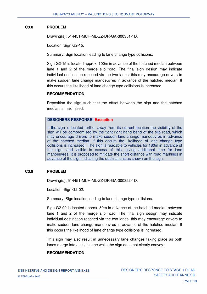
C3.8 PROBLEM
Drawing(s): 514451-MUH-ML-ZZ-DR-GA-300351-1D.
Location: Sign G2-15.
Summary: Sign location leading to lane change type collisions.
Sign G2-15 is located approx. 100m in advance of the hatched median between
lane 1 and 2 of the merge slip road. The final sign design may indicate
individual destination reached via the two lanes, this may encourage drivers to
make sudden lane change manoeuvres in advance of the hatched median. If
this occurs the likelihood of lane change type collisions is increased.
RECOMMENDATION
Reposition the sign such that the offset between the sign and the hatched
median is maximised.
DESIGNERS RESPONSE: Exception
If the sign is located further away from its current location the visibility of the sign will be compromised by the tight right hand bend of the slip road, which may encourage drivers to make sudden lane change manoeuvres in advance of the hatched median. If this occurs the likelihood of lane change type collisions is increased. The sign is readable to vehicles for 180m in advance of the sign, and visible in excess of this, giving additional time for lane manoeuvres. It is proposed to mitigate the short distance with road markings in advance of the sign indicating the destinations as shown on the sign.
C3.9 PROBLEM
Drawing(s): 514451-MUH-ML-ZZ-DR-GA-300352-1D.
Location: Sign G2-02.
Summary: Sign location leading to lane change type collisions.
Sign G2-02 is located approx. 50m in advance of the hatched median between
lane 1 and 2 of the merge slip road. The final sign design may indicate
individual destination reached via the two lanes, this may encourage drivers to
make sudden lane change manoeuvres in advance of the hatched median. If
this occurs the likelihood of lane change type collisions is increased.
This sign may also result in unnecessary lane changes taking place as both
lanes merge into a single lane while the sign does not clearly convey.
RECOMMENDATION

HIGHWAYS AGENCY – M4 JUNCTIONS 3 TO 12 SMART MOTORWAY
ENGINEERING AND DESIGN REPORT ANNEXES DESIGNER’S RESPONSE TO STAGE 1 ROAD
SAFETY AUDIT ANNEX D 27 FEBRUARY 2015
PAGE 20
Reposition the sign such that the offset between the sign and the hatched
median is maximised and review the sign face design drawing detailed design
stage.
DESIGNERS RESPONSE: Exception
The sign is located in the only position where it will be visible for an adequate length of time to allow lane manoeuvres. It is visible from the start of the slip road and if moved away from the hatching there would not be sufficient time to read the sign, this could cause drivers to make erratic manoeuvres leading to incidents. It is proposed to mitigate the short distance with road markings in advance of the sign indicating the destinations as shown on the sign.
C3.10 PROBLEM
Drawing(s): 514451-MUH-ML-ZZ-DR-GA-300354-1D.
Location: Westbound 1 1/3 mile ADS, Junction3.
Summary: Sign position leading to shunt type collisions.
The sign is positioned on an overbridge structure in advance of junction 3
westbound merge area. There is a risk that drivers will not appreciate the sign
is 1 1/3 miles in advance of the diverge area. As such, drivers may misinterpret
the road layout resulting in driver hesitation, inappropriate manoeuvres or
attempting to exit into the merge area. Due to this there will be an increased
risk of collisions occurring within the mainline merge area.
In addition to this the audit team are concerned that fixing the proposed sign to
the bridge structure will be problematic and may create ongoing maintenance
issues.
RECOMMENDATION
Reconsider the requirement/need for providing this ADS considering the design
also details a ¼ and ½ mile ADS in advance of the westbound junction 4
diverge slip road.
DESIGNERS RESPONSE
The design team agree with the recommendation and have reviewed the need for providing the ADS.
The inclusion of this sign was requested by NetServ as mitigation for not having ADS until the ½ mile location due to the short length of the link. The low risk of a driver misinterpreting the sign would be outweighed by informing motorists that they were approaching the interchange with the M25, so mitigating against late lane changes.

HIGHWAYS AGENCY – M4 JUNCTIONS 3 TO 12 SMART MOTORWAY
ENGINEERING AND DESIGN REPORT ANNEXES DESIGNER’S RESPONSE TO STAGE 1 ROAD
SAFETY AUDIT ANNEX D 27 FEBRUARY 2015
PAGE 21
C4 ROAD MARKINGS
Drawings for this design element were not submitted as part of this stage 1
road safety audit.
C5 TRAFFIC SIGNALS
C5.1 PROBLEM
Drawing(s): N/A
Location: Ramp metering at merge slip roads within the extents of the scheme.
Summary: Existing ramp metering facilities conflict with the proposed road
layout.
It is unclear from the details provided at this stage whether or not the ramp
metering located at the junction merge slip roads is to remain under the MM-
ALR scheme. Due to the change in road layout, there are concerns that if the
facility remains, drivers may not be expecting to stop on the merge slip road
leading to late braking and shunt type collisions occurring.
RECOMMENDATION
It is recommended that the ramp metering is either removed or the control point
is relocated in conjunction with the proposed road layout.
DESIGNERS RESPONSE:
The design team agree with the recommendation. Ramp Metering will either be removed or will be recalibrated in conjunction with the proposed road layout.
There are six existing RM sites within the scheme. As per the requirements of IAN 161/13 these sites have been assessed against the criteria of IAN 103/08 to determine if they will continue to provide benefit following implementation of the scheme. PSCRG endorsed Retain and Recalibrate for all but one of the sites. (J12 eastbound is to be further reviewed during detailed design). The decision to retain or decommission the sites will need to be agreed to by Specialist Technical Support Services (STSS) / Netserv during the detailed design stage.
C5.2 PROBLEM
Drawing(s): 514451-MUH-ML-ZZ-DR-GA-300343-1D
Location: MS4 sign G6-07.

HIGHWAYS AGENCY – M4 JUNCTIONS 3 TO 12 SMART MOTORWAY
ENGINEERING AND DESIGN REPORT ANNEXES DESIGNER’S RESPONSE TO STAGE 1 ROAD
SAFETY AUDIT ANNEX D 27 FEBRUARY 2015
PAGE 22
Summary: Limited space leading to vehicle strikes.
It was noted during the site inspection that at the point G6-07 is detailed there is
limited verge width which may result in inadequate lateral clearance to the sign
assembly. If sufficient lateral clearance is not achieved there is an increased
risk of any collision severity being increased if an errant vehicle was to leave
the carriageway at this location.
RECOMMENDATION
It is recommended that G6-07 is relocated to a point where additional verge
width is available.
DESIGNERS RESPONSE
The design team agree with the recommendation. This location has been checked and there is sufficient verge width available to locate G6-07.
D NON MOTORISED USER PROVISION
D1 ADJACENT LAND
No issues that were considered to be detrimental to the safety of road users
were identified in relation to this subject.
D2 FOOTWAYS/CYCLETRACKS
D2.1 PROBLEM
Drawing(s): N/A
Location: Various side roads.
Summary: Restricted shared facility width leading to conflicts.
A number of shared facilities are detailed as 2m in width, this is the absolute
minimum width permitted over long lengths of facility. There is a concern that
only providing the minimum width will increase the risk of NMU conflicts if the
routes are to be utilised by cyclists.
RECOMMENDATION
Where the footways are to be designated as shared facilities the potential of
increasing the width of the facilities to a minimum of 2.5m needs to be
investigated during detailed design.

HIGHWAYS AGENCY – M4 JUNCTIONS 3 TO 12 SMART MOTORWAY
ENGINEERING AND DESIGN REPORT ANNEXES DESIGNER’S RESPONSE TO STAGE 1 ROAD
SAFETY AUDIT ANNEX D 27 FEBRUARY 2015
PAGE 23
DESIGNERS RESPONSE
The design team agree with recommendation and such aspects will be investigated during detailed design and in collaboration with the local authority. The proposals presented are at this stage are based on matching the existing provisions.
D2.2 PROBLEM
Drawing(s): 514451-MUH-SR-ZZ-DR-GA-300599.
Location: Ascot Road side road.
Summary: Continuity of cycle track facility leading to NMU collisions.
The shared facility is detailed as ending at the northern extents of the scheme.
At this point no facilities have been detailed to enable users to access and
egress the facility.
RECOMMENDATION
At detailed design the shared facility should be furnished with access/egress
and crossing points to ensure the facility can be used safely.
DESIGNERS RESPONSE
The design team agree with recommendation and such aspects will be investigated during detailed design and in collaboration with the local authority.
D2.3 PROBLEM
Drawing(s): 514451-MUH-SR-ZZ-DR-GA-300601.
Location: Marsh Lane side road.
Summary: Continuity of shared facility leading to NMU collisions.
The drawing details a cycle track on both sides of the carriageway for the
extents of the re-alignment works. It was noted during the site inspection that
there are only existing facilities on a single side of the carriageway. It is not
clear how this short length of shared facility will be accessed from the
carriageway, if adequate facilities are not provided there is an increased risk of
collisions involving NMUs.
RECOMMENDATION
At detailed design the shared facility should be furnished with access/egress
and crossing points to ensure the facility can be used safely.

HIGHWAYS AGENCY – M4 JUNCTIONS 3 TO 12 SMART MOTORWAY
ENGINEERING AND DESIGN REPORT ANNEXES DESIGNER’S RESPONSE TO STAGE 1 ROAD
SAFETY AUDIT ANNEX D 27 FEBRUARY 2015
PAGE 24
DESIGNERS RESPONSE
The design team agree with recommendation and such aspects will be investigated during detailed design and in collaboration with the local authority.
D2.4 PROBLEM
Drawing(s): 514451-MUH-SR-ZZ-DR-GA-300606 & 300611.
Location: Oldway Lane & Old Slade Lane side road.
Summary: Parapet height resulting in NMU falls.
As this route is not open to traffic there is likely to be higher usage by cyclists
and equestrians. If the parapets are of not a sufficient height to protect users
there is an increased risk of falls from the structure.
RECOMMENDATION
At detailed design ensure that the parapet heights are of a sufficient height to
protect all users from the hazard.
DESIGNERS RESPONSE
The design team agree with recommendation and such aspects will be investigated during detailed design and in collaboration with the local authority. However it should be noted that the proposed bridges at Oldway Lane and Old Slade Lane have narrow raised verges resulting in NMU usage being within the “carriageway” and not directly adjacent to the parapets. Whilst both routes are not “open” to traffic, some vehicle usage of the structures is likely.
D2.5 PROBLEM
Drawing(s): 514451-MUH-SR-ZZ-DR-GA-300607, 300608, 300609 & 300610.
Location: Wood Lane, Datchet Road, Riding Court Road & Recreation Ground
side roads.
Summary: Parapet height resulting in NMU falls.
It is unclear if the proposed footways will be designated as shared facilities. If
they are and the parapets are of not a sufficient height to protect users there is
an increased risk of falls from the structure.
RECOMMENDATION
At detailed design ensure that the parapet heights are of a sufficient height to
protect users from the hazard.

HIGHWAYS AGENCY – M4 JUNCTIONS 3 TO 12 SMART MOTORWAY
ENGINEERING AND DESIGN REPORT ANNEXES DESIGNER’S RESPONSE TO STAGE 1 ROAD
SAFETY AUDIT ANNEX D 27 FEBRUARY 2015
PAGE 25
DESIGNERS RESPONSE
The design team agree with recommendation and such aspects will be investigated during detailed design and in collaboration with the local authorities.
E ROAD SIGNS, ROAD MARKINGS AND LIGHTING
E1 ROAD SIGNS
E1.1 PROBLEM
Drawing(s): 514451-MUH-ML-ZZ-DR-GA-300340-1D & 300341-1D.
Location: Junction 8/9 diverges.
Summary: Lack of speed limit signs leading to collisions.
The existing speed limit does not change as you exit the M4 onto the
connecting road network therefore there are no existing speed limit signs on the
diverge slip roads. Under the Smart Motorway scheme vehicles leaving the
mainline could be doing so under a lower posted speed limit but there will not
be any signage to inform them of the speed limit on the local network. This will
result in driver confusion with regarding the proposed speed limit and potential
conflicts due to variations in vehicle speeds.
RECOMMENDATION
Ensure terminal speed limit signage is provided for the local road network.
DESIGNERS RESPONSE
The design team agree with the recommendation. De-restriction signs are required at this location.
E1.2 PROBLEM
Drawing(s): 514451-MUH-ML-ZZ-DR-GA-300345-1D.
Location: Junction 6 diverges.
Summary: Lack of speed limit signs leading to collisions.
The existing speed limit does not change as you exit the M4 onto the
connecting road network therefore there are no existing speed limit signs on the
diverge slip roads. Under the Smart Motorway scheme vehicles leaving the
mainline could be doing so under a lower posted speed limit but there will not
HIGHWAYS AGENCY – M4 JUNCTIONS 3 TO 12 SMART MOTORWAY
ENGINEERING AND DESIGN REPORT ANNEXES DESIGNER’S RESPONSE TO STAGE 1 ROAD
SAFETY AUDIT ANNEX D 27 FEBRUARY 2015
PAGE 26
be any signage to inform them of the speed limit on the local network. This will
result in driver confusion with regarding the proposed speed limit and potential
conflicts due to variations in vehicle speeds.
RECOMMENDATION
Ensure terminal speed limit signage is provided for the local road network.
DESIGNERS RESPONSE
The design team agree with the recommendation. The End of Motorway Regulation signs are located at the end of the off slips before traffic joins the local road network. These signs cancel all motorway regulations including variable speed limits which may be on display.
E1.3 PROBLEM
Drawing(s): 514451-MUH-ML-ZZ-DR-GA-300352-1D.
Location: Eastbound permanent 60mph signs.
Summary: Uncertain speed limits leading to collisions.
It is unclear how the permanent 60mph will interact with the variable speed limit
associated with the Smart Motorway scheme. If it is unclear what the correct
speed limit is there is an increased risk of collisions due to differentials in
vehicle speeds.
RECOMMENDATION
Remove the fixed speed limit signage from this length of Smart Motorway.
DESIGNERS RESPONSE
The design team agree with the recommendation. The fixed 60mph signs should be removed from the design. The permanent 60mph section is required to be retained in the design to meet Air Quality requirements. Work is ongoing to establish whether the MS4 message signs will operate 24/7 to show a reduced speed limit or whether a Fixed Text Message Sign (FTMS) will be used to show a 60mph sign when the VMSL is not in operation.
E2 LIGHTING
E2.1 PROBLEM
Drawing(s): N/A.
Location: All junctions diverge/merge slip roads.

HIGHWAYS AGENCY – M4 JUNCTIONS 3 TO 12 SMART MOTORWAY
ENGINEERING AND DESIGN REPORT ANNEXES DESIGNER’S RESPONSE TO STAGE 1 ROAD
SAFETY AUDIT ANNEX D 27 FEBRUARY 2015
PAGE 27
Summary: Reduced visibility increasing the risk of collisions.
No details have been provided regarding changes to be made to ensure a
smooth transition between proposed and existing lighting. If a consistent or
smooth transition in lighting is not provided there is a risk of dark patches and
associated collisions.
RECOMMENDATION
Ensure adequate lighting levels are maintained.
DESIGNERS RESPONSE
The design team agree with the recommendation. The proposed road lighting will tie-in with the existing lighting that is to be retained at all locations. The proposed columns at the top of each merge/diverge slip road has been positioned to ensure that there are no unlit sections or dark patches. The compliant lighting layout will be finalised at the detailed design stage.
PSCRG endorsed an option to provide lighting from J3 to J6 and at J8/9. This was subject to further investigating the impact on safety risk for sections where there are constraints/features (such as retaining walls or environmental fencing) that would prevent drivers from reaching areas of safety away from the carriageway. Subsequent to the meeting the HA Project Team instructed that the scheme will proceed retaining the current lighting layout to mitigate the risk of challenge to the progression of the DCO (i.e. all lit except for J8/9-10 link).
E2.2 PROBLEM
Drawing(s): 514451-MUH-ML-ZZ-DR-GA-300586-1R.
Location: Junction 7 slip roads.
Summary: Lack of street lighting increasing the risk of shunt or side swipe type
collisions.
The westbound diverge & merge facilities are detailed as being realigned as
part of the scheme. The drawings provided do not indicate any new lighting on
the realigned slip road facilities. If lighting is not provided the merge and diverge
areas will have reduced illumination increasing the risk shunt or side swipe type
collisions.
HIGHWAYS AGENCY – M4 JUNCTIONS 3 TO 12 SMART MOTORWAY
ENGINEERING AND DESIGN REPORT ANNEXES DESIGNER’S RESPONSE TO STAGE 1 ROAD
SAFETY AUDIT ANNEX D 27 FEBRUARY 2015
PAGE 28
RECOMMENDATION
Provide street lighting on all the slip roads associated with junction 7.
DESIGNERS RESPONSE
The design team agree with the recommendation. The lighting of the slip roads at Junction 7 was upgraded, using the latest LED technology and aluminium lighting columns, in 2012. The proposed lighting and the existing lighting will be tied-in to ensure that there are no unlit sections. The compliant lighting layout, to allow for any road realignment, will be finalised at the detailed design stage.
E2.3 PROBLEM
Drawing(s): 514451-MUH-ML-ZZ-DR-GA-300594-1R.
Location: Chainage 14,600 to 15,500.
Summary: Lighting columns conflict with ERAs.
The lighting columns are detailed in the verge area between Ch.14,600 –
15,500. Within this section there is an eastbound and westbound ERA
(Ch.15,100). If the lighting columns are set back to accommodate the ERAs
there is a risk that the mainline may not be sufficiently illuminate leading to
potential collisions due to dark patches.
RECOMMENDATION
Ensure the lighting design accommodates the ERAs and the additional off-set
from the mainline carriageway.
DESIGNERS RESPONSE:
The design team agree with the recommendation. Where lighting is located at the back of ERAs, and therefore with an additional setback, higher wattage luminaires with appropriate photometry are to be proposed to ensure the necessary lighting levels are achieved. The compliant lighting layout will be finalised at the detailed design stage.
E3 ROAD MARKINGS
Drawings for this design element were not submitted as part of this stage 1
road safety audit.
E4 POLES & COLUMNS
No issues that were considered to be detrimental to the safety of road users
were identified in relation to this subject.

HIGHWAYS AGENCY – M4 JUNCTIONS 3 TO 12 SMART MOTORWAY
ENGINEERING AND DESIGN REPORT ANNEXES DESIGNER’S RESPONSE TO STAGE 1 ROAD
SAFETY AUDIT ANNEX D 27 FEBRUARY 2015
PAGE 29
3 CONCLUSIONS
All recommendations made within the RSA stage 1 report have been reviewed and
considered accordingly.
There are 4 exceptions and these are shown below in Table 1. These were discussed with
the PSCRG held on 5th February 2015:
Table 1: Exceptions to RSA
Table 2: Summary RSA Recommendation Designers Response
A5.9 ERA located after the 1/3 mile ADS leading to collisions
Reposition either the ERA or ADS such that the sign is located downstream of the ADS
Exception. The design team have reviewed whether the ERA or ADS could be repositioned.
Appendix A provides further information on the location of the ERA and ADS within the link. This assessment identified greater disbenefit with repositioning the ADS or ERA to achieve the relationship recommended by the auditors
A5.10 ERA located after the 1/2 mile ADS leading to collisions
Reposition either the ERA or ADS such that the sign is located downstream of the ADS
Exception. The design team have reviewed whether the ERA or ADS could be repositioned.
Appendix B provides further information on the location of the ERA and ADS within the link. This assessment identified greater disbenefit with repositioning the ADS or ERA to achieve the relationship recommended by the auditors.
C3.8 Sign location leading to lane change type collisions
Reposition the sign such that the offset between the sign and the hatched median is maximised
Exception. If the sign is located further away from its current location the visibility of the sign will be compromised by the tight right hand bend of the slip road, which may encourage drivers to make sudden lane change manoeuvres in advance of the hatched median. If this occurs the likelihood of lane change type collisions is increased. The sign is readable to vehicles for 180m in advance of the sign, and visible in excess of this, giving additional time for lane manoeuvres. It is proposed to mitigate the short distance with road markings in advance of the sign indicating the destinations as shown on the sign.
C3.9 Sign location leading to lane change type collisions
Reposition the sign such that the offset between the sign and the hatched median is maximised and review the sign face design drawing detailed design stage
Exception. The sign is located in the only position where it will be visible for an adequate length of time to allow lane manoeuvres. It is visible from the start of the slip road and if moved away from the hatching there would not be sufficient time to read the sign, this could cause drivers to make erratic manoeuvres leading to incidents. It is proposed to mitigate the short distance with road markings in advance of the sign indicating the destinations as shown on the sign

HIGHWAYS AGENCY – M4 JUNCTIONS 3 TO 12 SMART MOTORWAY
ENGINEERING AND DESIGN REPORT ANNEXES DESIGNER’S RESPONSE TO STAGE 1 ROAD
SAFETY AUDIT ANNEX D 27 FEBRUARY 2015
PAGE 30
Annex A: ERA E2-B1 Analysis (A5.9)
Introduction
A PSCRG was held on 5th February 2015 where the RSA recommendations were reviewed
and discussed. It was agreed at the PSCRG that the ERA at E2-B1 needs to be retained on
the J4b-4 Eastbound link but a further review should be undertaken to confirm whether the
ERA was positioned in the most appropriate location or whether it should be moved closer to
the merge at J4b.
Design Review
Moving the Signage
The location of the signage on the M4 J4b-4 link is constrained by the short length of
carriageway. The length of the link is 2.9km (centre of J4b to centre of J4) which limits the
possible locations where the signage on the link can be located. The GA drawing attached
(Ref: 514451-MUH-ML-ZZ-DR-GA-300351-2F) shows that moving the signs on a short link
provides greater disbenefit to road users. The 1/3 mile sign at G2-09 could be moved and
changed to be a ¼ mile sign and be located on gantry G2-07 as this would meet the RSA
recommendations (as the sign would be located after the ERA). However, it is considered
that moving the signage to this location would provide too much information at one location
and the information would be presented later on the link which could result in late weaving
by drivers looking to exit at this particularly busy junction.
Moving the ERA
Due to the short length of the link there are constraints as to where the ERA can be located.
Moving the ERA east (downstream) from its currently proposed location would move it closer
to the junction which would not address the RSA recommendation. The GA drawing provides
an illustration of two alternative locations west (upstream) of its currently proposed location
and demonstrates that there are greater disbenefits with locating the ERA at these locations.
Moving the ERA west as illustrated would mean that the ERA is located closer to the entry
datum point at J4b. This would mean that there is greater likelihood that drivers merging
could be in direct conflict with drivers who may be trying to reach the ERA. The ERA in its
currently proposed position is located approximately 850m from the previous location of
refuge. Moving the ERA further west to the illustrated locations on the GA drawing would
mean that the ERA is likely to be less than 500m from the previous area of refuge. Therefore
locating the ERA to the positions illustrated would result in the ERA providing less benefit to
drivers on the M4 scheme.
It is recognised that the M42 SM Pilot and Birmingham Box schemes have a similar layout at
some locations. Feedback has been sought from the Traffic Officer Service (TOS).
Comments received are that the TOS do not see these locations as an issue and there have
been no particular observations of drivers mistaking the ERA as the exit.

HIGHWAYS AGENCY – M4 JUNCTIONS 3 TO 12 SMART MOTORWAY
ENGINEERING AND DESIGN REPORT ANNEXES DESIGNER’S RESPONSE TO STAGE 1 ROAD
SAFETY AUDIT ANNEX D 27 FEBRUARY 2015
PAGE 31
Hazard Analysis Review
A hazard analysis has been undertaken in order to consider moving the ERA further west. A
qualitative approach has been adopted for this assessment. Key hazards which will be
affected by the moving of the ERA have been assessed to determine the change in risk if the
ERA were to be change location to a position further west.
• Eliminated: means the risk would be eliminated if there was no ERA at this location
• ‘-‘: means the risk for this hazard would reduce if there was no ERA at this location
• ‘+’: means the risk would increase if there was no ERA at this location
• ‘=’ means no change in risk expected if there was no ERA at this location
The assessment is shown in Table A below.

HIGHWAYS AGENCY – M4 JUNCTIONS 3 TO 12 SMART MOTORWAY
ENGINEERING AND DESIGN REPORT ANNEXES DESIGNER’S RESPONSE TO STAGE 1 ROAD SAFETY AUDIT ANNEX D
27 FEBRUARY 2015
PAGE 32
Table A: Key hazards from M4 J3-J12 Sm hazard log affected by moving the ERA further west
Hazard
Hazard score
for
implementation
of ALR (with
ERAs)
Effect on score if
ERA is removed Comments
Hazards relating to entry/exit of ERA
H9 - Driver changes mind about entering ERA E5.5 + This hazard would increase as the driver would have to cross lanes with increased
conflict from merging traffic
H116 - Vehicle misjudges entry to ERA E7.0 + This hazard would increase as the driver would have to cross lanes with increased
conflict from merging traffic
H14 - Driver mistakes ERA for exit slip E6.0 - This hazard would reduce in risk as moving the ERA closer west would mean the
ERA is located prior to 1/3m sign.
H48 - Legal-illegal pedestrian(s) in path of
vehicles in ERA E6.0 = No change
H74 - Person on off-side of vehicle in ERA S6.5 = No change
H113 - Vehicle exits ERA E7.5 + This hazard would increase as the driver would have to exit with increased conflict
from merging traffic
H141 - HGV-LGV-Bus exits ERA E7.5 + This hazard would increase as the driver would have to exit with increased conflict
from merging traffic
H152 - Vehicle recovered from ERA E8.0 + This hazard would increase as the driver would have to exit with increased conflict
from merging traffic
H150 - Vehicle in ERA (or verge) obtrudes into
lane 1 (applies only to ALR) S7.0 = No change
Other affected hazards
H112 – Vehicle enters main carriageway
unsafely E7.8 +
This hazard would increase as the drivers entering the M4 from the M25 could
come into conflict with drivers trying to enter or exit the ERA

HIGHWAYS AGENCY – M4 JUNCTIONS 3 TO 12 SMART MOTORWAY
ENGINEERING AND DESIGN REPORT ANNEXES DESIGNER’S RESPONSE TO STAGE 1 ROAD SAFETY AUDIT ANNEX D
27 FEBRUARY 2015
PAGE 33
Hazard
Hazard score
for
implementation
of ALR (with
ERAs)
Effect on score if
ERA is removed Comments
H32 - Health deterioration of vehicle
occupant E7.1 =
No change
H155 - Vehicle stops in running lane - Peak E7.5 + Moving the ERA west means more vehicles are forced to stop in a live lane when
they cannot reach the next refuge point.
H135 - Vehicle Stops in Running Lane - Off
Peak (Event) E08 +
Moving the ERA west means more vehicles are forced to stop in a live lane when
they cannot reach the next refuge point.
H147 - Pedestrians walking in lane 1 (applies
to ALR only) S7.0 + Moving the ERA west means more live lane stops.
H22 - Emergency staff -TO etc on foot at
scene of an incident S6.0 + Moving the ERA means more live lane stops to attend
H34 - Incident management - rolling block E6.5 + Moving the ERA means more live lane stops. Rolling road block may be required
more often e.g. to move stopped vehicle to next place of refuge
HIGHWAYS AGENCY
ENGINEERING AND DESIGN REPORT ANNEXES DESIGNER’S RESPONSE TO STAGE 1 ROAD
SAFETY AUDIT ANNEX D 27 FEBRUARY 2015
PAGE 34
The most significant hazards (i.e. those with a risk score of 7.5 or higher) affected by the
decision whether to move the ERA are:
• H152 - Vehicle recovered from ERA (E8.0)
• H135 - Vehicle Stops in Running Lane - Off Peak (Event) (E8.0)
• H112 – Vehicle enters main carriageway unsafely (E7.8)
• H113 - Vehicle exits ERA (E7.5)
• H141 - HGV-LGV-Bus exits ERA (E7.5)
• H155 - Vehicle stops in running lane – Peak (E7.5)
H14 - Driver mistakes ERA for exit slip (E6.0) is a relatively minor hazard. If we assume the
risk at this location is an order of magnitude higher than at other locations that would make
H14 an E7.0 (risk is 10 times greater), which would still not make it one of the highest
scoring risks.
Conclusions
It is recommended that the ERA as currently proposed remains in the optimum position.
There are disbenefits with moving the signage on the link and moving the ERA west
(upstream) increases the risk of conflict with merging traffic. Moving the ERA west would
also mean a less balanced refuge provision is provided on the scheme. The relationship
between the location of the signage and ERA will be further reviewed in the detailed design
stage.
If concerns remain that drivers could become confused there is an option to provide
designated lane markings immediately upstream of the ERA to make it clear that the lane
continues and also the green studs can be removed from the ERA to discourage drivers
from thinking it is the exit at J4. These mitigations will be reviewed during the detailed design
stage and will be informed by evidence from other operational SM schemes.

HIGHWAYS AGENCY
ENGINEERING AND DESIGN REPORT ANNEXES DESIGNER’S RESPONSE TO STAGE 1 ROAD
SAFETY AUDIT ANNEX D 27 FEBRUARY 2015
PAGE 35
Annex B: ERA E1-A1 Analysis (A5.10)
Introduction
A PSCRG was held on 5th February 2015 where the RSA recommendations were reviewed
and discussed. It was agreed at the PSCRG that the ERA at E1-A1 needs to be retained on
the J3-4 Westbound link but a further review should be undertaken to confirm whether the
ERA was positioned in the most appropriate location.
Design Review
Moving the Signage
The location of the signage on the M4 J3-4 link is constrained by the short length of
carriageway. The length of the link is 3km (centre of J3 to centre of J4) which limits the
locations where the signage on the link can be located. The GA drawing attached (Ref:
514451-MUH-ML-ZZ-DR-GA-300353-2F) shows that moving the signs on a short link
provides greater disbenefit to road users. The 1/2 mile sign at G1-03 could be moved and be
changed to be a 1/3 mile sign as this would meet the RSA recommendations (as the sign
would be located after the ERA). However, it is considered that moving the signage to this
location would mean that information would be presented later on the link which could
increase the likelihood of late weaving by drivers looking to exit at this busy junction.
Moving the ERA
Due to the short length of the link there are constraints as to where the ERA can be located.
Moving the ERA west (downstream) from its currently proposed location would move it
closer to the junction which would not address the RSA recommendation. The GA drawing
provides an illustration of two alternative locations east (upstream) of its currently proposed
location and demonstrates that there are greater disbenefits with locating the ERA at these
locations.
Moving the ERA east as illustrated would mean that the ERA is located closer to the entry
datum point at J3. This would mean that there is greater likelihood that drivers merging could
be in direct conflict with drivers who may be trying to reach the ERA. The ERA in its currently
proposed position is located approximately 1100m from the previous location of refuge.
Moving the ERA further west to the illustrated locations on the GA drawing would mean that
the ERA is likely to be less than 800m from the previous area of refuge. Therefore locating
the ERA to the positions illustrated would result in the ERA providing less benefit to drivers
on the M4 scheme.
It is recognised that the M42 SM Pilot and Birmingham Box schemes have a similar layout at
some locations. Feedback has been sought from the Traffic Officer Service (TOS).

HIGHWAYS AGENCY
ENGINEERING AND DESIGN REPORT ANNEXES DESIGNER’S RESPONSE TO STAGE 1 ROAD
SAFETY AUDIT ANNEX D 27 FEBRUARY 2015
PAGE 36
Comments received are that the TOS do not see these locations as an issue and there have
been no particular observations of drivers mistaking the ERA as the exit.
Hazard Analysis Review
A hazard analysis has been undertaken in order to consider moving the ERA further east. A
qualitative approach has been adopted for this assessment. Key hazards which will be
affected by the moving of the ERA have been assessed to determine the change in risk if the
ERA were to be change location to a position further east.
• Eliminated: means the risk would be eliminated if there was no ERA at this location
• ‘-‘: means the risk for this hazard would reduce if there was no ERA at this location
• ‘+’: means the risk would increase if there was no ERA at this location
• ‘=’ means no change in risk expected if there was no ERA at this location
The assessment is shown in Table B below.

HIGHWAYS AGENCY
ENGINEERING AND DESIGN REPORT ANNEXES DESIGNER’S RESPONSE TO STAGE 1 ROAD SAFETY AUDIT
ANNEX D 27 FEBRUARY 2015
PAGE 37
Table B: Key hazards from M4 J3-J12 Sm hazard log affected by moving the ERA further east
Hazard
Hazard score
for
implementation
of ALR (with
ERAs)
Effect on score if
ERA is removed Comments
Hazards relating to entry/exit of ERA
H9 - Driver changes mind about entering ERA E5.5 + This hazard would increase as the driver would have to cross lanes with increased
conflict from merging traffic
H116 - Vehicle misjudges entry to ERA E7.0 + This hazard would increase as the driver would have to cross lanes with increased
conflict from merging traffic
H14 - Driver mistakes ERA for exit slip E6.0 - This hazard would reduce in risk as moving the ERA east would mean the ERA is
located prior to 1/2m sign.
H48 - Legal-illegal pedestrian(s) in path of
vehicles in ERA E6.0 = No change
H74 - Person on off-side of vehicle in ERA S6.5 = No change
H113 - Vehicle exits ERA E7.5 + This hazard would increase as the driver would have to exit with increased conflict
from merging traffic
H141 - HGV-LGV-Bus exits ERA E7.5 + This hazard would increase as the driver would have to exit with increased conflict
from merging traffic
H152 - Vehicle recovered from ERA E8.0 + This hazard would increase as the driver would have to exit with increased conflict
from merging traffic
H150 - Vehicle in ERA (or verge) obtrudes into
lane 1 (applies only to ALR) S7.0 = No change
Other affected hazards
H32 - Health deterioration of vehicle
occupant E7.1 =
No change

HIGHWAYS AGENCY
ENGINEERING AND DESIGN REPORT ANNEXES DESIGNER’S RESPONSE TO STAGE 1 ROAD SAFETY AUDIT
ANNEX D 27 FEBRUARY 2015
PAGE 38
Hazard
Hazard score
for
implementation
of ALR (with
ERAs)
Effect on score if
ERA is removed Comments
H155 - Vehicle stops in running lane - Peak E7.5 + Moving the ERA east means more vehicles are forced to stop in a live lane when
they cannot reach the next refuge point.
H135 - Vehicle Stops in Running Lane - Off
Peak (Event) E08 +
Moving the ERA east means more vehicles are forced to stop in a live lane when
they cannot reach the next refuge point.
H147 - Pedestrians walking in lane 1 (applies
to ALR only) S7.0 + Moving the ERA east means more live lane stops.
H22 - Emergency staff -TO etc on foot at
scene of an incident S6.0 + Moving the ERA means more live lane stops to attend
H34 - Incident management - rolling block E6.5 + Moving the ERA means more live lane stops. Rolling road block may be required
more often e.g. to move stopped vehicle to next place of refuge

HIGHWAYS AGENCY
ENGINEERING AND DESIGN REPORT ANNEXES DESIGNER’S RESPONSE TO STAGE 1 ROAD
SAFETY AUDIT ANNEX D 27 FEBRUARY 2015
PAGE 39
The most significant hazards (i.e. those with a risk score of 7.5 or higher) affected by the
decision whether to move the ERA are:
• H152 - Vehicle recovered from ERA (E8.0)
• H135 - Vehicle Stops in Running Lane - Off Peak (Event) (E8.0)
H14 - Driver mistakes ERA for exit slip (E6.0) is a relatively minor hazard. Although the
current proposed design for ERA E1-A1 does not meet all aspects of IAN161 this is not
expected to have a significant impact on risk, at this location or for the overall scheme.
The drawings show that moving the signs on a short link is not practical. The 1/2 mile sign
could be moved to a 1/3 mile sign. This would however provide information much later on
the link and would therefore increase the level of risk on this link.
Conclusions
It is recommended that the ERA as currently proposed remains in the optimum position.
There are disbenefits with moving the signage on the link and moving the ERA east
(upstream) increases the risk of conflict with merging traffic. Moving the ERA east would also
mean a less balanced refuge provision is provided on the scheme. The relationship
between the location of the signage and ERA will be further reviewed in the detailed design
stage.
If concerns remain that drivers could become confused there is an option to provide
designated lane markings immediately upstream of the ERA to make it clear that the lane
continues and also the green studs can be removed from the ERA to discourage drivers
from thinking it is the exit at J4. These mitigations will be reviewed during the detailed design
stage and will be informed by evidence from other operational SM schemes.