a study of jamestown, stellenbosch. gary dean aren
TRANSCRIPT
0
Private property, gentrification, tension and change at the ‘urban edge’: a
study of Jamestown, Stellenbosch.
Gary Dean Arendse
2802290
Submitted in fulfilment of the requirements for the Magister Artium Degree in
the Department of Geography and Environmental Studies, University of the
Western Cape
Supervisor: Dr Noëleen Murray
November 2014

1
Declaration
I hereby declare that this thesis (Private Property, Gentrification, tension and change at the
‘urban edge’: a study of Jamestown, Stellenbosch.) contains no material which has been
accepted for the award of any other degree or diploma in any tertiary institution, and that, to
the best of my knowledge and belief, the thesis contains no material previously published or
written by another person, except where due reference is made in the text of the thesis.
Full name: ………………………
Date: ………………….
Signature: ……………………….
2
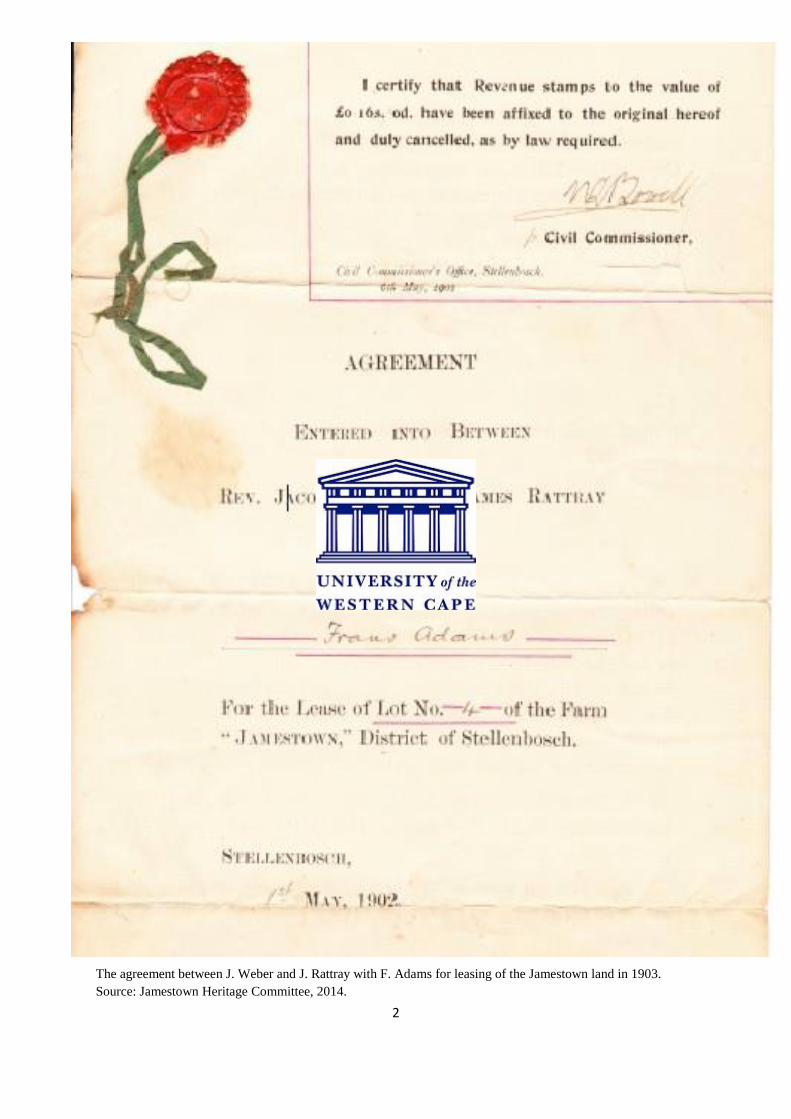
The agreement between J. Weber and J. Rattray with F. Adams for leasing of the Jamestown land in 1903.
Source: Jamestown Heritage Committee, 2014.

3
Page Contents Page #
Acknowledgements 5
Abstract 6 - 7
List of tables 8
List of images 8
List of figures 8 - 9
List of Screen Shots 9
Glossary 10 - 11
Chapter One: General Introduction 12 – 25
- Summary of chapters 17 - 18
- Oral History as ‘insider’ method 19 - 25
Chapter Two: Constructing a spatial history of Stellenbosch and Jamestown;
Past and Present. 26 - 57
Introduction 26 - 27
Considering insider/outsider experience 28 - 31
A mission town 31 - 37
A ‘close-knit’ community 37 - 46
Jamestown evades removal under the Groups Areas Act 46 - 51
Heritage and development 52 - 56
Chapter Three: Gentrification, tension and urban transformation take place. 57 - 92
Introduction 57 - 60
Gentrification and its long-lasting effects 60 - 67
Jamestown then and now: a visual history through aerial photography 68 - 73

4
The grip of anxiety on Jamestown and its residents 74 - 76
Jamestown and its ‘gated’ neighbours 76 - 79
The failure of malls and the case of Stellenbosch Square 79 – 82
The rapid development ‘explosion’ around Jamestown 82 - 92
Chapter Four: The “Downside” of urban development speculating on Jamestown’s future
93 - 122
Introduction 93 - 94
Urban sprawl: the ‘jump’ in urban development 94 - 107
What the future holds for the historic town of Jamestown. 107 - 114
Jamestown residents speak out. 114 - 122
Chapter Five: Conclusion 122 - 127
Bibliography 128 - 135
Appendix A (Jamestown short 1950 film) 136

5
Acknowledgements
I want to thank my supervisor, Dr Noëleen Murray for the major role she played in guiding
me through the experience of writing my masters dissertation. The immense effort she put in
to make it a good experience and going the extra mile in order to assist me is greatly
appreciated. Thanks also go to my parents, especially, for supporting me on a day to day
basis and encouraging me to do my best work. I also want to thank all participants who
welcomed me into their homes and a special thanks to Mrs Sarah Linders. I also want to
thank the greater Jamestown community for telling me their stories and making this a study
about them.
6
Abstract
This study entitled, “Private property, gentrification, tension and change at the ‘urban
edge’: a study of Jamestown, Stellenbosch.” is about a small place called Jamestown, in
which I have lived all my life. Jamestown, located near the town of Stellenbosch is situated
40 km to the east of Cape Town, in the Western Cape Province of South Africa.
The Stellenbosch area has a long history, as an early settlement in the Dutch Colonial period,
in which missionaries were active in the establishment of the town and its associated
agricultural activities after the end of slavery in 1848. It was the location in which
missionary societies first built churches and much missionary activity began. Jamestown was
established in 1903 as part of this process as a Rhenish Mission by the Rev. Jacob Weber and
James Rattray who made land available to a church congregation, made up of local small-
scale farmers. Contemporary Jamestown remains the home to many descendants of the
original families who still live and farm in a self-sustainable manner.
Yet, in 1965, Jamestown’s future was under threat as the infamous Group Areas Act was
being implemented across the country under apartheid. In 1966 a decision was made that to
save Jamestown from forced removals and declaration as a White Group Area, after which it
was declared a Coloured Group Area. This thesis explores the significance of this decision
and examines how this shift influenced the future of Jamestown. Major changes have been
occurring in and around Jamestown since 2000 and from 2009 Jamestown has been
designated as being situated on the ‘urban edge’ of Stellenbosch. Rapid transformation with
burgeoning urban sprawl, suburbanisation and gentrification taking place in the areas
surrounding the town with new themed developments, including gated communities and
malls has taken place. This research tracks how long-standing Jamestown residents have
been affected by these land-use changes and the social effect this has had on their lives. The

7
significant rise in the demand for private property in the area has led to the increase of
property prices over the last 15 years. Land in Jamestown, which didn’t have much value
previously, rose significantly in value and together with this, the rates and taxes have
escalated to such an extent that the majority of Jamestown’s residents, made up of low to
middle-income households, cannot afford to own property. Occurring in parallel with this
process a heritage committee has been established as residents seek to retain Jamestown’s
“village feel”, while for developers, the change in and around Jamestown has brought huge
profits. In short this thesis is concerned with the complex interplay between the effects of
private property development, gentrification and claims to heritage in the place I consider
home, in post-apartheid Jamestown.

8
List of tables
1.1 – Interview with long-standing resident, Mrs Sarah Linders 22
4.1 – Various factors leading to urban growth 96
List of images (Chapter 1)
1.1 – Image comparison of Stellenbosch town 1881 – 2014 12 -13
List of images (Chapter 2)
2.1 – First mission school/church in Jamestown. 34
2.2 – Rhenish missionary church in Stellenbosch. 36
2.3 – Stellenbosch historic building changes 1901 - 2014 37
2.4/2.5 – Still images from the film ‘Jamestown’ depicting early life in the town. 42
2.6 – General Dealer for sale 45
2.7 – Williams brothers (Owners of General Dealer) 54
2.8 – Mrs Sarah D. Linders (Long-standing resident) and Mr Alfie Williams (co-owner of
General Dealer) 55
List of images (Chapter 3)
3.1 – Promoting Aan de Weber with historic Jamestown sense 63
3.2 – Pristine land on which Aan de Weber was developed 87
List of images (Chapter 4)
4.1 – One of the last farming families in Jamestown. 113
4.2 – Human Rights Day protest (Kreefgat residents) 116
4.2 – Still image taken from the protest video showing ‘Kreefgat’, the informal settlement in
Jamestown. 118
List of figures
2.1 – Map of greater Stellenbosch area. (Chapter 2) 27
List of figures (Chapter 3)
3.1 – Jamestown plot distribution map. 65
9
3.2 – Map of Jamestown indicating property layout and street pattern. 76
3.3 – Aerial image of La Clemence retirement village and demarcated adjacent informal
settlement. 83
3.4 – Location of Techno Park in relation to Jamestown. 89
List of figures (Chapter 4)
4.1 – Stellenbosch Strategic Development Framework map sketch of Pniel and surrounding
areas. 104
4.2 – Stellenbosch Strategic Development Framework map sketch of Jamestown and
surrounding areas. 105
4.3 – Stellenbosch Strategic Development Framework showcasing Jamestown’s proposed
future developments. 109
List of screen shots
1.1 – Blaauwklippen webpage 51
3.1 – Stellenbosch Square webpage 81
4.1 – Property24 webpage 120

10
Glossary of Terms
Gentrification – This is the shift in an urban community toward wealthier residents with
increasing property value. Pre-gentrification residents who are not able to pay the increasing
rents and property tax are usually driven out of the area.
Village feel – The area which holds an undisturbed feeling to it. This usually felt within a
small historic town. The term used by the Jamestown Heritage Society.
Oral history – This is the method of recording of people’s memories, experiences and
opinions.
Basuinekoor – The Afrikaans word for a community choir who performs at various
community festivals or in church
Free blacks – The term which is commonly used in historical writing to refer to slaves who
have been set free by the settlers after 1848 in South Africa.
Rijksdaalders – It was the Dutch national Dollar which was the currency during the 20th
century.
Group Areas Act – The legislative act under statutory apartheid in South Africa which
promoted land based segregation based the creation of Group Areas and racial classification.
Urban edge – The urban edge is a term used in planning discourse to refer to the areas made
up of both urban and peri-urban spaces that include leased and unleased land around cities.
In the Western Cape Province of South Africa this has been demarcated by the City of Cape
Town as an enforceable line to protect against urban sprawl since 2008.
Urban Renewal - is a term which refers to a program of land redevelopment in areas of
moderate to high density urban land use.

11
Urban sprawl – is a term which refers to the spreading of urban developments (such as
housing and commercial development like shopping centres) on undeveloped land near a city
Segregation – a planning term for the social system that provides separate facilities for
different racial or ethnic groups.
Green belt - A green belt is a policy and land use designation used in land use planning to
retain areas of largely undeveloped, wild, or agricultural land surrounding or neighbouring
urban areas.
Sloot – the Afrikaans word for a narrow water channel constructed for irrigation.
Skoffel – the Afrikaans word for the act of weeding an area.

12
Chapter One: General Introduction
This thesis is about the place I call home, Jamestown, a small town in post-apartheid South
Africa. It is located 9km south of Stellenbosch which was first settled in 1679 and named
after Dutch settler, Simon Van Der Stel. Jamestown has received little attention in academic
literatures until recently with the publication of research by Corrine Cash from her recent
doctoral thesis; ‘Towards achieving resilience at the rural-urban fringe: the case of
Jamestown, Stellenbosch.’ In this thesis and a subsequent paper published she unpacks the
often messy processes behind the recent rampant property development in and around
Jamestown. This study has been a central and substantial source for this study.
Contemporary Stellenbosch has a population of about 120 000 people and is well known
being a student town because of the historically Afrikaans University of Stellenbosch. Cash
argues that in recent years the property market has boomed in Stellenbosch with an increase
in demand for student accommodation as well as high end residential homes, and this
expansion had taken place as private developers have bought up parcels of previously
agricultural land to the south of the town, near Jamestown.

13
Image 1: The previous set of pictures depict Stellenbosch during the 19th
and 21st century. The town was fairly
established in the first image and was built around the “Moeder Kerk” as evident by the church tower in the
centre of the picture.1 During this time the main form of income for the town’s people came in the form of
farming. The second image indicates the Stellenbosch 133 years later with the town being fully established.
Jamestown’s history dates back to 1903 when Rhenish Mission settlers made Stellenbosch
their home, and established Jamestown on the outskirts of the town in order for members of
their congregation, many of whom were farm labourers, small scale subsistence farmers and
descendants of freed slaves, to have their own parcels of land for farming purposes. Yet
Jamestown’s 100 year old history was almost disrupted in 1966. According to a report which
was discovered in the process of research towards this thesis entitled ‘Instelling van
Groepsgebiede by Jamestown’, Jamestown was threatened with Forced Removals under the
Group Areas Act promulgated in 1950. According to the oral history interviews conducted
for this thesis with residents Sarah Linders, Cyril Jooste and Myra Linders, this threat
eventually spurned through a complex process of landowner intervention by neighbouring
farmers who valued their closely located labour force and who, in an unexpected move,
argued against the proposed removal (Group Areas Act Report, 1966), this brought the
1 Picture taken from www.stellenboschheritage.co.za/stellenbosch
14
community of the small settlement together and formed it into what was later depicted in
archival sources as the ‘close-knit’ settlement.
This process of the research towards this study has surfaced issues of gentrification, urban
renewal, urban transformation, urban sprawl, private property, tensions between long-
standing and newer residents. My interviews with residents revealed how all this have had a
perceived negative effect on the historic settlement of Jamestown. The thesis argues, as
architect Rem Koolhaas (2014) says, too little attention is being paid to the country side,
where change actually happening faster than in most cities. Many interviewees placed
emphasis on the sudden significant rise in property prices and property tax within the area
and offered reasons for why it occurred within this specific area. As long-standing residents
are not able to afford their own property anymore, this resulted in some of them having to
leave the town. In trying to understand the current tensions and anxieties over this rapid
change, I started to research the history of the surrounding area in order to develop a picture
of the spatial and social changes that have taken place in Jamestown since it was established.
David Harvey’s (1989) argument that when considering the history of an area, it is important
to be mindful that geographical literature has, conventionally, been dominated by racism,
ethnocentrism and at best, a strong paternalism (Harvey, 1989:34). Following this first
introductory chapter, Chapter Two, presents this history from the 1900s when Stellenbosch
and its surroundings was less than half of the size it is today in 2014. Dutch missionaries had
settled in the area and their main focus was placed on convincing the settlers in the area
together with the slaves to be part of the congregation they came to establish. One of the
more important occurrences during the time of the missionaries was the arrival of German
missionaries, Jacob Weber and James Rattray, who were instrumental in Jamestown’s
establishment.

15
There is little in the historiography about Jamestown which points to its marginality in the
largely settler histories of Stellenbosch and the landed Cape Dutch farming estates in the
area. For this reason, the views and memories of local residents in Jamestown have played a
significant role in my study, in which many of those interviewed came from the oldest
families in the town. In conducting oral history research, I was interested in questions such
as: why they moved to the area? What had changed? And who were the first land owners in
Jamestown? I joined the newly formed Jamestown Heritage Committee and took part in their
activities, as well as gathered much of the historical material used in this thesis on the town
from their archives and members.
In order to begin to collect and give an account of the spatial history of Jamestown, this
research also places much focus on the early years of Jamestown, starting when the town was
established in 1903. Interest in the town’s heritage is evident in this research and interviews
with Jamestown residents contain in depth discussions on the early years, many of whom
were only toddlers during the early 1900s, but whose memories contain stories from their
parents. In order to understand the change through which Jamestown has gone, I felt it was
important to first establish what the factors were that drove the change. My analysis is based
on my disciplinary positioning as a student of geography and the study explores the
particularities of the Jamestown case in relation to broader debates in academic literatures
around gentrification, urban renewal, urban sprawl, suburbanisation of farmland, and
conditions on the urban fringe, amongst others.
In order to frame this approach, my study then moves to Chapter Three as a focus on the
rapid changes which took place in and around the town since 2000, and explores the rapid
private property developments which have taken place.

16
Over the years as the inner town of Stellenbosch became more populated, many businesses
and residents began to move out of the town, but yet stayed close enough to the CBD for it to
be convenient. According to the various estate agents such as Seeff properties web sites,
Jamestown became marketed as the perfect location for the resident who wanted to be
surrounded by nature and the perfect view, but also be close to work and the town. “Come
and build your dream house within a secure environment with lots of open spaces for your
children to play. Beautiful views of Stellenbosch Mountains and Surrounds.”
(www.Property24.com, accessed 7 October 2014). The population growth of Jamestown had
a slow increase from the 1990s to 2000s (Van Wyk, 2009). This however changed after 2000
as the demand for land in the area increased significantly. New developments such as the
Stellenbosch Square shopping centre, Donford BMW Dealership and La Clemence retirement
village all played a role in the increasing demand for land in the area. Cash, (2013) mentions
that reports of public meetings between Jamestown residents and various developers show
how the plans for and the subsequent major changes to the area were met with mixed
responses and unhappiness by many Jamestown residents. These sentiments, also alluded to
in interviews became evident at local community meetings with respect to the various
developments in and around Jamestown. In a land market in which demand for private
property had been steadily growing, demand rose significantly after the first major
developments occurred, the knock on effect was that demand for private land within
Jamestown escalated accordingly. The aerial study at the end of Chapter Three is a graphic
analysis of how this rapid change took place.
This research is of personal importance to me as a resident of Jamestown. The people who
are affected by the significant changes within the town are people I know well and many I see
every day. I have witnessed how they have daily struggles not only financially, but also

17
around how they have coped (or not) with the pace of change in our town. As a resident of
the area, I too experienced how change happened over a short period of time and how it
affected my own family. Suddenly my family had to pay higher property taxes and we had to
get used to the influx of many more people into the town and the surrounding area. Through
my studies in urban geography I had previously read up about the phenomenon of rapid urban
change and understood how development impacts on society, but having an inside view of
how it all plays out made me realise that this would be a worthwhile topic for my masters
research, as I could bring a subtlety different set of understanding to the process of change
described by Cash, using my insider status. This of course required me to think through my
own positionality, which is discussed in further detail in Chapter Two.
Summary of the chapters
Following this Chapter One General introduction, Chapter Two, entitled ‘Constructing a
spatial history of Stellenbosch and Jamestown; past and present’, focuses on the
discussion of the historical background for the research. It sheds light on the process of
establishment and the development drawn from the first colonial settlement to the newly
establishment of the Jamestown Heritage Committee. The chapter gives insight not only on
the development of Jamestown, but also on that of the greater Stellenbosch area, as
Jamestown developed out of this. It also explores why long standing residents as anxious due
to the sudden change within the area. My own experience as a researcher and an ‘insider’ to
the town with its advantages, but also disadvantages is also discussed in-depth. One of the
centre points and main discussions to this study is that of the Group Areas Act which was in
the process of attempting to declare Jamestown as a White Group Area.
Chapter Three, entitled ‘Gentrification, tension and urban transformation take place’,
traces the factors which have and are playing a role in the changes to the Jamestown

18
landscape. It looks at the phenomena of gentrification, tension and urban transformation, but
also how they are interlinked and have affected Jamestown. Various new property
developments are considered, such as the Stellenbosch Square shopping centre, Aan de
Weber residential estate and others which played a role in the sudden transformation within
the area. The research also reads into whether the fact that the area did not undergo forced
removals, was the turning point in the future of this town. Various archival materials such as
films, photographic evidence, land agreements and aerial photography are presented in this
chapter in order to support arguments.
In Chapter Four, “The ‘Downside’ of urban development speculating on Jamestown’s
future”, the ‘downside’ of urban development is considered in Jamestown, and compares this
to other towns undergoing similar rapid growth changes and circumstances. This section
discusses the term ‘urban sprawl’ and how in this case, it affects Jamestown in what residents
perceive to be a negative manner. It looks at the specific dimensions of change in Jamestown
and surveys the effects of sudden change. The comparison to two other historical towns such
as Franschhoek and Elim, also a mission settlement, is made in order to consider and how
they have managed to preserve their heritage and history. The future of Jamestown, which is
one of the important points in the study, is also discussed together with the possible ‘upside’
that urban development could have on an area.
Lastly, in Chapter Five, which is the Conclusion of the thesis, the arguments around the
changing landscape in Jamestown are discussed and the individual chapters are synthesised.
19
Oral History as ‘insider’ Method
Whereas in the Cash study interviews were conducted with a range of actors, my research
was intended to provide a thicker description, as Geertz noted, of residents’ experiences,
perceptions and anxieties (Geertz, 1973:30). My study required a large amount of interaction
with residents of the town, especially long-standing residents towards developing this thick
description of how life in Jamestown changed over the course of 50 years2 (Geertz, 1973).
Having had experience with questionnaires in previous studies in geography that I have
undertaken, I decided that it would not be the best choice during this study. I have found that
in many cases when the participant receives a questionnaire, they become hesitant about
completing it. In this area many of the residents also only had education up to secondary
level and many didn’t even complete this, making it more difficult to complete a
questionnaire.
This is, in part, why I decided to rather use Oral History as a method, as it enables a much
more intimate conversation with the participant which is less structured, allowing ‘memory
work’, a term which is used extensively by the District Six Museum staff, to take place as
part of the narrative of conversation. It is said by Lorimer (2009) that the forerunning
methods of collecting qualitative historical research can be achieved by oral history, visual
sources and material encounters. One of the most valuable oral history sessions I had was
with one of the long-standing residents of Jamestown, Mrs Sarah Linders who moved to the
area in 1935. It became evident how useful an interdisciplinary approach to the study was by
using the method of oral history. Even though oral history might not always be the exact
way in which things occurred, it gives you a sense of an individual’s story and personal
recollections, emotions about what people felt and how they experienced things. The oral
2 Clifford Geertz coined the term ‘thick description’; saying that it gives more detail, conceptual structure and
meaning to a piece.

20
history interviews that I conducted are all about these memories and I was interested in the
analysis to note which memories long-standing residents choose to bring forward. This
process has left me, as the researcher, with a collection or archive of these memories and has
enabled me to develop a picture, necessarily partial, of how residents experienced life in the
given area over time. Most of the interviews were conducted in Afrikaans, which is the
mother tongue of most Jamestown residents. This, combined with archival material sourced
in the process of my research has provided me with rich primary sources, especially in
relation to when enquiring about historical events or happenings. It is material that is unique
to the individuals, and as varied as hand-written notes and artwork (Clifford, French,
Valentine. 2010). As mentioned previously, part of my research journey, was that I was
lucky enough to meet up with the Jamestown Heritage Committee which helped me with
individual property documents dating back to 1903. Various other documents were also
made available to me after I attended the Jamestown Heritage Day which took place in
September 2013. According to Clifford et al. Oral histories and storytelling are common data
collecting methods which enable partners to share perspectives on empirical data (Clifford et
al. 2010). In addition popular publications like the town newspaper have also been valuable
sources as it contains posts and stories of ‘concerned residents’ from the area on various
issues. Another key find during the process of my research is the valuable archival imagery
contained in the video comprised of still photography which was shot during the 1950s in
Jamestown depicting the farm life and the everyday activities of the town’s people. Although
it is unclear who put the video together and for what purpose, it appears to be promoting the
activities around the settlement and the church. It also focused on the building of one of the
churches in Jamestown, depicting an integrated idea of community participation. Other
important visual sources of material used were those of videos by the Stellenbosch People’s

21
Alliance which showed the protest action of unhappy residents in the Kreefgat3 informal
settlement together, opposing the Jamestown Strategic Plan Document of 1989 which showed
in detail the intended layout of the area and identified future developments. Corrine Cash’s
PhD study titled; ‘Towards Achieving Resilience at the Rural-Urban Fringe’, gave me much
valuable insight into the politics which took place in the case of Jamestown, focusing on the
new developments. Even though her study was on the same area as mine, we had different
areas we focused on, meaning that I could cite her work in order to strengthen many of my
arguments. One of her main views was that the problems within the rural-urban fringe must
take into consideration multiple scales and time (Cash, 2013).
As with all data collecting methods, there are many challenges which were experienced
during the conducting of this research. One of these was that many of the long-standing
residents of the area were 70+ years of age, meaning that I had to get as much valuable
historic information from them as possible. Unfortunately Mr Pat van der Rheede passed
away days before our scheduled meeting could take place. It was also at times difficult to
remain objective to what long standing residents were saying, as I myself am a resident in the
town and had to remind myself not to romanticise my description and occurrences within
Jamestown.
With this accumulated archive of popular sources and documents along with the six oral
histories, I have been able to begin to add the thick description to the study. It was my
intention to give the reader more of an understanding with regard to the detail of life and
personal experience of the long-standing residents who participated in my research.
Here is an example of my transcribed oral history interviews in Afrikaans before translation
into English. Dr Neville Alexander, a political activist and author of ‘Some are more equal
3 Kreefgat Informal Settlement is located adjacent to Jamestown, and forms part of the community.
22
than others’ amongst others, believed that people express themselves more thoroughly when
speaking in their mother tongue. I have endeavoured to be as faithful to the sense of the
original text as possible, and acknowledge the expressiveness of Afrikaans as well as its
onomatopoeic quality it holds. Most of the interviews were conducted in Afrikaans, which is
the mother tongue for most Jamestown residents and by conducting them in Afrikaans, it
made the process of collection valuable historical stories easier, as residents felt at ease when
expressing their feelings. It became evident that long-standing residents still used proper
Afrikaans or ‘Suiwer Afrikaans’ as they would call it.
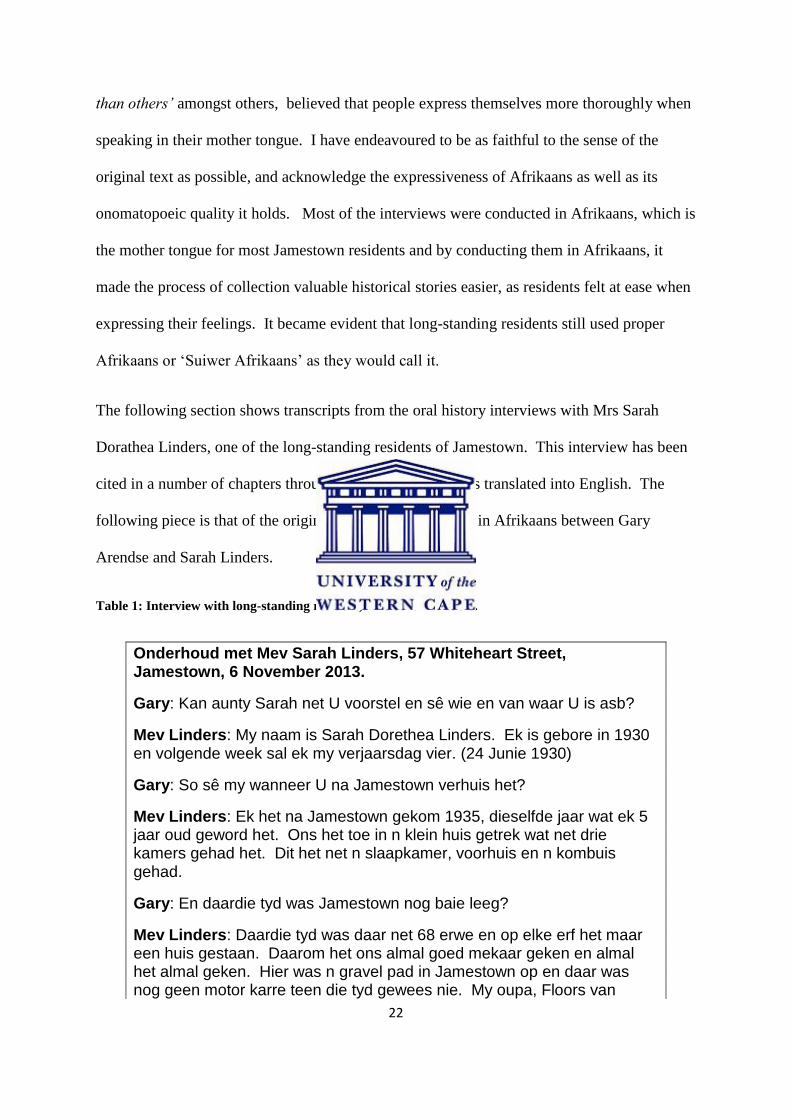
The following section shows transcripts from the oral history interviews with Mrs Sarah
Dorathea Linders, one of the long-standing residents of Jamestown. This interview has been
cited in a number of chapters throughout this thesis, but was translated into English. The
following piece is that of the original which was conducted in Afrikaans between Gary
Arendse and Sarah Linders.
Table 1: Interview with long-standing resident, Mrs Sarah Linders.
Onderhoud met Mev Sarah Linders, 57 Whiteheart Street, Jamestown, 6 November 2013.
Gary: Kan aunty Sarah net U voorstel en sê wie en van waar U is asb?
Mev Linders: My naam is Sarah Dorethea Linders. Ek is gebore in 1930 en volgende week sal ek my verjaarsdag vier. (24 Junie 1930)
Gary: So sê my wanneer U na Jamestown verhuis het?
Mev Linders: Ek het na Jamestown gekom 1935, dieselfde jaar wat ek 5 jaar oud geword het. Ons het toe in n klein huis getrek wat net drie kamers gehad het. Dit het net n slaapkamer, voorhuis en n kombuis gehad.
Gary: En daardie tyd was Jamestown nog baie leeg?
Mev Linders: Daardie tyd was daar net 68 erwe en op elke erf het maar een huis gestaan. Daarom het ons almal goed mekaar geken en almal het almal geken. Hier was n gravel pad in Jamestown op en daar was nog geen motor karre teen die tyd gewees nie. My oupa, Floors van

23
Niekerk het die eiendom gehad voor my pa dit gehad het en was die eerste persoon wat met n Ford bakkie in Jamestown se pad op gery het. Jamestown het net een water sloot gehad, maar dit was n sand sloot en nie die cement sloot wat ons vandag het nie. Uit die sand sloot het ons ons drink water gekry en moes ons wasgoed ook met die water was. Ons het buite toilette gehad wat ons gebruik het omdat niemand nog spoel toilette gehad het nie. Jamestown se mense se vernaamste oes wat hulle mee begin het was met aarbeie. Die aarbeie was toe destyd op die grond geplant sonder enige plastiek onder dit. Daar was grippies gekap waarin die plantjies neergeplaas was en dan toe getrap. Ons moes dan al die rye skoffel om ontslae te raak van al die gras wat tussen in opkom. Baie jare later het ons eers besproeing begin gebruik en voor dit moes ons maar met die hand nat maak. Daar was water beurte ingestel wat beteken het as jy een erf het, sal jy een uur per dag water kry om jou dam mee vol te maak en was ook net op sekere dae. Na 6 uur in die aand, as jy een van daardie ouens was met baie energie, dan kon jy gaan tuin nat maak.
Gary: Ek het gehoor daar was in vroeër jare n arbei fees in Jamestown, vertel my meer hiervan.
Mev Linders: Ja ons het n aarbei fees gehou. Die hele Jamestown kom saam en daar word verskillende stallejies opgesit wat verskillende vars produkte verkoop het. Almal sal dan van mekaar se goed koop van koek tot vrugte tot groente. Die een jaar het hulle Miss Jamestown gehou waar daar dan n helicopter gehuur word en vlieg hulle dan vir Miss Jamestown n sekere distansie voordat hulle haar terug bring. Al hierdie mooi dinge het plaasgevind wat die gemeenskap baie naby aanmekaar gehou het. Daar was ook n baie liedevolle gees tussen die mense. Almal was arm maar jy was gehelp met jou armoed. Ek kon onthou as n kind as my ouma n sekere dis gemaak het, dan moet ek oor die rivier stap om vir n vriend van my ma van dit te neem en dan terug bring wat sy gemaak het. En die een dag, ek was seker so 8 of 9 jaar oud, loop ek nog so met ingelegde vis oor die rivier en daar kom n groot hond agter my aan. Toe ek weer sien lê ek eenkant en die ingelegde vis doer anderkant. Nou dit is almal dinge wat gebeur het, maar dit was goeie dae en liefde volle dae. Die mense het ook nog nie daardie tyd trekkers gehad om jou grond mee te ploeg nie, so hulle moes alles met hulle hand doen. Jy het n perd gehad en n tou leier, nou ek was die tou leier en ek moes op en af stap en die land ploeg met die perd.
Gary: En wat vir my ook so interessant was, was die Rynse kerk. Vertel my van dit.
Mev Linders: Die gebou hier onder was die eerste skooltjie in Jamestown en die skool was gebou voor my tyd en was in 1924 gebou. Die datum was op die gebou maar n paar jaar daarna het deel van die voorste kant ingeval en moes oorgedoen word. Ek het in daardie gebou skool gegaan en my kinders het ook daar skool gegaan. Hulle het ook elke Sondag in die skool kerk gehou. My oupa, Floors van Niekerk het n deel van ons

24
grond afgegee vir die skool en kerk, omdat baie mense het nog daardie tyd by die Stellenbosse Rynse kerk behoort, maar daardie kerk het te klein geword, en daar is toe besluit om n kerk hier te bou. Die grond was toe gegee aan die Rynse kerk, maar op voorwaarde dat enige kind van Jamestown en omliggende plase aan die skool en kerk kon behoort. Hierdie gronde was nooit opverdeel nie en hulle het ons gesê dat die grond vir landbou gebruik was. Dit was seker so 25 jaar gelede wat deel van die landbou grond toe in residensiele grond gehersoneer was. Die mense van die tydskrif Farmers week was ook in 1981 hier in Jamestown en wou toe foto’s neem van ons in die landerye waar ons toe nog met aarbeie geboer het.
Gary: Jamestown se strate is mos na Arbeie vernoem. Hoe en wanneer het dit gebeur?
Mev Linders: Die strate het hulle name gekry toe hulle dit mos nou geteer her het want dit was net grond paaie voor dit. Die Jamestown se mense het elke maand so n vergadering gehou waar hulle dan nou besluit het wat vir Jamestown kan gedoen word en hoe die plek beter gemaak kan word. Hulle het toe hier besluit dat al die name van die strate na verskillende Arbeie vernoem gaan word. Ek dink Mr Pat van der Rheede was een van die mense wat ook deel was van dit.
Gary: Oor die laaste 10 jaar het die plek mos baie ontwikkel. Stellenbosch Square en al die nuwe plekke was gebou. Wat dink U hou dit in vir Jamestown?
Mev Linders: Baie mense is nie baie gelukkig dat die grond aan blankes verkoop was nie of dat hulle ingekom het nie, maar baie van die mense het ook hulle grond verkoop sodat hulle hul kinders na goeie skole toe kon stuur. Dit het vir hulle die lewe makliker gemaak omdat die geld vir hulle gehelp het. In my geval is ek nie ongelukkig nie want die mense wat ek grond aan verkoop het gee om vir ons. Hulle kom sê hallo en behandel ons soos all ander mense. En toe dit nog die apartheidsjare was, wat gebeur het was dat almal wat in die dorp gebly het (Stellenbosch), moes toe pad gee en dis hoe Idasvallei en Cloetesville onstaan het. Jamestown het gebly soos dit is, maar daar was n vermoede dat ons ook sal moes trek. Baie mense sê nee hulle hou nie van die boere nie, maar ons moet daai goed uit ons gedagte uit kry. Dit was hulle wat toegelaat het dat ons vir Jamestown kon bly hou omdat hulle vir die mense van die dorp om hulp gevra het om op hulle plase te kom werk. Hulle het gestaan dat Jamestown behoue moes bly vir die kleurlinge.
Gary: Dink U dat Jamestown die klien dorpie gevoel verloor het of staan dit nog?
Mev Linders: Ek sal sê hy het iets verloor, maar hy het iets by gekry ook. Daar was baie mense wat nie gelukkig was met die mall hieronder nie omdat hulle gevoel het dit was nie vir ons mense nie. Vroeër jare het ons net een winkel gehad en almal het by die winkel gekoop.

25
Locating these stories within academic discourse where the coupling of concepts of ‘sprawl’
together with ‘suburbanisation’ was a major contributor to my approach to analysing my
material gathered and enabled a critical reflection on the contemporary situation in which
Jamestown finds itself. Alan Mabin (2005) discusses how suburban expansions have affected
major cities within South Africa such as the Century City development along the N1 highway
20km outside Cape Town. This development has affected and redirected activity from areas
which usually was seen as the vibrant area within a city, to such new areas outside the cities
such as Cape Town. The presence of the new suburban gated developments and the new
malls and retail businesses are significant drivers in the case of Jamestown, which situated as
it is along the R44 on the main route between the towns of Somerset-West and Stellenbosch
which has become a new node on what Cash calls the ‘rural/urban fringe’, and remains the
place I call home despite this radical transformation in the landscape (Cash, 2013).
26
Chapter Two: Constructing a spatial history of Stellenbosch and Jamestown:
Past and Present.
Introduction
This chapter provides a discussion of the historical background for the research. It constructs
an account of the process of establishment and development of the town drawn from various
sources such as oral history, popular publications, photographs and other archival material.
In order to understand where the town of Jamestown comes from, research had to be done on
the history of Stellenbosch itself. This chapter will give insight on the development of not
only Jamestown, but also greater Stellenbosch and the processes which moulded the area into
what it is today. With this I hope to manifest an understanding of the various processes and
explore why long standing residents are anxious about the sudden change within the area.
Stellenbosch is claimed to be the oldest town in South Africa, and as such it has a history
which is directly linked to that of Jamestown. This light will also be shed on the history of
Stellenbosch together with how and by whom it was established. The place and position of
missionaries to Stellenbosch will also be focused on as they were one of the reasons the town
was established. As Harvey (1989) mentioned before, the geographical history of an area can
be a harsh environment with regard to racism and in Jamestown’s case, the process of the
implementation of the Group Areas Act tells such a history. Harvey does however think that
it is also important by saying: ‘Although there is more of which to be ashamed that proud in
the geographic tradition, there is a tread to geographic thinking which, at its best, produces an
acute sensitivity to place and community, to the symbiotic relations between individuals,
communities and environments’ (Harvey, 1989:34). As I am a resident of Jamestown, it is
important to reflect on my own experiences within it and how research could be affected
when you are either an outsider or insider. The town of Jamestown was heavily influenced
by the Rhenish missionary activity. This can be seen in the spatial layout it holds as well as

27
the many religious activities which take place within the town. As Jamestown is the centre of
this research, an in-depth historic discussion takes place within this chapter. The ‘close-knit’
community of Jamestown also became an important point during the time that the Group
Areas Act report was written, one of the major turning points in the town’s history.
Figure 2.1 Map of the greater Stellenbosch area, indicating Jamestown in the south.
The figure above gives an indication of the greater Stellenbosch area and where Jamestown is
situated in relation to the Stellenbosch CBD. Jamestown lies on the southern edge of
Stellenbosch and was always mainly surrounded by farmlands. Some of these lands have
however been developed in recent years.

28
Considering insider/outsider experience.
Jamestown is my home and this research is intended to provide an insider view of the
particularities of the history of the place. The research draws on archival and fieldwork
material collated during the oral history interviews with residents. I have known many of
these people all my life. I speak Afrikaans and many of the interviews conducted were in this
language. In many ways I have viewed this researcher position as one of advantage as it
enabled me to gain access to information and personal memories which many others would
not have had access to, yet at the same time I became critically aware that my insider position
also presented some limits to my work. I quickly became aware that community research
requires considered approaches, and given my own positionality as a resident of Jamestown,
this also presented some difficulties. There is much in literature in fields such as
anthropology which considers this difficult terrain. An awareness of the various factors
which played a role in this research appeared to determine the outcome of responses which
were collected from residents. Katie Kerstetter who is currently completing her Ph.D in
Sociology and Anthropology at the George Mason University and holds a Masters in Public
Policy from the University of Maryland, argues that the insider/outsider debate has for a long
time determined the success of research in various communities. (Kerstetter, 2012)
Ernest Stringer (2007) who is a visiting professor at the University of Mexico, teaching
research methods courses and is engaged in projects with African American and Latino
community neighbourhood groups, places emphasis on the importance on democratising
research practice. She argues that boundaries between the researcher and subject should be
eliminated for best results, and that when these boundaries are broken down, trust usually
forms in order to create and sustain the partnerships created. It is also important to reflect on
your own identity and status which you will bring to the project as the researcher. This will

29
bring forward ways in which the new partnerships might be affected by your personal
identity, but also the research process (Wallerstein and Duran, 2008). As I am a resident of
the area in which my research is focused, and as a young researcher who is part of the
community, it was important to approach people without using intimidating research
methods. Even though I am an insider, it was still a difficult task for people to open up to
me, and I was met with some resistance and curiosity as to why I was doing this research.
Kerstetter (2012) argues that there is not only the insider or outsider, but also the space in
between. Insiders, according to Kerstetter, will have more engaging relationship towards the
interviewees as they actually know what these people have to go through. They understand
the experiences the group of people are going through. I have lived in Jamestown all my life
(25 years) and have noticed some of the changes the town underwent and how these affected
people in intensely personal ways. As an insider one develops emotional attachments to the
participants, which become part of the specific narratives that are the outcome of your work,
as Laura Serrant-Green (2002), highlights. My own emotional investment in Jamestown is
deep and I have, along with many others, seen and experienced how the rapid change that has
occurred has changed much of our way of life in the town. This passion which I feel towards
the town and its residents has motivated me to do this research into these issues, in order to
help unpack what is happening in and around the place we call home in the Jamestown area.
As discussed above, there is the section in between being a complete insider and/or outsider,
known as the “multidimensional space” (Kerstetter, 2012:101). Kerstetter puts emphasis on
the fact that very few researchers are fully insiders or outsiders. This space in between is
where researchers’ identities, cultural backgrounds and their relationships to research
influence how they are positioned within that space. Professor Sarah Banks (1998) also
created four categories of personality that researchers can be divided into. He proposed these

30
as: the indigenous-insider, indigenous-outsider, external-insider and external-outsider. These
categories are all based on the individuals’ status considering variously age, class, gender and
education. During the process of looking at my own identity, it was noticeable that I am not a
complete insider and self-classified myself as what Banks would call an “indigenous-
outsider”. Even though I am from the community and know many of the residents well, the
main factor diverting me towards being an outsider was my interest as a result of my
discipline and education, together with the age difference between me and the older residents.
During the process of asking people if they would be interested in participating in my
research, I noticed that some felt uncomfortable with the idea of being interviewed as part of
a formal research project. This was intimidating for some, while others were suspicious of
my interest, given my tertiary education. I became aware of this potential barrier to my
research as many people never completed school or only attained a matric. As my main
focus was to speak to older, long standing residents, I encountered some hesitance to co-
operate and some did not feel comfortable to open-up to someone as young as myself. I
became aware that these and many other factors play a role in what information you get from
interviewees. According to Kerstetter (2012), if you are affected, participants will be more
open towards the researcher.
Jamestown, like many other historic small mission towns such as Genadendal in the Overberg
and Wupperthal in the Cederberg was established by Rhenish missionaries. These mission
towns were laid out in more or less the same layout, with housing located around ‘mission
cores’ which centred on the church. In many cases the layout of these towns was a response
to the topography and a characteristic of Jamestown and others is the long linear agricultural
plots located near a river for irrigation. This settlement pattern in Jamestown becomes
evident when spatial layout patterns are compared with those illustrated in Mission

31
settlements in South Africa, a study by Japha et al (1993), which details the spatial and
heritage value of many mission settlements from across South Africa. Mission towns like
Jamestown became part of a pattern of missionary activity, involving a complex interplay
between the missionaries’ intentions of spreading not only Christianity, but also helping
people as many of these towns also had schools or hospitals. Tracing the historical
background to contemporary Jamestown, as outlined in the section that follows in this chapter
has provided me with insight into what the place was like and assisted in being able to engage
with the life stories of the long standing residents, as well as providing a picture of how
Jamestown has changed over the years (Smuts, 1979).
A mission town.
The story of colonial settlement at the Cape is conventionally narrated as having begun with
the arrival of the Dutch in the mid-1600s. Wildebos, or better known as Stellenbosch today,
is a town which was founded by the governor of the Cape Colony, Simon van der Stel in
1679. Stellenbosch today is situated in what is called the heart of the Wine Lands and is
surrounded by the Simonsberg in the north, Stellenbosch Mountains in the east and the
Eersteriver flowing through the town (Giliomee and Mbenga, 2007:10). The name of the
town was given by Simon van der Stel and farmlands were given to people on either sides of
the Eersteriver. From the start, the town’s population was made up out of the local farmers,
slaves and “free blacks”4 (Giliomee, 2007). Slavery quickly became popular within the town
and by 1782, more than three quarters of the farmers had their own slaves. The farmers were
highly dependent on slaves as most of them did the work on the farms. They however didn’t
only work on the land, but the slave women also helped in the houses and looked after the
4 “Free Blacks” were slaves which have been set free by the farmers in order to start their living.

32
children. When the town was established in 1685, many of the surrounding farms such as
Blaauwklippen already existed and are still in operation today. This was the farm from which
Jamestown was established in the early 1900s. By the 1700s, Stellenbosch was a small, yet
established town with most farming focusing on vineyards and maze. After the discovery of
this valley with its rich soil and good climate, Stellenbosch became a centre from which
missionary societies developed outstations and was one of the stops for missionaries
travelling from Cape Town inland.5
In a recent paper published by Corrine Cash in the journal Urban Forum, a brief account of
the town’s history is provided, which starts at a much later stage towards the beginning of the
20th
century when land on which the town is currently situated was still owned by the farm of
Blaauklippen, which then sold part of it to Rev. Jacob Weber and James Rattray in 1902.
Rattray however withdrew entirely from the project three years later. The land was sub-
divided and rented out to some of the local ‘coloured’ people in the area who had an interest
in farming. As Cash describes the settlement is situated 9 km south of Stellenbosch and is
located within a valley with the Blaauwklippen River forming the northern boundary
(Weskaapse Streekdienste raad – Stellenbosch, Jamestown Struktuurplan, 1989:4).
Many popular histories of Stellenbosch such as those by the retired school teacher Philip
Crouse who moved to Stellenbosch, where he became fascinated by the history of the town,
state that Christianity became so popular that by 1938 the church was already becoming too
small for the significant growth of the church community and 10 000 Rijksdaalders were
donated by the Stellenbosch missionaries.6
5 For further reading: Giliomee, H. and Mbenga, B 2007. New history of South Africa.
6 Rijkdaalders were the Dutch currency used at the time.

33
Reading these histories, it becomes evident how one individuals’ movement influenced the
beginning of Jamestown as he arrived in Stellenbosch. During the year of 1882, Rev. Jacob
Weber also came to Stellenbosch and would serve there for a full 50 years up until his 76th
birthday in 1932. This would also be where the future plans of Jamestown began. Jacob
Weber was born in the small town of Lennep, Germany in 1856 and during his school years,
was known as “the religious Jacob”. His initial plan was to move to America in order to start
a business, but instead he joined the Y.M.C.A in order to take his religious work a step
further.7 This made him decide to become a missionary and received his education in the
town of Barmen, which is also in Germany, after which he was then sent to Stellenbosch in
1882 (Crouse, Fourie, 1998). According to sources, Weber’s wife, Augustine only joined
him in Stellenbosch two years later and was known for helping anyone out who was in need.
During the First World War, the family decided to stay in Stellenbosch, but were told by the
German government that they would not be allowed back until the war was over. Rev. Jacob
Weber and Augustine had eight children who, during later years, helped the family out in
difficult times. Their son, Werner farmed with live stock in order to support the family with
meat, milk, butter and vegetables. Two of the children however died at a young age, but the
others all lived full lives and lived to see old age. All the children except for the youngest
son, Hellmuth, made Stellenbosch their permanent home as they showed interest in the
Rhenish missionary as well as the Rhenish Girls High School.
One of the biggest obstacles Rev. Weber had to overcome was the language barrier. The
population of Stellenbosch spoke mostly Dutch, and Afrikaans was something not many were
interested in. This led to Weber only having 6 weeks to prepare for his first service which
would be in pure Dutch. Weber also focused much of his work on the youth of Stellenbosch
and therefore made sure he would receive a building in which he could start the Y.M.C.A 7 YMCA – Youth Men’s Christian Association based in Germany. www.cvjm.de
34
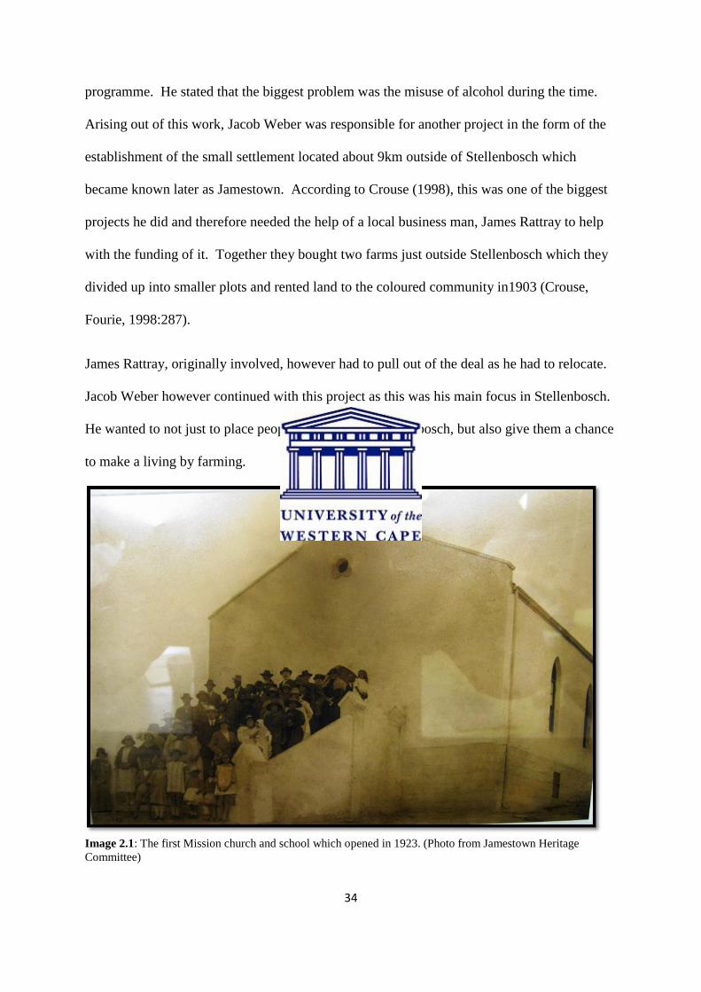
programme. He stated that the biggest problem was the misuse of alcohol during the time.
Arising out of this work, Jacob Weber was responsible for another project in the form of the
establishment of the small settlement located about 9km outside of Stellenbosch which
became known later as Jamestown. According to Crouse (1998), this was one of the biggest
projects he did and therefore needed the help of a local business man, James Rattray to help
with the funding of it. Together they bought two farms just outside Stellenbosch which they
divided up into smaller plots and rented land to the coloured community in1903 (Crouse,
Fourie, 1998:287).
James Rattray, originally involved, however had to pull out of the deal as he had to relocate.
Jacob Weber however continued with this project as this was his main focus in Stellenbosch.
He wanted to not just to place people in this part of Stellenbosch, but also give them a chance
to make a living by farming.
Image 2.1: The first Mission church and school which opened in 1923. (Photo from Jamestown Heritage
Committee)

35
The first church opened its doors in 1924 and during the same year, the church was also
opened as a school for the community. The photograph above was taken at the opening of
the new church/school in Jamestown in 1924. This was built after the congregation in
Stellenbosch became too big (Crouse, Fourie, 1998:285). Today, the original building is still
being used for church events, and has been renovated in recent years.
The town was first named Jamestown after Jacob Weber, as ‘Jacob’ was the Dutch form for
James and the name was Anglicised into Jamestown, but a few years later were renamed to
Webervallei on the request of the state (Crouse, Fourie, 1998:288). The name was however
in later years changed back to Jamestown (Jamestown Growth Management Strategy
document, 1996) as residents of the settlement were very unhappy and it was decided to
change the name back to Jamestown and name the road leading into the area being named
Webersvallei Road (Crouse, Fourie, 1998:288).
Connections to the central congregation in Stellenbosch remain as many Jamestwon
residents, to this day, still go to Stellenbosch on Sundays. This long history of connection is
explained by Gilliomee who writes that in the early years of Stellenbosch, in the town,
religion was something which was almost non-existent as many of the farmers and the slaves
were uneducated. Giliomee states that G.W.van Imhoff, who was an official from the
Netherlands, visited the area, but was shocked at how people were unaware of religion and
many didn’t even own a bible (Giliomee, 2007:86). Those farmers who were however
regular church goers, would allow the slaves to join them for services. Some years later, after
Christianity had established itself within the town, the first Rhenish missionaries were
welcomed into Stellenbosch. Giliomee mentions that the first Rhenish church was built next
36
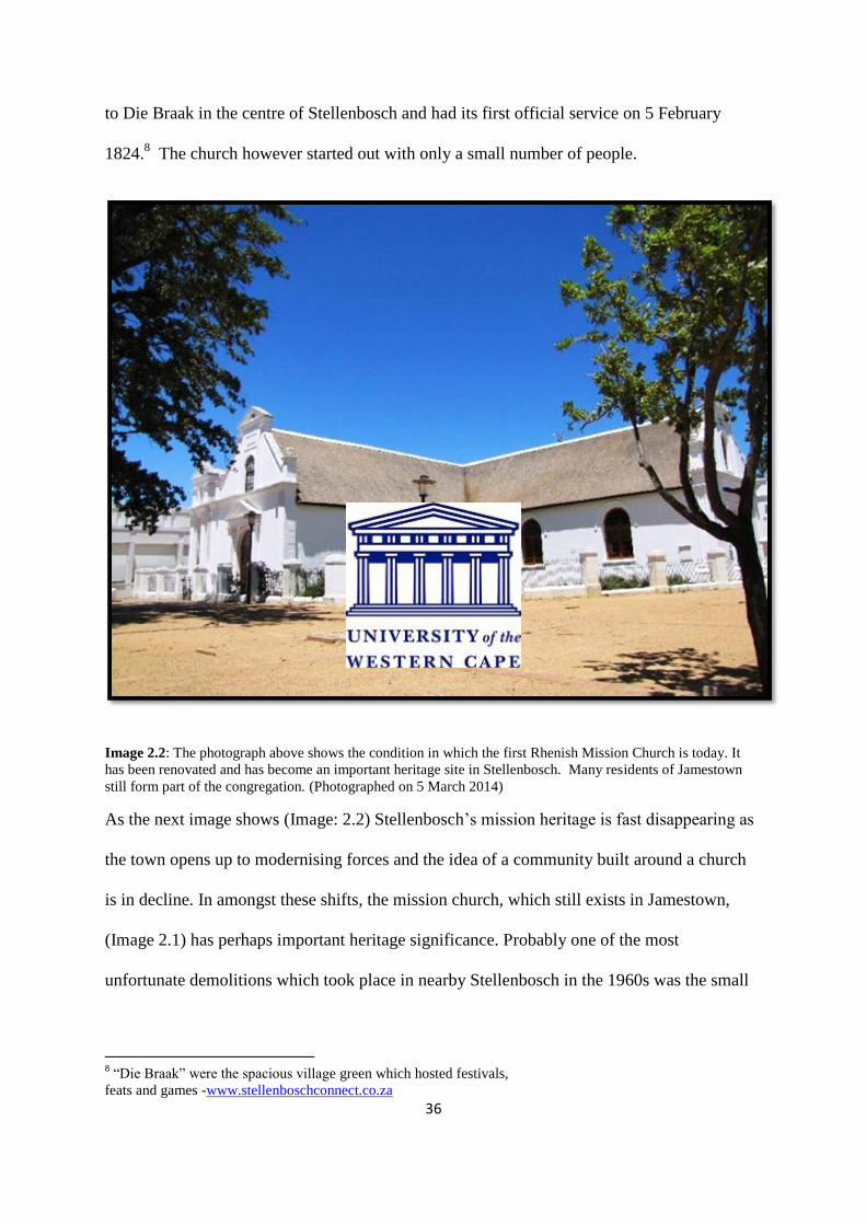
to Die Braak in the centre of Stellenbosch and had its first official service on 5 February
1824.8 The church however started out with only a small number of people.
Image 2.2: The photograph above shows the condition in which the first Rhenish Mission Church is today. It
has been renovated and has become an important heritage site in Stellenbosch. Many residents of Jamestown
still form part of the congregation. (Photographed on 5 March 2014)
As the next image shows (Image: 2.2) Stellenbosch’s mission heritage is fast disappearing as
the town opens up to modernising forces and the idea of a community built around a church
is in decline. In amongst these shifts, the mission church, which still exists in Jamestown,
(Image 2.1) has perhaps important heritage significance. Probably one of the most
unfortunate demolitions which took place in nearby Stellenbosch in the 1960s was the small
8 “Die Braak” were the spacious village green which hosted festivals,
feats and games -www.stellenboschconnect.co.za

37
Rhenish church (image 2.3), which was torn down in order to make way for this office block
(image 2.3).
Image 2.3: Stellenbosch historic building changes 1901 - 2014
A ‘close-knit community’
The popular history presented by the heritage society and the image presented in Smuts’
‘Stellenbosch drie eeue: amptelike gedenkboek’ (1976), present a romantic view of
Jamestown as a close-knit community. As Smuts relates, Weber showed great interest in the
“Basuinekoor” which was made up of various Jamestown residents who would perform at
festivals and church services. According to Smuts (1979) he also built a small structure
which the community used for a church and in later years as a school. The structure has been
38
renovated in recent years and is still in use. The early history of Jamestown already indicated
at how family orientated the town was, focusing on local festivals and church activities.
The history of the Jamestown families can be read in part through the history of land
ownership. As described in the Document of Agreement between J. Weber and J. Rattray
with A. Brandt, the land in Jamestown was officially handed over to members of the
settlement on 27 March 1916, as shown by the front piece on page 2. Families with names
such as the van der Rheede, Brandt, Jooste and Newman are some of those who received the
first land in Jamestown of which most used it for agricultural purposes (Agreement of Water-
Rights, 1916). Sarah Dorethea Linders, who moved to Jamestown in 1935, remembers how
she had to help with the planting and picking of strawberries during the harvest season. She
describes how this was hard labour and that there was no ‘fancy machinery’ like today to
make the work load easier. Lands had to be ploughed by hand and this would take days to
complete (Mrs Sarah Linders Oral history, 6 November 2013). By 1966, in total the land was
registered to 54 owners of which 4 of them were white (Group Areas Act Report, 1966:7).
Most of this land was suitable for farming and owners saw this as an opportunity to farm with
strawberries, flowers and vegetables. The strawberry industry did exceptionally well in the
area and annual total crops ranged between 200 and 300 tons and this led to two temporary
packing factories being built (Group Areas Act Report, 1966:2). As described in the Group
Areas Act report, many of the owners also made up to R2000 profit and could therefore
budget with ease for the following year’s harvest. Even though the settlement didn’t have
modern water infrastructure, irrigation took place without any difficulty as water was directed
from the Blaauwklippen River into a narrow furrow - like ditch flowing through the
settlement. This was used for both irrigation and cooking purposes. All of the farmers could

39
however not use the ditch at the same time, and therefore a water-use timetable was set up to
help with the process known as ‘leiwater’ (Group Areas Act Report, 1966:3).
Many of those living in Jamestown lived modest lives, where some were poor as Sarah
Linders described ‘The people within Jamestown were also poor, but everyone helped each
other which made it so much easier’. Others were frugal; they invested energy in annual
festivals which took place. One such festival was the Strawberry Festival where elderly
residents such as Sarah Linders and the members of the Heritage Committee described how
members of the community would have their own stall set up and sold various homemade
goods such as jams, biscuits, vegetables and more. This was also a way in which everyone
supported and built up a sense of community with one other, and as it was opportunity for
income for families. Sarah Linders, described the following:
“Ja ons het ʼn aarbei fees gehou. Die hele Jamestown kom saam en daar word
verskillende stallejies opgesit wat verskillende vars produkte verkoop het. Almal
sal dan van mekaar se goed koop van koek tot vrugte tot groente. Die een jaar het
hulle Miss Jamestown gehou waar daar dan ʼn helikopter gehuur word en vlieg
hulle dan vir Miss Jamestown ʼn sekere distansie voordat hulle haar terug bring. Al
hierdie mooi dinge het plaasgevind wat die gemeenskap baie naby aanmekaar
gehou het. Daar was ook ʼn baie liefdevolle gees tussen die mense. Almal was arm
maar jy was gehelp met jou armoed. Ek kon onthou as ʼn kind as my ouma ʼn sekere
dis gemaak het, dan moet ek oor die rivier stap om vir ʼn vriend van my ma van dit
te neem en dan terug bring wat sy gemaak het. En die een dag, ek was seker so 8
of 9 jaar oud, loop ek nog so met ingelegde vis oor die rivier en daar kom ʼn groot
hond agter my aan. Toe ek weer sien lê ek eenkant en die ingelgde vis doer

40
anderkant. Nou dit is almal dinge wat gebeur het, maar dit was goeie dae en liefde
volle dae.”
[English translation]“There was a year when a Miss Jamestown competition was also
part of the whole festival, and Miss Jamestown was flown in from Stellenbosch to the
area by helicopter, which obviously was a big deal back then. The people within
Jamestown were also poor, but everyone helped each other which made it so much
easier. I remember that when my mother made pickled fish, she’d send me to her
friend or the neighbour with a parcel, ands in return we’ll get something else to eat.
There were also one funny incident where my mother sent me across the river with a
parcel of pickled fish, a big black dog however ran up from nowhere and jumped on
me. Losing my balance and therefore having fish all over the place. This was what
made those days so much fun, not having many worries and the fun village feel of the
area.”(Interview: Sarah Linders, 6 November 2013)
In the 1990s, other festivals such as that of the flower and the garden festival also took place
within the area which brought a sense of pride to the town as the gardens of residents would
be judged in order to see who had the best garden for the year.9 These rituals of community
making very much revolved around the church which was the central organising institution in
the town and the way of life, which was the romantic memory of the ‘fun village feel of the
area’ of Sarah Linders appears to have continued up until the later 1980s when the new
structure plan was proposed for Jamestown. Even though the new structure plan was set for
the town, organisers of the festivals tried continuing the ritual, but as new people moved into
the area, these festivals stopped. The town was also still very under developed with no storm
water system in place, no street names or lights and no tarred roads. Reasons for this
9 The flower competition was revived in 2008 in order to create the ‘village feel’ again, but only took place this
year.
41
underdeveloped was not only being because the area was classified as a Coloured Group Area
and therefore received less attention, but also because Jamestown was not part of the
Stellenbosch Municipality during the time. Jamestown only became part of the Stellenbosch
Municipality in 1994 (Jamestown Heritage Committee). This rural character is evident in a
short 5min film which was taken by an unknown person in life in Jamestown is shown.
Unfortunately it is all speculation as to why the short film was made, but Chrisben February,
who is one of the Jamestown Heritage Committee members thinks that it was a way in which
to ‘treasure and remember’ how the town started out (Discussion with Chrisben February, 2
August 2013). The amateur film is like a biography of the town on film, showing scenes
varying from the agricultural activities, to the building of the church and also the everyday
life of residents in Jamestown. A minute of the film is dedicated to the farming, which at
that time was the main source of income for most families. It moves on to showing the
homes of these residents, portraying the lives of poor, yet happy people as an old lady leans
over her kitchen door. In the final shots of the film it shows how the Methodist church, one
of the newer churches, is being built (Jamestown Film, 1955). My own speculation is that the
film was produced in all likelihood by the Methodist Church as a way of showing
‘community development’ as the new church facility was being built for a poor rural farming
community. Its depiction of people at the beginning of apartheid South Africa shows racial
collaboration with white benefactors assisting coloured farmers in the betterment of their
lives. Instead of showing poverty as a negative, the film appears to romanticise a rural idyll in
which people live simple, yet happy family (and by extension Christian) lives. This fits with
a genre of amateur films made in other places such as District Six at the time and was
probably part of the Methodist Church’s way of reporting on activities in their various
congregations, in which ministering to the poor was showcased.

42
Image 2.4 Image 2.5
Both figure 2.4 and 2.5 are still images from the film “Jamestown” which was taken in 1955.
The images above show simple farming activities of residents of Jamestown in 1955,
depicting the rural idyll - whether it was with the planting of crops or the domestic activity of
doing washing. As previously mentioned, agriculture was one of the main forms of income
for these people as indicated in Image 2.4 on the left above. Water from the Blaauwklippen
43
River was diverted and distributed for the irrigation of farming allotments and collected at
various points for domestic use, as indicated in image 2.5 on the right above. A simple
comparison of these images to photographs taken in other mission settlements such as
Genadendal in the Overberg and Wuppertal in the Cederberg, shows many similarities, in
these areas farming was the main source of income and where land was given to residents of
the congregation with the main focus on making a living through subsistence farming.
Mission settlements, as shown in the 1955 film, show a notion of cohesive community built
around church and religion (Japha et al, 1993).
Surveying the changes to these harmonious scenes depicted in the film and portrayed in a
more widespread manner by mission societies and Church organisations, shows that in many
cases, those mission settlements that have survived, and in some cases become towns or as in
the case of Jamestown been incorporated into the local municipalities, are sites of a very
different way of life in post-apartheid South Africa. Changes within these towns over the
years until the present, shows how those close to urban areas have developed significantly,
while others particularly those in inaccessible rural settings have become stagnant, often
populated only by old people and the farming enterprises have all but collapsed. The reasons
for the significant difference in rates of developments in these mission settlements is
discussed in the latter part of this thesis. Other mission settlements established in areas which
were far from neighbouring towns, like Wuppertal near Clanwilliam and Genadendal in the
Overberg near Caledon, now in the Overberg District exist as sites of rural poverty supported
by the church and sustained to a lesser extent by tourism and craft. What is significant to
note is that development or disintegration began to take shape in many mission settlements
after the 1950s with the process of implementing the Group Areas Act. Considering
Jamestown, which situated so close to Stellenbosch, it has been subsumed into what is now

44
known as a hub of the ‘Wine Lands’ district. As Cash has argued, this location on the rural
urban fringe has been the major factor which led to the rapid transformation and development
of the Jamestown area (Cash, 2013).
The idea of community was encouraged in places like Jamestown where, as may older
residents described in interviews, was forged by life centred on the church-going residents’
strong Christian religious beliefs. Settlements such as Jamestown were developed and built
on land which was given by mission societies and church organisations such as at Jamestown
where Rhenish missionaries donated the land in the hope of expanding their congregation.
Mrs Sarah Linders tells us how in the case of death, illness or difficulty, the town would
come join to mourn or pray together (Interview: Sarah Linders, 6 November 2013).
Besides the religious and agricultural activity, the town had other small scale commercial
enterprises. The first shop in the area was owned by J.G. Williams and made it easier for
people of the town to get their monthly groceries as it was a General Dealer. The shop opened
its doors on 4 July 1946 and was an instant success (Eikestad News, 2012). Brothers Percy,
Alfie and Jeffrey Williams describe in an Eikestad News interview, how they began working
there at a young age. They did not however earn a salary from this, but the income helped
carrying the family through, even paying their children’s school fees (Eikestad News,
Handelaar sluit na jare, 18 June 2012). Percy states in the interview that in the 60 years of
business, there had never been a burglary which showed that the community was ‘truthful
and strong with great morals’. The shop had its doors open for 66 years, but on the 18th
of
June 2012, the Williams family gathered in front of Jamestown’s famous corner shop, and
locked its doors for the last time. The closure of the general dealer’s corner shop marked the
end of an era for many of us in Jamestown. As the Williams family closed their doors and

45
placed the property on the market, the estate agent’s description on the Property 24 listing
somehow captured the way things have changed, and the slippage into private property with
‘historical’ and ‘landmark’ value (www.property24.co.za, last accessed 6 October 2014).
“Historical commercial property in picturesque Jamestown.” ‘This well-situated
building has been a landmark in Jamestown for 50 years as a popular general dealer. Very
visible on the Jamestown main road, this commercial property has a multitude of possibilities
– a general dealer, a fast food shop, a pizza parlour, an internet café’ (www.property24.co.za,
last accessed 6 October 2014).10
Image 2.6: The image above showing the General Dealer in the main road of Jamestown, which has been for
sale for three years.
The suggested new uses were confidently presented with the description of the place in a
modern landscape and in a rising property market: ‘Jamestown is developing as the best
investment suburb in Stellenbosch with its beautiful views and its location close to upmarket
developments and a modern shopping mall’ (www.property24.co.za, last accessed 6 October
2014).
10
http://www.property24.com/for-sale/jamestown/stellenbosch/western-cape/8533/101927960

46
This is the nature of the changes that are evident as old structures are reimagined as heritage
and new forms of commercial usage. As new owners move into the streets named after
strawberry cultivars and were given by one of the oldest residents of the town, Mr Pat van der
Rheede, who also served as head of the Jamestown Committee who I did not manage to
interview in-depth for this research as he unfortunately passed away days before our
scheduled interview appointment on 3 June 2013. This was a big loss not only for me, but
also my research as Mr van der Rheede was one of the residents of the town who was
involved with almost all activities which took place here. He was involved in the cricket and
soccer teams of Jamestown while running another successful general dealer and being
involved in farming in Jamestown. Mr van der Rheede was clearly proud to be part of the
Jamestown community as his long standing dedication to and his involvement in it attested.
During the 1960s when the Group Areas Act was being implemented, he was in his 30s and
was already a well-known farmer within the community. I imagine he would have been
happy about the fact that the area was not declared a White Group Area as this meant they did
not have to abandon their farming activities.
Jamestown evades removal under the Group Areas Act
The early 1960s saw the Group Areas Act of 1950 being implemented in South Africa, which
meant that people classified different in race and ‘colour’ were not able to live in the same
area, nor use the same facilities. Jamestown, with its perfect location, scenery and fertile
agricultural soils was however spared from the forced removals, through a curious twist of
events. In the process of my research I found a copy of the Group Areas Report for
Jamestown, dated 1966 and written by M. C. v. T. Barker. This document was received from
the Heritage Committee and played a major role in the development and outcome of this
study. It clarifies the importance of change which was brought on by the failed

47
implementation of the Group Areas Act on the town of Jamestown. The subject of the report
under consideration for removal was the area around Jamestown, which was being considered
for reclassification. It was proposed that this should be changed from an area in which there
were many ‘coloured’ residents to become formally classified as a White Group Area.
Jamestown was slated to be a site of removals, but in a bizarre twist the place managed to
stay clear from the removals that took place systematically across Cape Town and its
neighbouring towns, as it was white farmers whose land surrounded the town who fought for
the people of the small settlement (many of whom relied on local seasonal labour from
Jamestown to these farms), stating that without them, their farms would not be able to
function (Group Areas Act Report, 1966:9-10).
During the 1960s, Jamestown had a total of 144 houses which were described to be in a poor
condition. The Group Areas Act report reads: “These houses were not in any condition for
white people” (Group Areas Act, 1966:8). This was during the time the Group Areas Board
evaluated the area with the intention of changing it from a predominantly coloured area to a
white area. On the southern boundary of Jamestown land was given to the Rhenish
congregation in 1960 by the town council and a modern building was erected in 1962 to be
used for a school. The school had 10 classrooms, had 13 staff members and a learner count of
450 of which most were residents from the area (Group Areas Act Report, 1966). The school
was fairly small before the new school was erected, but became rather important to the
community after the Group Areas Act movement failed to take place in Jamestown.
Difficult times were ahead for the residents of Jamestown during the 1960s as the Group
Areas Act was being enforced and removals were widespread in many parts of the country.
Although not formally implemented, I believe that the process to change Jamestown from a
largely coloured to a white area also started taking place during this time. On the 5th
of May

48
1966, an article was published in “Die Burger” and “The Cape Argus” advertising that the
provincial government together with the Stellenbosch Municipality were in talks to change
the land to a White Group Area (Group Areas Act Report, 1966:2). Reading this report
raised many questions for me and in the subsequent conversations and interviews I had with
longstanding residents, it became evident that this caught the community completely off
guard. Mrs Sarah Linders who was only 36 years old at the time responded to a question
regarding the Group Areas Act in an emotional manner saying:
“Ek onthou dat hulle ons land wou neem asof dit gister was, maar die
boere van die omliggende plase het by ons gestaan. Hulle het geweet hulle
kon altyd op ons staat maak, so hulle het saam ons gestaan” (Mrs Sarah
Linders oral history, 6 November 2013).
[English translation] “I remember clearly how they wanted to take our land
as if it was yesterday, but the farmers of the surrounding farms stood by us.
They knew thwy could always depend on us, so they stood by us.” (Mrs
Sarah Linders oral history, 6 November 2013).
After the newspapers published these articles, a meeting was organised on 19 July 1966 by
the acting regional representatives of the Group Areas Act Board, F.J. Visser, T. Barker and
S.W. van Wyk in order to get the responses from the greater white Stellenbosch community.
Much to their surprise, the Stellenbosch residents were completely against it. The
spokesperson for the Divisional Council of Stellenbosch, Mr M. C. v. T. Barker, had the
following to say:
We feel strongly that the area should not be proclaimed as a white community, but
should be pronounced as a coloured area. We had meetings with the Stellenbosch
49
and Hottentots Holland Farmers Association and felt that it is unnecessary to move
these people from a place which they called home for so many years. It will also be a
loss to the farmer community of the town as the seasonal labour come from this area
and specialised services w.r.t pruning of trees and vineyards11
.
The response by the Stellenbosch Farmers Association was one of the arguments which
tipped the odds in the favour of the coloured residents of Jamestown as the Divisional
Council saw that these farmers were not interested in having the land, but the people. The
Dutch Reformed Church of Stellenbosch was the other party who were completely against
the relocation of people from Jamestown. They also had a strong argument based on a moral
and financial logic. Their argument reads as follows:
The land was bought with Rev. Weber and Mr Rattray’s own capital with the main
aim being to support needy, but hardworking coloured people in order for them to
make a living with the farming of strawberries. All of these people earned their own
piece of land by working together and getting the approval of surrounding farmers,
which made them feel more like a close-knitted family. These coloured people began
to prosper because of this land that was given to them and at the same time developed
a strong religious sense. Should these people be moved to a place where they cannot
practice the same agricultural activities, it might lead to them losing their initiative,
becoming frustrated and or feel alienated. Approximately 4 years ago the community
of Jamestown also built a new school building with a cost of R21 000. This money
was received through a loan from Sanlam and with the Dutch Reformed “Moeder
Kerk” acting as the sponsor. If this area should therefore be changed into a white
11
Group Areas Act Report, M.C.Barker, 1967. p. 4 (Stellenbosch Farmers Association)

50
area, it will leave the Jamestown Dutch church congregation in financial difficulty as
well as the Dutch Reformed (Moeder Kerk) in Stellenbosch.12
These reasons given by various parties proved to be strong enough to stop the process from
taking place. There were also arguments made by eight of Rev. Weber’s children and
grandchildren stating that their father’s legacy lives on in Jamestown and they should not
change this. The oldest residents of the town back then who were Mr J.G. Williams13
and Mr
P. van der Rheede14
appointed an attorney arguing that if the people of the town leave, they’ll
do so without their homes and means of livelihood. Jamestown was spared from a process
which soured so many other areas in South Africa such as the likes of District Six in Cape
Town and Sophia Town in Johannesburg and many more lesser-known, suburbs, pockets and
urban areas. The notion of ‘a close-knitted family’ as cited by the Dutch Reformed Church
statement paints an image of historical labour dependency and Christian patronage, and this is
– at least in part – the discourse that residents of Jamestown share as they have made efforts
to create awareness of the town’s heritage over the past few years.
12
Group Areas Act Report, M.C.Barker, 1967. Pp. 5-7 (Dutch Reformed Church of Stellenbosch) 13
J.G. Williams (Owner of the General Dealer in Jamestown) 14
P. van der Rheede (Head of the Jamestown Committee)
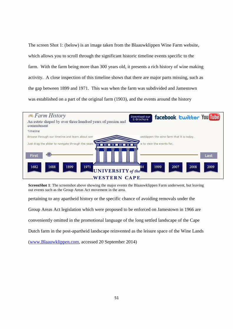
51
The screen Shot 1: (below) is an image taken from the Blaauwklippen Wine Farm website,
which allows you to scroll through the significant historic timeline events specific to the
farm. With the farm being more than 300 years old, it presents a rich history of wine making
activity. A close inspection of this timeline shows that there are major parts missing, such as
the gap between 1899 and 1971. This was when the farm was subdivided and Jamestown
was established on a part of the original farm (1903), and the events around the history
ScreenShot 1: The screenshot above showing the major events the Blaauwklippen Farm underwent, but leaving
out events such as the Group Areas Act movement in the area.
pertaining to any apartheid history or the specific chance of avoiding removals under the
Group Areas Act legislation which were proposed to be enforced on Jamestown in 1966 are
conveniently omitted in the promotional language of the long settled landscape of the Cape
Dutch farm in the post-apartheid landscape reinvented as the leisure space of the Wine Lands
(www.Blaauwklippen.com, accessed 20 September 2014)

52
Heritage and development
In recent years, and in the face of the rapid property development in the area, residents of
Jamestown became aware of how important it was to document the history of the area. In
2005 a committee known as the Jamestown Heritage was formed in order to documents
various activities which took place throughout the years, but also to plan for events for the
near future. Early in my research towards this thesis, I met up with one of the members of
Jamestown Heritage, Chrisben February, who was as passionate about the history of
Jamestown as the original longstanding residents were. During a very informal talk with him,
he mentioned how excited he was about organising events which ‘will bring the community
back together again’ (Chrisben February, 2014). The first major event took place on the 21st
of September 2013 and was called Jamestown ‘Stories or Story’s’. The event took place in
the once busy General Dealer, which as previously mentioned, permanently closed its doors
for business in 2012 after more than 60 years of business.15
The exhibition took old and new
residents back in time to the days of Strawberry Festivals and the establishment of the first
Jamestown Soccer Team. As February explained, when describing the planning for the
event, that when there is focus placed on the heritage of any given place, it can always lead to
unhappiness if certain groups of people feel left out or are not represented. Even though a
heritage, such as this at Jamestown which had its main focus of showcasing the areas rich
history, he emphasised that it should be planned properly in order for emphasis not only to be
placed on one specific group in Jamestown, but also include new residents from a diversity of
backgrounds in the town. It was evident that much thought went into the planning of the
Jamestown event, as various people were focused on and most importantly, no one was left
out. Even though new residents could not feature in the history of the town, they were part of
the Heritage Day by organising the event and being part of the Heritage Committee. Another 15
E. van Heerden. “Handelaar sluit na jare” Eikestad Nuus (2012)
53
example of such heritage initiatives, more complicated than this of Jamestown, is that of the
District Six Museum in Cape Town. Even though it is a different case to that of Jamestown,
it is also a situation in which anxiety and trauma were felt as a result of actual widespread
forced removals. The museum however tells both sides of the story, with stories told about
the law and the Group Areas Act, but also more intimate stories about the families who called
the place home and how they lost it all, and carefully inscribes the experiences of those
classified differently under apartheid’s heinous racial classification laws. In the case of
Jamestown, forming the Heritage Committee brought optimism to residents as long standing
residents nostalgically remembered the “happy days” whereas the heritage museum of
District Six, by virtue of its history, does ‘memory work’ around the traumatic effects of
apartheid. This initiative in Jamestown has also become a window for new residents to
educate themselves on the history of the area and possibly make them realise how change and
urban transformation affected residents in different ways. According to Crisben February,
future events will be even more interactive. He said:
“In 2002 the town celebrated 100 years of existence; we could however not create an
event for this as there was no support at this time. We are planning on bringing various
events such as the garden and strawberry competition and festivals back. This is
always the best way to bring back old memories.” (C. February, 2014)

54
Image 2.7: The photograph above shows the three Williams brothers Geoffrey, Alfie and Percy at the shop
counter from which they’ve served the Jamestown community for many years with the help of their children.
Even though this was a day of celebration, it was also a day where the chapter of the
Williams General Dealer ended. An observation I made at the Jamestown Storie event was
how interested some of the new Jamestown residents were in the history of the place. And
this was a shared sentiment that if this were to be the feel being created by a simple event
such as this one, then this must definitely be done on a more regular basis.

55
Image 2.8: shows us one of the oldest residents of Jamestown, Mrs Sarah Linders who was also interviewed on
her experience in Jamestown. Alfie Williams, also a resident and one of the General Dealer owners can also be
seen.
It is clear that the history of the Stellenbosch area is complex and rich dating back to the mid
1600s and later together with the establishment of Jamestown in 1903. The Rhenish
missionaries believed in the people of their congregation and were willing to go the extra
mile to make life easier for them. It is important to keep in mind that historic value of an area
can have an impact even though developments occur in and around it. Many of the current
residents of Jamestown are the children of the first land owners within Jamestown, meaning
that they carry pride in owning the land and being part of the town. This is evident in the
events that were historically organised by the community such as the flower/garden festivals
and the more recent heritage weeks. However, as I shall argue in the chapters that follow,
these historic settlements can also be easily disturbed by the change through new forms of
development and though decisions which might change the ‘feel’ to the town, despite the
processes of community consultation that Cash describes in detail in her PhD thesis (Cash,
2013). A process of change that started taking place in Jamestown as the demand for land in

56
the area rose significantly has resulted in the uncertainty about the future alongside a renewed
interest in the past. The following chapter will discuss the tensions and anxiety felt by
Jamestown residents following the new developments, and the fact that many of them are
unable to afford their own property.
We however have to ask ourselves the question of: ‘Is Jamestown really a town?’ or a place
which functions on its own, without the help of any other larger area. The residents of
Jamestown would like to believe this, but the area cannot be proclaimed a town simply
because the name depicts this. Jamestown is a well-established community meaning that it
has a stable population. We however must not confuse ourselves by thinking that “Well-
established” means that the area’s in harmony or has got no problems. At the moment
Jamestown is going through, as Cash describes, a Rural Urban Fringe (RUF) transition,
meaning that new developments and residents have been moving into the area in recent years.
16 These developments definitely moved the community to acquire elements of a town, such
as a clinic, library and stadium which have all been built over the past few years as
infrastructure improvements.
16
C. Cash (2013) “Towards Achieving Resilience at the Rural-Urban Fringe: the case of Jamestown, South
Africa.

57
Chapter Three: Gentrification, tension and urban transformation take place.
Introduction
Change is inevitable, as many believe, but there are various ways in which it can take place
and affect people. This chapter will explore the notions of gentrification, anxiety and urban
transformation, but at the same time it has sought to find out how they are interlinked and
have affected Jamestown. Throughout the chapter, focus will also be placed on how the
various new property developments in and around Jamestown, such as the development of the
Stellenbosch Square Shopping centre and the Aan de Weber Estate began. In the previous
chapter, ‘Constructing a spatial history of Stellenbosch and Jamestown; Past and Present.’,
one of the main focus points in this study came to light, which is the fact that the area was not
declared a ‘White Group Area’ and therefore did not undergo forced removals. This study
will read into whether this event was a turning point in the future of this town, and whether
the anxiety felt by so many residents can be linked to this event. Archival material such as
newspaper articles, municipal documents, historic photographs and video’s depicting
Jamestown pre the post-apartheid urban development will also be used in order to indicate
what the future plans of the town are and how this might further influence the anxiety felt
amongst some residents from the area. It is also important to focus on gated communities as
Jamestown is increasingly surrounded by various gated communities. These gated
communities are having an effect on Jamestown, which the chapter explores in-depth.
The concept of gentrification was coined by Ruth Glass in the 1950/60s and ever since then,
the debate of how it affects the social and economic lives of people has led to in-depth
discussions (McGirr et al. 2014). Ruth Glass was born in Germany in 1912 after which she
moved to the United Kingdom, becoming a well-known British Sociologist. Glass’s work
reflected her belief that the purpose of sociological research was to influence government
58
policy and bring about social change. She formed a lasting legacy for the term
‘gentrification’ which describes the processes by which poorer residents were ‘forced’ out of
London to make way for the wealthier. Since then the term has been used all across the globe
and by different authors (R. Bevan, The Guardian, ‘From Ruth Glass to Spike Lee:50 years of
gentrification.’ 2014, accessed 4 June 2014). Glass passed away in 1990 at the age of 78.
Levy et al. (2006) describe gentrification to be the process where-by high-income households
move into low-income neighbourhoods, escalating the area’s property value to the point that
displacement occurs. It is however not only economic changes which take place, but also
changes in racial and ethnic composition which can affect the area’s characteristic and
therefore lead to social anxiety and tension within the community. According to Levy et al
(2006) even though there are no clear stages of gentrification which can be observed in an
area, it helps classifying the extent of the process. When examining the case of Jamestown,
many of these patterns are evident, whereby the area underwent rapid urban transformation
and there was an influx of wealthier residents. At the same time, property prices and
municipal rates also increased significantly to the point where some original residents could
no longer afford to own their land. Jamestown’s location, situated on what is defined as the
urban edge by the Stellenbosch Municipality’s Strategic Developing Plan Framework of
2009 in relation to Stellenbosch, has experienced the effects of this encroaching and
expanding edge as farmlands that previously surrounded Jamestown have become
suburbanised developed into a city fringe (Stellenbosch Municipality SDP, 2009 and Cash,
2013). Urban edges, whether legislated or simply lines instituted by local authorities as
planning tools, are usually protected by the city or town in order to protect important
agricultural activity and land uses. Cash (2013) however mentions that land may be worth
R2 million in terms of land value for agriculture, but when developers offer R8 million for
residential use, the land owners will sell (Cash, 2013). This is how the ‘edge’ keeps on

59
moving further outwards, as land owners sell when large amounts of money is offered. In
many places in Cape Town, this ‘edge’ is being threatened to be moved as the demand for
new land for development increases, therefore infringing on other activities.
During the process of this research, the ‘urban edge’ recently came under threat in the area of
Philippi in the form of new developments which were proposed. The area of Philippi is about
20km south east of Cape Town and is the fresh produce hub of the city. In 2011 the residents
and farmers of Philippi were in utter disbelieve when land on the edge of the Philippi
Horticultural Area (PHA) was proposed to be developed for housing. Farmers in the area
believe that this would have had a negative effect on the produce in the area and feared that
the agricultural land might also soon be used for housing. The development of the land also
had several implications to it which included the impact on the aquifer and water table in the
area should storm water systems be implemented. It was also proposed by the city that there
would be 5000 low cost housing units on the land. This created a major debate amongst not
only city officials and locals, but Premier Helen Zille took to social media, tweeting; “The are
huge tracts of land formally in the Philippi Horticulture Area (PHA) that have not been
farmed for decades… get the facts.” The Greater Cape Town Civic Alliance’s Gavin Smith
however responded that in 2012 when MSP (Developers) sent in an application to develop,
that neither the mayoral committee nor the Western Cape Departments Agricultural and
Sustainable Resource Management were happy with it (The Argus, Philippi housing plan to
be tabled. 31 July 2013.) The development of the urban edge was supported by the
provincial and city officials, mostly because of the housing backlog the city is experiencing.
Farmers however wanted to use this remaining land to expand their farms as the area is the
‘bread basket’ of the city (Cape Argus, Philippi: Double standards at play. 27 January 2014).
An article in the Cape Argus in March 2014, entitled; “Cape Town ‘Hell-bent on

60
development’”, reported that the City of Cape Town may soon be able to make changes with
regard to new developments on the urban edge near the area of Kuilsriver. The dominant
land use for this area is designated for agricultural purposes and produces supplies of food
and fresh produce to the greater Cape Town area. The article also indicates that the same is
happening in the Durbanville area (Cape Argus, 6 March 2014).17
Gentrification and its long-lasting effects.
Since Ruth Glass coined the term gentrification in the 1950s, it has been used to describe
both positive and negative impacts on places. According to Stephan Sheppard (2011), who
received his Ph.D. in urban economics from Washington University and his B.Sc. from the
University of Utah, the term has been used by many scholars and policy makers around the
world and it has in most cases had a neutral connotation to processes of change. Many
authors believe that this might undo the ‘White Flag’ abandonment which took place between
the 1940s and 60s by bringing wealth and tax bases back to these areas. Many ethnic groups
were not allowed to be part of the inner city life around this time as segregation was fully
implemented. The change of this however brought diversity to the city of which the economy
of these areas received a massive growth. Others however, have viewed gentrification as an
“unfortunate desecration of interesting and authentic urban neighbourhoods” (Sheppard
(2011). The critics of gentrification, such as Atkinson, blast the phenomenon for being a
disadvantage to the lower income residents, who established a community with complex
social network and then have to watch it being broken down. This is definitely the position I
myself take as being largely an insider of the town. Jamestown has been established and built
up from nothing by the people of the town. This was especially done by the long-standing
17
For further reading on the expanding city fringe. 6 March 2014, Cape Argus.

61
residents who moved to the area in the 1930s and 40s, and some who were born in the area.
Atkinson does mention that in most places where gentrification has taken place, new
wealthier people have moved into the area and significantly changed it.
Many authors such as Atkinson, Freeman and Braconi and Vigdor however all have different
views and arguments on the degrees of the negative or positive effects of gentrification.
Atkinson (2000) who conducted most of her research in London came to the conclusion that
most displacements took place amongst those employed in unskilled or semi-skilled sectors
and therefore the most negatively affected were the poorer residents of the area. During the
1990s, London went through major urban changes as which played it’s part in the rapid act of
gentrification taking place within the city. This directly links up with the current situation
taking place within Jamestown, although on a smaller scale, as many of the lower-income
residents have had to look for new homes elsewhere. This comes as newer, wealthier and
younger residents move into the town, pushing up property prices, and therefore causing the
long standing resident to not be able to afford their property. Braconi and Vigdor (2004)
whose research was conducted mostly in the United States of America, argued that the poor
are not differentially likely to be displaced. Vigdor’s research (2002) was less conclusive
arguing that the effects of gentrification in Boston during the 1990s were not directly linked
to poor residents. He examined data taken from Boston neighbourhoods such as Roxbury,
Hyde Park and Bay Village and concluded that although displacement took place, the poor
were not clearly affected by it (Sheppard, 2011:3). Vigdor’s argument indicates that
consideration should be given to a more differentiated notion of gentrification whereby there
are different effects and outcomes in different urban areas and contexts.
Urban sprawl usually goes hand in hand with gentrification as developments often move to
the periphery of a city or town creating urban sprawl. The land in the inner city becomes

62
scarce and very expensive which allows the processes of gentrification, together with
development to take place in response to this land market pressure (Yenigul, 2009:1048-
1049). This is what took place over the last fifteen years within the Stellenbosch area as the
place became more attractive as a residential town close to Cape Town. This brought wealth
to the area and together with this came cars and congestion in the old town of Stellenbosch.
This means that the town gained more permanent residents and more students with cars. The
Stellenbosch of the 1990s was completely different to the present day town with regards to
developments such as retail space, festivals and tourism. The town has always been seen as
the student hub of surrounding areas and not much focus was placed on sectors such as
tourism and top notch shopping centres. The Stellenbosch Municipality however injected a
great amount of capital into the renewal of the Stellenbosch CBD and retail sector in order to
compete with surrounding areas such as Paarl and Somerset West. One of the major urban
renewal projects was that of the Eikestad Mall which in total had a cost of R550 million (du
Toit, New look for Stellenbosch shopping mall. www.property24.co.za, accessed 5 June
2014). Jan de Villiers who is the Eikestad Mall centre manager and a key Capitol director
had the following to say about the upgrading of the mall;
“The main objectives of the revamp were to raise the centre from a B-grade to an A-
grade shopping mall, by improving the tenant mix and providing parking. Limited
parking in the town had caused residents who live near Eikestad Mall to drive to more
distant shopping centres.”(du Toit, New look for Stellenbosch shopping mall.
www.property24.co.za, accessed 5 June 2014)
Vineyards were always a popular attraction in and around the Stellenbosch area, but after the
implementation of markets at the wine estates these became even more popular drawing
crowds. Major markets such as the Family Market on Blaauwklippen wine estate and the

63
Root44 market 2km south of Jamestown attract new people from all over the Cape Peninsula,
the Wine Lands and the Overberg. This influenced how people perceive Stellenbosch and
surrounding areas as not a ‘dead’ town when it comes to socialising, but one of the ‘must
visit’ wine route destinations. This also led to the significant rise in property prices
throughout Stellenbosch as the town also now holds some of the most expensive properties in
the country. The De Zalze golf and wine estate across the road from Jamestown has
properties going for as much as R25 million (www.property24.com). As Harvey (1989) says:
‘…for ephemerality and eclecticism of fashion and style rather than the search for enduring
values…’ Designing of an estate does not take place because we need to value history of an
area; it is merely developed for those who want high end style. The average house price also
increased in middle income neighbourhoods even though the looming 2010 recession curbed
the selling of them. This all leads to feeding the phenomena of urban sprawling in the area.
Real estate agents also promote the town and newly developed private estates and promote
these areas to buyers as having a piece of history, should they buy in (Aan de Weber
brochure, May 2014). The image below shows how Aan de Weber gets promoted by using
the historical town of Jamestown. (Photo taken on 2 February 2013 by Gary Arendse)
Image 3.1: Playing on the history of Jamestown in order to promote the residential estate.
64
Yenigul (2009) defines sprawl as the physical pattern of low-density expansion of large urban
areas, under market conditions, usually into the surrounding agricultural and or rural areas. A
negative aspect of urban sprawling is that it relates to patterns of private property ownership
and pockets of development start to occur in farming areas, as development ‘jumps’ over
certain areas leaving open spaces of agricultural land in between. This is what occurred
within the space between Stellenbosch and Jamestown. The land between these two areas is
occupied by a vineyard called Blaauwklippen wine estate and during earlier years, another
lawn farm. Blaauwklippen which is one of the oldest wine farms in South Africa was
established in 1682 and has been taken over by the Schoerghuber family in 1999
(www.blaauwklippen.com). The lawn farm was leased out to an individual, but was still
owned by Blaauwklippen. It was then changed into commercial land in the late 1990s on
which the Stellenbosch Square Mall, Donford BMW Dealership and Shell filling station were
built.

65
Figure 3.1: The Jamestown plot distribution map of 1989 indicating various land use areas. A: Section of the
Blaauwklippen Farm. B: Lawn/agricultural farming. C: Agricultural land allocated for Jamestown residents.
(Jamestown Struktuur Plan, 1989)
The structure plan of Jamestown, which was set up by the Stellenbosch Municipality in 1989,
gives a good indication of how urban sprawling affected the area with Stellenbosch being
located about 5km to the north. The sketch above gives us an indication of how Jamestown
was before sprawling and gentrification became relevant. The space demarcated with ‘A’
was the Blaauwklippen farm and had housing for farm workers situated here. At the time, the
land was mainly used for agricultural purposes with a major dam situated just north of the
main road (Red Line). The open space marked with the ‘B’, was partly a lawn farm, but also
used for agricultural purposes. This land remained for this purpose until the early 2000s,
after which it was sold by Blaauwklippen and taken over by Marriott Property for the
development of the shopping centre. The narrow vertical stretches of land demarcated by ‘C’
are the land which belongs to individuals from the area. Each narrow band of land belongs to
a different family on which agricultural activities are practiced. The red line, which is the

66
main road of Jamestown, is the historical settlement pattern which shows the separation of
the agricultural land in the north from the residential land south of it.
Levy et al (2006) indicate that even though we cannot measure gentrification, we can still see
the different stages in which it progresses. There is the early, middle and late stage of
gentrification in which Jamestown would fall under the middle stage. Levy focuses on
Reynoldstown, Atlanta which previously had a predominantly African American working
class community since World War 2, but which was undergoing a rapid transformation.
Reynoldstown is located east of downtown Atlanta next to the already gentrified
Cabbagetown and near some of the first neighbourhoods to experience housing market
appreciation after the 1996 Olympics (Levy et al, 2006). The town was also one of the first
free African American neighbourhoods in Atlanta. The longstanding residents of the town
worked at a cotton plant which has since closed down. By 2006 the town was in its early to
late stage of gentrification where house prices significantly rose from about $80 000 to
$200 000 (Levy et al, 2006). Comparing this to Jamestown is useful as this is more or less the
stage in which it is with property prices which climbed from an average R300 000 (+- 1000
sqm) in 2004 to R900 000+ in 2010 (www.property24.com, accessed 4 April 2014). Levy
also puts emphasis on how the white population of Reynoldstown has significantly increased,
bringing with them an influx of capital. It is also noted that it is uncertain how many
residents have been displaced because of gentrification, but during the first few years it was
minimal, seeing that vacant land was used. There is also the concern for elderly homeowners
with fixed incomes who would have to cope with the appreciating property values and
escalating taxes (Levy, 2006). This is what makes the similarities between the two areas so
strong. Even though the displacement rate in Jamestown is not as high as that of
Reynoldstown, the significant rise in property taxes may well lead to that. New residents

67
moving into the area will most likely want to buy their own open piece of land in order to
build their own house, rather than buying an existing house. This helps lowering the
displacement rate, but only for a short period of time. The area is however moving quickly
from the late early stage of gentrification to the middle stage as more people now come in
and make offers to existing houses. The offers at times seem too good to not take and that is
why many of the residents accept these offers, but then have to look for housing elsewhere.
All the sudden urban changes within and surrounding the town of Jamestown have led to a
placement of anxiety amongst some residents. Lees (2008) warns against social segregation
while Betancus (2011) tells of the ‘rich group with options, mobility and ability to profit from
rent manipulation clashes with a lower income community anchored in place.’ I believe that
social segregation is not the problem in this case, but rather the fact that Jamestown residents
find it difficult seeing wealthier people coming into the community, and changing it.

68
Jamestown then and now: A visual history through Aerial Photography
‘Technology has brought about a revolutionary shift in our ability to navigate, inhabit, and
define the spatial realm’ (L.Kurgan, 2013). Kurgan emphasises how the use of aerial
photography has opened our eyes in order to see new things around us. In order to see the
significant change which has taken place over the last 15 years around Jamestown, aerial
photography played a vital role in conducting this research. As Kurgan (2013) states; ‘the
creation of aerial images discovers new uses for them.’ – and in this case it is change over
time. Aerial photographs dating as far back as 1953 are included as they indicate how slow
growth in the area was between 1950 and 1989. This was also the period in which the Group
Areas Act took place within South Africa, with Jamestown almost falling victim to it. The
aerial photos included are from 1953, 1983, 1989, 2000 and 2010 which gives us a 60 year
snapshot of the same area.
Aerial Photograph 1: 1953 (Source: Chief Directorate surveys & mapping)

69
In the aerial photograph above, which was taken in 1953, it is evident that the area had not
had any major developments. The main activity was agriculture which is evident from the
various vegetation patches on the photo. On the northern boundary of Jamestown is where
the local residents had their own agricultural land. The area demarcated within the red
polygon is where Jamestown is situated with still very few structures within the town. Even
though other developments would only appear on the photo 65 years later, I indicated where
they are developed today. The yellow demarcated area represents the La Clemence
Retirement Village, The blue represents Aan de Weber residential estate which the larger
green polygon represents where the De Zalze Golf and Wine Estate is located today. During
the 1950s was also the period when the Group Areas Act was enforced in many areas within
South Africa (Group Areas Act, 1966). Jamestown was initially planned to be one of those
areas, but due to the farmers from farms around the town not agreeing on this change, it
remained and became proclaimed a ‘Coloured Group Area’. On the aerial photo it is clear
that Jamestown was the only settlement in the area and was surrounded by various farms.
Aerial Photograph 2: 1983 (Source: Chief Directorate surveys & mapping)

70
This aerial photo was taken 30 years after the previous one, at the height of apartheid, but it is
still evident that little change and development had taken place within Jamestown. The
community was however clearly growing as is evident from the increased number of
structures within the town (area demarcated with red), but still at a very slow rate. The main
activity around the town remained agricultural with Jamestown residents mainly still using
this activity as their primary form of income. The farm within the yellow demarcated area
(which in time was developed into La Clemence Retirement Village) still shows evidence of
a farm house with the houses of farm workers around it.
Aerial Photograph 3: 1989 (Source: Chief Directorate surveys & mapping)
The photo above is of Jamestown during 1989 and depicts that even though not much change
has happened, the town had been growing over the six years since the previous image was
taken. The area demarcated with the black circle is where the Techno Park Business Park is
in its beginning phase of development. This land was the first in the area surrounding
Jamestown to be rezoned from agricultural to commercial land. This was still 5 years before
Jamestown became part of the Stellenbosch Municipality and predominantly only had

71
untarred roads throughout the settlement. This, along with the fact that it was relatively
unknown beyond the farming community, could possibly be one of the reasons why the area
stayed underdeveloped until well into the 1990s. The Techno Park Business Park (area
within the black circle) was the first sign of urban sprawling taking place on the southern
sections of Stellenbosch, as businesses rather wanted to be located outside of the Stellenbosch
central business district. This was followed by a brand new upper-income neighbourhood
named Paradyskloof (demarcated with the green circle) which was completed in the early
1990s. Once again, agricultural land was rezoned to residential land in this case.
Aerial Photograph 4: 2000 (Source: Chief Directorate Surveys & Mapping)
Moving from the aerial photograph of the late apartheid years in 1989 to 2000, post-apartheid
shows a significant amount of new development around Jamestown, but still none in
immediate surroundings of the settlement at Jamestown. We can however see that the
community of Jamestown had by now increased significantly as this marks the beginning of
an influx of new residents to the area. The Techno Park Business Park which is circulated in

72
black, had now been well established with many new businesses relocating to this area. The
most significant growth is that of Paradyskloof which is circulated in green. This area
became a fully established upper-income neighbourhood in less than 9 years. The area west
of Jamestown, demarcated in green, is the De Zalze Golf and Wine Estate which by 2000 was
nearing completion. During this time property prices within Jamestown already started to
show an increase with more people showing interest in the area. It is believed that this is the
moment the gentrification process began gaining momentum with new developments
following as others were completed.
Aerial Photograph 5: 2010 (Source: Chief Directorate Surveys & Mapping)
The aerial photograph above indicates the area of Jamestown and its surrounding during
2010. It now becomes evident the amount of development which took place in less than 10
years together with the housing density within Jamestown which is demarcated in red. There
has now been a major influx of new residents to Jamestown as the developments around the

73
town significantly increased. The area demarcated with green on the western boundary of the
aerial photo is the De Zalze Golf and Wine Estate which is now complete and hold holds
more than 70 housing units. It is also evident that the farm houses which were located within
the yellow demarcated area had now been rezoned and redeveloped into La Clemence
Retirement Village, holding up to 50 separate housing units. One of the most recent
developments on the aerial photograph is that of the area demarcated in orange which were
completed between 2004 and 2007. This holds the faux Vernacular Cape Dutch Stellenbosch
Square Shopping centre together with a Donford BMW Dealership and office blocks. The
area demarcated in blue is the Aan de Weber Residential Estate which began development in
2011. This also led to more people becoming aware of Jamestown as the residents use the
town’s main road in order to get access to the estate. Jamestown was no longer an unknown
small settlement tucked away in the farmlands but had entered into the burgeoning new land
market economy marketed as the ‘Wine Lands’.
The collection of aerial photographs dating from 1953 to 2010 gives an indication of how
urban change occurred over a period of 60 years in and around the Jamestown area. It is
however clear that no significant change with regard to development took place until the
development of Techno Park Business Park in 1990. The photographs do support the
argument of rapid and significant development over a period of 10 years as is evident from
the difference when comparing the 2000 aerial photo with that of 2010. As I shall argue in
the next section, any area undergoing such a rapid change in development will see the
consequences of it with residents not being able to cope with this radical change.

74
The grip of anxiety on Jamestown and its residents.
The phenomenon of gentrification at times leads to unhappiness and a community split, as
previously mentioned in this chapter. As Lees (2008) mentions, where gentrification or
urban transformation takes place, anxiety usually manifests itself amongst people in the area.
Anxiety within the area is made up of different factors. Social, economic and heritage all
play a role in which some residents of Jamestown reacted to changes taking place. As I have
witnessed, new arrivals as residents have been in most cases more investment orientated and
were therefore more welcoming of the process of gentrification that continues to take place
(McGirr et al, 2014). Those renting homes in the town are however worried about the
looming increases in rent as well as the threat of displacement as landlords sell off properties
for profit. From my interactions and interviews it is clear that the long-term residents are
more worried about the heritage of the area and they fear seeing their social capital eroding
(McGirr et al 2014) suggest that there are two of the ways in which academics think of
gentrification. The Null hypothesis states that there will be no difference in attitudes between
the new residents and the long-standing residents. The alternative, which reflects Jamestown,
suggests that the gentrifiers are different, not only in status and income, but also that their
reasons for moving to the neighbourhood reflect different values. Their perceptions of
neighbourhood change and satisfaction with changing attributes also differ (McGirr et al
2014).
With the recent national elections which took place in May 2014, the residents of the town
expressed the concerns they had within the area. One of the major concerns was that the
municipality only looks after the periphery of the town, while the core is still being neglected
(Interview: Henry Arendse, 22 May 2014). The main road of the town called Webersvallei
Road, was recently upgraded with its sidewalk being lifted, making it safer for pedestrians.

75
This however did not go down well with some members of the community. In my interviews
I observed that it was the long-standing residents who had major concerns with this as most
of the younger generation welcomed the upgrades. This once again showed the anxiety and
fear of change amongst the long standing residents of Jamestown as many of them think that
this will affect the heritage and feel of the town. Complaints were handed in to the
municipality to remove the elevated sidewalks, months passed before it was approved and a
week before the elections, it was removed, sparking another debate that this was only done
for votes and not at the interest on the community. The article focusing on the meeting was
published in the Eikestad News on the 13th
of March 2014 after which the meeting took place
on the 15th
of April 2014. The process of gentrification arguably began in the early 2000s
after the approval of the Stellenbosch Square Shopping centre on the western boundary of the
town and the remainder of the original farm (Cash, 2013). Earlier plans which were drawn
up by the Stellenbosch Municipality, focusing on the future developments in the town,
indicated that the mall would be located within Jamestown, on the southern boundary. The
map below was taken from the Jamestown Structure Plan Document of 1989 and shows how
property was allocated to various owners and the basic street pattern. The area demarcated
with the letter ‘A’ indicates the proposed location for the shopping centre in 1989, while the
area demarcated with ‘B’ indicates where the Stellenbosch Square Shopping Centre was
actually built (Jamestown Struktuurplan, 1989 and Cash, 2013). The Jamestown Structure
Plan set up by the Stellenbosch Municipality in 1989 showed that the site ‘B’ would be a
shopping centre catering mostly for residents of Jamestown as it was located within the
settlement. This would most likely have meant that people, who were not from the area,
would not drive in all the way to make use of these shops. This proposed shopping centre
never materialised as talks surfaced during later years of having a shopping centre on site ‘A’.
Although this would bring in more feet to the mall as it is located east of the R44 main road
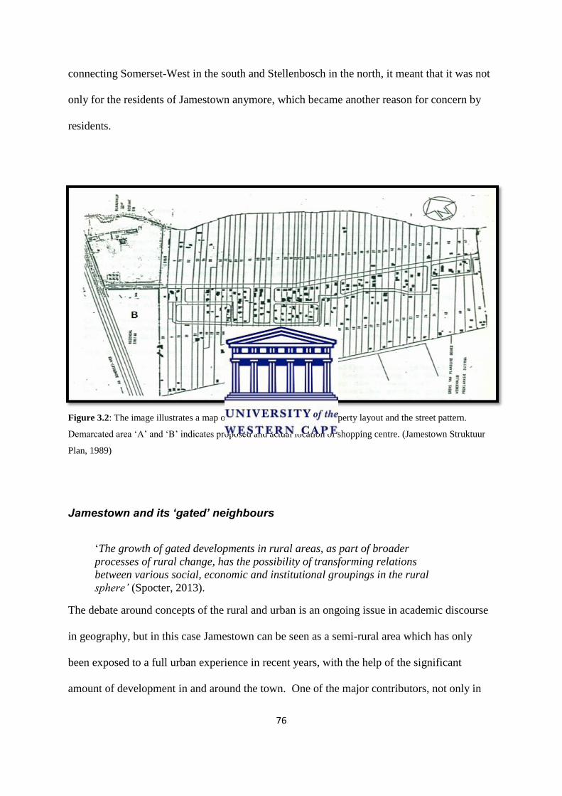
76
connecting Somerset-West in the south and Stellenbosch in the north, it meant that it was not
only for the residents of Jamestown anymore, which became another reason for concern by
residents.
Figure 3.2: The image illustrates a map of Jamestown in 1989 with property layout and the street pattern.
Demarcated area ‘A’ and ‘B’ indicates proposed and actual location of shopping centre. (Jamestown Struktuur
Plan, 1989)
Jamestown and its ‘gated’ neighbours
‘The growth of gated developments in rural areas, as part of broader
processes of rural change, has the possibility of transforming relations
between various social, economic and institutional groupings in the rural
sphere’ (Spocter, 2013).
The debate around concepts of the rural and urban is an ongoing issue in academic discourse
in geography, but in this case Jamestown can be seen as a semi-rural area which has only
been exposed to a full urban experience in recent years, with the help of the significant
amount of development in and around the town. One of the major contributors, not only in

77
Jamestown, but in the greater Stellenbosch area is the large demand for new gated
communities. University of Stellenbosch based urban geographer, Manfred Spocter (2013)
researched the rural gated developments as a contributor to post-productivism in the Western
Cape and results indicated that Stellenbosch is the area in the Western Cape with the most
gated communities in a single municipality. When focusing on the study area of Jamestown,
it is clear that even this community has been surrounded with a total of three gated
communities. That of De Zalze Golf and Wine Estate, La Clemence Retirement Village and
the latest addition being Aan de Weber Residential Estate which makes use of Jamestown’s
main road.
According to Spocter (2013) there are two very important aspects of post-productivist which
could explain the significant number of gated communities in the Stellenbosch area. These
are housing development and the pursuit of leisure activities, both being of most importance
for the wealthier residents of Stellenbosch. Banks and Marsden (2000) have also argued that
because the demand for new housing is this high in the area, the demand for rural land for
development purposes has also significantly increased. The new-comers to these rural areas
and who is the driving force behind the high demand for new housing are usually the middle
and upper-class urbanities. Their key driving forces is the quest for an improved lifestyle in
exclusive housing units together with the desire to be close to ‘nature and unspoilt natural
areas’, but also for a higher degree of security (Spocter. 2013:6). These activities usually
results in a perception of improved living standards of the people moving into these gated
communities, but the question of what the situation is outside these walls is unaddressed by
developers only interested in the bottom line of profit, where the local residents have had to
cope with the changes brought about by these developments. As Spoctor (2013) says:

78
‘It is also significant that the development of residential sites is followed by
concomitant development of commercial and retail services, which brings
further changes in the character of towns.’ (Spoctor, 2013)
This summarises the exact situation with in Jamestown as gated communities which were
formed on the boundaries of the town, were followed by increased retail development
resulting in more changes to the area.
As Corrine Cash mentions in her recently published article from her research, the
development of the Stellenbosch Square Shopping centre was also not well received not only
by some residents, but by the Stellenbosch Municipality itself (Cash, 2013:8). During the
early 2000s and at the time the New National Party (NNP) was still in power within the area,
half of the party was made up of coloured nationalist who supported the development, while
the other half was white and opposed the development (Cash, 2013:8). The ‘coloured
individuals’ threatened to split the party, should the development be opposed and in order to
avoid this, a deal was made which would allow the approval of the mall. During this time,
the Stellenbosch Municipality hired a retail consultant in order to evaluate the land on which
the development would take place. The consultant returned strongly recommending against
it. As stated by Cash (2013) the developer of the proposed shopping centre made sure that he
established positive relationship with the people of Jamestown. The Municipal officials
however did not fully support the development, but towards the end it was, under uncertain
conditions, approved. The building of the 84 million rand shopping centre began early in
2003 and was completed in August 2004 with the grand opening which took place in
September 2004 (eprop.co.za. 2004, accessed 12 February 2014). The article in The Cape
Argus, published on 11 June 2004 had the following to say about the development: “The
centre, designed in a Cape Vernacular architectural style, aims to be a niche lifestyle and
convenience centre that caters for the affluent shopper” (Stellenbosch Square set to open in
September, The Cape Argus, 2004:4). The article clearly stated that the shopping centre was

79
not catering for the lower to middle income residents of Jamestown. Promises were however
made by the developers of the centre that it will be encouraged for shops owners to hire
people from Jamestown (Cash, 2013). It became evident that Jamestown was not featured
once in the article when the location of the shopping centre was mentioned, other surrounding
areas such as the estates were however mentioned for their favourable location in relation the
mall. The shopping centre however never had great success as big retailers, such as
Truworths, closed down because of poor business. Jamestown’s invisibility in the imagined
new communities, (Bennedict Anderson, 1983) of the leisure class is significant as the place
seemed in 2004 to once again be viewed largely as an unsightly labour source, unworthy of
mention in the journalist’s story of development.
The failure of malls and the case of Stellenbosch Square.
The failure of malls is not a new phenomenon within urban geography and certainly not in
major urban areas across the world. As Shropshire and Yerak (2013) mention in an article
entitled; “As some malls fail, others thrive”, the main reasons for the failures of malls are that
new malls are developed nearby which functions as stiff competition for existing ones. One
similar case is that of the Werdmuller Centre in Claremont, Cape Town, which was built in
the 1970s for commercial purposes. As new commercial developments occurred around this
mall, especially with the establishment of Cavendish Square, it started to be viewed as a
commercial failure by its owners Old Mutual Properties and eventually was closed in 2009.
Noëleen Murray (2013) mentions how the Claremont main road acted like the “San Andreas
Fault”, with some of South Africa’s best shopping spaces on the one side of the road, but on
the other, you find that it is an ‘economic disaster’. The retailers within these malls also have
to make sure that they cater for the type of person who visits, and since the 1970s in South
Africa this has been imagined as largely ‘white shopping publics’ as Murray details in the

80
Claremont case. In many cases intense sociological research is conducted before deciding on
the type of mall (Shropshire and Yerak, 2013). The development of Stellenbosch Square was
however more complex as on the one side of the mall you have low to middle income
households, while on the other you will find one of the most exclusive golf and wine estates
in the country. The idea here was to cater for both of these income groups, but at the same
time have an A-class shopping centre. In the model of the commercial mall, as Shropshire
and Yerak point out, that once anchor stores start experiencing problems with profit, then that
is the first sign that there is a ‘problem’ with the mall. In the Jamestown area there is also the
newly renovated Eikestad Mall which is about 5km to the north and Somerset Mall which is
about 15km to the south of Stellenbosch Square. From observation, what seems to have
happened is that Stellenbosch Square experienced the loss of major anchor stores such as
Truworths, Mama Roma, Forum, NWJ and American Swiss as they closed down in recent
years leaving major areas vacant with ‘to lease’ signs everywhere. When looking at the type
of shops located in Stellenbosch Square, it is evident that it was to cater for high-income
groups as boutiques proliferated in the wide corridors. After an interesting interview with
some of the residents of Jamestown, most of them said they wanted retailers such as Edgars,
Mr Price or restaurants such as Mc Donalds or Steers. They felt that other than Pick n Pay,
that there are few other shops that interest them and they would rather go to Stellenbosch’s
Eikestad Mall which holds a variety of shops. Another shopping centre which had the same
failure was that of Broadway Mall in Somerset-West as its main anchor store, Pick n Pay had
to close its doors. The reason for the closure being that the community is mainly low-income
families and there being a more affordable Shoprite store only metres away.
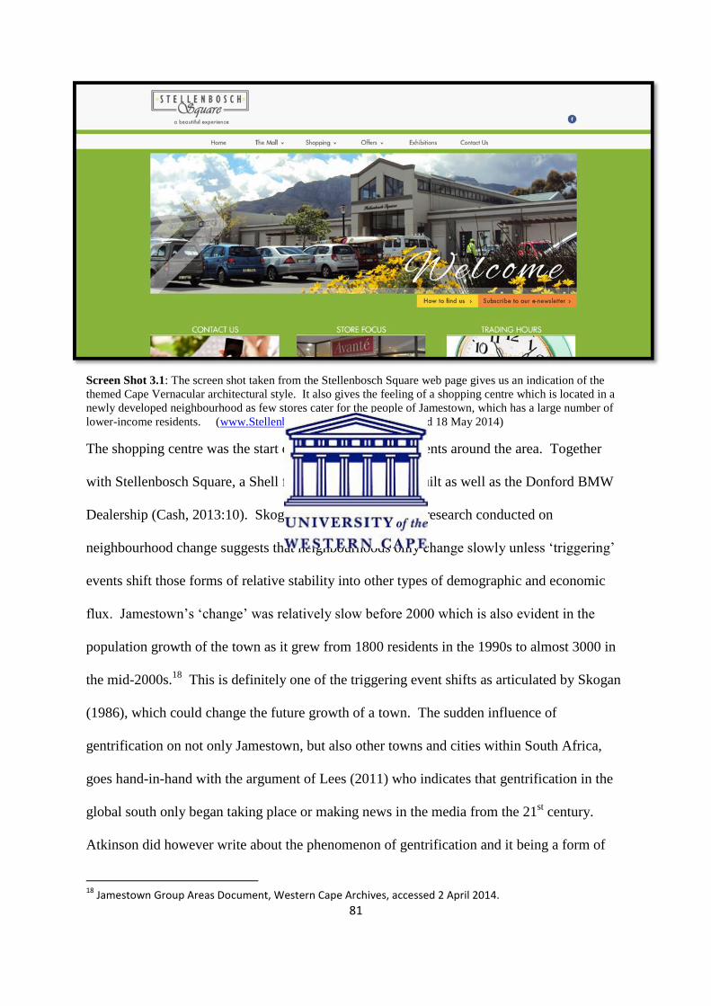
81
Screen Shot 3.1: The screen shot taken from the Stellenbosch Square web page gives us an indication of the
themed Cape Vernacular architectural style. It also gives the feeling of a shopping centre which is located in a
newly developed neighbourhood as few stores cater for the people of Jamestown, which has a large number of
lower-income residents. (www.StellenboschSquare.info, last accessed 18 May 2014)
The shopping centre was the start of other major developments around the area. Together
with Stellenbosch Square, a Shell filling station was also built as well as the Donford BMW
Dealership (Cash, 2013:10). Skogan (1986) mentions that research conducted on
neighbourhood change suggests that neighbourhoods only change slowly unless ‘triggering’
events shift those forms of relative stability into other types of demographic and economic
flux. Jamestown’s ‘change’ was relatively slow before 2000 which is also evident in the
population growth of the town as it grew from 1800 residents in the 1990s to almost 3000 in
the mid-2000s.18
This is definitely one of the triggering event shifts as articulated by Skogan
(1986), which could change the future growth of a town. The sudden influence of
gentrification on not only Jamestown, but also other towns and cities within South Africa,
goes hand-in-hand with the argument of Lees (2011) who indicates that gentrification in the
global south only began taking place or making news in the media from the 21st century.
Atkinson did however write about the phenomenon of gentrification and it being a form of
18
Jamestown Group Areas Document, Western Cape Archives, accessed 2 April 2014.

82
neo-colonialism in the global south, but offered little discussion on how to analyse this,
without providing detailed arguments as to how these processed might affect a predominantly
poorer area.
The rapid development ‘explosion’ around Jamestown
The follow-up development to that of Stellenbosch Square was La Clemance Retirement
Village on the western boundary of Jamestown, which opened in 2005. The 9 hectare piece
of land that was previously owned by the Blaauwklippen farm was sold in the early 20000s
with La Clemence in mind. The architects which were Dennis Moss Partnerships had the
following to say about the new development; ‘The architecture and design of ‘La Clémence’
is a contemporary interpretation of regional Cape architecture that is in harmony and
complement the local vernacular of Stellenbosch’ (www.dmp.co.za, last accessed 21 May
2014). In keeping with the popular retirement village model, the village is made up of 138
units, a club house and also a fully equipped health care centre (www.laclemence.co.za, last
accessed 5 June 2014). One of the issues mentioned earlier in the chapter was that residents
were concerned with the developments only beautifying the periphery of Jamestown and not
the core of the town. A resident whom I interviewed who wanted to stay anonymous
mentioned that it is as if ‘they want the inside of Jamestown to be kept away from the outside
by building all these fancy places on the edge of the town’ (Interview: Anonymous, 8
September 2014). There are however Jamestown residents who also approved of the new
development which is Le Clemence saying that: ‘These developments finally put Jamestown
on the map and are not just a town people pass on their way to Stellenbosch or Somerset-
West anymore’ (Interview: Henry Arendse, 22 May 2014). The map image on the official
website of La Clemence clearly shows the difference in living standards
(www.laclemence.co.za, last accessed 4 October 2014). On the western boundary of the

83
village there is the R44 main road while on the eastern boundary there is the informal
settlement of ‘Kreefgat’ which was established in the mid-1990s and curretly made up of
about 30 dwellings completely hidden away from the outside.
Figure 3.3: The image above shows an aerial image of La Clemence Retirement Village with the R44 main road
on the western boundary, Webervallei road (Jamestown main road) in the south and the informal settlement
demarcated by the yellow block on the eastern boundary.
The municipality of Stellenbosch claims that the expansion of the urban fringe is due to the
Stellenbosch CBD becoming overpopulated. Arguing that it is a student town, over the years
many permanent residents have migrated to the fringes and outskirts of Stellenbosch. As a
consequence of this trend, which was clearly visible from the late 1990s, tracts of land were
rezoned either from agriculture or in some cases industrial zoning to residential land. This
was as the demand for residential land became greater over a short period and therefore

84
expansion occurred rapidly into the outskirts of Stellenbosch (Cash, 2013:12). Corrine
Cash’s study of the land transformation at Jamestown took a slightly different position to my
own in this thesis. She focused mostly on how political processes affected the developments
around Jamestown and how this allowed gentrification to take place. This study starts off at a
different point of departure with a focus on the views of people of the town and it explored
their experiences, views and perceptions of the developments. It focuses on how their lives
were affected by new residents together with how this changed the place from the little quiet
town it was, to what it is like today, caught between different forms of new development in
the sprawling post-apartheid metropolis of greater Cape Town.
The most recent development that took place within Jamestown is that of Aan de Weber
residential estate on the eastern boundary of the town, also designed by architects Dennis
Moss Partnership who had previously designed Le Clemence. The first impression of its
official website sets the mood of the area and reads; ‘From the R44, the Webersvallei road
meanders through historic Jamestown and its unique, tranquil surrounds to reach a breath-
taking jewel: Aan de Weber’ (www.aandeweber.co.za, accessed 25 May 2014). The estate
which is developed on 5.4 hectares of land and divided up into 102 single residential plots is
claimed to be the last development of this nature in the area. The demand for the land was of
such nature, that the first phase of the development sold out in less than three hours (Aan de
Weber brochure, 2013). With the average size of a plot being 400sqm and selling for
between R500.000 and R900.000, only three were still available in the entire estate
(www.aandeweber.co.za, accessed 25 May 2014). This latest development, other than that of
Stellenbosch Square, was the only one that took Jamestown in consideration when it came to
consulting the people of the area. While the shopping centre was proposed with a
development agenda around creating job opportunities (for what turned out to be a small
85
percentage of the residents), the Aan de Weber development contained the proposed upgrade
of Jamestown’s main road. Whether this is mainly for the residents of the new estate or not,
both parties were envisaged to benefit from the upgrade. The upgrade of the main road
included five traffic circles in order to slow traffic down and control traffic flow better.
Residents whom I interviewed, felt this modern engineered road destroyed some of the
historic urban character of the small town. In a newspaper article place in the Eikestad News
of 12 June 2013, residents complained not only about the circles taking away the historic
character of the town, but also of the poor construction. Even though all these complaints
were reviewed by the Stellenbosch Municipality, they continued with the construction of
these traffic circles and the road upgrade was completed in June 2014. This sense of the
invisibility of Jamestown’s historic urban character was in direct conflict with the envisioned
‘Cape Vernacular’ theming of the new estate, as if Jamestown was without heritage in the
eyes of the developers, and without a citizenry whose discourse around heritage mattered.
The road as it is today has completely marked Jamestown’s changed urban character and
served the intimate relationship between houses in the old settlement with the lands near the
river.
Taking all of these private residential estates into consideration, it is difficult to see where
Jamestown’s continuity of a village feel is, as the effects of all these new developments has
also resulted in a sense of social polarisation. The idea of social polarization is associated
with the segregation within a society that may emerge from income inequality, real-estate
fluctuations, economic displacement and actual ‘modernisation’ of traditional settlement
patterns such as witnessed in the remarking of the road etc. and result in such differentiation
that consist of varied social groups. Hamnett (1994) however believes that polarisation is not
a synonym for inequality, as inequality can take many different forms, but also that there can

86
be greater inequality without greater polarisation. The term is also explained by Hamnet,
citing Marcuse, where the population is distributed in the form of an egg. When polarisation
occurs, the middle part becomes thinner and now takes the form of an hour glass. The
thinner middle can now be seen as the “intermediate social strata” within the process of social
polarisation (Hamnett, 1994). Throughout my interviews, a narrative thread that runs through
many people’s stories of life in Jamestown shows that members of the community do not
think that the ‘village feel’ developers promised to keep has prevailed or been preserved with
the given designs of the estates. In Aan de Weber’s EIA report it stated that one of the main
objectives in the community implementation plan was to not change the historic village in
any way (EIA Report, Withers Environmental Consultants, 2009). In some senses this
promise has been kept, but the complete lack of understanding in design terms of the changes
to the main road of the town by adding traffic circles to it, completely destroyed the historic
system of the agricultural settlement. This kind of a lack of spatial finesse is commonplace
when developers commission EIAs and no proper Heritage Impact Assessment (HIA) is
completed.
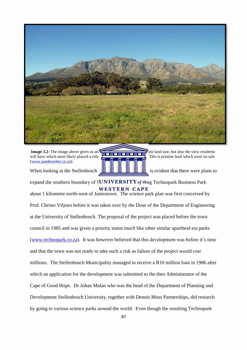
87
Image 3.2: The image above gives us an indication not only of the vacant land size, but also the view residents
will have which most likely played a role in how quick the estate sold. This is pristine land which went on sale
(www.aandeweber.co.za).
When looking at the Stellenbosch Structure Plan of 1989, it is evident that there were plans to
expand the southern boundary of Stellenbosch by developing Technopark Business Park
about 1 kilometre north-west of Jamestown. The science park plan was first conceived by
Prof. Christo Viljoen before it was taken over by the Dean of the Department of Engineering
at the University of Stellenbosch. The proposal of the project was placed before the town
council in 1985 and was given a priority status much like other similar apartheid era parks
(www.technopark.co.za). It was however believed that this development was before it’s time
and that the town was not ready to take such a risk as failure of the project would cost
millions. The Stellenbosch Municipality managed to receive a R10 million loan in 1986 after
which an application for the development was submitted to the then Administrator of the
Cape of Good Hope. Dr Johan Malan who was the head of the Department of Planning and
Development Stellenbosch University, together with Dennis Moss Partnerships, did research
by going to various science parks around the world. Even though the resulting Technopark

88
was only completed in the early 1990s, it was not instantly successful as most business
owners still preferred to be in bigger business districts such as those well established in Cape
Town, Bellville or Johannesburg (Stellenbosch Strategic Development Framework, 2009).
The idea of business parks were rather new to the area resulting in the park not having much
success in the first 10 years from 1990 to 2000. The rapid expansion and development of
Technopark only really took place from 2000, as businesses began moving out to science
parks such as this one. Major companies such as Protea Hotel, Brent Oil, Burgiss, Discovery
and many more moved to the area and increased both the value and demand for land there
(www.technopark.co.za, last accessed 14 June 2014). This also caused a significant growth
in interest in residential property in Jamestown and aided with the pressures for development
approval of other developments such as Stellenbosch Square by the local authorities.

89
Figure 3.4: The image above gives an indication of Techonopark in relation to Jamestown’s location.
Technopark being the area to the north marked with ‘A’ and Jamestown to the south marked with ‘B’. As
Technopark is only 1 km away, it makes Jamestown the perfect neighbourhood for residents to live who works
at the business park.
Transformations in South African cities since the 1990s shows symptoms of urban
transformation in peripheral economies, but at the same time this trend still depicts features
that are unique to those of post-apartheid urban societies. At the same time, many of the
urban areas, whether they were on the scale of Cape Town or Stellenbosch, had an inward
flow of businesses revitalising the core of these cities and towns. On the peripheries of these
areas typically suburban areas also grew from the 1990s containing various income level
neighbourhoods. As urban sprawling took place over the years, as a consequence of growth,
these cities and towns expanded by pushing their urban fringes outwards by developing new
pockets of open land. What is interesting about this is that places now become closer to each
other and a good example of this is that of Cape Town and Bellville. These two areas were
seen as two separate cities in the 1980s as developments between these two were minimal.
Today, with the development of major shopping centres (Canal Walk, N1 City) and

90
neighbourhoods, the two cities became one ‘megacity’. As Eunice (2009) mentions, South
African cities growth takes on three forms, firstly market driven sprawl, secondly state
provided low income townships or thirdly illegal land occupations. Looking at the case of
Jamestown, we will see that market driven sprawl is taking place which is space extensive in
South Africa and contributes to a high proportion of the farmland consumed for new
developments on the urban periphery.
One argument for the way in which urban transformation can be achieved more sustainably,
is by the implementation of green belts. Many countries have implemented this and formed
strict land use policies around these areas. Green belts are those areas around the city or town
on which no development whatsoever can take place as the main purpose of these spaces is to
keep the environment intact and undisturbed (Eunice, 2009). My research shows that the
Stellenbosch Municipality lacked planning, policy and political will to implement such a plan
as this is visible just by looking at the development patterns in and around Stellenbosch. It is
noticeable that development around the town has occurred in a haphazard manner and
together with the large amounts of land which is occupied by farms, natural
vegetation/environment is becoming increasingly scarce. According to Walker and Lewis
(2005), one criticism of green belts is that they hindered industrial development in
economically depressed areas. Despite the criticisms however, the green belt concept
remains popular in contemporary planning, despite the apartheid perversion of the concept in
the implementation of ‘buffer zones’ separating segregated sections of our cities, many of
which were implemented under the guise of the Garden City and green belt idioms (Coetzer,
2009).
In order for the green belts to be successfully implemented, the urban edge needs to be
clearly defined with its different sectors. As Eunice (2009) describes in her study which
91
focused on Paarl (which is about 30km north of Stellenbosch), there are different urban edges
for small towns like these. The edge that runs along the extreme edge of the town and around
the surrounding farms of the area is called the ‘Stellenbosch Farm Edge’. These are allocated
for agricultural purposes and cannot be rezoned for any other land use (Farms Land Use
Management Study, 2005). There is also the ‘permanent edge’ which is the non-negotiable
boundary which main aim is to protect valuable natural farmland together with land with
scenic and cultural values. The final form of such an edge and usually most important for
economic purposes is that of the ‘Growth Management Edge’. This part is envisaged to
allow urban expansion and urban development to take place (Provincial Urban Edge
Guidelines, 2005). Referring to the case of Jamestown, it is evident that these different types
of urban edges have shifted in the area. Jamestown which was most likely to have been in
the part of the ‘permanent edge’, at some time seems to be have moving towards the Growth
Management Edge, explaining much of the development taking place (Farms Land Use
Management Study, 2005).
Even though Jamestown, as I argue is a specific case, processes of gentrification and urban
renewal are occurring in many other areas in South Africa. One recent example is Evaton, in
the Emfuleni Municipality of Gauteng Province, underwent a similar situation where money
was pushed into the area for development, but the area could not adapt fast enough to the
changes. The community of Evaton which was predominantly poor were given capital in
order to lift the image of the area by improving infrastructure and living conditions of
residents. Money was however misused causing the project to be halted and not getting off
the ground (Tlhabanelo, 2011).
Many of the questions received from residents of the town were “What will happen to our
town after all these developments?” Many are worried about whether their children will be

92
able to afford to continue to live in the place where they were born. The future of a small
historic town developing at a rapid pace is what makes residents anxious as it is uncertain
where it will end. While many believe urban development is in most cases a ‘good’ step to
take in order to upgrade and modernise urban spaces, the forms of these however leave a
‘bitter taste’ in relation to historic nature of towns that are affected involved and that is why,
as I have argued, it is important to look at how a small historic town can be redeveloped
without the destruction of its historic fabric, both socially and in terms of its spatial patterns.
In the next chapter I shall consider how urban development can have a ‘downside’ in a town
such as Jamestown.

93
Chapter Four: The ‘DOWNSIDE’ of urban development: speculating on
Jamestown’s future.
Introduction
Throughout the period of conducting this research, from when I first started asking questions
about the history and future of Jamestown in 2012, it has become increasingly evident to me
that urban development is undergirded by many enormously complex processes. Much of the
tension that is evident in the changing landscape surrounding Jamestown was reflected in the
anxieties expressed by residents interviewed over the three year period of my thesis project.
As I have endeavoured to illustrate in the previous chapters, it increasingly became clearer
and clearer to me that there are many unintended and unexpected consequences of rampant
property development to a pre-existing area, as the impacts of rates of change are often not
well understood. In this chapter I will firstly look at the ‘downside’ of urban development in
Jamestown, and compare this to other small towns which experienced similar rapid growth
patterns and circumstances. This section of the thesis will then ask why urban sprawling
occurs together with the consequences it initiates in a place, followed by a section focusing
on the differences between development patterns in Jamestown and Pniel, also a small
previously mission settlement. In the previous chapter, discussion focussed on a description
of what urban sprawling is, how it takes place and in what forms it becomes manifest. In this
chapter however I shall focus more on how the process of urban sprawl affects an area such
as Jamestown in both a positive and negative manner together with how other historic towns
such as Elim and Franschhoek managed, preserved and retained aspects of their many
histories through heritage processes. Some people are very much in favour of notions of
urban development and believe that it holds the promise of ‘progress’ and ‘modernisation’,
while others - often those who experience the negative effects of the ‘downside’ of
development such as in Jamestown, are very much against change. This polarisation between
94
those who wish to retain the qualities of a place steeped in history, as in Jamestown, against
those who have ‘discovered’ the ‘Wine Lands lifestyle’. It was also important to look at why
the areas in and around Jamestown have the sites of this rapid transformation, as opposed to
slower development in other similar areas around Stellenbosch. The future of Jamestown
will also be discussed in the chapter supported by key oral history cases and to speculate on
to what extent the area will change and be developed through new planning initiatives by
both the local authorities and developers. Even though the chapter considers the ‘downside’
of urban development centrally, I have also had to consider its other – in what is perceived as
being the ‘upside’ of this phenomenon, in order to explore the central intention of this
research, which has been to explore why the developments took place in this area and
whether they took into consideration (or not) the effects this would have on the historic town
of Jamestown.
Urban sprawl: the ‘jump’ in urban development.
When one consider urban growth and urban sprawl, it is often evident that these often occur
from the same causes. The two are inextricably interlinked and are factors in the ways in
which urban development takes place (Bhatta, 2010:18). It is also interesting to realise that,
as Bhatta argues, urban growth can take place without urban sprawl taking place, but what is
clear is that sprawl induces growth in an urban area. There are also many causes that are
responsible for sprawl, for example that increasingly it has become popular amongst some
who prefer to live, and have the luxury to do so, in a country environment, which is evident
in the mushrooming of lifestyle estates which have fuelled luxuriant urban sprawl (Bhatta,
2010:18). The comparison to that which has been occurring within the Jamestown area is
useful, as many of its new residents were attracted to the idea of escaping city life and desired
to live in the countryside with its charming small ‘village feel’. The irony of this is that this

95
is the very process whereby urban sprawl has taken place, and the destruction of a sense of
historic ‘village feel’ for the original residents of the small agricultural settlement. The fact
that urban sprawl is most of the time uncontrolled and unplanned puts more threat on the
areas affected. Developers tend to buy land on the outskirts of towns in order to promote
country living by forming elite estates. This gives the municipalities little control over how
the fringe of the town will develop once the plans are approved. Freilich and Peshoff (1997)
clearly point out the problem which sprawling holds and argues that although sprawl
accommodates the greatest amount of growth, it also requires a significant development of
new facilities and services, leading to the abandonment and underutilisation of existing
facilities. This is starkly evident in the Stellenbosch region with regard to industrial property.
Many of the new businesses moving to the Stellenbosch area chose to be located on the
outskirts of the town in specifically designed business premises in areas such as in the
Techno Park. This however leaves the former central business areas within the town with a
large number of vacant buildings and even abandoned ones. Although this is a rather new
phenomenon in countries such as South Africa, developed countries underwent these changes
during the post-World War 1 era as part of a process of post-industrialisation where more low
density, decentralised suburban residential developments sprung up further away from the
city (Freilich and Peshoff, 1997:184).
According to Bhatta (2010) there are various factors which would lead to urban growth
resulting in urban sprawling. The table below indicates causes of urban growth which may
result in either compact and/or sprawled growth.

96
Causes of Urban Growth Compact Growth Sprawled Growth
-Population growth
-Economic Growth
-Expectation of land
appreciation.
-Country living desire
-Demand for more
living space
-Large plot size
Table 4.1: taken form B. Bhatta, Analysis of urban growth and sprawl from remote sensing data, Advances in
Geographic Information Science. 2010
The above mentioned table gives us a clear indication of some of the reasons why urban
sprawl takes places in certain areas. We can compare these directly to the case of Jamestown
in order to analysethe spatial process of change taking place there. Pardo and Echavarren
(2005) believe that population and economic growth will definitely result in both compact
and sprawled growth as large number of people usually flock to areas where job, business and
social opportunities are better. These two aspects will therefore be interlinked as economic
growth aids population growth. The population of Stellenbosch has been growing steady and
intensified in the 1990s, with a significant increase after 2000 as numbers of students at the
university grew and more and more have settled in the town making it their permanent
residence. This together with more business opportunities saw more people moving to the
Stellenbosch area for work purposes (National South African Census 2001 and 2011).
The above mentioned table also indicates that when the value of land is expected to rise, it is
also when real estate agencies begin to promote these properties as “Best or Most pristine
land” to buy in an area. This trend is supported by the shift in lifestyle choice towards
country living marketed as a quieter atmosphere than the city where residents commute to

97
their place of work (Bhatta, 2010). Being a resident of Jamestown myself, I can track that
this was what happened to the town as new residents chose this neighbourhood because of
these increasingly popular attractions on the edge of the busy town of Stellenbosch. Part of
this attraction of the Wine Lands area is that it is still close enough to the town of
Stellenbosch in order to commute to and from on a daily basis. According to estate agents
Seeff Properties, people also tend to purchase plots which are located out of towns as these
are bigger in size than the ones in town.
Frelich and Peshoff (1997) indicate that urban sprawl engendered six major crises within
American’s major metropolitan areas. These are (1) central city, first and second ring
suburban decline, (2) environmental degradation through the loss of sensitive land and
habitats, (3) the overutilization of fossil fuels, (4) infrastructure deficiencies and taxpayer
revolts, (5) devastating agricultural land conversion and the final crisis being housing
unaffordability (Frelich and Peshoff, 1997).19
Even though these are based on major cities,
they state that it is also taking place in smaller towns undergoing rapid development. In
Stellenbosch the decline of the central town has not really been affected by this as the
municipality made incentive funds of R500 million available for the upgrade of the central
town. It is however showing signs as stated in category number one, in the first suburban
ring of the town towards the northern neighbourhoods of the town. The Lavanda Flats which
are owned by the Stellenbosch Municipality had been one of the well maintained residential
apartment blocks in the 1980s. During the late 1990s however, the apartments became run
down as maintenance of the building began to be neglected. After much questioning done
about why this happened, it was explained to me by an official in the housing department’s
maintenance section, that the Stellenbosch Municipality increasingly had difficulty with
19
For further reading see: Freilich, R., Peshoff, B. (1997) “The social costs of Sprawl.” The Urban lawyer, Vol 29.

98
defaulting rent payers in the building, but as he explained, at the same time could not evict
the people from the premises.
In keeping with the conditions described in category number two by Frelich and Peshoff, and
seeing that Stellenbosch is located in a sensitive environment, rich in fauna and flora, of
which the unique ecosystem of the Fynbos region forms a part, presents the possibility that
these sensitive ecosystems could be negatively affected or even destroyed. Many of the new
developments are situated next to rivers which, prior to this had not been affected by
developments. The crises described in category five are particularly pertinent to the case of
Jamestown, as the devastating agricultural land conversion which is in the process of taking
place within Jamestown has resulted in farming practices all but ceasing. As mentioned in
previous chapters, half of Jamestown’s land was zoned as agricultural land and has been used
as such since the establishment in 1903. Presently, at the time of writing in 2014, it is still
classified as such, but is on the verge of being rezoned into residential land as many
applications for rezoning have been made for individual erwen in the town. The combination
of the effects of sprawl, with many of the residents no longer farming has meant that there is
only a hand full of residents including my own family that still use the land for agricultural
purposes.
According to the Charter for the Conservation of Historic Towns and Urban Areas
(ICOMOS, 1987), many historic areas whether small or large are either threatened, physically
degraded, damaged or even over-modernised by the impact of urban development as the
demand for new land increases. I visited two towns with rich histories in order to observe
how they were preserved and consider how the notion of the ‘village feel’ operated in these
towns and if residents either felt it still remained. When looking at historic towns and
settlements such as Elim in the Overberg region and Franschhoek in the Cape Wine Lands, it

99
becomes evident that a different form of historic preservation was occurring. During my visit
to Elim in December 2013, it was evident that even though the buildings could be renovated
into restaurants and galleries, this was not the case. Elim has the quality of being arrested in
time as very little of it has changed and not much new development has taken place. Elim,
which remains under the close control and influence of the Moravian church, has not seen the
same levels of commercialisation as in the over gentrified Franschhoek. Part of the reason
for this is that the town is much more isolated then that of Franschhoek, yet it still receives
large number of tourist each day. Franschhoek on the other hand is a completely different
case in the manner in which the history of the town is preserved. The town is much more
gentrified with modern architecture, especially the newer commercial buildings such as the
small shopping malls. The main road is a vibrant with restaurants, art galleries and other
tourist attractions. The town regularly celebrates its history with festivals such as the Bastille
Festivals which is a celebration of the settler history of the French Hugenot contribution to
the town. When comparing these two areas to that of Jamestown, it becomes evident that
Jamestown has some characteristics of both towns, but in this case, the worst of both. It has
been developed to the point where a rather large number of new residents have moved into
the area, but yet the historic buildings are largely kept intact, although none are declared
heritage sites. Jamestown does have the potential to grow into a smaller ‘Franschhoek’, but it
will take much longer as the houses along the main road is still occupied by the families who
will not easily change their homes into restaurants or even sell their properties. The only
spaces which could be revamped into restaurants, as the estate agents advertisement
suggested, are that of the old general dealers discussed in earlier chapters. Property tenants
are however cautious of taking the risk, as the property is still for sale two years after closing
down. This could be due to the collapse of the property market in recent years but also
probably a consequence of partial gentrification having happened in the town.

100
Richard Moe, the president of the National Trust of Historic Preservation had one of the
clearest definitions when it comes to sprawl and its effect on historic areas. He points out
that it is low-density developments on the edges of a city or town that are typically poorly
planned, land-consumptive, automobile dependant and designed without regard to the
surroundings. Dagger (2003) indicates that even though there are anti-sprawl campaigns
occurring all over the world, the force of sprawl is too strong to curb. Estate agents, private
land developers and contractors - these are all people who believe that they have a financial
stake in the continued outward growth of urban sprawling. This rampant and seemingly
uncontrolled growth of private property development globally has led to opposition to these
developments with the emergence of anti-sprawling organisations in places like the USA, but
also here in South Africa as witnessed by the recent rise of grass root movements around
evictions and relocation where people are resisting being removed to places like Blikkiesdorp
where they are far from access to work and the city (Dagger, 2003:29) and (Mail&Guardian,
2009, ‘Dumping ground’ for unwanted people, http://mg.co.za/article/2009-10-09-dumping-
ground-for-unwanted-people, accessed 1 November 2014). Increasingly this phenomenon is
driven by the increasing polarisation between rich and poor, between notions of inadequate
housing delivery by the state and high end development of elite private properties, and
between social aspects and not solely economic factors.
According to Freilich and Peshoff (1997), sprawl has been promoted by social forces where
people have the desire to have a rural lifestyle but coupled with an urban income. This
captures the phenomenon occurring in Jamestown as it is exactly what is happening there.
Many wealthier residents have moved into the predominantly low to middle-income area as it
has a ‘rural feel’ to it, but are still living urban lifestyles. This is also evident when you look
at the new developments such as Aan de Weber that was discussed in the previous chapter.

101
This private estate was marketed promoting a pastoral myth of country/rural idyll feel to it,
but with property prices ranging from R500 000 to R950 000, owners clearly need an urban
income. According to Seeff estate agents, the new developments which have been trending
since the early 2000s are private residential estates. This excludes golf estates as these were
introduced much earlier to the urban development scene in South Africa. Even though there
is conclusive evidence that sprawl has more negative than positive effects for an area, some
authors still hold the view that this is a positive phenomenon. Lessinger (1962) argued that
the scatter of new developments might prevent the development of huge homogeneous slums,
while Boyce (1963) also suggested that urban sprawl retains an element of flexibility within
the urban landscape. I believe that these were speculations on the phenomenon as it emerged
in the countries in which they were working. It is however important to take these into
consideration as comparisons when formulation arguments. Bahl (1968) however suggested
that with urban sprawl taking place in many areas, it will have a significant effect on property
tax and the people paying these (Ottensmann, R, 1977:389). In the situation in Jamestown not
only property tax, but also the price of services such as sewage, water and electricity
increased significantly as the town became designated urban rather than rural. This precedent
has left old Jamestown residents fearful of major price hikes that might follow. Archer
(1973) also made an argument by saying that the residents of the new areas are not fully
confronted by the costs of these developments. While newer more middle class residents in
Jamestown may be able to absorb the effects of the increasing property tax and services costs
this could be potentially disastrous for long-standing, lower-income residents in all likelihood
would not be able to cope with the sudden increases. Dagger (2003) mentions in his paper
“Stopping sprawl for the good of all” that Robert Putnam, who investigated social capital,
came up with three reasons for the detrimental effects of sprawl on civic life.20
Putnam’s first

102
reason was that sprawl takes time, meaning that the more time you spend in your car
travelling long distances, the less time you had for family, friends, business meetings, social
gatherings etc. His second reason, which is especially relevant to Jamestown, is that sprawl
is associated with increased segregation as well as the opportunities for social networks to cut
across class and racial lines. The last and probably most powerful is that sprawl disrupts
community ‘boundedness’ as the distance between work, shop and social becomes bigger.
Putnam says that this physical fragmentation of our daily lives has had a visible dampening
effect on community involvement. This is becoming evident in Jamestown as there are no
longer community festivals occurring within the town as they did 15 years ago. From my
interviews, many of Jamestown’s residents believe that this change occurred because the
town is not as focused on agricultural activities as it used to be a few decades ago. The
festivals which took place included the Strawberry, Flower or Miss Jamestown festivals. It is
always difficult to think of any solutions when it comes to gentrification and urban sprawl
and people usually go into ‘panic mode’ when these issues surface. Rick Jacobus of
Rooflines, the National Housing Institute Blog in the United States writes that the paralysing
thinking of gentrification and sprawl goes like this:
We want to improve the lower-income areas to make them better for the
people who already live there, but as always, when an area is redeveloped
it will get interest from the outsiders wanting to move there. This will
inevitably drive up property taxes and displace the current residents.
People will also feel that the place which they worked so hard for over
many years is now easily taken by new ‘strangers’. (Benfield, 2014)
He concludes his argument by saying that it is a complicated dynamic as it feels wrong to
leave a community who are degrading, but also not right to turn the place completely around.
20
Civic Life/Civic Identity – The inclination of someone who resides in a city to think of himself or herself as part of it. Such a person will be physically or emotionally invested in the city because it is in some sense his or hers. (Journal of social philosophy, Vol. 34 No.1, Spring 2003, pp. 32.)

103
The question of why the particular changes that are occurring in Jamestown are being played
out in this way in and around Stellenbosch was something that I investigated. According to
former Stellenbosch Mayor and resident of Jamestown, Mr Cyril Jooste, the town has one of
the best locations in comparison with other similar areas. When taking areas such as Raithby
or Pniel we can formulate an understanding of why these places aren’t undergoing the same
development. Take Pniel as an example; it is also located about 5 km out of Stellenbosch
towards the east. As Jamestown is located next to the main route connecting Somerset-West
with Stellenbosch, Pniel is located adjacent to the route connecting Franschhoek with
Stellenbosch. One of the biggest factors which could be playing a major role in the
development would be the location. From a geographical point of view, Jamestown has more
than enough space to expand as the terrain allows this. Pniel is surrounded by 300° of
mountains area making it much more difficult to expand.

104
Figure 4.1: The image above was taken from the Stellenbosch Strategic Development Framework of 2010 and
shows a rough sketch of Pniel and its surrounding areas.
The image above gives an indication of the confined area in which the town is situated as the
brown areas on the left and right indicate some of the steep mountain slopes. Pniel is the area
situated right of the northern mountain slope and has a linear town layout. As mentioned
earlier in the chapter, the road connecting Stellenbosch with Franschhoek also goes through
Pniel, but is not as busy as the R44 running past Jamestown towards Stellenbosch
(Stellenbosch SDF Report 2010). Given the physical landscape constraints, it is also
difficult, but not impossible for urban sprawl to take place there. Although developments
such as shopping centres and business parks have not yet appeared and it seems unlikely that
this will occur, private residential estates and the upgrading of the wine estates has led to
more people visiting the area. The difference, in general, is that the people visiting the area
are tourists rather than permanent. Jamestown’s location is favourable for people who work
in Stellenbosch, but still want the country environment. When we compare the population

105
growth of the two areas it also becomes clear that the one experienced a much higher growth
rate while the other became more stagnant. When looking at the population of Jamestown it
indicates that the area had an increase from 1800 in 1996 to 2800 in 2011
(www.census2011.adrianfrith.com). The population of Pniel however was around 1500 in
1996 and increased to 1900 in 2011 which indicates a smaller growth percentage.
Figure 4.2: The image above gives us an indication of the Jamestown area and its urban development plan
during 2010.
Jamestown’s growth pattern differs significantly from that of Pniel as the layout of the built-
up area is squarer as opposed to linear, showing that more land was physically available for
the developments. The yellow demarcated area which is circled is the Jamestown area and it
is clear that there’s more than enough open land to the south of it for even more new
developments (Stellenbosch Strategic Developing Framework 2010). It is now easier to
106
compare the two towns (Pniel and Jamestown) with the help of these sketches and realise
how important location is when it comes to an area expanding. What we have to keep in
mind with both Pniel and Jamestown is that with any new development taking place,
especially in this area, it will usually be agricultural land being rezoned into either residential
or commercial use. Even though there is land available for expansion on the southern
boundary of Jamestown, it will come at the cost of losing the agricultural land. The land is
currently owned by the Stellenbosch Municipality, but is currently being leased out to
farmers (Stellenbosch Strategic Development Framework, 2013). As revealed in the process
of my interviews, residents of the area are however not welcoming the expansion and further
development of the town towards the south. The reason for this being that, as outlined in the
Stellenbosch Strategic Development Framework, should the expansion take place on the
southern boundary, it will not be for middle-income housing, but very low to low-income
housing. Residents interviewed raised concerns that there would be increased crime activity
within Jamestown.
‘As hier sulke behuising in die area kom sal die misdaad syfer weer vinning
klim. Die meerderheid van mense wat hierdie huise ontvang is nie eers deel
van die huidige Jamestown gemeenskap nie, wat ons nogal bekommerd laat
voel.’ (Interview: Henry Arendse, 22 May 2014)
[English translation] ‘If such housing development occurs in the area, the
crime rate will rise again. The majority of people which will receive these
houses are not currently part of the Jamestown community, which worries
us.’
This availability of land for further development, along with its proposed designation for
housing for poorer people, comes after residents have already experienced significant change.
While their fears and perceptions of the impact of this reveals stereotypical and at times
prejudicial concerns, information about the proposed development is scant as is any
indication of a proposed consultation process with residents of the town. Although not the
central focus of this thesis, the question of social housing proposed, places the effects of

107
private property development in a tension with this proposed integration of poor people into
the area, a tension which sees Jamestown caught in the middle and where spatial planning
appears to be driving land development rather than a critically thought through social
development plan outlining a plan for sustaining families outside of the elite income bracket,
such as job creation and education programmes and the like. It is also unclear what the status
of existing poor families would be once such development takes place – see later in the thesis
how residents of the Kreefgat informal settlement have protested.
What the future holds for the historic town of Jamestown.
Caught between a now seemingly disappearing village past and an uncertain future, there are
different ways in which we can look at the future of Jamestown. As my research has
attempted to explore, speculations on this may depend on one’s vantage point and what your
relationship is with the town and its people. As Cash has shown the formal processes of
development have been highly political and while some may see it as a bright future
regarding the development of the town, others see it in a more tragic light as another small
town being engulfed by urban development. According to Cyril Jooste, former Stellenbosch
Mayor and an active resident in the town, Jamestown is a ‘gold mine’ which has only partly
been discovered. Plans of Jamestown from the Stellenbosch Municipality which surfaced in
the early 2000s, indicated that the main road of the town had the potential to become a
buzzing street with various coffee and craft shops, much like what we see in Franschhoek
today. This is exactly what investors would want as it will make the area one of the new hot
spots property prices would soar. As for new private residential estates in the area, we might
have seen the last of this for the next while with the Aan de Weber estate in its completion
stage. Yet, following an interview and subsequent conversations with Henry Arendse, my
father and the owner of 3 ha of agricultural land, it became clear that there are still large

108
tracts of land available for development. This is if the agricultural land gets rezoned into
residential or commercial uses, which will possibly happen in the near future as many
applications have been submitted to the Stellenbosch Municipality for this by the new land
owners who bought the land from the original Jamestown landowners. He said that this land
is perfectly located for new residential estates as they are ‘adjacent to a beautiful river and
some distance away from the residential area of Jamestown’ (Interview: Henry Arendse, 22
May 2014). Some of these agricultural plots have already been sold, but cannot, at this stage,
be sub-divided into smaller plots as this is not possible on agricultural land. Henry Arendse,
who is a passionate farmer, said the following:
“Ek en my broer sal die grond behou en boer vir so lank as wat ons kan
omdat dit al klaar vir dekades lank in ons familie was. Om die grond nou
te verkoop sal net nuwe inwoners na Jamestown lok wat miskien nie eers
die grond sal gebruik vir boerdery nie.” (Interview: Henry Arendse, 22
May 2014)
[English Translation] “My brother and I will keep this land as long as we
can as it has been in his family for decades. Selling this land will bring in
new people who will most likely not use the land for agricultural
purposes.”

109
Figure 4.3: This map was taken out of the Stellenbosch Strategic Development Framework document of March
2010.

110
Map Key:
1. Gateways
2. The main streets of Jamestown.
3. The heart of Jamestown, a new square.
4. Neighbourhood security
5. Medium to high density development. (Low-income Housing)
6. Managed land settlement (Very low-income housing)
7. Neighbourhood park.
8. Existing parks to be renewed and upgraded.
9. Combined schools and community sports facilities.
10. Low to medium density development. (Medium to high-income housing)
11. Light industrial development
12. Proposed mixed use commercial development. (Stellenbosch Square already built here)
13. Green buffer along R44 main road.
14. Blaauwklip River corridor.
15. Proposed Community Park.
16. Agricultural area. (Developed and strictly controlled)
17. Proposed garden/agricultural area.
18. Cemetery
19. Possible future development. (La Clemence and Aan de Weber)
The map depicts what the Stellenbosch municipality proposed as the future plans for the area.
One of the important statements on the map is that of #16 which shows the agricultural land
in Jamestown. In the key it states that the development on this land is strictly controlled
which is the case to some extent. Even though much of the land lies dormant, and only a few
areas are under agricultural activity, much of it had been sold and now holds multiple
residential units. #16 also plays an important role as a green buffer for #14 which is the river

111
flowing adjacent to the town and which separates Jamestown from the farm of
Blaauwklippen of which it was originally a part. The strip of blue blocks along the main road
(indicated by #2) is what could change Jamestown’s main road into an imagined buzzing
tourist street. These plots were changed from residential land to mixed-use, meaning that
businesses will be able to open here. Prior to the change there were only approximately two
plots allocated for commercial, that of the Williams General Dealer (Discussed in the
‘History of Jamestown’ chapter 2) and the smaller general dealer which was run by Mr Pat
van der Rheede.
We can also observe from the image that the majority of Jamestown is classified as a middle-
income area which can be strongly debated. Cash (2013) also argues that the majority of
Jamestown is made up of mid to high-income residents. As a resident of Jamestown, it is
difficult to fully agree with this statement. Even though many of the residents own properties
in the town, these do not generate any form of income for them as much is vacant or dormant
land. These residents have medical, water and electricity bills and taxes to pay with little
income. Many of the residents are also state pensioners and with a monthly grant of
R1370.00, there is very little left after getting the necessities. In my opinion, Jamestown
would be classified half middle-income and half lower-income residents. What stands out in
this image are the proposed ‘very low income’ units which will be erected on the southern
boundary of the town, indicated by the #5. This has however not taken place yet as the
community was against it. The Jamestown community felt that low-income housing would
be fine in the area, but was concerned about what ‘very low-income’ housing would bring in
for the town in terms of crime (Interview: Henry Arendse, 2014. Sarah Linders, 2013). This
has however not been the focus point of my research, but does indicate how urban
development is about both the elite development of the estates for the wealthy, but also the

112
growth of lower-income areas. In the case of Jamestown, both the estates and the lower-
income developments could affect the town in completely different ways. On the one hand
the residential estates make property prices rise significantly, but on the other, the residents
believe that the low-income developments will increase the crime rate in the area. All this
leaving Jamestown in a rather difficult situation, located between pockets of radically
different new income groups and forms of developments. Even though gentrification and
sprawling mostly goes together, gentrification on its own is usually the case of the wealthier
resident moving into an area. Sprawling however could go either way of wealthier or lower
income residents moving in. In the 2010 Stellenbosch Development Framework, it stated
that the southern boundary of Jamestown might receive 1000 new homes by in the next 10
years. This however stated that it will be an ‘affordable residential development’ which will
have different phases to it (Stellenbosch Strategic Development Framework, 2010). In my
research I have framed this the tension that Jamestown finds itself in and it is this, in part,
where anxiety and uncertainty – expressed in many of my interviews – most probably stems
from as residents find it hard to imagine a future beyond their older notions of ‘community’.
The image also indicates the new retirement village known as La Clemence together with the
private residential estate, Aan de Weber (#19 on the image) which has since been completed
and are about 80% sold out, with the area already containing about 20 completed houses.
The area indicating the land set aside for possible commercial use (#12) has already been
developed. This is the land on which Stellenbosch Square shopping centre and various office
blocks are located on (Stellenbosch Strategic Development Framework, 2010).

113
Image 4.1: This image which was taken on 12 May 2014 by Gary Arendse and indicates one of the last
remaining families of Jamestown (Arendse Family) who still make use of the agricultural land in the town.
The land on which we farm is approximately 3 hectares in size. The old house on the right
was also a family home which is believed to have been one of the earliest homes built in 1905
and 1910. The exact date of when it was built is however unclear as documentation before
the Williams family (Not the Williams family who owned the general dealer) became owners
is missing. As mentioned in previous chapters, these agricultural plots were passed on from
one generation to the next, but through the years the agricultural activities became less. This
picture shows my home and the way of life that I associate with home. Even though many of
the Jamestown residents have moved out of these type of houses, into more modern
structures, the town of Jamestown is still reminded of its ‘village’ past with many old

114
structures are still visible. There are however some residents who still call these old houses
their home.
Jamestown residents speak out
In my process of conducting extensive oral history interviews with Mrs Sarah Linders, one of
the oldest residents in the area and Ms Myra Linders, former independent political candidate
for Jamestown, I asked what they thought about the ‘village feel’ to the town which will
possibly be lost with the town being upgraded and developed. Mrs Sarah Linders mentioned
that it was a really sad situation that this lovely town grows further apart and therefore losing
its small ‘dorpie’ feel it had for so many years. She did however states that residents of
Jamestown were always unhappy about not enough money being injected into the
infrastructure of the town, and should have known that the town would change when
development took place.
“Ons kan nie verandering keer wat in ons dorp plaasvind nie, wat soms
nadelig kan wees vir die plek. Sommige inwoners sal ook nooit tevrede wees
met wat hulle ontvang of met watter opgradering plaasvind in Jamestown nie.
[English translation] “We cannot stop change from happening, which in some
cases can be negative. Some people will also never be satisfied with what they
receive or with what upgrades are done in the area.” (Interview: Mrs Sarah
Linders, 6 November 2013).
She also mentioned that it is clear that many of the new residents are trying to fit into the area
by lending a helping hand. Many of them were involved in the heritage day celebration of
the town together with starting a local newspaper for the town (Interview: Mrs Sarah Linders,
6 November 2013).
Ms Myra Linders who was the leader of an independent political party in Jamestown during
2011 and 2012 feels that the town has come far with regards to development. She also
indicated that they were able to stop or postpone some of the developments which would
115
have had negative impacts on both the people and the value of Jamestown, such as the very
low-income housing on the southern boundary of the town.
“We cannot however stop everything in order to satisfy each and every
resident of the town. Yes the new developments in and around the area made
it much more difficult for long-standing residents to afford their own property
due to a significant rise in price and tax, but not allowing the town to develop
would be shooting us in the foot. The new development together with the new
residents in the area doesn’t necessarily mean that the village feel would be
lost; it only means that we have to work harder in keeping it and motivating
new residents to participate and help with such event.” (Interview: Myra
Linders, 5 February 2014).
She herself is not happy seeing the town change at the rate at which it is, but says that this is
something which is already happening and little can be done to stop it. She asks: “What can
however be done is make the best of what we still have.”
Not the entire community however feels that Jamestown will have a bright future, or as Mr
Franklin Adams, leader of the Stellenbosch Peoples Alliance would say; “The future of
Jamestown is bright, but only for a handful of its people.” Mr Franklin who is also a resident
of Jamestown and a member on the Stellenbosch Municipality council, has always tried
easing the needs of the lower income residents of Jamestown. He focused on the informal
settlement which is located next to the La Clemence retirement village, and as mentioned in
the previous chapter. The informal settlements in Jamestown known as ‘Kreefgat’ has
according to its people, never had clean running water. In a video interview made by
students of Stellenbosch University and Mr Franklin himself, residents pleaded to the
Stellenbosch Municipality for running water and electricity. Mr Franklin says that only when
the residents of Kreefgat are helped out of their misery, can we say that fair development has
occurred within this town. The protest which took place on 21 March 2013 on the corner of
the R44 and the entrance to Jamestown, saw the residents of the informal settlement protest
with posters reading from ‘20 years, and still no electricity’ to ‘Ons kry swaar, help!’ and was
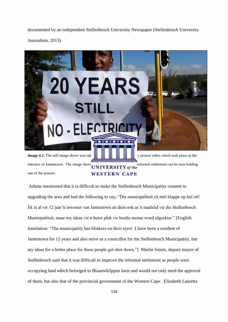
116
documented by an independent Stellenbosch University Newspaper (Stellenbosch University
Journalism, 2013).
Image 4.2: The still image above was taken from the Human Rights Day protest video which took place at the
entrance of Jamestown. The image show one of the residents from the informal settlement can be seen holding
one of the posters.
Adams mentioned that it is difficult to make the Stellenbosch Municipality commit to
upgrading the area and had the following to say; “Die munisipaliteit sit met klappe op hul oë!
Ek is al vir 12 jaar ʼn inwoner van Jamestown en dien ook as ʼn raadslid vir die Stellenbosch
Munisipaliteit, maar my ideas vir n beter plek vir hiedie mense word afgeskiet.” [English
translation: “The municipality has blinkers on their eyes! I have been a resident of
Jamestown for 12 years and also serve as a councillor for the Stellenbosch Municipality, but
my ideas for a better place for these people get shot down.”] Martin Smuts, deputy mayor of
Stellenbosch said that it was difficult to improve the informal settlement as people were
occupying land which belonged to Blaauwklippen farm and would not only need the approval
of them, but also that of the provincial government of the Western Cape. Elizabeth Lauretta
117
Marais, municipal councillor for Jamestown says that she was in utter shock because of these
ongoing protests and that the situation was not that bad.
“Dit is nie heeltemal waar nie, meneer Adams oordryf. Ek was die begin van
die week daar en daar is lopende, skoon water. Al wat opgelet is, is ʼn bietjie
stilstaande water. Die probleem is dat hulle op privaatgrond is en dus kan die
munisipaliteit geen dienste lewer nie. Hulle kan eintlik nie kla nie. hulle plak
onwettig.”
[English translation] “This is not completely the case as Mr Adams is
exaggerating. I was there early in the week and the residents have clean,
running water. One thing I noticed was some stagnant water. The major
problem is that the residents occupy private land and that’s why the
municipality can’t deliver any services here. They actually can’t complain as
they occupy the land illegally.”
This situation just indicates that even though the area of Jamestown is being upgraded, that
there are still those who live in harsh circumstances within the town. Adams organised the
same protest this year (2014), but still nothing has been done to improve the living conditions
of people living in unacceptable conditions.21
21
http://player.mashpedia.com/player.php?q=g-OwekZj7F8&lang= (video footage of the protest which
happened in March 2013)

118
Image 4.3: The previous image is a still taken by Mr Franklin Adams from the protest video which was taken in
March 2013. It paints a picture of the conditions in which these people live in and in comparison with the
neighbouring La Clemence retirement village.
In an oral interview with Henry Arendse it became clear that he did not have a problem with
new residents moving into the area, and the area changing.
‘Ek is bekommerd oor daardie mense wat nie hulle eie grond in Jamestown
kan bekostig nie, omdat die eiendom belasting so skerp gestuig het. Ek myself
voel al klaar die effek van hierdie belasting verhoging.’
[English translation]:’I am however worried about those who cannot afford
their own land in the area because of the significant increase in property tax
and price. As a land owner in Jamestown I myself already feel the effects of
these increases.’ (Interview: Henry Arendse, 22 May 2014)
He did however mention that it would be sad if the character of the town changes because of
this. When asked how he’s experience with new residents were, he had the following
response:
‘Ons het nog nie regtig problem gehad met nuwe inwoners nie, maar
ongelukkig het ek en my broer moeilikheid ontwikkel met n nuwe inwoner
langs die grond waarop ons boer. Dit is hartseerdat ons al vir meer as 50 jaar
op hiergrond boer en geen Jamestown inwoner nog niks gekla het oor hoe ons
dinge doen nie, maar sodra nuwe inwoners intrek, wil hulle veranderinge
maak.’(Interview: Henry Arendse, 22 May 2014)

119
‘We haven’t had any trouble or difficulty in the past with any of the
newcomers, but unfortunately my brother and I have encountered some trouble
with a new resident adjacent to our agricultural land. It is sad that we have
been farming for more than 50 years with no one in Jamestown having trouble
with how we do things, but as soon as the new residents move in they want to
change how you do things.’
This is why many of Jamestown residents feel anxious about the new residents moving in as
they are the friendliest people when wanting land in the area, and once they have it, they
change. This is however the minority of them. He also mentions that he knows that we
cannot control who moves into the area, but it is his view that people who sell their land must
be sure who they are selling it to (Interview: Henry Arendse, 22 May 2014).
When looking at the future development of Jamestown, one should also look at how the
property prices of the area will be affected by it. According to a collection of Property24
newspaper and internet Jamestown property sales, it becomes clear how the price of property
has risen over the last 10 to 15 years. Currently the average house price in Jamestown stands
at about R1.3 million (www.property24.co.za). Being land owners in Jamestown, we could
have sold a 500m² plot in 2000 for about R150 000 to R180 000, but the same piece of land
can now easily go for up to R800 000 depending on its location within Jamestown.
According to Realnet, the eastern portion of Jamestown has a higher property value as it is
further from the main road, has better mountain views and is located closer to the private
residential estate of Aan de Weber. When asked about what the future prices of Jamestown
property will be, many of the estate agents speculated that currently Jamestown is seeing its
highest property prices to date. They believe that the area’s prices will remain stable and
might even climb with higher income developments occur. During a conversation with one
of the Jamestown residents, who chose to stay anonymous, it became evident that many
residents sold their property between 1998 and 2002, before the big development ‘boom’
occurred. According to the resident, they sold their property for R150 000 in 2000, but the

120
same property will have a value of nearly R900 000 today. Those who were able to hang on
to their properties can now sell for millions. Unfortunately, many however sold these
properties during the early 2000s as already the pressures of rising costs and a lack of cash
were factors in their ability to retain their homes. Speculating on the future of property
prices, estate agents and some residents interviewed believe that the only way the market can
drop significantly is if the low-income housing development will be created in close
proximity or within the boundaries of Jamestown. These sentiments underline the tensions of
different forms of development occurring in the town at present.
Screen Shot 4.1: Is a screen shot of the Jamestown plots on www.property24.co.za
This gives us an indication of the current house prices within the area for a modern 3
bedroom house as it is going for R2.2 million. What is interesting about the last house is that
they indicate that the property tax for this place will be about R12 000 per year.
Focusing on the ‘downside’ of urban development from the vantage point of a Jamestown
resident is what the majority of this chapter shed light on. Where there is a downside
however, there must also be an ‘upside’ to the situation. While reading the Stellenbosch
121
Strategic Development Framework together with various Environmental Impact Assessment
reports from developments such as Aan de Weber and Stellenbosch Square Shopping centre,
I searched for ‘upsides’ and it became evident that developers usually put emphasis on why
these new developments would be of positive nature to the surrounding areas. Yet as Dr
Manfred Spocter, lecturer at the University of Stellenbosch says in his article “Rural gated
developments as a contributor to post-productivism in the Western Cape”, Stellenbosch is the
town in the Western Cape with the highest number of gated communities in the Western
Cape. Spocter’s argument is that there is not really a possible ‘upside’ to such forms of urban
development, rather his article pints to a deeper downside experienced by those within gated
developments, where these residents also experience anxiety and often prejudice towards the
outside. He asks if people need a wall around them in order for their families to feel safe?
Developers also have smart ways of promoting these gated developments as they play on the
significance of the area whether it is the rich history of the area or the scenic beauty of it. In
the Environmental Impact Assessment for Aan de Weber residential estate done by Aurecon
Environmental Services, it was mentioned that the development will hold positive impacts on
Jamestown in the form of the town being upgraded, focusing on the infrastructure of the area.
As discussed earlier, these ‘upgrades’ are not without complications and as Spocter also
emphasises the rise of the phenomenon of ‘second-homes’ surfaces as another factor in this
debate. He mentions that ‘second-home development, including homes located in gated
developments, is seen as the driver of gentrification in the town of Franschhoek.’ Donaldson
(2009) argues that towns such as Greyton have undergone a total change in their agricultural
base and character. Much of this is reflected in what has happened and is still happening to
Jamestown.

122
Urban development is a phenomenon we cannot stop as towns and cities grow at a rapid pace.
The only method which could be used is that of guiding the developments along in order to
try and plan these in a way which has the least impact on the environment or the people
(Stellenbosch Developing Framework). A good example is that of Duinepos, which is a
community situated within the West Coast National Park and was turned into a community
based tourism project. This was both beneficial for the community, as they were making a
living from it, and for the environment, as not any development other than the project could
now take place here. The downside of this is however that, even though these people get an
income from it, they do not have control over their own homes anymore. When looking at
various aspects of urban development such as the key terms of sprawling and gentrification it
also becomes evident that these hold both positive and negative impacts on the given area. In
the case of Jamestown we have seen residents resisting the change which is occurring in it as
well as the speed with which it took place. As discussed in the chapter, Jamestown is
perfectly located in order for it to expand compared to other areas in Stellenbosch. In all
interviews I had with residents of the area it became evident that they were aware of the rapid
changes which took place, and if they weren’t affected by it, they knew of someone who was.
The development in the area is already so far along that it is difficult to get the town back to
where it was. What can however be done is to sustain the village look and feel that is still
within the town and make sure that the heritage of the area is protected and showcased.
The post-apartheid change in class structures definitely played a role in the change of this
area. The post-apartheid era gave many a chance to move out into other areas and, ironically
also, allowed for super-elite areas to develop.

123
Chapter Five: Conclusion
“…It is at this point that we can identify a subterranean but nonetheless vital connection
between the rise of urban entrepreneurialism and the post-modern penchant for design of
urban fragments rather than comprehensive urban planning, for ephemerality and
eclecticism of fashion and style rather than the search for enduring values, for quotation and
fiction rather than invention and function, and, finally, for medium over message and image
over substance.” (Harvey, 1989:362)
As was also touched on in previous chapters, Harvey (1989) mentions that it is more likely
for new developments to nowadays focus more on how the aesthetic value of a place rather
than the focusing on the historic values of an area. People see the image of a place to be
more important than the actual substance the place holds. Harvey describes how the views of
people have changed and how it affects the values we link to certain areas such as urban
development.
When Jamestown was established in 1903, it was as a response to housing members of the
congregation of the Rhenish Church in Stellenbosch who were moved to the outskirts of the
town as the inner-town church had become crowded. Over the last century Jamestown has
grown significantly in population, but many descendants of the original founders of the town
still reside in Jamestown. Returning to the short film titled ‘Jamestown’, which was shot in
the 1950s, we have seen how the idea of the ‘village feel’ portrayed an idea of life in the town
with images of agriculture, dusty streets and old houses. Watching the short film now, one is
reminded of the idea of the ‘close-knit community’, which is the way in which Jamestown
has been conceived of both within the town and beyond as the motivation for saving the town
from removal in the 1966 Group Areas Report showed (Group Areas Act Report, 1966).
This image has remained intact for more than a century, and the recovery of a perception of

124
the place where everyone helps one another out where they could, and everyone knows
everyone in the town has become the motivation for the heritage initiative. This thesis has
traced how the area around Jamestown has grown rapidly and extensively over the last two
decades, and with this growth through rampant private property development, residents like
me have seen change happen as a result of this new development pattern where our
agricultural based life has been suburbanised and the town is surrounded by elite residential
areas and shopping centres.
The events of the 1960s around the threat of forced removals under the Group Areas
legislation, followed by the events that followed where white farmers from the surrounding
farms fought for the people of Jamestown, arguing for both the value of labour in the area but
also – in complicated ways – mobilising ideas of religious patronage in which the relationship
was described as the ‘close-knit family’ (Group Areas Act Report, 1966). As mentioned in
chapter 1, the discovery of the report and the subsequent answers I received in my interviews
enabled me to ask questions of residents that went beyond the romantic and nostalgic history
they are attempting to recover through the Jamestown heritage committee. Many of the
residents of Jamestown including the heritage committee do not focus much on the fact that
Jamestown was spared forced removals. The silence around the 1960s are also present when
one reads this particular histories of Stellenbosch and individual farm histories.
So ultimately staving off a significant event as happened in Jamestown when it was not
destroyed through removal in the 1960s, did not mean that residents were not affected by the
uncertainty that this threat brought or by the growing impact of apartheid on their lives. It
was also not the only case of forced removals in Stellenbosch. As mentioned by Fransch
(2009) many of the Muslims who lived in Stellenbosch were given a proposed relocation to
Jamestown. The far reaching effects of the Group Areas law during the 1960s is only really

125
beginning to be understood since 1994 with the process of land claims and restitution and
through memory projects such as District Six Museum, Lwandle Museum, South End in Port-
Elizabeth, Sophia Town and others. Another place that was saved from removal by the
patronage of prominent Afrikaners was the Bo Kaap in the central Cape Town, where
historian I. D Du Plessis led the arguments for saving the place based on notions of Malay
culture and tradition (Shamil Jeppie et al, 2010). Much like the Jamestown case, older
residents in the Bo Kaap have rallied against developers and even formed an anti-
gentrification grouping in response to the pressures created on their lives by a rising property
market.
While conducting this study over the past three years, I have come to realise that there are
consequences as a result of urban sprawl, urban transformation and gentrification, which have
most significantly altered the nature of the rural/urban fringe that was the subject of Cash’s
study. My study which has focused closely on my own personal experiences and those of
long standing residents whom I interviewed during the process of this research supports the
argument - together with authors such as Bhatta (2010) that even though developers, local
authorities and urban planners favour of development which has a social component in the
name of the upliftment of degraded and underdeveloped areas, reception of this is not always
experienced as positive by existing residents and communities.. Yet as Cash’s study
illustrated convincingly, a close look at the nature of developers promises and the actual
delivery as well as the types of interventions in a place like Jamestown, seems to prove that
this upliftment is this will not always the case. Residents that I interviewed expressed their
feelings as they were in many ways ‘happy’ with the change and the upgrade the town
underwent, but not with the ‘feel’ of the town which completely changed (Interviews: Sarah
Linders, Myra Linders, Henry Arendse). The sudden influx of developments in and around
126
Jamestown changed the dynamics of the town as it went from a ‘closed town’- where
‘everyone knows everyone’, and with few new residents in the town, to an ‘open town’ –
where there is a perceived influx of new people to the town. With the development of an
upmarket shopping mall, La Clemence retirement village, Aan de Weber private estate, the
Techno Park business park and De Zalze Golf and Wine estate, Jamestown has become seen
as the perfect place to settle for elite publics as it is central to all of these developments.
All these developments in and around the area caused the property prices together with the
property tax to rise significantly over a short period of time, making it nearly impossible for
many long-standing residents to afford their own properties. Many residents of Jamestown
became anxious about the changes as new large numbers of new residents, both wealthy and
poor moved into the area, changing the dynamics of the area. Many of the residents also
believe that this is the reason for the significant rise in crimes such as burglaries in the area.
This given research provided an in-depth historic view of Stellenbosch and the establishment
of Jamestown, together the vital role Rhenish missionaries played in the establishment of
both these areas. A key finding which influenced the path of the study was that of the Group
Areas Act and the fact that Jamestown was spared from the forced removals which had
occurred in so many other areas in South Africa such as District Six and Sofia Town. As a
resident of Jamestown, the manner in which I conducted my research, which was in the form
of oral histories, gave it more significance as people could tell me their own stories and how
they grew up in the area. Jamestown as a town on the ‘urban edge’ of Stellenbosch
underwent a rapid urban transformation, which as mentioned in chapter three, left long-
standing residents unable to afford their own property. As Kurgan (2013) says: ‘Technology
has brought about a revolutionary shift in our ability to navigate, inhabit, and define the
spatial realm.’, hence aerial photography being used to indicate the significant change which

127
took place between 1953 and 2010. Chapter 4, which focused on the ‘downside’ of urban
development on an area, also placed emphasis on urban sprawl, is not always as positive as
many geographers make it out to be. Benfield (2014) mentions that this could lead to tension
between old and new residents as: ‘People feel that the place they have worked so hard for
over many years is now taken by ‘strangers’.’ The future of this town is what is important
for the residents of Jamestown, and how the future growth and path of this small historic
town will continue to be a matter of personal concern into the future.

128
References and Sources
Journals
Atkinson, R. 2004. “The evidence on the impact of gentrification: new lessons for the urban
renaissance.” International Journal of Housing Policy. Vol. 4. Issue1. p. 107 – 131.
Brueckner, J. and Kim, H. 2003. “Urban sprawl and the property tax.” International tax and
public finance, Vol. 10, Kluwer Academic Publishers, Netherlands. p. 5 – 23
“Malls into Mainstreets: an in-depth guide to transforming dead malls into communities.”
Congress of New Urbanism. 2005. p. 6 - 50
Dagger, R. 2003. “Stopping sprawl for the good of all: The case for civic environmentalism.”
Journal of social philosophy, Vol. 34. p. 28 – 43.
Freilich, R. and Peshoff, B. 1997. “The social cost of urban sprawl.” The urban lawyer. Vol.
29, p. 183 – 198.
Garside, J 1993. “Inner city gentrification in South Africa: the case of Woodstock, Cape
Town.” Geojournal Vol. 30, 1, p. 29-35.
Kotze, N.J, Van der Merwe. I.J 2000, “Neighbourhood renewal in Cape Town’s inner city: is
it Gentrification.” Journal of Family Ecology and Consumer Scienc. Vol.28. p. 39 – 46.
Lees, L. 2008 “Gentrification and social mixing: towards an inclusive urban renaissance?”
Urban studies. Vol. 45. p.2449 – 2470.
Lees, L. 2010 “a reappraisal of gentrification: Towards ‘geography of gentrification.’”
Progress in Human Geography. Vol. 6. p.389-408.

129
Lees, L, Slater, T, Wyly, E. 2010 “Gentrification: Positive or Negative?” Urban
regeneration and renewal: Critical Concepts in Urban Studies. Vol.6, p. 222 - 269.
Lees, L. 2011. “The geography of gentrification: Thinking through comparative urbanism.”
Progress in Human Geography. Vol.36. p.155 – 171.
Lemanski, C. 2014. “Hybrid gentrification in South Africa: Theorising across southern and
northern cities.” Urban Studies. Vol.20. p 1 – 18.
McGirr et al. 2014. “Expectations, preferences and satisfaction levels among new and long-
standing residents in a gentrifying Toronto neighbourhood.”, Urban Studies. p. 1 – 17.
Murray, N. 2013. ’Love and loathing in Cape Town’, ABE Journal [Online], Vol. 3,
Accessed on 13 October 2014. URL : http://dev.abejournal.eu/index.php?id=376
Ottensmann, J. 1977. “Urban sprawl, land values and the density of development.” Land
Economics. Vol. 53, p.389 – 400. The University of Wisconsin Press.
Stringer, Ernest T. 2007. Action Research. Thousand Oaks, CA: Sage.
Spocter, M. 2013. South African Geographical Journal: ‘Rural gated developments as a
contributor to post-productivism in the Western Cape.’p.1 – 25.
Van der Merwe, I, Ferreira, S, Zietsman, L. 2005. “An investment strategy for effective town
development in the Western Cape, South Africa.” Urban Forum. Vol. 16. No.4
Visser, G. 2002 “Gentrification and South African cities” Towards a research agenda.Vol.
19, No. 6 p.419 – 423.
Visser, G, Kotze, N 2008. “The state and new-build gentrification in central Cape Town,
South Africa.” Urban studies Journal limited. Vol. 45, p. 2565 - 2593.
130
Williams, J.J. 2000. “South Africa: Urban Transformation.” School of government,
University of the Western Cape. Cities, Vol. 17. P. 167-183.
Books/Chapters
Bhatta, B. 2010. “Causes and Consequences of Urban growth and sprawl.” Analysis of urban
growth and sprawl from remote sensing data. Berlin. p. 17 – 36.
Crouse, P. Fourie, H. 1998. Stellenbosch: universiteit dorp langs die Eersterivier. Cape Town,
Human and Rousseau.
Geertz, C. 1973. The interpretation of cultures: selected essays. New York: Basic Books, p.3
- 30
Jeppie, S. Moosa, E. and Roberts, R. 2010. Muslim family law in sub-Saharan Africa:
colonial legacies and post-colonial challenges. Amsterdam: Amsterdam University Press
Pacione, M. 2005. Urban Geography: A Global Perspective. Routledge: Oxford.
Savage, M. Warde, A. 1993. Urban sociology, capitalism and modernity. MacMillan Press
Ltd. London. p. 80 - 85
Short, J. 2002 “An introduction to cities, culture and power.” An urban order. Blackwell
publishers. Oxford. UK. p. 182 – 184.
Slater, T. 2011. “The new Blackwell Companion to the City: Gentrification of the City.
Blackwell Publishing Ltd. Oxford, London. p. 571 – 585.

131
Smith, N. 2002. “Gentrification as Global Urban Strategy.” New Globalism, New Urbanism.
Blackwell publishers, Oxford, UK. p. 428 – 450.
Smuts, F. 1979. “Stellenbosch drie eeue: amptelike gedenkboek” Published by ‘Stadsraad van
Stellenbosch’
Tomlinson, R. 1990. Urbanization in post-apartheid South Africa.Unwin Hyman Ltd.
Wyly, E. 2007. Gentrification. London and New York: Routledge.
Research Papers
Atkinson, R. 2002. “Does Gentrification help or harm urban neighbourhoods? An assessment
of the evidence-base in the context of the new urban agenda” Economic and Social Research
Council.
Briney, A. 2010 Gentrification: The controversial topic of gentrification and its impacts on
the urban core. May 5 2010. (www.geography.about.com)
Coetzer, N. 2009 “Langa township in the 1920s – an (extra)ordinary garden suburb.” School
of Architecture, Planning & Geomatics, University of Cape Town.
Jansen, D.E.F. 2003. “A Proposed performance management system for the greater
Stellenbosch municipality.”Peninsula Technikon Theses, Paper 74.
Levy, D. Comey, J. Padilla, S. 2006. “In the face of gentrification: Case studies of local
efforts to mitigate displacement.” Washington DC. The Urban Institute.

132
Mashour, T. and McDonell, L. 2006. “Some negative effects of urban sprawl.” Changing
roles: WUI Professional Development Program. University of Florida.
Sheppard, S. 2007. “Why is gentrification a problem?” Centre for creative community
development. Willams College.
Skogan, W. 1986. “Fear of crime and neighbourhood change” The University of Chicago.
Smit, E. 2008. “Planning for urban containment or planning for urban sprawl?” The case
study of Paarl. Department of Geography and Environmental Studies, University of
Stellenbosch.
Tlhabanelo, M. 2011. “The impact of urban renewal on the health status of the community of
Evaton.” University of Stellenbosch.
Yang, Y. 2010. “Sustainable urban transformation driving forces, indicators and processes.”,
Bauhaus University.
“Urban transformation in peripheries: Transformation of South African cities for
sustainability and social justice.” 2007. (Unknown author)
Newspaper articles
Bevan, R. ‘From Ruth Glass to Spike Lee: 50 years of gentrification’
http://www.theguardian.com/cities/2014/feb/27/ruth-glass-spike-lee-gentrification-50-years
(online article) 27 Feb 2014.
Jansen van Rensburg, L. “Munisipaliteit sit met klappe oor hul oe.” Stellenbosch University
Journalism, 26 April 2013.
Knoetze, D. “Philippi: Double standards at play.” Cape Argus, 27 January 2014.
133
Norris, G. “Stellenbosch Square to open for trade in September.” The Argus. 26 July 2004.
Shropshire, C. Yerak, B. “As some malls fail, others thrive.” Chicago Tribune. 1 September
2013.
Van den Berg, S. “n Vader van Jamestown” Eikestad News, 30 July 2011.
Van Heerden, E. “Handelaar sluit na jare.” Eikestad News, 18 June 2012.
Visagie, E. “Jamestown-Erfenis: Die kerk.” Eikestad News, 13 July 2012.
Visagie, E. “Jamestown se aarbeiboere.” Eikestad News, 9 July 2012.
Waxa, C. “Philippi housing plan to be tabled.” The Argus, 31 July 2013.
Mail&Guardian, 2009, ‘Dumping ground’ for unwanted people, http://mg.co.za/article/2009-
10-09-dumping-ground-for-unwanted-people, accessed 1 November 2014.
Magazine articles
Kiviat, B. 2008. ‘Gentrification: Not ousting the poor?’ Time Magazine, June 29 2008.
Koolhaas, R. 2014. ‘Countryside: Koolhass in the country’. Icon Magazine, September 2014.
Media (Video)
Jamestown history Video clip, 1950.
Human Rights Day protest (Kreefgat residents) -
http://player.mashpedia.com/player.php?q=g-OwekZj7F8&lang

134
Websites
Benfield, K. “The thorny matter of gentrification.”
http://switchboard.nrdc.org/blogs/kbenfield/the_thorny_matter_of_gentrific.html (Online
article) 17 March 2014.
http://www.laclemence.co.za/index.html (site last accessed 23 September 2014)
http://www.dezalzehoa.co.za/about.php (site last accessed 25 June 2013)
http://www.technopark.co.za/technopark-history (site last accessed 20 June 2013)
http://www.blaauwklippen.com/farm-history/ (site last accessed 20 October 2014)
http://www.aandeweber.co.za/the-development/ (site last accessed 2 October 2014)
Seraphim Homes, 2012, Commercial property for sale in Jamestown,
http://www.property24.com/for-sale/jamestown/stellenbosch/western-
cape/8533/102305933?Branded=false, site last accessed 7 November 2014.
http://www.stellenboschheritage.co.za/stellenbosch last accessed 10 November 2014.
Documents (Municipal letters/developing plans/archival documents)
Stellenbosch Municipality Strategy Developing Framework report, 27 October 2009.
Stellenbosch Municipal Strategy Developing Framework report, November 2012.
Aan de Weber brochure. (Received on 3 October at sales office)

135
Aan de Weber (2011) Urban design, architecture and Landscape architecture design
framework. Dennis Moss Partnership.
Charter for the conservation of historic towns and urban areas. ICOMOS (International
Council on Monuments and Sites) General Assembly, Washington DC. 1987.
Agreement document between J. Weber and J. Rattray (Founders of Jamestown) with A.
Brandt for the lease of lot no. 21 of farm Jamestown. 1 May, 1902.
Agreement document between J. Weber and J. Rattray with F. Adams for the lease of lot no.
4 of farm Jamestown. 1 May, 1902.
Weskaapse Streeksdienste – Raad Stellenbosch.Struktuurplan, Webersvallei – plaaslike
gebied. Januarie 1989.
February, C. Jamestown Tydlyn. (Mr February is one of the founders of the Jamestown
heritage organisation.
Oral History Interviews
Mrs Sarah Linders – 6 November 2013
Mrs Myra Linders – 5 February 2014
Mr Henry Arendse – 22 May 2014
Mr Cyril Jooste (Former Stellenbosch Mayor) – 15 March 2014
Mr Chrisben February – 24 January 2014
Mr Franklin Adams – 6 June 2013
136
Appendix A
Jamestown Short Film (Please find this attached to the dissertation in the form
of a compact disc)