a fast and robust algorithm for road edges extraction … · a fast and robust algorithm for road...
TRANSCRIPT
A FAST AND ROBUST ALGORITHM FOR ROAD EDGES EXTRACTION
FROM LIDAR DATA
Kaijin Qiu a, Kai Suna, Kou Ding a, Zhen Shu a
a Leador Spatial Information Technology Co., Ltd. Building No.12, HUST Scien &Tech Park, East Lake Hi-Tech Zone, Wuhan,
China - (choukaijin, sunkai, dingkou, shuzhen)@leador.com.cn
Commission V, WG V/4
KEY WORDS: Mobile Mapping Systems (MMS), LiDAR data, Point clouds, Road edges extraction, Rough plane, Refined plane
ABSTRACT:
Fast mapping of roads plays an important role in many geospatial applications, such as infrastructure planning, traffic monitoring, and
driver assistance. How to extract various road edges fast and robustly is a challenging task. In this paper, we present a fast and robust
algorithm for the automatic road edges extraction from terrestrial mobile LiDAR data. The algorithm is based on a key observation:
most roads around edges have difference in elevation and road edges with pavement are seen in two different planes. In our algorithm,
we firstly extract a rough plane based on RANSAC algorithm, and then multiple refined planes which only contains pavement are
extracted from the rough plane. The road edges are extracted based on these refined planes. In practice, there is a serious problem that
the rough and refined planes usually extracted badly due to rough roads and different density of point cloud. To eliminate the influence
of rough roads, the technology which is similar with the difference of DSM (digital surface model) and DTM (digital terrain model) is
used, and we also propose a method which adjust the point clouds to a similar density to eliminate the influence of different density.
Experiments show the validities of the proposed method with multiple datasets (e.g. urban road, highway, and some rural road). We
use the same parameters through the experiments and our algorithm can achieve real-time processing speeds.
1. INTRODUCTION
In recent years, laser terrestrial Mobile Mapping Systems (MMS)
have been developed for the digital mapping. The applicability of
MMS are various (road control, urban security, virtual world,
entertainment, etc.) due to its performance, contactless, high
precision and cost efficient 3D data acquisition capability. Laser
scanners onboard terrestrial based moving vehicles are an
important part of MMS, and widely used in collecting high
quality 3D data. The 3D data can assist road authorities in
effective management of road networks and ensure maximum
safe driving condition for road users. Extracting road from the 3D
data is a key step to implement these applications. Obviously, the
road edge is a fundamental feature and its efficient extraction is
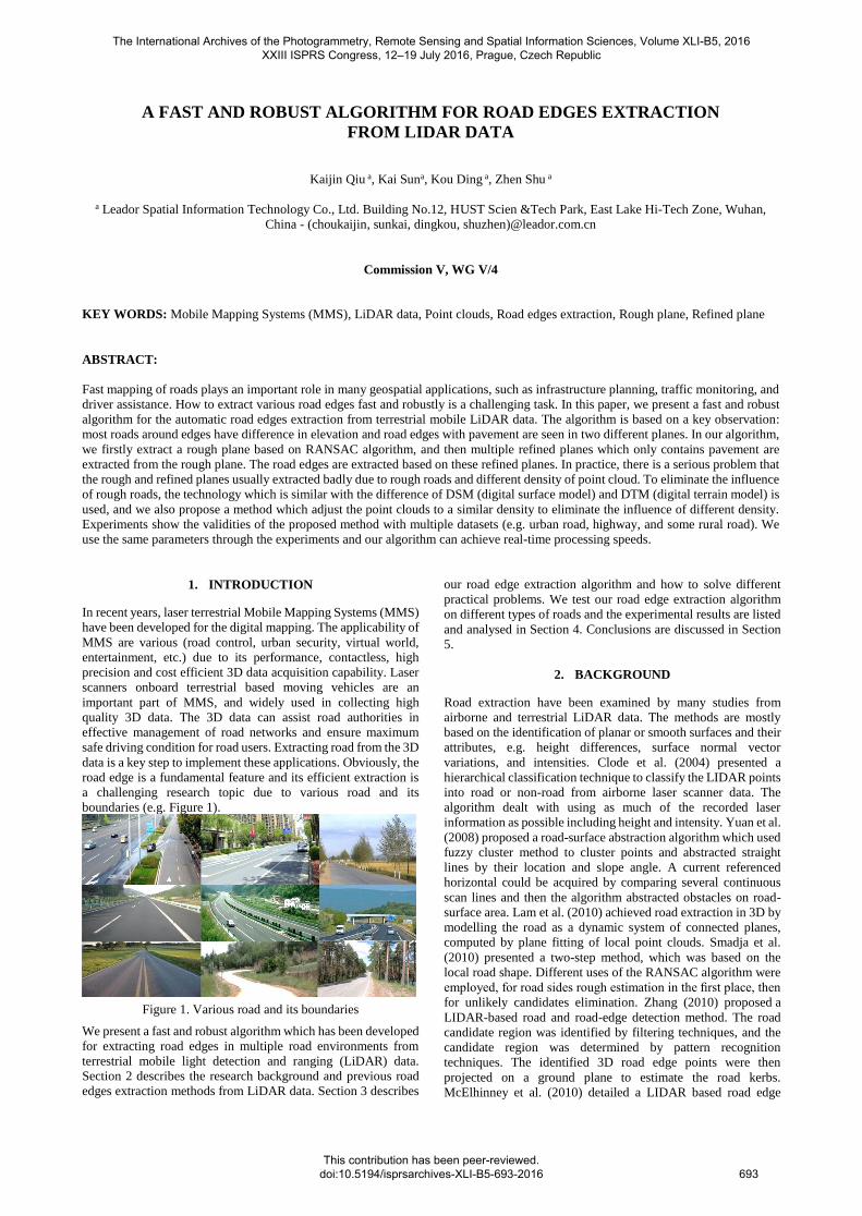
a challenging research topic due to various road and its
boundaries (e.g. Figure 1).
Figure 1. Various road and its boundaries
We present a fast and robust algorithm which has been developed
for extracting road edges in multiple road environments from
terrestrial mobile light detection and ranging (LiDAR) data.
Section 2 describes the research background and previous road
edges extraction methods from LiDAR data. Section 3 describes
our road edge extraction algorithm and how to solve different
practical problems. We test our road edge extraction algorithm
on different types of roads and the experimental results are listed
and analysed in Section 4. Conclusions are discussed in Section
5.
2. BACKGROUND
Road extraction have been examined by many studies from
airborne and terrestrial LiDAR data. The methods are mostly
based on the identification of planar or smooth surfaces and their
attributes, e.g. height differences, surface normal vector
variations, and intensities. Clode et al. (2004) presented a
hierarchical classification technique to classify the LIDAR points
into road or non-road from airborne laser scanner data. The
algorithm dealt with using as much of the recorded laser
information as possible including height and intensity. Yuan et al.
(2008) proposed a road-surface abstraction algorithm which used
fuzzy cluster method to cluster points and abstracted straight
lines by their location and slope angle. A current referenced
horizontal could be acquired by comparing several continuous
scan lines and then the algorithm abstracted obstacles on road-
surface area. Lam et al. (2010) achieved road extraction in 3D by
modelling the road as a dynamic system of connected planes,
computed by plane fitting of local point clouds. Smadja et al.
(2010) presented a two-step method, which was based on the
local road shape. Different uses of the RANSAC algorithm were
employed, for road sides rough estimation in the first place, then
for unlikely candidates elimination. Zhang (2010) proposed a
LIDAR-based road and road-edge detection method. The road
candidate region was identified by filtering techniques, and the
candidate region was determined by pattern recognition
techniques. The identified 3D road edge points were then
projected on a ground plane to estimate the road kerbs.
McElhinney et al. (2010) detailed a LIDAR based road edge
The International Archives of the Photogrammetry, Remote Sensing and Spatial Information Sciences, Volume XLI-B5, 2016 XXIII ISPRS Congress, 12–19 July 2016, Prague, Czech Republic
This contribution has been peer-reviewed. doi:10.5194/isprsarchives-XLI-B5-693-2016
693
extraction algorithm which is applicable to both urban and rural
road sections with geospatial data. Ibrahim and Lichti (2012)
presented an approach to the detection and extraction of the road
curb and the street floor from unorganized 3D point clouds
captured by Mobile terrestrial laser scanners. The pipeline
consisted of a sequence of five steps: organizing the input
irregular 3D point cloud and nearest neighbour search; density
based segmentation to extract the ground segment;
morphological analysis to refine the ground segment; derivative
of Gaussian to detect the curb; solving the travelling salesman
problem to form a closed polygon of the curb and point-in-
polygon test to extract the street floor. Kumar et al. (2013)
presented an algorithm to extract left and right road edges from
terrestrial mobile LiDAR data. The algorithm was based on a
combination of two modified versions of the parametric active
contour or snake model.
However, most of the above road extraction approaches have
been developed for urban road environments, and these methods
fail to provide an efficient and robust solution due to poor
performance and parameter-sensitivity. In the next section, we
describe our road edge extraction algorithm which attempts to
address the limitations of these approaches.
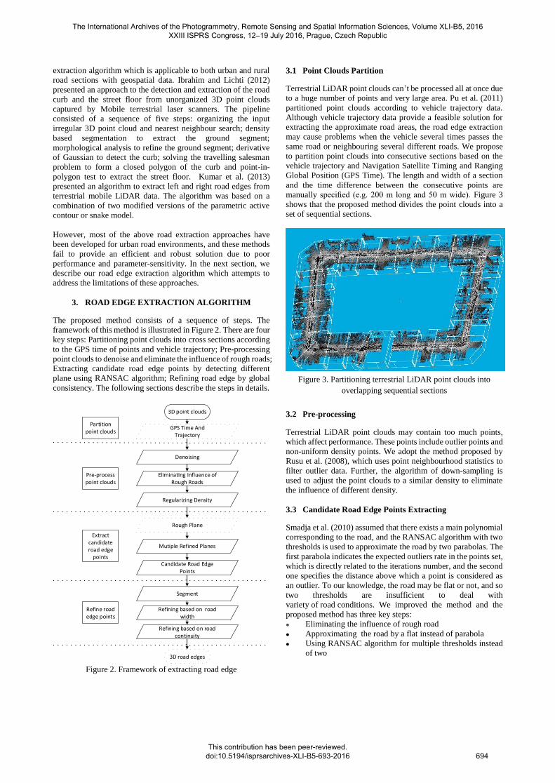
3. ROAD EDGE EXTRACTION ALGORITHM
The proposed method consists of a sequence of steps. The
framework of this method is illustrated in Figure 2. There are four
key steps: Partitioning point clouds into cross sections according
to the GPS time of points and vehicle trajectory; Pre-processing
point clouds to denoise and eliminate the influence of rough roads;
Extracting candidate road edge points by detecting different
plane using RANSAC algorithm; Refining road edge by global
consistency. The following sections describe the steps in details.
3D point clouds
Partition point clouds
Pre-process point clouds
Extract candidate road edge
points
Refine road edge points
GPS Time And Trajectory
Denoising
EliminatIng Influence of Rough Roads
Regularizing Density
Rough Plane
Mutiple Refined Planes
Candidate Road Edge Points
Refining based on road continuity
Segment
Refining based on road width
3D road edges
Figure 2. Framework of extracting road edge
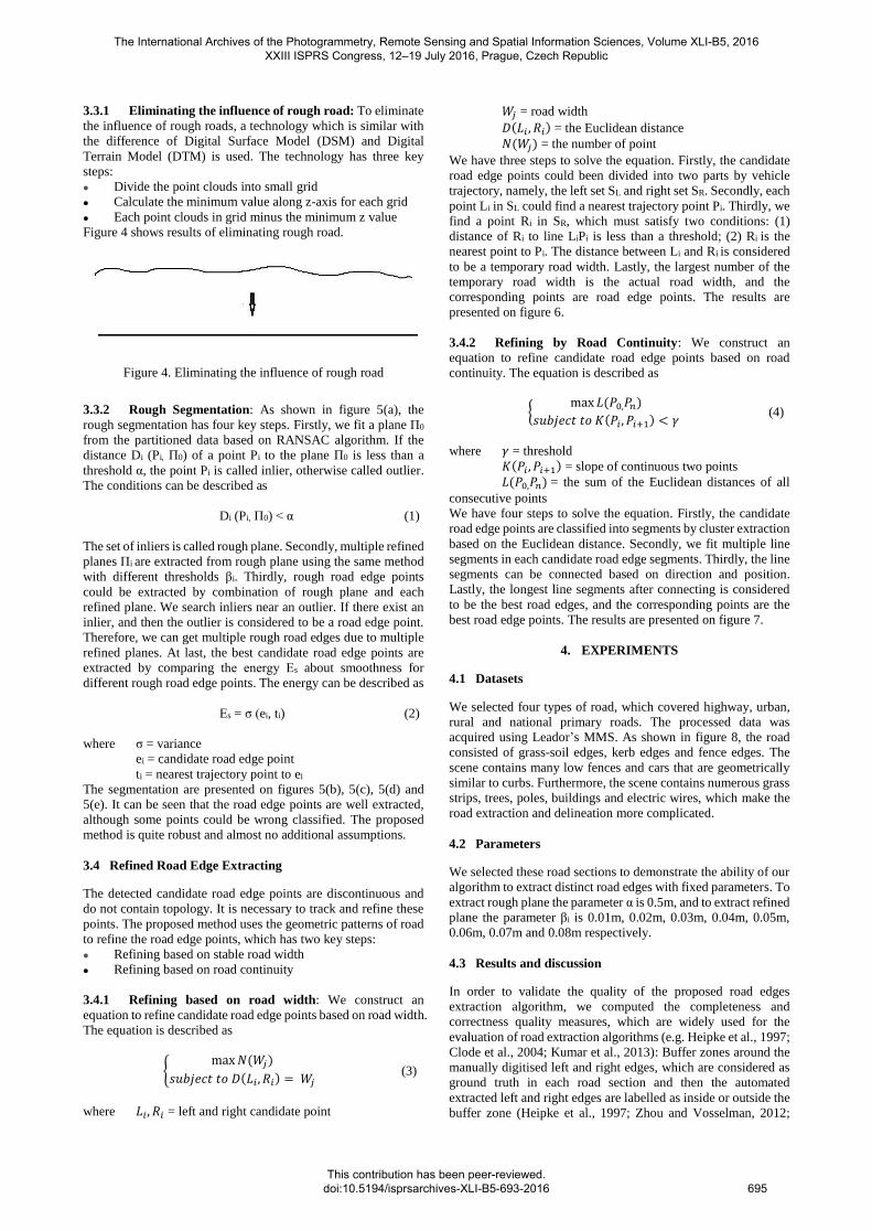
3.1 Point Clouds Partition
Terrestrial LiDAR point clouds can’t be processed all at once due
to a huge number of points and very large area. Pu et al. (2011)
partitioned point clouds according to vehicle trajectory data.
Although vehicle trajectory data provide a feasible solution for
extracting the approximate road areas, the road edge extraction
may cause problems when the vehicle several times passes the
same road or neighbouring several different roads. We propose
to partition point clouds into consecutive sections based on the
vehicle trajectory and Navigation Satellite Timing and Ranging
Global Position (GPS Time). The length and width of a section
and the time difference between the consecutive points are
manually specified (e.g. 200 m long and 50 m wide). Figure 3
shows that the proposed method divides the point clouds into a
set of sequential sections.
Figure 3. Partitioning terrestrial LiDAR point clouds into
overlapping sequential sections
3.2 Pre-processing
Terrestrial LiDAR point clouds may contain too much points,
which affect performance. These points include outlier points and
non-uniform density points. We adopt the method proposed by
Rusu et al. (2008), which uses point neighbourhood statistics to
filter outlier data. Further, the algorithm of down-sampling is
used to adjust the point clouds to a similar density to eliminate
the influence of different density.
3.3 Candidate Road Edge Points Extracting
Smadja et al. (2010) assumed that there exists a main polynomial
corresponding to the road, and the RANSAC algorithm with two
thresholds is used to approximate the road by two parabolas. The
first parabola indicates the expected outliers rate in the points set,
which is directly related to the iterations number, and the second
one specifies the distance above which a point is considered as
an outlier. To our knowledge, the road may be flat or not, and so
two thresholds are insufficient to deal with
variety of road conditions. We improved the method and the
proposed method has three key steps:
Eliminating the influence of rough road Approximating the road by a flat instead of parabola
Using RANSAC algorithm for multiple thresholds instead
of two
The International Archives of the Photogrammetry, Remote Sensing and Spatial Information Sciences, Volume XLI-B5, 2016 XXIII ISPRS Congress, 12–19 July 2016, Prague, Czech Republic
This contribution has been peer-reviewed. doi:10.5194/isprsarchives-XLI-B5-693-2016
694
3.3.1 Eliminating the influence of rough road: To eliminate
the influence of rough roads, a technology which is similar with
the difference of Digital Surface Model (DSM) and Digital
Terrain Model (DTM) is used. The technology has three key
steps:
Divide the point clouds into small grid Calculate the minimum value along z-axis for each grid
Each point clouds in grid minus the minimum z value
Figure 4 shows results of eliminating rough road.
Figure 4. Eliminating the influence of rough road
3.3.2 Rough Segmentation: As shown in figure 5(a), the
rough segmentation has four key steps. Firstly, we fit a plane Π0
from the partitioned data based on RANSAC algorithm. If the
distance Di (Pi, Π0) of a point Pi to the plane Π0 is less than a
threshold α, the point Pi is called inlier, otherwise called outlier.
The conditions can be described as
Di (Pi, Π0) < α (1)
The set of inliers is called rough plane. Secondly, multiple refined
planes Πi are extracted from rough plane using the same method
with different thresholds βi. Thirdly, rough road edge points
could be extracted by combination of rough plane and each
refined plane. We search inliers near an outlier. If there exist an
inlier, and then the outlier is considered to be a road edge point.
Therefore, we can get multiple rough road edges due to multiple
refined planes. At last, the best candidate road edge points are
extracted by comparing the energy Εs about smoothness for
different rough road edge points. The energy can be described as
Εs = σ (ei, ti) (2)
where σ = variance
ei = candidate road edge point
ti = nearest trajectory point to ei
The segmentation are presented on figures 5(b), 5(c), 5(d) and
5(e). It can be seen that the road edge points are well extracted,
although some points could be wrong classified. The proposed
method is quite robust and almost no additional assumptions.
3.4 Refined Road Edge Extracting
The detected candidate road edge points are discontinuous and
do not contain topology. It is necessary to track and refine these
points. The proposed method uses the geometric patterns of road
to refine the road edge points, which has two key steps:
Refining based on stable road width Refining based on road continuity
3.4.1 Refining based on road width: We construct an
equation to refine candidate road edge points based on road width.
The equation is described as
{max 𝑁(𝑊𝑗)
𝑠𝑢𝑏𝑗𝑒𝑐𝑡 𝑡𝑜 𝐷(𝐿𝑖 , 𝑅𝑖) = 𝑊𝑗 (3)
where 𝐿𝑖 , 𝑅𝑖 = left and right candidate point
𝑊𝑗 = road width
𝐷(𝐿𝑖 , 𝑅𝑖) = the Euclidean distance
𝑁(𝑊𝑗) = the number of point
We have three steps to solve the equation. Firstly, the candidate
road edge points could been divided into two parts by vehicle
trajectory, namely, the left set SL and right set SR. Secondly, each
point Li in SL could find a nearest trajectory point Pi. Thirdly, we
find a point Ri in SR, which must satisfy two conditions: (1)
distance of Ri to line LiPi is less than a threshold; (2) Ri is the
nearest point to Pi. The distance between Li and Ri is considered
to be a temporary road width. Lastly, the largest number of the
temporary road width is the actual road width, and the
corresponding points are road edge points. The results are
presented on figure 6.
3.4.2 Refining by Road Continuity: We construct an
equation to refine candidate road edge points based on road
continuity. The equation is described as
{max 𝐿(𝑃0,𝑃𝑛)
𝑠𝑢𝑏𝑗𝑒𝑐𝑡 𝑡𝑜 𝐾(𝑃𝑖 , 𝑃𝑖+1) < 𝛾 (4)
where 𝛾 = threshold
𝐾(𝑃𝑖 , 𝑃𝑖+1) = slope of continuous two points
𝐿(𝑃0,𝑃𝑛) = the sum of the Euclidean distances of all
consecutive points
We have four steps to solve the equation. Firstly, the candidate
road edge points are classified into segments by cluster extraction
based on the Euclidean distance. Secondly, we fit multiple line
segments in each candidate road edge segments. Thirdly, the line
segments can be connected based on direction and position.
Lastly, the longest line segments after connecting is considered
to be the best road edges, and the corresponding points are the
best road edge points. The results are presented on figure 7.
4. EXPERIMENTS
4.1 Datasets
We selected four types of road, which covered highway, urban,
rural and national primary roads. The processed data was
acquired using Leador’s MMS. As shown in figure 8, the road
consisted of grass-soil edges, kerb edges and fence edges. The
scene contains many low fences and cars that are geometrically
similar to curbs. Furthermore, the scene contains numerous grass
strips, trees, poles, buildings and electric wires, which make the
road extraction and delineation more complicated.
4.2 Parameters
We selected these road sections to demonstrate the ability of our
algorithm to extract distinct road edges with fixed parameters. To
extract rough plane the parameter α is 0.5m, and to extract refined
plane the parameter βi is 0.01m, 0.02m, 0.03m, 0.04m, 0.05m,
0.06m, 0.07m and 0.08m respectively.
4.3 Results and discussion
In order to validate the quality of the proposed road edges
extraction algorithm, we computed the completeness and
correctness quality measures, which are widely used for the
evaluation of road extraction algorithms (e.g. Heipke et al., 1997;
Clode et al., 2004; Kumar et al., 2013): Buffer zones around the
manually digitised left and right edges, which are considered as
ground truth in each road section and then the automated
extracted left and right edges are labelled as inside or outside the
buffer zone (Heipke et al., 1997; Zhou and Vosselman, 2012;
The International Archives of the Photogrammetry, Remote Sensing and Spatial Information Sciences, Volume XLI-B5, 2016 XXIII ISPRS Congress, 12–19 July 2016, Prague, Czech Republic
This contribution has been peer-reviewed. doi:10.5194/isprsarchives-XLI-B5-693-2016
695

Kumar et al., 2013). The buffer width parameter was set to 0.2m
for application. The completeness and correctness values were
calculated for the automated extracted road edges in each test
data as shown in Table 1.
Road
Completeness Correctness Time-
consuming
(ms/m) left
(%)
Right
(%)
Left
(%)
Right
(%)
Urban 1 96.1 96.7 99.4 99.6
150
Urban 2 94.5 95.2 99.1 99.2
Urban 3 56.3 95.3 70.9 99.3
Rural 1 96.0 97.5 99.2 99.3
Rural 2 93.2 95.5 99.0 99.1
Rural 3 83.4 87.5 96.5 96.2
Highway 1 97.1 96.8 99.8 99.6
Highway 2 97.3 96.4 99.9 99.9
Highway 3 97.2 96.8 99.7 99.7
National
primary
86.7 86.1 90.1 90.0
Table 1. Completeness and correctness values were calculated
for the automated extracted road edges
The proposed algorithm was able to successfully extract the left
and right road edges in these datasets. In the case of urban 3, the
completeness values is less than 70%. The primary reason for this
was that too many vehicles parked by the roadside as shown in
figure 9. In the case of national primary, the completeness values
is less than 90%. This was due to almost no height differences at
some road edges as shown in figure 10. We also collect the
computation time. The single-threaded average performance is
about 150 milliseconds per meters on our platform (3.60Ghz
Core i7 CPU, 16.0GB of RAM, C++ implementation), and multi-
threaded parallel processing could improve the performance.
Extract rough plane
Extract multiple refined
planes
Extract rough road edge
points
Extract best candidate
road edge points
Partitioned point clouds
Fit plane Π0
Calculate distance Di
Di <α
inlier
outlier
Rough plane
N
Y
Fit plane Πi
M
M
Refined planes Πi
Search
Exist outlier
Y
Rough road edge points
Calculate smoothness Es
best candidate road edge points
(a). Rough segmentation flowchart
(b). Rough plane and details (red points are inliers, white points
are outliers)
(c). One of refined plane and details (red points are inliers,
white points are outliers)
(d). One of rough road edge points
(e). Best candidate road edge points
Figure 5. Rough segmentation
Figure 6. Refining based on road width and details
The International Archives of the Photogrammetry, Remote Sensing and Spatial Information Sciences, Volume XLI-B5, 2016 XXIII ISPRS Congress, 12–19 July 2016, Prague, Czech Republic
This contribution has been peer-reviewed. doi:10.5194/isprsarchives-XLI-B5-693-2016
696

Figure 7. Refining based on road continuity
Figure 8. LiDAR data of various road edges
5. CONCLUSIONS
We have proposed an efficient method to extract road edges from
the dense and huge volume point clouds. Our algorithm was
based on the assumption that the LiDAR data elevation can be
used to distinguish the road surface from the road edges. The
successful extraction of road edges from the multiple types of
road validates our proposed algorithm.
Although the proposed method can extracts 3D road edges from
the test datasets, the road conditions are critical for the
performance of the proposed method. Particularly, obscure road
edges and too many obstructions by roadside have an effect on
the detection of road edges, and it is difficult for the proposed
method to deal with these situations.
Figure 9. Cars parked at the roadside
Figure 10. Obscure road edges
REFERENCES
Clode, S., Kootsookos, P., Rottensteiner, F., 2004. The automatic
extraction of roads from LiDAR data. In: The International
Archives of Photogrammetry, Remote Sensing and Spatial
Information Sciences 35 (Part B3), pp. 1–6.
Yuan, X., Zhao, C.X., Cai, Y.F., Zhang, H., Chen, D.B., 2008.
Road-surface abstraction using ladar sensing. In: Proc. 10th
International Conference on Control, Automation, Robotics and
Vision, 17–20 December, Hanoi, pp. 1097–1102.
Lam, J., Kusevic, K., Mrstik, P., Harrap, R., Greenspan, M., 2010.
Urban scene extraction from mobile ground based LiDAR data.
In: Proc. 5th International Symposium on 3D Data, Processing,
Visualization & Transmission, 17–20 May, Paris, pp. 1–8.
Smadja, L., Ninot, J., Gavrilovic, T., 2010. Road extraction and
environment interpretation from LiDAR sensors. In:
International Archives of Photogrammetry, Remote Sensing and
Spatial Information Sciences 38 (Part 3A), pp. 281–286.
Zhang, W., 2010. LiDAR based road and road-edge detection. In:
Proc. Intelligent Vehicles Symposium, 21–24 June, San Diego, pp.
845–848.
McElhinney, C.P., Kumar, P., Cahalane, C., McCarthy, T., 2010.
Initial results from european road safety inspection (EURSI)
mobile mapping project. International Archives of
Photogrammetry, Remote Sensing and Spatial Information
Sciences 38 (Part 5), 440–445.
Ibrahim, S., Lichti, D., 2012. Curb-based street floor extraction
from mobile terrestrial LiDAR point cloud. International
Archives of Photogrammetry, Remote Sensing and Spatial
Information Sciences 39 (Part B5), 193–198.
Kumar, P., McElhinney, C. P., Lewis, P. and McCarthy, T., 2013.
An automated algorithm for extracting road edges from terrestrial
mobile LiDAR data. ISPRS Journal of Photogrammetry and
Remote Sensing, 85, pp. 44–55.
Pu, S., Rutzinger, M., Vosselman, G., Oude Elberink, S., 2011.
Recognizing basic structures from mobile laser scanning data for
road inventory studies. ISPRS Journal of Photogrammetry and
Remote Sensing 66 (6), S28–S39.
The International Archives of the Photogrammetry, Remote Sensing and Spatial Information Sciences, Volume XLI-B5, 2016 XXIII ISPRS Congress, 12–19 July 2016, Prague, Czech Republic
This contribution has been peer-reviewed. doi:10.5194/isprsarchives-XLI-B5-693-2016
697

Rusu, R.B., Marton, Z.C., Blodow, N., Dolha, M., Beetz, M.,
2008. Towards 3D Point cloud based object maps for household
environments. Robotics and Autonomous Systems, 56, pp. 927–
941.
Heipke, C., Mayer, H., Wiedeman, C., Jamet, O., 1997.
Evaluation of automatic road extraction. International Archives
of Photogrammetry, Remote Sensing and Spatial Information
Sciences 32 (Part 3/W3), 47–56.
Zhou, L., Vosselman, G., 2012. Mapping curbstones in airborne
and mobile laser scanning data. International Journal of Applied
Earth Observation and Geoinformation 18, 293–304.
The International Archives of the Photogrammetry, Remote Sensing and Spatial Information Sciences, Volume XLI-B5, 2016 XXIII ISPRS Congress, 12–19 July 2016, Prague, Czech Republic
This contribution has been peer-reviewed. doi:10.5194/isprsarchives-XLI-B5-693-2016
698