2008 rttl draft 111908 rev 4 mlh with council edits
TRANSCRIPT

Lake PanasoffkeeRestoration Council
Report tothe LegislatureNovember 25, 2008
FINALREPORT

The Southwest Florida Water Management District (District) does not discriminate upon the basis of any individual’s disability status. This nondiscrimination policy involves every aspect of the District’s functions including one’s access to participation, employment, or treatment in its programs or activities. Anyone requiring reasonable accommodations as provided for in the Americans with Disabilities Act should contact the Operations Department at (352) 796-7211 or 1-800-423-1476 (FL only), extension 4222, TDD only 1-800-231-6103 (FL only).

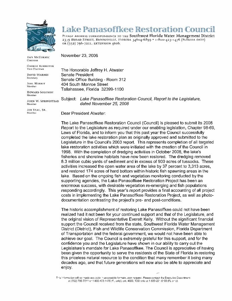
LAKE PANASOFFKEE RESTORATION PROJECT REPORT TO THE LEGISLATURE NOVEMBER 25, 2008 Restoration Council Members:
Daniel C. McCormic, Chairman, Attorney George L. Buhmeyer, Vice-Chairman, Lakefront Property Owner David Starnes, Secretary, Engineering John W. Springstead, P. E., Environmental Engineer Jim W. Veal, Sr., Sport Fishing Industry Joel A. Merritt, Biology Howard Solomon, Lakefront Property Owner


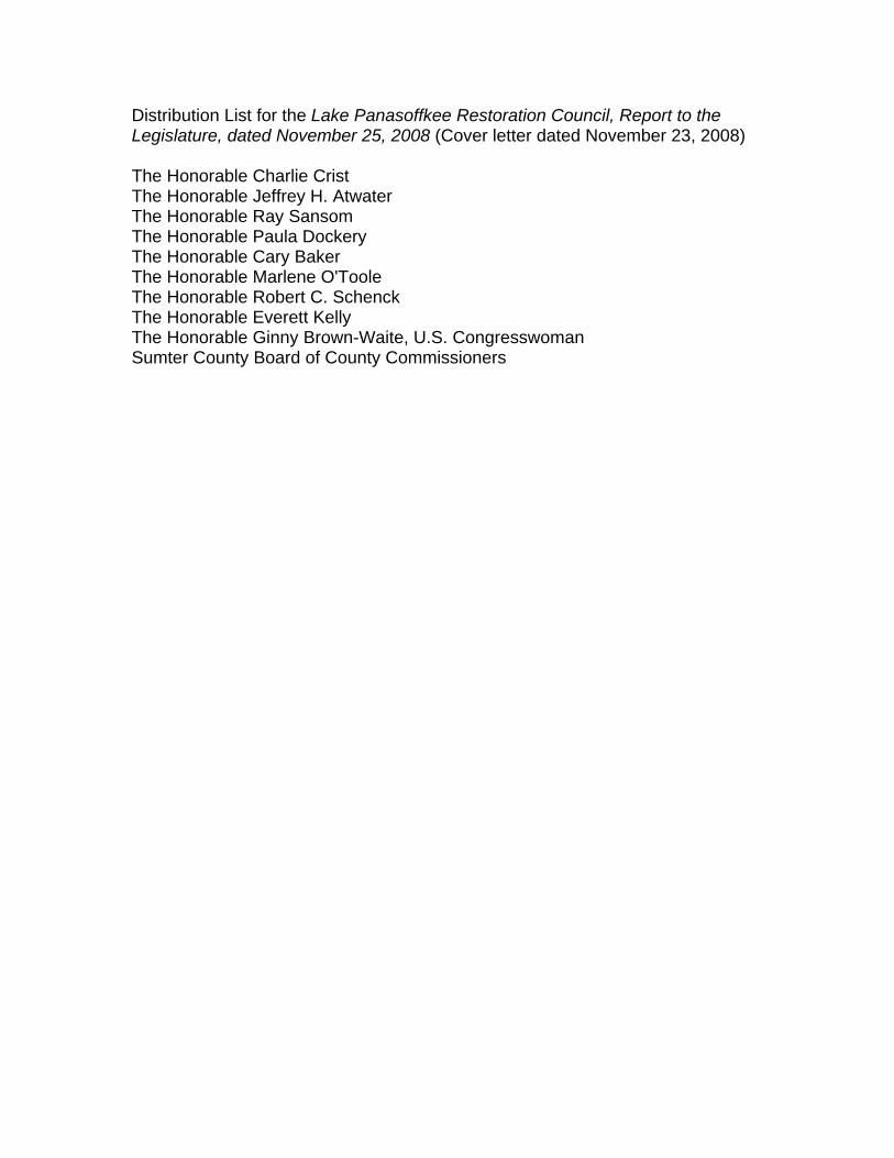
Distribution List for the Lake Panasoffkee Restoration Council, Report to the Legislature, dated November 25, 2008 (Cover letter dated November 23, 2008) The Honorable Charlie Crist The Honorable Jeffrey H. Atwater The Honorable Ray Sansom The Honorable Paula Dockery The Honorable Cary Baker The Honorable Marlene O'Toole The Honorable Robert C. Schenck The Honorable Everett Kelly The Honorable Ginny Brown-Waite, U.S. Congresswoman Sumter County Board of County Commissioners


LAKE PANASOFFKEE RESTORATION COUNCIL 2008 REPORT TO THE LEGISLATURE
TABLE OF CONTENTS
INTRODUCTION................................................................................................... 1 BACKGROUND.................................................................................................... 1 Lake Panasoffkee .......................................................................................... 1 Lake Panasoffkee Restoration Council .......................................................... 2 Lake Panasoffkee Restoration Plan............................................................ 2-4 SUMMARY REPORT............................................................................................ 5 Project Funding and Final Project Costs........................................................ 5 Project Element Summary .......................................................................... 6-7 Long Term Management Issues ................................................................. 7-8 RECOMMENDATIONS...................................................................................... 8-9 APPENDIX

1
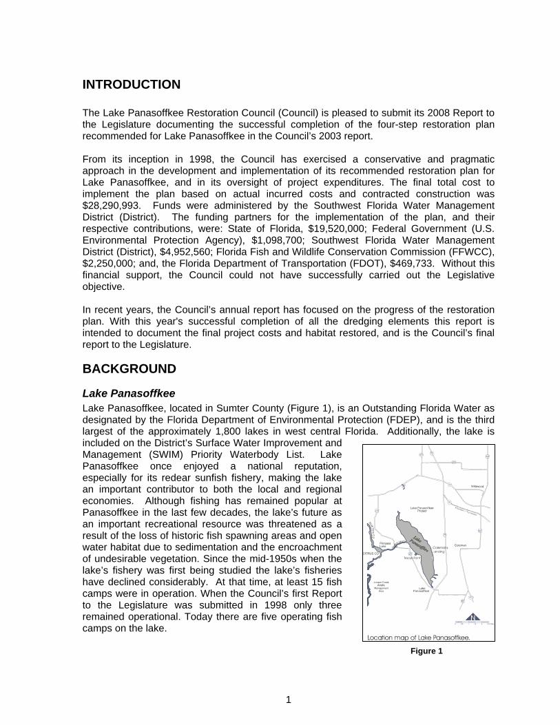
INTRODUCTION The Lake Panasoffkee Restoration Council (Council) is pleased to submit its 2008 Report to the Legislature documenting the successful completion of the four-step restoration plan recommended for Lake Panasoffkee in the Council’s 2003 report. From its inception in 1998, the Council has exercised a conservative and pragmatic approach in the development and implementation of its recommended restoration plan for Lake Panasoffkee, and in its oversight of project expenditures. The final total cost to implement the plan based on actual incurred costs and contracted construction was $28,290,993. Funds were administered by the Southwest Florida Water Management District (District). The funding partners for the implementation of the plan, and their respective contributions, were: State of Florida, $19,520,000; Federal Government (U.S. Environmental Protection Agency), $1,098,700; Southwest Florida Water Management District (District), $4,952,560; Florida Fish and Wildlife Conservation Commission (FFWCC), $2,250,000; and, the Florida Department of Transportation (FDOT), $469,733. Without this financial support, the Council could not have successfully carried out the Legislative objective. In recent years, the Council’s annual report has focused on the progress of the restoration plan. With this year's successful completion of all the dredging elements this report is intended to document the final project costs and habitat restored, and is the Council’s final report to the Legislature.
BACKGROUND
Lake Panasoffkee Lake Panasoffkee, located in Sumter County (Figure 1), is an Outstanding Florida Water as designated by the Florida Department of Environmental Protection (FDEP), and is the third largest of the approximately 1,800 lakes in west central Florida. Additionally, the lake is included on the District’s Surface Water Improvement and Management (SWIM) Priority Waterbody List. Lake Panasoffkee once enjoyed a national reputation, especially for its redear sunfish fishery, making the lake an important contributor to both the local and regional economies. Although fishing has remained popular at Panasoffkee in the last few decades, the lake’s future as an important recreational resource was threatened as a result of the loss of historic fish spawning areas and open water habitat due to sedimentation and the encroachment of undesirable vegetation. Since the mid-1950s when the lake’s fishery was first being studied the lake’s fisheries have declined considerably. At that time, at least 15 fish camps were in operation. When the Council’s first Report to the Legislature was submitted in 1998 only three remained operational. Today there are five operating fish camps on the lake.
Figure 1

2
Lake Panasoffkee Restoration Council In an effort to protect and restore the environmental and regionally economic importance of Lake Panasoffkee, the 1998 Florida Legislature created the Lake Panasoffkee Restoration Council within the District. The enabling legislation (Chapter 98-69, Laws of Florida) established the membership and outlined the responsibilities of the Council and its Advisory Group. Through the enabling legislation, the Legislature directed the Council to develop a restoration plan for Lake Panasoffkee. The Act specifically identified the Council’s focus would be on shoreline restoration, sediment control and removal, exotic species management, floating tussock management and removal, navigation, water quality, and fisheries habitat improvement. During its first year, the Council and Advisory Group prioritized the management issues and developed strategies for restoring the lake. The Council also recommended additional studies to evaluate the lake's fishery and identified additional information needed to develop and implement the restoration plan. The culmination of this effort was discussed in detail in the first Lake Panasoffkee Restoration Council Report to the Legislature, dated November 25, 1998. Pursuant to its Legislative directive, the Council has reported to the Legislature every year since 1998 to provide progress reports and recommendations for the next fiscal year.
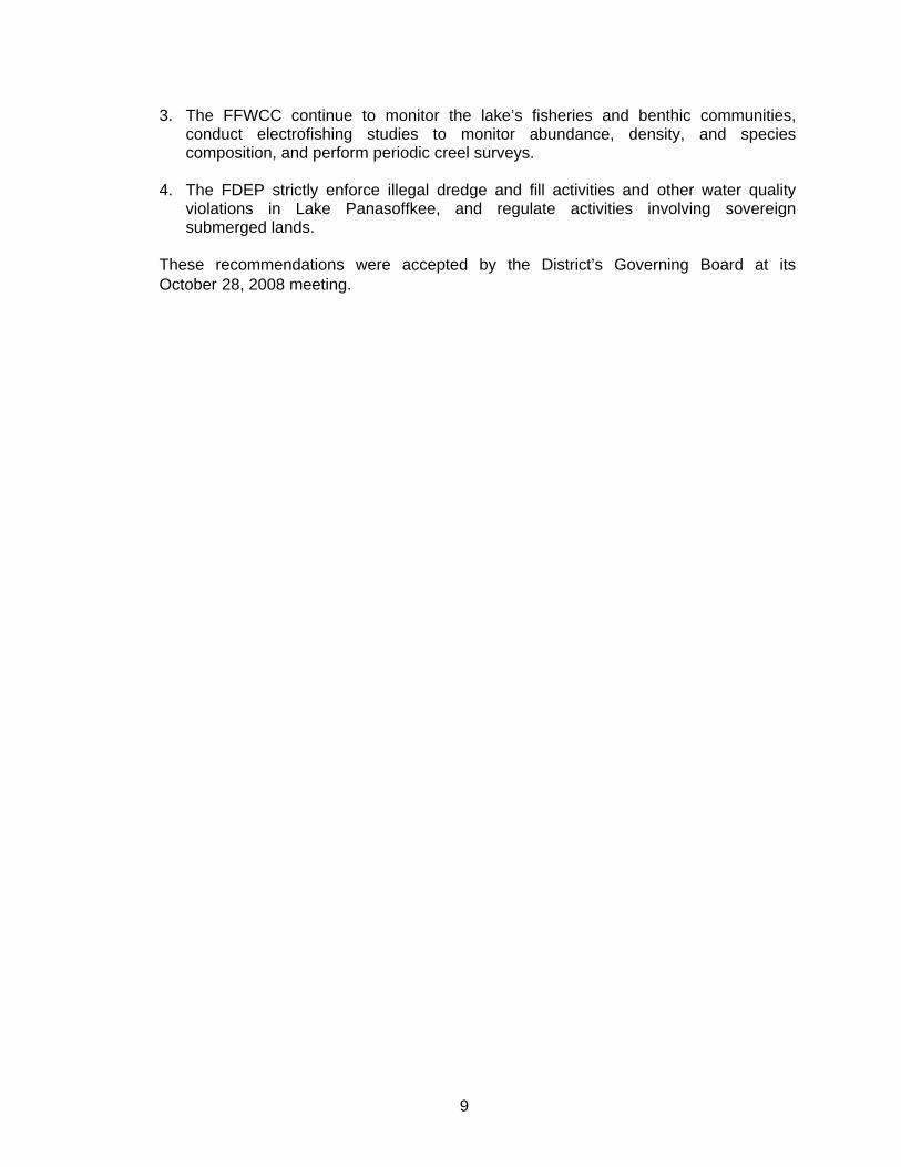
Lake Panasoffkee Restoration Plan The final restoration plan for Lake Panasoffkee was documented in the Council’s 2003 Report to the Legislature and was comprised of four steps. Step 1 of the plan, the Coleman Landing Pilot Dredging Project, was completed in December 2000. Since the completion of Step 1, the primary focus was on the implementation of Steps 2 and 3 of the restoration plan. Steps 2 and 3 represented the full-scale in-lake restoration effort, and consisted of the dredging of approximately 8.3 million cubic yards of accumulated sediments over 1,744 acres of lake area, and the restoration of approximately 900 acres of historic open water area. Steps 2 and 3 were the critical steps in achieving the Council's goals to restore fisheries habitat and historic shoreline conditions, and improving navigation. Step 4 involved the removal of sediment and undesirable vegetation from the man-made residential canals along the western shoreline. Sumter County was the lead entity on this step with the Council contributing $657,000, or approximately 32 percent of the total cost. The benefit of Step 4 to the lake is the control of undesirable vegetation and migration of fine grained sediments back into the lake. Additionally, by dredging the canals down to the same elevation as the in-lake dredging steps, it provides improved operational flexibility to allow the lake to fluctuate through a wider range of elevations to ensure healthy native submerged aquatic vegetation (SAV) community. The four steps of the Council’s recommended restoration plan are described below in order of their priority. Step 1 – Coleman Landing Pilot Project: The goals of this step were threefold. First and foremost, this pilot dredging project provided information critical to the design, permitting, and dredging of Steps 2 and 3 by confirming settling rates needed to size the upland spoil disposal area for Steps 2 and 3, and by demonstrating that discharge water would meet state water quality standards. Step 1 also confirmed that SAV would re-colonize in dredged areas, and provided an expected rate of re-colonization, both of which were key issues in the environmental permitting of Steps 2 and 3. Step 1 also restored public access and navigation by re-establishing a navigable channel from the existing Coleman's Landing boat ramp to the lake.

3
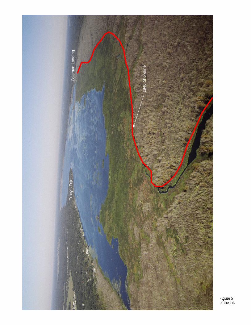
Step 2 – Dredge to Hard Bottom: The goal of this step was to dredge approximately 765 acres of lake bottom (3,396,120 cubic yards of sediment) to restore lost fisheries habitat, specifically the historic fish spawning areas in the vicinity of Grassy and Shell Points, where the desired hard bottom (sand/shell) for fish spawning has been covered by unconsolidated sediments. The dredging of this step also restored historic shoreline conditions along the eastern and western shores which provides improved fisheries, navigation, and recreational benefits. Step 3 – Dredge East-side Emergent Vegetation: The goal of this step was to dredge approximately 979 acres of lake bottom (4,875,169 cubic yards of sediment) along the eastern and southern shores, and in the creeks at the southern end of the lake, to restore fisheries habitat, and historic open water and shoreline conditions. Step 4 – Canals: The goal of this step was to improve lake access, and to control the transport of fine grained sediments and undesirable vegetation back into the lake from the 41 residential canals located along the lake’s western shoreline by the maintenance dredging of sediment and clean out of vegetation in the canals. Sumter County was the lead entity in the implementation of Step 4 and appropriated $1,386,060. The county hired a dredging contractor and managed the project. The goal of the county was to improve navigation from the canals to the lake. The Council participated financially in this element by contributing $657,000 of State appropriated funds. The justification for Council involvement was the elimination of the potential for canal sediments and undesirable vegetation to enter the lake once the lake was dredged adjacent to the mouth of the canals. The dredging boundaries of the three in-lake steps of the Council’s restoration plan are shown in Figure 2. The actual implementation of the Council’s restoration plan for Lake Panasoffkee consisted of three distinct elements:
1. Coleman Landing Pilot Dredging Project 2. Full-scale In-lake Dredging Effort 3. Maintenance Dredging and Cleanout of Residential Canals

4
Step 4: Canals
41 residential canals along western shoreline

5
SUMMARY REPORT
Project Funding and Final Project Costs The project funding for the Lake Panasoffkee Restoration Project administered by the District is summarized in Table 1.
Table 1 – Project Funding
Funding Source Amount Percent State Appropriations $19,520,000 69.00%Southwest Florida Water Management District 1 $4,952,560 17.51%Florida Fish and Wildlife Conservation Commission $2,250,000 7.95%U.S. Environmental Protection Agency $1,098,700 3.88%Florida Department of Transportation $469,733 1.66%
Total Project Funding $28,290,993 100.00% Notes: 1. Amount includes $1,918,155 for the purchase of the upland spoil disposal site. The total expenditures for the restoration plan for Lake Panasoffkee are summarized in Table 2. Costs have been updated since the 2007 report to reflect the final project costs based on actual project expenditures, including land acquisition. The costs shown for each element in Table 2 include prorated design, permitting, construction supervision and inspection, construction/dredging, SAV monitoring, land acquisition and other miscellaneous project related costs. In-kind costs incurred by the District, FFWCC and the FDEP for in-lake water quality and fisheries monitoring, and project management are not included in the costs shown.
Table 2 - Total Expenditures for All Elements of Lake Restoration
Element of Restoration Plan Area
Acres Volume
Cu. Yards Total Costs 4
Coleman Landing Pilot Dredging Project 1 24.5 138,035 $759,092
Full-scale In-lake Restoration Effort 2 1,744 8,271,289 $26,874,901
Residential Canals 3 $657,000
Totals 8,271,769 28,290,993Notes: 1. Costs include reclamation costs for the spoil disposal site. 2. Costs shown are based on land acquisition cost, actual bid amounts, approved amendments to the construction
agreement over the course of the project between December 2003 and September 2008, and other ancillary costs. 3. Sumter County was the lead entity for Step 4 and directly funded $1,386,060. The Council authorized the expenditure of
$657,000 in State appropriations based on the water quality benefits that would accrue to the work by reducing the potential for fine grained canal sediments migrating from the canals into the lake.
4. Total costs shown include costs associated with ground water monitoring, sediment and water quality analyses, an archeological assessment and quarterly project monitoring, and other miscellaneous costs in support of the design, permitting, and construction of the restoration plan.

6
Project Element Summary With the submittal of this report, all planned restoration activities of the Council’s restoration plan for Lake Panasoffkee have been completed. The appendix to this report provides photo documentation comparing the pre- and post-project conditions for the restoration effort. The following summarizes the timelines for each element of the plan along with the major cost components of each element.
Coleman Landing Pilot Dredging Project The dredging contract for the Coleman Landing Pilot Dredging Project was awarded by the District to Subaqueous Services, Inc. in May 2000 in the amount of $740,000. The notice to proceed was issued to the contractor on June 15, 2000 with a six-month construction/dredging period. Dredging was completed on December 14, 2000. The final dredging cost came in under budget because it was not necessary to use chemical flocculants to clarify discharge water from the upland spoil containment area. The design of the project was funded directly by the FFWCC, and the District made available the land for upland spoil containment area on property it owned adjacent to Coleman Landing. Major cost components: $699,000 Contracted Construction $57,767 Reclamation of Spoil Disposal Site $2,325 Miscellaneous project related costs $759,092 Total Cost
Full-scale In-lake Restoration Effort: The dredging contract for the full-scale in-lake restoration effort was awarded by the District to Subaqueous Services, Inc. in August 2003 in the amount of $22,627,895. The notice to proceed was issued to the contractor on December 8, 2003 with a four-year construction/dredging period. The 450 acre upland spoil containment facility was completed in June 2004, and the dredging commenced in July 2004. The original completion date was January 23, 2008; however, the date was pushed back due to the extreme low water conditions that existed in the summer and fall of 2007. Dredging was completed on September 30, 2008, and demobilization was completed on October 31, 2008. This element of the restoration plan removed approximately 8.3 million cubic yards of fine grained sediments and in excess of 900 acres of tussocks, increased the open water area of the lake by 37 percent to 3,313 acres, and restored 174 acres of hard bottom within historic fish spawning areas in the lake. Major cost components: $1,918,155 Acquisition of Upland Spoil Disposal Site (541 acres) $452,818 Final Design and Permitting $112,837 SAV Mapping/Monitoring $974,897 Construction Engineering & Inspection Services $86,130 Miscellaneous project related costs $23,330,063 Contracted Construction (to be confirmed based on actual final costs) $26,874,901 Total Cost
Residential Canals: In 2001, Sumter County (County) assumed the lead role in the implementation of this element of the restoration plan. The Council initially authorized the use of $200,000 in State appropriations in 2001 for the county to use in initiating the design and permitting phase of the canal clean out, and for the implementation of this element. The contract to dredge 28

7
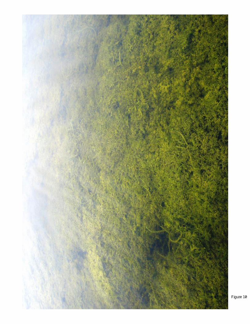
of the 41 canals along the western shoreline was awarded by the County to Associated Diving and Marine Contractors, L.L.C. in February 2007, in the amount of $1,336,842. Subsequent to the contract award, the County expanded the scope of work to increase the number of canals to be cleaned from 28 to 41, and extend the limits of the clean out. The notice to proceed was issued to the contractor effective February 27, 2007. In 2007, the Council authorized the expenditure of an additional $457,000 in State appropriations for this element, for a total contribution of $657,000. The Council’s funding of this element of the plan was based on the in-lake benefits attributable to the canal clean out. The District also made the upland spoil containment area for full-scale in-lake dredging project available to the County’s contractor for the disposal of the material from the canal clean out. Work was substantially completed in April 2008, and the contractor had demobilized on August 19, 2008. The County funded $1,386,060 toward the residential canal clean out. Major cost components: $657,000 State appropriations used for design, permitting and construction Long Term Management Issues Submerged Aquatic Vegetation (SAV): The Council's first Report to the Legislature in 1998 acknowledged the importance of maintaining a healthy SAV community in Lake Panasoffkee in order to maintain good water quality and water clarity. Baseline SAV mapping for the lake was obtained in the spring of 2000. Since the baseline mapping effort, the District had implemented an annual SAV mapping program to monitor SAV coverage during dredging operations to ensure SAV coverage does not drop below 60 percent of the open water area as a result of dredging activities. Research on Florida lakes has shown that 60 percent areal coverage of SAV is the minimal coverage necessary to maintain a healthy lake in terms of water clarity. Additionally, the maintenance of 60 percent SAV coverage in the lake during dredging was a requirement of the Environmental Resource Permit issued by the FDEP for the project. With the exception of the spring of 2003, when water clarity did not allow for the mapping of SAV, SAV has been mapped each spring since the 2000 baseline mapping effort through the final mapping effort in the summer of 2007. As reported in the Council’s 2006 Report, a major concern of the Council has been the lack of natural recruitment of desirable (i.e., native) SAV species in the newly dredged areas. The Coleman Landing Pilot Dredging Project had previously demonstrated SAV would recruit newly dredged areas; however, there had been no significant recruitment of native SAV observed during the first two years of dredging for the full-scale in-lake element. Based on these concerns, and at the recommendation of the Advisory Group, the Council approved deleting 157 acres from within the dredging foot print that supported robust SAV populations. These areas were deleted in order to preserve a desirable SAV source to aid in the colonization of the other areas of the lake. During 2007, there was dramatic resurgence of native SAV within the entire dredging foot print. This resurgence was attributable to the extended low water conditions that existed beginning in June 2006 and extending through the summer of 2007. The low water condition allowed for greater light penetration to the newly dredged lake bottom. The improved light penetration stimulated native SAV growth and the shallow water depths allowed the native species to compete with non-native species (i.e., hydrilla). Based on the last SAV mapping effort in August 2007, the lake’s SAV coverage was determined to be 69.9 percent, well in excess of the minimal 60 percent coverage characteristic of healthy lakes. Based on this resurgence of SAV and the continued recruitment of native SAV
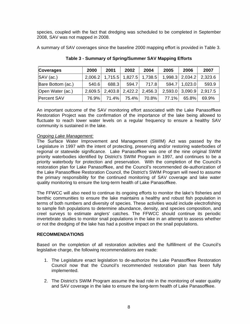
8
species, coupled with the fact that dredging was scheduled to be completed in September 2008, SAV was not mapped in 2008. A summary of SAV coverages since the baseline 2000 mapping effort is provided in Table 3.
Table 3 - Summary of Spring/Summer SAV Mapping Efforts
Coverages 2000 2001 2002 2004 2005 2006 2007 SAV (ac.) 2,006.2 1,715.5 1,827.5 1,738.5 1,998.3 2,034.2 2,323.6 Bare Bottom (ac.) 540.6 688.3 594.7 717.8 594.7 1,023.0 593.9 Open Water (ac.) 2,609.5 2,403.8 2,422.2 2,456.3 2,593.0 3,090.9 2,917.5 Percent SAV 76.9% 71.4% 75.4% 70.8% 77.1% 65.8% 69.9%
An important outcome of the SAV monitoring effort associated with the Lake Panasoffkee Restoration Project was the confirmation of the importance of the lake being allowed to fluctuate to reach lower water levels on a regular frequency to ensure a healthy SAV community is sustained in the lake. Ongoing Lake Management: The Surface Water Improvement and Management (SWIM) Act was passed by the Legislature in 1997 with the intent of protecting, preserving and/or restoring waterbodies of regional or statewide significance. Lake Panasoffkee was one of the nine original SWIM priority waterbodies identified by District’s SWIM Program in 1997, and continues to be a priority waterbody for protection and preservation. With the completion of the Council’s restoration plan for Lake Panasoffkee, and the Council’s recommended de-authorization of the Lake Panasoffkee Restoration Council, the District’s SWIM Program will need to assume the primary responsibility for the continued monitoring of SAV coverage and lake water quality monitoring to ensure the long-term health of Lake Panasoffkee. The FFWCC will also need to continue its ongoing efforts to monitor the lake’s fisheries and benthic communities to ensure the lake maintains a healthy and robust fish population in terms of both numbers and diversity of species. These activities would include electrofishing to sample fish populations to determine abundance, density, and species composition, and creel surveys to estimate anglers' catches. The FFWCC should continue its periodic invertebrate studies to monitor snail populations in the lake in an attempt to assess whether or not the dredging of the lake has had a positive impact on the snail populations. RECOMMENDATIONS Based on the completion of all restoration activities and the fulfillment of the Council’s legislative charge, the following recommendations are made:
1. The Legislature enact legislation to de-authorize the Lake Panasoffkee Restoration Council now that the Council’s recommended restoration plan has been fully implemented.
2. The District’s SWIM Program assume the lead role in the monitoring of water quality
and SAV coverage in the lake to ensure the long-term health of Lake Panasoffkee.
9
3. The FFWCC continue to monitor the lake’s fisheries and benthic communities, conduct electrofishing studies to monitor abundance, density, and species composition, and perform periodic creel surveys.
4. The FDEP strictly enforce illegal dredge and fill activities and other water quality
violations in Lake Panasoffkee, and regulate activities involving sovereign submerged lands.
These recommendations were accepted by the District’s Governing Board at its October 28, 2008 meeting.


APPENDIX
Lake Panasoffkee Restoration Project
Photo-Documentation
Pre- and Post-Restoration


Tuss
ocks
1940
Sho
relin
e
I-75
Shad
y Br
ook
Cole
man
Lan
ding
Trac
y’s
Poin
t
1940
Sho
relin
e

Cole
man
Lan
ding
Trac
y’s
Poin
t
War
nell
Cree
k
Appr
oxim
ate
wat
erw
ard
exte
nt o
f tu
ssoc
ks (
pre-
dred
ging
)
War
nell
Cree
k


Cole
man
Lan
ding
Cha
nnel
1
I-7
5

1940
sho
relin
e
Chan
nel 2
Cole
man
Lan
ding
Tuss
ocks
I-7
5


1940
Sho
relin
e
Big
Jone
s Cr
eek
Litt
le J
ones
Cre
ek

Big
Jone
s Cr
eek
Appr
oxim
ate
wat
erw
ard
exte
nt o
f tu
ssoc
ks (
pre-
dred
ging
)

Idle
wild
Fis
h Ca
mp

Idle
wild
Fis
h Ca
mp
Appr
oxim
ate
wat
erw
ard
exte
nt o
f tu
ssoc
ks (
pre-
dred
ging
)
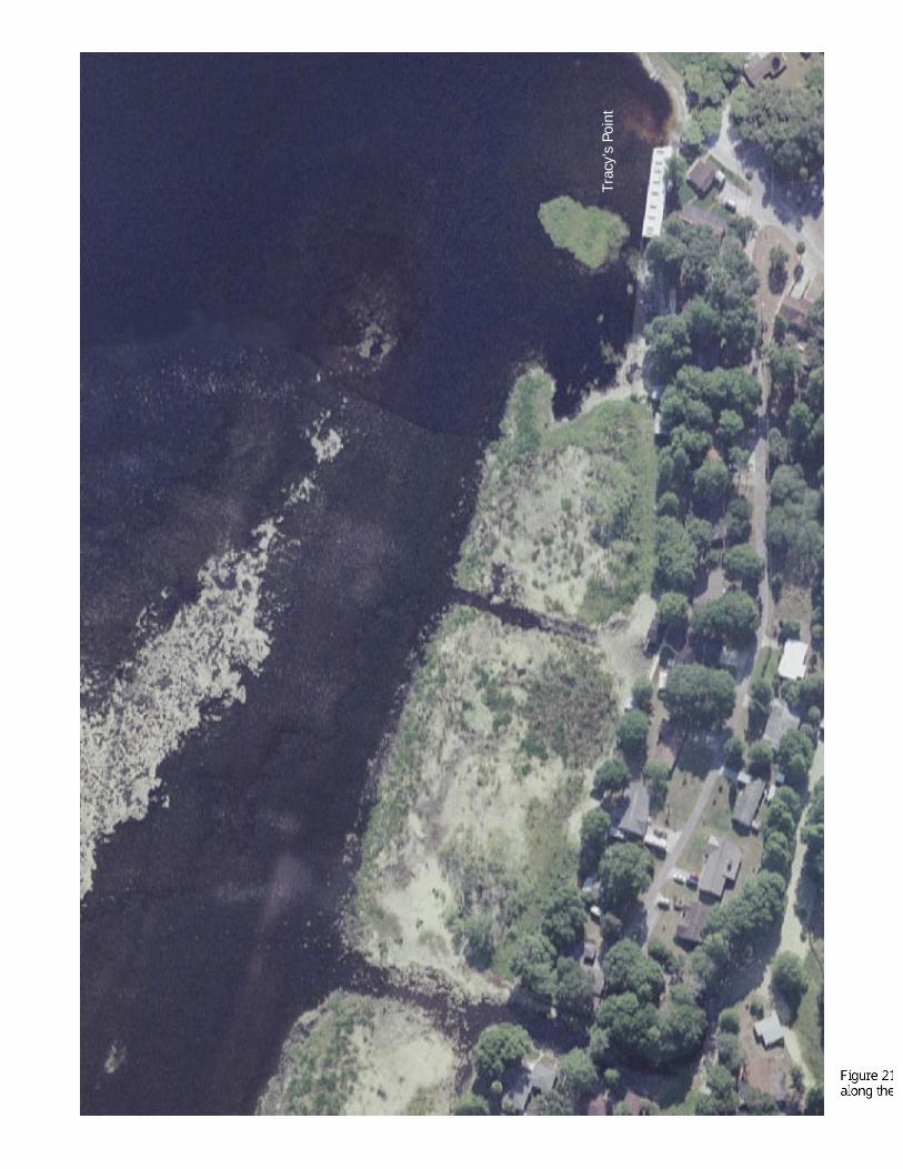
Trac
y’s
Poin
t

Trac
y’s
Poin
t
Appr
oxim
ate
wat
erw
ard
exte
nt o
f tu
ssoc
ks (
pre-
dred
ging
)
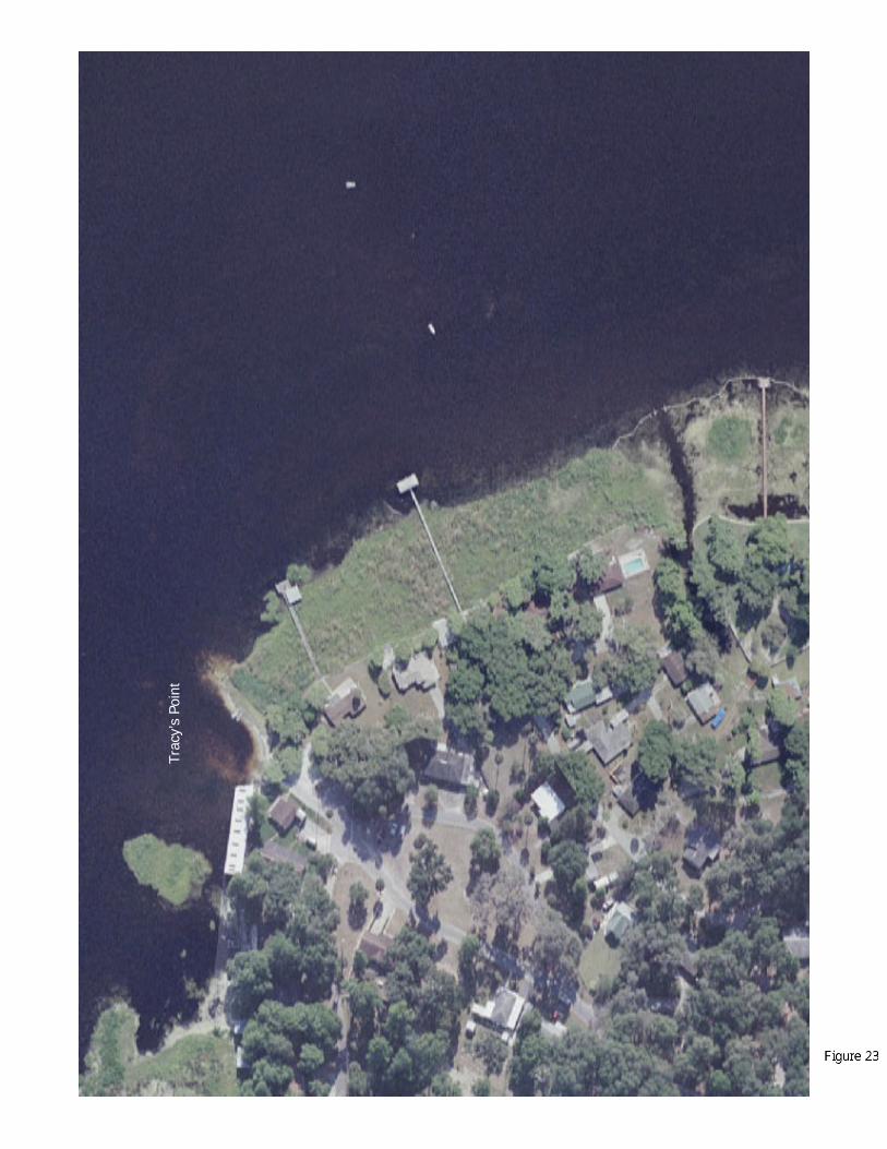
Trac
y’s
Poin
t

Trac
y’s
Poin
t
Appr
oxim
ate
wat
erw
ard
exte
nt o
f tu
ssoc
ks (
pre-
dred
ging
)


Appr
oxim
ate
wat
erw
ard
exte
nt o
f tu
ssoc
ks (
pre-
dred
ging
)
