® initiatives in interoperability in new zealand compiled for ogc hydro dwg arlington, march 2014...
TRANSCRIPT
®
Initiatives Initiatives inin
Interoperability in New ZealandInteroperability in New Zealand
Compiled for OGC Hydro DWG
Arlington, March 2014
By Jochen Schmidt, NIWA, New ZealandOn behalf of many NZ institutions with no guarantee of comprehensiveness
Copyright © 2012 Open Geospatial ConsortiumCopyright © 2012 Open Geospatial Consortium
OGC®
Environmental Data:Environmental Data:The The New Zealand situationNew Zealand situation
• NZ: Heterogeneous environment in terms of legislation, governance, management (freedom!). NZGO encourages use of standards and national SDI but with no “teeth” (sticks or dollars).
• Diversity of information system across the country.• BIG PUSH since ~4 years to make information better
accessible (particular freshwater).• Lots of ducks are running around (portals build, statements
made, etc.). • Since about ~2 years more engagement with OGC etc.
through various organizations – seems ducks getting in a row!
Copyright © 2012 Open Geospatial Consortium
OGC®
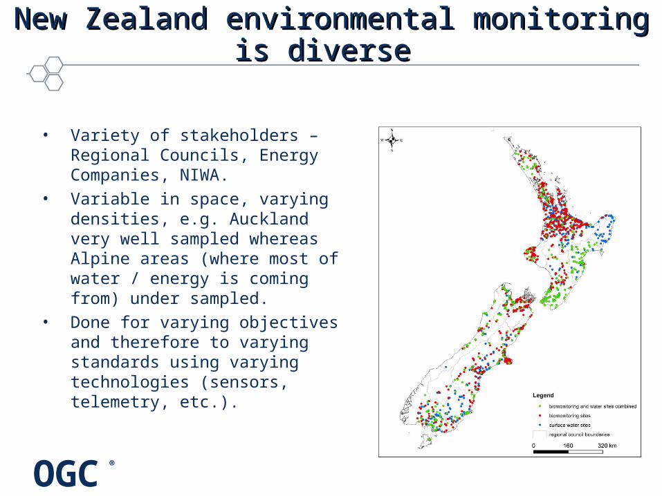
New Zealand environmental monitoring is diverse New Zealand environmental monitoring is diverse
• Variety of stakeholders – Regional Councils, Energy Companies, NIWA.
• Variable in space, varying densities, e.g. Auckland very well sampled whereas Alpine areas (where most of water / energy is coming from) under sampled.
• Done for varying objectives and therefore to varying standards using varying technologies (sensors, telemetry, etc.).
OGC®
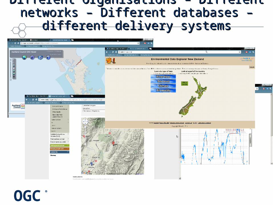
Different Organisations – Different networks – Different Organisations – Different networks – Different databases – different delivery systemsDifferent databases – different delivery systems
OGC®
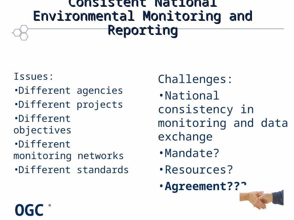
Consistent National Environmental Consistent National Environmental Monitoring and ReportingMonitoring and Reporting
Issues:•Different agencies•Different projects•Different objectives•Different monitoring networks•Different standards
Challenges:•National consistency in monitoring and data exchange•Mandate?•Resources?•Agreement???
OGC®
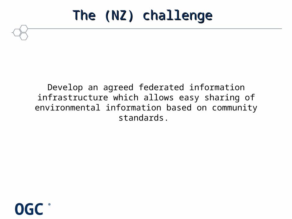
The (NZ) challenge The (NZ) challenge
Develop an agreed federated information infrastructure which allows easy sharing of environmental information based on
community standards.
OGC®
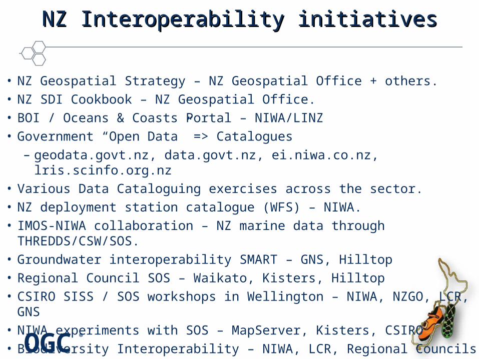
NZ Interoperability initiativesNZ Interoperability initiatives
• NZ Geospatial Strategy – NZ Geospatial Office + others.• NZ SDI Cookbook – NZ Geospatial Office.• BOI / Oceans & Coasts Portal – NIWA/LINZ • Government “Open Data” => Catalogues
– geodata.govt.nz, data.govt.nz, ei.niwa.co.nz, lris.scinfo.org.nz• Various Data Cataloguing exercises across the sector.• NZ deployment station catalogue (WFS) – NIWA.• IMOS-NIWA collaboration – NZ marine data through THREDDS/CSW/SOS.• Groundwater interoperability SMART – GNS, Hilltop• Regional Council SOS – Waikato, Kisters, Hilltop• CSIRO SISS / SOS workshops in Wellington – NIWA, NZGO, LCR, GNS• NIWA experiments with SOS – MapServer, Kisters, CSIRO• Biodiversity Interoperability – NIWA, LCR, Regional Councils
OGC®
Example NZ projects for data access through Example NZ projects for data access through OGC standardsOGC standards
Copyright © 2012 Open Geospatial Consortium
OGC®
Internet
Spatial Data
SOS
CSWWMS/WFS/
WCS
Data Sources
SMART- GeoPortal Software
Registry Service
Discovery Service
ViewDownloa
dTransformatio
n
Web Site / Maps
multiple datasources,
local repository+ other OGC services)
CSWCSW
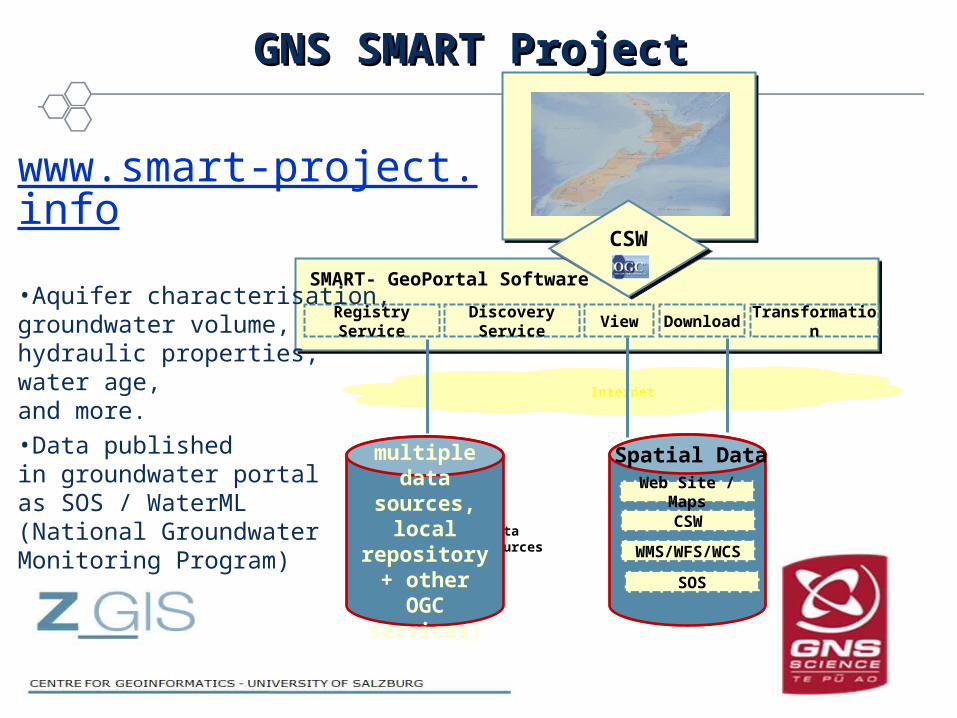
GNS SMART ProjectGNS SMART Project
www.smart-project.info
•Aquifer characterisation, groundwater volume,hydraulic properties,water age,and more.
•Data publishedin groundwater portal as SOS / WaterML(National Groundwater Monitoring Program)

OGC®
NIWA Environmental Information BrowserNIWA Environmental Information Browser
Copyright © 2012 Open Geospatial Consortium
• NIWA climate, freshwater, marine and more data provided through OGC services (CSW, WFS, WMS, SOS).
• Geospatial, temporal, contextual discovery and selection.
• Information visualisation components.
• Report & download options.
http://ei.niwa.co.nz
OGC®
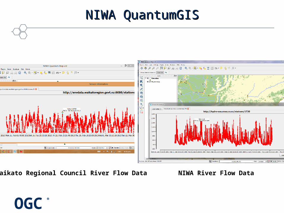
NIWA QuantumGISNIWA QuantumGIS
Waikato Regional Council River Flow Data NIWA River Flow Data
OGC®
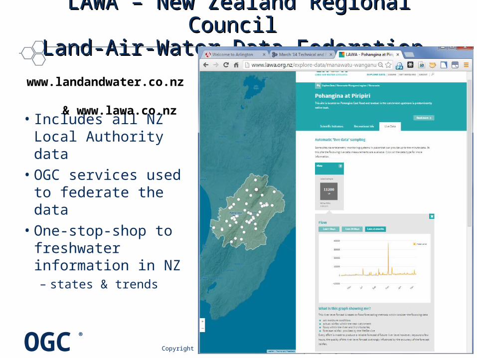
LAWA – New Zealand Regional Council LAWA – New Zealand Regional Council Land-Air-Water Data Federation Land-Air-Water Data Federation
• Includes all NZ Local Authority data
• OGC services used to federate the data
• One-stop-shop to freshwater information in NZ – states & trends
Copyright © 2012 Open Geospatial Consortium
www.landandwater.co.nz
& www.lawa.co.nz
OGC®
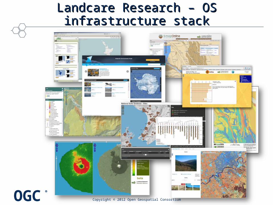
Landcare Research – OS infrastructure stackLandcare Research – OS infrastructure stack
• CSW– DQF
• WMS– ? WMS-V
• WFS– SoilML– Land Cover
• O&M/UncertML
• DGGS/O&M
Copyright © 2012 Open Geospatial Consortium
• http://lris.scinfo.org.nz,– catalogue & clip-zip-ship
– LCDB: DQF
• Browser & Services stack– http://ourenvironment.scinfo.org.nz
– http://smap.landcareresearch.co.nz
– SCAR Antarctic Environments Portal
– Possum population model scenario viewer
• Services – faq & examples– http://maps.scinfo.org.nz
• Irrigation control; real-time field sensors
• HPC pipelines & datacubes;– elastic spatio-temporal modelling
OGC®
Landcare Research – OS infrastructure stackLandcare Research – OS infrastructure stack
Copyright © 2012 Open Geospatial Consortium
OGC®
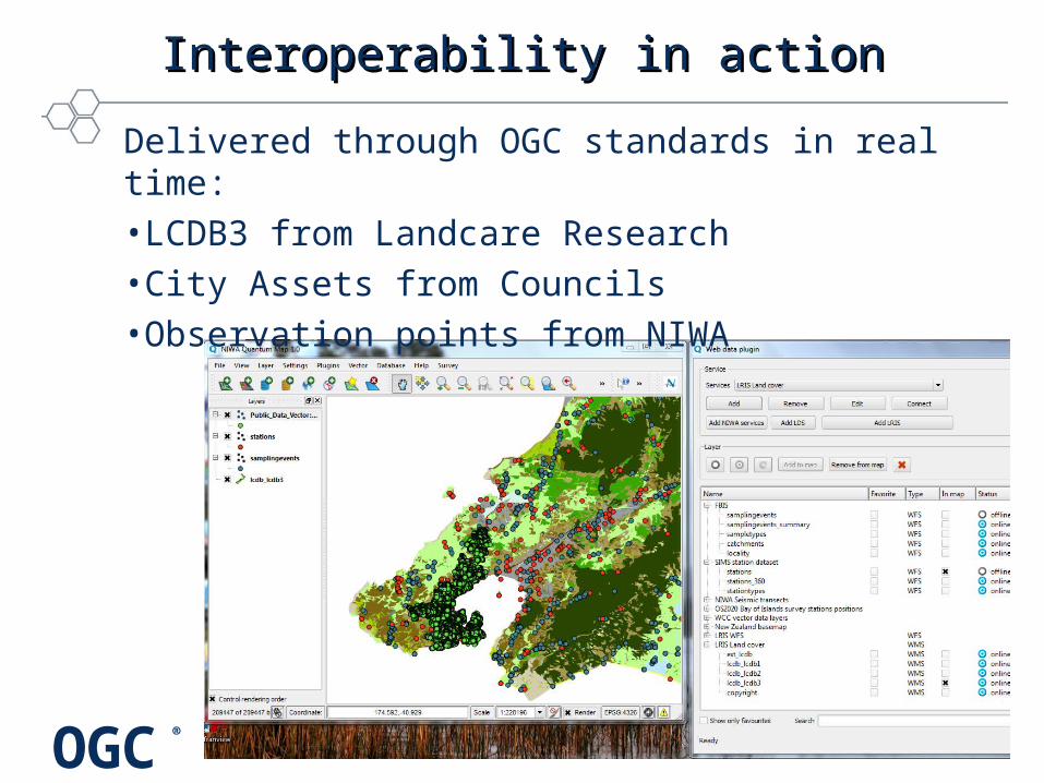
Interoperability in actionInteroperability in action
Delivered through OGC standards in real time:•LCDB3 from Landcare Research•City Assets from Councils•Observation points from NIWA