zentai: are we ready for cartography 2.0? application of web 2.0 in cartographic education...
Post on 21-Dec-2015
215 views
TRANSCRIPT
Zentai: Are we ready for Cartography 2.0? Application of web 2.0 in cartographic education (CartoTalks, WIen – 3 December 2010)
Application of web 2.0 in cartographic
education
Are we ready for Cartography 2.0?
Zentai: Are we ready for Cartography 2.0? Application of web 2.0 in cartographic education (CartoTalks, WIen – 3 December 2010)
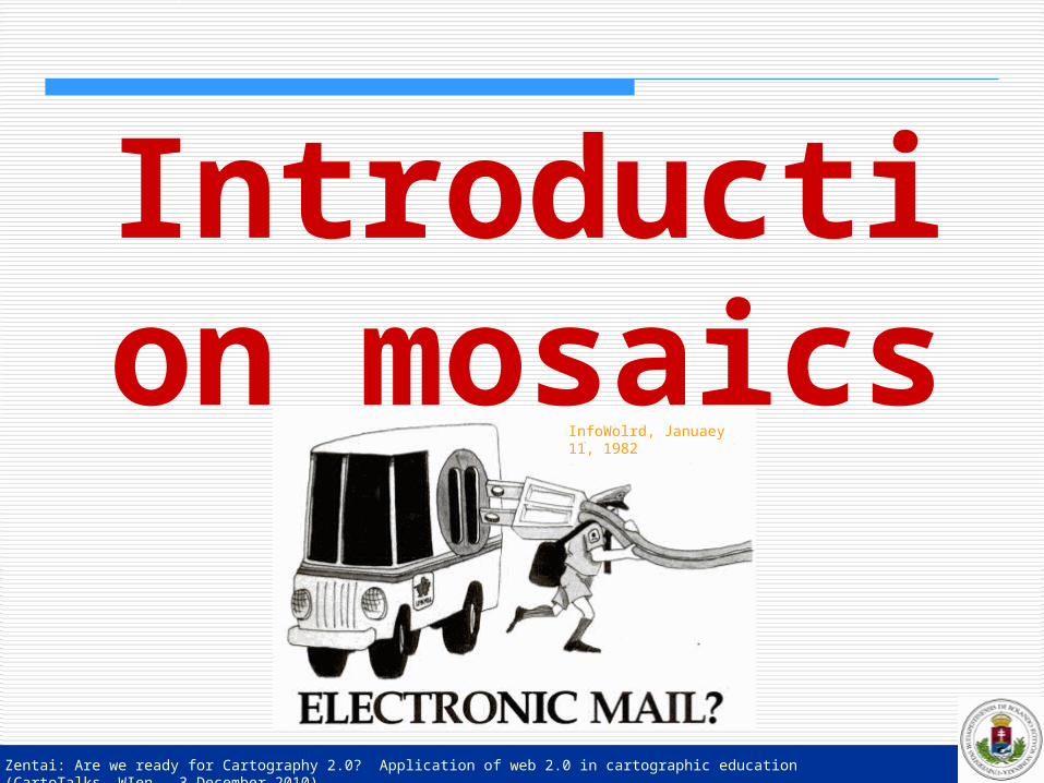
Introduction mosaics
InfoWolrd, Januaey 11, 1982
Zentai: Are we ready for Cartography 2.0? Application of web 2.0 in cartographic education (CartoTalks, WIen – 3 December 2010)
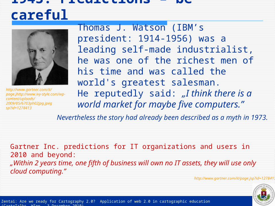
1943: Predictions – be carefulThomas J. Watson (IBM’s president: 1914-1956) was a leading self-made industrialist, he was one of the richest men of his time and was called the world's greatest salesman.He reputedly said: „I think there is a world market for maybe five computers.”
Nevertheless the story had already been described as a myth in 1973.
Gartner Inc. predictions for IT organizations and users in 2010 and beyond:„Within 2 years time, one fifth of business will own no IT assets, they will use only cloud computing.”
http://www.gartner.com/it/page.jsp?id=1278413
http://www.gartner.com/it/page.jhttp://www.ivy-style.com/wp-content/uploads/2009/05/6703ph02jpg.jpegsp?id=1278413
Zentai: Are we ready for Cartography 2.0? Application of web 2.0 in cartographic education (CartoTalks, WIen – 3 December 2010)
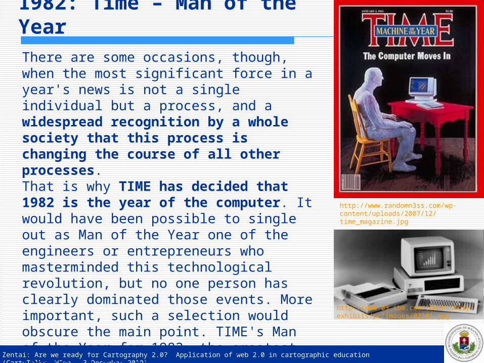
1982: Time – Man of the YearThere are some occasions, though, when the most significant force in a year's news is not a single individual but a process, and a widespread recognition by a whole society that this process is changing the course of all other processes. That is why TIME has decided that 1982 is the year of the computer. It would have been possible to single out as Man of the Year one of the engineers or entrepreneurs who masterminded this technological revolution, but no one person has clearly dominated those events. More important, such a selection would obscure the main point. TIME's Man of the Year for 1982, the greatest influence for good or evil, is not a man at all. It is a machine: the computer.
http://www.randomn3ss.com/wp-content/uploads/2007/12/time_magazine.jpg
http://www-03.ibm.com/ibm/history/exhibits/pc/images/02101.jpg
Zentai: Are we ready for Cartography 2.0? Application of web 2.0 in cartographic education (CartoTalks, WIen – 3 December 2010)
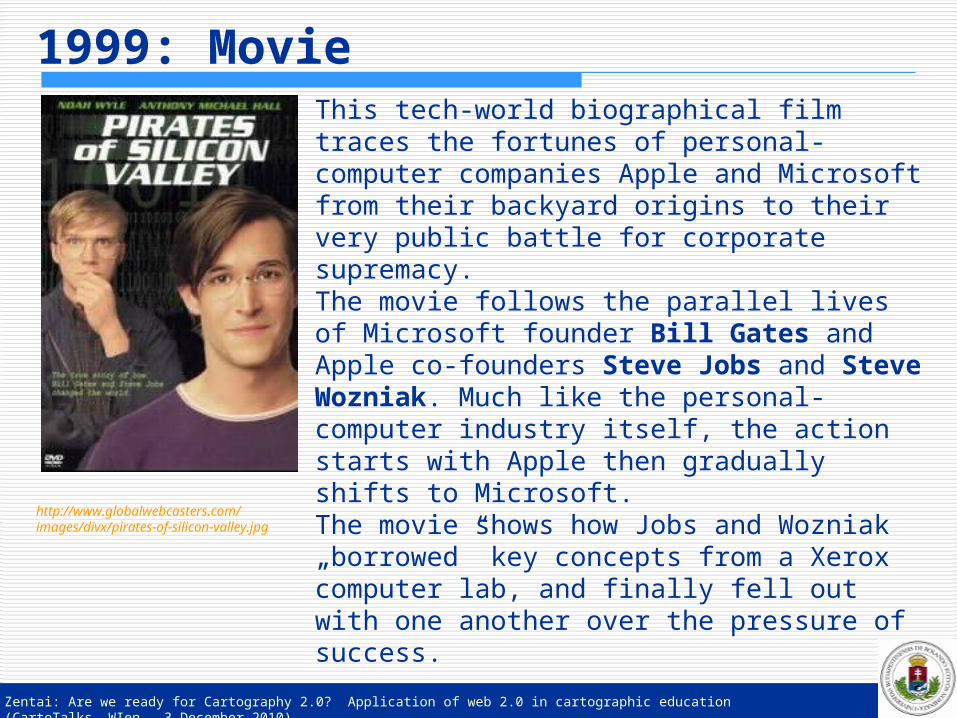
1999: MovieThis tech-world biographical film traces the fortunes of personal-computer companies Apple and Microsoft from their backyard origins to their very public battle for corporate supremacy. The movie follows the parallel lives of Microsoft founder Bill Gates and Apple co-founders Steve Jobs and Steve Wozniak. Much like the personal-computer industry itself, the action starts with Apple then gradually shifts to Microsoft.The movie shows how Jobs and Wozniak „borrowed” key concepts from a Xerox computer lab, and finally fell out with one another over the pressure of success.
http://www.globalwebcasters.com/images/divx/pirates-of-silicon-valley.jpg
Zentai: Are we ready for Cartography 2.0? Application of web 2.0 in cartographic education (CartoTalks, WIen – 3 December 2010)
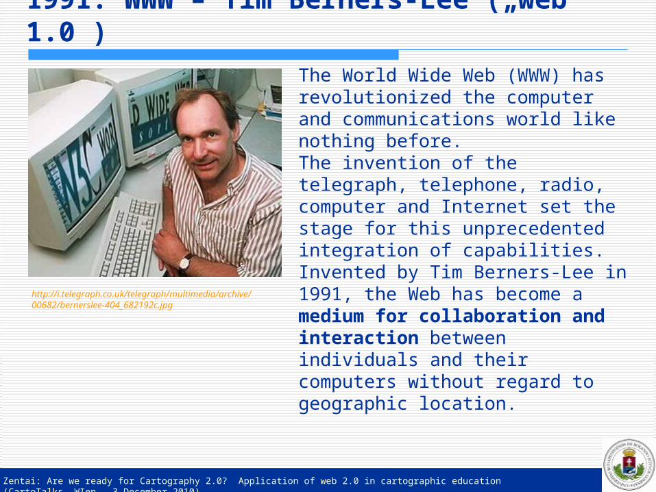
1991: WWW – Tim Berners-Lee („web 1.0”)
The World Wide Web (WWW) has revolutionized the computer and communications world like nothing before. The invention of the telegraph, telephone, radio, computer and Internet set the stage for this unprecedented integration of capabilities.Invented by Tim Berners-Lee in 1991, the Web has become a medium for collaboration and interaction between individuals and their computers without regard to geographic location.
http://i.telegraph.co.uk/telegraph/multimedia/archive/00682/bernerslee-404_682192c.jpg

Zentai: Are we ready for Cartography 2.0? Application of web 2.0 in cartographic education (CartoTalks, WIen – 3 December 2010)
Yes, you. You control the Information Age.Welcome to your world.
The tool that makes this possible is the World Wide Web. Not the Web that Tim Berners-Lee hacked together as a way for scientists to share research.It's not even the overhyped dotcom Web of the late 1990s. The new Web is a very different thing. It's a tool for bringing together the small contributions of millions of people and making them matter. Silicon Valley consultants call it Web 2.0, as if it were a new version of some old software. But it's really a revolution.
2006: Time – Person of the Year
http://magculture.com/blog/wp-content/uploads/2007/01/timeCoverPoY.jpg
Zentai: Are we ready for Cartography 2.0? Application of web 2.0 in cartographic education (CartoTalks, WIen – 3 December 2010)
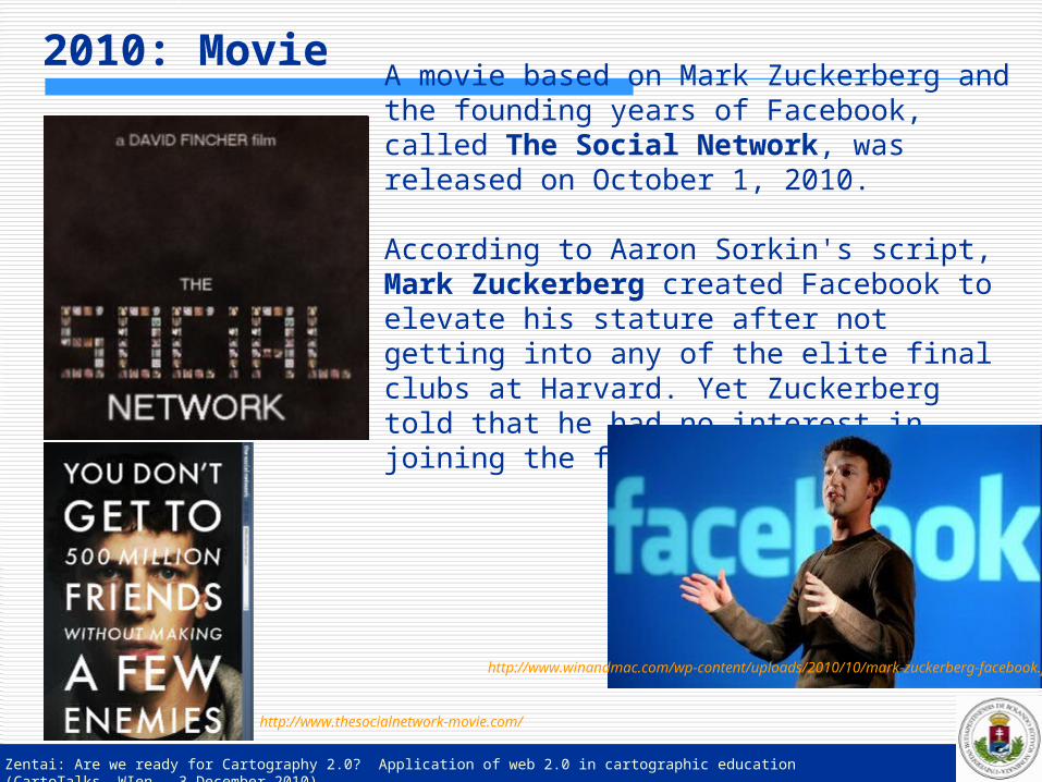
A movie based on Mark Zuckerberg and the founding years of Facebook, called The Social Network, was released on October 1, 2010.
According to Aaron Sorkin's script, Mark Zuckerberg created Facebook to elevate his stature after not getting into any of the elite final clubs at Harvard. Yet Zuckerberg told that he had no interest in joining the final clubs.
2010: Movie
http://www.thesocialnetwork-movie.com/
http://www.winandmac.com/wp-content/uploads/2010/10/mark-zuckerberg-facebook.jpg

Zentai: Are we ready for Cartography 2.0? Application of web 2.0 in cartographic education (CartoTalks, WIen – 3 December 2010)
Cartography – the term
http://gallery.sjsu.edu/cartography/images/main_world.jpg
Zentai: Are we ready for Cartography 2.0? Application of web 2.0 in cartographic education (CartoTalks, WIen – 3 December 2010)
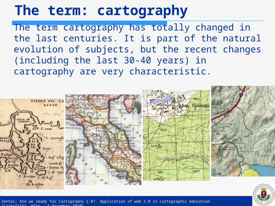
The term cartography has totally changed in the last centuries. It is part of the natural evolution of subjects, but the recent changes (including the last 30-40 years) in cartography are very characteristic.
The term: cartography
Zentai: Are we ready for Cartography 2.0? Application of web 2.0 in cartographic education (CartoTalks, WIen – 3 December 2010)
Definition of cartography1973:The art, science and technology of making maps, together with their study as scientific documents and works of art. In this context maps may be regarded as including all types of maps, charts and sections, three dimensional models and globes representing the Earth or any celestial body at any scale.
(nothing about digital at that time)
International Cartographic Association
Zentai: Are we ready for Cartography 2.0? Application of web 2.0 in cartographic education (CartoTalks, WIen – 3 December 2010)
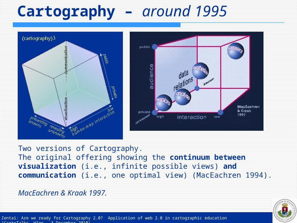
Cartography – around 1995
Two versions of Cartography.The original offering showing the continuum between visualization (i.e., infinite possible views) and communication (i.e., one optimal view) (MacEachren 1994).
MacEachren & Kraak 1997.
Zentai: Are we ready for Cartography 2.0? Application of web 2.0 in cartographic education (CartoTalks, WIen – 3 December 2010)
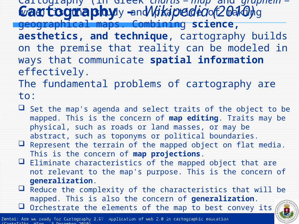
Cartography (in Greek chartis = map and graphein = write) is the study and practice of making geographical maps. Combining science, aesthetics, and technique, cartography builds on the premise that reality can be modeled in ways that communicate spatial information effectively.The fundamental problems of cartography are to:
Cartography – Wikipedia (2010)
Set the map's agenda and select traits of the object to be mapped. This is the concern of map editing. Traits may be physical, such as roads or land masses, or may be abstract, such as toponyms or political boundaries.
Represent the terrain of the mapped object on flat media. This is the concern of map projections.
Eliminate characteristics of the mapped object that are not relevant to the map's purpose. This is the concern of generalization.
Reduce the complexity of the characteristics that will be mapped. This is also the concern of generalization.
Orchestrate the elements of the map to best convey its message to its audience. This is the concern of map design.
Zentai: Are we ready for Cartography 2.0? Application of web 2.0 in cartographic education (CartoTalks, WIen – 3 December 2010)
The essence of the term cartography and cartographer has not changed too much till the end of the 18th century.The very first changes were caused by the invention of measuring equipments and the printing and engraving techniques (lithography).
The second change was caused by the time of the beginning of the regular military surveys, when the large-scale topographic mapping became a continuous task of the cartographers. Practically it was mainly a quantitative change to increase the number of topographers, but it was not a real qualitative development (or at least it was a slow development).
Changes of the last centuries
Zentai: Are we ready for Cartography 2.0? Application of web 2.0 in cartographic education (CartoTalks, WIen – 3 December 2010)
At that time the term cartographer was nearly the synonym of mapmaker. As the technical development continued, cartographers had to be familiar with new measuring techniques, although the term still included not only the technological and scientific part, but an art too.
The invention and rapid development of photography and its incorporation into cartography (including the invention of photogrammetry) and the development of offset printing at the end of the 19th century and the beginning of the 20th century were important milestones in the development of cartography.
Changes of the last centuries
Zentai: Are we ready for Cartography 2.0? Application of web 2.0 in cartographic education (CartoTalks, WIen – 3 December 2010)
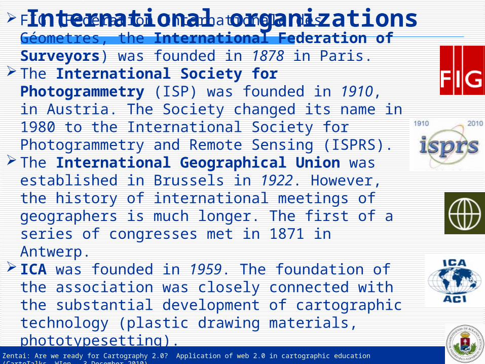
International organizationsFIG (Fédération Internationale des Géometres, the International Federation of Surveyors) was founded in 1878 in Paris.
The International Society for Photogrammetry (ISP) was founded in 1910, in Austria. The Society changed its name in 1980 to the International Society for Photogrammetry and Remote Sensing (ISPRS).
The International Geographical Union was established in Brussels in 1922. However, the history of international meetings of geographers is much longer. The first of a series of congresses met in 1871 in Antwerp.
ICA was founded in 1959. The foundation of the association was closely connected with the substantial development of cartographic technology (plastic drawing materials, phototypesetting).
Zentai: Are we ready for Cartography 2.0? Application of web 2.0 in cartographic education (CartoTalks, WIen – 3 December 2010)
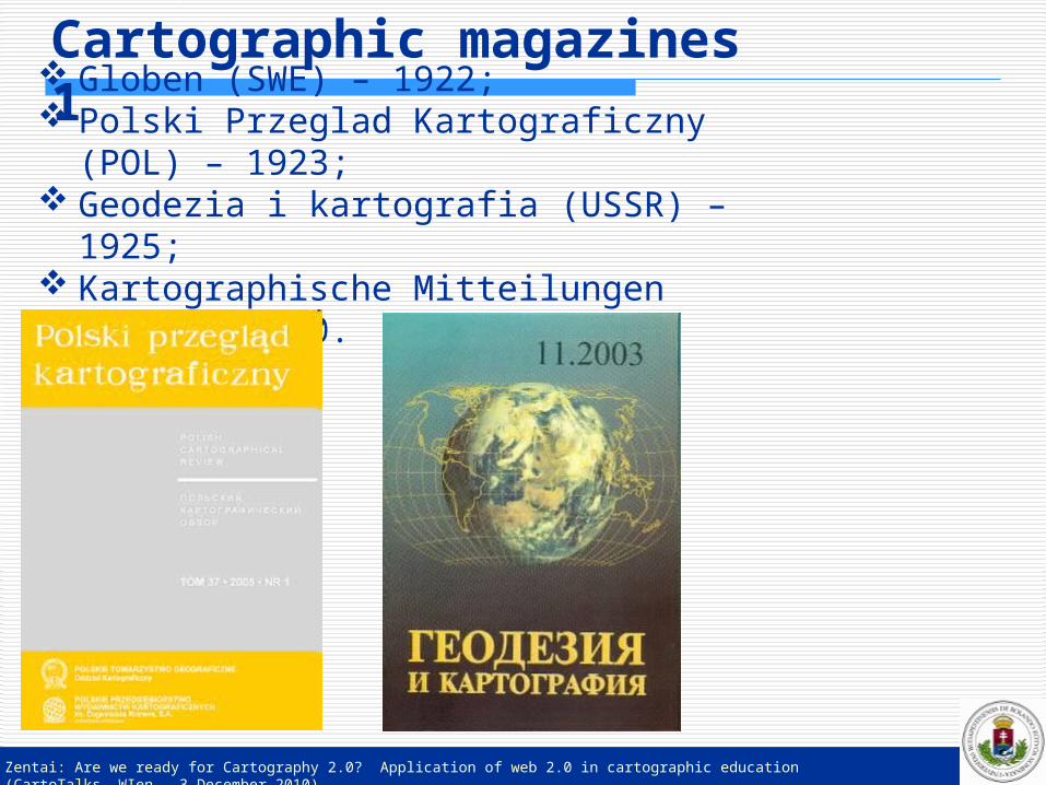
Cartographic magazines 1 Globen (SWE) – 1922;
Polski Przeglad Kartograficzny (POL) – 1923;
Geodezia i kartografia (USSR) – 1925; Kartographische Mitteilungen (AUT) –
1930.
Zentai: Are we ready for Cartography 2.0? Application of web 2.0 in cartographic education (CartoTalks, WIen – 3 December 2010)
Cartographic magazines 2 Most of the recent cartographic magazines were
founded around 1950.Cartographic Perspectives (USA) – 1947;National mapping bulletin (AUS) – 1950;Kartographische Nachrichten (GER) – 1950;Geodézia és Kartográfia (HUN) – 1950; World Cartography (UN) – 1951;Revista cartografica (ARG) – 1952; Cartography (AUS) – 1954; Geodeticky a kartograficky obzor (CZE) – 1955; Map (JAP) – 1962;The Cartographic Journal (GBR) – 1964; Cartographic Helvetica (SUI) – 1969;
New magazines were founded in the GIS era (1980-).GIMLocation based services
Zentai: Are we ready for Cartography 2.0? Application of web 2.0 in cartographic education (CartoTalks, WIen – 3 December 2010)
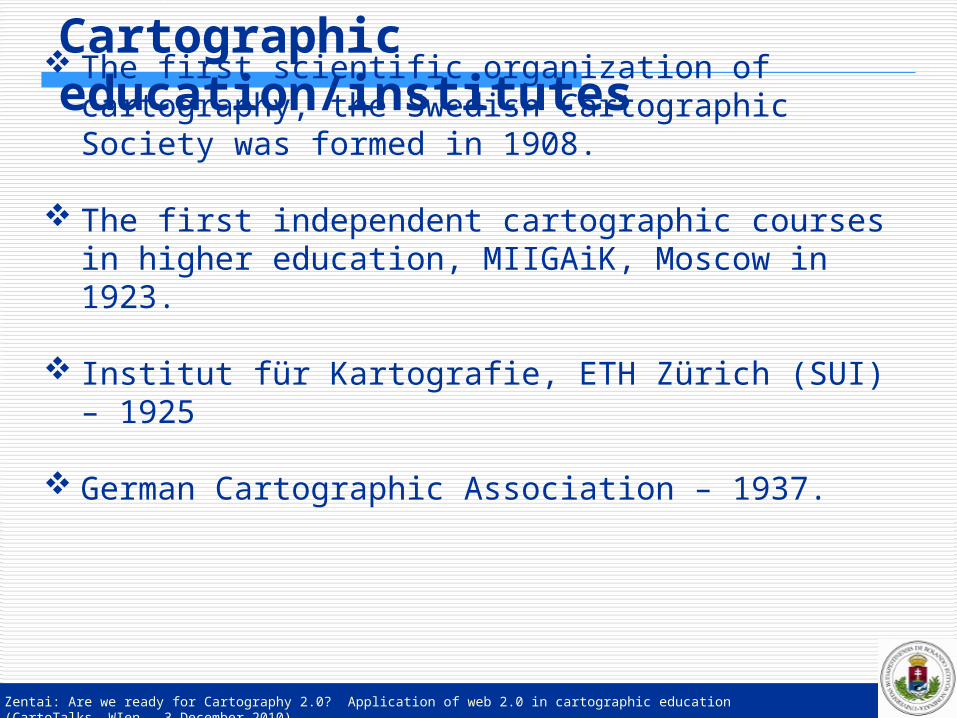
Cartographic education/institutes The first scientific organization of cartography,
the Swedish Cartographic Society was formed in 1908.
The first independent cartographic courses in higher education, MIIGAiK, Moscow in 1923.
Institut für Kartografie, ETH Zürich (SUI) – 1925
German Cartographic Association – 1937.

Zentai: Are we ready for Cartography 2.0? Application of web 2.0 in cartographic education (CartoTalks, WIen – 3 December 2010)
Computer ages After the integration of photogrammetry into the tools of
cartography, the next challenge was the remote sensing. During the cold war (1945-1991) it was difficult to get reliable
and “mappable” information on certain countries, so the remote sensing technologies were accepted immediately in cartography. The satellite images also helped the cartography to decrease the role of secrecy.
Cartography was very sensitive to adopting computer technology. This process affected all parts of cartography, but new professions (like remote sensing, geographic information system, global positioning system, location-based services) have also come into existence as the technology has managed to serve specific demands.
It is also exciting to investigate the process how the terms GIS, geoinformatics or GI Science have changed the term ‘cartography’.
While cartographers were still treated as mapmakers (map drawers) 40-50 years ago, the computer has changed it totally.
Zentai: Are we ready for Cartography 2.0? Application of web 2.0 in cartographic education (CartoTalks, WIen – 3 December 2010)
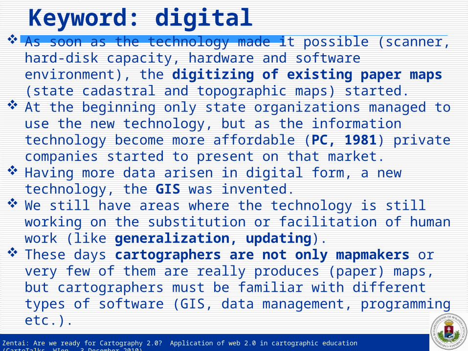
Keyword: digital As soon as the technology made it possible (scanner, hard-
disk capacity, hardware and software environment), the digitizing of existing paper maps (state cadastral and topographic maps) started.
At the beginning only state organizations managed to use the new technology, but as the information technology become more affordable (PC, 1981) private companies started to present on that market.
Having more data arisen in digital form, a new technology, the GIS was invented.
We still have areas where the technology is still working on the substitution or facilitation of human work (like generalization, updating).
These days cartographers are not only mapmakers or very few of them are really produces (paper) maps, but cartographers must be familiar with different types of software (GIS, data management, programming etc.).
Zentai: Are we ready for Cartography 2.0? Application of web 2.0 in cartographic education (CartoTalks, WIen – 3 December 2010)
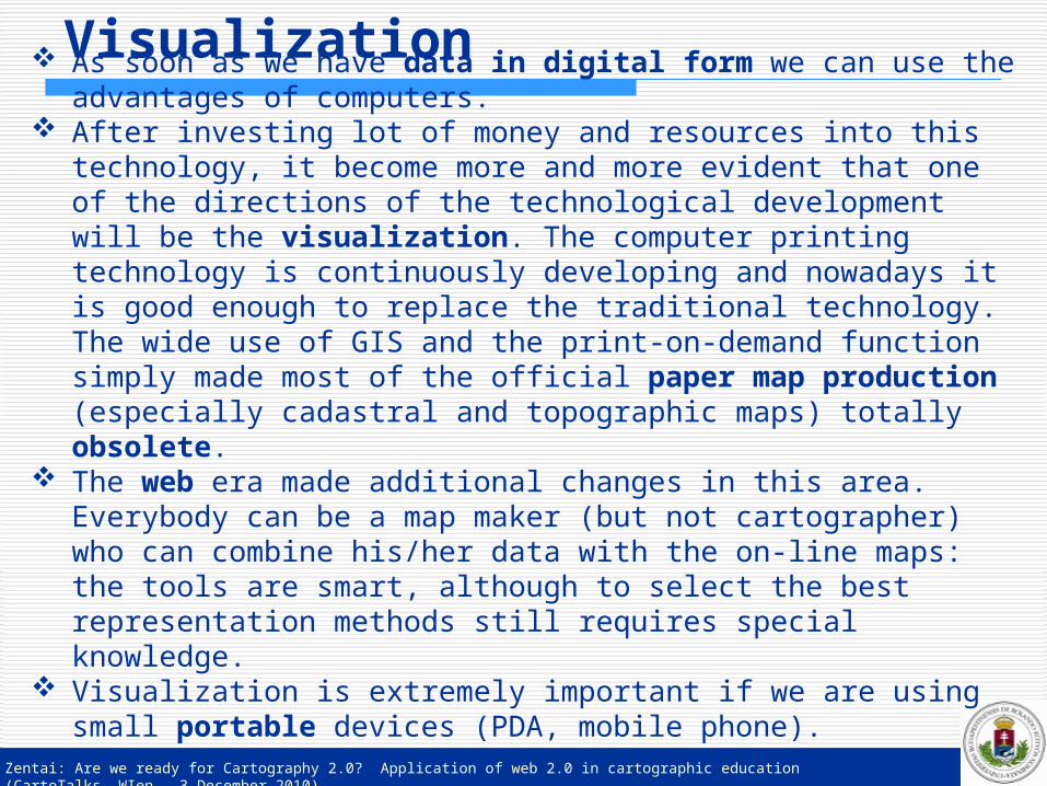
Visualization As soon as we have data in digital form we can use the
advantages of computers. After investing lot of money and resources into this technology,
it become more and more evident that one of the directions of the technological development will be the visualization. The computer printing technology is continuously developing and nowadays it is good enough to replace the traditional technology. The wide use of GIS and the print-on-demand function simply made most of the official paper map production (especially cadastral and topographic maps) totally obsolete.
The web era made additional changes in this area. Everybody can be a map maker (but not cartographer) who can combine his/her data with the on-line maps: the tools are smart, although to select the best representation methods still requires special knowledge.
Visualization is extremely important if we are using small portable devices (PDA, mobile phone).
Zentai: Are we ready for Cartography 2.0? Application of web 2.0 in cartographic education (CartoTalks, WIen – 3 December 2010)
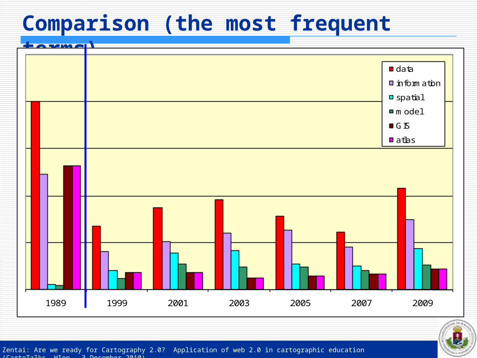
Comparison (the most frequent terms)
1989 1999 2001 2003 2005 2007 2009
data
information
spatial
model
GIS
atlas
Zentai: Are we ready for Cartography 2.0? Application of web 2.0 in cartographic education (CartoTalks, WIen – 3 December 2010)
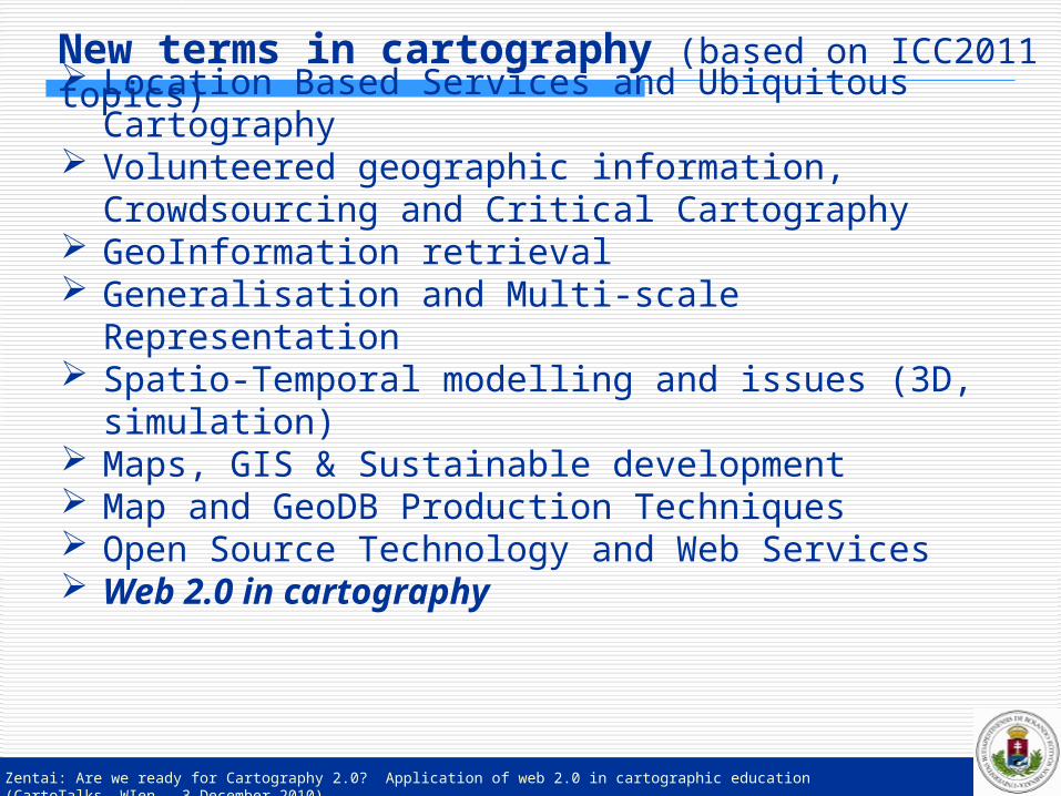
New terms in cartography (based on ICC2011 topics) Location Based Services and Ubiquitous
Cartography Volunteered geographic information, Crowdsourcing
and Critical Cartography GeoInformation retrieval Generalisation and Multi-scale Representation Spatio-Temporal modelling and issues (3D,
simulation) Maps, GIS & Sustainable development Map and GeoDB Production Techniques Open Source Technology and Web Services Web 2.0 in cartography
Zentai: Are we ready for Cartography 2.0? Application of web 2.0 in cartographic education (CartoTalks, WIen – 3 December 2010)
Web evolution
http://www.bloggiando.com/wp-content/uploads/2007/06/internet-italiani-non-usano.jpg
Zentai: Are we ready for Cartography 2.0? Application of web 2.0 in cartographic education (CartoTalks, WIen – 3 December 2010)
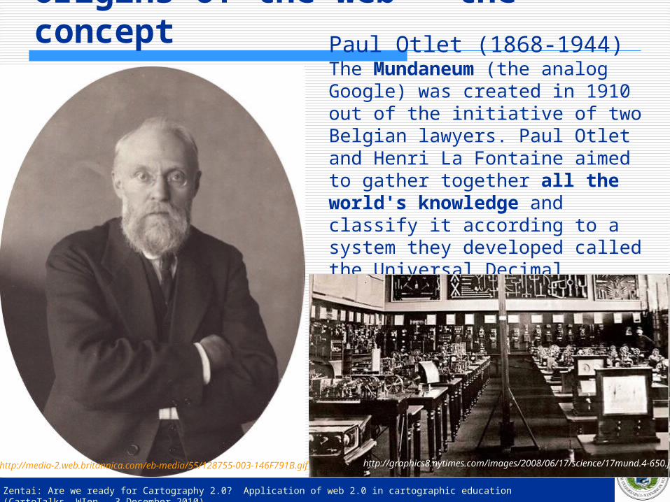
Origins of the web – the concept
Paul Otlet (1868-1944)The Mundaneum (the analog Google) was created in 1910 out of the initiative of two Belgian lawyers. Paul Otlet and Henri La Fontaine aimed to gather together all the world's knowledge and classify it according to a system they developed called the Universal Decimal Classification.
http://graphics8.nytimes.com/images/2008/06/17/science/17mund.4-650.jpghttp://media-2.web.britannica.com/eb-media/55/128755-003-146F791B.gif
Zentai: Are we ready for Cartography 2.0? Application of web 2.0 in cartographic education (CartoTalks, WIen – 3 December 2010)
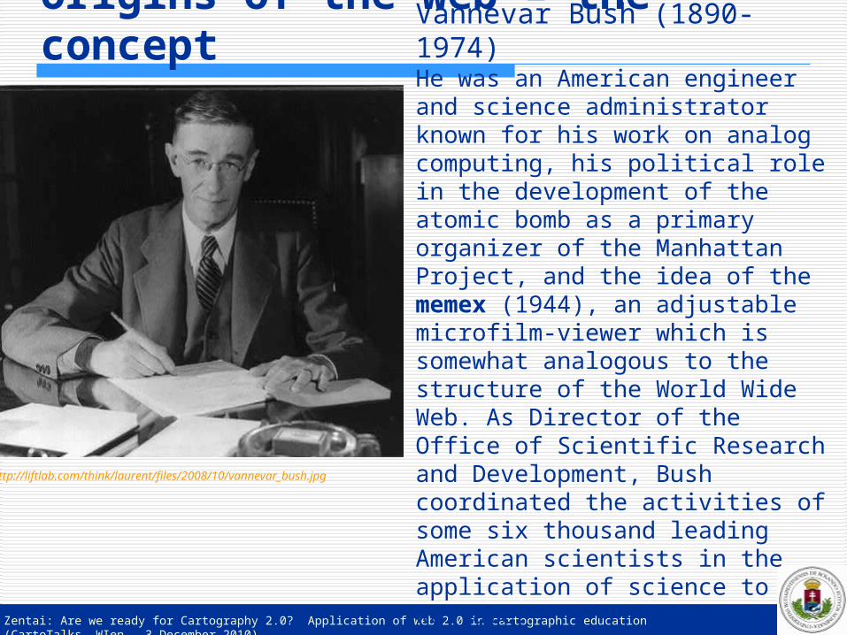
Origins of the web – the concept
Vannevar Bush (1890-1974)He was an American engineer and science administrator known for his work on analog computing, his political role in the development of the atomic bomb as a primary organizer of the Manhattan Project, and the idea of the memex (1944), an adjustable microfilm-viewer which is somewhat analogous to the structure of the World Wide Web. As Director of the Office of Scientific Research and Development, Bush coordinated the activities of some six thousand leading American scientists in the application of science to warfare.
http://liftlab.com/think/laurent/files/2008/10/vannevar_bush.jpg
Zentai: Are we ready for Cartography 2.0? Application of web 2.0 in cartographic education (CartoTalks, WIen – 3 December 2010)
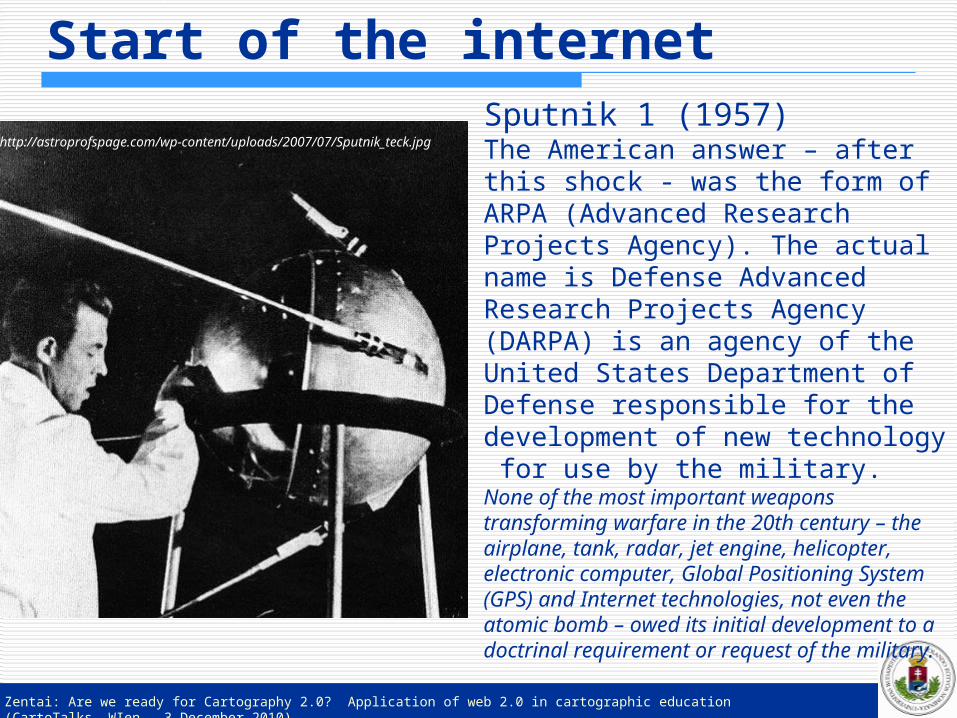
Start of the internetSputnik 1 (1957)The American answer – after this shock - was the form of ARPA (Advanced Research Projects Agency). The actual name is Defense Advanced Research Projects Agency (DARPA) is an agency of the United States Department of Defense responsible for the development of new technology for use by the military.None of the most important weapons transforming warfare in the 20th century – the airplane, tank, radar, jet engine, helicopter, electronic computer, Global Positioning System (GPS) and Internet technologies, not even the atomic bomb – owed its initial development to a doctrinal requirement or request of the military.
http://astroprofspage.com/wp-content/uploads/2007/07/Sputnik_teck.jpg
Zentai: Are we ready for Cartography 2.0? Application of web 2.0 in cartographic education (CartoTalks, WIen – 3 December 2010)
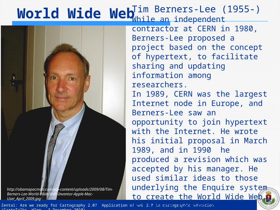
World Wide WebTim Berners-Lee (1955-)While an independent contractor at CERN in 1980, Berners-Lee proposed a project based on the concept of hypertext, to facilitate sharing and updating information among researchers.In 1989, CERN was the largest Internet node in Europe, and Berners-Lee saw an opportunity to join hypertext with the Internet. He wrote his initial proposal in March 1989, and in 1990 he produced a revision which was accepted by his manager. He used similar ideas to those underlying the Enquire system to create the World Wide Web, for which he designed and built the first Web browser.
http://obamapacman.com/wp-content/uploads/2009/08/Tim-Berners-Lee-World-Wide-Web-Inventor-Apple-Mac-User_April_2009.jpg

Zentai: Are we ready for Cartography 2.0? Application of web 2.0 in cartographic education (CartoTalks, WIen – 3 December 2010)
Mosaic – the first web browser
http://farm4.static.flickr.com/3502/4038823218_7e1eb9b3cc_o.jpg

Zentai: Are we ready for Cartography 2.0? Application of web 2.0 in cartographic education (CartoTalks, WIen – 3 December 2010)
Internet distribution (1992)
RIPE hostcount data
Zentai: Are we ready for Cartography 2.0? Application of web 2.0 in cartographic education (CartoTalks, WIen – 3 December 2010)
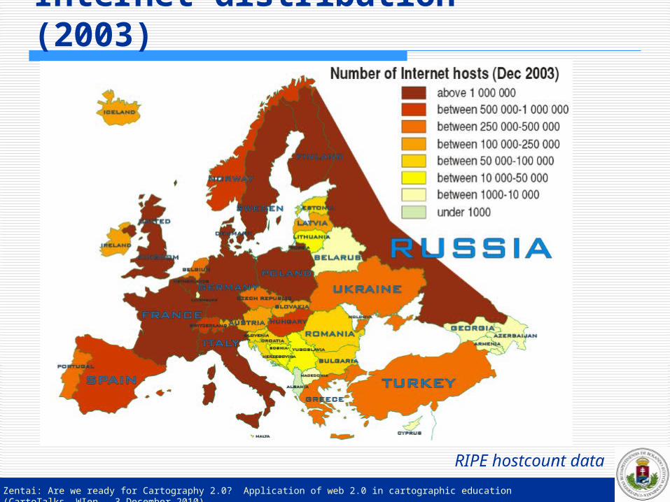
Internet distribution (2003)
RIPE hostcount data
Zentai: Are we ready for Cartography 2.0? Application of web 2.0 in cartographic education (CartoTalks, WIen – 3 December 2010)
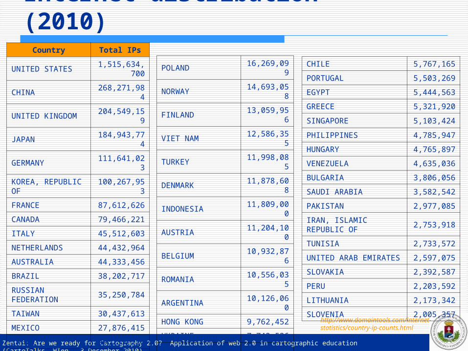
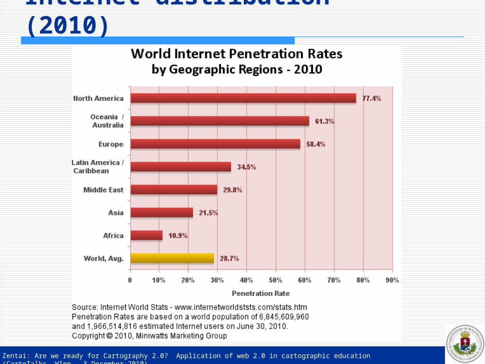
Internet distribution (2010)
http://www.domaintools.com/internet-statistics/country-ip-counts.html
Country Total IPs
UNITED STATES1,515,634,7
00
CHINA268,271,98
4
UNITED KINGDOM204,549,15
9
JAPAN184,943,77
4
GERMANY111,641,02
3
KOREA, REPUBLIC OF
100,267,953
FRANCE 87,612,626
CANADA 79,466,221
ITALY 45,512,603
NETHERLANDS 44,432,964
AUSTRALIA 44,333,456
BRAZIL 38,202,717
RUSSIAN FEDERATION
35,250,784
TAIWAN 30,437,613
MEXICO 27,876,415
INDIA 26,255,222
SPAIN 25,714,986
SWEDEN 25,469,933
SWITZERLAND 21,440,622
SOUTH AFRICA 17,129,264
POLAND16,269,09
9
NORWAY14,693,05
8
FINLAND13,059,95
6
VIET NAM12,586,35
5
TURKEY11,998,08
5
DENMARK11,878,60
8
INDONESIA11,809,00
0
AUSTRIA11,204,10
0
BELGIUM10,932,87
6
ROMANIA10,556,03
5
ARGENTINA10,126,06
0
HONG KONG 9,762,452
UKRAINE 7,742,536
CZECH REPUBLIC 7,524,736
ISRAEL 7,260,001
THAILAND 6,888,765
NEW ZEALAND 6,777,598
COLOMBIA 6,302,687
IRELAND 5,962,213
MALAYSIA 5,832,328
CHILE 5,767,165
PORTUGAL 5,503,269
EGYPT 5,444,563
GREECE 5,321,920
SINGAPORE 5,103,424
PHILIPPINES 4,785,947
HUNGARY 4,765,897
VENEZUELA 4,635,036
BULGARIA 3,806,056
SAUDI ARABIA 3,582,542
PAKISTAN 2,977,085
IRAN, ISLAMIC REPUBLIC OF
2,753,918
TUNISIA 2,733,572
UNITED ARAB EMIRATES 2,597,075
SLOVAKIA 2,392,587
PERU 2,203,592
LITHUANIA 2,173,342
SLOVENIA 2,005,357
Zentai: Are we ready for Cartography 2.0? Application of web 2.0 in cartographic education (CartoTalks, WIen – 3 December 2010)
Internet distribution (2010)
Zentai: Are we ready for Cartography 2.0? Application of web 2.0 in cartographic education (CartoTalks, WIen – 3 December 2010)
Web 2.0 in generalDarcy DiNucci (1999): „The Web we know now, which loads into a browser window in essentially static screenfulls, is only an embryo of the Web to come. The first glimmerings of Web 2.0 are beginning to appear, and we are just starting to see how that embryo might develop. The Web will be understood not as screenfulls of text and graphics but as a transport mechanism, the ether through which interactivity happens…”
The concept of web 2.0 was used next time in 2003-04 at a conference where the organizers (O'Reilly and CMP Media) focused on the new generation web services in a conference brainstorming session.
Zentai: Are we ready for Cartography 2.0? Application of web 2.0 in cartographic education (CartoTalks, WIen – 3 December 2010)
Web 2.0 in generalIt is really difficult to formulate the term and there is still a huge amount of disagreement about just what web 2.0 means, with some experts characterizing it as a meaningless marketing buzzword, and others accepting it as the new term.Although Web 2.0 is not a clear and easily definable term (the phrase may hint at an improved form of the World Wide Web), we can list new features of the web which has formed this new term. Mostly not simple concrete applications, but rather
philosophies. „Network as platform” — delivering (and allowing users to
use) applications entirely through a browser. Users owning the data on a site and exercising control
(maintain and distribute) over that data. An architecture of participation that encourages users to
add value to the application as they use it. A rich, interactive, user-friendly interface. Social-networking aspects.
Zentai: Are we ready for Cartography 2.0? Application of web 2.0 in cartographic education (CartoTalks, WIen – 3 December 2010)
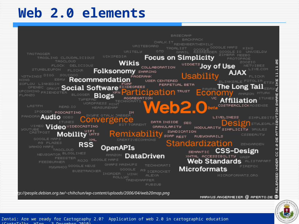
Web 2.0 elements
http://people.debian.org.tw/~chihchun/wp-content/uploads/2006/04/web20map.png
Zentai: Are we ready for Cartography 2.0? Application of web 2.0 in cartographic education (CartoTalks, WIen – 3 December 2010)
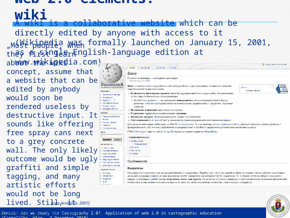
Web 2.0 elements: wikiA wiki is a collaborative website which can be directly edited by anyone with access to it (Wikipedia was formally launched on January 15, 2001, as a single English-language edition at www.wikipedia.com)„Most people, when they
first learn about the wiki concept, assume that a website that can be edited by anybody would soon be rendered useless by destructive input. It sounds like offering free spray cans next to a grey concrete wall. The only likely outcome would be ugly graffiti and simple tagging, and many artistic efforts would not be long lived. Still, it seems to work very well.”
[Lars Aronsson, 2007]

Zentai: Are we ready for Cartography 2.0? Application of web 2.0 in cartographic education (CartoTalks, WIen – 3 December 2010)
Wiki in cartographyThe project Wikimapia (Let’s describe the whole World) was launched in May 2006 to combine Google Maps with a wiki system, allowing users to add information to any location (mostly areas) on Earth.
http://wikimapia.org/

Zentai: Are we ready for Cartography 2.0? Application of web 2.0 in cartographic education (CartoTalks, WIen – 3 December 2010)
Web 2.0 elements: blog
Blogs provide commentary or news on a particular subject, as personal online diaries; they can be part of a wider network of social media.A typical blog combines text, images, and links to other blogs, web pages, and other media related to its topic.The ability for readers to leave comments in an interactive format is an important part of many blogs.
http://islamic-cartography.blogspot.com/

Zentai: Are we ready for Cartography 2.0? Application of web 2.0 in cartographic education (CartoTalks, WIen – 3 December 2010)
Cartography blogs
http://makingmaps.net/
http://terkepem.blogspot.com/

Zentai: Are we ready for Cartography 2.0? Application of web 2.0 in cartographic education (CartoTalks, WIen – 3 December 2010)
Microblog
http://yamm.hu/geocucc2

Zentai: Are we ready for Cartography 2.0? Application of web 2.0 in cartographic education (CartoTalks, WIen – 3 December 2010)
Microblog (Twitter)
http://twitter.com/codemap

Zentai: Are we ready for Cartography 2.0? Application of web 2.0 in cartographic education (CartoTalks, WIen – 3 December 2010)
Web 2.0 elements: mashupMashup, a website or web application that combines content from more than one source. Content used in mashups is typically sourced from a third party via a public interface or API, other methods of sourcing include Web feeds.GoogleMaps, eBay, Amazon, Flickr, YouTube, Yahoos API are the most common sources.
http://www.mapjack.com/

Zentai: Are we ready for Cartography 2.0? Application of web 2.0 in cartographic education (CartoTalks, WIen – 3 December 2010)
Web 2.0 elements: mashup
Google launched the Google Maps API in June 2005 to allow developers to integrate Google Maps into their websites.For whom the creation of mashup application is too complicated Google released Gooogle MyMaps in 2007, which is a simple online map creation tool.

Zentai: Are we ready for Cartography 2.0? Application of web 2.0 in cartographic education (CartoTalks, WIen – 3 December 2010)
GoogleMaps mashup
http://www.guardian.co.uk/world/interactive/2010/nov/23/korea-incidents-map

Zentai: Are we ready for Cartography 2.0? Application of web 2.0 in cartographic education (CartoTalks, WIen – 3 December 2010)
GoogleMaps mashup (NORC)
http://www.norc.ro/street-view/

Zentai: Are we ready for Cartography 2.0? Application of web 2.0 in cartographic education (CartoTalks, WIen – 3 December 2010)
YahooMaps mashup
http://manishranade.com/bay_area/apartments.php

Zentai: Are we ready for Cartography 2.0? Application of web 2.0 in cartographic education (CartoTalks, WIen – 3 December 2010)
BingMaps mashup
http://eyeonearth.cloudapp.net/

Zentai: Are we ready for Cartography 2.0? Application of web 2.0 in cartographic education (CartoTalks, WIen – 3 December 2010)
Géoportail mashup
http://ti.racoon.free.fr/geoportail.php?image_id=529&chem=./galleries/Paysage/StBarth/

Zentai: Are we ready for Cartography 2.0? Application of web 2.0 in cartographic education (CartoTalks, WIen – 3 December 2010)
Google StreetView
It was launched on May 25, 2007, originally only in several cities in the United States, and has since gradually expanded to include more cities and rural areas worldwide.
Integration of high quality photographs into the GoogleEarth environment to combine maps/satellite images and pictures.
Privacy problems in some country, photographs are to change: delete plate names, depixelize human faces or properties (it is an automatic process due to the huge number of photos, so the result will not be perfect).

Zentai: Are we ready for Cartography 2.0? Application of web 2.0 in cartographic education (CartoTalks, WIen – 3 December 2010)
Google StreetView (Paris)

Zentai: Are we ready for Cartography 2.0? Application of web 2.0 in cartographic education (CartoTalks, WIen – 3 December 2010)
Mapping APIs – top list (November, 2010)
API Popularity
Google Maps 2136
MS Virtual Earth 176
Yahoo Maps 133
Yahoo Geocoding 97
GeoNames 76
Google Maps Flash 41
Google Earth 40
Geocoder 35
Google Maps Data 24
Google Static Maps 22
Bing Maps 16
OpenLayers 14http://www.programmableweb.com/apis/directory/1?apicat=Mapping&sort=mashups

Zentai: Are we ready for Cartography 2.0? Application of web 2.0 in cartographic education (CartoTalks, WIen – 3 December 2010)
Social networkingThere were many early efforts to support social networks via computer-mediated communication, including Usenet, ARPANET, LISTSERV, bulletin board services (BBS).Early social networking websites started in the form of generalized online communities such as The WELL (1985), Theglobe.com (1994), Geocities (1994) and Tripod.com (1995). These early communities focused on bringing people together to interact with each other through chat rooms, and share personal information and ideas around any topics via personal homepage publishing tools which was a precursor to the blogging phenomenon. Some communities took a different approach by simply having people link to each other via email addresses. User profiles could be created, messages sent to users held on a “friends list” and other members could be sought out who had similar interests to yours in their profiles.

Zentai: Are we ready for Cartography 2.0? Application of web 2.0 in cartographic education (CartoTalks, WIen – 3 December 2010)
Social networkingNew social networking methods were quickly developed by the end of the 1990s, which changed the social networking model from ones that simply recommended additions to users to ones they could manage themselves.These sites included Epinions.com, using a system called 'The Web of Trust', which allowed users to build social networks based on who they trusted.These system began to flourish with the emergence of Friendster in 2002, causing such sites to become part of mainstream users globally. Friendster was followed by MySpace and LinkedIn a year later.By 2005, MySpace, emergent as the biggest of them all, was reportedly getting more page views than Google. 2004 saw the emergence of Facebook, a competitor, also rapidly growing in size.

Zentai: Are we ready for Cartography 2.0? Application of web 2.0 in cartographic education (CartoTalks, WIen – 3 December 2010)
Social networking - FacebookFounded in February 2004, Facebook is a social utility that helps people communicate more efficiently with their friends, family and coworkers. The company develops technologies that facilitate the sharing of information through the social graph, the digital mapping of people's real-world social connections. Anyone can sign up for Facebook and interact with the people they know in a trusted environment.In 2006, Facebook opened up to the non-US college community, and together with allowing externally-developed add-on applications, and some applications enabled the graphing of a user's own social network - thus linking social networks and social networking, became the largest and fastest growing site in the world, not limited by particular geographical followings.

Zentai: Are we ready for Cartography 2.0? Application of web 2.0 in cartographic education (CartoTalks, WIen – 3 December 2010)

Zentai: Are we ready for Cartography 2.0? Application of web 2.0 in cartographic education (CartoTalks, WIen – 3 December 2010)
Web 2.0 elements: Ajax, folksonomies, video sharing
The complex and evolving technology infrastructure of Web 2.0 includes
server-software,content-syndication,messaging-protocols,standards-based browsers with plugins and extensions,and various client-applications.
These differing but complementary approaches provide Web 2.0 with information-storage, creation, and dissemination capabilities:
rich internet applications,server-side software,new web protocols.

Zentai: Are we ready for Cartography 2.0? Application of web 2.0 in cartographic education (CartoTalks, WIen – 3 December 2010)
Folksonomy, semantic webFolksonomies, unlike many other forms of communication, are created collectively by people acting in isolation from one another and with no coordinated effort. The difficulty in taking communications intended primarily for personal use and making them available to the public is that the full meaning available to the sign creator is not generally available to the sign receiver.
Geospatial systems: 1) people’s tags may be difficult for others to understand, 2) people may have tagged items inappropriately for others’ needs.
All geospatial data sets have location tags, but adding them in an unstructured way creates enough chaos that it is very difficult to leverage location tags in a thorough way. Secondly many potential users do not know the variety of geodata available.

Zentai: Are we ready for Cartography 2.0? Application of web 2.0 in cartographic education (CartoTalks, WIen – 3 December 2010)
Folksonomy, semantic web

Zentai: Are we ready for Cartography 2.0? Application of web 2.0 in cartographic education (CartoTalks, WIen – 3 December 2010)
Examples

Zentai: Are we ready for Cartography 2.0? Application of web 2.0 in cartographic education (CartoTalks, WIen – 3 December 2010)
Examples
www.turistautak.hu – a Hungarian website of sharing GPS logs of hiking tracks and create a universal digital map using these track data:•collaborative environment
•comments, feedbacks•common knowledge (wiki-like)
•Special software or mashup for the graphic representation
Similar to OpenStreetMap

Google Earth/Map
A világhálós térképek fejlődésében a következő nagy áttörést a 2005 februárjában megjelent Google Earth/Maps jelentette. Felhasználói szempontból a következő előnyöket kell kiemelni:
•teljes világot lefedő, részletes térképi adatbázis,•hely szerinti keresési funkciók,•könnyen kezelhető, intuitív felhasználói felület,•testreszabható, kiterjeszthető nyílt programozási felület
(API).•ingyenes, mégis magas színvonalú és megbízható
szolgáltatás

Zentai: Are we ready for Cartography 2.0? Application of web 2.0 in cartographic education (CartoTalks, WIen – 3 December 2010)
Cartography 2.0

Zentai: Are we ready for Cartography 2.0? Application of web 2.0 in cartographic education (CartoTalks, WIen – 3 December 2010)
Conclusions 1 If we look at the history of cartography, the development
of the last decades caused the most rapid changes. The meaning of the term cartographer is continuously
changing by integrating more and more areas of information technology into cartography.
The cartographic approach is somehow built in the human brain (at least the navigational skills), but it will not be built-in totally in software (at least not in our life).
It is difficult to predict how the meaning of the term ‘cartographer’ is changing in the near future. Information technology is still developing rapidly creating new hardware and software to let us invent new chances for cartography.
Cartographers are ready to adapt new technologies and keep ‘something’ from the times when the cartographer was an artist too (ICA Working Group on Art and Cartography).

Zentai: Are we ready for Cartography 2.0? Application of web 2.0 in cartographic education (CartoTalks, WIen – 3 December 2010)
Conclusions 2
The web is becoming a platform for unparalleled activity. This kind of activity is not unusual for cartographers.
Share our own enthusiasm, excitement, and passion in the education.
The wisdom of the collaborative group may replace the expert – do we need cartographers at all?
Free software environment – how about free data (Inspire)?
Web 2.0 may change the role of the cartographer, we have to prepare for that.

Zentai: Are we ready for Cartography 2.0? Application of web 2.0 in cartographic education (CartoTalks, WIen – 3 December 2010)
Web 3.0
People keep asking what Web 3.0 is. I think maybe when you've got an overlay of scalable vector graphics - everything rippling and folding and looking misty — on Web 2.0 and access to a semantic Web integrated across a huge space of data, you'll have access to an unbelievable data resource..."
Tim Berners-Lee, 2006
Not much time passed before "Web 3.0" was coined. Definitions of Web 3.0 vary greatly. Web 3.0 is, among other things, about the Semantic Web and personalization. Some consider the Semantic Web an "unrealisable abstraction" and sees Web 3.0 as the return of experts and authorities to the Web. Others proposes that Web 3.0 will be a "Totally Integrated World" - cradle-to-grave experience of being always plugged onto the net. Others expects Web 3.0 to emerge from new and innovative Web 2.0 services with a profitable business model. Other users have argued that Web 3.0 is where "the computer is generating new information", rather than humans.