what is a smart city? - c.ymcdn.com · what is a smart city? smart cities is about getting from...
TRANSCRIPT

WHAT IS A SMART CITY? Smart cities is about getting from here to there seamlessly. Data within cities is dynamic and so must be its accessibility. It is more
than a map… it’s about a workflow “map it once use it many times”. It’s BIM (Building Information Modeling)… it’s CIM (Civil Information Modeling)… it’s SUE
(Subsurface Utility Engineering) working together within an intelligent 3D infrastructure that contains layers of information.
ACQUISITION BY TERRESTRIAL MOBILE LiDAR SCANNING (TMLS) Non-invasive survey-grade 3d LiDAR environment while traveling safely within an
environment. Terrametrix as a service provider to stakeholders addressing the need of mobile mapping versatility as another tool in the toolbox to acquire as-built data.
The TMLS tool helps accelerate the schedule and design for architects, engineers and surveyors and allows these disciplines to reap the benefits of complete 3D data
through our experience in accurate positional data documentation. The Terrametrix team is a group of survey professionals actively involved in the documentation and
consulting of 3d laser scanners and software since 2000
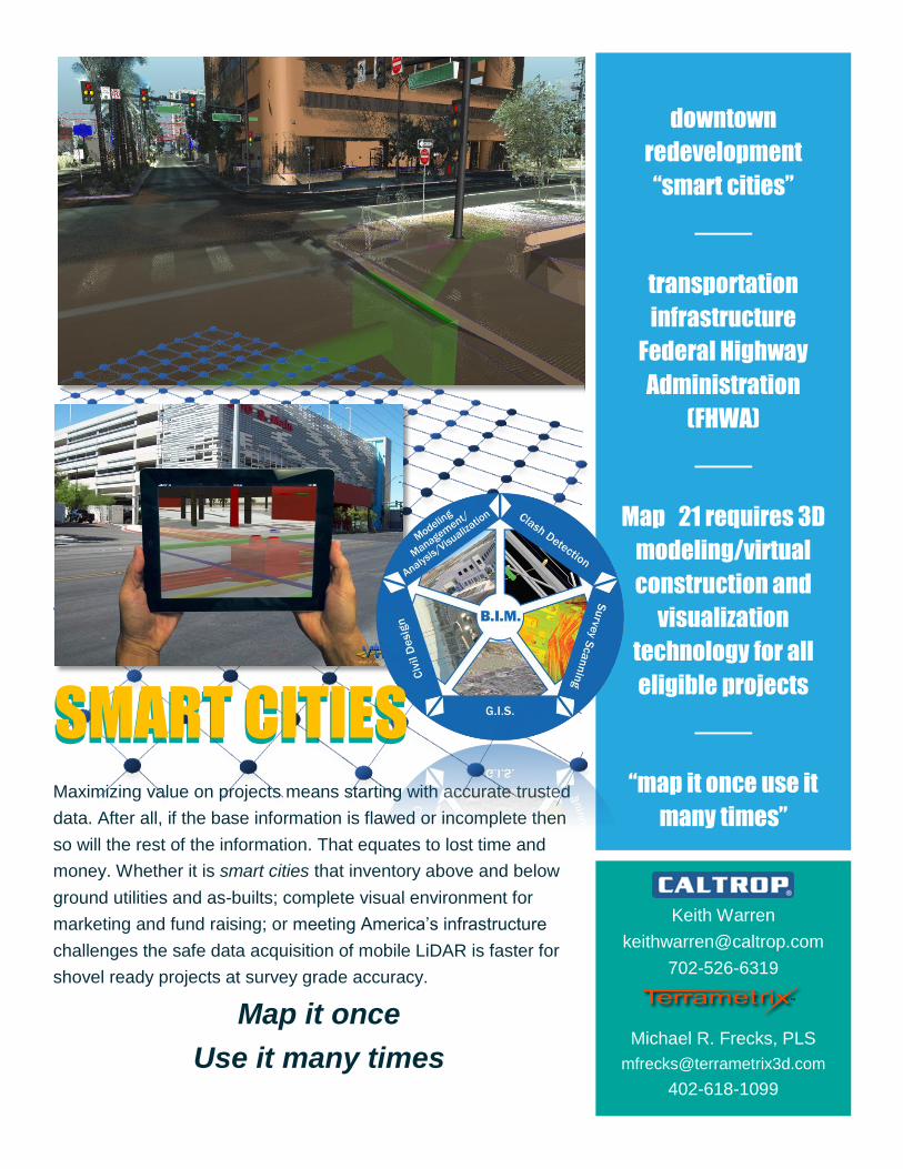
SMART CITIES
Maximizing value on projects means starting with accurate trusted
data. After all, if the base information is flawed or incomplete then
so will the rest of the information. That equates to lost time and
money. Whether it is smart cities that inventory above and below
ground utilities and as-builts; complete visual environment for
marketing and fund raising; or meeting America’s infrastructure
challenges the safe data acquisition of mobile LiDAR is faster for
shovel ready projects at survey grade accuracy.
Map it once
Use it many times
downtown
redevelopment
“smart cities”
transportation
infrastructure
Federal Highway
Administration
(FHWA)
Map 21 requires 3D
modeling/virtual
construction and
visualization
technology for all
eligible projects
“map it once use it
many times”
Keith Warren
702-526-6319
Michael R. Frecks, PLS
402-618-1099
SMART CITIES