water storage - lib.icimod.orglib.icimod.org/record/26754/files/attachment_654.pdf · glaciers and...
TRANSCRIPT
Sustainable Mountain Development No. 56, ICIMOD, Winter 2009
1
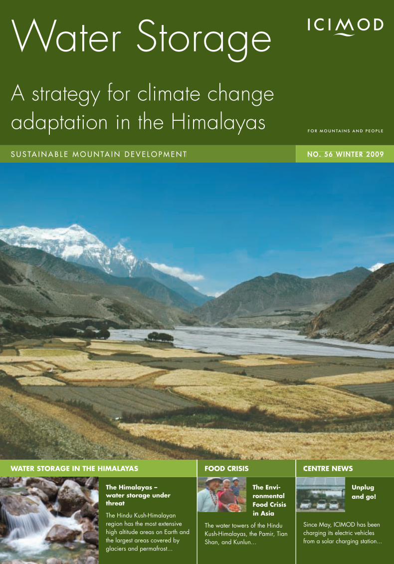
The Himalayas – water storage under threat
The Hindu Kush-Himalayan region has the most extensive high altitude areas on Earth and the largest areas covered by glaciers and permafrost...
The Envi-ronmental Food Crisis
Unplug and go!
Since May, ICIMOD has been charging its electric vehicles from a solar charging station...
WATER STORAGE IN THE HIMALAYAS
S U S TA I N A B L E M O U N TA I N D E V E L O P M E N T
FOOD CRISIS CENTRE NEWS
NO. 56 WINTER 2009
Water StorageA strategy for climate change adaptation in the Himalayas
in Asia
The water towers of the Hindu Kush-Himalayas, the Pamir, Tian Shan, and Kunlun...
dfsdaa
2
Contents
3The Himalayas – water storage under threat
Ouyang Hua
10The Role of Water Storage in Adaptation to Climate Change in the HKH Region
Ramesh Ananda Vaidya
17Climate Change and Hindu Kush-Himalayan Waters – knowledge gaps and priorities in adaptation
Jayanta Bandyopadhyay
24Traditional Techniques for Water Harvesting
Madhukar Upadhya
31Payment for Environmental Services – an approach to enhancing water storage capacity
Bhaskar Singh Karky and Laxman Joshi
6The Environmental Food Crisis in Asia – a ‘blue revolution’ in water effi ciency is needed to adapt to Asia’s looming water crisis
Christian Nellemann and Bjørn Petter Kaltenborn
14Glaciers as Indicators of Climate Change – the special case of the high elevation glaciers of the Nepal Himalaya
Richard Armstrong, Donald Alford and Adina Racoviteanu
21Himalayan Wetlands Initiative – conservation and wise use of natural water storage in the HKH region
Celeste Harris, Bishnu B. Bhandari, Ouyang Hua and Eklabya Sharma
27Rainwater Harvesting and Groundwater Recharge for Water Storage in the Kathmandu Valley
Roshan Raj Shrestha
34Adapting to Climate-induced Water Stresses and Hazards in the Hindu Kush-Himalayas
Julie Dekens and Mats Eriksson
38The Evolving Role of ICIMOD in the Development of Water Storage Capacity
Andreas Schild and Ramesh Ananda Vaidya
44 Centre News • ICIMOD Programme Advisory Committee and Board Executive Committee meetings • New Regional Board Member • New projects at ICIMOD • Workshops, meetings and training events • Hosted institutions • Partnership development • Outreach activities • ICIMOD publications • New appointments
Cover photo – View from Kagbeni in Mustang, Nepal, with Nilgiri Himal in the background, Sunil SharmaAll other photo credits back page
Sustainable Mountain Development No. 56, ICIMOD, Winter 2009
Dear Friends of ICIMOD,During the 5th World Water Forum in Istanbul in March 2009, we had the chance to chair a roundtable discussion on ‘Snowpack Dependent Water Services’.
The three key messages of the discussion were: (1) the need to increase the availability of scientifi c information and
knowledge, (2) the need to develop natural and artifi cial systems to increase water storage capacity, and (3) the
need to strengthen institutions for improving water governance. Storage of water in the mountains was identifi ed as a
key issue for improving water security and as an adaptation strategy to climate change and other events.
The present issue of ICIMOD’s periodical Sustainable Mountain Development is a follow-up of these discussions. We
want to provide a brief overview of the different dimensions of ‘storage’ in the Himalayan region in the context of
climate change.
We are convinced that water storage is and will be a key strategy for climate change adaptation. One of the
major impacts of climate change in the mountains will be on the availability of water. This together with increased
demand from a growing population for water for agricultural, industrial, and domestic purposes is likely to turn
water into a major issue in the countries of Asia in the coming years. The easiest way to address the growing gap
between demand and availability of water seems clear: store more water when it is available in excess and release
it when it is needed. ‘Storage’ thus becomes the central issue, although increasing effi ciency of water use is also
important. The more water we can store at high altitude the better. This allows us multifunctional use of the water, for
hydroelectricity, irrigation, animals, and domestic use.
What sounds simple in theory, proves complicated and challenging in practice, particularly in the Hindu Kush-
Himalayan region.
The many glacier lakes, themselves a product of rising temperatures, may offer storage potential, but only if the risk
of outburst from the unstable moraine dams can be reduced. But the high elevation of these lakes -- mostly above
5000 masl -- means we do not have any access or infrastructure to manage them.
The high altitude wetlands constitute an enormous potential, particularly on the Tibetan Plateau. Is it possible to
extend the surface and potential of the wetlands on the southern slopes of the Himalayas? Can we protect and
extend existing wetlands in the face of moves towards land use change and increasing exploitation?
Water storage at farm level is still a largely untapped
resource. Farmers in traditionally water-stressed areas
have developed elaborate systems of storage and
governance to collect and distribute water, but the skills
and knowledge are rapidly disappearing, just when
they are needed most. We have rich experience within
the Hindu Kush-Himalayan region. Are the hill farmers
going to be the water managers of the future? We
certainly have to revisit the watershed development
1
dfsdaa
2
programmes and analyse the potential of water storage. Out of the box thinking will be required combining local
experiences with high end technology.
And in the cities, rainwater harvesting and assisted recharge of aquifers offer a potential solution to some of the
massive urban shortages.
Big dams have not been discussed in this periodical; this is certainly a gap. We know that building dams is the
most conventional approach, but it has serious potential drawbacks in our unstable environment. In addition, dams
are massive local structures. We think that we need to rethink and look at new approaches that are supported and
promoted by the local population.
The topic is by no means exhausted. But we hope that the articles presented here will provide you with food for
thought, and stimulate discussion and activities on water storage in the mountains.
Sincerely,
Andreas Schild, October 2009

Sustainable Mountain Development No. 56, ICIMOD, Winter 2009
3
T he Hindu Kush-Himalayan region has the most extensive high altitude areas on Earth and the largest areas covered by glaciers and
permafrost outside the polar regions – the ‘Third Pole’. These mountains are now recognised to be a hotspot of climate change (Dyurgerov and Meier 2005), but they still receive signifi cantly less attention than the Arctic or Antarctic.
The region’s ranges and foothills encompass a wide spectrum of ecological zones with great socioeconomic potential. They contain signifi cant biodiversity hotspots and a unique array of plants and animals of global importance. Furthermore, the wetlands, rangelands, and forests provide valuable ecosystem services such as plant-based production, soil retention, climate regulation, and carbon sequestration.
The ranges form a barrier to the easterly monsoon winds and are the origin of ten of the largest rivers in Asia. The huge water storage capacity of the mountains provides a lifeline for millions of people in the region and downstream; more than 1.3 billion people are estimated to depend directly or indirectly on Himalayan waters.
Climate change
The Himalayas are experiencing a general warming trend. The mean maximum temperature in Nepal increased by 0.06°C per year between 1977 and 2000. Similarly, the Tibetan Plateau has experienced warming in the range of 0.02°C to 0.03°C per year over the last fi fty years (Yao et al. 2006) -- much greater than the global average of 0.74°C total over the last 100 years (IPCC 2007). Based on regional climate models, it is predicted that the temperatures on the Indian sub-continent will rise between 3.5°C and 5.5°C by 2100, and on the Tibetan Plateau 2.0°C by 2050 and 5.0°C by 2100 (Rupa Kumar et al. 2006). Monsoon rainfall in India and Nepal has been found to be highly correlated with large-scale climatological phenomena such as El Niño. There are already signs of changes in the dates of the onset and retreat of
The Himalayas – water storage under threatOuyang Hua, Integrated Water and Hazard Management, ICIMOD, [email protected]
the monsoon as well as the number and frequency of extreme precipitation events.
One of the main concerns in relation to climate change in the Himalayan region is the reduction of snow and ice, which reduces the region’s water storage capacity. Changes in the intensity and distribution of rainfall may also lead to changes in the uptake of rainwater by soils and the recharge of aquifers. Climate change may affect people‘s wellbeing in numerous ways. For example, it is very likely to aggravate the existing food insecurity and problems of irrigated farming systems, especially in the Tarim and Indus river basins. The Indus Irrigation Scheme in Pakistan depends 50% or more on runoff originating from snowmelt and glacial melt from the eastern Hindu Kush, Karakoram, and western Himalayas (Winiger et al. 2005).
The Himalayas as the water tower of Asia
The Hindu Kush-Himalayan mountains are the major source of stored water in the region. Water is retained in the form of ice and snow in the high mountains, as well as being stored in natural lakes, wetlands, and groundwater aquifers, and behind constructed dams.
The Himalayas have a total glaciated area of around 33,000 sq.km (Eriksson et al. 2009) which provides important short- and long-term water storage facilities. “There is about 12,000 cu.km of fresh water stored in the glaciers throughout the Himalayas -- more fresh water than in Lake Superior” (Thompson 2007). Compared to glaciers in other mountain ranges, the Himalayan glaciers are retreating at higher rates, and these rates are accelerating. Projections of glacier retreat in the region (IPCC 2007) suggest that the projected increase
“The huge water storage capacity of the mountains provides a lifeline for millions”
dfsdaa
4
in the mean annual temperature for High Asia of 1.0°C to 6.0°C by 2100 is likely to result in an extensive diminishing of glacial coverage. Continued deglaciation could have profound impacts on the hydrological regimes of the ten river basins originating in the Himalayas. It is suggested that river discharges are likely to increase for some time due to accelerated melting, but as the glaciers’ water storage capacity is reduced, the fl ow is likely to decline. Indications of shifting in the hydrographs of some rivers in Nepal have already been observed. The hydrological implications of such deglaciation are expected to be most severe in the arid parts of the Himalayan region.
Areas in the high mountains and on the high plateaus not covered in perennial snow and ice are underlain by permafrost. The areas covered by permafrost are much larger than those covered by glaciers or perennial snow, especially in the Tibetan Plateau, China. The Tibetan Plateau has approximately 1,360,000 cu.km of perennial permafrost (Xin Li and Cheng Guodong 1999). But recent studies show that the extent of permafrost is shrinking, that the thickness of the active layer (the upper portion of soil that thaws each summer)
is increasing, and that this has altered the hydrological cycle, vegetation composition, and carbon dioxide and methane fl uxes which appear to be linked to permafrost degradation.
The Himalayas have many lakes with an enormous capacity for water storage. For example, the Tibetan Plateau alone has more than 1000 lakes, with a total area of approximately 45,000 sq.km. The major sources of lakewater are rainfall, and glacial, snow, and permafrost melting. In addition, many glacial lakes have formed associated with the retreat of valley glaciers. According to ICIMOD’s inventory, there are 8790 glacial lakes in Bhutan, Nepal, and selected areas of China, India, and Pakistan. These lakes also offer a certain storage capacity, but a number of them are also potentially dangerous, that is they could burst out and cause catastrophic fl oods downstream (GLOFs) at any time. There have been at least 35 GLOF events in Bhutan, China, and Nepal in the past.
High altitude wetlands account for around 16% of the total area of the Hindu Kush-Himalayas Himalayas and play an important role in water storage and regulating water regimes (Trisal and Kumar 2008). They maintain water quality, regulate water fl ow (fl oods and droughts), and support biodiversity. They also play an important role in mitigating the impacts of climate change by acting as carbon sinks. The peatlands in the Tibetan Plateau are one of the most important stores of carbon in the mountain region, storing 1500-4000 tonnes per ha (Trisal and Kumar 2008). The Himalayan wetlands are under pressure from drainage for agriculture, tourism-related pollution, overgrazing, and climate changes. Some areas, such as the Ruoergai Marshes of the Tibetan Plateau, have been severely degraded over the past decades due to drainage, overgrazing, and climate change.
Groundwater aquifers are important for water storage in the Himalayan region, but there is little data available to allow assessment of the change and uses of groundwater on a regional scale.
Offi cial statistics on dams higher than 15 metres from the World Register of Large Dams show that India has 4300 dams and China 1855, compared to 6600 in the USA and 2700 in Japan. There are also a large number of non-registered dams in China. Researchers have tried to explain the viability and cost of dam construction at a location in terms of its geographical features such as average land gradient and river gradient. They have also concluded that rivers fl owing at a gradient of over 6% increase the suitability for dam construction. To this
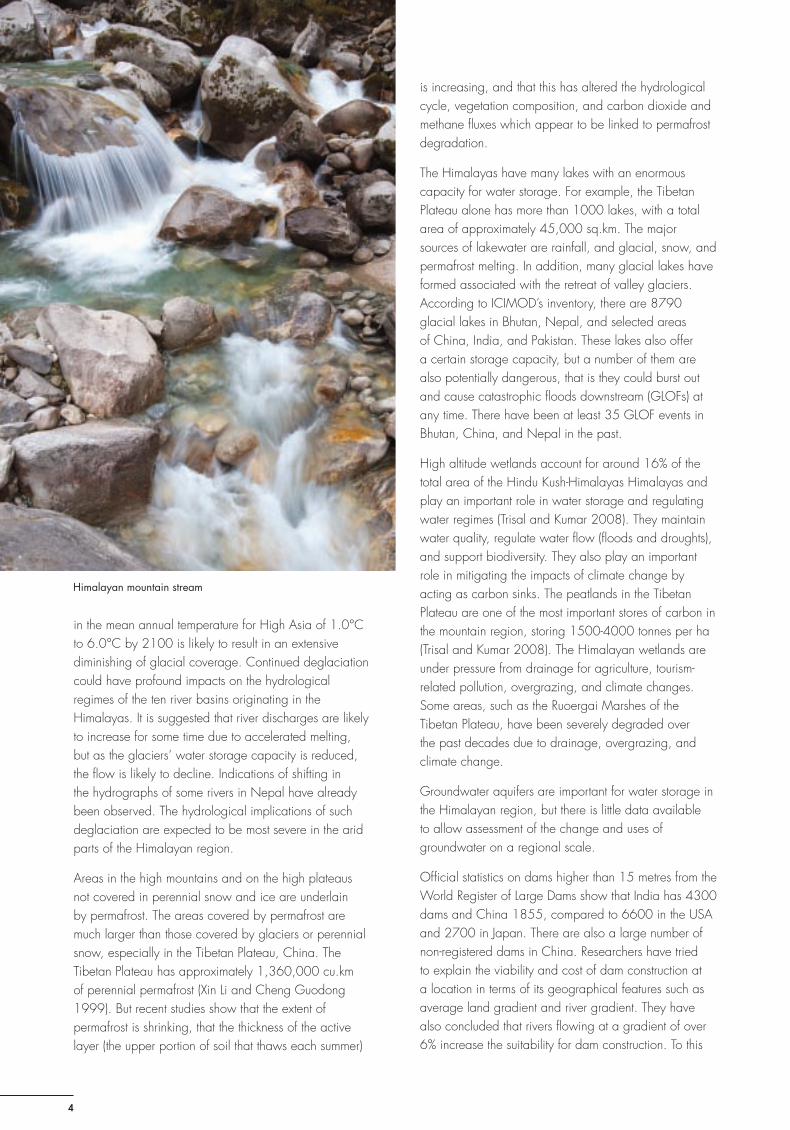
Himalayan mountain stream
Sustainable Mountain Development No. 56, ICIMOD, Winter 2009
5
end, if mechanisms could be developed to ensure that environmental concerns are integrated in the process of planning and implementation of artifi cial water storage systems, it may be appropriate to promote environmentally-friendly dams and reservoirs that could provide water storage, as well as fl ood control and hydro-energy benefi ts.
China and India are traditionally two leading producers of rice in the world, most of the harvest coming from irrigated agriculture in the Ganges, Yangtze, and Yellow river basins. Moreover, China and India are today experiencing economic growth and are gaining in international importance. The development of these two giants demands increasing ecosystem services, especially freshwater resources.
The Himalayas – reconciling human demands and the environment in a globally warmed world
Climate change clearly has a global dimension. While the priority has to be adaptation, we are aware that the Himalayas are suffering the consequences of a global phenomenon. Unfortunately, global instruments in relation to the Kyoto protocol do not yet benefi t the mountains. There is a continuum between mitigation and adaptation, where mountain systems should not be sidelined in world actions. The mountains, especially the Himalayas, require global solidarity. Adaptation calls for micro-level changes within national responsibilities, however, the Himalayan region needs regional consultation, as well as exchange of information and experiences. Certain tasks call for regional, transboundary actions as outlined below.
Promoting regional cooperation: Most of the large rivers originating in the Himalayas fl ow across several countries. The development of water resources in the Himalayan region requires transboundary cooperation. In the past, water resource management has been looked at from national and bilateral perspectives that hindered the optimum development of transboundary water resources in an integrated manner. Climate change has posed additional stress and challenges to water resources development and management, with an increased scarcity of water in the dry season, enhanced hazards in the monsoon, and increased temperature leading to melting of snow and ice. Cooperative efforts among the riparian countries are crucial for addressing this huge challenge.
Developing a regional programme for climate change monitoring: It is essential to develop a scientifi c framework for fi eld observation in collaboration with government agencies and academia. Remote sensing
allows for regular and repeated monitoring of snow cover, which can be carried out by countries such as China and India, with results shared with those lacking such technological infrastructure. Studies need to include both ground-based and satellite-based monitoring. Well-equipped stations and long-term monitoring, networking, and cooperation within and outside the region are essential.
Developing water storage systems and management strategies as options for climate change: It is necessary to assess the social requirements for water in the context of climate change, and then to develop natural systems and solutions for policymakers and stakeholders to take the required steps to meet those needs through wise use of high altitude wetlands, groundwater management, and construction of water storage systems, in the best manner possible. Water storage, based on local practices, should be encouraged in the region.
In the end, the Himalayas may be an example of how humans and the environment collide in a globally warmed world. Can the world’s third pole be saved? What we do about this will probably determine what is going to happen to our world in the future.
References
Dyurgerov, MD; Meier, MF (2005) Glaciers and changing earth system: A 2004 snapshot. Boulder: Institute of Arctic and Alpine Research, University of Colorado
Eriksson, M; Xu J; Shrestha AB; Vaidya, RA; Nepal, S; Sandstrom, K (2009) The changing Himalayas: Impact of climate change on water resources and livelihoods in the greater Himalayas. Kathmandu: ICIMOD
IPCC (2007) Climate change 2007: The physical science basis. Contribution of Working Group I to the Fourth Assessment Report of the Intergovernmental Panel on Climate Change. Cambridge: Cambridge University Press
Rupa Kumar, K; Sahai, AK; and others (2006) ‘High resolution climate change scenario for India for the 21st Century’. Current Science 90: 334-345
Thompson, Lonnie (2007) ‘New Tibetan ice cores missing A-bomb blast markers: suggest Himalayan ice fi elds haven’t grown in the last 50 years. Science Daily, Dec. 13, 2007
Trisal, CL; Kumar, R (2008) Integration of high altitude wetlands into river basin management in the Hindu Kush-Himalayas. New Delhi: Wetlands International – South Asia
Xin Li, Cheng Guodong (1999) Responding model of multi annual permafrost to climate change in the high Altitude region. Science in China, Series D 29(2):185-192
Yao, TD; Guo, XJ; and others (2006) ‘δ18O Record and Temperature Change over the Past 100 years in Ice Cores on
the Tibetan Plateau’. Science in China: Series D 49(1):1-9
Environmental Food Crisis
6
The Environmental Food Crisis in Asia – a ‘blue revolution’ in water effi ciency is needed to adapt to Asia’s looming water crisisChristian Nellemann, United Nations Environment Programme GRID-Arendal, Norway, [email protected]ørn Petter Kaltenborn, Norwegian Institute for Natural Science (NINA), Trondheim, Norway, [email protected]
T he water towers of the Hindu Kush-Himalayas, the Pamir, Tian Shan, and Kunlun Shan mountain ranges, constitute the primary water
resources for a large part of Asia’s population and food production. The majority of the water, some 75 to 90%, is used in food production. However, while many people and farmers are already challenged by seasonal water scarcity and disrupted monsoon patterns, the reliability of the overall water supply is at growing risk.
There are three major reasons why water scarcity is going to increase. Firstly, population growth is increasing the demand for water, and although only 10 to 25% of the water is used for households and industry, rising populations will also raise the agricultural production demand for water. Secondly, the higher demand for cereals for production of animal feed and for human consumption will increase water demand by an additional 30 to 50% in a few decades; and perhaps by 70 to 80% by 2050. Thirdly, climate change may not only disrupt monsoon patterns, it may also signifi cantly alter the main fl ow and seasonality of many of the large Asian rivers within a few decades, with disastrous impacts on food production as a result.
Nearly 100,000 children are born every day in Asia
The demand for food and irrigation water will continue to increase towards 2050 as a result of population growth of an additional one billion people in Asia,
increased incomes, and growing consumption of meat. In Pakistan, for example, one of the countries with the highest water scarcity and extreme dependency upon the Indus River, the population is projected to increase from around 184 million in 2010 to around 335 million by 2050, an 82% increase. By then, meat consumption per capita will have doubled worldwide and over half of the world’s cereals will be used to feed livestock, up from one-third today. Indeed, this cereal alone could have fed the entire projected population growth. Instead, unless changes are made, our water consumption to grow irrigated cereals for animal feed will have to increase by at least 30 to 50%, if not more, simply to support heavily fertiliser-based production schemes. In some regions, as in Pakistan, water demand will increase by 50 to 70% by 2050, and probably before, while availability will at the same time decline. In many regions, this water is already not available in the dry seasons, when it is needed the most.
Reduced amount of glaciers and snow jeopardise Asian and world food production
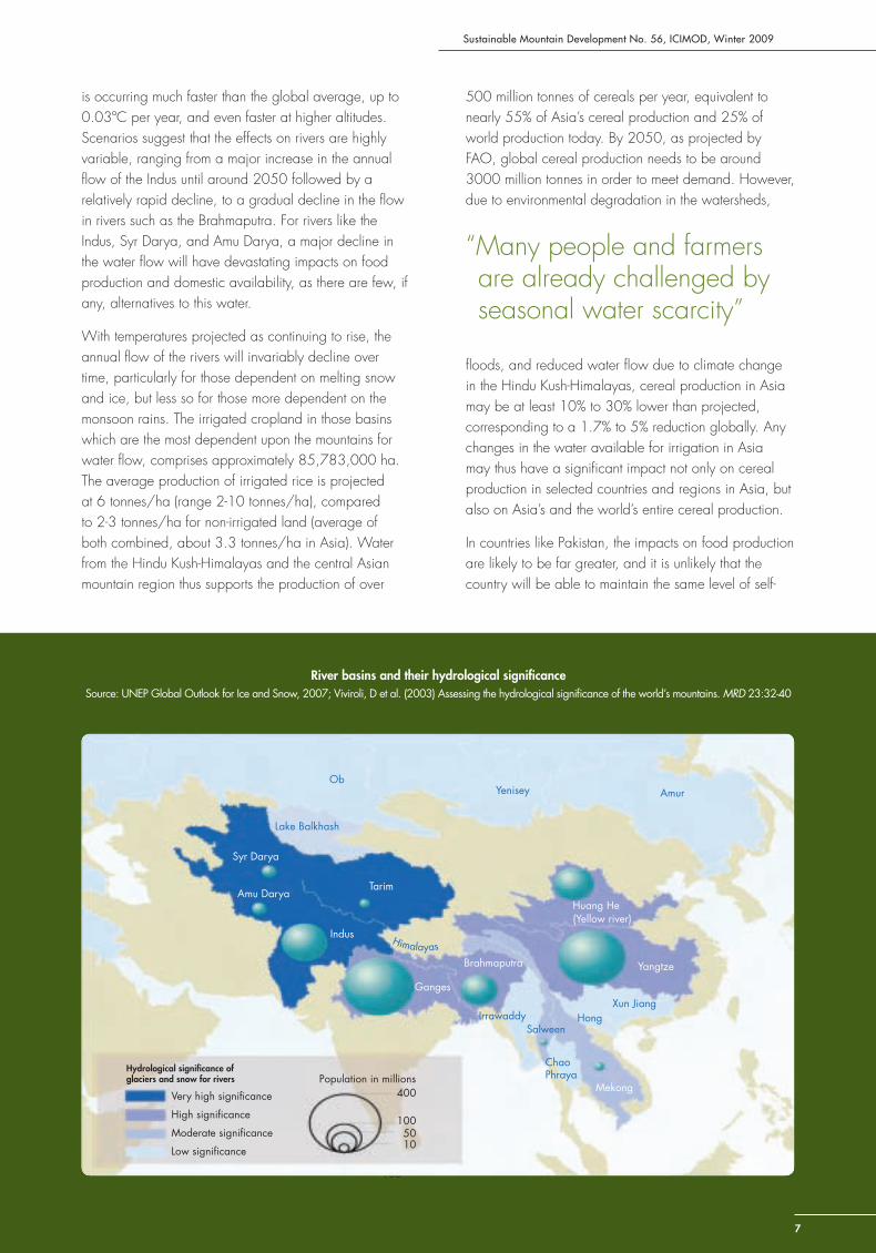
Irrigated croplands, mainly rice, in the watersheds of the Indus, Ganges, Brahmaputra, Yangtze, Huang He (Yellow River), Tarim, Syr Darya, and Amu Darya are all, to varying extents, dependent on glacial water and snowmelt from the mountains. With rising temperatures, combined with changes in the monsoon, a substantial part of the glaciated area may be lost within this century. While data is sparse in this region, observations from Nepal indicate that current warming at high altitudes
Sustainable Mountain Development No. 56, ICIMOD, Winter 2009
is occurring much faster than the global average, up to 0.03ºC per year, and even faster at higher altitudes. Scenarios suggest that the effects on rivers are highly variable, ranging from a major increase in the annual fl ow of the Indus until around 2050 followed by a relatively rapid decline, to a gradual decline in the fl ow in rivers such as the Brahmaputra. For rivers like the Indus, Syr Darya, and Amu Darya, a major decline in the water fl ow will have devastating impacts on food production and domestic availability, as there are few, if any, alternatives to this water.
With temperatures projected as continuing to rise, the annual fl ow of the rivers will invariably decline over time, particularly for those dependent on melting snow and ice, but less so for those more dependent on the monsoon rains. The irrigated cropland in those basins which are the most dependent upon the mountains for water fl ow, comprises approximately 85,783,000 ha. The average production of irrigated rice is projected at 6 tonnes/ha (range 2-10 tonnes/ha), compared to 2-3 tonnes/ha for non-irrigated land (average of both combined, about 3.3 tonnes/ha in Asia). Water from the Hindu Kush-Himalayas and the central Asian mountain region thus supports the production of over
500 million tonnes of cereals per year, equivalent to nearly 55% of Asia’s cereal production and 25% of world production today. By 2050, as projected by FAO, global cereal production needs to be around 3000 million tonnes in order to meet demand. However, due to environmental degradation in the watersheds,
fl oods, and reduced water fl ow due to climate change in the Hindu Kush-Himalayas, cereal production in Asia may be at least 10% to 30% lower than projected, corresponding to a 1.7% to 5% reduction globally. Any changes in the water available for irrigation in Asia may thus have a signifi cant impact not only on cereal production in selected countries and regions in Asia, but also on Asia’s and the world’s entire cereal production.
In countries like Pakistan, the impacts on food production are likely to be far greater, and it is unlikely that the country will be able to maintain the same level of self-
100
Mekong
River basins and their hydrological signifi canceSource: UNEP Global Outlook for Ice and Snow, 2007; Viviroli, D et al. (2003) Assessing the hydrological signifi cance of the world’s mountains. MRD 23:32-40
Brahmaputra
Ganges
Lake Balkhash
Syr Darya
Amu DaryaTarim
Yenisey Amur
Huang He(Yellow river)
Yangtze
Xun JiangHong
ChaoPhraya
SalweenIrrawaddy
Himalayas
Population in millions400Very high signifi cance
High signifi cance
Moderate signifi cance
Low signifi cance
Hydrological signifi cance ofglaciers and snow for rivers
Indus
Ob
1050
100
Mekong
“Many people and farmers are already challenged by seasonal water scarcity”
7
Environmental Food Crisis
88
suffi ciency in food production with the projected decline in water availability. Indeed, with the projections of population growth, water availability per person per year in Pakistan is likely to be reduced by 50 to 70% by 2050 – without assuming any climate change. If, as some projections indicate, water production due to disappearing glaciers and snow in the sources of the Indus declines by up to 50 to 80% beyond 2050, Pakistan would face a potential decline in water availability of up to 80 to 90% per capita compared to today – with devastating effects on food production.
In addition to this, the disappearance of much of the low-lying snow, so important to rangelands at higher altitudes, will severely impact pastoralists, for whom livestock is central for their livelihoods, economy, and culture.
After a long period with declining food prices, the surge in food prices in the last years was the largest and most extreme in more than a century. The ensuing crisis resulted in a 50 to 200% increase in selected commodity prices, drove 110 million people into poverty, and added 44 million more to
the undernourished on a worldwide basis. Elevated food prices have had dramatic impacts on lives and livelihoods, including increased infant and child mortality, and on those already undernourished or living in poverty who are spending 70 to 80% of their daily income on food. Key causes of the current food crisis were the combined effects of speculation in food stocks, extreme weather events, low cereal stocks, growth in biofuels competing for cropland, and high oil prices.
Greater price volatility ahead unless challenged
Decreased agricultural productivity and high demand could result in increased prices, create price volatility, and subsequently lead to hunger. Indeed, based on estimates from the World Bank, FAO, and the UN Environment Programme, coupled with scenarios of the environmental food crisis, food prices may increase by 30 to 50% on average – in addition to greater volatility. Large numbers of the world’s small-scale farmers, particularly in Bangladesh, China, India, Nepal, and Pakistan, are constrained by access to markets and the high price of inputs such as fertilisers and seed. With
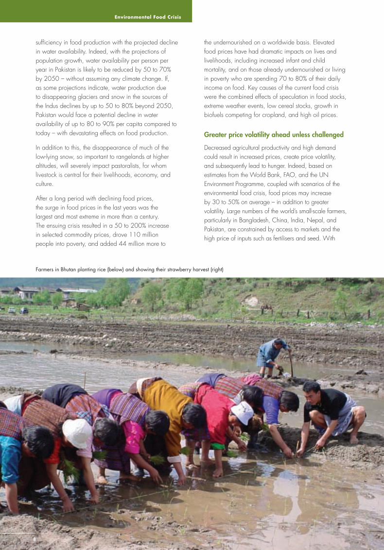
Farmers in Bhutan planting rice (below) and showing their strawberry harvest (right)
Sustainable Mountain Development No. 56, ICIMOD, Winter 2009
9
lack of infrastructure, investments, and reliable institutions (e.g., for water provision), and the low availability of micro-fi nance, it will become diffi cult to increase crop production in those regions where it is needed the most unless this is given major priority. Irrigation water was crucial in the former ‘Green Revolution’ based on fertiliser increase. Without a ‘blue revolution’ ahead, not only future production, but even previous gains may be off-set. Moreover, trade and urbanisation also change the food habits of consumers, and the supply from the hinterland of
many developing countries may become insuffi cient unless major investments in agricultural water effi ciency can take place, and may, even then, be an enormous challenge.
Half of the world’s food, and even more of the water, is wasted
In addition to increasing production, we can also learn from experiences in the conventional energy sector. In the 1970s, high oil prices led to increased research into more energy effi cient houses, cars, and industry. Similarly, rather than focusing solely on increasing production, there is a huge potential for improving food security through optimising food energy effi ciency and water effi ciency. Food energy effi ciency is about our ability to minimise the loss of energy in food from harvesting through processing, to actual consumption and recycling. Today, nearly half of the food produced, and even more of the irrigation water, is wasted in some form through ineffi cient use.
One of the chief challenges in the coming decades will be to capture and store excess water during periods of high water availability. We are likely to experience more extreme droughts, as well as extreme events
of rainfall. New and more effective systems in both capturing and storing water will become essential. This means both improved land management and improved storage methods. It includes, as possible options, the installation of new water capture and storage methods, as well as the re-introduction of some of the ancient traditional storage systems, such as the qanat, foggara, karez, and falaj systems known from desert regions. It also includes irrigation systems and pipelines from major rivers, as deforestation frequently increases the rate and speed of the fl ow of water into major channels. The required training, the revival of old knowledge, and implementation will require funds and programmes directed towards adaptation.
A ‘green economy’ may feed the world by reducing water and food waste through increased effi ciency
A concerted effort will be required to feed Asia and to ensure the platform of its productivity. A ‘green economy’ in Asia could provide society, business, and policymakers the room to provide innovative and progress-oriented ideas that may help to provide the basis of a more sustainable future for generations to come.
Firstly, developing alternatives to the use of cereal in animal feed, such as by recycling waste and using fi sh discards, could meet the demand for the projected population growth of nearly one billion people in Asia. Secondly, in addition to slowing down climate change and environmental degradation, the boosting of small-scale farmer productivity could both improve food security and generate small-scale business opportunities. Furthermore, a major shift to more eco-based production and reversing land degradation would help limit the spread of invasive species, conserve biodiversity and ecosystem services, and greatly help reduce the losses of water in ineffi cient irrigation systems. Thirdly, investments in green, small-scale technology and development, and the implementation of improved irrigation systems, designed to optimise the water irrigation exactly according to plant demand, reducing evaporation, and reducing run-offs, could likely increase effi ciency in water usage several-fold. It is expected that major changes and effi ciency improvements in the agricultural sector will take decades to implement. The time frame for implementation now is probably less than a couple of decades. In order to sustain populations we need a revolution in Asia – a ‘blue revolution‘ of water effi ciency.

Adaptation through Water Storage
10
The Role of Water Storage in Adaptation to Climate Change in the HKH RegionRamesh Ananda Vaidya, Integrated Water and Hazard Management, ICIMOD, [email protected]
I ncreasing water scarcity is a serious threat arising from climate change in Asia in general, and the Hindu Kush-Himalayan (HKH) region in particular.
The level of water withdrawal (demand) in Pakistan for example is already about three-quarters the level of annual renewable water resources available (supply); whereby a demand greater than one-third of supply is already considered risky. In 2005, the annual water availability per person in Pakistan was below the critical stress level of 1700 cubic metres (cum) per person per year to meet irrigation, industrial, and household water demand, and judging from the rate at which it declined between 2000 and 2005, it may soon fall below the minimum need of 1000 cum per person. The water availability is quickly approaching the critical stress level in Afghanistan, China, and India as well.
Most rivers in the region are shared between several countries, making water resources and their management a matter of regional concern. Both Bangladesh and Pakistan receive more than three-quarters of their surface water supply from across their borders. And during the dry season in the densely populated and fertile Ganges Basin of India, almost three-quarters of the surface water fl ows from Nepal.
Climate change is projected to have severe adverse effects on water availability in the region with overall changes in precipitation patterns The total amount may increase in some areas and be less in others, leading to water stress and droughts. More precipitation may fall as rain instead of snow, reducing both long and short-term storage. Precipitation may also increase in intensity with more falling over a shorter time resulting in a higher incidence and intensity of fl oods in the river basins and a higher proportion of runoff and reduction in groundwater recharge, again reducing storage. A
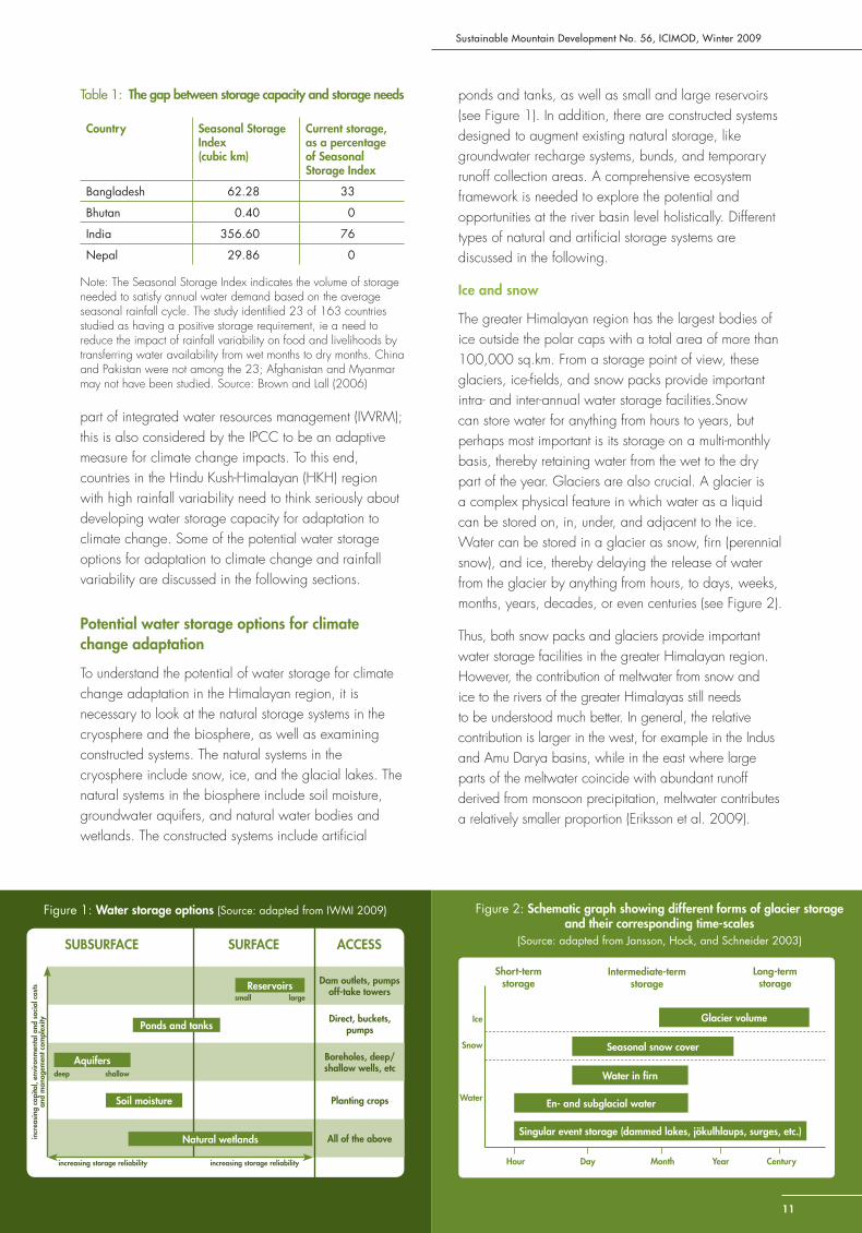
reduced volume of snow and ice, and the changes in precipitation, could lead to a serious shortage of water for drinking and farming. When the consequences of climate change are superimposed on the high degree of intra-annual rainfall variability in the region, marked by too much water in the wet season followed by too little water in the dry season, it is clear that the threat of water scarcity could pose a serious challenge to the approximately 1.3 billion people living in the ten river basins that have their origins in the Hindu Kush-Himalayan mountains. For example, India has a skewed pattern of rainfall distribution, receiving 50% of its annual rainfall in just 15 days. According to Biswas (2004) Cherrapunji, with the highest rainfall in India receives its annual rainfall of 10,820 mm between June and August in about 120 hours, but faces a water shortage problem during the dry months. A critical issue, then, is how to store massive quantities of rain falling in very short periods so that it can be used over the entire year.
Furthermore, there is a relationship between the intra-annual rainfall variability in a country and its level of prosperity. Countries with low rainfall variability typically have high GDPs (gross domestic products), while countries struggling with large seasonal variability in water availability typically have low GDPs (Brown and Lall 2006). Increasing the capacity to store water and reduce seasonal differences in availability may help to redress this balance. The current water storage capacity for countries in the Hindu Kush-Himalayan region is much below the estimated needs for food security. Estimates of seasonal storage requirements are based on the food requirements of the population, the area of cultivated land, and the rainfall distribution pattern over the year. According to estimates, only 33% of the seasonal storage requirement is met in Bangladesh, while 76% is met in India (Table 1). This implies the need to view development of water storage capacity as an integral
Sustainable Mountain Development No. 56, ICIMOD, Winter 2009
11
part of integrated water resources management (IWRM); this is also considered by the IPCC to be an adaptive measure for climate change impacts. To this end, countries in the Hindu Kush-Himalayan (HKH) region with high rainfall variability need to think seriously about developing water storage capacity for adaptation to climate change. Some of the potential water storage options for adaptation to climate change and rainfall variability are discussed in the following sections.
Potential water storage options for climate change adaptation
To understand the potential of water storage for climate change adaptation in the Himalayan region, it is necessary to look at the natural storage systems in the cryosphere and the biosphere, as well as examining constructed systems. The natural systems in the cryosphere include snow, ice, and the glacial lakes. The natural systems in the biosphere include soil moisture, groundwater aquifers, and natural water bodies and wetlands. The constructed systems include artifi cial
ponds and tanks, as well as small and large reservoirs (see Figure 1). In addition, there are constructed systems designed to augment existing natural storage, like groundwater recharge systems, bunds, and temporary runoff collection areas. A comprehensive ecosystem framework is needed to explore the potential and opportunities at the river basin level holistically. Different types of natural and artifi cial storage systems are discussed in the following.
Ice and snow
The greater Himalayan region has the largest bodies of ice outside the polar caps with a total area of more than 100,000 sq.km. From a storage point of view, these glaciers, ice-fi elds, and snow packs provide important intra- and inter-annual water storage facilities.Snow can store water for anything from hours to years, but perhaps most important is its storage on a multi-monthly basis, thereby retaining water from the wet to the dry part of the year. Glaciers are also crucial. A glacier is a complex physical feature in which water as a liquid can be stored on, in, under, and adjacent to the ice. Water can be stored in a glacier as snow, fi rn (perennial snow), and ice, thereby delaying the release of water from the glacier by anything from hours, to days, weeks, months, years, decades, or even centuries (see Figure 2).
Thus, both snow packs and glaciers provide important water storage facilities in the greater Himalayan region. However, the contribution of meltwater from snow and ice to the rivers of the greater Himalayas still needs to be understood much better. In general, the relative contribution is larger in the west, for example in the Indus and Amu Darya basins, while in the east where large parts of the meltwater coincide with abundant runoff derived from monsoon precipitation, meltwater contributes a relatively smaller proportion (Eriksson et al. 2009).
Figure 1: Water storage options (Source: adapted from IWMI 2009)
Reservoirs
Natural wetlands
Soil moisture
Aquifers
Ponds and tanks
deep shallow
small large
increasing storage reliability increasing storage reliability
SUBSURFACE ACCESSSURFACE
Dam outlets, pumpsoff-take towers
Boreholes, deep/shallow wells, etc
All of the above
Direct, buckets, pumps
Planting crops
incr
easi
ng c
apita
l, en
viro
nmen
tal a
nd s
ocia
l cos
ts
and
man
agem
ent c
ompl
exity
Table 1: The gap between storage capacity and storage needs
Country Seasonal Storage Index (cubic km)
Current storage, as a percentage of Seasonal Storage Index
Bangladesh 62.28 33
Bhutan 0.40 0
India 356.60 76
Nepal 29.86 0
Note: The Seasonal Storage Index indicates the volume of storage needed to satisfy annual water demand based on the average seasonal rainfall cycle. The study identifi ed 23 of 163 countries studied as having a positive storage requirement, ie a need to reduce the impact of rainfall variability on food and livelihoods by transferring water availability from wet months to dry months. China and Pakistan were not among the 23; Afghanistan and Myanmar may not have been studied. Source: Brown and Lall (2006)
Figure 2: Schematic graph showing different forms of glacier storage and their corresponding time-scales
(Source: adapted from Jansson, Hock, and Schneider 2003)
Singular event storage (dammed lakes, jökulhlaups, surges, etc.)
En- and subglacial water
Water in fi rn
Seasonal snow cover
Glacier volume
Short-termstorage
Intermediate-term storage
Long-term storage
Hour Day Month Year Century
Ice
Snow
Water
Adaptation through Water Storage
1212
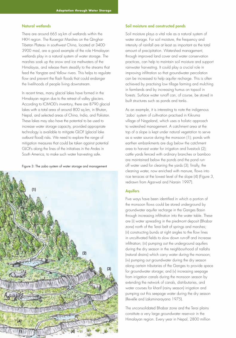
Figure 3: The zabo system of water storage and management
Natural wetlands
There are around 665 sq.km of wetlands within the HKH region. The Ruoergai Marshes on the Qinghai-Tibetan Plateau in southwest China, located at 3400-3900 masl, are a good example of the role Himalayan wetlands play in a natural system of water storage. The marshes soak up the snow and ice meltwaters of the Himalayas, and release them steadily to the streams that feed the Yangtze and Yellow rivers. This helps to regulate fl ow and prevent the fl ash fl oods that could endanger the livelihoods of people living downstream.
In recent times, many glacial lakes have formed in the Himalayan region due to the retreat of valley glaciers. According to ICIMOD’s inventory, there are 8790 glacial lakes with a total area of around 800 sq.km, in Bhutan, Nepal, and selected areas of China, India, and Pakistan. These lakes may also have the potential to be used to increase water storage capacity, provided appropriate technology is available to mitigate GLOF (glacial lake outburst fl ood) risks. We need to explore the range of mitigation measures that could be taken against potential GLOFs along the lines of the initiatives in the Andes in South America, to make such water harvesting safe.
Soil moisture and constructed ponds
Soil moisture plays a vital role as a natural system of water storage. For soil moisture, the frequency and intensity of rainfall are at least as important as the total amount of precipitation. Watershed management, through improved land cover and water conservation practices, can help to maintain soil moisture and support rainwater harvesting. It could play a crucial role in improving infi ltration so that groundwater percolation can be increased to help aquifer recharge. This is often achieved by practising low tillage farming and mulching in farmlands and by increasing humus on topsoil in forests. Surface water runoff can, of course, be stored in built structures such as ponds and tanks.
As an example, it is interesting to note the indigenous ‘zabo’ system of cultivation practised in Kikruma village of Nagaland, which uses a holistic approach to watershed management. A catchment area at the top of a slope is kept under natural vegetation to serve as a water source during the monsoon (1); ponds with earthen embankments are dug below the catchment area to harvest water for irrigation and livestock (2); cattle yards fenced with ordinary branches or bamboo are maintained below the ponds and the pond run-off water used for cleaning the yards (3); fi nally, the cleaning water, now enriched with manure, fl ows into rice terraces at the lowest level of the slope (4) (Figure 3, redrawn from Agarwal and Narain 1997).
Aquifers
Five ways have been identifi ed in which a portion of the monsoon fl ows could be stored underground by groundwater aquifer recharge in the Ganges Basin through increasing infi ltration into the water table. These are (i) water spreading in the piedmont deposit (Bhabar zone) north of the Terai belt of springs and marshes; (ii) constructing bunds at right angles to the fl ow lines in uncultivated fi elds to slow down run-off and increase infi ltration; (iii) pumping out the underground aquifers during the dry season in the neighbourhood of nallahs (natural drains) which carry water during the monsoon; (iv) pumping out groundwater during the dry season along certain tributaries of the Ganges to provide space for groundwater storage; and (v) increasing seepage from irrigation canals during the monsoon season by extending the network of canals, distributaries, and water courses for kharif (rainy season) irrigation and pumping out this seepage water during the dry season (Revelle and Laksminarayana 1975).
The unconsolidated Bhabar zone and the Terai plains constitute a very large groundwater reservoir in the Himalayan region. Every year in Nepal, 2800 million
(1)
(2)
(3)
(4)
(4)
Sustainable Mountain Development No. 56, ICIMOD, Winter 2009
13
cu.m of groundwater recharge takes place in the Bhabar zone, the piedmont deposit north of Nepal’s Terai belt, and another 8800 million cu.m in the Terai belt itself. Generally, the rate of recharge from vertical percolation is much higher in the Bhabar zone than in the Terai. The Bhabar zone is also the main recharge site for the Terai, but there is no clear information available on the exact demarcation and area of the zone.
Reservoirs
Since constructed reservoirs can have a wide range of capacity for water storage, it would be helpful to think in terms of small and large reservoirs. The standard defi nition of small dams is for structures less than 15 metres high with an embankment volume generally less than 0.75 million cu.m. Small reservoirs can be built at a low cost in a short period. Their proximity to the point of use makes them easily manageable by the local community. The evaporation loss in these small reservoirs is, however, high due to the high surface area to volume ratio.
Both upstream and downstream communities can take advantage of ‘positive externalities’ by choosing to build storage projects of a multipurpose type. A number of large dams have been built in in the HKH areas of China and India during the last six decades to service storage type hydropower plants . Water storage capacity in the hydropower plants of China and India has been found to be large enough to provide irrigation water benefi ts as well. The storage capacity in the hydropower plants of Bhutan and Nepal, however, is relatively small with the projects providing hydroenergy benefi ts only.
Sedimentation may be the greatest challenge facing existing reservoirs, both large and small. In addition, seismic risks and GLOF risks are also important. Furthermore, an important general issue facing large dams is their social and environmental impact, mainly land submergence and population resettlement.
Conclusion
It is possible to utilise the potential of water storage capacity in the HKH region for adaptation to climate change. It may be feasible to harness the natural systems in the biosphere through initiatives such as wetlands conservation and watershed management in the hills and mountains, as well as groundwater aquifer recharge in the foothills. Small ponds and tanks for rainwater harvesting could also be built on hill farms. Constructing large dammed reservoirs in the downstream plains is a further option. Depending upon the geophysical characteristics of a specifi c location in the region, a
combination of natural and artifi cial systems could be selected to meet the water needs of the community.
It is necessary, however, to turn the natural storage options, including ponds, lakes and aquifers, from a passive source to a planned and active source of water storage. To this end, the knowledge gap concerning the cryosphere and biosphere will have to be addressed. The changes in glacial volume and snow cover must also be examined further, and information sought on the contribution of snow meltwater to stream fl ow in river basins. Scientifi c investigations to assess and monitor groundwater resources in the region, including the three transboundary aquifers of the Indus, Ganges, and Brahmputra basins, must also be launched.
Traditional institutional mechanisms for community water governance play a very important role for the success of water storage capacity development initiatives. Institutional mechanisms may also be necessary to encourage the downstream benefi ciaries of aquatic ecosystem services to reward and compensate the upstream communities in managing watersheds or wetland conservation projects. Furthermore, institutional mechanisms for transboundary cooperation are vital for taking advantage of ‘positive externalities’ and making compromises on the ‘negative externalities’ of large reservoirs.
To conclude, it is necessary to close the knowledge gaps concerning the cryosphere and biosphere and to craft appropriate institutional mechanisms to successfully harness the water storage potential of the HKH region for adapting to climate change.
References
Agarwal, A; Narain, S (eds) (1997) Dying wisdom: Rise, fall and potential of India’s traditional water harvesting systems, State of India’s Environment: A citizen’s report 4. New Delhi: Centre for Science and Environment
Biswas AK (2004) Dams: Cornucopia or disaster? International Journal Water Resources Development 20(1):3-14
Brown, C; Lall, U (2006) ‘Water and economic development: The role of variability and a framework for resilience’. Natural Resources Forum 30: 306-317
Eriksson, M; Xu J; Shrestha AB; Vaidya, RA; Nepal, S; Sandström, K (2009) The changing Himalayas: Impact of climate change on water resources and livelihoods in the greater Himalayas. Kathmandu: ICIMOD
IWMI (2009) Flexible water storage options and adaptation to climate change, Water Policy Brief 31. Colombo: IWMI
Jansson, P; Hock, R; Schneider, T (2003) ‘The concept of glacier storage: a review’. Journal of Hydrology 282: 116-129
Revelle, R; Laksminarayana, V (1975) ‘The Ganges water machine’. Science 188: 611-616
Glaciers as Indicators
1414
Glaciers as Indicators of Climate Change – the special case of the high elevation glaciers of the Nepal HimalayaRichard Armstrong, National Snow and Ice Data Center, CIRES, Univ of Colorado, Boulder, USA, [email protected] Donald Alford, Consulting Hydrologist, Billings, Montana, USA, [email protected] Adina Racoviteanu, Inst of Arctic and Alpine Research, Univ of Colorado, Boulder, USA, [email protected]
G laciers represent perhaps the most dramatic and direct visual evidence of climate change. Glacier retreat provides a clear
indication of a global climate that has been warming since the Little Ice Age (LIA), which occurred from approximately 1650 to 1850. Throughout North America, Europe, and Asia, the evidence left by glacier moraines shows the maximum extent of these glaciers during the LIA and quantifi es the fact that glaciers have been retreating since this period in response to a warmer climate.
In addition, there is clear evidence that indicates that the retreat of glaciers in most locations of the world has accelerated in recent decades. However, while it is safe to say that almost all glaciers of the world have been losing mass to some degree, and retreating, since the LIA, it is important to point out that glacier systems at the highest elevations, 4000-7000 m, have not responded to recent climate warming in the same way as lower elevation glaciers. Therefore, although glaciers are retreating both in the European Alps and in the Himalayas, one cannot always make direct comparisons
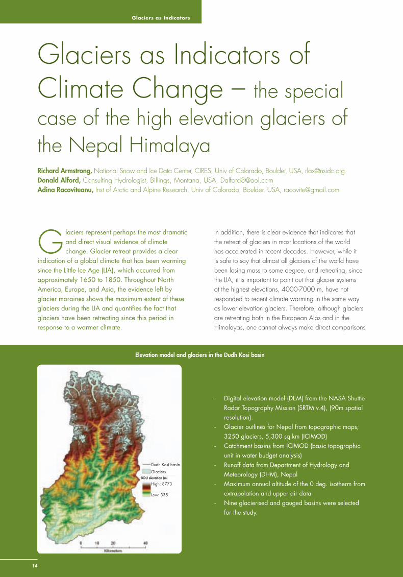
- Digital elevation model (DEM) from the NASA Shuttle Radar Topography Mission (SRTM v.4), (90m spatial resolution).
- Glacier outlines for Nepal from topographic maps, 3250 glaciers, 5,300 sq.km (ICIMOD)
- Catchment basins from ICIMOD (basic topographic unit in water budget analysis)
- Runoff data from Department of Hydrology and Meteorology (DHM), Nepal
- Maximum annual altitude of the 0 deg. isotherm from extrapolation and upper air data
- Nine glacierised and gauged basins were selected for the study.
Dudh Kosi basin
Glaciers
High: 8773
Low: 335
KDU elevation (m)
Elevation model and glaciers in the Dudh Kosi basin
Sustainable Mountain Development No. 56, ICIMOD, Winter 2009
15
and extrapolations from the well studied lower elevation glaciers to the higher elevations.
Glacier monitoring: terminus and mass balance
Terminus location: Recording the annual changes in the location of a glacier terminus is the simplest measurement that indicates the status of a glacier with respect to climate. Abundant terminus histories are available in some parts of the world, Europe in particular, while in regions such as the Himalaya, these data are more limited (WGMS 2008). An example of a summary of terminus data available for the Himalayan region can be found in Eriksson et al. (2009). In summary, these publications report that Himalayan glaciers are retreating at rates of 10 to 60 m per year and many small glaciers (<0.2 sq.km) have already disappeared.
It should be understood that the monitoring of the terminus location of a glacier is neither a complete nor a comprehensive assessment of total glacier condition or health. For example, if a glacier is noted to be retreating, this simply means that the ice volume at the terminus is melting faster than the rate at which ice is being supplied to that location by the dynamic movement of ice from further upslope in the system. On an annual basis, it is possible that a glacier could be gaining in total mass due to increasing amounts of snow arriving in the accumulation zone by precipitation, wind deposition and avalanching, while, at the same time,
Methodology and Data Sources
Our methodology is based on previous studies which involve concepts variously referred to as the ‘ablation gradient’ (Haefeli 1962), the ‘mass balance gradient’ (Konz et al. 2006 ), and the ‘vertical budget gradient, VBG’ (Kaser and Osmanston 2002). For any glacier, it is assumed that the slope of this gradient, defi ned as melt/metre, (m/100 m) is relatively constant and is determined by the response of the glacier to regional climate variations (Armstrong 1989). The fi rst step in this methodology is to determine the surface area over which annual melt is to be calculated. We introduce the concept of an ‘E0max’, which we defi ne as the highest annual altitude reached by the monthly mean zero degree isotherm. By extrapolation from lower elevation station data and from upper air temperature data, we estimate this average altitude to be approximately 5,400 m for the mountains of Nepal. We then compute melt extending down-glacier from the elevation of the E0max to the elevation of the glacier terminus. Melt over this area of the glacier is assumed to represent a net annual loss of mass to the glacier, i.e. it does not include the loss of seasonal snow. For the Himalayas, ablation gradients may range from 0.69 m/100 m for the Chhota Shigri glacier in the Western Himalayas (Wagnon et al. 2007) to 0.81-1.3m/100 m for Yala glacier in the Nepal Himalayas (Konz et al. 2006). In this preliminary study we chose to use a mass balance gradient of 1.4 m/100 in order to estimate possible maximum runoff.
the terminus is retreating. Data that report glacier retreat describe only the conditions at the lowermost elevation of the glacier where the current climate does not support the extension, or even stability of the glacier. Thus, terminus data alone cannot comprehensively represent those conditions controlling the changes in volume and mass across the entire elevation range of a glacier system. And to put the Himalayan region in a global perspective, the elevation range of the glacier systems in this region is the greatest in the world.
Mass balance: Glacier mass balance studies in the Himalayan region have been rare and often sporadic over recent decades, with measurements on only about a dozen glaciers, and with only a very few of those studies having a duration of more than a few years. The conventional methods for measurement of mass balance, relatively common in Europe and North America, have simply not been practical across the remote and rugged terrain of these ranges. As a result, very few data are available to assess the comprehensive ‘health’ of Himalayan glaciers. In addition, the limited results that are available may only be representative of those specifi c glaciers where the measurements have been made, typically the more accessible sites at lower elevations. Therefore, it is important to develop more spatially comprehensive methods to provide a truly regional assessment of glacier health across the Himalaya.
A simple methodology to compute glacier ice melt
The annual melt from a glacier tends to increase with decreasing altitude and can be represented by an ablation gradient, the inverse relationship between glacier ice melt and altitude. This gradient is purported to remain constant even as the varying temperature and precipitation patterns from year to year may cause changes ranging from extreme positive to extreme negative net mass balance years. While complete energy exchange models exist to compute melt at a specifi c point on a single glacier, such a methodology is not appropriate for a regional assessment, primarily due to the lack of the required input data. Therefore, we proposed an alternative method that we consider to be an optimal regional scale approach to determine the contribution of glacier ice melt to river runoff based on the data that are available (Alford et al. 2009).
For this study, it was necessary that the basins chosen be glacierised, contain stream gauges, and be covered by quality SRTM (NASA Shuttle Radar Topography Mission) data in order to derive measurements of the elevation

Glaciers as Indicators
16
of land above sea level (hypsometry). Nine basins in Nepal met these criteria. The glaciers of these nine basins contain approximately 80% of the total glacier surface area of the Nepal Himalaya. Figure 1 shows the estimated relative contributions of (1) glacier melt, (2) runoff from all sources in the 4000-6000 m altitude belt, and (3) the total annual catchment basin streamfl ow volume from these nine basins. The glacier contribution to basin stream fl ow varies from approximately 20% in the Budhi Gandaki Basin to approximately 2% in the Likhu Khola Basin, averaging approximately 10%. This volume represents approximately 4% of the total mean annual estimated volume of 200,000 million cubic metres for the rivers of Nepal. Under current climate conditions, our preliminary study indicates that the glaciers of Nepal experience no melt over 50% of their surface area at any time of the year (Figure 2). This is in sharp contrast to lower elevation glaciers of the world that do melt over their entire surface during the summer months, often resulting in signifi cant mass loss.
An analysis of the glaciers and hydrological regime of the mountain catchments of the entire greater Himalayas will be required to assess regional variations in the role of glaciers in stream fl ow production in the western Himalayas, Hindu Kush, and Karakoram. It is assumed, based primarily on anecdotal evidence, that the percentage contribution of glacier ice melt to regional stream fl ow will increase in an east to west direction across the Himalayas. However, it should be noted that both the precipitation and the total stream fl ow decrease when moving from the relatively wet monsoon climate of the east to the dry, more continental, climate of the western Himalayas.
References
Alford, D; Armstrong, RL; Racoviteanu, A (2009) Glacier retreat in the Nepal Himalaya: An assessment of the role of glaciers in the hydrologic regime of the Nepal Himalaya. Washington DC: The World Bank South Asia Sustainable Development (SASDN) Offi ce, Environment and Water Resources Unit
Armstrong, RL (1989) ‘Mass balance history of Blue Glacier, Washington, USA’. In Oerlemans, J (ed), Glacier fl uctuations and climate change, p 417. Dordrecht: Kluwer Academic Publishers
Eriksson, M; Xu J; Shrestha AB; Vaidya, RA; Nepal, S; Sandström, K (2009) The changing Himalayas: Impact of climate change on water resources and livelihoods in the greater Himalayas. Kathmandu: ICIMOD
Haefeli, R (1962) ‘The ablation gradient and the retreat of a glacier tongue’. Association of Hydrological Sciences 58: 49 - 59
Kaser, G; Osmaston, HA (2002) Tropical glaciers. Cambridge: Cambridge University Press
Konz, M; Uhlenbrook, S; Braun, L; Demuth, S; Shrestha, A; (2006) ‘Process-oriented runoff simulation from a glacierized Himalayan head watershed’. Geoph Research Abstr 8(04247)
Wagnon, P; Kumar, R; Arnaud, Y; Linda, A; Sharma, P; Vincent, C; Pottakal, J; Berthier, E; Ramanathan, A; Hassnain, SI; Chevalier, P (2007) ‘Four years of mass balance on Chhota Shigri Glacier, Himachal Pradesh, India, a new benchmark glacier in the western Himalaya’. J Glaciol 53(183): 603 - 611
WGMS (2008) Fluctuations of Glaciers 2000-2005, Haeberli, W; Zemp, M; Kääb, A; Paul, F; Hoelzle, M (eds) Zurich: World Glacier Monitoring Service (ICSU(FAGS)/
IUGG(IACS)/UNEP/UNESCO/WMO)
Figure 2 : Example of glacier area/altitude hypsometry and location of E0max for the Dudh Kosi Basin
Compute melt below 5400 m using a regional mass balance gradient, estimated range 0.6 to 1.4 m/100 m. Current pilot study uses 1.4 m/100 m for probable maximum runoff volume from ice melt
Estimated 0o C isotherm altitude = Approximately 5400 mEstimated 00C isotherm altitude = Approximately 5400 m
Elevation (m)
Are
a (s
q.km
)
Figure 1: Estimated average annual streamfl ow, in million cubic metres per year, from a) glacier melt, b) 4000-6000 m altitudinal belt, and c) basin total, into glacierised gauged basins in the Nepal Himalaya. Catchment basins are: 1. Bheri, 2. Kali Gandaki, 3. Budhi Gandaki, 4. Marsyangdi, 5. Trisuli, 6. Dudh Kosi, 7. Tama Kosi, 8, Likkhu, 9 Tamor.
Ann
ual V
olum
e, m
cm
Comparative streamfl ow volumes, mcm
Basin
4-6 km
Glacier Melt
Sustainable Mountain Development No. 56, ICIMOD, Winter 2009
17
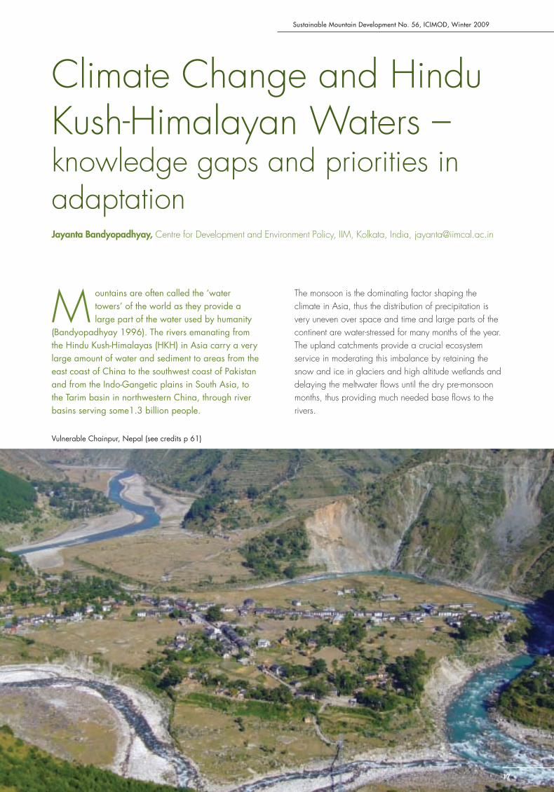
Climate Change and Hindu Kush-Himalayan Waters – knowledge gaps and priorities in adaptationJayanta Bandyopadhyay, Centre for Development and Environment Policy, IIM, Kolkata, India, [email protected]
M ountains are often called the ‘water towers’ of the world as they provide a large part of the water used by humanity
(Bandyopadhyay 1996). The rivers emanating from the Hindu Kush-Himalayas (HKH) in Asia carry a very large amount of water and sediment to areas from the east coast of China to the southwest coast of Pakistan and from the Indo-Gangetic plains in South Asia, to the Tarim basin in northwestern China, through river basins serving some1.3 billion people.
The monsoon is the dominating factor shaping the climate in Asia, thus the distribution of precipitation is very uneven over space and time and large parts of the continent are water-stressed for many months of the year. The upland catchments provide a crucial ecosystem service in moderating this imbalance by retaining the snow and ice in glaciers and high altitude wetlands and delaying the meltwater fl ows until the dry pre-monsoon months, thus providing much needed base fl ows to the rivers.
Vulnerable Chainpur, Nepal (see credits p 61)
Knowledge Gaps
18
The perception of the downstream majority is of the mountains as a dependable source of water supply for the plains. But the Himalayan waters are also the lifeblood of human settlements scattered in the mountains themselves, whose people rely on the annual snowfall and the water in small springs and streams for survival and economic activities.
Hydrological ‘Black Boxes’
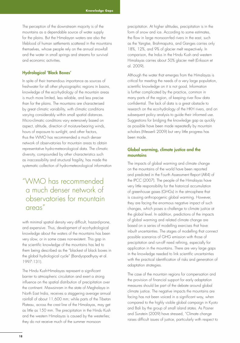
In spite of their tremendous importance as sources of freshwater for all other physiographic regions in basins, knowledge of the eco-hydrology of the mountain areas is much more limited, less reliable, and less precise than for the plains. The mountains are characterised by great climatic variability, with climatic conditions varying considerably within small spatial distances. Micro-climatic conditions vary extensively based on aspect, altitude, direction of moisture-bearing winds, hours of exposure to sunlight, and other factors, thus the WMO has recommended a much denser network of observatories for mountain areas to obtain representative hydro-meteorological data. The climatic diversity, compounded by other characteristics such as inaccessibility and structural fragility, has made the systematic collection of hydro-meteorological information
with minimal spatial density very diffi cult, hazard-prone, and expensive. Thus, development of eco-hydrological knowledge about the waters of the mountains has been very slow, or in some cases non-existent. This gap in the scientifi c knowledge of the mountains has led to them being described as the “blackest of black boxes in the global hydrological cycle” (Bandyopadhyay et al. 1997:131).
The Hindu Kush-Himalayas represent a signifi cant barrier to atmospheric circulation and exert a strong infl uence on the spatial distribution of precipitation over the continent. Mawsinram in the state of Meghalaya in North East India, receives a staggering average annual rainfall of about 11,600 mm; while parts of the Tibetan Plateau, across the crest line of the Himalayas, may get as little as 150 mm. The precipitation in the Hindu Kush and the western Himalayas is caused by the westerlies; they do not receive much of the summer monsoon
precipitation. At higher altitudes, precipitation is in the form of snow and ice. According to some estimates, the fl ow in large monsoon-fed rivers in the east, such as the Yangtse, Brahmaputra, and Ganges carries only 18%, 12%, and 9% of glacier melt respectively. In comparison, the Indus in the Hindu Kush and western Himalayas carries about 50% glacier melt (Eriksson et al. 2009).
Although the water that emerges from the Himalayas is critical for meeting the needs of a very large population, scientifi c knowledge on it is not good. Information is further complicated by the practice, common in many parts of the region, of keeping river fl ow data confi dential. The lack of data is a great obstacle to research on the eco-hydrology of the HKH rivers, and on subsequent policy analysis to guide their informed use. Suggestions for bridging the knowledge gap as quickly as possible have been made repeatedly by mountain scholars (Messerli 2009) but very little progress has been made.
Global warming, climate justice and the mountains
The impacts of global warming and climate change on the mountains of the world have been reported and predicted in the Fourth Assessment Report (AR4) of the IPCC (2007). The people of the Himalayas have very little responsibility for the historical accumulation of greenhouse gases (GHGs) in the atmosphere that is causing anthropogenic global warming. However, they are facing the enormous negative impact of such changes, which poses a challenge to climate justice at the global level. In addition, predictions of the impacts of global warming and related climate change are based on a series of modelling exercises that have inbuilt uncertainties. The stages of modelling that connect possible scenarios of GHG emission with those of precipitation and run-off need refi ning, especially for application in the mountains. There are very large gaps in the knowledge needed to link scientifi c uncertainties with the practical identifi cation of risks and generation of adaptation strategies.
The case of the mountain regions for compensation and the provision of fi nancial support for early adaptation measures should be part of the debate around global climate justice. The negative impacts the mountains are facing has not been voiced in a signifi cant way, when compared to the highly visible global campaign in Kyoto and Bali by the group of small island states. As Posner and Sunstein (2009) have stressed, “Climate change raises diffi cult issues of justice, particularly with respect to
“WMO has recommended a much denser network of observatories for mountain areas”
Sustainable Mountain Development No. 56, ICIMOD, Winter 2009
19
the distribution of burdens and benefi ts among poor and wealthy nations”. The case of the mountains, as some of the most vulnerable regions of the world, exemplifi es such injustice.
This makes the case for drawing special attention to the mountains in COP 15 with respect to adaptation to the impacts of global warming and climate change. Unfortunately, as we approach COP 15 in Copenhagen with the prospect of moving towards a post-Kyoto international climate protocol, the marginality of the mountains in global negotiations is once again clearly visible. There is a case for another organised intervention on behalf of the mountains, as was made by the Mountain Agenda collectively in the drawing up of Agenda 21 for UNCED (Bandyopadhyay and Perveen 2004).
Global warming and the waters of the HKH
Within the levels of accuracy of available modelling tools, the IPCC (2007) has outlined the possible impacts of global warming and climate change on the HKH region. These indicate that warming will be quite signifi cant for South Asia and the Tibetan Plateau. The rates of retreat of the glaciers of the Himalayas have also been linked to the rapid increase in human settlements, industrial and urban pollution, and deforestation near the glaciers. Eriksson et al. (2009) have summarised these predicted impacts and indicative scenarios. At the macro-level, accelerated retreat of the glaciers would alter the contribution of glacier melt and affect high altitude wetlands. This would change the base fl ow in the HKH rivers, fi rst by increasing base fl ow over the next three or four decades, and subsequently, by reducing it to a new equilibrium level, much lower than at present. This will seriously affect the very large Asian irrigation systems in China and South Asia that depend on HKH waters. According to Stern (2007), the accelerated melting of glaciers would seriously affect about half a billion people in the Hindu Kush-Himalayan region and a quarter of a billion in China. A recent statement from the Asian Development Bank says that about 1.6 billion people would be affected by the impacts on the HKH.
Another vital aspect is the impact of climate change on the precipitation pattern within the mountains which affects the availability of drinking water in springs, irrigation from small streams, and the snow needed to renew soil moisture on farmlands. These are more signifi cant for mountain communities than glacier recession. Drying up of springs, dehydration of soil, reduced fl ow of local streams, and lack of winter
snowfall are increasingly affecting the region. It is here that the knowledge gaps in the eco-hydrology of the HKH region stand as a serious obstacle to predictions of future climate patterns. Not only is the climate-modelling inaccurate, the identifi cation of risks is diffi cult and needed adaptation strategies unclear. The problems of global warming and climate change underscore the need for the HKH region to strengthen hydro-meteorological observations to the standards suggested by the WMO for mountain areas. With water at a premium, eco-hydrological data on the rivers of the HKH becomes knowledge that can create immediate economic possibilities.
Adaptation for the HKH: water as the main product of land
Mitigation of GHG emissions remains the fi rst priority for industrialised countries. However, adaptation strategies are in the short- and long-term interest of the whole world. In the case of the HKH region, adaptation must go ahead with whatever little knowledge is available. The objective of adaptation will be two-fold. Firstly, the
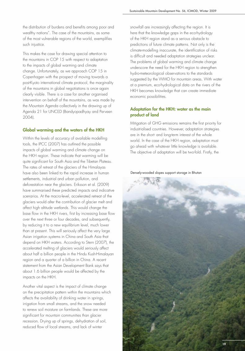
Densely-wooded slopes support storage in Bhutan

Knowledge Gaps
20
evolution of measures for minimising water stress in the densely populated plains that depend on water supplies from the HKH rivers; secondly, measures for mountain communities to adapt to the changing climate and water endowment. For coastal countries, adaptation needs are more related to sea level rise and monsoon inundations. It will be important to ensure the mutual consistencies of the diverse adaptation measures suitable for the various Asian countries.
A considerable amount of thinking has gone into adaptation strategies for mountain communities. Notwithstanding the lack of data, efforts based on smaller parameters and sensitivity analyses can identify the adaptation processes in small, but effective, directions. At the macro level, the design of adaptation measures to protect the water towers of Asia offers some revolutionary options for reorienting land and water management. For centuries, land and water use has been decided fi rst in the interests of local agri-pastoral economies, and then, in some parts, for the optimal
extraction of timber. The time may now have come to re-think land and water management in the HKH in terms of provisioning to the agri-industrial economies in the surrounding plains based on the principle of rewards and compensation for upstream environmental service providers. This should be the main adaptation strategy for addressing future water stress.
Adaptation includes promoting water storage and conservation. Land management offers a very cost-effective measure for this; but a robust payment system needs to be put in place for mountain land being used for the production and storage of water rather than wood, crops, and others. Areas in the HKH with heavy precipitation need to be covered with vegetation that maximises conservation and storage of water. This will require that water is accepted by all concerned as the main product of the land, and that the owners of land are willing to change their traditional management practices. New land use zoning dependent on the hydrological utility of the slopes for water conservation will have to be put in place. Payment for watershed services could provide the mechanism on the institutional
front, (Aylward et al. 2006). A review compiled in 2002 identifi ed 63 examples from around the world of the application of market-based approaches to the provisioning of watershed services (Landall-Mills and Porras 2002). This needs not only a revolutionary scientifi c and technological approach, but also a very informed and able political leadership to initiate the practice of the concept in smaller areas (to start with) with rich monsoon precipitation. Political vision, eco-hydrological wisdom, and diplomatic expertise of the highest order are required for such an innovative arrangement to be put in place.
References
Aylward, B; Bandyopadhyay, J; Belausteguigotia, JC (2005) ‘Freshwater Ecosystem Services’. In, Chopra, K; Leemans, R; Kumar, P; Simons, H (eds) Ecosystems and human well-being, pp. 241-44. Washington DC: Island Press
Bandyopadhyay, J (1996) ‘Water towers of the world’. People and the Planet 5 (1): 14-15
Bandyopadhyay, J; Rodda JC; Kattelmann, R; Kundzewicz ZW; Kramer, D (1997) ‘Highland waters: A resource of global signifi cance’. In Messerli B; Ives JD (eds) Mountains of the world: A global priority, pp131-56. Carnforth: Parthenon
Bandyopadhyay, J; Perveen S (2004) ‘Emergence of and future steps for sustainable mountain development in the global environmental agenda’. In Treves T, Pineschi L; Fodella, A (eds) Protection of mountain areas in international law: Rio, Johannesburg and beyond. Milan: Giuffrè
Eriksson, M; Xu Jianchu; Shrestha AB; Vaidya, RA; Nepal, S; Sandström, K (2009) The changing Himalayas: Impact of climate change on water resources and livelihoods in the greater Himalaya. Kathmandu: ICIMOD
IPCC (2007) Climate change 2007: Impacts, adaptation and vulnerability, Report of the Working Group II. Cambridge: Cambridge University Press
Landall-Mills, N; Porras, I (2002) Silver bullet or fool’s gold: Developing markets for forest environmental services and the poor. London: IIED
Messerli, B. (2009) ‘Biodiversity, environmental change and regional cooperation in the Hindu Kush-Himalayas’ In Proceedings of the International Mountain Biodiversity Conference. Kathmandu: ICIMOD
Posner, E.A; Sunstein CR (2009) ‘Justice and climate change’. In Aldy JE; Stavins RN (eds) Post-Kyoto International Climate Policy: Summary for Policymakers p 93. Cambridge: Cambridge University Press
Stern, N (2007) The economics of climate change: The Stern Review. Cambridge: Cambridge University Press
“Adaptation includes promoting water storage and conservation”
Sustainable Mountain Development No. 56, ICIMOD, Winter 2009
21
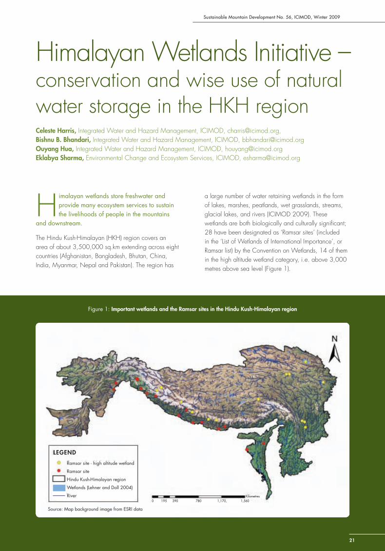
Himalayan Wetlands Initiative – conservation and wise use of natural water storage in the HKH regionCeleste Harris, Integrated Water and Hazard Management, ICIMOD, [email protected], Bishnu B. Bhandari, Integrated Water and Hazard Management, ICIMOD, [email protected] Hua, Integrated Water and Hazard Management, ICIMOD, [email protected] Sharma, Environmental Change and Ecosystem Services, ICIMOD, [email protected]
H imalayan wetlands store freshwater and provide many ecosystem services to sustain the livelihoods of people in the mountains
and downstream.
The Hindu Kush-Himalayan (HKH) region covers an area of about 3,500,000 sq.km extending across eight countries (Afghanistan, Bangladesh, Bhutan, China, India, Myanmar, Nepal and Pakistan). The region has
a large number of water retaining wetlands in the form of lakes, marshes, peatlands, wet grasslands, streams, glacial lakes, and rivers (ICIMOD 2009). These wetlands are both biologically and culturally signifi cant; 28 have been designated as ‘Ramsar sites’ (included in the ‘List of Wetlands of International Importance’, or Ramsar list) by the Convention on Wetlands, 14 of them in the high altitude wetland category, i.e. above 3,000 metres above sea level (Figure 1).
Figure 1: Important wetlands and the Ramsar sites in the Hindu Kush-Himalayan region
LEGEND
Ramsar site - high altitude wetland
Ramsar site
Hindu Kush-Himalayan region
Wetlands (Lehner and Doll 2004)
River 0 195 390 780 1,170, 1,560
Kilometres
Source: Map background image from ESRI data
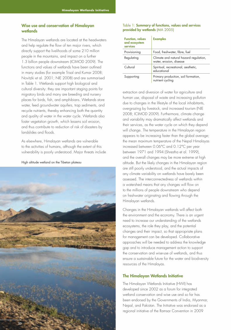
Himalayan Wetlands Initiative
2222
Wise use and conservation of Himalayan wetlands
The Himalayan wetlands are located at the headwaters and help regulate the fl ow of ten major rivers, which directly support the livelihoods of some 210 million people in the mountains, and impact on a further 1.3 billion people downstream (ICIMOD 2009). The functions and values of wetlands have been outlined in many studies (for example Trisal and Kumar 2008; Novitzki et al. 2001; NIE 2008) and are summarised in Table 1. Wetlands support high biological and cultural diversity: they are important staging points for migratory birds and many are breeding and nursery places for birds, fi sh, and amphibians. Wetlands store water, feed groundwater aquifers, trap sediments, and recycle nutrients, thereby enhancing both the quantity and quality of water in the water cycle. Wetlands also foster vegetation growth, which lessens soil erosion, and thus contribute to reduction of risk of disasters by landslides and fl oods.
As elsewhere, Himalayan wetlands are vulnerable to the activities of humans, although the extent of this vulnerability is poorly understood. Major threats include
Table 1: Summary of functions, values and services provided by wetlands (MA 2005)
Function, values and ecosystem services
Examples
Provisioning Food, freshwater, fi bre, fuel
Regulating Climate and natural hazard regulation, water, erosion, disease
Cultural Spiritual, recreational, aesthetic, educational
Supporting Primary production, soil formation, nutrient cycling
extraction and diversion of water for agriculture and human use, disposal of waste and increasing pollution due to changes in the lifestyle of the local inhabitants, overgrazing by livestock, and increased tourism (NIE 2008; ICIMOD 2009). Furthermore, climate change and variability may dramatically affect wetlands and their services, as the water cycle on which they depend will change. The temperature in the Himalayan region appears to be increasing faster than the global average; the mean maximum temperature of the Nepal Himalayas increased between 0.06°C and 0.12°C per year between 1971 and 1994 (Shrestha et al. 1999), and the overall changes may be more extreme at high altitude. But the likely changes in the Himalayan region are still poorly understood, and the actual impacts of any climate variability on wetlands have barely been assessed. The interconnectedness of wetlands within a watershed means that any changes will fl ow on to the millions of people downstream who depend on freshwater originating and fl owing through the Himalayan wetlands.
Changes in the Himalayan wetlands will affect both the environment and the economy. There is an urgent need to increase our understanding of the wetlands ecosystems, the role they play, and the potential changes and their impact, so that appropriate plans for management can be developed. Collaborative approaches will be needed to address the knowledge gap and to introduce management action to support the conservation and wise-use of wetlands, and thus ensure a sustainable future for the water and biodiversity resources of the Himalayas.
The Himalayan Wetlands Initiative
The Himalayan Wetlands Initiative (HWI) has developed since 2002 as a forum for integrated wetland conservation and wise use and so far has been endorsed by the Governments of India, Myanmar, Nepal, and Pakistan. The Initiative was endorsed as a regional initiative of the Ramsar Convention in 2009
High altitude wetland on the Tibetan plateau
Sustainable Mountain Development No. 56, ICIMOD, Winter 2009
23
(http://www.ramsar.org/pdf/sc/40/key_sc40_decisions_e.pdf) and is supported by ICIMOD, WWF International, Wetlands International, and IUCN, with ICIMOD as the HWI host institution.
The HWI works as an open informal regional partnership of the Ramsar focal points (administrative authorities of the Convention in each country), the Ramsar Convention Secretariat, international and regional partners, and national organisations. The overall goal is the “conservation and wise use of the wetlands and wetland complexes in the Himalayan region by promoting regional collaboration between the governments of the countries sharing the region and between other relevant institutions”. Achieving this means developing an understanding of regional issues related to climate change, degradation of wetland ecosystems and biodiversity, and infrastructural development. The major objectives proposed for 2009-2011 are to develop information management methodologies for Himalayan wetlands; develop mechanisms and facilities for cooperation, networking, and capacity building; promote needs-based joint research, particularly for high altitude wetlands and related river basins: devise and promote best practices on Himalayan wetland management; develop a participatory communication, education, participation, and awareness (CEPA) programme for the Himalayan wetlands; and build policy support for the implementation of Himalayan wetlands conservation.
The way forward
The HWI provides a formal means for regional conservation and understanding of wetlands in the greater Himalayan region. The strategic activities will help to fi ll the knowledge gap on wetland information, needed for wetland assessment and management activities. ICIMOD has implemented a series of projects as a fi rst step towards understanding and managing Himalayan wetlands (see Box). These activities will be followed by joint research under the HWI to give a solid foundation for conserving wetlands and provide an insight into the environmental, social, and cultural roles of wetlands in the region. Communities will be involved in the HWI process through knowledge sharing at all levels; and information will be disseminated to highlight the importance of, and threats to, the Himalayan wetlands.
The HWI has a potential for strengthening and formalising networks between stakeholders working with and managing wetlands and thus supporting exchange of regional experiences and development of a shared understanding of wetlands and their management. By assessing the needs of stakeholders and managers,
training programmes will assist in developing this network and build capacity in the region. This cooperative network can help promote best practices for wetland management, leading to a dramatic increase in the conservation status of wetlands, a rise in the number of Ramsar sites, and formal implementation of management plans across the region.
Policy development related to the objectives of the Initiative will be targeted to develop a formal basis for support of a regional framework for conservation and wise use for implementation at local, national and international levels. Through its activities, the HWI will assist in preserving the environmental integrity of the Himalayan wetlands to enable sustainable management of resources, and ultimately contribute to maintaining and improving livelihoods throughout the HKH region.
References
ICIMOD (2009) A manual for an inventory of greater Himalayan wetlands. Kathmandu: ICIMOD
Lehner, B; Doll, P (2004) ‘Development and validation of a global database of lakes, reservoirs and wetlands.’ Journal of Hydrology 296: 1-22
MA (2005) Ecosystems and human well-being: Wetlands and water synthesis, Millennium Ecosystem Assessment (MA). Washington DC: World Resources Institute
NIE (2008) Impacts of climate change on functions and services of wetlands of the eastern Himalaya, unpublished report by the National Institute of Ecology, New Delhi, India
Novitzki, RP; Smith, D; Fretwell, JD (2001) Restoration, creation and recovery of wetlands: Wetland functions, values, and assessment, USGS Water Supply Paper 2425. Reston (VA): USGS
Shrestha, A; Wake, CP; Mayewski, PA; Dibb, JE (1999) ‘Maximum temperature trends in the Himalaya and its vicinity: An analysis based on temperature records from Nepal for the period 1971-94’. Journal of Climate 12: 2775-2786
Trisal, CL; Kumar, R (2008) Integration of high altitude wetlands into river basin management in the Hindu-Kush Himalayas: Capacity building needs assessment for policy and technical support. New Delhi: Wetlands International -South Asia
Asian Wetlands Inventory approach and catchment management
ICIMOD in partnership with Wetlands International, the Centre for Ecology and Hydrology (UK), and ARGEOPS (Netherlands) undertook a pilot study on the application of the Asian Wetlands Inventory approach and stakeholder-led catchment management in Bhutan, China, India and Nepal. Outputs included:
• a Greater Himalayan Wetland Information System (inventory method and knowledge base, see http://www.ghwis.icimod.org:8081/wetlandsnew2/index.php)
• a vulnerability assessment tool (for value determination and identifi cation of threats to, and impacts on, Himalayan wetlands)
• capacity needs assessment for policy and technical support
• a report on the engagement of different players including the private sector in wetland conservation

Traditional Water Harvesting
2424
Traditional Techniques for Water HarvestingMadhukar Upadhya, Institute for Social and Environmental Transition- Nepal (ISET-N), [email protected]
A watershed collects precipitation, stores part of it, and directs the remaining fl ow of runoff components to a common river or lake. Most
of the rainwater that falls on upland areas fl ows away as surface runoff. Only a small portion goes into the soil to recharge soil moisture – ‘green water’ and an even smaller part sinks deeper to recharge the groundwater aquifers, fl owing out later at the base of the incline in the form of springs and seepage water – ‘blue water’ – that feed the streams (Upadhya 2009). As a result of this seepage, the low lying areas of a watershed are generally water-rich for most of the year, whereas the upland areas are usually water-poor, even in areas that receive high rainfall.
In the Himalayan region, most of the rain and snow generally falls during a short period, and in some places even then only sparsely. Thus to make water available for human use, the water must be collected or ‘harvested’ when rain or runoff is available. Traditional techniques of water harvesting have played a vital role in supporting the rural population in water-scarce areas (Agarwal and Narain 1997). The techniques chosen depend on the amount and timing of rain, and the soil type, geology, and topography of the area. Some typical traditional techniques used for harvesting rainwater, groundwater, and surface water, are described in the following, and their potential for meeting the challenges facing water managers is discussed.
A village pond is enjoyed by cattle and tourists alike, Nepal (below); Community water harvesting in Pakistan (right)

Sustainable Mountain Development No. 56, ICIMOD, Winter 2009
25
Harvesting techniques
Ruza or zabo
Rainwater harvesting systems are common in hill areas where water is scarce, despite heavy rainfall, as for example, in the hills of Nagaland in North East India where there is an acute shortage of drinking water. Managing rainwater in Nagaland means combining a typical landuse pattern with water collecting structures The upper part of the hill slope is kept forested, below this are terraces, and below them cattle yards. The base of the slope is used to cultivate paddy. Ponds, ‘ruza’,
or ‘zabo’, are built on the ridge tops, and the middle terraces to collect runoff. The stored water is used for the animals, and then runs down to the paddy fi elds.
In Nepal, the monsoon rainwater is essential for the survival of the mountain communities, but is also the source of major problems. Erosion and landslides destroy lives and properties during the wet season, but there is little water available in the dry season. The general land use pattern in the Nepali hills is similar to that in Nagaland, but settlements are scattered at all levels and cattle sheds and houses are usually found together. Nepali hill farmers have devised a systematic way of managing runoff from the ridge to the valley with drainage channels and ponds built at strategic points to hold, divert, and delay the fl ow of runoff. These techniques help to reduce rainwater-induced damage during the monsoon, while building water reserves for the winter.
Aahal and pokhari
An aahal, or ‘place for wallowing buffalo’, is the Nepali name for a type of shallow community pond built to collect runoff in the hills and mountains. A pokhari is larger than an aahal and collects runoff from small
catchments. Aahals are usually located close to a village where runoff and, if possible, seepage can be collected. They are around 20 to 50 sq.m and less than two metres deep. A pokhari is around 3000 to 5000 sq.m; but the shape and size varies depending on the space available. A pokhari is made both to lower the peak discharge in the runoff channel and to augment soil moisture. Some pokhari are found strategically located to hold potentially trouble-creating runoff, while some are found in grassland or on rainfed farmland (Upadhya 2009). In areas where the land is more porous, over-topping of the pond during high rainfall can wash the sides away and cause the water to fl ow in a gush. In such areas, farmers build several small ponds rather than a few big ones. Similarly, more smaller ponds are usually built in grazing areas as they keep a larger area moist for a longer period of time for growing grass. Large landholders also build private ponds in front of their houses which they may use for fi sh farming.
Johad
A Johad is a commonly used water harvesting technique in western Rajastan in India. It consists of a small but long earthen bund (small checkdam) built on the upper side of the land to hold back surface fl ow during rainfall and allow every drop of rainwater to soak into the soil and augment the groundwater. The system had fallen into decay until a severe drought in the 1990s when many were restored. Revival of thousands of such johads in one district not only helped farmers to grow food but also raised the groundwater level by almost 6 metres, bringing the once dead Arvari river back to life.
Ahar pyne and pat
Unlike Rajastan, southern Bihar receives a substantial amount of rain, but the area lacks water due to its gently sloping land and sandy soil. The groundwater is deep. People here use an ‘ahar pyne’ to collect fl ood water during the monsoon for later irrigation. The ahar is an area enclosed on three sides with embankments and connected to a swollen river via a pyne, a channel which can be up to 20 kilometres long. The pyne passes through farmlands irrigating crops between the river and the ahar. The ahar beds are also used to grow winter crops after the water has been drained for summer cultivation. Further south in Madhya Pradesh a similar system is used to divert water from streams fl owing from the hills into irrigation channels called pats via a stone diversion lined with leaves.
Karez
The karez system is widely used in the arid areas of western Pakistan, central Asia, and China where rainfall is very low. It is one of the traditional engineering

Traditional Water Harvesting
26
wonders of water managment in dry areas. The karez system consists of a series of wells starting from the foothills along the hill slope and linked at the bottom by an underground channel that collects and brings groundwater to the bottom of the hill. The water can be taken out vertically or drawn at the mouth of the channel at the foot of the hill. Wells are used to reach the channel for periodic maintenance and to remove the deposited sediment using buckets. The unique advantage of this system is that it helps access groundwater for irrigation using gravity and minimises evaporation loss in channels that are usually tens of kilometres long.
Hiti or dhunge dhara
The hiti (or dhunge dhara) system is a unique water harvesting system developed in the 6th century AD to provide domestic water to the urban residents of the Kathmandu Valley. A hiti is a stone spout that channels water from springs or a shallow aquifer usually about 10 metres below the surface of the ground. Most hiti were built in a lined pit about 3 to 10 metres deep, while some were built at the bottom of slopes where there were natural springs. Shallow aquifers deplete fast, so canals called rajkulo were built later to recharge the aquifers. The rajkulo brought stream water from hills tens of kilometres away. In addition, ponds were built close to the hiti to augment the aquifer by storing rainwater (Shakya 1993). The hiti system is an excellent example of how a prudently designed system using a combination of structures and methods can help manage even a shallow aquifer to provide a sustainable water supply. Many of the centuries-old hitis continue to supply water in Kathmandu today, but there are hundreds of others that have become dry due to urban encroachment.
Other techniques
Water harvesting is not limited to the above examples. There are many other types of systems used elsewhere in the world. Most of them tap runoff water from micro-catchments rather than rainwater. Farmers in southern Tunisia, for example, use a system called jessour, in which a series of cross walls are made across small streams called wadi that originate from a mountain catchment. Sediment deposited behind the walls is used to grow fi gures and olives or other crops after the water drains out. Farmers in West Asia and North Africa use earthen reservoirs called tanks and hafaer to store water in gently sloping areas that receive runoff water from a stream originating from large catchments. Similar tanks are also used in southern India. Tanks can store tens of thousands of cubic metres of water, which is used for irrigation, while hafaer store only few thousand cubic metres and are primarily for domestic uses.
Lessons for the future
The different techniques described above are just a few of the different systems developed by farmers living in varied climatic, topographic, and geological conditions. Many of these structures may be able to help meet the growing water demand of an ever-increasing population if they are maintained and promoted. Not every system can be replicated; hiti, for example, cannot be built anymore as the engineering is unclear. But these traditional techniques offer a core message: that only a combination of disciplines including culture, tradition, climate, and forest, land, and water engineering can help manage water sustainably; and that surface ‘blue water’ sources cannot be sustained if ‘green water’ is degraded.
In order to understand this core message, we need to realise that the traditional water planners relied on watershed functions by which rainwater is distributed, as surface runoff, soil moisture, and groundwater reserves, unlike the modern water planners, who with sophisticated tools and structures are able to transfer water from any source and are often inclined to view streams as neverending sources. They understood that precipitation is asymmetric and available only for a few months of the year, and that only a small portion is stored naturally.
It is important to understand that for all practical purposes surface or ‘blue water’ means visible stream fl ow. Most modern techniques for managing water are related to blue water sources, replenished by groundwater in the upland areas, which in turn is recharged only when the soil above is saturated. The sustainability of blue water sources depends on what fraction of rainwater has gone into the groundwater. This is where managing rainwater in upland areas becomes important for maintaining both green and blue water sources. The traditional water harvesting systems carry a wealth of wisdom. Analysing them can help us understand the limitations of the area-specifi c water cycle and its components and help us identify sustainable ways to manage water.
References
Agarwal, A; Narain, S (1997) Dying Wisdom. Rise, Fall and Potential of India’s Traditional Water Harvesting Systems. New Delhi: Centre for Science and Environment
Shakya B, (1993) (BS 2050) Swanigalaya Lonh Hiti (Stone Spouts of Kathmandu Valley). Kathmandu: Lok Sahitya Parishad
Upadhya, M (2009) Ponds and landslides, water culture, food systems and the political economy of soil conservation in mid-hill Nepal. Kathmandu: Nepal Water Conservation Foundation
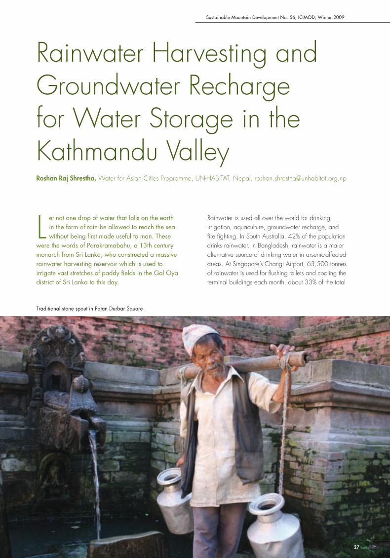
Sustainable Mountain Development No. 56, ICIMOD, Winter 2009
27
Rainwater Harvesting and Groundwater Recharge for Water Storage in the Kathmandu Valley Roshan Raj Shrestha, Water for Asian Cities Programme, UN-HABITAT, Nepal, [email protected]
L et not one drop of water that falls on the earth in the form of rain be allowed to reach the sea without being fi rst made useful to man. These
were the words of Parakramabahu, a 13th century monarch from Sri Lanka, who constructed a massive rainwater harvesting reservoir which is used to irrigate vast stretches of paddy fi elds in the Gal Oya district of Sri Lanka to this day.
Rainwater is used all over the world for drinking, irrigation, aquaculture, groundwater recharge, and fi re fi ghting. In South Australia, 42% of the population drinks rainwater. In Bangladesh, rainwater is a major alternative source of drinking water in arsenic-affected areas. At Singapore’s Changi Airport, 63,500 tonnes of rainwater is used for fl ushing toilets and cooling the terminal buildings each month, about 33% of the total
Traditional stone spout in Patan Durbar Square
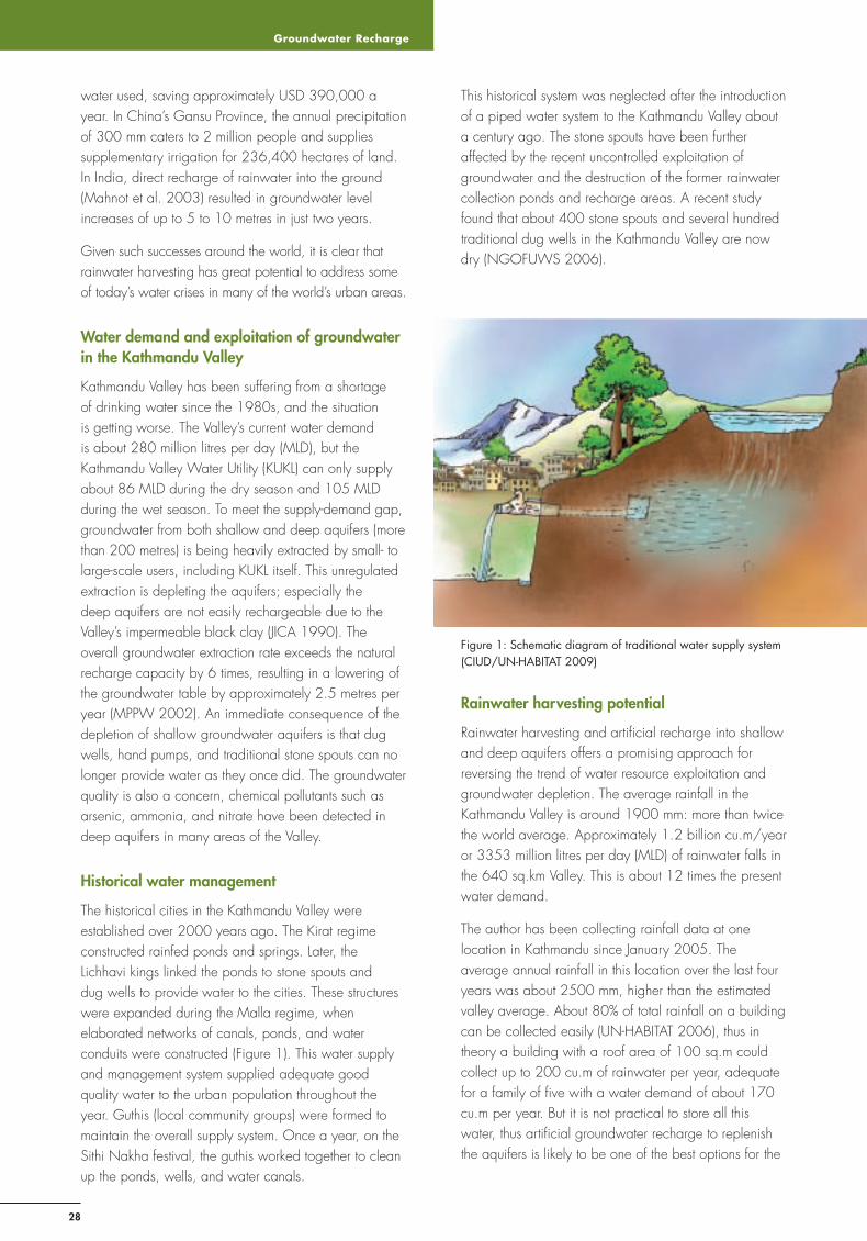
Groundwater Recharge
28
water used, saving approximately USD 390,000 a year. In China’s Gansu Province, the annual precipitation of 300 mm caters to 2 million people and supplies supplementary irrigation for 236,400 hectares of land. In India, direct recharge of rainwater into the ground (Mahnot et al. 2003) resulted in groundwater level increases of up to 5 to 10 metres in just two years.
Given such successes around the world, it is clear that rainwater harvesting has great potential to address some of today’s water crises in many of the world’s urban areas.
Water demand and exploitation of groundwater in the Kathmandu Valley
Kathmandu Valley has been suffering from a shortage of drinking water since the 1980s, and the situation is getting worse. The Valley’s current water demand is about 280 million litres per day (MLD), but the Kathmandu Valley Water Utility (KUKL) can only supply about 86 MLD during the dry season and 105 MLD during the wet season. To meet the supply-demand gap, groundwater from both shallow and deep aquifers (more than 200 metres) is being heavily extracted by small- to large-scale users, including KUKL itself. This unregulated extraction is depleting the aquifers; especially the deep aquifers are not easily rechargeable due to the Valley’s impermeable black clay (JICA 1990). The overall groundwater extraction rate exceeds the natural recharge capacity by 6 times, resulting in a lowering of the groundwater table by approximately 2.5 metres per year (MPPW 2002). An immediate consequence of the depletion of shallow groundwater aquifers is that dug wells, hand pumps, and traditional stone spouts can no longer provide water as they once did. The groundwater quality is also a concern, chemical pollutants such as arsenic, ammonia, and nitrate have been detected in deep aquifers in many areas of the Valley.
Historical water management
The historical cities in the Kathmandu Valley were established over 2000 years ago. The Kirat regime constructed rainfed ponds and springs. Later, the Lichhavi kings linked the ponds to stone spouts and dug wells to provide water to the cities. These structures were expanded during the Malla regime, when elaborated networks of canals, ponds, and water conduits were constructed (Figure 1). This water supply and management system supplied adequate good quality water to the urban population throughout the year. Guthis (local community groups) were formed to maintain the overall supply system. Once a year, on the Sithi Nakha festival, the guthis worked together to clean up the ponds, wells, and water canals.
This historical system was neglected after the introduction of a piped water system to the Kathmandu Valley about a century ago. The stone spouts have been further affected by the recent uncontrolled exploitation of groundwater and the destruction of the former rainwater collection ponds and recharge areas. A recent study found that about 400 stone spouts and several hundred traditional dug wells in the Kathmandu Valley are now dry (NGOFUWS 2006).
Figure 1: Schematic diagram of traditional water supply system (CIUD/UN-HABITAT 2009)
Rainwater harvesting potential
Rainwater harvesting and artifi cial recharge into shallow and deep aquifers offers a promising approach for reversing the trend of water resource exploitation and groundwater depletion. The average rainfall in the Kathmandu Valley is around 1900 mm: more than twice the world average. Approximately 1.2 billion cu.m/year or 3353 million litres per day (MLD) of rainwater falls in the 640 sq.km Valley. This is about 12 times the present water demand.
The author has been collecting rainfall data at one location in Kathmandu since January 2005. The average annual rainfall in this location over the last four years was about 2500 mm, higher than the estimated valley average. About 80% of total rainfall on a building can be collected easily (UN-HABITAT 2006), thus in theory a building with a roof area of 100 sq.m could collect up to 200 cu.m of rainwater per year, adequate for a family of fi ve with a water demand of about 170 cu.m per year. But it is not practical to store all this water, thus artifi cial groundwater recharge to replenish the aquifers is likely to be one of the best options for the
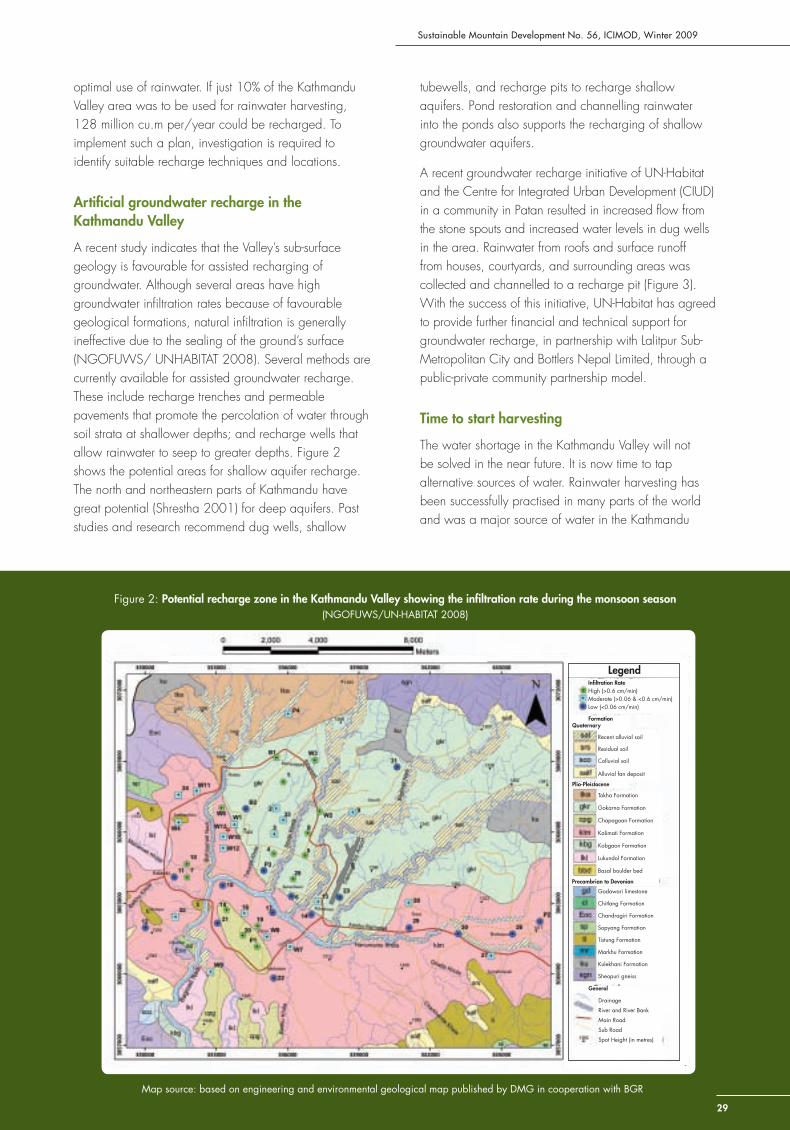
Sustainable Mountain Development No. 56, ICIMOD, Winter 2009
29
optimal use of rainwater. If just 10% of the Kathmandu Valley area was to be used for rainwater harvesting, 128 million cu.m per/year could be recharged. To implement such a plan, investigation is required to identify suitable recharge techniques and locations.
Artifi cial groundwater recharge in the Kathmandu Valley
A recent study indicates that the Valley’s sub-surface geology is favourable for assisted recharging of groundwater. Although several areas have high groundwater infi ltration rates because of favourable geological formations, natural infi ltration is generally ineffective due to the sealing of the ground’s surface (NGOFUWS/ UNHABITAT 2008). Several methods are currently available for assisted groundwater recharge. These include recharge trenches and permeable pavements that promote the percolation of water through soil strata at shallower depths; and recharge wells that allow rainwater to seep to greater depths. Figure 2 shows the potential areas for shallow aquifer recharge. The north and northeastern parts of Kathmandu have great potential (Shrestha 2001) for deep aquifers. Past studies and research recommend dug wells, shallow
tubewells, and recharge pits to recharge shallow aquifers. Pond restoration and channelling rainwater into the ponds also supports the recharging of shallow groundwater aquifers.
A recent groundwater recharge initiative of UN-Habitat and the Centre for Integrated Urban Development (CIUD) in a community in Patan resulted in increased fl ow from the stone spouts and increased water levels in dug wells in the area. Rainwater from roofs and surface runoff from houses, courtyards, and surrounding areas was collected and channelled to a recharge pit (Figure 3). With the success of this initiative, UN-Habitat has agreed to provide further fi nancial and technical support for groundwater recharge, in partnership with Lalitpur Sub-Metropolitan City and Bottlers Nepal Limited, through a public-private community partnership model.
Time to start harvesting
The water shortage in the Kathmandu Valley will not be solved in the near future. It is now time to tap alternative sources of water. Rainwater harvesting has been successfully practised in many parts of the world and was a major source of water in the Kathmandu
Figure 2: Potential recharge zone in the Kathmandu Valley showing the infi ltration rate during the monsoon season (NGOFUWS/UN-HABITAT 2008)
Map source: based on engineering and environmental geological map published by DMG in cooperation with BGR
Infi ltration RateHigh (>0.6 cm/min)Moderate (>0.06 & <0.6 cm/min)Low (<0.06 cm/min)
FormationQuaternary
Plio-Pleistocene
Recent alluvial soil
Residual soil
Colluvial soil
Alluvial fan deposit
Precambrian to Devonian
General
Drainage
River and River Bank
Main Road
Sub Road
Spot Height (in metres)
Godawari limestone
Chitlang Formation
Chandragiri Formation
Sopyang Formation
Tistung Formation
Markhu Formation
Kulekhani Formation
Sheopuri gneiss
Tokha Formation
Gokarna Formation
Chapagoan Formation
Kalimati Formation
Kobgaon Formation
Lukundol Formation
Basal boulder bed
Legend
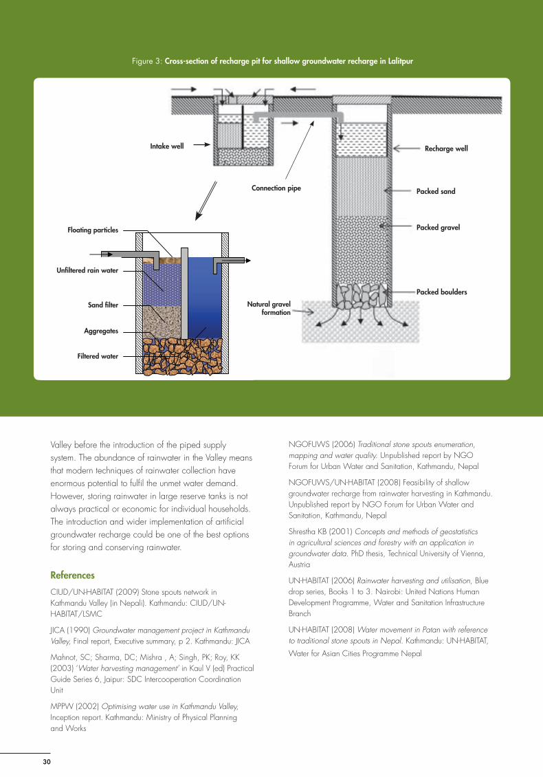
Groundwater Recharge
30
Valley before the introduction of the piped supply system. The abundance of rainwater in the Valley means that modern techniques of rainwater collection have enormous potential to fulfi l the unmet water demand. However, storing rainwater in large reserve tanks is not always practical or economic for individual households. The introduction and wider implementation of artifi cial groundwater recharge could be one of the best options for storing and conserving rainwater.
References
CIUD/UN-HABITAT (2009) Stone spouts network in Kathmandu Valley (in Nepali). Kathmandu: CIUD/UN-HABITAT/LSMC
JICA (1990) Groundwater management project in Kathmandu Valley, Final report, Executive summary, p 2. Kathmandu: JICA
Mahnot, SC; Sharma, DC; Mishra , A; Singh, PK; Roy, KK (2003) ‘Water harvesting management’ in Kaul V (ed) Practical Guide Series 6, Jaipur: SDC Intercooperation Coordination Unit
MPPW (2002) Optimising water use in Kathmandu Valley, Inception report. Kathmandu: Ministry of Physical Planningand Works
NGOFUWS (2006) Traditional stone spouts enumeration, mapping and water quality. Unpublished report by NGO Forum for Urban Water and Sanitation, Kathmandu, Nepal
NGOFUWS/UN-HABITAT (2008) Feasibility of shallow groundwater recharge from rainwater harvesting in Kathmandu. Unpublished report by NGO Forum for Urban Water and Sanitation, Kathmandu, Nepal
Shrestha KB (2001) Concepts and methods of geostatistics in agricultural sciences and forestry with an application in groundwater data. PhD thesis, Technical University of Vienna, Austria
UN-HABITAT (2006) Rainwater harvesting and utilisation, Blue drop series, Books 1 to 3. Nairobi: United Nations Human Development Programme, Water and Sanitation Infrastructure Branch
UN-HABITAT (2008) Water movement in Patan with reference to traditional stone spouts in Nepal. Kathmandu: UN-HABITAT,
Water for Asian Cities Programme Nepal
Floating particles
Unfiltered rain water
Sand filter
Aggregates
Filtered water Filtered water
Aggregates
Sand fi lter
Unfi ltered rain water
Floating particles
Figure 3: Cross-section of recharge pit for shallow groundwater recharge in Lalitpur
Connection pipe
Recharge well
Packed sand
Packed gravel
Packed boulders
Natural gravel formation
Intake well
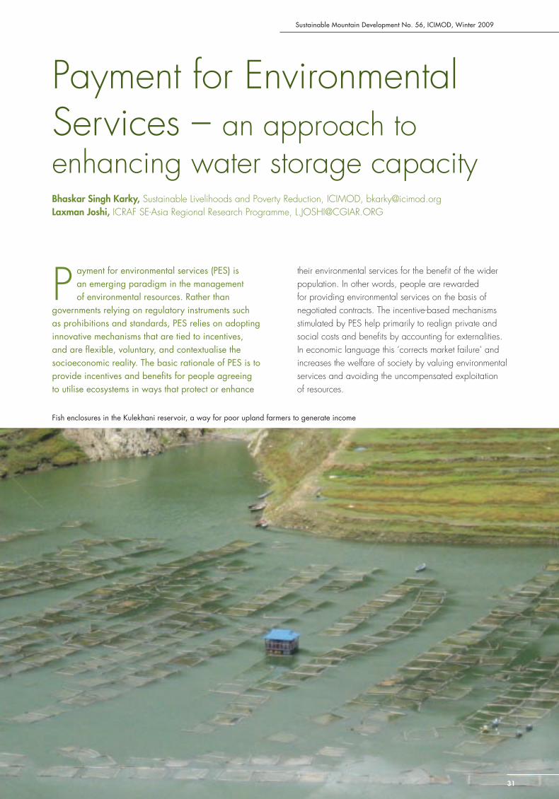
Sustainable Mountain Development No. 56, ICIMOD, Winter 2009
31
Payment for Environmental Services – an approach to enhancing water storage capacityBhaskar Singh Karky, Sustainable Livelihoods and Poverty Reduction, ICIMOD, [email protected] Joshi, ICRAF SE-Asia Regional Research Programme, [email protected]
P ayment for environmental services (PES) is an emerging paradigm in the management of environmental resources. Rather than
governments relying on regulatory instruments such as prohibitions and standards, PES relies on adopting innovative mechanisms that are tied to incentives, and are fl exible, voluntary, and contextualise the socioeconomic reality. The basic rationale of PES is to provide incentives and benefi ts for people agreeing to utilise ecosystems in ways that protect or enhance
their environmental services for the benefi t of the wider population. In other words, people are rewarded for providing environmental services on the basis of negotiated contracts. The incentive-based mechanisms stimulated by PES help primarily to realign private and social costs and benefi ts by accounting for externalities. In economic language this ‘corrects market failure’ and increases the welfare of society by valuing environmental services and avoiding the uncompensated exploitation of resources.
Fish enclosures in the Kulekhani reservoir, a way for poor upland farmers to generate income

PES for Water Storage
32
There is a growing interest in PES among countries in the Hindu Kush-Himalayan region. Recognising the value of incentive-based mechanisms, China has implemented an Upland Conversion Programme while India has initiated a Watershed Development Programme to reduce fl oods and droughts. In addition, there are now benefi t sharing policies in the hydropower sector in most Himalayan countries. This article examines the use of PES as a policy instrument in the Kulekhani watershed in central Nepal, and how it has played a role in enhancing the capacity of water storage.
Kulekhani hydropower (Nepal)
The Kulekhani watershed is located 50 km southwest of Kathmandu and is the source of water for the Kulekhani reservoir, which supplies water to hydropower plants downstream. The 92 MW Kulekhani hydropower plant is different to most hydropower plants in Nepal in that it relies entirely on monsoon rain collected in a reservoir rather than on rivers emerging from the Himalayas. As with similar reservoir systems, the plant was designed to supplement peak load in the drier seasons.
In 1973, Nepal generated 39 MW of electricity, of which 32 MW came from run-of-the-river (RoR) systems (Ghimere 2004). At this time, the demand for electricity was increasing by around 4% per year. The generating capacity of the RoR plants was nearly one-third less in the dry season. In 1980, the peak load requirement was 65 MW, indicating a need for an additional 40 to 60 MW by the mid 1980s. The 92 MW Kulekhani hydropower plant was commissioned by the Nepal Electricity Authority in 1982. The original gross capacity of the reservoir was 85.3 million cu.m, of which 73.3 million cu.m was live volume. The reservoir, designed with a life-span of 50 years, was expected to last 100 years (Sthapit 1996). However, the main problem for reservoir type hydropower plants in Nepal is sedimentation. Sediment loads in Nepal’s watersheds are among the highest in the world; 85% of the runoff occurs during the monsoon yielding 98% of the sedimentation load (Mahmood 1987 in Sangroula 2006).
The Kulekhani watershed
The hydropower reservoir depends on the water from a 12,500 ha watershed with a mosaic of different land uses (Table). The watershed has 8000 households with over 45,000 residents, spread over 8 VDCs living in a subsistence economy based on (sloping land) agriculture and livestock rearing. Communities also manage forests to extract timber, fuelwood, fodder, and litter. The four monsoon months account for around 80% of the annual
Table: Land use in the Kulekhani Watershed in 1991
Land use category Area (ha) %
Sloping terrace 4254 34.0%
Level terrace 237 1.9%
Valley terrace/fans/tars 713 5.7%
Forest 5455 43.6%
Shrubland 1147 9.2%
Grazing and grassland 200 1.6%
Barren land/rock 50 0.4%
Lakes 216 1.7%
Gullies/landslides 18 0.1%
Other 210 1.7%
Total 12,500 100%
Source: IWMP 1992 in Sthapit 1996
precipitation; this rain is the main source of water for agriculture. In general, there is a shortage of water during the remaining eight months.
The Kulekhani watershed receives 1500 to 1700 mm of rainfall annually on average but the rainfall is often uneven. In July 1993, the watershed received 542 mm over a 24-hour period with rainfall reaching 80 mm in an hour, causing a massive landslide, fl ooding, and siltation. The plant required major repairs. Over 20 years of operation, the reservoir has lost more than 25% of its storage capacity due to siltation (Sangroula 2006).
The PES mechanism
With the rapid loss in capacity of the reservoir, the government recognised that Kulekhani was a critical watershed of strategic importance and started programmes targeted at participatory conservation. More attention was paid to promoting proper land use management in the uplands to reduce siltation. Activities to promote watershed conservation included community forestry, conservation education, terrace improvement, and fruit plantations.
Various studies (e.g., Amatya 2004; Ghimere 2004) have shown that soil erosion from agricultural land is as much as 73 times higher than that from forested land. Analysis of land use patterns showed that forest cover in the watershed declined between 1978 and 1992, but that it had recovered to earlier levels by 2001. An analysis of sedimentation patterns indicated that the rate of sedimentation in the Kulekhani Reservoir declined with the increase in forest cover and that the dry season water fl ow gradually increased (Upadhyaya 2005). Maintaining forest cover appeared to be an effi cient way of reducing siltation. In 2003, in line with this, the Rewarding the Upland Poor for Environmental Services (RUPES) programme (WAC no date) started

Sustainable Mountain Development No. 56, ICIMOD, Winter 2009
33
to work with upland communities in Kulekhani and the hydropower plant authorities to foster a win-win situation based on a PES mechanism (Upadhyaya 2005). The RUPES programme empowered local communities and organised them into a Watershed Conservation and Development Forum to promote the conservation of forested lands in the upland watershed to reduce siltation. The aim was for the electricity authority to fi nance the activities through a PES mechanism with the upland people living in the catchment area receiving a payment from the hydropower plant in return for the community managed forests they conserve.
RUPES was successful in establishing a payment mechanism channelled through the district development committee (DDC) based on the 1999 Local Self-Governance Act and the 1992 Decentralisation Act. The Nepal Electricity Authority pays the upland farmers for implementing the conservation activities via the central government, which allocates 12% of the royalties generated from the Kulehkani plant to Makwanpur DDC under the Environment Management Special Fund. Of this, 50% is allocated to the village development committees (VDCs) in Makwanpur District and the remainder to upland settlements (20%), downstream settlements (15%), and the VDCs that house the power plant, generator, dam, and reservoir (15%).
The Kulekhani case refl ects the start of a paradigm shift in Nepal, with the government taking action to introduce PES. So far, three annual payments have been made. The VDCs, together with other local bodies such as civil society groups, political parties, and NGOs, organise themselves to formulate a plan which is discussed at village level meetings and then presented to the DDC for approval for fi nancing according to the agreed allocation. The budget is in addition to the regular VDC budget and depends on the power generated from the plant.
So far, much of the payment has been used by the local population for rural development work of immediate benefi t, such as village electrifi cation and road construction. While the payments, in principle, should be used for activities that reduce soil erosion and siltation, this has not yet happened. Village politics often lead to short-term gains over long-term benefi ts, and forest user groups have not been able to benefi t as planned. PES is still in its experimentation and learning phase, now attention and follow-up is required to institutionalise the PES concept at the grass roots level.
Conclusion
Globally, the services that watersheds provide in terms of quality and quantity of water are decreasing due
to unsustainable land management practices, but the demand for such services is increasing. The PES mechanism is an evolving policy instrument that offers innovative solutions by offering incentives to promote sustainable land management. The Kulekhani case shows that a reward system for upland farmers that leads to reduced siltation and enhanced water storage capacity can be implemented, although more needs to be done to ensure that the desired outcome is achieved. This is the beginning of a paradigm shift in natural resource management in Nepal. The drawing of lessons from the Kulekhani case to formulate national policies in Nepal is underway.
References
Adhikari, B (2009) Market-based approaches to environmental management: A review of lessons from payment for environmental services in Asia, ADBI Working Paper 134. Tokyo: Asian Development Bank Institute. Available at www.adbi.org/workingpaper/2009/03/26/2906.market.based.approaches.environmental.mngt/
Amatya, UB (2004) Rainstorm induced soil erosion in Kulekhani watershed and infl ow analysis in Kulekhani Reservoir. Kathmandu: Winrock International
Ghimire, BN (2004) Economic losses to Kulekhani Hydroelectric Project due to siltation in the reservoir. Kathmandu: Winrock International
Sangroula, DP (2006) ‘Hydropower development and its sustainability with respect to sedimentation in Nepal.’ Journal of the Institute of Engineering 7(1): 1-9
Sthapit, KM (1996) Sedimentation monitoring of Kulekhani reservoir. Paper presented at the Int. Conference on Reservoir Sedimentation, 9-13 September 1996, Fort Collins, Colorado
Upadhyaya, S (2005) Payments for environmental services: Sharing hydropower benefi ts with upland communities, RUPES Working Paper 1. Kathmandu: Winrock International
WAC (no date) RUPES. Bogor: World Agroforestry Centre SEARO. Available at http://www.worldagroforestry.org/sea/networks/rupes/index.asp
The Kulekhani watershed: a mosaic of different land uses
Adapting to Water Stresses
34
Adapting to Climate-induced Water Stresses and Hazards in the Hindu Kush-HimalayasJulie Dekens, Integrated Water and Hazard Management, ICIMOD, [email protected] Eriksson, Integrated Water and Hazard Management, ICIMOD, [email protected]
T he most forceful impact of a changing climate on the biosphere and society is through impact on the hydrological cycle. Increasing
temperatures translate to more energy in the atmosphere, which in turn intensifi es the water cycle. The result may be enhanced differences between wet and dry areas as well as enhanced seasonal differences. For the Hindu Kush-Himalayan region, climate predictions indicate that the already dry western Hindu Kush-Himalayas might become drier, some other areas might become wetter. However, it is still diffi cult to see clear trends in precipitation and climate predictions for this part of the world remain in their infancy. Nevertheless, it is generally accepted that we are facing an increased frequency and magnitude of high intensity rainfall events as part of an increased variability in the climate. There are already signs that this is happening in the Himalayan region.
Water-induced hazards are already a looming threat throughout the Hindu Kush-Himalayan region; every year riverine fl oods, inundations, fl ash fl oods, and droughts exact a heavy toll on human life, livelihoods, and economic prosperity. To some extent, societies have developed mechanisms to minimise the negative impacts on houses, infrastructure, crops, and access to safe drinking water when disaster strikes. However, adaptation strategies developed over generations might still not be enough if fl ood and inundation levels increase, the number of fl ash fl ood events doubles, or seasonal drought lasts longer.
These challenges highlight two urgent priorities. First, current adaptation strategies need to be documented and assessed in order to understand the mechanisms that people rely on for making their living in an inherently
risk-fi lled environment. Second, these adaptation strategies need to be analysed in the light of greater uncertainties and accelerated changes, where climate is one important driver among many other drivers (e.g., globalisation), in order to understand their future and long-term sustainability. In addition, adaptation to new conditions requires a supportive policy environment. Thus for any external support to adaptation to be useful, it is of paramount importance to analyse the role of existing policies in infl uencing, positively or negatively, people’s ability to adapt in a sustainable way.
ICIMOD has taken up the challenge to improve understanding of current adaptation strategies, for water stress their long-term sustainability, and the infl uence of current policies on these strategies, through a programme of documenting adaptation strategies in the region. Currently, fi ve fi eld teams are working in four countries (China, India, Nepal, and Pakistan) to document local adaptation strategies, and a team of policy experts is working in parallel to unravel the infl uence of existing policies at selected sites.
In the following, we highlight some preliminary fi ndings from these studies, especially in relation to the role of uncertainties, scale, indigenous knowledge, and culture in infl uencing local adaptation strategies to climate-related stresses and hazards.
When climate sidelines current adaptation strategies
Parts of Kavre District in eastern Nepal that lie in a rainshadow area have had less annual rainfall during the last fi ve years than usual. For generations, people have taken advantage of seasonal differences, cultivating vegetables using drip irrigation, planting
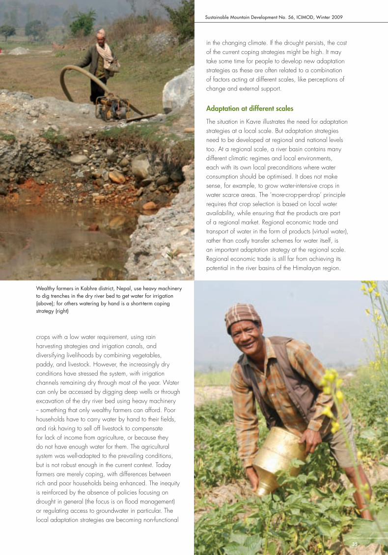
Sustainable Mountain Development No. 56, ICIMOD, Winter 2009
35
crops with a low water requirement, using rain harvesting strategies and irrigation canals, and diversifying livelihoods by combining vegetables, paddy, and livestock. However, the increasingly dry conditions have stressed the system, with irrigation channels remaining dry through most of the year. Water can only be accessed by digging deep wells or through excavation of the dry river bed using heavy machinery -- something that only wealthy farmers can afford. Poor households have to carry water by hand to their fi elds, and risk having to sell off livestock to compensate for lack of income from agriculture, or because they do not have enough water for them. The agricultural system was well-adapted to the prevailing conditions, but is not robust enough in the current context. Today farmers are merely coping, with differences between rich and poor households being enhanced. The inequity is reinforced by the absence of policies focusing on drought in general (the focus is on fl ood management) or regulating access to groundwater in particular. The local adaptation strategies are becoming non-functional
in the changing climate. If the drought persists, the cost of the current coping strategies might be high. It may take some time for people to develop new adaptation strategies as these are often related to a combination of factors acting at different scales, like perceptions of change and external support.
Adaptation at different scales
The situation in Kavre illustrates the need for adaptation strategies at a local scale. But adaptation strategies need to be developed at regional and national levels too. At a regional scale, a river basin contains many different climatic regimes and local environments, each with its own local preconditions where water consumption should be optimised. It does not make sense, for example, to grow water-intensive crops in water scarce areas. The ‘more-crop-per-drop’ principle requires that crop selection is based on local water availability, while ensuring that the products are part of a regional market. Regional economic trade and transport of water in the form of products (virtual water), rather than costly transfer schemes for water itself, is an important adaptation strategy at the regional scale. Regional economic trade is still far from achieving its potential in the river basins of the Himalayan region.
Wealthy farmers in Kabhre district, Nepal, use heavy machinery to dig trenches in the dry river bed to get water for irrigation (above); for others watering by hand is a short-term coping strategy (right)

Adapting to Water Stresses
3636
There are also important adaptation mechanisms at the intermediate scale, at district or national level. Examples include infrastructure such as embankments for fl ood mitigation, or larger irrigation canals to support agricultural production in seasonally dry environments. Such macro-level installations require the mobilisation of larger resources and have to be addressed by district or national governments, although households and communities govern the actual use of water at the level of the agricultural fi eld. Top-down structural adaptation strategies commonly show limits, however, e.g., problems of maintenance. Here, it is likely that increased funding mechanisms from the international community to address climate change adaptation can make a difference.
Adaptation to climate change needs to be addressed simultaneously at different scales for the strategies to be successful. Some aspects can be better addressed at the local scale, while others can be better addressed at regional and national levels (e.g., regional data sharing for fl ood mitigation, large infrastructures for fl ood prevention). In either case, there is a need to understand better the linkages or (mis)matches between top-down adaptation strategies and local adaptation strategies.
Indigenous knowledge and institutional arrangements
There are many examples of successful adaptation strategies at the community level. For example, in the Mulkhow Valley in Chitral, northern Pakistan, people have always faced water shortages during parts of the year. In this dry and vertical environment, very little land is available for settlement and agriculture. There are no perennial sources of water and people depend on rain feeding the streams. They have managed to adapt to recurrent drought through sophisticated traditional systems of water distribution for irrigation, including a
system of water monitoring and maintenance of irrigation channels. To adapt to the regular shortage of water and unequal water rights, people also ’borrow‘ water from relatives or neighbouring communities. Since the early 1990s, with growing population pressure and more frequent and/or severe drought, water is increasingly being traded for in-kind products (fodder, fuelwood, poultry) or services (harvesting, weeding, irrigating) or for cash. The success of this traditional resource management system is based on strong social capital. In this case as elsewhere, informal institutions provide an important vehicle for fostering innovative adaptation practices. Any external intervention should build upon such traditional mechanisms when adapting to rapid changes.
Culture
Socio-cultural aspects (like age, gender, caste, political affi liation, beliefs, traditions) can have a positive or negative infl uence on adaptation strategies to fl oods and droughts. In Assam in North East India, different ethnic groups have adapted to fl oods in different ways. The Mishing communities, a tribal ethnic group, live along the rivers in stilt houses (chang-ghar) made mainly of bamboo. These traditional houses are well-adapted to the annual fl oods that these communities face; people can continue their daily lives relatively unaffected. The Mishing have been adapting their chang-ghar to changes in the frequency and intensity of fl oods by progressively raising the house stilts according to the level of the last highest fl ood. Those who can afford it now make cement stilts, which are stronger than bamboo and resist fl oods better.
People of other ethnic groups living nearby have adapted to the fl oods in a different way by building their houses on platforms in traditional Assamese style. Since these platforms are often not high enough to keep out high fl oods, they have created ‘living platforms‘ inside the houses to stay on during the fl oods. They also take refuge in the granaries which are built on stilts and separate from the house. Although these houses are less well-adapted to the recurrent fl oods, they are often seen as symbols of modernity and affl uence, and these groups do not wish to live in stilt houses which they associate with a ’lower’ culture.
Cultural factors also infl uence access to livelihood diversifi cation strategies. The Mishing communities have develop new adaptation strategies and diversifi ed their livelihoods to meet the challenges of increasingly severe fl ooding. Although against their traditional lifestyle, the most vulnerable households have started to sell fi sh,
A traditional water distribution and control structure or ‘nirwalu’ in Mulkhow, a drought prone area of Chitral, Pakistan.
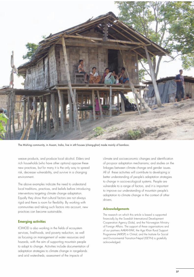
Sustainable Mountain Development No. 56, ICIMOD, Winter 2009
37
weave products, and produce local alcohol. Elders and rich households (who have other options) oppose these new practices, but for many it is the only way to spread risk, decrease vulnerability, and survive in a changing environment.
The above examples indicate the need to understand local traditions, practices, and beliefs before introducing interventions targeting climate change adaptation. Equally they show that cultural factors are not always rigid and there is room for fl exibility. By working with communities and taking such factors into account, new practices can become sustainable.
Emerging activities
ICIMOD is also working in the fi elds of ecosystem services, livelihoods, and poverty reduction, as well as focusing on management of water resources and hazards, with the aim of supporting mountain people to adapt to change. Activities include documentation of adaptation strategies to climate change in rangelands and arid watersheds; assessment of the impacts of
climate and socioeconomic changes and identifi cation of pro-poor adaptation mechanisms; and studies on the linkages between climate change and gender issues. All of these activities will contribute to developing a better understanding of people’s adaptation strategies to change in socio-ecological systems. People are vulnerable to a range of factors, and it is important to improve our understanding of mountain people’s adaptation to climate change in the context of other drivers.
Acknowledgements
The research on which this article is based is supported fi nancially by the Swedish International Development Cooperation Agency (Sida), and the Norwegian Ministry of Foreign Affairs. The support of these organisations and of our partners AARANYAK; the Aga Khan Rural Support Programme (AKRSP) in Chitral; and the Institute for Social and Environmental Transition-Nepal (ISET-N) is gratefully acknowledged.
The Mishing community, in Assam, India, live in stilt houses (chang-ghar) made mainly of bamboo.
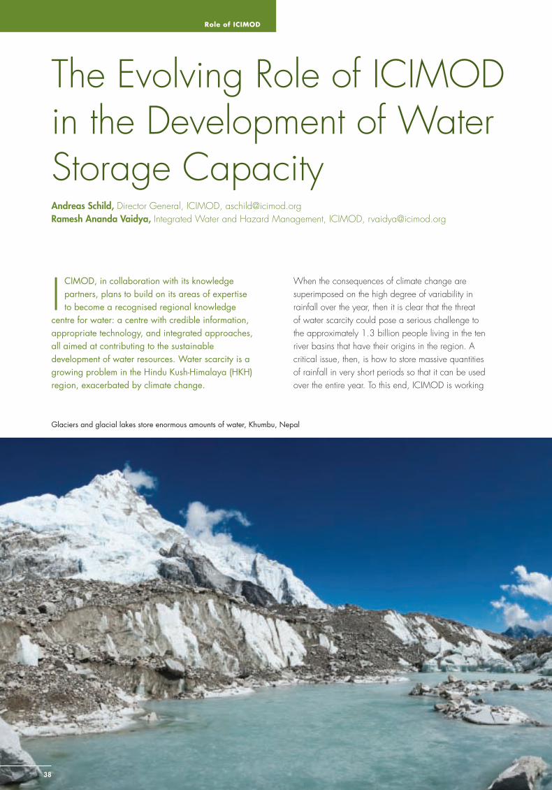
Role of ICIMOD
3838
The Evolving Role of ICIMOD in the Development of Water Storage Capacity Andreas Schild, Director General, ICIMOD, [email protected] Ramesh Ananda Vaidya, Integrated Water and Hazard Management, ICIMOD, [email protected]
I CIMOD, in collaboration with its knowledge partners, plans to build on its areas of expertise to become a recognised regional knowledge
centre for water: a centre with credible information, appropriate technology, and integrated approaches, all aimed at contributing to the sustainable development of water resources. Water scarcity is a growing problem in the Hindu Kush-Himalaya (HKH) region, exacerbated by climate change.
When the consequences of climate change are superimposed on the high degree of variability in rainfall over the year, then it is clear that the threat of water scarcity could pose a serious challenge to the approximately 1.3 billion people living in the ten river basins that have their origins in the region. A critical issue, then, is how to store massive quantities of rainfall in very short periods so that it can be used over the entire year. To this end, ICIMOD is working
Glaciers and glacial lakes store enormous amounts of water, Khumbu, Nepal
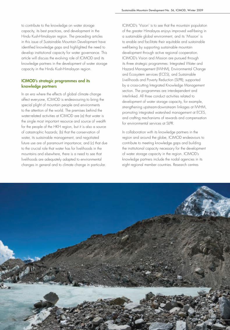
Sustainable Mountain Development No. 56, ICIMOD, Winter 2009
39
to contribute to the knowledge on water storage capacity, its best practices, and development in the Hindu Kush-Himalayan region. The preceding articles in this issue of Sustainable Mountain Development have identifi ed knowledge gaps and highlighted the need to develop institutional capacity for water governance. This article will discuss the evolving role of ICIMOD and its knowledge partners in the development of water storage capacity in the Hindu Kush-Himalayan region.
ICIMOD’s strategic programmes and its knowledge partners
In an era where the effects of global climate change affect everyone, ICIMOD is endeavouring to bring the special plight of mountain people and environments to the attention of the world. The premises behind the water-related activities at ICIMOD are (a) that water is the single most important resource and source of wealth for the people of the HKH region, but it is also a source of catastrophic hazards; (b) that the conservation of water, its sustainable management, and negotiated future use are of paramount importance; and (c) that due to the crucial role that water has for livelihoods in the mountains and elsewhere, there is a need to see that livelihoods are adequately adapted to environmental changes in general and to climate change in particular.
ICIMOD’s ‘Vision’ is to see that the mountain population of the greater Himalayas enjoys improved well-being in a sustainable global environment, and its ‘Mission’ is to enable and facilitate their equitable and sustainable well-being by supporting sustainable mountain development through active regional cooperation. ICIMOD’s Vision and Mission are pursued through its three strategic programmes: Integrated Water and Hazard Management (IWHM), Environmental Change and Ecosystem services (ECES), and Sustainable Livelihoods and Poverty Reduction (SLPR); supported by a cross-cutting Integrated Knowledge Management section. The programmes are interdependent and interlinked. All three conduct activities related to development of water storage capacity, for example, strengthening upstream-downstream linkages at IWHM, promoting integrated watershed management at ECES, and crafting mechanisms of rewards and compensation for environmental services at SLPR.
In collaboration with its knowledge partners in the region and around the globe, ICIMOD endeavours to contribute to meeting knowledge gaps and building the institutional capacity necessary for the development of water storage capacity in the region. ICIMOD’s knowledge partners include the nodal agencies in its eight regional member countries. Research centres
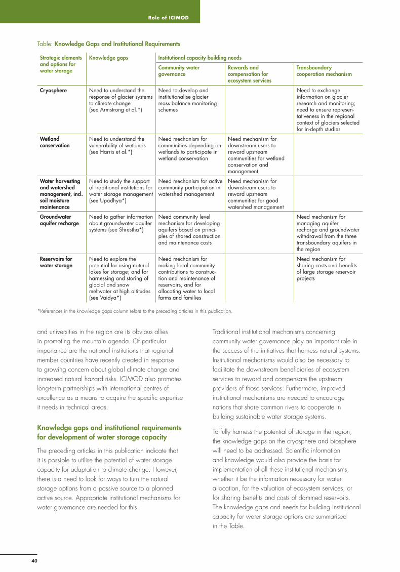
Role of ICIMOD
40
Table: Knowledge Gaps and Institutional Requirements
Strategic elements and options for water storage
Knowledge gaps Institutional capacity building needs
Community water governance
Rewards and compensation for ecosystem services
Transboundary cooperation mechanism
Cryosphere Need to understand the response of glacier systems to climate change (see Armstrong et al.*)
Need to develop and institutionalise glacier mass balance monitoring schemes
Need to exchange information on glacier research and monitoring; need to ensure represen-tativeness in the regional context of glaciers selected for in-depth studies
Wetland conservation
Need to understand the vulnerability of wetlands (see Harris et al.*)
Need mechanism for communities depending on wetlands to participate in wetland conservation
Need mechanism for downstream users to reward upstream communities for wetland conservation and management
Water harvesting and watershed management, incl. soil moisture maintenance
Need to study the support of traditional institutions for water storage management (see Upadhya*)
Need mechanism for active community participation in watershed management
Need mechanism for downstream users to reward upstream communities for good watershed management
Groundwater aquifer recharge
Need to gather information about groundwater aquifer systems (see Shrestha*)
Need community level mechanism for developing aquifers based on princi-ples of shared construction and maintenance costs
Need mechanism for managing aquifer recharge and groundwater withdrawal from the three transboundary aquifers in the region
Reservoirs for water storage
Need to explore the potential for using natural lakes for storage; and for harnessing and storing of glacial and snow meltwater at high altitudes (see Vaidya*)
Need mechanism for making local community contributions to construc-tion and maintenance of reservoirs, and for allocating water to local farms and families
Need mechanism for sharing costs and benefi ts of large storage reservoir projects
*References in the knowledge gaps column relate to the preceding articles in this publication.
and universities in the region are its obvious allies in promoting the mountain agenda. Of particular importance are the national institutions that regional member countries have recently created in response to growing concern about global climate change and increased natural hazard risks. ICIMOD also promotes long-term partnerships with international centres of excellence as a means to acquire the specifi c expertise it needs in technical areas.
Knowledge gaps and institutional requirements for development of water storage capacity
The preceding articles in this publication indicate that it is possible to utilise the potential of water storage capacity for adaptation to climate change. However, there is a need to look for ways to turn the natural storage options from a passive source to a planned active source. Appropriate institutional mechanisms for water governance are needed for this.
Traditional institutional mechanisms concerning community water governance play an important role in the success of the initiatives that harness natural systems. Institutional mechanisms would also be necessary to facilitate the downstream benefi ciaries of ecosystem services to reward and compensate the upstream providers of those services. Furthermore, improved institutional mechanisms are needed to encourage nations that share common rivers to cooperate in building sustainable water storage systems.
To fully harness the potential of storage in the region, the knowledge gaps on the cryosphere and biosphere will need to be addressed. Scientifi c information and knowledge would also provide the basis for implementation of all these institutional mechanisms, whether it be the information necessary for water allocation, for the valuation of ecosystem services, or for sharing benefi ts and costs of dammed reservoirs. The knowledge gaps and needs for building institutional capacity for water storage options are summarised in the Table.
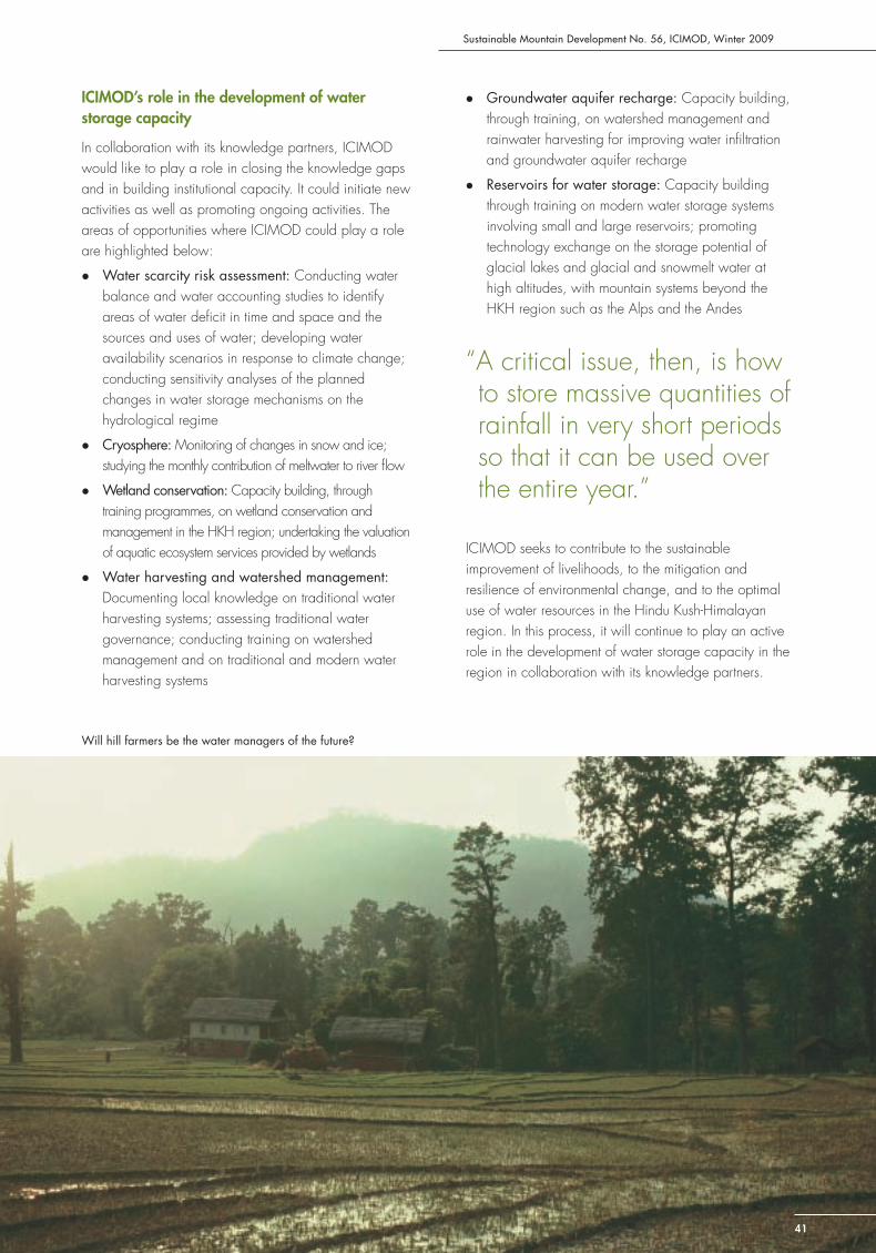
Sustainable Mountain Development No. 56, ICIMOD, Winter 2009
41
! Groundwater aquifer recharge: Capacity building, through training, on watershed management and rainwater harvesting for improving water infi ltration and groundwater aquifer recharge
! Reservoirs for water storage: Capacity building through training on modern water storage systems involving small and large reservoirs; promoting technology exchange on the storage potential of glacial lakes and glacial and snowmelt water at high altitudes, with mountain systems beyond the HKH region such as the Alps and the Andes
ICIMOD seeks to contribute to the sustainable improvement of livelihoods, to the mitigation and resilience of environmental change, and to the optimal use of water resources in the Hindu Kush-Himalayan region. In this process, it will continue to play an active role in the development of water storage capacity in the region in collaboration with its knowledge partners.
ICIMOD’s role in the development of water storage capacity
In collaboration with its knowledge partners, ICIMOD would like to play a role in closing the knowledge gaps and in building institutional capacity. It could initiate new activities as well as promoting ongoing activities. The areas of opportunities where ICIMOD could play a role are highlighted below:
! Water scarcity risk assessment: Conducting water balance and water accounting studies to identify areas of water defi cit in time and space and the sources and uses of water; developing water availability scenarios in response to climate change; conducting sensitivity analyses of the planned changes in water storage mechanisms on the hydrological regime
! Cryosphere: Monitoring of changes in snow and ice; studying the monthly contribution of meltwater to river fl ow
! Wetland conservation: Capacity building, through training programmes, on wetland conservation and management in the HKH region; undertaking the valuation of aquatic ecosystem services provided by wetlands
! Water harvesting and watershed management: Documenting local knowledge on traditional water harvesting systems; assessing traditional water governance; conducting training on watershed management and on traditional and modern water harvesting systems
“A critical issue, then, is how to store massive quantities of rainfall in very short periods so that it can be used over the entire year.”
Will hill farmers be the water managers of the future?
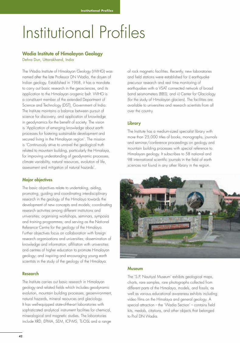
Institutional Profiles
42
Wadia Institute of Himalayan GeologyDehra Dun, Uttarakhand, India
Institutional Profi les
The Wadia Institute of Himalayan Geology (WIHG) was named after the late Professor DN Wadia, the doyen of Indian geology. Established in 1968, it has a mandate to carry out basic research in the geosciences, and its application to the Himalayan orogenic belt. WIHG is a constituent member of the extended Department of Science and Technology (DST), Government of India. The Institute maintains a balance between pursuit of science for discovery, and application of knowledge in geodynamics for the benefi t of society. The vision is ‘Application of emerging knowledge about earth processes for fostering sustainable development and secured living in the Himalayan region’. The mission is ‘Continuously strive to unravel the geological truth related to mountain building, particularly the Himalaya, for improving understanding of geodynamic processes, climate variability, natural resources, evolution of life, assessment and mitigation of natural hazards’.
Major objectives
The basic objectives relate to undertaking, aiding, promoting, guiding and coordinating interdisciplinary research in the geology of the Himalaya towards the development of new concepts and models; coordinating research activities among different institutions and universities; organising workshops, seminars, symposia and training programmes; and serving as the National Reference Centre for the geology of the Himalaya.Further objectives focus on collaboration with foreign research organisations and universities; dissemination of knowledge and information; affi liation with universities and centres of higher education to promote Himalayan geology; and inspiring and encouraging young earth scientists in the study of the geology of the Himalaya.
Research
The Institute carries out basic research in Himalayan geology and related fi elds which includes geodynamic evolution, mountain building processes, geoenvironment, natural hazards, mineral resources and glaciology. It has well-equipped state-of-the-art laboratories with sophisticated analytical instrument facilities for chemical, mineralogical and magnetic studies. The laboratories include XRD, EPMA, SEM, ICP-MS, TL-OSL and a range
of rock magnetic facilities. Recently, new laboratories and fi eld stations were established for i) earthquake precursor research and real time monitoring of earthquakes with a VSAT connected network of broad band seismometers (BBS), and ii) Center for Glaciology (for the study of Himalayan glaciers). The facilities are available to universities and research scientists from all over the country.
Library
The Institute has a medium-sized specialist library with more than 25,000 titles of books, monographs, journals and seminar/conference proceedings on geology and mountain building processes with special reference to Himalayan geology. It subscribes to 58 national and 98 international scientifi c journals in the fi eld of earth sciences not found in any other library in the region.
Museum
The ‘S.P. Nautiyal Museum’ exhibits geological maps, charts, rare samples, rare photographs collected from different parts of the Himalaya, models, and fossils, as well as various educational awareness exhibits including video fi lms on the Himalaya and general geology. A special attraction -- the ‘Wadia Section’ -- contains fi eld kits, medals, citations, and other objects that belonged to Prof DN Wadia.
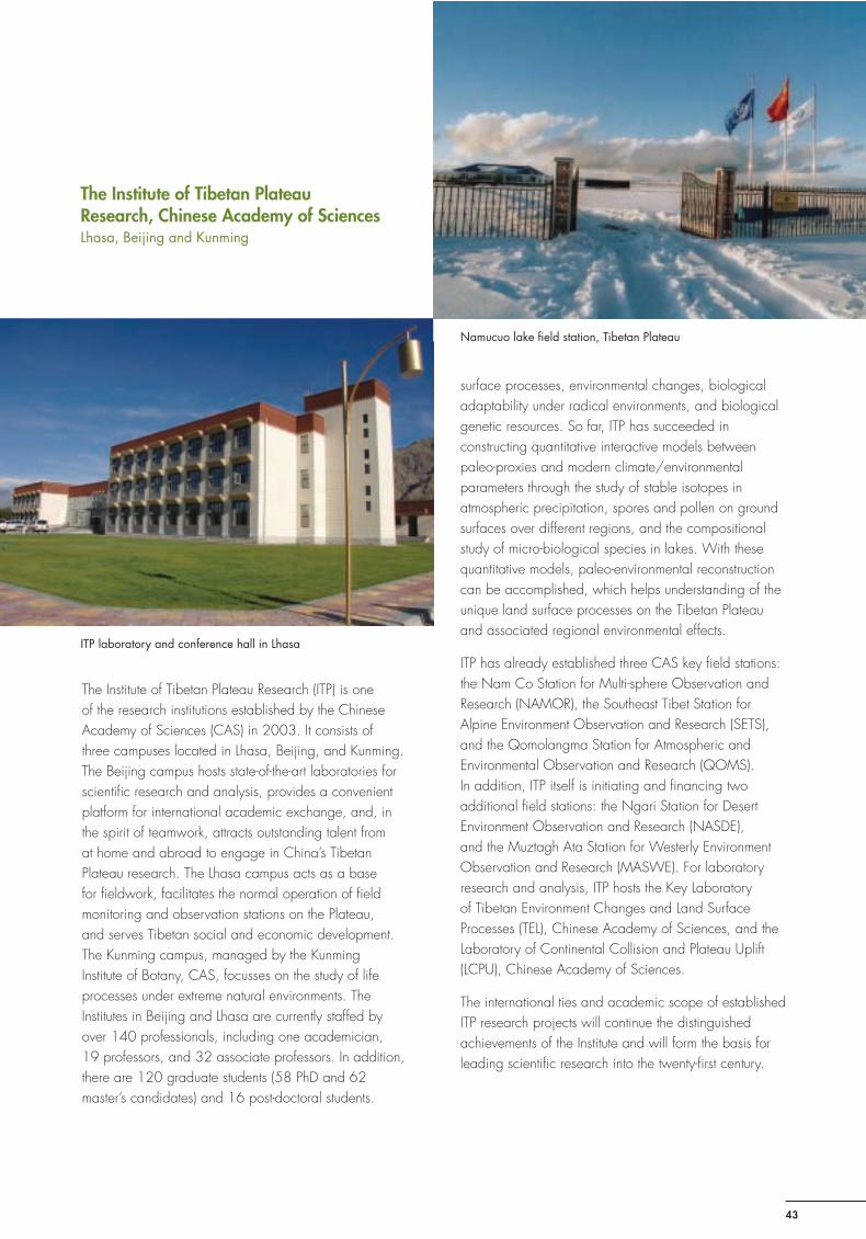
Sustainable Mountain Development No. 56, ICIMOD, Winter 2009
43
The Institute of Tibetan Plateau Research, Chinese Academy of SciencesLhasa, Beijing and Kunming
The Institute of Tibetan Plateau Research (ITP) is one of the research institutions established by the Chinese Academy of Sciences (CAS) in 2003. It consists of three campuses located in Lhasa, Beijing, and Kunming. The Beijing campus hosts state-of-the-art laboratories for scientifi c research and analysis, provides a convenient platform for international academic exchange, and, in the spirit of teamwork, attracts outstanding talent from at home and abroad to engage in China’s Tibetan Plateau research. The Lhasa campus acts as a base for fi eldwork, facilitates the normal operation of fi eld monitoring and observation stations on the Plateau, and serves Tibetan social and economic development. The Kunming campus, managed by the Kunming Institute of Botany, CAS, focusses on the study of life processes under extreme natural environments. The Institutes in Beijing and Lhasa are currently staffed by over 140 professionals, including one academician, 19 professors, and 32 associate professors. In addition, there are 120 graduate students (58 PhD and 62 master’s candidates) and 16 post-doctoral students.
The Institute’s scientifi c approach revolves around core issues such as the uplift processes of the Tibetan Plateau and their impact on the regional climate and environment, while also addressing scientifi c frontiers such as Tibetan Plateau geodynamics, land
surface processes, environmental changes, biological adaptability under radical environments, and biological genetic resources. So far, ITP has succeeded in constructing quantitative interactive models between paleo-proxies and modern climate/environmental parameters through the study of stable isotopes in atmospheric precipitation, spores and pollen on ground surfaces over different regions, and the compositional study of micro-biological species in lakes. With these quantitative models, paleo-environmental reconstruction can be accomplished, which helps understanding of the unique land surface processes on the Tibetan Plateau and associated regional environmental effects.
ITP has already established three CAS key fi eld stations: the Nam Co Station for Multi-sphere Observation and Research (NAMOR), the Southeast Tibet Station for Alpine Environment Observation and Research (SETS), and the Qomolangma Station for Atmospheric and Environmental Observation and Research (QOMS). In addition, ITP itself is initiating and fi nancing two additional fi eld stations: the Ngari Station for Desert Environment Observation and Research (NASDE), and the Muztagh Ata Station for Westerly Environment Observation and Research (MASWE). For laboratory research and analysis, ITP hosts the Key Laboratory of Tibetan Environment Changes and Land Surface Processes (TEL), Chinese Academy of Sciences, and the Laboratory of Continental Collision and Plateau Uplift (LCPU), Chinese Academy of Sciences.
The international ties and academic scope of established ITP research projects will continue the distinguished achievements of the Institute and will form the basis for leading scientifi c research into the twenty-fi rst century.
Namucuo lake fi eld station, Tibetan Plateau
ITP laboratory and conference hall in Lhasa
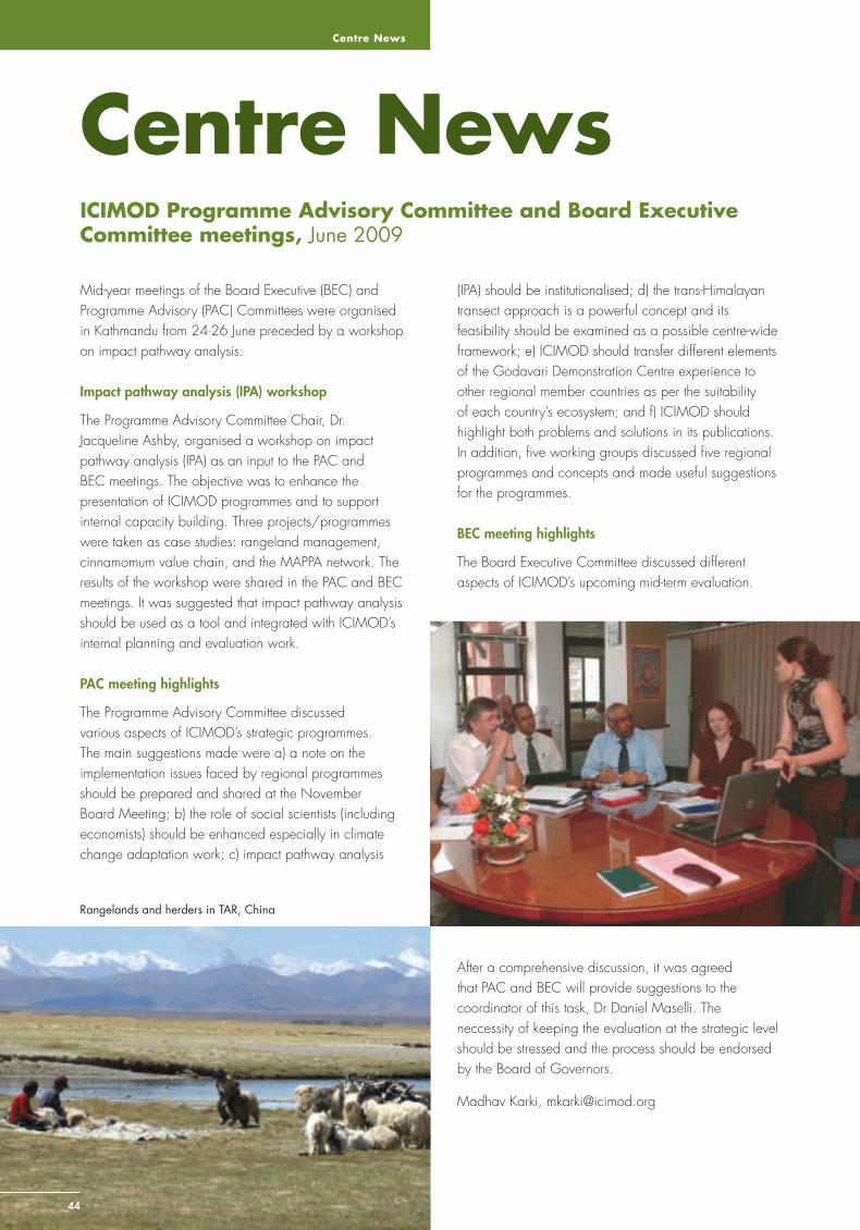
Centre News
44
Centre NewsICIMOD Programme Advisory Committee and Board Executive Committee meetings, June 2009
Mid-year meetings of the Board Executive (BEC) and Programme Advisory (PAC) Committees were organised in Kathmandu from 24-26 June preceded by a workshop on impact pathway analysis.
Impact pathway analysis (IPA) workshop
The Programme Advisory Committee Chair, Dr. Jacqueline Ashby, organised a workshop on impact pathway analysis (IPA) as an input to the PAC and BEC meetings. The objective was to enhance the presentation of ICIMOD programmes and to support internal capacity building. Three projects/programmes were taken as case studies: rangeland management, cinnamomum value chain, and the MAPPA network. The results of the workshop were shared in the PAC and BEC meetings. It was suggested that impact pathway analysis should be used as a tool and integrated with ICIMOD’s internal planning and evaluation work.
PAC meeting highlights
The Programme Advisory Committee discussed various aspects of ICIMOD’s strategic programmes. The main suggestions made were a) a note on the implementation issues faced by regional programmes should be prepared and shared at the November Board Meeting; b) the role of social scientists (including economists) should be enhanced especially in climate change adaptation work; c) impact pathway analysis
(IPA) should be institutionalised; d) the trans-Himalayan transect approach is a powerful concept and its feasibility should be examined as a possible centre-wide framework; e) ICIMOD should transfer different elements of the Godavari Demonstration Centre experience to other regional member countries as per the suitability of each country’s ecosystem; and f) ICIMOD should highlight both problems and solutions in its publications. In addition, fi ve working groups discussed fi ve regional programmes and concepts and made useful suggestions for the programmes.
BEC meeting highlights
The Board Executive Committee discussed different aspects of ICIMOD’s upcoming mid-term evaluation.
After a comprehensive discussion, it was agreed that PAC and BEC will provide suggestions to the coordinator of this task, Dr Daniel Maselli. The neccessity of keeping the evaluation at the strategic level should be stressed and the process should be endorsed by the Board of Governors.
Madhav Karki, [email protected]
Rangelands and herders in TAR, China
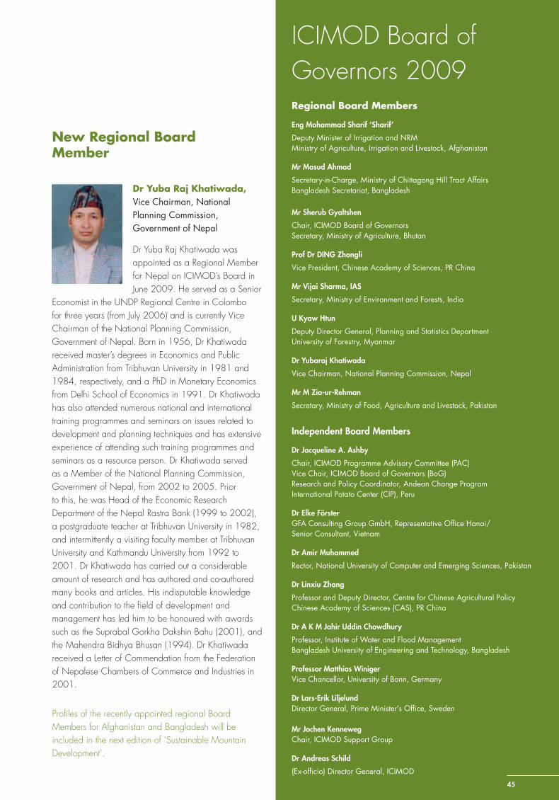
Sustainable Mountain Development No. 56, ICIMOD, Winter 2009
ICIMOD Board of Governors 2009Regional Board Members
Eng Mohammad Sharif ‘Sharif’
Deputy Minister of Irrigation and NRMMinistry of Agriculture, Irrigation and Livestock, Afghanistan
Mr Masud Ahmad
Secretary-in-Charge, Ministry of Chittagong Hill Tract AffairsBangladesh Secretariat, Bangladesh
Mr Sherub Gyaltshen
Chair, ICIMOD Board of GovernorsSecretary, Ministry of Agriculture, Bhutan
Prof Dr DING Zhongli
Vice President, Chinese Academy of Sciences, PR China
Mr Vijai Sharma, IAS
Secretary, Ministry of Environment and Forests, India
U Kyaw Htun
Deputy Director General, Planning and Statistics Department University of Forestry, Myanmar
Dr Yubaraj Khatiwada
Vice Chairman, National Planning Commission, Nepal
Mr M Zia-ur-Rehman
Secretary, Ministry of Food, Agriculture and Livestock, Pakistan
Independent Board Members
Dr Jacqueline A. Ashby
Chair, ICIMOD Programme Advisory Committee (PAC) Vice Chair, ICIMOD Board of Governors (BoG)Research and Policy Coordinator, Andean Change ProgramInternational Potato Center (CIP), Peru
Dr Elke FörsterGFA Consulting Group GmbH, Representative Offi ce Hanoi/Senior Consultant, Vietnam
Dr Amir Muhammed
Rector, National University of Computer and Emerging Sciences, Pakistan
Dr Linxiu Zhang
Professor and Deputy Director, Centre for Chinese Agricultural PolicyChinese Academy of Sciences (CAS), PR China
Dr A K M Jahir Uddin Chowdhury
Professor, Institute of Water and Flood ManagementBangladesh University of Engineering and Technology, Bangladesh
Professor Matthias Winiger Vice Chancellor, University of Bonn, Germany
Dr Lars-Erik Liljelund Director General, Prime Minister’s Offi ce, Sweden
Mr Jochen KennewegChair, ICIMOD Support Group
Dr Andreas Schild
(Ex-offi cio) Director General, ICIMOD
Dr Yuba Raj Khatiwada, Vice Chairman, National Planning Commission, Government of Nepal
Dr Yuba Raj Khatiwada was appointed as a Regional Member for Nepal on ICIMOD’s Board in June 2009. He served as a Senior
Economist in the UNDP Regional Centre in Colombo for three years (from July 2006) and is currently Vice Chairman of the National Planning Commission, Government of Nepal. Born in 1956, Dr Khatiwada received master’s degrees in Economics and Public Administration from Tribhuvan University in 1981 and 1984, respectively, and a PhD in Monetary Economics from Delhi School of Economics in 1991. Dr Khatiwada has also attended numerous national and international training programmes and seminars on issues related to development and planning techniques and has extensive experience of attending such training programmes and seminars as a resource person. Dr Khatiwada served as a Member of the National Planning Commission, Government of Nepal, from 2002 to 2005. Prior to this, he was Head of the Economic Research Department of the Nepal Rastra Bank (1999 to 2002), a postgraduate teacher at Tribhuvan University in 1982, and intermittently a visiting faculty member at Tribhuvan University and Kathmandu University from 1992 to 2001. Dr Khatiwada has carried out a considerable amount of research and has authored and co-authored many books and articles. His indisputable knowledge and contribution to the fi eld of development and management has led him to be honoured with awards such as the Suprabal Gorkha Dakshin Bahu (2001), and the Mahendra Bidhya Bhusan (1994). Dr Khatiwada received a Letter of Commendation from the Federation of Nepalese Chambers of Commerce and Industries in 2001.
Profi les of the recently appointed regional Board Members for Afghanistan and Bangladesh will be included in the next edition of ‘Sustainable Mountain Development’.
New Regional Board Member
45
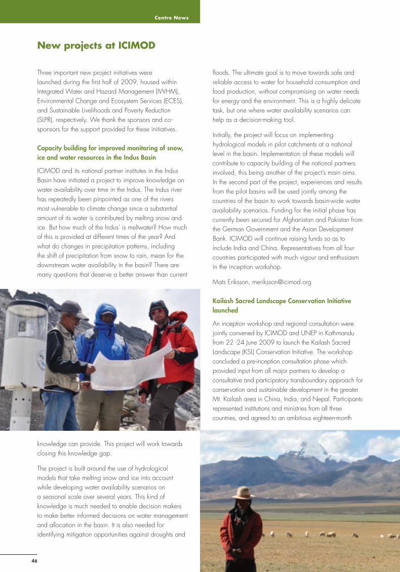
Centre News
46
Three important new project initiatives were launched during the fi rst half of 2009, housed within Integrated Water and Hazard Management (IWHM), Environmental Change and Ecosystem Services (ECES), and Sustainable Livelihoods and Poverty Reduction (SLPR), respectively. We thank the sponsors and co-sponsors for the support provided for these initiatives.
Capacity building for improved monitoring of snow, ice and water resources in the Indus Basin
ICIMOD and its national partner institutes in the Indus Basin have initiated a project to improve knowledge on water availability over time in the Indus. The Indus river has repeatedly been pinpointed as one of the rivers most vulnerable to climate change since a substantial amount of its water is contributed by melting snow and ice. But how much of the Indus’ is meltwater? How much of this is provided at different times of the year? And what do changes in precipitation patterns, including the shift of precipitation from snow to rain, mean for the downstream water availability in the basin? There are many questions that deserve a better answer than current
fl oods. The ultimate goal is to move towards safe and reliable access to water for household consumption and food production, without compromising on water needs for energy and the environment. This is a highly delicate task, but one where water availability scenarios can help as a decision-making tool.
Initially, the project will focus on implementing hydrological models in pilot catchments at a national level in the basin. Implementation of these models will contribute to capacity building of the national partners involved, this being another of the project’s main aims. In the second part of the project, experiences and results from the pilot basins will be used jointly among the countries of the basin to work towards basin-wide water availability scenarios. Funding for the initial phase has currently been secured for Afghanistan and Pakistan from the German Government and the Asian Development Bank. ICIMOD will continue raising funds so as to include India and China. Representatives from all four countries participated with much vigour and enthusiasm in the inception workshop.
Mats Eriksson, [email protected]
Kailash Sacred Landscape Conservation Initiative launched
An inception workshop and regional consultation were jointly convened by ICIMOD and UNEP in Kathmandu from 22 -24 June 2009 to launch the Kailash Sacred Landscape (KSL) Conservation Initiative. The workshop concluded a pre-inception consultation phase which provided input from all major partners to develop a consultative and participatory transboundary approach for conservation and sustainable development in the greater Mt. Kailash area in China, India, and Nepal. Participants represented institutions and ministries from all three countries, and agreed to an ambitious eighteen-month
New projects at ICIMOD
knowledge can provide. This project will work towards closing this knowledge gap.
The project is built around the use of hydrological models that take melting snow and ice into account while developing water availability scenarios on a seasonal scale over several years. This kind of knowledge is much needed to enable decision makers to make better informed decisions on water management and allocation in the basin. It is also needed for identifying mitigation opportunities against droughts and
Sustainable Mountain Development No. 56, ICIMOD, Winter 2009
47
start-up phase whose overall goal will be to establish the institutional framework for regional cooperation and ecosystem management approaches for conservation of the rich cultural and biological diversity of this region. The proposed transboundary KSL comprises a vast landscape of great variety and diversity, and includes Mt. Kailash and its environs in the south-west of Tibet Autonomous Region in China, and portions of the adjacent pilgrimage routes in India and the far northwest of Nepal. Mt. Kailash attracts pilgrims from all over the world and is considered sacred by fi ve major religions – the Buddhist, Bon-po, Hindu, Jain, and Sikh faiths.
The KSL will encourage transboundary cooperation to address the challenges of global climate warming and other environmental changes in this region, while encouraging sustainable and environmentally sound approaches for development, improved livelihoods, tourism, poverty alleviation, food security, and alternative livelihood options. This process will be based upon the development of an improved understanding of change processes, a regional knowledge base, information sharing, capacity building, and the promotion of stakeholder consultation and community participation. Currently, this remote region, like much of the rest of the Hindu Kush-Himalayan region, lacks basic climatic, ecological, socioeconomic and socio-cultural data, as well as the long-term knowledge base required for effective ecosystem management and biodiversity conservation. As part of the KSL framework, a transboundary and regional approach for long-term ecological monitoring will be implemented, based upon common protocols, collaboration, and data sharing. The KSL framework addresses the need for improved and coordinated long-term ecological monitoring across the Hindu Kush-Himalayan region by piloting ICIMOD’s transect approach, which seeks to facilitate ecological and environmental monitoring through enabling policy frameworks and institutional networks, and encouraging regional cooperation. This approach encourages the collection and sharing of environmental data, long-term climate and ecological monitoring, baseline assessments, and in-depth fi eld studies in order to improve our understanding of the potential impact of global warming across the region on biodiversity, ecosystem services, and the livelihoods of mountain communities.
The KSL Conservation Initiative will develop a framework for cooperation and common understanding on transboundary landscape issues in the region, and represents an important and timely opportunity to conserve this irreplaceable cultural and natural landscape. This initiative supports the broad objectives of the international community, ICIMOD, and the
regional member countries, to sustainably manage cultural and ecological diversity in the region through participatory processes, and to promote landscape-level ecosystem management approaches addressing transboundary conservation and sustainable development. Maintaining the sacred nature and intrinsically unique elements of this cultural and sacred landscape will be a key element of the Initiative.
Robert Zomer, [email protected]
Improving Local Governance in the Hindu Kush-Himalayas
July 2009 marked the start of the programme ‘Improving Local Governance in the Hindu Kush-Himalayas’, which has the objective of alleviating poverty and improving natural resource management through mainstreaming good practices of governance at the local level. The focus will be on building and strengthening the capacity of selected local government institutions and civil society organisations (NGOs, CBOs, federations, networks) for promoting good governance in public affairs by establishing the rights of mountain people in relation to social, economic, and gender issues.
The second phase of the programme will be implemented in Bangladesh, India, Nepal, and Pakistan for three years, supported by ICIMOD’s long-term partner, ICCO (Interchurch Organisation for Development Co-operation). The programme follows from the Regional Programme for Capacity Building of Community-based Organisations in Advocacy Strategies in the HKH. The distinct characteristics of the current phase include a strong emphasis on improving governance by enhancing the governance capacity of local-level stakeholders, including local communities working in collaboration with ICIMOD teams on other projects, and documenting and providing regional experiences and lessons in local governance to ICIMOD member countries.
This programme is part of ICIMOD’s attempt to promote good governance in the region and to mainstream good practices in the Centre’s programmes. Good governance is accepted as a cross-cutting theme in development programmes as it ensures participation and inclusiveness, the rule of law, effectiveness, and responsiveness as well as transparency and accountability. Good governance practices have been identifi ed as the key to optimisation of results while considering equality and equity at all levels in the formulation and implementation of decisions.
Noorin Nazarin, [email protected]
Centre News
48
Workshops, meetings and training events (April – September 2009)
Event Date Place
Training on Non-Timber Forest Products’ Survey Techniques 5 – 9 April Kunduz, Afghanistan
NEPCAT Training on Documentation and Dissemination of Sustainable Land Management (SLM) Technologies and Approaches using WOCAT Tools
6 – 11 April Dhulikhel, Nepal
Blue Bag Seminar: World Water Forum by Andreas Schild, Ramesh Ananda Vaidya, Mats Eriksson, and Basanta Shrestha, ICIMOD
10 April Kathmandu, Nepal
ERDAS APOLLO Server Training 20 – 24 April Kathmandu, Nepal
Regional Training Course on Glacier Mass Balancing Monitoring 27 April – 15 May Kathmandu, Nepal
National Consultation on Gaoligangshan National Nature Reserve 26 – 27 May CAS, Kunming
Value Chain Expert Meeting 27 – 28 April Kathmandu, Nepal
Training on Documentation and Dissemination of Sustainable Land Management Technologies and Approaches Using WOCAT Tools
28 April – 3 May Islamabad, Pakistan
ICIMOD Discussion Series: Himalayan Glacier Caves by Mr. Maurice Duchene, Chairman of the Himalpyramis Association and Honorary Member and Technical Advisor of the Nepal Canyoning Association
28 April Kathmandu, Nepal
Training on Low Cost Soil and Water Conservation Techniques and Watershed Management Activities
29 April – 5 May Takhar, Afghanistan
Brown Bag Seminar: Incentive-based Mechanisms for Ecosystem Services by Ines Freier, ICIMOD
6 May Kathmandu, Nepal
Innovative Asia-Pacifi c Symposium 4 – 7 May Kathmandu, Nepal
ICIMOD Discussion Series: Blending in with the Natural Beauty of Afghanistan – Experience Sharing of the Establishment of the First National Park Band-i-Amir and the First Botanical Garden of Afghanistan at Kabul University by Mr. Anne Feenstra, Visiting Professor, School of Planning and Architecture, Delhi, India
8 May Kathmandu, Nepal
Training on Low Cost Soil and Water Conservation Techniques and Watershed Management Activities
9 – 16 May Parwan, Afghanistan
Dissemination Workshop on Decision Support Tools and Approaches for Integrated Mountain Development
14 – 15 May Kathmandu, Nepal
Nepal’s East Regional Rangeland Policy Consultation Workshop 17 May Biratnagar, Nepal
International Workshop on Sustainable Land Management in the Highland of Asia 18 – 22 May Northwest Yunnan, China
Brown Bag Seminar: Climate Change Adaptation by Mirjam Macchi, ICIMOD 20 May Kathmandu, Nepal
Regional Experience Sharing Consultation on Landscape Approach to Biodiversity Conservation and Management in the Eastern Himalayas
24 – 28 May Yunnan Province, China
ICIMOD Discussion Series: Experience Implementing a Watershed Programme in Afghanistan by Sanjeev Bhuchar, HELVETAS, Afghanistan
26 May Kathmandu, Nepal
Photo Exhibition: Himalaya — Changing Landscapes 1 – 12 June Bonn, Germany
Regional Consultation on Sacred Himalayan Landscape Interim Implementation Plan 7 June Ilam, Nepal
Brown Bag Seminar: Impact Assessment in the CGIAR and World Agroforestry Centre: Current Practice and Remaining Challenges by Dr. Frank Place, Principal Economist, World Agroforestry Centre Nairobi, Kenya
9 June Kathmandu, Nepal
World Environment Day and Imja Tsho Action Event: Interschool Art and Letter Writing Competition
5 – 8 June & 19 June
Khumbu Valley, Nepal
Regional Workshop on Integrated Tourism Concepts to Contribute to Sustainable Development in Mountain Regions
15 – 22 June Kathmandu and Mustang, Nepal
Training on Watershed and Flood Risk Management for Engineers from Arunanchal, India
16 – 19 June Kathmandu, Nepal
Inception Workshop on the Kailash Sacred Landscape Conservation Initiative: Developing a Transboundary Framework for Conservation and Sustainable Development in the Greater Mt. Kailash landscape of China, India, and Nepal
22 – 24 June Kathmandu, Nepal
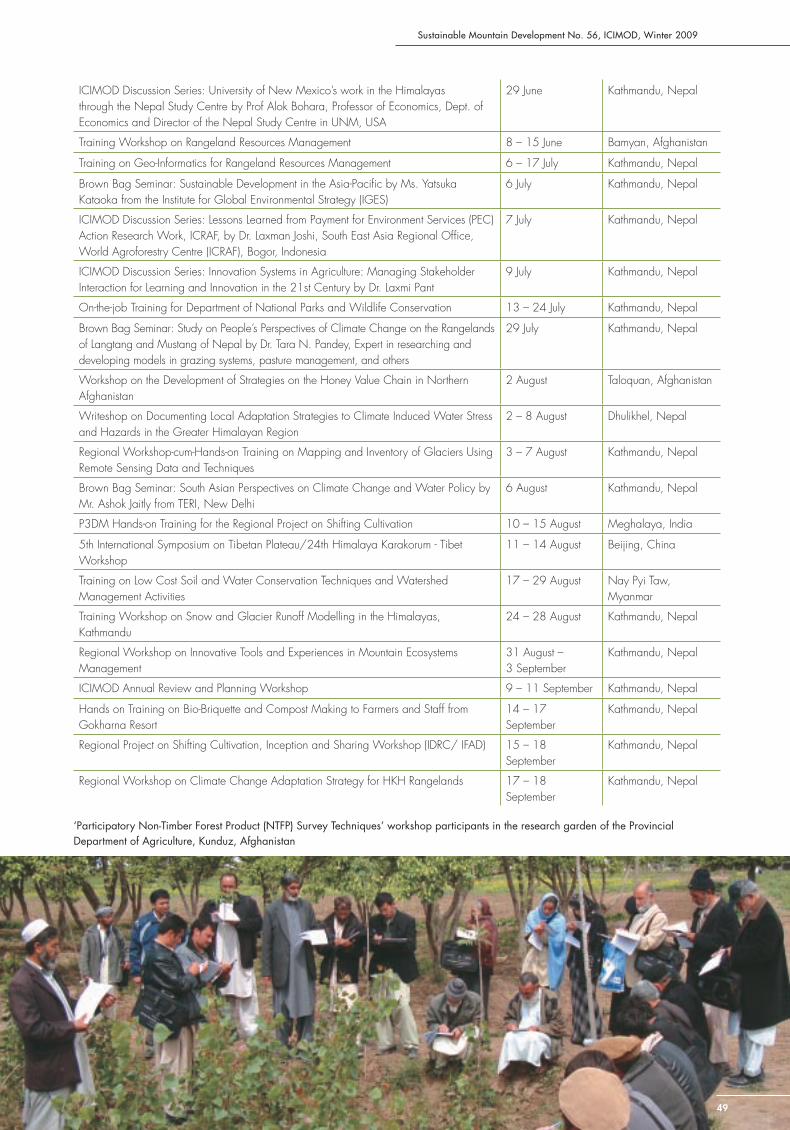
Sustainable Mountain Development No. 56, ICIMOD, Winter 2009
ICIMOD Discussion Series: University of New Mexico’s work in the Himalayas through the Nepal Study Centre by Prof Alok Bohara, Professor of Economics, Dept. of Economics and Director of the Nepal Study Centre in UNM, USA
29 June Kathmandu, Nepal
Training Workshop on Rangeland Resources Management 8 – 15 June Bamyan, Afghanistan
Training on Geo-Informatics for Rangeland Resources Management 6 – 17 July Kathmandu, Nepal
Brown Bag Seminar: Sustainable Development in the Asia-Pacifi c by Ms. Yatsuka Kataoka from the Institute for Global Environmental Strategy (IGES)
6 July Kathmandu, Nepal
ICIMOD Discussion Series: Lessons Learned from Payment for Environment Services (PEC) Action Research Work, ICRAF, by Dr. Laxman Joshi, South East Asia Regional Offi ce, World Agroforestry Centre (ICRAF), Bogor, Indonesia
7 July Kathmandu, Nepal
ICIMOD Discussion Series: Innovation Systems in Agriculture: Managing Stakeholder Interaction for Learning and Innovation in the 21st Century by Dr. Laxmi Pant
9 July Kathmandu, Nepal
On-the-job Training for Department of National Parks and Wildlife Conservation 13 – 24 July Kathmandu, Nepal
Brown Bag Seminar: Study on People’s Perspectives of Climate Change on the Rangelands of Langtang and Mustang of Nepal by Dr. Tara N. Pandey, Expert in researching and developing models in grazing systems, pasture management, and others
29 July Kathmandu, Nepal
Workshop on the Development of Strategies on the Honey Value Chain in Northern Afghanistan
2 August Taloquan, Afghanistan
Writeshop on Documenting Local Adaptation Strategies to Climate Induced Water Stress and Hazards in the Greater Himalayan Region
2 – 8 August Dhulikhel, Nepal
Regional Workshop-cum-Hands-on Training on Mapping and Inventory of Glaciers Using Remote Sensing Data and Techniques
3 – 7 August Kathmandu, Nepal
Brown Bag Seminar: South Asian Perspectives on Climate Change and Water Policy by Mr. Ashok Jaitly from TERI, New Delhi
6 August Kathmandu, Nepal
P3DM Hands-on Training for the Regional Project on Shifting Cultivation 10 – 15 August Meghalaya, India
5th International Symposium on Tibetan Plateau/24th Himalaya Karakorum - Tibet Workshop
11 – 14 August Beijing, China
Training on Low Cost Soil and Water Conservation Techniques and Watershed Management Activities
17 – 29 August Nay Pyi Taw, Myanmar
Training Workshop on Snow and Glacier Runoff Modelling in the Himalayas, Kathmandu
24 – 28 August Kathmandu, Nepal
Regional Workshop on Innovative Tools and Experiences in Mountain Ecosystems Management
31 August – 3 September
Kathmandu, Nepal
ICIMOD Annual Review and Planning Workshop 9 – 11 September Kathmandu, Nepal
Hands on Training on Bio-Briquette and Compost Making to Farmers and Staff from Gokharna Resort
14 – 17 September
Kathmandu, Nepal
Regional Project on Shifting Cultivation, Inception and Sharing Workshop (IDRC/ IFAD) 15 – 18 September
Kathmandu, Nepal
Regional Workshop on Climate Change Adaptation Strategy for HKH Rangelands 17 – 18 September
Kathmandu, Nepal
‘Participatory Non-Timber Forest Product (NTFP) Survey Techniques’ workshop participants in the research garden of the Provincial Department of Agriculture, Kunduz, Afghanistan
49
Centre News
50
Hosted institutions
Mountain Forum: Highlights from the Board Meeting, Cusco, Peru
The Mountain Forum (MF) Board of Governors has representatives from the regional host institutions and donor organisations, and elected members from user communities in the Andes and Asia-Pacifi c. The Board met in June in Cusco in the Andes to discuss overall progress and mountain development issues requiring coordination among the regional nodes and their user communities. The Board was pleased to note the growth in the number of user communities; the interaction of users through e-dialogues, e-conferences, discussion boards, and questions from users-to-users; and the development of a mountain repository.
The Board emphasised that the main spirit of MF is to act as a ‘network of networks’ with a small governance and coordination body and with information and communication exchange primarily executed by the regional nodes. In line with this, the global secretariat will be converted into a global node with reduced staff and the role of the regional nodes strengthened. The future work plan should look into the possibility of engaging new, active mountain institutes in regions currently under-represented especially Africa and Central Asia. These new regions have invested heavily in the past years in advanced telecommunication networks and the Board has noted their demand to be involved in knowledge transfer on mountain issues.
Dr Andreas Schild of ICIMOD explained that he would be unable to continue as Chair as implementation of ICIMOD’s ambitious Strategic Framework 2008-2012 required his full attention. This was diffi cult to combine with chairing MF through its own growth and transition phase. The Board nominated Robert Hofstede (formerly IUCN-Quito, Ecuador) as the new Chair and Daan Boom, ICIMOD, as Vice-Chair. In view of this, the future global node will be hosted by Condesan, the regional host organisation of MF in the Andes, from1 January 2010. The transition of the Global Node to Lima, Peru will not affect the activities of the Asia-Pacifi c Mountain Network, the node hosted by ICIMOD. The MF Board’s intention is to strengthen the regional node activities through more effective collaboration among the nodes and decentralisation of the global network functions.
Four new staff joined the Mountain Forum Secretariat to complete the outstanding activities in 2009: Ms Sunita Chaudhary for Advocacy and Policy Support; Ms Laura Elizabeth Keenan for Information Production
and Management; Mr Iñigo Ballester Gurpide for Information Technology and Knowledge Management; and Mr Prabin Gurung for Information and Knowledge Management Systems
Daan Boom, [email protected]
Asia Pacifi c Mountain Network
Asia-Pacifi c Mountain Network (APMN), the Asia-Pacifi c node of Mountain Forum (MF), continued to develop its activities as a knowledge-sharing platform connecting mountain regions and members through dialogue and networking. In July 2009, the network had 243 organisational and 1760 individual users from 39 countries.
APMN worked with ICIMOD’s knowledge management team to document knowledge and prepare daily briefs for the Innovation Asia-Pacifi c (IAP) Symposium held in Kathmandu in May. The event was organised by CIAT ICIMOD, and Prolinnova, in collaboration with LI-BIRD, and Practical Action – Nepal. The summer 2009 issue of the APMN newsletter appeared with a new name – Asia Pacifi c Mountain Courier – and a focus on mountain biodiversity with articles, news, interviews, seminar reports, book reviews, and other information. APMN is working closely with the Mountain Forum Secretariat and other regional nodes to collect users views on mountain biodiversity in response to the Convention on Biological Diversity (CBD) Secretariat’s call for inputs to the Conference of Parties (CoP) 10 to be held in Nagoya, Japan next year.
APMN is also working closely together with youth organisations based in South Asia to institutionalise youth issues in the mountain agenda. It supported the South Asian Youth Summit on Climate Change (SAYSoCC-09) organised from 3-6 September by Nepalese Youth for Climate Action; Clean Energy Nepal; the Indian, Bangladesh and Sri Lankan Youth Climate Networks; ‘350.org’; and ‘ENVIRON VISION’, an action initiative of the Youth Network for Social & Environmental Development.
Tek Jung Mahat, [email protected]
Sustainable Mountain Development No. 56, ICIMOD, Winter 2009
51
Mountain Partnership Secretariat – Asia Pacifi c Decentralised Hub (MPS-APDH)
The Mountain Partnership Secretariat’s Decentralised Hub for Asia and the Pacifi c (MPS-APDH) has been working towards strengthening the network through capacity building training and supporting members’ partnership initiatives. A month-long online training on advocacy was held for participants from thirteen Asia Pacifi c countries with a curriculum adapted from the training modules prepared by ICIMOD under the advocacy project. The hub now maintains a Yahoo discussion group on advocacy for sustainable mountain development .
An e-survey of MPS Asia Pacifi c members was carried out with technical support from the Mountain Forum Secretariat and had a 93% response rate. It integrated 70 questions which helped to rank and narrow down the wide range of thematic areas that resulted from the merging of MPS and ICIMOD programme focus areas. The highest ranking themes for members were ‘funding’ and ‘funders related info’. Also highlighted were the need for information sharing platforms, technical support for proposal development/submission, linkage/brokerage with potential donors, the development of training modules, and the launching of joint initiatives for fundraising. Eighty-three percent of respondents were fully aware of the networking tools offered by MPS, and seventy-fi ve percent considered them adequate for forging effective partnerships. The survey highlighted a demand for further diversifi cation of tools. Members also looked for ways to reach out to communities, have member forums in face-to-face meetings, and provide fi nancial support to country-based members.
The joint initiative on Central Asia Outreach (MP members AGOCA/Kyrgyzstan, Eco-Forum/Uzbekistan, and CAMP Kuhiston/Tajikistan) aims to raise awareness of the concept of sustainable mountain development and the challenges of mountain regions. The project facilitates information exchange and communication between the mountain regions to disseminate good practices. Papers by ICIMOD staff and others on such topics as mountain specifi cities, climate change impacts, glaciers, and the role of local and indigenous knowledge are being translated into Russian and published in national and local dailies and on websites of national information agencies in Kyrgyzstan, Tajikistan, and Uzbekistan. Customised radio programmes were designed and broadcast on national and local radio channels. A special bilingual blog (Russian/English) at http://www.ca-dialogue.blogspot.com invites civil society to discuss these papers. The project plans to hold live sessions and interviews for Q&A sessions.
Elbegzaya Batjarfal, [email protected]
South Asian Network for Development and Environmental Economics (SANDEE)
ICIMOD became the new host of the South Asian Network for Development and Environmental Economics (SANDEE) in August 2009. SANDEE, launched in 1999, is a regional network that uses economic tools and analyses to address some of South Asia’s environmental challenges. It is based on the premise that solutions to economic development concerns and environmental problems are integrally interlinked. SANDEE brings together South Asian researchers and institutes interested in the inter-connections among development, poverty, and the environment. Its main goal is to build the professional skills required to enable South Asians to address local and global environmental concerns. SANDEE works in seven countries in South Asia — Bangladesh, Bhutan, India, Maldives, Nepal, Pakistan, and Sri Lanka. Dr Priya Shyamsundar is SANDEE’s Programme Director and for many years has also been a consultant to the Environment Department of the World Bank, mostly on issues related to poverty and the environment. Priya has a PhD in Environmental Economics from Duke University USA. Her research interests range over a number of topics within environment and development economic. Dr Mani Nepal is an environmental/development economist and Senior Environment Economist at SANDEE. Dr Nepal has a PhD from the University of New Mexico, USA, in resource/environmental and development economics, and an MSc in Policy Economics from the University of Illinois, USA. His research work has been published in a number of international and national journal. Ms Anuradha Kafl e is SANDEE’S research and communication offi cer. She manages the information and research dissemination process, organises regional training workshops, and supports the implementation of programmes in under-served areas. She has a Master’s degree in Zoology with a major in Ecology from Tribhuvan University, Nepal. Her long-term research and activism interests are in wildlife conservation and natural resource management. Ms Krisha Shrestha joined SANDEE as an Administrative Associate in November 2008. She has a BSc in business administration from North-Eastern University, Boston. Krisha will be instrumental in managing SANDEE’s research activities and supporting SANDEE’s growth as an organisation. Her responsibilities include grants management, organising research workshops, and managing the administrative tasks of the secretariat. The ICIMOD family extends a warm welcome to the staff members of SANDEE and looks forward to fruitful collaboration in the days to come.
Centre News
52
Partnership development (April–September 2009)
Through its diverse strategic partnerships, ICIMOD is bringing together the active synergies of relevant institutions to address the emerging issues and challenges of mountain development in the region, including climate change, water hazards, and sustainable livelihoods. ICIMOD recognises that partnership is the main strategy for knowledge development, networking, and impact orientation. During 2009, ICIMOD entered into agreements with a number of strategic partners and international resource centres in order to realise its strategic outcomes. Selected agreements are highlighted below.
Climate change adaptation
In 2009, ICIMOD signed agreements with the International Institute for Environment and Development (IIED), UK, and the Stockholm Environment Institute, Bangkok, with the objective of providing technical and methodological backstopping and coordination to fi eld assessment teams on the identifi cation, collation, and assessment of policies and discourses, and analysing and synthesising the policies and information documented on local adaptation strategies in the context of ‘too much and too little water’. A Memorandum of Understanding was also signed between ICIMOD and SN Power Holding Singapore Pte Ltd to carry out a GLOF Hazard Assessment for the Tamakoshi River Basin. This study will be a part of the feasibility study for the Tamokoshi 3 hydroelectric projects.
Payment for environmental services (PES)
ICIMOD signed an agreement with the World Agroforestry Centre (ICRAF) for the further strengthening of strategic cooperation in promoting and understanding PES. This partnership was established in the context of the recently-initiated IFAD-funded RUPES-II project
(Rewards for, Use of, and Shared Investment in Pro-poor Environmental Services).
Capacity development
ICIMOD signed an MOU with The World Bank’s Offi ce of the South Asia Region Chief Economist, Washington DC to make a research capacity building grant to the South Asian Network for Development and Environmental Economics (SANDEE) programme, which is being hosted by ICIMOD.
Raising awareness of climate change and shifting cultivation
The uncertainties about and challenges to effective biodiversity conservation in the face of climate change in mountain regions is one of ICIMOD’s main concerns. ICIMOD signed agreements with the Namsaling Community Development Centre in Nepal to support conservation activities by promoting the landscape approach to biodiversity conservation; with the Nepal Chepang Association and LIBIRD to implement the Regional Project on Shifting Cultivation: ‘Promoting Innovative Policy and Development Options for Improving Shifting Cultivations in the Eastern Himalayas’; and with Initiatives for Development and Eco Action Support (iDEAS) to jointly raise awareness of the effects of climate change among the mountain community of the Khumbu region. Under the latter, an interschool art and letter writing competition was organised on the theme ‘Climate Change: Voices of Khumbu’s Children’; the winning entries will be highlighted at COP 15 in Copenhagen in December.
Regional knowledge sharing
ICIMOD signed agreements with the GB Pant Institute of Himalayan Environment and Development (GBPIHED) with the objective of fi lling knowledge gaps and gaining a better understanding of the impact of climate change on biodiversity and the environmental services provided by protected areas; and with FAST-National University of Computer and Emerging Sciences Islamabad, Pakistan, to explore research areas of mutual interest; share knowledge, research data, and publications; and support networking of experts and resource persons. An MOU was signed between the Institute of Tibetan Plateau Research (ITP), the Chinese Academy of Sciences (CAS), and ICIMOD to promote academic exchange and research on the natural environment of the Tibetan Plateau and surrounding areas.

Sustainable Mountain Development No. 56, ICIMOD, Winter 2009
Promoting value chains for sustainable livelihoods
ICIMOD signed a number of agreements with regional institutions to improve livelihoods through knowledge partnerships and value chains for bee products and services in the Himalayas including the Alital Multipurpose Cooperative Limited Nepal; the Honeybee Research Program; the National Agriculture Research Centre, Pakistan; NWFP Agriculture University Peshawar; Dr YS Parmar University of Horticulture and Forestry India; Bangladesh Institute of Apiculture; Central Himalayan Environmental Association (CHEA) India; the Federation of Nepal Beekeepers; and the Agha Khan Rural Support Programme, Pakistan.
Partnerships with international resource centres
Through its diverse strategic partnerships, ICIMOD is developing synergies among relevant institutions to address the emerging issues and challenges of mountain development in the region. ICIMOD sees partnership as the main strategy for knowledge development, networking, and impact orientation.
In order to strengthen research and capacity development in the area of natural resources, ecosystem services, policy, and governance, ICIMOD signed MOUs with several international resource centres including the Institute for Global Environmental Strategies, Japan, and the Global Biodiversity Information Facility. ICIMOD also entered into an
agreement with the newly-established Regional Mountain Centre of Central Asia for experience sharing and knowledge management beyond the boundaries of the Hindu Kush-Himalayan region.
Other agreements
ICIMOD also signed agreements with the following partner organisations:• Asia Network for Sustainable Agriculture and Bio
resources, Nepal • Federation of Community Forest Users Nepal,
(FECOFUN)• Institute for Social and Environmental Transition-Nepal• Council for RNR Research, Bhutan Ministry of
Agriculture, Thimpu, Bhutan • Beekeeping Development Section, Department of
Agriculture, Nepal• Institute of Tibetan Plateau Research, Chinese
Academy of Sciences, China• Local Initiatives for Biodiversity, Research and
Development (LI-BIRD), Nepal • Research Centre for Rural Economies, Ministry of
Agriculture, China• Gross National Happiness Commission, Bhutan
Ayushma Rana Basnyat, [email protected] Ahmad, [email protected]
Unplug and go!
Since May, ICIMOD has been charging its electric vehicles from a solar charging station. The three electric smart cars, used to take staff and visitors to meetings around Kathmandu, are now parked under a purpose built solar charging system where they can plug in and recharge at any time. The system has 28 photovoltaic panels each of 175 watt, which charge 24 2-volt deep cycle batteries, together with a recording device for the solar power input and usage metres charge controllers. Under ideal sunshine conditions, the station generates 4.9 kW electricity. Surplus electricity was used in the summer to power the lights of the ICIMOD compound at night through batteries.
53
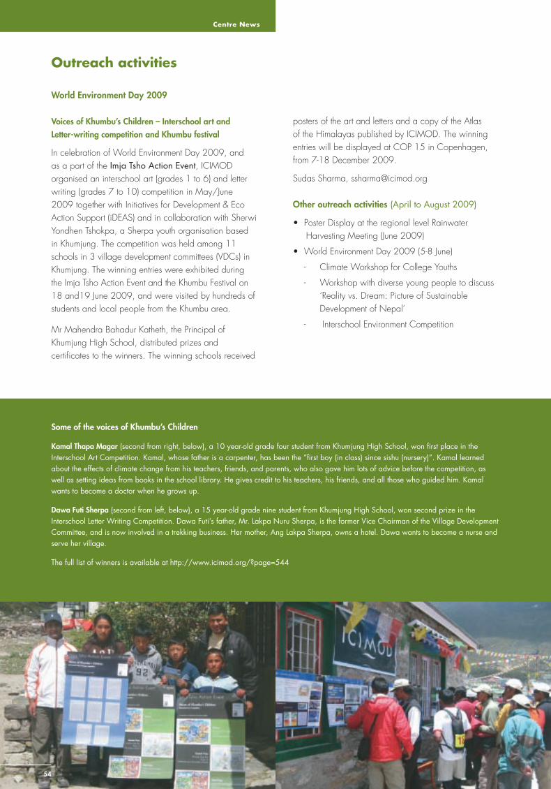
Centre News
54
Outreach activities
World Environment Day 2009
Voices of Khumbu’s Children – Interschool art and Letter-writing competition and Khumbu festival
In celebration of World Environment Day 2009, and as a part of the Imja Tsho Action Event, ICIMOD organised an interschool art (grades 1 to 6) and letter writing (grades 7 to 10) competition in May/June 2009 together with Initiatives for Development & Eco Action Support (iDEAS) and in collaboration with Sherwi Yondhen Tshokpa, a Sherpa youth organisation based in Khumjung. The competition was held among 11 schools in 3 village development committees (VDCs) in Khumjung. The winning entries were exhibited during the Imja Tsho Action Event and the Khumbu Festival on 18 and19 June 2009, and were visited by hundreds of students and local people from the Khumbu area.
Mr Mahendra Bahadur Katheth, the Principal of Khumjung High School, distributed prizes and certifi cates to the winners. The winning schools received
Some of the voices of Khumbu’s Children
Kamal Thapa Magar (second from right, below), a 10 year-old grade four student from Khumjung High School, won fi rst place in the Interschool Art Competition. Kamal, whose father is a carpenter, has been the ”fi rst boy (in class) since sishu (nursery)”. Kamal learned about the effects of climate change from his teachers, friends, and parents, who also gave him lots of advice before the competition, as well as setting ideas from books in the school library. He gives credit to his teachers, his friends, and all those who guided him. Kamal wants to become a doctor when he grows up.
Dawa Futi Sherpa (second from left, below), a 15 year-old grade nine student from Khumjung High School, won second prize in the Interschool Letter Writing Competition. Dawa Futi’s father, Mr. Lakpa Nuru Sherpa, is the former Vice Chairman of the Village Development Committee, and is now involved in a trekking business. Her mother, Ang Lakpa Sherpa, owns a hotel. Dawa wants to become a nurse and serve her village.
The full list of winners is available at http://www.icimod.org/?page=544
posters of the art and letters and a copy of the Atlas of the Himalayas published by ICIMOD. The winning entries will be displayed at COP 15 in Copenhagen, from 7-18 December 2009.
Sudas Sharma, [email protected]
Other outreach activities (April to August 2009)
• Poster Display at the regional level Rainwater Harvesting Meeting (June 2009)
• World Environment Day 2009 (5-8 June)
- Climate Workshop for College Youths
- Workshop with diverse young people to discuss ‘Reality vs. Dream: Picture of Sustainable Development of Nepal’
- Interschool Environment Competition

Sustainable Mountain Development No. 56, ICIMOD, Winter 2009
55
Himalaya – Changing Landscapes photo exhibition draws attention to global climate change
ICIMOD’s photo exhibition Himalaya – Changing Landscapes continued its European tour in 2009. The fi fth exhibition was organised in Bonn, Germany, from 1 to 12 June 2009 in conjunction with the UNFCCC climate change conference. The concept of the exhibition was extended with new photos to make it even more compelling. The repeat mountain panoramas and photos of the 1950s glacial research teams were complemented by repeat photographs of landscapes from the mid hills of Nepal and Pakistan. New repeat photos of people were also added, as well as pictures of cultural and socioeconomic changes in the region. The Bonn exhibition was displayed next to the hotel where the UNFCCC conference was being held, and on the way to many side events. The exhibition drew much interest amongst the conference participants and the employees of the German Ministries nearby and was extensively covered in both the local and international
media. The large European exhibition will now move to Switzerland where it will be shown in Berne in October. ICIMOD has received a steady stream of requests from its member countries to have the powerful photos exhibited in the region itself.
As the European exhibition is too large to be transported by air (the panels are 4 m x 2 m), ICIMOD has now created a small version of the exhibition. This ‘mobile exhibition’ fi ts inside a box and can travel on an aeroplane. Three sets arrived at ICIMOD headquarters in August 2009. Two will remain with ICIMOD and will be available to travel to different locations where they will be displayed for a limited period, one was custom-made for the GP Pant Institute of Himalayan Environment and Development, located in Almora, Uttarakhand, India.
Nonna Lamponen, [email protected]
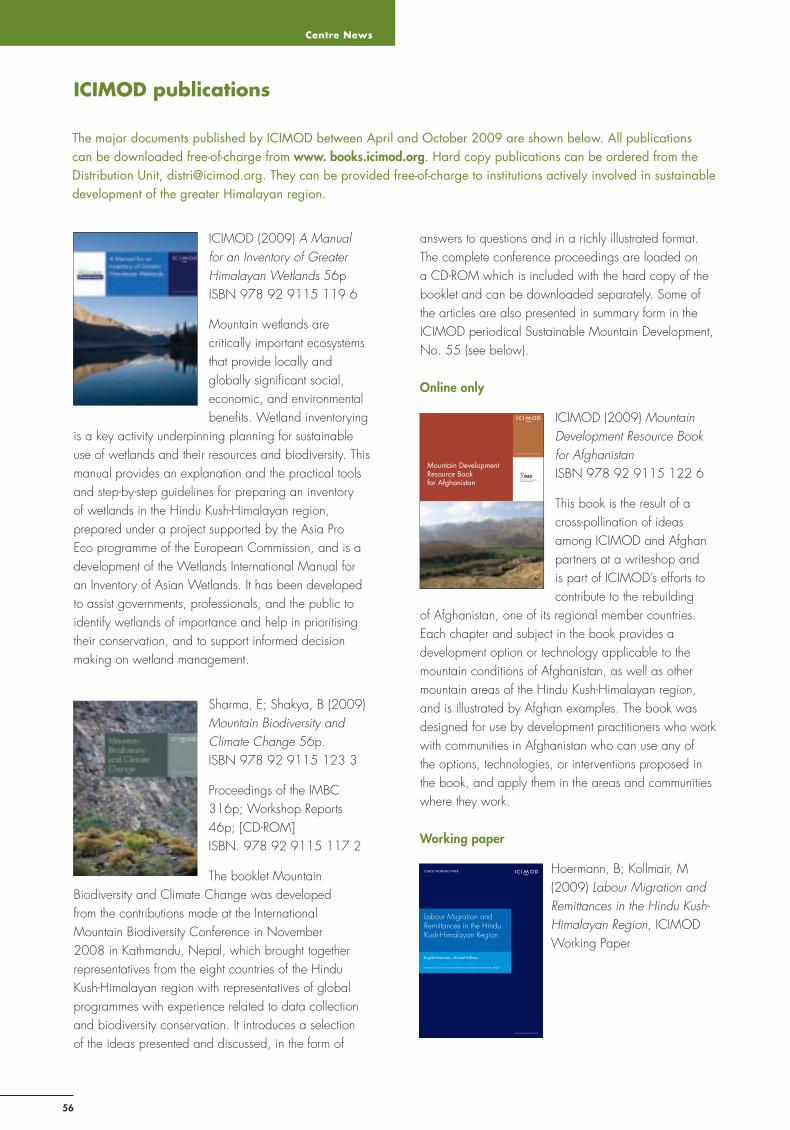
Centre News
56
ICIMOD publications
The major documents published by ICIMOD between April and October 2009 are shown below. All publications can be downloaded free-of-charge from www. books.icimod.org. Hard copy publications can be ordered from the Distribution Unit, [email protected]. They can be provided free-of-charge to institutions actively involved in sustainable development of the greater Himalayan region.
ICIMOD (2009) A Manual for an Inventory of Greater Himalayan Wetlands 56p ISBN 978 92 9115 119 6
Mountain wetlands are critically important ecosystems that provide locally and globally signifi cant social, economic, and environmental benefi ts. Wetland inventorying
is a key activity underpinning planning for sustainable use of wetlands and their resources and biodiversity. This manual provides an explanation and the practical tools and step-by-step guidelines for preparing an inventory of wetlands in the Hindu Kush-Himalayan region, prepared under a project supported by the Asia Pro Eco programme of the European Commission, and is a development of the Wetlands International Manual for an Inventory of Asian Wetlands. It has been developed to assist governments, professionals, and the public to identify wetlands of importance and help in prioritising their conservation, and to support informed decision making on wetland management.
Sharma, E; Shakya, B (2009) Mountain Biodiversity and Climate Change 56p. ISBN 978 92 9115 123 3
Proceedings of the IMBC 316p; Workshop Reports 46p; [CD-ROM] ISBN. 978 92 9115 117 2
The booklet Mountain Biodiversity and Climate Change was developed from the contributions made at the International Mountain Biodiversity Conference in November 2008 in Kathmandu, Nepal, which brought together representatives from the eight countries of the Hindu Kush-Himalayan region with representatives of global programmes with experience related to data collection and biodiversity conservation. It introduces a selection of the ideas presented and discussed, in the form of
answers to questions and in a richly illustrated format. The complete conference proceedings are loaded on a CD-ROM which is included with the hard copy of the booklet and can be downloaded separately. Some of the articles are also presented in summary form in the ICIMOD periodical Sustainable Mountain Development, No. 55 (see below).
Online only
ICIMOD (2009) Mountain Development Resource Book for Afghanistan ISBN 978 92 9115 122 6
This book is the result of a cross-pollination of ideas among ICIMOD and Afghan partners at a writeshop and is part of ICIMOD’s efforts to contribute to the rebuilding
of Afghanistan, one of its regional member countries. Each chapter and subject in the book provides a development option or technology applicable to the mountain conditions of Afghanistan, as well as other mountain areas of the Hindu Kush-Himalayan region, and is illustrated by Afghan examples. The book was designed for use by development practitioners who work with communities in Afghanistan who can use any of the options, technologies, or interventions proposed in the book, and apply them in the areas and communities where they work.
Working paper
Hoermann, B; Kollmair, M (2009) Labour Migration and Remittances in the Hindu Kush-Himalayan Region, ICIMOD Working Paper
Brigitte Hoermann, Michael Kollmair
International Centre for Integrated Mountain Development, Kathmandu, Nepal
Labour Migration and Remittances in the Hindu Kush-Himalayan Region
ICIMOD WORKING PAPER
Enabling poor rural peopleto overcome poverty
Mountain Development Resource Book for Afghanistan

Sustainable Mountain Development No. 56, ICIMOD, Winter 2009
57
Annual Report 2008
Newsletters
Biodiversity and Climate Change in the Himalayas: Sustainable Mountain Development, No. 55 (2009)
Asia Pacifi c Mountain Courier: Newsletter of the Asia Pacifi c Mountain Network, Volume 10, No. 1, June 2009
CNICIMOD Newsletter: Newsletter of the Chinese Committee on International Centre for Integrated Mountain Development, Volume 3, No.1 (published by CNICIMOD)
Information sheets
Responding to the Challenges of Global Change (ICIMOD Flyer) (Lang: Bhutanese)
Kathmandu Water Declaration – 2009
Water and Hazards: Key Achievements
Climate Change in the Himalayas, IS #3/09
Improving Livelihoods through Beekeeping – Knowledge partnerships and value chains for bee products and services in the Himalayas, IS # 4/09
Briefi ng papers
Socio-cultural Engagement and Sensitivity in Disaster Risk Reduction, BP #1/09
The Changing Himalayas: the impact of climate change on water resources and livelihoods in the greater Himalayas, BP #2/09
Project brochures
Working Today for a Better Tomorrow: Together we can care for Afghanistan’s natural resources!
The Mountain Partnership: Asia Pacifi c Decentralised Hub
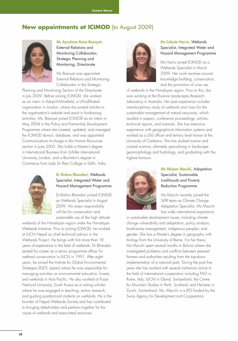
Centre News
58
New appointments at ICIMOD (to August 2009)
Ms Ayushma Rana Basnyat, External Relations and Monitoring Collaborator, Strategic Planning and Monitoring, Directorate
Ms Basnyat was appointed External Relations and Monitoring Collaborator in the Strategic
Planning and Monitoring Section of the Directorate in July 2009. Before joining ICIMOD, she worked as an intern in Adopt-A-Minefi eld, a UN-affi liated organisation in London, where she posted articles to the organisation’s website and assist in fundraising activities. Ms. Basnyat joined ICIMOD as an intern in May 2004 in the Policy and Partnership Development Programme where she created, updated, and managed the ICIMOD donors’ database, and was appointed Communications In-charge in the Human Resources section in June 2005. She holds a Master’s degree in International Business from Schiller International University, London, and a Bachelor’s degree in Commerce from Lady Sri Ram College in Delhi, India.
Dr Bishnu Bhandari, Wetlands Specialist, Integrated Water and Hazard Management Programme
Dr Bishnu Bhandari joined ICIMOD as Wetlands Specialist in August 2009. His major responsibility will be for conservation and sustainable use of the high altitude
wetlands of the Himalayan region under the Himalayan Wetlands Initiative. Prior to joining ICIMOD, he worked at IUCN Nepal as chief technical advisor in the Wetlands Project. He brings with him more than 18 years of experience in the fi eld of wetlands. Dr Bhandari started his career as a senior programme offi cer for wetland conservation in IUCN in 1991. After eight years, he joined the Institute for Global Environmental Strategies (IGES, Japan) where he was responsible for managing activities on environmental education, forests, and wetlands in Asia Pacifi c. He also worked at Pusan National University, South Korea as a visiting scholar where he was engaged in teaching, action research, and guiding postdoctoral students on wetlands. He is the founder of Nepal Wetlands Society and has contributed to bringing stakeholders and partners together for the cause of wetlands and associated resources.
Ms Celeste Harris, Wetlands Specialist, Integrated Water and Hazard Management Programme
Ms Harris joined ICIMOD as a Wetlands Specialist in March 2009. Her work revolves around knowledge building, conservation, and the promotion of wise use
of wetlands in the Himalayan region. Prior to this, she was working at the Riverine Landscapes Research Laboratory in Australia. Her past experience includes interdisciplinary study of wetlands and rivers for the sustainable management of natural resources, which resulted in papers, conference proceedings, articles, technical reports, and manuals. She has extensive experience with geographical information systems and worked as a GIS offi cer and tertiary level trainer at the University of Canberra. She has studied marine and coastal science, ultimately specialising in landscape geomorphology and hydrology, and graduating with the highest honours.
Ms Mirjam Macchi, Adaptation Specialist, Sustainable Livelihoods and Poverty Reduction Programme
Ms Macchi recently joined the SLPR team as Climate Change Adaptation Specialist. Ms Macchi has wide international experience
in sustainable development issues, including climate change vulnerability and adaptation; policy analysis; biodiversity management; indigenous peoples; and gender. She has a Master’s degree in geography with biology from the University of Berne. For her thesis, Ms Macchi spent several months in Bolivia where she investigated problems and confl icts between peasant farmers and authorities resulting from the top-down implementation of a national park. During the past fi ve years she has worked with several institutions active in the fi eld of international cooperation including FAO in Rome, Italy; IUCN in Gland, Switzerland; the Centre for Mountain Studies in Perth, Scotland; and Helvetas in Zurich, Switzerland. Ms. Macchi is a JPO funded by the Swiss Agency for Development and Cooperation.

Sustainable Mountain Development No. 56, ICIMOD, Winter 2009
59
Ms Anusha Joshi, Web Associate, Integrated Knowledge Management
Ms Joshi, a Nepali national, joined ICIMOD as a Web Associate in August 2009. She will be promoting ICIMOD’s web presence and managing its web
content. Prior to joining ICIMOD, she worked as the a knowledge management coordinator with BrightMind Synergy Pvt. Ltd., an IT company based in Kathmandu, where she also worked as a functional consultant for Naviworld Nepal. She has given lectures in ICT-related areas in Kathmandu College of Management, Kathmandu Engineering College, and Management Development Campus, the Management Association of Nepal, as a visiting lecturer. She has an ME in Information & Communications Technologies from the Asian Institute of Technology, Thailand.
Dr Giridhar Kinhal, Team Leader High Value Products & Value Chains, and Coordinator MAPPA, Sustainable Livelihoods and Poverty Reduction Programme
Dr. Kinhal joined ICIMOD as Team Leader High Value Products
& Value Chains, and Coordinator for the Medicinal and Aromatic Plants Programme in Asia (MAPPA) in April 2009. As an Indian Forest Service Offi cer with the Government of India, he brings with him more than 29 years of administrative and fi eld experience in forest management and research. As an Additional Secretary to the Government of Madhya Pradesh, he was involved in the development of several policy interventions in the forestry sector, especially in developing participatory forest management. Dr Kinhal has rich experience working in the NGO sector in addition to serving as a member on important national and international bodies. Dr. Kinhal has a Master of Professional Services degree in natural resource management and policy analysis from the State University of New York, College of Environmental Science and Forestry, Syracuse, and several technical papers on forestry issues to his credit in international and national journals and magazines, including a book on Adaptive Management of Medicinal Plants and NTFPs. He has twice been awarded the Brandis Memorial Prize by the ICFRE/Indian Forester, Dehradun, for his scientifi c papers.
Ms Noorin Nazari, Governance Specialist, Sustainable Livelihoods and Poverty Reduction Programme
Ms Nazari, an Afghan-Canadian national, joined ICIMOD in June 2009 as Governance Specialist to provide technical expertise and
support to the Improving Local Governance Project, and to mainstream good governance practices in ICIMOD at the level of both the organisation and its programmes. Ms Nazari has experience working in Afghanistan, Nepal, and Pakistan, and Canada and the United States, with national governments, the UN and civil society organisations. Ms. Nazari’s most recent experiences include working for the National Solidarity Programme in Afghanistan, where she was involved in the Afghan Government’s governance programme; as a subject matter expert working for the Centre for Intercultural Learning of the Canadian Department of Foreign Affairs and International Trade in Canada; and as a regional gender advisor working for the Canadian Centre for International Cooperation and Education in Nepal. Ms Nazari has a Bachelor’s degree in Public Affairs and Policy Management from Carleton University, Canada; and a Master’s degree in International Development - Project Management from Duke University, USA.
Ms Doma T Sherpa, Communications Associate
Ms Sherpa, a Nepalese national, joined ICIMOD as a Communications Associate in July 2009. Prior to this she worked as an intern with ICIMOD’s Public Relations unit for one
year and for a short time as a consultant within the Resource Mobilisation and External Relations unit. She was involved in different types of outreach and dissemination activities in both units, and especially with the photo exhibition: Himalaya – Changing Landscapes. She is currently pursuing a postgraduate degree in Environmental Management at the School of Environment Management and Sustainable Development (SchEMS) in Kathmandu, Nepal. A mountain person by birth, Ms. Sherpa enjoys working in this regional development and learning centre, and is pleased to have the opportunity to work for the betterment of mountains and people.

Centre News
60
Ms Anu Joshi Shrestha, High Value Chain Development Specialist, Sustainable Livelihoods and Poverty Reduction Programme
Ms Shrestha joined ICIMOD in August 2009 as Value Chain Development Specialist. She
brings with her extensive experience in working with development agencies and bi-lateral/multilateral organisations. Ms Shrestha will be focusing on high value product value chains, emphasising the equitable promotion of pro-poor value chains and strengthening rural-urban linkages. Prior to joining ICIMOD, she worked as an Advisor on local and regional economic development for GTZ INCLUDE, where she worked in the value chain promotion of various potential sectors for economic development in Palpa, Kapilbastu, and Rupendehi, including serving as the focal point for NTFP/MAPS value chains. Ms Shrestha has a strong interest in nature conservation and worked with the National Trust for Nature Conservation as a knowledge management offi cer. She was also a faculty member in Kathmandu College of Management, Kathmandu University. She has an MBA from the University of Wales, UK, specialising in marketing and human resources development.
Dr Golam Rasul, Division Head, Economic Analysis Division, Sustainable Livelihoods and Poverty Reduction Programme
Dr Rasul, a development economist, was appointed Head of the Economic Analysis Division in August 2009,
following fi ve years as a policy development specialist at ICIMOD. Dr Rasul is from Bangladesh and holds a PhD in regional and rural development planning from the Asian Institute of Technology (AIT), Thailand. He worked for many years in the Bangladesh Civil Service in different ministries and in fi eld administration in different capacities and was involved in the formulation and implementation of development planning and programming. As well as development work, he is actively involved in research in areas that include agriculture, natural resource management, poverty alleviation, and sustainable development in Bangladesh and the South Asian region. His research fi ndings have been published in many international journals and four of his papers have appeared as ‘most read papers’ in Science Direct. Dr Rasul will provide intellectual leadership to mainstream economic concepts, tools, and approaches to ICIMOD’s three Strategic Programmes with a view to contributing to the achievement of the strategic objectives of the Centre.
Sustainable Mountain Development No. 56, ICIMOD, Winter 2009
61
Sustainable Mountain Development periodical publication from the International Centre for Integrated Mountain Development, Kathmandu
LCCN - 00227124
Editorial contactICIMOD Publications, [email protected]
Guest editorial teamOuyang Hua, Mats Eriksson, Ramesh Ananda Vaidya
Issue coordinatorNira Gurung
Production team
Rosemary Thapa (Consultant Editor); A. Beatrice Murray (Senior Editor); Asha Kaji Thaku (Editorial Assistance); Punam Pradhan (Design and Layout)
Photos: Narendra Bajracharya - p 1, 44, 52, 53; Nabin Baral - pp 2, 27; AKRSP-Chitral - p 36; Dinesh Deokota - p37; Mats Eriksson - pp 2, 35; Ambika Gautam - p 49; CEE Himalaya - p 51; ITP - p 43; Ingrid Jaeger - p 2; Sharad Joshi - pp 2, 46; Bhaskar S Karky - pp 31, 33; Nonna Lamponen - p 55; C Murray - p 22; Sushil Kumar Shrestha* - p 17; Radio Sagarmatha - p 24; Salman Asif Siddiqui p 25; Sudas Sharma - p 54; Asha Kaji Thaku - p 12; Alex Treadway - pp 2, 4, 38, 39, 41; Karma Tshering - pp 2, 8, 9, 19; Robert Zomer - pp 44, 46; WIHG - p 42
* Entry from the digital photo contest ‘Mountains and People’ organised by ICIMOD and APMN/Mountain Forum in 2008. Details of the competition can be found at www.icimod.org/photocontest2008
The views and interpretations in this paper are those of the authors. They are not attributable to the International Centre for Integrated Mountain Development (ICIMOD) and do not imply the expression of any opinion concerning the legal status of any country, territory, city, or area of its authorities, or concerning the delimitation of its frontiers or boundaries.
ReproductionThis publication may be reproduced in whole or in part and in any form for educational or non-profi t purposes without special permission from the copyright holder, provided acknowledge-ment of the source is made. ICIMOD would appreciate receiv-ing a copy of any publication that uses this publication as a source. No use of this publication may be made for resale or for any other commercial purpose whatsoever without prior permis-sion in writing from ICIMOD.
This publication is available in electronic form at www.books.icimod.org
Printed by Sewa Printing Press, Kathmandu, Nepal

dfsdaa
62
Event Date Place
2008
Mountain Forum’s Asia Pacifi c Mountain Network (APMN) Board Election March - April Kathmandu, Nepal
Mountains and People Global Digital Photo Contest March - June Kathmandu, Nepal
Topographic Survey for Paghman Botanical Garden in Afghanistan 1 April Afghanistan
© ICIMOD 2009 International Centre for Integrated Mountain Development GPO Box 3226, Kathmandu, Khumaltar, Lalitpur, Nepal Tel +977-1-5003222 email [email protected] Web www.icimod.org