water resources - » explore nature
TRANSCRIPT


Water Resources Management Plan
Big South Fork National River and
Recreation Area
UNITED STATES DEPARTMENT OF THE INTERIOR NATIONAL PARK SERVICE

Water Resources Management Plan Big South Fork National River and Recreation Area
Prepared by:
Barbara Smyth Hamilton Environmental Specialist
Leslie Turrini-Smith Geologist
Tennessee Department of Environment and Conservation Division of Water Pollution Control
Watershed Management Section Nashville, TN
Approved by:
Date: 6-7-97
Superintendent,Big South Fork National River and Recreation Area

Big South Fork National River and Recreational Area Water Resource Management Plan
May 10, 1997
PREFACE
This Water Resources Management Plan (WRMP) is a 5-to-10 year planning document for the Big South Fork National River and Recreation Area, hereafter referred to as the Recreation Area. This WRMP addresses water quality and quantity issues and their monitoring and management. Biological resources management (e.g. reintroduction of species) and habitat management (e.g. riverine improvements to support fisheries) are not covered in this plan. The plan evaluates existing conditions of water resources, identifies water resources issues, and guides future management decisions regarding Recreation Area water resources. The purpose of the WRMP is to assist Recreation Area managers in making decisions and establishing priorities for the protection, use, conservation, and management of Recreation Area waters and water-related resources (National Park Service, 1991a). Water resources management for the Recreation Area is identified as the highest priority in both the Strategic Plan (National Park Service, 1990a) and the Resource Management Plan (National Park Service, 1990b). This WRMP is a component of the National Park Services comprehensive planning process as described in Management Policies (National Park Service, 1988), Planning Process Guideline (National Park Service, 1986), and Natural Resources Management Guideline (National Park Service, 1991b). These policies require that each National Park Service unit develop and implement a General Management Plan to provide the overall basis for manageing the unit's resources, uses, and facilities. In addition to the General Management Plan, each unit may develop appropriate `action" plans to address specific resource needs. This Water Resources Management Plan is such a plan. The Recreation Area is in the process of writing a General Management Plan and updating the Resources Management Plan; descriptions in this WRMP will support both these plans. This is the first Water Resources Management Plan written for the Recreation Area.

Big South Fork National River and Recreational Area Water Resource Management Plan
May 10, 1997
ACKNOWLEDGMENTS A Technical Advisory Team (see Appendix F) convened at the beginning of this planning process and helped identify water resources issues facing the Recreation Area. The following individuals provided data and information for inclusion in this plan: Kentucky Division of Forestry: Ken Thompson Kentucky Division of Mines: Shane Casebow Kentucky Division of Water: Terry Anderson, John Brumely, Roger Conn, Sarah Evans,
Bunny Fint, Joan Garrison, Morgan Jones, Lajaunda Maybriar, Larry Souter, Tom VanArsdall, Judy Ziegler
Kentucky Geologic Survey: Bart Davidson National Park Service: Steve Bakaletz, Brenda Coleman, Robert Emmott, Larry Heath,
Jeanne Richardson, Steve Seven, Etta Spradlin Natural Resources Conservation Service: Carol Chandler, Mike Glidewell Stearns Museum: Anna Mary Creekmore, Dawn Strunk, Warren Meadows Tennessee Department of Environment and Conservation: Tyler Alley, Fran Baker,
Lee Barron, Jonathan Burr, Greg Denton, David Duhl, Tim Eagle, David Greif, Deborah Hamilton, Evelyn Haskins, Bill Hench, Mike Hoyal, Kathy Larrieu, Kirk Pickering, Dave Turner, John West
Tennessee Department of Health: Debbie Arnwine Tennessee Division of Forestry: Hart Applegate, Ken Arney, David Arnold, Rick Merinar,
Bob Rochelle, Bob Wright Tennessee Division of Geology: Albert Horton Tennessee State Parks: Roy Jensen US Corps of Engineer: Don Getty US Geological Survey: Bradley Bryan, Dave Byrd, Harry Rollins US Forest Service: Jon Walker University of Tennessee: Steve Nodvin Some legislation descriptions were taken from the Colonial National Historic Park Water Resources Management Plan and the Big Cypress National Preserve Water Resources Management Plan. The Big Cypress National Preserve Water Resources Management Plan was used for format ideas; some text from the Water Resources Issues and Water Resources Management sections were taken from this plan. The following individuals reviewed drafts of this plan and made valuable suggestions: National Park Service: Steve Bakaletz, Don Forester, Jim Wiggins,
Dave Shan-ow, Dan McGlothlin Vanderbilt University: Doug Smith, Dr. Richard Steams Tennessee Division of Water Pollution Control: Greg Denton, Garland Wiggins, US Geological Survey: Bradley Bryan
ii

Big South Fork National River and Recreational Area Water Resource Management Plan
May 10, 1997
TABLE OF CONTENTS Page
Preface .......................................................................................................................i Acknowledgments .....................................................................................................u List of Figures ...........................................................................................................v List of Tables ...........................................................................................................vi INTRODUCTION .....................................................................................................1
Recreation Area Significance .......................................................................2 Need For A Water Resources Management Plan .........................................2
THE HYDROLOGIC ENVIRONMENT .................................................................3
Physiographic Region ..................................................................................3 Ecoregions ....................................................................................................3 Geology ........................................................................................................4
General Geology of the Cumberland Plateau ..........................................4 Geology of the Recreation Area ..............................................................4 Coal Deposits in the Recreation Area .....................................................8 Coal Mining History ................................................................................9 Oil and Gas in the Recreation Area .......................................................11
Soils ............................................................................................................11 General Soils Description ......................................................................11 County Soil Surveys ..............................................................................12
Climate .......................................................................................................12 Flora ...........................................................................................................14 Fauna ..........................................................................................................14 Rare and Endangered Flora and Fauna ......................................................15 Surface Water Resources ...........................................................................15 Watersheds .................................................................................................17 State Stream Classifications .......................................................................17 Surface Water alit 20
Acid Mine Drainage .............................................................................22 Sediment ...............................................................................................22 State Water Quality Assessments ........................................................23
How Characteristics ...................................................................................24 Surface Water Withdrawal .........................................................................28 Floodplains .................................................................................................29 Wetlands .....................................................................................................30 Groundwater Resources .............................................................................31
iii
Big South Fork National River and Recreational Area Water Resource Management Plan
May 10, 1997
Groundwater Withdrawal ..................................................................... 31 WATER RESOURCES MANAGEMENT PLANNING CONSIDERATIONS .. 33
Legislative and Regulatory Relationships ................................................. 33 Specific Federal Legislation ................................................................ 33 General Federal Legislation ................................................................. 35 State Legislation ................................................................................... 39 National Park Service Management Policies and Guidelines .............. 40
Land Use Considerations ........................................................................... 41 Land Use Within the Recreation Area Boundaries .............................. 41 External Land Use ................................................................................ 44
WATER RESOURCES MANAGEMENT OBJECTIVES ................................... 49 WATER RESOURCES MANAGEMENT ISSUES ............................................. 51
Programmatic Issues .................................................................................. 51 Specific Issues ............................................................................................ 57
WATER RESOURCES MANAGEMENT PROGRAM ................................. 63
Overview of Existing and Historic Programs ............................................ 63 Need for an Expanded Program ................................................................. 63
Inventory and Monitoring .................................................................... 64 Data Management ................................................................................ 64 Mitigation and Protection .................................................................... 65 Water Resources Staff .......................................................................... 66
REFERENCES ...................................................................................................... 68 PROJECT STATEMENTS .................................................................................... 78 APPENDICES A. County Soil Survey Data B. Aquatic Species of the Big South Fork River Watershed C. Acid Mine Drainage Process D. Recreation Area Facilities Water Supply and Wastewater Treatment Systems E. National Park Service Water Resource Management Objectives F. Multi-Agency Technical Advisory Team G. Additional USGS Gage Station Data
iv

Big South Fork National River and Recreational Area Water Resource Management Plan
May 10, 1997 LIST OF FIGURES
Figure Page
1. Location of Big South Fork National River and Recreation Area ................ 1 2. Generalized Stratigraphic Colunm for the Big South Fork
National River and Recreation Area Region ................................................ 5 3. Average Monthly Precipitation Record for Fentress and Pickett Counties .13 4. Big South Fork River Watershed and Subwatersheds ................................16 5. Mean Monthly Discharge for the Big South Fork River at Stearns, KY.....25 6. Representative Mean Annual Hydrograph for Seasonal Analysis ..............28 7. Big South Fork National River and Recreation Area Resources
Management Organization and Staff ……………………………………...67
v
Big South Fork National River and Recreational Area Water Resource Management Plan
May 10, 1997 LIST OF TABLES
1. Major Coal Mines Near Stearns, Kentucky ................................................10 2. Description of General Soil Groups within the
Recreation Area Watershed ..........................................................................12 3. Recreation Area Subwatersheds .................................................................16 4. Stream Use Classifications for the Tennessee Portion of the
Recreation Area Watershed ..........................................................................17 5. Stream Use Classifications for the Kentucky Portion of the
Recreation Area Watershed ..........................................................................19 6. Nondegradation Policy Categories for the Kentucky Portion
of the Recreation Area Watershed ...............................................................20 7. Natural Water Quality Parameters for Sandstone and
Limestone Streams in the Recreation Area ..................................................21 8. Unimpacted Sandstone and Limestone Streams in the Recreation Area ....21 9. Correlation of Stream Support Designations Between
Tennessee and Kentucky ..............................................................................23 10. Streams in the Recreation Area Watershed That Do Not Meet
State Designated Uses ..................................................................................24 11. Flood Frequency Analyses of Streams in the Recreation Area Watershed .26 12. Low Flow Analyses of Streams in the Recreation Area Watershed............27 13. Surface Water Withdrawal in the Recreation Area Watershed ..................29 14. Estimated Wetland Acreage South Fork Cumberland River Basin
in Kentucky ..................................................................................................30 15. Public Water Supply Wells in the Recreation Area Counties .....................32 16. Private Water Supply Wells in the Recreation Area Counties ...................32 17. State Roads in the Recreation Area ............................................................41 18. Flood Frequency of Lake Cumberland Pool Elevations .............................44 19. Timberland in the Recreation Area Watershed Counties ...........................45 20. Producing Oil and Gas Wells in the Recreation Area Watershed ..............46 21. Industrial NPDES Permits in the Recreation Area Watershed ...................46 22. Municipal NPDES Permits in the Recreation Area Watershed ..................47 23. Populations of Recreation Area Watershed Counties .................................47 24. State of Tennessee Monitoring Sites in the Recreation Area Watershed ...52 25. State of Kentucky Monitoring Sites in the Recreation Area Watershed ....53 26. National Park Service Water Quality Parameter ........................................53 27. National Park Service Water Quality Monitoring Sites
in the Recreation Area Watershed ................................................................54 28. Recreation Area Baseline Data ...................................................................56
vi

Big South Fork National River and Recreational Area Water Resource Management Plan
May 10, 1997
INTRODUCTION The Big South Fork National River and Recreation Area was established by Congress in 1974 "to conserve] and interpret[e] an area containing unique cultural, historic, geologic, fish and wildlife, archeological, scenic, and recreational values, [and] preserving as a natural, free-flowing stream the Big South Fork of the Cumberland River...". It was designated in response to two studies directed by Congress. The studies reviewed an US Army Corps of Engineers proposal to dam the South Fork Cumberland River at Devil's Jump and assessed alternative uses of the area. These studies recognized the outstanding resources of the river and gorge and the lack of economic justification for flood control and power generation (National Park Service, 1993a). The Recreation Area encompasses approximately 125,000 acres in northeastern Tennessee and southeastern Kentucky in some of the most rugged terrain of the Cumberland Plateau. The Recreation Area is located in portions of Fentress, Scott, Morgan, and Pickett Counties in Tennessee; and McCreary County in Kentucky (Fig 1). The South Fork Cumberland River, also referred to as the Big South Fork River, and its tributaries are the primary focus of the Recreation Area. It is included in the National Park System in recognition of the variety and abundance of natural and cultural resources within its boundaries.
FIGURE 1 Location of Big South Fork National River and Recreation Area
1

Big South Fork National River and Recreational Area Water Resource Management Plan
May 10, 1997
RECREATION AREA SIGNIFICANCE The Recreation Area is a unique and significant resource in the following ways: • South Fork Cumberland River is one of the few remaining free flowing rivers in the region. • The Recreation Area contains a large variety of habitats in a limited area and protects a diversity of
rare, endangered, and threatened species. • The Recreation Area contains unique geological formations, including deep gorges. • It is one of the most significant archeological sites in the Southeast and has an estimated 10,000 sites
within the Area. • It provides one of the best opportunities for activity in the Southeast. • It has been specifically recognized by Congress as important to the regional economy. • The Recreation Area provides opportunities for various types of outdoor recreation in one area and is
accessible to many of the Southeast cities. (National Park Service, 1993a, 1994c).
NEED FOR A WATER RESOURCES MANAGEMENT PLAN
The Recreation Area was designated in part to preserve and protect the South Fork Cumberland River. At the time the Recreation Area was designated, the land was already a product of long-term intensive land use including coal mining, timber harvesting, oil and gas operations, and the associated network of largely unmaintained roads. Water resources suffer the legacy of these land uses including contaminated mine drainage and sediment. While some of these issues have been addressed, water resources continue to be threatened by current and future intensive land uses in the Recreation Area watershed. Today, the water resources issues facing the Recreation Area are both varied and diverse.
Several water quality and aquatic fauna surveys were completed in the late 1970s and early 1980s. While a basic hydrologic monitoring program has been in place since 1982, comprehensive analysis of the data has not been completed since 1984. Mitigation activities within the Recreation Area, such as restoration of abandoned coal mines, have been completed as funds allow. Some proposals for funding and management have been included in the Resources Management Plan . This Water Resources Management plan, the first for the Recreation Area, provides a foundation for the Recreation Area's water resources management program over the next 5 - 10 years.
2

Big South Fork National River and Recreational Area Water Resource Management Plan
May 10, 1997
THE HYDROLOGIC ENVIRONMENT This chapter describes the physiographic regions, geology, soils, climate, flora, fauna, ecoregions, surface water resources, and groundwater resources of the Recreation Area. It provides a summary of what is currently known about the water resources of the Recreation Area and its watershed, and provides a basis for identifying and evaluating water resources management issues.
PHYSIOGRAPHIC REGION The Big South Fork watershed is wholly contained within the Cumberland Plateau physiographic province, which is the southern portion of the Appalachian Plateaus structural province. The Cumberland Plateau is bordered on the east by a prominent escarpment, adjacent to the Valley and Ridge province. The more irregular western margin is contiguous with the eastern Highland Rim in Tennessee and the correlative Pennyroyal Plain in Kentucky, which are both included in the Interior Low Plateau province. The Cumberland Plateau within the Big South Fork watershed is generally flat to undulating, with slopes averaging 25 percent, and elevations that range from 1700 to 2000 feet (Parker and Carey, 1980). The northeast-southwest trending Cumberland Mountains, located in the southeastern portion of the watershed, are characterized by steep terrain with slopes averaging 20 to 60 percent, and reach elevations of over 3500 feet (Beatty, 1982). The Big South Fork River drains the Plateau toward the north, flowing into the Cumberland River and eventually Lake Cumberland. The topography of the Recreation Area is characterized by a dendritic drainage pattern and narrow, v-shaped gorges created by stream incision. The headwaters of the Big South Fork River have deeply dissected stream valleys with no floodplain development. Further downstream and to the north, the terrain is less rugged with minor floodplain development.
ECOREGIONS Ecoregions are defined as "regions of relative homogeneity in ecological systems and relationships between organisms and their environments" (Omernik, 1995). Ecoregions are a spatial framework which allow effective structuring of resource monitoring, assessment, and management. The entire Recreation Area watershed is located within the Central Appalachian ecoregion. The Tennessee Department of Environment and Conservation, in conjunction with the Environmental Protection Agency, is currently delineating sub-ecoregions within Tennessee. In the Tennessee portion of the Recreation Area watershed, the Central Appalachian ecoregion may be subdivided into the Cumberland Plateau, the Plateau Escarpment, and the Cumberland Mountain ecoregions. Delineation and descriptions are currently in review and are expected to be finalized in 1997.
3

Big South Fork National River and Recreational Area Water Resource Management Plan
May 10, 1997
GEOLOGY
General Geology of the Cumberland Plateau The Cumberland Plateau is generally underlain by shales and conglomeratic sandstones with lesser amounts of siltstone and coal of Pennsylvanian age. The most completely preserved section of Mississippian and Pennsylvanian rocks in the state of Tennessee is found on the Cumberland Plateau (Milici et al., 1979). These rocks form a stratigraphic wedge of deposits that increases in thickness from 600 feet in the west to approximately 3,000 feet in the east. The regolith of the Plateau averages 2 to 3 feet in thickness with anomalous thicknesses of up to 30 feet in some fractures and joints (Beatty, 1982). The lower part of the Mississippian and Pennsylvanian sequence is generally composed of carbonate rocks that were deposited on a relatively shallow, stable platform in the west and terrigenous clastic and carbonate rocks deposited in a foreland basin in the east (Rice, 1994; Milici et al., 1979). The upper part of the sequence consists predominately of coal-bearing, terrigenous, clastic deposits that represent either coastal barrier island-lagoon or deltaic depositional environment. The lower carbonate sequence is separated from the upper coal-bearing terrigenous beds by a transitional unit referred to as the Pennington Formation. The Pennington Formation is a heterogeneous unit composed of various lithologies. In general, the lower carbonate rocks and the Pennington Formation are Mississippian, and the overlying terrigenous, clastic rocks are Pennsylvanian (Milici et al., 1979).
Geology of the Recreation Area There is no published information specific to the Recreation Area about the hydrologic influence of the stratigraphy and geologic structures. Therefore, the specific hydrogeologic character of the strata, such as hydrologic conductivity and aquifer/aquitard potential of each formation, within the Recreation Area, is not available. In general, sandstones tend to be good aquifers, while shales and clays are usually aquitards. Individual formation characteristics, such as degree and type of cementation, influence the hydrologic functioning of the strata. A published geologic map or stratigraphic column specific to the Recreation Area or Recreation Area watershed does not exist. However, general information is available from published Kentucky geologic quadrangles (1:24,000 scale) and a statewide Tennessee geologic map (1:100,000 scale) (Pomerene, 1964a, 1964b; Tennessee Division of Geology, 1966). A simple discussion of the Recreation Area stratigraphy is difficult because of unresolved formation nomenclature and poor regional formation correlation, especially across the Kentucky-Tennessee state line. The lithostratigraphic problems arise from several regional characteristics: stratigraphic and structural complexity, historical miscorrelations of many key stratigraphic beds because of lateral facies changes, and dissection by major faults and mountain divides (Rice, 1994, 1984; Luther, 1959). A generalized stratigraphic column for the region is given in Figure 2.
4

Big South Fork National River and Recreational Area Water Resource Management Plan
May 10, 1997 FIGURE 2
Generalized Stratigraphic Column for the Big South Fork River and Recreational Area Region
After Jackson, 1984 The Recreation Area upper watershed is structurally dominated by the Wartburg Basin, a structural low in Scott, Morgan, Anderson, and Campbell Counties, Tennessee. The Wartburg Basin is bounded on the
5

Big South Fork National River and Recreational Area Water Resource Management Plan
May 10, 1997
northeast, southeast, and southwest by faults. Rock strata may dip steeply adjacent to these faults, but flatten quickly to a gentle dip toward the center of the Basin. Strata from the northwest and southwest also dip gently into the Basin. Some low relief anticlinal and synclinal structures are contained within the Wartburg Basin (Kimball, 1979). No major faults have been identified within the Recreation Area boundaries (Tennessee Division of Geology, 1966; Pomerene, 1964a, 1964b). In general, the geology of the Recreation Area is characterized by parallel, horizontally-bedded sedimentary rocks of Pennsylvanian and Mississippian age. These rocks are predominately sandstone and shale, and include siltstone, conglomerate, and coal. The specific geologic formations found in the Recreation Area are described below. Where possible, all known formation names used to reference to each unit are provided (Beatty, 1982). The oldest rocks exposed in the Recreation Area belong to the Pennington Formation, which presently crops out in the bottom of the gorge. The Pennington however, is not exposed at the origin of the Big South Fork River, at the confluence of the New and Clear Fork Rivers, because the river has not downcut through the younger formations to expose the Pennington. The Pennington Formation is a heterogeneous unit composed of reddish and greenish shale and siltstone, fine-grained dolomite, dark-gray limestone, and thin-bedded sandstone (TN Division of Geology, 1966). A persistent dolomite bed, ranging from 3 to 33 feet thick, is found at the base of the unit. Unit thickness ranges from 150 to 400 feet (TN Division of Geology, 1966). The Pennington in Tennessee was deposited in a littoral, but not deltaic, depositional environment (Milici et al., 1979). Because this unit is not very resistant, further bed degradation, or downcutting, by the river is expected, thus resulting in gorge deepening. Little floodplain development occurs because steep gradients favor stream bed degradation over lateral planation (US Army Corps of Engineers, 1974). The Pennsylvanian Fentress Formation overlies the Pennington Formation. This formation forms most of the slopes within the gorge. The Fentress Formation is a mostly dark-gray to light-brown shale, with minor siltstone and sandstone, and the Wilder coal layer near the middle. The Fentress Formation is equivalent to the Gizzard Group and all the Crab Orchard Mountains Group below the Rockcastle Conglomerate. The regional difficulty in stratigraphic reconstruction is exemplified by the boundary between the Gizzard Group and the Pennington Formation near the Recreation Area. Complex facies relationships result in beds that intertongue both laterally and vertically (Milici et al., 1979). The Gizzard Group includes three members: the Raccoon Mountain Formation, the Warren Point Sandstone, and the Signal Point Shale. The Crab Orchard Mountains Group, below the Rockcastle, comprises the Sewanee Conglomerate, Whitwell Shale, Newton Sandstone, and Vandever Formation. None of these units are separable in the Fentress Formation. The Kentucky equivalent of the Tennessee Fentress Formation is largely the Beattyville Shale Member of the Lee Formation (US Army Corps of Engineers, 1974). The Beattyville Shale includes shale, siltstone, sandstone, and coal. The shale is light gray, dark gray, or brown; locally carbonaceous or sandy. The siltstone is banded light gray to dark gray when fresh but rapidly weathers, turning brown and breaking into shaley laminae. Thickness reaches 340 feet in Tennessee, but ranges from 130 to 290 feet in Kentucky (TN Division of Geology, 1966; US Army Corps of Engineers, 1974). Coal beds occur in several horizons in this member. The Stearns Coal Zone, consisting of numerous discontinuous, scattered coal beds, is located near the base of the Beattyville Shale (Pomerene, 1964a). A thinner, discontinuous coal layer outcropping near Stearns, Kentucky, is the Beaver Creek coal bed, located between the Beattyville Shale, and the next younger unit, the Rockcastle Conglomerate (Pomerene, 1964b). The name "Beattyville Shale Member" has been discontinued because it is poorly defined and has been applied to different stratigraphic intervals (Rice, 1984). The Pennsylvanian Rockcastle Conglomerate lies disconformably above the Fentress Formation and the Beattyville Shale Member of the Lee Formation. The Rockcastle Conglomerate is the top unit of the Crab Orchard Mountains Group in Tennessee, and is within the Lee Formation in Kentucky. This highly-resistant, massive, cross-bedded conglomerate forms the conspicuous, vertical and overhanging cliffs
6

Big South Fork National River and Recreational Area Water Resource Management Plan
May 10, 1997
visible along the walls of the Big South Fork gorge (US Army Corps of Engineers, 1974; Pomerene, 1964a, 1964b). The numerous talus blocks lying at the bottom of the gorge and in the river bed are typically derived from this formation (US Army Corps of Engineers, 1974). The Rockcastle Conglomerate is a widespread layer of orthoquartzite found throughout most of the central and northwestern parts of the Cumberland Plateau, and is therefore a more consistently mappable unit than many other formations found in the area (Milici et. al, 1979). Accordingly, the Rockcastle Conglomerate is the predominant rock type exposed on the plateau surfaces, particularly west of the gorge, and to a lesser extent along the east plateau surface (TN Division of Geology, 1966). In Tennessee the Rockcastle Member is described as a gray to brown, fine- to coarse-grained sandstone and conglomeratic sandstone with locally conspicuous crossbedding. A thin coal-bearing shale, the Nemo coal bed, is locally present near the middle. The thickness ranges from 150 to 220 feet in Tennessee and from 50 to 250 feet in Kentucky (US Army Corps of Engineers, 1974; TN Division of Geology, 1966; Pomerene, 1964a, 1964b). The Pennsylvanian Crooked Fork Group of Tennessee lies stratigraphically above the Rockcastle Conglomerate Member of the Crab Orchard Mountains Group. The sandstone units of the Crooked Fork Group often form the small, highest cliff exposures along the gorge rim (US Army Corps of Engineers, 1974). The Crooked Fork Group consists of succession of six shale and sandstone formations: Dorton Shale, Crossville Sandstone, Burnt Mill Shale, Coalfield Sandstone, Glenmary Shale, and Wartburg Sandstone. The Kentucky equivalent is the lower Breathett and the upper Lee Formation consisting of siltstone and sandstone units, with the Barren Fork coal bed near the base (US Army Corps of Engineers, 1974; Pomerene, 1964b). The Dorton Shale member of the Crooked Fork Group is characterized as a mostly dark-gray to light-brown shale, with minor siltstone and sandstone, and a thin coal layer near the top. The only economic coal deposit in this group is the Rex Coal, located as much as 70 feet above the base of the unit (Milici, et. al. 1979; TN Division of Geology, 1966). The thickness reaches 150 feet in Tennessee. The Crossville Sandstone Member of the Crooked Fork Group lies above the Dorton Shale. This sandstone is described as gray to brown or pink, fine- to medium-grained, thinly and evenly bedded. The thickness is from 30 to 70 feet (TN Division of Geology, 1966). The Kentucky equivalent is the Corbin Sandstone Member at the top of the Lee Formation (US Army Corps of Engineers, 1974). The Corbin Sandstone is massive to thin bedded. Massive beds form smoothly rounded outcrops or ledges and cliffs in the vicinity of Stearns, Kentucky. The Corbin Sandstone thins to the south, becoming thin bedded and lenticular (Pomerene, 1964b). The Burnt Mill Shale, stratigraphically above the Crossville Sandstone, is a mostly dark-gray to light-brown shale, with minor siltstone, and thin sandstone locally present near the base. This shale is present only on a few of the highest ridges and hills, but is significant because it interferes with groundwater recharge (US Army Corps of Engineers, 1974). The Hooper Coal deposit is located just above the base (Luther, 1959). The Burnt Mill Shale Member is as much as 110 feet thick (TN Division of Geology, 1966). This shale unit is also the base of the Breathitt Formation (Milici et al., 1979). In Kentucky, above the Lee Formation is the Breathitt Formation. The Breathitt Formation is a shale, siltstone, sandstone, and coal unit of Middle Pennsylvanian age. The shale is light to dark gray or brown; sometimes carbonaceous; generally poorly exposed; forming even slopes. The siltstone is light to dark brown, and weathers to thin, shaley laminae. The sandstone is coarse to medium grained; medium weathers to brown to pink; where massive, forms smoothly rounded outcrops on upland surfaces and cliff where headward erosion of streams is rapid. The River Gem is one mineable coal bed in this unit that outcrops in the Whitley City quadrangle (Pomerene, 1964b).
7

Big South Fork National River and Recreational Area Water Resource Management Plan
May 10, 1997
Coal Deposits In the Recreation Area Watershed The important coal beds in the headwaters of the Recreation Area in the New River watershed include the Big Mary, Jellico, Pewee, and Coal Creek (Nodvin et al., 1992; Kimball, 1979; Luther, 1959). In the Kentucky portion of the Recreation Area, the major coal beds are the Stearns Coal Zone in Beattyville Shale, the Barren Fork in the Lee Formation, and the River Gem in the Breathitt Formation (Pomerene, 1964a, 1964b). The following discussion summarizes the important economic coal deposits found in each county of the Recreation Area watershed. All data, unless noted otherwise, are from Luther (1959). The headwaters of the New River, located southeast of the Recreation Area, are in small portions of northwest Anderson County and southwest Campbell County. These two counties have the greatest thickness of coal-bearing strata of any Tennessee counties. In Anderson County, the most important coal-producing seams are found among the following six rock groups (listed from oldest to youngest): Slatestone, Indian Bluff, Graves Gap, Redoak Mountain, Vowell Mountain, and Cross Mountain. There are 11 recoverable reserve coal beds within these six rock groups and within the county. These six groups are not present within the Recreation Area boundaries; all of them lie stratigraphically above the formations found in the Recreation Area as described previously. Campbell County also has a natural abundance of coal reserves. Coal bearing strata are found in the same six rock groups as in Anderson County, with the addition of the younger Crooked Fork Group. There are 35 named coal beds in these seven rock groups, of which 17 contain known recoverable reserves. These 17 beds are the greatest number of economically-important coal seams in any of the Tennessee coalfield counties. Total recoverable reserves in Campbell County is also the largest for any Tennessee county. The Rex Coal seam, occurring at the base of the Crooked Fork Group, is the stratigraphically lowest of all the commercially important coal beds in the county. The Crooked Fork Group with the Rex Coal seam is found within the Recreation Area watershed. The majority of the Recreation Area is located in Scott County. The maximum thickness of coal-bearing Pennsylvanian strata are found in the southern part of Scott County, outside Recreation Area boundaries, but within the Recreation Area watershed. Only five of the nine rock groups found in the county contain known recoverable coal reserves: Gizzard, Crooked Fork, Slatestone, Graves Gap, and Redoak Mountain. Of these five groups, Crooked Fork and Redoak Mountain contain 80 percent of the county's recoverable reserves. Scott County has 32 named coal seams, of which 10 are economically important. Poplar Creek is the most important coal seam in the county. Although the Poplar Creek seam is very widespread in the county, it is also extremely irregular, and is not found in the Recreation Area. This seam has been both strip and deep mined on a large scale. It has been mined in the headwaters area of the Recreation Area watershed, including along Bear Creek, a tributary to the Big South Fork River. A smaller, older coal bed, the White Oak coal, is found along the North Whiteoak Creek tributary, west of the Big South Fork River. The eastern portion of Fentress County is contained within the Recreation Area watershed. The Pennsylvanian rocks that form the caprock on top of the Cumberland Plateau in eastern Fentress County reach a maximum thickness of 1,100 feet. These Pennsylvanian rocks belong to three rock groups that are also found in the Recreation Area: Gizzard, Crab Orchard Mountains, and Crooked Fork. The Rockcastle Conglomerate Member of the Crab Orchard Mountains Group forms the surface rock over most of the county. Only the two lower groups, the Gizzard and Crab Orchard Mountains, contain known recoverable reserves. There are 14 named coal beds in Fentress County. Only five of these beds contain known recoverable reserves. Wilder Coal within the Fentress Formation is the most important coal seam, and the only one to have been mined on a large scale in the county.
8

Big South Fork National River and Recreational Area Water Resource Management Plan
May 10, 1997
Coal Mining History Coal mining has been pivotal in the economic and cultural development of the Cumberland Plateau, including the region of the Recreation Area. Prior to the Civil War, extensive coal mining was not economically feasible. The small amounts of coal mined were floated on boats to Burnside, KY during the rainy season. From Burnside, the coal was loaded on steamers and barged to Nashville (source: 1913 report, Stearns Museum). In 1880, the advent of the railroad into the region transformed the local economy when the Southern Railway was completed to link Cincinnati with Chattanooga. The railroad provided access to coal, virgin timber, equipment, a labor force, and provided the means of shipping coal and lumber to market. Many small towns dependent upon the burgeoning mining and lumber industries were built near the turn of the century (O'Neal, 1988; Kimball, 1979; Luther, 1959). Most of the early coal mines in the Recreation Area were "drift" mines, or tunnels into a hillside that sloped down to a coal seam. The only shaft mine was "Justus", located outside the Recreation Area (Steams Museum). After WWII, many areas in the Recreation Area were strip mined, including the River Gem coal bed near Roaring Paunch Creek by Pine Knott, Kentucky, and Straight Fork and Brimstone Creeks in the New River watershed (Kimball, 1979; Pomerene, 1964b). Strip mining has become the dominant method of coal extraction in the area (Kimball, 1979). Coal mining has impacted the water quality of many of the streams in the region. Historically, large amounts of sediment and debris were introduced into the streams during the mining process. Waste water from coal processing also contributed to water quality degradation. Groundwater flow patterns are often disrupted by the mining activity. Today, many of the abandoned coal mines continue to severely impact both surface and ground water quality by the leaching of sulfuric acid from the pyritic shales found in the waste material. Stearns, Kentucky The largest coal mining operation in the Recreation Area was the Steams Coal and Lumber Company, founded by J.S. Steams in 1902 (Birdwell, no date). Stearns, Kentucky was the company town built by the Steams Coal and Lumber Company. Large scale underground coal mining began in the area when Steams built a narrow-gauge railroad from Mine 1 at Barthell on Roaring Paunch Creek to connect with the new Southern Railway (Steams Ranger District, 1966; Pomerene, 1964a). The Steams Company employed 1300 miners in 1916. Coal mining in the Steams area peaked in 1929 producing 1,000,000 tons of coal (Manning, 1994). A summary of the mining activity in the Steams area is shown in Table 1.
9

Big South Fork National River and Recreational Area Water Resource Management Plan
May 10, 1997 TABLE 1
Major Coal Mines Near Stearns, Kentucky
Mine Name Open date Close Date Other Information Barthell #1 1902 1961 oldest mine entrance. Worley 1904 1953 best producing mine and best quality coal called "Golden
Eagle". Average seam 52" Yamacraw 1907 1949 Carmago 1907 1929 Fidelity 1916 1938 located on Rock Creek Co-operative 1922 1950 located on White Oak Creek. An operator-owned mine,
not owned by Steams Company Blue Heron 1938 1962 see notes below Oz 1924 1959 Justus 1968 1987 highly mechanized Exodus 1918 n/a Paint Cliff n/a n/a located on White Oak Creek Source: Stearns Museum
Mining concentrated in several productive coal beds in the middle and lower Beattyville Shale Member of the Lee Formation, especially near Stearns, Kentucky. Coal production from the Beattyville Shale has been considered by the miners to have come from three coal beds, known locally as the Stearns No. 1, No. 1-1/2, and No. 2 (Meadows, pers. comm.; Pomerene, 1964a). The stratigraphy of the Stearns coal zone is probably more complex: the major beds are lenticular, thickening and thinning relatively abruptly. Coal beds may be continuous for a few hundred feet and then merge with another, or split into several very thin seams (Pomerene, 1964a). Blue Heron was a modem tipple operation operated by the Steams Company, and considered the state-of-the-art at the time. The Blue Heron Mine opened in 1938 and after 18 months had mined all of the #1 grade coal, totaling 250,000 tons. The mine became a financial liability and was closed in 1963. Today, the Blue Heron mining community and the original narrow-gauge railroad have been restored. The reconstructed Blue Heron mining camp is now an interpretive center in the Recreation Area. The first commercial coal mining in Scott County began in 1880 near Glenmary (O'Neal, 1988). J.S. Crooke and partners organized the Crooke Coal Company in 1880, which became the economic base for Coal Hill in Scott County (O'Neal, 1988). The Crooke Coal Company was sold in 1884 to become the Glenmary Coal and Coke Company, eventually the largest mining company in Scott County at the turn of the century. Peak production years during the late 1880's averaged 350 tons of coal mined per day, with a record total of 101,142 tons in 1891. The Glemnary mines employed between 100 to 250 men during this time (O'Neal, 1988). Another important product of the Glenmary Company was the production of coke. Coke is coal that has been altered by driving off volatiles in processing ovens. The resulting coke is a brittle, silver-gray material that burns with the intense heat necessary for smelting iron and steel. Production peaked in 1890 with 18,543 tons. Local processing and washing of coke was hindered by an inadequate water supply. Some local creeks were dry, especially during the drought in the late 1890's. The Glenmary Coal and Coke Company was defunct by 1916 (O'Neal, 1988).
10

Big South Fork National River and Recreational Area Water Resource Management Plan
May 10, 1997
The region continued to experience healthy economic growth until the Depression in the 1930's, which reduced the demand for coal and lumber. Fasily accessible coal and timber were also being depleted. World War II brought some economic resurgence through increased demand for raw materials. Strip mining for coal increased, while deep mining decreased between the 1940's and 1970's (TN Dept. of Public Health, 1978). As fewer miners were needed, by 1948, emigration from the area began in earnest (Manning, 1994). Many of the early mining towns no longer exist today, including Barthell, Worley, Yamacraw, and Fidelity (Pomerene, 1964a).
Oil and Gas in the Recreation Area Watershed The greatest production of oil and gas in the Recreation Area has been from Mississippian age rocks at depths of less than 2,000 feet (US Army Corps of Engineers, 1984a). Reservoirs in the Fort Payne Formation have produced the majority of oil and gas in the region. Potential reserves are indicated at greater depths, especially in Cambrian-Ordovician Knox Dolomite at depths of about 3,500 feet. However, these deeper reserves have not been exploited because of increased drilling costs and difficulty in detection. Because prediction of prospective production is difficult, if not impossible, random drilling is the common method of exploration (US Army Corps of Engineers, 1984a). In 1818 the first commercial oil well in the United States was drilled along the banks of the Big South Fork River in McCreary (then Wayne) County, Kentucky (Shepard, 1988). Referred to as the Beatty Well #1, the well was initially drilled in search of salt water, which was mined and processed for salt. But instead of salt water, heavy oil flowed freely to the surface. The well was drilled to a depth of 200 feet and produced oil from the Monteagle Limestone (Shepard, 1988).
SOILS This section describes the soils of the Recreation Area watershed and includes general soil descriptions provided by county soil surveys, when available. Appendix A contains detailed soil type descriptions.
General Soils Description The soils of the Cumberland Plateau are weathered from the broad area of sandstone caprock. Some soils are also formed with additions from acidic shales and siltstone, or combinations of these rock types. The General Soil Map of Tennessee (US Soil Conservation Service et al., 1978) identifies the two main soil groups in the Recreation Area as 1) the Ramsey-Hartsells-Grimsley-Gilpin complex located immediately adjacent to the gorge area, and 2) the Hartsells-Lonewood-Ramsey-Gilpin complex found on the plateau. The Recreation Area watershed also includes soils in 1) the Hartsell-Ramsey-Gilpin Group on the eastern plateau surface, and 2) Muskingum-Gilpin-Jefferson Group in the upper watershed. General soil descriptions of each of these soil groups are given in Table 2.
11

Big South Fork National River and Recreational Area Water Resource Management Plan
May 10, 1997
TABLE 2
Description of General Soil Groups within the Recreation Area Watershed
General Geographic Location
Soil Group Description
Gorge area Ramsey-Hartsells- Grimsley-Gilpin
steep and hilly, well-drained, loamy and stony soils from sandstone and shale
West plateau surface Hartsells-Lonewood- Ramsey-Gilpin
undulating and rolling, moderately deep, well- drained, loamy soils from sandstone and shale
Fast plateau surface Hartsell-Ramsey-Gilpin rolling and hilly, moderately deep to shallow, well- drained, loamy soils from sandstone and shale
Upper watershed Muskingum-Gilpin- Jefferson
steep, well-drained, loamy soils from shale and sandstone
Source: US Soil Conservation Service et al., 1978.
County Soil Surveys County soil surveys, written by the US Department of Agriculture and state Agricultural Experiment Stations, provide general and detailed soil descriptions and evaluations. There are no published soil surveys for Scott County, which contains the largest portion of the Recreation Area, or for Campbell and Morgan Counties in Tennessee (Fig 2). There are published county soil surveys for Anderson, Fentress, and Pickett Counties in Tennessee; and McCreary County in Kentucky.
County soil surveys have a county-specific general soil map with general soil associations, and detailed soil maps which identify specific soil types. The general soil associations identified in the county soil survey publications are different than those identified on the General Soil Map of Tennessee, as described above. The specific soils descriptions from the county soil survey publications are included in Appendix A. The data for each soil type included in Appendix A includes soil properties (e.g., permeability, available water capacity, soil reaction, flooding, hazard of erosion, water table, depth to bedrock); existing land use; and use suitability;
Site-specific soils data are available in the Big South Fork National River and Recreational Area Master Plan compiled by the US Army Corps of Engineers (1974). Specific reference sources for the soils information provided in the Master Plan are not cited, and are not included in this report.
CLIMATE In general, locations on the Cumberland Plateau have lower average seasonal temperatures and higher annual precipitation than do those at lower elevations nearby. However, micro-climatic conditions vary greatly between the ridge summits and valley floors. Temperatures in valleys and gorges, especially under atmospheric inversion conditions, are higher in the summer and lower in winter than those of adjacent highlands.
The Recreation Area is located in a humid climatic region, typified by moderately cold winters and humid, warm-to-hot summers. The average annual temperature is 55 degrees Fahrenheit (F)(12.8 C). Average winter temperature is 38° F (3.3° C) with an average daily minimum temperature of approximately 29° F (-1.7° C). In the summer, the average temperature is 73° F (22.8° C) with an average daily maximum temperature of approximately 85° F (29.4° C) (Campbell and Newton, 1995; Byrne, 1989; Moneymaker, 1981).
12

Big South Fork National River and Recreational Area Water Resource Management Plan
May 10, 1997
Moist air from the Gulf Coast region is brought into the area by prevailing winds from the south and southwest (US Army Corps of Engineers, 1974). Rainfall is relatively uniform throughout the year. The mean annual precipitation is 55 inches (139.7 cm) in Anderson County, 54 inches (137 cm) in Fentress and Pickett Counties, and 47 inches (119.4 cm) in McCreary County (Campbell and Newton, 1995; Byrne, 1989; Moneymaker, 1981). Approximately 27 inches (68.6 cm), or about 50 percent, usually falls in April through September. Summer precipitation falls chiefly during thunderstorms, which occur on about 51 days each year. Summer thunderstorms of short duration bring most of the heavy rainfall, and can cause waters to rise rapidly. However, heavy rains can occur at any time of the year. These prolonged storms can cover large areas and are followed by severe flooding in the valleys. Flooding is most likely to occur from December though March when migrating storm systems bring high-intensity rains. Lighter rainfall lasting for several days sometimes occurs in late spring. These spring rains are likely to cause local flooding, because they occur when the soil is saturated, frozen or covered with snow (Byrne, 1989). The heaviest one-day rainfall during the period of record (1951 to 1973) was 4.4 inches (11.1 cm) at Allardt, Fentress County on December 30, 1969 (Campbell and Newton, 1995).
FIGURE 3
Average Monthly Precipitation Record for Fentress and Pickett Counties
Source: Campbell and Newton, 1995
Average annual snowfall is about 20 inches (50.8 cm) in Fentress and Pickett Counties, 11 inches (27.9 cm) in Anderson County, and 10 to 14 inches (25.4 to 35.6 cm) in McCreary County. The greatest recorded snow depth at any one time during the period of record (1951 to 1973) is 11 inches (27.9 cm) in Anderson County, and 15 inches (38.1 cm) in Fentress and Pickett Counties. On average at least one inch of snow is on the ground at least eight days each year in Pickett and Fentress Counties, and at least four days in Anderson County. The number of days varies greatly from year to year. In McCreary County, temperatures drop to freezing, 32° F (0° C), or below on 97 days during the average year. Because the temperature on most of these days rises above freezing, a daily freeze-thaw cycle is normal (Byrne, 1989). The average relative humidity in mid-afternoon is about 55 percent. Humidity is higher at night, and average at dawn is about 85 percent. The sun shines 65 percent of the time in summer and 40 percent in winter. Average wind speed is highest in March and April at 6 to 10 miles per hour.
13

Big South Fork National River and Recreational Area Water Resource Management Plan
May 10, 1997
FLORA An inventory of riparian or aquatic flora has not been completed for the Recreation Area. The following information is a general description of terrestrial vegetation of the Cumberland Plateau (Hinkle, 1989; US Army Corps of Engineers, 1974). The Cumberland Plateau forest type is mixed-oak with some mixed-mesophytic pockets (Hinkle, 1989). The composition of the Cumberland Plateau forest reflects variations in climate, topography, and soil. There are generally two communities of vegetation: Upland and Ravine (Hinkle, 1989). The Upland vegetation community is found on the broad, flat surfaces of the plateaus that border the river gorges and valleys; the Ravine vegetation community is found in the gorge of the Big South Fork River and within the deep, narrow, v-shaped tributary valleys. Upland vegetation types range from Red maple-dominated stands on poorly-drained flats to Virginia pine-dominated stands on dry ridges and cliff edges. Broad flats and the gentle slopes of the Upland are characteristically mixed oaks with some hickory. Ravine communities are generally dominated by more mesic species with oaks on the middle to lower slopes. Hemlock is prominent in narrow gorges and along streams. A wide diversity of specialized habitats exists on the floodplains, in protected coves and ravines, on moist north-facing slopes, and on the sandstone caprock with dry shallow soils. A soil moisture regime generally distinguishes these habitats from plateau top to floodplain bottom: pines, such as Virginia pine (Pinus virginiana), grow on the very dry soils; deciduous hardwoods, such as White oak (Quercus alba) and North red oak (Quercus borealis), grow in the deeper well-drained soils; Beech (Fagus grandifolia), Sugar maple (Acer saccarum), Yellow birch (Betula alleghaniensis = B. lutea), and several other tree species characterize the moist soils of protected coves and ravines; Hemlock (Tsuga canadensis) grows on the very moist acidic soils of north-facing slopes; and River birch (Betula nigra) and Sycamore (Platanus occidentalis) typify the periodically flooded soils of the floodplains. The forest in the Recreation Area is predominately second growth because most of the primary forest was harvested in the early 20th century (US Army Corps of Engineers, 1974).
FAUNA The Big South Fork River system supports a wide variety of aquatic fauna; however, it does not provide optimum productivity of aquatic organisms because of natural low pH and low alkalinity associated with the underlying geology (US Army Corps of Engineers, 1984b). The Tennessee Rivers Assessment (1996) compiled all available fish survey data for the watershed and found 78 fish species reported for the South Fork Cumberland River. Forty-four (44) species of fish, 215 taxa of macroinvertebrates, and 23 species of mussels have been documented in recent comprehensive surveys within Recreation Area boundaries (Bakaletz, 1991; O'Bara et al., 1982). Lists of the fish, macroinvertebrates, and mussel taxa from these surveys are included in Appendix B. Other fish or macroinvertebrate surveys within the watershed include O'Bara et al. (1984), Brazinski (1979), Lokey (1979), Winger et al. (1977), Comiskey and Etnier (1972), and Comiskey (1970). Brown trout (Salmo trutta) and rainbow trout (Salmo gairdneri) have been introduced into Laurel Fork of North White Oak Creek, Laurel Fork of Station Camp Creek, and Rock Creek by the Tennessee Wildlife Resources Agency and the Kentucky Department of Fish and Wildlife Resources. Breeding populations of trout are found in both Laurel Forks, but not in Rock Creek (O'Bara et al., 1982).
14

Big South Fork National River and Recreational Area Water Resource Management Plan
May 10, 1997
The mussel community has approximately one half of the historic species diversity, and mussels are completely absent from the New River in which historic populations existed (Bakaletz, 1991). The main cause of impacts to the mussel community are pollutants and sediment associated with coal mining. Acid mine drainage also impacts the macroinvertebrate and fish community. A 1981 biological survey found that macroinvertebrate communities in Bear, Roaring Paunch, and Rock Creeks were suppressed by acid mine drainage (O'Bara et al., 1982). Recent biological surveys of Bear Creek (Stucki, 1995) have found that the macroinvertebrate and fish community is still mainly nonexistent even after reclamation of large areas of abandoned mines in the watershed. This indicates that acid mine drainage impacts to the aquatic faunal community may be persistent and ubiquitous. It is likely that aquatic populations in Rock, and Roaring Paunch Creeks also remain impacted. A recent intensive biological survey was conducted by KY Division of Water and may provide more insight into biological conditions at these sites. The aquatic community is also responsive to organic pollutants. Pine Creek had a decrease in species abundance and a change to more tolerant species because of organic enrichment (likely from the sewage treatment plant and septic systems) in the 1970's. A more recent survey is needed to track any improvements in the biological community of that stream. The aquatic community at the downstream (northern) end of the Recreation Area has been impacted by the sediment and reduced flow associated with the Wolf Dam, which was constructed in 1950 (Campbell et al., 1990).
RARE AND ENDANGERED FLORA AND FAUNA Rare and endangered flora and fauna are inventoried by the state Natural Heritage Programs. Species lists and locations are available from those programs. Four federally-listed threatened or endangered plant species may be located in the watershed: Cumberland Sandwort, Cumberland Rosemary, Green Pitcher Plant, and Virginia Spirea. Fifty-one (51) state-listed threatened or endangered species may be located in the watershed. Twelve federally-listed endangered aquatic invertebrates may be located in the watershed: Anthony's River Snail, Dromedary Pearlymussel, Yellow Blossom mussel, Green Blossom mussel, Pink Mucket mussel, Birdwing Pearlymussel, White Wartyback mussel, Orange Foot Pimpleback mussel, Rough Pigtoe mussel, and Cumberland Bean mussel. Six federally-listed threatened or endangered fish species may be located in the watershed: Spotfm Chub, Slender Chub, Duskytail Darter, Palezone Shiner, and Blackside Dace. The River Otter, which was re-introduced in the Recreation Area, is a state-listed endangered mammal.
SURFACE WATER RESOURCES The Big South Fork River originates at the confluence of the Clear Fork and New Rivers in the southern portion of the Recreation Area (Fig 4). Other major tributaries include North White Oak Creek, Pine Creek, Bear Creek, Station Camp Creek, Williams Creek, Roaring Paunch Creek, and Rock Creek. The Big South Fork River flows northward through the Recreation Area for approximately 49 miles (79 km) and joins the Cumberland River 28 miles (45 km) north of the Recreation Area's northern boundary at Burnside, Kentucky. The northern-most reach of the Big South Fork River, approximately 37 miles from the confluence of the New River and Clear Fork Rivers, is not free-flowing but is affected by the levels of the Lake Cumberland Reservoir. This reservoir is formed by the Wolf Creek Dam, built in 1950, on the Cumberland River. Roughly six miles of the Big South Fork River within Recreation Area boundaries show evidence of significant water level changes along the banks. Lake Cumberland pool levels are included in Table 18.
15

Big South Fork National River and Recreational Area Water Resource Management Plan
May 10, 1997 FIGURE 4
Big South Fork River Watershed and Subwatersheds
16

Big South Fork National River and Recreational Area Water Resource Management Plan
May 10, 1997
WATERSHEDS The Big South Fork River watershed, from its headwaters to the confluence with the Cumberland River, is referred to as Hydrologic Unit Code 05130104 (US Geological Survey, 1974). It covers 1,382 square miles (3,580 km2) in Fentress and Scott Counties, Tennessee; and Wayne and McCreary Counties, Kentucky. Smaller areas of Anderson, Campbell, Morgan, and Pickett Counties, Tennessee; and Pulaski County, Kentucky are also included in the Big South Fork River watershed. For the purposes of this plan, the Recreation Area watershed is a subset of the Big South Fork River watershed. It is that portion of the Big South Fork River watershed that is hydrologically above the northern Recreation Area boundary. The Recreation Area watershed covers approximately 1,123 square miles (2,909 km2) in Fentress and Scott Counties, Tennessee; and McCreary County, Kentucky. Smaller areas of Anderson, Campbell, Morgan, and Pickett Counties, Tennessee are also included in the Recreation Area watershed. There are nine major subwatersheds within the Recreation Area watershed (Table 3).
TABLE 3
Recreation Area Subwatersheds
Sub-watershed River
Sub-watershed Area
mi2 (km2) Location counties
New River 396 (1,026) Scott, Anderson, Campbell, Morgan Clear Fork River 283 (733) Scott, Fentress, Morgan North White Oak Ck 88 (228) Scott, Fentress Pine Ck 27 (70) Scott Station Camp Ck 32 (83) Scott, Pickett, Fentress Bear Ck 23 (60) Scott, McCreary Williams Ck 24 (62) Scott Roaring Paunch Ck 50 (130) Scott, McCreary Rock Ck 63 (163) Scott, Pickett, McCreary
After: Tennessee Valley Authority, 1962
STATE STREAM USE CLASSIFICATIONS Both Kentucky and Tennessee have two ways to determine which criteria apply to waters of the State: 1) use classifications, or "designated uses", 2) an anti-degradation (TN) or nondegradation (KY) designation. Use classifications are used in conjunction with state water quality criteria. State water quality criteria are the minimum standards that apply to all surface waters in order to maintain and protect them for designated uses. The state antidegradation/nondegradation policy ensures that waters identified as high quality are not permanently degraded, and that waters assessed as not meeting designated uses will not receive additional sources of pollutants.
17

Big South Fork National River and Recreational Area Water Resource Management Plan
May 10, 1997
Tennessee's Stream Use Classifications Tennessee's stream use classifications are described in Rules of the Tennessee Department of Environment and Conservation, Division of Water Pollution, Chapter 1200-4-3 (Tennessee Department of Environment and Conservation, 1995). These Rules also contain specific water quality criteria values for each stream use. There are nine stream use classifications in Tennessee:
• Domestic Water Supply • Industrial Water Supply • Fish and Aquatic Life (subcategories are Trout Stream and Naturally Occurring Trout Stream) • Recreation (includes primary and secondary contact recreation, and subsequent consumption
of fish) • Irrigation • Navigation • Livestock Watering and Wildlife
There are no streams in the Recreation Area watershed classified for naturally-occurring trout stream or navigation. Water quality criteria associated with each of these stream uses are contained in the Tennessee Water Quality Standards document that is on file at the Recreation Area.
TABLE 4
Stream Use Classifications for the Tennessee Portion of the Recreation Area Watershed
Stream DWS IWS FAL REC IRR LWW TRO Big South Fork River (river mile 77.0 to 55.5)
X X X X X X
No Business Creek (upper 4.0 miles)
X X X X X
Parch Corn Creek (upper 1.5 miles)
X X X X X
Station Camp Creek (upper 4.8 miles)
X X X X X
Laurel Fork (upper 4.9 miles)
X X X X X
North White Oak Creek (upper 3.9 miles)
X X X X X
Williams Creek (upper 7.6 miles)
X X X X X
Pine Creek (mile 10.5 to Origin)
X X X X X
All Other Streams X X X X
DWS = Drinking Water Supply, IWS = Industrial Water Supply, FAL = Fish and Aquatic Life REC = Recreation, IRR = Irrigation, LWW = Livestock Watering and Wildlife, TRO = Trout Stream
Source: TN Division of Water Pollution Control, 1996a
18

Big South Fork National River and Recreational Area Water Resource Management Plan
May 10, 1997
Kentucky's Stream Use Classifications Kentucky's stream use classifications are described in the Kentucky Administrative Regulations, 401 KAR Chapter 5 (Kentucky Division of Water, no date). These regulations also contain specific water quality criteria for each stream use classification. There are five use classifications in Kentucky:
• Wannwater Aquatic Habitat • Coldwater Aquatic Habitat • Primary Contact Recreation • Secondary Contact Recreation • Domestic Water Supply • Outstanding Resource Water.
TABLE 5
Stream Use Classifications for the Kentucky Portion of the Recreation Area Watershed
Stream WAH CAH PCR SCR DWS ORW Big South Fork River (river mile 55.2 to 45.5)
X X X X
Difficulty Creek X X X Rock Creek (TN/KY stateline to White Oak Cr)
X X X X
Troublesome Creek X X X All Other Streams X X X X*
WAH = Wannwater Aquatic Habitat, CAH = Coldwater Aquatic Habitat, PCR = Primary Contact Recreation, SCR = Secondary Contact Recreation, DWS = Domestic Water Supply, ORW = Outstanding Resource Water * Drinking Water Supply designation is at point of withdrawal Source: KY Division of Water, no date
Tennessee's Antidegradation Policy Tennessee's antidegradation statement (Chapter 1200-4-3-.06) includes two categories of protection beyond use-protected: 1) Outstanding National Resource Waters (ONRW), and 2) "[O]ther surface waters identified by the Department as high quality in accordance with 1200-4-3-.06(2)". The Tennessee antidegradation policy does not specifically designate high quality waters and no streams have yet been designated as ONRWs. The TN Department of Environment and Conservation may recommend to the Water Quality Control Board that certain streams be designated as ONRWs. The Board then accepts or rejects these recommendations according to the appropriate rulemaking process. In 1994, the Division of Water Pollution Control recommended ONRW status for the Tennessee portion of the Big South Fork River, but the Board did not incorporate this recommendation into its 1995 revisions. Further discussion about the ONRW designation is included in the Management Issues section.
Kentucky's Nondegradation Policy Kentucky's nondegradation policy (401 KAR 5:030) includes three categories of protected waters: 1) Outstanding National Resource Waters, 2) Waterbodies whose quality exceeds that necessary to support
19

Big South Fork National River and Recreational Area Water Resource Management Plan
May 10, 1997
propagation of fish, shellfish, and wildlife, and recreation in and on the water, and 3) Use-protected waters. ONRW streams and "waterbodies whose quality exceeds..." receive enhanced protection through more stringent discharge limits set to maintain existing water quality. Two streams within the Recreation Area watershed have nondegradation designations beyond specified use protection (Table 6).
TABLE 6
Nondegradation Policy Categories for the Kentucky Portion of the Recreation Area Watershed
Stream
Outstanding National Resource Waters
Waterbody whose quality exceeds that necessary to
support propagation of fish, shellfish, and wildlife, and recreation in and on the
water Use-
Protected Big South Fork River (river mile 55.2 to 45.5)
X
Rock Creek (TN/KY stateline to White Oak Creek)
X
All Other Streams X
Source: KY Division of Water, no date Kentucky also has a Wild River designation, established by state statute, in addition to the two types of classification described above. Kentucky Wild Rivers receive enhanced protection through the regulation of activities within their associated stream corridors. The Big South Fork River (river mile 55.2 to river mile 45.5) and Rock Creek (TN/KY stateline to White Oak Creek) are Kentucky Wild Rivers.
SURFACE WATER QUALITY Water quality descriptions in this plan were taken from existing analyses and available reports. Much of the water quality information available was collected in the Recreation Area or its watershed in the late 1970s and early 1980s. Early comprehensive studies were conducted by or for the US Corps of Engineers who had the initial responsibility for managing the Recreation Area (i.e., O'Bara et al, 1982; US Army Corps of Engineers, 1984b). Additional water quality studies were more specific in their scope (e.g., Stucki, 1995; Mason, 1994; Nodvin et al., 1992; Evaldi and Garcia, 1991; Duke, 1990; Dyer, 1982a,b; Pennington and Estes, 1980; Brazinski, 1979; Lokey, 1979; and Winger et al., 1977). Beginning in 1982, the National Park Service initiated a stream water quality monitoring program at 19 sites in the Recreation Area. Seven (7) sites have been added since that time and monthly monitoring continues at all 26 sites. Early data was analyzed and reported by Rikard et al. (1986). Select data collected after 1984 have been analyzed for specific as-needed purposes; however no additional comprehensive analyses have been completed. The National Park Service, Water Resources Division (1994a) compiled all data for the Recreation Area that has been entered into the Environmental Protection Agency's STORET database; however these analyses did not include data from the Park Service water quality monitoring program. In general, streams in the western portion of the Recreation Area watershed are less disturbed than streams in the eastern and southern portions of the Recreation Area watershed. Stream impacts are more
20

Big South Fork National River and Recreational Area Water Resource Management Plan
May 10, 1997
frequent and severe in the eastern and southern watershed areas because coal mining, forestry, and stormwater runoff are concentrated in these areas (Rikard et al., 1986). Natural water quality parameters of the Recreation Area streams fluctuate seasonally, particularly pH, dissolved oxygen, iron, aluminum, sulfate, suspended solids, turbidity, and conductivity (O'Bara et al., 1982). The natural stream water chemistry also differs depending on the geology of the stream bed. Two natural water chemistry stream categories exist in the Recreation Area: limestone-influenced and sandstone-influenced (Rikard et al., 1986). This differentiation was based on nine water quality parameters that reflect the geologic substrate of each stream type (Table 7).
TABLE 7
Natural Water Quality Parameters for Sandstone and Limestone Streams in the Recreation Area
Water Quality Parameter Sandstone-Influenced Stream Value
Limestone-Influenced Stream Value
Conductance (µmhos/cm) <30 < 60 pH (units) 5.5- 7.0 6.0 - 7.5 Chlorides (mg/L) < 5.0 < 5.0 Iron (mg/L) < 0.2 < 0.2 Manganese (mg/L) < 0.5 < 0.5 Sulfates (mg/L) <10 < 10 Alkalinity (mg/L) < 5.0 most > 10 Hardness (mg/L) <20 >20 Turbidity (units NTU) <10 <10
Source: Rikard et al., 1986 Sandstone-influenced streams are more susceptible to acid contamination because of low buffering capacity and very low alkalinity. Examples of relatively unimpacted streams for both stream types are included in Table 8.
TABLE 8
Unimpacted Sandstone and Limestone Streams in the Recreation Area
Sandstone-Influenced Streams Limestone-Influenced Streams Bandy Creek No Business Creek Grassy Fork of Williams Creek Station Camp Creek Laurel Fork of Station Camp Creek Upper Rock Creek
Source: Rikard et al., 1986
21

Big South Fork National River and Recreational Area Water Resource Management Plan
May 10, 1997
Acid Mine Drainage Water quality impacts in the watershed are due primarily to acid mine drainage from active and abandoned coal mines (Denton et al., 1994; KY Division of Water, 1994; Rikard et al., 1986; O'Bara et al., 1982). Acid mine drainage results in decreased pH, increased heavy metals, and a sterile coating of ferric hydroxide (called "yellow boy") on stream substrate (O'Bara et al., 1982). The formation of acid mine drainage is explained in Appendix C. These processes are often toxic to the biological community. The following are water quality parameters associated with acid mine drainage (From US Dept of Interior, 1968 as cited in O'Bara et al., 1982):
pH Less than 6.0 Alkalinity Less than Acidity Total Iron Greater than 0.5 mg/I Sulfate Greater than 75.0 mg/1 Aluminum Greater than 0.3 mg/I Total Hardness Greater than 150 mg/1 Turbidity Greater than 200 mg/1
Increased sediment is a secondary pollutant associated with mines. Acid mine drainage impacts are most notable in Bear Creek, Roaring Paunch Creek, and lower Rock Creek. These three streams do not support their state use classification. A 1981 biological survey found that the macroinvertebrate and fish communities in these streams were severely depressed. Recent biological surveys of Bear Creek (Stucki, 1995) found that the macroinvertebrate and fish community is still mainly nonexistent even after several abandoned mines in the watershed were reclaimed. This indicates that impacts from acid mine drainage may be persistent and ubiquitous. It is likely that aquatic populations in Rock and Roaring Paunch Creeks remain impacted; a recent survey was conducted by KY Division of Water and may provide more insight into biological conditions at those sites. Paint Rock Creek (Denton et. al, 1994), New River, and Puncheoncamp Fork of Williams Creek (Rikard et al., 1986) have had lesser mining impacts. The Big South Fork River mainstem also shows evidence of impact from acid mine drainage. The Big South Fork River has nearly twice as much dissolved solids and suspended solids, and 2.5 times greater sulfate yield as a comparable unmined river basin (Evaldi and Garcia, 1991).
Sediment Sediment is the second major water quality pollutant in the watershed. Impacts from sediment have been documented for Roaring Paunch Creek, Bear Creek, Paint Rock Creek, and Pine Creek (Denton et al., 1994), White Oak Creek, New River, North White Oak Creek, and Williams Creek (Rikard et al., 1986). Potential sediment sources include abandoned and active mines, roads and trails, forestry operations, oil and gas operations, and stream channel instability (including channelization). Turbidity and suspended solids were found to be the major problem in the New River in a 1984 environmental assessment (US Corps of Engineers, 1984). Sediment in the New River is visually significant at the confluence with Clear Fork River where the New River is notably more turbid. Sediment can remain in the aquatic system long after the causal land use has ceased. Coarse rock may be transported through systems
22

Big South Fork National River and Recreational Area Water Resource Management Plan
May 10, 1997
State Water Quality Assessments State water quality assessment of streams is based on water quality criteria associated with designated uses. Stream assessments are reported biennially in a state water quality report as required by Section 305(b) of the Federal Clean Water Act. The Tennessee biennial water quality report referenced in this plan is The Status of Water Quality in Tennessee, 1994 305(b) Report (Denton et al., 1994); the Kentucky biennial report is 1994 Kentucky Report to Congress on Water Quality (KY Division of Water, 1994). Tennessee and Kentucky use slightly different terminology for the three categories of stream support designations (Table 9).
TABLE 9
Correlation of Stream Support Designation Between Tennessee and Kentucky
Stream Support Designations in Tennessee
Stream Support Designations in Kentucky
Fully Supporting Supporting Designated Uses Fully Supporting but Threatened (no equivalent) Partially Supporting Partially Supporting Designated Uses Not Supporting Not Supporting Designated Uses
Source: Denton et al., 1994; KY Division of Water, 1994 "Fully Supporting" streams are those streams that meet all their designated uses. "Fully Supporting but Threatened" means that the stream currently supports all its designated uses but is threatened by potential pollution-causing activities. "Partially Supporting" streams are considered moderately impacted. Streams "Not Supporting" their designated uses have very poor water quality and do not support one or more of their designated uses. To provide consistency in this plan, the Tennessee support designation terminology will be used for all streams. These assessments are based on monitoring data and on best professional judgment. Ten waterbodies within the Recreation Area watershed are recognized by the states as not meeting designated uses (Table 10).
23

Big South Fork National River and Recreational Area Water Resource Management Plan
May 10, 1997
TABLE 10
Streams in the Recreation Area Watershed That Do Not Meet State Designated Uses
Waterbody Location Use Classification
Cause of Impact Source of Impact
Pickett Lake Pickett Co., TN Partially Supporting
organic enrichment, plants
NA
Roaring Paunch Creek
Scott Co., TN Not Supporting
metals pH, siltation, unknown,
agriculture, roads, surface & subsurface mining
Bear Creek Scott Co., TN Not Supporting
metals, pH, siltation, surface & subsurface mining, roads
Bear Creek McCreary Co., KY Not Supporting
pH surface & subsurface mining
Paint Rock Creek
Scott Co., TN Partially Supporting'
siltation, metals, pH, pathogens, low DO, organic enrichment
surface & subsurface mining, channelization, roads, other
Pine Creek2 Scott Co., TN Not Supporting
organic enrichment, low DO, pathogens, metals, priority organics, siltation
industrial & municipal point sources, storm water, channelization
Buffalo Creek, incl. Straight Fk
Scott Co., TN Threatened' not available future development
New River incl. Smokey Creek
Scott, Campbell, Anderson Co., TN
Threatened1 not available future development
Rock Creek McCreary Co., KY Not Supporting
metals, pH mining
Roaring Paunch Creek
McCreary Co., KY Not Supporting'
pH surface & subsurface mining
'Use classification is "evaluated", meaning assessment is based on data more than five years old, or special data, such as land use, watershed knowledge, and predictive models (Denton et al., 1994). 2Pine Creek, including Litton Fork, East Fork, South Fork, and North Fork tributaries, is posted (signs warn against human contact with the water) due to bacterial contamination from the Oneida Sewage Treatment Plant and septic systems (Denton et al., 1994).
After: Denton et al., 1994; KY Division of Water, 1994
FLOW CHARACTERISTICS The USGS gage station near Stearns, Kentucky is the furthest downstream and only currently operational station within the Recreation Area . The average annual flow at this station is 1,760 cfs (150 m'/s) based on data collected from 1942-1990. The maximum discharge during this same period was 93,200 cfs (7922 m3/s) on May 28. 1973. The minimum recorded discharge was 11 cfs (0.9 m'/s) on October 4, 1948 and September 17-20, 1954 (Evaldi and Garcia, 1991). Average monthly flows for 1943 - 1982 are included as Fig 5 (Melcher and Ruhl, 1984). A minimum of 800 cfs (23 m'/s) is needed to raft the gorge
24

Big South Fork National River and Recreational Area Water Resource Management Plan
May 10, 1997 section of the river; 10,000 cfs (283 m'/s) is considered maximum flow for safe rafting on the river (Rikard et al., 1986). Most constituent transport occurs during the winter high flows (Evaldi and Garcia, 1991).
FIGURE 5 Mean Monthly Discharge for Big South Fork River at Stearns, KY
month
Source: USGS gage station data collected from 1943-1982 (Melcher and Ruhl, 1984). Flood frequencies for five USGS gage stations located near or in the Recreation Area are given in Table 11. The vertical heights of floods are more pronounced in the Big South Fork drainage because the river is confined in a narrow gorge for the majority of its length through the Recreation Area. Low flow discharge frequencies for four USGS gage stations are given in Table 12.
4000
3000
2000
1000 0 I __ I ___ IOct Nov Dec Jan Feb Mar Apr May June July Aug Sept
25

Big South Fork National River and Recreational Area Water Resource Management Plan
May 10, 1997
TABLE 11
Flood Frequency Analyses of Streams in the Recreation Area Watershed
USGS Station Name (Number)
Contributing Drainagl
Area (mi )
Peak Discharge Frequencies (cis) Gage Data Value
(regionally-weighted curve value*) 2- year _ 10-year 25-year 50-year 100-year 500-year
New River, near New River, TN (3408000)
314 19,800(18,100)
30,100(26,600)
37,600 (33,000)
47,600(41,800)
55,600(48,800)
63,900(56,100)
85,000 (74,300)
New River, at New River, TN (3408500)
382 24,500(23,700)
34,800(33,400)
42,300 (40,500)
52,400(50,300)
60,300(58,100)
68,700(66,400)
90,200 (87,300)
White Oak Creek, at Sunbright, TN (3409000)
13.5 1,950(1,840)
2,810(2,680)
3,430 (3,310)
4,260(4,190)
4,910(4,890)
5,590(5,610)
7,310 (7,390)
Clear Fork, near Robbins, TN (3409500)
272 13,800(13,700)
21,200(21,100)
26,500 (26,400)
33,600(33,500)
39,100(39,100)
44,900(44,800)
59,100 (58,900)
Big South Fork River, near Stearns, KY (3410500)
954 45,400 62,200 73,300 87,400 97,900 108,000 n/a
* Regionally weighted curve values were calculated using a weighted value based on length of record of the observed station data and equivalent years of record for the regression value. Equations and regression tables are provided in Flood Frequency of Streams in Rural Basins of Tennessee (Weaver and Gamble, 1993)
Source: Weaver and Gamble, 1992; Melcher and Ruhl, 1984
26
I I I I I I I I

Big South Fork National River and Recreational Area Water Resource Management Plan
May 10, 1997
TABLE 12
Low Flow Analyses of Streams in the Recreation Area Watershed
USGS Station Name (number)
3-day low flow discharge frequencies (cfs)
7-day low flow discharge frequencies (cis)
14-day tow flow discharge frequencies (cfs)
2-yr 5-yr 10-yr 20-yr 2-yr 5-yr 10-yr 20-yr 2-yr 5-yr 10-yr 20-yr New River, near New River, TN (3408000)
2.4 0.8 0.4 0.3 2.8 1.2 0.8 0.6 3.7 1.8 1.3 1.0
New River, at New River, TN (3408500)
3.98 0.91 0.39 0.18 4.91 1.12 0.47 0.21 6.82 1.58 0.66 0.30
Clear Fork, near Robbins, TN (3409500)
4.54 1.98 1.22 0.80 4.96 2.25 1.45 1.00 6.10 2.85 1.88 1.32
Big South Fork River, near Stearns, KY (3410500)
42 n/a 19 15 48 28 21 17 56 _
n/a 25 20
Source: Bingham, 1985; Melcher and Ruhl, 1984
27

Big South Fork National River and Recreational Area Water Resource Management Plan
May 10, 1997
The National Park Service, Water Resources Division (1994a) defined three hydrologic seasons for the Recreation Area:
1. November 16 - March 15 2. March 16 - June 30 3. July 1 - November 15
The hydrologic seasons are based on interpretation of the mean annual hydrograph from the USGS Hydro-Climatic Data Network station on the Wolf River, near Byrdstown, TN (Fig 6).
FIGURE 6
REPRESENTATIVE MEAN ANNUAL HYDROGRAPH FOR SEASONAL ANALYSIS
BIG SOUTH FORK NATIONAL RIVER AND RECREATION AREA Wolf River near Byrdstown, TN
03416000, 45 year record
Source: National Park Service, 1994a SURFACE WATER WITHDRAWAL There are currently five public water supply intakes that withdraw water from the Recreation Area watershed. All these intakes are outside Recreation Area boundaries. Withdrawal information for each of these intakes is given in Table 13. The Recreation Area water supply is provided by Oneida Water System, McCreary County Utility District, and seven wells (see page 31).
1
28

Big South Fork National River and Recreational Area Water Resource Management Plan
May 10, 1997
TABLE 13
Quantities of Surface Water Withdrawal in the Recreation Area Watershed
Public Water Supply
Date Operation
Began
Source Average Pumpage
(106 gals/day)
Average Pumpage
(cfs)
Year Populat. Served
Jamestown, TN 1971 North White Oak Creek
1.174 1.81 1994 3,231
Plateau Utility District, TN
1985 Crooked Fork Creek
0.593 0.92 1995 4,416
Huntsville Utility District, TN
1985 New River Flat Cr. Impound.
1.048 1.62 1995 9,118
Oneida Water System, TN'
1961 Howard Baker Lake
1.0402 1.61 1994 7,990
McCreary County Utility District, KY
19663 Laurel Fork Reservoir
1.0234 1.58 1995 15,510
'Oneida Water System also withdraws water from Verdun well (see page 31), this figure includes both sources. 2lncludes pumpage from Verdun Well. 3 Drinking Water Supply Program monitoring of this site began in 1973 4Calculated for July 1995 - February, 1996.
Source: TN Division of Water Supply; KY Division of Water, Drinking Water Program Water wells on the Cumberland Plateau generally do not yield significant quantities of water (Hoos, 1990; Bradley, 1982); therefore, two regional utility districts, Fentress County and McCreary County, have proposed additional impoundments to meet water supply needs. The Fentress County Utility District proposed a drinking water supply impoundment on Clear Fork in 1993. This proposal was rejected by the Tennessee Department of Environment and Conservation because of Clear Fork's unique stream ecology (Baker, pers. comm.). The Fentress County Utility District submitted an alternative proposal to impound Crooked Creek. The final decision for this proposal is pending the Environmental Impact Statement conducted for the Catoosa Utility District Impoundment proposal in the Obed watershed. The EIS will address regional water supply approaches that may apply to the Crooked Creek impoundment proposal. McCreary County Utility district is currently proposing a drinking water intake from the northern portion of Big South Fork River in Recreation Area boundaries.
FLOODPLAINS Floodplain delineation has not been completed for the Recreation Area. The headwaters of the Big South Fork have deeply dissected stream valleys with no floodplain development. Further downstream and to the north, there is minor floodplain development (US Army Corps of Engineers, 1974). The only Recreation Area facilities within the 10-year floodplains are the river access points at Worley, Peters Bridge, Station Camp, Yamacraw, and Alum Ford; and portions of the Leatherwood Ford and Blue Heron Tipple sites. Both the Leatherwood Ford and Blue Heron Tipple sites are in the 100-year floodplain (US Army Corps of Engineers, 1974).
29

Big South Fork National River and Recreational Area Water Resource Management Plan
May 10, 1997
WETLANDS The National Wetland Inventory (NWI) has evaluated the wetland resources in the Recreation Area region. The NWI identifies wetlands by determination of vegetation, visible hydrology, and geography using stereoscopic analysis of high altitude aerial photographs. Using this NWI methodology, the minimum size wetland identified is five acres. Wetland determination is based on the Cowardin classification hierarchy of wetlands, which is based on plants (hydrophytes), soils (hydric soils), and frequency of flooding (Cowardin et al., 1979). Wetlands are defined as "lands transitional between terrestrial and aquatic systems where the water table is usually at or near the surface or the land is covered by shallow water. For purposes of this classification wetlands must have one or more of the following three attributes: (1) at least periodically, the land supports predominately hydrophytes; (2) the substrate is predominately undrained hydric soil; and (3) the substrate is nonsoil and is saturated with water or covered by shallow water at some time during the growing season of each year (Cowardin et al., 1979). The Cowardin classification uses "Systems" as the highest hierarchy. The next level is "Class", which is based on substrate material and flooding regime, or on vegetative life form. The NWI maps show that the dominant wetland systems within the Recreation Area watershed are Palustrine of emergent, scrub-shrub, or forested class. There are also smaller total areas of Lacustrine and Riverine wetland systems. The NWI wetland acreage within the Tennessee portion of the Recreation Area watershed has not been calculated. Sixteen NWI quadrangles within the Recreation Area watershed have been digitized by the Tennessee Wildlife Resources Agency:
Barthell SW Pilot Mountain Block Robbins Oneida South Winfield Gobey Jacksboro Burrville Huntsville Ketchen Fork Mountain Norma Rugby Pioneer Duncan Flats
The following quadrangles are pending digitization:
Sharp Place Oneida North Stockton Honey Creek Twin Bridges
The State of Tennessee is currently refining the state NWI wetland data through the State Biodiversity Project. This project, sponsored by the Tennessee Wildlife Resource Agency and the Tennessee Conservation League, focuses on wildlife habitat assessment using remote sensing. Kentucky Division of Water estimated wetland acreage for the Kentucky portion of the entire Recreation Area basin (Table 14). It is likely that most Lacustrine (lake) type wetlands are outside Recreation Area boundaries within that portion of the Big South Fork River that is effected by Lake Cumberland slack water.
TABLE 14
Estimated Wetland Acreage South Fork Cumberland River Basin in Kentucky
System Palustrine Lacustrine Riverine Class Forested Scrub Shrub Emergent Other Limnetic Acres 49.75 15.13 24.52 235.06 2800.22 206.66
Source: KY Division of Water, 1994.
30

Big South Fork National River and Recreational Area Water Resource Management Plan
May 10, 1997
A floristic study of the Tennessee Cumberland Plateau wetlands concluded that wetlands on the Plateau are disappearing because of activities such as coal mining, logging, and highway construction (Jones, 1989). Preservation of Recreation Area wetlands is paramount because these wetlands may act as a reservoir of wetland flora and fauna.
GROUNDWATER RESOURCES An inventory of the Recreation Area's groundwater resources does not currently exist. The following description is a general description of Cumberland Plateau groundwater resources. The major regional aquifer is the Cumberland Plateau aquifer, formerly known as the Pennsylvanian sandstone aquifer. The aquifer is comprised of Pennsylvanian-aged sandstone, shale, and conglomerate. Because these rocks contain very little primary porosity, groundwater occurs mostly in bedrock fractures and faults (Roos, 1990; Bradley, 1982). Locally, groundwater exists under artesian pressure that causes the water level to rise above the top of the aquifer. Perched aquifers are also common (Bradley, 1982). The weathered rock material over most of the plateau surface, regolith, is too thin to be a significant aquifer. Seeps and springs, occurring where the groundwater table intersects the land surface, are common in the Recreation Area, particularly at the base of ledges and bluff shelters. Springs of moderate yield occur at the base of the Hartsell Formation in Kentucky (Smith, 1978); other low-yield springs occur at the base of thick sandstone beds and along coal bed horizons (Bradley, 1982; Smith, 1978, 1976; US Army Corps of Engineers, 1974). Estimated mean recharge rate for the Cumberland Plateau is 6.5 inches per year (Hoos, 1990). There are no published groundwater quality studies for the Recreation Area watershed. In general the groundwater is moderately mineralized, slightly acidic, and may have high concentrations of iron, sulfate, chloride, and hydrogen sulfide when it flows through sandstone or shale containing pyritic or ferrous compounds (Broshears, 1986; Macy, 1982). In general, groundwater quantity is variable. Wells in the Cumberland Plateau generally yield 5 to 50 gal/min (Hoos, 1990), but can yield more than 300 gal/min. (Bradley, 1982). Records of 376 wells in the region show 62 percent produce an average yield of 10 to 25 gal/min (Bradley, 1982). Water wells generally do not yield enough water to be used for public water supply. Cumberland Plateau transmissivity values estimated from stream base-flow analysis average 480 ft2/day; transmissivity values estimated from specific capacity data average 2,800 ft2/day (Hoos, 1990).
Groundwater Withdrawal Groundwater uses in the Recreation Area watershed include both public and domestic water supply wells. Most wells are for domestic purposes and less than 200 feet deep. Some wells in Kentucky penetrate limestone solution channels and have large yields (Bradley, 1982; Smith, 1978). There are four public water supply entities that utilize wells in the Recreation Area watershed (Table 15).
31

Big South Fork National River and Recreational Area Water Resource Management Plan
May 10, 1997
TABLE 15
Public Water Supply Wells in the Recreation Area Counties
Public Water Supplier Source
Average Daily
Pumpage (106 gals)
Max. Daily
Pumpage (106 gals) Date
Population Served
Oneida Water System Verdun Well & Howard Lake'
1.040 1.264 1994 7,990
Pickett State Park2 n/a n/a n/a 1995 75 Bandy Creek Recreation Area
7 wells .014 .028 1995 1,003
Chant Creek Lodge2 1 well n/a n/a 1995 40 'Oneida Water System reports only combined water withdrawal from both well and lake (see page 27). 2Pickett State Park will access the Jamestown water supply in 1997 (Jensen, pers. comm.).
Source: TN Division of Water Supply; KY Division of Water
There are 2,416 private water supply wells located within the counties that include the Recreation Area watershed (Table 16). Well data are reported by county rather than by watershed boundaries because longitude and latitude are not available for all well locations. Private wells include residential, farm, irrigation, and other (e.g., churches, small businesses). Discharge data is not available for private wells.
TABLE 16
Private Water Supply Wells in the Recreation Area Counties
County Number of Individual Wells
Scott, TN 715' Fentress, TN 738' Morgan, TN 648' Pickett, TN 2011 McCreary, KY 1142
1 Number of individual wells registered since approximately 1960; does not include wells drilled prior to this time or illegally drilled wells.
2 Number of individual wells registered since 1985; does not include wells drilled prior to that time or illegally drilled wells.
Source: Grief, 1996; Davidson, 1996
32

Big South Fork National River and Recreational Area Water Resource Management Plan
May 10, 1997
WATER RESOURCES MANAGEMENT PLANNING CONSIDERATIONS
LEGISLATIVE AND REGULATORY RELATIONSHIPS
Water resources management in the Recreation Area is responsive to four categories of legislation and guidelines. A synopsis of pertinent legislation and guidelines are provided in the following categories:
• Specific Federal Legislation: Federal legislation that established the National Park Service and the Recreation Area, provides specific direction for its management, and defines acceptable activities within the Recreation Area.
• Other Federal Legislation: Federal legislation and regulations that apply to water resources activities on land and waters in and around the Recreation Area (e.g., Federal Clean Water Act).
• State Legislation: State legislation and regulations that apply to water resources activities on land and waters in and around the Recreation Area (e.g., Tennessee Water Quality Control Act).
• National Park Service Guidelines: Policies that establish the scope of park management as developed from the National Park Service Organic Act, as amended.
Specific Federal Legislation
Public Law 93-251: Establishment of the Big South Fork National River and Recreational Area
The Big South Fork National River and Recreational Area was established in 1974 by Title I of Public Law (P.L.) 93-251, H.R. 10203. The act was amended by P.L. 94-587 (1976) and P.L. 101-561 (1990). This legislation states the purpose of the Recreation Area establishment, defines the gorge and adjacent areas, defines activities that are acceptable within Recreation Area boundaries, and limits impacts to the Recreation Area from outside federal projects.
The Big South Fork National River and Recreational Area was established for
[T]he purposes of conserving and interpreting an area containing unique cultural, historic, geologic, fish and wildlife, archeological, scenic, and recreational values, preserving as a natural, free-flowing stream the Big South Fork of the Cumberland River, major portions of its Clear Fork and New River stems, and portions of their various tributaries for the benefit and enjoyment of present and future generations, the preservation of the natural integrity of the scenic gorges and valleys and the area's potential for healthful outdoor recreation. (Section 108(a) PL93-21 as amended by PL94-587 and P.L. 101-561).
The Big South Fork National River and Recreational Area is divided into two geographic areas: the gorge and the adjacent area. The gorge is a more strictly protected portion of the Recreation Area.
[W]ithin the gorge area, no extraction of, or prospecting for, minerals, petroleum products, or gas shall be permitted. No timber shall be cut within the gorge area except for limited clearing necessary for establishment of day-use facilities, historical sites, primitive campgrounds, and access roads. No structures shall be constructed within the gorge except for reconstruction and improvement of the historical sites specified in paragraphs (5), (6), and (8), except for day-use facilities and primitive campgrounds along the primary and secondary access routes specified herein and within 500 feet of such roads, and except for primitive campgrounds accessible only by water or on foot. No motorized transportation shall be allowed in the gorge area except on designated access routes, existing routes for administration of the National Area, existing routes for access to cemeteries; except that motorboat access into the gorge shall be permitted up to a point one-tenth of a mile downstream from Devils' Jumps and except for the continued operation and maintenance of the rail line currently operated and known as the K&T Railroad. (Section (e)(2)(A)).
33

Big South Fork National River and Recreational Area Water Resource Management Plan
May 10, 1997
Mineral ownership in the adjacent area may be maintained by non-federal owners (Section 108(c)(4)). Mining, oil, and gas operations are allowed with certain restrictions. Mining is allowed "only where the adit of the mine can be located outside the boundary of the National Area; no surface mining or strip mining shall be permitted" (Section 108 (e)(3)). Oil and gas operations (prospecting and drilling) are
permitted in the adjacent area under such regulations as the ... Secretary of the Interior ... may prescribe to minimize the detrimental environmental impact, such regulations shall provide among other things for an area limitation for each such operation, zones where operations will not be permitted, and safeguards to prevent air and water pollution. (Section 108(e)(3)).
Timber harvest is not permitted on land owned by the National Park Service except
where required for the development or maintenance of public use and for administrative sites and shall be accomplished with careful regard for scenic and environmental values. (Section 108(E)(3)).
The Public Law further protects the Recreation Area from impacts by other federal projects, such that
[T]he Federal Power Commission shall not license the construction of any dam, water conduit, reservoir, powerhouse, transmission line, other project works under the Federal Power Act ... within or directly affecting the National Area and no department or agency of the United States shall assist by loan, grant, license, or otherwise in the construction of any water resources project that would have a direct and adverse effect on the values for which the National Area was established. ...No department or agency of the United States shall recommend authorization of any water resources project that would have a direct and adverse effect on the values for which the National Area was established or request appropriates to begin construction of any such projects ... without advising the ... Secretary of the Interior ...of its intention to do so at least sixty days in advance. (Section 108(f)).
The National Park Service is legislated to
consult and cooperate with other departments and agencies of the United States and the States of Tennessee and Kentucky in the development of measures and programs to protect and enhance water quality within the National Area and to insure that such programs for the protection and enhancement of water quality do not diminish other values that are to be protected.
A copy of the enabling legislation (PL 93-251, HR 10203) is on file at the Recreation Area.
National River Designation
The Recreation Area is a National River and Recreation Area. Congress has designated the Big South Fork Recreation Area as a National River to denote that it is a unit of the National Park System which centers around a free-flowing river. The designation is used to protect areas containing unique natural and/or cultural features. Designated river systems are to be maintained in their free-flowing state. Recreational use of National Rivers is allowed if it is compatible with resource protection. The Recreation Area is not part of the National Wild and Scenic Rivers system, and therefore, is not subject to that legislation.
National Recreation Area Concept
The National Recreation Area Concept, established by Executive Order on April 27, 1967, is designed to be more responsive to outdoor recreation demands. Management Policies (National Park Service, 1988) provides further guidance for recreational use of National Park Service units and directs Recreation Area management to "manage recreational activities and settings so as to protect park resources, ... and minimize conflict with other visitor activities and park uses."
34

Big South Fork National River and Recreational Area Water Resource Management Plan
May 10, 1997
National Park Service Organic Act Congress created the National Park Service (NPS) in 1916 to
...promote and regulate the use of the federal areas known as national parks, monuments, and reservations...by such means and measures as to conform to the fundamental purpose of said parks, monuments, and reservations, which purpose is to conserve the scenery and the natural and historic objects and the wild life therein and to provide for the enjoyment of the same in such a manner and by such means as will leave them unimpaired for the enjoyment of future generations. (National Park Service Organic Act, 16 USC 1)
General Authorities Act of 1970 The General Authorities Act reinforces the National Park Service Organic Act by uniting all areas administered by the National Park Service into one National Park System. This was done in recognition of the growing variety of National Park Service units (e.g. national recreation areas, national seashores). The act assures a common preservation purpose for all units, regardless of title or designation. Hence, the fundamental duty of Recreation Area managers is to protect park resources, unless specifically exempted by Congress. Managers of all National Park Service units are accountable to the National Park Service Organic Act, related legislation and to National Park Service policies and guidelines. Redwood National Park Act of 1978 The Redwood National Park Act amends the General Authorities Act of 1970, and reasserts the system-wide standard of protection prescribed in the original Organic Act. This Act strengthens the Secretary of the Interior's ability to protect park resources, yet qualifies that park protection will "not be exercised in derogation of the values and purposes for which these various areas have been established." Thus, specific provisions in a park's enabling legislation allow park managers to permit certain activities, such as hunting or grazing. Public Law 91-383 Sale of Park Water Public Law 91-383 was enacted in August, 1970 in response to requests to use springs within Grand Canyon National Park to provide water for an adjacent community. The law was amended by Public Law 94-458 in 1976. This law provides for the National Park Service to enter into contracts to sell or lease water to nearby communities, while recognizing that water is necessary for the protection of scenic, natural, cultural, and scientific resources. The law established several tests that must be met before park waters can be sold or leased. Among the tests are: 1) that no reasonable alternative source of water exists, 2) that the services supported by the water sale are for the direct or indirect benefit of the park or park visitors, 3) that the sale is not detrimental to the park, its resources, and visitors, 4) that the sale is consistent with Federal water rights, and 5) that any agreement is short term and revocable at any time. Any agreement to sell or lease waters must also be reviewed by the appropriate congressional committees.
General Federal Legislation
Federal Water Pollution Control Act (Clean Water Act) The Federal Water Pollution Control Act, commonly known as the Clean Water Act, was first promulgated in 1972 and amended in 1977, 1987, and 1990. This law is designed to restore and maintain the integrity of the nation's water. Goals set by the act are to make all navigable waters "swimmable and fishable" by 1983, and to avoid further discharge of pollutants into the nation's waterways by 1985. The Clean Water Act addresses five primary issues: 1) the primary role of states in management and
35

Big South Fork National River and Recreational Area Water Resource Management Plan
May 10, 1997
regulation of water quality, 2) water quality standards, 3) best management practices to mitigate nonpoint source pollution, 4) National Pollutant Discharge Elimination System, and 5) permits for discharge of dredged or fill materials into US waters. Each of these five issues is detailed below. Congress recognized the primary role of the states in managing and regulating the nation's water quality within the general framework developed by Congress. All federal agencies must comply with the requirements of state law for water quality management, regardless of other jurisdictional status or land ownership. States implement the protection of water quality through water quality standards and through best management practices. The Clean Water Act is the primary tool for the protection of water quality; the National Park Service needs to work with the states to achieve mutual goals. Water quality standards are composed of 1) the designated use or uses of a waterbody or segment, 2) water quality criteria necessary to protect those uses, and 3) an anti-degradation provision to protect the existing water quality. States are required to identify nonpoint sources of pollution (e.g., silviculture, agriculture, and resource extraction) and propose best management practices to control such pollution. Best management practices (BMPs) are defined by the US Environmental Protection Agency (EPA) as methods, measures, or practices selected by an agency to control nonpoint source pollution. These practices include, but are not limited to, structural and non-structural controls, operation procedures, and maintenance procedures. The Clean Water Act requires that a National Pollutant Discharge Elimination System (NPDES) permit be obtained for the discharge of pollutants from any point sources into the waters of the United States. Generally, all discharges and storm water runoff from major industrial and transportation activities, municipalities, and certain construction activities must be permitted by the NPDES program. EPA usually delegates NPDES permitting authority to the state. The state, through the permitting process, establishes the effluent limits and monitoring requirements for the types and quantities of pollutants that may be discharged into state waters. Under the anti-degradation policy, the state must also insure that the approval of any NPDES permit will not eliminate or otherwise impair any designated uses of the receiving waters. The Clean Water Act requires that a Section 404 permit be issued for the discharge of dredged or fill materials in waters of the United States including wetlands. The US Army Corps of Engineers administers the Section 404 permit program with oversight and veto power held by the EPA. Endangered Species Act The Endangered Species Act was enacted in 1973 and amended in 1978, 1982 and 1988. It provides for the conservation, protection, restoration, and propagation of selected species of native fish and wildlife that are threatened with extinction. All entities using federal funding must consult with the Secretary of the Interior (through authority delegated to the US Fish and Wildlife Service) on activities that potentially affect endangered flora and fauna. Safe Drinking Water Act The Safe Drinking Water Act was enacted in 1974 and amended in 1986. This act, implemented by the states, sets national minimum drinking water quality standards and requires regular testing of public drinking water supplies. The National Park Service must comply with state regulations regarding the construction, operation, and monitoring of its public water supplies.
36

Big South Fork National River and Recreational Area Water Resource Management Plan
May 10, 1997
Fish and Wildlife Coordination Act The Fish and Wildlife Coordination Act requires federal agencies to consult with the US Fish and Wildlife Service (USF&W), or National Marine Fisheries Service, and with parallel state agencies, whenever water resource development plans result in alteration of a body of water. The Secretary of the Interior is authorized to assist and cooperate with federal agencies to "provide that wildlife conservation shall receive equal consideration and be coordinated with other features of water-resource development programs." Surface Mining Control and Reclamation Act The Surface Mining Control and Reclamation Act was enacted in 1977. It establishes a nationwide program to protect the environment from adverse effects of surface coal mining operations, establishes minimum national standards for regulating surface coal mining, assists states in developing and implementing regulatory programs, and promotes reclamation of previously mined areas with inadequate reclamation. Under the Act, the Secretary of the Interior is directed to regulate the conduct of surface coal mining throughout the United States for both federally and non-federally owned rights. The Act establishes the Abandoned Mine Reclamation Fund, which is for the reclamation of land and water affected by coal mining. Eligibility for reclamation under this program requires that the land or water had been mined for coal, or affected by coal mining, and had been inadequately reclaimed prior to the enactment of this act in 1977. Both public and private lands are eligible for funding. Sections 522(e)(l) and 533(e)(3) of the act specifically prohibit surface mining within the National Park Service, National Wildlife Refuge System, National System of Trails, National Wilderness Preservation System, or Wild and Scenic Rivers System. The act also prohibits surface mining that adversely impacts any publicly-owned park or place included in the National Register of Historic Sites. These prohibitions are subject to valid existing rights at the time of the Act, the exact definition of which remains the subject of administrative and legal action. How valid existing rights are ultimately defined will affect the ability of mineral owners to mine in the Recreation Area. 36 CFR 9 Non-Federal Oil and Gas Rights The Non-Federal Oil and Gas Rights regulations (71-87 edition) "control all activities within any unit of the National Park System in the exercise of rights to oil and gas not owned by the United States, where access is on, across, or through federally owned or controlled lands or waters" (Section 9.30). The regulation sections specific to water include regulated use of water; required description of natural resources, including water, impacted by operations; and measures to protect surface and subsurface water. All operation plans must be reviewed and approved by the Regional Director. In addition to these regulatory requirements, the US Army Corps of Engineers has developed a set of "Construction Guidelines for Protecting the Big South Fork National River and Recreation Area During Mineral Activity (Owner-Related Tracts)." These guidelines include Best Management Practices (BMPs) designed to protect water resources (US Army Corps of Engineers, 1984a). Off-Road Vehicle Use (Executive Orders 11644 and 11989) Executive Order 11644, enacted February 8, 1972 and amended by Executive Order 11989 on May 24, 1977, regulates off-road vehicle use. If the enabling legislation allows the use of off-road vehicles, NPS is required to designate specific areas for off-road vehicle use. These areas must be "located to minimize damage to soil, watershed, vegetation, or other resources" (Section (3)(a)(1)). If it is determined that such use is adverse to resources, the NPS is to immediately close such areas or trails until the impacts have been corrected.
37

Big South Fork National River and Recreational Area Water Resource Management Plan
May 10, 1997
Floodplain Management (Executive Order 11988) Executive Order 11988 was enacted May 24, 1977. It requires all federal agencies to "reduce the risk of flood loss,._ minimize the impacts of floods on human safety, health and welfare, and ... restore and preserve the natural and beneficial values served by flood plains." To the extent possible, park facilities, such as campgrounds and rest areas, should be located outside floodplain areas. Executive Order 11988 is implemented in the National Park Service through the Floodplain Management Guidelines (National Park Service, 1993b). It is the policy of the National Park Service to 1) restore and preserve natural floodplain values; 2) to the extent possible, avoid environmental impacts to the floodplain by discouraging floodplain development; 3) minimize the risks to life and property when structures and facilities must be located on a floodplain; and, 4) encourage nonstructural over structural methods of flood hazard mitigation. Protection of Wetlands (Executive Order 11990) Executive Order 11990 was enacted May 24, 1977. It requires all federal agencies to "minimize the destruction, loss, or degradation of wetlands, and preserve and enhance the natural and beneficial values of wetlands". Unless no practical alternative exists, federal agencies must avoid any activities that have the potential to adversely affect wetland ecosystem integrity. NPS guidance pertaining to this Executive Order is stated in Floodplain and Wetland Protection Guidelines (National Park Service, 1980). Federal Compliance with Pollution Control Standards (Executive Order 12088) Executive Order 12088 was enacted October 13, 1978. It requires all federal agencies to prevent, control, and abate environmental pollution from federal facilities and activities and to comply with all applicable pollution control standards, including the Federal Water Pollution Control Act. National Environmental Policy Act The National Environmental Policy Act (NEPA) was passed in 1969 as the fundamental national charter for environmental protection. "NEPA is intended to help public officials to: (1) make decisions that are based on an understanding of environmental consequences; and (2) take actions that protect, restore, and enhance the environment." (National Park Service, 1990c). The National Environmental Policy Act states that the federal government will "preserve important historic, cultural, and natural aspects of our national heritage." It directs that all practicable means be used to improve federal functions so that the nation may "...attain the widest range of beneficial uses of the environment without degradation, risk to health or safety, or other undesirable and unintended consequences..." Specifically, NEPA requires that an environmental impact statement (EIS) be prepared for major actions by federal government agencies. The primary purpose of an EIS is to evaluate the environmental impacts of proposed projects and facilitate public review. An environmental assessment may be prepared to determine if an EIS is required. An environmental assessment is not required as part of the WRMP because the plan provides a general management direction for the Recreation Area. Specific actions recommended in this WRMP may be implemented depending on funding and staff availability. Compliance with NEPA will be completed when specific actions are likely to be initiated.
38

Big South Fork National River and Recreational Area Water Resource Management Plan
May 10, 1997
State Legislation Tennessee Legislation There are two categories of Tennessee water quality legislation: The Tennessee Water Quality Control Act, and Rules of the Department of Environment and Conservation, Division of Water Pollution Control. The portion of the Recreation Area located in Fentress and Pickett Counties is under the jurisdiction of TDEC's Nashville Field Office; Scott, Morgan, Campbell, and Anderson Counties are under the jurisdiction of TDEC's Knoxville Field Office. The primary state water quality legislation in Tennessee is the Tennessee Water Quality Control Act, enacted in 1977 and amended August, 1994. This act "recognizes that the waters of Tennessee are the property of the state and are held in public trust for the use of the people of the state" (Section 69-3-102). The act establishes a water quality control board that is responsible for establishing the water quality control standards for the state. Rules of the Tennessee Department of Environment and Conservation, Division of Water Pollution Control - Chapter 1200 specifies the following water quality legislation: general rules, NPDES regulations, water quality criteria, use classifications for surface waters, effluent limitations and standards, specifications for general Aquatic Resource Alteration Permits, and general NPDES stormwater permits, and rule-making rules. The Aquatic Resource Alteration Program is described below. Additional information about Tennessee use classifications is in Chapter 3. The Division of Water Pollution Control also manages the Aquatic Resource Alteration Permit (ARAP) program. Activities in the State of Tennessee that require an ARAP include stream channel dredging, widening, or straightening; streambank stabilization; levee construction; channel relocation; water diversions; dams; water withdrawals; and wetland alteration. This program is administered by the Natural Resources Section of the Division of Water Pollution Control. A copy of the Tennessee Water Quality Control Act, select Rules of the Tennessee Department of Environment and Conservation, Division of Water Pollution Control - Chapter 1200, and A Guide to Permits Required for Work Within Streams in the State of Tennessee are on file at the Recreation Area. Kentucky Legislation There are two categories of Kentucky water quality legislation: The Kentucky Revised Statutes (KRS) and the Kentucky Administrative Regulations (KAR). These statutes and regulations are implemented by the Kentucky Department for Environmental Protection, Division of Water. The portion of the Recreation Area located within McCreary County, Kentucky, is under the jurisdiction of the Kentucky Division of Water's London Regional office. The primary Kentucky state water quality legislation pertaining to the Recreation Area are portions of Chapters 146 and 224 of the Kentucky Revised Statutes. Chapter 146 contains the Kentucky Wild Rivers Act, enacted in 1972. The Wild Rivers Act was designed to "..preserve the unique and primitive character of those streams in Kentucky which still retain a large portion of their natural and scenic beauty..." Rivers included in the Wild River System are protected from unwise use and development through the establishment of riparian zone corridors and a permit system for activities within that corridor. The Wild River designation is described in Chapter 3. Chapter 224 (Subchapters 1 and 70) contains general water quality legislation. This statute states
[It is] the policy of this Commonwealth to conserve the waters of the Commonwealth for public water supplies, for the propagation of fish and aquatic life, for fowl, animal wildlife and
39

Big South Fork National River and Recreational Area Water Resource Management Plan
May 10, 1997
arboreous growth, and for agricultural, industrial, recreational and other legitimate uses; to provide a comprehensive program in the public interest for the prevention, abatement and control of pollution; to provide for cooperation with agencies of other states or of the federal government in carrying out these objectives.
The Kentucky Division of Water Administrative Regulations (401 KAR) for water resources cover five topics: water withdrawal permit information, design criteria for dams, standards for construction within floodplains, wild rivers regulations, and water supply plan requirements. The regulations for water quality include six topics: classification of waters, nondegradation policy, surface water standards, groundwater protection plans, KPDES permit requirements, and certification of wastewater system operators. A copy of select Kentucky Statutes and Administrative Regulations are on file at the Recreation Area.
National Park Service Management Policies and Guidelines National Park Service policy is consistent with the US Constitution, public laws, proclamations, executive orders, rules and regulations, and directives of the Secretary of the Interior and the Assistant Secretary for Fish and Wildlife and Parks. Management Policies (National Park Service, 1988) provide service wide interpretation of applicable legislation, provide broad policy guidance for planning, land protection, natural and cultural resource management, wilderness preservation and management, interpretation and education, special uses of the parks, park facilities design, and concessions management. Management Policies also set forth water resources goals and objectives and states that NPS will "...seek to restore, maintain, or enhance the quality of all surface and ground waters within the parks consistent with the Clean Water Act, and other applicable federal, state, and local laws and regulations." Recommended procedures for implementing NPS policy are described in the NPS guideline series. The guidelines most directly pertaining to actions affecting water resources include • NPS-2 Planning Process Guideline (National Park Service, 1986) • NPS-12 Environmental Compliance Handbook (National Park Service, 1990c) • NPS-75 Natural Resources Inventory and Monitoring Guideline (National Park Service, 1992) • NPS-77 Natural Resources Management Guideline (National Park Service, 1991b) • Floodplain Management Guideline (National Park Service, 1993b). • Floodplain and Wetland Management Guideline (National Park Service, 1980)
40

Big South Fork National River and Recreation Area Water Resources Management Plan
May 10, 1997 Water Rights in Tennessee and Kentucky Like most states in the eastern third of the United States, the use of surface water in Tennessee and Kentucky is generally governed by the common law doctrine of riparian rights. The riparian doctrine is a court-derived system of rules used to allocate rights to use water from natural water bodies. A riparian right arises from the ownership of land either bounded or crossed by a natural watercourse. Because of its land ownership along rivers and streams within the Big South Fork National River and Recreation Area, the United States enjoys the same rights as any other riparian landowner. In both states, the fundamental riparian right is the right to reasonable use of the water. That is, a riparian user, by virtue of ownership of land that adjoins, is overflowed by or overlays a water resource, is entitled to make a reasonable use of a portion of the flow of a water course. The use is subject both to the availability of water and to the reasonable use by other landowners similarly situated (Tarlock 1933). Reasonableness under the riparian doctrine is not subject to simple definition and is decided by the courts by examining many factors such as purpose of use, suitability to the watercourse, economic or social value, harm caused by the use, practicality of avoiding harm by adjusting use of one or both of the parties, and the protection of existing values. Typically, riparian rights are asserted for water diverted out of the stream. Riparian rights could be asserted downstream from existing diversions to maintain flow levels (assuming these flow levels could be reasonably maintained, given hydrologic conditions of the stream) for beneficial and reasonable uses of water. In Tennessee, the definition of the fundamental riparian right is made difficult by the paucity of common law. However, it is reasonably safe to state that Tennessee adheres to the rule of reasonable use (Thompson 1991). Although Tennessee also recognizes two preferred water uses - withdrawal of water for domestic use and instream water for navigation. It is unclear if domestic use extends to municipal purposes. Tennessee appears to recognize at least five instream uses of surface water: navigation; recreation; hydroelectric power generation; fish and wildlife preservation; and aesthetic enhancement. A permit must be obtained from the Tennessee Division of Water Resources for all water uses (except public water systems) greater 50,000 gallons of water per day. The rule of reasonable use also applies to groundwater in Tennessee. Kentucky enacted a comprehensive water law in 1966. Under this law, diversions and construction of dams and impoundments are regulated by the Department of Natural Resources and Environmental Protection. A permit system for all surface and ground water uses where the average withdrawal rate is greater than 10,000 gallons per day. Exempted from this permit requirement are uses for domestic, agricultural, and water used in power generation facilities regulated under other applicable State law and water used for underground injection in conjunction with oil and gas production. Public water suppliers may transfer amounts greater than 10,000 gallons per day out of the source basin for use on non-riparian lands. A permit is issued if it is determined that the "quantity, time, place or rate of withdrawal of public water will not be detrimental to the public interests or rights of other public water users" (KRS, 151.170). As in Tennessee, the rule of reasonable use also applies to groundwater. References: Tarlock, A.D., 1993, Law of Water Rights and Resources, Release #5. (June, 1993), The Clark Boardman Callaghan Environmental Law Series, New York, NY. Thompson, J.E., 1991 Tennessee (Summary of Tennessee water laws), In "Waters and Water Rights", Volume 6. Robert E. Beck, Editor-in-chief, the Miche Company, Charlottesville, VA, pp. 397 - 405.
40a

Big South Fork National River and Recreational Area Water Resource Management Plan
May 10, 1997
LAND USE CONSIDERATIONS Evaluating existing and potential land use impacts on water resources is a vital component to water resource planning. This section provides a summary of land use within and adjacent to the Recreation Area boundaries.
Land Use Within Recreation Area Boundaries The National Park Service owns approximately 120,000 acres within Recreation Area boundaries. The majority of this land is managed for its natural characteristics. The remaining acres within the boundary are in federal (non-National Park Service), state, county, or private ownership. Much of the following information was taken from the Biennial Update Land Protection Plan, Big South Fork National River and Recreation Area (National Park Service, 1994b); more detailed information is available in that plan. Abandoned Coal Mines There are approximately 100 abandoned deep mine openings within Recreation Area boundaries. Approximately 40 deep mine openings are located on the mainstem of the Big South Fork River in the Blue Heron Area (Rikard et al., 1986). Currently there are no active coal mines in the Recreation Area.
Roads and Trails Currently, there are more than 295 miles (475 km) of roads and more than 280 miles (451 km) of trails within the Recreation Area. The road mileage includes approximately 180 miles (290 km) unimproved dirt roads, 95 miles (153 km) gravel roads, and 20 miles (32 km) paved roads. Many of these existing roads or trails existed prior to acquisition of the property by National Park Service. Many, particularly old logging roads and access roads to oil/gas sites, have not been mapped (National Park Service, in review(a)). Road and trail users include cars, trucks, hikers, mountain bikes, horses, and all terrain vehicles. Kentucky and Tennessee each own the right-of-way for the following state roads that enter or transit the Recreation Area (Table 17).
TABLE 17
State Roads in the Recreation Area
Tennessee Kentucky State Route 52 State Route 154
1.6 miles 0.2 miles
State Route 92 State Route 1363 State Route 700
0.3 miles 1.0 miles 1.0 miles
Source: National Park Service, 1994b
There are five counties included in the Recreation Area's boundaries. McCreary County in Kentucky, and Scott and Fentress Counties in Tennessee have claimed ownership to 57.7 miles of roads that appear on county highway maps within the Recreation Area boundaries. Morgan and Pickett Counties in Tennessee
41

Big South Fork National River and Recreational Area Water Resource Management Plan
May 10, 1997
have stated no interest in old county roads within the boundary. Barthell Mining Camp Road in McCreary County is a county-owned gorge road that remains open to public use. Oneida and Western (O&W) Railroad Right-of-Way Scott County claims the Oneida and Western Railroad right-of-way from Oneida to the Fentress County border as part of its public road system. The county has maintained portions of the right-of-way as a gravel or dirt road that provides vehicle access to the gorge. This access is contrary to the Recreation Area enabling legislation, which directs that all gorge roads not specifically listed in the legislation be closed. A survey of ownership has been completed and awaits judicial review to determine the rightful ownership of the O&W right-of-way. The O&W right-of-way issue is of particular concern because it is an unpaved road with access through the gorge. Potential intensive use by all terrain vehicles and other vehicles could exacerbate road erosion problems. Oil and Gas Sites Oil and gas sites within the Recreation Area under National Park Service land surface ownership include
• abandoned oil and gas sites with National Park Service mineral rights • active, inactive, or abandoned oil and gas sites with owner-retained mineral rights
There are approximately 300 active or abandoned oil or gas wells in the Recreation Area. The highest concentration of wells is located south of Highway 297 along the drainages of North White Oak, Clear Fork, and New River. One hundred sixty-one (161) wells were inspected in 1988; ninety-six percent of these wells had environmental or health/safety problems (Vaculik et al., 1989). Mineral Ownership Private owners retain mineral ownership of approximately 18,900 acres on 75 tracts throughout the Recreation Area. The Recreation Areas enabling legislation provides that private exploration and extraction of minerals may take place in the Recreation Area outside the gorge area. The legislation prohibits strip mining within the Recreation Area and requires mine openings be located outside the gorge area. Inholdings Approximately 7,000 acres within the Recreation Area have yet to be acquired by the National Park Service so remain in under private ownership. This privately-owned land has yet to be acquired by the National Park Service for inclusion in the Recreation Area. Because this land does not fall under the same jurisdictional management requirements as National Park Service land within Recreation Area boundaries, land use could include forestry, oil and gas operations, mining, and development. Recreation Area Facilities The National Park Service, or its licensed concessionaires, operates the facilities within the Recreation Area. Facilities within the Recreation Area include four campgrounds, one lodge, six day use areas, one horse stable, two visitor centers, one interpretive center, eight administration buildings, and twelve river access points. Detailed information about each facility is included in the Statement for Management (National Park Service, 1993a). A description of water supply and wastewater treatment systems for these facilities is included in Appendix D. There are twelve access points to the Big South Fork River or its major tributaries within the Recreation Area. These access points are located at Blue Heron, Yamacraw, Alum Ford, Worley, New River Bridge,
42

Big South Fork National River and Recreational Area Water Resource Management Plan
May 10, 1997
Burnt Mill Bridge, White Oak Creek, Brewster Bridge, Peter's Bridge, Zenith, Leatherwood Ford, and Station Camp. The National Park Service owns 9 acres of land in Stearns, Kentucky outside the Recreation Area boundaries. The Stearns Visitor Center and a maintenance building are operated at this site. National Park Service also owns 20 acres of land located between the Recreation Area headquarters and Oneida, TN. This land was acquired for potential use as a Visitors Center and is currently undeveloped. Agricultural Leases The National Park Service owns approximately 385 acres of old farm fields in five parcels near Brewster Bridge. These fields are leased to individuals who use the land for soybean or hay production. Scott State Forest Scott State Forest encompasses 3,182 acres that lie completely within the Recreation Area and virtually surround the Bandy Creek Campground. The Tennessee Department of Agriculture, Division of Forestry manages Scott State Forest primarily to harvest white pine seed. Some timber harvesting is conducted as demonstration projects. Water resources within Scott State Forest include Bandy Creek and Coyle Creek. Kentucky and Tennessee (K&T) Railroad Right-of-Way K&T Railroad is privately owned. The right-of-way includes 47.6 acres along approximately four miles of track extending from the eastern Recreation Area boundary near Barthell, parallel to the river, and crossing below Yamacraw to the western Recreation Area boundary near Highway 1363. The present owners of the K&T Railroad operate a concessions known as the Big South Fork Scenic Railway. Gas Pipelines Two natural gas pipelines crossing the Recreation Area are under private ownership. One pipeline crossing occurs at the Silcot Ford on the New River, the other occurs near Shirley, on the Big South Fork River (Hammitt, 1989). Tennessee Valley Authority Power Line Right-of-Way Tennessee Valley Authority owns two powerlines that cross the Recreation Area. Each has an average 300-foot wide right-of-way. Approximately 12 miles of power line cross the Recreation Area north of the Leatherwood Ford crossing. Approximately 1 mile of power line crosses the Recreation Area north of Worley. US Army Corps of Engineers Flowage Easements on Lake Cumberland The US Army Corps of Engineers currently has approximately 177 acres of flowage easements within the Recreation Area boundaries for the maintenance of Lake Cumberland. A flowage easement is a legal right to flood a property. Additional information is included in Table 18.
43

Big South Fork National River and Recreational Area Water Resource Management Plan
May 10, 1997
TABLE 18
Flood Frequency of Lake Cumberland Pool Levels
Flood frequency (years)
Flat Pool Elevation (feet)
Upstream extent of pool (river mile)
1 726.5 44.5 10 742.6 46.5 50 749.0 47.5
100 751.01 NA 1 This number is an estimate; the period of record is inadequate to calculate this value.
Source: US Army Corps of Engineers, 1983 External Land Use
Approximately 83% of the Recreation Area watershed lies outside the boundaries of the Recreation Area; therefore, land use activities in areas adjacent to the Recreation Area may impact water resources within the Recreation Area.
Coal Mining
The majority of historic and current coal mining in Tennessee occurs within the Big South Fork watershed, particularly in the headwaters of the New River. There are approximately 69 permitted coal mines in the Recreation Area watershed (KY Division of Mines, 1995; TN Division of Water Pollution Control, 1996a). Not all permitted mines are currently active; however, permits provide the best estimate of mining activity. There has been a recent resurgence in regional coal mining activity, particularly in the New River headwaters. Approximately 50 permit applications for new mining and remitting of previously mines sites were submitted in 1995-1996 (Turner, pers. comm.). There are approximately 25,100 acres of unreclaimed abandoned coal mines in Tennessee counties adjacent to the Recreation Area (TN Abandoned Coal Mine Reclamation Committee, no date) and approximately 10 abandoned surface coal mine sites in McCreary County, KY (KY Division of Mines, no date). Most of these sites were mined prior to 1977 before the Surface Mining Control and Reclamation act required reclamation of mine sites. Forestry Private timber production is a major land use adjacent to the Recreation Area. There are two types of forest acreage that are recorded by the US Forest Service: reserved timberland and timberland. While the US Forest Service has conducted the resource inventory, it does not have a management role for any acreage outside National Forest boundaries. Reserved timberland includes forests that are not available for harvest (e.g., National Park Service units); timberland (formerly termed "commercial forest land") includes forest that is available for harvest. There are approximately 1,327,100 acres of timberland within the Recreation Area watershed counties including acres that extend beyond the watershed boundaries (Table 19). Two companies, Bowater and Champion International, are the largest industrial forest owners in the Recreation Area watershed (Applegate, pers. comm.).
44

Big South Fork National River and Recreational Area Water Resource Management Plan
May 10, 1997
Existing timber markets in the region include approximately 26 sawmills and 16 secondary manufacturers (Tennessee Division of Forestry, 1996a). A chip mill in Caryville started operation in 1996, and an oriented strand board factory in Rhea County is currently under construction (Applegate, pers. comm.). These facilities will be able to utilize the lower grade hardwoods that characterize much of the second growth forests of the region. Hardwood flooring and log home production are major industries in Scott County, TN.
TABLE 19
Timberland in the Recreation Area Watershed Counties
County Timberland (Acres)
Scott, TN 300,300 Pickett, TN 68,400 Morgan, TN 276,200 Fentress, TN 244,100 Campbell, TN 250,200 Anderson, TN 124,000 McCreary, KY 63,900'
Total 1,327,100 Kentucky acreage is for "Forestland" and includes both timberland and reserved timberland.
Source: May and Vissage, 1989; US Department of Agriculture, 1982
Oil and Gas Operations In 1994, oil production in the Recreation Area watershed counties accounted for 82% of Tennessee's total oil production; gas production in these counties accounted for 60% of Tennessee's total gas production (Zurawski, 1995). In 1992, there were a total of 788 producing oil wells and 529 producing gas wells in the Recreation Area watershed; however, oil and gas production in the region is declining (Table 23).
45

Big South Fork National River and Recreational Area Water Resource Management Plan
May 10, 1997
TABLE 20 Producing Oil and Gas Wells in the Recreation Area Watershed
County Number of Producing Oil
Wells
Number of Producing Gas
Wells
Total'
Scott, TN 257 212 325 Pickett, TN 34 0 34 Morgan, TN 272 207 316 Fentress, TN 125 63 160 Campbell, TN 25 15 10 Anderson, TN 6 4 8 McCreary, KY 69 28 97 Totals 788 529 950
'Total number of wells for Tennessee is less than the sum of oil and gas wells because some wells are both oil and gas.
Source: TN Division of Geology, 1996; KY Geological Survey, no date
Wastewater Discharges There are 13 industrial and 12 municipal National Pollutant Discharge Elimination System (NPDES) permits within the Recreation Area watershed (Table 20, Table 21). There has been a single incident of noncompliance with permit specifications in the last 5 years: in May, 1996, 800 gallons of 8-10% hydrochloric acid were released to Pine Creek and killed 30-200 fish downstream.
TABLE 21
Industrial NPDES Permits in the Recreation Area Watershed
Facility Name Receiving Stream Coated Glove House Unnamed tributary to New River Jamestown Water Treatment Plant Yellow Creek to City Lake Thermoid, Inc. Litton Creek Country Store Unnamed tributary of Litton Fork Hartco Flooring Company, Inc. (formerly Tibbals Flooring, Inc.)
Unnamed ditch to Litton Fork
Hartco Flooring Company, Inc. (formerly Tibbals Flooring, Inc.)
Stormwater ditch to Pine Creek
Hartco Flooring Company Pine Creek Helenwood Auto Parts Phillips Creek Southfork Coal Company Coffey Hollow KTC McCreary County Maint. Garage Bridge Fork McCreary County Water Treatment Plant Laurel Creek Sand Supply Company N. Prong Clear Fork Walter Dimensions Lumber Co. N. White Oak Creek
Source: Permit Compliance System, TN Division of Water Pollution Control; Permit Compliance System, KY Division of Water
46

Big South Fork National River and Recreational Area Water Resource Management Plan
May 10, 1997
TABLE 22
Municipal NPDES Permits in the Recreation Area Watershed
Facility Name Receiving Stream Bandy Creek Campground Bandy Creek Fairview Elementary School Unnamed Branch to Straight Fork Helenwood Sewage Treatment Plant Phillips Creek Huntsville Sewage Treatment Plant Unnamed Tributary to New River Oneida Sewage Treatment Plant Pine Creek Robbins Elementary School Wolf Creek Winfield Sewage Treatment Plant Jones Branch McCreary County Apartments Lick Creek Barthell Coal Camp Roaring Paunch Creek McCreary County Board of Education Upper Cumberland River Sunbright Sewage Treatment Plant White Oak Creek Pickett State Park Sewage Treatment Plant Thompson Creek
Source: Permit Compliance System, TN Division of Water Pollution Control; Permit Compliance System, KY Division of Water
Communities The Recreation Area watershed is characterized by scattered, low-density rural development with no major urban areas. The populations of Recreation Area watershed counties are given in Table 22 below. The largest towns in the Recreation watershed include Oneida (population 3,502) and Jamestown (population 1,862) (University of Tennessee, 1991).
TABLE 23
Populations of Recreation Area Watershed Counties
County Area (mi2)' Population 3
Scott, TN 338 68,250 Pickett, TN 480 35,079 Morgan, TN 499 14,669 Fentress, TN 522 17,300 Campbell, TN 163 4,548 Anderson, TN 532 18,358* McCreary, KY 428
2 15,900 ° Totals 2,962 173,804
* Majority of population in Anderson County is in two cities outside the Recreation Area watershed (pop. 27,662 in Oak Ridge, and pop. 8,200 in Clinton, TN).
Source: University of Tennessee, 1991; 2Rand McNally, 1995; 3 University of TN, 1991; 4
Rand McNally, 1995
47

Big South Fork National River and Recreational Area Water Resource Management Plan
May 10, 1997
Septic Systems Rural populations rely on individual septic systems, which require regular maintenance to function correctly and without environmental impacts. There are over 130,000 people living in rural areas within the Recreation Area counties. The potential risk for pollution from septic systems is high because the majority of soil types within the area are rated poor for septic system suitability (Campbell and Newton, 1995; Byrne, 1989; Moneymaker, 1981; US Army Corps of Engineers, 1974). Daniel Boone National Forest Daniel Boone National Forest encompasses 669,379 acres in eastern Kentucky and is managed by the US Forest Service. The Stearns Ranger District of Daniel Boone National Forest lies adjacent to the Recreation Area's western boundary and completely surrounds the Recreation Area north of State Route 92. The Stearns Ranger District includes two campgrounds, hiking trails, and horse trails. Daniel Boone National Forest has several abandoned mine lands within its borders. These are located primarily in the White Oak Creek watershed, which is a tributary to Rock Creek. Pickett State Park and Forest Pickett State Park and Forest, located adjacent to the west boundary of the Recreation Area in Tennessee, covers 11,752 acres. Of this, Tennessee State Parks manages the 865 acres as a park, which includes 40 campsites, 15 cabins, and 15-acre Arch Lake. Tennessee State Parks operates a small wastewater treatment facility that discharges into Thompson Creek. Water for the park is currently supplied by two wells on park property. Tennessee State Parks plans to receive water from Jamestown starting in late 1997. Tennessee Division of Forestry manages 10,887 acres as Pickett State Forest. There has been no timber harvesting in Pickett since 1983, except for limited harvest in conjunction with a water quality study (Pelren et al., 1990). Future timber harvest is anticipated according to the forest management plan (TN Department of Agriculture, 1996b); however specific harvest locations and techniques have note yet been determined. Portions of the Thompson Creek and Rock Creek watersheds are maintained as "unregulated scenic zones" in which no timber harvest is planned. A description of Pickett State Forest Resources is available in An Assessment of Resources for Pickett State Forest (TN Division of Forestry, 1992). Oneida Railyard Superfund Site The Oneida Railyard is a Superfund site because of creosote contamination from a crosstie processing plant, which operated from 1950 to 1970. Tennessee Division of Superfund currently monitors Pine Creek near the railyard and has found that current treatment systems adequately control creosote contamination (Barren, pers. comm.). Agriculture Agriculture occurs on less than 20% of the land in the Recreation Area counties. Most agricultural land is dedicated to hay production, livestock grazing, and very little row-cropping (TN Department of Agriculture, 1994; US Department of Agriculture, 1982).
48

Big South Fork National River and Recreational Area Water Resource Management Plan
May 10, 1997
WATER RESOURCES MANAGEMENT OBJECTIVES Water resources management objectives for the Recreation Area were developed in the context of broader objectives contained in Management Policies, Natural Resources Management Guidelines, and Big South Fork National River and Recreation Area Management Objectives. Specific policies and guidance from these documents are included in Appendix E. The following specific Recreation Area water resources objectives were developed by National Park Service staff and a multi-agency technical advisory team. A list of team members is included in Appendix F. These objectives are intended to provide guidance for Recreation Area management in making long-term and day-to-day decisions regarding Recreation Area water resources. There are eight categories of water resources objectives, which are defined as follows:
WATER ENVIRONMENTS • Preserve the Big South Fork of the Cumberland River, major portions of the Clear Fork and New
River, and portions of their various tributaries, as natural free-flowing streams. • Restore or maintain natural aquatic, wetland, and riparian environments in which natural physical,
chemical, and biological processes function with minimal interference. • Allow natural hydrologic and geomorphic processes of floods to occur while minimizing risks of
injury and property damage. Develop a management policy that is consistent with National Park Service Floodplain Management Guidelines (National Park Service, 1993b).
WATER QUALITY • Maintain, and where needed, restore a high level of water quality to support natural ecosystem
functioning and healthful water-based recreation.
WATER RESOURCES INVENTORY AND MONITORING • Maintain and enhance a water resources inventory and monitoring program that accurately reflects the
condition of water resources, detects changes and impacts, and provides a useful basis for Recreation Area management decisions. Attributes that represent the condition of water resources include habitat, biological, physical, and chemical parameters.
• Develop and maintain a regular data management and analysis program, including development of a
Geographic Information System database.
MINING • Mitigate impacts of past coal mine activities to both surface water and ground water. • Ensure that permitted mineral exploration and development are accomplished with minimal impact to
both surface water and ground water.
49

Big South Fork National River and Recreational Area Water Resource Management Plan
May 10, 1997
OIL AND GAS • Mitigate impacts of past oil and gas activities to both surface water and ground water.
• Ensure that oil and gas exploration and development are accomplished with minimal impact or risk to both surface water and ground water.
RECREATION AREA OPERATIONS
• Ensure that Recreation Area development and operations do not adversely affect Recreation Area water resources and water-dependent environments.
• Ensure that all Recreation Area activities comply with applicable federal and state laws and regulations.
COOPERATIVE MANAGEMENT
• Maximize the use of cooperative relationships with federal, state, and local government agencies; universities; private organizations; and landowners to achieve the purposes of the Recreation Area.
PUBLIC EDUCATION/PUBLIC AWARENESS • Promote public awareness and understanding of the importance and function of water resources and
their dependent environments.
50

Big South Fork National River and Recreational Area Water Resource Management Plan
May 10, 1997
WATER RESOURCES MANAGEMENT ISSUES
The Recreation Area was created in 1974 in recognition of the unique natural and cultural resources in the area. At the time of its designation, the Recreation Area had a legacy of intensive land use including coal mining, timber harvest, oil and gas operations, and a network of unmaintained primitive roads. Many of the water resources issues facing the Recreation Area stem from this land use. The Recreation Area is a relatively new National Park Service unit and is still defining its long term resource management program. This is the first Water Resources Management Plan for the Recreation Area, issues identified here represent the most basic issues and those issues that need immediate attention. Water resources issues were identified from the following sources: • Recreation Area and Water Resources Division staff • Multi-agency technical advisory team (Appendix F) • A Proposal for Development of a Water Resources Management Plan, Big South Fork National River
and Recreation Area (BISO) (Green and Barrass, 1993) • Study Plan, Water Resources Management Plan, Big South Fork NRRA, Tennessee (Cornelius and
Bakaletz, 1994) • Resources Management Plan (National Park Service, 1990b) • Historic data and document review. The water resources management issues identified here require action to meet the management objectives outlined in this plan. Two general categories of Recreation Area water resources management issues are evaluated: programmatic and specific. Programmatic issues relate to the need for understanding and managing the Recreation Area's water resources. They address issues such as the need for baseline information, long-term hydrologic monitoring, and data management. These issues are long-term and on-going and function as the foundation for water resources management decisions regarding specific issues. Specific issues relate primarily to land use issues within the Recreation Area watershed. Specific issues vary widely but are similar in that they require specific action to mitigate or prevent impacts to Recreation Area water resources.
PROGRAMMATIC ISSUES The following programmatic issues are considered essential as core features of a water resources management program for the Recreation Area.
Issue: Long Term Hydrologic Monitoring Long-term, continuous monitoring is essential to water resources management in the Recreation Area; particularly because the Recreation Area centers around a river network. An understanding of hydrologic characteristics is essential for decision making and establishing priorities for the protection of Recreation Area waters and water-related resources. Early water quality data for the Recreation Area were collected in the late 1970s and early 1980s by or for the US Army Corps of Engineers who had the initial responsibility for managing the Recreation Area (i.e., O'Bara et al., 1982; US Army Corps of Engineers, 1984b). The US Geological Survey collected long-term discharge and water quality data at seven gage stations and limited data at approximately 40 gage stations in the Recreation Area watershed during this same time period. US Geologic Survey gage sites are listed in Appendix G. Currently the US Geological Survey operates a single gage station in the Recreation Area watershed on the Big South Fork River at Steams, KY.
51

Big South Fork National River and Recreational Area Water Resource Management Plan
May 10, 1997
Additional water quality monitoring within the Recreation Area has been conducted by the US Forest Service, Tennessee Department of Environment and Conservation, and the Kentucky Division of Water. The US Forest Service conducted water chemistry monitoring every three weeks in Rock Creek from 1980 through 1984 (US Forest Service, 1985). Additional water chemistry monitoring of Rock Creek occurred in 1995, and a biotic inventory was conducted in 1993. The US Forest Service, in conjunction with the University of Kentucky, currently conducts water chemistry monitoring on a small tributary to Rock Creek as part of an abandoned mine land reclamation project. This monitoring commenced in 1988 (Walker, pers. comm.). The State of Tennessee does not currently have regular monitoring sites within the Recreation Area watershed; however, the Department of Environment and Conservation and the Department of Health have conducted sporadic or limited monitoring at eleven sites (Table 24). TN Department of Health data are available in three separate reports (Duke, 1990; Mason, 1994; Stucki, 1995).
TABLE 24
State of Tennessee Monitoring Sites in the Recreation Area Watershed
Stream Name Type of Record Year (frequency) Crooked Creek Macroinvertebrates and fish
Water chemistry 1994 (once) 1994 (once)
Crooked Creek tributaries Macroinvertebrates and fish Water chemistry
1996 (once) 1994 (once)
Rock Creek Macroinvertebrates and fish Water chemistry
1993 - 1996 (once per yr) 1993 - 1996 (once per yr)
Pine Creek' Water Chemistry Bacteria
1990 - 1994 (sporadically) 1989 - 1995 (sporadically)
West Branch Bear Creek Water chemistry 12/93 - 9/94 (monthly)2 Fast Fork Bear Creek Macroinvertebrates and fish3
Water chemistry 4/94 and 10/94 12/93 - 2/95 (monthly)2
Unnamed tributary to East Fork Bear Creek
Macroinvertebrates and fish3
Water chemistry
10/90 - 7/92 (quarterly) 10/94 - 7/95 (quarterly) 12/93 - 2/95 (monthly)2
Unnamed tributary to East Fork Bear Creek
Macroinvertebrates and fish3
Water chemistry
10/90 - 7/92 (quarterly) 10/94 - 7/95 (quarterly) 12/93 - 2/95 (monthly)2
Line Fork Creek Macroinvertebrates and fish3 10/90 - 7/92 (quarterly) 10/94 - 7/95 (quarterly)
Bear Creek Macroinvertebrates and fish3 10/90 - 7/92 (quarterly) 10/94 - 7/95 (quarterly)
Laurel Fork of Station Camp Creek
Macroinvertebrates and fish3 10/90 - 7/92 (quarterly) 10/94 - 7/95 (quarterly)
Note: All monitoring conducted by TN Division of Water Pollution Control except as noted below: Water chemistry monitoring by TDEC, Division of Superfund
2 Occasional weekly or bi-weekly monitoring 3 Biological monitoring by TN Department of Health
Source: TN Division of Water Pollution Control; TN Division of Superfund; TN Department of Health.
52

Big South Fork National River and Recreational Area Water Resource Management Plan
May 10, 1997
The Kentucky Division of Water conducts regular monitoring of the Big South Fork River (at Blue Heron) and Rock Creek, and limited monitoring of Bear Creek (Table 25).
TABLE 25
State of Kentucky Monitoring Sites in the Recreation Area Watershed
Stream Name Type of Record Year (frequency) Big South Fork River at Blue Heron'
Water chemistry 1990 - present (monthly)
Big South Fork2 Intensive biologic survey August 1991 Big South Fork at Yamacraw
Water chemistry 1979-1989 (monthly)
Rock Creek upstream
Intensive biologic survey Macroinvertebrates, fish Water chemistry
May 1989 1991-1992 (quarterly) 1990 - present (quarterly) 1991-1992 (storm sampling)
Bear Creek3 Macroinvertebrates, fish Water chemistry
1991-1992; 1996-present (quarterly) 1991-1992; 1996-present (storm sampling)
t Kentucky's Fixed Station Monitoring Network (KY Division of Water, 1994) 2 Sites at the TN-KY stateline, above Blue Heron, below Roaring Paunch, below Bear Creek, and below
Rock Creek (Brumley, pers. comm.) By Kentucky's Nonpoint Source Program; monitoring will continue through 1997 (Maybriar, pers. comm.); Wild Rivers Program quarterly since 1990.
Source: KY Division of Water, 1994
The National Park Service initiated a monthly water chemistry and bacteriological monitoring program in 1982 to evaluate stream water quality, identify polluted streams, locate major sources of pollution, and determine background levels of water quality in unimpacted streams (Rikard et al., 1986). Monitoring is currently conducted at 26 stations on 16 streams in the Recreation Area watershed (Table 27). Water chemistry parameters are analyzed in a water quality lab onsite at the Recreation Area.
TABLE 26
National Park Service Water Quality Monitoring Parameters
pH Water temperature ConductivityDissolved oxygen Turbidity Alkalinity Acidity Hardness Chlorides Iron Sulfate Manganese Ammonia Fecal coliform Fecal streptococci
53

Big South Fork National River and Recreational Area Water Resource Management Plan
May 10, 1997
TABLE 27
National Park Service Water Quality Monitoring Sites in the Recreation Area Watershed
Stream Code Dates (monthly) Bandy Creek BN-2 1983 - present Bear Creek BR-1 1982 - present Bear Creek BR-3 1982 - present Big South Fork River BS-45 1989 - present Big South Fork River BS-46 1989 - present Big South Fork River BS-70 1989 - present Clear Fork CL-2 1982 - present Clear Fork CL-4 1982 - present Laurel Fork of North White Oak Creek LN-1 1983 - present Laurel Fork of North White Oak Creek LN-3 1982 - present Laurel Fork of Station Camp Creek LS-3 1982 - present Mill Creek MC-1 1985 - present New River NR-3 1982 - present North White Oak Creek NW-1 1982 - present North White Oak Creek NW-3 1982 - present Pine Creek PI-1 1982 - present Pine Creek PI-3 1982 - present Puncheon Camp Creek PU-3 1982 - present Rock Creek RO-1 1982 - present Rock Creek RO-3 1982 - present Roaring Paunch Creek RP-1 1982 - present Roaring Paunch Creek RP-3 1982 - present Station Camp Creek SC-3 1982 - present Station Camp Creek SC-4 1983 - present Williams Creek WL-3 1982 - present White Oak Creek WO-3 1982 - present Source: Spradlin, pers. comm.
The National Park Service has operated a seasonal (summer) fire weather station at the headquarters since 1984. The Corps of Engineers has operated a rainfall gage at Stearns since approximately 1988. This data is used to model South Fork Cumberland River flow for dam control. This rainfall gage is located in an incised river valley and probably does not accurately reflect regional rainfall patterns (Rollins, pers. comm.) There are seven major gaps in the current Recreation Area hydrologic monitoring program: 1. Current coverage and distribution of sampling sites may be inadequate to track hydrologic conditions
throughout the Recreation Area. 2. Current National Park Service surface water sampling and laboratory analyses are not conducted
according to documented Standard Operating and Quality Control Procedures, an analyses of current techniques is necessary to ensure that they are scientifically sound.
54

Big South Fork National River and Recreational Area Water Resource Management Plan
May 10, 1997
3. Stream flow is only measured at one site within the Recreation Area. More data is needed to calculate pollutant loads and to detect changes in flow characteristics that may be related to land use and water withdrawal within the watershed.
4. Parameters reflecting land use impacts, such as sediment (associated with roads, trails, forestry
operations, mining), aluminum (from coal mining), and petroleum hydrocarbons (from oil/gas sites) are not measured.
5. Climate data are insufficient for hydrologic models. 6. Groundwater flow characteristics and groundwater quality are not measured. 7. Geomorphic stream classifications are lacking. Such a classification would permit hydrologic,
biologic, and water quality data to be evaluated for stream reaches with similar characteristics, thereby increasing the quality of the analysis.
Issue: Long Term Biological Monitoring Biological data are a crucial component of an effective monitoring program. Biological communities provide a holistic measure of the cumulative effects of different pollutants over time and provide an ecological measure of fluctuating environmental conditions. Water chemistry monitoring alone often misses cumulative impacts or fluctuating environmental conditions (Plafkin et al., 1989). Given that many of the pollutants in the watershed are linked to land use, bioassessment data are more likely to provide an accurate assessment of water quality conditions in the Recreation Area. Rapid bioassessment techniques are often less expensive than traditional water chemistry monitoring and are particularly informative when used in conjunction with chemical monitoring. Currently the Kentucky Division of Water conducts the only biological monitoring in the Recreation Area watershed. The Division monitors macroinvertebrate and fish in Bear Creek (in KY). Quarterly monitoring will be completed 1997. Biological monitoring of Bear Creek (in TN), Laurel Fork, and Line Fork Creek was conducted by The State of Tennessee in 1990-1992 and 1994-1995 (Stucki, 1995; Duke, 1990; Mason, 1994). This monitoring was done in conjunction with an acid mine remediation project. An extensive biological survey of sixteen Recreation Area streams was completed in 1981 (O'Bara et al., 1982). The Kentucky Division of Water conducted a biological survey of Rock Creek in 1989 and the Big South Fork River in 1991 (data are currently unpublished). These biological surveys are not sufficient to provide biological assessment information for the Recreation Area. Regular bioassessment needs to be incorporated into the Recreation Area's long term hydrologic monitoring program. To be most effective, biological monitoring should be done in conjunction with a traditional water quality monitoring program. Together they will provide a more complete data base for the analysis and understanding of the biological results, and the traditional water quality monitoring will provide data that can be tested against numeric standards, which exist for few if any biological parameters.
Issue: Geographic Information System Database Limited water resources data currently exist in the Recreation Area Geographic Information System (GIS) database. Some georeferenced data are on file at the Recreation area but have not been entered into the GIS system. Additional GIS-formatted or georeferenced data are available from other agencies involved in water resources management in Tennessee and Kentucky (Table 28).
55

Big South Fork National River and Recreational Area Water Resource Management Plan
May 10, 1997
Table 28 Recreation Area Baseline Information
Recreation Area GIS database
• Recreation Area boundaries • EPA Reach Files 1 & 3 (streams & watershed boundaries) • Digital Elevation Models for Recreation Area • Roads and trails'
Recreation Area georeferenced data (not on GIS)
• Oil and gas wells in the Recreation Area • Gorge and adjacent area boundaries • Recreation Area facilities • Roads and trails' (map is incomplete) • Abandoned coal mines in the Recreation Area
Other agencies' GIS databases
• Permitted wastewater discharges (TN Dept. of Environment & Conservation, KY Natural Resources and Environmental Protection Cabinet)
• TN stream use classifications (TN Dept. of Environment & Conservation) • TN stream assessments (TN Dept. of Environment & Conservation) • Active and abandoned coal mines (Office of Surface Mines) • Threatened and endangered species (TN and KY Natural Heritage Programs) • Land use/land coverage data (TN Wildlife Resources Agency, KY Natural Resources and Environmental Protection Cabinet2)
• Wetlands (TN Wildlife Resources Agency, KY Natural Resources and Environmental Protection Cabinet)
The roads and trails map for the Recreation Area is incomplete and may be inaccurate (National Park Service, in review(a))
2 KY land use data are from 1976. Groundwater delineation (including aquifer locations and flow patterns) nonexistent for the Recreation Area. Floodplain delineations are also lacking for the Recreation Area; project-specific delineations for proposed facilities (including trails) within the floodplain should be completed as needed.
Issue: Data Management The National Park Service initiated a water quality monitoring program in 1982 and the water quality data from 1982-1984 were analyzed and reported (Rikard et al., 1986). The current Recreation Area data management program is characterized by periodic and limited analyses of water quality data; no comprehensive analyses have been completed since 1986.
Recreation Area data are currently not accessible by other agencies and Recreation Area staff do not regularly access other agencies' data to facilitate management decisions. Constant evaluation of the Recreation Area data network is needed to ensure its adequacy for internal management needs, as well as for the needs of others. Both Tennessee and Kentucky are focusing water resources management efforts at the watershed level. It is in the interest of the Recreation Area, both as a major regional player and for the enhancement of its own database, to cooperate fully in any data acquisition efforts that arise from this new approach.
Data management is a fundamental component of the hydrologic monitoring program. Regular, comprehensive data analyses are critical to water resources management. The current Recreation Area data management program is deficient in eight areas: • there are no standard operating and quality control procedures for data entry
56

Big South Fork National River and Recreational Area Water Resource Management Plan
May 10, 1997
• monitoring data are not regularly analyzed • water quality trends are not identified • water data are not entered into the Recreation Area geographic information system • monitoring data are not entered into the Environmental Protection Agency STORET database • data collected by other agencies (e.g., USGS, TDEC, KDW) are not incorporated into the Recreation
Area data management program • Recreation Area data and reports are not tracked by a centralized system • Recreation Area data and findings are not published or distributed to partner organizations
Issue: Coordination
Approximately 83% of the Recreation Area watershed lies outside Recreation Area boundaries. For this reason, the hydrologic well-being of Recreation Area water resources is closely tied to activities outside the Recreation Area Coordination and cooperation with all agencies and organizations involved in water resources management in Tennessee and Kentucky is essential to protection of the Recreation Area's water resources. Coordination serves to keep Recreation Area staff fully aware of all activities and actions that may affect them. It also serves as a mechanism for representing Recreation Area interests in complex water resources management efforts. Recreation Area participation in the states' permitting process is important to achieve protection of the water resources. Examples of active involvement by the National Park Service include participation in the public permit review process, and participation in the review of state water quality regulations and standards. Opportunities for increased coordination exist in water resources monitoring and data analyses. Many activities within the Recreation Area will require coordination to achieve their goals. These include coordination with the State of Tennessee and the State of Kentucky for water resources monitoring, assessment, permit review, regulations, and implementation of land use best management practices; the Tennessee and Kentucky Departments of Transportation and County Highway Departments for roads and highways in the Recreation Area; as well as numerous other Federal, State, and local agencies and organizations having interest in the activities of the Recreation Area.
SPECIFIC ISSUES
Though much of the Recreation Area watershed appears at first glance to be predominantly natural, portions of it are characterized by intensive land use, including abandoned strip coal mines, active coal mines, timber harvest, oil and gas drilling, light industry, communities, and extensive road networks. Recreation Area water resources are at risk from pollutants associated with this land use. Continuing intensive land use within the watershed, e.g. timber harvesting and coal mining in the New River headwaters, may have synergistic impacts on the water resources of the Recreation Area
Issue: Coal Mining
Coal mining is the most significant water resources management issue for the Recreation Area. Abandoned mines and the associated acid mine drainage are larger in magnitude in this Recreation Area than in any other National Park Service unit nationwide. The Recreation Area watershed is particularly susceptible to acid mine drainage because of the prevalence of pyritic shales (which are the source of acid mine drainage) and sandstone-bedded streams that do not adequately buffer increased acid. The Big South Fork River has nearly twice as much dissolved solids and suspended solids and 2.5 times greater sulfate yield as a comparable unmined river basin (Evaldi and Garcia, 1991).
57

Big South Fork National River and Recreational Area Water Resource Management Plan
May 10, 1997
There are approximately 100 abandoned deep coal mine openings and associated spoil piles in the Recreation Area. Approximately 40 deep mine openings are located on the mainstem of the Big South Fork River in the Blue Heron area (Rikard at al., 1986). Future mining within the Recreation Area is possible on the 18,900 acres where mineral rights have been retained by private owners. Thirty-seven (37) deep mines in the Recreation Area are known to cause acid mine drainage (National Park Service, 1990b). A watershed analysis of acid mine drainage impacts in the Recreation Area found that impacts to water quality remain substantial and will likely persist in duration (Nodvin et al., 1992). The Recreation Area is also at risk from water quality impacts associated with mines outside its boundaries. There are approximately 69 NPDES permitted coal mines in the Recreation Area watershed (KY Division of Mines, 1995; TN Division of Water Pollution Control, 1996a). The majority of these coal mines are located in the headwaters of the New River. Not all permitted mines are currently active; however, permits are the best estimate of mining activity. There has been a recent resurgence in regional coal mining activity, particularly in the New River headwaters. Approximately 50 permit applications for new mining and remining of previously-mined sites were submitted in 1995-1996 (Turner, pers. comm.). There are approximately 25,100 acres of unreclaimed abandoned coal mines in Tennessee counties adjacent to the Recreation Area (TN Abandoned Coal Mine Reclamation Committee, no date) and approximately 10 abandoned surface coal mine sites in McCreary County, KY (KY Division of Mines, no date). Most of these sites were mined prior to 1977 before the Surface Mining Control and Reclamation act required reclamation of mine sites. Water resources impacts associated with coal mining include the following:
• acid mine drainage caused by exposure of pyrite-rich rock to oxygen and moisture, resulting in increased acid, manganese, aluminum, sulfates, iron, sedimentation; high conductivity and hardness; and low pH. A complete description of the acid mine drainage process in included in Appendix C.
• erosion from active operations, abandoned operations, and access roads because of improper construction and/or improper maintenance
• increased runoff because of soil compaction and loss of vegetation • alteration of surface water and groundwater hydrology (i.e., alteration of surface water and
groundwater drainage/distribution patterns and/or alteration of surface water and groundwater quantity)
(Dyer, 1982a, 1982b; Gaydos, 1982; TN Department of Public Health, 1978). Water quality impacts from coal mining are most notable in Bear Creek, Roaring Paunch Creek, and lower Rock Creek. These three streams do not support their state use classification (Denton et al., 1994; KY Division of Water, 1994). Recent biological surveys of Bear Creek (Stucki, 1995) found that the macroinvertebrate and fish community is still mainly nonexistent even after several abandoned mines in the watershed were reclaimed. It is likely that aquatic populations in Rock and Roaring Paunch Creeks remain impacted; a recent survey was conducted by KY Division of Water and may provide more insight into biological conditions at those sites. Paint Rock Creek (Denton et. al, 1994), New River, and Puncheoncamp Fork of Williams Creek (Rikard et al., 1986) have had lesser mining impacts. To date, mine reclamation efforts in the Recreation Area have focused on the Blue Heron, Worley, and Alum Ford areas. This reclamation was funded largely by the Office of Surface Mining. Some reclamation activities within the watershed outside the Recreation Area have been completed by the TN Dept. of Environment and Conservation or the Natural Resources Conservation Service. The Natural Resources Conservation Service and partner agencies, including the National Park Service, are developing a mine reclamation plan for the Tennessee portion of the Bear Creek watershed (US Dept of Agriculture, 1994). The National Park Service has funded a study of mine impacts to twelve miles of the Big South
58
Big South Fork National River and Recreational Area Water Resource Management Plan
May 10, 1997
Fork River within Recreation Area boundaries as part of the National Resource Preservation Program. This project identifies and characterizes mining impacts and proposes preliminary mitigation strategies for two Worley sites, Blair Creek, and Jones Branch. This information will be one component of a coal mining mitigation program; however, it is not sufficient to address all mining issues.
Issue: Roads and Trails Unmaintained roads are a significant contributor of sediment (National Park Service, 1990b) and are a significant erosion problem in the Recreation Area (Vaculik et al., 1989). Currently, there are more than 295 miles (475 km) of roads and more than 280 miles (451 km) of trails within the Recreation Area. The road mileage includes approximately 180 miles (290 km) unimproved dirt roads, 95 miles (153 km) gravel roads, and 20 miles (32 km) paved roads. Many of these existing roads or trails existed prior to acquisition of the property by National Park Service and have not been mapped (National Park Service, in review(a)). Many roads were built to access the area for mining, logging, and oil and gas operations; these primitive roads were often improperly constructed and were not maintained. Road and trail impacts are further aggravated by • highly erodible soils and steep terrain present throughout the Recreation Area • improper construction, maintenance, or lack of erosion controls, • inappropriate stream crossings • increased use by off-road vehicles and horseback riders • improper location (for the topography, in floodplains, or within stream beds) (National Park Service, in review(a); National Park Service, 1991b; National Park Service, 1990b; US Army Corps of Engineers, 1974). The National Park Service maintains the existing road network, and in some cases constructs additional roads and trails. A draft Roads and Trails Management Plan (National Park Service, in review(a)) has been prepared for the Recreation Area. This plan provides greater detail about the current road and trail network and future plans. Water quality impacts from roads have been documented for Bear Creek, Roaring Paunch Creek, and Paint Rock Creek (Denton et al., 1994), Laurel Fork of North White Oak Creek, and Williams Creek (Rikard et al., 1986). A complete survey of road impacts has not yet been completed and is likely to locate other problem sites.
Issue: Oil and Gas Operations The majority of oil and gas production in Tennessee occurs in the Recreation Area watershed (Zurawski, 1995). There are approximately 300 active or abandoned oil or gas wells in the Recreation Area and an unknown number of unmapped sites. One hundred sixty-one (161) sites were inspected in 1988; ninety six percent (approximately 154) of these sites had environmental or health/safety problems (Vaculik et al., 1989). The remaining approximately 140 sites have not been inspected; it is likely that there are additional impacts from these sites. Oil and gas operations continue within the Recreation Area in the 18,900 acres where mineral rights have been retained by private owners. Sources of impacts on the water resources from oil and gas operations include the following:
• sediment from pads because of improper construction and/or improper maintenance • increased runoff because of soil compaction and/or vegetation damage • oil, gas, brine, or production chemicals discharges from separation or holding ponds • oil, gas, brine, or production chemicals leaks from improperly cased or unplugged wells
59

Big South Fork National River and Recreational Area Water Resource Management Plan
May 10, 1997
• oil, gas, or brine from well blowouts • oil, gas, brine, or production chemicals from overflowing pits, failing pits, leaking tanks, or
leaking wellheads • impacts from roads associated with oil/gas operations are discussed in the previous section
(Vaculik et al., 1989; National Park Service, 1987; US Army Corps of Engineers, 1984a; Tennessee Department of Public Health, 1978)
The highest concentration of wells is located south of Highway 297 along the drainages of North White Oak Creek, Clear Fork, and New River. Water quality impacts from oil and gas operations have been documented for Clear Fork, New River, and Pine Creek (Rikard et al., 1986).
Issue: Forestry in the Watershed Private timber production is a major land use in the Recreation Area watershed and large tracts of land, particularly in the New River watershed, are owned by major timber companies. Timber stands in the New River basin are often located on or near previously mined land or mine spoils. Future harvest of this timber may destabalize the already modified topography resulting in excessive erosion. A study of water quality impacts associated with these combined land uses has not been completed. Other potential impacts associated with forestry operations include the following:
• increased runoff because of soil compaction and/or loss of vegetation • sediment from clearcuts, haul roads, log platforms, and/or skid trails because of improper
construction, improper erosion controls, and/or lack of maintenance of erosion control structures
• changes in hydrology • habitat destruction because of sediment and/or stream crossings
There have been 5 water quality complaints associated with forestry in the New River basin in 1996. These complaints were made to the TN Division of Water Pollution Control and included sediment in the stream and possible stream alteration from small independent loggers on private property. More significant sediment problems were reported in 1993 and 1994 and were associated with a company that no longer works in the region. At present, there have been no sediment and erosion issues associated with corporate forestry operations in the area (Burr, pers. comm). The magnitude of timber harvest is likely to increase given the presence of a new regional chip mill and current high timber prices. This, in turn, may impact surface and ground water in the New River basin. Water quality impacts from forestry have been documented for New River, White Oak Creek (Rikard et al., 1984) and Bear Creek (Walker, 1996).
Issue: State Stream Use Classifications Stream use classifications of the states of Tennessee and Kentucky offer an opportunity to strengthen the protection of water quality in the Recreation Area. There are several different classification for the waters of the Recreation Area. The Big South Fork River and its tributaries in the Tennessee portion of the Recreation Area are all classified as use-protected. The Big South Fork River in the Kentucky portion of the Recreation Area is classified as an Outstanding National Resource Water; Rock Creek (upstream of White Oak Creek) is classified as a state (KY) Outstanding Resource Water. Outstanding Resource Water is a non-degradation designation provided under Kentucky law. The Outstanding National Resources Waters designation provides the highest level of protection available under the Federal Clean Water Act. Tennessee has similar non-degradation classifications; however, no Tennessee streams have been specifically designated as high quality waters.
60

Big South Fork National River and Recreational Area Water Resource Management Plan
May 10, 1997
Nondegradation classifications are designed to maintain existing high water quality. In contrast, all other water quality standards are based on protected uses, which allow discharges that degrade water quality so long as the quality remains sufficient to maintain designated uses. Nondegradation classifications call for the establishment of baseline water quality conditions, and, with few exceptions, prohibit the issuance of permits for activities that would degrade water quality from that baseline. Under either designation, any proposed new limits, or modification of existing permits, will have to meet the strict non-degradation standards. Outstanding National Resources Waters designation in Tennessee can only be granted by the Water Quality Control Board. In 1994, the Division of Water Pollution Control recommended ONRW status for the TN portion of the Big South Fork River, but the board did not grant this designation. The Recreation Area will seek an Outstanding National Resources Waters designation for streams in the Tennessee portion of the Recreation Area. This designation will further protect the water quality of the Recreation Area and will protect the downstream portion of the Big South Fork river which has ONRW status. Prior to making a request to the Water Quality Control Board to initiate the designation process, the Recreation Area will need to evaluate the effects of such a designation on Recreation Area operations and consider appropriate streams for designation.
Issue: Recreational Facilities The National Park Service, or its licensed concessionaires, operates the facilities within the Recreation Area. Facilities within the Recreation Area include four campgrounds, one lodge, six day use areas, one horse stable, two visitor centers, one interpretive center, eight administration buildings, and twelve river access points. Seven wells and two public water systems supply water to these facilities. Twenty-nine (29) septic systems serve the Blue Heron, Bear Creek, and Station Camp Creek campgrounds; the administrative buildings; day-use areas at Yahoo Falls, Blue Heron Depot, and Leatherwood Ford; and the Stearns Visitor Center. Four vault toilets are used at Alum Ford. A wastewater treatment plant serves the Bandy Creek campground and Visitor's Center (See Appendix D). The majority of soils in the Recreation Area region are unsuitable for septic system development because of the depth to bedrock and steepness of slope. Malfunctioning or improperly located septic systems can result in increased bacteria, nutrients, and organic matter; and decreased dissolved oxygen in receiving streams. A soil survey has not been completed for Scott County, Tennessee. A majority of the Recreation Area is located in Scott County. Current National Park Service monitoring does not assess the impacts of septic systems on Recreation Area streams. River access points at Worley, Peters Bridge, Station Camp, Yamacraw, and Alum Ford are in the 10-year floodplain. Portions of the Leatherwood Ford day-use area and the Blue Heron Depot are within the 10-year floodplain and the entirety of both sites are in the 100-year floodplain of the Big South Fork River (US Army Corps of Engineers, 1974).
Issue: Water Development Water needs are outgrowing existing water supply systems along the Cumberland Plateau and Highland Rim. This is due in large part to the fact that there are not sufficient groundwater resources to meet public water supply needs. Regional resource managers have identified water development as a growing issue; however, the cumulative effects of water development on stream flow patterns has not been assessed. The Recreation Area does not have a water development strategy/policy and water development issues are resolved on a case-by-case basis.
61
Big South Fork National River and Recreational Area Water Resource Management Plan
May 10, 1997
Two regional utility districts have proposed new drinking water supply intakes in the Recreation Area watershed. The Fentress County Utility District proposed a drinking water supply impoundment on Clear Fork in 1993. This proposal was rejected by the Tennessee Department of Environment and Conservation because of Clear Fork's unique stream ecology (Baker, pers. comm.). The Fentress County Utility District submitted an alternative proposal to impound Crooked Creek. The fmal decision for this proposal is pending the Environmental Impact Statement conducted for the Catoosa Utility District Impoundment proposal in the Obed watershed. The EIS will address regional water supply approaches that may apply to the Crooked Creek impoundment proposal. McCreary County Utility district is currently proposing a drinking water intake from the northern portion of Big South Fork River in Recreation Area boundaries. Water withdrawal can alter natural stream flows, water quality, aquatic habitat, and recreation use. Water development issues are important because the Recreation Area enabling legislation mandates the National Park Service to • maintain the Big South Fork River and its tributaries as free-flowing (within Recreation Area
boundaries), and • maintain high water quality and aquatic habitat in Recreation Area streams.
Other Potential Water Resources Issues The following water resources issues are not addressed in this Water Resources Management Plan. These are less significant water resources issues when compared to those issues addressed in this WRMP. Consideration of these issues may be appropriate in future WRMP updates: • Bacteria and viral contaminants, nutrients, organic matter, and low dissolved oxygen from municipal
wastewater discharges and septic systems within the watershed • Toxics from industrial wastewater, spills, and the Oneida superfund site • Water quality impacts associated with TVA powerline right-of-ways, Corps of Engineers flowage
easements, the K&T Railroad right-of-way, state and federal roads, agriculture, Scott and Pickett State Forests, and Daniel Boone National Forest
• Public education of water resources
62

Big South Fork National River and Recreational Area Water Resource Management Plan
May 10, 1997
WATER RESOURCES MANAGEMENT PROGRAM This chapter provides an overview of the historic and current Recreation Area water resources management program and describes the actions that are necessary to address water resources issues.
OVERVIEW OF EXISTING AND HISTORIC PROGRAMS Big South Fork National River and Recreation Area was established in 1974 to "...conserve and interpret an area containing unique cultural, historic, geologic, fish and wildlife values..."(PL 93-251). The US Army Corps of Engineers was initially responsible for all planning, acquisition, development and administration in the Recreation Area. The US Army Corps of Engineers developed the Big South Fork National River and Recreation Area Master Plan and Design Memorandum (US Army Corps of Engineers, 1974), funded biotic surveys, conducted a comprehensive study of the New River, and identified oil and gas issues. Management responsibilities were transferred to the National Park Service in 1990 (PL 101-561). The National Park Service developed Statement for Management (1993a), Management Objectives (1994c), Resource Management Plan (1990b), Land Protection Plan (1994b), Roads and Trails Management Plan (in review(a)), and Cultural Landscape Management Plan (in review (b)) for the Recreation Area. The Recreation Area is in the process of developing a General Management Plan and a revised Resource Management Plan. The National Park Service initiated a water quality monitoring program in 1982. Monitoring sites and the specific water quality parameters analyzed at each station are identified in Tables 26 and 27.
NEED FOR AN EXPANDED PROGRAM The current management program is inadequate to address the multitude of water resources issues facing the Recreation Area. This plan outlines an enhanced water resources management program with four primary components:
• Inventory and Monitoring • Data Management • Mitigation and Protection • Water Resources Staff
Inventories, monitoring, and data management are essential to understanding and documenting the status of the hydrologic system. These long-term and on-going components are the foundation for mitigation of impacts to water quality and quantity and protection of water resources. The water resources staff component describes the staffing needs necessary to implement an expanded water resources management program. Eleven proposed projects have been developed from these four components. These projects represent actions that are necessary to build a strong resources management foundation and to address the most urgent water resources issues. Each project statement presents a water resources problem and the proposed actions to address it. These project statements enable the Recreation Area to compete with other National Park Service units for additional support.
63

Big South Fork National River and Recreational Area Water Resource Management Plan
May 10, 1997
Inventory and Monitoring The highest priority for the monitoring program is to continue the existing program at its present level, evaluate its effectiveness, and modify it as necessary to meet resources management needs. While the current program is inadequate, its long-term nature provides a foundation for an expanded monitoring program. The more immediate inadequacies in the current monitoring program include lack of flow data, lack of biological assessment data, and insufficient climate data. Additional inadequacies will be better defined by a complete evaluation of the current monitoring program; they may include lack of appropriate water quality parameters to detect land use impacts, and the need for additional sites and/or change in location of existing sites. Monitoring procedures should also be examined to determine their acceptance by regional partners. Sound standard operating and quality control procedures will increase the usefulness of Recreation Area data to other agencies. This evaluation and the resultant modified monitoring program will require an increase in staff and base funding. The Recreation Area should also explore opportunities for joint monitoring efforts with regional agencies. Both Tennessee and Kentucky are focusing water resources management efforts at the watershed level. The National Park Service is an important regional player, and should participate fully in monitoring efforts that arise from this new approach. Many of the water quality issues facing the Recreation Area are related to historic and current land use in the watershed. Complete land use inventories (e.g. roads, trails, oil and gas sites) are essential to water resources management; the revised Resources Management Plan will include projects for such inventories. The following projects address the inventory and monitoring component of this plan: • Evaluate and Update the Water Chemistry and Bacteria Monitoring Program • Develop a Stream Flow Measurement Network • Establish an Aquatic Invertebrate Monitoring Program • Determine Sources and Impacts of Excessive Sediment • Establish and Maintain Weather Stations • Delineate Characterize and Map Recreation Area Groundwater Resources • Classify Stream Types for the Big South Fork River and Select Tributaries
Data Management
Resources management decisions need to be based on a more comprehensive and current database than is currently available for the Recreation Area. The current data management program is characterized by periodic and limited analyses of water quality data. The last comprehensive analyses was completed in 1984 (Rikard et at, 1986). An analyses of the 1984-1996 data will be the foundation for evaluating water resources conditions and evaluating the adequacy of the current hydrologic monitoring program. This will be followed by the preparation of Annual Water Quality Reports that will ensure adequate assessment of resource conditions, and detection of water quality trends or acute conditions that require management action. Consideration should be given to organizing the Recreation Area's database in a format compatible with other databases used by regional resource managers. The Environmental Protection Agency STORET database provides such a format and should be considered for use in entering Recreation Area data. The next generation of STORET (scheduled for implementation in 12 to 18 months) should make using that system less cumbersome and more flexible for most users. It will very likely include stand-alone software
64

Big South Fork National River and Recreational Area Water Resource Management Plan
May 10, 1997
that the Recreation Area can use to manage their own data base, while still being able to up-load and down-load data to and from the central STORET files. The Recreation Area should also fully utilize appropriate data from other agencies. Examples of such data include biological data collected by the Kentucky Division of Water, and climate data from the US Army Corps of Engineers. Incorporating these data is a cost-effective way to augment the Recreation Area database. Concerns about data quality can be alleviated by developing standard operating and quality control procedures that are acceptable to those agencies who are sharing data. Data management can be enhanced by fully utilizing the Geographic Information System database. Currently, a dedicated Geographic Information Systems specialist operates the Recreation Area GIS system, including dedicated hardware and Arclnfo software. This GIS system provides a strong foundation for managing the breadth of resource; however, the database includes only minimal water resources data. The Resources Management Plan will include actions for improving the GIS database. The following project addresses data management: • Establish and Maintain a Water Data Management Program
Mitigation and Protection Protection of Recreation Area water resources is dependent on mitigation of past, as well as protection from current and future, land use impacts. The mitigation and protection projects proposed in this plan are designed to address the most pressing water quality issues facing the Recreation Area. Priorities and projects will change as issues are addressed and others arise. Mitigation and protection projects that are broader than water resources will be addressed in the Resources Management Plan. The highest priority project for this plan is management of impacts from coal mines because this action is most likely to produce the most significant water quality improvements. Coal mine impacts are larger in the Recreation Area than any other National Park Service unit nationwide. The Office of Surface Mining funded some abandoned coal mine reclamation soon after acquisition. A current National Resources Preservation Program project has identified and characterized mining impacts and proposes mitigation strategies for several additional sites. This information will be the basis of a coal mine management program; however, more expanded management is needed. Sediment is also a major water resources issue. however source and impacts are not completely delineated. A study of sediment sources will provide data crucial to management of this problem. Some information indicates that Recreation Area roads and trails add sediment to streams. While this may not be the largest source of sediment it makes sense to mitigate these known impacts as further data on other sources is acquired, and to demonstrate NPS diligence in this area prior to asking others to reduce their sediment contributions. The following projects address the mitigation and protection component of the Recreation Area's water resources program: • Implement a Coal Mine Management Program • Determine Sources and Impacts of Excessive Sediment • Mitigate Impacts of Recreation Area Roads and Trails Other actions have not been addressed as specific projects but are crucial to water resources management in the Recreation Area. These include the following: • Cooperate with federal, state, and local organizations to address prevention of impacts from forestry
activities in the watershed • Cooperate with federal, state, and local organizations to address water development issues
65

Big South Fork National River and Recreational Area Water Resource Management Plan
May 10, 1997
• Review and comment on all relevant permit applications to federal, state, and local regulatory agencies • Evaluate the effects of Outstanding National Resources Waters designation on Recreation Area
operations and propose appropriate streams for designation • Incorporate appropriate wetland and floodplain delineation and mitigation in planning for any
Recreation Area facility, including trails
Water Resources Staff Additional staff and support funding are necessary to accomplish the objectives of this program. Presently the majority of water resources issues are addressed as an adjunct duty of an already limited staff. The Resources Management Staff has nine members; most water resources activities are done by a wildlife biologist and biological technician. These two staff members also have responsibility for water resources activities at the Obed Wild and Scenic River. The Recreation Area has depended on the assistance the National Park Service Water Resources Division for some water resources management activities. The Water Resources Division published Baseline Water Quality Data Inventory and Analysis Big South Fork National River and Recreation Area (National Park Service, 1994) and co-authored Big South Fork National River and Recreation Area: Water Quality Report 1982-1984 (Rikard et al., 1986). Water Resources Division staff currently serve as technical advisors for the NRPP coal mine project, water development issues, and this plan. While utilization of Water Resources Division staff makes sense for specific needs it is inadequate for long term water resources management. A comprehensive water resources management program requires full-time dedicated staff at the Recreation Area. A staffing plan (Fig 7) was developed using staff experience and the National Park Service Natural Resources Management Assessment Program (NR-MAP), which provides an estimate of staff needs for a wide array of resources management program areas. The rough estimate provided by NR-MAP was enhanced by staff knowledge of the special program needs and logistical considerations of the Recreation Area. Four additional staff members were identified as necessary to meet the basic water resources management requirements of the Recreation Area:
1. Hydrologist (water quality specialist) 2. Minerals Management Specialist 3. Data Management Technician 4. Hydrologic Technician
These staff additions support an expanded water resources management program; additional new positions may be added as part of the updated Resources Management Plan. In addition to increasing staff, the following strategies should be implemented to increase the efficiency of current staff: • Provide additional water resources training for existing staff • Contract with outside organizations including National Biological Survey to carry out appropriate
inventory, monitoring, and/or data analysis • Continue to utilize Water Resources Division and Geologic Resources Division specialists for technical
assistance • Convene technical advisory teams of qualified specialists from federal, state, and local organizations • Develop cooperative and interagency agreements
66

Big South Fork National River and Recreational Area Water Resource Management Plan
May 10, 1997
FIGURE 7
Big South Fork National River and Recreation Area Resources Management Organization and Staff
6 7

Big South Fork National River and Recreational Area Water Resource Management Plan
May 10, 1997
REFERENCES
Applegate, H., personal communication, April 11, 1996: TN Division of Forestry. Bakaletz, S., 1991, Freshwater Mussel Survey of the Big South Fork National River and Recreation Area
[Masters Thesis]: TN Technological University, 70 p. Baker, R., personnal communication, September 1, 1995: TN Division of Water Pollution Control.
Barren, L., personal communication, April 17,1996:TN Division of Superfund
Beatty, J.S., 1982, Parts of Two Physiographic Sections Are in Area 17, and Different Types of Rock
Underlie Area 17: by M.W. Gaydos and others, in Hydrology of Area 17, Eastern Coal Province, Tennessee and -Kentucky, US Geological Survey Water Resources Investigations, Open-File Report 81-1118. p . 4 - 8 .
Bingham, R.H., 1985, Low Flows and Flow Duration of Tennessee Streams Through 1981: US Geological
Survey Water-Resources Investigations Report 84-4347, p. 13-15. Birdwell, M.E., no date. The Steams Company: A History 1902 - 1975, W.C. Dickenson, ed., Prepared for
BSFSRA by Upper Cumberland Institute, TN Technological University.. Bradley, M.W., 1982, Ground Water Occurs in Three Types of Aquifers, and Aquifer Yields and
Transmissivities Vary: by M.W. Gaydos and others, in Hydrology of Area 17, Eastern Coal Province, Tennessee and Kentucky, US Geological Survey Water Resources Investigations Open-File Report 81-1118, p. 54-57.
Brazinski, M.J., 1979, Fish Populations of the New River, Tennessee, A System Receiving Acid Mine
Drainage [Masters thesis]: TN Technological University, 68 p. Brumley, J., personal communication, August 3, 1995: KY Division of Water Bryan, B., personal communication, June 18, 1996: US Geological Survey, Knoxville Subdistrict Broshears, R., 1986, National Water Summary 1986 - Ground Water Quality; State Summaries: US
Geological Survey Water-Supply Paper 2325 Bulow. F.J., 1985, Fisheries Management Plan for The Big South Fork National River and Recreation Area:
US Army Corps of Engineers, Environmental Resources Branch, Nashville, TN, 50 p. Bunte, K., MacDonald, L., 1995, Detecting Changes in Sediment Loads: Where and How is it Possible?, in
proceedings Effects of Scale on Interpretation and Management of Sediment and Water Quality, IAHS Publ. no. 226, pp 253-261
Burr, J., personal communication, January 7, 1997, TN Division of Water Pollution Control
Byrne, 1989, Soil Survey of McCreary-Whitley Counties, Kentucky: United States Department of Agriculture, Soil Conservation Service, 85 p. plus maps
Campbell, J.F., Newton, D.L., 1995, Soil Survey of Fentress and Pickett Counties: Tennessee, United States
Department of Agriculture, Soil Conservation Service, 117 p. plus maps
68

Big South Fork National River and Recreational Area Water Resource Management Plan
May 10, 1997
Campbell, J.J.N., Risk, A.C., Andrews, V.L., Palmer-Bell, Jr., B., and MacGregor, J.R., 1990, Cooperative Inventory of Endangered, Threatened, Sensitive and Rare Species, Daniel Boone National Forest: Stearns Ranger District, prepared in cooperation with US Forest Service, The Nature Conservancy, Kentucky State Nature Preserves Commission, Kentucky Department of Fish and Wildlife Resources, 170 p.
Carey, W.P, Brown R.T., and Chatham C.G., 1988, History of Suspended-Sediment Data Collection and
Inventory of Available Data for the Tennessee and Cumberland River Basins: US Geological Survey Open-File Report 88-497, p. 29, 45-46.
Cowardin, L.M., Carter C., Colet F.C., and LaRoe E.T., 1979, Classification of Wetlands and Deepwater
Habitats of the United States, FWS/OBS-79/31: US Department of the Interior, Fish and Wildlife Service, Office of Biological Services, Washington DC, 131 p.
Comiskey, C.E., 1970, The Fishes of the Big South Fork of the Cumberland River System [Masters Thesis]:
University of Tennessee, 91 p. Comiskey, C.E. and Etnier, D.E., 1972, The Fishes of the Big South Fork of the Cumberland River: US
Army Corps of Engineers, in cooperation with US Fish and Wildlife Service an TN Technological University, 68 p..
Cornelius, R.J., and Bakaletz, S., 1994, Study Plan, Water Resources Management Plan, Big South Fork
NRRA, Tennessee, 20 p. Davidson, B., personal communication, April 17, 1996: KY Geological Survey Denton, G.M., Larrieu, K. A., Dancy, L. M., Freeman, C.S., 1994, The Status of Water Quality in
Tennessee: 1994 305(b) Report. Tennessee Department of Environment and Conservation, pp 3-33, 56-59.
Duke, J.T., 1990, Impact of Strip Mines on the Bear Creek Watershed Non-Point Source Pollution Project,
Scott County, Tennessee: TN Department of Health and Environment, Division of Environmental Laboratories, Aquatic Biology Section, 36 p.
Dyer, K.L., 1982a, Stream Water Quality in the Coal Region of Eastern Kentucky: US Forest Service
General Technical Report NE-74, Northeastern Forest Experiment Station, 208 p. Dyer, K.L., 1982b, Stream Water Quality in the Coal Region of Tennessee: US Forest Service General
Technical Report NE-77, Northeastern Forest Experiment Station, 125 p. Evaldi, R.D., Garcia, R., 1991, Quality of South Fork Cumberland River, near Stearns, Kentucky, in
Proceedings of the Second International Conference on the Abatement of Acidic Drainage: Ottawa, MEND Program, CANMET, Tome 3, p. 417-424.
Fint, B., personal communication, April 3, 1996: KY Division of Water. Flohr, D.F., Hamilton J.T., Lewis J.G., and Thomas, L.B., 1995, Water Resources Data Tennessee Water
Year 1994: US Geological Survey Water-Data Report TN-94-1. Flohr, D.F., Counts P.H., Edwards, F.D., and Garrett, J.W., 1991, Water Resources Data Tennessee Water
Year 1990: US Geological Survey Water-Data Report TN-90-1.
69

Big South Fork National River and Recreational Area Water Resource Management Plan
May 10, 1997
Flohr, D.F., Edwards, F.D., Lewis, J.G., and Orr, R.A., 1993, Water Resources Data Tennessee Water Year 1992: US Geological Survey Water-Data Report TN-92-1.
Garrison, J., personal communication, April 1, 1996, KY Division of Water. Gaydos, M.W., 1982, Hydrologic Environment Can Be Adversely Affected by Surface Mining: in by M.W.
Gaydos and others, Hydrology of Area 17, Eastern Coal Province, Tennessee and Kentucky, US Geological Survey Water Resources Investigations Open-File Report 81-1118, p. 2-3.
Green, D.L., and Barrass, A.B., 1993, A Proposal for Development of a Water Resources Management
Plan, Big South Fork National River and Recreation Area (BISO): TN Department of Environment and Conservation, Division of Water Pollution Control, Nonpoint Source Program, (unpublished report), 10 p.
Grief, D., personal communication, April 2, 1996: TN Division of Water Supply. Harrelson, C.C., Rawlins, C.L., and Potyondy, J.P., 1994, Stream Channel Reference Sites: An Illustrated
Guide to Field Technique, US Forest Service, Rocky Mountain Forest and Range Experiment Station, General Technical Report RM-245, 61 p.
Hammit, W.E., 1989, River Management Plan - Big South Fork National River and Recreation Area, Phase
II Document: Department of Forestry, Wildlife and Fisheries, University of Tennessee, (unpublished report), 58 p.
Heath, L., personal communication, November 4, 1995, Big South Fork National River and Recreation
Area, Maintenence Division. Hinkle, C.R., 1989. Forest Communities of the Cumberland Plateau of Tennessee: Journal of the TN
Academy of Science, v.64, n.3, p.123-129. Hoos, A., 1990, Recharge Rate and Aquifer Hydraulic Characteristics for Selected Drainage Basins in
Middle and East Tennessee: US Geological Survey Water-Resources Investigations Report 90-4015, 34 P.
Jackson, S., 1984, Depositional Environment of the Lower Pennsylvanian Rockcastle Conglomerate, Northern Cumberland Plateau, Tennessee [Masters Thesis]: Vanderbilt University
Jensen, R., personal communication, 1995: TN State Parks. Jones, R.L. 1989. A Floristic Study of Wetland Plants on the Cumberland Plateau of Tennessee, Journal of the
TN Academy of Science, v.64, n.3, p. 131-134. Kentucky Division of Mines, 1995, unpublished data. Kentucky Division of Water, 1994, 1994 Kentucky Report to Congress on Water Quality. Commonwealth of
Kentucky: Natural Resources and Environmental Protection Cabinet. Kentucky Division of Water, no date, KY Division of Water Administrative Regulations, 401 KAR: KY
Natural Resources and Environmental Protection Cabinet, Department for Environmental Protection, Division of Water, Chapters 4-5.
70

Big South Fork National River and Recreational Area Water Resource Management Plan
May 10, 1997
Kentucky Division of Water, no date, unpublished data
Kentucky Geological Survey, no date, unpublished data.
Kimball, L.R., and Associates, 1979, New River Comprehensive Study, Phase II, Final Report, plus
appendices: L. Robert Kimball and Associates Consulting Engineers and Architects, Ebensburg, Pennsylvania, p. I1-13 - I1-23, D-4 - D-5.
Lokey, N.C., 1979, Benthic Macroinvertebrate Populations of the New River, Tennessee, A System
Receiving Acid Coal Mine Drainage [Masters thesis]: US Army Corps of Engineers Water Quality Report, in cooperation with US Fish and Wildlife Service and TN Technological University, 135 p.
Lowery, J.F., Counts, P.H, Edmiston, H.L., and Edwards, F.D., 1983, Water Resources Data Tennessee
Year 1982: US Geological Survey Water-Data Report TN-82-1. Lowery, J.F., Counts, P.H, Edmiston, H.L., and Edwards, F.D., 1984, Water Resources Data Tennessee
Year 1983: US Geological Survey Water-Data Report TN-83-1. Lowery, J.F., Counts, P.H, Edmiston, H.L., and Edwards, F.D., 1985, Water Resources Data Tennessee
Year 1984: US Geological Survey Water-Data Report TN-84-1. Lowery, J.F., Counts, P.H, Edmiston, H.L., and Edwards, F.D., 1986, Water Resources Data Tennessee
Year 1985: US Geological Survey Water-Data Report TN-85-1. Lowery, J.F., Counts, P.H, Edmiston, H.L., and Edwards, F.D., 1987, Water Resources Data Tennessee
Year 1986: US Geological Survey Water-Data Report TN-86-1. Lowery, J.F., Counts, P.H, Edmiston, H.L., and Edwards, F.D., 1988, Water Resources Data Tennessee
Year 1987: US Geological Survey Water-Data Report TN-87-1. Lowery, J.F., Counts, P.H, Edwards, F.D., and Garrett, J.W., 1989, Water Resources Data Tennessee Year
1988: US Geological Survey Water-Data Report TN-88-1. Lowery, J.F., Counts, P.H, Edwards, F.D., and Garrett, J.W., 1990, Water Resources Data Tennessee Year
1989: US Geological Survey Water-Data Report TN-89-1. Luther, E.T., 1959, The Coal Reserves of Tennessee: State of Tennessee, Division of Geology, Bulletin 63,
Nashville, TN, 294 p. MacDonald, L.H., 1992, Sediment Monitoring: Reality and Hope, in Proceedings Technical Workshop on
Sediments, Corvalis, OR, Terrene Institute, U.S. Environmental Protection Agency, US Forest Service, 7 p.
MacDonald, L., 1994, Developing a Monitoring Project: Journal of Soil and Water Conservation, p.221-
237. Macy, J.A., 1982, Quality of Ground Water in Area 17 Generally Good: in by M.W. Gaydos and others,
Hydrology of Area 17, Eastern Coal Province, Tennessee and Kentucky, US Geological Survey Water Resources Investigations Open-File Report 81-1118, p. 60-61.
Manning, R., 1993, The Historic Cumberland Plateau - An Explorer's Guide: University of Tennessee
Press, Knoxville, p. 113-139.
71

Big South Fork National River and Recreational Area Water Resource Management Plan
May 10, 1997
Manning, R., 1994, Exploring the Big South Fork - A Handbook to the National River and Recreation Area: Mountain Laurel Place, Norris, Tennessee, p. 97414.
Mason, L.K., 1994, Impact of Acid Mine Drainage on Macroinvertebrate and Fish Communities in the Bear
Creek Watershed, Scott County, Tennessee, Fall 1990- Summer 1991: Tennessee Department of Health, Division of Environmental Laboratories, Aquatic Biology Section, 118 p .
May, D.M., and Visage, J.S., 1989, Forest Statistics for Tennessee's Plateau Counties - 1989: US Forest
Service Resource Bulletin SO-146, Southern Forest Experiment Station, p.5. Maybriar, L., personal communication, 1995: KY Division of Water, Nonpoint Source Section.
McIntosh, G., personal communication, September 12, 1995, Office of Surface Mining, Denver Office
Meadows W., personal communication, March 26, 1996, Steams Coal Museum, Steams, KY
Melcher, N.B. and Ruhl, K.J., 1984, Streamflow and Basin Characteristics at Selected Sites in Kentucky:
US Geological Survey Open-File Report 84-704, p.36-80. Mercer, L.M., Flohr, D.F., Counts, P.H., and Edwards, F.D., 1992, Water Resources Data Tennessee Water
Year 1991: US Geological Survey Water-Data Report TN-91-1. Milici, R.C., Briggs, G., Knox, L.M., Sisterly, P.D., Smiler, A.T., 1979. The Mississippian and
Pennsylvanian (Carboniferous) Systems in the United States - Tennessee: Geological Survey Professional Paper 1110-G, prepared in cooperation with the State of TN, Department of Conservation, Division of Geology, United States Government Printing Office, 38 p.
Miller, A.J., 1991, Channel Instability in a Strip-Mined Basin in proceedings Fifth Federal Interagency Sedimentation Conference, Las Vegas, Nevada, pp 10:1 - 10:2.
Moneymaker, R.H., 1981, Soil Survey of Anderson County, Tennessee: US Department of Agriculture, Soil
Conservation Service, 165 p.plus maps National Park Service, 1982, Floodplain and Wetland Management Guideline
National Park Service, 1982, EIS guidelines.
National Park Service, 1986, Planning Process Guideline, NPS-2, Release No. 3: US Government Printing
Office, various pagings. National Park Service, 1987, Handbook on Oil and Gas Technologies and Associated Environmental
Effects: prepared by Tetra Tech, Inc., Vaculik, L., ed., NPS, Energy Mining and Minerals Branch, various pagings.
National Park Service, 1988, Management Policies: US Government Printing Office, Region 8, various
pagings. National Park Service, 1990a, Big South Fork National River and Recreation Area - Strategic Plan:
(unpublished report), 11 p.
72

Big South Fork National River and Recreational Area Water Resource Management Plan
May 10, 1997
National Park Service, 1990b, Resource Management Plan - Big South Fork National River and Recreation Area: 27 p., plus attachments.
National Park Service, 1990c, Environmental Compliance Handbook National Park Service, Southeast
Region: (unpublished report), 12 p., plus attachments National Park Service, 199la, Revised Instructions for the Preparation of Water Resources Management
Plan, Final Draft: Water Resources Division, 26 p. National Park Service, 1991b, Natural Resources Management Guideline - NPS-77: US Government
Printing Office, various pagings. National Park Service, 1992, Natural Resources Inventory and Monitoring Guidelines: NPS-75,US
Government Printing Office, 37 p. National Park Service, 1993a, Statement for Management - Big South Fork National River and Recreation
Area: 41 p., plus appendices. National Park Service, 1993b, Floodplain Management Guideline: (unpublished report), 14 p. National Park Service, 1994a, Baseline Water Quality Data Inventory and Analysis - Big South Fork
National River: Contract Number 1443CX0001-92-022, Technical Report NPS/NRWRD/NRTR-94/24, Water Resources Division and Servicewide Inventory and Monitoring Program, 288 p., plus appendices.
National Park Service, 1994b, Biennial Update - Land Protection Plan - Big South Fork National River and
Recreation Area: (unpublished report), 45 p. National Park Service, 1994c, Management Objectives Workshop - July 18: (unpublished report), 20 p. National Park Service, in review(a), Roads and Trails Management Plan - Big South Fork National River
and Recreation Area (Draft): 59 p., plus appendices. National Park Service, in review(b), Cultural Landscape Management Plan - Big South Fork National River
and Recreation Area: 13 p. National Park Service, (no date), Long Range Interpretive Plan: 35 p.
National Wetland Inventory Quadrangles, 19XX.
Nodvin, S.C., Leary M.C., and Harden, C.P., 1992, Effects of Abandoned Coal Mines on Stream Water
Chemistry at Big South Fork National River and Recreation Area: National Park Service - Southeast Region, Research/Resources Management Report SER-9200C, National Park Service - Cooperative Park Studies Unit, Department of Forestry, Wildlife, and Fisheries, University of TN, (in review), 57 p.
O'Bara, C., Rector, J., Bulow, F., 1984, Distribution of Uncommon Rished of the Big South Fork of the
Cumberland River Tennessee and Kentucky, J. of the TN Acad. of Sci., Vol 59, No. 4
73

Big South Fork National River and Recreational Area Water Resource Management Plan
May 10, 1997
O'Bara, C., Pennington, W.L., Bonner, W.P., 1982, A Survey of Water Quality, Benthic Macroinvertebrates and Fish for Sixteen Streams within the Big South Fork National River and Recreational Area: Tennessee Cooperative Fishery Research Unit, TN Technological University, submitted to US Army Corps of Engineers, Contact Number DACW62-81-C-0162, 77 p., plus appendices.
Omernik, J., 1995, Ecoregions: A Spatial Framework for Environmental Management, in Davis, W.S. and Simon, T.P., eds., Biological Assessment and Criteria Tools for Water Resource Planning and Decision Making, Chapter 5, Boca Raton, Florida, Lewis Publishers, p.49-62.
O'Neal, M.R., 1988, A History of the Glenmary Coal and Coke Company: (unpublished report), 33 p. Osterkamp, W.R., Carey, W.P., Hupp, C.R., Bryan, B.A., Movement of Tractive Sediment From Disturbed
Lands in proceedings Water for Resource Development, HY Div/ASCE Couer D'Alene, Idaho, pp 59-63 Parker, R.S. and Carey, W.P., 1980, The Quality of Water Discharging from the New River and Clear Fork
Basins, Tennessee: US Geological Survey Water Resources Investigations, 80-37, 52 p. Pelren, D.W., Curtis, J.G., George, D.B., Adams, V.D., and Layzzer, J.B., 1990, Effectiveness of the
Tennessee Division of Forestry's Best Management Practices to Control Degradation of Aquatic Resources due to Clearcutting in the Pickett State Forest: in Coleman, S. and Neary, D., eds., Proceedings of the Sixth Biennial Southern Silvicultural Research Conference, General Technical Report SE-70, US Department of Agriculture, Forest Service, Southeastern Forest Experiment Station
Pennington, W. and Estes, R. D., 1980, Benthic Populations of Thirty Three Stream Locations Draining
Coal Reserves of Tennessee: TN Cooperative Fishery Research Unit, TN Technological University (with US Fish and Wildlife Service, and TN Wildlife Resources Agency), submitted to US Geological Survey, Water Resources Division, Tennessee District, Contract Number 14-16-0009-80-941, various pagings.
Pfankuch, D.J., 1975, Stream Reach Inventory and Channel Stability Evaluation - a Watershed Management
Procedure, R1-75-002, US Forest Service, Northern Region, 26 p. Plafkin, J., Barbour, M., Porter, K., Gross, S., and Hughes, R., 1989, Rapid Bioassessment Protocols for
Use in Streams and Rivers - Benthic Macroinvertebrates and Fish: US Environmental Protection Agency, Office of Water, EPA/440/4-89/001, various pagings.
Pomerene, J.B., 1964a, Geology of the Barthell Quadrangle and Part of the Oneida North Quadrangle,
Kentucky: US Geologic Survey, prepared in cooperation with the Commonwealth for KY, University of KY, and KY Geological Survey, map GQ-314, 1:24,000, one sheet.
Pomerene, J.B., 1964b, Geology of the Whitely City Quadrangle, Kentucky and the Kentucky Part of the
Winfield Quadrangle: US Geologic Survey, prepared in cooperation with the Commonwealth for KY, University of KY, and KY Geological Survey, map GQ-260, 1:24,000, one sheet.
Rand McNally, 1995, Commercial Atlas and Marketing Guide. Rice, C.L., 1984, Sandstone Units of the Lee Formation and Related Strata in Eastern Kentucky, with a
section on Lee and Breathitt Formations along the Northwest Part of the Eastern Kentucky Coal Field, by C.L. Rice and G.W. Weir: prepared in cooperation with the KY Geological Survey, Geological Survey Professional Paper 1151-G, 53 p.
74

Big South Fork National River and Recreational Area Water Resource Management Plan
May 10, 1997
Rice, C.L., 1994, Introduction: in C.L. Rice, ed., Elements of Pennsylvanian Stratigraphy, Central Appalachian Basin, Geological Society of America Special Paper 294, p. 1-5.
Richardson, J., 1995, Personal Communication, Big South Fork National River and Recreation Area,
Resource Management Division. Rikard, M., Kunkle S., and J. Wilson, 1986, Big South Fork National River and Recreation Area: Water
Quality Report 1982-84: Water Resources 86-7, Water Resources Division, National Park Service, 65 P.
Rollins, H., 1996, personal communication, March 11, 1996, US Geological Survey, KY Rosgen, D.L., 1994, A Classification of Natural Rivers: in Catena, Elsevier Science, v.22, n.3, p. 169-199.
Rosgen, D.L., 1996, Applied River Morphology: Wildland Hydrology Books, Colorado, 495 p., (in press).
Seven, S., personal communication, November 9, 1995: Big South Fork National River and Recreation
Area, Interpretation Division. Shelton, N. and Fox, L., 1994, An Introduction for Selected Laws Important for Resources Management in
the National Park Service: Natural Resources Report NPS/NRPO/NRR-94/15, United States Department of the Interior, National Park Service, Natural Resources Publication Office, 48 p.
Shepard, R.G., 1988, America's First Commercial Oil Well: Earth Sciences History, v.7, n.2, p.134-139. Smith, J.H., 1976, Geologic Map of the Nevelsville Quadrangle, South-Central Kentucky: US Geologic
Survey, prepared in cooperation with the Commonwealth for KY, University of KY, and KY Geological Survey, map GQ-1326, one sheet.
Smith, J.H., 1978, Geologic Map of the Bell Farm Quadrangle and Part of the Barthell SW Quadrangle,
McCreary and Wayne Counties, KY, Kentucky: US Geologic Survey, prepared in cooperation with the Commonwealth for KY, University of KY, and KY Geological Survey, map GQ-1496, one sheet.
Spradlin, E., personal communication, December 12, 1995: Big South Fork National River and
Recreational Area. Steams Museum, Historical coal mining exhibits and files: Stearns, KY. Stearns Ranger District, 1966, Mining Operations Inventory - Big South Fork Cumberland River,
McCreary County, KY: Cumberland National Forest, (unpublished report), 70 p. Stucki, D., 1995, Impact of Acid Mine Drainage on Macroinvertebrate and Fish Communities in the Bear
Creek Watershed, Scott County, Tennessee, Fall 1990- Summer 1992: TN Department of Health, Division of Environmental Laboratories, Aquatic Biology Section., 139 p.
Tennessee Abandoned Coal Mine Reclamation Committee, no date, When the Coal is Gone...Devastation or
Reclamation?: Clinch-Powell Resource Conservation and Development Council, 19 p. Tennessee Department of Agriculture, 1994, Tennessee Agriculture 1994: State of Tennessee, 190 p.
75

Big South Fork National River and Recreational Area Water Resource Management Plan
May 10, 1997
Tennessee Department of Environment and Conservation, 1995, State of Tennessee Water Quality Standards, Rules of the Department of Environment and Conservation, Bureau of Environment, Division of Water Pollution Control, Chapter 1200-4-3 and Chapter 12000-4-4: State of Tennessee, p. 328-372
Tennessee Department of Public Health, Division of Water Quality Control, 1978, Water Quality
Management Plan for Mining in Tennessee: State of Tennessee, p. 2-11. Tennessee Division of Forestry, 1996a, unpublished database. Tennessee Division of Forestry, 1996b, Management Plan for Pickett State Forest 1996-2005, 17 p. Tennessee Division of Forestry, 1992, An Assessment of Resources for Pickett State Forest: State of
Tennessee, 42 p. Tennessee Division of Geology, 1966, Geologic Map of Tennessee, East-Central Sheet: compiled and
edited by G.D. Swingle, R.A. Miller, E.T. Luther, W.D. Hardemen, D.S. Fullerton, C. R. Sykes, and R. K Garman, one sheet.
Tennessee Division of Geology, 1996, unpublished oil and gas well database.
Tennessee Division of Water Pollution Control, 1996a, unpublished database.
Tennessee Division of Water Pollution Control, 1996b, State of Tennessee Water Quality Standards, Rules of
the Department of Environment and Conservation, Bureau of Environment: State of Tennessee, p.328-373.
Tennessee Division of Water Pollution Control, 1996c, Tennessee Biological Standard Operating
Procedures Manual - Volumes I and II: State of Tennessee, various pagings. Tennessee Division of Water Supply, 1996, unpublished database. Tennessee Rivers Assessment Project, 1997, Tennessee Division of Natural Heritage, unpublished data Tennessee Valley Authority, 1962, Drainage Areas for Streams in Tennessee and Cumberland River Basins,
Report Number 0-5829-R-1: XX p. Turner, D., personal communication, 1996: TN Division of Water Pollution Control. US Army Corps of Engineers, US Department of Interior, US Department of Agriculture, 1969, Big South
Fork, Cumberland River (Kentucky-Tennessee) Interagency Report US Army Corps of Engineers, 1974, Big South Fork National River and Recreation Area, Master Plan,
Design Memorandum, No. 7, volumes I and II: prepared by Miller, Wihry, and Lee, Incorporated, various pagings.
US Army Corps of Engineers, 1983, unpublished data US Army Corps of Engineers, 1984a, Status Report, Recovery of Oil and Gas Resources on Owner-
Retained Mineral Tracts, Big South Fork National River and Recreation Area: US Army Engineer District - Nashville, 14 p.
76

Big South Fork National River and Recreational Area Water Resource Management Plan
May 10, 1997
US Army Corps of Engineers, 1984b, New River Comprehensive Study and Environmental Assessment, Tennessee, Final: various pagings.
US Department of Agriculture, 1982, National Resources Inventory - McCreary County, Kentucky: US
Government Printing Office, one sheet. US Department of Agriculture, Soil Conservation Service, 1994, Plan of Work, Bear Creek, Watershed Plan
- Environmental Assessment, Scott County Tennessee: 12 p. US Forest Service, 1989, Forest Resources Report 1989, Forest Statistics for Tennessee Counties, Resource
Bulletin SO-148: Southern Forest Experiment Station, New Orleans. US Forest Service, 1985, Water Quality Monitoring Program, Daniel Boone National Forest, Stearns
Ranger District, Rock Creek, McCreary County, Kentucky, Final Report: (unpublished report), unnumbered pages.
US Geological Survey, 1974, Hydrologic Unit Map - 1974, State of Tennessee: prepared in cooperation
with the Interagency Advisory Committee on Water Data, one sheet. US Geological Survey, 1982, Water Resources Data Tennessee Water Year 1981: US Geological Survey
Water-Data Report TN-81-1. US Geological Survey, 1981, Water Resources Data Tennessee Water Year 1980: US Geological Survey
Water-Data Report TN-80-1. US Soil Conservation Service, 1978, General Soil Map, Tennessee: prepared in cooperation with Tennessee
Agricultural Experiment Station, one sheet. University of Tennessee, 1991, Tennessee Statistical Abstract 1991: University of Tennessee, Knoxville, p.
507-515. Vaculik, L., Duwe, M., and Matthes, P., 1989, Oil and Gas Development Issues in Big South Fork National
River and Recreation Area: National Park Service, Land Resources Division, Mining and Minerals Branch, 33 p.
Walker, J., personal communication, 1996, Forest Hydrologist, US Forest Service. Weaver, J.D. and Gamble, C.R., 1993, Flood Frequency of Streams in Rural Basins for Tennessee: US
Geological Survey Water-Resources Investigations Report 92-4165, p.10. Winger, P.V., Bettoli P., Brazinski M., and C. Lokey, 1977, Fish and Benthic Populations of the New River,
Tennessee, Final Report: submitted to US Fish and Wildlife Service,. Contract No. RFP-FWS-4-29, funded by US Army Corps of Engineers, Tennessee Technological University, 245 p.
Zurawski, R.P., 1995, Oil and Gas Activity in Tennessee During 1994: TN Division of Geology, presented at
24th Annual Meeting of the Tennessee Oil and Gas Association, Nashville, TN, 7 p.
77

Big South Fork National River and Recreational Area Water Resource Management Plan
May 10, 1997
PROJECT STATEMENTS
BISO-N-201 Implement a Coal Mine Management Program BISO-N-202 Determine Sources and Impacts of Excessive Sediment BISO-N-203 Establish and Maintain a Water Data Management and Analysis Program BISO-N-204 Develop a Stream Flow Measurement Network BISO-N-205 Establish an Aquatic Invertebrate Monitoring Program BISO-N-206 Evaluate and Update the Water Chemistry and Bacteria Monitoring Program BISO-N-207 Develop and Implement Laboratory Standard Operating and Quality
Assurance/Quality Control Procedures BISO-N-208 Establish and Maintain Weather Stations BISO-N-209 Classify Stream Types for the Big South Fork River and Select Tributaries BISO-N-210 Monitor Stream Sediments BISO-N-211 Delineate, Characterize, and Map Groundwater Resources BISO-N-212 Mitigate Impacts of Recreation Area Roads and Trails
78

BISO-N-201
TITLE: Implement a Coal Mine Management Program FUNDING STATUS: Unfunded SERVICEWIDE ISSUE CODE: N10 Disruption of Park Resources Due to Mineral
Extraction & Geothermal Activities N20 Baseline Data
PACKAGE NUMBER: 238
PROBLEM STATEMENT:
Water quality impacts in the Recreation Area are due primarily to active and abandoned coal mines (Denton, et al., 1994, KY Division of Water, 1994; Rikard et al., 1986; O'Bara et al., 1982). Impacts to Recreation Area water resources from past and current coal mine activities include acid mine drainage, sediment, and changes in surface water and ground water hydrology. Acid mine drainage is larger in magnitude in this Recreation Area than in any other National Park Service unit nationwide. While some specific, localized problems have been addressed, the Recreation Area lacks a comprehensive coal mine management program with specialized and dedicated management. Considering the level of impacts that coal mines invariably cause, the Recreation Area needs to establish an active program of coal mine management, and continue that effort for the foreseeable future. The 125,000 acre Big South Fork National River and Recreation Area was designated to protect the Big South Fork River and its tributaries. The Big South Fork River is one of the few remaining free-flowing rivers, and the only designated National River, in the southeast United States. At the time the Recreation Area was designated, the land was already a product of long-term intensive use including coal mining, timber harvesting, oil and gas operations, and a network of largely primitive roads. This same land use continues in the Recreation Area watershed, 83% of which is outside Recreation Area boundaries.. Water quality is closely tied to this past and current land use. The Big South Fork River has nearly twice as much dissolved solids and suspended solids and 2.5 times greater sulfate yield as a comparable unmined river basin (Evaldi and Garcia, 1991). Water quality impacts from coal mining are most notable in Bear Creek, Roaring Paunch Creek, and lower Rock Creek. Water quality in these streams is so degraded that they consistently fail to meet the state's water quality criteria (Denton et al., 1994; KY Division of Water, 1994). Recent biological surveys of Bear Creek (Stucki, 1995) found that the macroinvertebrate and fish communities are still mainly nonexistent even though several abandoned mines in the watershed have been reclaimed. It is likely that aquatic populations in Rock and Roaring Paunch Creeks remain impacted. Paint Rock Creek (Denton et. al, 1994), New River, and Puncheoncamp Fork of Williams Creek (Rikard et al., 1986) have had lesser mining impacts.
There are approximately 100 abandoned deep coal mine openings and associated spoil piles in the Recreation Area. Approximately 40 deep mine openings are located on the mainstem of the Big South Fork River in the Blue Heron area (Rikard at al., 1986). Thirty-seven (37) deep mines within the Recreation Area are known to cause acid mine drainage (National Park Service, 1990). A watershed analysis of acid mine drainage impacts in the Recreation Area found that impacts to water quality remain substantial and will likely persist (Nodvin et al., 1992). Future mining within the Recreation Area is possible on the 18,900 acres where mineral rights are retained by private owners.
79

The Recreation Area is also at risk from threats to water quality associated with mines outside its boundaries. There are approximately 69 NPDES permitted coal mines in the Recreation Area watershed (KY Division of Mines; TN Division of Water Pollution Control). There has been a recent resurgence in regional coal mining activity, particularly in the New River headwaters. Approximately 50 permit applications for new mining and remining of previously-mined sites were submitted in 1995-1996 (Turner, pers. comm.). There are approximately 25,100 acres of unreclaimed abandoned coal mines in Tennessee counties adjacent to the Recreation Area (TN Abandoned Coal Mine Reclamation Committee, no date) and approximately 10 abandoned surface coal mine sites in McCreary County, KY (KY Division of Mines, no date). These sites were mined prior to the 1977 Surface Mining Control and Reclamation act that requires reclamation of mine sites. Past mine reclamation efforts in the Recreation Area were funded largely by the Office of Surface Mining. As part of the National Resource Preservation Program (NRPP), the National Park Service funded a study of mine impacts along twelve miles of the Big South Fork River within Recreation Area boundaries. This project characterizes and prioritizes mining impacts to this river segment and proposes preliminary mitigation strategies for four sites.
Some reclamation activities within the watershed outside the Recreation Area have been completed by the TN Dept. of Environment and Conservation or the Natural Resources Conservation Service. The Natural Resources Conservation Service and partner agencies are developing a mine reclamation plan for the Tennessee portion of the Bear Creek watershed (US Dept. of Agriculture, 1994). A National Park Service representative has served on the interagency advisory committee for this project. Past reclamation efforts, strategies proposed in the NRPP project, and projects in the Recreation Area watershed provide a basis for a coal mine management program; however, these efforts alone do not adequately address coal mine issues.
DESCRIPTION OF RECOMMENDED PROJECT OR ACTIVITY: The objective of this project is to mitigate the impacts to water quality from coal mining by
• developing mitigation strategies to address water quality impacts in the Recreation Area • supporting reclamation efforts in the watershed outside Recreation Area boundaries • ensuring that potential impacts from future coal mining in the watershed are minimized • developing Recreation Area policy to address potential mining activity in the Recreation
Area where minerals are privately owned. The program will address these objectives as follows:
1. Review NRPP project data and assist in development of mitigation strategies for those sites. 2. Update the inventory of abandoned coal mines including location data and past reclamation methods
(where reclamation was done) for those locations not covered by the NRPP project.
3. Utilize existing water quality data (where it is available) and conduct water quality monitoring to locate and characterize water quality impacts associated with coal mines.
4. Prioritize sites for mitigation activities.
BISO-N-201 page 2
80

5. Develop mitigation priorities and strategies for these sites. 6. Coordinate with National Park Service, and other state and federal agencies to seek funding for coal
mine reclamation and impact mitigation. 7. Implement mitigation activities. 8. Inspect sites during and after mitigation. 9. Work with water quality monitoring staff to monitor effectiveness of mitigation techniques. 10. Analyze and interpret water quality data. Report and publish findings. 11. Meet with appropriate federal and state agencies to address mining issues in the watershed outside
Recreation Area boundaries. 12. Establish Recreation Area policy for the management of coal mining where mineral rights are
privately owned. The policy will address the determination of valid existing rights, use of land surface for access to coal, and reclamation requirements.
This is a long-term and ongoing project and requires a full time position. Program implementation and administration will be accomplished by a full time (1 FTE) Minerals Management Specialist (GS-12). This will be a new permanent full-time position to be established in the Resources Management Section. Additional program support will require 0.2 FTE to conduct water quality monitoring and inspect sites. This FTE could support personnel needs for project statements BISO-N-202 and BISO-N-206.
RELATED PROJECT STATEMENTS: BISO-N-202 Determine Sources and Impacts of Excessive Sediment BISO-N-203 Establish and Maintain a Water Data Management Program BISO-N-205 Establish an Aquatic Invertebrate Monitoring Program BISO-N-206 Evaluate and Update the Water Chemistry and Bacteria Monitoring Program BISO-N-210 Monitor Stream Sediment BISO-N-211 Delineate, Characterize, and Map Groundwater Resources
BISO-N-201 page 3
81

BUDGET AND FI'E's:
Budget Source Act Type ($1000s) FTE
Year 1 MIT 90.0 1.2 ADM 9.0
Year 2 MIT 90.0 1.2 ADM 9.0
Year 3 MIT 90.0 1.2 ADM 9.0
Year 4 MIT 90.0 1.2 ADM 9.0 Total 4.0 Administration budget includes vehicle and equipment support ($5000), training and travel to regional AMD conferences/workshops ($4000)
COMPLIANCE CODE: EXCL
EXPLANATION: 516 DM6 App. 7.4 B(4), E(2)
REFERENCES:
Denton, G.M., Larrieu, K. A., Dancy, L. M., Freeman, C.S., 1994, The Status of Water Quality in
Tennessee: 1994 305(b) Report. Tennessee Department of Environment and Conservation, pp 3-33, 56-59.
Evaldi, R.D., Garcia, R., 1991, Quality of South Fork Cumberland River, near Stearns, Kentucky, in
Proceedings of the Second International Conference on the Abatement of Acidic Drainage: Ottawa, MEND Program, CANMET, Tome 3, p. 417-424.
Kentucky Division of Water, 1994, 1994 Kentucky Report to Congress on Water Quality. Commonwealth of
Kentucky: Natural Resources and Environmental Protection Cabinet. National Park Service, 1990, Resource Management Plan - Big South Fork National River and Recreation
Area: 27 p., plus attachments. Nodvin, S.C., Leary M.C., and Harden, C.P., 1992, Effects of Abandoned Coal Mines on Stream Water
Chemistry at Big South Fork National River and Recreation Area: National Park Service - Southeast Region, Research/Resources Management Report SER-92, National Park Service - Cooperative Park Studies Unit, Department of Forestry, Wildlife, and Fisheries, University of TN, (in review), 57 p.
BISO-N-201 page 4
82

O'Bara, C., Pennington, W.L., Bonner, W.P., 1982, A Survey of Water Quality, Benthic Macroinvertebrates and Fish for Sixteen Streams within the Big South Fork National River and Recreational Area: Tennessee Cooperative Fishery Research Unit, TN Technological University, submitted to US Army Corps of Engineers, Contact Number DACW62-81-C-0162, 77 p. plus appendices.
Rikard, M., Kunkle S., and J. Wilson, 1986, Big South Fork National River and Recreation Area: Water
Quality Report 1982-84: Water Resources 86-7, Water Resources Division, National Park Service, 64 P.
Stucki, D., 1995, Impact of Acid Mine Drainage on Macroinvertebrate and Fish Communities in the Bear Creek Watershed, Scott County, Tennessee, Fall 1990- Summer 1992: TN Department of Health, Division of Environmental Laboratories, Aquatic Biology Section., 139 p.
Tennessee Abandoned Coal Mine Reclamation Committee, no date, When the Coal is Gone...Devastation or
Reclamation?: Clinch-Powell Resource Conservation and Development Council, 19 p. Turner, D., personal communication, 1996: TN Division of Water Pollution Control, Surface Mining Section
PROPOSAL DATE: 1997
BISO-N-201 page 5
83

BISO-N-202
TITLE: Determine Sources and Impacts of Excessive Sediment FUNDING STATUS: Unfunded
SERVICEWIDE ISSUE CODE: N10 Disruption of Park Resources Due to Mineral and Geothermal Activities
N11 Degradation of Park Water Quality Due to External Activities
N20 Baseline Data PACKAGE NUMBER: 238
PROBLEM STATEMENT:
Excessive sediment is a major water quality pollutant and was found to be a significant problem for eight major tributaries in the Recreation Area watershed (Denton et al., 1996, Rikard et al., 1986). Land use with potential for sediment production, including coal mining and timber harvesting, is prevalent in the watershed. Excessive sediment associated with coal mining has increased channel instability in Recreation Area watershed streams (Osterkamp et al., 1984, Miller, 1991). Other potential sediment impacts include damage to aquatic ecosystems, such as degraded fish habitat; and decreased light to aquatic plants which results in decreased water quality. Quantification of sediment impacts, analysis of sediment sources, and development of appropriate mitigation strategies have not been completed for the Recreation Area. The 125,000 acre Big South Fork National River and Recreation Area was designated to protect the Big South Fork River and its tributaries. The Big South Fork River is one of the few remaining free-flowing rivers, and the only designated National River, in the southeast United States. At the time the Recreation Area was designated, the land was already a product of long-term intensive use including coal mining, timber harvesting, oil and gas operations, and a network of largely unmaintained roads. These same land uses continue in the Recreation Area watershed, 83% of which is outside Recreation Area boundaries.. Water quality is closely tied to this past and current land use. Potential sediment sources in the watershed include historic and current mines, roads and trails, forestry operations, oil and gas operations; and stream channel instability (including channelization). Agriculture occurs on less than 20% of the land in the Recreation Area counties (TN Dept. of Agriculture, 1994; US Dept. of Agriculture, 1982) and is unlikely to be a major sediment contributor. Determining the relative contributions of each of these sources is difficult given that several of these land uses often occur in the same area. This determination is further complicated by the presence of sediment in stream channels that is associated with land use practices from decades ago. Osterkamp et al. (1984) found that coal fines moved through a headwater stream of the New River in several years, but that coarser rock debris may take decades to move a similar distance. This same stream had sediment deposits from coal activities in the 1960s as well as from forestry activities in the 1920s (Miller, 1991). It follows that streams within the Recreation Area are still receiving sediment from activities that occurred in the upper watershed earlier in the century.
The majority of sediment causing activities are within the New River basin. Turbidity and suspended solids were found to be the major problem in the New River in a 1984 environmental assessment (US Corps of Engineers, 1984). Sediment in the New River is visually significant at the confluence with Clear Fork River where the New River is notably more turbid. Sediment issues in this basin are extremely
84

complicated. For example, harvest of timber near old mine spoils may destabilize the mine spoils and contribute more sediment to the system than timber harvesting on unmined land. Timber harvest is increasing in the area because of a new regional chip mill and current high timber prices. New coal mining and remining of old sites is also increasing in the area compared to the last several years. The effect of sediment on the Recreation Area aquatic community has not been assessed. It will be difficult in most cases to segregate sediment impacts from acid mine drainage impacts since both pollutants often occur in concert. Impacts may need to be inferred from studies in similar watersheds without multiple pollutant issues. DESCRIPTION OF RECOMMENDED PROJECT OR ACTIVITY: The objective of this project is to detennine the sources of sediment, their impacts to the aquatic system, and use these data to implement mitigation and prevention strategies. Of the four components of this project, component number 3 - Identify Sediment Sources - will receive the greatest emphasis. The program will address this objective as follows: 1. Conduct an assessment of sediment impacts
• Conduct a quantitative comparison of aquatic communities under various sediment conditions to determine the impacts of changes in the sediment regime.
Existing macroinvertcbrate, fish, and water quality data will be used when it is available. Aquatic invertebrate data collected as part of project BISO-N- 205 will be correlated with sediment data for continued monitoring of sediment impacts.
2. Conduct an assessment of stream conditions
Examine sediment conditions stream-by-stream to identify priority streams for additional study. This very basic screening for impacts will be done using existing water quality information and field observations.
3. Identify sediment sources in priority streams
• Use aerial photos, land use maps, soil maps, and field observations to identify areas with existing or potential sediment problems.
• Analyze existing USGS sediment data (Carey et al., 1988) to describe baseline conditions and describe trends in sediment loads.
• Measure and monitor channel morphology to identify areas where channel instability is the major contributor to the sediment load, thus indicating reaches were sediment problems might be the result of historic deposits moving through the system, rather than current land use activities. • Convene a technical advisory team. • Select reference sites with stable channel configurations. • Select sites for channel stability analysis. • Survey and install permanent stream channel cross-sections. • Monitor stream channel stability using an accepted stability assessment methodology (e.g.
Phankuch, 1975). • Install and monitor scour chains.
• Analyze data. Report and publish findings.
BISO-N-202 page 2
85

4. Mitigate identified sediment problems • Work cooperatively with land owners and operators to mitigate current problems and design
strategies to prevent future problems. An effort will be made to identify and advocate mitigation techniques that will enhance the land owner's productivity and land values in addition to reducing erosion.
• Work cooperatively with state agencies that address land use issues. A major element of completing this project will include hiring a base-funded Hydrologist (GS-12) to provide both technical support and program management. A 0.5 FTE will conduct field evaluations and monitoring. This FTE could support personnel needs for project statements BISO-N-201 and BISO-N-209.
RELATED PROJECT STATEMENTS: BISO-N-201 Implement a Coal Mine Management Program BISO-N-203 Establish and Maintain a Water Data Management Program BISO-N-205 Establish an Aquatic Invertebrate Monitoring Program BISO-N-206 Evaluate and Update the Water Chemistry and Bacteria Monitoring Program BISO-N-209 Classify Stream Types for the Big South Fork River and Select Tributaries BISO-N-210 Monitor Stream Sediments BISO-N-213 Mitigate Impacts of Recreation Area Roads and Trails
BUDGET AND FTE's: Budget Source Act Type ($1000s) FI'E
Year 1 RES 16.4 1.0
Year 2 RES/MON 14.4 1.5
Year 3 RES/MON 14.4 1.5
Year 4 RES/MON 14.4 1.5 Total 5.5 Budget will include vehicle and equipment support ($5000), aerial photos ($5400), soil and land use maps ($2000 once), training and travel to regional sediment conferences/workshops($4000).
COMPLIANCE CODE: EXCL
EXPLANATION: 516 DM6 App. 7.4 B(4), E(2)
REFERENCES:
Bunte, K., MacDonald, L., 1995, Detecting Changes in Sediment Loads: Where and How is it Possible? in
Proceedings of Effects of Scale on Interpretation and Management of Sediment and Water Quality Conference, IAHS Publ. No. 226, pp 253-261
Carey, W.P., Brown, R.T. and Chatham, C.G., 1988, History of Suspended-Sediment Data Collection and
Inventory of Available Data for the Tennessee and Cumberland River Basins: US Geological Survey Open File Report 88-497, p. 29, 45-46.
BISO-N-202 page 3
86

Denton, G.M., Larrieu, K. A., Dancy, L. M., Freeman, C.S., 1994, The Status of Water Quality in Tennessee: 1994 305(b) Report. Tennessee Department of Environment and Conservation, pp 3-33, 56-59.
MacDonald, L.H., 1992 Sediment Monitoring: Reality and Hope in Proceedings of Technical Workshop on
Sediments, Corvalis, OR, Terrene Institute, U.S. Environmental Protection Agency, US Forest Service, 7 p.
Miller, A.J., 1991, Channel Instability in a Strip-Mined Basin in Proceedings of the Fifth Federal
Interagency Sedimentation Conference, Las Vegas, Nevada, pp 10:1 - 10:2. Osterkamp, W.R., Carey, W.P., Hupp, C.R., Bryan, B.A., Movement of Tractive Sediment From Disturbed
Lands in Proceedings of Water for Resource Development, HY Div/ASCE Couer D'Alene, Idaho, pp 59-63
Pfankuch, D.J., 1975, Stream Reach Inventory and Channel Stability Evaluation - a Watershed
Management Procedure, R1-75-002, US Forest Service, Northern Region, 26 p. Rikard, M., Kunkle S., and J. Wilson, 1986, Big South Fork National River and Recreation Area: Water
Quality Report 1982-84: Water Resources 86-7, Water Resources Division, National Park Service, 64 P.
Tennessee Department of Agriculture, 1994, Tennessee Agriculture 1994: State of Tennessee, 190 p. US Army Corps of Engineers, 1984, New River Comprehensive Study and Environmental Assessment,
Tennessee, Final: various pagings. US Department of Agriculture, 1982, National Resources Inventory - McCreary County, Kentucky, US
Government Printing Office, one sheet
PROPOSAL DATE: 1997
BISO-N-202 page 4
87

BISO-N-203
TITLE: Establish and Maintain a Water Data Management Program
FUNDING STATUS: Unfunded
SERVICEWIDE ISSUE CODE:
PACKAGE NUMBER: 238
PROBLEM STATEMENT:
The Recreation Area needs an improved data management program, including analyses and reporting in order to communicate the significant findings and concerns to National Park Service management, state regulators, and local communities. The National Park Service initiated a water quality monitoring program in 1982 and the water quality data from 1982-1984 were analyzed and reported (Rikard et al., 1986). While periodic and limited analyses of water quality data have been completed since that time, there has been no statistical analysis of trends or significant hydrologic events mainly because of staffing constraints.
The 125,000 acre Big South Fork National River and Recreation Area was designated to protect the Big South Fork River and its tributaries. The Big South Fork River is one of the few remaining free-flowing rivers, and the only designated National River, in the southeast United States. At the time the Recreation Area was designated, the land was already a product of long-term intensive use including coal mining, timber harvesting, oil and gas operations, and a network of largely unmaintained roads. These same land uses continue in the Recreation Area watershed, 83% of which is outside Recreation Area boundaries.. Water quality is closely tied to these past and current land uses. Effective water quality monitoring and data management programs are critical to understanding and protecting the water and water-related resources of the Recreation Area, however this understanding alone is of little value unless it is effectively conveyed to the appropriate decision makers. The National Park Service initiated a monthly water chemistry and bacteriological monitoring program in 1982 to evaluate stream water quality, identify polluted streams, locate major sources of pollution and determine water quality in unimpacted streams (Rikard et al., 1986). Monthly monitoring is currently conducted at 26 stations in 16 Recreation Area streams. An analysis of the 1982-1996 data, and subsequent annual analyses are needed to ensure adequate assessment of water resources conditions and detection of water quality trends or acute conditions that require management.
Currently Recreation Area data are entered into an on site database. Data are not entered into the Recreation Area Geographic Information System and are not entered into a database that is accessible by other agencies (e.g. EPA STORET database). Other agencies' data (e.g. biological data collected by the Kentucky Division of Water, and climate data from the US Army Corps of Engineers) are not included in the Recreation Area's data management program. The Recreation Area needs to explore opportunities for sharing data with other regional agencies. Concerns about data quality can be alleviated by developing standard operating and quality control procedures that are acceptable to those agencies who are sharing data.
88

DESCRIPTION OF RECOMMENDED PROJECT OR ACTIVITY:
There are three major components to this project:
1. A data management program will be developed and will include the following components:
• inclusion of appropriate data from other agencies • methods to provide Recreation Area data to other regional agencies (e.g. through EPA STORET
database) • entry of water data into the Recreation Area Geographic Information System • standard operating and quality control procedures • standardized analysis techniques and report formats
2. A comprehensive water resources report will include analyses of the 1984-1996 data. This report will be
the foundation for evaluating water resources conditions and evaluating the adequacy of the current hydrologic monitoring program.
3. An annual water resources report will be prepared to provide a summary of water data, including
significant hydrologic events and trends, for each respective year. The comprehensive summary report and subsequent annual reports will be produced for internal use and submitted to appropriate agencies (e.g. TN Department of Environment and Conservation, Kentucky Division of Water, US Geological Survey, US Army Corps of Engineers, National Park Service: Water Resources Division). The report will contain the following components: 1. Use of appropriate data management software to provide graphical summaries of hydrologic data. 2. A comparison of historical and current hydrologic data to identify trends and/or anomalies. 3. Geographic Information System maps for specific water quality parameters. 4. A narrative summary of any water quality/quantity trends or anomalies. A data management protocol will be developed and the comprehensive report of 1984 - 1996 water data will be completed in the first two years of this project. Short-term funding during this time will include purchasing a dedicated computer, appropriate computer software, and a modem. Long-term (base) funding would be used to establish a data management technician (GS-5) position in the Resources Management Staff. This technician would also support personnel needs for project statements BISO-N-201, BISO-N-202, , BISO-N-204, , BISO-N-205, BISO-N-206, , BISO-N-208, BISO-N-209, BISO-N-210, (after the first two years of this project). RELATED PROJECT STATEMENTS: BISO-N-201 Implement a Coal Mine Management Program BISO-N-202 Determine Sources and Impacts of Excessive Sediment BISO-N-204 Develop a Stream Flow Measurement Network BISO-N-205 Establish an Aquatic Invertebrate Monitoring Program BISO-N-206 Evaluate and Update the Water Chemistry and Bacteria Monitoring Program
BISO-N-203 page 2
89

BUDGET AND F I'E's:
Budget Source Act Type ($1000s) FIE
Year 1 MON 13.0 1.0
Year 2 MON 3.0 1.0
Year 3 MON 3.0 0.5 Total 16.0 2.0
Initial budget includes computer, software, modem. Annual budget includes costs of duplicating and distributing reports.
COMPLIANCE CODE: EXCL
EXPLANATION: 516 DM6 App. 7.4 E(2)
REFERENCES:
Rikard, M., Kunkle S., and J. Wilson, 1986, Big South Fork National River and Recreation Area: Water
Quality Report 1982-84: Water Resources 86-7, Water Resources Division, National Park Service, 64 P-
PROPOSAL DATE: 1997
BISO-N-203 page 3
90

BISO-N-204
TITLE: Develop a Stream Flow Measurement Network
FUNDING STATUS: Unfunded SERVICEWIDE ISSUE CODE: N20 Baseline Data PACKAGE NUMBER: 238
PROBLEM STATEMENT:
A comprehensive analysis of water resources conditions requires water quantity as well as water quality data. The current Recreation Area monitoring program does not include flow measurements and therefore lacks a complete understanding of hydrologic functioning in the watershed. Stream flow data is important to recreational boaters, provides a better understanding of floods, and is essential to calculating total pollutant inputs. The 125,000 acre Big South Fork National River and Recreation Area was designated to protect the Big South Fork River and its tributaries. The Big South Fork River is one of the few remaining free-flowing rivers, and the only designated National River, in the southeast United States. At the time the Recreation Area was designated, the land was already a product of long-term intensive use including coal mining, timber harvesting, oil and gas operations, and a network of largely unmaintained roads. These same land uses continue in the Recreation Area watershed, 83% of which is outside Recreation Area boundaries.. Water quality is closely tied to these past and current land uses. Coal mining and timber harvesting have been shown to cause changes in the flow regime of streams (Salo and Cundy, 1987; TN Dept. of Public Health, 1978). Water quality in general and seasonal fluctuations in particular, are related to stream flow (Rikard et al., 1986). Without flow data, it is impossible to correlate water quality data to stream flow or to calculate total pollutant loads. Staff gages need to be installed at water chemistry monitoring sites and rating curves need to be developed for each gage. This will allow for stream flow to be calculated each time a sample is taken. In addition to staff gages associated with monitoring sites, the Recreation Area needs flow data for the mainstem Big South Fork River and larger tributaries. The US Geological Survey has collected long-term discharge data at seven gage stations and limited discharge data at approximately 40 gage stations in the Recreation Area watershed. All stations were discontinued prior to 1995, except for a single station on the Big South Fork River at Stearns, KY. These data provide good baseline information for those streams in which the gages were located. However, additional data are needed to describe the hydrologic condition of the river system, to monitor impacts from changing land use, to study the impact of water development on stream flows, and to provide data for hydrologic models. This project is especially important given the potential for increased water supply demands in the region and changing land use in the watershed, particularly the recent increase in coal mining and forestry activities.
91

DESCRIPTION OF RECOMMENDED PROJECT OR ACTIVITY:
The objectives of this project are to
1. enhance the interpretation of water quality data by characterizing flow at National Park Service
monitoring sites 2. support an overall understanding of hydrologic conditions in the Recreation Area by characterizing
stream hydrographs for the mainstem Big South Fork, Clear Fork, New River, and other select tributaries.
The program will address these objectives as follows: 1. Install staff gages and develop rating curves for water chemistry monitoring sites:
• Staff gages will be installed at nine water chemistry monitoring sites on the following tributary streams: White Oak Creek, North White Oak Creek, Bandy Creek, Pine Creek, Station Camp Creek, Laurel Fork of Station Camp Creek, Bear Creek, Roaring Paunch Creek, and Rock Creek.
• Current USGS methods will be used to produce rating curves for each gage site. • Rating curves will be used to calculate stream flow at each sample timepoint. • Rating curves will be recalibrated annually and following major flood events to account for
changes in the stream morphology. 2. Restore USGS gage stations at select major tributary sites:
• National Park Service will contract with USGS to restore gage stations at select Big South Fork River, Clear Fork, New River, and major tributary sites.
• Gage data will be analyzed annually by USGS and incorporated into the Recreation Area data management/data analysis program.
RELATED PROJECT STATEMENTS: BISO-N-201 Implement a Coal Mine Management Program BISO-N-202 Determine Sources and Impacts of Excessive Sediment BISO-N-203 Establish and Maintain a Water Data Management and Analysis Program BISO-N-206 Evaluate and Update the Water Chemistry and Bacteria Monitoring Program BISO-N-208 Establish and Maintain Weather Stations BISO-N-209 Classify Stream Types for the Big South Fork River and Select Tributaries BISO-N-210 Monitor Stream Sediments BISO-N-211 Delineate, Characterize, and Map Groundwater Resources
BISO-N-204 page 2
92
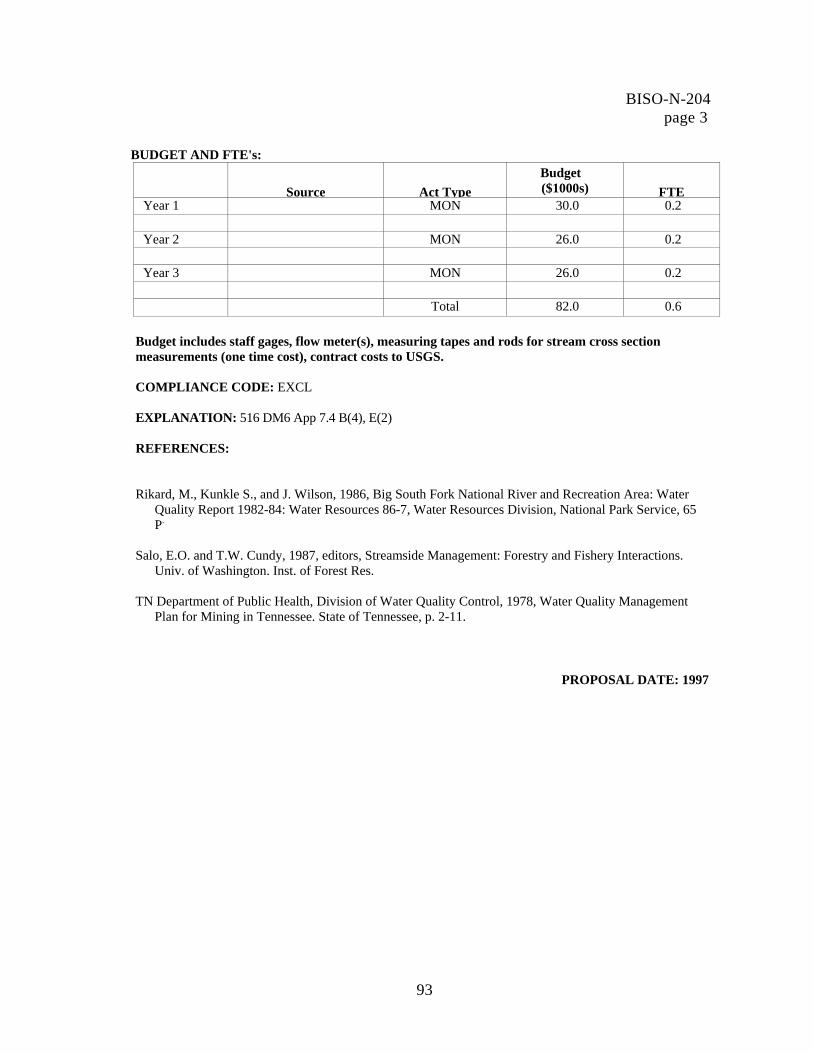
BUDGET AND FTE's: Source Act Type
Budget ($1000s) FTE
Year 1 MON 30.0 0.2
Year 2 MON 26.0 0.2
Year 3 MON 26.0 0.2 Total 82.0 0.6
Budget includes staff gages, flow meter(s), measuring tapes and rods for stream cross section measurements (one time cost), contract costs to USGS.
COMPLIANCE CODE: EXCL
EXPLANATION: 516 DM6 App 7.4 B(4), E(2)
REFERENCES:
Rikard, M., Kunkle S., and J. Wilson, 1986, Big South Fork National River and Recreation Area: Water
Quality Report 1982-84: Water Resources 86-7, Water Resources Division, National Park Service, 65 P.
Salo, E.O. and T.W. Cundy, 1987, editors, Streamside Management: Forestry and Fishery Interactions.
Univ. of Washington. Inst. of Forest Res. TN Department of Public Health, Division of Water Quality Control, 1978, Water Quality Management
Plan for Mining in Tennessee. State of Tennessee, p. 2-11.
PROPOSAL DATE: 1997
BISO-N-204 page 3
93

BISO-N-205
TITLE: Establish an Aquatic Invertebrate Monitoring Program
FUNDING STATUS: Unfunded SERVICEWIDE ISSUE CODE: N20 Baseline Data PACKAGE NUMBER: 238
PROBLEM STATEMENT:
The Recreation Area does not have an aquatic macroinvertebrate monitoring program. Macroinvertebrate (including mussels) and fish surveys have been conducted by outside researchers in the past. These surveys provide some baseline data; however, they are not sufficient to document the current condition of, and/or changes in, the aquatic community. Biological communities provide a holistic measure of the cumulative effects of different pollutants over time and provide an ecological measure of fluctuating environmental conditions. Water chemistry monitoring alone often misses cumulative impacts or fluctuating environmental conditions (Plafkin et al., 1989). The 125,000 acre Big South Fork National River and Recreation Area was designated to protect the Big South Fork River and its tributaries. The Big South Fork River is one of the few remaining free-flowing rivers, and the only designated National River, in the southeast United States. At the time the Recreation Area was designated, the land was already a product of long-term intensive use including coal mining, timber harvesting, oil and gas operations, and a network of largely unmaintained roads. These same land uses continue in the Recreation Area watershed, 83% of which is outside Recreation Area boundaries. Aquatic communities continue to face significant threats from past and current intensive land use in the watershed.
Recreation Area streams support an abundant and diverse aquatic community that includes 77 fish species and 215 macroinvertebrate species (23 mussel sp.); however, both the macroinvertebrate and fish communities have been reduced or completely eliminated in streams receiving acid mine drainage (O'Bara et al., 1982; Stucki, 1995). Historically, this area has a rich mussel assemblage, however species diversity is half of what it once was (Bakaletz, 1991). The aquatic communities continue to face significant threats from past and current intensive land use in the watershed.
An extensive biological survey of sixteen Recreation Area streams was completed in 1981 (O'Bara et al., 1982). More recent surveys include a Kentucky Division of Water 1989 survey of Rock Creek and a 1991 survey of the Big South Fork River in Kentucky. Several surveys of Bear Creek have been conducted since 1990 as part of an abandoned mine reclamation project. These were completed by the Tennessee Department of Health (Stucki, 1995; Mason, 1994; Duke, 1990) and the Kentucky Division of Water. The streams in the Recreation Area arc characterized by two types of substrate: limestone-influenced and sandstone-influenced (Rikard et al., 1986). These streams are defined by naturally occurring differences stream chemistry; however, an analyses of difference in the aquatic macroinvertebrate community across these two stream types has not been completed.
This project is very complementary to the current water quality monitoring program (BISO-N-206). Aquatic macroinvertebrate data will be used to indicate where water quality problems may exist and to identify those sites that need further water chemistry monitoring.
94

DESCRIPTION OF RECOMMENDED PROJECT OR ACTIVITY: Establish and maintain a macroinvertebrate monitoring program for the Big South Fork River and significant tributaries. This program will document aquatic species occurrence, distribution, richness, and abundance, as well as trends and changes in aquatic community composition, for Recreation Area streams. This program will serve as a management tool for examining the ecological health of the river system. Surveys will be conducted using the least destructive sampling techniques available to minimize impact to the aquatic community. Given the extensive stream network in the Recreation Area it will be impossible to monitor all the streams annually. Therefore, several stream sites will be monitoring each year so that every reach gets sampled every 3-5 years. Year 1 Convene a technical advisory group including state agencies, and researchers to assist in
program development and site selection. Develop a fish and macroinvertebrate sampling procedure including survey intervals.
Field test the protocol. Select sites on the Big South Fork River and major tributaries for surveys.
Year 2 Conduct fish and macroinvertebrate surveys.
Enter survey data into an appropriate database and Geographic Information System. Year 3 Analyze and report survey results. Note: This project is ongoing and long-term. Current Recreation Area staff are inadequate to manage the complexity and magnitude of this project. Both the University of Tennessee and Tennessee Technological University have established water resources and fisheries programs that qualify them for this type of work. The Recreation Area will establish a long-term agreement with one of these or a similar institution to conduct the monitoring, laboratory analyses, data management, and reporting. Recreation Area water resources staff will work with the contracting university to develop the sampling protocol and schedule. Recreation Area personnel will be responsible for analyzing aquatic biota data in conjunction with water quality data to determine relationships between the two and to devise appropriate water resources management strategies where needed. RELATED PROJECT STATEMENTS: BISO-N-201 Implement a Coal Mine Management Program BISO-N-202 Determine Sources and Impacts of Excessive Sediment BISO-N-203 Establish and Maintain a Water Data Management and Analysis Program BISO-N-204 Develop a Stream Flow Measurement Network BISO-N-206 Evaluate and Update the Water Chemistry and Bacteria Monitoring Program BISO-N-209 Classify Stream Types for the Big South Fork River and Select Tributaries BISO-N-210 Monitor Stream Sediments
BISO-N-205 page 2
95

BUDGET AND FM's:
Source Act Type
Budget ($1000s) FI'E
Year 1 MON 25.0 0.2
Year 2 MON 20.0 0.2
Year 3 MON 20.0 0.2 Total 65.0 0.6 Budget will include contract costs to TTU or UT, including staff time.
COMPLIANCE CODE: EXCL
EXPLANATION: 516 DM6 App. 7.4 B(4), E(2) REFERENCES: Bakaletz, S., 1991, Freshwater Mussel Survey of the Big South Fork National Rive and Recreation Area
[Masters Thesis]: TN Technological University, 70 p. Duke, J.T., 1990, Impact of Strip Mines on the Bear Creek Watershed Nonpoint Source Pollution Project,
Scott County, Tennessee: TN Department of Health and Environment, Division of Environmental Laboratories, Aquatic Biology Section, 36 p. p.
Mason, L.K., 1994, Impact of Acid Mine Drainage on Macroinvertebrate and Fish Communities in the
Bear Creek Watershed, Scott County, Tennessee, Fall 1990- Summer 1991: TN Department of Health, Division of Environmental Laboratories, Aquatic Biology Section, 118 p.
National Park Service, 1992, Natural Resources Inventory and Monitoring Guidelines: NPS-75, US Government Printing Office, 37 p.
O'Bara, C., Pennington, W.L., Bonner, W.P., 1982, A Survey of Water Quality, Benthic Macroinvertebrates and Fish for Sixteen Streams within the Big South Fork National River and Recreational Area: Tennessee Cooperative Fishery Research Unit, TN Technological University, submitted to US Army Corps of Engineers, Contact Number DACW62-81-C-0162, 77 p. plus appendices.
Plafkin, J., Barbour, M., Porter, K., Gross, S., and Hughes, R., 1989, Rapid Bioassessment Protocols for Use in Streams and Rivers - Benthic Macroinvertebrates and Fish: US Environmental Protection Agency, Office of Water, EPA/440/4-89/001, various pagings.
BISO-N-205 page 3
96

Rikard, M., Kunkle S., and J. Wilson, 1986, Big South Fork National River and Recreation Area: Water Quality Report 1982-84: Water Resources 86-7, Water Resources Division, National Park Service, 65 P.
Stucki, D., 1995, Impact of Acid Mine Drainage on Macroinvertebrate and Fish Communities in the Bear Creek Watershed, Scott County, Tennessee, Fall 1990 - Summer 1992; TN Department of Health, Division of Environmental Laboratories, Aquatic Biology Section, 139 p.
Tennessee Division of Water Pollution Control, 1996, Tennessee Biological Standard Operating
Procedures Manual - Volumes I and II: State of Tennessee.
PROPOSAL DATE: 1997
BISO-N-205 page 4
97

BISO-N-206
TITLE: Evaluate and Update the Water Chemistry and Bacteria Monitoring Program FUNDING STATUS: Unfunded SERVICEWIDE ISSUE CODE: N20 Baseline Data PACKAGE NUMBER: 238
PROBLEM STATEMENT:
External and internal influences on the Recreation Area watersheds are ever changing. The current water chemistry and bacteria monitoring program was initiated in 1982 and has not been significantly modified since that time. The program needs to be completely reevaluated to ensure that monitoring site locations and monitoring parameters are adequate to describe hydrologic conditions. Inadequacies in the current program will be better defined by a complete evaluation of the current monitoring program; they may include a need to modify water quality parameters to detect land use impacts, add additional sites and/or change location of existing sites. The 125,000 acre Big South Fork National River and Recreation Area was designated to protect the Big South Fork River and its tributaries. The Big South Fork River is one of the few remaining free-flowing rivers, and the only designated National River, in the southeast United States. At the time the Recreation Area was designated, the land was already a product of long-term intensive use including coal mining, timber harvesting, oil and gas operations, and a network of largely unmaintained roads. These same land uses continue in the Recreation Area watershed, 83% of which is outside Recreation Area boundaries.. Water quality is closely tied to these past and current land uses. The primary external influences on Recreation Area water quality are abandoned coal mines, coal mining, forestry, and unmaintained roads. Acid mine drainage from abandoned coal mines is larger in magnitude in this Recreation Area than in any other National Park Service unit nationwide. There are approximately 25,000 acres of unreclaimed abandoned coal mines in the watershed (TN Abandoned Coal Mine Reclamation Committee, no date; Kentucky Division of Mines, 1995). Coal mining activity in the upper watershed has increased significantly in the last two years. Sixty-nine coal mines currently have NPDES permits (KY Division of Mines, 1995; TN Division of Water Pollution Control, 1996). Approximately 50 applications for new mining and remining of previously-mined sites were submitted in 1995 - 1996 (Turner, pers. comm.). Forestry activity has also increased, due in part to completion of a new regional chip mill and current high timber prices. Internal influences include abandoned coal mines, oil and gas sites, roads and trails, and Recreation Area development. There are approximately 100 abandoned deep coal mine openings in the Recreation Area, over 300 active or abandoned oil or gas wells and 295 miles of roads (275 are dirt or gravel) and 285 miles of trails. Recreation Area development in the last 3 years has included the addition of two campgrounds and roads and trails. The current road and trail network includes approximately. The National Park Service initiated a monthly water chemistry and bacteria monitoring program in 1982 to evaluate stream water quality, identify polluted streams, locate major sources of pollution, and determine water quality in unimpacted streams (Rikard et al., 1986). Monitoring is currently conducted at 26 stations in 16 Recreation Area streams. Water quality parameters include the following:
98

pH Water temperature Conductivity Dissolved oxygen Turbidity Alkalinity Acidity Hardness Chlorides Iron Sulfate Manganese Ammonia Fecal coliform Fecal streptococci
The current water quality monitoring is not conducted according to documented Standard Operating and Quality Assurance/Quality Control procedures. Sound standard operating and quality control procedures are needed to ensure consistency in water quality data and to increase the usefulness of Recreation Area data to other agencies. DESCRIPTION OF RECOMMENDED PROJECT OR ACTIVITY: The objectives of this program are to • identify areas where water resources are not adequately assessed • identify appropriate water quality parameters, based on potential threats, for proper evaluation of the
water resources. The program will address these objectives as follows: 1. Evaluate the current Recreation Area stream monitoring program:
• Analyze existing monitoring data to identify trends in water quality (as described in BISO-N-203, Establish and Maintain a Water Data Management and Analysis Program).
• Identify potential impacts using the Geographic Information System, aerial photos, land use maps, soil maps, and field observations.
2. Report evaluation results. 3. Modify and supplement the current monitoring program.
The Recreation Area monitoring program will be modified to address findings from the evaluation. • Add (or modify) monitoring sites. • Add water quality parameters to track land use impacts (e.g. sediment, aluminum, petroleum
hydrocarbons). 4. Establish monitoring standard operating and quality assurance/quality control procedures.
Implement a Coal Mine Management Program Determine Sources and
Impacts of Excessive Sediment Establish and Maintain a Water Data Management and Analysis Program Develop a Stream Flow Measurement Network Establish an Aquatic Invertebrate Monitoring Program Develop and Implement Laboratory Standard Operating and Quality Assurance/Quality Control Procedures BISO-N-209 Classify Stream Types for the Big South Fork River and Select Tributaries
BISO-N-206 page 2
99
RELATED PROJECT STATEMENTS:BISO-N-201 BISO-N-202 BISO-N-203 BISO-N-204 BISO-N-205 BISO-N-207

BUDGET AND FTE's: Budget Source Act Type ($1000s) FITS
Year 1 RES 15.0 0.4
Year 2 RES 15.0 0.4
Year 3 RES 15.0 0.4 Total 45.0 1.2 Budget includes vehicle and equipment support, aerial photos, land use maps, water sample collection and analysis.
COMPLIANCE CODE: EXCL
EXPLANATION: 516 DM6 App. 7.4 B(4), E(2)
REFERENCES:
Kentucky Division of Mines, 1995, unpublished database.
Rikard, M., Kunkle S., and J. Wilson, 1986, Big South Fork National River and Recreation Area: Water
Quality Report 1982-84: Water Resources 86-7, Water Resources Division, National Park Service, 65 P.
Tennessee Abandoned Coal Mine Reclamation Committee, no date, When the Coal is Gone...Devastation or Reclamation?: Clinch-Powell Resource Conservation and Development Council, 19 p.
Tennessee Division of Water Pollution Control, 1996, unpublished database.
Turner, D., personal communication, 1996: TN Division of Water Pollution Control.
PROPOSAL DATE: 1997
BISO-N-206 page 3
100

BISO-N-207
TITLE: Develop and Implement Laboratory Standard Operating and Quality Assurance/Quality Control Procedures
FUNDING STATUS: Unfunded SERVICEWIDE ISSUE CODE: N24 Other
PACKAGE NUMBER: 238
PROBLEM STATEMENT: Water chemistry samples collected by Recreation Area staff are currently analyzed in an on-site laboratory. Currently laboratory Standard Operating Procedures (SOPs) or Quality Assurance/Quality Control (QA/QC) procedures do not exist and the technician conducting analysis has received no formal training in analysis methods. Established laboratory SOPs and QA/QC procedures are essential to ensure data accuracy and consistency. An established SOP and QA/QC procedure will expand the usefulness of Recreation Area data to other organizations. The 125,000 acre Big South Fork National River and Recreation Area was designated to protect the Big South Fork River and its tributaries. The Big South Fork River is one of the few remaining free-flowing rivers, and the only designated National River, in the southeast United States. At the time the Recreation Area was designated, the land was already a product of long-term intensive use including coal mining, timber harvesting, oil and gas operations, and a network of largely unmaintained roads. These same land uses continue in the Recreation Area watershed, 83% of which is outside Recreation Area boundaries. Water quality is closely tied to these past and current land uses. The National Park Service monitors water chemistry and bacteria monthly at 26 stations in 16 Recreation Area streams. Fifteen (15) water quality parameters are analyzed for each sample. One FTE is dedicated to water quality monitoring and laboratory analysis. Analysis of water samples is done on site because the Recreation Area is located approximately 80 miles from a laboratory with the necessary analysis capabilities. Because of this relative isolation, it is more effective to enhance the capability of the Recreation Area laboratory than to go to an outside laboratory. DESCRIPTION OF RECOMMENDED PROJECT OR ACTIVITY: Develop a laboratory SOP and OA/QC procedure and train laboratory technician: The National Park Service, with the assistance of the Water Resources Division, and state water quality agencies, will develop a SOP and QA/QC procedure for all onsite laboratory analyses. State laboratories provide QA/QC checks by analyzing duplicate samples. The Recreation Area laboratory technician will receive appropriate training. This SOP will need to be evaluated on a regular basis to ensure that techniques are current. Year 1 Convene a technical advisory team, including Water Resources Division, and
appropriate state or federal agencies. Evaluate existing state and federal SOPs and QA/QC procedures. Write SOPs and QA/QC procedures specific to the Recreation Area. Train Recreation Area staff in analysis techniques.
Year 2 Implement SOPs and QA/QC procedures for all laboratory analyses.
101

RELATED PROJECT STATEMENTS: BISO-N-203 Establish and Maintain a Water Data Management and Analysis Program BISO-N-206 Evaluate and Update the Water Chemistry and Bacteria Monitoring Program
BUDGET AND FEE's: Budget
Source Act Type ($1000s) FTEYear 1 RES 4.0 0.2
Year 2 RES 4.0 0.1
Total 8.0 0.3
Budget includes costs of duplicate analyses for QA/QC, training, publishing SOP and QA/QC procedures.
PROPOSAL DATE: 1997
BISO-N-207 page 2
102

BISO-N-208
TITLE: Establish and Maintain Weather Stations
FUNDING STATUS: Unfunded SERVICEWIDE ISSUE CODE: CULTURAL RESOURCE TYPE CODE (where applicable):
PACKAGE NUMBER: 238
PROBLEM STATEMENT: The Recreation Area climate data are insufficient to monitor long term conditions in the Recreation Area. Additional data are needed for a more complete understanding of the hydrologic system. The 125,000 acre Big South Fork National River and Recreation Area was designated to protect the Big South Fork River and its tributaries. The Big South Fork River is one of the few remaining free-flowing rivers, and the only designated National River, in the southeast United States. The Recreation Area is located in the Cumberland Plateau physiographic province. Weather patterns on the Cumberland Plateau are localized such that there is an uneven distribution of localized storms; however, long-term averages are fairly even in the Recreation Area counties (Campbell and Newton, 1995; Byrne, 1989; Moneymaker, 1981). Stream flow characteristics are strongly related to precipitation events, and flooding is most likely to occur from December through May when migrating storms bring high-intensity rains. A complete understanding of the hydrologic system requires additional climate data than is currently available for the Recreation Area. The National Park Service currently operates a single weather station at Recreation Area headquarters; this stations is primarily a seasonal (summer) fire weather station. Rainfall data are collected at the US Army Corps of Engineers gage station on the Big South Fork River at Stearns (river mile 49.6). This station is operated by the US Geologic Survey. The nearest National Weather service stations is located in Knoxville approximately 80 miles from the Recreation Area. Two to three meteorological stations are necessary for basic long-term monitoring of Recreation Area climate conditions. Year-round climate data is needed for inclusion in hydrologic models. Regular statistical analysis of climate data is necessary for a more complete understanding of the hydrologic system. DESCRIPTION OF RECOMMENDED PROJECT OR ACTIVITY: Convert the existing seasonal weather station to a continuous weather station: Climate data will be collected daily and entered into a database for regular analysis. Data will be used in conjunction with stream gage data to describe the hydrologic environment, monitor trends and fluctuations, and determine relationships between different components of the hydrologic system. Add weather stations in the Clear Fork and New River basins: This data will also be collected daily and entered into a database for regular analysis. Additional weather station swill increase understanding of regional climate differences across the Recreation Area and will enhance management's ability to be responsive to specific regional differences within the Recreation Area.
103

Year 1 Update the existing headquarters weather station. Begin data collection and analysis.
Year 2 Add weather stations to Clear Fork and New River watersheds.
Begin data collection and analysis of these new weather stations. Continue data collection and analysis of headquarters station.
Year Report and publish climate data and analysis.
Note: This is an ongoing, long-term-project.
RELATED PROJECT STATEMENTS:
BISO-N-203 Establish and Maintain a Water Data Management and Analysis Program BISO-N-204 Develop a Stream Flow Measurement Network BISO-N-209 Classify Stream Types for the Big South Fork River and Select Tributaries
BUDGET AND FTE's:
Budget Source Act Type ($1000s) FIE
Year 1 MON 24.6 0.1
Year 2 MON 24.6 0.1
Year 3 MON 24.6 0.1 Total Budget includes cost of 3 MET stations measuring precip., temperature, wind speed, wind direction, and relative humidity, with a data logger plus annual calibration and servicing.
COMPLIANCE CODE: EXCL EXPLANATION:
518 DM6 App. 7.4 B(4), E(2) REFERENCES:
Byrne, 1989, Soil Survey of McCreary-Whitley Counties, Kentucky: United States Department of Agriculture, Soil Conservation Service, 85 p. plus maps
Campbell, J.F., Newton, D.L., 1995, Soil Survey of Fentress and Pickett Counties, Tennessee: United States
Department of Agriculture, Soil Conservation Service, 117 p. plus maps Moneymaker, R.H., 1981, Soil Survey of Anderson County, Tennessee: US Department of Agriculture, Soil
Conservation Service, 165 p. plus maps
PROPOSAL DATE: 1997
BISO-N-208 page 2
104

BISO-N-209
TITLE: Classify Stream Types for the Big South Fork River and Select Tributaries. FUNDING STATUS: Unfunded SERVICEWIDE ISSUE CODE: N20 Baseline Information PACKAGE NUMBER: 238
PROBLEM STATEMENT:
A geomorphic stream classification analysis of Recreation Area streams does not exist. This information is needed to enhance monitoring programs particularly sediment and aquatic macroinvertebrate studies. Several physical and biological attributes of streams are reflected in stream morphology. By using a classification based on stream morphology, stream reaches with similar characteristics and responses can be grouped together for the purposes of designing monitoring networks and analyzing the results. Sediment and macroinvertebrate monitoring programs would be directly enhanced by this classification. A classification system has been developed by Rosgen (1994) and uses channel shape, sinuosity, gradient, entrenchment, width/depth ration, and channel material to classify streams. This system is directly applicable to streams in the Big South Fork watershed. The 125,000 acre Big South Fork National River and Recreation Area was designated to protect the Big South Fork River and its tributaries. The Big South Fork River is one of the few remaining free-flowing rivers, and the only designated National River, in the southeast United States. At the time the Recreation Area was designated, the land was already a product of long-term intensive use including coal mining, timber harvesting, oil and gas operations, and a network of largely unmaintained roads. These same land uses continue in the Recreation Area watershed, 83% of which is outside Recreation Area boundaries.. Water quality is closely tied to these past and current land uses. Effective monitoring of the hydrologic conditions of the Recreation Area will be enhanced by stream classification information. Potential sediment sources in the watershed include historic and current mines, roads and trails, forestry operations, oil and gas operations; and stream channel instability (including channelization). Agriculture occurs on less than 20% of the land in the Recreation Area counties (TN Dept. of Agriculture, 1994; US Dept. of Agriculture, 1982) and is unlikely to be a major sediment contributor. Determining the relative contributions of each of these sources is difficult given that several of these land uses often occur in the same area. This determination is further complicated by the presence of sediment in stream channels that is associated with land use practices from decades ago. Osterkamp et al. (1984) found that coal fines moved through a headwater stream of the New River in several years, but that coarser rock debris may take decades to move a similar distance. This same stream had sediment deposits from coal activities in the 1960s as well as from forestry activities in the 1920s (Miller, 1991). It follows that streams within the Recreation Area are still receiving sediment from activities that occurred in the upper watershed earlier in the century. The majority of sediment causing activities are within the New River basin. Turbidity and suspended solids were found to be the major problem in the New River in a 1984 environmental assessment (US Corps of Engineers, 1984). Sediment in the New River is visually significant at the confluence with Clear Fork River where the New River is notably more turbid. Sediment issues in this basin are extremely complicated. For example, harvest of timber near old mine spoils may destabilize the mine spoils and contribute more sediment to the system than timber harvesting on unmined land. Timber harvest is increasing in the area
105

Stream classification information is necessary to • to provide a basis for integrating biological monitoring, water quality monitoring (physical, biological,
and chemical) with physical characteristics assessments • predict geomorphic channel response to human activities and natural events, and sequences of
morphological evolution • evaluate impacts of excessive sedimentation on water quality • assess aquatic habitat and evaluate aquatic habitat enhancement • augment land use planning • assess natural hazards • estimate stream channel erodibility potential (see BISO-N-018 and BISO-N-021) • provide a consistent and reproducible frame of reference of communication with other professional
disciplines
DESCRIPTION OF RECOMMENDED PROJECT OR ACTIVITY: The fluvial geomorphic stream type of the Big South Fork River mainstem and select tributary streams will be classified using the Rosgen classification system (Rosgen, 1994). Select tributaries will also be classified to provide an immediate overview of Recreation Area stream types. Following this initial classification effort, additional tributary streams, including all streams with water quality monitoring stations, will be classified. This program will be implemented as follows:
• Conduct a literature search • Convene a technical advisory committee • Select stream reaches for classification • Conduct stream classification surveys • Integrate stream classification findings with other monitoring studies and land use planning • Report and publish results • Digitize data and enter into GIS
Classification will be completed by a qualified fluvial geomorphologist and may be contracted to an outside specialist.
Determine Sources and Impacts of Sediment
Establish and Maintain a Water Data Management and Analysis Program Develop a Stream Flow Measurement Network Establish an Aquatic Invertebrate Monitoring Program Evaluate and Update the Water Chemistry Monitoring Program BUDGET AND FTE's:
Budget Source Act Type ($1000s) FTE
Year 1 45.0 0.7 Total 45.0 0.7
BISO-N-209 page 2
RELATED PROJECT STATEMENTS:BISO-N-202 BISO-N-203 BISO-N-204 BISO-N-205 BISO-N-206
106

COMPLIANCE CODE: EXCL EXPLANATION: 516 DM6 App. 7.4 B(4), E(2)
REFERENCES: Rosgen, D.L., 1994, A Classification of Natural Rivers: in Catena, Elsevier Science, v.22, n.3, p. 169-199.
Rosgen, D.L., 1996, Applied River Morphology: Wildland Hydrology Books, Colorado, 495 p., (in press).
PROPOSAL DATE: 1997
BISO-N-209 page 3
107

BISO-N-210
TITLE: Delineate, Characterize, and Map Recreation Area Groundwater Resources
FUNDING STATUS: Unfunded SERVICEWIDE ISSUE CODE: N20 Baseline Data
PACKAGE NUMBER: 238
PROBLEM STATEMENT:
The groundwater resources of the Recreation Area have not been inventoried. A general description of Cumberland Plateau groundwater resources has been documented (Hoos, 1990); however, the information is too broad to be useful in water resources management. Some water well data is available from the US Geological Survey, the Kentucky Geological Survey, and the Tennessee Division of Water Supply. These data have not been compiled or analyzed to provide a groundwater profile for the Recreation Area. A specific inventory of groundwater resources, including aquifer locations and characteristics, flow patterns, recharge and discharge zones, current groundwater quality, and groundwater quantity is needed in order to understand and respond to threats to water quality and quantity. The 125,000 acre Big South Fork National River and Recreation Area was designated to protect the Big South Fork River and its tributaries. The Big South Fork River is one of the few remaining free-flowing rivers, and the only designated National River, in the southeast United States. At the time the Recreation Area was designated, the land was already a product of long-term intensive use including coal mining, timber harvesting, oil and gas operations, and a network of largely unmaintained roads. These same land uses continue in the Recreation Area watershed, 83% of which is outside Recreation Area boundaries.. Water quality is closely tied to these past and current land uses. Coal mine impacts to groundwater include acid mine drainage and changes in groundwater hydrology (Gaydos, 1982; TN Dept. of Health, 1978). Oil, gas, brine, or production chemicals from oil and gas wells can also influence groundwater quality. An assessment of impacts to groundwater quality from these land uses has not been completed. Groundwater is a critical component of the water resources management in the Recreation Area for three reasons: 1. The National Park Service uses wells to provide a portion of the Recreation Area water supply. 2. Groundwater has potentially been impacted by contaminated mine drainage and oil/gas operations. 3. Groundwater impacts surface water (e.g. discharge and recharge zones, seeps with surface run-off,
fractures from mine operations).
Groundwater maps need to be incorporated into the Recreation Area GIS to facilitate integrated resource management decisions.
DESCRIPTION OF RECOMMENDED PROJECT OR ACTIVITY: The objective of this program is to provide a general description of regional groundwater including quantity, flow directions, and major structure that affect flow. An analysis of ground water quality problems will also be completed. The program will address these objectives as follows:
Conduct a detailed groundwater survey: The National Park Service will work with USGS, TN Division of Geology, and KY Geological Survey, to delineate and characterize the Recreation Area groundwater resources. These data will be entered into the Recreation Area GIS.
108

Year 1 Convene a technical advisory group. Assemble available groundwater data from Tennessee and Kentucky.
Do preliminary map of groundwater resources. Inventory major springs including location, discharge, and water quality characteristics. Determine additional data needs.
Year 2 Drill test wells.
Revise the preliminary groundwater map. Determine the amount of stream flow that is contributed by groundwater for select tributaries.
Year 3 Enter groundwater data into Geographic Information System. Report and publish
groundwater delineation.
RELATED PROJECT STATEMENTS: BISO-N-201 Implement Coal Mine Management Program BISO-N-203 Establish and Maintain a Water Data Management and Analysis Program BISO-N-204 Develop a Stream Flow Measurement Network BISO-N-206 Evaluate and Update the Water Chemistry Monitoring Program BISO-N-207 Develop and Implement Laboratory Standard Operating and Quality Assurance/
Quality Control Procedures BUDGET AND FTE's: Budget Source Act Type ($1000s) FTE
Year 1 RES 15.0 05.
Year 2 RES 15.0 0.5
Year 3 RES 15.0 0.5 Total 45.0 1.5
COMPLIANCE CODE: EXCL
EXPLANATION: 512 DM2 App. 2, 2.4
BISO-N-210 page 2
109

REFERENCES: Gaydos, M.W., 1982, Hydrology of Area 17, Eastern Coal Province, Tennessee and Kentucky, US
Geological Survey Water Resources Investigations Open-File Report 81-1118, 77 p. Hoos, A., 1990, Recharge Rate and Aquifer Hydraulic Characteristics for Selected Drainage Basins in
Middle and East Tennessee: US Geological Survey Water-Resources Investigations Report 90-4015, 34 p.
Tennessee Department of Public Health, Division of Water Quality Control, 1978, Water Quality
Management Plan for Mining in Tennessee: State of Tennessee, p. 2-11.
PROPOSAL DATE: 1997
BISO-N-210 page 3
110
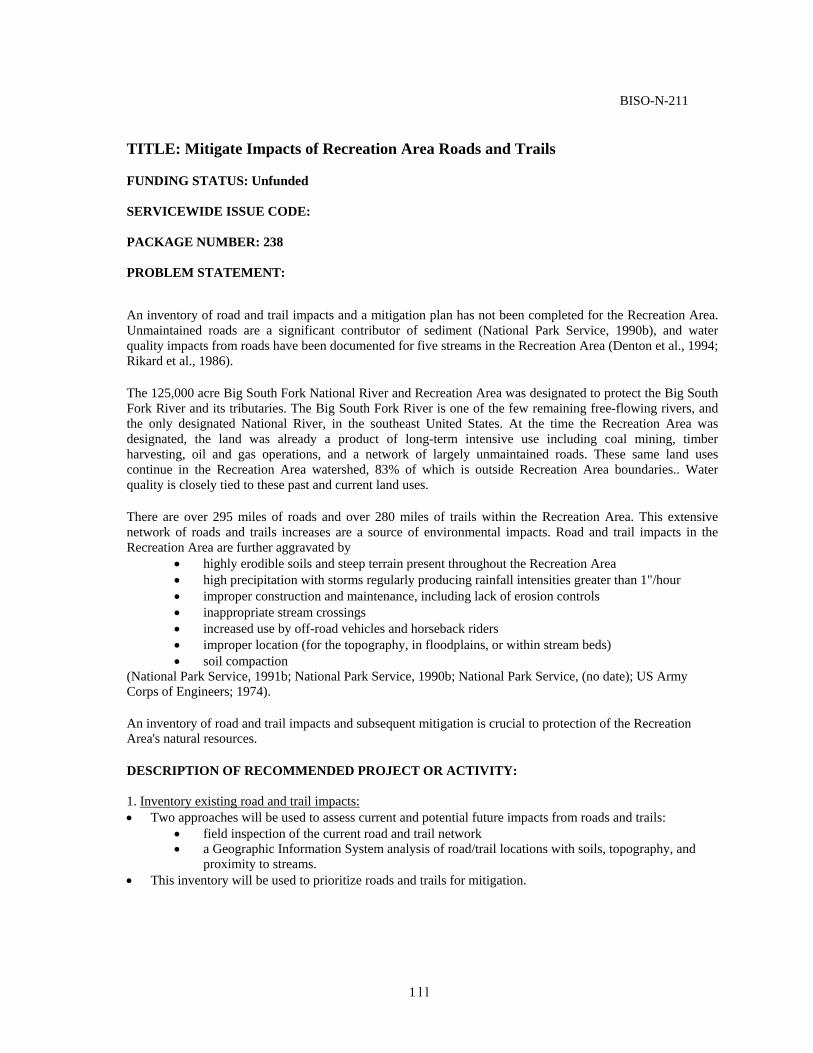
BISO-N-211
TITLE: Mitigate Impacts of Recreation Area Roads and Trails FUNDING STATUS: Unfunded
SERVICEWIDE ISSUE CODE:
PACKAGE NUMBER: 238
PROBLEM STATEMENT:
An inventory of road and trail impacts and a mitigation plan has not been completed for the Recreation Area. Unmaintained roads are a significant contributor of sediment (National Park Service, 1990b), and water quality impacts from roads have been documented for five streams in the Recreation Area (Denton et al., 1994; Rikard et al., 1986).
The 125,000 acre Big South Fork National River and Recreation Area was designated to protect the Big South Fork River and its tributaries. The Big South Fork River is one of the few remaining free-flowing rivers, and the only designated National River, in the southeast United States. At the time the Recreation Area was designated, the land was already a product of long-term intensive use including coal mining, timber harvesting, oil and gas operations, and a network of largely unmaintained roads. These same land uses continue in the Recreation Area watershed, 83% of which is outside Recreation Area boundaries.. Water quality is closely tied to these past and current land uses.
There are over 295 miles of roads and over 280 miles of trails within the Recreation Area. This extensive network of roads and trails increases are a source of environmental impacts. Road and trail impacts in the Recreation Area are further aggravated by
• highly erodible soils and steep terrain present throughout the Recreation Area • high precipitation with storms regularly producing rainfall intensities greater than 1"/hour • improper construction and maintenance, including lack of erosion controls • inappropriate stream crossings • increased use by off-road vehicles and horseback riders • improper location (for the topography, in floodplains, or within stream beds) • soil compaction
(National Park Service, 1991b; National Park Service, 1990b; National Park Service, (no date); US Army Corps of Engineers; 1974).
An inventory of road and trail impacts and subsequent mitigation is crucial to protection of the Recreation Area's natural resources.
DESCRIPTION OF RECOMMENDED PROJECT OR ACTIVITY: 1. Inventory existing road and trail impacts: • Two approaches will be used to assess current and potential future impacts from roads and trails:
• field inspection of the current road and trail network • a Geographic Information System analysis of road/trail locations with soils, topography, and
proximity to streams. • This inventory will be used to prioritize roads and trails for mitigation.
1 l l

2. Mitigate existing road and trail impacts: • Guidelines for road and trail rehabilitation, maintenance, and construction will be developed by
Recreation Area staff with outside consultation. • Impacts from National Park Service-owned roads and trails will be minimized using a variety of
methods: road closure, change in use categories (i.e. horse, ATV, bike), rerouting, erosion control techniques, and revegetation.
• National Park Service personnel will meet with county and state officials to address impacts from state and county owned roads.
3. Implement road and trail guidelines for new construction:
• Construction of new trails will be done according to the new Recreation Area guidelines. 4. Monitor road and trails network:
• Road and trails will be monitored regularly to ensure that impacts are addressed in a timely manner.
• The Road and Trails Specialist and maintenance crew will work with the water quality specialist to monitor water quality impacts.
Year 1 Convene technical advisory team.
Develop road and trail maintenance and construction guidelines. Develop prioritization scheme for addressing existing impacts. Develop GIS to highlight areas of potential impacts. Begin field inventory of road and trail impacts. Mitigate sites with significant impacts immediately.
Year 2 Complete field inventory of road and trail impacts.
Prioritize impacts for mitigation. Begin mitigation of existing impacts using maintenance guidelines. Implement construction guidelines for new roads and trails.
Year 3 Complete mitigation of existing impacts. Report and publish results.
Year 4 Continue monitoring road and trail impacts. Modify maintenance and construction guidelines as necessary.
Note: This project is ongoing and long-term.
Determine Sources and Impacts of Excessive Sediment Establish and Maintain a Water Data Management and Analysis Program Establish an
Aquatic Invertebrate Monitoring Program Evaluate and Update the Water Chemistry and Bacteria Monitoring Program Classify Stream Types for the Big South Fork River and Select Tributaries Monitor Stream Channel Stability
BISO-N-211 page 2
RELATED PROJECT STATEMENTS:BISO-N-202 BISO-N-203 BISO-N-205 BISO-N-206 . BISO-N-209 BISO-N-210
112
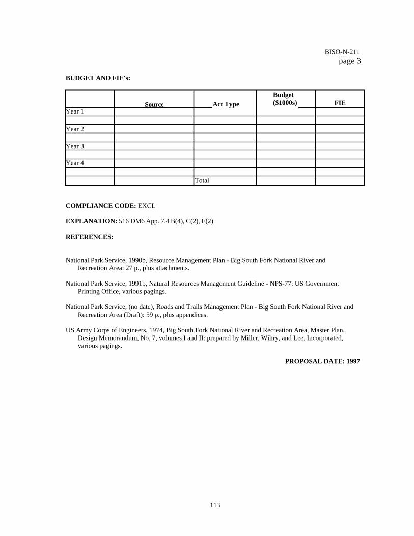
BUDGET AND FIE's:
COMPLIANCE CODE: EXCL EXPLANATION: 516 DM6 App. 7.4 B(4), C(2), E(2)
REFERENCES:
National Park Service, 1990b, Resource Management Plan - Big South Fork National River and
Recreation Area: 27 p., plus attachments. National Park Service, 1991b, Natural Resources Management Guideline - NPS-77: US Government
Printing Office, various pagings. National Park Service, (no date), Roads and Trails Management Plan - Big South Fork National River and
Recreation Area (Draft): 59 p., plus appendices. US Army Corps of Engineers, 1974, Big South Fork National River and Recreation Area, Master Plan,
Design Memorandum, No. 7, volumes I and II: prepared by Miller, Wihry, and Lee, Incorporated, various pagings.
PROPOSAL DATE: 1997
BISO-N-211 page 3
113
Source Act Type
Budget ($1000s) FIE
Year 1
Year 2
Year 3
Year 4
Total

Big South Fork National River and Recreational Area Water Resource Management Plan
May 10, 1997 APPENDIX A
SOIL DESCRIPTIONS FROM COUNTY SOIL SURVEYS
SOIL SURVEY OF FENTRESS AND PICKETT COUNTIES, TENNESSEE
In addition to the specific soil descriptions given below, the Soil Survey of Fentress and Picket Counties provides data on • average monthly temperature and precipitation • freeze dates • growing season temperatures • acreage and proportionate extent by soil type • prime farmland by soil type • land capability and yields per acre of crops and pasture by soil type • woodland management and productivity by soil type • recreational development and restrictive soil features by soil type • wildlife habitat evaluation by soil type • building site development and restrictive soil features by soil type • sanitary facilities and restrictive soil features by soil type • construction materials use suitability by soil type • water management considerations by soil type • engineering index properties • physical and chemical properties of soils • soil and water features, such as flooding, high water table characteristics, bedrock, and risk of corrosion
The following soil descriptions are summarized from the Soil Survey of Fentress and Picket Counties (Campbell and Newton, 1995).
Lily loam, 3-8 percent slopes
The Lily Loam is a moderately deep, well drained soil found on narrow, undulating ridgetops and side slopes of the Cumberland Plateau. It is in scattered areas, dominantly throughout Fentress County. The soil formed in material weathered from acid sandstone. Fragipan occurs in a few areas at a depth of about 24 inches.
Soil properties: permeability: moderately rapid available water capacity: moderate soil reaction: strongly acid to extremely acid throughout the profile, except for the surface layer in limed areas flooding: none hazard of erosion: severe water table: none depth to bedrock: 20 to 40 inches, hard sandstone
114

Big South Fork National River and Recreational Area Water Resource Management Plan
May 10, 1997
Land Use: About half of the areas have been cleared and are used for corn, snap beans, and pasture or hay. The rest support mixed hardwoods and pine.
Use Suitability: The Lily Loam is suited to row crops, pasture, and hay. The hazard of erosion and the depth to bedrock are the major management concerns. Erosion is a severe hazard if cultivated crops are grown. Minimum tillage, crop residue management, cover crops, and inclusion of grasses and legumes in the cropping system increase the rate of water infiltration and help to control runoff and erosion. Contour terraces, grassed waterways debris basins, and contour fanning help to control erosion in clean-cultivated areas. This soil is also suited to woodland. No significant hazards or limitations affect woodland management. This soil is suited or poorly suited to most urban uses. Building site development, septic tank absorption fields, and road construction are limited by the slope and the depth to bedrock. The capability subclass is Ile.
Jefferson-Ramsey complex, 15 to 35 percent slopes
This unit consists of a very deep, well drained Jefferson soil and a shallow, somewhat excessively drained Ramsey soil. The unit is on long, hilly, and steep slopes that form V-shaped valleys and the upper gorges of the Cumberland Plateau. It is in scattered areas throughout Fentress county and in the western part of Pickett County. The Jefferson soil is on the lower slopes below the Ramsey soil. The Jefferson soil formed in colluvium weathered from acid sandstone, and the Ramsey soil formed in material weathered from acid sandstone. Individual areas are about 65 percent Jefferson soil and 30 percent Ramsey soil. The two soils occur as areas so intermingled that mapping them separately is not practical at the scale used. Included in this unit in mapping are a few scattered areas of a soil that has bedrock at a depth of 20 to 40 inches. Also included are scattered areas of soils that have a high content of stones and few areas of rock outcrop.
Soil properties: permeability: Jefferson - moderately rapid; Ramsey - rapid available water capacity: Jefferson - moderate; Ramsey - very low soil reaction: strongly acid to very strongly acid flooding: none hazard of erosion: severe in exposed areas water table: none depth to bedrock: Jefferson - more than 6 feet; Ramsey - 8 to 20 inches
Land Use: Most areas support mixed hardwoods. A few areas of the Jefferson soil on the lower slopes have been cleared and are used as pasture. Many of the cleared areas have reverted to trees, dominantly yellow-poplar.
Use Suitability: These soils are generally unsuited to row crops. The slope of both soils and the depth to bedrock in the Ramsey soil are the major limitations. The Jefferson soil is suited to pasture and hay, but the Ramsey soil is poorly suited. The Jefferson soil is well suited to woodland, but the Ramsey soil is poorly suited. Because of the depth to bedrock in the Ramsey soil, the hazard of windthrow is the major management concern. The hazard generally is highest during wet periods. Managing for an uneven-aged stand or harvesting by area selection methods
115

Big South Fork National River and Recreational Area Water Resource Management Plan
May 10, 1997
can reduce this hazard. The hazard of erosion, the equipment limitation, seedling mortality, and plant competition are additional management concerns.
These soils are poorly suited to most urban uses. Building site development, septic tank absorption fields, and road construction are limited by the slope of the Jefferson soil and the depth to bedrock in the Ramsey soil.
The Jefferson soil is in capability subclass VIe. The Ramsey soil is in capability subclass Vlle.
Ramsey-Alticrest-Rock outcrop complex, 5 to 20 percent slopes
This unit consists of a shallow, somewhat excessively drained Ramsey soil; a moderately deep, well drained Alticrest soil; and sandstone ledges and outcrops. The unit is on short, rolling, and hilly hillsides on the Cumberland Plateau. It is in scattered areas throughout Fentress County and in the western part of Pickett County. The Ramsey soil is near the Rock outcrop, and the Alticrest soil is in areas that generally have no Rock outcrop. Both soils formed in material weathered form acid sandstone. Individual areas are about 40 percent Ramsey soil, 30 percent Alticrest soil, and 20 percent Rock outcrop. The two soils and the Rock outcrop occur as areas so intermingled that mapping them separately is not practical at the scale used. Bedrock is hard sandstone. The Rock outcrop is in scattered areas throughout the unit. It is generally nearly level with the surface or only a few feet high.
Soil properties: permeability: Ramsey - rapid; Alticrest - moderately rapid available water capacity: Ramsey - very low; Alticrest - moderate or low soil reaction: strongly acid to very strongly acid flooding: none hazard of erosion: severe in exposed areas water table: none depth to bedrock: Ramsey - 7 to 20 inches; Alticrest - 20 to 40 inches
Land Use: Most areas are forested with mixed hardwoods and Virginia Pine. A few small areas have been cleared and are used as pasture.
Use Suitability: This unit is poorly suited or unsuited to row crops, pasture, and hay. The Ramsey soil is generally unsuited because of the depth to bedrock and the very low available water capacity. Moderate yields can be obtained on the Alticrest soil.
This unit is suited or poorly suited to woodland. The hazard of windthrow on the shallow Ramsey soil is the major management concern. Managing for an uneven-aged stand or harvesting by area selection methods can reduce this hazard. The hazard of erosion, the equipment limitation, seedling mortality, and plant competition are additional management concerns.
The Ramsey and Alticrest soils are poorly suited to urban uses. Building site development, septic tank absorption fields, and road construction are limited by the depth to bedrock and the slope.
The Ramsey soil is in capability subclass VIe. The Alticrest soil is in capability subclass IVe.
116

Big South Fork National River and Recreational Area Water Resource Management Plan
May 10, 1997 Gilpin silt loam, 5 to 20 percent slopes, eroded
This moderately deep, well drained soil is on small, rounded hills and narrow ridges on the Cumberland Plateau. It is on a network of rolling and hilly ridges and hills dissected by streams that have cut back from the deep mountain gorges scattered dominantly throughout the western and central parts of Fentress County. The soil formed in material weathered from acid shale, siltstone, and sandstone.
Soil properties: permeability: moderate available water capacity: moderate soil reaction: strongly acid to extremely acid throughout the profile, except for the surface layer in limed areas flooding: none hazard of erosion: severe in exposed areas water table: none depth to bedrock: 20 to 40 inches
Land Use: Most areas support hardwoods. A few small areas have been cleared and are used mainly as pasture. A few of the cleared areas are used for truck crops.
Use Suitability: This soil is poorly suited to mw crops, but is suited to pasture and hay. The slope, the depth to bedrock, and the hazard of erosion are the major management concerns. As soil is removed by erosion, the depth to bedrock and the rooting depth is reduced. Minimum tillage, crop residue management, cover crops, and inclusion of grasses and legumes in the cropping system increase the rate of water infiltration and help to control runoff and erosion. Contour terraces, grassed waterways, debris basins, and contour farming help to control erosion in clean-cultivated areas.
The soil is suited to woodland. The hazard of erosion, the equipment limitation, and plant competition are the major management concerns. Minimizing disturbance of the forest litter reduces the hazard of erosion. Operating wheeled equipment in the steeper areas is hazardous. Site preparation and maintenance can help to control competing vegetation.
This soil is poorly suited to most urban uses. Building site development and septic tank absorption fields are limited by the depth to bedrock and the slope.
The capability subclass is IVe.
Grimsley-Jefferson-Rock Outcrop complex, 20 to 60 percent slopes
This unit consists of a deep, well drained Grimsley soil; a very deep, well drained Jefferson soil; and sandstone cliffs. It is in steep and very steep mountain gorges that formed when streams cut onto the Cumberland Plateau from the Highland Rim. The unit is dominantly in the eastern part of Fentress County. The Grimsley soil is in areas directly below the sandstone bluffs, which are on the uppermost parts of the unit. The Jefferson soil is on the lower sloped below the Grimsley soil. Both soils formed in colluvium derived from acid sandstone. Individual areas are about 60 percent Grimsley soil, 30 percent Jefferson soil, and 5 percent rock outcrop. The two soils and the Rock outcrop occur as areas so intermingled that mapping them separately is not practical at the scale used.
117

Big South Fork National River and Recreational Area Water Resource Management Plan
May 10, 1997
Soil properties: permeability: moderately rapid available water capacity: Grimsley - low; Jefferson - moderate soil reaction: strongly acid or very strongly acid flooding: none hazard of erosion: severe in exposed areas water table: none depth to bedrock: Grimsley - 40 to 60 inches; Jefferson - more than 6 feet
Land Use: Virtually all areas support mixed hardwoods.
Use Suitability: Mainly because of the slope and the Rock outcrop, this unit is generally unsuited to row crops, pasture, and hay. It is suited to woodland. Because of the slope, the hazard of erosion and the equipment limitation are the major management concerns. Minimizing disturbance of the forest litter reduces the hazard of erosion. Operating wheeled equipment on the steep and very steep slopes is hazardous. Seedling mortality is an additional management concern. The Grimsley and Jefferson soils are poorly suited to most urban uses because of the slope and the stoniness.
The Grimsley soil is in capability subclass VIIs. The Jefferson soil is in capability subclass VIIe.
SOIL SURVEY OF ANDERSON COUNTY, TENNESSEE
In addition to the specific soil descriptions summarized below, the Soil Survey of Anderson County provides data on: • average monthly temperature and precipitation • freeze dates • growing season temperatures • acreage and proportionate extent by soil type • prime farmland by soil type • land capability and yields per acre of crops and pasture by soil type • woodland management and productivity by soil type • recreational development and restrictive soil features by soil type • wildlife habitat evaluation by soil type • building site development and restrictive soil features by soil type • sanitary facilities and restrictive soil features by soil type • construction materials use suitability by soil type • water management considerations by soil type • engineering index properties • physical and chemical properties of soils • soil and water features, such as hydrologic group, flooding, high water table characteristics, bedrock, and
risk of corrosion.
118

Big South Fork National River and Recreational Area Water Resource Management Plan
May 10, 1997 The following soil descriptions are summarized from the Soil Survey of Anderson County (Moneymaker, 1981).
Grimsley stony loam (GrE), 15 to 50 percent slopes
This deep, well drained, moderately steep to steep soil is in coves and on the lower mountainsides. It formed in material washed and rolled from soils underlain by sandstone and shale. Areas range from 2 to 170 acres.
Soil properties:
permeability: moderately rapid available water capacity: low soil reaction: strongly acid or very strongly acid flooding: none water table: none depth to bedrock: 40 to 60 inches
Use Suitability: This soil has poor potential for farming and for urban use. It is low in natural fertility. There are so many cobbles and stones on the surface and in the soil that tillage is impractical. In most places, it is too steep for any use except for forest, recreation, or wildlife habitat.
The capability subclass is VIIs. The woodland group is 3x.
Jefferson gravelly loam (JgC), 5 to 12 percent slopes
This sloping soil is deep and well drained. It is on benches and foot slopes at the base of steep ridges and mountains. It formed in sediments moved downslope from soils underlain by sandstone and shale. Areas commonly are less than 20 acres but range to about 40 acres.
Soil properties:
permeability: moderately rapid available water capacity: medium soil reaction: strongly acid or very strongly acid in all parts except where the surface layer is limed flooding: none water table: none depth to bedrock: greater than 60 inches
Use Suitability: Gravel makes this soil slightly droughty and hinders the use of farm machinery. It is low in natural fertility. This soil has fair to poor potential for row crops. Its potential is limited by slope and by gravel. Row crops such as corn and soybeans can be grown, but even under good management, yields are medium. The potential for small grains, hay, and pasture is fair.
The potential for most urban use is good. Slope and gravel are the main limitations. Good planning, design, and installation can compensate for the slope. In addition to making the soil droughty, the gravel is a problem in caring for lawns.
The capability subclass is Ille. The woodland group is 3o.
119

Big South Fork National River and Recreational Area Water Resource Management Plan
May 10, 1997
Jefferson-Grimsley complex (JmE), 20 to 50 percent slopes
This complex consists of small areas of the Jefferson and Grimsley soils so intermingled that they could not be mapped separately. These are deep, well drained, hilly and steep soils on benches and foot slopes and in coves.
Soil properties: permeability: moderately rapid available water capacity: low to medium soil reaction: strongly acid or very strongly acid flooding: none water table: none depth to bedrock: greater than 60 inches
Use Suitability: The soils in this complex have poor potential for farming and for urban use. Natural fertility is low. Stones and gravel and, in most places, steep slopes, are limitations that are difficult to overcome for these uses. The Grimsley soil has stones and cobbles on and in the soil that make up one-third to one-half of the volume. Slides are a hazard if deep cuts are made across slopes. The capability subclass is Vile. The woodland group is 3r for Jefferson soil and 3x for Grimsley soil.
Jefferson soils (JSE), 20 to 50 percent slopes
Jefferson soils consist of moderately steep and steep loamy soils in the Cumberland Mountains. It is mostly in coves and on the lower mountain slopes. It has a wide range of stone content, ranging from few to about 35 percent by volume. Mapped areas range from 3 to more than 200 acres. A typical area of this unit is about 50 percent Jefferson cobbly loam, 25 percent Jefferson gravelly loam, 15 percent Jefferson loam, and 10 percent Grimsley soils. Grimsley soils are mainly nearest the drainageways. Soil properties:
permeability: moderately rapid available water capacity: ordinarily medium, but is high for the nongravelly and noncobbly soils soil reaction: strongly acid or very strongly acid flooding: none water table: none depth to bedrock: greater than 60 inches
Use Suitability: The Jefferson soils have poor potential for farming and for urban use. Most areas are too steep for farming and for homesites, commercial buildings, and roads. Natural fertility is low. In most areas Jefferson soils have enough coarse fragments on and in the soil to make tillage difficult. The larger part of this unit is too steep and too rough for farm machinery. The capability subclass is VIIe. The woodland group is 3r.
120

Big South Fork National River and Recreational Area Water Resource Management Plan
May 10, 1997
Lily loam (LyC), 3 to 10 percent slopes
This moderately deep, well drained, gently sloping and sloping soil is on uplands that are underlain by sandstone. , Areas range from 2 to about 50 acres.
Soil properties: permeability: moderate available water capacity: high soil reaction: very strongly acid flooding: none water table: none depth to bedrock: 20 - 40 inches
Use Suitability: This soil has good tilth and can be worked throughout a wide range of moisture conditions. The root zone is easily penetrated by the roots. This soil has good to fair potential for row crops and good potential for small grains and for hay and pasture crops. The small size and the shape of some areas limit the potential for row crops. The main limitations are the moderate depth over bedrock and the low natural fertility. Crops respond well to fertilizer and lime. This soil has fair potential for most urban uses. Its main limitations are the moderate depth over bedrock and, in places, the slope. It is not deep enough for the efficient functioning of a septic tank absorption system. The capability subclass is Iie. The woodland group is 4o.
Muskingum-Gilpin-Petros complex (MpE), 15 to 60 percent slopes
This complex consists of small areas of Muskingum, Gilpin, and Petros soils so intermingled that they could not be mapped separately. These are well drained and excessively drained, moderately deep and shallow soils in irregularly shaped, 8- to 275-acre areas on moderately steep and steep mountainsides.
Soil properties: permeability: moderately slow available water capacity: medium to low soil reaction: strongly acid to extremely acid flooding: none water table: none depth to bedrock: 20 - 40 inches
Use Suitability: The soils in this complex have poor potential for farming and urban use. Natural fertility and organic matter content is low. Compensating for the steep slopes and shallowness over bedrock is difficult. The capability subclass is Vlle. The woodland group is 3r for the Muskingum and Gilpin soils and 5f for the Petros soil.
Muskingum-Petros complex (MrE), 15 to 60 percent slopes
This complex consists of small areas of the Muskingum and Petros soils so intermingled that they could not be mapped separately. It is on high mountainsides, generally at an elevation of more than 2,300 feet. It is moderately steep and steep. Muskingum silt loam makes up about 60 to 75 percent of each mapped area.
121

Big South Fork National River and Recreational Area Water Resource Management Plan
May 10, 1997 Petros shaly silt loam makes up about 25 to 40 percent of each mapped area. It is mainly on points and narrow mountain tops. Interlayered siltstone and shale bedrock is at a depth of 18 inches. Hard, rippable bedrock starts at about 25 inches.
Soil properties: permeability: moderately slow available water capacity: medium to low soil reaction: strongly acid to very strongly acid flooding: none water table: none
depth to bedrock: 20 - 40 inches
Use Suitability: The soils in this complex have poor potential for farming and urban use. Compensating for the steep slopes and shallowness over bedrock is extremely difficult. These soils are low in natural fertility and low in organic matter content. The capability subclass is VIIe. The woodland group is 3r for the Muskingum soil and 5f for the Petros soil.
Sewanee-Ealy complex (Se), 0 to 3 percent slopes
This complex consists of intermingled areas of nearly level Sewanee and Ealy soils. These are well drained and moderately well drained soils on flood plains. They occur as irregularly shaped areas of 5 to 75 acres. The Sewanee soil makes up about 65 to 80 percent of each mapped area. Bedrock is hard sandstone. The Ealy soil makes up about 15 to 30 percent of each mapped area. Included with this complex in mapping are a few small areas of a nearly level soil that is poorly drained. Also included are areas of a soil on low stream terraces that contain numerous pebbles and cobbles. Soil properties:
permeability: moderate to moderately rapid available water capacity: high soil reaction: strongly acid to very strongly acid throughout except for the surface layer where limed flooding: occasional, for very brief duration water table: Sewanee: 1.0 to 2.0 feet; Ealy: 5.0 - 6.0 feet depth to bedrock: Sewanee: 40 - 60 inches; Ealy: greater than 60 inches
Use Suitability: The soils in this complex have good potential for farming. These soils are medium in natural fertility and low in organic matter content. They have poor potential for most urban uses. The Sewanee soil is too wet for septic tank absorption systems, foundations, and roads. Both soils are subject to flooding. In some years it is not flooded. In other years it is flooded two or three times. The capability subclass is IIw. The woodland group is 2o for the Ealy soil and 2w for the Sewanee soil. Udorthents (UDE), steep
This unit is in the Cumberland Mountains. It consists of the high walls that are formed and the heterogeneous spoil that is excavated during the strip mining of coal. The spoil has been smoothed to form benches with steep to very steep outer slopes. The benches are 20 to 150 feet or more across, and the rocky walls are more
122

Big South Fork National River and Recreational Area Water Resource Management Plan
May 10, 1997 than 60 feet or more across, and the rocky walls are more than 60 feet high in places. These narrow strip mines are at various elevations on mountainsides and mountain tops. Almost on the contour, they extend around the mountain tops. Almost on the contour, they extend around the mountainsides in strips that range from a few hundred yards to several miles. Areas mapped range from 3 acres to more than 250 acres. Slopes are dominantly 12 to 20 percent on the benches but range from about 25 to 80 percent on the outer slopes. The high walls are nearly vertical. The color, texture, and thickness of the spoil vary greatly and without coherent pattern within short distances. Most of the material is yellowish brown shale silty clay loam. The color ranges from gray through yellow to several shades of brown. The fine earth fraction is mostly silty clay loam but ranges from silt loam to clay. It is 350 to 80 percent rock fragments, mostly shale but also sandstone and coal. The fragments are one-fourth inch to several feet across. There are many gravelly, cobbly, flaggy, stony, and bouldery areas. The composition of the high walls varies. In places, Muskingum, Petros, Gilpin, Jefferson, Ramsey, or Grimsley soils are at the top of the high wall. In other places, shale or sandstone bedrock is at the top. The rest of the wall may be one kind of rock or a layering of more than one kind. Included with this unit in mapping are small areas of moderately deep and shallow soils that have not been disturbed by excavation. Also included are narrow bands of deep soils that formed in colluvium and some areas where slopes are less than 12 percent. Soil properties:
permeability: n/a available water capacity: low soil reaction: very strongly acid to extremely acid except where
the material is limed flooding: n/a water table: n/a depth to bedrock: a few inches to 50 feet or more
Use Suitability: This unit has poor potential for fanning and urban use. Natural fertility and the organic matter content are low. Tall fescue, sericea lespedeza, and black locust grow well in places. Compensating for the droughtiness, shallowness over bedrock, stoniness, and steep slopes is difficult. No interpretative groupings are assigned.
Welchland-Ealy complex (WeB), 0 to 5 percent slopes
This complex consists of small areas of the cobbly, gently sloping Welchland soils and the loamy, nearly level Ealy soils so intermingled that they could not be mapped separately. They are well drained soils on low terraces and on first bottoms along the larger intermountain streams. The areas mapped range from about 5 to 45 acres. The Welchland cobbly loam makes up about 50 to 75 percent of each mapped area. The Ealy soil makes up from about 25 to 40 percent of each mapped area.
Soil properties: permeability: moderately rapid
available water capacity: medium soil reaction: strongly acid or very strongly acid flooding: Welchland: rarely flooded; Ealy: occasionally flooded water table: n/a depth to bedrock: a few inches to 50 feet or more
123

Big South Fork National River and Recreational Area Water Resource Management Plan
May 10, 1997
Use Suitability: This complex has fair potential for farming and poor potential for urban use. Major limitations are the flood hazard and the cobblestones on the surface and in the soil. The Welchland soil is suited to the commonly grown crops, but it contains so many cobblestones and pebbles that the use of farm machinery is difficult. This soil is low in natural fertility. The Ealy soil is suited to all crops commonly grown in the county. The Ealy soil is medium in natural fertility, has good filth, and can be worked throughout a wide range of moisture conditions.. The capability subclass is IIIs. The woodland group is 3x for the Welchland soil and 2o for the Ealy soil.
Zenith loam (ZeE), 20 to 65 percent slopes
This deep, well drained, dark colored soil is on north- and east-facing slopes of high mountains, mainly in coves at elevations above 2,800 feet. It formed in material washed from soils underlain by sandstone, shale, and siltstone. It is dominantly steep, but in some areas it is moderately steep. Areas are 5 to 130 acres. Hard shale bedrock is at 42 inches. Included with this soil in mapping are a few small areas of a soil that occurs on rolling mountain tops, generally above 3,000 feet in elevation, and is less than 40 inches deep over bedrock. Also included are areas of soils that do not have a dark surface layer and are less than 40 inches over soft shale bedrock and a few areas of a soil that contains many cobbles and boulders.
Soil properties: permeability: moderate available water capacity: high soil reaction: strongly acid or very strongly acid throughout flooding: none water table: none depth to bedrock: 40 to 60 inches
Use Suitability: This soil has poor potential for farming and urban use because it is too steep and rough. In many places it is inaccessible except on foot. The entire acreage is wooded. Natural fertility is medium. The root zone is deep and is easily penetrated by the roots. The capability subclass is Vile. The woodland group is 2r.
SOIL SURVEY OF McCREARY COUNTY, KENTUCKY
In addition to the specific soil descriptions summarized below, the Soil Survey of McCreary County provides data on: • use and soils for crops and pasture • capability groups of soils • engineering uses of soils • use of soils for recreational and community developments • use of soils as watersheds • use of soils for wildlife • use of soils as woodland • formation and classification of soils • general nature of the area
124

Big South Fork National River and Recreational Area Water Resource Management Plan
May 10, 1997
Clymer Series The Clymer series consists of moderately deep to deep, well-drained soils. These soils occupy slightly convex ridgetops and broad, rolling flats throughout the survey area, but they are mainly near Pine Knot and Gilreath. They formed in material that weathered from sandstone. In a typical profile, the surface layer is about 11 inches thick. Sandstone bedrock is at a depth of about 37 inches. The Clymer soils are very strongly acid and have moderately low natural fertility. Permeability is moderate. These soils can be tilled throughout a wide range of moisture content. They have moderate to high available moisture capacity. Most areas of these soils are farmed or pastured, but the smaller, rougher areas are forested, primarily with shortleaf pine.
Clymer fine sandy loam (CIC), 6 to 12 percent slopes This soil occupies gently rolling ridgetops. This soil is suited to all crops commonly grown in the survey area. Where it is cultivated, however, the hazard of erosion is high. Capability unit is Ille-1. Woodland suitability is group 12.
Clymer and Dekaib fine sandy loarns (CmD), 12 to 20 percent slopes This undifferentiated group of soils occurs on steep side slopes below broad uplands. Both Clymer and Dekaib soils have convex to smooth slopes; however, the Dekaib soil generally has steeper, more convex slopes or occurs in areas where the bedrock is more resistant. The Dekalb soil in this group has rapid permeability, low natural fertility, and low to moderate available moisture capacity. Because the hazard of erosion is very high where row crops are grown and growth is moderately poor, the soils in this group are better suited to pasture than to cultivated crops. Capability unit is Vie-8. Woodland suitability is group 12. Colbert Series
The Colbert series consists of moderately deep to deep, well-drained soils. These soils occupy wide, convex benches on hillsides and moderately wide ridgetops mostly in the Rock Creek and Little South Fork watersheds. They formed in material that weathered from multicolored, calcareous clay shale. Depth to bedrock ranges from 2-1/2 to 3-1/2 feet. The Colbert soils are neutral and have moderate natural fertility. Because the subsoil is plastic clay, permeability is slow and root growth is restricted. During normally dry periods in the growing season, droughtiness restricts plant growth. The natural vegetation includes oak, buckeye, ash, black cherry, hickory, winged elm, tulip-poplar, black walnut, and butternut.
Colbert silty clay loam (CoD), 6 to 20 percent slopes This soil is not well suited to row crops, but where slopes are less than 8 percent, it can be cultivated occasionally. Growth of crops generally is poor. Runoff is rapid, and the hazard of erosion is very high. Capability unit is Vie-5. Woodland suitability is group 4.
125

Big South Fork National River and Recreational Area Water Resource Management Plan
May 10, 1997 Cotaco Series
The Cotaco series consists of deep, moderately well-drained to somewhat poorly drained soils. These are nearly level to gently sloping soils on alluvial fans and foot slopes throughout the survey area, especially along Marsh Creek, Jellico Creek, Clear Fork, and their tributaries. They formed in gravelly, acid sediment that washed from soils derived from sandstone and shale. The Cotaco soils are strongly acid or very strongly acid and have moderate natural fertility. Permeability is moderate to moderately rapid, but seepage keeps these soils wet for long periods in areas that are not artificially drained. These soils have high available moisture capacity. Where artificial drainage and management are good, these soils produce good growth of crops that tolerate slight wetness. Gravel in the plow layer hinders tillage in some places. Depth to bedrock ranges from about 4 to 15 feet, but generally it is about 6 feet. The natural vegetation commonly consists of oak, hickory, elm, beech, dogwood, and maple. Most of the acreage of Cotaco soils is pastured or cultivated.
Cotaco silt loam (Ct), 0 to 4 percent slopes This soil occupies small alluvial fans, low stream terraces, and foot slopes. Where drainage is adequate, this soil is suited to intensive use for cultivated crops that tolerate slight wetness. It is well suited to pasture. Capability unit is Iiw-4. Woodland suitability is group 2. Dekalb Series The Dekalb series consists of moderately deep to deep, somewhat excessively drained soils. These soils are sloping to steep and occupy backbone-like ridgetops throughout the survey area. They formed in residuum that weathered from sandstone. Sandstone bedrock is at a depth of about 25 inches. The Dekalb soils are very strongly acid and have low natural fertility and organic-matter content. Available moisture capacity is low to moderate, and permeability is moderately rapid. Consequently, plant growth is restricted during short dry periods. These soils are easily tilled throughout a wide range of moisture content, but aggregation in the plow layer is weak. Crops on these soils respond fairly well to additions of lime and fertilizer. Southern yellow pine, blackjack oak, post oak, southern red oak, chestnut oak, and scarlet oak are the common trees that grow on these soils.
Dekalb and Ramsey sandy loams (DrD), 12 to 20 percent slopes This undifferentiated group of soils occupies narrow ridgetops and the upper part of side slopes throughout the survey area. The soils in this group formed in residuum that weathered from acid sandstone. Generally, about 60 to 70 percent of this group is the moderately deep, somewhat excessively drained Dekalb soil; about 20 30 percent is the shallow, excessively drained Ramsey soil; and the remaining 10 percent is included soils. Except that the Ramsey soil has a thinner root zone and is more droughty, the Dekalb and Ramsey soils have similar qualities. Also, added lime and fertilizer are effective for a shorter period on the Ramsey soil. Under good management, pasture and hay crops grow fairly well on the soils of this group. These soils are not suited to cultivated crops, because of the hazard of erosion and poor growth of crops. Capability unit is Vie-8. Woodland suitability is group 12.
126

Big South Fork National River and Recreational Area Water Resource Management Plan
May 10, 1997
Dekalb and Tate sandy loans (Dte), 20 to 30 percent slopes This undifferentiated group of soils occurs throughout the survey area and occupies the upper part of side slopes that are smooth and slightly convex. Generally, about 70 to 90 percent of the group is Dekalb soil, about 10 to 30 percent is Tate soil, and a small percentage is included soils. The Tate soil does not occur in all areas mapped. The soils in this group formed in residuum that weathered from acid sandstone. Because the soils in this group are steep and near dangerously high cliffs, they are not suited to cultivated crops. Also, the hazard of erosion is high, and the Dekalb soil is droughty. Growth of pasture and hay plants is limited on the Dekalb soil, but these plants grow fairly well on the Tate soil. Both soils are well suited as woodland or as wildlife habitat. Permanent plant cover is needed to help reduce runoff and control erosion. Capability unit is Vie-1. Woodland suitability is group 10.
Dekalb and Tate sandy loans (DtF), 30 to 50 percent slopes The soils in this undifferentiated group, and the percentages of each, are similar to those in the undifferentiated Dekalb and Tate sandy loans, 20 to 30 percent slopes. These soils are steeper, however, and contain more coarse fragments. Also, stones, boulders, and rock outcrops are more common. Small patches of Ramsey soils are included in some mapped areas. Because of droughtiness, steep slopes, a very high hazard of erosion, and nearby dangerous cliffs, the soils in this group are not suited to cultivated crops, and their use for pasture is somewhat limited. They are better suited as woodland or wildlife habitat. Capability unit is VIle-1. Woodland suitability is group 10.
Huntington Series
The Huntington series consists of deep, well-drained, nearly level soils. These soils occupy narrow flood plains along the Little South Fork Cumberland River and its tributaries. They formed in nonacid sediments that washed from soils derived from limestone and calcareous shale. The Huntington soils have a thick, moderately permeable root zone. Their available moisture capacity and natural fertility are high. The organic-matter content is adequate for maintaining good tilth, and the plow layer is easily worked without clodding or crusting. Most areas arc flooded during winter, but damage to crops from flooding during the growing season is infrequent. Nearly all the acreage of Huntington soils has been cleared and is used for corn, hay, or pasture. Depth to bedrock ranges from 4 to 10 feet.
127

Big South Fork National River and Recreational Area Water Resource Management Plan
May 10, 1997
Muse silt loam (MeC), 6 to 12 percent slopes This soil occupies convex ridgetops. Except for a slightly thicker surface layer and fewer coarse fragments, the profile of this soil is similar to the profile described as typical for the Muse series. This soil can be tilled throughout a wide range of moisture content. The organic-matter content is medium. All crops commonly grown in the survey area are suited, but the hazard of erosion is high in cultivated areas. Capability unit isIllc-2. Woodland suitability is group 6.
Muse silt loam (MeD), 12 to 20 percent slopes This soil is in the uplands. It has the profile described as typical for the Muse series. This soil is suited to most crops commonly grown in the survey area. Because the hazard of erosion is very high in cultivated areas, this soil is suited to only an occasional row crop. It is well suited to pasture and hay. The organic-matter content of the plow layer is medium, and this soil can be tilled throughout a wide range of moisture content. Capability unit is Ivc-3. Woodland suitability is group 6.
Muse-Trappist silt loams (MpE), 20 to 30 percent slopes This complex is on benched, smooth landscapes. About 60 to 70 percent of the complex is Muse soil and about 30 to 40 percent is Trappist and included soils. Because of the hazard of erosion and steepness, the soils in this complex are not suited to cultivated crops. Under good management, pasture and hay crops grow well. Capability unit is Vie-l. Woodland suitability is group 6. Pope Series The Pope series consists of deep, well-drained, gently sloping to strongly sloping soils. These soils are on flood plains and streambanks and are flooded annually. They formed in acid sediment that washed from weathered sandstone and shale. The Pope soils are strongly acid and have moderately high natural fertility. Permeability is moderate to moderately rapid, and the available moisture capacity is high. These soils have a thick root zone and can be tilled throughout a wide range of moisture content without clodding or crusting. Most of the acreage is cleared and farmed. Although these soils arc flooded annually, flooding rarely occurs during the growing season. The natural vegetation is red maple, river birch, elm, sycamore, sweetgum, and tulip-poplar.
Pope fine sandy loam (PoD), 4 to 20 percent slopes This soil occupies banks of the larger streams. Except for having a fine sandy loam surface layer, and in some places along the Cumberland River, common fragments of coal throughout its depth, the profile described as typical for the Pope series. Steepness, a hazard of sloughing, and the annual deposition on this soil of material washed from coal mines are the main limitations to use. This soil generally occurs in long, narrow strips that, except for trees, are not easily used in a different way than the adjoining nearly level flood plain. Capability unit is I-1. Woodland suitability is group 2.
Pope soils (PsA), 0 to 4 percent slopes This undifferentiated group of soils generally occupies the higher parts of flood plains. Texture of the surface layer ranges from fine sandy loam to silt loam. Under good management, these soils are suited to intensive use for cultivated crops. They arc also well suited to pasture and hay crops. Capability unit is I-1. Woodland suitability is group 2.
128

Big South Fork National River and Recreational Area Water Resource Management Plan
May 10, 1997 Strip Mines
Strip mines (St) consists of areas where the material above a coal seam has been removed to allow open pit mining. This mapping unit occurs throughout the survey area, generally in very steep areas. Strip mines generally consists of a high vertical wall on one side, a spoil bank on the other side, and a pond of water between. The high wall is the vertical face on the upper side of the mining pit above the coal seam. Sloughing from this high wall is common. The spoil bank consists of soil material, shale, waste coal, and sandstone removed to expose the coal scam. This mixture is spilled downhill or deposited downslope from the pit as steep mounds. These spoil banks tend to slump badly when saturated with water. In some places this slumping releases the water in the pond between the spoil bank and the high wall. The water in strip mines is extremely acid. When the strip mine water is released it kills most plants where it flows and all fish that normally live in the streams it flows into. Also, the stream bottoms and nearby rocks are coated yellowish-brown. Spoil banks have a high surface temperature, tend to be droughty, and are highly erodible. A continuous cover crop, a good mulch of litter, and trees that have a deeply penetrating root system help significantly to stabilize these areas. Because the soil characteristics are variable, as well as other features affecting use, investigation at each site is needed to determine suitability for a specific use. Capability unit and woodland suitability group are not assigned. Tate Series
The Tate series consists of deep, well-drained, mainly moderately steep or steep soils on side slopes that have a sandstone cliff at or near the upper part. These soils are gently sloping and strongly sloping in a small acreage on stream terraces. Tate soils are the most extensive soils in the county. They formed in colluvium that moved downslope from soils derived from acid sandstone and shale. The Tate soils are very strongly acid and have moderate natural fertility. Permeability is moderate to moderately rapid. The root zone is deep, and available moisture capacity is high. Except in stony areas, tillage is easy. These soils can be worked throughout a wide range of moisture content without clodding or crusting.
Most of the steep areas are forested. Tulip-poplar and other hardwoods grow on slopes facing north, and mixed oak and hickory grow on slopes facing south. Most of the acreage on stream terraces is used for crops and pasture.
Tate fine sandy loam (TeB), 0 to 6 percent slopes This soil occupies second bottoms. Some areas are so high above normal flood stage that they are infrequently flooded. In most places the surface layer is darker colored, is slightly coarser textured, and has weaker structure than that in the profile typical for the Tate series. Also, this soil is fairly free of coarse fragments to a depth of 40 inches, but below this depth pebbles and cobblestones are common. Natural fertility is moderate, and infiltration and permeability are moderately rapid.
This soil is well suited to hay and pasture. Growth of most crops is good if management is good. Where this soil is cultivated, the hazard of erosion is slight to moderate. Capability unit is Iie-9. Woodland suitability group 2.
Tate loam (TID), 12 to 20 percent slopes This soil has a concave surface. The soil developed in colluvium, generally around the head of drains and at the base of steep slopes. This soil is well suited to pasture and hay. It is suited to only an occasional row crop,
129

Big South Fork National River and Recreational Area Water Resource Management Plan
May 10, 1997
because the hazard of erosion is very high in cultivated areas. Most crops grow well, however, if management is good. Capability unit is Ive-1. Woodland suitability is group 11.
Tate loam (TIE), 20 to 30 percent slopes This soil occupies concave and smooth side slopes. Its surface layer and subsoil combined are slightly thicker and contain more coarse fragments than those layers in the profile described as typical for the Tate series. Because of steepness and the hazard of erosion, this soil is not suited to cultivated crops. It is well suited to pasture and most hay crops. Capability unit is Vie-1. Woodland suitability is group 11.
Tate loam (TIF), 30 to 50 percent slopes This soil occupies slightly concave side slopes. Its profile is the one described as typical for the Tate series. Steep slopes and rapid runoff limit the use of this soil, but it can be used as woodland, for wildlife, or for limited grazing. Capability unit is VIIe-l. Woodland suitability is group 11.
Tate stony sandy loam (TmF), 30 to 50 percent slopes This soil occupies concave side slopes, generally at the foot of cliffs. The profile of this soil is sandier than the one described as typical for the Tate series and contains from 3 to 20 percent more coarse fragments. Stones and steep slopes severely limit the use of this soil. It is suitable for limited grazing but is more suitable as woodland and for providing wildlife food and cover. Capability unit is VIIs-l. Woodland suitability is group 13.
Tate-Trappist stony complex (TnF), 25 to 45 percent slopes This complex is on benched or irregular landscapes. Generally, about 60 percent of the complex is Tate soil, about 30 percent is Trappist soil, and the remaining 10 percent is included soils. All of these soils are so intermingled that separating them on a soil map is not practical.
The Tate soil developed in colluvium on concave or smooth slopes at the head of drainageways, on benches, or on the lower part of side slopes. In contrast, the Trappist soil developed on strongly convex landforms that project a short distance out from the side slopes. The Trappist soil is 5 to 7 percent steeper than the Tate soil. The Tate and Trappist soils are unlike in appearance. The profile of the Tate soil in this complex is similar to the profile described as typical for the series but has a higher content of coarse fragments and is underlain by weathered clay shale a depth of 3 to 4 feet. The profile of the Trappist soil is slightly thicker above shale than the profile described as typical for the series and contains fewer coarse fragments in the subsoil. Also, the Trappist soil is capped with moderately coarse textured colluvium about 5 inches thick. In this complex, however, stones cover from 3 to 15 percent of the surface. Rock outcrops are common on abrupt slope breaks. Stoniness and steepness severely restrict the use of soils in this complex. These soils are suitable for limited grazing but are more suitable as woodland and for providing wildlife food and cover. Capability unit is VIIs-1. Woodland suitability is group 13.
Tate, Shelocta, and Muse stony soils (ToE), 12 to 35 percent slopes This undifferentiated group of soils occupies benched landforms that have an overall concave appearance. It occurs mainly along South Fork, Little South Fork, and Rock Creek and in small areas along Lake Cumberland near the mouth of Beaver Creek.
The soils in this group developed in acid colluvium that weathered from siltstone, sandstone, and shale. This colluvium ranges from 3 to 5 feet in thickness and overlies red, greenish gray, and gray, calcareous clay shale and some limestone. Typically, stones cover from 10 to 30 percent of the surface.
130

Big South Fork National River and Recreational Area Water Resource Management Plan
May 10, 1997
Some areas arc made up of only Tate soil, some areas of only Shelocta soil, some areas of only Muse soil, and some areas of all three of these soils. The profile of the Tate soil in this group has coarser texture and contains more coarse fragments than the profile described as typical for the Tate series. The profile of the Shelocta soil is similar to the one described as typical for the Shelocta series. Except for more coarse fragments in the surface layer, the profile of the Muse soil is similar to the one described as typical for the Muse series. The large amount of stones on the surface severely restricts the use of the soils in this group. These soils can be used as woodland and for producing wildlife food and cover. The operation of farm machinery is extremely difficult. Because of the underlying shale, these soils are likely to slump in some places if they are used for engineering. Capability unit is VIIs-1. Woodland suitability is group 5.
Tate-Very stony land complex (Tc) This complex occurs mainly along the Cumberland River and the South Fork Cumberland River. It is at the foot of massive sandstone cliffs and along drainageways that have steep to very steep, concave side slopes. Slopes range from 20 to 65 percent and are from 50 to 200 feet long. This complex consists of about equal parts of Tate soil and very stony areas. The very stony areas have about 40 to 90 percent of their surface covered by sandstone boulders, some rock outcrops, and stones. The stones and boulders generally range from I to 8 feet across, but some are 30 feet or more.
Except that it is coarser textured and contains more angular stones and boulders, the profile of the Tate soil in this complex resembles the profile described as typical for the Tate series. The soils in this complex are less erodible than soils on comparable slopes, because of rapid infiltration and the large amount of stones and boulders on the surface.
Because conventional wheeled and crawler-type vehicles cannot be operated on this complex, and because the steep, stony and bouldery slopes and cliffs make access difficult, this complex is not suited to cultivated crops. It has limited use as pasture but is more suitable as woodland and for providing wildlife food and cover. Capability unit is VIIs-2. Woodland suitability is group 14. Wellston Series The Wellston series consists of well-drained, gently sloping to sloping soils on broad ridgetops throughout the survey area. These soils formed partly in residuum from acid shale and sandstone and partly in thin loess.
Wellston silt loam (WeC), 6 to 12 percent slopes This soil occupies wide, smooth, convex ridgetops. This soil is suited to all crops commonly grown in the survey area. In cultivated areas the hazard of erosion is high. This soil is well suited to pasture and hay crops. Capability unit is Ille-2. Woodland suitability is group 3.
Wellston and Tilsit silt loams (WtB), 2 to 6 percent slopes This undifferentiated group of soils generally occurs on the less sloping, wide ridgetops and benches that are smooth and slightly convex. These soils do not occur together in a regular pattern. The Wellston soil generally makes up more than 60 percent of the mapping unit, and the rest is Tilsit and included soils. The Wellston soil in this mapping unit is slightly better drained, is more permeable, and has a thicker root zone than the Tilsit soil. The Tilsit soil has a fragipan at a depth of 10 to 20 inches. The choice of plants is wider for the Wellston soil. Both soils are well suited to pasture and hay crops, but in cultivated areas the hazard of erosion is moderate. Capability unit is Iie-9. Woodland suitability is group 3.
131

Big South Fork National River and Recreational Area Water Resource Management Plan
May 10, 1997
APPENDIX B
AQUATIC SPECIES OF THE BIG SOUTH FORK NATIONAL RIVER AND RECREATION AREA WATERSHED
MUSSELS
Mussel Species on the Big South Fork National River and Recreation Area, 1985-86
SPECIES Number Live Mussels
Number Dead Mussels'
Sites With
MusselsStrophitus undulatus 5 12 9 Alasmidonta atropurpurea 21 127 24 Pefias fabula 0 6 2 Lasmigonia costata 38 41 17 Tritigonia verrucosa 0 50 15 Quadrula pustulosa 9 80 15 Pleurobema sintoxia 36 119 12 Pleurobema oviformie 1 0 1 Elliptio dilatata 120 694 40 Ptychobranchus fasciolarus 9 32 8 Ptychobranchus subtentum 1 0 1 Actinonaias pectorosa 8 19 8 Potamilus alatus 16 74 16 Medionidus conradicus 0 6 4 Liguma recta 1 19 9 Villosa trabalis 2 4 4 Villosa iris 3 62 24 Villosa taeniata punctata 11 39 9 Lampsilis ventricosa 49 69 23 Lampsilis fasciola 40 139 37 Epioblasma brevidens 18 24 8 Epioblasma walkerib 26 37 7 Total 414 1653
a Equivalent to number of shells collected / 2. b Special effort was exerted to collect E. walkeri, these data do not reflect relative abundance.
Source: Bakaletz, 1991
132

Big South Fork National River and Recreational Area Water Resource Management Plan
May 10, 1997
BENTHIC MACROINVERTEBRATES
Benthic Macroinvertebrates Collected from 16 Tributaries in the Big South Fork National River and Recreational Area, 1981
ANNELIDA Oligochacta
Lumbriculidae Lumbriculus sp. Tubificidae
Pelescolex sp.
Hirundinea
NEMATODA
NEMATOMORPHA Gordiida
PLATYHELMINTHES
Turbcllaria Planariidae
ARTHROPODA
Arachnoidae Hydracarina
Crustacca Copepoda
Cyclopoida
Isopoda Asellidae
Asellus sp. Lirceus sp.
Amphipoda
Gammaridae Gammarus sp. Tal itridae
Ilyallela azteca
Dccapoda Astacidac
Cambarus bartonii Cambarus sp. Pseudocloeon sp.
Bactiscidac Baetisca
berneri Baetisca gibbera
Caenidae
Insecta Collembola Ephemeroptera
Bactidac Baetis sp. Centroptilium sp. Brachycercus sp. Caenis sp.
Ephemerellidae Ephemerella (Drunella)longirostris
Ephemerella (Eurylophella) sp. Ephemerella (Serratella) sp. Ephemerella sp.
Ephemeridae Ephemera sp.
Heptageniidae Epeorus sp. Heptagenia sp. Rhithrogenia sp. Stenacron sp. Stenonema sp.
Leptophlebiidae !labrophlebia vibrans Paraleptophlebia sp.
Neoephemeridae Neoephemera youngi
Polymitarcyidae Ephoron album
Siphlonuridae Ameletus sp. Isonychia sp.
Tricorythodae Tricorythodes sp.
Odonata Anisoptcra
Aeshnidae Boyeria sp.
Corduliidae Neurocordulia sp.
Cordulcgastridac Cordulegaster sp.
133

Big South Fork National River and Recreational Area Water Resource Management Plan
May 10, 1997
Odonata cont'd. Gomphidae Gomphurus
sp. Gomphurus rogersi Hagenius sp. Hagenius brevistylus Lanthus sp. Ophiogomphus sp. Stylogomphus sp.
Lihcllulidae Perithemis sp.
Macromiidae Macromia sp.
Zygoptera Calopterygidae
Calopteryx sp. Helaerina sp.
Coenagrionidac Argia sp.
Plecoptcra Capniidae
Allocapnia sp. Capnia sp.
Chloroperlidae Hastaperla sp.
Lcuctridac Leuctra sp.
Nemouridae Amphinemura sp.
Peltoperlidae Peltoperla sp.
Perlidae Acroneuria sp. Acroneuria abnormis Neoperla clymene Paragnetina sp. Paragnetina immarginata Perlesta -placida Phasganophora sp.
Perlodidae Isoperla sp.
Pteronarcidae Allonarcys sp.
Pteronarcys sp. Plecoptera cont'd.
Tacnioptcrygidac Taeniopteryx sp.
Hemiptcra Getridae Gerris sp.
Metrobates sp. Hebridae Saldidae Veliidae
Rhagovelia sp. Megaloptera
Corydalidae Corydalus cornutus Nigronia fasciatus Nigronia serricornis
Sialidae Sialis sp.
Trichoptera
Brachycentridae Micrasema sp.
Calamoceratidae Heteroplecton americum
Glossomatidae Agapetus sp. Glossosoma sp. Protoptila sp
Helicopsychidac Ilelicopsyche borealis
Hydropsychidac Cheumatopsyche sp. Cheumatopsyche pet:iti Diplectrona modesta Hydropsyche sp. Hydropsyche venularis
Hydroptilidae Agraylea multipunctata Hydroptila sp. Leucotrichia pictipes Mayatrichia ayama Oxyethira sp.
Lepidostomatidae Lepidostoma sp.
Leptoceridae Ceraclea sp. Oecetis sp. Triaenodes sp.
Limnephilidae Neophylax sp. Pycnopsyche sp. Pycnopsyche gentilis
134

Big South Fork National River and Recreational Area Water Resource Management Plan
May 10, 1997
Trichoptera cont'd. Molannidae
Molaina sp. Odontoceridae
Psilotreta sp. Philopotamidae Chimarra
atterrima Dolophiloides distinctus Wormaldia sp.
Phrygancidae Ptilostomis sp.
Polycentropodidac Neureclipsis sp. Neureclipsis crepuscularis Polycentropus sp.
Psychomyiidae Lype diversa Psychomyia}lavida
Rhyacophilidae Rhyacophila sp.
Coleoptera
Dryopidae Helichus sp.
Helichus lithophilus Dytiscidae Hygrotus sp.
Hydroporus sp. Elmidac
Ancyronyx variegata Dubiraphia sp. Dubiraphia bivittata Dubiraphia quadrinotata Dubiraphia vittata Heterelmis sp. Macronychus glabratus Microcylloepus sp. Microcylloepus pusillus Optioservus sp. Optioservus fastidatus Optioservus ovalis Oulimnius latiusculus Promesia elegans Stenelmis sp.
Gyrinidae Dineutus sp. Gyrinus sp.
Hydrophilidae Berosus sp. Hydroporus sp.
Coleoptera cont'd. Psephenidae Ectopria nervosa Psephenus herricki
Ptilodactylidae Anchytarsus bicolor
Diptera
Ceratopogonidae Atrichopogon sp. Bezzia sp. Palpomyia sp.
Chironomidac
Chironominac Chironomini
Cryptochironomus fulvus Dicrotendipes sp. Microtendipes sp. Paratendipes "connectens" Paratendipes subaequalis Phaenopsectra obediens Polypedilum angulum Polypedilum convictum Polypedilum fallax Polypedilum illinoense Stenochironomus sp. Stictochironomus devinctus Tribelos fuscicornis Tribelos jucundus
Tanytarsini Micropsectra sp. Paratanytarsus sp. Rheotanytarsus sp. Tanytarsus sp. Zavrelia sp.
Orthocladiinae Brillia sp. Cardiocladius obscurus Corynoneuria sp. Cricotopus sp. Cricotopus bicinctus Diplocladius sp. Eukiefferiella bavarica group Eukiefferiella claripennis group Eukiefferiella coloripes group Eukiefferiella pseudomontana Euryhapsis or X ylotopus Orthocladius sp. Parametriocnemus lundbecki
135

Big South Fork National River and Recreational Area Water Resource Management Plan
May 10, 1997
Orthocladiinae coned. Psectrocladius psilopterus Psectrocladius vernalis Pseudorlhocladius sp. Rheocricotopus sp. Synorlhocladius sp. Synposiocladius sp. Thienemanniella xena
Tanypodinae Ablabesmyia mallochi Ablabesmyia ornata Ablabesmyis larella Conchapelopia sp. Labrundrinia pilosella Larsia sp. Nilolanypus sp. Procladius sp. Zavrelimyia sp.
Dixidae Dixa sp.
Dolichopodidae Emphididae Psychodidae
Pericoma sp. Rhagionidae
Atherix variegata Simulidac
Simulium sp. Tabanidae
Chrysops sp. Tabanus sp. Tanyderidae
Protoplasma fitchii Chironomidae contd. Tipulidae
Antocha sp. Hexatoma sp. Limnophila sp. Pseudolimnophila sp. Tipula sp.
Source: O'Bara et al., 1982
136
MOLLUSCA Gastropoda
Prosobranchia Pleuroceridae
Pleurocera sp.
Pulmonata Ancylidae
Ferrissia sp. Lymnaeidae
Fossaria sp. Physidae
Physa sp. Planoribidae Gyraulus sp.
Pelecypoda Heterodonta
Corbiculidae Corbicula manilensis
Sphaeriidae Sphaerium sp.
Musculium sp.

Big South Fork National River and Recreational Area Water Resource Management Plan
May 16, 1997
FISH Fish collected from 16 tributaries
in the Big South Fork National River and Recreational Area, 1981
/chthyomyzon greeleyi Salmo gairdneri Salmo trutta Campostoma anomalum Hybopsis amblops Nocontis micropogan Notropis ardens Notropis c. chrysocephalus Notropis galacturus Notropis rubellus Notorpis sp. Notropis spilopterus Notropis stramineus Notropis telescopus Notropis volucellus Phoxinus erthrogaster Rhinichthys atratulus Semotilus mromaculalus Catostontus commersoni Hypentelium nigricans Moxostoma duquesnii Ictalurus punctatus Noturus flavus Pylodictis olivaris Ambloplites rupestris Lepomis gulosus Lepomis macrochirus Lepomis megalotis Micropterus dolomieui Micropterus punctulatus Micropterus salmoides
Allegheny Brook Lamprey Rainbow Trout Brown Trout Stoneroller Bigeye Chub River Chub Rosefin Shiner Common Shiner Whitetail Shiner Rosyface Shiner Sawfin Shiner Spotfin Shiner Sand Shiner Telescope Shiner Minic Shiner Southern Redbelly Dace Blacknose Dace Creek Chub White Sucker Northern Hog Sucker Black Redhorse Channel Catfish Stonecat Flathead Catfish Rock Bass Warmouth Bluegill Longear Sunfish Smallmouth Bass Spotted Bass Largemouth Bass
137
Pctromyrontidac
Salmonidac
Cyprinidac
Catostom idae
Ictaluridac

Big South Fork National River and Recreational Area Water Resource Management Plan
May 16,1997
Fish collected from 16 tributaries in the Big South Fork National River and Recreational Area, 1981 - Con't
Perc idae
Scienidae
Etheostoma blennioides Etheostoma caeruleum Etheostoma camurum Etheostoma cinereum Etheostoma maculatum Etheostoma obeyense Etheostoma sagitta Etheostoma stigmaeum Percina caprodes Percina maculata Percina squamata Stizostedion vitreum Aplodinotus grunniens
Greenside Darter Rainbow Darter Bluebreast Darter Ashy Darter Spotted Darter Barcheek Darter Arrow Darter Speckled Darter Logperch Blackside Darter Olive Darter Walleye Freshwater Drum
Source: O'Bara et al., 1982
138

Big South Fork National River and Recreational Area Water Resource Management Plan
May 16, 1997
Fish Species of the Big South Fork River Watershed of Tennessee reported in the Tennesssee Rivers Assessement
SCIENTIFIC NAME Ambloplites rupestris Aplodinotus grunniens Campostoma anomalum Catostomus commersoni Clinostomus funduloides Coitus carolinae Dorosoma cepedianum Dorosoma petenense Esox masquinongy Etheostoma blennioides Etheostoma caeruleum Etheostoma camurum Etheostoma cinereum Etheostoma kennicotti Etheostoma sanguifluum Etheostoma obeyense Etheostoma rufilineatum Etheostoma sagitta Etheostoma simoterum Etheostoma sp.(flabellare) Etheostoma baileyi Etheostoma spectabile Etheostoma stigmaeum Etheostoma zonale Fundulus catenatus Gambusia affinis Iliodon tergisus Notropis amblops Erimystax dissimilis Ilypenteliun nigricans Ichthyomyzon greeleyi Ictalurus furcatus Ameriurus melas Ameriurus natalis Ameriurus nebulosus Ictalurus punctatus Ictiobus bubalus Labidesthes sicculus Lampetra aepyptera Lepisosteus oculatus Lepisosteus osseus Lepisosteus platostomus Lepomis cyanellus Lepomis gulosus Lepomis macrochirus Lepomis megalotis Lepomis microlophus Micropterus dolomieu
COMMON NAME Rock Bass Freshwater Drum Central Stoneroller White Sucker Rosyside Dace Banded Sculpin Gizzard Shad Threadfin Shad Ohio River Muskellunge Greenside Darter Rainbow Darter Bluebreast Darter Ashy Darter Stripetail Darter Bloodfin Darter Barcheek Darter Redline Darter Arrow Darter Snubnose Darter Duskytail Darter Emerald Darter Orangethroat Darter Speckled Darter Banded Darter Northern Studfish Mosquitofish Mooneye Bigeye Chub Streamline Chub Northern Hog Sucker Mountain Brook Lamprey Blue Catfish Black Bullhead Yellow Bullhead Brown Bullhead Channel Catfish Smallmouth Buffalo Brook Silverside Least Brook Lamprey Spotted Gar Longnosc Gar Shortnose Gar Green Sunfish Warmouth Blucgill Longear Sunfish Redcar Sunfish Smallmouth Bass
139

Big South Fork National River and Recreational Area Water Resource Management Plan
May 16, 1997
Fish Species of the Big South Fork River Watershed of Tennessee reported in the Tennesssee Rivers Assessement - Con't
SCIENTIFIC NAME Micropterus dolomieu Micropterus punctulatus Micropterus salmoides Minytrema melanops Morone chrysops Moxostoma anisurum Moxostoma carinatum. Moxostoma duquesnei Moxostoma erythrurum Moxostoma macrolepidotum Nocomis micropogon Notemigonus crysoleucas Lythrurus ardens Luxilus chrysocephalus Cyprinella galacturus Notropis leuciodus Notropis rubellus Notropis sp.(spectrunculus) Cyprinella spiloptera Notropis stramineus Notropis telescopus Notropis volucellus Noturus eleutherus Noturus exilis Noturus flavus Percina burtoni Percina caprodes Percina copelandi Percina evides Percina maculata Percina squatnata Phoxinus erythrogaster Pimephales notatus Pimephales promelas Polyodon spathula Pomoxis annularis Pomoxis nigromaculatus Pylodictis olivaris Rhinichthys atratulus Semotilus atromaculatus Stizostedion canadense Stizostedion vitreum
COMMON NAME Smallmouth Bass Spotted Bass Largemouth Bass Spotted Sucker White Bass Silver Redhorse River Redhorse Black Rcdhorse Golden Redhorse Shorthcad Redhorse River Chub Golden Shiner Rosefin Shiner Striped Shiner Whitetail Shiner Tennessee Shiner Rosyface Shiner Sawfin Shiner Spotfin Shiner Sand Shiner Telescope Shiner Mimic Shiner Mountain Madtom Slender Madtom Stonecat Blotchside Logperch Common Logperch Channel Darter Gilt Darter Blackside Darter Olive Darter Southern Redbelly Dace Bluntnose Minnow Fathead Minnow Paddlefish White Crappie Black Crappie Flathead Catfish Blacknose Dace Creek Chub Sauget Walleye
Source: Tennessee Rivers Assessment Project, 1997
140

Big South Fork National River and Recreational Area Water Resource Management Plan
May 16, 1997 APPENDIX C
ACID MINE DRAINAGE PROCESS
The following description was taken from O'Bara ct al. (1982): The runoff from coal mines and processing plants alter the abiotic environment of receiving streams. The alteration primarily can be attributed to the presence of sulfuric acid and ferric hydroxide. The acid is formed by the oxidation of the sulfur in the pyritic form which is exposed during mining. This pyritic form is found as iron pyrite or marcasite (FeS2). The chemical reaction for this process is:
2FeS2+ 702 + 2H20-*2Fe2' + 4H' + 4SO,2 2FeS2 + 702 + 2H2O-42FcSO, + 21-12S0,
This reaction produces an increment of acid [H'] which enters the stream and lowers the pH. Upon entering the stream, the ferrous iron (Fe2') is oxidized by oxygen or microorganisms to form ferric iron (Fe''). The chemical equation is
4Fe2i + 0 2+4H' -*4Fe'' + 2 H 2O. With a decrease in the acidic ferrous solution, the stream becomes neutralized and the pH increases. The ferric iron
(Fe') will go through hydrolysis and form ferric hydroxide. The equation is: Fe'' + 3H20 —~ Fe(OH3) + 3H'.
At this time the ferric hydroxide may remain suspended or settle onto the substrate as a sterile yellowish slime often called "yellow boy".
141

Big South Fork National River and Recreational Area Water Resource Management Plan
May 16, 1997
APPENDIX D
RECREATION AREA FACILITIES WATER SUPPLY AND WASTEWATER TREATMENT SYSTEMS
Area Water Supply' Wastewater Treatment Bandy Creek Area 5 wells
70,000 g. tank Treatment Plant (1985) Dump Station (1985)
Leatherwood Ford City of Oneida 4 - 1,000 g. septic tanks (1989) Seasonal Quarters I well 1 - 1,000 g. septic tank East Rim Maintenance City of Oneida 2 - 1,000 g. septic tanks (1990) Chant Creek Lodge 1 well
4,500 g. tank 1 - 1,000 g. septic tank (1987) Clevis-Multrim Compost Latrine
Building 106 - Ranger Offices City of Oneida 1 - 750 g. septic tank (1980) Recreation Area Headquarters City of Oneida 2 - 1,000 g. septic tanks (1990) Resource Mgt. Bldg & Trailers City of Oneida 1 - 1,000 g. septic tank (1980) Station Camp Horse Camp City of Oneida 2 - 1,000 g. septic tanks (1994) Rugby Allardt Water District 1 - 750 g. septic tank Bear Creek Horse Camp McCreary Co. Water
District 2 - 1,000 g. septic tanks (1995)
Blue Heron Campground McCreary Co. Water District
4 - 1,000 g. septic tanks (1985) Dump Station (1985)
Blue Heron Maintenance Shop McCreary Co. Water District
1 - 1,000 g. septic tank (1987)
Blue Heron Depot McCreary Co. Water District
1 - 1,000 g. septic tank (1987)
Bear Cr. Visitor Center - Stearns McCreary Co. Water District
1 - 750 g. septic tank (—1980)
Ranger/Maint. Bldg - Steams McCreary Co. Water District
1 septic tank
Living Quarters at Blue Heron McCreary Co. Water District
2 - 1,000 g. septic tanks
Yahoo Falls McCreary Co. Water District
2 - 1,000 g. septic tanks 2 vault toilets
Alum Ford none 4 vault toilets
Source: Big South Fork National River and Recreational Area, Maintenance Division
142

Big South Fork National River and Recreational Area Water Resource Management Plan
May 16, 1997 APPENDIX E
NATIONAL PARK SERVICE MANAGEMENT OBJECTIVES
There arc four sources of general water resources management guidance for National Park Service Units. Management Policies and Natural Resources Management Guidelines provide guidance that is applicable to all National Park units. The Statement for Management and Management Objectives contain guidance that is specific to this Recreation Area.
Management Policies (National Park Service, 1988) states that "The National Park Service will seek to restore, maintain, or enhance the quality of all surface and ground waters within the parks consistent with the Clean Water Act, and other applicable federal, state, and local laws and regulations." There are three categories of objectives: water quantity and quality, floodplains and wetlands, and water rights. These objectives include adequate sewage treatment, erosion control, regulation of detrimental uses, and monitoring of adjacent land and water uses. NPS-77 Natural Resources Management Guideline (National Park Service, 1991b) defines both water quality and water quantity objectives. These objectives are more specific than those included in Management Policies and include reviewing states' water quality programs, gathering baseline data, evaluating impacts, and cooperating with other agencies.
Management Objectives (National Park Service, 1994c) includes four basic categories of objectives that are related to water resources: natural and cultural resources, water quality and quantity, interpretation, and oil and gas operations.
The following National Park Service Water Resources Objectives were taken from Management Policies (National Park Service, 1988), NPS-77 Natural Resources Management Guidelines ( National Park Service, 1991), Big South Fork National River and Recreation Area Statement for Management (National Park Service, 1988), and Big South Fork National River and Recreation Area Management Objectives (National Park Service, 1994). MANAGEMENT POLICIES
Water Quantity and Quality
The National Park Service will seek to restore, maintain, or enhance the quality of all surface and ground waters within the parks consistent with the Clean Water Act (33 USC 1251 et seq.) and other applicable federal, state, and local laws and regulation. The quality of water originating within the boundaries of parks will be maintained through the following management actions:
• Adequate sewage treatment and disposal will be provided for all public use and administrative facilities. Sewage treatment and disposal are subject to the provisions of Executive Order 12088, "Federal Compliance with Pollution Control Standards (42 USC 4321)
• Human activities will be managed to control erosion.
• Direct pollution by livestock under commercial grazing permits will be prevented by eliminating streamside or lakeside corrals and pastures and associated watering sites on natural waters wherever possible.
• Fuel-burning watercraft and marina operations, placer mining, and other activities with high potential for water pollution will he regulated and controlled as necessary.
143

Big South Fork National River and Recreational Area Water Resource Management Plan
May 16, 1997
• Toxic substances, such as pesticides, petroleum products, and heavy metals, will be managed to minimize the risk of water contamination.
• The intensity of use will be regulated in certain areas and at certain times determined to be necessary based on water quality monitoring studies.
• The National Park Service will enter into agreements or compacts with other agencies and governing bodies to secure their cooperation in avoiding degradation of water resources.
• Consistent with the rights of others, the Park Service will maintain a continuos vigilance by observing and monitoring upstream diversions, adjacent land uses, and groundwater withdrawals and their effects on the occurrence, quantity, and quality of water necessary for the continued preservation of park biota and ecosystems.
• The National Park Service will seek state support in helping to protect and enhance the quality of park waters through special use classifications, such as outstanding resource waters.
Floodplains and Wetlands The occupancy and modification of floodplains and wetlands will be avoided whenever possible. Each park will:
• inventory wetlands and those floodplains subject to or potentially subject to public use or development.
• identify high-hazard flood areas and take actions to limit risks to people and property.
Water Rights
Water for the preservation, management, development, and use of the national park system will be obtained and used in accordance with legal authority and with due consideration for the needs of other water users.
NPS-77 NATURAL RESOURCES MANAGEMENT GUIDELINES
Water Quality Management Water Quality Standards: • participation in a state's required triennial review of water quality standards to assure the state standards adequately
protect park aquatic resources,
• alerting the water resources coordinator, designated in each NPS region, to upstream point source discharge applications for National Pollutant Discharge Elimination System (NPDES) permits which could impact the quality of water within an NPS unit.
• encouraging states to apply effective anti-degradation standards and nonpoint source pollution policies to those stream segments most likely to affect park water resources.
• working with state, county, and local agencies to develop and implement appropriate nonpoint source pollution control practices on NPS lands and lands upstream from NPS units
• working with local, state, and federal agencies to implement applicable groundwater protection programs.
144

Big South Fork National River and Recreational Area Water Resource Management Plan
May 16, 1997 Water Quality Monitoring For NPS units, monitoring objectives almost always entail one or more of the following: • evaluation of impacts caused by a particular water or land use or combination of water or land uses. • evaluation of compliance with local, state, or federal standards or legal requirements
• gathering of baseline data to characterize existing water quality for general inventory, pre-existing (historical)
conditions, or to establish long-term trends, using for example, previous water gauging stations or groundwater monitoring wells.
Cooperation with Other Agencies • consulting with federal (e.g., U.S. Geological Survey and EPA), state, local, and Native American agencies in the
design of complementary and effective monitoring networks. • providing water quality monitoring data to the EPA's STORET system, which serves as the primary national
repository for stream and lake water quality data • providing regulatory agencies with information regarding NPS compliance with point source and nonpoint source
pollution control programs • consulting with appropriate Native American, local, state, and federal agencies regarding planned upstream
activities, permit applications, and water quality issues of concern to the NPS. Water Quantity Management Water Rights NPS will establish rights to water in conformance with federal and state law and procedures. Alteration to Natural Flow participate in the preparation and review of other agencies' watershed management plans, stormwater management plans, etc. for areas that may not be located within the park boundary, but which impact the park aquatic resources that are a downstream watershed component. Groundwater Quantity Park personnel should maintain an awareness of local groundwater conditions and uses, and, when appropriate, work cooperatively with federal, state, and local agencies to protect these resources. Water Quantity Inventory and Monitoring NPS should cooperate with the USGS and other federal and state agencies in monitoring surface water available in rivers, streams, and other water bodies, and flows of artesian wells, springs, and water levels in wells.
145

Big South Fork National River and Recreational Area Water Resource Management Plan
May 16, 1997 STATEMENT FOR MANAGEMENT
Water
To preserve the river system as a natural free-flowing stream and enhance, achieve, and maintain water quality at the highest EPA levels to minimize siltation and ensure it does not impose a health hazard for swimmers and other recreationist, or for aquatic life. Landscape
Protect the natural systems, landscape character, and bio-diversity of the entire BSF area while allowing biological systems to operate and develop towards the renewal of the ecological balance which existed prior to disturbance by man.
Assist in the preservation of the rural and agricultural character of the BSF region by promoting conservation of adjacent important cultural and natural resources such as views to and from the BSF, wetlands scenic corridors, and other similar regional features.
Flora and Fauna
Maintain the natural abundance and diversity of native plants, game, and fish populations in order to provide a quality park experience as well as recreational activities. Recreational
Manage the area to allow recreational hunting, fishing, and trapping as well as for the variety of environmentally sound and well maintained recreational facilities. Data Acquisition
Secure and compile data concerning the cultural and natural features of the BSF in order to allow proper protection of the diversity of cultural and natural features of the area.
MANAGEMENT OBJECTIVES
Natural and Cultural Resources
To conserve the cultural, biologic, geologic and scenic values and resources of the Park. Preserve the natural free flowing streams and the ecological and cultural integrity of the Park's scenic gorges and valleys, while allowing for recreational use and congressionally authorized access.
Water Quality and Quantity
To achieve and maintain clear and fishable and swimmable water quality, healthy aquatic and riparian habitat, and historical stream flow distributions in the Park.
146

Big South Fork National River and Recreational Area Water Resource Management Plan
May 16, 1997
Interpretation To provide information and education opportunities to the visitors and area residents about: (1) the significance of, and the importance of, preserving the diverse natural resources of the Park; (2) the diverse cultural heritage of the Park and the region and the opportunities to experience it; (3) the diverse recreation opportunities and how to enjoy them in a safe and environmentally sensitive manner.
Oil and Gas Operations Permit the exploration and extraction of privately owned minerals, oil, and gas, in the adjacent area, in accordance with the enabling legislation and NPS regulations, in a manner which will not reduce natural and cultural values and public enjoyment. Ensure that abandoned mineral, oil and gas sites arc reclaimed in the park.
147

Big South Fork National River and Recreational Area Water Resource Management Plan
May 16, 1997
APPENDIX F
TECHNICAL ADVISORY TEAM PARTICIPANTS
The following people met as a technical advisory team on May 24, 1994.
Steve Bakaletz, Biologist Big South Fork NRRA Robert Baker, Environmental Specialist TN Division of Water Pollution Control Natural Resources Section Andrew Barrass, Environmental Manager TN. Division of Water Pollution Control Nonpoint Source Section Robin Bible, Forest Hydrologist TN. Division of Forestry Water Quality Management Program Ellington Agricultural Center Bradley Bryan, Subdistrict Chief U.S. Geological Survey Carol Chandler, Biologist US Soil Conservation Service Division of Resource Planning Yvette Clark, R & D Engineer Tennessee Technological University Ron Cornelius, Acting Chief of Res. Mangmt Big South Fork NRRA Bill Dickinson, Park Superintendent Big South Fork NRRA Tim Eagle, Director TN. Division of Land Reclamation Robert Emmott, Res. Management Spec Big South Fork NRRA Ronald Evaldi, Hydrologist U. S. Geological Survey Water Resources Division
Tim Gangaware, Associate Director The University of Tennessee Water Resources Research Center Joan Garrison, Environmental Inspector KY Division of Water Wild Rivers Program Dennis George, Director Center for the Management, Utilization and Protection of Water Resources Tennessee Technological University Don Gilmore, Geologist TN. Division of Water Pollution Control Nonpoint Source Section John Gordon Dept. of Civil & Environment. Engineering TN. Technological University Don Green, Environmental Specialist TN. Division of Water Pollution Control Nonpoint Source Section Tim Higgs U.S. Army Corps of Engineers Water Quality Section (EP-H) U.S. Courthouse Morgan Jones, Program Coordinator KY Division of Water Wild Rivers Program Rick Lowhorn, Civil Engineer Tennessee Technological University Civil and Environmental Engineering Sharon Martin U.S. Fish and Wildlife Ecological Services
148

Big South Fork National River and Recreational Area Water Resource Management Plan
May 16, 1997
Lajuanda Maybriar, Environmental Biologist Kentucky Division of Water Nonpoint Source Section Mike Melton U. S. Forest Service Daniel Boone National Forest Harry Rollins, Assistant District Chief U.S. Geological Survey - Kentucky Water Resources Division Andrew Schiller, Director of Protection Planning and Stewardship The Nature Conservancy David Sharrow, Hydrologist National Park Service Planning and Evaluation Branch Ben Smith, Executive Admin. Assistant Environmental Policy Group Barbara Smyth, Environmental Specialist TN. Division of Water Pollution Control Nonpoint Source Section Etta Spradlin, Biological Technician Big South Fork NRRA
Tim Thompson, Environmental Specialist TN. Division of Water Pollution Control Nonpoint Source Section Dave Turner, Environmental Specialist TN. Division of Water Pollution Control Mining Section Greg Upham, Geologist TN. Division of Water Pollution Control Nonpoint Source Program Jon Walker, Forest Hydrologist U.S. Forest Service Daniel Boone National Forest Jess Weaver, Assistant District Chief U. S. Geological Survey Water Resources Division Corrine Wells, Supervisor KY Division of Water Nonpoint Source Pollution Section Frankfort Office Park David Young, Aquatic Biologist TN. Wildlife Resources Agency Brendhan Zubricki, Water Resource Program Manager National Park Service
This list contains information that was current at the time of the May 24, 1994 meeting. Some participants are no longer in the same position or at the same address.
149

Big South Fork National River and Recreational Area Water Resource Management Plan
May 16, 1997
APPENDIX G
USGS GAGE STATIONS IN THE RECREATION AREA WATERSHED
LONG TERM CONTINUOUS STATIONS
Stream Name USGS Station # Type of Record Dates Big South Fork River, near 03410500 Discharge 1942-present Stearns, KY Water Quality 1960-1972, 1979-1994 White Oak Creek, near 03409000 Discharge 1934, 1955-1982, Sunhright, TN 1985-1994 New River, at Cordell, TN 03407908 Discharge 1975-1977, 1977-1987
Water Quality 1976-1977, 1979-1982 New River, at New River, 03408500 Discharge 1934-1991 TN Water Quality 1964-1967, 1975-1986 Clear Fork, near Robbins, 03409500 Discharge 1930-1971, 1975-1991 TN Water Quality 1964-1965, 1976-1977
1979-1982, 1983-1986 Big South Fork River, 03410210 Discharge 1961-1962', 1979-1980, at Lcatherwood Ford, TN Water Quality 1983-1987
1979-1980, 1984-1986 Rock Creek, near Yamacraw,KY
03410590 Discharge 1965, 1975-19812
' Occasional discharge measurements taken during this time period 2 Low flow station - measurements were taken during the summer months.
SHORT TERM STATIONS
Stream Name USGS Station # Type of Record Dates East Branch Bear Creek 03409700 Discharge
Water Quality 1994-1995
Unnamed tributary to East Branch Bear Creek
03490710 Discharge Water Quality
1994-1995
Jellico Creek at Ketchen, TN
03404150 Discharge Water Quality
1979-1981 1979-1981
Coon Pool Branch at Tioga. TN
03407797 Discharge Water Quality
1983 1983
Indian Fork above Braytown 03407804 Discharge Water Quality
------------ 1975-1981
New River at Stainville, TN 03407850 Discharge Water Quality
1962, 1975-1981 1975-1981
Beech Fork at Shea, TN 03407873 Discharge Water Quality
1975, 1979-1981 1975, 1979-1981
Green Branch near Hembree, TN
03407874 Discharge Water Quality
1976-1977, 1982-1983 1975-1981, 1982-1983
Bills Branch near Hembree, TN
03407875 Discharge Water Quality
1975-1983 1975-1983
150

Big South Fork National River and Recreational Area Water Resource Management Plan
May 16, 1997
Stream Name USGS Station # Type of Record Dates Smoky Creek at Hembree, TN
03407876 Discharge Water Quality
1976-1983 1979-1983
Bowling Branch above Smoky Junction, TN
03407877 Discharge Water Quality
197.5-1981, 1982-1983 1975-1981, 1982-1983
Smoky Creek at Smoky Junction, TN
03407879 Discharge Water Quality
1975-1981 1975-1981
Anderson Branch near Montgomery, TN
03407881 Discharge Water Quality
1975-1980 1975-1981
Montgomery Fork at Montgomery Fork
03407890 Discharge Water Quality
1975, 1979-1981 1975, 1979-1981
Buffalo Creek near Winona, TN
03407920 Discharge Water Quality
1975, 1979-1981 1975, 1979-1981
Paint Rock Creek near Huntsville, TN
03407960 Discharge Water Quality
1975-1981 1975-1981
New River near Huntsville, TN
03407990 Discharge Water Quality
1982, 1986-1987 1982, 1986-1987
Flat Creek at Huntsville, TN 03407992 Discharge Water Quality
1982 1982
Mill Creek of Brimstone Creek
03408020 Discharge Water Quality
1983 1983
Pemberton Branch near Robbins, TN
03408190 Discharge Water Quality
1983 1983
Brimstone Creek near Robbins, TN
03408200 Discharge Water Quality
1955-1971, 1975-1981 1983
Smith Branch of Brushy Fork
03408540 Discharge Water Quality
1983 1983
Brushy Fork near Allardt, TN
03408544 Discharge Water Quality
1983 1983
N. Prong Clear Fork near Grimsley, TN
03408550 Discharge Water Quality
1979-1981 1979-1981
Long Branch near Grimsley, TN
03408600 Discharge Water Quality
1976-1981 1976-1981
Clear Fork at Gatewood, TN 03408700 Discharge Water Quality
1979-1981 1979-1981
Crooked Creek near Allardt, TN
03408815 Discharge Water Quality
1976-1981 1978-1981
Bone Camp Creek near Burrville, TN
03409350 Discharge Water Quality
1929, 1979-1981 1929, 1979-1981
Black Wolf Creek near Glenmary, TN
03409395 Discharge Water Quality
1979-1981 1979-1981
White Oak Creek at Rugby, TN
034094(X) Discharge Water Quality
1979, 1980-1981 1979-1981
Smoky Creek near Mahan Village, TN
034078737 Discharge Water Quality
1982-1983 1982-1983
Asher Fork near Hembree, TN
034078738 Discharge Water Quality
1982-1983 1982-1983
Shack Creek at Hembree, TN
034078739 Discharge Water Quality
1982 1982
Smoky Creek near Hembree, TN
034078739 Discharge Water Quality
1982-1983 1982-1983
151

Big South Fork National River and Recreational Area Water Resource Management Plan
May 16, 1997
Stream Name USGS Station # Type of Record Dates Smoky Creek above Hembree, TN
034078745 Discharge Water Quality
1982 1982
Bills Branch at mouth, near Hembree, TN
034078752 Discharge Water Quality
1982-1983 1975-1983
Lowe Branch at Hembree, TN
034078753 Discharge Water Quality
1982-1983 1982-1983
Shack Creek near Hembree, TN
034078756 Discharge Water Quality
1982-1983 1983
Smoky Creek below Hembree, TN
034078757 Discharge Water Quality
1982-1983 1928-1983
Little Brimestone Creek at Hembree, TN
034078759 Discharge Water Quality
1982-1983 1982-1983
Lowe Branch near Montgomery, TN
034078882 Discharge Water Quality
1975-1980 1975-1980
Clear Fork near Burrville, TN
034088600 Discharge Water Quality
1929, 1979-1981 1979-1981
152