visual impact provision - iema impact provision, dorset project nts...visual impact provision,...
TRANSCRIPT

VISUAL IMPACT
PROVISION
Dorset Project
Non Technical Summary
Final
December 2017

Visual Impact Provision, Dorset Project Non Technical Summary
December 2017
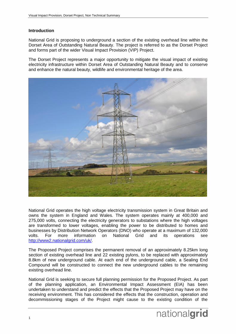
Front Cover: 4YA overhead transmission line, near Winterbourne Abbas, Dorset AONB
Visual Impact Provision, Dorset Project, Non Technical Summary
1
Introduction
National Grid is proposing to underground a section of the existing overhead line within the Dorset Area of Outstanding Natural Beauty. The project is referred to as the Dorset Project and forms part of the wider Visual Impact Provision (VIP) Project.
The Dorset Project represents a major opportunity to mitigate the visual impact of existing electricity infrastructure within Dorset Area of Outstanding Natural Beauty and to conserve and enhance the natural beauty, wildlife and environmental heritage of the area.
National Grid operates the high voltage electricity transmission system in Great Britain and owns the system in England and Wales. The system operates mainly at 400,000 and 275,000 volts, connecting the electricity generators to substations where the high voltages are transformed to lower voltages, enabling the power to be distributed to homes and businesses by Distribution Network Operators (DNO) who operate at a maximum of 132,000 volts. For more information on National Grid and its operations see http://www2.nationalgrid.com/uk/.
The Proposed Project comprises the permanent removal of an approximately 8.25km long section of existing overhead line and 22 existing pylons, to be replaced with approximately 8.8km of new underground cable. At each end of the underground cable, a Sealing End Compound will be constructed to connect the new underground cables to the remaining existing overhead line.
National Grid is seeking to secure full planning permission for the Proposed Project. As part of the planning application, an Environmental Impact Assessment (EIA) has been undertaken to understand and predict the effects that the Proposed Project may have on the receiving environment. This has considered the effects that the construction, operation and decommissioning stages of the Project might cause to the existing condition of the
Visual Impact Provision, Dorset Project, Non Technical Summary
2
environment, and takes into account measures incorporated into the project design and other methods (termed mitigation) that will be employed to reduce the significance of those effects.
The findings of the EIA are reported in the Environmental Statement. This document forms the Non Technical Summary of the Environmental Statement. It comprises a standalone document that presents a summary of the principal findings of the EIA.
Consultation
Consultation has been integral to the design and development of this stakeholder led Proposed Project. Stakeholder engagement has involved a range of activities including Stakeholder Advisory Group meetings, Stakeholder Reference Group meetings, direct engagement, third party channels, media relations, public drop-in events held in June 2016 and July 2017, and other local events, and the establishment of a project specific website (http://dorset.nationalgrid.co.uk/).
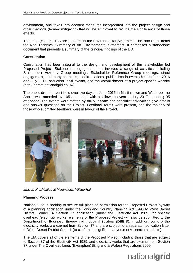
The public drop-in event held over two days in June 2016 in Martinstown and Winterbourne Abbas was attended by 105 attendees, with a follow-up event in July 2017 attracting 95 attendees. The events were staffed by the VIP team and specialist advisors to give details and answer questions on the Project. Feedback forms were present, and the majority of those who submitted feedback were in favour of the Project.
Images of exhibition at Martinstown Village Hall
Planning Process
National Grid is seeking to secure full planning permission for the Proposed Project by way of a planning application under the Town and Country Planning Act 1990 to West Dorset District Council. A Section 37 application (under the Electricity Act 1989) for specific overhead (electricity works) elements of the Proposed Project will also be submitted to the Department for Business, Energy and Industrial Strategy (DBEIS). In addition, some of the electricity works are exempt from Section 37 and are subject to a separate notification letter to West Dorset District Council (to confirm no significant adverse environmental effects).
The EIA covers all of the elements of the Proposed Project including those that are subject to Section 37 of the Electricity Act 1989, and electricity works that are exempt from Section 37 under The Overhead Lines (Exemption) (England & Wales) Regulations 2009.
Visual Impact Provision, Dorset Project, Non Technical Summary
3
Summary of Relevant Consenting Regimes
Project Element Consent Required Determined By
Installation of approximately 8.8km of 400kV underground cable.
Construction of two new sealing end compounds including permanent access.
Permanent removal of the existing overhead line section (approximately 8.25km) and 22 pylons.
Planning permission required under Town and Country Planning Act 1990 application.
EIA under The Town and Country Planning (Environmental Impacts Assessment) Regulations 2011.
West Dorset District Council
Replacement overhead line from existing pylon 4YA217 via replacement pylon (4YA216A) to the boundary of the Southern SEC (approximately 427m).
Replacement pylon 4YA216A.
Temporary overhead line diversion between pylon 4YA215 & 4YA217; includes 1 temporary pylon (4YA216T). Total length is approximately 700m.
Exempt under The Overhead Lines (Exemption) (England & Wales) Regulations 2009 as within tolerances and no significant adverse environmental effects.
Notification to West Dorset District Council to confirm no significant adverse environmental effects.
West Dorset District Council
Replacement of overhead line (both circuits) from pylon 4YA193 to proposed Northern SEC (approx 170m)
Section 37 Consent required under Electricity Act 1989.
EIA under the Electricity Works (Environmental Impact Assessment) (England and Wales) Regulations 2017
Secretary of State Business, Energy, Industrial Strategy (BEIS)
Alternatives
The Proposed Project has been developed from a number of options, taking into account engineering and environmental constraints identified from baseline studies, site walkovers and discussions with landowners and stakeholders. The new underground cable will largely follow a similar route to that of the existing 400kV overhead line. The Sealing End Compounds have been located within field corners next to existing hedgerows to minimise the effect on field patterns and field boundaries. The location of sensitive receptors also informed the Sealing End Compound locations, with the aim of reducing the visual effects experienced at these locations.

Visual Impact Provision, Dorset Project, Non Technical Summary
4
Project Details
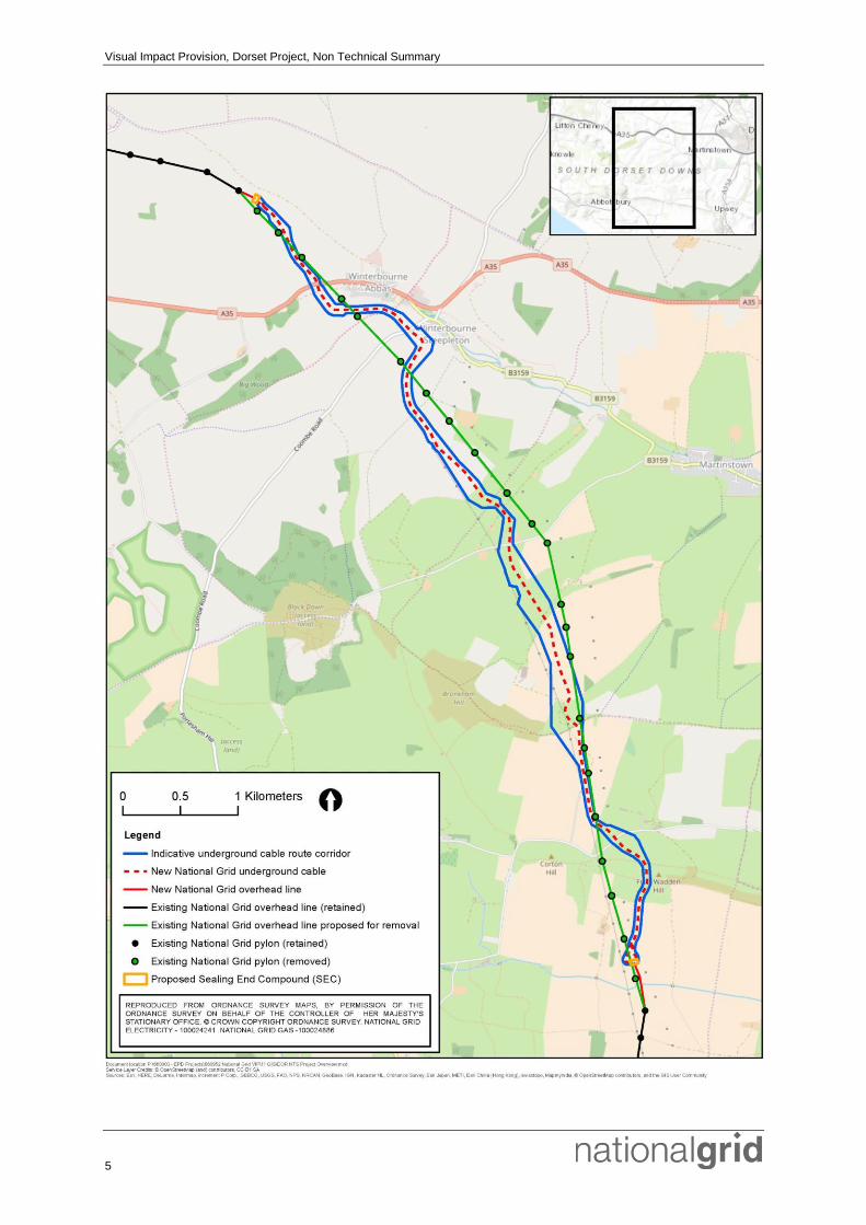
The Proposed Project will remove a section of National Grid’s existing electricity transmission line that runs through the Dorset Area of Outstanding Natural Beauty. The overhead line to be removed runs south from elevated ground, near Lankham Eweleaze, north-west of Winterbourne Abbas, across the A35, over undulating downland west of the B3159 road and the settlements of Winterbourne Abbas, Winterbourne Steepleton and Martinstown. The overhead line continues in a south-easterly direction crossing over a minor road east of Ballarat Farm before turning south, across the upper slopes of Shorn Hill and Corton Down, and over an escarpment east of Corton Farm (in an area known as Friar Waddon Hill), before exiting the Dorset Area of Outstanding Natural Beauty.
VIP Dorset Project
The Proposed Project will comprise the following main elements:
Dismantling and permanent removal of approximately 8.25km of existing overhead line including 22 pylons;
Installation of approximately 8.8km of 400kV underground cable;
Construction of two new Sealing End Compounds including permanent access, required to connect the new underground cables to the remaining existing overhead line; and
Replacement of one terminal pylon and approximately 0.6km of new overhead line.
Visual Impact Provision, Dorset Project, Non Technical Summary
5
Visual Impact Provision, Dorset Project, Non Technical Summary
6
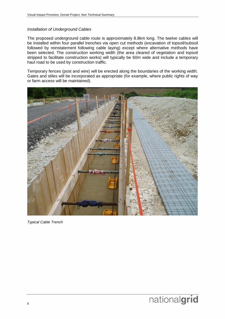
Installation of Underground Cables
The proposed underground cable route is approximately 8.8km long. The twelve cables will be installed within four parallel trenches via open cut methods (excavation of topsoil/subsoil followed by reinstatement following cable laying) except where alternative methods have been selected. The construction working width (the area cleared of vegetation and topsoil stripped to facilitate construction works) will typically be 60m wide and include a temporary haul road to be used by construction traffic.
Temporary fences (post and wire) will be erected along the boundaries of the working width. Gates and stiles will be incorporated as appropriate (for example, where public rights of way or farm access will be maintained).
Typical Cable Trench

Visual Impact Provision, Dorset Project, Non Technical Summary
7
Construction of Sealing End Compounds
Two permanent Sealing End Compounds of approximately 68m by 40m are required where the overhead line and underground cables will connect to each other. Each of these compounds will include gantries, switchgear, sealing ends and support structures bounded by a perimeter security fence. A photo of a typical Sealing End Compound is shown below.
At the Southern Sealing End Compound, a replacement pylon will be required with a short section of new overhead line (approximately 427m) to link the Sealing End Compound to the replacement pylon.
At the Northern Sealing End Compound, a new short section of overhead line (approx 170m) will be required to link the Sealing End Compound to the existing pylons; this work falls under Section 37 of the Electricity Act.
Typical Sealing End Compound
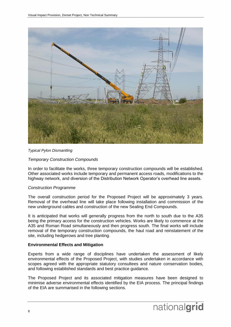
Removal of Existing Overhead Lines
As part of the Proposed Project, approximately 8.25km of existing 400kV overhead lines will be permanently removed, along with 22 pylons. Access for the overhead line removal works and dismantling of pylons will be off the cable construction haul road, with temporary access trackway laid between the haul road and individual overhead line works areas. Temporary access trackways will generally be laid directly on the ground.
Upon removal of the existing overhead line, much of the material will be taken for recycling. The existing concrete pylon foundations will be removed to approximately 1.2m depth.
Visual Impact Provision, Dorset Project, Non Technical Summary
8
Typical Pylon Dismantling
Temporary Construction Compounds
In order to facilitate the works, three temporary construction compounds will be established. Other associated works include temporary and permanent access roads, modifications to the highway network, and diversion of the Distribution Network Operator’s overhead line assets.
Construction Programme
The overall construction period for the Proposed Project will be approximately 3 years. Removal of the overhead line will take place following installation and commission of the new underground cables and construction of the new Sealing End Compounds.
It is anticipated that works will generally progress from the north to south due to the A35 being the primary access for the construction vehicles. Works are likely to commence at the A35 and Roman Road simultaneously and then progress south. The final works will include removal of the temporary construction compounds, the haul road and reinstatement of the site, including hedgerows and tree planting.
Environmental Effects and Mitigation
Experts from a wide range of disciplines have undertaken the assessment of likely environmental effects of the Proposed Project, with studies undertaken in accordance with scopes agreed with the appropriate statutory consultees and nature conservation bodies, and following established standards and best practice guidance.
The Proposed Project and its associated mitigation measures have been designed to minimise adverse environmental effects identified by the EIA process. The principal findings of the EIA are summarised in the following sections.
Visual Impact Provision, Dorset Project, Non Technical Summary
9
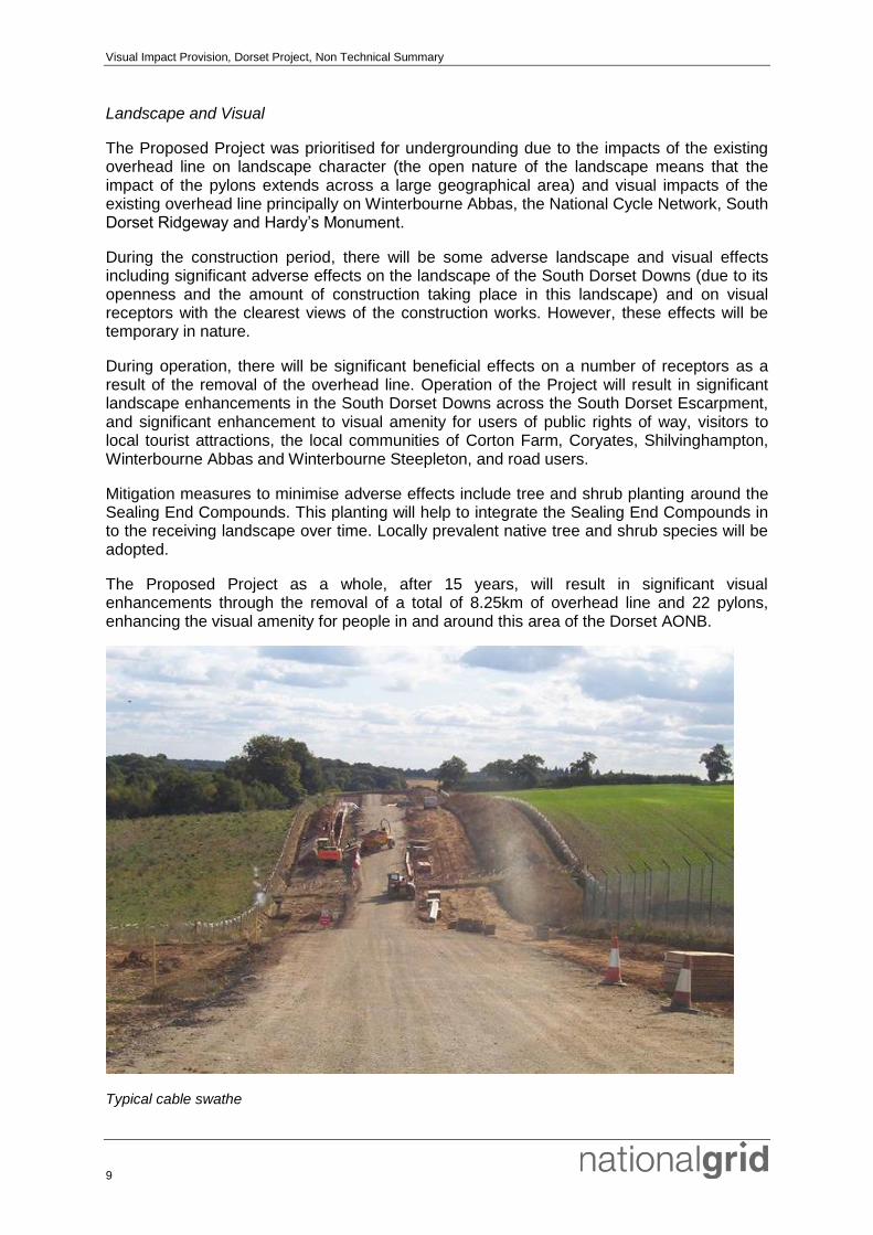
Landscape and Visual
The Proposed Project was prioritised for undergrounding due to the impacts of the existing overhead line on landscape character (the open nature of the landscape means that the impact of the pylons extends across a large geographical area) and visual impacts of the existing overhead line principally on Winterbourne Abbas, the National Cycle Network, South Dorset Ridgeway and Hardy’s Monument.
During the construction period, there will be some adverse landscape and visual effects including significant adverse effects on the landscape of the South Dorset Downs (due to its openness and the amount of construction taking place in this landscape) and on visual receptors with the clearest views of the construction works. However, these effects will be temporary in nature.
During operation, there will be significant beneficial effects on a number of receptors as a result of the removal of the overhead line. Operation of the Project will result in significant landscape enhancements in the South Dorset Downs across the South Dorset Escarpment, and significant enhancement to visual amenity for users of public rights of way, visitors to local tourist attractions, the local communities of Corton Farm, Coryates, Shilvinghampton, Winterbourne Abbas and Winterbourne Steepleton, and road users.
Mitigation measures to minimise adverse effects include tree and shrub planting around the Sealing End Compounds. This planting will help to integrate the Sealing End Compounds in to the receiving landscape over time. Locally prevalent native tree and shrub species will be adopted.
The Proposed Project as a whole, after 15 years, will result in significant visual enhancements through the removal of a total of 8.25km of overhead line and 22 pylons, enhancing the visual amenity for people in and around this area of the Dorset AONB.
Typical cable swathe

Visual Impact Provision, Dorset Project, Non Technical Summary
10
Ecology
There are a number of features of ecological importance located within and within close proximity to the Proposed Project. These include designated sites, habitats and species, some of which are protected by international and national legislation.
There are two Sites of Nature Conservation Interest (SNCI) within the area where the Proposed Project will be located which are protected by local planning policy. Both SNCI’s are designated for the grassland habitats they support.
Habitats within the area include low quality grassland, high quality grassland, scrub, trees, hedgerows, woodland, streams and ponds. Protected species that are confirmed as present in the area are great crested newt, reptiles (grass snake, common lizard and slow-worm), birds, bats, dormouse, badger and water vole.
A range of mitigation measures, such as sensitive scheduling and appropriate Method Statements, will be incorporated in order to minimise the impact of the Proposed Project on habitats and protected species. In addition, a range of ecological and landscape enhancement measures have been developed.
As a result of these measures the ecological assessment has concluded that the effects will range from not significant to significant (beneficial) for these habitats and for the species which they support.
Visual Impact Provision, Dorset Project, Non Technical Summary
11
Historic Environment
The Proposed Project is located within a rich, multi-period archaeological landscape. As part of the EIA a range of assessment techniques were adopted to assess potential heritage assets in the area including: a walkover survey; a review of LIDAR (Light Detection and Ranging) data to detect potential archaeological surface earthworks; geophysical survey; geoarchaeological watching brief during intrusive geotechnical works; historic map regression exercise; and initial trial trenching.
There are 88 known heritage assets within the Site Boundary. Of these, 37 are located outside of the indicative construction impact area. Direct impacts are predicted upon the remaining 51 known heritage assets which will require mitigation through preservation ‘by record’. The geophysical survey has identified 107 anomalies of potential archaeological interest. Of these, eight anomalies have been matched to known heritage assets. Ten anomalies lie outside the construction impact area and will be preserved in situ. Phase 1 trial trenching has determined that two previously uncertain effects are ‘no effect’, having proven geophysical anomalies as non-archaeological. The remaining 87 geophysical anomalies will require mitigation through preservation ‘by record’.
A range of archaeological mitigation is proposed to minimise potential impacts on archaeology and cultural heritage as follows:
Preservation in situ of specific heritage assets including the fencing off of nine assets throughout construction to prevent accidental damage;
Preservation by record of specific heritage assets; and
Reinstatement of specific surface earthworks (lynchets) / built heritage (dry stone walls) where directly affected by the construction works.
The agreed programme of mitigation is detailed in an Outline Archaeological Written Scheme of Investigation prepared in discussion with Historic England and Dorset County Council. The assessment concludes that, following the implementation of appropriate mitigation measures (preservation in situ or preservation ‘by record’), there would be no residual historic environment effects. The historic assessment also considers potential visual impacts to heritage assets and the contribution made by setting. There are no predicted significant adverse visual effects on designated and non-designated heritage assets as a result of the Proposed Project. The Proposed Project will result in an improvement in setting, and in the majority of cases there will be a net benefit to the significance and setting of surrounding heritage assets through removal of the overhead line.
Water Resources
The water resources assessment considers the potential effects on surface water resources, groundwater resources, hydromorphology, water quality and flooding and drainage associated with the construction, operation and decommissioning phases of the Proposed Project.
The new underground cables will cross a river (South Winterbourne) and its floodplain located west of Winterbourne Abbas as well as numerous unmapped field drains and overland flow pathways. The replacement pylon at the southern end of the works will be located approximately 40m north of Pucksey Brook and its floodplain.
Impacts will be minimised by the adoption of best construction practices. In addition, a number of additional mitigation measures will be implemented to mitigate impacts on water resources. These include, but are not limited to:

Visual Impact Provision, Dorset Project, Non Technical Summary
12
The avoidance of construction activities during periods of high groundwater levels;
The development of a construction phase drainage strategy;
Where possible, avoid stockpiling soil and alluvium within areas of floodplain, critical overland flow pathways, and areas of groundwater flood risk;
Where possible, avoid locating above ground elements and trenches within areas of floodplain, critical overland flow pathways, and areas of groundwater flood risk;
Where obstruction of overland flow is unavoidable, create natural flow diversions in order to restore lateral connectivity; and
The implementation of an Operational Phase Sustainable Drainage System (SuDS) Maintenance and Management Plan for both Sealing End Compounds (including permanent access roads)
Assuming that the proposed mitigation measures are implemented, it is considered that the water resources effects of the Proposed Project will be no worse than minor adverse (temporary) with respect to the water environment and therefore not considered significant.
Additional studies include a Flood Risk Assessment and a Sustainable Drainage System statement which form part of the planning application documentation and an overland flow path assessment providing information on the location and direction of surface water flow pathways.
Geology, Soils and Contaminated Land
An assessment of the potential effects on soils, geology and contaminated land as a result of the construction, operation and decommissioning of the Proposed Project has been undertaken.
The assessment reviewed the sensitivity of the underlying geology and potential environmental receptors informed by a baseline review, site walkover and the findings of an intrusive site investigation. Although the site was identified to have sensitive environmental receptors, including valuable groundwater resources relating to the predominate underlying chalk geology, no potential sources of contamination were identified.
A geological Site of Special Interest (SSSI) at Corton Cutting is located close to the Proposed Project but will not be affected by the works.
The underlying limestone geology in the south of the Proposed Project was identified as a potential mineral resource, part of which will be lost beneath the Proposed Project, although this will be minimal given the limited width of the cable route.
Potential effects of the Proposed Project on soils, geology and contaminated land relate to any accidental spills of fuels, oils, etc. polluting the sensitive environment and damage to soils during construction. Impacts will be minimised by the adoption of best construction practices. No significant effects on soils and geology are predicted.
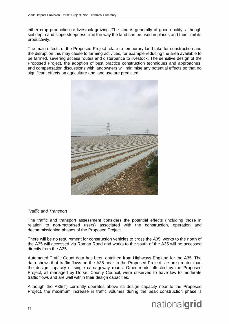
Agriculture and Land Use
An assessment of the potential effects on agriculture and land use as a result of the construction, operation and decommissioning of the Proposed Project has been undertaken. The assessment has focused on the soil types present, the quality of the agricultural land and the farming practices being used. The majority of the land is rural farmland used for
Visual Impact Provision, Dorset Project, Non Technical Summary
13
either crop production or livestock grazing. The land is generally of good quality, although soil depth and slope steepness limit the way the land can be used in places and thus limit its productivity.
The main effects of the Proposed Project relate to temporary land take for construction and the disruption this may cause to farming activities, for example reducing the area available to be farmed, severing access routes and disturbance to livestock. The sensitive design of the Proposed Project, the adoption of best practice construction techniques and approaches, and compensation discussions with landowners will minimise any potential effects so that no significant effects on agriculture and land use are predicted.
Traffic and Transport
The traffic and transport assessment considers the potential effects (including those in relation to non-motorised users) associated with the construction, operation and decommissioning phases of the Proposed Project.
There will be no requirement for construction vehicles to cross the A35; works to the north of the A35 will accessed via Roman Road and works to the south of the A35 will be accessed directly from the A35.
Automated Traffic Count data has been obtained from Highways England for the A35. The data shows that traffic flows on the A35 near to the Proposed Project site are greater than the design capacity of single carriageway roads. Other roads affected by the Proposed Project, all managed by Dorset County Council, were observed to have low to moderate traffic flows and are well within their design capacities.
Although the A35(T) currently operates above its design capacity near to the Proposed Project, the maximum increase in traffic volumes during the peak construction phase is

Visual Impact Provision, Dorset Project, Non Technical Summary
14
predicted to be 0.9% (all traffic) and less than 13% (HGV traffic), with the typical increase in traffic volumes over the construction phase being approximately one-third of this.
Proposed measures to mitigate the traffic and transport impacts are:
Access improvements on Roman Road, to improve visibility and enhance the existing passing places;
Construction Traffic Management Plan, to manage the impact of construction vehicle movements (particularly HGVs) on the local highway network; and
Public rights of way management, to keep footpaths, bridleways and byways open as far as possible during the construction programme whilst implementing measures to minimise conflicts between rights of way users and construction vehicles.
With the implementation of the above mitigation measures, it is considered that the traffic and transportation effects of the Proposed Project will be no worse than minor adverse (temporary) with respect to severance, driver delay, pedestrian and cycle delay, pedestrian and cycle amenity and fear and intimidation, and therefore not significant.
Typical cable drum delivery
Socio-Economics and Tourism
An assessment of the likely significant effects on socio-economic features associated with the construction, operation and decommissioning phases of the Proposed Project has been undertaken. This includes consideration of tourism, access, amenity, employment and the supply chain.
The workforce numbers required for the Proposed Project will vary depending on factors such as the agreed construction programme and specific requirements of the chosen contractor. It is anticipated that a labour peak of up to 20 personnel will occur during the busiest period at each of the Sealing End Compounds, up to 45 personnel for cable construction and of 5 to 10 operatives at a particular pylon for the overhead line removal works. During construction, the majority of employment activities would require trained specialists who are qualified to work on National Grid sites. Workers are likely to be sourced from an existing pool of approved contractors. Local employment opportunities would be expected in sectors including site security, construction labouring, plant hire, haulage, landscaping, fencing and drainage. The number of employees working on the Proposed Project during operation is expected to be minimal, and will be limited to periodic checks by a small maintenance team.

Visual Impact Provision, Dorset Project, Non Technical Summary
15
The assessment has concluded that no significant effects are anticipated on tourism, amenity, employment and supply chain as a result of the Proposed Project. Increased focus/ publicity on the area as a result of the Proposed Project may encourage more visitors and tourists to the area as a whole which could potentially have a positive knock on effect to local businesses.
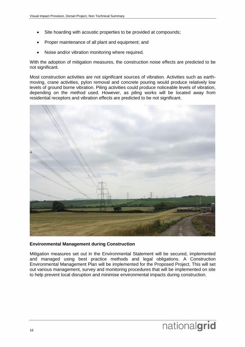
Noise and Vibration
A combination of noise monitoring and predictive calculations have been undertaken to establish the existing noise climate and the change in noise levels predicted as a result of the Proposed Project during construction. The Proposed Project area is largely rural with few noise and vibration sensitive receptors. However, there are some isolated receptors within, and close to, the Proposed Project which have the potential to be affected by noise during construction and decommissioning works dependent on the separation distance to construction works. The village of Winterbourne Abbas would carry more traffic and is typically urban residential in nature.
In order to minimise construction noise impacts, mitigation measures will include:
Working hours restricted to core hours so far as appropriate. Core hours are between 0700 and 1900 Mondays to Fridays and between 0800 and 1700 on Saturdays and Sundays;
Selection of quieter plant and less intrusive methods (such as hydraulic plant rather than percussive) where appropriate and practicable;
Locating plant and equipment as far as practicably possible from receptor locations;
Visual Impact Provision, Dorset Project, Non Technical Summary
16
Site hoarding with acoustic properties to be provided at compounds;
Proper maintenance of all plant and equipment; and
Noise and/or vibration monitoring where required.
With the adoption of mitigation measures, the construction noise effects are predicted to be not significant.
Most construction activities are not significant sources of vibration. Activities such as earth-moving, crane activities, pylon removal and concrete pouring would produce relatively low levels of ground borne vibration. Piling activities could produce noticeable levels of vibration, depending on the method used. However, as piling works will be located away from residential receptors and vibration effects are predicted to be not significant.
Environmental Management during Construction
Mitigation measures set out in the Environmental Statement will be secured, implemented and managed using best practice methods and legal obligations. A Construction Environmental Management Plan will be implemented for the Proposed Project. This will set out various management, survey and monitoring procedures that will be implemented on site to help prevent local disruption and minimise environmental impacts during construction.
Visual Impact Provision, Dorset Project, Non Technical Summary
17
Conclusion
The Dorset Project represents a major opportunity to mitigate the visual impact of existing electricity infrastructure within Dorset Area of Outstanding Natural Beauty and to conserve and enhance the natural beauty, wildlife and environmental heritage of the area.
The EIA identified a number of potential adverse effects on the environment and, where possible, measures to avoid or minimise these effects have been included in the project design. Additional mitigation measures have also been identified in order to minimise impacts where significant impacts were predicted. The EIA concludes that there will be significant beneficial effects on a number of receptors (eg the South Dorset Downs landscape, users of local public rights of way, visitors to local tourist attractions, and the local communities of Corton Farm, Coryates, Shilvinghampton, Winterbourne Abbas and Winterbourne Steepleton) during operation, despite temporary adverse construction effects.
Further Information
The planning application documents, including the Environmental Statement and this Non Technical Summary are also available to download electronically from the Dorset VIP website at the following address:
http://webapps.westdorset-weymouth.gov.uk/PlanningApps/Pages/Search.aspx
The full Environmental Statement, including this Non Technical Summary, is available by writing to the address below at a cost of £290 (to cover production costs (including a delivery charge) for a hard copy format or free on DVD.
Post: National Grid VIP Project C/o Camargue 11 Waterloo Street Birmingham B2 5TB
or
Email: [email protected]
Further hard copies of this Non Technical Summary are available free of charge from the same address.

National Grid plcNational Grid House, Warwick Technology Park, Gallows Hill, Warwick, CV34 6DA, United Kingdom Registered in England and Wales No. 4031152www.nationalgrid.com
FOR FURTHER INFORMATION:Visual Impact Provision hotline: 0330 134 0051Visit our website at: www.nationalgrid.com/VIPSend an email to: [email protected] to our freepost address and quote: “FREEPOST VISUAL IMPACT PROVISION”