urban surveyors brochure - home - board of … just a bit of history 1 surveyors and their toys and...
TRANSCRIPT

Do you love maths and maps, lots of Do you love maths and maps, lots of variety and freedom working outdoors? variety and freedom working outdoors?
Technical Assistant Graduate Surveyor Surveyor
Survey Technician Graduate Surveyor Cadastral Surveyor Surveyor
SSURVEYORSURVEYORS
VOLUME 2
Working in the city Working in the city WWhathat
will I be?will I be? Rural SeriesRural Series
WWhathat will I be?will I be?
SurveyorSurveyor

Proudly supported by:
www.surveyors.org.au
www.smicnsw.org.au
www.lpi.nsw.gov.au
www.acsnational.com.au
www.acsis.com.au
www.acsnsw.com.au
www.minesurveyors.com.au
www.cumberlandgroup.com.au
www.environment.act.gov.au
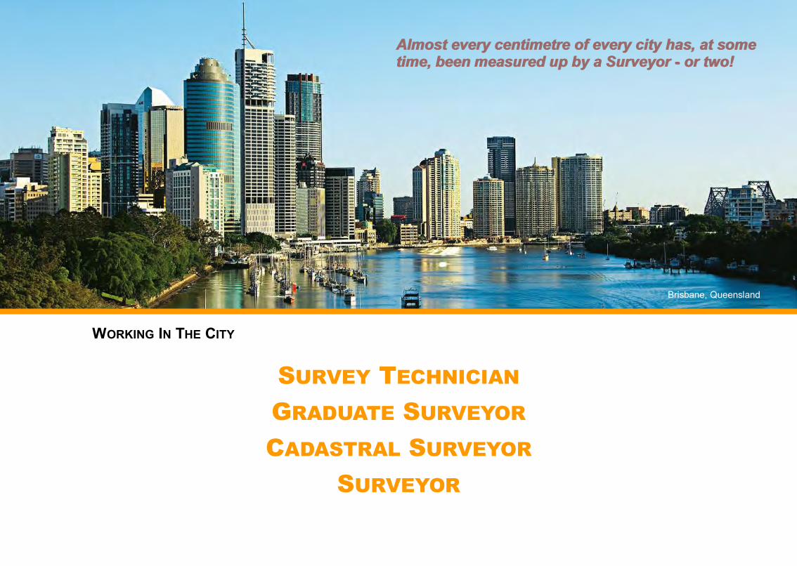
WORKING IN THE CITY
SURVEY TECHNICIAN GRADUATE SURVEYOR CADASTRAL SURVEYOR
SURVEYOR
Almost every centimetre of every city has, at some Almost every centimetre of every city has, at some time, been measured up by a Surveyor time, been measured up by a Surveyor -- or two!or two!
Brisbane, Queensland
This book is dedicated to all those who have a bigger vision for their lives.
With thanks to the
Cumberland Group of SurveyorsCreation, printing and distribution of these books is made
possible through the enthusiasm and financial assistance of the:
Cumberland Group of SurveyorsAlso the:
NSW Government Land & Property Information
Environment and Sustainable Development, ACT Government
Association of Consulting Surveyors NSW
Australian Institute of Mine Surveyors
Surveying and Mapping Industry Council NSW
The Institution of Surveyors NSW Inc. (ISNSW)
Consulting Surveyors National
ACSIS Ltd
Acknowledgements: We acknowledge the Traditional Owners of this awe-inspiring land.Thanks to Belinda, Tom, Jill, Greg and Bridget for sharing their insight.Thanks to Dr Veronica Bondarew, CEO, Consulting Surveyors NSW, for her enthusiasm and passion for bringing this book into being...… and to Michael Green, Phil Dingeldei, Mick Rose and Peter Noble for their yarns and their inspiring love for their profession.
All rights reserved. No part of this PDF/book may be produced in any form or by any means whatsoever - graphic, electronic or mechanical - including printing, photocopying or information storage and retrieval systems, without permission in writing from the Author.
Copyright © 2014 Beverley Neil, d’Scriptive Words
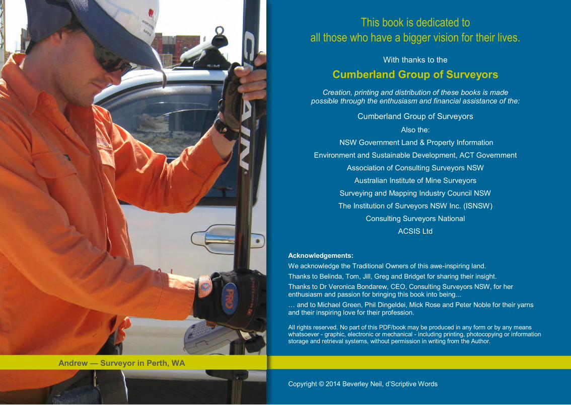
Andrew — Surveyor in Perth, WA
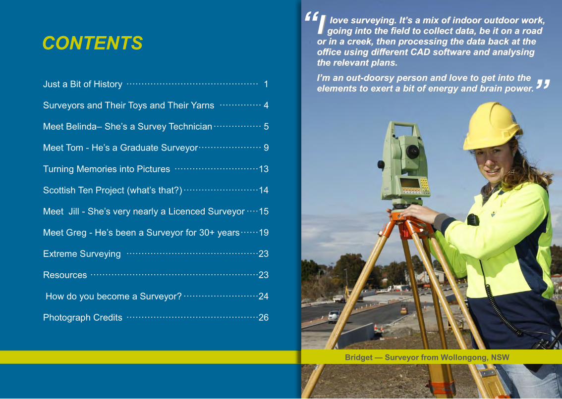
CONTENTS
Just a Bit of History ············································ 1
Surveyors and Their Toys and Their Yarns ·············· 4
Meet Belinda– She’s a Survey Technician ················ 5
Meet Tom - He’s a Graduate Surveyor····················· 9
Turning Memories into Pictures ····························13
Scottish Ten Project (what’s that?) ·························14
Meet Jill - She’s very nearly a Licenced Surveyor ····15
Meet Greg - He’s been a Surveyor for 30+ years······19
Extreme Surveying ············································23
Resources ························································23
How do you become a Surveyor? ·························24
Photograph Credits ············································26“
“ II love surveying. It’s a mix of indoor outdoor work, love surveying. It’s a mix of indoor outdoor work, going into the field to collect data, be it on a road going into the field to collect data, be it on a road
or in a creek, then processing the data back at the or in a creek, then processing the data back at the office using different CAD software and analysing office using different CAD software and analysing the relevant plans. the relevant plans. I’m an outI’m an out--doorsy person and love to get into the doorsy person and love to get into the elements to exert a bit of energy and brain power.elements to exert a bit of energy and brain power.
Bridget — Surveyor from Wollongong, NSW

Surveyors have always been essential to civilisation!
When you get into the high tech equipment and satellite position technology used by surveyors today, it’s incredible to think once all surveying was carried out by chains, steel bands, and ‘moving’ rulers, known as slide rules. Yet, Surveyors hundreds, even thousands, of years ago were still
amazingly accurate down to the inth degree!
Land and boundaries have always been vital to individuals, groups, towns and countries, so it’s hardly surprising that the accurate measurement of those boundaries was of the utmost importance! This has made Surveyors some of the most influential people throughout history, right back to early Egypt around 3000 plus years ago.
Enduring structures such as the pyramids all needed surveyors on the job first and foremost as well as other feats of engineering from the aqueducts of ancient Rome to our own home-grown Snowy Mountains Hydro Electric Scheme and the Sydney Harbour Bridge.
Surveying is all about accurately mapping, measuring, calculating and marking in both 2-dimensions and 3-dimensions — very accurately! This may be anything from an ocean bed or the sky, the polar icecaps, a mountain range, a golf course, bridge or land boundary.
1960 - Snowy Mountains Scheme Surveying at Tooma Dam site
In 1836, Colonel William Light was sent to South Australia with a team of 10 largely inexperienced surveyors plus 30 labourers and given a mere two-months to 1/ Explore and survey 1500 miles of coast line to choose a site for a town; 2/ Found not only that town but a series of secondary towns; 3/ Carry out a survey on 100,000 country sections. He chose
the beautiful location where Adelaide now rests, and also pegged 1004 town acres within eight weeks despite labour shortages and strikes.
Because the colony was growing so rapidly, Light and his team had to measure up and produce a plan covering another 100,000 acres. When Light contacted London for more staff he was told he should work faster instead of working so
accurately. Following this unrealistic, unprofessional advice, Light handed in his resignation (as did most of the other surveyors) and went out on his own, establishing South Australia’s first private surveying business!1
Construct ing an icon!
Did you know?Long before European settlement, Indigenous tribes had established designated ‘track-ways’ and trade routes across Australia.
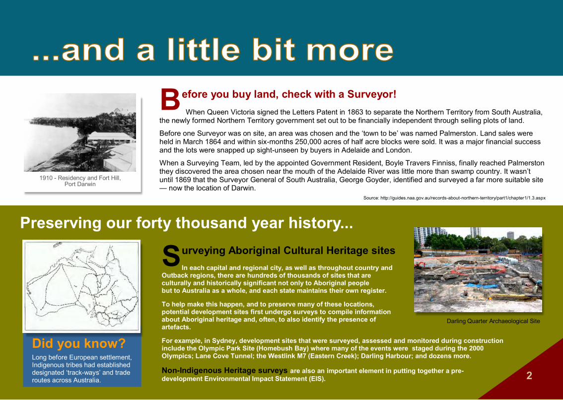
Surveying Aboriginal Cultural Heritage sitesIn each capital and regional city, as well as throughout country and
Outback regions, there are hundreds of thousands of sites that are culturally and historically significant not only to Aboriginal people but to Australia as a whole, and each state maintains their own register.
To help make this happen, and to preserve many of these locations, potential development sites first undergo surveys to compile information about Aboriginal heritage and, often, to also identify the presence of artefacts.
For example, in Sydney, development sites that were surveyed, assessed and monitored during construction include the Olympic Park Site (Homebush Bay) where many of the events were staged during the 2000 Olympics; Lane Cove Tunnel; the Westlink M7 (Eastern Creek); Darling Harbour; and dozens more.
Non-Indigenous Heritage surveys are also an important element in putting together a pre- development Environmental Impact Statement (EIS). 2
Before you buy land, check with a Surveyor! When Queen Victoria signed the Letters Patent in 1863 to separate the Northern Territory from South Australia,
the newly formed Northern Territory government set out to be financially independent through selling plots of land.
Before one Surveyor was on site, an area was chosen and the ‘town to be’ was named Palmerston. Land sales were held in March 1864 and within six-months 250,000 acres of half acre blocks were sold. It was a major financial success and the lots were snapped up sight-unseen by buyers in Adelaide and London.
When a Surveying Team, led by the appointed Government Resident, Boyle Travers Finniss, finally reached Palmerston they discovered the area chosen near the mouth of the Adelaide River was little more than swamp country. It wasn’t until 1869 that the Surveyor General of South Australia, George Goyder, identified and surveyed a far more suitable site — now the location of Darwin.
Source: http://guides.naa.gov.au/records-about-northern-territory/part1/chapter1/1.3.aspx
1910 - Residency and Fort Hill,Port Darwin
Preserving our forty thousand year history...
Darling Quarter Archaeological Site

Hospitals
Sports grounds
Virtually Virtually nothingnothing happens without a Surveyor!happens without a Surveyor!
3
Aquatic centres
Theme parks
Olympic Park Aquatic Centre, Sydney NSW
Fiona Stanley Hospital, Perth WA
Blundstone Arena, Hobart Tas
Movieworld, Gold Coast Qld

“When they were building Sydney Tower Eye, when they reached the halfway point I had to measure the height to make sure the distance from that disc down to the slab was exactly right. This was before electronic equipment so we had to hang a tape vertically down the structure to make the measurement. We found it was 25mm too short.
Later they mapped the movement as the sun rose in the east and warmed and expanded the metal, then moved through the sky heating the metal as it went. With the movement there is a kind of twisting effect. They set laser beams going up through the centre to measure how severe the twist was. The engineers then made adjustments to the cables to keep everything secure.”
4
Machine guidance control unit
SmartStation using GNSS Theodolite Laser Scan Station
Optical Level
Surveyors and their toysThe way Surveyors take measurements has not really changed over the years, but the equipment has massively changed and improved and it is far easier to get accurate measurements than when only sticks, pegs, string and
chains were used. Now, Surveyors use instruments such as laser range finders, robotic-guided total stations with electronic distance measuring devices, optical and laser levels, GNSS (Global Navigation Satellite Systems) and more.
There are dozens of surveying tools on the market, plus they are constantly being updated or created, but these images will give you a rough idea of the fascinating equipment you’ll be utilising as a Surveyor…
GNSS/GIS Handset
Laser Distance Meter
“I measured up for a newly constructed sewer tunnel that wound through the foundations of an existing building in the city. At one point they had to break a hole into the existing sewer just above the flow level. I couldn’t believe the speed of the flow in this tunnel – you could go white water rafting. Thankfully at that point the surveyor’s job was over and I was out of there.”
...and their tales“Just before the 2000 Olympics they increased the size of the flags at the top of the bridge, then Sydney had a very gusty day. The concern was that the flagpoles were going to break with the extra flag weight billowing in the breeze, the wind was so strong. Our job was to climb the bridge with surveying equipment and measure the deflection angle of the flagpoles. We were up there from late afternoon, through dusk and sunset: a beautiful sight as the city lights came on. Surveying doesn't get much better than that.”

5
Q&AQ&AIINSIGHTNSIGHT
What does a Survey Technician
Do?A Survey Technician is a senior role which supports the Surveyor. One of the many and varied duties a Survey Technician can perform is uploading calculated information from survey specific programs into the field survey equipment, which may be either a hand controller or a survey total station. A Survey Technician can then use this information to make additional measurements, check and analyse data, draft plans using drafting software, and set out points, or gridlines, on a construction site.
A Survey Technician is TAFE trained with a Diploma of Surveying and a possible pathway to a Surveying degree.
Another key role, the ‘Technical Assistant’, also undertakes a wide variety of jobs. When working out in the field, he or she assists senior, or Licensed/Registered Surveyors to complete jobs by hammering in pegs, identifying survey marks, making sure the senior surveyor has all the tools and equipment needed for the day’s work, downloading data, and ensuring the work is completed quickly and correctly. Assistants also maintain all of the survey equipment and vehicles, keeping them clean and making sure everything is in working order. Study may start with a TAFE Certificate III in Surveying and Spatial Science.
In the office, both the Survey Technician and Technical Assistant may enter data and draft plans on the computer working through a ‘CAD’ drafting program, which is used to show the scope of work completed in the field.
In this first Q&A, Belinda gives an insight into being a Survey Technician.
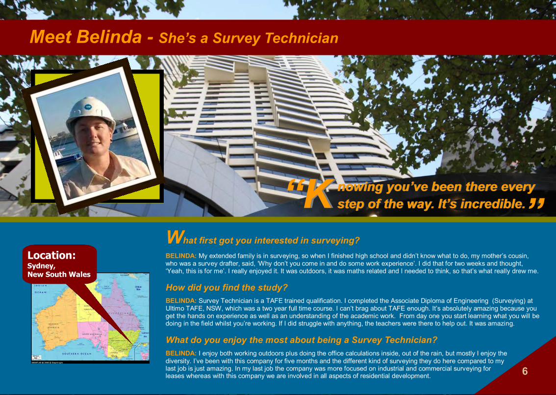
Meet Belinda - She’s a Survey Technician
Location: Sydney, New South Wales
“ “KK nowing you’ve been there every nowing you’ve been there every step of the way. It’s incredible.step of the way. It’s incredible.
What first got you interested in surveying?
BELINDA: My extended family is in surveying, so when I finished high school and didn’t know what to do, my mother’s cousin, who was a survey drafter, said, ‘Why don’t you come in and do some work experience’. I did that for two weeks and thought, ‘Yeah, this is for me’. I really enjoyed it. It was outdoors, it was maths related and I needed to think, so that’s what really drew me.
How did you find the study?BELINDA: Survey Technician is a TAFE trained qualification. I completed the Associate Diploma of Engineering (Surveying) at Ultimo TAFE, NSW, which was a two year full time course. I can’t brag about TAFE enough. It’s absolutely amazing because you get the hands on experience as well as an understanding of the academic work. From day one you start learning what you will be doing in the field whilst you’re working. If I did struggle with anything, the teachers were there to help out. It was amazing.
What do you enjoy the most about being a Survey Technician?BELINDA: I enjoy both working outdoors plus doing the office calculations inside, out of the rain, but mostly I enjoy the diversity. I’ve been with this company for five months and the different kind of surveying they do here compared to my last job is just amazing. In my last job the company was more focused on industrial and commercial surveying for leases whereas with this company we are involved in all aspects of residential development. 6

So, what sort of projects do you work on?BELINDA: I work on various projects from placing marks in the ground to show the location of where a fence should be placed, up to working on 50 storey residential
buildings, and lots of variety in between. With the multi-storey building, we go from surveying the excavations to the finished job. Once it’s completed we finalise and make sure the building has been put in the exact location that it should be, and that it has been built to the correct height. Then we measure up for the strata plan so that individual units can be sold off.
So basically, you’re advising the builders where to build the structure, then finally checking they have built it as per the plan. The building also gets checked on a level by level basis throughout the project. Seeing the progress and knowing you’ve been involved from a big excavated hole in the ground right up to this magnificent building that is completed and furnished, and knowing you’ve been there every step of the way through the development – it’s incredible.
What do think the downsides are to your job?
BELINDA: The weather is one. When it’s six o’clock in the morning in the middle of winter and it’s raining it’s not fantastic to be working outside, but this doesn’t happen very often. Really, the only negative, and this is just me trying hard to think of something, is doing a repetitive job on some of the really big projects, such as putting in the hundreds of nails to define the gridlines. As I say, that’s just me struggling to find something, anything, that could be a downside in a job I really love.
7
WHAT IS A GRIDLINE?“A gridline is like playing Battleships – you’ve got your letter lines and your number lines which are used as building reference points. So every level of a building has the same gridlines, and the design of the building is all related to the gridlines. “
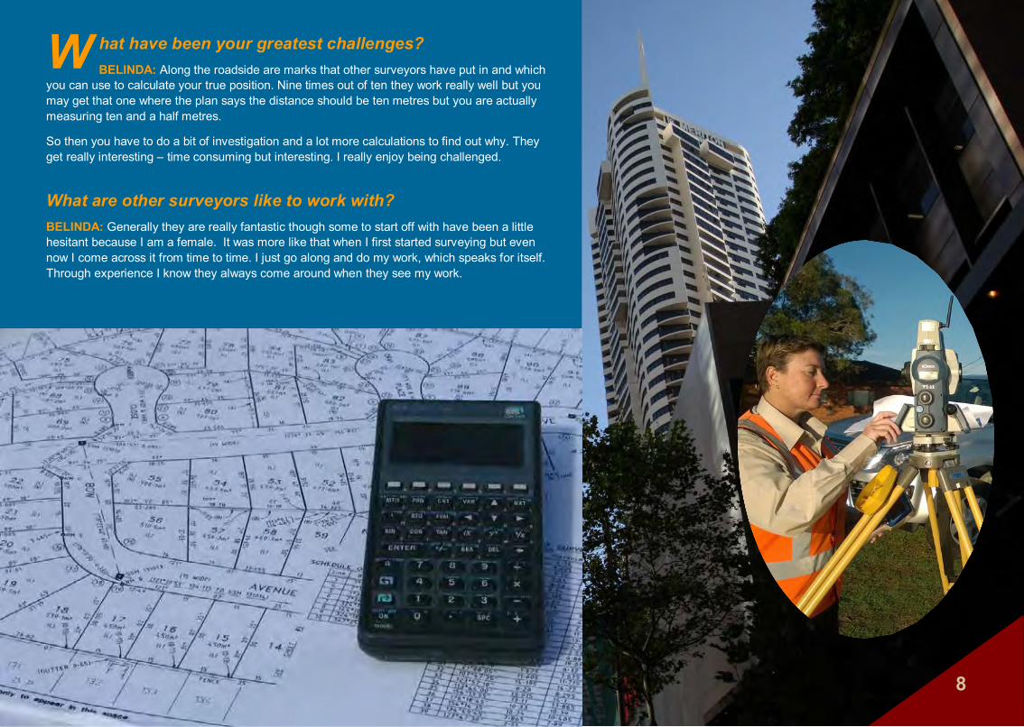
W hat have been your greatest challenges?
BELINDA: Along the roadside are marks that other surveyors have put in and which you can use to calculate your true position. Nine times out of ten they work really well but you may get that one where the plan says the distance should be ten metres but you are actually measuring ten and a half metres.
So then you have to do a bit of investigation and a lot more calculations to find out why. They get really interesting – time consuming but interesting. I really enjoy being challenged.
What are other surveyors like to work with?
BELINDA: Generally they are really fantastic though some to start off with have been a little hesitant because I am a female. It was more like that when I first started surveying but even now I come across it from time to time. I just go along and do my work, which speaks for itself. Through experience I know they always come around when they see my work.
8
9
Q&AQ&AIINSIGHTNSIGHT
What does a Graduate Surveyor
Do?A Graduate Surveyor has already undertaken his or her Bachelor of Surveying or similar university degree. This may have taken up to five years full-time study to complete, though the length of study can vary from state to state. To move on from being a Graduate Surveyor it’s necessary to gain one year’s field experience as a survey team leader (the one who is making the decisions!). A Graduate Surveyor will be working outdoors undertaking many different types of survey field work in a wide variety of situations and locations, as well as using CAD software in the office working on calculations and drafting survey plans.
Tom has been a Graduate Surveyor for just five months, and says he carries out four main types of survey work — Engineering Detail Surveys, Subdivision Boundary Marking, Identification Surveys (which is Cadastral Surveying) and also Construction and Set Out Surveys.
A Graduate Surveyor works under the ‘supervision’ of a Licensed Surveyor, who has had his or her licence for at least two years. This supervisor guides and mentors the Graduate through their Cadastral learning up until they themselves receive their licence, if that is the surveying discipline the Graduate wants to pursue. As the Graduate’s experience grows, he or she can work independently as well as assisting a senior surveyor or operating as the team leader.

Meet Tom - He’s a Graduate Surveyor
Location: Adelaide, South Australia
10
W hat was it about surveying that grabbed your attention?TOM: My mum was long-term friends with a surveyor so when we were discussing things I could do, surveying
was always one of them. I forgot about surveying through high school but I was interested in geology. When I was looking through the university subjects for geology I came across surveying.
I always liked the idea of working out of doors and you get to see some fantastic things when you’re out working in paddocks in rural areas or working in high rise buildings in the city.
(Main photo: Tom is conducting a detailed survey of the topography of a section of a golf course. A new subdivision will be built adjoining the golf course and the developers need to know the potential impact for drainage etcetera).
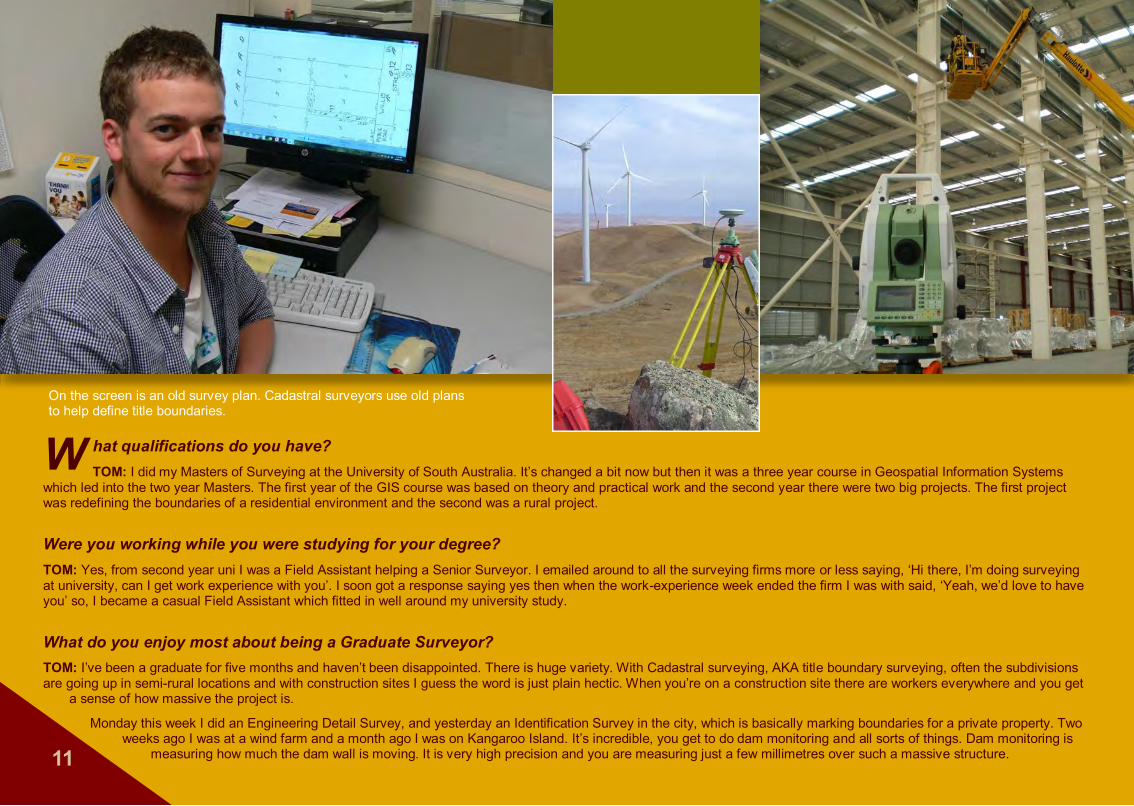
W hat qualifications do you have?TOM: I did my Masters of Surveying at the University of South Australia. It’s changed a bit now but then it was a three year course in Geospatial Information Systems
which led into the two year Masters. The first year of the GIS course was based on theory and practical work and the second year there were two big projects. The first project was redefining the boundaries of a residential environment and the second was a rural project.
Were you working while you were studying for your degree?TOM: Yes, from second year uni I was a Field Assistant helping a Senior Surveyor. I emailed around to all the surveying firms more or less saying, ‘Hi there, I’m doing surveying at university, can I get work experience with you’. I soon got a response saying yes then when the work-experience week ended the firm I was with said, ‘Yeah, we’d love to have you’ so, I became a casual Field Assistant which fitted in well around my university study.
What do you enjoy most about being a Graduate Surveyor?TOM: I’ve been a graduate for five months and haven’t been disappointed. There is huge variety. With Cadastral surveying, AKA title boundary surveying, often the subdivisions are going up in semi-rural locations and with construction sites I guess the word is just plain hectic. When you’re on a construction site there are workers everywhere and you get a sense of how massive the project is.
Monday this week I did an Engineering Detail Survey, and yesterday an Identification Survey in the city, which is basically marking boundaries for a private property. Two weeks ago I was at a wind farm and a month ago I was on Kangaroo Island. It’s incredible, you get to do dam monitoring and all sorts of things. Dam monitoring is
measuring how much the dam wall is moving. It is very high precision and you are measuring just a few millimetres over such a massive structure.11
On the screen is an old survey plan. Cadastral surveyors use old plans to help define title boundaries.
12“ “II haven’t been disappointed. There is haven’t been disappointed. There is
huge variety working as a Surveyor. huge variety working as a Surveyor.
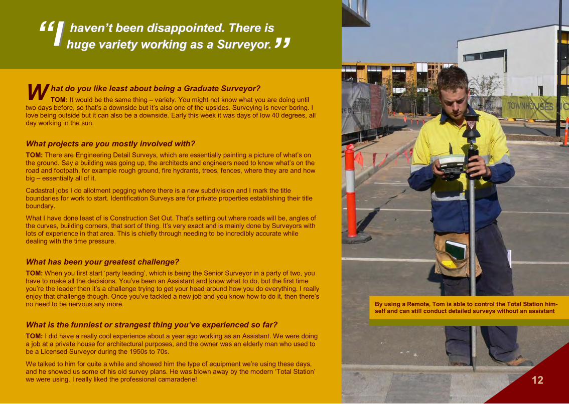
By using a Remote, Tom is able to control the Total Station him-self and can still conduct detailed surveys without an assistant
W hat do you like least about being a Graduate Surveyor?TOM: It would be the same thing – variety. You might not know what you are doing until
two days before, so that’s a downside but it’s also one of the upsides. Surveying is never boring. I love being outside but it can also be a downside. Early this week it was days of low 40 degrees, all day working in the sun.
What projects are you mostly involved with?TOM: There are Engineering Detail Surveys, which are essentially painting a picture of what’s on the ground. Say a building was going up, the architects and engineers need to know what’s on the road and footpath, for example rough ground, fire hydrants, trees, fences, where they are and how big – essentially all of it.
Cadastral jobs I do allotment pegging where there is a new subdivision and I mark the title boundaries for work to start. Identification Surveys are for private properties establishing their title boundary.
What I have done least of is Construction Set Out. That’s setting out where roads will be, angles of the curves, building corners, that sort of thing. It’s very exact and is mainly done by Surveyors with lots of experience in that area. This is chiefly through needing to be incredibly accurate while dealing with the time pressure.
What has been your greatest challenge?TOM: When you first start ‘party leading’, which is being the Senior Surveyor in a party of two, you have to make all the decisions. You’ve been an Assistant and know what to do, but the first time you’re the leader then it’s a challenge trying to get your head around how you do everything. I really enjoy that challenge though. Once you’ve tackled a new job and you know how to do it, then there’s no need to be nervous any more.
What is the funniest or strangest thing you’ve experienced so far?TOM: I did have a really cool experience about a year ago working as an Assistant. We were doing a job at a private house for architectural purposes, and the owner was an elderly man who used to be a Licensed Surveyor during the 1950s to 70s.
We talked to him for quite a while and showed him the type of equipment we’re using these days, and he showed us some of his old survey plans. He was blown away by the modern ‘Total Station’ we were using. I really liked the professional camaraderie!
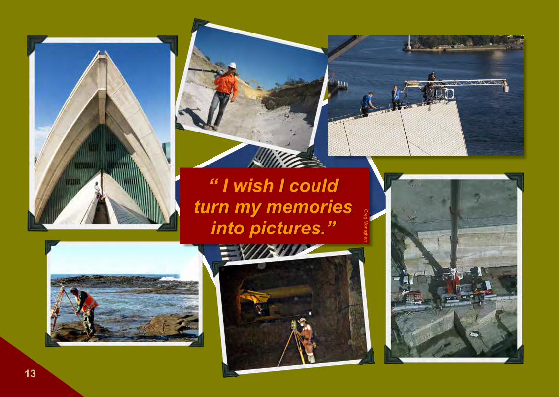
“ I wish I could I could turn my memories turn my memories
into pictures.”into pictures.”
Greg M
onaghan
13

14
Create the life you wantCreate the life you wantIt’s not up to others It’s not up to others -- it’s up to you!it’s up to you!
During April 2013, the Scottish Ten Project (you must check out their amazing projects at www.scottishten.org) surveyed the entire external area and the full interior of the Sydney Opera House. The project provided the Opera House management with invaluable, detailed information vital to conserving the Opera House for generations to come. Now, that’s taking surveying to new heights!
15
Q&AQ&AIINSIGHTNSIGHT
What does a Cadastral Surveyor
Do?If you see someone referred to as a Registered or Licensed Surveyor, what this means is that they have undertaken the process to become a ‘Cadastral’ or ‘Title Boundary’ Surveyor. You can be a Surveyor without being Licensed and can conduct any number of surveying jobs, but you can not determine and mark up title boundaries and fencelines that are recognised legally. Only Surveyors who have passed a rigorous licensing examination process can establish title boundaries that are recognised by governments, councils and the courts. This includes the boundaries for the creation of all new titles for housing estates and high rise apartments.
The name Cadastral comes from the word Cadastre, essentially a French word with some Latin and Greek roots and meaning a list or register. The Cadastre actually underpins societal and economic development. There’s a bit of a history to the Cadastre but guess what kick started the whole thing — governments wanting taxes!
The tax element still applies but the real importance is what it means to each of us every single day — the biggest being the home you live in and being able to say, this is my patch of the world.
Another Surveyor you’ll meet, Greg, perfectly stated what the Cadastre means, “To me, the Cadastre is the biggest element of surveying – it’s the mathematical model of the boundaries of what we own and where we live.”
It’s clear that Jill, soon to be a Licensed Surveyor, has this same passion.

Meet Jill - She has one exam to go to be a Licenced Surveyor
Y ou’ll soon be a Licensed Surveyor. What does that mean?JILL: Currently I’m a Surveyor but I’m on a training agreement which allows me to work toward becoming a Licenced Cadastral Surveyor. You can be a Surveyor without
being Licensed, but only Licensed Surveyors can legally define, mark out and record the boundaries.
So far I’ve successfully submitted three of the four assessments towards being licensed. These are an Urban Cadastral Survey project, a Professional Assessment project, and a Cadastral Law project. I’m about to do the Rural Cadastral Survey project, then I’ll be eligible to sit my professional
examination before the Surveyors’ Registration Board. They interview me and generally test my knowledge to decide whether I’m suitable to be registered as a Licensed Surveyor.
How long does this process take?JILL: After you have your surveying degree, on average it takes between five and eight years to do your Licence because you’re also working full time. You can do it faster, but for me it’s about having the balance between your work and private life plus doing the projects and gaining the experiences needed to become Licensed.
It’s an extensive process but it’s important because the stakes are quite high. You’re determining title boundaries and the entire Cadastre of people’s property ownership. The land market and the general economy all rely on the stability and the accuracy of the Cadastre so, for example, when you buy a piece of land or when a developer erects a 50 storey building, there is the certainty the title boundaries are correct, otherwise you can imagine the problems! So it’s appropriate the process you go through should be detailed and extensive. You need to have the professional confidence to make these calls. 16
Location: Melbourne,
““ ““II love the combination of mapping, love the combination of mapping, data collection, history and tracing data collection, history and tracing
back other people’s steps. back other people’s steps.
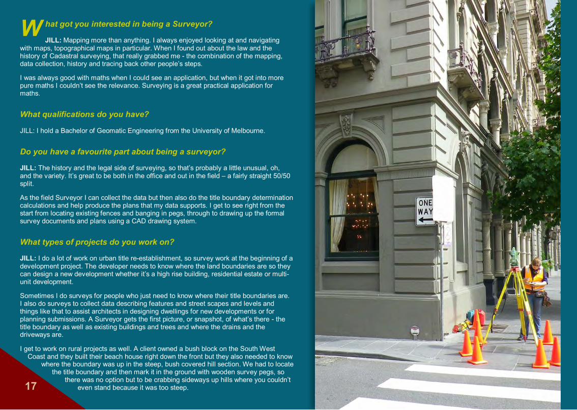
W hat got you interested in being a Surveyor?
JILL: Mapping more than anything. I always enjoyed looking at and navigating with maps, topographical maps in particular. When I found out about the law and the history of Cadastral surveying, that really grabbed me - the combination of the mapping, data collection, history and tracing back other people’s steps.
I was always good with maths when I could see an application, but when it got into more pure maths I couldn’t see the relevance. Surveying is a great practical application for maths.
What qualifications do you have?
JILL: I hold a Bachelor of Geomatic Engineering from the University of Melbourne.
Do you have a favourite part about being a surveyor?
JILL: The history and the legal side of surveying, so that’s probably a little unusual, oh, and the variety. It’s great to be both in the office and out in the field – a fairly straight 50/50 split.
As the field Surveyor I can collect the data but then also do the title boundary determination calculations and help produce the plans that my data supports. I get to see right from the start from locating existing fences and banging in pegs, through to drawing up the formal survey documents and plans using a CAD drawing system.
What types of projects do you work on?
JILL: I do a lot of work on urban title re-establishment, so survey work at the beginning of a development project. The developer needs to know where the land boundaries are so they can design a new development whether it’s a high rise building, residential estate or multi-unit development.
Sometimes I do surveys for people who just need to know where their title boundaries are. I also do surveys to collect data describing features and street scapes and levels and things like that to assist architects in designing dwellings for new developments or for planning submissions. A Surveyor gets the first picture, or snapshot, of what’s there - the title boundary as well as existing buildings and trees and where the drains and the driveways are.
I get to work on rural projects as well. A client owned a bush block on the South West Coast and they built their beach house right down the front but they also needed to know
where the boundary was up in the steep, bush covered hill section. We had to locate the title boundary and then mark it in the ground with wooden survey pegs, so
there was no option but to be crabbing sideways up hills where you couldn’t even stand because it was too steep.17
Are there any downsides to surveying for you?JILL: I’ll have to be honest - when surveying land for a new development you see some fairly grimy, dingy parts of the city such as run down, abandoned houses, but
then you also get to see these areas improved in the long run so that’s a positive. In Melbourne a lot of the inner suburbs, the older suburbs, have terraced houses and you need to go into the building because the boundary runs through the middle of the wall that the two houses share – so you can’t avoid going in no matter how derelict it is.
What has been your greatest challenge?JILL: My projects for gaining my Cadastral License. The jobs have to be really complex to demonstrate I’ve gained the necessary skills to become Licensed. I’ve surveyed entire blocks of the Melbourne CBD to re-establish all the titles and all the laneways and roadways in order to help the council declare new roads. That sort of really detailed Cadastral re-establishment is what I enjoy most.
Has anything strange or funny happen to you during a surveying project?JILL: Field work in particular is fun. You’re out with another person, it’s just you and them all day, you’re sharing jokes, you’re physically challenged but it’s still enjoyable.
The strangest thing happened on a project I did towards my qualification. There are some tunnels and left over historical parts of buildings in Melbourne, you know, old dingy dark stairwells that don’t seem to go anywhere. We found one of these odd tunnels that had a grate over the top. We weren’t sure what it was for so we surveyed around it and took a photo. Then five minutes later as we were further up the laneway a man climbed out of the tunnel. Just a regular guy. He randomly climbed Up and out and bid us, ‘Good day’ and walked off down the street. It may have been a tunnel to somewhere but I wasn’t keen to check it out. I believe the underside of Melbourne is riddled with tunnels and conduits and things. 18
“ “X XXXXXXXXXXXXX.
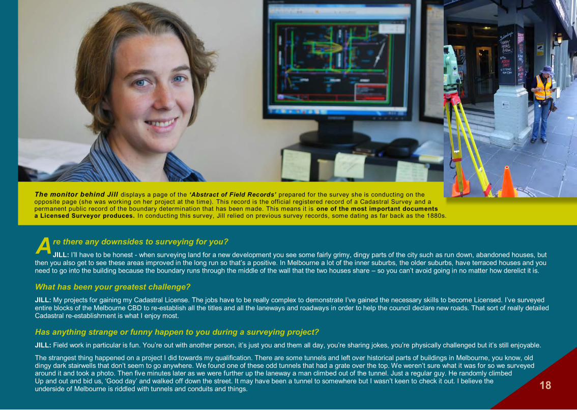
The monitor behind Jill displays a page of the ‘Abstract of Field Records’ prepared for the survey she is conducting on the opposite page (she was working on her project at the time). This record is the official registered record of a Cadastral Survey and a permanent public record of the boundary determination that has been made. This means it is one of the most important documents a Licensed Surveyor produces. In conducting this survey, Jill relied on previous survey records, some dating as far back as the 1880s.
19
Q&AQ&AIINSIGHTNSIGHT
What scope does aSurveyor
have?A Surveyor collects, stores and analyses data and information to assist with urban and regional planning, land and resource development, environmental and marine management, government-provided infrastructure such as new hospitals and schools, transportation and other facilities — and far more — employing GNSS (global navigation satellite system) and GPS (global positioning system) technology.
The data a Surveyor gathers is often referred to as ‘spatial data’ and holds within it a description of objects such as buildings, landscape and natural resources, street addresses, parks and way more which can help predict community/environmental trends.
The DTDB (Digital Topographic Database) provides information regarding buildings such as hospitals and schools, transport infrastructure and the routes they take. The DCDB (Digital Cadastral Database) is a record of suburbs, roads, electoral districts, rivers and coastlines and provides information to the official Cadastre (land boundary register). These two databases provide major insight and assistance to governments, councils and the business sector. And who gathers this information? The Surveyor.
Our next Surveyor, Greg, says he uses GPS every day for everything from establishing residential boundaries to measuring up new bridges to structural monitoring and assessment of the M7 motorway in Sydney.

Meet Greg - He’s been a Surveyor for about 30 years
18
Location: Sydney, New South Wales
W hat got you interested in surveying in the first place?GREG: I was about 17 when surveying was suggested to me by a
careers advisor. Basically, I was interested in working outdoors, I was quite good at mathematics and enjoyed physics and I was brought up around machinery. I enjoyed the practical world. Actually, the real reason I took up surveying is a mate of mine said I’d never make it and I wanted to prove him wrong – and I did!
Working sky high—taking measurements for a sales brochure promoting a multi-storey residential apartment building.
20

Westlink M7, Sydney – Replacing an over-rotated bearing between the pillar and the overpass. Greg’s role was crucial, ensuring the bridge was not jacked up too high, the correct placement of the bearing, and accurate replacement of the bridge.
How did you get your qualifications? GREG: Initially I started in my tech college certificate. I’d been too busy playing rugby league for Penrith
and didn’t put in the effort at school. I didn’t matriculate but I did do my higher school certificate and picked up science and physics which allowed me to do a part time TAFE course for four years.
I started in the practical part of the career as a Surveyor Assistant and then went on to be a Survey Technician leading field parties. By the time I’d matured enough to go to university to get my degree I had four solid years of field work and calculations and all sorts of things, plan drawing and working in a small business. Also, I had a chance to take on part time work for surveyors while I studied.
What types of surveying projects do you do?GREG: After university I pursued a career in land development and ended up being a project manager with a company doing large 600 to 800 lot sub-divisions. It was varied and interesting but I resigned and set up my own business, moving out of the office into the field basically banging in pegs and doing subdivisions and boundary checks. I grew that business – then I discovered GPS surveying and that led me in a totally different path that allowed me to connect with infrastructure development.
I use GPS every day for all sorts of things. I put the 42 kilometre M7 Motorway on the map – I was the Surveyor for that job. I have predominantly been the only surveyor on the M7 since completion, being involved with defects liability correction assessing bridge and pavement settlement, structural monitoring, and the construction associated with this.
I believe we should always be involved in something bigger than ourselves. Being involved with these motorways is an amazing, fulfilling thing. I have to pinch myself every now and then.
Note: Replace bearing
21
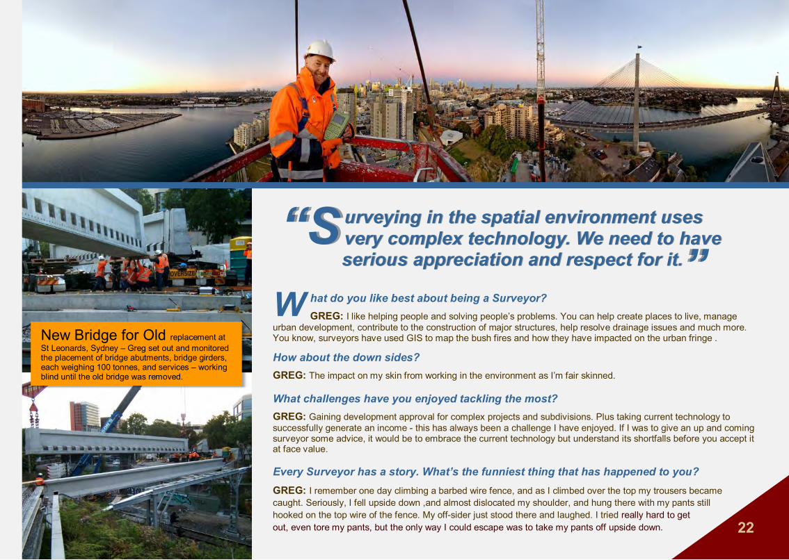
New Bridge for Old replacement at St Leonards, Sydney – Greg set out and monitored the placement of bridge abutments, bridge girders, each weighing 100 tonnes, and services – working blind until the old bridge was removed.
““ “S“S urveying in the spatial environment uses urveying in the spatial environment uses very complex technology. We need to have very complex technology. We need to have
serious appreciation and respect for it. serious appreciation and respect for it.
W hat do you like best about being a Surveyor?GREG: I like helping people and solving people’s problems. You can help create places to live, manage
urban development, contribute to the construction of major structures, help resolve drainage issues and much more. You know, surveyors have used GIS to map the bush fires and how they have impacted on the urban fringe .
How about the down sides?GREG: The impact on my skin from working in the environment as I’m fair skinned.
What challenges have you enjoyed tackling the most?GREG: Gaining development approval for complex projects and subdivisions. Plus taking current technology to successfully generate an income - this has always been a challenge I have enjoyed. If I was to give an up and coming surveyor some advice, it would be to embrace the current technology but understand its shortfalls before you accept it at face value.
Every Surveyor has a story. What’s the funniest thing that has happened to you?GREG: I remember one day climbing a barbed wire fence, and as I climbed over the top my trousers becamecaught. Seriously, I fell upside down ,and almost dislocated my shoulder, and hung there with my pants still hooked on the top wire of the fence. My off-sider just stood there and laughed. I tried really hard to get out, even tore my pants, but the only way I could escape was to take my pants off upside down. 22
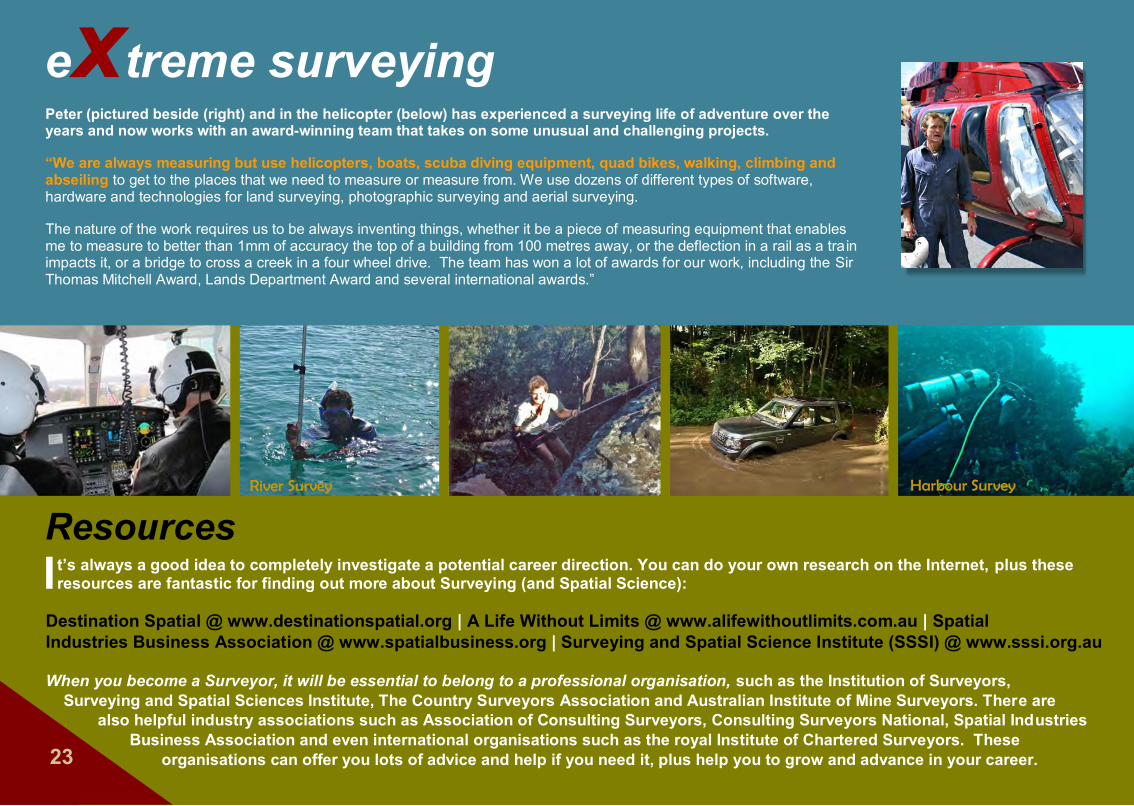
extreme surveyingPeter (pictured beside (right) and in the helicopter (below) has experienced a surveying life of adventure over the years and now works with an award-winning team that takes on some unusual and challenging projects.
“We are always measuring but use helicopters, boats, scuba diving equipment, quad bikes, walking, climbing and abseiling to get to the places that we need to measure or measure from. We use dozens of different types of software, hardware and technologies for land surveying, photographic surveying and aerial surveying.
The nature of the work requires us to be always inventing things, whether it be a piece of measuring equipment that enables me to measure to better than 1mm of accuracy the top of a building from 100 metres away, or the deflection in a rail as a train impacts it, or a bridge to cross a creek in a four wheel drive. The team has won a lot of awards for our work, including the Sir Thomas Mitchell Award, Lands Department Award and several international awards.”
River Survey Harbour Survey
It’s always a good idea to completely investigate a potential career direction. You can do your own research on the Internet, plus these resources are fantastic for finding out more about Surveying (and Spatial Science):
Destination Spatial @ www.destinationspatial.org | A Life Without Limits @ www.alifewithoutlimits.com.au | Spatial Industries Business Association @ www.spatialbusiness.org | Surveying and Spatial Science Institute (SSSI) @ www.sssi.org.au
When you become a Surveyor, it will be essential to belong to a professional organisation, such as the Institution of Surveyors, Surveying and Spatial Sciences Institute, The Country Surveyors Association and Australian Institute of Mine Surveyors. There are
also helpful industry associations such as Association of Consulting Surveyors, Consulting Surveyors National, Spatial Industries Business Association and even international organisations such as the royal Institute of Chartered Surveyors. These
organisations can offer you lots of advice and help if you need it, plus help you to grow and advance in your career.23
Resources

24
When searching for surveying courses, also look under
‘Spatial Science’
FYI:
How do you become a Surveyor?You can gain surveying skills through a university or TAFE, whether this be on-campus, via e-learning or distance education. Depending which course you choose, study may last up to 4 years. After you have completed your course, you work as an assistant to a Senior or Licensed Surveyor for one to two years before becoming qualified yourself.
Some of the different courses you can look into include Certificates II and III in Surveying and Surveying and Information Services; Certificate IV in Surveying; Spatial Data Collection and Surveying; Bachelor of Surveying and Spatial Sciences; and Graduate Diploma in Surveying. A great place to start investigating these options and more information is the Destination Spatial web site.
There are different surveying disciplines, for example Engineering Surveyor - setting out roads and infrastructure projects, Geodetic Surveyor - taking precise measurements over large distances and undertaking complex calculations on the shape of the earth, even using satellites for earthquake prediction and more, Cadastral Surveyor - measuring and establishing legal property boundaries enforceable by law, Mining Surveyor and several other disciplines. Surveyors may also do town planning and prepare statements detailing the environmental effects of a development. Make sure you investigate all the options because knowing your area of interest can help you choose your study direction.
What skills will you need? Over time, you’ll need to gain good computer skills and skills in a relevant technical drawing software, such as AutoCAD Civil 3D, CivilCAD and others, plus the ability to use GPS instruments. You’ll also need to develop high attention to detail, the ability
to write up good reports and to communicate clearly and politely with other workers and clients, with people from the government, and with members of the general public.
How about personality traits? Eventually, you’ll need to be able to work independently, have lots of initiative, be very observant and able to think clearly to solve problems. You’ll also need to be good at working in teams or with another person, and be calm and patient. Sounds a
lot doesn’t it - but many of these skills will come with age and a love for your work.

This is your one and only life. Make the most of it!25
Now you know a bit about being an Urban Surveyor. If you enjoy maths and maps and being outdoors, if you care about the environment, like variety and working on computers, maybe this could be the job for you.
Over time web addresses, names of organisations, available options and other information may change, so be sure to do your research.
A fabulous app that provides current information on salary rates, career options etcetera, is the Career Hunter app. You can download it for free at the App Store on iTunes.
Even if you’re working for a surveying company in the city, you may end up working on projects anywhere across Australia. It’s all great experience!
26
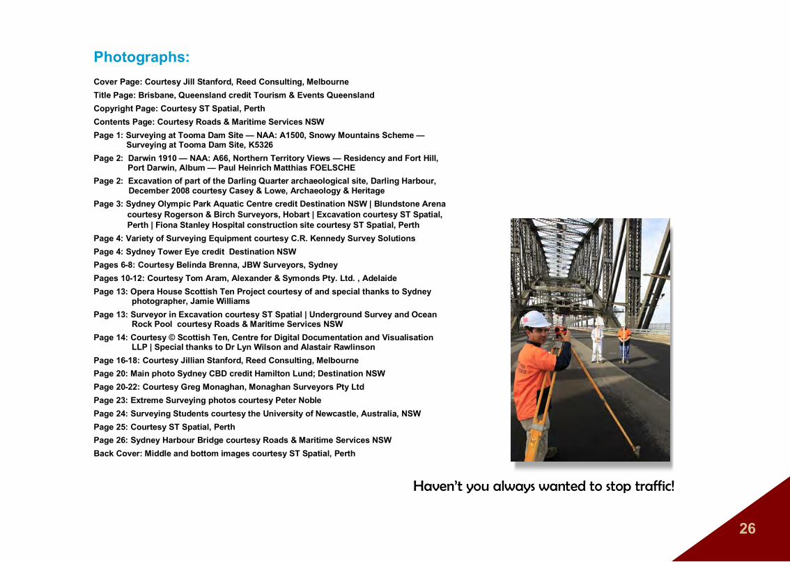
Photographs:Cover Page: Courtesy Jill Stanford, Reed Consulting, MelbourneTitle Page: Brisbane, Queensland credit Tourism & Events QueenslandCopyright Page: Courtesy ST Spatial, Perth Contents Page: Courtesy Roads & Maritime Services NSWPage 1: Surveying at Tooma Dam Site — NAA: A1500, Snowy Mountains Scheme — Surveying at Tooma Dam Site, K5326Page 2: Darwin 1910 — NAA: A66, Northern Territory Views — Residency and Fort Hill,
Port Darwin, Album — Paul Heinrich Matthias FOELSCHEPage 2: Excavation of part of the Darling Quarter archaeological site, Darling Harbour, December 2008 courtesy Casey & Lowe, Archaeology & HeritagePage 3: Sydney Olympic Park Aquatic Centre credit Destination NSW | Blundstone Arena
courtesy Rogerson & Birch Surveyors, Hobart | Excavation courtesy ST Spatial, Perth | Fiona Stanley Hospital construction site courtesy ST Spatial, Perth
Page 4: Variety of Surveying Equipment courtesy C.R. Kennedy Survey SolutionsPage 4: Sydney Tower Eye credit Destination NSWPages 6-8: Courtesy Belinda Brenna, JBW Surveyors, SydneyPages 10-12: Courtesy Tom Aram, Alexander & Symonds Pty. Ltd. , AdelaidePage 13: Opera House Scottish Ten Project courtesy of and special thanks to Sydney
photographer, Jamie WilliamsPage 13: Surveyor in Excavation courtesy ST Spatial | Underground Survey and Ocean
Rock Pool courtesy Roads & Maritime Services NSWPage 14: Courtesy © Scottish Ten, Centre for Digital Documentation and Visualisation
LLP | Special thanks to Dr Lyn Wilson and Alastair RawlinsonPage 16-18: Courtesy Jillian Stanford, Reed Consulting, MelbournePage 20: Main photo Sydney CBD credit Hamilton Lund; Destination NSWPage 20-22: Courtesy Greg Monaghan, Monaghan Surveyors Pty LtdPage 23: Extreme Surveying photos courtesy Peter NoblePage 24: Surveying Students courtesy the University of Newcastle, Australia, NSWPage 25: Courtesy ST Spatial, PerthPage 26: Sydney Harbour Bridge courtesy Roads & Maritime Services NSWBack Cover: Middle and bottom images courtesy ST Spatial, Perth
Haven’t you always wanted to stop traffic!

Surveyors are the people who usually fly under the radar — few people notice them going about their work, but nothing happens without them!
It’s true! There are dozens of options open to Surveyors at every level, working with environmental planners, engineers, architects, rail, road and infrastructure planners, even archaeologists, and far more.
Surveyors are in high demand which means it’s far easier to get a job when you graduate. Maybe it’s time to look a little closer!