urban landscape ecology - iale.uk
TRANSCRIPT

ialeUK Conference
1 – 3 September 2014,
King’S College
london,
gUy’S CampUS
ABSTRACTS
Urban landSCape eCology:SCienCe, poliCy & pRACTiCe
iale.org.uk/conference2014 #ialeuk2014

Urban landSCape eCology: SCienCe, poliCy & pRACTiCe1–3 SepTemBeR 2014, King’S College london, guy’S CAmpuS
iale.org.uk 2
ABSTRACTS
ConTenTS
Foreword
James millington ___________________________________________________________________________5
monday 1 September – 10:45 – 11.15
Keynote: ecology in the service of the city
prof. John Handley oBe ______________________________________________________________________8
monday 1 September – am:
mapping and modelling urban landscapes
Using ecosystem Services to inform urban ecological networks (application of ecoServ-giS to Sunderland, UK)
Jonathan Winn ___________________________________________________________________________10
Quantifying landscape Structure with an emphasis on Connectivity
ebru ersoy, Anna Jorgensen, philip H. Warren ___________________________________________________ 11
investigating the Human Health benefits of Urban Heat island mitigation by london’s greenspaces
Kieron Jochem doick, Francis edwin Ashwood, phil Handley and Tony Richard Hutchings _________________13
assessing and mapping the potential for green infrastructure in the Urban Core of london
dusty gedge and gary grant _________________________________________________________________15
a metapopulation approach to urban biodiversity planning
laura J. graham, Roy Haines-young, Richard Field ________________________________________________ 17
modeling the effects of landscape composition and structure on urban ungulate populations
Chellby Kilheffer, H. Brian underwood _________________________________________________________18
monday 1 September – pm:
managing urban landscapes
the all london green grid: green infrastructure – from policy to practice in london
peter massini _____________________________________________________________________________21
Urban biodiversity management in ireland – capturing the experience of practitioners
maryann Harris, Tamara Hochstrasser, Karen Foley and Claire Cave ___________________________________23

Urban landSCape eCology: SCienCe, poliCy & pRACTiCe1–3 SepTemBeR 2014, King’S College london, guy’S CAmpuS
iale.org.uk 3
ABSTRACTS
ConTenTS
ecosystem Service and Urban landscape management
peter glaves, dave egan ____________________________________________________________________24
Connecting people and environment in the brighton & lewes downs biosphere
Rich Howorth _____________________________________________________________________________26
london’s gardenscapes; the challenge for landscape scale management
mathew Frith _____________________________________________________________________________28
Conservation or Cultural Services? the management of Competing ecosystem Services in an Urban Habitat patch
gilchrist, A. ______________________________________________________________________________30
integrating multiple societal demands into urban forest management – a case study from munich (germany)
gerd lupp, günter Weber, Stephan pauleit ______________________________________________________31
the Hitchhikers guide to Urban Forestry
Tim Hall _________________________________________________________________________________32
Tuesday 2 September – 10:30 – 11.00
Keynote: biodiversity functions of urban habitats
prof. ingo Kowarik ________________________________________________________________________34
Tuesday 2 September – am
urban patches and Heterogeneity
bees in a Changing World: How land surface phenology, bee community distributions, and pollinator-plant interactions are impacted by urbanization and agriculture.
misha leong _____________________________________________________________________________37
Fine-scale heterogeneity of urban landscapes affects soil hydrological processes and services
ossola, A., Hahs, A.C., Christie, F.J., nash, m.A., livesley, S.J. ______________________________________39
Composition, structure, and spatial patterning of urban residential yards: implications for biodiversity
emily S. minor, magaly Franco, Amelie y. davis, meimei lin , J. Amy Belaire ____________________________ 41
Horizontal and vertical island biogeography on green roofs
lior Blank, Amiel Vasl, Bracha Schindler, Shay levy, Ronen Shapir, gyongyver Kadas, leon Blaustein ________43

Urban landSCape eCology: SCienCe, poliCy & pRACTiCe1–3 SepTemBeR 2014, King’S College london, guy’S CAmpuS
iale.org.uk 4
ABSTRACTS
ConTenTS
brownfields as unintentional green spaces
Hana Skokanova, marek Havlicek _____________________________________________________________44
a lawn without grass – a new tool for landscape ecologists
lionel S Smith ____________________________________________________________________________46
niche enhancement for diverse green roofs
Amiel Vasl, Brachi Schindler, Shay levy, Amots dafni, gyongyver Kadas and leon Blaustein _______________48
Tuesday 2 September – pm
urban Rivers and Water
assessing the effects of urbanisation on river systems at multiple scales
Smith, B. and Clifford, n.J. __________________________________________________________________50
restoring the river Wandle in south london: implementing policy, research and best practice
Bella davies ______________________________________________________________________________ 51
the river Crane – the history and potential future of a productive urban river corridor
Robert Charles gray ________________________________________________________________________53
a comparative analysis of biodiversity in urban ponds in the UK
Christopher Hassall, david gledhill, paul Wood, ian Thornhill, Jeremy Bigg ____________________________55
Habitat restoration on a landscape scale: restoring the post-industrial landscape for Wildlife Conservation: a Case Study
m. H. Champion, Thom dallimore, paul Ashton ___________________________________________________57
the Change in Fish abundance and diversity over time in man-made intertidal Habitats on the thames estuary
Jethro yates, mike Chadwick, Steve Colclough, Janina gray _________________________________________59
Variation of ecosystem Services as reported for the river irwell from 1720
James p, law BA, Redhead n _________________________________________________________________ 61
the FreshWater Watch: a global urban freshwater research programme
Charlotte Hall, Steven loiselle and neil Bailey ___________________________________________________63

Urban landSCape eCology: SCienCe, poliCy & pRACTiCe1–3 SepTemBeR 2014, King’S College london, guy’S CAmpuS
iale.org.uk 5
ABSTRACTS
ConTenTS
Tuesday 2 September – 16:45 – 15.00
president’s Closing Address: How might landscape ecology help inform development of sustainable cities?
Richard J. Smithers ________________________________________________________________________66
posters 2014:
biodiversity conservation in urban ponds: ecological, land-cover and social-economic variables
malgorzata Blicharska, Tuija Hilding-Rydevik, Johan Andersson, Frank Johansson ______________________69
landscape factors influencing urban wasteland’s plant diversity
marion Brun______________________________________________________________________________ 71
making the business case for landscape scale water management
Burton, A., Shamier, n., Harris, R., Brace, S. ____________________________________________________73
From gi audit to action: improving green infrastructure of a business improvement district, in the central london borough of Southwark
dusty gedge, gary grant and Ben Kimpton ______________________________________________________ 75
assessing ecosystem Services in a peri-urban national park: the case of rizoelia Forest park-Cyprus
manolaki, p., Sutherland, l., Trigkas, V., Vogiatzakis, i.n. __________________________________________ 76
an assessment of residents’ satisfaction and short-term visions for urban yards in San Juan, puerto rico
molly m Ramsey (presenter), elvia J. meléndez-Ackerman, marianne Cartagena, Christopher J. nytch, Ana m Trujillo, Hagmel A Vega Fontanez, laura l Fidalgo, Cristina Vila, elizabeth díaz, Khrisia Torres, nicolas Correa, Sofia olivero, José Fontanez, and Angelica erazo _________________________________________________78
the development of an alternative approach to appraise landscape sensitivity within impact assessment, informed by a review and conceptual synthesis of relevant philosophical and psychological theory and science
peacock, J _______________________________________________________________________________80
defining High nature Value Farmland (HnVF) in Cyprus: an expert driven approach
Zomeni, m., martinou, A.F, Stavrinides, m.C., Xenofontos, m., Stylianopoulou, e., Vogiatzakis, i.n. _________82

Contents
Urban landSCape eCology: SCienCe, poliCy & pRACTiCe1–3 SepTemBeR 2014, King’S College london, guy’S CAmpuS
iale.org.uk 6
ForewordCities are growing rapidly. across europe, more than 70 per cent of people already live in urban areas, including 80 per cent of the UK population. the growth of cities poses ever-increasing challenges for the natural environment on which they impact and depend, not only within their boundaries but also in surrounding peri-urban areas. landscape ecology – the study of interactions across space and time between the structure and function of physical, biological and cultural components of landscapes – has a pivotal role to play in identifying sustainable solutions.
these proceedings contain the abstracts of the ialeUK annual conference Urban landscape ecology: science, policy and practice held at King’s College, london 1–3 September 2014. the conference brings together academics, practioners and policy-makers to consider how concepts from landscape ecology can inform the maintenance and restoration of healthy, properly functioning natural environments across urban and peri-urban landscapes, as the foundation of sustained economic growth, prospering communities and personal wellbeing.
the conference has four symposia:
• mapping and modelling urban landscapes will consider application of technical tools for understanding and managing urban landscapes
• managing urban landscapes will explore alternative approaches to conservation and stewardship of ecosystems in urban contexts
• urban patches and Heterogeneity will examine components of urban landscapes, including green roofs, and how they and their spatial configuration influence ecosystem function
• urban Rivers and Water will look at how urban landscapes influence water resources and discuss efforts to restore riparian and aquatic habitats
each of the first two days of the conferences will be prefaced by a keynote presentation and posters will be on display for viewing and discussion throughout. on day three excursions will visit iconic sites across london, including the Shard to view london’s spatial pattern connectivity from Western europe’s tallest building, the thames barrier to tour london’s vital flood defence, and Queen elizabeth ii olympic park to explore the ecological legacy of the 2012 olympic games. opportunities for networking with colleagues will be available throughout the conference, including during the conference reception at Southwark Cathedral.
the 2014 ialeUK conference has been organised by members of the department of geography at King’s College london, led by dr James millington and in partnership with dr robert Francis, dr michael Chadwick and ben Smith. We are grateful for organizational support from King’s College london and the ialeUK committee, in particular dr bella davies, Jonathan porter and richard Smithers. Student participation has in part been supported by Student Conference registration Fee awards from ialeUK in co-ordination with Jess neumann. We are also grateful to staff at the thames barrier and Queen elizabeth olympic park for assistance with excursions.
We welcome you to london and the ialeUK Conference 2014 and hope you find both enjoyable and stimulating!
James millington
london, august 2014
ABSTRACTS
FoReWoRd

Contents
Urban landSCape eCology: SCienCe, poliCy & pRACTiCe1–3 SepTemBeR 2014, King’S College london, guy’S CAmpuS
ABSTRACTSmon 1 SepTemBeR • 10:45 – 11:15:
KeynoTe
iale.org.uk 7
monday 1 September 10:45 – 11:15
Keynote: ecology in the service of the city
prof. John Handley oBe

Contents
Urban landSCape eCology: SCienCe, poliCy & pRACTiCe1–3 SepTemBeR 2014, King’S College london, guy’S CAmpuS
ABSTRACTSmon 1 SepTemBeR • 10:45 – 11:15:
KeynoTe
iale.org.uk 8
ecology in the service of the cityAuthors and Affiliations:
prof. John Handley oBeCentre for urban Resilience and energy, School of environment, education and development,
The university of manchester, uK
email:[email protected]
this keynote paper will explore the co-evolution of ecology and urban design in the modern era, from both a conceptual and practical standpoint. the principles of town and country planning, as expressed through the garden Cities movement incorporated much of what today we would consider to be progressive ecological thinking. during that period, ecology itself emerged as a cognate discipline and leading planners such as patrick geddes were quick to incorporate ecological thinking into planning theory. meanwhile, social scientists in the Chicago School brought new perspectives on the spatial differentiation of urban communities and that, in turn, has provided a reference frame for exploring the determinants of urban biodiversity.
a seminal development was tansley’s ecosystem concept which ushered in a new era of functional ecology. those concerned with the city as an ecological system have provided valuable insights for sustainability planning. but of greater interest perhaps to landscape ecologists, was ian mc Harg’s notion that urban design involved more than cost benefit analysis – nature contributed a range of services, which although difficult to quantify, must be taken into account for effective decision making. landscape architects such as michael Hough wrote persuasively about ‘Cities and natural process’ but it is the quantification of these processes by natural scientists, allied to the development of a new geodesign toolkit, that is elevating green infrastructure planning to the same level as engineering for transport, water supply and waste water treatment.
We will explore the notion of a functional urban ecology in some depth and position that within the ecosystem services framework. the emergence of this new planning framework and its acceptance by policy makers is timely because climate change will arguably pose the same magnitude of challenge to the 21st Century city as that faced by public health engineers in the 19th Century.

Contents
Urban landSCape eCology: SCienCe, poliCy & pRACTiCe1–3 SepTemBeR 2014, King’S College london, guy’S CAmpuS
ABSTRACTSmondAy 1 SepTemBeR Am – mApping And
modelling uRBAn lAndSCApeS
iale.org.uk 9
monday 1 September am
mapping and modelling urban
landscapes
Contents
Urban landSCape eCology: SCienCe, poliCy & pRACTiCe1–3 SepTemBeR 2014, King’S College london, guy’S CAmpuS
ABSTRACTSmondAy 1 SepTemBeR Am – mApping And
modelling uRBAn lAndSCApeS
iale.org.uk 10
using ecosystem Services to inform urban ecological networks (Application of ecoServ-giS to Sunderland, uK)
Authors and Affiliations:Jonathan Winn
Scottish Wildlife Trust Harbourside House, 110 Commercial Street, edinburgh, eH6 6nF
email:[email protected]
results are presented for Sunderland City illustrating the overlap of ecosystem service benefiting areas with potential ecological networks in order to inform a combined ecological and ecosystem services urban conservation strategy.
Connectivity modelling is used to create a series of urban ecological networks. these were then examined in relation to a set of ecosystem service benefiting maps, created using the ecoServ-giS toolkit. the contribution of the different networks to areas of capacity and demand (need) for ecosystem services is examined and this is discussed in the context of strategies to conserve, enhance or create natural and semi-natural greenspace for both human needs, and broader conservation benefit.
10 ecosystem services were examined, with a particular focus on air purification, noise regulation and the cultural ecosystem services of community cohesion, accessible nature and education. by combining an analysis of the gaps in existing ecological networks with mapped areas of human demand for ecosystem services, win-win areas are identified where habitat creation and restoration would also result in enhanced ecosystem service delivery to people.

Contents
Urban landSCape eCology: SCienCe, poliCy & pRACTiCe1–3 SepTemBeR 2014, King’S College london, guy’S CAmpuS
ABSTRACTSmondAy 1 SepTemBeR Am – mApping And
modelling uRBAn lAndSCApeS
iale.org.uk 11
Quantifying landscape Structure with an emphasis on Connectivity
Authors and Affiliations:ebru ersoy, Anna Jorgensen1, philip H. Warren2
1department of landscape, The university of Sheffield, Floor 9, The Arts Tower, Western Bank, Sheffield, S10 2Tn, uK
2department of Animal and plant Sciences, Alfred denny Building, The university of Sheffield, Western Bank, Sheffield, S10 2Tn, uK
email:[email protected]
the determination of relationships between the landscape structure and associated ecological processes have been regarded as a prerequisite for landscape planning, since this spatially explicit information provides the basis of understanding the functioning of landscapes (leitão et al, 2006). regarding this, recently researchers have expressed an increased involvement in the landscape structural analysis. the aim of this paper, therefore, is to explore the main characteristics of landscape structure in Sheffield and prioritizing the areas of a potential network to support functional connectivity. the study is conducted in Sheffield, covering an area of 48527ha, using FragStatS class level landscape metrics. 10 land cover types were identified in the study area. the landscape structure analysis revealed that Vegetation clearly constitutes the landscape matrix (71.86%), in which grassland dominated the landscape by covering an area of 12860.97ha (more than one-fourth of the total landscape area). However, the structural connectivity of grassland is not as very strong as expected. on the other hand, the Wetlands are characterized by the highest structural connectivity with a dense cluster of larger patches covering an area of 5781ha. being aware of the fact that some land cover patches may be functionally connected even though they are physically isolated, based on the ecology of species in the research area; the findings of this study provide the following insights for further functional connectivity analysis: (1) Wetland, Heathland, Woodland and Shrub, and grassland may serve as important habitats for biodiversity and they would be a part of potential connectivity routes considering their physical structure, (2) although mixed Vegetation, Cultivated land and Water (occupying 19.52% of the total landscape) reported lower levels of connectivity; their potential to deliver certain benefits to biodiversity and the public should not be ignored (gaston et al, 2005; the Wildlife trust for Sheffield and rotherham, 2014) in a potential network to be derived in the future.

Contents
Urban landSCape eCology: SCienCe, poliCy & pRACTiCe1–3 SepTemBeR 2014, King’S College london, guy’S CAmpuS
ABSTRACTSmondAy 1 SepTemBeR Am – mApping And
modelling uRBAn lAndSCApeS
iale.org.uk 12

Contents
Urban landSCape eCology: SCienCe, poliCy & pRACTiCe1–3 SepTemBeR 2014, King’S College london, guy’S CAmpuS
ABSTRACTSmondAy 1 SepTemBeR Am – mApping And
modelling uRBAn lAndSCApeS
iale.org.uk 13
investigating the Human Health Benefits of urban Heat island mitigation by london’s greenspaces
Authors and Affiliations:Kieron Jochem doick1, Francis edwin Ashwood1, phil Handley1 and
Tony Richard Hutchings2
1land Regeneration and urban greenspace Research group Centre for Sustainable Forestry and Climate Change And 2C-Cure Solutions limited
email:[email protected]
Background: Heat-related stress is aggravated by the urban heat island effect. With air temperatures up to 8oC cooler in greenspaces than in the surrounding urban area, a cooling effect extends out beyond the greenspace boundaries providing localised relief.
objectives: We map the extent to which london’s greenspaces cool the resident population in an attempt to value the cooling service they provide and the merit of increasing greenspace provision to reduce heat-related stress under a changing climate.
methods: based on the literature, a cooling boundary was designated for different sized greenspaces. Using a geographic information system, the total cooled area in inner and greater london was modelled and the proportion of the population cooled was calculated. We focus on societal groups susceptible to heat-related stress: people over 75 years old, children under 4, and people with compromised health.
Results: assuming equal population distribution across residential areas in greater london 1.1 million people live in areas cooled by 2oC by greenspace, in inner london that figure is 0.4 million. based on these figures we estimate that this cooling saves 4 lives per day across greater london and 2 lives per day across inner london during extended periods of high temperature. an average 74% of inner london and 46% of greater london is not cooled by greenspace.
Conclusions: averting a premature death has been valued at £1,653,687. Collectively valued £9.1 million per day when air temperatures exceed 24oC, greenspaces should be protected to sustain this cooling long term. new greenspaces strategically placed across greater and inner london would provide heat-stress amelioration to an additional 6.6 million people. these should be at least 2 ha in size.

Contents
Urban landSCape eCology: SCienCe, poliCy & pRACTiCe1–3 SepTemBeR 2014, King’S College london, guy’S CAmpuS
ABSTRACTSmondAy 1 SepTemBeR Am – mApping And
modelling uRBAn lAndSCApeS
iale.org.uk 14

Contents
Urban landSCape eCology: SCienCe, poliCy & pRACTiCe1–3 SepTemBeR 2014, King’S College london, guy’S CAmpuS
ABSTRACTSmondAy 1 SepTemBeR Am – mApping And
modelling uRBAn lAndSCApeS
iale.org.uk 15
Assessing and mapping the potential for green infrastructure in the urban Core of london
Authors and Affiliations:dusty gedge and gary grant
The green Roof Consultancy
email:[email protected]
Since the london policy on living roofs and walls in london was announced in 2008, the majority of new developments require green roofs as part of their design. However a key issue for a city like london, like all major conurbations in europe and beyond, is how green roofs, walls and other features can be retrofitted into the Urban Core on existing buildings.
Since 2011 a number of green infrastructure audits have been undertaken in london to address this issue. this paper collates the details of how and where green roofs could be retrofitted in specific neighbourhoods within the Central activity Zone of london. taking these neighbourhoods the paper presents the potential for the whole urban area of the Central activity Zone and considers the impacts of such wholescale greening of roofs would have as a climate change adaptation strategy. the benefits to the Urban Heat island, flash flood storage and biodiversity are assessed.
Furthermore the paper considers issues relating to the qualities of green roofs. the assessment highlights the areas of the city where the most effective and high quality green roof systems can be installed in terms of performance criteria across the sustainability agenda. Such an audit approach could be undertaken in other european Cities ensuring if and when were available for such interventions roofs with the greatest potential can be target to provide that greatest performance benefit to the neighborhood and city in question.

Contents
Urban landSCape eCology: SCienCe, poliCy & pRACTiCe1–3 SepTemBeR 2014, King’S College london, guy’S CAmpuS
ABSTRACTSmondAy 1 SepTemBeR Am – mApping And
modelling uRBAn lAndSCApeS
iale.org.uk 16

Contents
Urban landSCape eCology: SCienCe, poliCy & pRACTiCe1–3 SepTemBeR 2014, King’S College london, guy’S CAmpuS
ABSTRACTSmondAy 1 SepTemBeR Am – mApping And
modelling uRBAn lAndSCApeS
iale.org.uk 17
A metapopulation approach to urban biodiversity planning
Authors and Affiliations:laura J. graham, Roy Haines-young, Richard Field
School of geography, university of nottingham
email:[email protected]
in an attempt to move away from the idea that nature belongs strictly in the countryside, conservation of wildlife in urban areas is gaining increased attention from both policy-makers and ecologists. in the UK, for example, the lawton report and the natural environment White paper both highlight the importance of urban green space within larger habitat networks. accordingly, there has been an increase in research into urban ecology over the last decade. it is recognised by ecological theorists, and as such adopted into planning and conservation policy recommendations, that a landscape-scale approach to biodiversity assessment is necessary. i also argue that extinction debt—that there is a time lag between habitat destruction and the effect on species—should be factored into ecological impact assessments. as such, a metapopulation approach to landscape planning is deemed appropriate.
my phd research aims to refine a specific metapopulation model, the incidence function model (iFm), and its parameters to be suitable for urban ecology. i take a scenario based approach, using the adapted model, to explore the ecological implications of policy decisions.
Here i discuss how the iFm can be adapted for practical use in conservation and development planning at a landscape scale, and how this can be used to answer key policy questions. to illustrate this i present the results of habitat loss scenarios, using the city of nottingham as a case study.

Contents
Urban landSCape eCology: SCienCe, poliCy & pRACTiCe1–3 SepTemBeR 2014, King’S College london, guy’S CAmpuS
ABSTRACTSmondAy 1 SepTemBeR Am – mApping And
modelling uRBAn lAndSCApeS
iale.org.uk 18
modeling the effects of landscape composition and structure on urban ungulate populations
Authors and Affiliations:Chellby Kilheffer, department of environmental & Forest Biology, Suny
H. Brian underwood, uSgS patuxent Wildlife Research Center, SunyCollege of environmental Science & Forestry, Syracuse, new york, uSA
email:[email protected]
expanding ungulate populations are causing concerns for wildlife professionals and residents in many urban areas worldwide. nowhere is the phenomenon more apparent than in the eastern US, where urban white-tailed deer (Odocoileus virginianus) populations are increasing. most habitat suitability models for deer have been developed in rural areas and across large (>1000 km2) spatial extents. only recently have we begun to understand the factors that contribute to space use by deer over much smaller spatial extents. in this study, we explore the concepts, terminology, methodology and state-of-the-science in wildlife abundance modeling as applied to overabundant deer populations across heterogeneous urban landscapes. We used classified, high-resolution digital orthoimagery to extract landscape characteristics in several urban areas of upstate new york. in addition, we assessed deer abundance and distribution in 1-km2 blocks across each study area from either aerial surveys or ground-based distance sampling. We recorded the number of detections in each block and used binomial mixture models to explore important relationships between abundance and key landscape features. Finally, we cross-validated statistical models of abundance and compared covariate relationships across study sites. Study areas were characterized along a gradient of urbanization based on the proportions of impervious surfaces and natural vegetation which, based on the best-supported models, also distinguished blocks potentially occupied by deer. models performed better at identifying occurrence of deer and worse at predicting abundance in cross-validation comparisons. We attribute poor predictive performance to differences in deer population trajectories over time. the proportion of impervious surfaces often yielded better predictions of abundance and occurrence than did the proportion of natural vegetation, which we attribute to a lack of certain land cover classes during cold and snowy winters. merits and limitations of our approach to habitat suitability modeling are discussed in detail.

Contents
Urban landSCape eCology: SCienCe, poliCy & pRACTiCe1–3 SepTemBeR 2014, King’S College london, guy’S CAmpuS
ABSTRACTSmondAy 1 SepTemBeR Am – mApping And
modelling uRBAn lAndSCApeS
iale.org.uk 19

Contents
Urban landSCape eCology: SCienCe, poliCy & pRACTiCe1–3 SepTemBeR 2014, King’S College london, guy’S CAmpuS
ABSTRACTSmondAy 1 SepTemBeR pm –
mAnAging uRBAn lAndSCApeS
iale.org.uk 20
monday 1 September pm
managing urban landscapes

Contents
Urban landSCape eCology: SCienCe, poliCy & pRACTiCe1–3 SepTemBeR 2014, King’S College london, guy’S CAmpuS
ABSTRACTSmondAy 1 SepTemBeR pm –
mAnAging uRBAn lAndSCApeS
iale.org.uk 21
The All london green grid: green infrastructure – from policy to practice in london
Authors and Affiliations:peter massini
urban greening Team leader, greater london Authority
email:[email protected]
in london we are beginning to rethink our parks and green spaces as ‘green infrastructure’; a multi-functional network, integrated with the built environment, which delivers a range of services. described and understood as an essential infrastructure it becomes as integral to the capital as its roads, rail lines, digital networks and water pipes. properly designed, managed and maintained, green infrastructure can help absorb floodwater, cool the urban environment and clean the air; it can support local food production, promote healthy lifestyles and ensure space for london’s biodiversity. these are all vital in helping to highlight london’s offer as a city that can sustain economic growth and accommodate an expanding population without compromising london’s status as a green city, studded with parks and open spaces.
in the london plan, the city’s statutory strategic spatial planning document, the mayor has included policies on green infrastructure and urban greening – the greening of buildings and streets – and established the all london green grid, a planning framework to promote and co-ordinate delivery.
landscape ecology underpins the all london green grid. it describes the city’s physical geography, ecology, demography and infrastructure, and identifies the opportunities for the existing resource to be modified and managed to provide a broader range of services and deliver a wider suite of benefits.
the concept of green infrastructure is now widely accepted and the term is commonly used but translating policy into practice is still in its infancy and landscape ecologists have a significant role to play in making the policy more robust and its implementation more successful.

Contents
Urban landSCape eCology: SCienCe, poliCy & pRACTiCe1–3 SepTemBeR 2014, King’S College london, guy’S CAmpuS
ABSTRACTSmondAy 1 SepTemBeR pm –
mAnAging uRBAn lAndSCApeS
iale.org.uk 22
Contents
Urban landSCape eCology: SCienCe, poliCy & pRACTiCe1–3 SepTemBeR 2014, King’S College london, guy’S CAmpuS
ABSTRACTSmondAy 1 SepTemBeR pm –
mAnAging uRBAn lAndSCApeS
iale.org.uk 23
urban biodiversity management in ireland – capturing the experience of practitioners
Authors and Affiliations:maryann Harris1,2, Tamara Hochstrasser1, Karen Foley3 and Claire Cave1
1School of Biology & environmental Sciences, university College dublin, Belfield, dublin 4, ireland2parks Services, dublin City Council, ireland
3School of Architecture, university College dublin, Belfield, dublin 4, ireland
email:[email protected]
apart from the scientific challenges of monitoring and understanding urban biodiversity, its management presents many practical challenges. in particular, urban biodiversity is essential to the experience of nature for the urban population as well as for delivering ecosystem services such as flood control. the management of urban biodiversity therefore must cater to many needs and stakeholders. it is often resource intensive, such that trade-offs between management actions have to be carefully weighted. the aim of our project (funded by the environmental protection agency) is to develop a conceptual framework within which these trade-offs can clearly be depicted and priorities determined. in a first step to develop this framework we carried out a survey of several relevant professional groups (engineers, urban planners, ecologists, landscape architects, and horticulturists) in order to identify 1. relevant stakeholders (their role, priorities, and education in relation to biodiversity; 2. the resources they manage, trade-offs in allocation and prioritisation of resources and 3. the actions they implement currently or plan to implement. We examine trends among the above-mentioned professions. the results from this survey suggest low awareness of some environmental designations and of stakeholders’ budgets for biodiversity. respondents were asked to score threats to urban biodiversity, how they implement biodiversity, benefits of biodiversity, budgets, information sources and tools they use. based on these surveys, which were only distributed to those attending seminars on biodiversity-related themes, we intend to extend this survey to a wider group of professionals, with a view of assessing the requirements for mainstreaming biodiversity concerns in irish local authorities. Ultimately, this consultative process will allow us to determine the needs in terms of guidance on urban biodiversity management for these professional groups and deliver it effectively.

Contents
Urban landSCape eCology: SCienCe, poliCy & pRACTiCe1–3 SepTemBeR 2014, King’S College london, guy’S CAmpuS
ABSTRACTSmondAy 1 SepTemBeR pm –
mAnAging uRBAn lAndSCApeS
iale.org.uk 24
ecosystem Service and urban landscape management
Authors and Affiliations:peter glaves1, dave egan2
1dept geography, northumbria university2Sheffield Business School
email:[email protected]
nature provides a range of benefits that underpin society (e.g. high quality landscape attract tourists, fresh water is used to cool factories) and improve quality of life (e.g. air purification, stress relief of green spaces etc.). Such benefits are referred to as ecosystem Services.
ecosystem services has been increasingly adopted as policy e.g. defra (2007) ‘ensuring that the value of ecosystems services is fully reflected in decision making.’ a large number of studies have been undertaken into ecosystem services in the UK but most of these are rural in focus. extensive consultation with practitioners and decision makers has demonstrated the need for case studies to firstly show the relevance of ecosystem services and achieve buy in and secondly the development of practical tools which input and add value to existing landscape management.
this paper presents key findings from three case studies investigating how ecosystem services can aid in urban landscape and greenspace management. the case studies have focused on the use of ecosystem services to:
1. understand how locals value and use (or not use) urban landscapes;
2. an alternative approach to the design and management of urban green space and
3. as part of strategic landscape decision making.
Key findings from these studies demonstrates than an ecosystem approach can be a useful practical tool in urban landscape management:
1. ecosystem services are about how people benefit from nature, it is a more tangible approach.
2. ecosystem services can be used to determine what stakeholders’ value in urban landscapes and identify areas of conflict, barriers to use and opportunities not realized.
3. ecosystem services can link urban biodiversity to health, social depravation and wider planning objectives.
4. ecosystem services can be of benefit in consultation, reviewing options and assessing wider costs and benefits of urban landscape management.

Contents
Urban landSCape eCology: SCienCe, poliCy & pRACTiCe1–3 SepTemBeR 2014, King’S College london, guy’S CAmpuS
ABSTRACTSmondAy 1 SepTemBeR pm –
mAnAging uRBAn lAndSCApeS
iale.org.uk 25

Contents
Urban landSCape eCology: SCienCe, poliCy & pRACTiCe1–3 SepTemBeR 2014, King’S College london, guy’S CAmpuS
ABSTRACTSmondAy 1 SepTemBeR pm –
mAnAging uRBAn lAndSCApeS
iale.org.uk 26
Connecting people and environment in the Brighton & lewes downs Biosphere
Authors and Affiliations:Rich Howorth
Brighton & lewes downs Biosphere partnership, uK
email:[email protected]
UneSCo biosphere reserves serve as international sites of excellence of sustainable development to better balance the needs of people and nature. a new biosphere site is proposed from summer 2014 for the area of brighton in south-east england, covering major urban areas that are home to some 350,000 people, as well as the surrounding countryside of the South downs national park and the adjacent coast and sea of the english Channel.
brighton & Hove hosts the national elm Collection of trees in its city streets and extensive parks, whilst the national park here contains internationally important chalk grassland and the coast supports rare chalk reefs and vegetated shingle beaches. the local population, augmented by 12 million visitors annually, is dependent on the supply of ecosystem services from their environment, notably groundwater from the chalk aquifer which is declining in quality due to pollution from land management activities.
many examples of progressive policy and good practice already exist, including: recognition of the world’s first ‘one planet City’ for sustainable living; an identified urban ‘green network’ for planning; sustainable transport projects; and new wildflower grassland and urban landscaped features under the nature improvement area scheme.
as a new biosphere area, there are plans to further improve urban environments and peoples’ understanding and interaction with their local environment. proposals are being developed to address groundwater contamination across both rural and urban environments, and improve green infrastructure through habitat enhancements as well as sustainable urban drainage schemes. both residents and visitors will be the focus of environmental education initiatives to encourage outdoor recreation and eco-tourism activities, including a proposed visitor gateway to the national park. the goal is for the biosphere status to add value by fostering environmental awareness and action through new projects, and thus better integrate urban communities especially with their environment.

Contents
Urban landSCape eCology: SCienCe, poliCy & pRACTiCe1–3 SepTemBeR 2014, King’S College london, guy’S CAmpuS
ABSTRACTSmondAy 1 SepTemBeR pm –
mAnAging uRBAn lAndSCApeS
iale.org.uk 27
Contents
Urban landSCape eCology: SCienCe, poliCy & pRACTiCe1–3 SepTemBeR 2014, King’S College london, guy’S CAmpuS
ABSTRACTSmondAy 1 SepTemBeR pm –
mAnAging uRBAn lAndSCApeS
iale.org.uk 28
london’s gardenscapes; the challenge for landscape scale management
Authors and Affiliations:mathew Frith, mCieem
director of policy & planning, london Wildlife Trust
email:[email protected]
london Wildlife trust first surveyed the wildlife habitats of london in 1984-5. this city-wide survey helped to establish the framework of over 1500 wildlife sites that influences nature conservation in the capital today, through the protection and management of these sites, as well as providing a baseline for the evolution of current paradigms for green infrastructure. nevertheless, nature occupies a much greater area of london outside these wildlife sites, and in particular the mosaics of private and communal gardens that cover over 24% of the capital. these complement – and are arguably critical to the viability of – wildlife sites, and are directly influenced by millions of londoners but subject to far less protection.
nature is most often experienced by people in the city in their garden. However, the efforts of many organisations over the past 25 years to influence the management of gardens for wildlife is failing to influence declines in many species associated with them (e.g. hedgehog, common frog). the evidence is that collectively across london they’re abrading in biodiversity quality, moving from green to grey. between 1998-9 and 2006-7 an estimated 3000 hectares and 1 million trees disappeared from london’s gardens, a trend that is probably continuing. in contrast the oft-forgotten landscapes of social housing, are undergoing a slow but steady positive transformation – and yet remain vulnerable to the demands for new housing.
the presentation provides a short background to the issues affecting gardens in london, their critical role in the ecology of the urban landscape, and some examples of influencing their management to benefit nature and people.

Contents
Urban landSCape eCology: SCienCe, poliCy & pRACTiCe1–3 SepTemBeR 2014, King’S College london, guy’S CAmpuS
ABSTRACTSmondAy 1 SepTemBeR pm –
mAnAging uRBAn lAndSCApeS
iale.org.uk 29

Contents
Urban landSCape eCology: SCienCe, poliCy & pRACTiCe1–3 SepTemBeR 2014, King’S College london, guy’S CAmpuS
ABSTRACTSmondAy 1 SepTemBeR pm –
mAnAging uRBAn lAndSCApeS
iale.org.uk 30
Conservation or Cultural Services? The management of Competing ecosystem Services in an urban Habitat patch
Authors and Affiliations:gilchrist, A.
planning and environmental management, School of environment, education and development, university of manchester, oxford Road, manchester, m13 9pl.
email:[email protected]
Urban habitat patches provide vital ecosystem services to the surrounding environment, including the provision of goods, regulating air quality, urban heat and water, and supporting services such as nutrient cycling. equally as important although harder to quantify are the cultural services provided by urban patches, such as providing opportunities for recreation and the associated physical and mental health benefits. it is increasingly recognised in policy and practice that threats such as climate change mean that habitat patches should be managed to conserve and enhance the ecosystem services provided. this is extremely challenging however, as management objectives and interventions to enhance different ecosystem services often conflict. Where urban patches have high biodiversity value the challenges can be further compounded as the number of services and the extent of their provision increase. this aim of this paper is to explore whether the management of a UK ‘priority Habitat’, lowland heathland, can effectively balance the competing requirements of different ecosystem services. lindow Common on the southern edge of the greater manchester city region, is a small area of lowland heathland almost entirely encapsulated by the urban area, and although an extreme example, is indicative of the problems encountered managing lowland heathland and other rare habitat types within the urban matrix. Historic aerial photography is used to map habitat change over time and considers how this has may have affected ecosystem services. Contemporary analysis of the site using aerial photography, ecological data and interviews are used to explore the ecosystem services provided by the site and the conflicts arising. results show habitats have changed significantly over time and that the management objectives driven by biodiversity conservation policy are threatening the ability for cultural services to be fully exploited. the findings are used to discuss the potential implications for the future management of rare or protected habitat patches within the urban matrix.

Contents
Urban landSCape eCology: SCienCe, poliCy & pRACTiCe1–3 SepTemBeR 2014, King’S College london, guy’S CAmpuS
ABSTRACTSmondAy 1 SepTemBeR pm –
mAnAging uRBAn lAndSCApeS
iale.org.uk 31
integrating multiple societal demands into urban forest management – A case study from munich (germany)
Authors and Affiliations:gerd lupp, günter Weber, Stephan pauleit
Chair for Strategic landscape planning and management, Tu munich emil-Ramann-Str. 6, 85354 Freising, germany, phone: +49(0)8161-71-4661
email:[email protected]
multifunctional forestry in munich’s urban forests strives to enhance provisioning, regulating and socio-cultural ecosystem services (eS) and to adapt to climate change. monocultures of spruce, pine or poplar are converted to structured multilayer stands containing different broadleaved species, especially beech. Socio-cultural eS like aesthetics and suitability for outdoor recreation are considered extremely important for urban forests, so a number of core questions arise for the managing forest authorities and forest owners: What are current recreation patterns and demands? does adaptive management of forest stands affect perceived scenic attractiveness? How can different lifestyle groups better participate in urban forest recreation? Which impacts on biodiversity and eS can be expected from outdoor recreation? How can forest authorities communicate multifunctional forestry and climate change adaptation? First, urban forest recreation patterns, forest preferences, and recreation demands from nearby urban areas using lifestyle group concepts were assessed. mainly lifestyle groups characterized by older age and higher education levels participate in forest recreation. recreation patterns have changed and diversified compared to studies carried out in the early 1980ies and mid 1990ies, e.g. biking has increased significantly and new trends like nordic walking with significant shares have emerged. mixed multilayered forests as a result of the management objectives are preferred; however, interviewed persons perceive forest management negative. in a next step, two extreme scenarios were developed and analyzed. in the “Urban park-like forest management scenario”, logging for timber production in urban forests would be ceased and many different recreation facilities would be provided. the “maximized wood production scenario” describes intense forestry to produce timber and renewable energy to mitigate climate change. the scenario work served as a tool to develop strategies for adaptive management strategies as well as a basis for communication to address different lifestyle groups.

Contents
Urban landSCape eCology: SCienCe, poliCy & pRACTiCe1–3 SepTemBeR 2014, King’S College london, guy’S CAmpuS
ABSTRACTSmondAy 1 SepTemBeR pm –
mAnAging uRBAn lAndSCApeS
iale.org.uk 32
The Hitchhikers guide to urban ForestryAuthors and Affiliations:
Tim Hall, miCForThe Woodland Trust Scotland
email:[email protected]
‘Urban Forestry’ can be simply defined as the management of the urban forest. defining the ‘urban forest’ is more complex. in the UK foresters tended to define urban forests in the same way as outside the city: stands of trees and forest ecosystems over 0.5 ha in area. We are beginning to take a more holistic view: the urban forest also includes trees in streets, gardens, green space and is integrated within the city infrastructure. the urban forest is part of urban dwellers everyday lives.
the urban forest delivers significant benefits to the urban population, including:
• moderating local climate and saving energy.
• Water management.
• mental and physical health.
• Social benefits including education, community cohesion and carrying capacity for ‘anti-social’ behaviour.
• economic.
the urban forester faces management challenges not faced by their more rural counterpart. these are linked to the large number of people who live in and around the urban forest and include:
• a high volume of complaints. trees blocking views, light, tV, leaves falling in gardens. these and other issues have to be managed consistently, diplomatically and assertively.
• people have fears and concerns. they may be perceptual and cultural (fear of the woods) or based on fact such as storm damage.
• a minority engage in anti-social behaviour.
• the physical environment is challenging for management with a complex array of over and underground services, difficult management access and sensitive neighbours.
Urban forestry has become mainstream. However, there is still a way to go. ‘Conventional’ foresters tend to bring their idea of the forests from the countryside to the towns. at the other extreme, the urban forest can be overseen by landscape architects and planners who may ‘overdesign’.
Foresters need to recognise, accept and welcome urban design and function within them. Urban planners need to ensure that we maximise benefits the forest gives, through allowing more semi-natural processes and structure. We need to do more to incorporate street trees and garden trees into the concept of the urban forest, engaging garden owners and street scape designers more into the concept of the ‘urban forest’ and their role in its management.

Contents
Urban landSCape eCology: SCienCe, poliCy & pRACTiCe1–3 SepTemBeR 2014, King’S College london, guy’S CAmpuS
ABSTRACTSTueSdAy 2 SepTemBeR • 10:30 – 11:00:
KeynoTe
iale.org.uk 33
Tuesday 2 September 10:30 – 11:00
Keynote: Biodiversity functions of urban
habitats
prof. ingo Kowarik

Contents
Urban landSCape eCology: SCienCe, poliCy & pRACTiCe1–3 SepTemBeR 2014, King’S College london, guy’S CAmpuS
ABSTRACTSTueSdAy 2 SepTemBeR • 10:30 – 11:00:
KeynoTe
iale.org.uk 34
Biodiversity functions of urban habitatsAuthors and Affiliations:
prof. ingo Kowarikdepartment of ecology, Chair of plant ecology and ecosystem Science, Technische universität Berlin,
Berlin, germany
Berlin-Brandenburg institute of Advanced Biodiversity Research (BBiB), Berlin, germany
email:[email protected]
in the Urban millennium, approaches to understanding, conserving and enhancing biodiversity in urban settings are becoming increasingly important because (i) more and more urban dwellers depend on ecosystem services related to urban biodiversity, and (ii) the potential relative contribution of urban habitats to biodiversity conservation increases in an urbanized world.
Knowledge of urban biodiversity patterns evolved in several steps, starting with early descriptions in the tradition of natural history. about 100 years ago, two early landmark studies quantified alien species in urban floras and associated introduction pathways (thellung) and disclosed relationships of biodiversity patterns with urban form (linkola). Since urban ecology was broadly established in the last decades, a wealth of studies has increased the understanding of urban biodiversity patterns and underlying environmental and human drivers. most work refers to broader spatial scales, e.g. by performing urban-rural comparisons, or to specific habitat types, including approaches from landscape ecology. moreover, previous studies mostly address species numbers and related diversity measures as respondents to urban drivers.
beyond this background, three key issues can be identified that would help to increase the understanding of urban habitat functions and their integration into urban development. (i) given the highly dynamic nature of urban habitat mosaics, the history of habitat transformation from natural remnants to novel urban ecosystems should be increasingly incorporated into urban studies; (ii) as it is not total species numbers, but sustainable populations at the habitat scale that decide the survival of species in urban settings, the population level should be more considered in biodiversity studies; (iii) the ecosystem service approach has a high potential to integrate biodiversity conservation into the development of urban green infrastructure, but functional relationships between biodiversity at the community or species levels and the provision of ecosystem services are poorly understood.

Contents
Urban landSCape eCology: SCienCe, poliCy & pRACTiCe1–3 SepTemBeR 2014, King’S College london, guy’S CAmpuS
ABSTRACTSTueSdAy 2 SepTemBeR • 10:30 – 11:00:
KeynoTe
iale.org.uk 35
Contents
Urban landSCape eCology: SCienCe, poliCy & pRACTiCe1–3 SepTemBeR 2014, King’S College london, guy’S CAmpuS
ABSTRACTSTueSdAy 2 SepTemBeR Am –
uRBAn pATCHeS And HeTeRogeneiT y
iale.org.uk 36
Tuesday 2 September am
urban patches and Heterogeneity

Contents
Urban landSCape eCology: SCienCe, poliCy & pRACTiCe1–3 SepTemBeR 2014, King’S College london, guy’S CAmpuS
ABSTRACTSTueSdAy 2 SepTemBeR Am –
uRBAn pATCHeS And HeTeRogeneiT y
iale.org.uk 37
Bees in a Changing World: How land surface phenology, bee community distributions, and pollinator-plant interactions are impacted by urbanization and agriculture.
Authors and Affiliations:misha leong
department of environmental Science, policy, and management; university of California, Berkeley
email:[email protected]
Background. Urbanization and agricultural intensification of landscapes are influential drivers of global change, resulting in direct impacts on ecological communities and leading to shifts in species distributions and interactions. these landscapes are novel for many reasons, but an often overlooked aspect is how the phenology of vegetation can vary between land use types. because such differences can impact floral-dependent species, we explored how human-altered landscapes affect bees, a group of high economic and ecological importance. We measured the phenological diversity of vegetation across a human-altered landscape, compared these findings to a spatio-temporal pollinator distribution dataset, and investigated how pollinator visitation translates to seed set.
Approach. We collected and observed bees for three field seasons in a peri-urban landscape on the outskirts of the San Francisco bay area, California, where urban, agricultural, and natural land use types interface. to assess patterns of phenological change, we used seasonal remote sensing data from mod13Q1 vegetation indices, which we complimented with collections of 91 bee species groups across different land use types. We examined how differences in bee populations between land use types impacted plant-pollinator interactions by making standardized observations of floral visitation and measuring seed set of yellow starthistle (Centaurea solstitialis), a common grassland invasive abundant in all land use types.
Results & Conclusion. We found phenological patterns in vegetation indices, total bee abundance, and species richness of human-altered landscapes to be out of sync between urban, agricultural, and natural areas. Vegetation indices were significant predictors of total bee abundance, a relationship that improved when time lags were included. bee visitation was highest in urban and agricultural land use contexts, but seed set rates in these human-altered landscapes were lower than in natural sites. these results emphasize the importance of differences in temporal dynamics between land use types, a previously overlooked mechanism of global change.

Contents
Urban landSCape eCology: SCienCe, poliCy & pRACTiCe1–3 SepTemBeR 2014, King’S College london, guy’S CAmpuS
ABSTRACTSTueSdAy 2 SepTemBeR Am –
uRBAn pATCHeS And HeTeRogeneiT y
iale.org.uk 38

Contents
Urban landSCape eCology: SCienCe, poliCy & pRACTiCe1–3 SepTemBeR 2014, King’S College london, guy’S CAmpuS
ABSTRACTSTueSdAy 2 SepTemBeR Am –
uRBAn pATCHeS And HeTeRogeneiT y
iale.org.uk 39
Fine-scale heterogeneity of urban landscapes affects soil hydrological processes and services
Authors and Affiliations:ossola, A.1, Hahs, A.C.2, Christie, F.J.3, nash, m.A.4, livesley, S.J.1
1green infrastructure Research group, dRmg, university of melbourne, melbourne, Australia.2Australian Research Centre for urban ecology, Royal Botanic gardens melbourne, melbourne, Australia.
3dFeS, university of melbourne, Creswick, Australia.4South Australian Research and development institute, Waite Campus, Adelaide, Australia.
email:[email protected]
Urban landscapes show high heterogeneity at a variety of scales. numerous studies have investigated the effects of urban landscape composition on ecological processes and services at large scales (city, watershed, neighbourhood). However, soil processes vary greatly at much finer scales. moreover, current evaluations of hydrological processes in urban landscapes are rarely based on field measurements. thus, measuring fine-scale variation in soil processes may provide useful information in scaling-up processes and services to larger urban landscapes.
this study aims to assess how the fine-scale heterogeneity of urban landscapes impacts upon soil hydrological processes and subsequently the ecosystem services that urban soil provides.
in particular we asked: i) does fine-scale heterogeneity of urban landscapes alter soil hydrological processes and services? ii) what are the implications in scaling-up processes and services at larger scales?
We selected five anthropogenic urban landscapes characterized by a different proportion of low-complex (lCp) and high-complex (HCp) wooded patches. Five high complexity forest remnants (HCr) were also evaluated as natural benchmark. We measured soil hydrological processes such as water infiltration, soil water holding capacity and runoff.
our results demonstrate that the fine-scale heterogeneity of urban landscapes exerted a significant control on soil hydrological processes. in particular, lCp patches showed water infiltration rates up to ten times slower than HCp patches. Superficial runoff was generated in many lCps even during low-intensity precipitation events, and particularly for precipitation types characterized by higher average recurrence intervals (100 years). HCp and HCr patches were characterized by consistently permeable surfaces. Conversely, soils in lCps had a water holding capacity 47% and 21% higher compared to HCr and HCp patches, respectively.
We argue that in order to assess soil hydrological processes and services of urban landscapes the fine-scale heterogeneity of these systems should be considered.

Contents
Urban landSCape eCology: SCienCe, poliCy & pRACTiCe1–3 SepTemBeR 2014, King’S College london, guy’S CAmpuS
ABSTRACTSTueSdAy 2 SepTemBeR Am –
uRBAn pATCHeS And HeTeRogeneiT y
iale.org.uk 40

Contents
Urban landSCape eCology: SCienCe, poliCy & pRACTiCe1–3 SepTemBeR 2014, King’S College london, guy’S CAmpuS
ABSTRACTSTueSdAy 2 SepTemBeR Am –
uRBAn pATCHeS And HeTeRogeneiT y
iale.org.uk 41
Composition, structure, and spatial patterning of urban residential yards: implications for biodiversity
Authors and Affiliations:emily S. minor1, magaly Franco1, Amelie y. davis2, meimei lin2 , J. Amy Belaire1
1university of illinois at Chicago, Chicago, illinois, uSA2miami university, oxford, ohio, uSA
email:[email protected]
thus far, most urban ecology has focused on sizable green spaces like parks or preserved habitats in the city. but the importance of the matrix between parks and preserves is becoming more apparent. residential yards form a large portion of the matrix in many cities and are important for urban biodiversity. in particular, birds and bees respond to diverse vegetation and presence of floral resources, respectively. the spatial patterning of yards might also be important. For example, neighborhoods that are spatially heterogeneous in terms of yard composition may support greater overall biodiversity. yard composition is a function of a number of factors, including residents’ attitudes toward nature, household income, social interactions among neighbors, and neighborhood norms. little is known about empirical spatial patterns of these small but important green spaces. We studied over 600 front yards in 25 neighborhoods across Chicago (illinois, USa) to better understand the composition, structure, and spatial patterning of urban residential yards. in each yard, we recorded presence and height of vegetation in different zones, type of ground cover, and occurrence of 30 common plants. We also collected socioeconomic data about each neighborhood from the U.S. Census bureau. We found that yard composition and structure varied greatly among neighborhoods and along socioeconomic gradients. in particular, neighborhoods with higher household income or a greater percentage of Hispanic residents tended to have more vegetation and higher plant diversity. Spatial patterning of yards also varied across the city, with significant spatial autocorrelation among yards in some neighborhoods but not in others. We discuss the implications of these patterns for human-environment interactions and urban biodiversity.

Contents
Urban landSCape eCology: SCienCe, poliCy & pRACTiCe1–3 SepTemBeR 2014, King’S College london, guy’S CAmpuS
ABSTRACTSTueSdAy 2 SepTemBeR Am –
uRBAn pATCHeS And HeTeRogeneiT y
iale.org.uk 42

Contents
Urban landSCape eCology: SCienCe, poliCy & pRACTiCe1–3 SepTemBeR 2014, King’S College london, guy’S CAmpuS
ABSTRACTSTueSdAy 2 SepTemBeR Am –
uRBAn pATCHeS And HeTeRogeneiT y
iale.org.uk 43
Horizontal and vertical island biogeography on green roofs
Authors and Affiliations:lior Blank1, Amiel Vasl1, Bracha Schindler1, Shay levy1, Ronen Shapir1,
gyongyver Kadas2, leon Blaustein1*
1Kadas green Roof ecology Center, institute of evolution and department of evolutionary and environmental Biology, university of Haifa, israel
2Sustainability Research institute, university of east london, uK*speaker
email:[email protected]
green roofs, aside from providing benefits such as storm-water retention, reducing heating and cooling costs in buildings, and reducing urban-heat islands, also show promise for providing local habitat for flora and fauna. in predicting how diverse a green roof plot of specific size will be, in an island biogeography theory (ibt) context, urban green roofs can be viewed as green islands isolated by an urban matrix. ibt predicts that the number of species on an island of given size is the outcome of a dynamic equilibrium between immigration and extinction, which is affected by distance from a colonizing source. For green roofs, this distance may be horizontal (nearest green area on ground) and vertical (building height). We first review published works to consider what is known about how these two spatial components may affect green roof diversity. We then focus on a new, unpublished study conducted in Haifa, israel. We compared arthropod abundance and richness in module arrays of 16 pots containing four plant species on 19 rooftop buildings and on adjacent ground-level yards. buildings varied in height and distance from rural areas.
the few existing published works comparing diversity between green roofs and ground-level habitats indicate that green roofs and ground-level fields support many similar species. in our literature review, we also found that only a small number of studies addressed potential effects of distance from city edge and building height on insect occurrence on roofs, and usually these studies focused on a small number of roofs. in our Haifa study, we found significantly more species on yards than on roofs and different species compositions. We also found higher taxa richness along the city edge than along the city center. our results suggest that the distance from open areas and building height can be limiting factors for insect colonization on roofs.
Contents
Urban landSCape eCology: SCienCe, poliCy & pRACTiCe1–3 SepTemBeR 2014, King’S College london, guy’S CAmpuS
ABSTRACTSTueSdAy 2 SepTemBeR Am –
uRBAn pATCHeS And HeTeRogeneiT y
iale.org.uk 44
Brownfields as unintentional green spacesAuthors and Affiliations:
Hana Skokanova, marek Havlicekdepartment of Forest ecology, Silva Tarouca Research institute for landscape and ornamental
gardening, Brno, Czech Republic
email:[email protected]
brownfields are sites previously used for industrial or agricultural purposes or commercial uses that were abandoned. their redevelopment can improve public health and environment, increase investment opportunities leading in long-term improvements in housing, jobs, recreational opportunities, open space and public facilities. However, finding willing investors who would contribute to the redevelopment of these sites is often difficult resulting in further deterioration of present buildings and slow vegetation succession on unsealed surfaces. if not redeveloped, the vegetation might “take over” and brownfields might become unintentional green spaces that can be incorporated into the green networks of a given city. this contribution stems from an ongoing project dealing with developing a methodology for optimizing decision-making processes used in brownfields redevelopment. in particular, it focuses on capturing vegetation succession in the brownfields located in brno city, the Czech republic, between years 2003 and 2012.
in total, 124 brownfields have been identified. these were classified according to their previous use: industrial (61), agricultural (14), civic facilities (25) and other (24).
Vegetation succession was researched on the basis of aerial photographs. We distinguished bare surfaces (without vegetation), surfaces with herb vegetation and woody vegetation, sealed surfaces together with buildings, water and mixed surfaces (gardens, garden colonies and graveyards). Further, the distance to the nearest larger green areas will be calculated as a potential for integration into the green network.
We have also looked at the intentions of the brno municipality to further use these sites according to the territorial plan with the emphasis on their potential incorporation into public green space.
preliminary results show that buildings together with sealed surfaces dominated in industrial and civil facilities in both 2003 and 2012 while agricultural and other brownfields were covered mainly by herb vegetation (see Figure). bare surfaces were quite pronounced in agricultural brownfields and in a lesser extent in industrial brownfields as well. the differences between 2003 and 2012 show a decrease in the area of buildings in all types of brownfields, increase in the area of bare surfaces (typical for other brownfields), herb surfaces (in case of civil facilities and partly agricultural brownfields) or woody surfaces (typical for industrial and other brownfields). in other words, vegetation succession in the form of shrubs or trees was quite pronounced in these two types of brownfields as well as in agricultural brownfields while in the form of herbs it dominated in civil facilities and occurred on larger areas in the agricultural brownfields.
the analysis of brno city territorial plan revealed that there is no brownfield which would be completely turned into public green space. However, 37 brownfields contain some potential green spaces.

Contents
Urban landSCape eCology: SCienCe, poliCy & pRACTiCe1–3 SepTemBeR 2014, King’S College london, guy’S CAmpuS
ABSTRACTSTueSdAy 2 SepTemBeR Am –
uRBAn pATCHeS And HeTeRogeneiT y
iale.org.uk 45

Contents
Urban landSCape eCology: SCienCe, poliCy & pRACTiCe1–3 SepTemBeR 2014, King’S College london, guy’S CAmpuS
ABSTRACTSTueSdAy 2 SepTemBeR Am –
uRBAn pATCHeS And HeTeRogeneiT y
iale.org.uk 46
A lawn without grass – a new tool for landscape ecologists
Authors and Affiliations:lionel S Smith
university of Reading
email:[email protected]
the lawn represents a conundrum in modern landscape ecology. it is the most common element of urban greenspace worldwide yet it can be regarded as being both ecologically insensitive and species poor. lawns both public and private bring a social dimension to urban ecology that takes in situational suitability, cultural norms and aesthetics in a way that no current alternative has been able to usefully replicate.
recently developed at the University of reading is a new and some might say radical ‘grass-free’ approach to lawn space that has the potential to address some of these issues. by using mowing tolerant clonal perennial forbs in place of grasses it is possible to retain the traditional low managed lawn aesthetic and in the process manage lawn plant species richness and bring floral performance to an area traditionally managed to be flower-free. additionally grass-free lawns have been found to contain greater numbers of terrestrial lawn insects than traditionally managed lawns and substantially improve resource opportunities for pollinators. grass-free lawns have also shown the potential for improved water infiltration compared to established turf lawns and a substantial reduction in the need for mowing.
briefly outlined here are the results of a four year research project that shows how grass-free lawns may offer a new aesthetically pleasing and ecologically relevant approach to lawn space.

Contents
Urban landSCape eCology: SCienCe, poliCy & pRACTiCe1–3 SepTemBeR 2014, King’S College london, guy’S CAmpuS
ABSTRACTSTueSdAy 2 SepTemBeR Am –
uRBAn pATCHeS And HeTeRogeneiT y
iale.org.uk 47

Contents
Urban landSCape eCology: SCienCe, poliCy & pRACTiCe1–3 SepTemBeR 2014, King’S College london, guy’S CAmpuS
ABSTRACTSTueSdAy 2 SepTemBeR Am –
uRBAn pATCHeS And HeTeRogeneiT y
iale.org.uk 48
niche enhancement for diverse green roofsAuthors and Affiliations:
Amiel Vasl1, Brachi Schindler1, Shay levy1, Amots dafni1, gyongyver Kadas1,2 and leon Blaustein1
1Kadas green roofs ecology center, institute of evolution and department of evolutionary and environmental biology, faculty of natural sciences, university of Haifa, Haifa 31905, israel
2environmantal research group, Sustainability research institute, university of east london, london e16 2Rd, uK
email:[email protected]
green roofs are becoming more common in many urban landscapes. the vast majority of these green roofs are extensive green roofs (egr) which are shallow, light-weight vegetated roofs with little to no irrigation and minimal maintenance. While such “green islands” in the urban landscape can provide ecological habitats for plants and animals, this aspect has received very limited consideration in the past. While many egrs are species poor, recent recognition has been made of the importance of species rich green roofs. initial biodiversity levels on roofs can easily be achieved, whereas preventing community degradation of the plant community in this harsh habitat is a major challenge.
We suggest that niche enhancement by means of a heterogeneous substrate composition on green roofs will support a more diverse plant community over time.
to test this hypothesis, we performed experimental manipulations of the inorganic and organic substrate components in replicated green roof modules. experimental design included spatial heterogeneity within the substrate of each plot regarding the organic components, inorganic components (perlite), and both organic and inorganic components as well as a homogenous treatment where all components were equally distributed. experimental green roof units were placed on three roofs in the city of Haifa, israel and seeded with local annual seeds; we assessed soil component dispersion effect on the plant community.
after one growing season we found that substrate heterogeneity affected plant growth rate. inorganic component treatment resulted in higher plant biomass than other treatments. Several plant species showed different levels of germination, and seed setting in the different treatments. this may indicate future changes to community composition and help predict community degradation.
Contents
Urban landSCape eCology: SCienCe, poliCy & pRACTiCe1–3 SepTemBeR 2014, King’S College london, guy’S CAmpuS
ABSTRACTSTueSdAy 2 SepTemBeR pm – uRBAn RiVeRS And WATeR
iale.org.uk 49
Tuesday 2 September pm
urban Rivers and Water

Contents
Urban landSCape eCology: SCienCe, poliCy & pRACTiCe1–3 SepTemBeR 2014, King’S College london, guy’S CAmpuS
ABSTRACTSTueSdAy 2 SepTemBeR pm – uRBAn RiVeRS And WATeR
iale.org.uk 50
Assessing the effects of urbanisation on river systems at multiple scales
Authors and Affiliations:Smith, B. and Clifford, n.J.
department of geography, King’s College london, uK
email:[email protected]
the negative effects of urbanisation on river hydrology, ecology and geomorphology are well established, and have been grouped together under the paradigm Urban Stream Syndrome. in response, there has been an increasing focus on how to mitigate the effects of urbanisation on river systems, with urban river restoration now a well-developed tool for environmental management. Combining broad-scale analysis and london-based case studies, we present the results of work assessing the impact of urbanisation on attainment of Water Framework directive objectives, and the possibilities for improvement via restoration. Catchment urbanisation is shown to be a strong predictor of the likelihood of achieving good ecological Status, while comparisons of ecosystem function across pairs of restored-unrestored sites indicate that restoration does not automatically lead to ecosystem improvement.

Contents
Urban landSCape eCology: SCienCe, poliCy & pRACTiCe1–3 SepTemBeR 2014, King’S College london, guy’S CAmpuS
ABSTRACTSTueSdAy 2 SepTemBeR pm – uRBAn RiVeRS And WATeR
iale.org.uk 51
Restoring the River Wandle in south london: implementing policy, research and best practice
Authors and Affiliations:Bella davies
Trust director, the Wandle Trust / South east Rivers Trust
email:[email protected]
the river Wandle flows for 23 km through the urban landscape of South london. as the river’s catchment was urbanised and industrialised its quality declined until, in the 1960s, it was declared an open sewer. Since this time, legislation has resulted in substantial improvements in water quality and the work of many organisations has improved habitat, such that, in 2011, the environment agency named the Wandle amongst the ten most improved rivers in the country.
despite this recovery, the river Wandle fails its target of good ecological potential (gep) under the Water Framework directive and needs substantial restoration to enhance its resilience to future pressures, such as climate change and population increase. With this in mind, the Wandle trust has brought together a range of partners to identify a Vision for the Wandle and a plan to outline actions to improve the river for both people and wildlife and to work towards attaining gep by 2015.
the presentation will outline the process by which the Wandle Vision and Catchment plan were produced and will detail the work that has been undertaken to tackle issues in the headwaters of the river. measures that have been implemented to improve connectivity for fish passage, including weir removal and fish passes, will be outlined, as will the installation of both technical and simple measures that aim to reduce the impact of urban diffuse pollution. the benefits of an approach based on scientific evidence and involving the community in delivery will be presented, resulting in a real possibility that this river will be the first to reach its target of gep in an urban area.

Contents
Urban landSCape eCology: SCienCe, poliCy & pRACTiCe1–3 SepTemBeR 2014, King’S College london, guy’S CAmpuS
ABSTRACTSTueSdAy 2 SepTemBeR pm – uRBAn RiVeRS And WATeR
iale.org.uk 52

Contents
Urban landSCape eCology: SCienCe, poliCy & pRACTiCe1–3 SepTemBeR 2014, King’S College london, guy’S CAmpuS
ABSTRACTSTueSdAy 2 SepTemBeR pm – uRBAn RiVeRS And WATeR
iale.org.uk 53
The River Crane – the history and potential future of a productive urban river corridor
Authors and Affiliations:Robert Charles gray
Chair of FoRCe
email:[email protected]
the river Crane is a small tributary of the river thames that covers around 125 sq km of urban and suburban west london. ForCe is a local charity, with over 500 members, set up eleven years ago to help preserve and enhance the environmental and community value of the river corridor. ForCe is a member of the Crane Valley partnership, which includes five london boroughs as well as thames Water, the environment agency and greater london authority.
the river Crane corridor was first settled in pre-history and is the site of roman villas and camps. it remained a rural backwater near to london until the 1500’s when a water transfer system from the river Colne to the west led to the development of mills along its middle and lower reaches. the suburban spread of london in the early 20th century engulfed much of the catchment, but the corridor was protected by early local planning policy and the declaration of the corridor as the “West london green Chain” in the middlesex plan of 1924.
With the dissolution of middlesex County Council in the 1960’s, and the division of the catchment into five london boroughs, there followed 30 years of gentle decline and disuse, culminating in various threats of development and loss to the green corridor.
now, following the creation of the Crane Valley partnership and the investment of several million pounds into improvements along the corridor, the river Crane stands at a crossroads. How will this valuable linear green space fare in the face of public pending cuts and increasing population pressures?
this paper sets out the history of the river Crane as a productive landscape and sets out potential opportunities for maintaining and improving the environmental and community value of the corridor.

Contents
Urban landSCape eCology: SCienCe, poliCy & pRACTiCe1–3 SepTemBeR 2014, King’S College london, guy’S CAmpuS
ABSTRACTSTueSdAy 2 SepTemBeR pm – uRBAn RiVeRS And WATeR
iale.org.uk 54

Contents
Urban landSCape eCology: SCienCe, poliCy & pRACTiCe1–3 SepTemBeR 2014, King’S College london, guy’S CAmpuS
ABSTRACTSTueSdAy 2 SepTemBeR pm – uRBAn RiVeRS And WATeR
iale.org.uk 55
A comparative analysis of biodiversity in urban ponds in the uK
Authors and Affiliations:Christopher Hassall1, david gledhill2, paul Wood3, ian Thornhill4,
Jeremy Biggs5
1university of leeds, 2university of Salford, 3university of loughborough, 4university of Birmingham, 5Freshwater Habitats Trust
email:[email protected]
research over the past 20 years has demonstrated that ponds (lentic water bodies <2ha in area) are an important biodiversity resource in a variety of contexts. Furthermore, strategic use of such habitats can bring a range of other ecosystem services, contributing to floodwater management, water quality, carbon sequestration, and green space in urban areas (Hassall, C. 2014, Wires Water). despite this, the impacts of anthropogenic stressors in urban areas on aquatic habitats are still poorly understood. We present a comparative analysis of pond datasets, incorporating six previous studies conducted in leeds (x2), bradford, birmingham, Huddersfield, and merseyside, alongside the national pond monitoring network dataset of pond surveys for a total of ca. 1000 ponds. We show that ponds designed for specific functions (industrial, water management, biodiversity) differ little in their capacity to enhance biodiversity in urban areas. We further test the hypothesis that urbanisation acts as a force for biological homogenisation, creating similar biological communities in all urban areas, using a stratified sample of ponds from the npmn dataset across a large number of urban areas. the conclusions show that the classification of urban ponds by function can mask their value to different ecosystem services. However, the corollary is also true: that managing ponds for a given function will not necessarily reduce the value of that water body for other services. We conclude with a discussion of research needs, particularly in the context of studying socioecological factors and public engagement with urban wetlands.

Contents
Urban landSCape eCology: SCienCe, poliCy & pRACTiCe1–3 SepTemBeR 2014, King’S College london, guy’S CAmpuS
ABSTRACTSTueSdAy 2 SepTemBeR pm – uRBAn RiVeRS And WATeR
iale.org.uk 56
Contents
Urban landSCape eCology: SCienCe, poliCy & pRACTiCe1–3 SepTemBeR 2014, King’S College london, guy’S CAmpuS
ABSTRACTSTueSdAy 2 SepTemBeR pm – uRBAn RiVeRS And WATeR
iale.org.uk 57
Habitat Restoration on a landscape scale: Restoring the post-industrial landscape for Wildlife Conservation: A Case Study
Authors and Affiliations:m. H. Champion1, Thom dallimore2, paul Ashton2
1The Wildlife Trust for lancashire, greater manchester and north merseyside, preston2department of Biology, Biosciences, edge Hill university
email:[email protected]
the great manchester Wetlands is a 30,000ha area in the northwest of england that stretches from Wigan in a broad south-easterly arc down to the mersey valley and then towards manchester. the region has been heavily modified by various industrial processes over the last two centuries including extensive mining, spoil dumping and peat winning. this has left a variety of damaged wetland habitats with a potential conservation value including several SSSis and a SaC. this includes reedbed, lowland raised bog and grassland habitats. Some of these habitats are of national or international importance for their species assemblages. more recently their value for ecosystem services has also been recognised.
Within the last fifteen years major effort and expense has gone into restoring these habitats. the work has incorporated major earthworks alongside more traditional conservation approaches. the major earthworks have involved unifying the hydrology, re-profiling the topography, ditch creation, and the installation of bunding and sheet piling. traditional approaches have included grazing management, hay and reed cutting. taken together this management has led to the general improvement of habitat quality compared with the initial condition. it has also led to marked success for important species hence delivering significant regional, national and international conservation gains. However it is possible to view the restored habitats as species rich islands within a mixed periurban, post-industrial landscape. the current challenge is to identify, develop and maintain corridors between these species rich sites in a way that establishes linkage between the existing reserves while improving biodiversity within the wider landscape.
this paper outlines successes in the great manchester Wetlands to date. it identifies the potential corridors, investigation into their location and further development along with the management approaches that are required to improve connectivity and thus species mobility within the area.

Contents
Urban landSCape eCology: SCienCe, poliCy & pRACTiCe1–3 SepTemBeR 2014, King’S College london, guy’S CAmpuS
ABSTRACTSTueSdAy 2 SepTemBeR pm – uRBAn RiVeRS And WATeR
iale.org.uk 58

Contents
Urban landSCape eCology: SCienCe, poliCy & pRACTiCe1–3 SepTemBeR 2014, King’S College london, guy’S CAmpuS
ABSTRACTSTueSdAy 2 SepTemBeR pm – uRBAn RiVeRS And WATeR
iale.org.uk 59
The Change in Fish Abundance and diversity over time in man-made intertidal Habitats on the Thames estuary
Authors and Affiliations:Jethro yates1, mike Chadwick1, Steve Colclough2, Janina gray3
1King’s College london, 2Coclough & Coates Aquatic Consultants / The environment Agency
3Historical data provided by
email:[email protected]
man-made intertidal habitats are seen as a key way to maintain and improve the ecology of heavily modified estuaries such as the thames. development and coastal squeeze in urban centres leads to the loss of existing intertidal habitat; man-made sites can therefore be valuable tools for habitat mitigation and compensation.
the fish that utilise man-made intertidal habitats were the focus of this mSc dissertation. population size and species diversity was sampled at two nearly identical man-made intertidal habitats on a reach of the river roding at barking Creekmouth. Crucially, these sites were of different ages and, using a combination of sampling and historical data, it was possible to see variations over time.
the two sites were seven years and one year old respectively, allowing for an interesting comparison between new and mature sites. data from a fish population study at the older of the two sites was also used to support this comparison.
it was found that a significant succession takes place within these sites which subsequently has an effect on the fish that are able to use it: the older site was found to have a very dense stand of Phragmites australis that had encroached into the main channel; this appeared to directly impede fish passage and greatly reduced the depth of the habitat. this contrasted with the younger site which was at the beginning of its succession with open water throughout and had no stands of vegetation, thus providing little shelter and low habitat complexity.
it was concluded that the progression of vegetation succession within man-made intertidal habitats is a key determinant of the abundance and diversity of fish utilising it. it follows, therefore, that this succession determines the success of such a site in providing good habitat for fish. the report suggested important considerations for the planning of future man-made intertidal habitats so that fish can continue to benefit from them sustainably and the benefits of the habitats are not lost over time

Contents
Urban landSCape eCology: SCienCe, poliCy & pRACTiCe1–3 SepTemBeR 2014, King’S College london, guy’S CAmpuS
ABSTRACTSTueSdAy 2 SepTemBeR pm – uRBAn RiVeRS And WATeR
iale.org.uk 60

Contents
Urban landSCape eCology: SCienCe, poliCy & pRACTiCe1–3 SepTemBeR 2014, King’S College london, guy’S CAmpuS
ABSTRACTSTueSdAy 2 SepTemBeR pm – uRBAn RiVeRS And WATeR
iale.org.uk 61
Variation of ecosystem Services as reported for the River irwell from 1720
Authors and Affiliations:James p1, law BA2, Redhead n3
1leader of ecosystems and environment Research Centre, School of environment and life Sciences, peel Building, university of Salford, Salford, m5 4WT email [email protected]
2ecosystems and environment Research Centre, School of environment and life Sciences, peel Building, university of Salford, Salford, m5 4WT email [email protected]
3Heritage management director (Archaeology), Centre for Applied Archaeology, Adelphi House, university of Salford, Salford, m3 6en email [email protected]
email:[email protected]
the ecosystem service paradigm is posited on the philosophy that ecosystems provide benefits for humanity. all too often this is seen as a static situation, with little or no recognition that the services people relied on and will rely on may be different. Stated in this way a unidirectional relationship is emphasised: ecosystems for people. yet the relationship between nature and people is bi-directional: nature and people.
the river irwell flows from the pennines into the City of Salford, acts as a boundary with the City of manchester, and becomes the manchester Ship Canal. the changing relationship between nature and people is explored through an analysis of historic documents and maps that chart the history of a 3.8 km stretch of the river as it flows between the twin cities of Salford and manchester. Historical changes noted are compared with the current aspirations for this stretch of river as articulated by the river irwell Catchment partnership (the rivers return partnership). data were drawn from historic and contemporary maps, contemporary and historic accounts of the river, and current aspirations for the river.
over the period of study (1700s to present day) the river has provided a range of ecosystem services and there have also been some disservices. Since the early 1700s the river has been shortened and heavily modified by both flood prevention measures and the installation of a weir. ecosystem services that were provided by the river prior to the industrial revolution of the 1800s were lost to be replaced by others. in turn the prevalent services of the early 1900s have been supplanted as industrialisation waned and attitudes of the river changed. the analysis presented demonstrates how temporal variations in ecosystem services and disservices can be illustrated (Figure 1). over time there has been a change in emphasis from provisioning, through regulating to cultural services as dominating usage of the river. rivers are now perceived as providing an essential insurance against climate and social change.
With the advent of the Catchment based approach new ideas around the governance of issues connected to the river are emerging. these new governance structures are also explored as a mechanism by which people manifest the value associated with specific ecosystem services derived from the river.
this case study illustrates how an understanding of the past informs current thinking on ecosystem services at the landscape scale and how changing values are implicit within the emerging nature and people paradigm.

Contents
Urban landSCape eCology: SCienCe, poliCy & pRACTiCe1–3 SepTemBeR 2014, King’S College london, guy’S CAmpuS
ABSTRACTSTueSdAy 2 SepTemBeR pm – uRBAn RiVeRS And WATeR
iale.org.uk 62

Contents
Urban landSCape eCology: SCienCe, poliCy & pRACTiCe1–3 SepTemBeR 2014, King’S College london, guy’S CAmpuS
ABSTRACTSTueSdAy 2 SepTemBeR pm – uRBAn RiVeRS And WATeR
iale.org.uk 63
The FreshWater Watch: a global urban freshwater research programme
Authors and Affiliations:Charlotte Hall, Steven loiselle and neil Bailey
earthwatch institute, 256 Banbury Road, oxford, uK
email:[email protected]
Urban development and expansion are generally considered to have negative effects on water quality and ecosystem integrity. However, the relationships between urbanisation, land cover change and aquatic ecosystem functioning are not straightforward. Urban ponds, lakes, streams and rivers have a range of sensitivity to changes in land cover and climate.
at present, there is a significant knowledge gap in our understanding of many ecological processes and basic ecological conditions in most urban waterbodies. Studies of aquatic ecosystems require large inputs of field data which is often constrained by limited human resources. High-resolution data acquired by citizen scientists, if methodologically consistent and scientifically robust, can allow researchers to address issues that are otherwise logistically unfeasible. these interactions also provide important indirect benefits, as projects involving communities and citizen scientists generate informed public action.
the FreshWater Watch is earthwatch’s global freshwater research being conducted in 9 locations in the UK and 20 locations in asia, north and South america. participants are trained to become citizen scientists and take an active role in scientific data gathering in collaboration with leading research institutes in each country. While the individual research objectives in each urban area are focused on the local challenges to freshwater ecosystem management, all participants follow a globally consistent methodology and upload their ecological data to a common online database. this allows for a global comparison of freshwater dynamics. in the first year of activity more than 3500 datasets were obtained by more than 800 citizen scientists. preliminary results indicate that waterbody size and hydrology are strongly related to impact level. Within-city and between city comparisons indicated a strong annual variability. most importantly, these citizen scientists are taking an active role in addressing freshwater challenges in their local area.

Contents
Urban landSCape eCology: SCienCe, poliCy & pRACTiCe1–3 SepTemBeR 2014, King’S College london, guy’S CAmpuS
ABSTRACTSTueSdAy 2 SepTemBeR pm – uRBAn RiVeRS And WATeR
iale.org.uk 64

Contents
Urban landSCape eCology: SCienCe, poliCy & pRACTiCe1–3 SepTemBeR 2014, King’S College london, guy’S CAmpuS
ABSTRACTSTueSdAy 2 SepTemBeR • 16:45 – 17:00:
pReSidenT’S CloSing AddReSS
iale.org.uk 65
Tuesday 2 September 16:45 – 17:00
president’s Closing Address: How
might landscape ecology help inform
development of sustainable cities?
Richard J. Smithers

Contents
Urban landSCape eCology: SCienCe, poliCy & pRACTiCe1–3 SepTemBeR 2014, King’S College london, guy’S CAmpuS
ABSTRACTSTueSdAy 2 SepTemBeR • 16:45 – 17:00:
pReSidenT’S CloSing AddReSS
iale.org.uk 66
How might landscape ecology help inform development of sustainable cities?
Authors and Affiliations:Richard J. Smithers
Ricardo-AeA ltd., The gemini Building, Fermi Avenue, Harwell, didcot, oX11 0QR, uK
email:[email protected]
globally, urban populations are expected to nearly double by 2030, increasing from 2.84 billion (in 2000) to 4.9 billion. the extent of urban areas is anticipated to expand even more rapidly than their populations with direct and indirect impacts on biodiversity and ecosystem services locally and elsewhere. most urban expansion is likely to occur in low-income countries, where lack of resources and competing priorities make protection of biodiversity and management of ecosystem services particularly challenging. moreover, urban areas are growing fastest close to global biodiversity hotspots and in biodiversity-rich coastal zones (Secretariat of the Convention on biological diversity 2012).
“A healthy, properly functioning natural environment is the foundation of sustained economic growth, prospering communities and personal wellbeing” (Hm government, 2011). yet, in a way that continues to echo the early evolution of integrated landscape-scale conservation, much thought on developing sustainable cities currently seems to be focused on socio-economic solutions with biodiversity pushed to the side-lines. insofar as green infrastructure is considered, it tends to be based on site-centred or city-centred thinking. Having said that, site management is central to integrated landscape-scale conservation and landscape-scale management within a city’s bounds is a first step to sustainable cities. in this context, many of the papers presented at this conference provide important insights that may help inform innovative solutions.
the natural environment knows no bounds. in a globalised world, a city may be far more than the flap of ‘lorenz’s butterfly-wings’ causing chaos on the other side of the planet, it may also be subject to such chaos from cities ‘flapping’ elsewhere. Hence, it is vital that efforts to develop sustainable cities do not only look in on cities but also look out from them to their impacts and dependencies on the natural environment locally, nationally and internationally (Figure 1). However, the fact that local authority’s boundaries often do not match the scale of ecosystem functioning presents a substantial barrier to action even where there is the will. new york City’s watershed management program is a well-known exception and demonstrates what can be achieved where politics does not inhibit.
“Landscape ecology is the study of interactions, across space and time, between the structure and function of physical, biological and cultural components of landscapes; marine, freshwater, and on land” (ialeUK). Hence, it provides the vital means to help cities to identify their impacts and dependencies on biodiversity and ecosystem services, the associated risks and opportunities, and to plan accordingly. this demands consideration across multiple scales, as demonstrated by some of the papers presented at this conference. in doing so, landscape ecology has the power to help decision-makers appreciate that it is to local authorities’ mutual advantage to cooperate.
this conference illustrates the panoply of evidence and ideas from urban landscape ecology upon which researchers, policymakers and practitioners can continue to develop understanding and action that sustains the environment on which people depend. it is the opportunity to use an ecosystem-based approach to deliver socio-economic outcomes

Contents
Urban landSCape eCology: SCienCe, poliCy & pRACTiCe1–3 SepTemBeR 2014, King’S College london, guy’S CAmpuS
ABSTRACTSTueSdAy 2 SepTemBeR • 16:45 – 17:00:
pReSidenT’S CloSing AddReSS
iale.org.uk 67
more effectively that will have wide appeal, with biodiversity as an emergent property of such an approach rather than the focus for action.
References
Hm government. 2011. the natural choice: securing the value of nature. accessed 18 august 2014 at https://www.gov.uk/government/publications/the-natural-choice-securing-the-value-of-nature
Secretariat of the Convention on biological diversity. 2012. Cities and biodiversity outlook. montreal, 64pp. accessed 18 august 2014 at http://www.cbd.int/en/subnational/partners-and-initiatives/cbo
UK national ecosystem assessment. 2011. the UK national ecosystem assessment: synthesis of the key findings. Unep-WCmC, Cambridge. accessed 18 august 2014 at http://uknea.unep-wcmc.org/resources/tabid/82/default.aspx

Contents
Urban landSCape eCology: SCienCe, poliCy & pRACTiCe1–3 SepTemBeR 2014, King’S College london, guy’S CAmpuS
ABSTRACTS
poSTeRS 2014
iale.org.uk 68
posters 2014

Contents
Urban landSCape eCology: SCienCe, poliCy & pRACTiCe1–3 SepTemBeR 2014, King’S College london, guy’S CAmpuS
ABSTRACTS
poSTeRS 2014
iale.org.uk 69
Biodiversity conservation in urban ponds: ecological, land-cover and social-economic variables
Authors and Affiliations:malgorzata Blicharska1, Tuija Hilding-Rydevik1,
Johan Andersson2, Frank Johansson2
1Swedish Biodiversity Centre, uppsala, Sweden,2uppsala university, Sweden
email:[email protected]
ponds, i.e. small water bodies, are very important elements of urban areas. they not only deliver numerous ecosystem services significant for humans, e.g. reducing the urban heat island effect, sequestering carbon, providing opportunities for recreation and enhancing local aesthetics, but also potentially provide a network of habitats essential for biodiversity in the disturbed environments of cities. although there is large body of research on rural ponds, relatively less is known about the biodiversity of urban ponds, and particularly about what factors determine their potential to maintain this biodiversity. in our project, we are investigating how ecological/environmental, land-cover and socio-economic factors (including the impact of management) affect the biodiversity of urban ponds in the city of Stockholm, focusing on aquatic species, as a proxy for biodiversity. We have already conducted a pilot study, covering the ne of Stockholm (ca. 25 % of the city area) in 2013, gathering data on ecological/environmental variables (e.g. vegetation cover, shoreline, presence of fish and newts, and basic water chemistry) and land-cover variables (e.g. land-use, distance to the nearest developed area) for 26 urban ponds. preliminary results suggest that some land-cover variables, such as distance to nearest building, and ecological variables, such as emergent vegetation, are strong explanatory variables of biodiversity. However, the limited number of ponds sampled has prevented us from employing robust statistical analyses to determine relationships between pond’s biodiversity and a wider range of variables. We are, therefore, currently expanding this study to cover the whole of Stockholm, which includes ca. 100 ponds. We are also supplementing ecological and land-cover data collected through field survey with existing data on socio-economics (e.g. income and education level distribution, household type, housing age and density) from Statistics Sweden. information regarding management of the ponds is also being collected through interviews with relevant individuals from Stockholm’s municipalities.

Contents
Urban landSCape eCology: SCienCe, poliCy & pRACTiCe1–3 SepTemBeR 2014, King’S College london, guy’S CAmpuS
ABSTRACTS
poSTeRS 2014
iale.org.uk 70

Contents
Urban landSCape eCology: SCienCe, poliCy & pRACTiCe1–3 SepTemBeR 2014, King’S College london, guy’S CAmpuS
ABSTRACTS
poSTeRS 2014
iale.org.uk 71
landscape factors influencing urban wasteland’s plant diversity
Authors and Affiliations:marion Brun
equipe ipApe – umR CnRS 7324 CiTeReS – université François Rabelais
Tours, France
email:[email protected]
Urban biodiversity, the only one citizens can experience daily, can be represented by managed spaces (parks, gardens) or not (wasteland, roadsides). We focus particularly on neglected areas: urban wasteland.
Urban landscape strongly disturbs urban flora (habitat fragmentation, urban heat island), as well as human actions (plantations of exotic plants, trampling, pesticides). Wastelands can act as reservoirs of biodiversity, but because of their lack of management, they are potentially unstable places likely to facilitate the spread of exotic species.
179 wastelands were sampled in the cities of tours and blois (Centre region of France). Floristic inventories (10 quadrats of 2m ² per site) have been carried out in the spring-summer 2013. they allow us to (1) characterize the typical flora of urban wasteland, and (2) understand the urban mechanisms acting on plant communities.
our first results show that urban landscape characteristics (eg human population density in the area, % of built-up areas around sites) influence floristic diversity. in parallel, investigations concerning green space managers will be performed in order to collect information on the development of wasteland sites and their potential role in urban planning projects.
the aim of this research project is to link plant ecology and urban planning in order to characterize the potential role of urban wasteland in urban greenways.

Contents
Urban landSCape eCology: SCienCe, poliCy & pRACTiCe1–3 SepTemBeR 2014, King’S College london, guy’S CAmpuS
ABSTRACTS
poSTeRS 2014
iale.org.uk 72

Contents
Urban landSCape eCology: SCienCe, poliCy & pRACTiCe1–3 SepTemBeR 2014, King’S College london, guy’S CAmpuS
ABSTRACTS
poSTeRS 2014
iale.org.uk 73
making the business case for landscape scale water management
Authors and Affiliations:Burton, A., Shamier, n., Harris, R.*, Brace, S.
*Ricardo-AeA, 14th Floor marble Arch Tower, 55 Bryanston Street, W1H 7AA
email:[email protected]
Water management has been recognised as a key barrier or enabler to economic growth in greater lincolnshire. the pressures on water management across flooding, water quality, and water availability were investigated to assess their impact on greater lincolnshire’s key growth sectors. the project applied a landscape scale partnership approach by working with the greater lincolnshire local enterprise partnership, the environment agency, anglian Water and number of industry stakeholders.
through a targeted literature review, giS modelling and economic analysis it was found that the potential for growth in the region could be unlocked through effective water management. eleven infrastructure projects have been identified in greater lincolnshire as having added value to over 9,000 businesses in the regions’ economy. these include flood risk schemes which aim to avoid business damages and disruption, and multidisciplinary tourism, water quality and water resource improvement projects. these aim to maintain the quality and quantity of water required by the agricultural sector, increase visitor numbers to feed a buoyant visitor economy and improve attractiveness as a place to work.
a cost benefit analysis was undertaken to support the case for the UK government’s growth Fund to contribute to 11 environmental infrastructure projects. this included the number of Fte jobs and how much money per job was required; increased economic growth including the visitor-economy sector; and developing a cost benefit ratio per scheme and for the wider programme. this was successful with government granting flexibility in delivery of funds in this area for the lep and setting up objectives for partnership working and developing further evidence. a range of wide financing and investment options were also reviewed based on delivery through partnerships with business and key stakeholders.
as partnership funding and leps are set to play an increasingly important role in the funding and delivering water management schemes, taking a partnership and landscape scale approach can help build the business case for growth potential of investment in water management infrastructure and the options to deliver and fund it.

Contents
Urban landSCape eCology: SCienCe, poliCy & pRACTiCe1–3 SepTemBeR 2014, King’S College london, guy’S CAmpuS
ABSTRACTS
poSTeRS 2014
iale.org.uk 74

Contents
Urban landSCape eCology: SCienCe, poliCy & pRACTiCe1–3 SepTemBeR 2014, King’S College london, guy’S CAmpuS
ABSTRACTS
poSTeRS 2014
iale.org.uk 75
From gi Audit to Action: improving green infrastructure of a Business improvement district, in the central london borough of Southwark
Authors and Affiliations:dusty gedge, gary grant and Ben Kimpton
green Roof Consultancy, The ecology Consultancy
email:[email protected]
the green roof Consultancy and the ecology Consultancy were commissioned by the neighbouring business improvement districts (bids) better bankside and team london bridge to carry out a gi audit and Feasibility Study. Using in-house giS mapping and a team of ecologists, work comprised of data collection and analysis of all existing vegetation within 96ha. the potential locations for new features including trees, green roofs, green walls and rain gardens were mapped concurrently. Following the feasibility study, several of the proposals have been implemented including a green roof at Flat iron Square, london’s first down-pipe fed green wall opposite potters Field and down-pipe planters within the grounds of residential flats.

Contents
Urban landSCape eCology: SCienCe, poliCy & pRACTiCe1–3 SepTemBeR 2014, King’S College london, guy’S CAmpuS
ABSTRACTS
poSTeRS 2014
iale.org.uk 76
Assessing ecosystem Services in a peri-urban national park: the case of Rizoelia Forest park-Cyprus
Authors and Affiliations:manolaki, p., Sutherland, l., Trigkas, V., Vogiatzakis, i.n.
School of pure & Applied Sciences, open university of Cyprus
email:[email protected]
protected areas and national parks around the world are increasingly being recognized for their potential to protect various ecosystem services and ensure their continuous flow. the natura 2000 site “rizoelia national Forest park” –Cy6000006 is a peri-urban natura 2000 site located at the Se of Cyprus near the town of larnaca. the area covers 90.7ha and includes three priority habitats at the european level.
the assessment of the ecosystem services in rizoelia national Forest park is conducted in the context of a liFe+ project. the main purpose of the study is the determination of the ecosystem services level provision before and after the conservation actions proposed by the current life project. For this purpose we use the toolkit for ecosystem Service Site-based assessment (teSSa) which provides a net benefits framework through applying a set of appropriate methods for two alternative states of the site: plausible future (based on current trend without intervention) and alternative state (after habitat restoration). the methodology includes a rapid appraisal to identify the most important habitats, drivers of land-use change and the services provided by the site. after the determination of the alternative state- based on the current status and impacts- the selection of the appropriate methods for each service follows.
Having reviewed the range of plausible services we are focusing on three main ecosystem service categories: climate regulation (global climate, local climate and air quality); water-related services (e.g water for human use and water quality improvement); and recreation and aesthetic benefits. the paper reports on the preliminary results of the study and discusses how these can help decision-makers direct future restoration and management actions in a way that is beneficial to a wide range of stakeholders.

Contents
Urban landSCape eCology: SCienCe, poliCy & pRACTiCe1–3 SepTemBeR 2014, King’S College london, guy’S CAmpuS
ABSTRACTS
poSTeRS 2014
iale.org.uk 77

Contents
Urban landSCape eCology: SCienCe, poliCy & pRACTiCe1–3 SepTemBeR 2014, King’S College london, guy’S CAmpuS
ABSTRACTS
poSTeRS 2014
iale.org.uk 78
An assessment of residents’ satisfaction and short-term visions for urban yards in San Juan, puerto Rico
Authors and Affiliations:molly m Ramsey (presenter), elvia J. meléndez-Ackerman, marianne
Cartagena, Christopher J. nytch, Ana m Trujillo, Hagmel A Vega Fontanez, laura l Fidalgo, Cristina Vila, elizabeth díaz, Khrisia Torres, nicolas Correa,
Sofia olivero, José Fontanez, and Angelica erazouniversity of puerto Rico at Rio piedras, department of environmental Science, College of natural
Sciences, po Box 70377, Rio piedras, pR, 00936-8377
email:[email protected]
green infrastructure in tropical urban environments remains understudied regarding its potential to provide future ecosystem services, in part because of a lack of data concerning management preferences. in heavily urbanized San Juan, puerto rico, aggregate green cover has declined in recent decades. much of this loss has occurred at the neighborhood level, where increases in total housing units and footprint area of individual homes has resulted in significant green area loss from private residential areas since the 1950s. the accumulated reduction in green cover and concomitant increase in impervious surfaces represents a diminishment of environmental services and amenities. Successfully modeling future land cover configurations and associated service provision requires an understanding of socio-demographic trends and likely land management decisions. We surveyed 430 single-family homes in six neighborhoods distributed throughout San Juan in order to assess residents’ satisfaction with the current state of their yards, and their intentions to make alterations within the next five years. a total of forty-three percent of survey participants indicated that they planned on making changes, and people who were satisfied with their yards were twenty-nine percent more likely to favor alterations than dissatisfied respondents.
improvements/expansions to current vegetative cover were proposed by respondents 40% more often than conversion to gray areas. these results suggest that residential green infrastructure in San Juan is expected to increase in the short term, in contrast with a reduction in yard green space observed over the last 60 years. this finding correlates with positive relationships recorded between age of residents who manage their yards and the percentage of yard vegetative cover, in the context of a city that currently exhibits an aging demographic profile. accordingly, the suite of ecological services afforded by residential yards in San Juan may vary at temporal scales not previously examined.

Contents
Urban landSCape eCology: SCienCe, poliCy & pRACTiCe1–3 SepTemBeR 2014, King’S College london, guy’S CAmpuS
ABSTRACTS
poSTeRS 2014
iale.org.uk 79

Contents
Urban landSCape eCology: SCienCe, poliCy & pRACTiCe1–3 SepTemBeR 2014, King’S College london, guy’S CAmpuS
ABSTRACTS
poSTeRS 2014
iale.org.uk 80
The development of an alternative approach to appraise landscape sensitivity within impact assessment, informed by a review and conceptual synthesis of relevant philosophical and psychological theory and science
Authors and Affiliations:peacock, J
landscape Architecture department, leeds metropolitan university All content expresses only my personal opinion and not that of my employer
email:[email protected]
Within ‘the experience of landscape’ Jay appleton, a geographer suggests that there is no generally accepted theoretical basis for the aesthetics of landscape, which might be used for describing landscape. i consider this to remain the case and sketch an exploratory proposal, to remedy this, drawing on Formans’ (1996) ‘patch size’ theory amongst others.
the proposal is based on a synthesis between the ‘restorative experience’ identified by environmental psychologist Stephen Kaplan (1995) through his attention restoration theory (art), and the ‘aesthetics of engagement’ identified by philosopher arnold berleant (1993), to derive a concept of ‘restorative engagement’ (re).
this concept is used to inform an alternative impact assessment tool named ‘restorative engagement impact assessment’ (reia), through which an exploration of landscape value might be structured. the aim is that reia addresses the following issues with the current generally accepted approach to landscape sensitivity:
1. the implied relevance of natural beauty, but the lack of an explicit approach to identify this,
2. the lack of reference to a more broad sensory engagement with landscape,
3. landscape quality being defined through a focus on preservation of existing character, rather than its potential,
4. the lack of ‘existing use analysis’ to inform how recreational activity is characterised,
the potential for public involvement in informing sensitivity not being realised.
the study concludes that it is possible to develop an understanding of how the landscape is used through identifying how patterns of optional activities result in restorative engagement (re), through identifying the relationship between cultural frames of reference and natural processes in the landscape. as such, it takes a more explicit approach to identifying value in the landscape, which can enable public engagement based on their experience of the landscape.
However, as an exploratory concept, the method requires testing in the field and perhaps with the benefit of empirical data, such as that collected by aspinall (2013), through mobile eeg (electroencephalography) in the environment to measure brainwaves, and their known associations with frustration, arousal, directed attention and meditation.
With regards the UK national ecosystem assessment the method of reia and its testing has the potential to inform how health and ‘shared (social) value’ aspects are linked.
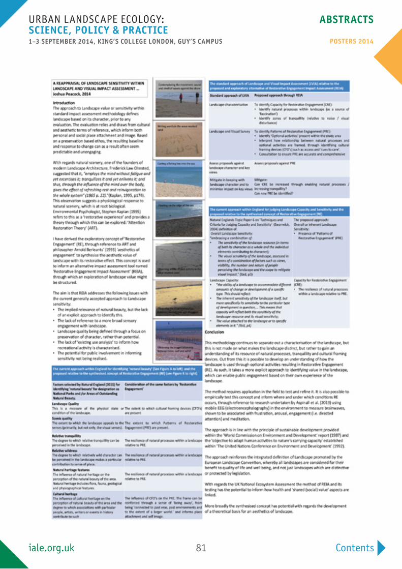
Contents
Urban landSCape eCology: SCienCe, poliCy & pRACTiCe1–3 SepTemBeR 2014, King’S College london, guy’S CAmpuS
ABSTRACTS
poSTeRS 2014
iale.org.uk 81

Contents
Urban landSCape eCology: SCienCe, poliCy & pRACTiCe1–3 SepTemBeR 2014, King’S College london, guy’S CAmpuS
ABSTRACTS
poSTeRS 2014
iale.org.uk 82
defining High nature Value Farmland (HnVF) in Cyprus: an expert driven approach
Authors and Affiliations:Zomeni1, m., martinou2, A.F, Stavrinides2, m.C., Xenofontos3,
m., Stylianopoulou3, e., Vogiatzakis1*, i.n.1open university of Cyprus, 2Cyprus university of Technology, 3department of environment (mAnRe)
email:[email protected]
agriculture worldwide is a key driver behind environmental change including climate change, biodiversity loss and degradation of land and freshwater. High nature Value Farmland systems (HnVF) worldwide are sustainable agroecosystems recognized for their importance for biodiversity conservation and the provision of ecosystem services. the area of HnVFs in member states is a key indicator used by eurostat for evaluating the evolving relationship between agriculture and the environment, in response to changes in markets, technological developments and the Common agricultural policy. although the core elements of what constitutes HnV farming in europe have been developed in the past, these serve solely as guidance to member countries which according to their individualities (farming practices, physiographical conditions and climate) should refine these elements and come up with a concrete definition of the main HnV farming types within their territory. in Cyprus, HnVF defines the island’s landscape features for more than four millennia but is currently under threat from two major opposing forces: agricultural intensification and land abandonment.
We brought together under a common spatial framework datasets on farming typology rules, agro-chemicals inputs, water use intensity, biodiversity and other datasets collected from public authorities and conservation organizations. Using an expert driven approach informed by a range of stakeholders (government departments, Universities, ngos and farmers), we define HnVF areas in Cyprus informed by principles of landscape ecology and verified in the field. the precise definition, identification and mapping of the targeted HnV farming types are prerequisites for the implementation of a monitoring and management programme which will reconcile biodiversity conservation, agricultural production and other ecosystem services.

Contents
Urban landSCape eCology: SCienCe, poliCy & pRACTiCe1–3 SepTemBeR 2014, King’S College london, guy’S CAmpuS
ABSTRACTS
poSTeRS 2014
iale.org.uk 83