universiti putra malaysia oil spill detection and...
TRANSCRIPT
UNIVERSITI PUTRA MALAYSIA
JANAM
OIL SPILL DETECTION AND CONTINGENCY PLANNING USING RADAR IMAGERY AND GIS
HAMID ASSILZADEH
FK 2002 33

JANAM OIL SPILL DETECTION AND CONTINGENCY PLANNING
USING RADAR IMAGERY AND GIS
By
HAMID ASSILZADEH
Thesis Submitted to the School of Graduate Studies, Universiti Putra Malaysia, in Fulfilment of the Requirement for the Degree of Doctor of Philosophy
April 2002

DEDICATION
To my dear family, my parents, brothers and sisters who have been my source of inspiration, wisdom and strength through the most difficult times of my life. I dedicate also this thesis to my lovely country mates who are the symbol of resistance.
ii

Abstract of thesis presented to the Senate ofUniversiti Putra Malaysia in fulfilment of the requirement for the degree of Doctor of Philosophy
OIL SPILL DETECTION AND CONTINGENCY PLANNING USING RADAR IMAGERY AND GIS
By
HAMID ASSILZADEH
March 2002
Chairman: Associate Professor Shattri Bin Mansor, Ph.D.
Faculty: Engineering
Shipping casualties often resulted in serious accidental spills as experienced in the
Straits of Malacca in the past decade. Operational remote sensing and geographic
infonnation system (GIS) are important tools for oil spill research and development
activities. The use of remote sensing and GIS has been making important
contributions to environmental monitoring, modeling and management. The
combined use of remotely sensed images and GIS data has received considerable
interest in recent years to protect human life, and reduce the environmental
consequences of both spills and cleanup efforts. It is necessary to identify vulnerable
coastal locations before a spill happens, and promptly perfonn removal actions when
an oil spill occurs, so that the protection priorities can be established and clean-up
strategies recognized. In this project an oil spill contingency plan has been created
for the Straits of Malacca in three steps as follow: (a) SAR data such as RADARSAT
has been used to detect and map oil spills pattern on the Malaysian coastal waters.
Infonnation on detection, exact position and size of the oil spill can be identified by
iii

remote sensing in SAR images and then plotted on maps in GIS and a priority of the
combat efforts and means according to the identified coastal sensitive areas can be
carried out; (b) environmental sensitivity index (ESI) map; suggested to provide spill
response teams with information about shoreline sensitivity and ranking based on
vulnerability of the spill area. This map can show resources at risk in the event of an
oil or hazardous substance spill; (c) Prediction of oil spill trajectory, using main
seasonal surface currents and surface drift produced by winds. Hypothetical spill
trajectories have been simulated for each of the potential launch areas across the
entrance of the straits of Malacca. These simulations assumed more than hundred
spills occurring in each seasons of the year from each launched area. A successful
combating operation to a marine oil spill is dependent on a rapid response from the
time the oil spill is reported until it has been fully combated. In order to optimize the
decision support capability of the surveillance system for oil spill contingency
planning, GIS database have been integrated with the detection tool. An automatic
oil spill detection tool was established and information on the exact position and size
of the oil spill is then visualized in GIS environment. The system offer opportunities
for integration of oil drift forecast models by prediction of wind and current
influence on the oil spill for risk assessment using EASI program in PCI software.
iv

Abstrak tesis yang dikemukakan kepada Senat Universiti Putra Malaysia sebagai memenuhi keperluan untuk ijazah Doktor Falsafah
PENGESAN TUMPAHAN MINY AK DAN PERANCANGAN KONTIGENSI MENGGUNAKAN IMEJ RADAR DAN GIS
Oleh
HAMID ASSILZADEH
March 2002
Pengerusi: Profesor Madaya Shattri Bin Mansor, Ph.D.
Fakulti: Kejuruteraan
Sektor perkapalan sering menyebabkan kemalangan yang serius sebagaimana yang
dialami di Selat Melaka dalam dekad yang lepas. Sistem Penderian Jauh dan GIS
merupakan alat yang penting dalam aktiviti penyelidikan dan pembangunan untuk
kajian tumpahan minyak. Penggunaan sistem penderian jauh dan GIS telah
memberikan sumbangan yang besar dalam pemantauan, pengurusan dan permodelan
alam sekitar. Kombinasi penggunaan data dari imej penderian jauh dan GIS telah
mendapat perhatian sejak kebelakangan ini dalam melindungi kehidupan manusia
dan juga dalam mengurangkan kesan alam sekitar akibat daripada tumpahan minyak
dan langkah pembersihan. Untuk tujuan ini, adalah perIu untuk mengenalpasti
kawasan pinggir pantai yang terdedah kepada tumpahan minyak dan dengan ini
usaha yang serta merta dapat dilakukan untuk mengatasi hal ini apabila ianya
berlaku. Dengan ini strategi perlindungan dan langkah pembersihan dapat
dikenalpasti. Untuk memenuhi keperluan di Selat Melaka, pelan kontigensi
tumpahan minyak telah direkacipta di dalam tiga langakah seperti berikut: (a) Data
v

SAR contohnya RADARSAT telah digunakan untuk mengesan dan memetakan
corak tumpahan minyak di perairan Malaysia. Maklumat tentang pengesanan, posisi
yang sebenar dan saiz tumpahan minyak boleh dikenalpasti dengan menggunakan
teknik penderian jauh dalam imej SAR dan kemudiannya diplotkan ke dalam peta
menggunakan GIS. Dengan ini langkah pencegahan bagi kawasan pinggir pantai
yang terdedah dapat dikenalpasti; (b) Peta indeks kepekaan Persekitaran (ESI)
dlcadangkan bagi memberikan maklumat tentang kepekaan dan tahap garis pinggir
pantai berdasarkan kepada kawasan yang terdedah kepada tumpahan minyak kepada
pasukan yang bertindakbalas . Peta ini boleh menunjukkan sumber yang berisiko
semasa kejadian tumpahan minyak atau bencana yang berkaitan dengannya; (c)
Jangkaan trajektori tumpahan minyak menggunakan keadaan permukaan musim
utama dan pergerakan di atas permukaan yang dihasilkan oleh angin; Hipotesis
trajektori tumpahan minyak telah disimulasikan untuk setiap kawasan perlancaran
yang berpotensi merentasi Selat Melaka. Di dalam mengoptimunkan keupayaan
sokongan membuat keputusan bagi sistem pemantauan untuk perancangan
kontigensi tumpahan minyak, pangkalan data GIS telah diintergrasikan dengan
peralatan pengesanan. Simulasi ini mengandaikan lebih daripada ratusan tumpahan
yang wujud bagi setiap musim untuk setiap tahun bagi kawasan yang dilancarkan.
Operasi yang beIj aya bagi tumpahan di lautan ini bergantung kepada tindak balas
yang kerap dari masa tumpahan minyak dilaporkan sehinggalah ianya diatasi
sepenuhnya. Untuk tujuan mengoptimakan keupayaan sokongan keputusan untuk
sistem pengesanan bagi pelan kontigensi tumpahan minyak, pangkalan data GIS
telah diintegrasikan dengan alat pengesan. Alat pengesan automatik tumpahan
vi

11l1l1yah. telah dlkenal pasti dan maklumat posisi sebenar dan saiz tumpahan minyak
kemudiannya divisualkan dalam persekitaran GIS. Sistem ini menawarkan satu
keupayaan untuk mengintegrasi model ramalan hanyutan minyak dengan membuat
jangkaan pengaruh angin dan semasa ke atas tumpahan minyak untuk penilaian
risiko dengan menggunakan program EASI yang terdapat dalam perisian PCI.
vii
ACKNOWLEDGEMENTS
I am most indebted and grateful to Associate Professor Dr. Shattri Bin Mansor, Ph.D.
who has guided and supported me along the way and given me a lot of constructive
comments, advice, and ideas, and finally for his kind friendship. He is certainly the
person who is responsible for the successful completion of this study.
I would like to extend my gratitude to the members of my Supervisory Committee,
Prof. Dr. Mohd. Ibrahim Hj Mohd, and Dr. Abdul Rashid Mohamed Shariff for their
advice, kind and constant support, encouragement and omnipresence at all my
difficulties. My appreciation also goes to Mr. Ahmad Rodzi Mahmud for his interest
and guidance in my project.
This research was made possible through the financial support of the Ministry of
Science, Technology and Environment, Malaysia (IRP A grant), which is highly
appreciated. I would like to acknowledge support from Department of Environment
(DOE), Malaysia Meteorological Service Department (MMS), Malaysia Center of
Remote Sensing (MACRES), for various aspects of the project to make it successful.
Special thanks to my friends for all their patience, kind help and morale support.
Many thanks to Ali Mashinchian and his wife Lisa Pourlak, Dr. Peyman Roostaeian
and Javad Khadem Sameni, Wong Tai Hong, Nor Aizam Binti Adnan and all my
other friends who contributed so much indirectly towards this achievement. Special
thanks to Laura Sanchez my best friend.
viii
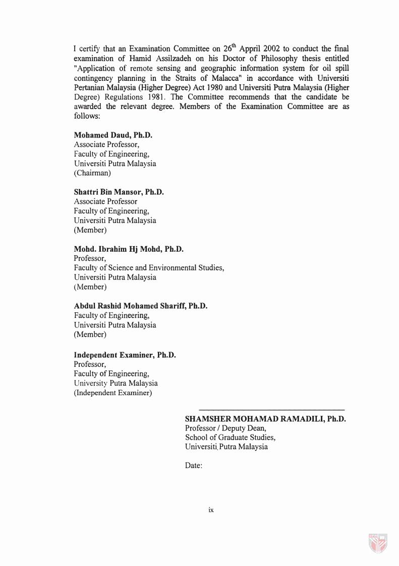
I certify that an Examination Committee on 26th Appril 2002 to conduct the final examination of Hamid Assilzadeh on his Doctor of Philosophy thesis entitled "Application of remote sensing and geographic information system for oil spill contingency planning in the Straits of Malacca" in accordance with Universiti Pertanian Malaysia (Higher Degree) Act 1980 and Universiti Putra Malaysia (Higher Degree) Regulations 1981. The Committee recommends that the candidate be awarded the relevant degree. Members of the Examination Committee are as follows:
Mohamed Daud, Ph.D. Associate Professor, Faculty of Engineering, Universiti Putra Malaysia (Chairman)
Shattri Bin Mansor, Ph.D. Associate Professor F acuIty of Engineering, Universiti Putra Malaysia (Member)
Mohd. Ibrahim Hj Mohd, Ph.D. Professor, Faculty of Science and Environmental Studies, Universiti Putra Malaysia (Member)
Abdul Rashid Mohamed Shariff, Ph.D. F acuIty of Engineering,
Universiti Putra Malaysia (Member)
Independent Examiner, Ph.D. Professor, Faculty of Engineering, University Putra Malaysia (Independent Examiner)
SHAMSHER MOHAMAD RAMADILI, Ph.D. Professor / Deputy Dean, School of Graduate Studies, Universiti. Putra Malaysia
Date:
ix

This thesis submitted to the Senate ofUniversiti Putra Malaysia has been accepted as fulfilment of the requirement for the degree of Doctor of Philosophy.
x
AINI IDERIS, Ph.D. Professor / Dean, School of Graduate Studies,
Universiti Putra Malaysia
Date: 0 8 hGIJ 2002

DECLARATION
I hereby declare that the thesis is based on my original work except for quotations and citation, which have been duly acknowledged. I also declare that it has not been previously or concurrently submitted for any other degree at UPM or other institutions.
Hamid Assilzadeh
Date:
xi

TABLE OF CONTENTS
DEDICATION
ABSTRACT
ABSTRAK
ACKNOWLEDGEMENTS
APPROVAL
DECLARATION
TABLE OF CONTENTS
LIST OF TABLES
LIST OF FIGURES
LIST OF ABBREVIATIONS
CHAPTER
1 .
2.
INTRODUCTION
1 . 1 Background of Study
1 .2 Problem Statement
1 .3 Significance of Study
1 .4 Purpose of Study
1.5 Study Objectives
LITERATURE REVIEW
2. 1 Oil Spill
2.2 Oil Spill in the Straits of Malacca
2.3 Oil Spill Contingency Plan
11
111
v
viii
IX
Xl
xii
xv
XlI
Xu
1
1
3
4
5
5
7
7
1 1
14
2.3 .1 An Evaluation of Previous Contingency Planning 17
2.3.2 Remote Sensing and GIS Support Oil Spill 23
Contingency
2.3.3 Oil Spill Contingency Planning in Malaysia 27
xii

3.
2.5 Remote Sensing and Oil Spill Evaluation 30
2.5.1 The Problems of Oil Spill Remote Sensing 41
MATERIALS AND METHODS 45
3.1 Radar Imagery 46
3.1.1 Pre-Processing of Radar Image 50
3.1.1.1 Radiometric Correction 50
3.1.1.2 Geometric Correction 53
3.1.2 Post-Processing of Radar Image 55
3.1.2.1 Generate Radar Brightness 56
3.1.2.2 Texture Analysis 57
3.1.2.3 SCALING Radar Image 60
3.1.2.4 GAMMA Distribution for Reduce 62
Speckles
3.1.2.5 Feature Extraction 63
3.1.3 Oil Spill Image Classification 64
3.1.4 Automatic Spill Detection Using Visual Modeler 66
in PCI
3.2 GIS Application 68
3.2.1 Creating Data in GIS 68
3.2.2 Creating Attribute Data 73
3.2.3 Data Output from GIS 74
3.2.3.1 ESI Map 74
3.2.3.2 Bathymetric Map 76
3.3 Oil Spill Trajectory Simulation 76
3.3.1 Mathematical Model 76
3.3.2 Programing the Mathematical Model Using 80
EASI
3.3.3 Evaluation of the Simulation Model (Accuracy 88
Analysis)
xiii

4. RESULTS AND DISCUSSIONS
4.1 Pre-processing Results of Radar Image
4.1.1 Geometric and Radiometric Correction
4.2 Post-processing Results of Radar Image
4.2.1 Image Enhancement
4.2.2 Derivation of Brightness Value
4.2.3 Texture Analysis Results
4.2.4 Image Gray Level Scaling and Quantization
Results
4.2.5 Image Gamma Map Filtering Results
4.3 Oil Spill Image Classification Results
4.4 Automatic Spill Detection Results by Visual Modeler
4.5 GIS Application Results
4.5.1 Mapping Oil Spill
4.5.2 Other Maps Created with Database in GIS
4.5.3 Automatic Trajectory Simulation
4.6 Accuracy Analysis of the Model
5. CONCLUSION AND RECOMMENDATIONS
REFERENCES
APPENDICES
VITA
XIV
90
90
90
93
93
93
95
99
100
101
104
109
109
112
119
121
135
142
158
201

LIST OF TABLES
Table Page
2. 1 Oil pollution incidents in the Straits ofMalacca (BOr. 2002) 12
2.2 Oil spill contingency planning procedures (EPA. 1 990) 1 5
2.3 Spill evaluation criteria (Environmental Law Report, 1 99 1 ) 16
2.4 Thickness of thin oil layer based on its color and appearance 30
(Environmental Law Report, 1991 )
4. 1 Comparison of oil spills trajectory based on simulated model 1 34
and real images
4.2 Comparison of oil spills trajectory based on angle simulated in 134
model and real images
xv

Figure
2.1
3 . 1
3.2
3.3
3.4
3.5
3.6
LIST OF FIGURES
Page
Transport of crude oil and distribution of resource areas 13 sensitive and vulnerable to oil pollution in East Asia (Chua, 1997).
Schematic of an oil spill contingency plan for the Straits 46 of Malacca based on remotely sensed data and GIS.
Raw image database on PIX format presented in PCI's 47 image processing software.
The expansions of oil spill detection and oil spill 48 classification algorithm.
Picture Analysis, Correction, and Enhancement (PACE) 51 provides extensive digital image processing functions.
Antenna Pattern Compensation (APC) performs a 51 radiometric balancing on synthetic aperture radar.
Geometric Correction based on GCPWorks main panel. 54
3.7 SARBETA generates a radar brightness channel from 56 the input scaled radar channel using the gain offset and scaling.
3.8 Texture analysis calculates a set of texture measures for 56 all pixels in an input image.
3.9 Scaling radar standardized the texture values. Scaling 61 perfonns a linear or nonlinear mapping of image gray levels to a desired output range.
3 . 1 0 Gamma function in PCI performs spatial filtering on 63 each individual pixel in an image using the gray-level values in a square window surrounding each pixel.
3. 11 Classification methods and session configuration for the 65 image III PCI allows configuring the type of classification.
xvi

3 . 1 2 Model Librarian can serve all commands needed for 67 processing radar image to detect oil spill automatically.
3 . 1 3 Vectorised topographic map of coastal area of Tanjung 7 1 Tohor region in the Straits of Malacca.
3 . 14 Vectorised topographic map of Batu Pahat area in the 71 Straits of Malacca.
3. 1 5 Vectorised topographic map of Malacca area III the 72 Straits of Malacca.
3 . l 6 Vectorised topographic map of Johor area in the Straits 72 of Malacca.
3 . 17 Schematic of oil spill trajectory modeling in sea 79 environment based on wind induced current and net current.
3 . 1 8 Simulation model for oil spill traj ectory converted to 82 SPANS functions by EASI programming.
3 . 1 9 Compute New Column creates a column containing new 83 attributes by applying a user defined mathematical equation to existing attributes in the data layer.
3 .20 The grid for the study area (with 1 0000 m resolution 84 cells).
3.21 Monthly wind direction, speed and sea conditions 85 reported by ground stations in the Straits of Malacca (October 1997) (Malaysian Meteorological Service, 1 997).
3.22 Oceanographic and atmospheric chart data over the 86 Straits of Malacca (26 Oct. 1 997) (Malaysian Meteorological Service, 1997).
3.23 Figure 3 .23: Oceanographic and Sea condition data in 87 the Straits of Malacca, point data format and its attribute data in SPANS.
3 .24 Thirty oil spill samples collected in the Straits of 89 Malacca from the 26 Oct. 1 997 oil spill accident. Real directions of the spills based on their centerline are determined.
xvii

4.1
4.2
4.3
4. 4
4.5
4.6
4.7
4.8
Raw image on PIX format before geometric and 91 radiometric correction presented in PCI image processing software.
The image after pre-processing (geometric and 92 radiometric correction).
Enhancing radar image using FSPEC--SAR Speckle 94 Filters command in PACE.
Brightness values of the image In 32-bit pixel SIze 95 referring to pixel brightness.
Effects of the Homogeneity function of texture analysis 97 on the image.
Effects of the Angular Second Moment function of 98 texture analysis on the image.
Scaling performs a linear mapping of image gray levels 100 to a desired output range.
Classification result of the processed image. 102
4.9 SAR image classification and attribute DN values of the 103 image pixels showing three different classes for oil spill.
4.10 Automatic detection of oil spill using Visual Modeler 104 was designed to detect any spilled oil in a short time.
4.11 Input is a sample of oil spill in radar image. 106
4.12 Two different actions on image by Visual Modeler to 106 identify Spill area (ii) and Pollution area (i).
4. 13 Classified oil spill image by Visual Modeler in two 107 regions: oil spills area in red and polluted area in black color.
4.14 Grey values of original image (channel l ) and attribute 108 values after Homogeneity (Channel 2) and Angular Second Moment (Channel 3) texture analysis. Channel 2 specified the all polluted area and channel 3 rectified only very high-polluted area (spilled area).
xviii

4.15: Oil spill mapping in GIS system giving information 1 10 about area, and thickness of spilled oil.
4.16 Spill area extracted from classified image using GIS. 111
4.17 High and low pollution area extracted from classified 111 image using GIS.
4.18 Malacca Straits: Bathymetric data extracted and overlaid 113 with radar image.
4.19 Malacca Straits ESI map in North-West of Johor state 114 extracted and overlaid from topographic map and radar image. See legends in Figure 4.22.
4.20 Malacca Straits ESI map in Johor region extracted and 115 overlaid from topographic map and radar image. See legends in Figure 4.22.
4.21 Malacca Straits ESI map of the whole study area 116 extracted and overlaid from topographic map and radar image. See legends in Figure 4.22
4.22 Legends display some features on the ESI map In 117 SPANS engine.
4.23 Oil spills history in the Straits of Malacca, (DOE, 1998) 118 in point data format and its attribute data in SPANS.
4.24 Oil spill trajectory simulated based on oceanographic 120 and meteorological information extracted from the charts and records on 26 Oct 1997.
4.25 Hypothetical oil spill trajectory simulated for an 121 appropriate point in the Straits of Malacca.
4.26 Regression line is showing the relationship between the 122 model and the real image.
4.27 Oil spill from radar images at two different times (ERS- 124 1997 -03-19 and ERS- 1997-05-12).
4.28 Oil spill from radar image at two different times (ERS- 124 1997 -05-28 and ERS- 1997-07-18).
xix
4.29 Oil spill from radar image at two different times (ERS- 125 1 997-09- 10 and ERS- 1 997- 11- 1 9) .
4.30 Oil spill from radar image at two different times (ERS- 1 25 1 998-03-04 and ERS- 1 998-04-08).
4 .3 1 Oil spill from radar image at two different times (ERS- 126 1 997- 10 - 1 5 and ERS-1 997- 1O - 14).
4.32 Oil spill from radar image at two different times (ERS- 1 27 2000-02-2 1 and ERS- 2000-02-20).
4.33 Oil spill from radar image at two different times (ERS- 1 28 2000 -03- 8 and ERS-2000 -03-7).
4 .34 Initial position of oil spill on 7 March 2000 (ii) and the 1 29 position of the same spill after 24 hours on 8 March 2000 (i).
4.3 5 Traj ectory simulation o f oil spill i n the Straits of 1 30 Malacca, using two reference point (A; the initial point of center mass coordination is X = 5 53962. 1 m, Y =
1 66 1 25 .4 m B; initial point of center mass coordination is X = 534392.5 m, Y = 1 8 1 877.5 m). A and B are initial points of oil spills on 7 March 2000 and J1! and B/ are destination points of oil spills on 8 March 2000.
4.36 Schematic of angular difference on movement of oil 1 3 2 spill based o n final location o f oil spill simulated by model and the real location of oil spill extracted by radar Image.
xx

APC:
ASA:
ASEAN:
CASI:
CCRS:
CCRS:
DBIC:
DBOC:
DN:
DOE:
DSS:
EASI:
ESI:
FLI:
GCP:
GEMS:
GIS:
GLCM:
IAS:
LDIAS:
LEAF:
MEIS II:
LIST OF ABBREVIATIONS
Antenna Pattern Correction
Applied Science Associates
Association of South East Asian Nations
Compact Airborne spectrographic Imager sensor
Canada Center for Remote Sensing
Canadian Center for Remote Sensing
Database Input Channel
Database Output Channel
Digital Number
Department of Environment
Decision Support System
Engineering Analysis and Scientific Interface
Environmental Sensitivity Index
Flourescence Line Imager
Ground Control Point
Marine Department of Environmental Management System in USA
Geographical information system
Gray level co-occurrence matrix
Image Analysis System
Landsat Digital Image Analysis System
Laser Environmental airborne fluorosensor
Multi-spectral Electro-optical Imaging Scanner sensor
xxi

MOSIS: Marine Oil Spill Information System
Nbr: Neighbor pixel
NLOOK: Nwnber of Looks
NOCC: National Oil Spill Control Committee
NRDA: Natural Resource Damage Assessment Model
Oil SCAN: Oil Spill Contingency and Navigation System
OSC: On Scene Commander
OSP AR: Oil Spill Preparedness and Response in Asia
PACE: Picture Analysis, Correction, and Enhancement
PMI: Programmable Multi-spectral Imager
PMR: Power-to-mean ratio
Ref: Reference pixel
RPI Research Planning Institute
SAR: Synthetic Aperture Radar
SARBET A: PCI function generates a radar brightness
SARGEO: PCI function creates a geocoded SAR image
SCAL: Gray Level Scaling program in PCI
SI: Spill Impact
SIS: Spatial Information System
SLAR: Side-looking Airborne Radar
TEX: PCI function produces several output based on texture analysis
WQ: Water Quality
xxii

CHAPTER 1
INTRODUCTION
1.1 Background of Study
Malaysian coastal and marine environment contain many species, habitats and other
resources that could be severely affected by oil pollution. The most sensitive areas are
coastal areas where oil can strand on the foreshore. The Straits of Malacca is located
west of Peninsular Malaysia and it is an important and unique water body. A unique,
tropical estuarine environment, rich in renewable and non-renewable natural resources
characterizes the Malacca Strait. For the local communities, the Straits host a large
marine fishery sector and numerous aquaculture and mariculture ventures. At a national
level, the three littoral states rely greatly either on the production of rich natural
resources or on trades/shipping business associated with the Straits. Finally, the
importance of the Straits to international users is reflected in the high tonnage of goods
carried through the Straits.
The Malacca Straits is considered highly vulnerable to pollution risk due to increased
maritime activities and rapid industrial developments along the coastal areas causing
deterioration of the marine and coastal ecosystems. The most important risk is that
associated with possible oil spills from tankers crossing the Straits of Malacca. There are
several reports since 1975 on the number and extent of these oil spills in the Straits of

Malacca (Calow, 1 997). According to these records the southwestern coast of Johor state
up to Melaka are areas at highest risk. This area is vulnerable due to presence of
different kinds of environmental reservoirs, natural resources and anthropogenic
activities. Managing and reducing pollution risks in the Straits will require concerted
efforts among users and bordering littoral states. Such efforts were initiated by
GEFIUNDPIIMO Regional Program for the Prevention and Management of Marine
Pollution in the East Asian Seas, including Environmental Profile ( 1 997) and Initial Risk
Assessment ( 1 997), prepared by Professor Peter Calow and Dr. Valery E. Forbes.
On the other hand, development of space technology in Malaysia was driven initially by
its effort to use space remote sensing technology for natural resources and
environmental management in 1 990s. Despite having a short history in space
technology, Malaysia has already made significant impacts towards achieving selected
capabilities in this technology - through the launching of MEASAT-l communication
satellite in 1997. In the ground segment, Malaysia is currently implementing a project to
acquire a satellite remote sensing ground receiving station to facilitate real-time
reception of high-resolution data to meet the national need for a more effective
environmental monitoring and natural resources management. These include monitoring
of forest fires that lead to recent serious haze problem, illegal forest logging, and oil spill
in the surrounding waters. In the field of oil spill detection, and environmental impact
assessment, this technology has already been widely utilized.
2