tsunami time travel eric b. grosfils geology department pomona college tsunami travel time
TRANSCRIPT
Tsunami Time TravelTsunami Time Travel
Eric B. GrosfilsEric B. Grosfils
Geology DepartmentGeology Department
Pomona CollegePomona College
Tsunami Travel TimeTsunami Travel Time
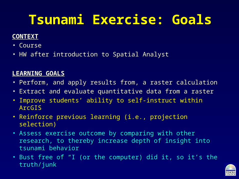
Tsunami Exercise: GoalsTsunami Exercise: GoalsCONTEXTCONTEXT
• CourseCourse
• HW after introduction to Spatial AnalystHW after introduction to Spatial Analyst
LEARNING GOALSLEARNING GOALS
• Perform, and apply results from, a raster calculationPerform, and apply results from, a raster calculation
• Extract and evaluate quantitative data from a rasterExtract and evaluate quantitative data from a raster
• Improve students’ ability to self-instruct within ArcGISImprove students’ ability to self-instruct within ArcGIS
• Reinforce previous learning (i.e., projection selection)Reinforce previous learning (i.e., projection selection)
• Assess exercise outcome by comparing with other research, to Assess exercise outcome by comparing with other research, to thereby increase depth of insight into tsunami behaviorthereby increase depth of insight into tsunami behavior
• Bust free of “I (or the computer) did it, so it’s the truth/junk”Bust free of “I (or the computer) did it, so it’s the truth/junk”
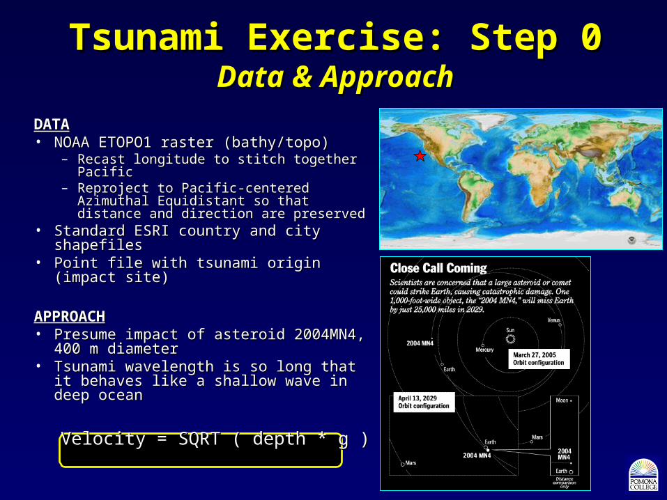
Tsunami Exercise: Step 0Tsunami Exercise: Step 0Data & ApproachData & Approach
DATADATA• NOAA ETOPO1 raster (bathy/topo)NOAA ETOPO1 raster (bathy/topo)
– Recast longitude to stitch together PacificRecast longitude to stitch together Pacific– Reproject to Pacific-centered Azimuthal Reproject to Pacific-centered Azimuthal
Equidistant so that distance and direction Equidistant so that distance and direction are preservedare preserved
• Standard ESRI country and city shapefilesStandard ESRI country and city shapefiles• Point file with tsunami origin (impact site)Point file with tsunami origin (impact site)
APPROACHAPPROACH• Presume impact of asteroid 2004MN4, Presume impact of asteroid 2004MN4,
400 m diameter400 m diameter• Tsunami wavelength is so long that it Tsunami wavelength is so long that it
behaves like a shallow wave in deep behaves like a shallow wave in deep oceanocean
Velocity = SQRT ( depth * g )Velocity = SQRT ( depth * g )
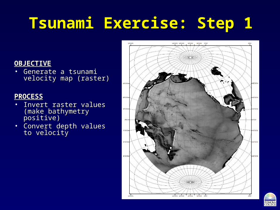
Tsunami Exercise: Step 1Tsunami Exercise: Step 1
OBJECTIVEOBJECTIVE• Generate a tsunami Generate a tsunami
velocity map (raster)velocity map (raster)
PROCESSPROCESS• Invert raster values (make Invert raster values (make
bathymetry positive)bathymetry positive)• Convert depth values to Convert depth values to
velocityvelocity
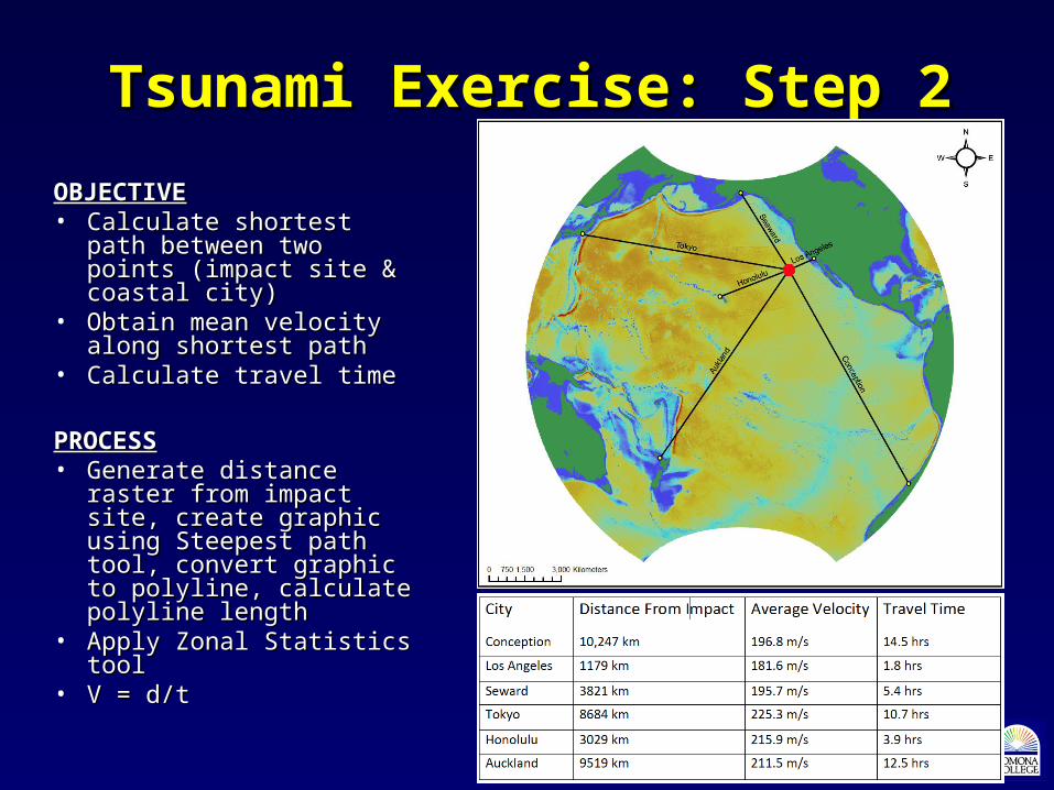
Tsunami Exercise: Step 2Tsunami Exercise: Step 2
OBJECTIVEOBJECTIVE• Calculate shortest path Calculate shortest path
between two points between two points (impact site & coastal city)(impact site & coastal city)
• Obtain mean velocity Obtain mean velocity along shortest pathalong shortest path
• Calculate travel timeCalculate travel time
PROCESSPROCESS• Generate distance raster Generate distance raster
from impact site, create from impact site, create graphic using Steepest path graphic using Steepest path tool, convert graphic to tool, convert graphic to polyline, calculate polyline polyline, calculate polyline lengthlength
• Apply Zonal Statistics toolApply Zonal Statistics tool• V = d/tV = d/t
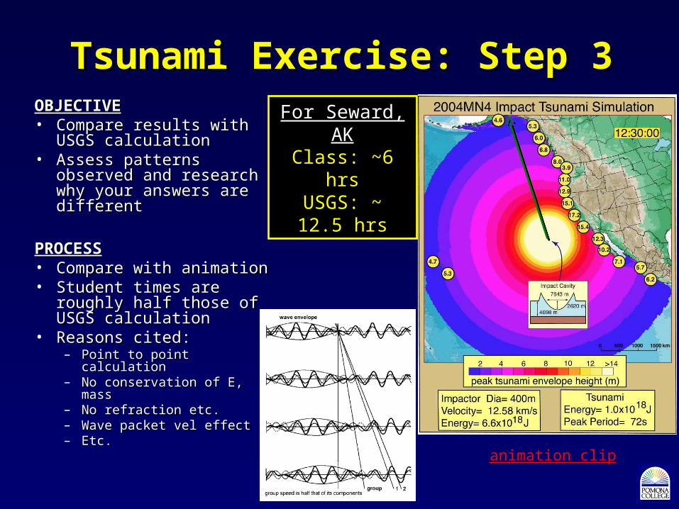
Tsunami Exercise: Step 3Tsunami Exercise: Step 3OBJECTIVEOBJECTIVE• Compare results with Compare results with
USGS calculationUSGS calculation• Assess patterns observed Assess patterns observed
and research why your and research why your answers are differentanswers are different
PROCESSPROCESS• Compare with animationCompare with animation• Student times are roughly Student times are roughly
half those of USGS half those of USGS calculationcalculation
• Reasons cited:Reasons cited:– Point to point calculationPoint to point calculation– No conservation of E, massNo conservation of E, mass– No refraction etc.No refraction etc.– Wave packet vel effectWave packet vel effect– Etc.Etc.
For Seward, AKFor Seward, AKClass: ~6 hrsClass: ~6 hrsUSGS: ~ 12.5 USGS: ~ 12.5
hrshrs
animation clip

Other Parts of Spatial Analyst HWOther Parts of Spatial Analyst HW• Viewshed problem (2003 Padua & Grand Prix fire visibility from my home)Viewshed problem (2003 Padua & Grand Prix fire visibility from my home)
• Cost Path Analysis (getting geophysical equipment from campsite to field Cost Path Analysis (getting geophysical equipment from campsite to field area in Grabens District of Canyonlands NP)area in Grabens District of Canyonlands NP)
• Analysis of independently obtained dataset (conclusion of assignment Analysis of independently obtained dataset (conclusion of assignment started in first week of course)started in first week of course)