towards an archaeology of the welfare state in britain...
TRANSCRIPT
1
Towards an archaeology of the welfare state in Britain, 1945-2009
Abstract
In this paper I develop an argument for the specific contribution which archaeology might make to the study of the ‘classic’ welfare state in Britain (c.1945-1975) and its aftermath (c.1976-present).
This period saw massive state investment in infrastructure which transformed both the material and social worlds of its citizens, through new state policies, new networks of political and social control,
the centralisation and nationalisation of a range of existing aspects of civilian life and the
construction of housing on a monumental scale. While this is a topic which has been studied in
detail by historians and sociologists, despite the massive investment in construction and the
accompanying effects on the physical landscape of Britain, there has been relatively little work on
the ‘material worlds’ of the welfare state. In developing this argument I focus particularly on public
housing, an area which has been the subject of some previous archaeological comment and which
provides a clear case study in the contribution which such an approach might make. State subsidised
housing policy developed as a brave utopian socialist experiment during the interwar period in
Britain, reaching its zenith in the mid 1970s, at which time the state supplied almost a third of the
nation’s housing. Public housing projects became an area of experimentation in the realisation of
modernist ideals of high density private accommodation and in the use of new building technologies
and materials. However, following the demise of the classic welfare state, for various reasons high
density public housing has come to be viewed as part of a dystopian social cycle, the buildings and associated landscapes themselves becoming a symbol of poverty, substance abuse and violence.
From an early history associated with slum clearance and the development of idealised homes for the nation’s poor, many high rise/high density public housing developments from the classic
welfare state are now more often viewed themselves as slums, their design and ‘materiality’ perceived as contributing to, or even creating, a series of social problems. I suggest, following
earlier work by Miller (1988), Buchli (1999) and Buchli and Lucas (2001) that an archaeological approach to the material world of public housing has the potential to reveal not only the ways in
which changing state ideologies are expressed through their design, but also the ways in which
individuals have (and continue to) engage with their spaces and material culture to manage the
conditions of everyday life, and how such places exist within counter-discursive urban and
suburban worlds. I also suggest that part of the role of an archaeology of the welfare state is to
consider the circumstances under which the welfare state fails through a focus on the archaeology
of poverty and homelessness.
Introduction
In this paper I develop an argument for the specific contribution which archaeology might make to
the study of the ‘classic’ welfare state in Britain (1945-1975) and its aftermath (1976-present).
While this is a topic which has been studied in detail by historians and sociologists, despite the
massive investment in construction and the accompanying effects on the physical landscape of
Britain, there has been relatively little work on the ‘material worlds’ of the welfare state (but see recent work by Jane M. Jacobs and colleagues at the University of Edinburgh as part of the AHRC
‘Highrise’ project at http://www.ace.ed.ac.uk/highrise/). In developing this argument I focus particularly on public housing, an area which has been the subject of some previous archaeological
comment and which provides a clear case study in the contribution which such an approach might make. Council estates, housing for the working classes built and managed by local government,
were constructed throughout the twentieth century in Britain, but belong properly to the period after the First World War, reaching peak housing coverage in the decades following the Second World
War up until the mid 1970s. At this time, council estates supplied almost a third of the nation’s
housing stock. In this paper I will provide a summary of the history of British council housing and
discuss the potential for an archaeological study of council housing in Britain, before focussing on
the particular example of the ways in which the state used the ‘materiality’ of council estates to
control its subjects, and the material legacies of their responses to these forms of social and material

2
controls. In undertaking this project I hope to develop a role for archaeology in addressing not only
issues of the recent past, but an argument regarding the potential for archaeology to contribute to an understanding of issues such as housing, class and the social influences of mid to late twentieth
century urban planning on contemporary British culture. This is part of a broader objective to consider the ways in which archaeology might engage with social justice and issues of exclusion
and the subaltern in contemporary society.
The British Welfare State, 1945-2009
There are many scholarly analyses of the history of the welfare state in Britain (e.g. see Gladstone
1999; Fraser 2002; Harris 2004), and it is not my intention to cover aspects of the various academic
debates surrounding its origins here. The ‘classic’ period of the welfare state is generally given as
the period between 1945 and 1975 (e.g. Digby 1989; Lowe 2004), in the implementation of the
1942 Report to the Parliament on Social Insurance and Allied Services (the ‘Beveridge Report’) by
Prime Minister Clement Attlee’s Labour Government. The Beveridge Report extended various
provisions of the 1911 National Insurance Act, that all people of working age should pay a weekly
national insurance contribution in return for which benefits would be paid to people who were sick,
unemployed, retired or widowed to provide a minimum standard of living. Its ultimate aim was to
eliminate the ‘five giants on the road of [post-war] reconstruction’ (Beveridge 1942: 1)—want,
disease, ignorance, squalor and idleness. It led to the reformation of schooling under the 1944
Butler Act, a commitment to full employment for all able bodied people, the creation of a National Health Service in 1948, the reorganisation of public housing provision under the 1946 New Towns
Act and the 1947 Town and Country Planning Act, alongside massive centralisation of municipal services and the increased regulation of all of all health and welfare services in the country. The
classic period of the welfare state is generally considered to have come to an end in the mid 1970s, its demise accelerating under Prime Minister Margaret Thatcher after 1979, when various public
institutions began to be partially privatised (Lowe 2004). Nonetheless, many aspects of the welfare state continue in contemporary Britain, although successive governments have instigated various
reforms which have influenced the character of public housing (e.g. King 2006) and health
provision in particular.
We can conceptualise the welfare state in terms of the centralisation and regulation of five core
areas of society— health care, education, social security (and employment), personal social services
and housing (Jones and Lowe 2002). In Seeing like a State, James Scott (1998) has described these
forms of regulation as part of the implementation of the high modernist ideal of centralised state
control and the over-riding of the legitimacy of localised forms of knowledge and social practice.
We might see this as a period in which the modern British state began to assert its control internally
and apply the sort of strict colonial measures, which had been used as a tool of Empire over the
preceding centuries, at home.
The British welfare state invested massively in the construction of various institutions of welfare. The requirements for rebuilding and the post-war economic boom during the 1950s and 1960s saw
unparalleled levels of new construction of schools, hospitals, public housing, transport infrastructure and new towns. This massive level of construction had a fundamental influence on
the character of British landscapes in both a physical and a social sense. During this period, architects, sponsored by government, attempted to apply various modernist design principles to
town planning and the built environment. At the same time, planners were putting into spatial practice various state sponsored ideologies and reflecting a wide range of changing ideas on the
nature of class, health, sanitation, work, gender relations, the family ‘unit’ and the community.
More than any other, this period defined and created the landscape of modern Britain. One of the
most important transformations of both the physical and social environment occurred in the area of
public housing, on which I will focus my discussion in this paper.

3
From utopia to dystopia: a brief history of public housing in Britain
At the turn of the nineteenth century, housing was a major problem for Britain1. The 1880s had seen major changes in the class landscape, with the urban working classes
establishing a position of respectability, and the widening of concepts of citizenship to include lodgers and recipients of relief. A study by Charles Booth which was published between 1891 and
1903 found that at the turn of the century over a third of London’s population lived in extreme poverty. Reformers turned their attention to the squalid housing conditions of Britain’s slums as the
source of social and moral ills, campaigning for the State to take responsibility for housing its poor.
At the same time, philanthropists had begun to provide private tenement housing for the urban poor,
while factory owners had also begun to build model villages, such as that built by Robert Owen at
New Lanark, and Cadbury’s village at Bourneville, to house their workers. It was not until 1885,
when a Royal Commission was held, that the State took an interest in housing. In 1890 it passed the
Housing of the Working Classes Act, which encouraged local authorities to improve the housing in
their areas. Some local authorities, including the London County Council, began to construct
housing for the working classes at this time.
Despite this, widespread public housing in Britain really only came about with the progressive
implementation by local councils of the 1919 Housing Act in the early 1920s (Ravitz 2001: 3) and
its associated slum clearances. The 1919 Housing Act was part of an ambitious scheme for returned
soldiers developed in the closing years of the First World War to provide “homes fit for heroes to live in”. The Housing Act was followed by further legislation in 1930 which introduced a five year
programme for the clearance of slums in towns within designated ‘Improvement Areas’.
The period following the Second World War saw a major boom in the construction of council housing. The war had caused a major housing shortage due to the widespread destruction of homes,
over 4 million of which are thought to have been damaged or destroyed during its course. In 1942 the coalition British Government unveiled plans for a comprehensive welfare state in which
everyone of working age would pay a weekly national insurance contribution in return for benefits
paid to the sick, widowed, retired, and unemployed. Mass social building programmes saw the
expansion of inner city housing estates. The 1909 Town Planning Act forbade the building of back-
to-back houses, which had become symbolic of the poverty of industrial cities. However, more
influential than legislation were the social ideals of housing reformers. The utopian socialism and
communalist ideals of those involved in drawing up a charter for the State’s responsibility for
working class housing culminated in what many commentators now agree was a ‘brave, new’ social
experiment (Ravetz 2001: 2) which involved the construction of ideal homes for the nation’s poor.
The philosophies underlying these ideals sought to bring about not only material but also social
reform through the creation of ‘ideal’ environments. In the immediate post-War years and well into
the 1950s council house provision was shaped by the 1946 New Towns Act and the 1947 Town and
Country Planning Act (Short 1982). Houses were typically semi-detached or in small terraces. A
three-bedroom semi-detached council house was typically built on a 7 by 7 yd (6.4 by 6.4 m) grid and at a density of no more than 12 houses per acre (337 m² per house), meaning that most houses
had generous space around them. For many working class people, this housing model provided the first experience of private garden space (usually front and rear) and the first private, indoor toilets
and bathrooms.
A housing shortage continued well into the mid 1950s in Britain. In an effort to address this shortage many local authorities, usually in inner cities where the population was growing rapidly,
saw a solution in prefabricated modernist high rise housing. The 1956 Housing Act introduced a
premium which was paid to councils for building blocks higher than five storeys: the higher the
block, the greater the subsidy. The Labour Party's 1966 general election manifesto promised “a
1 This background history draws primarily on Alison Ravetz’s excellent account in Council Housing and Culture: The
History of a Social Experiment (2001) and Lynsey Hanley’s narrative history in Estates: An intimate history (2007).

4
target of 500,000 houses by 1969/70”. The rush to build high and fast led to ‘system-built’ blocks
— prefabricated towers which could be assembled on site. These ‘tower blocks’ and massive, ultimately ghettoised Estates on the outskirts of cities across Britain are perhaps the most infamous
symbol of council housing in this period, being a powerfully material reminder of class and enacting a widespread segregation of the classes-what Lynsey Hanley (2007: 79) refers to as the
‘slums in the sky’. A system had been developed whereby council estates represented a form of housing which was both radically different in physical form to the majority of middle class housing
stock, and spatially removed, simultaneously marking the tenants of council estates as different, and
limiting the interactions between the classes which might contribute to social mobility and class
dissolution.
By the 1970s, council tenants were no longer considered poor, but part of a newly affluent working
class. But while the material part of this experiment must be considered a success, the social
experiment had by this point been labelled a failure, both in the national media and by way of a
series of academic studies which considered the impact of life on the estates on the social health of
their residents. Indeed, by 1982, such criticisms had become so firmly entrenched in British popular
culture that it was possible for popular rock band the Jam to sing:
They were gonna build communities/
It was going to be pie in the sky/ But the piss stench hallways and broken down lifts/
Say the planners dream went wrong
If people were made to live in boxes/ God would have given them string/
To tie around their selves at bed time/ And stop their dreams falling through the ceiling
(‘The Planners Dream Goes Wrong’, featured on the Album The Gift [1982] by The Jam)
Indeed, the perception of council estates had moved from one of Utopic working class
environments to a vision of urban dystopia par excellence. In 1971, Stanley Kubrick famously
chose to set much of his film adaptation of Anthony Burgess’ 1962 novel A Clockwork Orange on
the Thamesmead South Housing Estate in East London. In the film, the brutal, modernist
Thamesmead South becomes the setting for a series of violent crimes committed by the young
protagonist Alex and his gang members before he is caught and submitted to an experimental
aversion therapy. It is a future Britain imagined as brutal and subject to State control, not only as a
result of the depravation of civil liberties, but also due to the influence and social controls of the
housing environment.
This radical turn around in the perception of council estates is often attributed to the widely
publicised failure of a number of high rise prefabricated modernist buildings. Perhaps the most well known of these occurred on 16th May, 1968, when Mrs Ivy Hodge, a council tenant in a block of
flats called Ronan Point in east London, struck a match in the kitchen of her 18th floor flat, causing an explosion which blew out the pre-cast concrete panels which formed the side of the building,
causing the entire end of the block to collapse. Mrs. Hodge survived, but four others died in what has been described as modern architecture’s ‘Titanic’ (The Open University, nd. a).
Public unease with the safety of hundreds of similar blocks across the country spilled over into a
backlash against the modernist architecture and high rise housing (The Open University, nd. b). In
addition to the rush to build houses rapidly, the standards of public housing, in particular in terms of
their design and space allowances, have been argued to have declined rapidly over the late 1950s
5
and 1960s. At this time, commentators also note that the early respectability associated with being a
council estate tenant was replaced as Tory Governments began to propagate the view that council estate residency should be seen as less an end in itself than a means to the ultimate aim of home
owner-occupancy (Hanley 2007; Kynaston 2007).
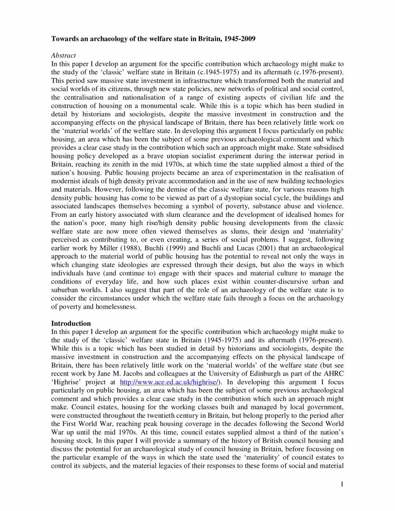
Figure 1: View across the Brownfield estate in Poplar, east London from the Balfron Tower, built during the mid
1960s and designed by the Hungarian born architect Ernı Goldfinger. The estate has a range of medium and
high density housing, including the Balfron Tower itself, which stands 84 metres and 27 stories high and contains
146 flats. Photograph taken in 2008 by Rodney Harrison.
6
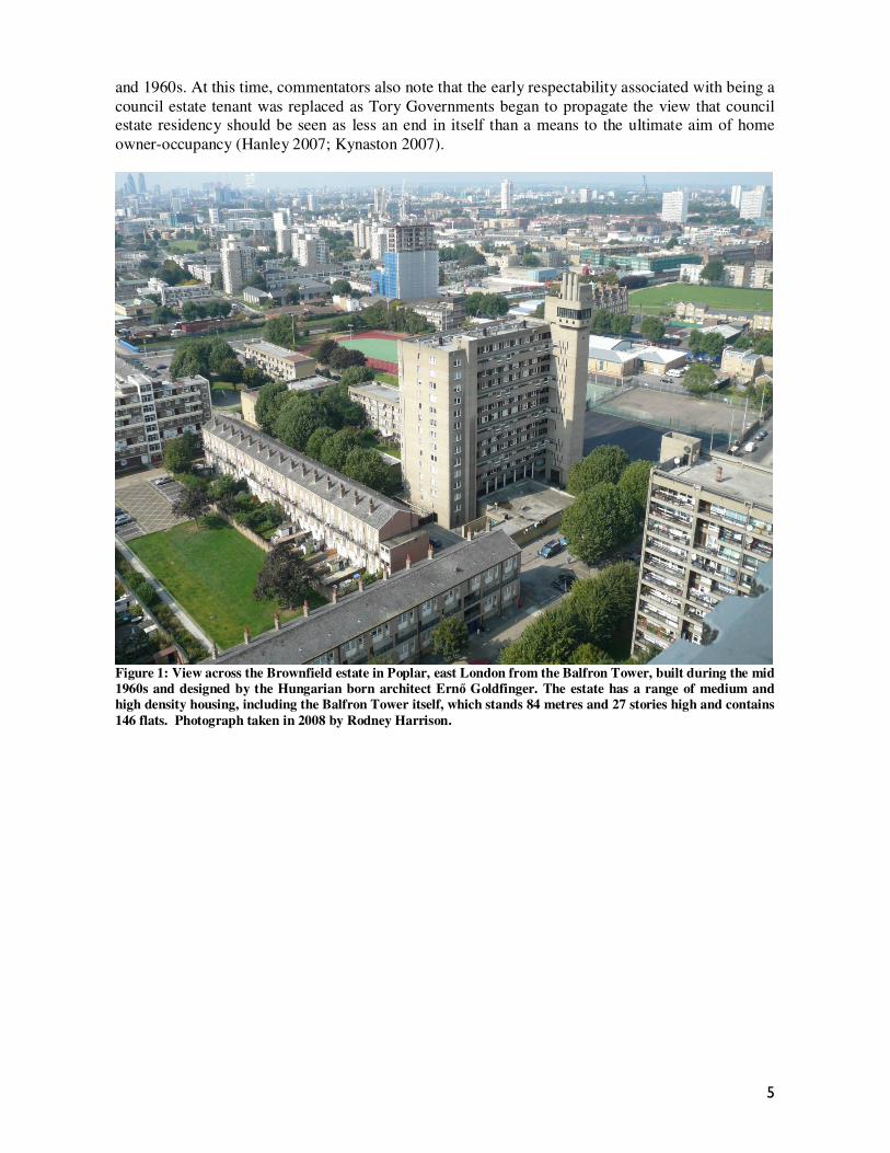
Figure 2: View of the Balfron Tower showing separate lift and services tower connected by walkways to the main
block. Photograph taken in 2008 by Rodney Harrison.
Nonetheless, by the mid to late 1970s, council housing provided a third of all housing in Britain
(Malpas 2005: 3). The end of the long post-war boom heralded the start of two decades of
intermittent recession and rising unemployment. In 1979, in what would be a major turning point in

7
the history of British public housing, the Thatcher government announced the ‘Right to buy’
scheme, under which tenants were encouraged to buy their home with a discount of up to 70% of the market price, depending on the length of time they had lived there. Councils were prevented
from reinvesting the proceeds of these sales in new housing, and the total available stock of public housing declined by over 1.6 million houses over the intervening years. While some local
authorities continue to manage their historic housing stock and to build new housing, others have transferred their housing stock to not-for-profit housing associations, who are now also the
providers of most of the newly constructed public sector housing in Britain. Throughout the 1980s
and 1990s, council housing was increasingly marginalised and stigmatised at the same time that it
was being privatised, with the term ‘council’ increasingly used as a pejorative signifying poverty,
squalor and social decay.
‘Defensible Spaces’ and ‘Slums in the Sky’: Understanding the materiality of public housing
In the years immediately following the Second World War, British council estates became the focus
of a school of sociological analyses (e.g. Young and Wilmott [1957] 2007 and Jephcott 1971; see
further discussion in Glendinning and Muthesius 2004), many of which suggested more or less
explicitly that the design of high rise tower blocks directly fostered social problems. Oscar
Newman’s theory of ‘Defensible Space’ has been influential in perceptions of the failure of council
housing as a social experiment in Britain. Newman published his book Defensible Space in 1972,
which suggested on the basis of a case study from New York that higher crime rates existed in high-rise apartment buildings than in lower-density housing projects because residents felt no control or
personal responsibility for those public areas within such estates that contained large numbers of people. These ideas were subsequently developed by Newman into a manifesto for community
housing design (see Newman 1996). The idea of defensible space is an application of Foucault’s ideas about self governance taken to their logical conclusion. For Newman, the key to successful
urban design is the development of communal areas in which residents can share a sense of responsibility for public spaces. He suggests that housing developments that evoke forms of
territorialism and shared responsibility are the best deterrents to crime and vandalism.
Newman’s work echoed earlier academic criticisms of public housing, such as Jane Jacobs’ The
Death and Life of Great American Cities (1961). Jacobs identified what she saw as flaws in
Modernist urban planning. She compared traditional neighbourhoods with planned estates, noting
that high density, mixed districts, where people were within walking distance of amenities and of
each other, fostered a greater sense of community than did modern estates where land use was
segregated into zones, and where space and meticulous planning had created barriers to human
interaction.
These theories seem to have been accepted almost wholeheartedly in Britain, and form the basis not
only for the widespread popular condemnation of modernism as an architectural movement through
its connection with prefabricated high rise public housing, but also driven almost entirely contemporary developments in British community housing and urban design. It is tempting to see
these ideas connecting high rise developments with social problems as somewhat simplistic, particularly given the lack of social problems in similar types of communal housing projects in
southeast Asian countries such as Singapore. Brindley (1999) suggests that many of the problems in state owned apartment buildings arise due to an initial failure to recognise the costs of maintenance.
When high rise buildings are not maintained properly, new social problems are created and/or existing social problems are exacerbated. I argue that the changing attitudes towards public housing
over the period 1945-2009, from ‘utopia’ to ‘dystopia’, reflect changing attitudes and policies
towards housing over this period as much as they reflect the lived experience of council housing
residents (see also Kynaston 2007; Hanley 2007: 122ff). This suggests the need for detailed
analyses of council housing which reflect on the everyday lived experience of housing as part of a
broader consideration of both the physical and social landscapes of welfare in Britain.

8
Figure 3: Indefensible spaces? Interior walkways between lift shaft and flats in the Balfron Tower. Photograph
taken in 2008 by Rodney Harrison.
9
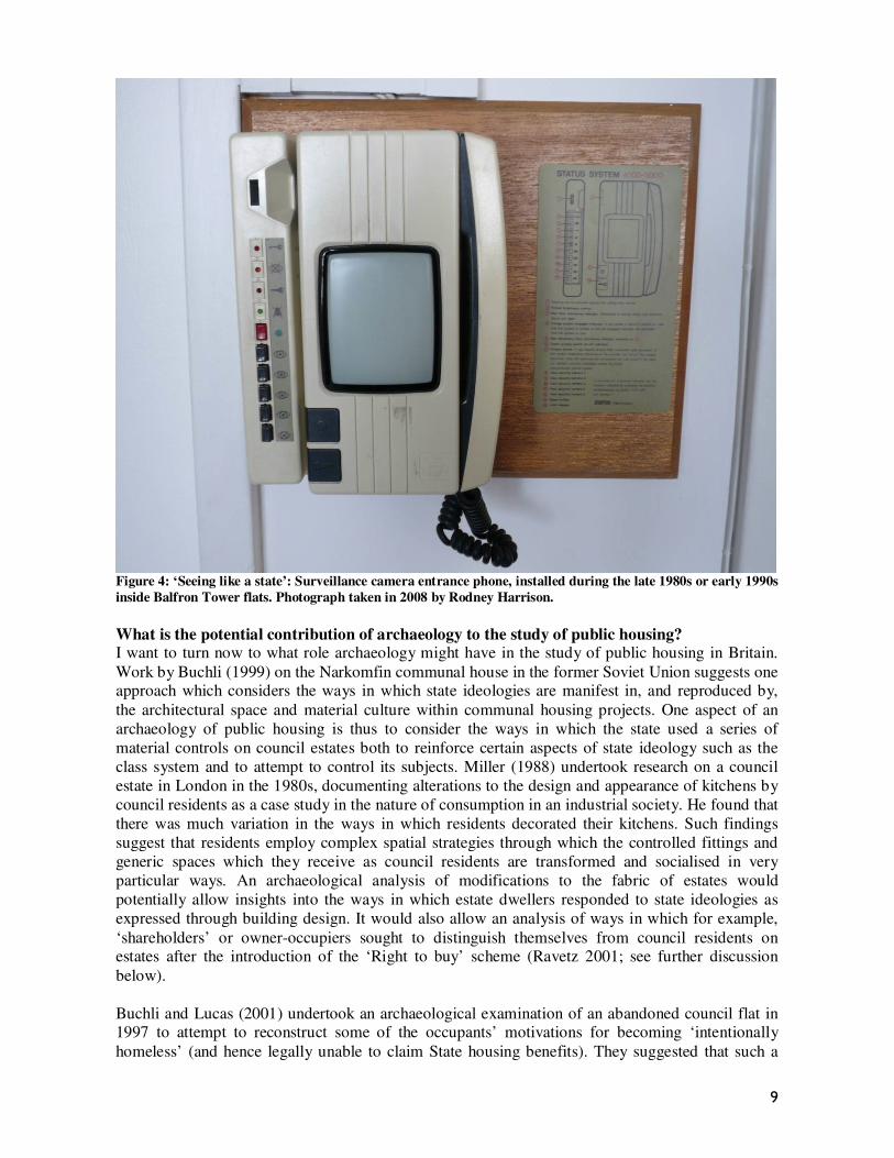
Figure 4: ‘Seeing like a state’: Surveillance camera entrance phone, installed during the late 1980s or early 1990s
inside Balfron Tower flats. Photograph taken in 2008 by Rodney Harrison.
What is the potential contribution of archaeology to the study of public housing? I want to turn now to what role archaeology might have in the study of public housing in Britain.
Work by Buchli (1999) on the Narkomfin communal house in the former Soviet Union suggests one approach which considers the ways in which state ideologies are manifest in, and reproduced by,
the architectural space and material culture within communal housing projects. One aspect of an
archaeology of public housing is thus to consider the ways in which the state used a series of
material controls on council estates both to reinforce certain aspects of state ideology such as the
class system and to attempt to control its subjects. Miller (1988) undertook research on a council
estate in London in the 1980s, documenting alterations to the design and appearance of kitchens by
council residents as a case study in the nature of consumption in an industrial society. He found that
there was much variation in the ways in which residents decorated their kitchens. Such findings
suggest that residents employ complex spatial strategies through which the controlled fittings and
generic spaces which they receive as council residents are transformed and socialised in very
particular ways. An archaeological analysis of modifications to the fabric of estates would
potentially allow insights into the ways in which estate dwellers responded to state ideologies as
expressed through building design. It would also allow an analysis of ways in which for example,
‘shareholders’ or owner-occupiers sought to distinguish themselves from council residents on estates after the introduction of the ‘Right to buy’ scheme (Ravetz 2001; see further discussion
below).
Buchli and Lucas (2001) undertook an archaeological examination of an abandoned council flat in 1997 to attempt to reconstruct some of the occupants’ motivations for becoming ‘intentionally
homeless’ (and hence legally unable to claim State housing benefits). They suggested that such a

10
study has a potential role in understanding processes of marginalisation and alienation. Their study
indicates an important area of investigation in the archaeology of housing which relates to what happens when public housing ‘fails’, and the potential for an archaeology of public housing to feed
into the development of state and council housing policy and practice.
An archaeology of public housing must be approached from a variety of different spatial scales. At the broadest scale, this would involve looking at the influence of housing on the physical landscape
by mapping the location of public housing and the associated transformation of the landscape at the
country, town, city and borough level. Analysis of the design of individual estates, and the location
and provision of services by local councils to estates at the city or borough level would allow an
exploration of the ways in which state ideologies are reflected through public housing design. More
detailed micro-archaeologies of individual estates allow an exploration of the ways in which state
ideologies are reflected, accepted or resisted at the level of individual housing projects.
An integral part of the archaeology of public housing is an exploration of the biographies of
individual estates and the everyday lives of their residents. This can be achieved through processes
of mapping and interviewing residents about their use of the space on individual estates as part of a
landscape of work, family, recreation and home. My approach is influenced by the work of Jean-
François Augoyard ([1979] 2007) who explored the everyday lives of the inhabitants of l‘Arleqiuin,
a ‘new town’ in Grenoble, France, through the semiotic analysis of patterns of walking and using the space of the housing project. His work on l’Arlequin famously influenced Michel de Certeau’s
writing on the practice of everyday life (1984), which is also an influence here (see also Harrison 2004). Below I explore some preliminary themes which are emerging from my work on the
everyday spaces of contemporary council estates in south and east London.
Council estates and the archaeology of everyday life in east London I have recently been involved in a project exploring the social landscapes of the Carpenters Road
Estate in east London, which has formed the basis for a series of three short films which are part of
the Open University course AD281 Understanding Global Heritage2. The Carpenters Road Estate
is a public housing estate located in Newham, Stratford in east London, directly adjacent to the
2012 Olympics site. It was constructed after 1965 and comprises a mixture of high rise and low rise
housing. It is dominated by three 23-storey tower blocks—Dennison Point, James Riley Point and
Lund Point—which were completed in 1968. Newham is one of the most ethnically diverse areas in
the country, with no single ethnic group dominating the population. This ethnic mix is reflected in
the vibrant community of the Estate. Residents have been involved in long negotiations with
Newham council about the future of the Estate in the light of Council’s plans to regenerate the area
in conjunction with various works associated with the 2012 London Olympics.
2 These films, along with a series of academic perspectives on them, have been made freely available by the Open
University on iTunesU. Please see http://www.open.ac.uk/itunes/ and http://www.open.ac.uk/Arts/ad281/ for more
information.
11
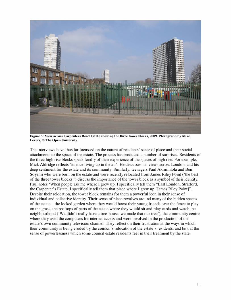
Figure 5: View across Carpenters Road Estate showing the three tower blocks, 2009. Photograph by Mike
Levers, © The Open University.
The interviews have thus far focussed on the nature of residents’ sense of place and their social
attachments to the space of the estate. The process has produced a number of surprises. Residents of
the three high rise blocks speak fondly of their experience of the spaces of high rise. For example,
Mick Aldridge reflects ‘its nice living up in the air’. He discusses his views across London, and his deep sentiment for the estate and its community. Similarly, teenagers Paul Akinrinlola and Ben
Soyemi who were born on the estate and were recently relocated from James Riley Point (‘the best of the three tower blocks!’) discuss the importance of the tower block as a symbol of their identity.
Paul notes ‘When people ask me where I grew up, I specifically tell them “East London, Stratford, the Carpenter’s Estate, I specifically tell them that place where I grew up [James Riley Point]”.
Despite their relocation, the tower block remains for them a powerful icon in their sense of individual and collective identity. Their sense of place revolves around many of the hidden spaces
of the estate—the locked garden where they would boost their young friends over the fence to play
on the grass, the rooftops of parts of the estate where they would sit and play cards and watch the
neighbourhood (‘We didn’t really have a tree-house, we made that our tree’), the community centre
where they used the computers for internet access and were involved in the production of the
estate’s own community television channel. They reflect on their frustration at the ways in which
their community is being eroded by the council’s relocation of the estate’s residents, and hint at the
sense of powerlessness which some council estate residents feel in their treatment by the state.

12
Figure 6: View of James Riley Point in 2009 showing the way in which high rise tower blocks punctuate the
landscape in ways which make them constantly visible. This level of visibility provides a permanent reminder of
class distinctions within the contemporary British landscape, but also provides people who live within Tower
Blocks with a distinctive way of relating to space. Photograph by Mike Levers, © The Open University.
As individuals who were born on the estate, Paul and Ben’s recollections are profoundly different to
those of Violet Sloane, who lived on the original Carpenters Road Estate (which sustained massive
13
bomb damage during the Blitz) and who moved on to the estate when it was first built in the 1960s.
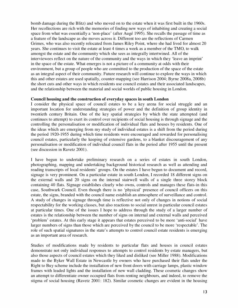
Her recollections are rich with the memories of finding new ways of inhabiting and creating a social space from what was essentially a ‘non-place’ (after Augé 1995). She recalls the passage of time as
a feature of the landscape as she moves across it. Different too are the reflections of Carmen Grimes, who was also recently relocated from James Riley Point, where she had lived for almost 20
years. She continues to visit the estate at least 4 times a week as a member of the TMO, to walk amongst the estate and the community which she sees as integrally intertwined. All of the
interviewees reflect on the nature of the community and the ways in which they ‘leave an imprint’
in the space of the estate. What emerges is not a picture of a community at odds with their
environment, but a group of people who are committed to the production of the space of the estate
as an integral aspect of their community. Future research will continue to explore the ways in which
this and other estates are used spatially, counter-mapping (see Harrison 2004; Byrne 2008a, 2008b)
the short cuts and other ways in which residents use council estates and their associated landscapes,
and the relationship between the material and social worlds of public housing in London.
Council housing and the construction of everyday spaces in south London
I consider the physical space of council estates to be a key arena for social struggle and an
important location for understanding strategies of power and the definition of group identity in
twentieth century Britain. One of the key spatial strategies by which the state attempted (and
continues to attempt) to exert its control over recipients of social housing is through signage and the controlling the personalisation or modification of individual flats and houses by residents. One of
the ideas which are emerging from my study of individual estates is a shift from the period during the period 1920-1955 during which time residents were encouraged and rewarded for personalising
council estates, particularly the keeping of extensive gardens, to a blanket discouragement of any personalisation or modification of individual council flats in the period after 1955 until the present
(see discussion in Ravetz 2001).
I have begun to undertake preliminary research on a series of estates in south London,
photographing, mapping and undertaking background historical research as well as attending and
reading transcripts of local residents’ groups. On the estates I have begun to document and record,
signage is very prominent. On a particular estate in south London, I recorded 18 different signs on
the external walls and 20 signs on the internal stairwell walls of a single three storey block
containing 40 flats. Signage establishes clearly who owns, controls and manages these flats-in this
case, Southwark Council. Even though there is no ‘physical’ presence of council officers on this
estate, the signs, branded with the council name establish an atmosphere of surveillance and control.
A study of changes in signage through time is reflective not only of changes in notions of social
respectability for the working classes, but also reactions to social unrest in particular council estates
at particular times. One of the issues I hope to address through the study of a larger number of
estates is the relationship between the number of signs on internal and external walls and perceived
‘problem’ estates. At this early stage it appears that estates perceived to be more ‘anti-social’ have larger numbers of signs than those which are perceived by the council to be more ‘respectable’. The
role of such spatial signatures in the state’s attempts to control council estate residents is emerging as an important area of research.
Studies of modifications made by residents to particular flats and houses in council estates
demonstrate not only individual responses to attempts to control residents by estate managers, but also those aspects of council estates which they liked and disliked (see Miller 1988). Modifications
made to the Byker Wall Estate in Newcastle by owners who have purchased their flats under the
Right to Buy scheme include the installation of new front doors with carriage lamps, plastic window
frames with leaded lights and the installation of new wall cladding. These cosmetic changes show
an attempt to differentiate owner occupied flats from renting neighbours, and indeed, to remove the
stigma of social housing (Ravetz 2001: 182). Similar cosmetic changes are evident in the housing

14
estates I have been studying in south London, in particular, through painting and replacing the front
door of flats, one of the few decorative modifications which owners are allowed to the external facing aspects of their flats. Such modifications can be read as an overt response to the tight
controls exercised by local councils.
Figure 7: Series of external doors showing modifications made by leaseholders and council residents at a council
estate in south London. Photographs taken in 2007 by Rodney Harrison.
These individual issues around the modification of space reflected broader, generational issues in the lives of council estates as communities. Just as the management of estates “precluded
incremental change produced by individual choices and actions” (Ravetz 2001: 176), in many
instances married offspring of home owners had no automatic right to settle on the same estates as
their parents, or even close by. This prohibits the development of long term community links with
individual council estates. The restrictions on the use of buildings within council estates for
commercial purposes also meant that council estates, even the very large ones, could never develop
into ‘normal neighbourhoods’.
These restrictive forms of estate management, along with the physical aspects of the design and
geographic isolation of estates—on the outskirts of towns and cities, design to be ‘inward’ looking,
and thus lacking ordinary features of villages such as a ‘main street’ or a commercial centre—have
been seen to lead to the development of particular psychological conditions which restrict class mobility; what Lynsey Hanley terms the ‘wall in the head’ (2007: 148). Studies of the locations of
15
estates at a landscape level also demonstrate the ways in which they enacted a form of spatial
segregation of the working classes; clearing the nineteenth century slums to replace them with ‘slums in the sky’.
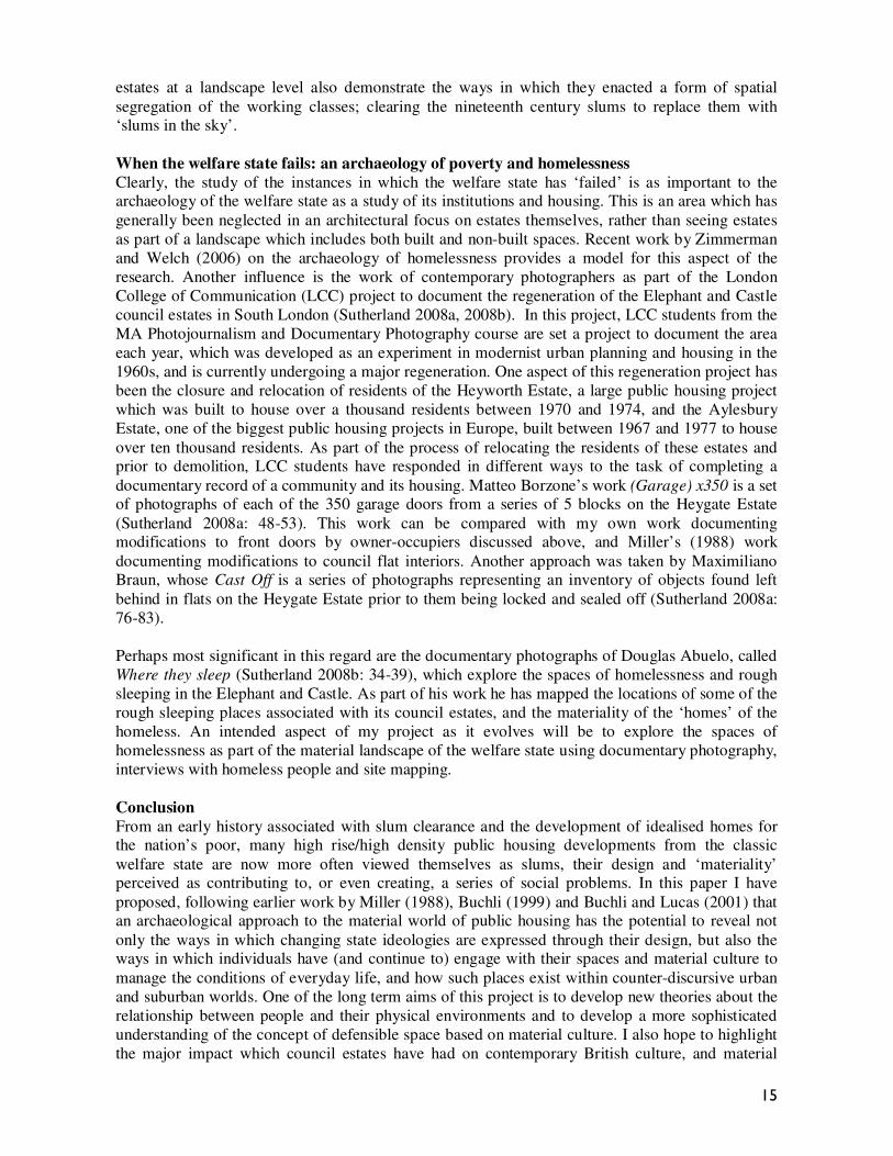
When the welfare state fails: an archaeology of poverty and homelessness
Clearly, the study of the instances in which the welfare state has ‘failed’ is as important to the archaeology of the welfare state as a study of its institutions and housing. This is an area which has
generally been neglected in an architectural focus on estates themselves, rather than seeing estates
as part of a landscape which includes both built and non-built spaces. Recent work by Zimmerman
and Welch (2006) on the archaeology of homelessness provides a model for this aspect of the
research. Another influence is the work of contemporary photographers as part of the London
College of Communication (LCC) project to document the regeneration of the Elephant and Castle
council estates in South London (Sutherland 2008a, 2008b). In this project, LCC students from the
MA Photojournalism and Documentary Photography course are set a project to document the area
each year, which was developed as an experiment in modernist urban planning and housing in the
1960s, and is currently undergoing a major regeneration. One aspect of this regeneration project has
been the closure and relocation of residents of the Heyworth Estate, a large public housing project
which was built to house over a thousand residents between 1970 and 1974, and the Aylesbury
Estate, one of the biggest public housing projects in Europe, built between 1967 and 1977 to house
over ten thousand residents. As part of the process of relocating the residents of these estates and prior to demolition, LCC students have responded in different ways to the task of completing a
documentary record of a community and its housing. Matteo Borzone’s work (Garage) x350 is a set of photographs of each of the 350 garage doors from a series of 5 blocks on the Heygate Estate
(Sutherland 2008a: 48-53). This work can be compared with my own work documenting modifications to front doors by owner-occupiers discussed above, and Miller’s (1988) work
documenting modifications to council flat interiors. Another approach was taken by Maximiliano Braun, whose Cast Off is a series of photographs representing an inventory of objects found left
behind in flats on the Heygate Estate prior to them being locked and sealed off (Sutherland 2008a:
76-83).
Perhaps most significant in this regard are the documentary photographs of Douglas Abuelo, called
Where they sleep (Sutherland 2008b: 34-39), which explore the spaces of homelessness and rough
sleeping in the Elephant and Castle. As part of his work he has mapped the locations of some of the
rough sleeping places associated with its council estates, and the materiality of the ‘homes’ of the
homeless. An intended aspect of my project as it evolves will be to explore the spaces of
homelessness as part of the material landscape of the welfare state using documentary photography,
interviews with homeless people and site mapping.
Conclusion
From an early history associated with slum clearance and the development of idealised homes for the nation’s poor, many high rise/high density public housing developments from the classic
welfare state are now more often viewed themselves as slums, their design and ‘materiality’ perceived as contributing to, or even creating, a series of social problems. In this paper I have
proposed, following earlier work by Miller (1988), Buchli (1999) and Buchli and Lucas (2001) that an archaeological approach to the material world of public housing has the potential to reveal not
only the ways in which changing state ideologies are expressed through their design, but also the ways in which individuals have (and continue to) engage with their spaces and material culture to
manage the conditions of everyday life, and how such places exist within counter-discursive urban
and suburban worlds. One of the long term aims of this project is to develop new theories about the
relationship between people and their physical environments and to develop a more sophisticated
understanding of the concept of defensible space based on material culture. I also hope to highlight
the major impact which council estates have had on contemporary British culture, and material

16
legacy of this ambitious cultural and political experiment which is so integrally linked with the
physical landscapes of contemporary Britain.
An archaeological approach to the welfare state in Britain must operate at various spatial scales—from an exploration of the massive state investment in infrastructure which transformed both the
material and social worlds of its citizens, through new state policies, new networks of political and social control, the centralisation and nationalisation of a range of existing aspects of civilian life and
the construction of housing on a monumental scale, to the minutiae of everyday life on individual
public housing projects. Such an exploration has the potential to reveal the ways in which state
ideologies relating to such broad issues as class, health, sanitation, work, gender relations, the
family ‘unit’ and the community were both consumed and resisted at the local level. Ultimately, it
will provide an example of the ways in which archaeology might engage with broader issues of
relevance to contemporary society such as social justice and issues of exclusion and the subaltern.
17
References cited
Augé, M. (1995). Non-Places: Introduction to an Anthropology of Supermodernity, Verso, London
and New York.
Augoyard, J. (2007). Step by Step: Everyday walks in a French Urban Housing Project, Minnesota University Press, Minneapolis and London.
Brindley, T. (1999). The modern house in England: an architecture of exclusion. In Chapman, T.
and Hockey, J. (eds), Ideal Homes? Social change and domestic life, Routledge, London and
New York, pp. 30-43.
Buchli, V. (1999). The Archaeology of Socialism, Berg, New York and Oxford.
Buchli, V. and G. Lucas (2001). The archaeology of alienation: a late twentieth century British council house. In Buchli, V. and Lucas, G. (eds) Archaeologies of the contemporary past,
Routledge, London and New York, pp. 158-167.
Byrne. D. (2008a). Counter-mapping: New South Wales & Southeast Asia. Transforming Cultures
e-journal 3(1): 256-264. Online at http://epress.lib.uts.edu.au/journals/TfC accessed 19
March 2008.
——(2008b). Counter-mapping in the archaeological landscape. In David, B. and Thomas, J. (eds) Handbook of Landscape Archaeology, Left Coast Press, Walnut Creek.
de Certeau, M. (1984). The Practice of Everyday Life, University of California Press, California.
Digby, A. (1989). British Welfare Policy: Workhouse to Workfare, Faber, London.
Fraser, D. (2002). The Evolution of the British Welfare State, Palgrave Macmillan Publishers, Basingstoke.
Glendinning, M., and S. Muthesius (1994). Tower Block: Modern Public Housing in England,
Scotland, Wales and Northern Ireland, Yale University Press, London and New Haven.
Gladstone, D. (1999). The Twentieth-century Welfare State, Palgrave Macmillan Publishers, Basingstoke.
Hanley, L. (2007). Estates: An intimate history, Granta Books, London.
Harris, B. (2004). The Origins of the British Welfare State: Society, State and Social Welfare in
England and Wales, 1800-1945, Palgrave Macmillan Publishers, Basingstoke.
Harrison, R. (2004). Shared landscapes, UNSW Press, Sydney.
Jacobs, J. (1961). The death and life of great American cities, Random House, New York.
Jephcott, P. (1971). Homes in High Flats: Some of the Human Problems Involved in Multi-Storey
Housing, Oliver & Boyd, Edinburgh.
Jones, M. and R. Lowe (2002). From Beveridge to Blair: The First Fifty Years of Britain's Welfare
State 1948-1998, Manchester University Press, Manchester.
King, P. (2006) Choice and the End of Social Housing, Institute of Economic Affairs.
Kynaston, D. (2007) Bleak Housing. Times Literary Supplement Online. Online at
http://tls.timesonline.co.uk/article/0,,25351-2576778,00.html accessed 28 March 2009.
Lowe, R. (2004). Welfare State in Britain since 1945, Palgrave Macmillan Publishers, Basingstoke.
Malpas, P. (2005). Housing and the welfare state: the development of housing policy in Britain,
Palgrave Macmillan Publishers, Basingstoke.
Miller, D. (1988). Appropriating the State on the Council Estate. Man (New Series) 23(2): 353-372
18
Newman, O. (1972). Defensible Space: People and design in the violent city, Macmillan, New
York.
——(1996). Creating Defensible Space, U.S. Department of Housing and Urban Development
Office of Policy Development and Research.
Ravetz, A. (2001). Council Housing and Culture: The History of a Social Experiment, Routledge,
London and New York.
Scott, J.C. (1998). Seeing like a State: How certain schemes to improve the human condition have
failed, Yale University Press, London and New Haven.
Short, J.R. (1982). Housing in Britain: The Post-war Experience, Routledge, London and New York
Sutherland, P. (2008a). Community: The Elephant and Castle, London College of Communication, Elephant and Castle.
Sutherland, P. (2008b). Home: The Elephant and Castle, London College of Communication,
Elephant and Castle.
The Open University (no date a.). From here to Modernity: Ronan Point. Online at http://www.open2.net/modernity/3_13.htm accessed 18 March 2009.
——(no date b.). From here to Modernity: Trellick Tower. Online at
http://www.open2.net/modernity/3_14.htm accessed 19 March 2009.
Young, M. and P. Wilmott (2007). Family and Kinship in East London, Penguin books.
Zimmerman, L. and J. Welch (2006). Toward an archaeology of homelessness. Anthropology News
47(2): 54-55.
19
Figure captions
Figure 1: View across the Brownfield estate in Poplar, east London from the Balfron Tower, built
during the mid 1960s and designed by the Hungarian born architect Ernı Goldfinger. The estate has
a range of medium and high density housing, including the Balfron Tower itself, which stands 84
metres and 27 stories high and contains 146 flats. Photograph taken in 2008 by Rodney Harrison.
Figure 2: View of the Balfron Tower showing separate lift and services tower connected by
walkways to the main block. Photograph taken in 2008 by Rodney Harrison.
Figure 3: Indefensible spaces? Interior walkways between lift shaft and flats in the Balfron Tower. Photograph taken in 2008 by Rodney Harrison.
Figure 4: ‘Seeing like a state’: Surveillance camera entrance phone, installed during the late 1980s
or early 1990s inside Balfron Tower flats. Photograph taken in 2008 by Rodney Harrison.
Figure 5: View across Carpenters Road Estate showing the three tower blocks, 2009. Photograph by
Mike Levers, © The Open University.
Figure 6: View of James Riley Point in 2009 showing the way in which high rise tower blocks
punctuate the landscape in ways which make them constantly visible. This level of visibility
provides a permanent reminder of class distinctions within the contemporary British landscape, but
also provides people who live within Tower Blocks with a distinctive way of relating to space.
Photograph by Mike Levers, © The Open University.
Figure 7: Series of external doors showing modifications made by leaseholders and council
residents at a council estate in south London. Photographs taken in 2007 by Rodney Harrison.