thursday, october 15, 2015 city hall council …
TRANSCRIPT

THURSDAY, October 15, 2015
CITY HALL COUNCIL CHAMBERS 107 NORTH NEVADA AVENUE
COLORADO SPRINGS, COLORADO 80903
CHAIRMAN PHILLIPS CALLED THE MEETING TO ORDER AT 8:30 A.M., ADJORNED AT 11:30 A.M.
PRESENT: ABSENT: Markewich McDonald Henninger Gibson Donley Phillips Shonkwiler Walkowski Smith ALSO IN ATTENDANCE: Mr. Peter Wysocki, Planning and Development Director Mr. Marc Smith, City Senior Corporate Attorney COMMUNICATIONS Chairman Phillips excused Commissioner McDonald. RECORD OF DECISION Moved by Commissioner Shonkwiler, Seconded by Commissioner Smith to approve the September 15, 2015 meeting minutes. Motion carried 8-0 (Commissioner McDonald excused).
1

CONSENT CALENDAR ITEM NO. PROJECT DESCRIPTION
ITEM NO.: A.1-A.2 CPC ZC 15-00070 (Quasi-Judicial) CPC CP 15-00071 (Quasi-Judicial) PARCEL NO.: 6303104005 PLANNER: Meggan Herington
A request by NES, Inc. on behalf of Colorado Springs Union, LLC for approval of the following development applications:
1. A zone change of 16.4 acres from PIP-I (Planned Industrial Park) to OC/CR (Office Complex with Conditions of Record).
2. The Mountain Vistas at Briargate Concept Plan. The concept plan illustrates future office development for the vacant 16.4 acres that is currently part of the Checks Unlimited campus.
The property is located east of North Union Boulevard and north of Meadow Ridge Drive.
2
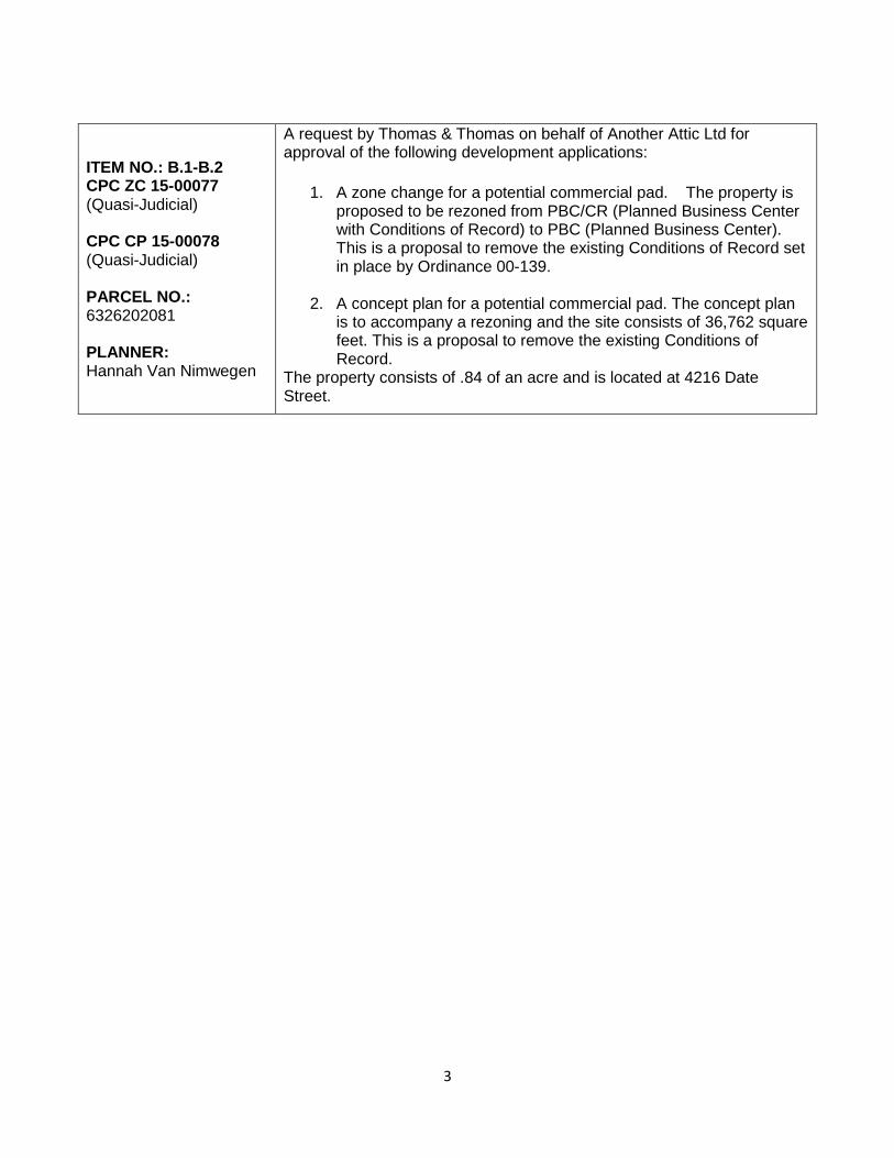
ITEM NO.: B.1-B.2 CPC ZC 15-00077 (Quasi-Judicial) CPC CP 15-00078 (Quasi-Judicial) PARCEL NO.: 6326202081 PLANNER: Hannah Van Nimwegen
A request by Thomas & Thomas on behalf of Another Attic Ltd for approval of the following development applications:
1. A zone change for a potential commercial pad. The property is proposed to be rezoned from PBC/CR (Planned Business Center with Conditions of Record) to PBC (Planned Business Center). This is a proposal to remove the existing Conditions of Record set in place by Ordinance 00-139.
2. A concept plan for a potential commercial pad. The concept plan is to accompany a rezoning and the site consists of 36,762 square feet. This is a proposal to remove the existing Conditions of Record.
The property consists of .84 of an acre and is located at 4216 Date Street.
3

UNFINISHED BUSINESS CALENDAR ITEM NO. PROJECT DESCRIPTION
ITEM: 4A – 4C
CPC MPA 04-00043-A2MN15 (Quasi-Judicial)
ITEM: 7B CPC PUZ 15-00051 (Quasi-Judicial) ITEM: 7C CPC PUP 15-00052 (Quasi-Judicial) PARCEL NO.: 7336200001 PLANNER: Lonna Thelen
A request by RTA Architects on behalf of Turtle Creek Grandview Office LLC for the consideration of the following applications:
1. A minor amendment to the Hill Master Plan. The amendment proposes revising the land use designations. The existing master plan designates the area as neighborhood commercial, office and general industrial. The proposed amendment shows hospital and office uses.
2. A Zone Change from PBC/OC/PIP-1 (Planned Business Center, Office Complex, Planned Industrial Park) to PUD (Planned Unit Development) for the Penrose-St. Francis New Campus. A hospital, office, and commercial, with 200’ maximum building height.
3. A concept plan for the Penrose-St. Francis New Campus. A hospital with office and commercial uses.
The property consists of 51.05 acres and is currently zoned PBC/OC/PIP-1 (Planned Business Center, Office Complex, and Planned Industrial Park) and is located at the northeast corner of Fillmore Street and Centennial Boulevard.
4
NEW BUSINESS CALENDAR ITEM NO. PROJECT DESCRIPTION
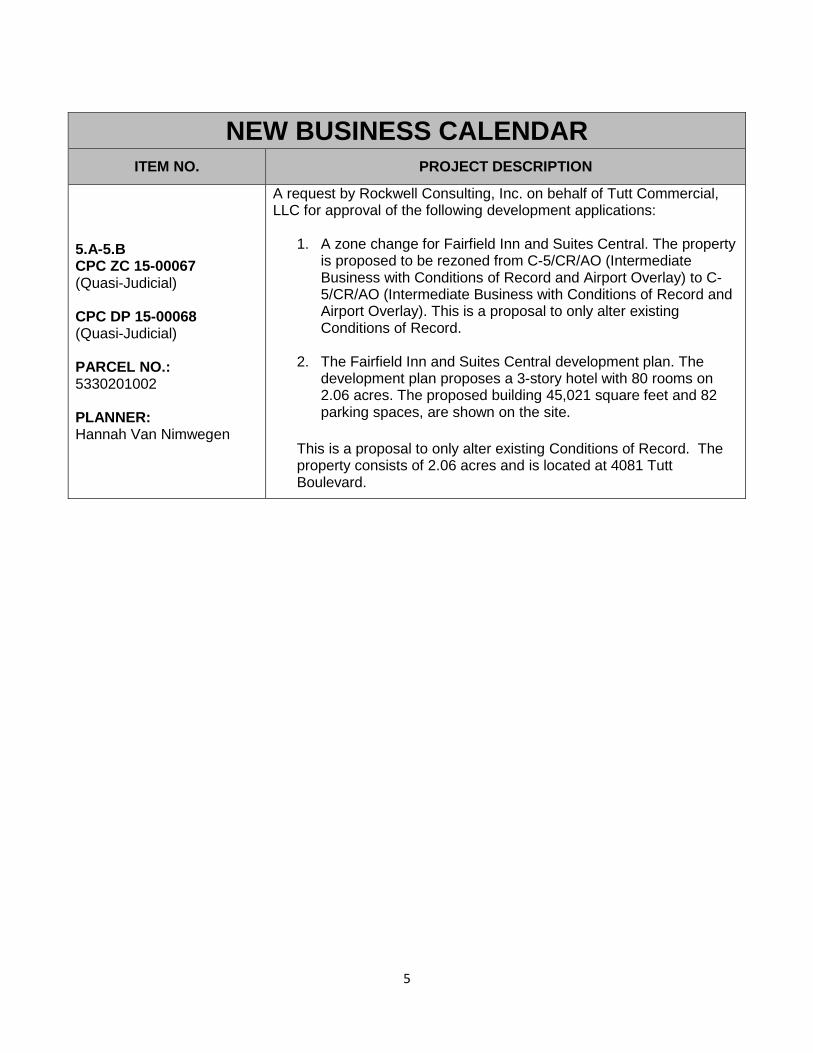
5.A-5.B CPC ZC 15-00067 (Quasi-Judicial) CPC DP 15-00068 (Quasi-Judicial) PARCEL NO.: 5330201002 PLANNER: Hannah Van Nimwegen
A request by Rockwell Consulting, Inc. on behalf of Tutt Commercial, LLC for approval of the following development applications:
1. A zone change for Fairfield Inn and Suites Central. The property is proposed to be rezoned from C-5/CR/AO (Intermediate Business with Conditions of Record and Airport Overlay) to C-5/CR/AO (Intermediate Business with Conditions of Record and Airport Overlay). This is a proposal to only alter existing Conditions of Record.
2. The Fairfield Inn and Suites Central development plan. The development plan proposes a 3-story hotel with 80 rooms on 2.06 acres. The proposed building 45,021 square feet and 82 parking spaces, are shown on the site.
This is a proposal to only alter existing Conditions of Record. The property consists of 2.06 acres and is located at 4081 Tutt Boulevard.
5

ITEM 6 CPC MP 15-00102-URA PLANNER: Peter Wysocki
Determination of whether or not the proposed South Nevada Avenue Area Urban Renewal Plan is consistent with the City of Colorado Springs 2001 Comprehensive Plan. The proposed South Nevada Area Urban Renewal Plan generally covers the area between Interstate 25 and East Cheyenne Road, and South Tejon Street and Wahsatch Avenue.
6
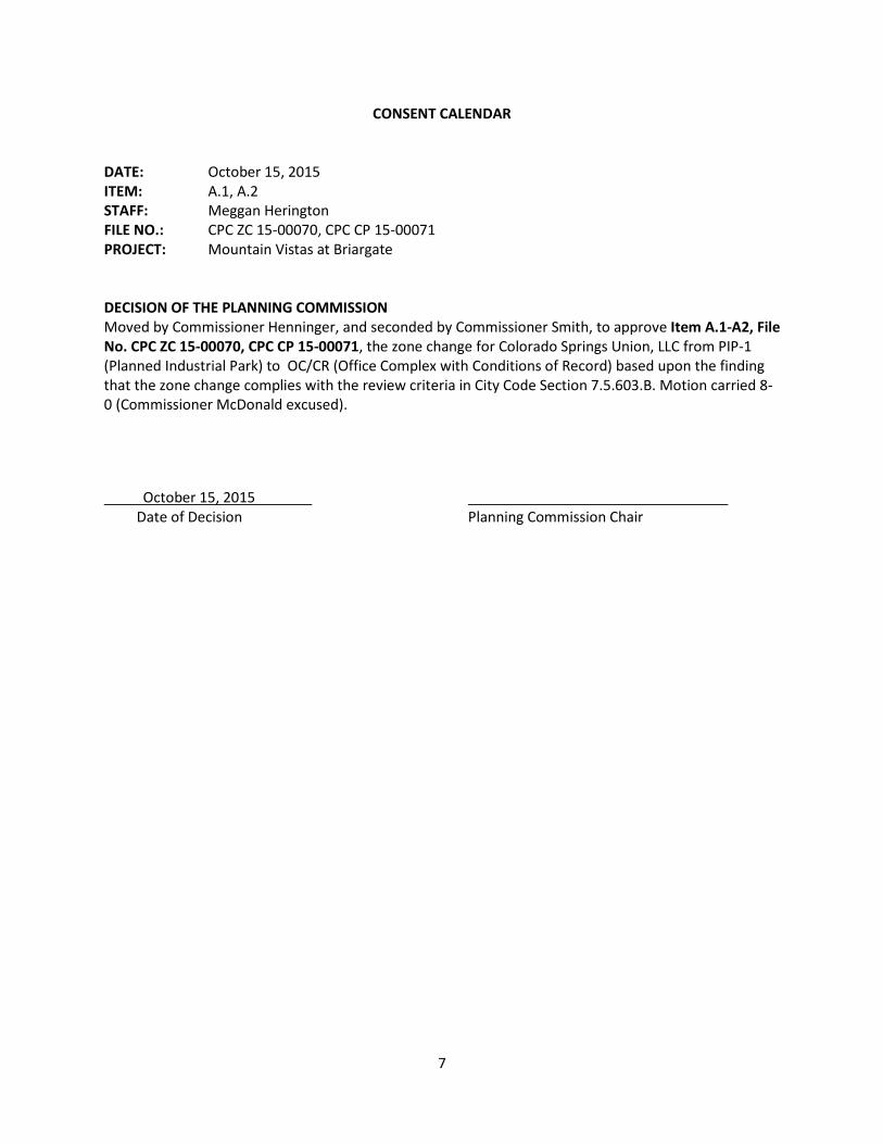
CONSENT CALENDAR DATE: October 15, 2015 ITEM: A.1, A.2 STAFF: Meggan Herington FILE NO.: CPC ZC 15-00070, CPC CP 15-00071 PROJECT: Mountain Vistas at Briargate DECISION OF THE PLANNING COMMISSION Moved by Commissioner Henninger, and seconded by Commissioner Smith, to approve Item A.1-A2, File No. CPC ZC 15-00070, CPC CP 15-00071, the zone change for Colorado Springs Union, LLC from PIP-1 (Planned Industrial Park) to OC/CR (Office Complex with Conditions of Record) based upon the finding that the zone change complies with the review criteria in City Code Section 7.5.603.B. Motion carried 8-0 (Commissioner McDonald excused).
October 15, 2015 Date of Decision Planning Commission Chair
7

CONSENT CALENDAR DATE: October 15, 2015 ITEM: B1 – B2 STAFF: Hannah Van Nimwegen FILE NO.: CPC ZC 15-00070, CPC CP 15-00071 PROJECT: Another Attic Ltd DECISION OF THE PLANNING COMMISSION Moved by Commissioner Smith, and seconded by Commissioner Gibson, to approve Item B.1- B2, File No. CPC ZC 15-00077, CPC CP 15-00078 the zone change Another Attic LTD from PBC/CR (Planned Business Center with Conditions of Record) to PBC (Planned Business Center) based upon the finding that the zone change complies with the review criteria in City Code Section 7.5.603.B. Motion carried 8-0 (Commissioner McDonald excused). October 15, 2015 Date of Decision Planning Commission Chair
8

UNFINISHED BUSIENSS CALENDAR DATE: October 15, 2015 ITEM: 4.A-4.C STAFF: Lonna Thelen FILE NO.: CPC MPA 04-00043-A2MN15, CPC PUZ 15-00051, CPC PUP 15-00052 PROJECT: Penrose-St. Francis New Campus STAFF PRESENTATION Ms. Lonna Thelen, Senior Planner, presented PowerPoint slides (Exhibit A). Ms. Thelen disclosed she received extra emails since the informal meeting, which were email to all Commissioners and were listed as Attachment 4.1 APPLICANT PRESENTATION Jamie Smith, Chief Administrative Office for Penrose-St. Francis Health Services, presented a Power Point presentation (Exhibit B).
The reason for the new campus is due to the fact that the city and region are growing. At present time they do not have the capacity or the ability to grow at their present footprint. They had a third party consultant complete some demographic analysis. They have a primary, secondary and tertiary service area their volume comes from and all these areas are proposed to grow rapidly over the next 10 years. This means they will see more admissions, more testing, and therefore they will need the facilities to accommodate those services.
The dilemma with the current Penrose campus is they are landlocked at 20 acres. It’s a very small campus for the size of the hospital that is run. The West Bed Tower is almost 60 years old and has most of the hospital’s inpatient capacity. This building is aging, it’s inefficient, as well as having high maintenance costs. The rooms are too small and are semi-private at best. Visually it is not what many people want to see in the appearance of a hospital these days. They looked extensively at expanding their current campus. Any type of expansion will require more parking and the only way to accomplish that would be to go up, which would mean building a structured parking facility which is very expensive but also causes business disruption in order to complete. They did not feel they could bear that expense and not have ability for growth for the future.
The capacity at Penrose will not be enough within the next 10 years because growth is not only needed but necessary in some way. Part of that growth has been shifting to the north and east where the St. Francis campus is located at Woodmen and Powers so it accommodates that area of the region. Central Colorado Springs however is very dense, with very little potential for growth in population. The current campus has boundaries on all four sides of the campus with doctor offices, diagnostics centers, the cancer treatment center, the MRI facility, the East Tower facility and the MOB building. All the buildings have been built at different periods and thus it is a mix matched of designs. There is more or less 100 % coverage on the site with the exception of the southeast quadrant where parking is located. Therefore this campus will not be able to accommodate the needs of the hospital in the next 10 years or 50-100-years. Therefore the need to move somewhere is evident.
9

The current campus was thoroughly looked at as a possible option to expand, improve and provide for the services that not only are needed at the present time but also for the future of the needs of not only the hospital but also for the needs of our patients, community and people who use the facilities. The conclusion that the current Penrose Hospital facilities would not meet their inpatient hospital needs. It did not make sense to invest or build more facilities on the current campus. The price tag and time that would be needed to accomplish this task did not make sense and thus the reason for looking at other sites. This new option of Greenfield makes the most sense for what is needed.
The current use of the Penrose Hospital will not be abandoned. It is imperative those facilities continue their important uses. The site will be repurposed. They will do some creative things. The East Tower built in 2005 will be part of their strategic operations as well as other parts of their campus. So the continued use of the Penrose Campus will be a part of their plan. The only difference will be that it will not house the inpatient part component of their business.
In looking at other sites they looking at a minimum of 35 acres, they needed high visibility and to remain close to I-25. They also want to add value to the community. They want to be a larger referral center for all of Southern Colorado. They didn’t want overlap into other areas that other hospitals may serve. So they are west of the other facilities including Memorial, but allows them to remain central and a little bit south of the northern hospitals of Memorial North and St. Francis. So the area they chose was the Centennial and Fillmore location since it met those boundaries.
From a strategic standpoint they want to be convenient to where people are living and serve the regional needs. The new campus will be their primary in-patience care location.
The new site is not that far from their current location and there are advantages to this, they want to operate the two campuses in a virtual way. There would be shuttle services as well as other ways to mesh operational functions. Right now they do not have a final plan; however, if the site does not work for them they will not be able to go the full way of planning. Their vision on this site is to create an incredible health campus. They have been a part of the community for a long time and will continue to be a part so where they are located extremely important for them. They will do their best to make that the site fits in within the natural beauty of where it is, have a lot of green space associated with the design but also key will be the ability for room to grow.
Questions from the Commissioners:
Commissioner Shonkwiler asked if the old campus be closed. Mr. Smith stated he cannot speak to the future say in 30 years but the current plan is to repurpose the campus; some areas are so old, they might moth ball those but for the next foreseeable future he believes that location will be key in what they do. Located on that campus is outpatient, oncology, all of their radiation vaults will stay, they do infusion, imaging and plan to have a freestanding emergency department at that campus. From their standpoint it is a vibrant part of the strategy going forward.
Commissioner Shonkwiler asked why no one has built any medical facilities on the south side of town. Mr. Smith stated he may not have the best answer for that. When they looked at other areas they did
10

not find a site that was eminently suitable in that direction. They looked at 10-11 sites. They didn’t find one that was attainable or that didn’t have multiple owners. This site allowed for that. They needed 45-50 acres in one site. There was no bias about going south there was just no property available. They wanted a site they could build within the next 5-7 years and there were none south. Commissioner Shonkwiler stated some of the reasons he understood as to why no one had go south was due to demographics and asked Mr. Smith if that was correct. Mr. Smith stated that was not correct. It is about is the area flat enough, large enough, and have good access to fit this kind of a use.
Commissioner Walkowski asks what the time for construction. Mr. Smith stated if everything went according to plan he thinks 5-7 years would the approximate time table.
Questions for Staff: None Supporters for the request: None Opponents for the request: Rhoda Fletcher lives on Hofsted Street directly under the area for the proposed site. She would like to represent several others of her neighbors that are very opposed to the entire project. They feel construction of this magnitude could have disastrous consequences for this neighborhood, particularly the area that was affected by the 1999 landslide. Geological surveys have been done to determine whether this is a feasible area to build such a complex. She quoted from an August 24, 2015, Colorado Geological Survey Report – “debris laden and undocumented fill material was CTL’s description of the current soil situation at this site. Extreme care must be exercised in developing the northeastern portion of site in the Hofsted area of the Holland Park landslide. “These surveys indicate the instability of this hill directly above the Hofsted Street. The project should not be started without an extensive stability analysis at a minimum and to her knowledge it has not been done. She quoted from the August 24, 2015, Geological Survey “no stability analysis has been done.” The borings that are included in CTL’s report may not extend to potential slope failure surfaces. The borings toward the east slope are only 20-25 feet deep and the slope is 110 – 140 feet in elevation. CGS strongly recommends that the city require detail slope stability slope analysis for both is area above Holland Park landslide scar and the portion of the site above the asphalt plant and the northern boundary. Ms. Fletcher stated that although the landslide instability could pose grave risk for this neighborhood under the proposed site there are other concerns including increased noise and greatly increased traffic in a well-established residential neighborhood. She stated they felt there were other sites that could serve the needs of this project just as well.
11

John Vandervalk stated he had a lot of experience with this site. He has been in the engineering field for six years and took a break and worked a job running heavy equipment. They were at this site. They filled this area with all types of items. They would fill it up over 100 feet, they never compacted, and they just kept dumping and dumping. It was wood, debris, recycled asphalt or whatever they were hauling. He had asked both Ms. Thelen and the previous planner Steve Tuck how they could rezone a property that they already know is very unstable. He spoke with one of the head geological surveyor in the state and that person said he worked with Clinton administration when they condemned the land to be built on the north side of the site and that person told him that the actual top mesa table was still moving. Therefore he asked the city why they could build on it and how the city could rezone 45 feet to 200 feet on property that is not stable, has not been properly compacted. The company had not bored down to 100 feet to actually see what the stability was. He himself has extensive drainage issues. When the land that was the landslide was condemned they simply took bulldozers and pushed all the dirt at an angle so all the water was pouring into his property. He has had to rent equipment to get all of the water away from his house. When severe thunderstorms happened this summer all the water came into his property. There is no proper drainage. If he had not done all the mitigation previously, his house would have slid. So those are some of his concerns that he would ask to be addressed and wanted to bring that to the Commissioners attention and the back history of the property.
Commissioner Shonkwiler asked Mr. Vandervalk asked there was a map he could show them the area of the site he brought the fill. Ms. Thelen pulled up a site map and Mr. Vandervaulk showed the area to the directly north of the asphalt plant. Commissioner Shonkwiler asked what was the time frame of that happening. Mr. Vandervaulk stated around 2004 – 2005.
Mr. David Puerto represents numerous neighbors that have been impacted by the visuals of enterprise as well as Sunrise the developer that has a huge project to be built, Red Rocks Point Phase I where 79 new homes will be built in the next few years directly west of this area. He stated those that were notified have no direct line of site with this property other than the apartment complex close to the site. Residents Kissing Camels Estates along the east side of the mesa will have this 200 foot structure in their back yards. He questions the zoning and what the allowable height of structure at allowed to be in the proposed zoning. The requesting zoning is PUD (Planned Unit Development) but Mr. Puerta referenced that the PUD zoning does not list as permitted or conditional use for hospital for hospital development but it opens the door for border range of construction and the possibility for a high-rise overlay. He feels the resident can tolerate the traffic and such that would come with this type of project but what they strongly oppose is the replication of the Penrose-St. Francis campus at Cascade and another 200 foot high architecturally unattractive monstrosity. A building this size will far overreach the horizon to the east and dwarf surrounding facilities. If this is where this facility is to be built they request that the build a more architecturally pleasing design and get the building height down to a maximum of 80 – 100 feet.
Richard Mantz felt that it was simple for him. It’s a rezoning that is being looked at. A couple things came to his mind. Why put a 200 foot tall facility at the highest point in the city. This does not make a lot of sense. You are putting it on top of unstable materials. He stated he had not seen where due diligence was done with geological survey to support this type of construction up there. This will be a
12

major hospital facility and it doesn’t seem to fit at this location. He feels there are traffic issues. Primarily he wanted to know why this large of a facility on unstable ground without a geological survey. He would like the geological survey be done before any type of rezoning is done.
Commissioner Shonkwiler stated he had not seen any architectural renderings. Mr. Peter Wysocki stated there were not any at this part of the process. Commissioner Shonkwiler asked Mr. Mantz if he had seen some to give him a point of reference. Mr. Mantz stated he had not he was trying to picture a 200 foot building on top of the mesa would look like. He stated if the hospital doesn’t develop it the rezoning opens it to other potential structures that could be built there. He stated many homeowners lost their homes in the1997 landslide. And there is a lot drainage issue in this area.
Dennis Mincan stated he felt Penrose Hospital going on this site could be a great use and great facility. What he is opposed to is the 200 foot height. The site is approximately 6400 feet in elevation. The mesa to the west is roughly 6480 feet so even from one of the highest points in the city is going to be 100-125 feet taller than any other part of the mesa on the west side. He wanted to know the sketch plan is setting the zoning and the height, he thought with the PUD that all of the requirements are to be in the development plan and not the sketch plan. The PUD development plan requires much more study and visual analysis. Not only what does this site look like from residents to the west but what will it look like to the rest of the city. He stated they would be putting a monolith on the highest point in the city. It will be visible for anyone coming up and down I-25 from either direction or anyone driving in the central part of the city. He wants the height to be looked at.
QUESTIONS OF STAFF: Commissioner Walkowski stated there were a lot of studies that needed to be done for the development plan. Is that done at a staff level or would it come back before the Planning Commission in the future. Ms. Thelen stated this project does allow the development plan to be approved administratively. If you would want that to come back before you they would need to make that a requirement that the development plan come back before the Planning Commission. Commissioner Shonkwiler asked without an amendment to this would this board have any opportunity to review the architectural plans other than the administrative staff. He stated what he was trying to figure out, was this was going to be a big building and architecturally very prominent. Well done, it could be something people are proud of but not well done it would certainly be noticeable. Is there any way other than having the requirement that the development plan come back before this board or another review body to have an opportunity to look at the architectural plans, which could be tremendous. Ms. Thelen stated they were required to submit elevation drawings when they submit their development plan and that would be reviewed by staff to ensure compatibility. If you would want to review by Planning Commission you would need to request the development plan come back before the Planning Commission. Commissioner Shonkwiler stated that would be the only opportunity for the Planning Commission or the public to take a look at this other than reviewing staff’s work. He stated he was not criticizing staff’s work but if the public wants to come forward and have any input this would be the way to go. Ms. Thelen stated the public will definitely get notified during the review process and will be able to provide input during that administrative review portion of it. It would be an opportunity
13

for citizens to comment on the plans and provide suggestions for changes. Commissioner Shonkwiler asked how large of a territory would people be notified because people could see this from a good distance away. Ms. Thelen stated they would use a 1000 feet buffer. They used 1000 feet for the notification for the zone change and concept plan. So they would propose that buffer again. If there are additional neighbors that comment during the process they would also be included and re-notified throughout the process. Mr. Peter Wysocki, Planning Director stated for the benefit of the public and the Planning Commission that the city does not have architectural standards adopted nor do they have architectural design guidelines adopted. If the plan came to fruition he wanted to caution the Planning Commission that their ability to recommend architectural designs is extremely limited. Since there are no guidelines to offer you a recommendation if a building is attractive or unattractive. You have the development plan review criteria but it does not go into the areas of architecture of a building. Commissioner Gibson asked if there had been neighborhood meetings with the residents. Ms. Thelen stated there had not been any neighborhood meetings. They received comments during the review process and staff has addressed those comments and worked with those neighbors. Commissioner Gibson stated they were told that the city was developing a new height ordinance so possibly Ms. Thelen or Mr. Wysocki could speak to that so would this area be included in the new height ordinance. Mr. Wysocki stated he was not aware of any ordinances that were being worked on for height. Commissioner Markewich stated the way the property is currently zoned is looks like to him that 65 feet is the maximum height, is that correct? Ms. Thelen stated that she did not believe it got up to 65 feet. The PIP (not sure – Deferred to Mr. Wysocki), PCB (45) and OC (40 or 45). Commissioner Markewich asked if the 200 foot is being requested, is that the standard in the PUD zone or is a PUD zone with a 200 foot addition or notation. Ms. Thelen stated the height allowance is specific to what is shown in the concept plan. The 200 foot allowance would just for the center section, the hospital area and then 65 feet for the office/medical office and then 65 feet for the commercial zone. So the 200 foot height would not be for the entire site, just the center section. Commissioner Markewich stated then in a PUD zone is 65 feet the highest maximum height standard. Ms. Thelen stated there was no standard for PUD. PUD is a zone district that you can propose your height type and density and so the applicant is proposing a maximum height of 200 feet and then it is up to staff as well as Planning Commission and Council to review that and approve or deny it. Commissioner Markewich stated to Ms. Thelen at the time the development plan comes in that’s when they would have to prove the geologic suitability of this site. He was not sure if Mr. Kuehster would be better to answer those questions regarding the mesa and the drainage because Commissioner Markewich believes that once the development is completed as long as they are addressing drainage around that northeast boundary he would believe that drainage issues would improve dramatically for the residents if they did it correctly around that edge. But that is not something they are hearing today it would only be heard at the development plan stage and did Ms. Thelen agree with that. Ms. Thelen stated that would be correct. At the development plan stage they are required to submit a geological
14
hazard report as well as a drainage report and those would both be reviewed by the city engineering team. The geological hazard report would be sent to Colorado Geological Survey to have their review as well and ensuring that we follow through with all the recommendations from their proposal and she would let Steve Kuehster speak to the condition of it existing, but they require they address their drainage on site through that drainage report. Mr. Steve Kuehster, City Engineering was asked by Commissioner Markewich to address the concerns of the neighbor. Commissioner Markewich stated he visited the site and the housing below and there is obviously a significant slope and he can see how they have had the landslides and flooding problems. With a project of this magnitude what do you anticipate from a drainage standpoint, slope stabilization what do you foresee is going to be the end result. Commissioner Markewich thought there would be an improvement for the neighbors. Mr. Kuehster stated that would be correct. He also stated there is not enough detail for them to get everything resolved at the concept plan stage which is just a preliminary stage. That is why the actual mitigation and those types of things have to be put on until they locate the building, locate the drainage features because everything they have right now is very conceptual. But the problems that came up today can be mitigated and he thinks the developer will do the correct type of mitigation for both slope stability and debris underneath the building. As far as drainage they can mitigate for that as well with proper retention and water quality features. He feels he’s at a disadvantage with Mr. Vandervalk’s issues because he didn’t get a chance to look at his property and would be glad to go out and meet with him and see what the impact are from his neighbors and that upstream property to see if there is something the city can do. Often times it is just private property and where they are located and it sounds like in Mr. Vandervalk’s instance a lot of that landslide open spaces is outflowing on his property they would have to see what they could do. Commissioner Markewich stated that when a development of this size goes into any location he would imagine there is an overall improvement in terms of drainage vs. it being an open field with no mitigation whatsoever. Mr. Kuehster stated that was true. There would be water quality detention that is in conformance with a basin study that is up that area to make sure that nobody is adversely impacted. Legally they cannot adversely impact their neighbor from drainage. Commissioner Markewich stated then that legally if the residents were impacted adversely the residents would have some recourse. Mr. Kuehster stated that was correct. Commissioner Donley asked Mr. Kuehster that when he goes to do the site visit at this property’s owners location can you invite Mr. Jamie Smith or other representatives from hospital to join you. Because he thinks they will be assuming some responsibility or mitigating what happens not only after construction but also between now and construction. Mr. Kuehster stated he could do that with him or his engineer. Mr. Kuehster stated the applicants were nodding their heads affirmatively. Mr. Wysocki stated that he looked up the height allowed in PIP-1 and it is 45 feet. PBC, OC and PIP-1 are 45 feet height max. Commissioner Donley asked Ms. Thelen if she could address the comments about protecting views and how the city policy relates to that. Ms. Thelen at this point the city does not have any view corridors nor
15

are there any requirements to protect views for citizens. If possible they can mitigate those but there is not a requirement per the code to do that. Commissioner Markewich asked Ms. Thelen about the traffic in the area. He said in the development plan stage that is where a traffic study would come into play. Ms. Thelen stated there was a traffic study done at this point and reviewed by the traffic engineers with the amount of information they have at this point and was deemed satisfactory. There would be requirement for another traffic report to be submitted at the development plan. Commissioner Markewich stated so according to traffic engineering they felt it was acceptable at this time. Ms. Thelen stated that was correct they did NOT have concerns. Commissioner Walkowski stated that the development plan would address if you need to improve traffic signals in the area, correct. Ms. Thelen stated that was correct. There were two signals proposed on Centennial or two access points on Centennial and an access point off Fillmore. Mr. Zaker Alazzeh is here and may be able to address that and then the one other question he had that Mr. Zaker Alazzeh could know what the time frame for expanding Centennial down to the Interstate. Commissioner Walkowski asked Mr. Zaker Alazzeh with City Traffic Engineering about the traffic signals that will be proposed or required in the area. Mr. Zaker Alazzeh stated that the signal for the main entrance to Penrose Hospital will be modified. As far as the study based on 2035 is should operate at level service D. So it should be fine. It’s operating at A and B right now which is A in the morning and B in the afternoon. It’s expected to be at C in the morning and D in the afternoon. So it is acceptable level of service. Commissioner Walkowski stated that he noticed the existing traffic signals were stringed, are those going to be improved. Mr. Zaker Alazzeh stated they would be modified. It will be four lane intersection instead of a T intersection. Commissioner Walkowski then asked about the expansion of Centennial and Mr. Zaker Alazzeh stated it should begin sometime in 2016 and finish it in 2017. This should mitigate some of the traffic Rebuttal Mr. Jamie Smith, Chief Administrative Office for Penrose-St. Francis Health Services stated that he appreciated the input from everyone and they have some of the same concerns. They do not want to build on an unstable site. Nor have a site that doesn’t work for the traffic patterns. Mostly certainly they do not want to have an ugly site. After the exhaustive search throughout the area this one was one of the top three. There are not a lot of other options as far as they see it so they want to do what they need to in order to make it work here and make the city proud of what is done here at this location. Mr. Smith wanted to address the 200 foot height. He stated they did not anticipate constructing a 200 foot high building in this first phase and they may never build a 200 foot high building. The first phase as they have looked at with their budget is 140 feet. They may stay there forever and is probably the more likely scenario but they need to have the flexibility to go up. But he wanted it put in the record they will not build a 200 foot site day one. The fact that there is enough horizontal space to grow is going to help that. If they were at Penrose where it is current located the only way to go at that campus is up there is no horizontal growth. But at the new location with the ability to have horizontal growth it gives them
16

the ability to fashion building types that health care of the future will be better suited for. There are also some technical representatives that also would like to speak. Bill Hoffman with CTL Hoffman, he was the author of the geological hazards and the preliminary geotechnical investigation for this site. He has also been involved in this site for over 30 years. He is well aware of the challenges. When CGS (Colorado Geological Survey) reviewed his report they basically said CLT has covered all the bases and problems and made recommendations that additional studies be done as the planning goes forward. Everyone recognizes that this needs to happen. But the challenges with site will continue to be there whether this development is put in or another one is put there. Commissioner Smith asked if Mr. Hoffman could address the amount of fill and how it was filled and what you may recommend regarding foundation, and over excavation and re-compaction and those types of things. Mr. Hoffman stated their report contained mapping that showed areas that were identified with both controlled and uncontrolled fills. This site was originally a gravel quarry pit. In 1984, 1985, and 1986 it was developed and a lot of the debris was taken off site and a lot of the areas were filled in a controlled manner. There was some fill that was placed on the eastern portion of the site, not towards Hofsted Terrace but further down towards the asphalt plant and that is uncontrolled fill. They recently found some other uncontrolled fill down there. It has all been identified and they will have to be reworked in one fashion or another. Even some of the building plans can help mitigate that fill because it can be removed and rebuilt Commissioner Smith stated they had only drilled 20-30 feet and there were some questions about whether you drilled far enough. So are you going to drill samples deeper than that? Mr. Hoffman stated that they needed to recognize that the holes that were drilled were done 20-30 years ago. So they relied on a lot of information that previously been gathered on this site. They have subsequently gone out and dug some deeper holes to help identify the fill that Mr. Vandervalk mentioned in order to characterize it and find out how deep it is. Certainly they will have a lot deeper holes because if anything gets near that ancient landslide they are going to have to do a detailed slope stability on that portion and other portions. Commissioner Smith asked Mr. Hoffman that if he saw and expansive material to his knowledge at this point. Mr. Hoffman stated there is expansive material there but most of the site still has a decent gravel cover. So that is somewhat mitigated by the depth of the cuts and such, but expansive problems are dealt with all the time in Colorado. Commissioner Smith stated to Mr. Hoffman that to Mr. Hoffman’s knowledge does the shale have a slope to it. Is it a sever slope or relatively flat. Commissioner Smith stated he was trying to get to the potential for sliding. Mr. Hoffman stated that the bedrock is what geotechnical engineers call the regional depth which means it’s relatively flat. It does go relatively steep the west side of Kissing Camels but it’s outside of the deeply dipping zone CGS has defined. Commissioner Smith asked Mr. Hoffman if he would be involved in the drainage issues. Mr. Hoffman stated if they are geotechnically related then yes he would be.
17

Commissioner Walkowski stated to Mr. Hoffman that he submitted a geological hazard report for the concept plan and then another one would need to be done at the development plan. What is the difference in what you have done and what you will do. Mr. Hoffman stated all they have really done is a due diligence at this point. They have identified the problems and now as the plans come forward they would need to do more detailed studies and not just identify the problem but figure how to mitigate it. Mr. Hoffman stated there was nothing there that he found that can’t be mitigated with conventional engineering solutions that are commonly employed in this area. Commissioner Markewich asked if the majority of the uncontrolled fill and potential material are they generally in the landscaped zone or to the east side or is the entire area this way. Mr. Hoffman stated no it is not the entire area. The uncontrolled fill area is limited from the eastern slope crest down to the tow. It is only in the south half of the site. The landscaped area is open space and all natural. Commissioner Smith stated Mr. Hoffman was showing 500 feet from the eastern edge of the property as landscaped area. Does that mean that 500 feet is in that major slope area. Mr. Hoffman stated he would have to defer to someone else to answer that. Randy from RTA Architects showed where the approximate 500 feet would exist. Commissioner Smith asked if the area that is stated as landscaped zone is it ever going to be built on. Randy stated there were trails systems and some other type public amenities that they didn’t want to disclose at that time that they were thinking about that might sit in the natural landscape but they would not be structures, just part of the landscape. Commissioner Smith stated they wouldn’t be major impacts as far as loading on that area and Randy from RTA stated no. Commissioner Henninger asked Mr. Smith or one of the other applicants if they could provide the height of the St. Francis hospital out on Woodmen. Randy with RTA stated it was about 130 foot including the mechanical roof. Commissioner Phillips asked Mr. Smith that in his presentation that the project would add value to the community. Beside it being a hospital how else he see this adding value to the community. Mr. Smith stated that it would the most technologically advanced hospital that they have just by the virtue of it being new but he believed it will have a transformative effect on the community to be able to keep healthcare local. Much of what plan on doing will allow for people in Colorado Springs as well as south of the area avail themselves of care without having to go to Denver or even go outside the state. For technologically procedures they do provide in many respects but will continue providing that kind of care. But it will allow them to move into another league of care with the new building. Commissioner Smith stated that as long as they have the money there is not anything on this site regarding the debris fill or any of the mitigating factors you can take care of any of the problems that have been discussed today, you can get them items taken care of, correct. Mr. Smith stated he would put it this way, why would he put a 100-year building on a site is not geotechnically sound. So they share the concerns and they will mitigate those and if they find through the due diligence process that it cannot be mitigated they will have a decision to make.
18
DISCUSSION OF THE PLANNING COMMISSION: Commissioner Shonkwiler stated that he would be making a motion to approve the project. He stated it could be a tremendous asset to the community. There are a number of issues that need to be taken care of and one of the biggest is the geotechnical and if he building cannot be done due to geotechnical reasons he believes they would look at a different site. But with enough money, engineering and expertise you can build almost anywhere. He stated what he wanted and was looking for is to add an amendment to his motion to have this plan come back at the development review stage and any member of the public if they want to they can require this come back for a public review and given the expressed concern discussed it would anyway. So in his motion he is going to add a requirement to have it come back before the Planning Commission at the development review. One of his reasons for that is to encourage the applicant to make a tremendous building as stated and this way it will truly be an asset and a positive thing for the community. Commissioner Shonkwiler stated he fully supported the concept of what the applicant is doing
Commissioner Markewich stated based on the criteria they use to review these type of projects including the PUD Concept Plan review criteria he stated it met the criteria. He concurs with Commissioner Shonkwiler for all the reasons discussed that the development plan to come back before the Planning Commission. He encouraged the applicant to do some neighborhood meetings specifically the Holland Park area as well as the Kissing Camel area ad even those Kissing Camels is further than the 1000 foot buffer that is used per the code, that would be an appropriate place to have meetings and include as many people as possible to get as much feedback as the neighbors can provide. But based on the criteria, he will support the project.
Commissioner Walkowski thanked the neighbors for coming out because they raise some very important points, the geological hazards, soil stability, drainage and traffic. All of these things are required to be addressed that the development review process. So there is the opportunity to see those concerns are addressed and in many ways could help with the drainage issues. So there is numerous technical issues to be resolved before the applicant could move forward. He is also in agreement that the development plan should come before the planning commission at the time of the development review.
Commissioner Henninger thanked those who presented both for and against. Colorado Springs does not have a challenge with restrictions on height of buildings. As the town was developed and grew it grew laterally as opposed to vertically. View corridors are something Colorado Springs should be proud of, but we have no restrictions. The site is in an area that is ripe to be used. This site has been discussed before but nothing has reached fruition on the site. He supports the development of this property. There are many many challenges ahead of it and therefore he supports the amendment to bring the item back to the Planning Commission for their review but also for the citizens to have another discussion with it. He state if the applicant develops correctly it will help with water flow and drainage into the surrounding areas. Right now they do not have enough to say anything other than it fits parameters and therefore he would be in support for that reason
19
Commissioner Gibson stated she would also support the project. She stated she would like to see the applicant work with the residents, hear them out and hear their concerns. She is also concerned about the geological hazards and supports the amendment to come back before the Planning Commission and also have the residents come back and look at all the information presented
Commissioner Donley stated he would be supporting the application and look forward to the amendment that requires the development plan come back before the Planning Commission. He stated he felt it was important they make clear that the development plan will come back when the hospital is applied for. There may be other minor developments on the site around the parameter but it is the hospital that we need to emphasis. He also felt the applicant address helicopter noise and landing and approaches. He didn’t think that came out enough in thinking about those implications. He felt the soils and drainage had been extensively discussed but really wants to emphasize to the hospital they need to start their soil analysis immediately and understand what the issues are and start to mitigate those immediately. The hospital is assuming responsibility for this facility and the liability the hospital is taking on is by acquiring the site and starting the process there could be other issues there that have not been looked at and that are not known and therefore the reason to get it addressed. The city does not protect views yet views are important to all of us. So a way needs to be found to put in regulations that will create view corridors and protect views. They are not there right now but it comes back to Mr. Smith and the hospital. This going to be a really prominent location; it will be visible from I-25, areas to west, areas to the east so recognize that this could one of those things that causes view corridors to be implemented. It is one of those tripping issues that can be that significant. In terms of the design of the building and the height of it, you have to do what is right for the hospital, he wants to see it happen but it needs to be done in a sensitive way. It is an infill project. It is very important in our community we retain those facilities in proximity to downtown and he thinks it is going to be a boon to this immediate neighborhood. There is going to be a tremendous change that is going to come out of this magnet of activity from this particular facility and he doesn’t think they will recognize this neighborhood 20 or 30 years from now it will be totally different. He thought those changes will be positive across the board and will a plus for this city.
Commissioner Smith stated he felt his fellow commissioners had stated everything that could be stated and did not feel could add anything therefore he will just state he is supporting the project.
Commissioner Walkowski asked Commissioner Donley about his comment regarding the development plan review and asked that he state it again.
Commissioner Donley stated there may be multiple development plans that may come in, one of them will be the hospital, and others may be peripheral smaller buildings. He stated he felt those could be approved administratively those smaller peripheral buildings without bringing it back before them. But it is absolutely essential that the hospital come back for development plan review. He wanted to be sure they get those words correct so they do not have multiple plans coming back for their review.
Mr. Wysocki stated he they were required to have three motions. He state they would recommend that and Commissioner Donley is correct that there could be other development plans filed separately from
20

the main hospital building. If you look at the PUD staff report there are ancillary uses are also permitted on the PUD zone change like office buildings and other type of commercial buildings. He believed that Commissioner Shonkwiler's intent was to review the big building and if so Mr. Wysocki recommends they be specific for the development plan for the main hospital building to be reviewed by the Planning Commission.
Commissioner Shonkwiler stated he wanted to get a sense of the board before he makes the motion. He stated he felt there were a number of issues – geotechnical, drainage and traffic and so forth that need to be reviewed at this point in time in addition to the main hospital building. He was not concerned about ancillary and smaller scale buildings. So Commissioner Shonkwiler asked if Commissioner Donley could help him with the wording so he can incorporate it into his motions. Mr. Wysocki stated if they did that, which was fine, they would recommend they do it on 4B the actual zone change.
Commissioner Donley stated he thought if they referenced the hospital high rise portion he felt that would cover it if you say a development plan for the high rise portion. Commissioner Shonkwiler stated that did not take care of his concerns about drainage, geotechnical and traffic. Commissioner Donley agreed that drainage, geotechnical and traffic may not be addressed in the high rise development plan and that development plans addressing those issues should be reviewed. Commissioner Shonkwiler stated a way to do it would be to state for the initial development plan connected to this procedure. Mr. Wysocki stated that the initial development plan may not include the hospital. He also stated that the property is zone PIP-1 and OC and someone could file a development plan today and it would be reviewed administratively with essentially the same concerns of geotechnical, drainage and traffic issues and we could end up with a very large footprint building with a very large parking lot that would probably have an equal impact and require equal mitigation for storm water, etc.
Commissioner Markewich stated they have two different sections. You have the commercial zone in this small section so maybe any development plan in this north quadrant would require anything that is being built on the north side, to the east would encounter the geotechnical as well as the drainage
Commissioner Smith stated he felt they were getting too complicated. He stated he felt the drainage and geological issues can be taken care of without the Commission having to have another review process. He stated he would support Commissioner Shonkwiler’ s amendment regarding concerns of the high rise area anything else doesn’t really need to be a part of the motion.
Commissioner Shonkwiler state that they could leave it at anything that exceeds 65 feet in height comes back before the Planning Commission.
Commissioner Donley noted that Mr. Wysocki stated they had 3 approvals before them; a master plan, a zone change and a concept plan. He wanted to be sure they had done adequate findings on those 3 because he wasn’t sure if they had addressed the master plan maybe just enough to say they have looked at all 3 and feels comfortable that they have met the criteria for all 3 items. Mr. Wysocki stated that staff’s presentation and the Commissioners discussion imply and include all 3 items. So when you make a motion on 4A, B and C you will state it meets the findings necessary for you to the motion.
21

Motioned by Commissioner Shonkwiler and 2nd by Commissioner Smith for Item No. 4.A-File No. CPC MPA 04-00043-A2MN15, Master Plan Amendment. Approve the amendment to the Hill Properties Master Plan based on the finding that the request complies with the review criteria of city code section 7.5.408.
Motion passed 8-0 (Commissioner McDonald excused)
Motioned by Commissioner Shonkwiler and2nd by Commissioner Smith for Item No. 4.B-File No. CPC PUZ 15-00051 – Zone Change. Approve the zone change from PBC/OC/PIP-1 to PUD with 1,032,000 square feet maximum of commercial office, civic, 200-foot maximum building height based on the finding that the request complies with the review criteria of city code section 7.5.603.B, establishment of change of zone district boundaries with the condition of record that the submittal of the development plan of any building height greater than 65 feet in height be brought before the Planning Commission for development plan approval.
Motion passed 8-0 (Commissioner McDonald excused)
Motioned by Commissioner Shonkwiler and 2nd by Commissioner Smith for Item No. 4.C-File No. CPC PUP 15-00052 – Concept Plan. Approve the concept plan for Penrose St. Francis New Campus based on the finding the plan complies with the review criteria of city code section 7.3.605, review criteria for the PUD concept plan subject to compliance with the following significant modifications and technical and/or informational modifications to the concept plan:
Technical and Informational Modifications to the Concept Plan: 1. Include a note on the concept plan that states “A geologic hazard report will be required with the
submittal of a development plan for the hospital building zone and the parking zones north and east of the hospital building zone.”
2. To the west of the property identify the land uses as office, medical office, vacant and financial institution. The note has been added, but is not entirely readable. Ensure the note is legible.
3. Scale the site plan to a typical scale, for example 1”-100’.
22

Motion passed 8-0 (Commissioner McDonald excused)
October 15, 2015 Date of Decision Planning Commission Chair
23
NEW BUSIENSS CALENDAR DATE: October 15, 2015 ITEM: 5A-5B STAFF: Hannah Van Nimwegen FILE NO.: CPC ZC 15-00067, CPC DP 15-00068 PROJECT: Tutt Commercial Center STAFF PRESENTATION Ms. Hannah Van Nimwegen, Planner II, presented PowerPoint slides (Exhibit A). APPLICANT PRESENTATION Stephen Kallaher with Red River Development Group and owner of the hotel. Mr. Kallaher stated he concurred with Ms. Van Nimwegen’s comments and are there to answer any questions they might have. His architect and his civil engineer are there as well to answer any questions. Commissioners had no questions of the applicant. Citizens in favor of the application: None Citizen in opposition of the application: None Questions of Staff: None
Rebuttal: None DECISION OF THE PLANNING COMMISSION: Commissioner Donley stated these were straight forward changes to the zoning to allow increased height consistent with a hotel of this type. It adds a nice mix of uses in the neighborhood, will be a positive, and will be supporting the applications. Commissioner Walkowski stated he agreed with Commissioner Donley. Reviewing the review criteria for both the change of zone and the development plan he is in full agreement.
Motioned by Commissioner Smith for item 5A CPC ZC 15-00067 – change of zone to approve the change of zone district from C-5/CR/AO (Intermediate Business with Conditions of Record and Airport Overlay) to C-5/CR/AO (Intermediate Business with Conditions of Record and Airport Overlay) based on the finding that the zone change complies with the review criteria outlined in city code section 7.5.603.B, 2nd by Commissioner Walkowski.
24

Motion passed 8-0 (Commissioner McDonald excused)
Motioned by Commissioner Smith for item 5B CPC DP 15-00068 – development plan. Approve the development plan for Tutt Commercial Center based on the finding the development plan meets the review criteria as set forth in city code section 7.5.502 E, 2nd by Commissioner Walkowski.
Motion passed 8-0 (Commissioner McDonald excused)
October 15, 2015 Date of Decision Planning Commission Chair
25

NEW BUSIENSS CALENDAR DATE: October 15, 2015 ITEM: 6 STAFF: Peter Wysocki FILE NO.: CPC MP 15-00102-URA PROJECT: South Nevada URA STAFF PRESENTATION Mr. Peter Wysocki, Planning Director, presented PowerPoint slides (Exhibit A). Questions of Staff: Commissioner Markewich asked for clarification. He stated this was setting up the taxing district by virtue of this being an Urban Renewal Authority plan the normal course of business for zone change, concept plans, development plans and notifications to neighbors is all still exactly the way it would be without this urban renewal, correct? Mr. Wysocki stated the second part of his comment is correct. The urban renewal plan does not establish a separate taxing district. It establishes the tax increment financing scheme but yes all development within the urban renewal plan areas is subject to the standard city review procedure. Commissioner Markewich stated it wasn’t setting up anything special.
Commissioner Markewich stated when he first heard they were doing this he thought the area from I-25 north to the train tracks was in there, was he mistaken or something that was originally discussed and decided to take it out because he is curious why it doesn’t extend further north. Mr. Wysocki stated that Commissioner Markewich was correct . When the urban renewal authority and city staff discussed the south Nevada corridor there was an idea that the URA should evaluate the area from Lowell neighborhood south to the urban renewal plan. However it increases the size of the area to the point where they have no proposed development and have not discussed any redevelopment north of the interstate. When the urban renewal plan is adopted the taxing and financing can be up to 25 years and the clock starts ticking when the plan is adopted. If they extended that area to the north and there is not any development generating that incremental tax there was the concern that the southern portion may not generate enough tax increment covering improvements north of I-25. That doesn’t mean that in the future that gap between the interstate and Lowell neighborhood that there may not be a separate plan for the neighborhood area. But at this point and time they are actively engaged in redevelopment of this area. The public improvements that will be constructed now would be in part funded from this area.
Commissioner Markewich stated that if a specific development is identified north of the interstate can that area be for lack of a better word, annexed or included into this urban renewal zone and added say in two years as one big district under one big plan or is that not possible once this is adopted. Mr. Wysocki stated they would do a separate urban renewal area to give it a new 25 year clock.
26

Commissioner Markewich stated that Mr. Wysocki's slide presentation showed Gold Hill Mesa and just wanted to clarify they were not talking about that.
Commissioner Smith asked the improvement go ahead and there is someone on one of the streets and people on both side but he doesn’t want to pay for it. How do private owners who do not want to do this how do they get treated and what happens with them. Mr. Wysocki stated typically there was a group or a private developer that fronts or advances the public improvements . That development group fronts the money somehow there is not a special assessment on those property owners or businesses that are along that corridor. How they are contributing to repayment of any debt that was issued to advance funding for those improvements the theory is that when the area becomes redeveloped the entire area sees and increase in property values and theoretically an increase in sales tax because more people are going there, purchasing more taxable goods . That increase is what is called the increment. That increment instead of going to say the city’s general fund it goes to the urban renewal authority as the tax increment then that is used to pay off any debt. It is not like they are paying any additional taxes this is not an establishment of any additional tax. What this does is sets a baseline, property tax values and sales tax revenue and any increment above that baseline is then used to pay off the debt or pay any advances issued to the developer that did the improvement.
Commissioner Markewich stated their packets mentioned imminent domain. This isn’t putting any fast track imminent domain, City Council still has asked us to approve it through the normal process. Mr. Wysocki stated that was correct.
Commissioner Donley stated he had some concerns about the flood plain. He asked Mr. Wysocki to show the slide of the map of the flood plain. Commissioner Donley noted it showed two maps together, zoning and flood plain. So, virtually as shown by the maps all of the urban renewal area is currently in the flood plain. Mr. Wysocki stated the vast majority of it, Commissioner Donley stated 70 % of it is and Mr. Wysocki agreed. Commissioner Donley stated they had been given a concept plan that illustrates areas that are going to widened the channel he thought so how are they going to mitigate the flood plain, do we have that understood at this point. Mr. Wysocki stated there were members in the audience that could speak to that because there had already been several discussion about the flood plain issue about what is going to be mitigated. As far as the details he will let Mr. Steve Kuehster answer that.
Commissioner Donley stated he wanted to establish where they were going. He stated there was a natural environment section within the comp plan that does address flood plains so line of discussion is consistent with the comp plan and answering those questions.
Mr. Steve Kuehster with City Engineering, just to talk about the flood plain issues; the study is still going on. Rich Wray who is the applicant’s whole team’s engineer is present for the meeting and if you want to go into the details of the letter of map revision that is ongoing, they have had meeting with the flood plain administrator, so would you like to hear where we are with this and what the impacts of this kind of ongoing FEMA changes that are for this plan. Commissioner Donley stated that is useful and would like to hear where they are going with that.
27

Richard Wray with Kiowa Engineering, he stated in 2010 his company was retained by the city to create the technical data to give them the ability to submit what is called a letter of map revision. That is a process to where FEMA allows you to revise the affected flood plains by submitting technical information and in this case they prepared a hydrology report which had the effect of lowering the 100-years floods which of course then affects flood plains width and breadth and also brought to bear the FIMS Mapping Base which was quite a bit more detailed than was used and studied in 1980 and is what is effective now. If you go on the to the county’s land use map that is the flood plain you will see. Since 2010 it has had fits and starts of getting submitted to FEMA. In 2013 they were further retained to complete the map revision by Regional Building Department flood plain office. The status of that map revision is as of yesterday they received the flood plain work maps from FEMA which is basically the last step. They have submitted the new flood plain, they’ve reviewed it, they send it back to us with comments about do it look correct are there any concerns . So that is the status of where they are at. He thinks that within two months the Mayor will receive the formal letter from FEMA notifying of the change in the flood plain maps and then they will have new effective flood plain maps which is different than the ongoing digital firm map that were presented by FEMA the other night . These are maps that will actually go into effect 90 days from the time the Mayor gets that letter. That is about a couple of months out to when that 90 day period would be in effect. The flood plains themselves have generally the effect of doing the LOMR (Letter of Map Revision) is to generally lower the flood plain. Not substantially. Anywhere from ½ a foot to as much as three feet to the base flood elevation which is the 100-year water surface, the significance of that to a land owner or property owner is that your flood insurance is based upon the depth of flooding. So if you lower potential depth of flooding insurance rates can go down for that particular property and structures. Flood insurance is quite pricy and it goes up exponentially. So if they can lower base floods they can effectively low flood insurance rates. A count by Keith at Regional Building showed that the map revision overall , the revision goes from Fountain Creek all the way to Evans up by Starsmore, so it includes the whole basin and not just the urban renewal area. That particular reach there was over 400 structures that were removed from the flood plain. As is relates to the urban renewal area, the map revision now will give you a new baseline from starting your planning, so for instance if a concept is placed forward where Cheyenne Creek is brought up out of the shadows, the particular piece of Cheyenne Creek from Cheyenne Creek to I-25 is a hidden gem. It’s a hidden gem because it is over grown and encroached and these properties really cannot be improved because of the flood plain problems they have. They can’t afford it, you cannot afford insurance, can’t afford the 50 % of the improvement to do your actual project. But the LOMR (Letter of Map Revision) provides a new baseline for the planning to begin should they look to widen or otherwise not necessarily widen the Cheyenne Creek channel in the urban renewal area, map revisions would have to be submitted as well if you were to affect the width of the floodway or the depths again, so further type of changes could occur. The planning for the creek for the urban renewal area for the major players that are involved in this urban renewal area has been done. It’s very conceptual at this point but it involves opening up the creek visually, keeping the threat of the creek pretty much the way it is. But opening it up so development can face and basically benefit from this resource that Cheyenne Creek offers such a as base flow, fishery, those types of things. At this point it is only conceptual plans. There are always ways to flood proof to place a structure in the flood plain. That is the status of the LOMR. As the urban renewal moves forward that will be a greater level of detail for concepts for the
28

creek that will work with the properties that will develop within the urban renewal area. Right now they are still a long way away of presenting any type of concepts. That is status of the flood plain. It has been a benefit to lower the flood plain a modest amount , it’s further defined it made it more accurate than the original study.
Commissioner Donley asked if this paper exercise has taken the entire urban renewal area out of the flood plain? Mr. Wray stated no, the flood plain that is depicted is the revised flood plains. From Cheyenne Road north the flood plain widths have not changed really too much, it was the depths. It’s just a very wide spreading flood plain due to the lack of capacity of the creek and the roads that cross through it. So the area is still in the flood plain. The floodway, the highly restrictive area of the FEMA zone of the 100-year floodway has narrowed in some places and widened in others. That is a technical result more than anything else.
Commissioner Donley stated the flood elevations have a big effect on residential insurance and wanted to know what were the implications for commercial and industrial properties. Mr. Wray stated is has the same affect. Commissioner Donley stated there was no prohibition from having a commercial structure in the flood plain, you don’t have to elevate it, you don’t have to flood proof it, how does that part of the code work in terms of flood plains. Mr. Wray stated there is no changes if he places a building inside what is called the flood fringe and what the flood fringe is, is that area between the floodway and the area of the 100-year floodway. The regular FEMA ordinance still apply. You have the option to elevate your structure one foot above those base floods at which point you are affectively paying no insurance. You have the option to flood proof. So none of the flood proofing techniques or mitigation for being in a flood plain are relieved by the LOMR, you still have to meet the minimum city and county flood plain ordinances so we don’t place properties in the flood plain, you do all the things such as elevating, flood proofing and such. So those same types of measures will still have to be considered within the urban renewal area.
Commissioner Donley stated conceivably there should be a way to remove the flood plain from this area other than right in the channel itself. So we are leave 70 % of the parcels in the flood plain so we are not actually removing that flood plain issue we are just reducing the cost of what people will have to pay. Mr. Wray stated that was correct.
Commissioner Donley asked without knowing what the plans are, the improvement made to the channel eliminate the flood plain so they remove that constraint to development . Mr. Wray stated and improvement to the corridor in terms of the creek corridor will not totally ever remove the flood plain. He stated this because the magnitude of the 100-year flow is such that if they try and get it channelized to just in the creek virtually every bridge that crosses that would have to be replaced. You can widen the main drainage area. They have looked at elimination or alternatives so mainly any channel widening or bridge widening or bridge removal as part of an overall concept plan would more than likely have the effect of narrowing the floodway further, which is a good thing, it could have the effect of slightly lowering base flows but is does not seem feasible to try and get the full 100-year flow correct within a corridor and allow you to have the character of Cheyenne Creek still remain. So they are pushing for more of a concept that puts some creek improvements in, widen some bridges or eliminate some
29

bridges to have the effect to keep nice greenway multi-use corridor and those type of things but it would have some on further lowering base floods for those that still would remain in the flood fringe. If a concept was submitted for the Cheyenne Creek corridor a letter of approvision would have to be submitted, actually a conditional pre-project would have to be submitted to FEMA. Once that was approved the improvements could be put in and then a LOMR would be filed. So creek improvements are essential through the area and made possible by the redevelopment but it will not ever completely eliminate that wide flood plain.
Commissioner Donley stated the other uncertainty that needed to be thought about is a risk up on Cheyenne Canyon. There is a huge water shed there and a fire similar to Waldo Canyon would have a big effect on flooding down in this area. Mr. Wray stated you would have to say it could have an effect just as we have seen in the Waldo burn area which should start to mitigate as the water shed heals itself. But Commissioner Donley was correct the majority of the water shed lies above Seven Falls, so it’s not in the city it’s above the city.
Commissioner Donley asked if they have seen in the process of preparing the letter did Mr. Wray identify any events in the last 60 years that we had flooding that impacted houses that was in this area, could you describe the character that you’ve seen over the last 60 years. Mr. Wray stated the flood of record on Cheyenne Creek is the 1965 flood. The second flood of record was the flood of 1935 that devastated Fountain and Monument Creek also affected Cheyenne Creek and those were very wide regional storms that caused that flooding. There was a significant event in 1999 and most recently 2013. Those produced areas of way and excess of the 100-year rainfall in 2013 however because it was limited to its coverage of the basin it only caused localized flooding but from Evans Road to about Cresta they had multiple residents that had structures that had water in their homes or sediment deposited on their lots. Cresta was almost overtopped, Wolf was overtopped those types of things. But if you got below Cresta the nature of the drainage way was to spread that flood out and you saw virtually no severe flooding damages from Cresta down in the 2013 incident. Flooding can happen anywhere along that corridor but floods for the magnitude of 1965 and 1935 have not been experienced in the most recent events of 1999 and 2013 because they just covered a small portion of the water shed. Citizens in favor of the application: None Citizens in opposition to the application: None Questions or comments from Staff / Rebuttal: Mr. Wysocki stated from a larger city wide perspective , they have worked on North Nevada, they are working on the downtown so this is a great opportunity and a big effort on the part of the landowners, URA and the city to have South Nevada redeveloped again. It is a bookend project. It is one of the city’s gateways to our communities. So they are very excited that they have an opportunity to redevelop this area and appreciate your support.
30

DECISION OF THE PLANNING COMMISSION: Commissioner Donley stated he is really struggling with this one. He worries they are not addressing the real problem with a budget that is available and yet there is not enough information to know whether that is true or not. The flood plain is the constraint to the development he thinks is causing this area from redeveloping. He though street scape improvements are nice but as was seen on East Platte Ave they may not have any effect if you haven’t address any of the underlying issues so that is the struggle he is having and he thinks these are critical to the comprehensive plan. There is a whole natural environmental section that discusses flood plains and they need to be addressed as part of the development process. Having said that, he stated he did not feel they knew what the budget atthis stage in the process. Therefore he state he was like he was in a catch 22 where he says I don’t think this is going to work, it will not solve the problem, he doesn’t think it is consistent with the comp plan but he can’t know that because he doesn’t know the budget, the improvements that are going to be made and the things that are going to be fixed. On the flip side this is very important part of our community, it’s a gateway, big infill project, there are tremendous opportunities. He felt Mr. Wray’s comments about how this is a hidden gem, that creek in there could be absolutely incredible and a great place to enjoy, have recreation and other opportunities. He is in an conundrum of whether to support it. At this stage he will support it but he is going to put the owness on the Urban Renewal Authority, staff and ultimately on Council because Planning Commission is not going to see this again. Recognize that the flood plain is what is most important in terms of getting redevelopment to occur make sure you have removed that as a constraint. Mr. Wysocki responded to Commissioner Donley by stating he did not want to lose focus of where the TIFF funding will be used, it can be used for any public infrastructure such as trails, storm water, other utilities including street scape. He did not want the Planning Commission to feel leaving here today they are just going to improve South Nevada, the street itself, because the discussions they’ve had with the landowners have been comprehensive and whether or not this is actually used for the street scape or storm water and FEMA improvements it was not determined at this point but they do know that redeveloping this area is very expensive and it’s just one of several tools that is needed to fund and finance the redevelopment of this corridor. He didn’t want to lose sight of it’s not just about a street scape project. It is about assisting the property owners with a very broad spectrum of improvements that are needed to be made in order for development to happen in this area. Commissioner Markewich stated based on the comprehensive plan this complies and he is comfortable in making recommendations to City Council on this based on the fact that the zone change, development review criteria all of that process will remain the same. The neighborhood is still going to be notified when things are done, there will still be opportunity for appeals of administrative decisions to the Planning Commission and we will still have the ability to review things in the development plan stage to address things like the flood plain and the mitigation efforts being made by the developers along this corridor so he feels comfortable recommending it to City Council.
31

Commissioner Walkowski stated he agreed with Mr. Wysocki that this is a gateway and an important area of town and the comprehensive plan does urge the city to use incentives to improve the infrastructure which he thinks is needed in this area. He stated he was going to agree with Commissioner Donley that flood plain issue is a doable issue as far as construction but the floodway issue is not and as you look at the maps there is a significant portion of this URA boundaries within the floodway and that is hard to develop and in fact you cannot. What’s there can be there but you cannot develop that in that designation as far as he knew. What the city will do with the incentive really needs to focus on the floodway. But he will be in support because it meets the rest of the city’s comprehensive plan. Commissioner Phillips thanked Commissioner Donley for his in-depth comments and expertise as being a former planner and being on the infill committee. Motioned by Commissioner Donley, 2nd by Commissioner Walkowski on Item 6 File. No. CPC MP 15-00102-URA, recommend approval of the South Nevada Avenue Urban Renewal Plan to the City Council based on the finding that it is consistent with the City’s Comprehensive Plan. Final approval of Urban Renewal improvements should pay special attention to flood plain and floodway issues.
Motion passed 7-0 (Commissioner McDonald excused, Commissioner Shonkwiler recused)
October 15, 2015 Date of Decision Planning Commission Chair
32