the world and its people, the world -...
TRANSCRIPT

The WorldLooking at the Earth
Water, Climate, and Vegetation
The World’s People
Copyright © by The McGraw-Hill Companies, Inc. All rights reserved. Permission is granted to reproducethe material contained herein on the condition that such material be reproduced only for classroom use;be provided to students, teachers, and families without charge; and be used solely in conjunction with The World and Its People. Any other reproduction, for use or sale, is prohibited without written permissionfrom the publisher.
Send all inquiries to:Glencoe/McGraw-Hill8787 Orion PlaceColumbus, Ohio 43240-4027
ISBN 0-07-865527-7
Printed in the United States of America.
1 2 3 4 5 6 7 8 9 10 079 09 08 07 06 05 04
BOOK ORGANIZATION
Glencoe offers resources that accompany The World and Its People to expand,enrich, review, and assess every lesson you teach and for every student you teach.Now Glencoe has organized its many resources for the way you teach.
How This Book Is OrganizedEach Unit Resources book offers blackline masters at unit, chapter, and sec-
tion levels for each unit. Each book is divided into three parts—unit-basedresources, chapter-based resources, and section-based resources. Glencoe hasincluded tabs at the side of every activity page in this book to help you navigate.
Unit-Based ResourcesWe have organized this book so that all unit resources appear at the beginning.
Although you may choose to use the specific activities at any time during the courseof unit study, Glencoe has placed these resources up front so that you can reviewyour options. For example, the History and Geography Activity and World Liter-ature Readings appear in the front part of this book, but you may plan to use theseactivities in class at any time during the study of the unit.
Chapter-Based and Section-Based ResourcesChapter-based resources follow the unit materials. These activities are directly
tied to their chapter and should be used during the course of chapter study. A description of each of the many chapter activities available to you in this bookcan be found on page v. Following the chapter-based resources are the GuidedReading Activities—one per each section of the Student Edition.
A Complete Answer KeyA complete answer key appears at the back of this book. This answer key
includes answers for all activities in this book in the order in which the activitiesappear.
ii

iii
To the Teacher v
THE WORLDUnit Resources viEconomics and Geography Activity 1History and Geography Activity 3Environmental Case Study 5Citizenship Activity 9World Literature Reading 11
LOOKING AT THE EARTHChapter Resources 15Vocabulary Activity 16Cooperative Learning Activity 17Chapter Map Activity 19Chapter Skills Review 23Reteaching Activity 25Critical Thinking Skills Activity 27Map and Graph Skills Activity 29Reading and Writing Skills Activity 31GeoLab Activity 33Enrichment Activity 35Take-Home Review Activity 37
Section Resources 39Guided Reading Activity 1 40Guided Reading Activity 2 41Guided Reading Activity 3 42Guided Reading Activity 4 43
WATER, CLIMATE, AND VEGETATIONChapter Resources 45Vocabulary Activity 46Cooperative Learning Activity 47Chapter Map Activity 49Chapter Skills Review 53Reteaching Activity 55Critical Thinking Skills Activity 57Map and Graph Skills Activity 59Reading and Writing Skills Activity 61GeoLab Activity 63Enrichment Activity 65Take-Home Review Activity 67
TABLE OF CONTENTS

Section Resources 69Guided Reading Activity 1 70Guided Reading Activity 2 71Guided Reading Activity 3 72Guided Reading Activity 4 73
THE WORLD’S PEOPLEChapter Resources 75Vocabulary Activity 76Cooperative Learning Activity 77Chapter Map Activity 79Chapter Skills Review 83Reteaching Activity 85Critical Thinking Skills Activity 87Map and Graph Skills Activity 89Reading and Writing Skills Activity 91GeoLab Activity 93Enrichment Activity 95Take-Home Review Activity 97
Section Resources 99Guided Reading Activity 1 100Guided Reading Activity 2 101Guided Reading Activity 3 102Guided Reading Activity 4 103
Answer Key 105
iv
TABLE OF CONTENTS, CONTINUED
v
The World and Its People Unit ResourcesGlencoe’s Unit Resources books are packed with activi-
ties for the varied needs of all of your students. They includethe following activities:
UNIT-BASED ACTIVITIES• Regional Atlas Activities
These activities enable students to work with the infor-mation in the Regional Atlas sections of the studenttextbook. The activities require students to focus onpolitical and physical maps, charts and graphs, andfacts about cultural geography related to each region.
• Economics and Geography ActivitiesThese interdisciplinary activities analyze and interpretgeographical concepts and maps in relation to eco-nomics and the economies of the world’s regions. Theactivities are designed to help students appreciate howeconomics and geography are interrelated.
• History and Geography ActivitiesThese interdisciplinary activities provide students withthe opportunity to analyze and interpret maps in rela-tion to historical events. Students practice using geog-raphy skills as an aid to understanding history.
• Environmental Case StudiesThese case studies actively explore environmental issuesthat affect each of the world’s regions. Case studiesinclude critical thinking questions and activitiesdesigned to extend students’ knowledge and apprecia-tion of environmental challenges.
• Citizenship ActivitiesThese application activities give students the opportunityto participate in grassroots community projects that mayhave national or international implications. The proj-ects help students understand how geography affectstheir own lives on a daily basis. The projects also showstudents how they can use their communities as resourcesfor becoming geographically informed persons.
• World Literature ReadingsThese readings provide literature by or about peoplewho live in each of the world’s geographic regions. Eachselection is preceded by background information anda guided reading suggestion, and followed by compre-hension and critical thinking questions.
CHAPTER-BASED ACTIVITIES• Vocabulary Activities
These review and reinforcement activities help studentsto master unfamiliar terms used in the student text-book. The worksheets emphasize identification of wordmeanings and provide visual and kinesthetic reinforce-ment of language skills.
• Cooperative Learning ActivitiesThese extension activities offer students clear manage-ment directions for working together on a variety ofactivities that enrich prior learning.
TO THE TEACHER
• Chapter Map ActivitiesThese activities include reproducible outline maps,which can be used for a variety of purposes. Teachingstrategies are included that offer suggestions for usingthe reproducible maps in the classroom.
• Chapter Skills ReviewThese reinforcement activities correspond to the skillslessons presented in each student textbook chapter. Theactivities give students the opportunity to gain addi-tional skills practice.
• Reteaching ActivitiesThese are a variety of activities designed to enable stu-dents to visualize the connections among facts in theirtextbook. Graphs, charts, tables, and concept maps areamong the many types of graphic organizers used.
• Critical Thinking Skills ActivitiesCritical thinking skills are important to studentsbecause they provide the tools to live and work in anever-changing world. These activities show students howto use information to make judgments, develop their ownideas, and apply what they have learned to new situations.
• Map and Graph Skills ActivitiesThese activities help students develop and practicemap- and graphic-based skills. The activities developthe skills that will help students become geographicallyinformed persons.
• Reading and Writing Skills ActivitiesThese activities help students develop and practice read-ing and writing skills. They are designed to enable stu-dents to apply, relate, interpret, analyze, compare,organize, and write about social studies facts and concepts.
• GeoLab ActivitiesThese activities give students the opportunity toexplore, through hands-on experience, the various geo-graphic topics presented in the student textbook.
• Enrichment ActivitiesThese activities introduce students to content that isdifferent from, but related to, the themes, ideas, andinformation in the student textbook. Enrichment activ-ities help students develop a broader and deeper under-standing of the physical world and global community.
• Take-Home Review ActivitiesThese activities contain information and activities thatstudents and their families/caregivers can do at hometo reinforce an understanding of geography. They areintended to give parents easy (not challenging) mate-rials to help their children with chapter lessons.
SECTION-BASED ACTIVITIES• Guided Reading Activities
These activities provide help for students who are havingdifficulty comprehending the student textbook. Studentsfill in missing information in the guided reading outlines,sentence completion activities, or other information-organizing exercises as they read the textbook.

UN
IT
vi
THE WORLDUnit Resources
Economics and Geography ActivityGross Domestic Product 1
History and Geography ActivityWater: The Explorers’ Highway 3
Environmental Case StudyTaking the Earth’s Temperature 5
Citizenship ActivityStart a Recycling Program 9
World Literature ReadingFrom Keepers of the Earth by Michael J. Caduto
and Joseph Bruchac 11The Creation as told by Joseph Bruchac 13

Gross domestic product, or GDP, is thetotal dollar value of all final goods and servicesproduced by a country within its borders in ayear. The higher a country’s GDP, the healthierits economy. An economy is a system of produc-ing and distributing the material needs of a soci-ety. Economists are experts who study economies.They measure GDP by using statistics and bymaking educated guesses. Statistics are real num-bers. The number of automobiles produced inthe United States is a statistic. It is easily meas-ured because car manufacturers know how manycars they have produced. However, services such
as babysitting or lawns mowed part-time byteenagers require economists to guess in order tocount them and decide the value of the services.Although GDP is not entirely accurate, it is thebest measure of what a country has produced.
A high GDP means a better standard of liv-ing for a country’s people. Standard of living isa measure of the quality of life based on a person’sincome and material goods. A high standard ofliving is directly tied to a society’s well-being.Another factor that improves the well-being of asociety is the literacy rate. The literacy rate is thepercentage of people who can read and write.
1
Cop
yrig
ht ©
by
The
McG
raw
-Hill
Com
pani
es, I
nc.
Directions: Use the graphs below and on the next page to answer the following questions.
Name Date Class
THE WORLD
Economics and Geography Activity
•••
Haiti
Japan
Luxembourg
Nepal Somalia
Norway UnitedStates
$50,000$45,000$40,000$35,000$30,000$25,000$20,000$15,000$10,000
$5,000$0
Selected Countries
GD
P (m
easu
red
in U
.S.
dolla
rs)
$1,700
$28,000
$44,000
$31,800
$550
$37,600
$1,400
GDP (Per Person) of Selected Countries
Gross Domestic Product
UN
IT
SOURCE: CIA World Factbook, 2003.

1. Define GDP.
2. Which country on the graph has the highestGDP?
3. Which country has the lowest GDP?
4. Which countries on the graph have the high-est literacy rates?
5. Which country has the lowest literacy rate?
6. List the countries in order from highest to lowest GDP.
7. List the countries in order from highest to lowest literacy rates.
8. Compare your answers for questions six andseven. How does a country’s GDP compareto its literacy rate?
9. How do you think a country’s literacy ratemay affect its GDP?
10. Critical Thinking Activity Literacy is onlyone of many factors that influences the GDPof a country. Working in pairs or smallgroups, brainstorm and make a list of otherfactors, like the weather, that might influenceGDP. Be prepared to explain your choices.
2
Copyright ©
by The M
cGraw
-Hill C
ompanies, Inc.
THE WORLD
Economics and Geography Activity (continued)
Name Date Class
100%90%80%70%60%50%40%30%20%10%
0%Haiti
JapanLuxembourg
Nepal SomaliaNorway United
StatesSelected Countries
53%
99% 100%
45%
100%
38%
97%
Perc
enta
ge o
f Tot
al A
dult
Popu
latio
n
•••••• ••• ••• •••••• •••
Literacy Rate of Selected Countries
UN
IT
SOURCE: CIA World Factbook, 2003.

How did people move from place to placebefore trains, planes, and automobiles wereinvented? People could walk, and they did. Bytaming animals such as horses, people could travelfarther, go faster, and carry a larger load.
Traveling by WaterLong ago, humans discovered the conven-
ience of traveling by water. The earliest forms ofwater transportation consisted of hollowed-outlogs with long poles to push against the bottomof a shallow lake or stream. Over the centuries,humans learned to use oars, then sails, to makethe boats go faster and farther. Rudders andimproved boat designs helped people steer betterthrough the water. Soon boats could travel fartherand carry larger loads than other existing formsof transportation.
Humans learned to navigate rivers, streams,and lakes. At first, humans did not roam far fromland. They would travel as far as possible duringdaylight and bring the boat ashore each night.Some sailors ventured across large lakes. Thiswould take them out of sight of land for a day or more; yet theyknew what lay across thelake. They knew theirdestination.
Eventually, sailorstraveled into the salt-water seas and oceans.These trips involvedmore danger. Sailors onthe seas encounteredharsh weather. Violentstorms could overturnships. The sailors couldbe lost at sea, and no onewould ever know for
sure what had happened to them. In contrast,days of calm water and winds made the sails unus-able and forced the crew to use the oars. Food andfreshwater could be used up if the boat met toomany bad weather conditions.
Exploring Other LandsMore than a thousand years ago, Viking
ships sailed into the oceans. Historians believethat the Vikings were the first sailors to explorethe unknown waters of the north Atlantic Ocean.At first, their voyages into the ocean stayed closeto the coastline of Scandinavia, the northern partof Europe. Then the Vikings ventured out intothe North Sea and landed on the British Isles.Eventually they traveled farther west, arriving inIceland.
The Vikings established a colony on Icelandthat eventually had 12,000 people. Using Icelandas a starting point, adventurers such as Erik theRed, Bjarni Herjolfsson, and Leif Erikssonexplored Greenland and the North Americancoastline. The voyages were dangerous because the
3
Cop
yrig
ht ©
by
The
McG
raw
-Hill
Com
pani
es, I
nc.
Name Date Class
HISTORY AND GEOGRAPHY ACTIVITIES
............................................
........Early voyagesErik the Red, 985Bjarni Herjolfsson, 985-6Leif Eriksson, 1000
Atlantic Ocean
Greenland Sea
Norwegian Sea
North Sea
Atlantic Ocean
Greenland Sea
Norwegian Sea
North Sea
N
E
S
W
N
E
S
WHellulandHelluland
MarklandMarkland
VinlandVinland
GreenlandGreenland
HomelandsHomelands
IcelandIceland
British IslesBritish Isles
Viking Routes
Name Date Class
GEOGRAPHY AND THE WORLD
History and Geography Activity
THE WORLD
Water: The Explorers’ Highway
UN
IT

Copyright ©
by The M
cGraw
-Hill C
ompanies, Inc.
4
Vikings traveled for days in cold, choppy watersout of sight of land. The routes for some of theirvoyages are shown in the map on the previouspage.
These adventurers would know that land wasnear when they started to see seals and seabirds.Both types of animals live some parts of theirlives on land. The sight of a seal floating in thewater or a gull flying overhead was a sign that thevoyage was nearing an end.
Many people today wonder what it was liketo sail as the Vikings did. In 1997 modern descen-dants of the Vikings set sail from Greenland inboats similar to those used by their ancestors. They
sought to follow the same route taken by the greatadventurers of the past. Their first attempt failedwhen they could not steer the ship properly. Later,a smaller crew set sail. It took them 87 days of sail-ing and rowing to travel the route from Greenlandto Vinland, today known as Newfoundland.
THE WORLD
History and Geography Activity (continued)
Name Date Class
1. Why did humans learn to travel by water?
2. What bodies of water were first explored?
3. Why were trips on seas and oceans more dan-gerous than trips on rivers or lakes?
4. On what island did the Vikings establish acolony that served as a starting point ofexplorations to the west?
5. How did sailors know when they were near-ing land?
6. Drawing Conclusions Examine the routestaken by the Viking explorers. What do youthink influenced the routes they took?
7. Mapping Activity Imaginethat you are an early explorerof North America from
Europe. Copy or draw a map of NorthAmerica from your textbook. Show the likelyroute you would take as you explored thisnew territory. Remember, there are no roads,no cars, no motels, no trains, and no planes.Indicate the place where you would locate acolony. Write one paragraph describing whyyou chose this location.
Directions: Answer the questions below in the spaces provided.
UN
IT

OverviewMelting ice caps, violent storms and
droughts, record-breaking temperatures—peoplepoint to events like these as proof that the earthis getting warmer. While some scientists disagree,most are convinced that this is true. How do theyknow? How do scientists take the earth’s temper-ature? This case study describes several of theirmethods.
Instrument Measures Each day, at a world-wide network of weather stations on land and atsea, scientists take the temperature of the earth.To find the average global temperature, scientistsdivide the planet into a grid. They add togetherthe temperature readings from all the weatherstations in the grid boxes and then average themeasurements.
By the early twentieth century, scientistsrecorded temperatures almost everywhere aroundthe world. Scientists have gathered and studiedrecords from more than 7,000 weather stations.They have found that, since 1860, the global sur-face temperature has risen by more than 1 degree
Fahrenheit, or .5 degrees Celsius. Satellite datafrom the past 20 years confirm that the temper-ature has been rising, though more slowly thanthe records from weather stations show.
This information, however, does not give usthe whole picture. To be sure that the earth is get-ting warmer now, we would have to know whatthe temperature was for a large part of the worldgoing back thousands of years. For that job, sci-entists turn to paleoclimatology—the study ofpast climate. One tool of paleoclimatologists ishistorical documents.
Ancient Writings Long ago, people wroteabout events in the natural world around them.Monks, for example, noted blizzards, harvests,and droughts. Today paleoclimatologists searchthrough journals, newspapers, and other sourceslooking for such accounts. From these descrip-tions they can gauge temperatures for certainplaces and times.
Records from so long ago survive in only afew areas of the world, however. To estimate pasttemperatures globally, scientists turn to tree rings,
5
Cop
yrig
ht ©
by
The
McG
raw
-Hill
Com
pani
es, I
nc.
Y E A R S A . D .
0.5
0
-0.5
1000 1200 1400 1600 1800 2000
TEM
PERA
TURE
DIF
FERE
NCE
(°F)
Temperature Changes Over Past 1,000 Years
Name Date Class
HISTORY AND GEOGRAPHY ACTIVITIES
Name Date Class
GEOGRAPHY AND THE WORLD
Environmental Case Study
Name Date Class Name Date Class
THE WORLD
Taking the Earth’s Temperature
UN
IT
SOURCE: U.S. National Climatic Data Center, 2001.
Y E A R S
1.41.2
10.80.60.40.2
0-0.2-0.4-0.6-0.8
1920 1930 1940 1950 1960 1970 1980 1990 2000
TEM
PERA
TURE
DIF
FERE
NCE
(°F)
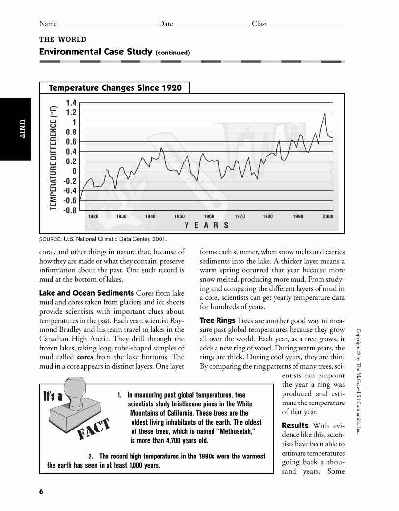
Temperature Changes Since 1920
coral, and other things in nature that, because ofhow they are made or what they contain, preserveinformation about the past. One such record ismud at the bottom of lakes.
Lake and Ocean Sediments Cores from lakemud and cores taken from glaciers and ice sheetsprovide scientists with important clues abouttemperatures in the past. Each year, scientist Ray-mond Bradley and his team travel to lakes in theCanadian High Arctic. They drill through thefrozen lakes, taking long, tube-shaped samples ofmud called cores from the lake bottoms. Themud in a core appears in distinct layers. One layer
forms each summer, when snow melts and carriessediments into the lake. A thicker layer means awarm spring occurred that year because moresnow melted, producing more mud. From study-ing and comparing the different layers of mud ina core, scientists can get yearly temperature datafor hundreds of years.
Tree Rings Trees are another good way to mea-sure past global temperatures because they growall over the world. Each year, as a tree grows, itadds a new ring of wood. During warm years, therings are thick. During cool years, they are thin.By comparing the ring patterns of many trees, sci-
entists can pinpointthe year a ring wasproduced and esti-mate the temperatureof that year.
Results With evi-dence like this, scien-tists have been able toestimate temperaturesgoing back a thou-sand years. Some
6
Copyright ©
by The M
cGraw
-Hill C
ompanies, Inc.
THE WORLD
Environmental Case Study (continued)
1. In measuring past global temperatures, treescientists study bristlecone pines in the WhiteMountains of California. These trees are theoldest living inhabitants of the earth. The oldestof these trees, which is named “Methuselah,”is more than 4,700 years old.
2. The record high temperatures in the 1990s were the warmestthe earth has seen in at least 1,000 years.
It's a
FACT
UN
IT
Name Date Class
SOURCE: U.S. National Climatic Data Center, 2001.

recent studies conclude that the twentieth centurywas the warmest century in the past 600 to 1,000years. The research continues.
Taking the Earth’s Temperature: Review the FactsDirections: Write the answer to each question inthe space provided.
1. How do scientists determine the averageglobal temperature today?
2. Why are temperature records since 1920 notadequate to show that the earth is warming?
3. Define paleoclimatology.
4. Give three examples of the kinds of infor-mation scientists can get from ice cores.
A.
B.
C.
5. What can scientists learn from tree rings?
7
Cop
yrig
ht ©
by
The
McG
raw
-Hill
Com
pani
es, I
nc.
THE WORLD
Environmental Case Study (continued)
Ice cores yield an amazingly good recordof global climate. Each year the snowfall ona glacier or ice sheet freezes and forms anew layer. Scientists can count these layersto date events such as volcanic eruptions.They can analyze water in the ice to deter-mine temperatures. They can also examineother things the ice holds. For example, theice might contain dust that was carried bythe wind and dropped into the snow. Thisdust might have air molecules holdingatmospheric gases. These data help scien-tists form a picture of the earth’s climatefrom thousands of years ago.
The ice records both human and naturaleffects on climate. For example, sulfuric acidand nitrates point to the start of the Indus-trial Revolution. The amount of materials lev-els off after the 1972 U.S. Clean Air Act. Theice also contains fallout from the Chernobylnuclear accident in the Soviet Union in1986.
GLACIERS AND ICE SHEETS
UN
IT
Name Date Class
8
Copyright ©
by The M
cGraw
-Hill C
ompanies, Inc.
THE WORLD
Environmental Case Study (continued)
Name Date Class
The increase in the earth’s average temper-atures is known as global warming. The long-range effects of global warming are unknown.Many scientists believe that a rise in the earth’stemperatures would melt parts of the icyregions at the North and South Poles. As aresult, the level of the oceans would rise,flooding many parts of the earth. Then manypeople who live in low-lying areas wouldhave to move, which could crowd otherregions of the world. Many journalists andorganizations report on global warming inprint and on the Internet. Create an infor-mational brochure about global warming.
What to Do1. Look through print newspapers and magazines or on the Inter-
net for articles and information from around the world that is relatedto global warming. Cut out, photocopy, or print the stories and anypictures that you might want to use in your brochure.
2. Summarize information from your research and include it in yourbrochure. For example, you may choose to focus on definingglobal warming; explaining how global warming occurs; list-ing different theories, viewpoints, and facts about globalwarming; or proposing solutions to global warming.
3. Include any photos, graphs, or other visual information,arranging them as you like.
4. Design a cover and create a title for your brochure.Review your work to make sure the information is pre-sented clearly.
5. Share your brochure with your classmates.
Make a Global WarmingInformational Brochure
• notebook or constructionpaper
• pens and markers• research materials, such
as newspapers andmagazines (or access tothe Internet)
• scissors• paste or adhesive tape
Materials
UN
IT

Why It’s Important Earth is a living, changingplanet. Earth’s environment, or natural sur-roundings, is changed partly by human actions.Humans change the environment by cuttingroads through mountains or clearing land andforests for housing developments or bigger farms.Some human actions may help people and theenvironment. Other actions may damage theenvironment.
One way that humans harm the environ-ment is by creating too much trash. People nowrealize that we are running out of places to burytrash. One solution to this problem is to recycle,or reuse, the trash that we make. Recycling pro-grams help cut down on the amount of garbagewe simply throw away. If we do not recycle, Earthmay have more land devoted to garbage dumpsthan to living spaces.
BackgroundIn earlier times, when there were few people
on Earth, recycling was not necessary. As the pop-ulation on Earth grows, so does the need to recy-cle. Every year, millions of tons of garbage arecollected in the United States alone. Americanscreate more than 100 million tons of tires, appli-ances, furniture, paper, certain disposable prod-ucts, and clothing every year. Glass, aluminumcans, plastic containers, and steel and other met-als make up another 42 million tons of garbage.Grass clippings and tree limbs also add to thegarbage pile.
For many years, no one thought about whathappened to drink cans or food boxes that theytossed into the trash. On the edges of manytowns, there were dumps where people threwaway old clothes, furniture, boxes, and othertrash. Then people began to notice that thegarbage heaps were growing bigger. Thesegarbage heaps smelled bad and sometimes evencaught on fire. Something had to be done. Peo-ple started to recycle to cut down on the amountof trash.
Questions to ConsiderDirections: Answer the questions below on aseparate sheet of paper.
1. What do you do with drink cans and otherrecyclable items? Does your family have arecycling program? If not, how could youbegin recycling?
2. What types of people recycle? Do you thinkthese people care more about the environ-ment than others? What types of people donot recycle?
3. Do garbage dumps cost anything to main-tain? How do they affect the economy of yourcommunity?
9
Cop
yrig
ht ©
by
The
McG
raw
-Hill
Com
pani
es, I
nc.
Name Date Class
THE WORLD
Citizenship ActivityStart a Recycling Program
Paper 71.6 million tons
Yard Trimmings31.6 million tons
Metals 15.3 million tons
Glass 12.5 million tons
Plastic 14.4 million tons
Food Scraps 13.2 million tons
Other20.8 million tons
(e.g., rubber,leather,
textiles, wood, miscellaneous
inorganic wastes)
What’s in America’s Trash?
SOURCE: Environmental Protection Agency, 2003.
UN
IT
4. Why does garbage build up more in certainareas rather than in other areas?
5. Would you want to live near a garbage dump?Why or why not? Would you want to livenear a recycling center? Why or why not?
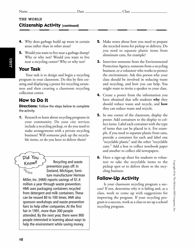
Your TaskYour task is to design and begin a recycling
program in your classroom. Do this by first cre-ating and displaying a poster for recycling aware-ness and then creating a classroom recyclingcollection center.
How to Do ItDirections: Follow the steps below to completethe activity.
1. Research to learn about recycling programs inyour community. Do your city servicesinclude a recycling pickup, or do you need tomake arrangements with a private recyclingbusiness? Will someone pick up the recycla-ble items, or do you have to deliver them?
2. Make notes about how you need to preparethe recycled items for pickup or delivery. Doyou need to separate plastic items from aluminum cans, for example?
3. Interview someone from the EnvironmentalProtection Agency, someone from a recyclingbusiness, or a volunteer who works to protectthe environment. Ask this person why yourclass should be involved in reducing wasteand recycling, and how you can help. Youmight want to invite a speaker to your class.
4. Create a poster from the information youhave obtained that tells students why theyshould reduce waste and recycle, and howthey can reduce waste and recycle.
5. In one corner of the classroom, display theposter. Add containers to the display to col-lect items. Label each container with the typeof items that can be placed in it. For exam-ple, if you need to separate plastic from cans,provide a container for each and label one“recyclable plastic” and the other “recyclablecans.” Add a box to collect notebook paperand another to collect old newspapers.
6. Have a sign-up sheet for students to volun-teer to take the recyclable items to the pickup spot or to deliver them to the recy-cling business.
Follow-Up ActivityIs your classroom recycling program a suc-
cess? If not, determine why it is failing and, as aclass, work to come up with suggestions forimproving the program. If your recycling pro-gram is a success, work as a class to set up a schoolrecycling program.
10
Copyright ©
by The M
cGraw
-Hill C
ompanies, Inc.
Recycling and wasteprevention pays off. InZeeland, Michigan, furni-ture manufacturer Herman
Miller, Inc. (HMI) reports savings of $1.4million a year through waste prevention.HMI uses packaging containers recycledfrom detergent and milk containers. Thesecan be reused 80 to 100 times. HMI alsosponsors workshops and waste preventionfairs to help other companies. At the firstfair in 1991, more than 300 peopleattended. By the next year, there were 900people interested in learning about ways tohelp the environment while saving money.
Did YouKnow?
THE WORLD
Citizenship Activity (continued)
Name Date Class
UN
IT
11
Cop
yrig
ht ©
by
The
McG
raw
-Hill
Com
pani
es, I
nc.
Name Date Class
THE WORLD
World Literature Reading
About the Selection From ancient times to thisday, legends, myths, stories, and literature have helpedpeople answer questions about creation, nature, andour relationship to everything in and beyond ourworld. Even before people could read and write, sto-ries were passed down by word of mouth. This selec-tion is a Seneca story about the origin of legends. TheSeneca are Native Americans, a part of the IroquoisLeague. The Iroquois people lived in what is now NewYork, Pennsylvania, and Ohio.
Guided Reading As you read the story, notice what happens to the cold airand snow when the stories are told. Then answer the questions that follow.
a S e n e c a s t o r y a s t o l d i n
K E E PE R S O F TH E E A R TH
Long ago, there were no stories in the world. Life was not easy for thepeople, especially during the long winters when the wind blew hard and thesnow piled high about the longhouse.
One winter day a boy went hunting. He was a good hunter and managedto shoot several partridge. As he made his way back home through the snow, hegrew tired and rested near a great rock which was shaped almost like the headof a person. No sooner had he sat down than he heard a deep voice speak.
“I shall now tell a story,” said the voice.The boy jumped up and looked around. No one was to be seen.“Who are you?” said the boy.“I am Great Stone,” said the rumbling voice which seemed to come from
within the Earth. Then the boy realized it was the big standing rock which spoke.“I shall now tell a story.”
“Then tell it,” said the boy.“First you must give me something,” said the stone. So the boy took one
of the partridge and placed it on the rock.“Now tell your story, Grandfather,” said the boy.Then the great stone began to speak. It told a wonderful story of how the
Earth was created. As the boy listened he did not feel the cold wind and the snowseemed to go away. When the stone had finished the boy stood up.
Re a de r ’ s D i c t i o n a r y
longhouse: traditional dwellingor home of Iroquois people
game: a wild bird or animalhunted for food
Naho: an Iroquois word meaning“I have spoken.”
UN
IT
Name Date Class
“Thank you, Grandfather,” said the boy. “I shall go now and share thisstory with my family. I will come back tomorrow.”
The boy hurried home to the longhouse. When he got there he told every-one something wonderful had happened. Everyone gathered around the fireand he told them the story he heard from the great stone. The story seemed todrive away the cold and the people were happy as they listened and they sleptpeacefully that night, dreaming good dreams. The next day, the boy went backagain to the stone and gave it another bird which he had shot.
“I shall now tell a story,” said the big stone and the boy listened.It went on this way for a long time. Throughout the winter the boy came
each day with a present of game. Then Great Stone told him a story of the oldtimes. The boy heard the stories of talking animals and monsters, tales of whatthings were like when the Earth was new. They were good stories and theytaught important lessons. The boy remembered each tale and retold it to the peo-ple who gathered at night around the fire to listen. One day, though, when thewinter was ending and the spring about to come, the great stone did not speakwhen the boy placed his gift of wild game.
“Grandfather,” said the boy, “Tell me a story.”Then the great stone spoke for the last time. “I have told you all of my sto-
ries,” said Great Stone. “Now the stories are yours to keep for the people. Youwill pass these stories on to your children and other stories will be added to themas years pass. Where there are stories there will be more stories. I have spoken.Naho.”
Thus it was that stories came into this world. To this day, they are told bythe people of the longhouse during the winter season to warm the people.Whenever a storyteller finishes a tale, the people always give thanks, just as theboy thanked the storytelling stone long ago.
Source: Michael J. Caduto and Joseph Bruchac. Keepers of the Earth, NativeAmerican Stories and Environmental Activities for Children. Golden, Colorado:Fulcrum, Inc., 1997.
Analyzing the Reading
1. The standing rock said his name was Great Stone. What did the boy callhim?
Copyright ©
by The M
cGraw
-Hill C
ompanies, Inc.
12
THE WORLD
World Literature Reading (continued)
UN
IT
Name Date Class
2. What was the first story Great Stone told the boy?
3. Critical Thinking What did the stories protect the boy and people from?Find two examples to support your answer.
Cop
yrig
ht ©
by
The
McG
raw
-Hill
Com
pani
es, I
nc.
13
THE WORLD
World Literature Reading (continued)
About the Selection For thousands and thousandsof years, creation stories have been told and havebecome the folklore of many cultures. In the UnitedStates, the following creation story is told with varia-tions by the Onondaga, Native Americans also in theIroquois League.
Guided Reading As you read the story, notice theanimals’ behavior toward the woman falling from the sky. Then answer the questions that follow.
TH E C R E ATI O Na n O n o n d a g a s t o r y
Re a de r ’ s D i c t i o n a r y
loon: type of diving bird that eatsfish
muskrat: a rodent that lives in ornear water
Before this world came to be,there lived in the Sky-Worldan ancient chief.In the center of his landgrew a beautiful treewhich had four white rootsstretching to eachof the four directions:North, South, East and West.From that beautiful tree,all good things grew.
Then it came to bethat the beautiful treewas uprooted and throughthe hole it made in the Sky-Worldfell the youthful wifeof the ancient chief,a handful of seeds,which she grabbed from the treeas she fell, clutched in her hand.
UN
IT

Name Date Class
Source: As told by Joseph Bruchac. Iroquois Stories: Heroes and Heroines, Monsters, and Magic. Trumansburg, New York: The Crossing Press, 1985.
Analyzing the Reading
1. What color were the roots of the beautiful tree in Sky-World?
2. What animal was able to dive deep enough to reach a tiny speck of earth?
3. Critical Thinking What are two words you can think of to describe theanimals’ behavior toward the woman falling from the sky?
Copyright ©
by The M
cGraw
-Hill C
ompanies, Inc.
14
THE WORLD
World Literature Reading (continued)
Far below there were only waterand water creatureswho looked up as they swam.
“Someone comes,” said the duck.“We must make room for her.”
The great turtle swam upfrom his place in the depths.“There is room on my back,”the great turtle said.
“But there must be earthwhere she can stand,” said the duckand so he dove beneath the waters,but he could not reach the bottom.
“I shall bring up earth,”the loon then said and he dove too,but could not reach the bottom.
“I shall try,” said the beaverand he too dove butcould not reach the bottom.
Finally the muskrat tried.He dove as deeply as he could,swimming until his lungs almost burst.With one paw he touched the bottom,and came up with a tiny speckof earth clutched in his paw.
“Place the earth on my back,”the great turtle said,and as they spreadthe tiny speck of earth it grewlarger and larger and largeruntil it became the whole world.
Then two swans flew upand between their wingsthey caught the womanwho fell from the sky.They brought her gentlydown to the earthwhere she dropped her handfulof seeds from the Sky-World.
Then it was that the first plants grewand life on this new earth began.
UN
IT

CH
AP
TE
R
15
Looking at the EarthChapter Resources
Vocabulary Activity:Looking at the Earth 16
Cooperative Learning Activity:Your Hometown 17
Chapter Map Activity:Looking at the Earth 19
Chapter Skills Review:Using a Map Key 23
Reteaching Activity:Looking at the Earth 25
Critical Thinking Skills Activity:Distinguishing Fact From Opinion 27
Map and Graph Skills Activity:Using a Map Key 29
Reading and Writing Skills Activity:Outlining 31
GeoLab Activity:Satellites in the Sky 33
Enrichment Activity:Finding Your Way 35
Take-Home Review Activity:Looking at the Earth 37

Directions: True or False Write true or false on the line before each definition.If the statement is false, write the word that matches the definition in the blank atthe end of the statement.
1. Environment refers to the natural surroundings where people live.
2. An orbit is an imaginary line that runs through the earth’s center.
3. Magma is melted rock.
4. An equinox is the time when day and night are of equal length in both hemispheres.
5. A tsunami is a flat piece of land at a higher elevation.
6. A strait is a piece of land that is surrounded by water on three sides.
7. The crust is the center of the earth.
8. A revolution is a huge wave.
9. The layer of air surrounding the earth is its atmosphere.
10. A planet’s path around the sun is its axis.
11. A plateau is a narrow body of water between two pieces of land.
12. Geography is the study of the earth in all its variety.
13. A fault is a crack in the earth’s crust.
14. The core is the thin, uppermost layer of the earth.
15. A planet’s complete orbit around the sun is called a peninsula.
16. The individual features of the land, like mountains and valleys, are known as landforms.
16
Copyright ©
by The M
cGraw
-Hill C
ompanies, Inc.
Name Date Class
LOOKING AT THE EARTH
Vocabulary Activity
CH
AP
TE
R
landform equinox axis straitorbit environment fault tsunamirevolution geography core crustmagma plateau peninsula atmosphere

BackgroundIn this chapter, you learn about two ways that geographers study the world.
They look at the world’s physical geography and human geography. The earth’sland, water, plants, and animals are its physical geography. Where people live,how they live and change, how their environment influences them, and howdifferent groups compare to one another are all part of human geography.Learning about a place’s physical and human characteristics will help you under-stand how the natural world shapes your life and how people affect the naturalworld.
Group Directions1. Imagine that your local government has asked your group to create a
booklet to tell people in other areas of the world about your hometowncommunity.
2. Use library resources or the Internet to gather as much information as possible about your local area.
3. Interview older relatives and neighbors. Find out how they think geographic features affect the lives of people in your community.
4. Include photos and drawings that illustrate the physical and human geography of your community.
5. Use the following geographic divisions to help you organize your information:
Cop
yrig
ht ©
by
The
McG
raw
-Hill
Com
pani
es, I
nc.
Physical Characteristics Human Characteristics
Where is it? How many people?Landforms Where do they live?Waterways GovernmentClimate WorkPlant life ReligionLocal wildlife Language
Ancestors
Your Hometown
Name Date Class
LOOKING AT THE EARTH
Cooperative Learning Activity
17
CH
AP
TE
R

Organizing the Group1. Group Work/Decision Making Decide what information each team
member will look for. Use the information listed in the box to help you dividethe work. If you have a special interest in one area, ask for that assignment.
2. Individual Work Group members will begin to look for information ontheir topic about the community. Illustrate your report with drawings,photographs, and/or graphics printed from Web pages.
3. Group Sharing When group members finish their individual reports andillustrations, share them with your group. Together, decide if more informa-tion will make the reports better. If needed, make additions and corrections.
4. Additional Group Work As a team, design and create a cover for all theteam members’ reports. Be creative. What images on the cover would makepeople want to visit your community? Organize all the reports. Bind themtogether to create the team booklet.
Group Process Questions• What is the most important thing you learned about your community from
this activity?
• What characteristics do you think make your community special?
• What part of your research was most difficult? Why?
• How did working with other people help you?
• What kinds of additions and corrections did your group make to the reportsbefore organizing your booklet?
Quick Check1. Was the goal of the assignment clear? If not, what parts of the assignment
confused you?
2. Did you have problems working well together? If so, how did you solvethem?
3. Were you satisfied with your work on this project? Why or why not?
18
Copyright ©
by The M
cGraw
-Hill C
ompanies, Inc.
CH
AP
TE
R
LOOKING AT THE EARTH
Cooperative Learning Activity (continued)
Name Date Class

19
Cop
yrig
ht ©
by
The
McG
raw
-Hill
Com
pani
es, I
nc.
LOOKING AT THE EARTH
Chapter Map Activity Teaching Strategy
CH
AP
TE
R
World Continents and Oceans Map
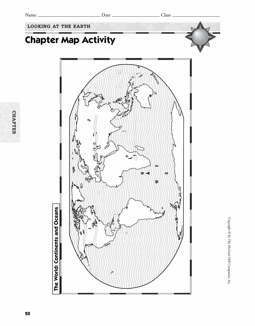
Place Location ActivityReproduce the world continents and oceans map for eachstudent. Ask students to:• Label the seven continents and indicate their bound-
aries as needed: Africa, Antarctica, Asia, Australia,Europe, North America, and South America.
• Label the following oceans: Arctic Ocean, AtlanticOcean, Indian Ocean, and Pacific Ocean.
• Draw and label the following lines of latitude: ArcticCircle, Tropic of Cancer, Equator, Tropic of Capri-corn, Antarctic Circle.
Discussing the Map1. Which continents border the Pacific Ocean? (North
America, South America, Asia, Australia, and Antarctica)
2. Which continents border the Atlantic Ocean? (NorthAmerica, South America, Europe, Africa, and Antarctica)
3. Which world ocean is the largest? (the Pacific Ocean)4. Which ocean lies entirely north of the Equator? (the
Arctic Ocean)5. Which continents border three oceans? (North Amer-
ica, Asia, and Antarctica)
APPLYING GEOGRAPHY SKILLSCreating Bar GraphsYou may use the following activity as a portfolio or extracredit project.
Have students research the area in square miles andsquare kilometers for each of the world’s four oceans andfor each of the world’s seven continents. Based on theinformation they locate, have them create two bar graphs:one comparing the area of each of the oceans and theother comparing the land area of each of the seven conti-nents. Tell students that they may choose to use squaremiles or square kilometers for the Y-axis of their charts.Tell students that they should arrange the bars in orderby size from largest to smallest. Remind students toinclude descriptive labels for the X- and Y-axes. (Note:Since the areas are so large, you may need to review withstudents how to show the Y-axis scale in millions.)
Tectonic Plate Boundaries Map
Place Location ActivityReproduce the tectonic plate boundaries map for eachstudent. Ask students to:• Label the six populated continents and draw their
plate boundaries. (See the list of continents for the worldcontinents and oceans map.)
• Label the Atlantic, Pacific, and Indian Oceans.
Discussing the Map1. Where do the majority of the volcanoes and earth-
quakes occur? (Most occur near a plate boundary.)2. True or false: Earthquakes most often occur near plate
boundaries. (True, although students should note theearthquake activity in Australia and the eastern partof North America, indicating that not all earthquakeactivity occurs near plate boundaries.)
3. True or false: Most volcanic activity and earthquakeactivity in North and South America occur on thecontinents’ west coasts. (true)
4. Where do most of Africa’s earthquakes occur? (Mostoccur on the continent’s east coast.)
5. Which activity—earthquake or volcanic eruption—ismore common? (There are many more earthquakesyearly than there are volcanic eruptions.)
APPLYING GEOGRAPHY SKILLSBuilding a DatabaseYou may use the following activity as a cooperative learn-ing or extra credit project.
Have students work in small groups to create a databaseof major worldwide earthquake activity within the past 12months. Tell students that an earthquake’s magnitude ismeasured on the Richter Scale and is reported as a num-ber such as 5.5. Have the groups use an almanac or Inter-net sources to create a database with the following fields:
Date Country Continent Magnitude
If students are using an electronic database, have themsort and print the database by date of the earthquakefrom most recent to least recent. Then have them sortand print the database by magnitude from greatest toleast.
The earth consists of seven continents, four major oceans, and almost 200 countries. Morethan two-thirds of the earth’s surface is covered by water. The presence (or lack) of water is amajor influence on a region’s climate.
20
Copyright ©
by The M
cGraw
-Hill C
ompanies, Inc.
Name Date Class
LOOKING AT THE EARTH
Chapter Map Activity
CH
AP
TE
R
N
E
S
W
The
Wo
rld
: Co
ntin
ents
and
Oce
ans

21
Cop
yrig
ht ©
by
The
McG
raw
-Hill
Com
pani
es, I
nc.
Name Date Class
LOOKING AT THE EARTH
Chapter Map Activity
CH
AP
TE
R
N
E
S
W
Mill
er p
roje
ctio
nEa
rthqu
ake
Volc
ano
The
Wo
rld
: Tec
toni
c Pl
ate
Boun
dar
ies


Learning the SkillWhen reading a map, you must use the map key, or legend, to understand
what the colors, lines, or symbols on the map mean. The compass rose will showthe cardinal directions of north, south, east, and west on the map. To understanda map, read the map title first, and then read the map key to find out what spe-cial information it gives. Next, find examples of each map key color, line, or sym-bol on the map, and use the compass rose to identify the four cardinal directions.
Practicing the SkillDirections: Read the map and map key below, and then answer the followingquestions on a separate sheet of paper.
1. What is the main land use for the area immediately surrounding Peoria?2. What is the main land use for the area outside of Decatur?3. Which major mineral resources are found in southern Illinois?
Applying the SkillDirections: On a separate sheet of paper, draw a map of the area around yourhome. Don’t forget to include a compass rose and a map key.
23
Cop
yrig
ht ©
by
The
McG
raw
-Hill
Com
pani
es, I
nc.
Chapter Skills ReviewUsing a Map Key
Corn, oats, soybeans
Hogs, soft winter wheat
Cattle feed, hogs
Hogs, dairy
Specialized dairy
Pasture livestock
Urban areas
CoalClayFluorsparLimestonePetroleumLeadZinc
CClFLsOPbZn
Major industrial areasFF
General farming,dairy, livestock, poultry
Land Use Resources
CCC
C C
C
C
C
C
Pb
Pb
Zn
Zn
Ls
Ls
OO
OO
O
O
LsLs Cl
Cl
Ls
Springfield
East St. Louis
Chicago
Rockford
Rock Island
Decatur
Peoria
CCC
C C
C
C
C
C
Pb
Pb
Zn
Zn
Ls
Ls
OO
OO
O
O
LsLs Cl
Cl
Ls
Springfield
East St. Louis
Chicago
Rockford
Rock Island
Decatur
Peoria
Name Date Class
LOOKING AT THE EARTH
CH
AP
TE
R
Illinois: Economic Activity


You can learn to think like a geographer.Study how Earth travels through space. IdentifyEarth’s internal structure and the landforms onEarth’s outer shell. Understand the dynamic
forces that shape our ever-changing planet.Earth’s movement, structure, landforms, bodies ofwater, and forces of nature determine where andhow people live.
25
Cop
yrig
ht ©
by
The
McG
raw
-Hill
Com
pani
es, I
nc.
DIRECTIONS: Creating a Web Diagram Use this web diagram to help youthink like a geographer. Consider the five “big picture” categories regarding Earththat are identified in the circles. They provide a geographer’s snapshot of Earth. Eachgeographical term or phrase listed below refers to one of these five categories. Writethe letter of each term in the appropriate circle.
A. tsunamiB. isthmusC. channelD. crustE. axis
F. faultsG. dense core of hot metalH. Mariana TrenchI. Indian OceanJ. earthquake
K. leap yearL. mantleM. straitN. orbitO. plateau
Name Date Class
LOOKING AT THE EARTH
Reteaching Activity
CH
AP
TE
R
Movement in Space Structure of the Earth
Bodies of WaterForces of Nature
Landforms
Geographer'sSnapshot of Earth


CH
AP
TE
R
Learning the SkillA fact is a statement that can be proven. Facts
answer specific questions such as what happened,who did it, when and where it happened, andsometimes why it happened. An opinion is a per-sonal belief. Opinions express beliefs and feel-ings, and cannot be proven.
Fact: The planets travel in orbits, or ellipticalpaths, around the sun.
Opinion: Intelligent life must exist on plan-ets other than our own.
Use the following steps to distinguish betweenfact and opinion:• Identify the facts. Look for phrases that you
can check for accuracy. Ask yourself: Canthese statements be verified, or proven? Wherecan I find information to verify them?
• Identify the nonfacts, or opinions. Statementscontaining words or phrases such as all,always, impossible, interesting, likely, more,most, must, never, none, only, and should areoften opinions.
• Identify the statement’s purpose. What does thespeaker or author want you to believe or to do?
Applying the SkillDirections: The diagram below shows the nineknown planets that travel around the sun in oursolar system. Examine the diagram and reread yourtextbook chapter. Then, beside each of the follow-ing statements, mark each fact with an F and eachopinion with an O.
1. The earth makes one revolutionaround the sun in 365.25 days.
2. The earth’s atmosphere is a cushion ofgases about 1,000 miles thick.
3. Mercury makes one revolutionaround the sun in just 88 days.
4. The “canals” on Mars are most likelycaused by water erosion.
5. Because of its atmosphere, it is prob-ably impossible for life to exist onMars.
Mercury
CometMars
Venus NeptunePluto
EarthMoon
Uranus
JupiterSaturn
SunA
steroids
The Solar System
Cop
yrig
ht ©
by
The
McG
raw
-Hill
Com
pani
es, I
nc.
27
Name Date Class
LOOKING AT THE EARTH
Critical Thinking Skills Activity Distinguishing Fact From Opinion
SOCIAL STUDIES OBJECTIVE: Distinguish between fact and opinion (nonfact).
6. Mercury is the closest planet to thesun, and Pluto is the farthest planetfrom the sun.
7. Within 10 years, a large comet willlikely strike the planet Venus.
8. The moon revolves around Earthabout once every 30 days.
9. People always do strange things dur-ing the “full moon.”
10. Mercury is so hot and so close to thesun, it would be impossible to everdesign a spacecraft capable of landingthere.
Practicing the SkillDirections: In each of the following groups of sen-tences, the opening statement about earthquakes isalways a fact. Choose which one of the follow-upstatements is an opinion. Circle the letter of thestatement that is an opinion.
1. Earthquakes are the result of forces deepwithin Earth’s interior that continuouslyaffect its surface.
A. The energy from these forces is stored ina variety of ways within the rocks.
B. An earthquake results when this energy isreleased suddenly by movements alongfaults in the crust of Earth.
C. The area of the fault where the suddenmovement takes place is called the focus,or hypocenter, of the earthquake.
D. Due to the number of faults in Califor-nia, it is the most dangerous state inwhich to live.
2. The severity of an earthquake can beexpressed in terms of both intensity and magnitude.
A. The two terms are quite different, butare often confused.
B. Intensity is based on the visible effectsof the ground shaking on people, build-ings, and natural features.
C. Magnitude is related to the amount ofseismic energy released at the focus ofthe earthquake.
D. Geologists should be careful whenreporting the magnitude of an earth-quake to avoid alarming the public.
3. Seismic waves are the vibrations from earth-quakes that travel through Earth.
A. These waves are recorded on instru-ments called seismographs.
B. Sensitive seismographs can detect strongearthquakes anywhere in the world.
C. A government-licensed seismologistshould be the only person to read aseismograph and predict earthquakes.
D. The time, location, and magnitude ofan earthquake can be determined fromthe data recorded by seismographs.
4. Charles F. Richter developed the Richtermagnitude scale in 1935. It is a device thatcompares the size of earthquakes.
A. The Richter scale is probably much eas-ier for most scientists to use than theseismograph.
B. The magnitude of an earthquake isdetermined by measuring the range ofseismic waves recorded by seismographs.
C. On the Richter scale, magnitude isexpressed in whole numbers and deci-mal fractions.
D. The largest known shocks have hadmagnitudes in the 8.8 to 8.9 range.
Copyright ©
by The M
cGraw
-Hill C
ompanies, Inc.
28
CH
AP
TE
R
LOOKING AT THE EARTH
Critical Thinking Skills Activity (continued)
Name Date Class
Cop
yrig
ht ©
by
The
McG
raw
-Hill
Com
pani
es, I
nc.
29
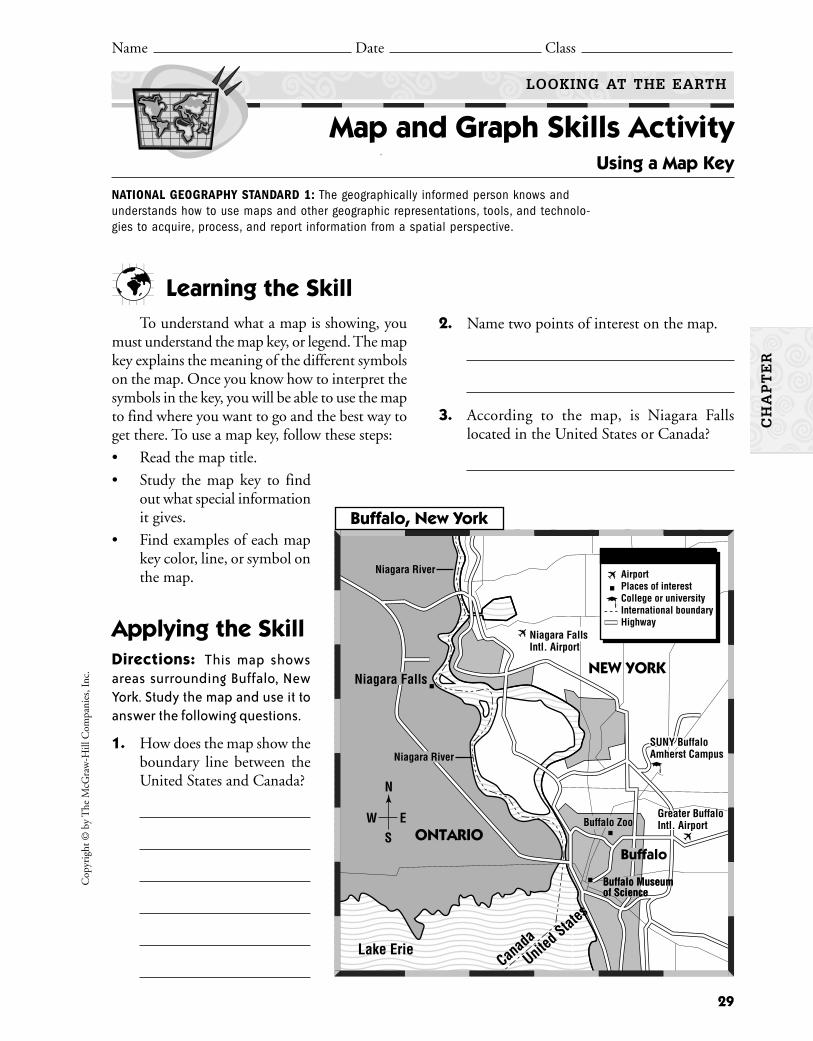
Learning the SkillTo understand what a map is showing, you
must understand the map key, or legend. The mapkey explains the meaning of the different symbolson the map. Once you know how to interpret thesymbols in the key, you will be able to use the mapto find where you want to go and the best way toget there. To use a map key, follow these steps:
• Read the map title.
• Study the map key to findout what special informationit gives.
• Find examples of each mapkey color, line, or symbol onthe map.
Applying the SkillDirections: This map showsareas surrounding Buffalo, NewYork. Study the map and use it toanswer the following questions.
1. How does the map show theboundary line between theUnited States and Canada?
2. Name two points of interest on the map.
3. According to the map, is Niagara Fallslocated in the United States or Canada?
Name Date Class
LOOKING AT THE EARTH
Map and Graph Skills Activity Using a Map Key
NATIONAL GEOGRAPHY STANDARD 1: The geographically informed person knows andunderstands how to use maps and other geographic representations, tools, and technolo-gies to acquire, process, and report information from a spatial perspective.
Buffalo Museum of Science
SUNY BuffaloAmherst Campus
Buffalo
Niagara Falls
Niagara FallsIntl. Airport
SUNY BuffaloAmherst Campus
Buffalo Museum of Science
Buffalo ZooGreater BuffaloIntl. Airport
Lake ErieCanada
United States
✈
✈
N
ES
W
AirportPlaces of interestCollege or universityInternational boundaryHighway
✈
ONTARIO
NEW YORK
Niagara River
Niagara RiverC
HA
PT
ER
Buffalo, New York
Copyright ©
by The M
cGraw
-Hill C
ompanies, Inc.
30
4. How many airports are identified on themap? Name them.
5. True or False SUNY Buffalo Amherst Campus is located within the city limits ofBuffalo.
6. Critical Thinking Suppose you want totravel by air to visit Niagara Falls. Howwould the map key help you plan your trip?
7. Critical Thinking What other kinds ofinformation could have been included in themap key to make the map even more help-ful to users? What symbols would you use torepresent this information?
8. Activity Make a map of your school.Include a map key showing the principal’soffice, the lunchroom, and other places ofinterest.
Practicing the SkillDirections: Answer the following questionsbased on the map by circling the letter of the correctanswer.
1. How many highways shown on the mapcross the border from the United States intoCanada?
A. oneB. twoC. threeD. four
2. What type of attraction is SUNY BuffaloAmherst Campus?
A. airportB. body of waterC. college or universityD. cannot tell from the key
3. Which of the following statements about themap is true?
A. One airport is in the United States andone is in Canada.
B. Two airports are in Canada.C. Two airports are in the United States.D. No airports are shown on the map.
4. In which Canadian province is Niagara Fallslocated?
A. OntarioB. New YorkC. BuffaloD. Quebec
LOOKING AT THE EARTH
Map and Graph Skills Activity (continued)
Name Date Class
CH
AP
TE
R
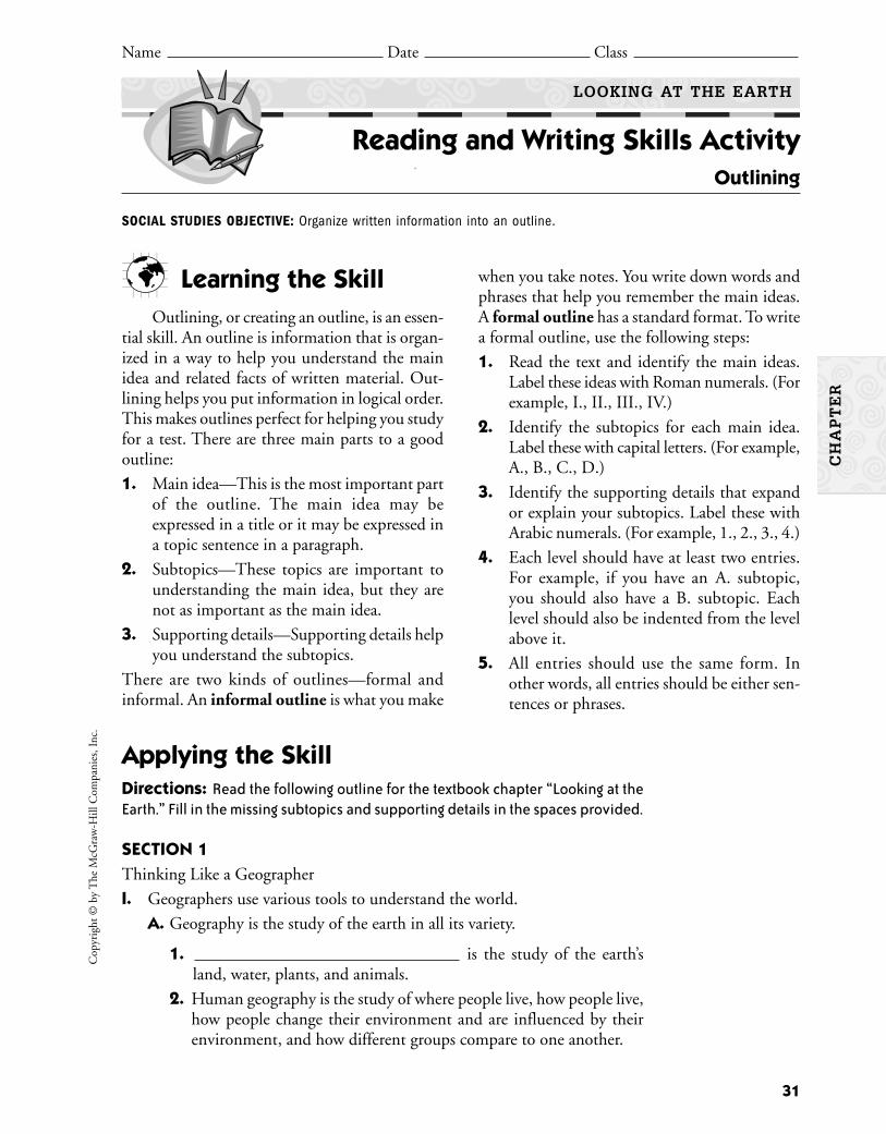
Learning the SkillOutlining, or creating an outline, is an essen-
tial skill. An outline is information that is organ-ized in a way to help you understand the mainidea and related facts of written material. Out-lining helps you put information in logical order. This makes outlines perfect for helping you studyfor a test. There are three main parts to a goodoutline:
1. Main idea—This is the most important partof the outline. The main idea may beexpressed in a title or it may be expressed ina topic sentence in a paragraph.
2. Subtopics—These topics are important tounderstanding the main idea, but they arenot as important as the main idea.
3. Supporting details—Supporting details helpyou understand the subtopics.
There are two kinds of outlines—formal andinformal. An informal outline is what you make
when you take notes. You write down words andphrases that help you remember the main ideas.A formal outline has a standard format. To writea formal outline, use the following steps:
1. Read the text and identify the main ideas.Label these ideas with Roman numerals. (Forexample, I., II., III., IV.)
2. Identify the subtopics for each main idea.Label these with capital letters. (For example,A., B., C., D.)
3. Identify the supporting details that expandor explain your subtopics. Label these withArabic numerals. (For example, 1., 2., 3., 4.)
4. Each level should have at least two entries.For example, if you have an A. subtopic,you should also have a B. subtopic. Eachlevel should also be indented from the levelabove it.
5. All entries should use the same form. Inother words, all entries should be either sen-tences or phrases.
31
Cop
yrig
ht ©
by
The
McG
raw
-Hill
Com
pani
es, I
nc.
Name Date Class
LOOKING AT THE EARTH
Reading and Writing Skills Activity Outlining
CH
AP
TE
R
SOCIAL STUDIES OBJECTIVE: Organize written information into an outline.
Applying the SkillDirections: Read the following outline for the textbook chapter “Looking at theEarth.” Fill in the missing subtopics and supporting details in the spaces provided.
SECTION 1Thinking Like a Geographer
I. Geographers use various tools to understand the world.
A. Geography is the study of the earth in all its variety.
1. is the study of the earth’sland, water, plants, and animals.
2. Human geography is the study of where people live, how people live,how people change their environment and are influenced by theirenvironment, and how different groups compare to one another.
B. What does a geographer look at?
1. Physical characteristics are important. Landforms are individual fea-tures of the land. Examples of landforms are mountains and valleys.Geographers also look at water.
2. Human characteristics are also important. These characteristics
include .
3. The environment is the natural surroundings of a place. It has aneffect on the people who live in the area. The people can also havean effect on the environment.
4. Regions are .
C. What tools does a geographer use?
1. (or GPS) is a groupof satellites traveling around the earth that can help pinpoint the exactlongitude and latitude where a special receiver is located.
2. or (GIS) includescomputer software that helps geographers gather many different kindsof information about the same place. The software combines andoverlays the information on special maps.
Directions: On another sheet of paper, write a formal outline for Section 2 of yourtextbook chapter “Looking at the Earth.”
Practicing the SkillDirections: Answer the questions below by circling the letter of the correct answer.
1. How are subtopics generally identified in an outline?
A. with Arabic numerals
B. with Roman numerals
C. with capital letters
D. with lowercase letters
2. What would you use to add details under the following outline entry: “C. Scientists have developed a theory called plate tectonics.”?
A. Arabic numerals
B. Roman numerals
C. capital letters
D. lowercase letters
32
Copyright ©
by The M
cGraw
-Hill C
ompanies, Inc.
LOOKING AT THE EARTH
Reading and Writing Skills Activity (continued)
Name Date Class
CH
AP
TE
R

Read more about the high technology used to communicate and study theworld today. Use what you have learned to make your own model satellite.
BackgroundPeople across the world communicate over long distances through televi-
sion, radio, telephones, and the Internet. Satellites and computers make masscommunication possible by allowing messages to bounce from one part of theworld to another. Today, more than 100 communications satellites constantlyorbit the earth. News stories and pictures of the world arrive to your home morequickly than ever before. The advanced technology of satellites has also allowedscientists to better understand weather patterns and storm paths; environmen-tal conditions such as desertification and deforestation; and global positioningof people, places, and things. One satellite has even been tracking a herd of ele-phants in Malaysia. Satellites can see more specific details than the human eye.Your task is to design and build a model of a satellite.
Materials
What to Do1. At the library or on the Internet, research the various kinds of satellites used
today. Find information with good up-to-date illustrations of satellites.Read about their functions and purpose. Decide which type of satellite youwould like to construct. (Designs of models are available on the World WideWeb and in books, but try to invent your own design based on the picturesyou see.)
2. Design your model on paper. Determine the size of your model and drawit to scale. Decide what construction materials you will need.
3. Collect materials. Use your paper design to guide you as you construct yoursatellite model.
4. Write a brief explanation of the type of satellite you built. List some waysyour satellite would be used. Display your model. If possible, include a pic-ture of the real satellite on which your model was based.
33
Cop
yrig
ht ©
by
The
McG
raw
-Hill
Com
pani
es, I
nc.
Name Date Class
HISTORY AND GEOGRAPHY ACTIVITIES GEOGRAPHY AND THE WORLD
GeoLab Activity
LOOKING AT THE EARTH
Satellites in the Sky
From the classroom of Rebecca A. Corley, Evans Junior High School, Lubbock, Texas
CH
AP
TE
R
■ reference materials about space and astron-omy, including library materials or theInternet
■ aluminum foil and/or aluminum pie plates■ glue■ scissors■ poster board
■ craft sticks■ polystyrene balls■ toothpicks■ chenille wires■ toy building pieces■ paint■ egg cartons

34
Copyright ©
by The M
cGraw
-Hill C
ompanies, Inc.
LOOKING AT THE EARTH
GeoLab Activity (continued)
Name Date Class
CH
AP
TE
R
Satellites roam the skies to show us pictures of theearth and of outer space. The first aerial photograph,however, was taken by Wilbur Wright of WrightBrothers fame. Early aerial photographs were alsotaken by cameras that were attached to carrierpigeons, set to take pictures every 30 seconds.
Lab Activity Report
1. Name four areas of science and communications that benefit from an orbit-ing satellite.
2. What features of real satellites did you include in your design?
3. What are some of the positives of “instant” information? What are someof the negatives?
4. Drawing Conclusions What do you think might replace satellites toimprove information gathering such as communications or weather fore-casting in the future?
Go A Step FurtherExplore reference materials more completely if you have not done so pre-
viously. Gather information on space exploration as well as more satellite infor-mation regarding the LANDSAT satellite and remote sensing. Track actualsatellite paths of Mir and Skylab as well as weather satellites. Write a short para-graph on an object or place you would like a satellite to track and be sure toinclude an explanation.

Directions: Read the article below about the Global Positioning System (GPS).Then, on a separate sheet of paper, answer the questions that follow.
35
Cop
yrig
ht ©
by
The
McG
raw
-Hill
Com
pani
es, I
nc.
Name Date Class
LOOKING AT THE EARTH
Enrichment Activity Finding Your Way
Taking Another Look1. You and a group of friends are going on a day hike. One of your friends
wants to bring a handheld GPS receiver. Another friend sees no reason tobring any extra gear and thinks that the gadget probably doesn’t reallywork. What would you recommend to your friends? Why?
2. Making Predictions Create a list of possible uses for GPS receivers,assuming that they can be made small enough to be worn like a watch.
CH
AP
TE
R
From our earliest travels, we have looked forways to know where we are on the earth. Earlytravelers used the stars, sun, and moon to guidetheir travels. Later navigation devices, such ascompasses and sextants, improved our ability toknow where we were on the planet. The most cur-rent technology, the Global Positioning Systemor GPS, gives us more accurate information thanwe have had in the past.
The military developed the GPS to help placetroops and guide missiles. They used GPSextensively during the Persian Gulf War in 1991.Today the airline industry uses GPS to helpplanes land even when visibility is poor. Many carrental companies offer GPS receivers to directtravelers to their destinations.
Small handheld devices now give backpack-ers and other outdoor adventurers a new meas-ure of safety. If a backpacker gets lost in awilderness area, the GPS receiver can help res-cuers locate him or her. The latest technologyallows a rescue crew to locate a person withinabout a 100-foot area.
How can GPS give such an exact location?The GPS consists of 24 satellites positionedabout 10,000 miles above the earth’s surface.Backpackers carry a small receiver. If a back-packer gets lost, he or she uses the receiver totake readings from three of these satellites. Eachsatellite will recognize the location of the receiveras a circular area on the earth’s surface. The dia-
gram below helps us understand why readingsfrom three satellites are needed. The readingsfrom the three satellites overlap. The points atwhich they intersect give the possible locationsof the backpacker. If you had readings from Satel-lites A and B only, the backpacker could belocated at either Possible Location 1 or 2. Byincluding the reading from Satellite C, you narrowthe location to Possible Location 1. This is thepoint at which all three circles intersect.
Using the readings from the three satellites,the receiver knows the backpacker’s exact lati-tude and longitude. A computer chip in thereceiver transmits the location to rescuers. Usingsurface maps, rescuers are sent out to find thelost backpacker.
Satellite APossible Areaof Backpacker
Possible Areaof Backpacker
Possible Areaof Backpacker
Satellite B
Satellite C PossibleLocation 1
PossibleLocation 2

Reviewing the Chapter THINKING LIKE A GEOGRAPHER
• Geographers study physical and humancharacteristics of places. They study the land-forms and water resources, as well as theeffect of the physical characteristics onhumans. Usually, geographers study regions,or areas that have common characteristics.
• Geographers use the Global Positioning Sys-tem (GPS) and global information systems(GIS) to gather and sort information and cre-ate maps of areas.
• People other than geographers use geographyto manage resources, plan communities, andmake decisions.
THE EARTH IN SPACE
• Earth is one of nine planets revolving in anorbit around the sun. It has its own atmos-
37
Cop
yrig
ht ©
by
The
McG
raw
-Hill
Com
pani
es, I
nc.
Name Date Class
LOOKING AT THE EARTH
Take-Home Review Activity
phere and moon. One revolution of Eartharound the sun roughly equals one year orabout 365 days.
• Earth has different seasons because of theway it tilts and revolves around the sun.
FORCES SHAPING THE EARTH
• The earth is composed of the core, the man-tle, and the crust, on which we live. Magmafrom the mantle flows out of volcanic erup-tions. The crust includes the seven conti-nents and the ocean floors of the world.
• Scientists theorize that the earth’s crust is aseries of plates that move because they arefloating on top of liquid rock just below thecrust. This movement can cause earthquakes,the creation of mountain ranges, volcanoes,and tsunamis.
• Weathering and erosion can cause changes inlandforms.
Geographers study the world in all its variety. They look at the land, plants,water, animals, and human interaction with all of these elements. To begin tounderstand geography, you must look at what geographers study.
People who study and use geography work in many fields. Their job titlesmay include:
materials analystlaboratory technicianpark naturalisttechnical writermineralogistenvironmental specialistearth science teacherpollution control
specialist
petroleum engineersurveyorprospectorenvironmental engineerregional plannermeteorologistgeologistsoil scientistseismologist
museum researcherlandscape architectpaleontologisthydrologisturban/regional plannerfield technicianfarmer
CH
AP
TE
R
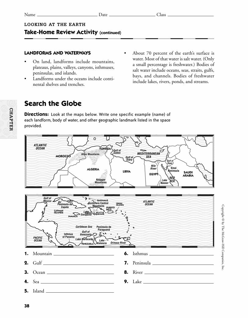
LANDFORMS AND WATERWAYS
• On land, landforms include mountains,plateaus, plains, valleys, canyons, isthmuses,peninsulas, and islands.
• Landforms under the oceans include conti-nental shelves and trenches.
38
Copyright ©
by The M
cGraw
-Hill C
ompanies, Inc.
LOOKING AT THE EARTH
Take-Home Review Activity (continued)
Name Date Class
• About 70 percent of the earth’s surface iswater. Most of that water is salt water. (Onlya small percentage is freshwater.) Bodies ofsalt water include oceans, seas, straits, gulfs,bays, and channels. Bodies of freshwaterinclude lakes, rivers, ponds, and streams.
Search the GlobeDirections: Look at the maps below. Write one specific example (name) of each landform, body of water, and other geographic landmark listed in the space provided.
Atlas MountainsAtlas MountainsAtlas Mountains
AhaggarMountainsMountainsAhaggar
Mountains
SinaiPeninsula
SinaiPeninsula
ATLANTICOCEAN
MEDITERRANEANSEA
REDSEA
Gulf ofGulf ofSuezSuez
Gulf ofSidra
Gulf ofGabes
ATLANTICOCEAN
MEDITERRANEANSEA
REDSEA
Gulf ofSuez
Gulf ofSidra
Gulf ofGabes
NileRiver
LakeNasser
MOROCCOMOROCCO
ALGERIA
EGYPTEGYPTLIBYA SAUDI
ARABIA
TUNISIATUNISIA
1. Mountain
2. Gulf
3. Ocean
4. Sea
5. Island
6. Isthmus
7. Peninsula
8. River
9. Lake
Cordillera CentralMountains
Cordillera CentralMountainsPenínsula de
Zapata
Península deParaguaná
Península deParaguaná
IsthmusIsthmusof Panama
Isthmusof Panama
CUBACUBA
JAMAICAJAMAICA
CACAYMANYMANISLANDSISLANDS
BAHAMASBAHAMAS
PUERTOPUERTORICORICO
VENEZUELAVENEZUELA
VIRGINVIRGINISLANDSISLANDS
CUBA
JAMAICA
CAYMANISLANDS
BAHAMAS
PUERTORICO
VENEZUELA
VIRGINISLANDS
HispaniolaHispaniolaHispaniola
Gulf ofMexicoMexico
PACIFICOCEAN
Caribbean Sea
Gulf ofVenezuela
ATLANTICOCEAN
Lake MaracaiboLake Maracaibo
LakeEnriquillo
Gulf ofMexico
PACIFICOCEAN
Caribbean Sea
Gulf ofVenezuela
ATLANTICOCEAN
Lake MaracaiboOrinoco River
LakeEnriquillo
LakeValencia
CH
AP
TE
R
39
Looking at the Earth Section Resources
Guided Reading Activity 1:Thinking Like a Geographer 40
Guided Reading Activity 2:The Earth in Space 41
Guided Reading Activity 3:Forces Shaping the Earth 42
Guided Reading Activity 4:Landforms and Waterways 43
SE
CT
ION
S
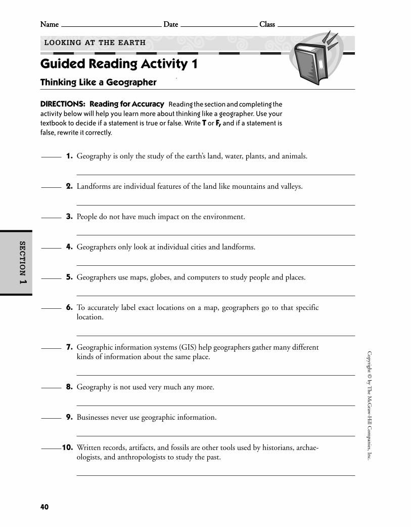
40
Copyright ©
by The M
cGraw
-Hill C
ompanies, Inc.
Name Date Class
HISTORY AND GEOGRAPHY ACTIVITIES
Name Date Class
GEOGRAPHY AND THE WORLD
Guided Reading Activity 1
Name Date Class Name Date Class
LOOKING AT THE EARTH
Thinking Like a Geographer
DIRECTIONS: Reading for Accuracy Reading the section and completing theactivity below will help you learn more about thinking like a geographer. Use yourtextbook to decide if a statement is true or false. Write T or F, and if a statement isfalse, rewrite it correctly.
1. Geography is only the study of the earth’s land, water, plants, and animals.
2. Landforms are individual features of the land like mountains and valleys.
3. People do not have much impact on the environment.
4. Geographers only look at individual cities and landforms.
5. Geographers use maps, globes, and computers to study people and places.
6. To accurately label exact locations on a map, geographers go to that specific location.
7. Geographic information systems (GIS) help geographers gather many differentkinds of information about the same place.
8. Geography is not used very much any more.
9. Businesses never use geographic information.
10. Written records, artifacts, and fossils are other tools used by historians, archae-ologists, and anthropologists to study the past.
SE
CT
ION
1

41
Cop
yrig
ht ©
by
The
McG
raw
-Hill
Com
pani
es, I
nc.
Name Date Class
HISTORY AND GEOGRAPHY ACTIVITIES
Name Date Class
GEOGRAPHY AND THE WORLD
Guided Reading Activity 2
Name Date Class Name Date Class
LOOKING AT THE EARTH
The Earth in Space
SE
CT
ION
2
DIRECTIONS: Filling in the Blanks Reading the section and completingthe sentences below will help you learn more about Earth. Refer to your textbookto fill in the blanks.
Earth, eight other planets, thousands of smaller bodies, and the
(1) form the (2)
. The planets travel in paths called (3)
around the (4) . The Earthlike planets are Mercury,
(5) , Mars, and Pluto. They are solid and
(6) with few or no (7) .
The layer of air around the earth supports (8) and is called
the (9) . About 99 percent of the atmosphere is made of
nitrogen and (10) .
The earth rotates on its (11) and takes
(12) hours to complete one spin. In the Northern Hemisphere,
on or about June 21 is the summer (13) , the day with the
(14) hours of sunlight. The day of the year with the fewest
hours of sunlight occurs on the (15) .
Spring and autumn begin when day and night are of (16)
length, which is called the (17) .
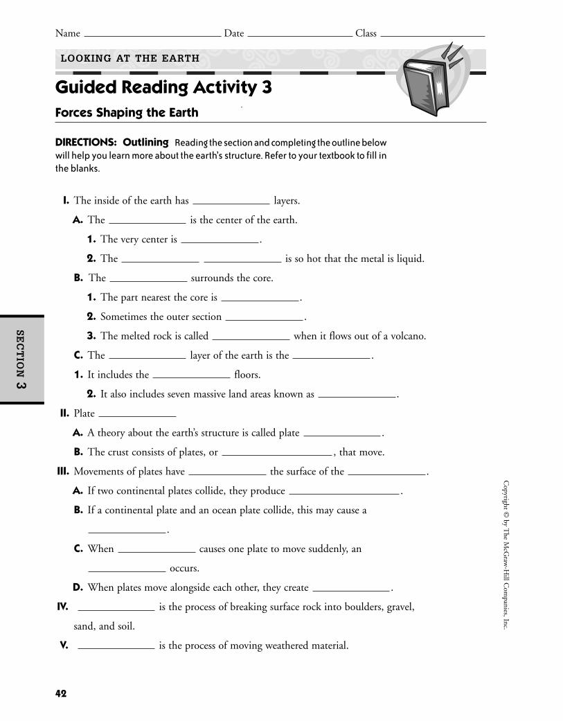
42
Copyright ©
by The M
cGraw
-Hill C
ompanies, Inc.
HISTORY AND GEOGRAPHY ACTIVITIES GEOGRAPHY AND THE WORLD
Guided Reading Activity 3
LOOKING AT THE EARTH
Forces Shaping the Earth
DIRECTIONS: Outlining Reading the section and completing the outline belowwill help you learn more about the earth’s structure. Refer to your textbook to fill inthe blanks.
I. The inside of the earth has layers.
A. The is the center of the earth.
1. The very center is .
2. The is so hot that the metal is liquid.
B. The surrounds the core.
1. The part nearest the core is .
2. Sometimes the outer section .
3. The melted rock is called when it flows out of a volcano.
C. The layer of the earth is the .
1. It includes the floors.
2. It also includes seven massive land areas known as .
II. Plate
A. A theory about the earth’s structure is called plate .
B. The crust consists of plates, or , that move.
III. Movements of plates have the surface of the .
A. If two continental plates collide, they produce .
B. If a continental plate and an ocean plate collide, this may cause a
.
C. When causes one plate to move suddenly, an
occurs.
D. When plates move alongside each other, they create .
IV. is the process of breaking surface rock into boulders, gravel,
sand, and soil.
V. is the process of moving weathered material.
SE
CT
ION
3
Name Date Class

43
Cop
yrig
ht ©
by
The
McG
raw
-Hill
Com
pani
es, I
nc.
Name Date Class
HISTORY AND GEOGRAPHY ACTIVITIES GEOGRAPHY AND THE WORLD
Guided Reading Activity 4
LOOKING AT THE EARTH
Landforms and Waterways
SE
CT
ION
4
DIRECTIONS: Answering Questions Reading the section and answering thequestions below will help you learn about landforms and waterways. Refer to yourtextbook to answer the questions.
1. Name the earth’s seven continents.
2. What are the differences among mountains, hills, plains, and plateaus?
3. Contrast a peninsula and an isthmus.
4. What are valleys under the ocean called?
5. What are some reasons why people decide to live in a particular area?
6. How much of the earth’s surface is water?
7. What is the difference between a strait and a channel?
8. What is a delta?


CH
AP
TE
R
45
Water, Climate, and VegetationChapter Resources
Vocabulary Activity:Water, Climate, and Vegetation 46
Cooperative Learning Activity:Climate Extremes 47
Chapter Map Activity:Water, Climate, and Vegetation 49
Chapter Skills Review:Using Latitude and Longitude 53
Reteaching Activity:Water, Climate, and Vegetation 55
Critical Thinking Skills Activity:Making Observations 57
Map and Graph Skills Activity:Using Directions 59
Reading and Writing Skills Activity:Taking Notes 61
GeoLab Activity:Climates in Africa 63
Enrichment Activity:What Is a Drought? 65
Take-Home Review Activity:Water, Climate, and Vegetation 67
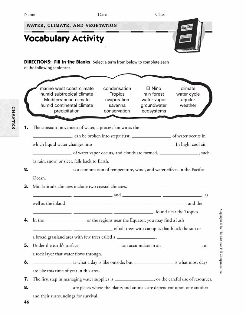
46
Copyright ©
by The M
cGraw
-Hill C
ompanies, Inc.
Name Date Class
WATER, CLIMATE, AND VEGETATION
Vocabulary Activity
CH
AP
TE
R
DIRECTIONS: Fill in the Blanks Select a term from below to complete eachof the following sentences.
1. The constant movement of water, a process known as the
, can be broken into steps: first, of water occurs in
which liquid water changes into . In high, cool air,
of water vapor occurs, and clouds are formed. , such
as rain, snow, or sleet, falls back to Earth.
2. is a combination of temperature, wind, and water effects in the Pacific
Ocean.
3. Mid-latitude climates include two coastal climates,
and , as
well as the inland and the
, found near the Tropics.
4. In the , or the regions near the Equator, you may find a lush
of tall trees with canopies that block the sun or
a broad grassland area with few trees called a .
5. Under the earth’s surface, can accumulate in an , or
a rock layer that water flows through.
6. is what a day is like outside, but is what most days
are like this time of year in this area.
7. The first step in managing water supplies is , or the careful use of resources.
8. are places where the plants and animals are dependent upon one another
and their surroundings for survival.
marine west coast climate condensation El Niño climatehumid subtropical climate Tropics rain forest water cycle
Mediterranean climate evaporation water vapor aquiferhumid continental climate savanna groundwater weather
precipitation conservation ecosystems
47
BackgroundClimate is the usual pattern of weather in an area over a long period of time.
To understand an area’s climate, scientists study the extremes of temperature andprecipitation, as well as the shape of the land there. Different places on Earthhave different climates, creating a variety of environments. The continentalUnited States has a temperate climate. In most places in the United States, peo-ple and many types of plants and animals can thrive in the moderate conditions.Can people live in extreme climates? How do plants, animals, and people livein places that are so hot, cold, wet, or high that simply surviving seems impos-sible? Your group will study one of these extreme climates and create a posterto depict it. As each group shares its findings, you will learn about some of Earth’sharshest environments.
Group Directions1. Imagine that you are scientists. You are looking for some of the most dif-
ficult climates on Earth in which to live. You want to find out what theseextreme climates are like and how plants, animals, and people can survivein such conditions.
2. Use library resources or the Internet to learn about the earth’s climateextremes.
3. Your group of scientists will select one of these extreme climates to research:
4. Make a poster with pictures and facts that characterize your location, itsclimate, its landforms, and its living things. Be prepared to present yourfindings to the other scientists in the class.
Organizing the Group1. Decision Making Decide which climate extreme your group will research.
As a group, decide what information each group member will gather for
Cop
yrig
ht ©
by
The
McG
raw
-Hill
Com
pani
es, I
nc.
Climate Extremes
Name Date Class
WATER, CLIMATE, AND VEGETATION
Cooperative Learning Activity
CH
AP
TE
R
Extreme heat: Death Valley, CaliforniaExtreme cold: AntarcticaExtreme wet: Mt. Waialeale, Kauai, HawaiiExtreme dry: Sahara desertExtreme altitude: Kilimanjaro
your location. Be sure to include facts about the climate, such as averagerainfall and temperatures, types of landforms, and so on. Also, what plants,animals, and people live there? What are they like? How do they adapt totheir extreme environment?
2. Individual Work Individuals will begin gathering their assigned infor-mation. Write notes on what you find. Gather pictures and drawings thatillustrate your information.
3. Group Work Discuss with your group the information you found.Together, identify any additional information your group needs to com-plete your location’s description. Then gather this information.
4. Additional Group Work Together, create a poster of your climateextreme. Include a map and mark the location. Organize your illustrationson the poster. Write a brief caption for each illustration.
5. Group Sharing Display your poster on the classroom wall. Each groupwill present its climate extreme to the class. Group members should pre-sent their part of the research. As a class, discuss the ways that climate affectsthe life-forms that survive and even thrive in such harsh environments.
Group Process Questions• What is the most important thing you learned about extreme climates?
• What was the hardest part of this assignment? Why?
• What problems did you have?
• How was it helpful to work with others?
Quick Check1. Was the goal of the assignment clear at all times? Explain.
2. Did you have problems working well together? If so, how did you solve them?
3. Were you satisfied with your work on this project? Why or why not?
48
Copyright ©
by The M
cGraw
-Hill C
ompanies, Inc.
CH
AP
TE
R
WATER, CLIMATE, AND VEGETATION
Cooperative Learning Activity (continued)
Name Date Class
World Ocean Currents Map
Place Location ActivityReproduce the world ocean currents map for each stu-dent. Ask students to:• Label the seven continents and indicate their bound-
aries as needed: Africa, Antarctica, Asia, Australia,Europe, North America, and South America.
• Label the following oceans: Arctic Ocean, AtlanticOcean, Indian Ocean, and Pacific Ocean.
• Draw and label the following lines of latitude: ArcticCircle, Tropic of Cancer, Equator, Tropic of Capri-corn, Antarctic Circle.
• Label each of the ocean currents shown on the mapand identify each as either a warm current or cold current. (Remind students to include a map key.)
Discussing the Map1. What is the purpose of the ocean currents map? (It
illustrates the origins, movements, and temperatures ofthe world’s ocean currents.)
2. Who would use the ocean currents map? (This mapcould be used by meteorologists to help them predictthe weather or by sailors to help them chart a naviga-tion course.)
3. Which world ocean is the largest? (the Pacific Ocean)4. Which ocean currents do you think have the greatest
effect on climate in the United States? (the CaliforniaCurrent, Labrador Current, and Gulf Stream)
5. Identify the southernmost ocean current shown onthe map. In which general direction does it flow? Is ita warm or a cold current? (The southernmost oceancurrent shown on the map is the Antarctic Circumpo-lar Current, a cold current that generally flows east.)
APPLYING GEOGRAPHY SKILLSCreating a Hurricane MapYou may use the following activity as a cooperative learn-ing activity or extra credit project.
49
Cop
yrig
ht ©
by
The
McG
raw
-Hill
Com
pani
es, I
nc.
WATER, CLIMATE, AND VEGETATION
Chapter Map Activity Teaching Strategy
More than two-thirds of the earth’s surface is covered by water. The presence (or lack) ofwater is a major influence on a region’s climate, which is the usual pattern of weather events inan area over a long period of time. Climate, in turn, determines the types of vegetation thatgrow in various parts of the world.
CH
AP
TE
R
Have students research the path taken by the twomost recent hurricanes to approach North America. (If ahurricane is in progress while this chapter is being taught,students can trace its path while it is happening.) Instructstudents to draw the paths of the storms on the oceancurrents map. Then have students speculate in class onany possible effects the ocean currents shown on the maphad on the path the hurricanes took.
World Climate RegionsMap
Place Location ActivityReproduce the world climate regions map for each stu-dent. Ask students to:• Label the continents and oceans. (See the list of conti-
nents and oceans for the world ocean currents map.)• On the map, draw the boundaries of the 12 major cli-
mates for each part of the world and give each climatea unique shading or color: subarctic, tundra, ice cap,highlands, steppe, desert, Mediterranean, humid sub-tropical, marine west coast, humid continental, tropi-cal rain forest, and tropical savanna. (Remind studentsto include a map key.)
Discussing the Map1. What is the major climate in western Europe? Where
else in the world can this climate be found? (Themarine west coast climate predominates in westernEurope. It can also be found along the west coast ofNorth America, assorted small pockets in South Amer-ica, southeastern Africa, southeastern Australia, andNew Zealand.)
2. What similarities exist between the main climate innorthern Africa and the main climate in western andcentral Australia? (These regions mainly feature desertor steppe climates.)
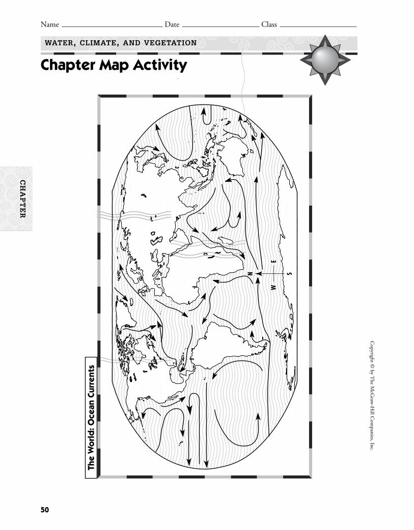
50
Copyright ©
by The M
cGraw
-Hill C
ompanies, Inc.
Name Date Class
WATER, CLIMATE, AND VEGETATION
Chapter Map Activity
CH
AP
TE
R
N
E
S
W
The
Wo
rld
: Oce
an C
urre
nts

51
Cop
yrig
ht ©
by
The
McG
raw
-Hill
Com
pani
es, I
nc.
Name Date Class
WATER, CLIMATE, AND VEGETATION
Chapter Map Activity
CH
AP
TE
R
N
E
S
W
The
Wo
rld
: Clim
ate
Regi
ons

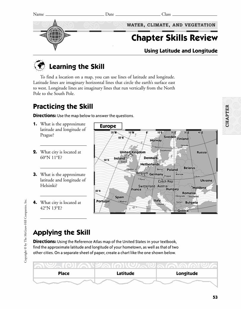
Learning the SkillTo find a location on a map, you can use lines of latitude and longitude.
Latitude lines are imaginary horizontal lines that circle the earth’s surface eastto west. Longitude lines are imaginary lines that run vertically from the NorthPole to the South Pole.
Practicing the SkillDirections: Use the map below to answer the questions.
1. What is the approximatelatitude and longitude ofPrague?
2. What city is located at60°N 11°E?
3. What is the approximatelatitude and longitude ofHelsinki?
4. What city is located at42°N 13°E?
Applying the SkillDirections: Using the Reference Atlas map of the United States in your textbook,find the approximate latitude and longitude of your hometown, as well as that of twoother cities. On a separate sheet of paper, create a chart like the one shown below.
1010°W 0°2020°W 1010°E 2020°E 3030°E 4040°E10°W 0°20°W 10°E 20°E 30°E 40°E
50°N
40°N
6060°N60°N
Ireland
France
SpainPortugal Italy Bulgaria
Romania
Greece
Hungary
Ukraine
Belarus
NorwaySweden Finland
Russia
PolandGermany
Ireland
United KingdomUnited KingdomUnited Kingdom
France
SpainPortugal Italy Bulgaria
Romania
Austria
DenmarkDenmarkDenmark
Helsinki
Warsaw
Berlin
Prague Kiev
Bucharest
RomeMadrid
Paris
London
Dublin
OsloStockholm
Sofia
Belgrade
Greece
Hungary
Ukraine
Belarus
NorwaySweden Finland
Russia
PolandGermany
Austria
Helsinki
Warsaw
Berlin
Prague Kiev
Bucharest
RomeMadrid
Paris
London
Dublin
OsloStockholm
Sofia
Belgrade
BelgiumBelgium
SwitzerlandSwitzerland
NetherlandsNetherlands
Czech Rep.Czech Rep.
MoldovaMoldovaMoldova
Place Latitude Longitude
Europe
53
Cop
yrig
ht ©
by
The
McG
raw
-Hill
Com
pani
es, I
nc.
CH
AP
TE
R
Name Date Class
WATER, CLIMATE, AND VEGETATION
Chapter Skills Review Using Latitude and Longitude

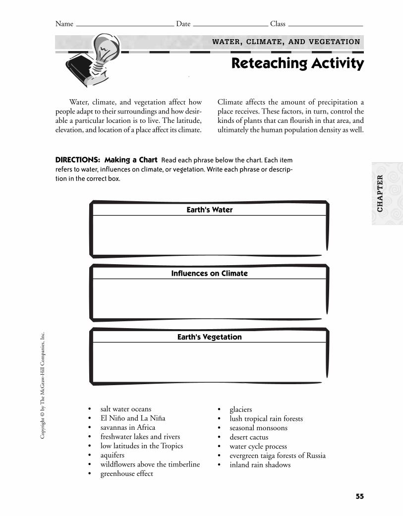
Water, climate, and vegetation affect howpeople adapt to their surroundings and how desir-able a particular location is to live. The latitude,elevation, and location of a place affect its climate.
Climate affects the amount of precipitation aplace receives. These factors, in turn, control thekinds of plants that can flourish in that area, andultimately the human population density as well.
• salt water oceans• El Niño and La Niña• savannas in Africa• freshwater lakes and rivers• low latitudes in the Tropics• aquifers• wildflowers above the timberline• greenhouse effect
• glaciers• lush tropical rain forests• seasonal monsoons• desert cactus • water cycle process• evergreen taiga forests of Russia• inland rain shadows
DIRECTIONS: Making a Chart Read each phrase below the chart. Each itemrefers to water, influences on climate, or vegetation. Write each phrase or descrip-tion in the correct box.
Earth's Water
Influences on Climate
Earth's Vegetation
55
Cop
yrig
ht ©
by
The
McG
raw
-Hill
Com
pani
es, I
nc.
Name Date Class
WATER, CLIMATE, AND VEGETATION
Reteaching Activity
CH
AP
TE
R

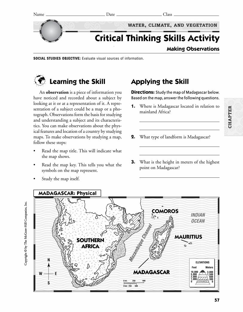
Learning the SkillAn observation is a piece of information you
have noticed and recorded about a subject bylooking at it or at a representation of it. A repre-sentation of a subject could be a map or a pho-tograph. Observations form the basis for studyingand understanding a subject and its characteris-tics. You can make observations about the phys-ical features and location of a country by studyingmaps. To make observations by studying a map,follow these steps:
• Read the map title. This will indicate whatthe map shows.
• Read the map key. This tells you what thesymbols on the map represent.
• Study the map itself.
Applying the SkillDirections: Study the map of Madagascar below.Based on the map, answer the following questions.
1. Where is Madagascar located in relation tomainland Africa?
2. What type of landform is Madagascar?
3. What is the height in meters of the highestpoint on Madagascar?
MADAGASCARMADAGASCAR0 250 500
0 250 500
mi.
km
NN
EE
SS
WW
N
E
S
W
SOUTHERNAFRICA
SOUTHERNAFRICA
ELEVATIONS
10,0005,0002,0001,0000
3,0001,500
600300
0
Feet Meters
COMOROSCOMOROSINDIANINDIANOCEANOCEAN
MAURITIUSMAURITIUS
Moz
ambi
que
Chan
nel
COMOROSINDIANOCEAN
MAURITIUS
Moz
ambi
que
Chan
nel
MADAGASCAR: Physical
Cop
yrig
ht ©
by
The
McG
raw
-Hill
Com
pani
es, I
nc.
57
Cop
yrig
ht ©
by
The
McG
raw
-Hill
Com
pani
es, I
nc.
CH
AP
TE
R
Name Date Class
WATER, CLIMATE, AND VEGETATION
Critical Thinking Skills Activity Making Observations
SOCIAL STUDIES OBJECTIVE: Evaluate visual sources of information.
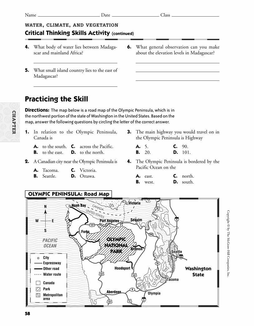
WATER, CLIMATE, AND VEGETATION
Critical Thinking Skills Activity (continued)
Name Date Class
CH
AP
TE
R
5
16
104
6
16
5
90
12101
101 101
101
N
E
S
W
OLYMPICNATIONAL
PARK
OLYMPICNATIONAL
PARK
OlympiaOlympia
Sequim
Forks
Port Angeles
Aberdeen
Hoodsport
Brinnon
Noah Bay Victoria
Olympia
Tacoma
Seattle
Tacoma
Sequim
Forks
Port Angeles
Aberdeen
Hoodsport
Brinnon
Noah Bay Victoria
Seattle
PACIFICOCEANPACIFICOCEAN
CANADAUNITED STATES
CANADAUNITED STATES
WashingtonState
0 10 20 Km
0 10 20 Km
CityExpresswayOther roadWater route
Canada
Park
Metropolitanarea
OLYMPIC PENINSULA: Road Map
58
Copyright ©
by The M
cGraw
-Hill C
ompanies, Inc.
58
4. What body of water lies between Madaga-scar and mainland Africa?
5. What small island country lies to the east ofMadagascar?
6. What general observation can you makeabout the elevation levels in Madagascar?
Practicing the SkillDirections: The map below is a road map of the Olympic Peninsula, which is inthe northwest portion of the state of Washington in the United States. Based on themap, answer the following questions by circling the letter of the correct answer.
1. In relation to the Olympic Peninsula,Canada is
A. to the south. C. across the Pacific.B. to the east. D. to the north.
2. A Canadian city near the Olympic Peninsula is
A. Tacoma. C. Victoria.B. Seattle. D. Ottawa.
3. The main highway you would travel on inthe Olympic Peninsula is Highway
A. 5. C. 90.B. 20. D. 101.
4. The Olympic Peninsula is bordered by thePacific Ocean on the
A. east. C. north.B. west. D. south.
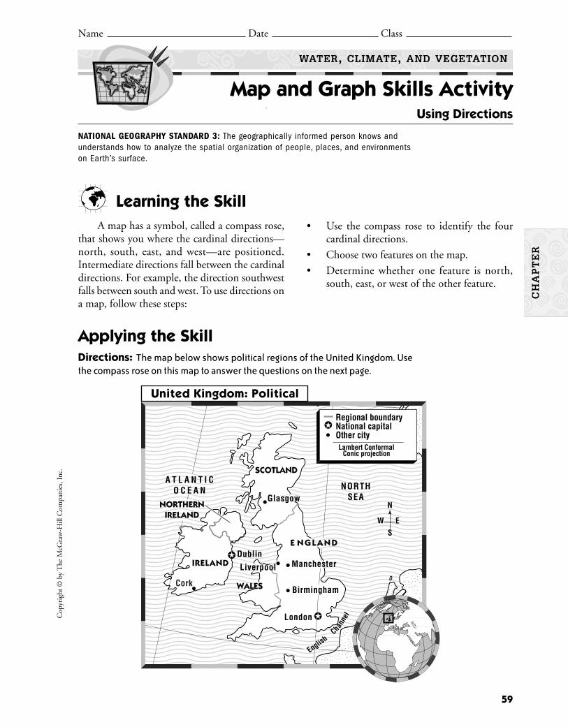
Cop
yrig
ht ©
by
The
McG
raw
-Hill
Com
pani
es, I
nc.
59
Learning the SkillA map has a symbol, called a compass rose,
that shows you where the cardinal directions—north, south, east, and west—are positioned.Intermediate directions fall between the cardinaldirections. For example, the direction southwestfalls between south and west. To use directions ona map, follow these steps:
• Use the compass rose to identify the fourcardinal directions.
• Choose two features on the map.
• Determine whether one feature is north,south, east, or west of the other feature.
Name Date Class
WATER, CLIMATE, AND VEGETATION
Map and Graph Skills Activity Using Directions
NATIONAL GEOGRAPHY STANDARD 3: The geographically informed person knows andunderstands how to analyze the spatial organization of people, places, and environmentson Earth’s surface.
Applying the SkillDirections: The map below shows political regions of the United Kingdom. Usethe compass rose on this map to answer the questions on the next page.
London
A T L A N T I CO C E A N
WALES
NORTHSEAGlasgow
Birmingham
Manchester
EnglishCha
nnel
IRELAND
NORTHERNIRELAND
SCOTLAND
DublinE N GLA N D
Liverpool
Regional boundaryNational capitalOther cityLambert Conformal
Conic projection
Cork
N
ES
W
United Kingdom: Political
CH
AP
TE
R
Copyright ©
by The M
cGraw
-Hill C
ompanies, Inc.
60
1. In which direction would you travel to gofrom Birmingham to London?
2. In which direction would a person in Lon-don travel to reach Liverpool?
3. Which city on the map lies farthest west?
4. Identify the southernmost bodies of water onthis map.
5. Which national capital on this map lies far-thest north?
6. Identify all the cities on this map that lie eastof Liverpool.
7. Critical Thinking Imagine that you are inManchester. Describe the directions youwould travel to complete the following trip:first to Liverpool, then to Glasgow, and backto Manchester.
8. Activity Obtain a map of your town or cityfrom the local library. Locate the street whereyou live. Then identify the directions youwould travel to reach your school or anotherplace you frequently go.
Practicing the SkillDirections: Answer the following questionsbased on the map by circling the letter of the correctanswer.
1. Which direction would you travel if youwent from Glasgow to Dublin?
A. southB. westC. southwestD. southeast
2. Which of the following cities is farthest west?
A. GlasgowB. LiverpoolC. ManchesterD. London
3. Which of the following statements about themap is true?
A. The North Sea is north of the AtlanticOcean.
B. The North Sea is east of the AtlanticOcean.
C. Wales lies in the northern portion of theUnited Kingdom.
D. Dublin lies farther east than Liverpool.
WATER, CLIMATE, AND VEGETATION
Map and Graph Skills Activity (continued)
Name Date Class
CH
AP
TE
R

Learning the SkillEffective note taking involves breaking up information into meaningful
parts so that it can be understood and remembered. Notes can include key ideas,events, people, and the order in which events happen. Forms of note taking are:
1. Cause-and-Effect Chart—This chart identifies connections amongevents.
2. Semantic Web—This graphic organizer shows different aspects of a general topic or theme.
3. Category Chart—A category chart puts information into specificcategories.
61
Cop
yrig
ht ©
by
The
McG
raw
-Hill
Com
pani
es, I
nc.
Name Date Class
WATER, CLIMATE, AND VEGETATION
Reading and Writing Skills Activity Taking Notes
CH
AP
TE
R
SOCIAL STUDIES OBJECTIVE: Identify main ideas and organize information into easilyunderstood and remembered parts.
Results of Greenhouse EffectGreenhouse EffectHuman Actions
(Cause) (Effect and Cause) (Effect)
Climate
Weather
Latitude
Landforms
Sun
Wind
People
Freshwater Resources Salt Water Resources
Glaciers Pacific OceanGroundwater Atlantic OceanAquifers Indian OceanRivers and lakes Arctic Ocean
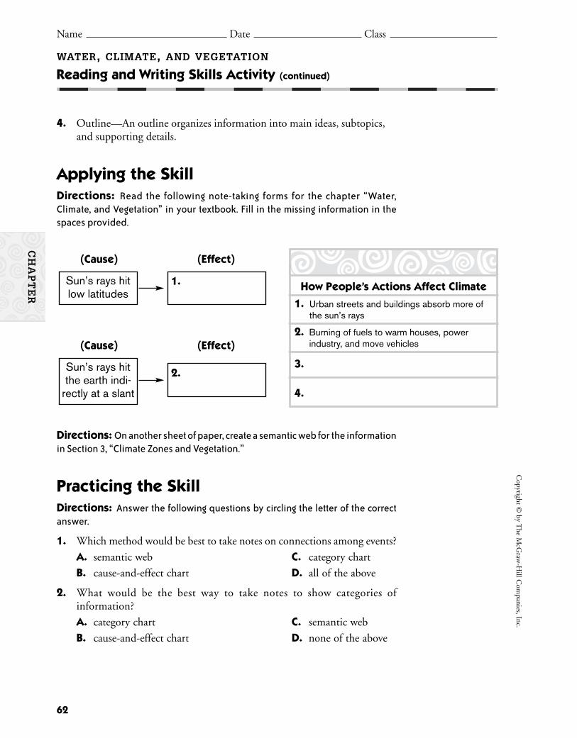
4. Outline—An outline organizes information into main ideas, subtopics,and supporting details.
Applying the SkillDirections: Read the following note-taking forms for the chapter “Water, Climate, and Vegetation” in your textbook. Fill in the missing information in thespaces provided.
Directions: On another sheet of paper, create a semantic web for the informationin Section 3, “Climate Zones and Vegetation.”
Practicing the SkillDirections: Answer the following questions by circling the letter of the correctanswer.
1. Which method would be best to take notes on connections among events?
A. semantic web C. category chart
B. cause-and-effect chart D. all of the above
2. What would be the best way to take notes to show categories of information?
A. category chart C. semantic web
B. cause-and-effect chart D. none of the above
62
Copyright ©
by The M
cGraw
-Hill C
ompanies, Inc.
WATER, CLIMATE, AND VEGETATION
Reading and Writing Skills Activity (continued)
Name Date Class
CH
AP
TE
R
1.Sun’s rays hitlow latitudes
(Cause) (Effect)
2.Sun’s rays hitthe earth indi-
rectly at a slant
(Cause) (Effect)
How People’s Actions Affect Climate
1. Urban streets and buildings absorb more ofthe sun’s rays
2. Burning of fuels to warm houses, powerindustry, and move vehicles
3.
4.
Discover the four main African climate zones by working in groups. Learnhow to be a team player by creating a written report and a diorama as a team.Make an oral presentation to the class.
BackgroundThe African people adjust to the particular climate in which they live just
as you do. They may live where it is hot and dusty, or muggy and rainy. The cli-mate affects the way people live, how they dress, what they eat, where they work,and how they spend their leisure time. Learn about the kinds of climates in whichthe African people live, and try to imagine what it might be like to live there.
Materials
What to Do1. Organize the class into four groups. Assign each group to research one of
the four main African climate zones: desert, steppe, tropical savanna, trop-ical rain forest.
2. Each group should then further divide their topic among team members.Topics to research include the countries in that zone, the landforms, theplants, the animals, and any significant architectural structures.
3. Assemble your information and write a report about the team’s findings.4. Using the report, make a diorama, or a visual representation, of the written
report.5. Use a large shoebox or other sturdy box to display your diorama.6. Cover the box with paint or colored paper, using colors that accurately
represent the colors of your particular climate zone.7. Include in your display at least three to five animals, three to five plants or
other greenery or flowers, and a significant physical and/or architecturallandmark of that area.
8. Present the report and diorama to the class.
63
Cop
yrig
ht ©
by
The
McG
raw
-Hill
Com
pani
es, I
nc.
Name Date Class
HISTORY AND GEOGRAPHY ACTIVITIES
Name Date Class
GEOGRAPHY AND THE WORLD
GeoLab Activity
Name Date Class Name Date Class
WATER, CLIMATE, AND VEGETATION
Climates in Africa
From the classroom of Kim Plomske and Sandra Kelly, Bryan Station Traditional Middle School, Fayette,Kentucky
CH
AP
TE
R
■ reference materials on Africa and climatesincluding books, maps, magazines, and theInternet
■ shoebox or other sturdy cardboard box■ colored pencils, markers■ paint
■ clay■ colored tissue paper, construction paper■ glue■ scissors■ assorted small plastic animals, trees, plants,
flowers

64
Copyright ©
by The M
cGraw
-Hill C
ompanies, Inc.
WATER, CLIMATE, AND VEGETATION
GeoLab Activity (continued)
Name Date Class
CH
AP
TE
R
If you traveled and stood in the plains of Tanzania inAfrica, you might feel very small. You would be stand-ing in the middle of one of the largest and wildestanimal populations in the world. Wildebeests, monkeys,antelopes, lions, cheetahs, crocodiles, gazelles, and fla-mingoes all roam the lands of this country. Tanzaniacan also claim the highest concentrations of elephant,buffalo, crocodile, hippo, hunting dog, and chimpanzeepopulations.
Lab Activity Report
1. What would be easy or pleasant about living in the climate zone youresearched? What would be difficult or uncomfortable?
2. In which African climate zone would you expect to find the most people?In which would you expect to find the fewest? Why?
3. What did you discover about working in a group on a project? Do you pre-fer to work with a group or alone? Why?
4. Drawing Conclusions How does climate affect the plants and animalsfound in a region? How does climate affect the people?
Go A Step FurtherAdd people to your diorama. Research the type of clothing traditionally
worn and the types of dwellings in which the people of the area live. Includethe people and dwellings in the scene in such a way that you can see how theyinteract with their surroundings.

Taking Another Look1. Work in a small group to create a water conservation poster that informs
people about the danger of droughts.
2. Understanding Cause and Effect Write an essay that describes thechanges in plant and animal life in your community that would result froman unpredictable drought.
Droughts are natural disasters that occurover long periods of time. The beginning of adrought may not even be recognized for weeksor months. The drought itself may last for years.Droughts can cause famine (a shortage of food),increase the danger of large-scale fires, and resultin the deaths of animals and humans.
If it does not rain in your community for aweek, would people begin to worry about adrought? If you live in a tropical rain forest climate,they might. If you live in a steppe climate, peoplewould not consider a week without rain unusual.As shown in the table below, the occurrence ofdrought depends on the climate region in whichyou live.
Climatologists, or scientists who studyweather and climates, have identified four typesof droughts. These include permanent, seasonal,unpredictable, and invisible droughts.
1. Permanent droughts occur in desert cli-mates. Little vegetation grows and few peo-ple live in desert climates. The only way toraise crops is to bring water from othersources through irrigation.
2. Seasonal droughts are predictable droughtsthat happen each year. Tropical savanna andMediterranean climates experience extendeddry spells followed by wet seasons.
3. Unpredictable droughts occur when rainfallis significantly below normal for that climateregion. These droughts can occur in any cli-mate region. Unpredictable droughts candevastate the economy of an entire region.
4. Invisible droughts often follow unpredictabledroughts. Rain falls and people tend to thinkthat the danger has passed. However, theamount of rain is not enough to refill rivers,streams, and aquifers. Plants still struggle forsurvival, because people stop conservingwater since the danger appears to be past.
Location Drought Definition Climate RegionBali 6 consecutive days without rain Tropical rain forestUnited Kingdom 15 consecutive days without rain Marine west coastIndia Seasonal rainfall less than 1/2 of normal Tropical savannaLibya Annual rainfall less than 7 inches (180 mm) Desert
65
Cop
yrig
ht ©
by
The
McG
raw
-Hill
Com
pani
es, I
nc.
Name Date Class
WATER, CLIMATE, AND VEGETATION
Enrichment Activity What Is a Drought?
CH
AP
TE
R
Directions: Read the article below about droughts. Then complete the activitiesthat follow.

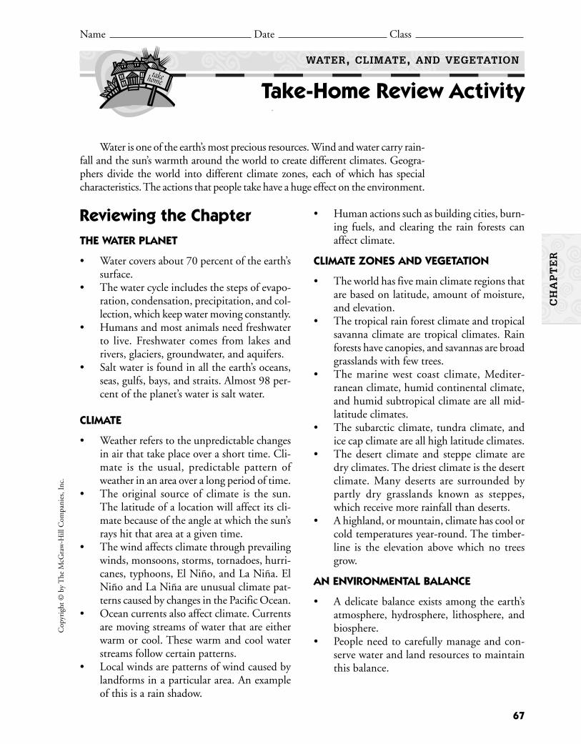
Reviewing the Chapter THE WATER PLANET
• Water covers about 70 percent of the earth’ssurface.
• The water cycle includes the steps of evapo-ration, condensation, precipitation, and col-lection, which keep water moving constantly.
• Humans and most animals need freshwaterto live. Freshwater comes from lakes andrivers, glaciers, groundwater, and aquifers.
• Salt water is found in all the earth’s oceans,seas, gulfs, bays, and straits. Almost 98 per-cent of the planet’s water is salt water.
CLIMATE
• Weather refers to the unpredictable changesin air that take place over a short time. Cli-mate is the usual, predictable pattern ofweather in an area over a long period of time.
• The original source of climate is the sun.The latitude of a location will affect its cli-mate because of the angle at which the sun’srays hit that area at a given time.
• The wind affects climate through prevailingwinds, monsoons, storms, tornadoes, hurri-canes, typhoons, El Niño, and La Niña. ElNiño and La Niña are unusual climate pat-terns caused by changes in the Pacific Ocean.
• Ocean currents also affect climate. Currentsare moving streams of water that are eitherwarm or cool. These warm and cool waterstreams follow certain patterns.
• Local winds are patterns of wind caused bylandforms in a particular area. An exampleof this is a rain shadow.
67
Cop
yrig
ht ©
by
The
McG
raw
-Hill
Com
pani
es, I
nc.
Name Date Class
WATER, CLIMATE, AND VEGETATION
Take-Home Review Activity
• Human actions such as building cities, burn-ing fuels, and clearing the rain forests canaffect climate.
CLIMATE ZONES AND VEGETATION
• The world has five main climate regions thatare based on latitude, amount of moisture,and elevation.
• The tropical rain forest climate and tropicalsavanna climate are tropical climates. Rainforests have canopies, and savannas are broadgrasslands with few trees.
• The marine west coast climate, Mediter-ranean climate, humid continental climate,and humid subtropical climate are all mid-latitude climates.
• The subarctic climate, tundra climate, andice cap climate are all high latitude climates.
• The desert climate and steppe climate aredry climates. The driest climate is the desertclimate. Many deserts are surrounded bypartly dry grasslands known as steppes,which receive more rainfall than deserts.
• A highland, or mountain, climate has cool orcold temperatures year-round. The timber-line is the elevation above which no treesgrow.
AN ENVIRONMENTAL BALANCE
• A delicate balance exists among the earth’satmosphere, hydrosphere, lithosphere, andbiosphere.
• People need to carefully manage and con-serve water and land resources to maintainthis balance.
Water is one of the earth’s most precious resources. Wind and water carry rain-fall and the sun’s warmth around the world to create different climates. Geogra-phers divide the world into different climate zones, each of which has specialcharacteristics. The actions that people take have a huge effect on the environment.
CH
AP
TE
R
CH
AP
TE
R
Word UnscrambleDirections: Look at the letters below. Unscramble the letters to form importantterms from this chapter. After you unscramble the term, write a definition for thatterm without using your textbook.
1. N O D C S A N N T I E O
2. L I C A G R E
3. T R A H E W E
4. P P T E E S
5. V A N S N A A
6. L M A E T C I
7. V E A P T O R A I N O
8. M S T Y C O E S E
9. D R U T N A
10. S S I I P C D T E E
68
Copyright ©
by The M
cGraw
-Hill C
ompanies, Inc.
WATER, CLIMATE, AND VEGETATION
Take-Home Review Activity (continued)
Name Date Class
There are an average of 100 different species of large trees in a singleacre of rain forest.
1.
2.
3.
4.
5.
6.
7.
8.
9.
10.

69
Water, Climate, and Vegetation Section Resources
Guided Reading Activity 1:The Water Planet 70
Guided Reading Activity 2:Climate 71
Guided Reading Activity 3:Climate Zones and Vegetation 72
Guided Reading Activity 4:An Environmental Balance 73
SE
CT
ION
S
70
Copyright ©
by The M
cGraw
-Hill C
ompanies, Inc.
Name Date Class
HISTORY AND GEOGRAPHY ACTIVITIES
Name Date Class
GEOGRAPHY AND THE WORLD
Guided Reading Activity 1
Name Date Class Name Date Class
WATER, CLIMATE, AND VEGETATION
The Water Planet
DIRECTIONS: Reading for Accuracy Reading the section and completing theactivity below will help you learn more about Earth’s water. Use your textbook todecide if a statement is true or false. Write T or F, and if a statement is false, rewriteit correctly.
1. The three forms of water found on the earth are liquid, ice, and water vapor.
2. The total amount of water on the earth is always changing.
3. The water cycle is the movement of water from surfaces of lakes, rivers, andoceans to the air; then to the ground; and then back to the oceans.
4. Cold air can hold more water vapor than warm air.
5. Condensation occurs when warm air rises and cools, losing its ability to hold humidity.
6. People and fish are the only creatures that really need water.
7. There is more water found in lakes and rivers than in groundwater.
8. Glaciers and polar ice caps hold about 2 percent of the earth’s freshwater.
9. About 95 percent of the earth’s water is salt water.
10. The four major oceans are the Pacific, Atlantic, Indian, and Arctic.
SE
CT
ION
1

71
Cop
yrig
ht ©
by
The
McG
raw
-Hill
Com
pani
es, I
nc.
Name Date Class
HISTORY AND GEOGRAPHY ACTIVITIES
Name Date Class
GEOGRAPHY AND THE WORLD
Guided Reading Activity 2
Name Date Class Name Date Class
WATER, CLIMATE, AND VEGETATION
Climate
SE
CT
ION
2
DIRECTIONS: Filling in the Blanks Reading the section and completingthe sentences below will help you learn more about climate. Refer to your text-book to fill in the blanks.
(1) describes the unpredictable changes in air that occur
over a short period of time. (2) is the usual, predictable pattern
of weather in a certain area over a long period of time. It is affected by the sun, wind,
ocean currents, (3) , and people. Scientists look at the extremes
of (4) and precipitation in order to understand the
(5) of an area.
Climate is also affected by the (6) at which the
(7) rays hit the earth. The areas near the Equator are known
as the (8) . Here you would almost always experience a hot
climate. (9) are seasonal winds that blow over continents for
months at a time, mainly in (10) and Africa. Thunderstorms
may produce dangerous (11) , or funnel-shaped windstorms.
(12) form when cold winds from the east are weak. When the
winds from the east are strong, (13) occur.
The warm current called the (14) flows along the east
coast of North America and crosses to Europe, where it is called the
(15) . The climate on the (16) side of
mountains is moist and foggy, making vegetation very green. By the time the air moves
over the top, it becomes cool and dry, creating a (17) .
72
Copyright ©
by The M
cGraw
-Hill C
ompanies, Inc.
Name Date Class
HISTORY AND GEOGRAPHY ACTIVITIES
Name Date Class
GEOGRAPHY AND THE WORLD
Guided Reading Activity 3
Name Date Class Name Date Class
WATER, CLIMATE, AND VEGETATION
Climate Zones and Vegetation
DIRECTIONS: Answering Questions Reading the section and answering thequestions below will help you learn about climate zones and vegetation. Refer toyour textbook to write the answers.
1. What are the two types of tropical climate regions?
2. What is the main difference between the two tropical climates?
3. What are the different types of climates found in the mid-latitude region?
4. Which climate has a strong growth of deciduous trees and coniferous forests?
5. Where are the high latitude climates located?
6. What is a tundra?
7. What are the only things that can grow in the ice cap climate?
8. How much rainfall do the driest climates receive?
9. Describe the steppe climate.
10. What is the timberline?
SE
CT
ION
3

73
Cop
yrig
ht ©
by
The
McG
raw
-Hill
Com
pani
es, I
nc.
Name Date Class
HISTORY AND GEOGRAPHY ACTIVITIES
Name Date Class
GEOGRAPHY AND THE WORLD
Guided Reading Activity 4
Name Date Class Name Date Class
WATER, CLIMATE, AND VEGETATION
An Environmental Balance
SE
CT
ION
4
DIRECTIONS: Answering Questions Reading the section and answeringthe questions below will help you learn more about how people can affect theenvironment. Use your textbook to write answers to the questions.
1. What are the four basic parts of the earth’s physical geography?
2. What are the three global effects of air pollution?
3. What happens when the chemicals in air pollution combine with precipitation?
4. How does deforestation affect topsoil?
5. Why do some farmers practice crop rotation?
6. About what percent of the world’s freshwater is used for farming?
7. What two steps are involved in managing water supplies?
8. How can the pesticides that farmers use to help increase food production also be harmful?
9. What are ecosystems?
10. What is included in a wetland’s biodiversity?

CH
AP
TE
R
75
The World’s PeopleChapter Resources
Vocabulary Activity:The World’s People 76
Cooperative Learning Activity:A Day in the Life of . . . 77
Chapter Map Activity:The World’s People 79
Chapter Skills Review:Reading a Thematic Map 83
Reteaching Activity:The World’s People 85
Critical Thinking Skills Activity:Drawing Inferences and Conclusions 87
Map and Graph Skills Activity:Using Latitude and Longitude 89
Reading and Writing Skills Activity:Using Library Resources 91
GeoLab Activity:Products of the World 93
Enrichment Activity:How the World’s People Live 95
Take-Home Review Activity:The World’s People 97
76
Copyright ©
by The M
cGraw
-Hill C
ompanies, Inc.
Name Date Class
THE WORLD’S PEOPLE
Vocabulary Activity
CH
AP
TE
R
DIRECTIONS: Matching Select the term that matches each definition below.Write the correct term in the space provided.
natural resources democracy emigrate culture regionsrenewable resource population density interdependence civilization
cultural diffusion dictatorship culturenonrenewable resource globalization refugee
1. The development of a world culture and interdependent economy is .
2. A government in which the people hold the power is a .
3. When countries depend on one another for goods, raw materials, and markets, it is called
.
4. The opposite of immigrate, or entering a country, is , or leaving a country.
5. A government in which a single ruler seizes control is a .
6. The average number of people living in a given area is the
.
7. The way of life of people who share similar beliefs and customs is a .
8. A person forced to flee his or her own country is a .
9. A highly developed culture is a .
10. A resource that cannot be replaced is a .
11. Areas of the world that include different countries with cultural traits in common are
.
12. A resource that can be replaced if used wisely is a .
13. The process by which cultures share knowledge and skills is
.
14. Products of the earth that people use to meet their needs are
.
DIRECTIONS: Writing Sentences Use each of the following terms correctlyin a complete sentence. Write the sentences on a separate sheet of paper.
import urbanization famine developed countrydialect birthrate export developing country
BackgroundAll human beings have a culture. Culture is a way of life. People in the same
culture share similar beliefs and customs. People are not born with knowledgeof their culture. They learn about their culture by talking and listening to thepeople around them as they grow up. They also learn by watching and imitat-ing the behavior of others in their society. Your group will learn about a cultureand write a story about a typical day in the life of a teenager in that culture.
Group Directions1. Imagine that you are a teenager in one of the following cultures.
What would your life be like? Where would you live? What would you eat?What would you wear? What would you do for fun? What responsibilitieswould you have as a member of your society?
2. Use library resources or the Internet to learn about one of these cultures.Collect pictures and facts.
3. Use what you learn to write a story about a typical day in the life of ateenager who is part of that culture. Include in your story as many of thefollowing eight cultural “traits” as you can:
Organizing the Group1. Decision Making With your group, decide which culture you will study.
Each group should choose a different culture. Then divide the work amonggroup members. You can use the cultural traits as a way to divide the work,or choose another way.
77
CH
AP
TE
R
Masai of Kenya Aborigines of AustraliaAztec of Mexico Navajo of North AmericaInca of Central America Inuit of the Arctic
Social groups Daily life Government systemLanguage History Economic systemReligion Arts
Cop
yrig
ht ©
by
The
McG
raw
-Hill
Com
pani
es, I
nc.
A Day in the Life of . . .
Name Date Class
THE WORLD’S PEOPLE
Cooperative Learning Activity
2. Individual Work Group members will then do the research on theirassigned topics. Find or draw pictures that support your main points.
3. Group Work Share your pictures and information with the group. Thendiscuss a plot for your story about a day in the life of a teenage boy or girlin this culture. Choose a main character and give him or her a name.Include other characters in your story. Then write the story together, giv-ing one another ideas as you go.
4. Additional Group Work After you finish the first draft, have someonein your group read it aloud to the group. Give suggestions for improvingthe story. Then revise the story into final form. Add pictures and drawingsthat group members collected to illustrate your story.
5. Group Sharing A member of each group will read the group’s story aloudto the rest of the class, or group members can take different roles and actout the story. After all stories have been read, the class should discuss thedifferences among the cultures of these peoples.
Group Process Questions• What is the most important thing you learned about different cultures from
this activity?
• What part of the project did you enjoy most?
• What problems did you have?
• How did you solve the problems?
• How was it helpful to work with others?
Quick Check1. Was the goal of the assignment clear? If not, what parts confused you?
2. Did you have problems with writing a story cooperatively? If so, how didyou solve them?
3. Were you satisfied with your work on this project? Why or why not?
Copyright ©
by The M
cGraw
-Hill C
ompanies, Inc.
CH
AP
TE
R
78
THE WORLD’S PEOPLE
Cooperative Learning Activity (continued)
Name Date Class
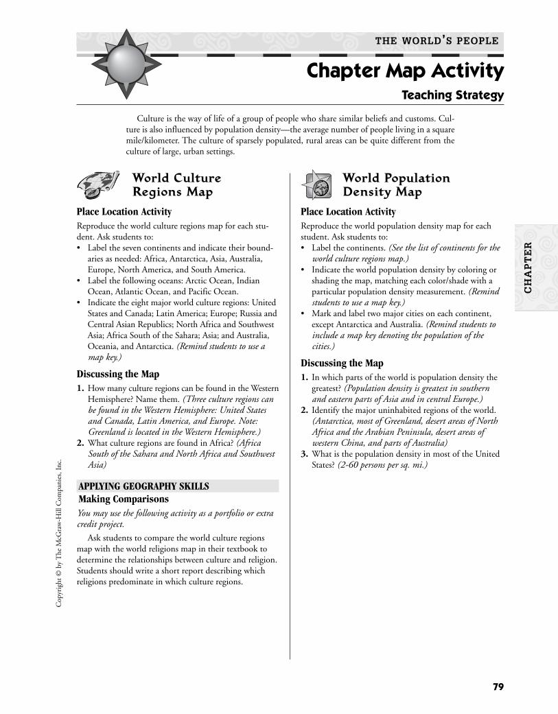
World Culture Regions Map
Place Location ActivityReproduce the world culture regions map for each stu-dent. Ask students to:• Label the seven continents and indicate their bound-
aries as needed: Africa, Antarctica, Asia, Australia,Europe, North America, and South America.
• Label the following oceans: Arctic Ocean, IndianOcean, Atlantic Ocean, and Pacific Ocean.
• Indicate the eight major world culture regions: UnitedStates and Canada; Latin America; Europe; Russia andCentral Asian Republics; North Africa and SouthwestAsia; Africa South of the Sahara; Asia; and Australia,Oceania, and Antarctica. (Remind students to use amap key.)
Discussing the Map1. How many culture regions can be found in the Western
Hemisphere? Name them. (Three culture regions canbe found in the Western Hemisphere: United Statesand Canada, Latin America, and Europe. Note:Greenland is located in the Western Hemisphere.)
2. What culture regions are found in Africa? (AfricaSouth of the Sahara and North Africa and SouthwestAsia)
APPLYING GEOGRAPHY SKILLSMaking ComparisonsYou may use the following activity as a portfolio or extracredit project.
Ask students to compare the world culture regionsmap with the world religions map in their textbook todetermine the relationships between culture and religion.Students should write a short report describing whichreligions predominate in which culture regions.
World Population Density Map
Place Location ActivityReproduce the world population density map for eachstudent. Ask students to:• Label the continents. (See the list of continents for the
world culture regions map.)• Indicate the world population density by coloring or
shading the map, matching each color/shade with aparticular population density measurement. (Remindstudents to use a map key.)
• Mark and label two major cities on each continent,except Antarctica and Australia. (Remind students toinclude a map key denoting the population of thecities.)
Discussing the Map1. In which parts of the world is population density the
greatest? (Population density is greatest in southernand eastern parts of Asia and in central Europe.)
2. Identify the major uninhabited regions of the world.(Antarctica, most of Greenland, desert areas of NorthAfrica and the Arabian Peninsula, desert areas ofwestern China, and parts of Australia)
3. What is the population density in most of the UnitedStates? (2-60 persons per sq. mi.)
79
Cop
yrig
ht ©
by
The
McG
raw
-Hill
Com
pani
es, I
nc.
THE WORLD’S PEOPLE
Chapter Map Activity Teaching Strategy
Culture is the way of life of a group of people who share similar beliefs and customs. Cul-ture is also influenced by population density—the average number of people living in a squaremile/kilometer. The culture of sparsely populated, rural areas can be quite different from theculture of large, urban settings.
CH
AP
TE
R
80
Copyright ©
by The M
cGraw
-Hill C
ompanies, Inc.
Name Date Class
THE WORLD’S PEOPLE
Chapter Map Activity
CH
AP
TE
R
N
E
S
W
The
Wo
rld
: Cul
ture
Reg
ions

81
Cop
yrig
ht ©
by
The
McG
raw
-Hill
Com
pani
es, I
nc.
Name Date Class
THE WORLD’S PEOPLE
Chapter Map Activity
CH
AP
TE
R
N
E
S
W
The
Wo
rld
: Po
pul
atio
n D
ensi
ty


Learning the SkillThematic maps focus on a specific subject or theme. To read a thematic map,
(1) read the title of the map; (2) find the map’s scale to determine the generalsize of the area at which you are looking; (3) read the compass rose to deter-mine north, south, east, and west; (4) read the map key; and (5) analyze theareas on the map that are highlighted in the key. Look for patterns.
Practicing the SkillDirections: Use the map below to answer the questions.
1. What is the mainland use around the city of Rio deJaneiro?
2. What fish are com-monly caught offthe shores of Brazil?
3. What is the mainland use for the west-ern area of Brazil?
4. What are two miner-als found in Brazil?
Applying the SkillDirections: On another sheet of paper, draw a thematic map of your local areasimilar to the one above. Before you begin to draw, select a focus for your map,such as physical, economic, climatic, historic, or cultural information about yourarea. Don’t forget to include a compass rose and a map key.
83
Cop
yrig
ht ©
by
The
McG
raw
-Hill
Com
pani
es, I
nc.
Land Use
Subsistence farming
Commercial farming
Ranching
Forests
BauxiteGoldCoalCopperDiamondsIron ore
ManganesePetroleumTinUraniumZinc
ResourcesMnOSnUZn
AlAuCCuDFe
Tuna
OystersSardines
MackerelMackerel
AlbacoreAlbacoreShrimp
Shrimp
O
SnD
AuFe
Al MnMn
ZnFeMnMn
DU Fe
Al
FeCuC
C
MnMn
U
O
Sn
Tuna
OystersSardines
Herring
Mackerel
TunaShrimp
Shrimp
O
SnD
AuFe
Al Mn
ZnFeMn
DU Fe
Al
FeCuC
C
Mn
U
O
Sn
SalvadorSalvador
Rio de JaneiroRio de Janeiro
Porto AlegrePorto Alegre
SnapperSnapper
RecifeRecife
CH
AP
TE
R
Name Date Class
THE WORLD’S PEOPLE
Chapter Skills Review Reading a Thematic Map
Brazil: Economic Activity

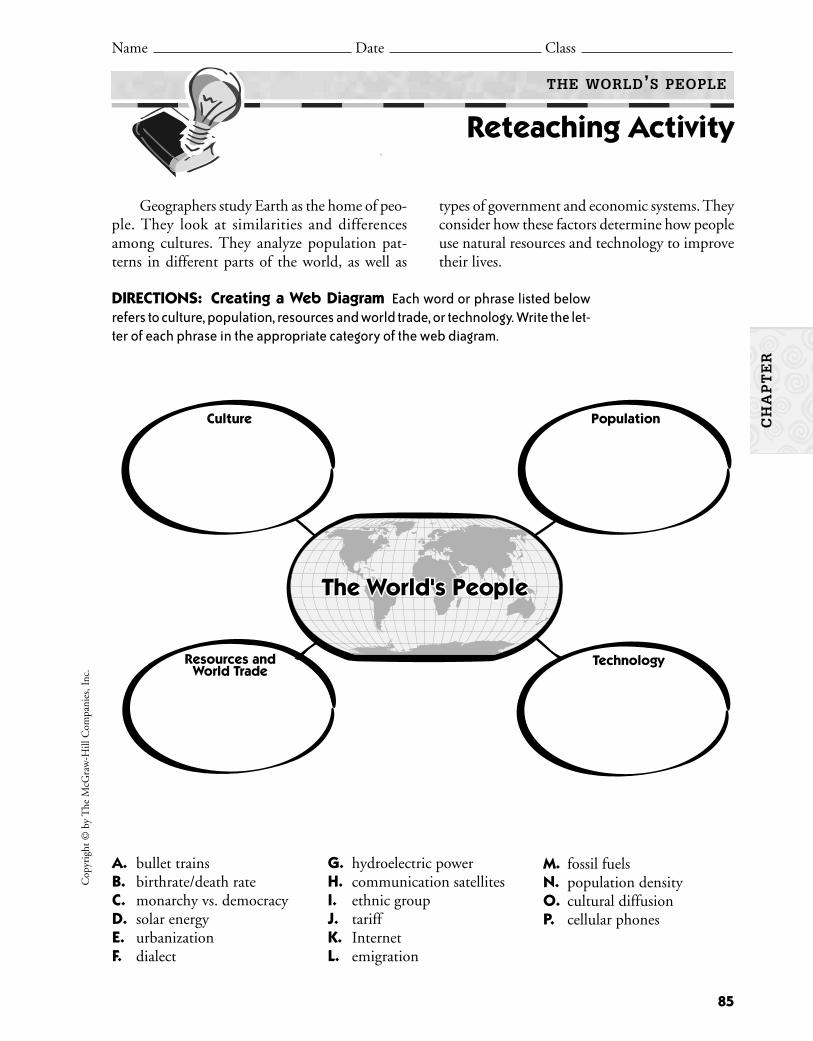
Geographers study Earth as the home of peo-ple. They look at similarities and differencesamong cultures. They analyze population pat-terns in different parts of the world, as well as
types of government and economic systems. Theyconsider how these factors determine how peopleuse natural resources and technology to improvetheir lives.
85
Cop
yrig
ht ©
by
The
McG
raw
-Hill
Com
pani
es, I
nc.
Name Date Class
THE WORLD’S PEOPLE
Reteaching Activity
DIRECTIONS: Creating a Web Diagram Each word or phrase listed belowrefers to culture, population, resources and world trade, or technology. Write the let-ter of each phrase in the appropriate category of the web diagram.
CH
AP
TE
R
A. bullet trainsB. birthrate/death rateC. monarchy vs. democracyD. solar energyE. urbanizationF. dialect
G. hydroelectric powerH. communication satellitesI. ethnic groupJ. tariffK. InternetL. emigration
M. fossil fuelsN. population densityO. cultural diffusionP. cellular phones
Culture Population
TechnologyResources andWorld Trade
The World's PeopleThe World's People


SOCIAL STUDIES OBJECTIVE: Analyze statistics to interpret social studies information.
Learning the SkillTo infer means to evaluate information and
arrive at a conclusion. When you make infer-ences, you “read between the lines,” or draw con-clusions that are not stated directly in the text.Drawing conclusions means using facts togetherwith your own knowledge, experience, andinsight to make a judgment about the informa-tion. For example, when you are evaluating sta-tistics, you need to ask what the numbers andprojected numbers imply, or suggest, about thesubject. Then you must draw conclusions about
the information. To make inferences and drawconclusions, follow these steps:
• Read the information carefully for statedfacts and ideas.
• Summarize the information and list the mostimportant facts.
• Apply related information that you mayalready know to make inferences.
• Add your knowledge and insight to developa conclusion.
• Look for information to check the accuracyof your conclusion.
Applying the SkillDirections: Read the information about world population below. Then answerthe questions on the next page.
The world’s population exceeded 6 billion in October1999. In that year, the earth’s population grew by nearly 80million. Ninety-seven percent of this growth happened in thepoorest parts of the world. In the next generation, there willbe 3 billion young people. This is equal to the whole popu-lation of the world in 1960. This generation will then beginto have children of their own. If population growth does notchange, by no later than the year 2025, the combined popu-lation of Asia and Africa will be 6.5 billion. That is more peo-ple than live on the entire earth right now. Additionally, 300million women want and need family planning but lack eitherthe information or means to obtain it.C
opyr
ight
© b
y T
he M
cGra
w-H
ill C
ompa
nies
, Inc
.
87
Name Date Class
THE WORLD’S PEOPLE
Critical Thinking Skills Activity Drawing Inferences and Conclusions
CH
AP
TE
R
CH
AP
TE
R
1. What is the approximate population of theearth?
2. Where was the greatest population growth in1999?
3. What does the last sentence in the readingimply is part of the population problem?
4. What is predicted for Asia and Africa by theyear 2025? Why is this alarming?
5. Imagine your own home has a populationproblem. The number of people living theresuddenly multiplies by 10, yet yourresources, budget, and available room doesnot change. What are some of the possiblesolutions to this situation?
Practicing the SkillDirections: Use the information in the paragraphabout world population to answer the followingquestions by circling the letter of the correct answer.
1. In October 1999, the world’s population
A. was less than 6 billion.B. was more than 6 billion.C. grew by 100 million.D. grew by 97 percent.
2. In 1999, 97 percent of the world’s popula-tion growth occurred in
A. the United States.B. Europe.C. the poorest countries.D. Antarctica.
3. The world’s population in 1960 was approx-imately equal to
A. one-fourth the population in 1999.B. one-half the population in 1999.C. double the population in 1999.D. four times the population in 1999.
4. If the rate of growth in population does notchange,
A. Asia and Africa will have a combinedpopulation of 6.5 billion by no laterthan 2025.
B. the October 1999 population will morethan double by 2025.
C. the population of Asia and Africa will begreater than the world’s population rightnow.
D. all of the above.
Copyright ©
by The M
cGraw
-Hill C
ompanies, Inc.
88
Name Date Class
THE WORLD’S PEOPLE
Critical Thinking Skills Activity (continued)
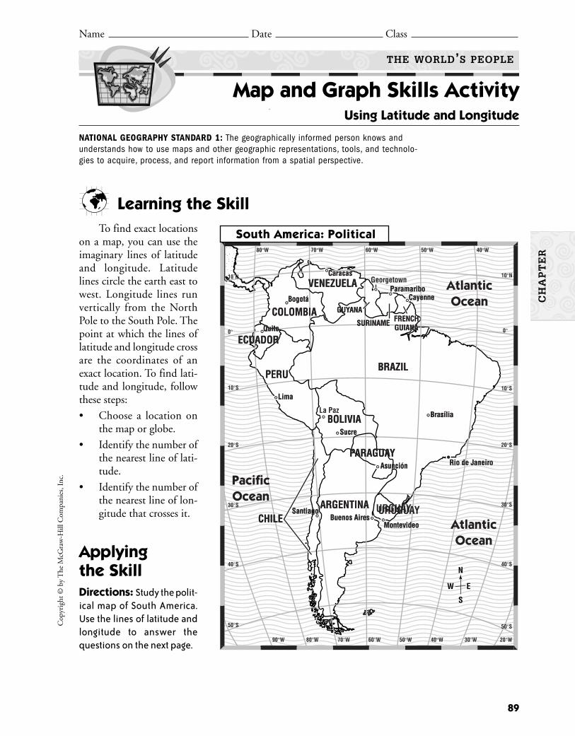
Cop
yrig
ht ©
by
The
McG
raw
-Hill
Com
pani
es, I
nc.
89
Learning the SkillTo find exact locations
on a map, you can use theimaginary lines of latitudeand longitude. Latitudelines circle the earth east towest. Longitude lines runvertically from the NorthPole to the South Pole. Thepoint at which the lines oflatitude and longitude crossare the coordinates of anexact location. To find lati-tude and longitude, followthese steps:
• Choose a location onthe map or globe.
• Identify the number ofthe nearest line of lati-tude.
• Identify the number ofthe nearest line of lon-gitude that crosses it.
Applying the SkillDirections: Study the polit-ical map of South America.Use the lines of latitude andlongitude to answer thequestions on the next page.
Name Date Class
THE WORLD’S PEOPLE
Map and Graph Skills Activity Using Latitude and Longitude
NATIONAL GEOGRAPHY STANDARD 1: The geographically informed person knows andunderstands how to use maps and other geographic representations, tools, and technolo-gies to acquire, process, and report information from a spatial perspective.
N
E
S
W
80°W 70°W 60°W 50°W 40°W
10°N
0°
10°S
20°S
30°S
40°S
50°S
80°W 70°W 60°W 50°W 40°W 30°W 20°W90°W
50°S
40°S
30°S
20°S
10°S
0°
10˚NVENEZUELA
COLOMBIA
BRAZILPERU
ECUADOR
BOLIVIA
ARGENTINA URGUAY
PARAGUAY
CHILE
ParamariboCayenne
Brazilia
Asuncion
MontevideoBuenos Aires
Santiago
Sucre
Lima
Quito
Bogota
Caracas
GUYANA
SURINAME FRENCHGUIANA
Rio de Janeiro
VENEZUELA
COLOMBIA
BRAZILPERU
ECUADOR
BOLIVIA
ARGENTINA URUGUAY
PARAGUAY
CHILE
GeorgetownGeorgetownParamaribo
Cayenne
Brasília
Asunción
MontevideoBuenos Aires
Santiago
Sucre
Lima
Quito
Bogotá
Caracas
GUYANA
SURINAME FRENCHGUIANA
Rio de Janeiro
AtlanticOcean
PacificOcean
AtlanticOcean
La Paz
South America: Political
CH
AP
TE
R

Copyright ©
by The M
cGraw
-Hill C
ompanies, Inc.
90
1. Which South American countries shown onthe map lie entirely to the east of the 60°Wlongitude line?
2. Through which South American countriesdoes the Equator run?
3. Which South American countries shown onthe map are entirely north of the Equator?
4. What is the closest line of latitude to BuenosAires? To Georgetown?
5. Critical Thinking Write the names of thecountries located at the following degrees oflatitude and longitude.
Country
a. 9°S, 53°W
b. 8°N, 65°W
c. 24°S, 57°W
d. 36°S, 67°W
e. 35°S, 72°W
6. Activity Turn to the Reference Atlas mapof the United States in your textbook. Findyour city or the city closest to it. What areits coordinates?
Practicing the SkillDirections: Answer the following questionsbased on the map by circling the letter of the correctanswer.
1. Which city shown on the map is closest tothe Equator?
A. Bogotá, ColombiaB. Quito, EcuadorC. Caracas, VenezuelaD. Rio de Janeiro, Brazil
2. Which city shown on the map is closest to20°S, 40°W?
A. Caracas, VenezuelaB. Buenos Aires, ArgentinaC. Rio de Janeiro, BrazilD. Quito, Ecuador
3. Which of the following are the correct coor-dinates of Montevideo, Uruguay?
A. 35°S, 56°WB. 25°S, 58°WC. 33°S, 71°WD. 19°S, 65°W
4. Which of the following are the correct coor-dinates of Santiago, Chile?
A. 35°S, 56°WB. 25°S, 58°WC. 33°S, 71°WD. 19°S, 65°W
THE WORLD’S PEOPLE
Map and Graph Skills Activity (continued)
Name Date Class
CH
AP
TE
R
Learning the SkillYour school and local libraries are valuable
resources for many kinds of information. Youmay visit the library in person or connect on theWorld Wide Web. You can find the followingresources at the library:
1. Encyclopedias—These are a set of booksthat contain short articles on many subjects.
2. Biographical dictionary—This dictionarylists brief biographies, or life stories, of impor-tant people in history.
3. Atlas—An atlas is a collection of maps. Youcan even find historical atlases, which willshow you, for example, the world map at theturn of the twentieth century.
4. Almanac—An almanac is a reference that isupdated each year to provide current statis-tics and historical information on a widerange of subjects.
5. Card catalog—This lists every book in thelibrary, by author, subject, or title, and it canbe accessed in person or electronically.
6. Periodical guide—This guide is really a setof books that lists topics covered in periodi-cals, or magazines and newspapers.
7. Computer databases—These are electroniccollections of information that are organizedfor rapid search and retrieval.
91
Cop
yrig
ht ©
by
The
McG
raw
-Hill
Com
pani
es, I
nc.
Name Date Class
THE WORLD’S PEOPLE
Reading and Writing Skills Activity Using Library Resources
CH
AP
TE
R
SOCIAL STUDIES OBJECTIVE: Use secondary sources to acquire information.
Applying the SkillDirections: Read the text below, which is from a resource you can find at yourlibrary. Then answer the questions that follow.
Alexandria, Library of, famous ancient library, considered to havethe greatest collection of books in the ancient world. Founded byPtolemy I Soter, king of Egypt, in the city of Alexandria, it was expandedby his son Ptolemy II Philadelphus early in the 3rd century B.C. … In thetime of Ptolemy II, according to one historian, the main library in theAlexandrian Museum contained nearly 500,000 volumes, or rolls, and anannex in the Temple of Serapis contained some 43,000 volumes. Mostof the writings of antiquity were preserved in these collections fromwhich copies were made and disseminated to libraries throughout thecivilized world.
1. What makes the Library of Alexandria different from modern libraries?
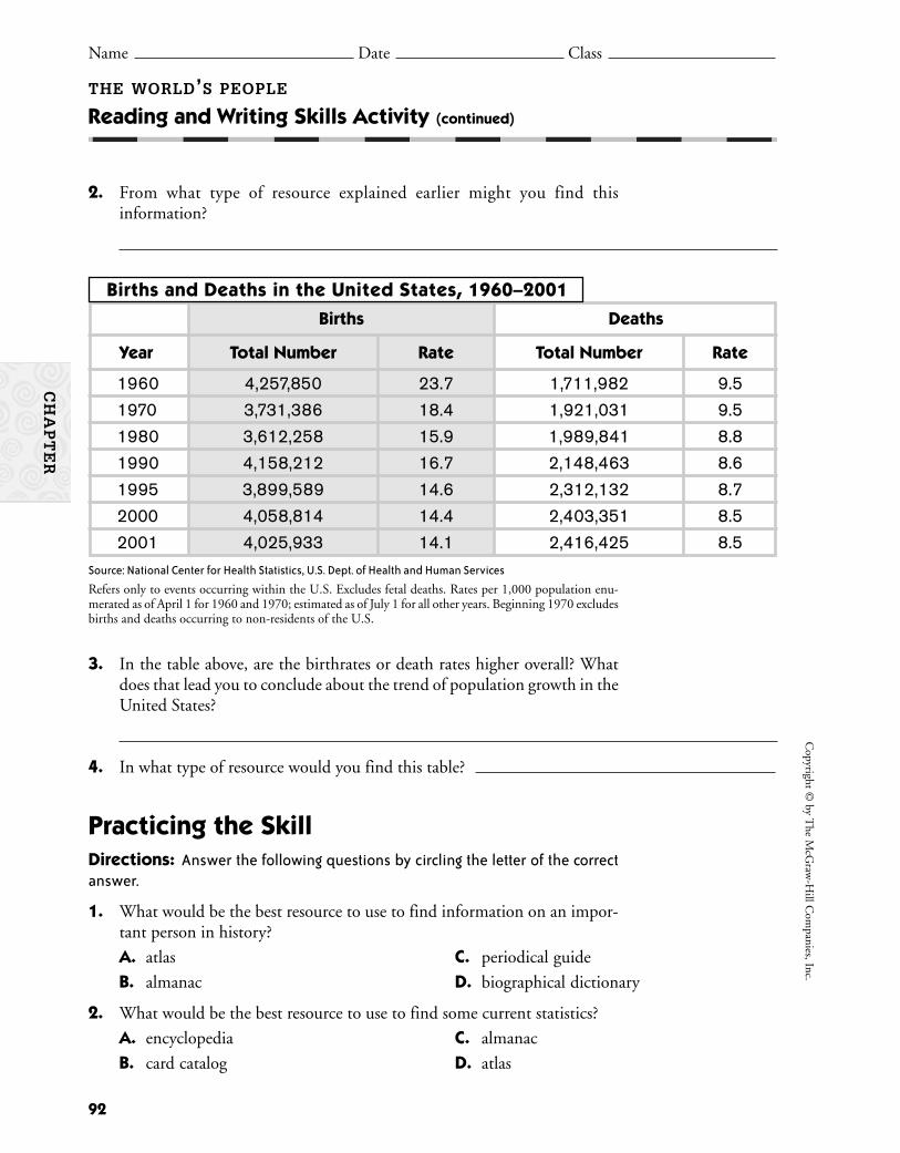
2. From what type of resource explained earlier might you find thisinformation?
92
Copyright ©
by The M
cGraw
-Hill C
ompanies, Inc.
THE WORLD’S PEOPLE
Reading and Writing Skills Activity (continued)
Name Date Class
CH
AP
TE
R
Births and Deaths in the United States, 1960–2001
Births Deaths
Year Total Number Rate Total Number Rate
1960 4,257,850 23.7 1,711,982 9.5
1970 3,731,386 18.4 1,921,031 9.5
1980 3,612,258 15.9 1,989,841 8.8
1990 4,158,212 16.7 2,148,463 8.6
1995 3,899,589 14.6 2,312,132 8.7
2000 4,058,814 14.4 2,403,351 8.5
2001 4,025,933 14.1 2,416,425 8.5
3. In the table above, are the birthrates or death rates higher overall? Whatdoes that lead you to conclude about the trend of population growth in theUnited States?
4. In what type of resource would you find this table?
Practicing the SkillDirections: Answer the following questions by circling the letter of the correctanswer.
1. What would be the best resource to use to find information on an impor-tant person in history?
A. atlas C. periodical guide
B. almanac D. biographical dictionary
2. What would be the best resource to use to find some current statistics?
A. encyclopedia C. almanac
B. card catalog D. atlas
Source: National Center for Health Statistics, U.S. Dept. of Health and Human Services
Refers only to events occurring within the U.S. Excludes fetal deaths. Rates per 1,000 population enu-merated as of April 1 for 1960 and 1970; estimated as of July 1 for all other years. Beginning 1970 excludesbirths and deaths occurring to non-residents of the U.S.
Learn how different countries of the world rely on one another’s manufac-tured products by researching and mapping international products.
BackgroundImproved electronic communication and faster transportation methods
have helped countries to better use and appreciate products that were originallymade in another part of the world. The shoes you put on your feet this morn-ing may have been manufactured in the United States. The company head-quarters, however, may actually be in another country. This could also be trueof the toaster that toasted your waffle or the family car that brought you toschool. Many international companies export their products to the UnitedStates or have factories here that manufacture their products. Find out aboutsome of these companies by researching in the library or on the Internet.
Materials
What to Do1. Organize into groups of three or four.2. Review the suggested reference materials. Each student should then choose
10 to 15 different companies that you determine are foreign companiesdoing business in the United States. Research those companies to determinewhat products they actually export to or manufacture in the United States.Choose companies with which you are familiar and whose products youmay use as well as some with which you are unfamiliar. Choose a varietyof products and industries.
3. For each company, identify the location of its headquarters and the mainproduct that it exports to or manufactures in the United States.
4. Cut the colored card stock into small rectangles. Record the individual com-pany, country, and its main product export on that rectangle. You mightalso include the company logo, if there is one, or a picture representing theproduct. (You will be mounting these papers to your map so you will wantthe size to be small enough to fit on the map but large enough to read.)
5. Mount a large world map to the foam board.
93
Cop
yrig
ht ©
by
The
McG
raw
-Hill
Com
pani
es, I
nc.
Name Date Class
HISTORY AND GEOGRAPHY ACTIVITIES GEOGRAPHY AND THE WORLD
GeoLab Activity
THE WORLD’S PEOPLE
Products of the World
From the classroom of Ed Smith, Fairmont Jr. High, Boise, Idaho
CH
AP
TE
R
■ large foam board on which to mount themap
■ mounting tape or glue■ colored card stock■ ruler■ scissors■ straight pins or push pins
■ reference books on world businesses such asDirectory of Foreign Firms Operating in theUnited States, business magazines, or informa-tion found on the Internet
■ paper, pencils■ large map of the world for each group (you
may draw a world map if you do not have one)

94
Copyright ©
by The M
cGraw
-Hill C
ompanies, Inc.
THE WORLD’S PEOPLE
GeoLab Activity (continued)
Name Date Class
CH
AP
TE
R
Although the hula hoop is an American invention, theoriginal idea actually came from Australia. Physicaleducation students there exercised with hoops madefrom bamboo. The inventors used that idea and madethe hula hoop into a popular product at one time andone of the biggest fads in history.
Lab Activity Report
1. Do you or your family members use any international products on a dailybasis? Explain.
2. Did you notice any kinds of industries concentrated in any particular regionof the world? Describe your findings.
3. What parts of the world are not represented on your completed map? Whydo you think this is so?
4. Drawing Conclusions In what ways would your life be different withoutthe products that come from other countries? Do you think people aroundthe world are better off or worse off because goods are bought and soldaround the world? Explain your answer.
Go A Step FurtherAdd creative touches to your group’s map. Include a title or decorate the
borders with pictures. You might use a particular color to represent a particu-lar region of the world or a particular product. For example, display countriesin Europe in red or all car companies in yellow. Use your imagination to makeyour map as attractive as possible.
6. Using push pins or straight pins, mount the pieces of card stock to yourmap at the appropriate country location.
7. Display the map in your classroom.

95
Cop
yrig
ht ©
by
The
McG
raw
-Hill
Com
pani
es, I
nc.
Name Date Class
THE WORLD’S PEOPLE
Enrichment Activity How the World’s People Live
CH
AP
TE
R
Directions: Read the article below about the differences between developedand developing countries. Then answer the questions that follow on a separatesheet of paper.
Geographers use various ways to describeand classify the world in which we live. They cat-egorize the world by climate zones, by continent,and by hemisphere. Geographers also describethe world’s people by classifying them in suchcategories as languages spoken, government
systems, religious heritage, manner of dress, andeconomic systems. Some geographers dividethe world into developed countries and devel-oping countries. Study the chart below to learnthe characteristics of these two categories ofcountries.
Developed Countries(such as Australia, Canada,
and Japan)
1. Countries have a great deal of manufacturing.
2. Farmland is highly productive, and fewpeople work in agriculture.
3. Most people who work have skilled jobsthat require education and training.
4. Countries have found productive ways touse their natural resources. The entirepopulation benefits from their use.
5. Countries have good transportation andcommunication systems.
Developing Countries(such as Indonesia, Mexico, Pakistan,
and Tanzania)
1. Countries have limited manufacturingcapabilities.
2. Many people work as subsistence farm-ers, growing only the food they need fortheir own families.
3. Most people who work have unskilled orlow-skilled jobs. Few people are trainedfor skilled jobs.
4. Countries lack good natural resources ormake poor use of them. Others use theirresources to benefit only a few people.
5. Countries lack good transportation andcommunication systems.
Characteristics of:
Taking Another Look1. Would you classify the United States as a developed or a developing country?
Explain your answer.2. Which of the factors in the chart do you think need to change for a devel-
oping country to become a developed country?3. Imagine that you travel to a developing country. Make a list of questions
that you would ask of a person your age about what life is like in his or hercountry.


97
Cop
yrig
ht ©
by
The
McG
raw
-Hill
Com
pani
es, I
nc.
CH
AP
TE
R
Reviewing the Chapter UNDERSTANDING CULTURE
• Culture is the way of life of a group of peo-ple who share similar beliefs and customs.
• In studying a society’s culture, geographerslook at eight traits: social groups, language,religion, daily life, history, arts, government,and economy.
• Cultures do not remain the same. The processof spreading new knowledge and skills toother cultures is called cultural diffusion.
• Human societies evolved over thousands ofyears from a nomadic existence to the pres-ent-day Information Revolution.
POPULATION PATTERNS
• The world’s population has grown so fast inthe last 200 years because the death rate hasgone down and the birthrate has gone up.
• An increase in the number of people meansthat more food and more resources are needed.
• The world’s population is not distributedevenly. Population density is the averagenumber of people living in a square mile ora square kilometer.
Name Date Class
THE WORLD’S PEOPLE
Take-Home Review Activity
• Many people move to cities, mostly to findjobs. Nearly half the world’s people live incities.
RESOURCES AND WORLD TRADE
• People use natural resources, such as wind,water, and oil, to meet their needs. Renewableresources, like wind and sun, cannot be usedup. Nonrenewable resources, such as fossilfuels, are natural resources that are limited.
• Nations that have large amounts of certainresources or products trade with othernations for resources or products that theyneed, as long as there are no barriers to trade.
• Countries that have a great deal of manu-facturing are called developed countries, andthose working toward industrialization arecalled developing countries.
TECHNOLOGY “SHRINKS” THE WORLD
• Advancements in transportation and com-munication technology, including the Inter-net, have “shrunk” the world.
• The world’s countries are linked throughtrade, and some people fear that globaliza-tion will erase traditional cultures.
People usually live with others who follow similar beliefs and practiceslearned from the past. The world’s population is growing rapidly, and how andwhere people live are changing, too. Because many resources are limited and dis-tributed unevenly, countries must trade for goods. Modern technology hashelped to bring the world’s diverse peoples closer together.
Because humans are at the top of the food chain, they are particularlyvulnerable to the effects of pollutants. This was clearly illustrated in the 1960sand 1970s when people living near Minimata Bay, Japan, developed nervousdisorders, tremors, and paralysis in a mysterious epidemic. More than 400
people died before authorities discovered that a local industry had released mercury intoMinimata Bay. This highly toxic element built up in the bodies of local fish and eventually inthe bodies of the people who consumed the fish.
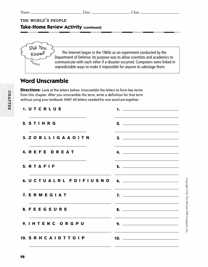
98
Copyright ©
by The M
cGraw
-Hill C
ompanies, Inc.
CH
AP
TE
R
THE WORLD’S PEOPLE
Take-Home Review Activity (continued)
Name Date Class
The Internet began in the 1960s as an experiment conducted by theDepartment of Defense. Its purpose was to allow scientists and academics tocommunicate with each other if a disaster occurred. Computers were linked inunpredictable ways to make it impossible for anyone to sabotage them.
Word UnscrambleDirections: Look at the letters below. Unscramble the letters to form key termsfrom this chapter. After you unscramble the term, write a definition for that termwithout using your textbook. HINT: All letters needed for one word are together.
1. U T C R L U E
2. S T I H R G
3. Z O B L L I G A A O I T N
4. R E F E D R E A T
5. R T A F I F
6. U C T U A L R L F D I F I U S N O
7. E R M E G I A T
8. F E E G S U R E
9. I H T E N C O R G P U
10. S R H C A I D T T O I P
1.
2.
3.
4.
5.
6.
7.
8.
9.
10.
99
The World’s PeopleSection Resources
Guided Reading Activity 1:Understanding Culture 100
Guided Reading Activity 2:Population Patterns 101
Guided Reading Activity 3:Resources and World Trade 102
Guided Reading Activity 4:Technology “Shrinks” the World 103
SE
CT
ION
S
100
Copyright ©
by The M
cGraw
-Hill C
ompanies, Inc.
Name Date Class
HISTORY AND GEOGRAPHY ACTIVITIES
Name Date Class
GEOGRAPHY AND THE WORLD
Guided Reading Activity 1
Name Date Class Name Date Class
THE WORLD’S PEOPLE
Understanding Culture
DIRECTIONS: Outlining Reading the section and completing the outline belowwill help you learn more about culture. Refer to your textbook to fill in the blanks.
I. is the way of life of a group of people with similar customs and beliefs.
II. Geographers look at eight when studying a society.
A. They study what a society is divided into.
B. They study what the people speak.
1. is one of the strongest unifying forces for a culture.
2. Within some cultures, people speak a , or local form of
language, which differs from the main language.
C. helps people answer basic questions about life’s meaning.
D. Geographers examine people’s —what they eat, wear, and
how they build their homes.
E. shapes how we view the world.
1. People celebrate to honor heroes and heroines.
2. They also remember , or dark periods of history.
F. People express their culture through the .
G. Rules or laws are created by .
1. A democracy is a form of government.
2. One type of unlimited government is a(n) .
H. Culture includes , or how people earn a living.
III. Cultures are always .
A. is the process of spreading new knowledge and skills to other
cultures.
B. As cultures became more complex, four arose.
C. In the 1700s and 1800s, some countries began to .
D. The is the newest revolution.
E. A includes different countries with common traits.
SE
CT
ION
1
101
Cop
yrig
ht ©
by
The
McG
raw
-Hill
Com
pani
es, I
nc.
Name Date Class
HISTORY AND GEOGRAPHY ACTIVITIES
Name Date Class
GEOGRAPHY AND THE WORLD
Guided Reading Activity 2
Name Date Class Name Date Class
THE WORLD’S PEOPLE
Population Patterns
SE
CT
ION
2
DIRECTIONS: Answering Questions Reading the section and answering thequestions below will help you learn more about population. Refer to your textbookto write answers to the questions.
1. What are two reasons for the fast growth of the population in the past 200 years?
2. How are birthrates and death rates used to measure population growth?
3. What special needs does a growing population create?
4. What types of land cannot support large populations?
5. Where do people prefer to live?
6. How do geographers figure out population density?
7. How can knowing population density be helpful to geographers, and how can it be misleading?
8. Why do people move to cities?
9. What is the difference between an immigrant and a refugee?

102
Copyright ©
by The M
cGraw
-Hill C
ompanies, Inc.
Name Date Class
HISTORY AND GEOGRAPHY ACTIVITIES
Name Date Class
GEOGRAPHY AND THE WORLD
Guided Reading Activity 3
Name Date Class Name Date Class
THE WORLD’S PEOPLE
Resources and World Trade
DIRECTIONS: Outlining Reading the section and completing the outline belowwill help you learn more about resources and world trade. Refer to your textbookto fill in the blanks.
I. How can natural resources, or products people use from nature, be grouped?
A. Renewable resources can be naturally or again.
1. Forests, grasslands, plants, animals, and can be replaced.
2. is power produced by the sun.
B. take too long to replace.
1. , such as coal, , and
natural are sources of energy.
2. is power from an atomic reaction.
II. What are the different types of economic systems?
A. A economy is based on customs.
B. The government makes all economic decisions in a economy.
C. In a economy, individuals make their own decisions.
III. How do people get the resources they need?
A. Countries , or focus on activities best suited to their resources.
B. Countries what they do not need, trading it to other countries.
C. When they cannot produce enough of something, countries it.
IV. How is world trade managed?
A. are taxes charged by some countries on imported goods.
B. Other governments put a , or limit on the number of items allowed into a
country.
C. removes trade barriers.
V. What are differences in the development of countries?
A. have a great deal of manufacturing.
B. are working toward industrialization.
SE
CT
ION
3

103
Cop
yrig
ht ©
by
The
McG
raw
-Hill
Com
pani
es, I
nc.
Name Date Class
HISTORY AND GEOGRAPHY ACTIVITIES
Name Date Class
GEOGRAPHY AND THE WORLD
Guided Reading Activity 4
Name Date Class Name Date Class
THE WORLD’S PEOPLE
Technology “Shrinks” the World
SE
CT
ION
4
DIRECTIONS: Filling in the Blanks Reading the section and completingthe sentences below will help you learn more about how the world’s people arebeing brought closer together. Refer to your textbook to fill in the blanks.
The world’s people have been brought closer together with
(1) . (2) speed
workers from city to city. People can move from one continent to another in just a few
hours by using (3) . News can be
broadcast live to the entire world through the use of (4)
. Millions of people today use the (5) to
exchange mail, shop, do research, exchange photographs, and more. Two important
inventions made this global network possible—the (6) and the
(7) .
Being concerned with the public affairs of a community is
(8) . Citizens in a democracy like the
United States have (9) , which are benefits and protections
guaranteed by law. You also have (10) , which are duties that
you owe other citizens and the government. For example, you have a duty to respect the
(11) and (12) of others.
(13) is when countries depend on one another for
goods, raw materials to make goods, and markets in which to sell goods. Many people
believe that (14) , which is the development of a world culture
and an interdependent economy, might erase traditions and customs of certain groups
of people. A big issue in the world today is to make products, services, and
(15) available to developing countries.

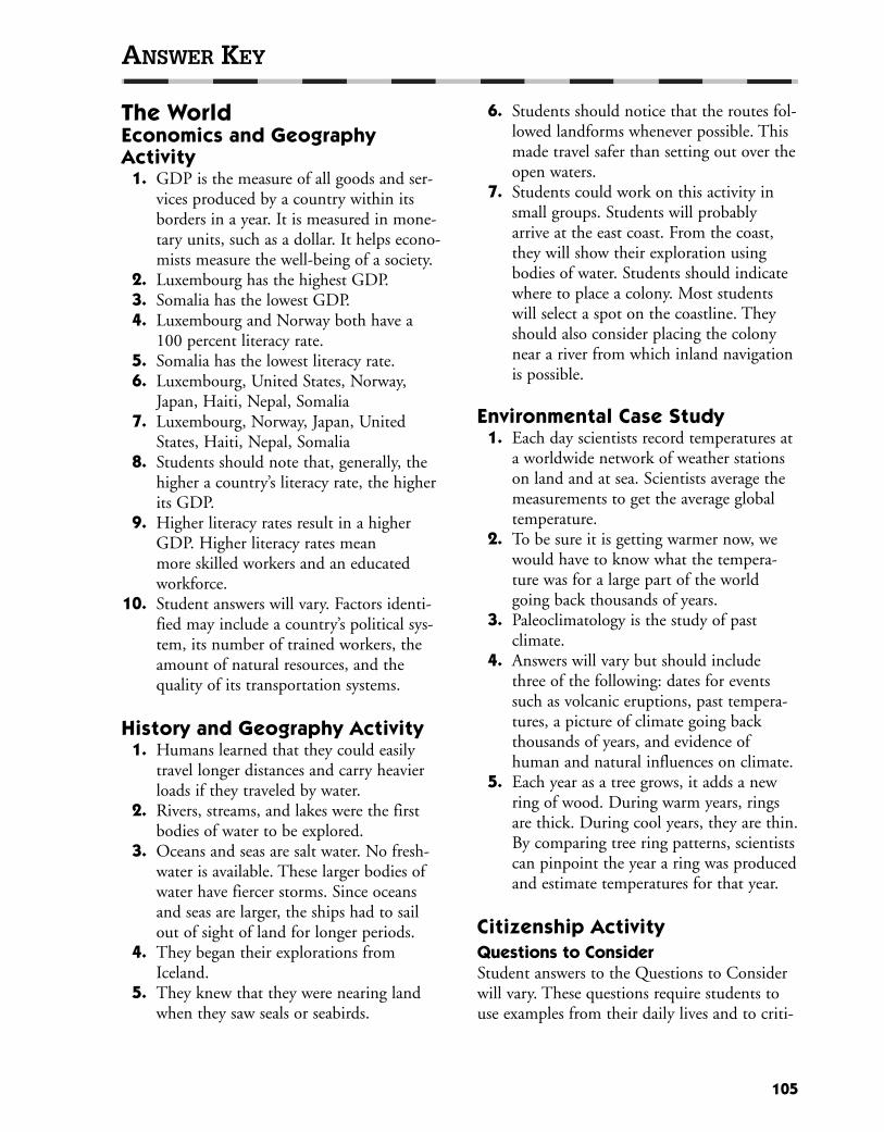
The WorldEconomics and Geography Activity
1. GDP is the measure of all goods and ser-vices produced by a country within itsborders in a year. It is measured in mone-tary units, such as a dollar. It helps econo-mists measure the well-being of a society.
2. Luxembourg has the highest GDP.3. Somalia has the lowest GDP.4. Luxembourg and Norway both have a
100 percent literacy rate.5. Somalia has the lowest literacy rate.6. Luxembourg, United States, Norway,
Japan, Haiti, Nepal, Somalia7. Luxembourg, Norway, Japan, United
States, Haiti, Nepal, Somalia8. Students should note that, generally, the
higher a country’s literacy rate, the higherits GDP.
9. Higher literacy rates result in a higherGDP. Higher literacy rates mean more skilled workers and an educatedworkforce.
10. Student answers will vary. Factors identi-fied may include a country’s political sys-tem, its number of trained workers, theamount of natural resources, and thequality of its transportation systems.
History and Geography Activity 1. Humans learned that they could easily
travel longer distances and carry heavierloads if they traveled by water.
2. Rivers, streams, and lakes were the firstbodies of water to be explored.
3. Oceans and seas are salt water. No fresh-water is available. These larger bodies ofwater have fiercer storms. Since oceansand seas are larger, the ships had to sailout of sight of land for longer periods.
4. They began their explorations fromIceland.
5. They knew that they were nearing landwhen they saw seals or seabirds.
6. Students should notice that the routes fol-lowed landforms whenever possible. Thismade travel safer than setting out over theopen waters.
7. Students could work on this activity insmall groups. Students will probablyarrive at the east coast. From the coast,they will show their exploration usingbodies of water. Students should indicatewhere to place a colony. Most studentswill select a spot on the coastline. Theyshould also consider placing the colonynear a river from which inland navigationis possible.
Environmental Case Study 1. Each day scientists record temperatures at
a worldwide network of weather stationson land and at sea. Scientists average themeasurements to get the average globaltemperature.
2. To be sure it is getting warmer now, wewould have to know what the tempera-ture was for a large part of the worldgoing back thousands of years.
3. Paleoclimatology is the study of past climate.
4. Answers will vary but should includethree of the following: dates for eventssuch as volcanic eruptions, past tempera-tures, a picture of climate going backthousands of years, and evidence ofhuman and natural influences on climate.
5. Each year as a tree grows, it adds a newring of wood. During warm years, ringsare thick. During cool years, they are thin.By comparing tree ring patterns, scientistscan pinpoint the year a ring was producedand estimate temperatures for that year.
Citizenship Activity Questions to ConsiderStudent answers to the Questions to Considerwill vary. These questions require students touse examples from their daily lives and to criti-
105
ANSWER KEY

cally think about issues that affect them.Students should answer the questions by usingcomplete sentences and by supporting theiropinions with logical arguments. Studentsshould complete the Citizenship Activity Taskby working individually and in groups. At theend of the project, have students review theirwork by discussing the difficulties they facedand how they resolved them. Encourage stu-dents to explain how they would improve theirwork if they did this project again.
World Literature Reading Keepers of the Earth
1. The boy called the rock Grandfather. 2. The first story was about how the earth
was created. 3. The stories protected the boy and people
from the cold. Two times words like “thestory seemed to drive away the cold” areused: when Great Stone told the firststory to the boy, and when the boy toldthe story in the longhouse.
The Creation1. The roots of the beautiful tree in Sky-
World were white.2. Finally, the muskrat was able to dive deep
enough to reach a tiny speck of earth. 3. Answers will vary but should be similar
to kind, caring, friendly, respectful, andhelpful.
LOOKING AT THE EARTH
Vocabulary Activity1. true2. false; axis3. true4. true5. false; plateau6. false; peninsula7. false; core8. false; tsunami9. true
10. false; orbit11. false; strait12. true
13. true14. false; crust15. false; revolution16. true
LOOKING AT THE EARTH
Cooperative Learning Activity Students should complete the CooperativeGroup Process activities and questions andanswer the Quick Check questions. Have stu-dents share their responses with their groups orwith the class as a whole.
LOOKING AT THE EARTH
Chapter Map Activity Use the reproducible maps in the classroom.You may wish to use the teacher strategies presented for this chapter or other map skillsstrategies of your own design.
LOOKING AT THE EARTH
Chapter Skills ReviewPracticing the Skill
1. It is a major industrial area.2. Corn, oats, and soybeans are grown.3. petroleum, coal, fluorspar, lead, zinc, and
limestone
Applying the SkillStudent maps will vary. Correct examples willinclude a compass rose, a map key, and somelocal landmarks.
LOOKING AT THE EARTH
Reteaching Activity Movement in Space: E, K, NStructure of the Earth: D, G, LForces of Nature: A, F, JLandforms: B, H, OBodies of Water: C, I, M
LOOKING AT THE EARTH
Critical Thinking Skills Activity Applying the Skill
1. F2. F
106
ANSWER KEY
3. F4. O5. O6. F7. O8. F9. O
10. O
Practicing the Skill1. D2. D3. C4. A
LOOKING AT THE EARTH
Map and Graph Skills Activity Applying the Skill
1. It is a dashed line in the Niagara Riverand Lake Erie.
2. Answers will vary but might includeNiagara Falls, the Buffalo Zoo, or theBuffalo Museum of Science.
3. Canada4. Two airports are shown on the map:
Niagara Falls International Airport andthe Greater Buffalo International Airport.
5. False6. The map shows which airport is nearer to
the falls.7. Answers will vary but might include
showing railroads, toll roads, parks,wildlife areas, or similar features. Studentsshould select symbols that reflect theitems they represent.
8. Maps should accurately reflect the school and should include a readable map keywith symbols.
Practicing the Skill1. B2. C3. C4. A
LOOKING AT THE EARTH
Reading and Writing Skills Activity Applying the SkillI./A./1. Physical geographyI./B./2. Student answers may vary. Correct
examples include population, religion, government, work, languages, ancestry.
I./B./4. areas that share common characteristics
I./C./1. Global Positioning SystemI./C./2. Geographic information systems
Student answers and outlines may vary. Correctexamples may be similar to the one below. Besure that students understand the layers of theoutline.
Possible outline for “The Earth in Space”I. Earth has life because of the sun. Earth has
different seasons because of the way it tiltsand revolves around the sun.A. Our solar system is made up of Earth,
eight other planets, the sun, and thou-sands of smaller bodies.1. Earth travels along its own orbit
around the sun.2. Planets are like Jupiter or like Earth.
Planets like Earth are small and solidand have few or no moons. Planetslike Jupiter are large, mostly made upof gas, and have many moons or rings.
3. Earth’s atmosphere, or the layer of airsurrounding it, supports life. It isabout 1,000 miles thick and is mainlymade up of nitrogen and oxygen.
4. Earth’s nearest neighbor is the moon,which does not have an atmosphereand revolves around Earth.
5. Earth makes one revolution, or complete orbit, around the sun in365 1/4 days, or one year.
107
ANSWER KEY

B. The seasons are a result of Earth beingtilted on its axis. 1. The summer solstice is the day of the
year in which there are the mosthours of sunlight in the NorthernHemisphere. It marks the beginningof summer in that hemisphere.
2. The winter solstice is the day of theyear with the fewest hours of sunlightin the Northern Hemisphere. It alsomarks the beginning of winter in thathemisphere.
3. Spring is marked by the vernal equi-nox, which is a day that has the samenumber of hours of daylight anddarkness. The autumnal equinoxmarks the beginning of autumn.
Practicing the Skill1. C 2. A
LOOKING AT THE EARTH
GeoLab Activity 1. Answers may include weather, television,
cell phones, mapping, television, environ-mental studies, and so on.
2. Answers will vary depending on the satel-lites chosen by the students, but theymust be able to name the actual satelliteand the features they tried to duplicate.
3. Students may discuss how important it isto receive certain news information ortelephone messages instantly, especially incrises or emergency situations. Satellitesalso help us to have a better understand-ing and appreciation of people outsideour own culture because we have becomemore aware of the global community.Satellites have helped travel to becomemore efficient and to better prepare vari-ous locales for bad weather conditions.Negative results might be the commonattitude of today’s modern society to doeverything quickly and not to take thetime to appreciate the simplicities of life.Students might also mention that we
sometimes become impatient with anyaction that does not take place instantly.Sometimes news or other informationarrives and is processed so quickly thatdetails are not accurately confirmed.
4. Answers will vary, but students shouldnote that technology is always improvingand changing. It could be very likely thatanother technology at some point maytake the place of satellites. For example, atone time LPs, not CDs, were common.Most homes have video recorders, butDVD players are quickly taking theirplace. Trains were once an accepted wayof long-distance travel. Passenger trainstoday are very limited in their use.
LOOKING AT THE EARTH
Enrichment Activity1. Student answers will vary. Encourage stu-
dents to weigh the trade-offs between car-rying a small device and the danger ofgetting lost. Most students should realizethat one small piece of safety equipmentsuch as a GPS receiver can give them vitalprotection and can help their parentsworry less about them.
2. Student answers will vary. Encourage stu-dents to be creative. Possible uses includenavigating around traffic jams and locatinglost pets that are wearing GPS receivers.
LOOKING AT THE EARTH
Take-Home Review ActivityStudent answers may vary. Correct examplesare listed below.1. Atlas Mountains (Morocco and Algeria),
Ahaggar Mountains (Algeria), CordilleraCentral (Hispaniola)
2. Gulf of Suez, Gulf of Sidra, Gulf ofGabes, Gulf of Mexico, Gulf of Venezuela
3. Atlantic Ocean, Pacific Ocean4. Mediterranean Sea, Red Sea, Caribbean
Sea5. Cuba, Jamaica, the Bahamas, Hispaniola,
Puerto Rico, Virgin Islands, CaymanIslands
108
ANSWER KEY

6. Isthmus of Panama7. Sinai Peninsula, Península de Zapata
(Cuba), Península de Paraguaná(Venezuela)
8. Nile River, Orinoco River9. Lake Nasser (Egypt), Lake Enriquillo
(Hispaniola), Lake Valencia (Venezuela),Lake Maracaibo (Venezuela)
Guided Reading Activity 1Thinking Like a Geographer
1. False. Physical geography is the study ofthe earth’s land, water, plants, and animals.Human geography is the study of whereand how people live, how people changeand are influenced by their environment,and how different groups compare to oneanother.
2. True.3. False. People can have a major impact on
the environment.4. False. Geographers look at individual cities
and landforms as well as larger regions.5. True.6. False. To accurately label exact locations
on a map, geographers use a group ofsatellites called the Global PositioningSystem (GPS).
7. True.8. False. Geographic information has many
uses, such as planning, making sounddecisions, and helping to manageresources.
9. False. Businesses use geographic informa-tion for making decisions.
10. True.
Guided Reading Activity 2The Earth in Space
1. sun2. solar system3. orbits4. sun5. Venus6. small
7. moons8. life9. atmosphere
10. oxygen11. axis12. 2413. solstice14. most15. winter solstice16. equal17. equinox
Guided Reading Activity 3Forces Shaping the Earth
I. threeA. core
1. solid2. outer core
B. mantle1. solid2. melts3. magma
C. uppermost, crust1. ocean2. continents
II. MovementsA. tectonicsB. huge slabs of rock
III. shaped, earthA. high mountain rangesB. volcanoC. pressure, earthquakeD. faults
IV. WeatheringV. Erosion
Guided Reading Activity 4Landforms and Waterways
1. North America, South America, Europe,Asia, Africa, Australia, and Antarctica
2. Mountains have high peaks and ruggedslopes; hills are lower and more rounded.Plains are low-lying stretches of flat orgently rolling land; plateaus are also flatbut have a higher elevation.
109
ANSWER KEY
3. A peninsula is a piece of land with wateron three sides, and an isthmus is a narrowpiece of land that connects two largerpieces of land.
4. trenches; they are the lowest spots on theearth’s crust
5. climate and the availability of resources,such as freshwater and good supplies ofuseful items like trees, iron, and petroleum
6. about 70 percent7. A strait is a narrow body of water between
two pieces of land, and a channel is awider passage.
8. A delta is where soil and sand build up atthe mouth of a river.
WATER, CLIMATE, AND VEGETATION
Vocabulary Activity1. water cycle, evaporation, water vapor,
condensation, Precipitation2. El Niño 3. marine west coast climate, Mediterranean
climate, humid continental climate,humid subtropical climate
4. Tropics, rain forest, savanna5. groundwater, aquifer6. Weather, climate7. conservation8. Ecosystems
WATER, CLIMATE, AND VEGETATION
Cooperative Learning Activity Students should complete the CooperativeGroup Process activities and questions andanswer the Quick Check questions. Have stu-dents share their responses with their groups orwith the class as a whole.
WATER, CLIMATE, AND VEGETATION
Chapter Map Activity Use the reproducible maps in the classroom.You may wish to use the teacher strategies presented for this chapter or other map skillsstrategies of your own design.
WATER, CLIMATE, AND VEGETATION
Chapter Skills ReviewPracticing the Skill
1. 51°N 15°E2. Oslo, Norway3. 60°N 24°E4. Rome, Italy
Applying the SkillStudent answers will vary. Please note that stu-dents may need to estimate the exact locationsof their hometowns, so their approximate lati-tude and longitude measurements may vary.
WATER, CLIMATE, AND VEGETATION
Reteaching Activity Earth’s Water: salt water oceans, freshwaterlakes and rivers, aquifers, glaciers, water cycleprocessInfluences on Climate: El Niño and La Niña,low latitudes in the Tropics, greenhouse effect,seasonal monsoons, inland rain shadowsEarth’s Vegetation: savannas in Africa, wild-flowers above the timberline, lush tropical rainforests, desert cactus, evergreen taiga forests ofRussia
WATER, CLIMATE, AND VEGETATION
Critical Thinking Skills Activity Applying the Skill
1. Madagascar lies to the east of mainlandAfrica.
2. Madagascar is an island.3. The height at the highest point is 1,500
to 3,000 meters.4. The body of water between Madagascar
and mainland Africa is the MozambiqueChannel.
5. Mauritius6. Answers may vary, but students should
mention that the lowest elevations are onthe coasts along the Indian Ocean andMozambique Channel. Elevations arehighest in the center of the island.
110
ANSWER KEY

Practicing the Skill1. D2. C3. D4. B
WATER, CLIMATE, AND VEGETATION
Map and Graph Skills Activity Applying the Skill
1. You would travel southeast.2. One would travel northwest.3. Cork4. English Channel and Atlantic Ocean5. Dublin6. Manchester, Birmingham, and London7. You would travel west to Liverpool, then
north to Glasgow, and then south back toManchester.
8. Answers should accurately reflect the loca-tions of the places chosen by the student.
Practicing the Skill1. C2. A3. B
WATER, CLIMATE, AND VEGETATION
Reading and Writing Skills Activity Applying the Skill
1. Hot climate2. Cold climate3. The greenhouse effect4. Clearing rain forests
Answers may vary. Correct examples mayinclude:
Practicing the Skill1. B 2. A
WATER, CLIMATE, AND VEGETATION
GeoLab Activity 1. These answers will depend on the kind of
weather the student prefers. They shouldnote, however, that there is no true coolclimate in Africa.
2. The grasslands of the tropical savannawould be easier to live in than either thedesert area or the tropical rain forest.Students should realize, however, thatpeople do live in these areas, althoughthey are not nearly as populous. Studentsshould talk about the difficulties of bothexcessive heat and excessive rain.
3. Some students will like the idea of work-ing together on a project because it takesthe total responsibility of the project offof one person. On the other hand, it maybe frustrating if one member of the groupdoes not contribute as much as others orhas trouble getting his or her part of theproject done in a timely manner.
4. Humans and animals learn to adjust tothe climates in which they live. Certainanimals and plants can survive only inparticular climates, though, and that iswhy not all species live everywhere. Thevariety makes each part of the worldunique.
WATER, CLIMATE, AND VEGETATION
Enrichment Activity 1. Encourage the groups to create a clear,
simple message or theme for their posters.Make resources available that will allowstudents to create visual images to com-municate their themes.
2. Students’ essays will vary. Before writingthe essay, you may want to have a classdiscussion to identify the normal rainfall/snowfall patterns in your community.
111
ANSWER KEY
Tropical Climates
Types ofClimates
Mid-LatitudeClimates
High LatitudeClimates
HighlandClimates
Dry Climates
WATER, CLIMATE, AND VEGETATION
Take-Home Review Activity Note: Definitions may vary.
1. condensation; water vapor changes backinto liquid as air cools
2. glacier; giant sheets of ice that are part ofthe freshwater on the earth
3. weather; changes that occur in the air overshort periods of time
4. steppe; a mostly dry area with grasslandsand prairies that often is located near adesert
5. savanna; grasslands that have a wet seasonand the rest of the year is hot and dry
6. climate; the usual pattern of weather thatoccurs in an area over time
7. evaporation; water is turned to watervapor as a result of the water beingwarmed by the sun’s heat
8. ecosystem; a place where the plants andanimals are dependent upon one anotherand their surroundings for survival
9. tundra; a large, treeless plain10. pesticides; powerful chemicals that kill
insects
Guided Reading Activity 1The Water Planet
1. True.2. False. The total amount of water on the
earth does not change.3. True.4. False. Warm air can hold more humidity
than cold air.5. True.6. False. All plants, animals, and people need
water to survive.7. False. There is 10 times more groundwater
than there is water in rivers and lakes.8. False. Glaciers and polar ice caps hold
about 80 percent of the earth’s freshwater.9. False. Almost 98 percent of the earth’s
water is salt water.10. True.
Guided Reading Activity 2Climate
1. Weather2. Climate3. landforms4. temperature5. climate6. angle7. sun’s8. Tropics9. Monsoons
10. Asia11. tornadoes12. El Niños13. La Niñas14. Gulf Stream15. North Atlantic Current16. windward17. rain shadow
Guided Reading Activity 3Climate Zones and Vegetation
1. The two types of tropical climate regionsare the tropical rain forest climate and thetropical savanna climate.
2. The tropical rain forest climate is verywet, and the tropical savanna climate hasa wet season and a dry season.
3. The climates found in the mid-latituderegion are marine west coast climate,Mediterranean climate, humid continentalclimate, and humid subtropical climate.
4. The marine west coast climate has astrong growth of deciduous trees andconiferous forests.
5. High latitude climates are located from60°N to the North Pole and 60°S to theSouth Pole.
6. A tundra is a vast treeless plain with per-mafrost.
7. The only things that can grow in an icecap climate are lichens.
8. The driest climates, or deserts, receive lessthan 10 inches (25 cm) of rainfall a year.
112
ANSWER KEY
9. Steppes surround many deserts and arepartly dry grasslands and prairies. Steppesget more rain than the desert and theyhave bushes and short grasses.
10. The timberline is the elevation abovewhich no trees grow in the highland climates.
Guided Reading Activity 4An Environmental Balance
1. atmosphere, lithosphere, hydrosphere, andbiosphere
2. global warming, ozone depletion, andacid rain
3. They combine to form acid rain.4. Without tree roots to hold the soil, wind
and water can carry it away.5. They practice crop rotation to avoid using
up all the minerals in the soil.6. about 70 percent7. The two steps involved are conservation
and avoiding pollution.8. The pesticides can seep into rivers and
groundwater supplies, polluting the waterways.
9. These are places where the plants and animals are dependent upon one anotherand their surroundings for survival.
10. the various insects, reptiles, birds, andwater plants
THE WORLD’S PEOPLE
Vocabulary Activity 1. globalization2. democracy3. interdependence4. emigrate5. dictatorship6. population density7. culture8. refugee9. civilization
10. nonrenewable resource11. culture regions12. renewable resource13. cultural diffusion14. natural resources
Check students’ sentences for proper usage ofvocabulary terms in complete sentences.
THE WORLD’S PEOPLE
Cooperative Learning Activity Students should complete the CooperativeGroup Process activities and questions andanswer the Quick Check questions. Have stu-dents share their responses with their groups orwith the class as a whole.
THE WORLD’S PEOPLE
Chapter Map Activity Use the reproducible maps in the classroom.You may wish to use the teacher strategies presented for this chapter or other map skillsstrategies of your own design.
THE WORLD’S PEOPLE
Chapter Skills ReviewPracticing the Skill
1. subsistence farming2. shrimp, mackerel, snapper, herring,
oysters, sardines, and tuna3. forestry4. Student answers many vary. Correct
answers may include bauxite, gold, coal,copper, diamonds, iron ore, manganese,petroleum, tin, uranium, and zinc.
Applying the SkillStudent answers will vary. Students should firstchoose an area of focus, such as physical, eco-nomic, climatic, historic, or cultural aspects ofthe local area. Some students may need addi-tional information to help them with thisassignment. Articles from a local newspaper ora possible list of local economic activities mayhelp students get started.
THE WORLD’S PEOPLE
Reteaching Activity Culture: C, F, I, OPopulation: B, E, L, NResources and World Trade: D, G, J, MTechnology: A, H, K, P
113
ANSWER KEY
THE WORLD’S PEOPLE
Critical Thinking Skills Activity Applying the Skill
1. The approximate population of the worldis more than 6 billion.
2. The greatest population growth occurredin the poorest parts of the world.
3. Answers may vary but could mention that no family planning is available towomen who want it; they lack the educa-tion to know how to plan their familiesand they do not have ways to obtain thisinformation.
4. It is predicted that the population in Asiaand Africa will exceed that of the entireearth today. Answers may vary, but stu-dents may mention that this is alarmingbecause parts of Asia and Africa cannotadequately feed their current populations.
5. Answers will vary, but students shouldmention that they would need to managetheir available resources, determine waysto bring in additional resources, limit fur-ther population growth, and plan for thebest use of their available space.
Practicing the Skill1. B2. C3. B4. D
THE WORLD’S PEOPLE
Map and Graph Skills Activity Applying the Skill
1. Suriname, French Guiana, and Uruguay2. Brazil, Colombia, and Ecuador3. Venezuela, Guyana, Suriname, and French
Guiana4. 30˚S (34˚S); 10˚N (8˚N)5. a. Brazil; b. Venezuela; c. Paraguay;
d. Argentina; e. Chile6. Students should find the coordinates of
their city or the city closest to it.
Practicing the Skill1. B2. C3. A4. C
THE WORLD’S PEOPLE
Reading and Writing Skills Activity Applying the Skill
1. Answers will vary. Students should notethat modern libraries contain books, magazines, and videos, not scrolls.
2. Students should conclude that this infor-mation came from an entry in an encyclo-pedia because it is a short article on a specific subject. (Source: Microsoft®Encarta® 98 Encyclopedia, (online), S.V.“Alexandria, Library of.”)
3. With birthrates higher than the deathrates, it means that the overall populationof the United States is growing.
4. This information can be found in analmanac.
Practicing the Skill1. D2. C
THE WORLD’S PEOPLE
GeoLab Activity 1. Students will probably note electronic
items, shoes, and cars. They should alsomention food products and other clothingitems and accessories.
2. Students should comment on the highconcentration of companies in Europeand Japan. Students should note thatthese areas have strong economies andmanufacturing industries.
3. Students should notice the lack of repre-sentation from developing countries. Theyshould comment on the probable lack ofeducational opportunities and natural
114
ANSWER KEY

resources. They should also recognize thelack of financial resources to buy or sellproducts. People in many parts of theworld are struggling to develop moderneconomies and products.
4. Students may have trouble imaginingtheir lives without video games and themost popular shoes. They should deter-mine, however, that they could survivewithout those items. Some students mayrecognize that some countries mustimport food from other nations to pre-vent starvation or malnutrition. Beingable to import and export goods helps theeconomies of the world and helps peopleto know more about one another.
THE WORLD’S PEOPLE
Enrichment Activity 1. The United States is a developed country.
Students should explain that the UnitedStates is an industrialized and manufac-turing country with good transportationand communication systems.
2. Answers will vary. Most students will focuson the need to increase manufacturingcapabilities to bring income into the country.
3. Answers will vary. Students’ questions willlikely focus on daily life such as: Do yougo to school? What is your school like?What is your house like? What are yourfavorite foods? What do you like to do forfun? How do your parents make a living?Students should conclude that, in someways, their lives are very different fromthose of young people in developingcountries. Examples may include trans-portation methods, buying food at gro-cery or convenience stores, using E-mailor cellular phones, technology used athome or in school, buying clothing atmalls or department stores, and so on.
THE WORLD’S PEOPLE
Take-Home Review Activity Note: Definitions may vary.
1. culture; the way of life of people whoshare similar beliefs and customs
2. rights; benefits and protections guaran-teed to you by law
3. globalization; the development of a worldculture and interdependent economy
4. free trade; taking down trade barriers sothat goods flow freely among countries
5. tariff; tax added to the price of goods thatare imported
6. cultural diffusion; process of spreadingnew knowledge and skills to other cultures
7. emigrate; leave the country where you areborn and move to another country
8. refugees; people who are forced to leavetheir homeland because of wars or otherproblems
9. ethnic group; group of people who share acommon history, language, religion, andsome physical characteristics
10. dictatorship; form of unlimited govern-ment: a ruler seizes control of the govern-ment and rules the country, usually withthe help of military forces
Guided Reading Activity 1Understanding Culture
I. CultureII. traits
A. groupsB. language
1. Sharing a language2. dialect
C. religionD. daily livesE. History
1. holidays2. disasters or defeats
115
ANSWER KEY

F. artsG. governments
1. limited2. dictatorship or absolute monarchy
H. economic activitiesIII. changing
A. Cultural diffusionB. civilizationsC. industrializeD. Information RevolutionE. culture region
Guided Reading Activity 2Population Patterns
1. Population has increased rapidly becausethe death rate is low and the birthrate insome regions of the world is high.
2. High numbers of births combined withlow numbers of deaths increase popula-tion growth.
3. A growing population creates the need formore food, water, housing, jobs, andmany other resources.
4. Land that is covered with ice, deserts, orhigh mountains cannot support largepopulations.
5. People prefer to live in places that haveplentiful water, good land, and a favorableclimate.
6. Geographers divide the total populationby the total land area. Some geographersuse only the farmable or usable land areainstead of total land area.
7. It helps to determine how crowded a cer-tain area is. It assumes that people are dis-tributed evenly throughout the country,which seldom happens.
8. People move to cities mainly to find jobs.9. An immigrant is a person who moves
from the country where he or she wasborn to another country. A refugee fleesto another country to escape persecutionor disaster.
Guided Reading Activity 3Resources and World Trade
I.A. replaced, grown
1. soil2. Solar energy
B. Nonrenewable resources1. Fossil fuels, oil, gas2. Nuclear energy
II.A. traditionalB. commandC. market or free enterprise
III.A. specializeB. exportC. import
IV.A. TariffsB. quotaC. Free trade
V.A. Developed countriesB. Developing countries
Guided Reading Activity 4Technology “Shrinks” the World
1. technology2. Bullet trains3. jet planes4. communication satellites5. Internet6. computer7. microchip8. civic participation9. rights
10. responsibilities11. property12. privacy13. Interdependence14. globalization15. technology
116
ANSWER KEY
TEACHER NOTES
117

TEACHER NOTES
118

TEACHER NOTES
119

TEACHER NOTES
120

TEACHER NOTES
121

TEACHER NOTES
122