the summit - washington urisa...the summit 3 summer 2009 older youth joined in the giscorps team to...
TRANSCRIPT
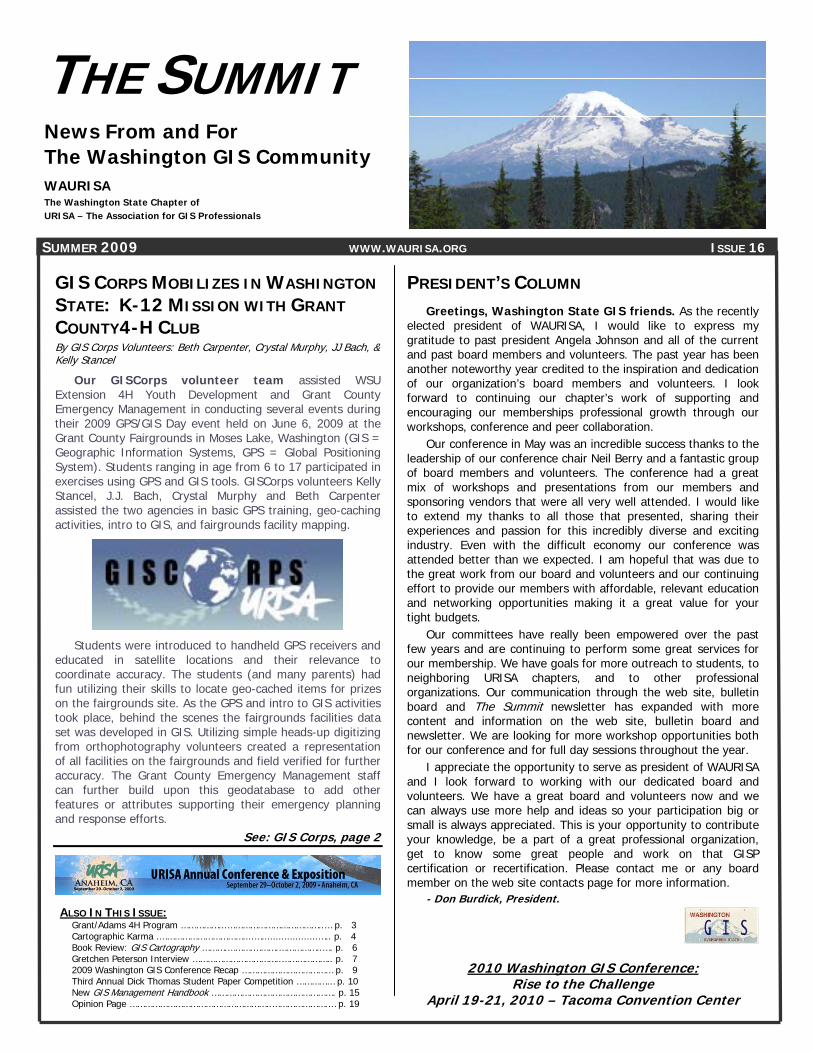
THE SUMMIT News From and For The Washington GIS Community WAURISA The Washington State Chapter of URISA – The Association for GIS Professionals
SUMMER 2009 WWW.WAURISA.ORG ISSUE 16 ALSO IN THIS ISSUE:
Grant/Adams 4H Program ……………...………………………………..… p. 3 Cartographic Karma .……………………………....…....................….. p. 4 Book Review: GIS Cartography ……….……….……….……………..…. p. 6 Gretchen Peterson Interview ……………………………..……………….. p. 7 2009 Washington GIS Conference Recap ……………………………… p. 9 Third Annual Dick Thomas Student Paper Competition …………… p. 10 New GIS Management Handbook …………………………………………. p. 15 Opinion Page ………………………………………………..………………….… p. 19
GIS CORPS MOBILIZES IN WASHINGTON STATE: K-12 MISSION WITH GRANT COUNTY4-H CLUB By GIS Corps Volunteers: Beth Carpenter, Crystal Murphy, JJ Bach, & Kelly Stancel
Our GISCorps volunteer team assisted WSU Extension 4H Youth Development and Grant County Emergency Management in conducting several events during their 2009 GPS/GIS Day event held on June 6, 2009 at the Grant County Fairgrounds in Moses Lake, Washington (GIS = Geographic Information Systems, GPS = Global Positioning System). Students ranging in age from 6 to 17 participated in exercises using GPS and GIS tools. GISCorps volunteers Kelly Stancel, J.J. Bach, Crystal Murphy and Beth Carpenter assisted the two agencies in basic GPS training, geo-caching activities, intro to GIS, and fairgrounds facility mapping.
Students were introduced to handheld GPS receivers and educated in satellite locations and their relevance to coordinate accuracy. The students (and many parents) had fun utilizing their skills to locate geo-cached items for prizes on the fairgrounds site. As the GPS and intro to GIS activities took place, behind the scenes the fairgrounds facilities data set was developed in GIS. Utilizing simple heads-up digitizing from orthophotography volunteers created a representation of all facilities on the fairgrounds and field verified for further accuracy. The Grant County Emergency Management staff can further build upon this geodatabase to add other features or attributes supporting their emergency planning and response efforts.
See: GIS Corps, page 2
PRESIDENT’S COLUMN Greetings, Washington State GIS friends. As the recently
elected president of WAURISA, I would like to express my gratitude to past president Angela Johnson and all of the current and past board members and volunteers. The past year has been another noteworthy year credited to the inspiration and dedication of our organization’s board members and volunteers. I look forward to continuing our chapter’s work of supporting and encouraging our memberships professional growth through our workshops, conference and peer collaboration.
Our conference in May was an incredible success thanks to the leadership of our conference chair Neil Berry and a fantastic group of board members and volunteers. The conference had a great mix of workshops and presentations from our members and sponsoring vendors that were all very well attended. I would like to extend my thanks to all those that presented, sharing their experiences and passion for this incredibly diverse and exciting industry. Even with the difficult economy our conference was attended better than we expected. I am hopeful that was due to the great work from our board and volunteers and our continuing effort to provide our members with affordable, relevant education and networking opportunities making it a great value for your tight budgets.
Our committees have really been empowered over the past few years and are continuing to perform some great services for our membership. We have goals for more outreach to students, to neighboring URISA chapters, and to other professional organizations. Our communication through the web site, bulletin board and The Summit newsletter has expanded with more content and information on the web site, bulletin board and newsletter. We are looking for more workshop opportunities both for our conference and for full day sessions throughout the year.
I appreciate the opportunity to serve as president of WAURISA and I look forward to working with our dedicated board and volunteers. We have a great board and volunteers now and we can always use more help and ideas so your participation big or small is always appreciated. This is your opportunity to contribute your knowledge, be a part of a great professional organization, get to know some great people and work on that GISP certification or recertification. Please contact me or any board member on the web site contacts page for more information.
- Don Burdick, President.
2010 Washington GIS Conference: Rise to the Challenge
April 19-21, 2010 – Tacoma Convention Center

THE SUMMIT 2 SUMMER 2009
GIS CORPS Continued from page 1
Figure 1: Hands-on GPS/Geocaching Field Exercise - GISCorps Volunteer, Kelly Stancel, working with students on a variety of handheld
recreational and vehicle navigation GPS receivers.
“Community engagement is pivotal in informing and educating others about the GIS field.” - Kelly Stancel, GIS Analyst, Seattle Public Schools
Figure 2: Fairgrounds Facility Mapping – Student digitizing building footprints from aerial imagery, GISCorps team member Crystal Murphy
assists.
”Opportunities like this to share my expert GIS advice and offer all parties involved a new perspective of the GIS technology. The usability that ESRI products provide for many areas of research and design are infinite.” - Crystal Murphy, GIS Analyst; King County GIS Center
Figure 3: ArcGIS Exercise, Intro to GIS – Students learning GIS on laptops inside Grant County Emergency Mgmt. office.
J.J. Bach/GISCorps (standing) and Jennifer Merrill/WSU Extension 4H Youth Development (near whiteboard).
“I am glad that I decided to volunteer for this opportunity because it was a great experience to be able to work hands-on in the field with the GIS/GPS technologies and at the same time teach others to use the technology.” - J.J. Bach, GIS Analyst, Seattle Public Schools
Figure 4: Fairground Facilities Mapping – GISCorps team members Crystal Murphy (left) and Beth Carpenter (right) after field verification
of building locations on fairgrounds “I enjoyed donating my time and talent – especially for a project that will help the community and become a basis for county emergency management datasets. Having the current software and equipment made this project run smoothly. Our team was able to quickly apply our skills toward the project work immediately. The organizing staff on this project were so great to work with, very helpful and supportive of our ideas.” - Beth Carpenter, GISP - GIS Coordinator/City of Sammamish, WA
THE SUMMIT 3 SUMMER 2009
Older youth joined in the GISCorps team to work on preparing the basics for the mapping project. A small group of older youth joined Carey Roos with a video production of the day exhibiting yet another form of technology.
Jennifer Merrill, 4-H Leader, conducted a lesson using laptops and ArcView (GIS Program) while newly trained parents collected waypoints for data entry. These waypoints were then entered into the system allowing a map to be generated of the Grant County Fairgrounds.
Due to the efforts of the day, Grant County now has a modern technological map of the Grant County Fairgrounds for emergency preparedness, and those attending increased their technological background.
The inclusion of GIS at the club level helped prepare the youth in Grant/Adams Area for higher education and employment in the fields of science and engineering. With valuable skills learned through the 4-H program, youth discovered new interest and professional goals. They also learned the value of serving others through community service with the Grant County Emergency Management team.
A pre and post evaluation was conducted at the GPS/GPS Day revealing positive gains from both youth and adults.
Grant County Fairgrounds
GISCORPS GISCorps started life in October 2003 in Atlanta, Georgia, when the URISA Board unanimously approved it as an initiative of URISA. This happened after an intensive summer of brainstorming, conceptualizing and a lot of hard work required to translate an idea into a well designed proposal. GISCorps is now a URISA program and operates entirely on a volunteer basis. The core committee members, most of whom are themselves GISCorps volunteers, run the program with administrative help from the staff at URISA. They reside in different states across the United States and Canada and use a wiki site to work collaboratively, mostly at nights and on weekends. For more information, to volunteer, or to donate, see: www.giscorps.org
GRANT/ADAMS AREA 4-H PROGRAM MAKES A DIFFERENCE IN THE COMMUNITY By Diane Russo, WSU Extension
The Grant/Adams Area 4-H program received a grant from ESRI which included GIS software and licensing to assist in adding our state and county for emergency preparedness. The Grant County Fairgrounds has been deemed the statewide emergency relief zone for a catastrophic event as it is centrally located and has excellent air and ground transportation possibilities.
Our goal for the GPS/GIS Day was to learn about GPS by geocaching and collecting waypoints at the fairgrounds, which would then be transferred to the GIS software for mapping all of the sites on the fairgrounds for future emergency preparedness.
Our GPS/GIS Day was posted on the national ESRI site, which spurred interest to an international group called GISCorps, who contacted me with the intent to send volunteers to help us. It was wonderful as we did get four volunteer from GISCorps.
GISCorps (www.giscorps.org) coordinates short-term, volunteer GIS services to communities worldwide. Begun in 2003 with a primary focus on humanitarian efforts, GISCorps has expanded its projects to include local educational support. These educational efforts are seen as an integral part of its mission to improve the quality of life on our planet. GISCorps services support humanitarian relief, community development, local capacity building, health and education. Since its inception in October of 2003, the Corps has attracted hundreds of volunteers from over 67 countries. To date, GISCorps has deployed over 137 volunteers to 51 missions. These volunteers have contributed over 7,100 working hours in emergency and non-emergency response missions including several K-12 projects in the United States, Latin America, Asia, Eastern Europe, and Africa.
Collaborating on the project was Diane Russo, WSU Extension 4-H Youth Development, Megan Smith, Grant County GIS Coordinator, Mike Shannon and Sam Lorenz, Grant County Emergency Management Preparedness, Jennifer Merrill, 4-H Leader, Carey Roos, Operation Military Kids and the GISCorps Team (Beth Carpenter, Kelly Stancel, Crystal Murphy, and J.J. Bach).
Learning GPS The morning began with geocaching fun practicing on the
GPS units. Youth and adults gathered around to learn as this was new technology for most of them. Each team was sent out to find the treasures and return for a prize. The youth were great learners as well as teacher. Soon they were teaching their parents who later helped collect waypoints for mapping.

THE SUMMIT 4 SUMMER 2009
CARTOGRAPHIC KARMA ON PUBLIC TRANSPORTATION By Lisa Castle
Commute by bus long enough and you see things. The
route I take runs from the Seattle suburbs where I live, to theKCGIS Center downtown, where I work as a GIS programmer. It’s anice quiet route with nice quiet commuters -- in the morning, we’remostly still half-asleep, and in the afternoon, we’re mostly ... well,brain-dead.
It’s a commuter bus, but it’s still public transportation. So whensome random guy gets on at a downtown stop one afternoon,plops down in the seat behind one of the regulars and says loudly,“Hey, check this out!” most of us know better than to look.
Okay, I know what you’re thinking. This isn’t that sort of horror story.
The guy pulled something out of his coat pocket, unfolded it,and said, “I got these maps. See?” That got my attention. I wassitting across the aisle a couple rows back and saw that it was notjust a map, it was an old map.
“I’m looking to see if I can get something for these,” the guysaid. He foisted the map onto the regular in front of him and pulledout another one, unfolded it and waved it in the general vicinity ofanother regular.
“Uh,” said the second regular, his brain slowly resurrectingitself. “Have you tried Metsker’s?”
“What’s that?” We filled him in about Metsker’s, the iconic Seattle map store,
located -- after some discussion -- in iconic Pike Place Market. Inthe meantime, he’d pulled out a third map. “Can I see that?” Iasked.
He handed it across the aisle, explaining that he’d found a boxof these old maps in his grandfather’s attic, that he was looking toget someone to give him something for them, maybe five dollarseach, that he was heading over to visit his son in the suburbs. “Idon’t know about that place -- what did you call it?” he said. “I’mjust looking for someone to give me maybe a little cash.”
I examined the map as he talked. 1800’s vintage, Rand McNally& Co. The Washington Territory. “Full Postal Directions, Railroads inthe Territory, Counties, Lakes, Rivers, Etc., Etc.,” the coverproclaimed. He found this in an attic? And he’s got more? Why didn’t he bring them all?
“You should try the Seattle Historical Society,” someone said, asI carefully folded the map and handed it back. I gestured to seethe next one, and he handed it to me.
“Nah, I don’t know about that,” the guy said dubiously. “I justwanna -- you know, get five bucks for each. No big deal.” He pulledout his wallet and opened it. “See? This is my son. I’m visiting himin the suburbs.” I glanced. Cute kid.
The guy pulled something out of his coat pocket, unfolded it, and said, “I
got these maps. See?”
Rand McNally ‘Washington Territory’ Map A couple of the regulars discussed the Historical Society;
a couple others had lost interest and rebuilt their personal Fortresses of Solitude. I examined the map in my hands. This one was fragile, 1910 Political Map of Seattle. It looked almost like a blueprint, its folds reinforced with white tape, which had cracked and split.
Then the light hit it just right and I saw the perforated mark. “Seattle Public Library.”
“Hey,” I said. “This one came from the Seattle Library.” Hadn’t he gotten on at the stop in front of the library?
“Oh, uh, yeah. I tried to sell these back to them, but they didn’t want them. Something about not having cash or buying over the counter or buying back their own stuff. They said these maps were, um, released.”
Yeah, I thought. That’s the ticket. I handed back the blue map, took the third, and as I did
so, glanced across the aisle at the first regular. He rolled his eyes. This guy is a nutjob.
See: Cartographic Karma, page 5

THE SUMMIT 5 SUMMER 2009
1910 Political Map of Seattle
I called the library when I got home, and after explaining my story once or twice, talked to Steve in Historical Collections. He was very interested -- of course -- and said that without seeing the maps, couldn’t tell if they’d been “released,” as the guy had claimed. We were both dubious. We talked about security versus accessibility, and how SPL tended toward the latter, despite the fact that items were more likely to walk off.
I gave him the guy’s description in case he tried it again, and promised to bring the maps in as soon as I could -- probably later that week or the next.
The next day -- a Friday -- I took them in to work and had a bit of show and tell with some of my coworkers. We managed not to pet them too hard.
I didn’t take the maps back that week, or the next. Life sort of got in the way, and it was over a month before I could get to the library.
On an overcast May afternoon, I rode the elevator to the ninth floor of the Seattle Library. I waited my turn at the Historical Research desk, then stepped up. “Hi, I talked to Steve awhile back. I think I have something of yours.” I hitched a breath to finish my explanation, but the gal cut me off.
“The maps!” she said. I nodded. “We are really glad to see you! Come on back!”
Jodee explained that because of what had happened, they had gathered all the maps and other small items in the collection and placed them under lock and key. They were still available to see, but now they’d be much safer from ne’er-do-wells.
I handed the maps back to their rightful owners, and we wondered. With all those buses passing by -- literally nose-to-tail in rush hour along 4th Ave. -- what were the chances that the guy would randomly choose a bus with a map person on it?
We chatted for awhile longer, then I exited the library just as my last bus home pulled up to its stop. I sprinted and jumped on just before the doors closed, and as I sat down, I checked around for nutjobs with illicit maps.
Lisa Castle is a Senior GIS Programmer at the King County GIS Center
CARTOGRAPHIC KARMA Continued from page 2
This map was large, paper on fabric. “Map of the OregonDistricts and the Adjacent Country. James Wyld, Geographer to theQueen, Charing Cross East, London.” 1843. Delicate red and greenand blue shading outlined the various regions. It too, had a SeattlePublic Library mark and penciled call number.
By now the rest of the regulars had lost interest. They had beenunable to convince him of the merits of Metsker’s or the HistoricalSociety. “I’m just looking for someone to give me a little cash forthese.”
Right. You said that. Okay, I’ll bite. “These are pretty cool,” Isaid. “I might be interested.”
“I’ll give you all three for ten bucks,” he said. “Done.” I handed him a ten, he handed me the maps. “Great!” He grinned, stood. We pulled up at the last stop before
the interstate. The door sucked open, and the guy got off. “I thought he was visiting his son,” said the driver. “I think you just got scammed,” said one of the regulars.
James Wyld’s 1843 ‘Oregon District’ Map

THE SUMMIT 6 SUMMER 2009
BOOK REVIEW
GIS CARTOGRAPHY: A GUIDE TO EFFECTIVE MAP DESIGN by Gretchen N. Peterson Boca Raton, FL: CRC Press, Taylor & Francis Group, 2009. REVIEWED BY EADIE KALTENBACHER, GISP Summit Editor
Gretchen Peterson, a GIS professional in our very own corner
of the world, has authored her first book. Titled GIS Cartography: A Guide to Effective Map Design, it offers advice on the various aspects of GIS map design. Gretchen runs her own GIS consulting company near Poulsbo, and her book includes many examples of local GIS work.
The content of GIS Cartography is written in a casual style,
and the content is as straightforward as the title. GISers (as she refers to GIS professionals) will appreciate her common-sense advice and generous quantities of graphics and illustrations. Geared towards GISers beginning their careers, this book is also appropriate for seasoned GISers who have an interest in map design. The book is divided into five sections corresponding to the main components of map design (Layout Design, Fonts, Color, Features, and Media) and can easily be read out-of-order for those that are more interested in one section than another.
While reading this book, my first impression was that
much of Gretchen’s advice seemed overly simplistic. But once I finished the book, I began noticing an astonishingly large volume of maps that did not follow her advice, and I could easily see where they could be improved. Even more surprisingly, I noticed that some of those maps were mine! GIS Cartography features examples of professional-looking maps and color swatches. It also includes in-depth examples of good design for specific disciplines, such as symbolizing fault lines on geology maps or wind measurements on weather maps. Gretchen even conducted her own experiments to determine which type size works best at various viewing distances, and presents charts of her results for some common fonts.
Once I finished the book, I began
noticing an astonishingly large volume of maps that did not follow her advice, and I could easily see where they could be improved.
I found that a major theme of GIS Cartography was
balance. Ranging from organizing map elements on a layout to placing labels in relation to features, an essential element of good map design is achieving a pleasing balance. In addition to visual balance, Gretchen notes that for a map to communicate its message, it must strike a balance between eye-catching interest (complexity) and clarity (simplicity). She also emphasizes the importance of balancing conventions and standards with the GISer’s own creativity. An oft-stressed point is to strive for creativity and novel solutions, but also be able to justify any departures from audience expectations. Gretchen also notes that the balancing point will differ depending on your audience; for example, GISers must take into account whether they are targeting potential clients or scientists, whether they are presenting maps in a slideshow or a report, and much more.
I would recommend this book to any GISer who is willing to take some time to learn about map design. You will certainly discover many tips and tricks to make your maps look more professional, and you may break some bad habits you didn’t even know you had. GIS Cartography: A Guide to Effective Map Design is available through Gretchen’s website (www.gretchenpeterson.com) at a cost of $77.60. The website also has a free poster with helpful design tips available for download. Eadie Kaltenbacher: [email protected]
THE SUMMIT 7 SUMMER 2009
When asked for final thoughts, Gretchen had this advice to give: “Maps are an abstraction of reality, but as a mapmakeryou need to understand the reality that your data represents.Know your data.”
Gretchen will be leaving the area this summer to move back to Colorado, but she will continue to operate PetersonGIS and work with her clients in Washington. We wish her well onher journey! Eadie Kaltenbacher: [email protected]
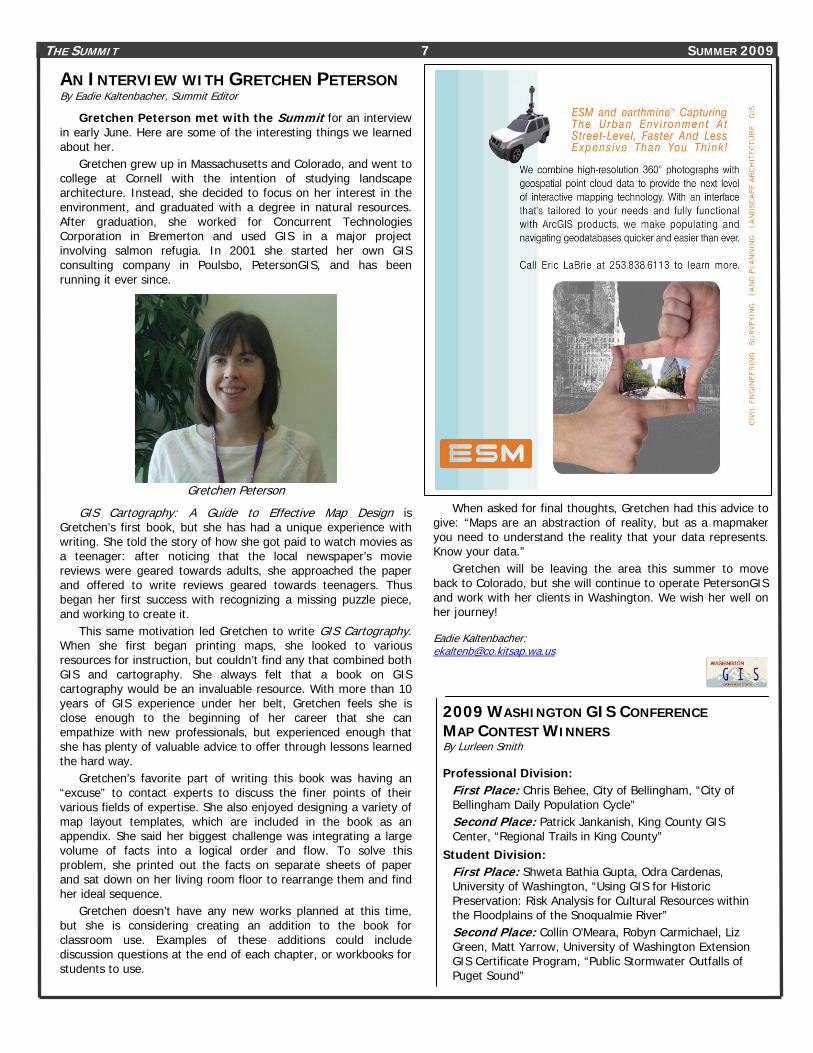
AN INTERVIEW WITH GRETCHEN PETERSON By Eadie Kaltenbacher, Summit Editor
Gretchen Peterson met with the Summit for an interview in early June. Here are some of the interesting things we learned about her.
Gretchen grew up in Massachusetts and Colorado, and went to college at Cornell with the intention of studying landscape architecture. Instead, she decided to focus on her interest in the environment, and graduated with a degree in natural resources. After graduation, she worked for Concurrent Technologies Corporation in Bremerton and used GIS in a major project involving salmon refugia. In 2001 she started her own GIS consulting company in Poulsbo, PetersonGIS, and has been running it ever since.
Gretchen Peterson
GIS Cartography: A Guide to Effective Map Design is Gretchen’s first book, but she has had a unique experience with writing. She told the story of how she got paid to watch movies as a teenager: after noticing that the local newspaper’s movie reviews were geared towards adults, she approached the paper and offered to write reviews geared towards teenagers. Thus began her first success with recognizing a missing puzzle piece, and working to create it.
This same motivation led Gretchen to write GIS Cartography. When she first began printing maps, she looked to various resources for instruction, but couldn’t find any that combined both GIS and cartography. She always felt that a book on GIS cartography would be an invaluable resource. With more than 10 years of GIS experience under her belt, Gretchen feels she is close enough to the beginning of her career that she can empathize with new professionals, but experienced enough that she has plenty of valuable advice to offer through lessons learned the hard way.
Gretchen’s favorite part of writing this book was having an “excuse” to contact experts to discuss the finer points of their various fields of expertise. She also enjoyed designing a variety of map layout templates, which are included in the book as an appendix. She said her biggest challenge was integrating a large volume of facts into a logical order and flow. To solve this problem, she printed out the facts on separate sheets of paper and sat down on her living room floor to rearrange them and find her ideal sequence.
Gretchen doesn’t have any new works planned at this time, but she is considering creating an addition to the book for classroom use. Examples of these additions could include discussion questions at the end of each chapter, or workbooks for students to use.
2009 WASHINGTON GIS CONFERENCE MAP CONTEST WINNERS By Lurleen Smith Professional Division:
First Place: Chris Behee, City of Bellingham, “City of Bellingham Daily Population Cycle” Second Place: Patrick Jankanish, King County GIS Center, “Regional Trails in King County”
Student Division: First Place: Shweta Bathia Gupta, Odra Cardenas, University of Washington, “Using GIS for Historic Preservation: Risk Analysis for Cultural Resources within the Floodplains of the Snoqualmie River” Second Place: Collin O’Meara, Robyn Carmichael, Liz Green, Matt Yarrow, University of Washington Extension GIS Certificate Program, “Public Stormwater Outfalls of Puget Sound”

THE SUMMIT 8 SUMMER 2009
2009 WAURISA BOARD ELECTION RESULTS Election of WAURISA officers and board members took place during the 2009 Washington GIS Conference in Bellevue. The following officers and board members were elected:
• President: Don Burdick • Vice President: Greg Babinski • Secretary: Karl Johansen • Treasurer: Steve Schunzel (one year term) • Board Member: Neil Berry • Board Member: Whitney K. Bowerman • Board Member: Donna Wendt • Board Member: Cort Daniel (one year term)
Angela Johnson assumed a two year term as Past-President.
WAURISA Board of Directors Position Name Term President Don Burdick 2009-2011 Vice President Greg Babinski 2009-2011 Secretary Karl Johansen 2009-2011 Treasurer Steve Schunzel 2009-2010 Past President Angela Johnson 2009-2011 BOD Member Neil Berry 2009-2011 BOD Member Heather Glock 2008-2010 BOD Member Whitney Bowerman 2009-2011 BOD Member Cort Daniel 2009-2010 BOD Member Amanda Taub 2008-2010 BOD Member Donna Wendt 2009-2011
THE SUMMIT 9 SUMMER 2009
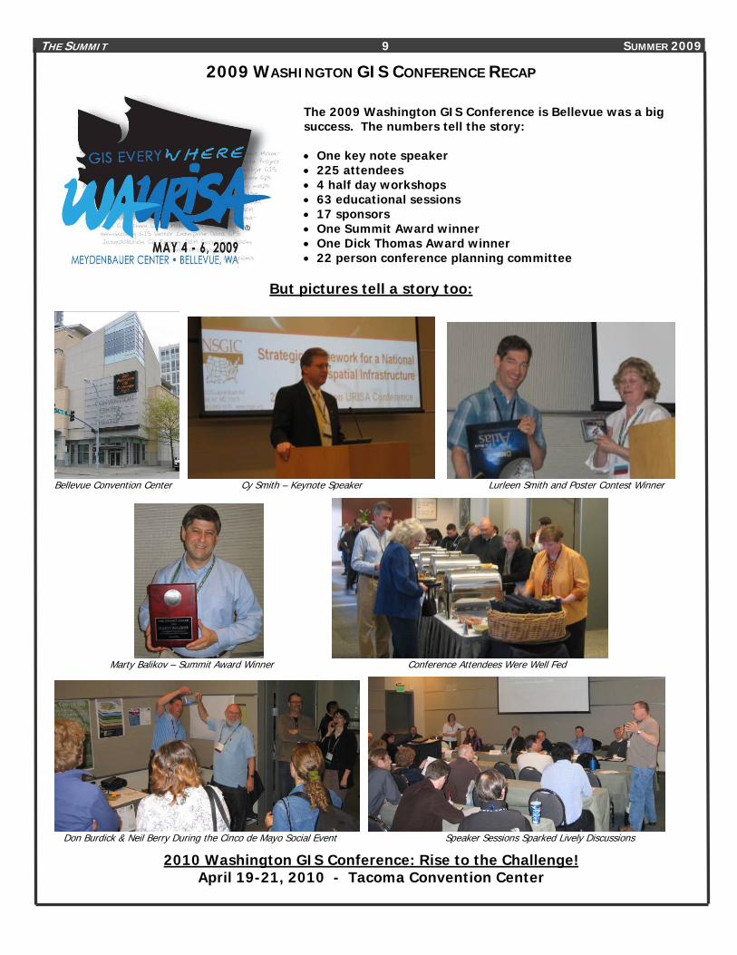
2009 WASHINGTON GIS CONFERENCE RECAP
But pictures tell a story too:
Bellevue Convention Center Cy Smith – Keynote Speaker Lurleen Smith and Poster Contest Winner
Marty Balikov – Summit Award Winner Conference Attendees Were Well Fed
Don Burdick & Neil Berry During the Cinco de Mayo Social Event Speaker Sessions Sparked Lively Discussions
2010 Washington GIS Conference: Rise to the Challenge! April 19-21, 2010 - Tacoma Convention Center
The 2009 Washington GIS Conference is Bellevue was a big success. The numbers tell the story: • One key note speaker • 225 attendees • 4 half day workshops • 63 educational sessions • 17 sponsors • One Summit Award winner • One Dick Thomas Award winner • 22 person conference planning committee
THE SUMMIT 10 SUMMER 2009
THIRD ANNUAL DICK THOMAS MEMORIAL STUDENT PRESENTATION COMPETITION & AWARD AT THE 2009 WASHINGTON GIS CONFERENCE By Amanda Taub, GISP
The third annual Dick Thomas Memorial Award competition was held on May 6, 2009 at this year’s Washington GIS Conference (May 4 – 6, 2009) at the Meydenbauer Center in Bellevue. WAURISA established this award to honor Washington State GIS pioneer and mentor, Richard ‘Dick’ Thomas by continuing his work of encouraging students to excel in their studies and transition successfully into GIS careers.
WAURISA’s goal is to inspire students to present their original work related to GIS, geography, or geographic research in Washington State at the annual Washington GIS Conference. The competition comprised of two parts: the first was the selection of five (5) abstracts by the WAURISA Student Presentation Competition Committee. The second part was the judging of the 5 selected presentations during the Student Presentation Session at the 2009 Washington GIS Conference. Abstracts used a maximum of 250 words to describe the proposed presentations. The presentations were limited to 25 minutes, with an additional 5 minutes for questions.
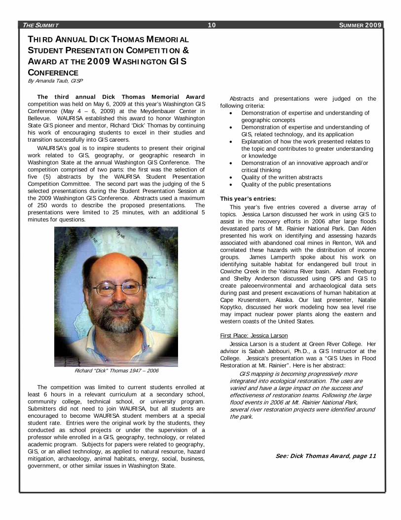
Richard “Dick” Thomas 1947 – 2006
The competition was limited to current students enrolled at
least 6 hours in a relevant curriculum at a secondary school, community college, technical school, or university program. Submitters did not need to join WAURISA, but all students are encouraged to become WAURISA student members at a special student rate. Entries were the original work by the students, they conducted as school projects or under the supervision of a professor while enrolled in a GIS, geography, technology, or related academic program. Subjects for papers were related to geography, GIS, or an allied technology, as applied to natural resource, hazard mitigation, archaeology, animal habitats, energy, social, business, government, or other similar issues in Washington State.
Abstracts and presentations were judged on the following criteria:
• Demonstration of expertise and understanding of geographic concepts
• Demonstration of expertise and understanding of GIS, related technology, and its application
• Explanation of how the work presented relates to the topic and contributes to greater understanding or knowledge
• Demonstration of an innovative approach and/or critical thinking
• Quality of the written abstracts • Quality of the public presentations
This year’s entries:
This year’s five entries covered a diverse array of topics. Jessica Larson discussed her work in using GIS to assist in the recovery efforts in 2006 after large floods devastated parts of Mt. Rainier National Park. Dan Alden presented his work on identifying and assessing hazards associated with abandoned coal mines in Renton, WA and correlated these hazards with the distribution of income groups. James Lamperth spoke about his work on identifying suitable habitat for endangered bull trout in Cowiche Creek in the Yakima River basin. Adam Freeburg and Shelby Anderson discussed using GPS and GIS to create paleoenvironmental and archaeological data sets during past and present excavations of human habitation at Cape Krusenstern, Alaska. Our last presenter, Natalie Kopytko, discussed her work modeling how sea level rise may impact nuclear power plants along the eastern and western coasts of the United States. First Place: Jessica Larson
Jessica Larson is a student at Green River College. Her advisor is Sabah Jabbouri, Ph.D., a GIS Instructor at the College. Jessica’s presentation was a “GIS Uses in Flood Restoration at Mt. Rainier”. Here is her abstract:
GIS mapping is becoming progressively more integrated into ecological restoration. The uses are varied and have a large impact on the success and effectiveness of restoration teams. Following the large flood events in 2006 at Mt. Rainier National Park, several river restoration projects were identified around the park.
See: Dick Thomas Award, page 11

THE SUMMIT 11 SUMMER 2009
DICK THOMAS AWARD Continued from page 10
Invasive species removal, site stabilization, and plantings/salvage were all priorities. GIS was incorporated in all aspects of the restoration. GPS collection of invasive species was used to complement the existing Access database and aid in herbicide application. All fifteen major flood restoration sites were mapped, including both structural and vegetative components. Vector and raster data was combined to create site maps for field use and department analysis.
The information contained in the maps will be used to monitor the effectiveness of the restoration efforts and will provide precise archival information to staff. This is critical due to the temporary and transitive nature of national park staff. In addition to restoration site mapping, the Park supplied data for river flood risk analysis. Using this most up to date LIDAR data, flood inundation of Mt. Rainier’s Carbon River was analyzed using ArcHydro and Hec-GeoRAS as modeling tools.
The methodology used for the Carbon River will be streamlined and given to the Park for use on all rivers. The continued use of the restoration site maps and integration of park wide flood risk map can be used by multiple departments within the Park to create a more informed and comprehensive park plan in the future.
As 2009 Dick Thomas Award winner, Jessica received: • Dick Thomas Award Plaque • $1000 cash • 2009 Washington GIS Conference t-shirt • One year membership in WAURISA • Free registration to the 2010 Washington GIS Conference • Publication of her paper in The Summit
Jessica Larson (A. Taub photo)
Second Place: Dan Alden
Dan Alden, with Green River College, presented “Income Distribution in Coal Mine Hazard Areas: Renton, WA”. His advisor is Sabah Jabbouri, Ph.D., a GIS Instructor at the College. Here is Dan’s abstract:
Coal mining was active in the Renton, WA vicinity until 1933 and contributed to the development of Renton as an industrial center. Relict coal mines are present within the Renton city limits.
Before 1982, however, development on property above old coal mines was not considered in city zoning practices. The City of Renton has defined specific locales as coal mine hazard areas. These areas have an elevated risk of void collapse, ground subsidence, or noxious gasses associated with the abandoned mine workings. Of particular danger are areas with abandoned or improperly sealed openings and areas underlain by mine workings less than 200 feet in depth.
In 1984, the State of Washington contracted with the Morrison-Knudsen Company Mining Group to conduct an Abandoned Mine Study Engineering Investigation of the Renton vicinity. Detailed maps of the extent of the mine workings and associated problem areas were included with the final report. This information, however, is presently only available in analog format.
This project will scan and georeference the Morrison-Knudsen maps and digitize features relevant to identification of High Coal Mine Hazard Areas, including mine entrances, tunnels, and depth of coal seams below surface. These features will then be overlain on LiDAR datasets and historic air photos in order to pinpoint previously unidentified hazard areas. Office of Financial Management demographic data will be correlated with identified problem areas and spatial distribution of income groups will be part of the final analysis.
Dan received: • Dick Thomas Second Place Award Certificate • $300 cash • 2009 Washington GIS Conference t-shirt • One year membership in WAURISA • Free registration to 2010 Washington GIS Conference
Dan Alden Receives $300 Check From Amanda Taub
(M. Balikov photo)
See: Dick Thomas Award, page 12
THE SUMMIT 12 SUMMER 2009
DICK THOMAS AWARD Continued from page 11 Third Place: James Lamperth
James Lamperth is a student at Central Washington University in Ellensburg. His advisor is Dr. Nancy Hultquist. James’ presentation was on “Are Bull Trout Present in Cowiche Creek, WA?: A Spatial Model Predicting Suitable Habitat”. Here is his abstract:
Bull trout (Salvelinus confluentus) are listed as threatened under the Endangered Species Act requiring managing agencies to monitor population status. Bull trout often occur in remote, high elevation areas making monitoring activities logistically difficult. Models identifying suitable habitat patches can help focus monitoring efforts. Although the locations of most bull trout populations are known throughout the Yakima River basin, uncertainty remains regarding its occurrence in some streams, particularly Cowiche Creek.
The objective of this study was to identify the quantity of suitable habitat in Cowiche Creek using tools available in ArcGIS 9.3 to infer the probability of bull trout occurrence in this catchment. Maximum daily stream temperature (MDST), stream gradient, and percent stream canopy cover were selected as predictive suitable habitat characteristics. ArcHydro 9.0 and Spatial Analyst tools were used to identify stream gradient and canopy cover values at the pixel resolution along the length of the study stream. MDST was estimated for each pixel by entering a linear regression equation into Map Algebra. The equation was derived from stream temperature data collected at a nearby stream with elevation as the predictor variable.
A workflow was created and all tools were executed using ModelBuilder. Habitat variables were reclassified to suitability ranks based on published literature and the ranked data sets were added together to determine suitable habitat. This model identifies approximately 9.3 km of high quality suitable bull trout habitat in the Cowiche Creek watershed, less than the minimum habitat necessary to support a bull trout population. James’ received: • Dick Thomas Third Place Award Certificate • $200 cash • 2009 Washington GIS Conference t-shirt • One year membership in WAURISA
James Lamperth Receives Award from Amanda Taub
See: Dick Thomas Award, page 13
THE SUMMIT 13 SUMMER 2009
DICK THOMAS AWARD Continued from page 12 Honorable Mention: Adam Freeburg and Shelby Anderson
Adam Freeburg and Shelby Anderson, are graduate students in the Dept. of Anthropology at the University of Washington in Seattle. They presented their work on “Building High Resolution Paleoenviron-mental and Archaeological Data Sets: Application of GPS and GIS Technology at Cape Krusenstern, Alaska”. Ben Fitzhugh, Associate Professor of Anthropology, was their instructor and advisor for their work. Here is their abstract:
For over 4,000 years, a unique and complex paleoenvironmental and archaeological record has accumulated at the beach ridge complex of Cape Krusenstern, preserving evidence of the dynamic interaction between people and the environment in Northwest Alaska. The University of Washington and the National Park Service are studying these interactions through a collaborative interdisciplinary project with the immediate goal of developing and synthesizing high resolution archaeological and paleoenvironmental data sets.
Previous research at the Cape has established a strong chronological foundation and has also outlined the problems with correlating archaeological and paleoenvironmental data across the beach ridge complex. Accurate spatial data, when integrated into GIS, provide the platform needed to study human-environmental dynamics. Here we illustrate the utility of employing highly accurate GPS technology to archaeological problems with data from our current project at Cape Krusenstern.
Specifically, we focus on the incorporation of legacy data and its implication for the results of current analyses. The rubbersheeting and georeferencing maps and aerial photos from the original archaeological investigations performed here from 1958 to 1961, as well as archival research, allows spatial and attribute data not available in publication to be incorporated into spatial analyses of the current project. This not only allows a window into past research, but also permits a significant reevaluation of human and environmental dynamics of the prehistoric Northwest Alaskan coast.
Honorable Mention: Natalie Kopytko
Natalie Kopytko is a student at Evergreen State College. Her advisor is John Perkins, Ph.D., an emeritus professor at the College. Natalie’s presentation was “Sea Level Rise at Nuclear Power Plants in the United States”. Here is her abstract:
Climate change mitigation entails greater utilization of energy sources that do not emit greenhouse gases; however, adaptation to climate change must be addressed when selecting mitigation projects.
Extreme climate events impact energy supply; moreover, energy choices can impair the ability of natural and human systems to adapt to climate change.
Nuclear power requires large volumes of cooling water to operate making it vulnerable to climate change. Nuclear power plants are often located along the coast to take advantage of the ample water provided by the ocean, but sea level rise and storm surges threaten safe operation.
I input digital elevation models into the raster calculator in ArcGIS to model inundation from sea level rise for all nine coastal reactors within 2 miles of the Pacific and Atlantic oceans in the United States. In many coastal regions erosion processes pose a greater threat than inundation; therefore, I also considered coastal vulnerability data from the U.S. Geological Survey for those nine reactors.
Sea level rise models revealed that nuclear power plants in Florida are the most vulnerable to inundation followed by nuclear power plants in the northeast. Calvert Cliffs in Maryland has some flooding under the most severe conditions, while reactors in California are not threatened by inundation. However, San Onofre in California and Calvert Cliffs in Maryland received a high and very high ranking respectively according to the coastal vulnerability index. Therefore, development at these sites impedes the ability of natural and human systems to adapt to climate change.
I would like to thank everyone who helped with this year’s
Dick Thomas Student Award. Thanks to Jessica Larson, Dan Alden, James Lamperth, Adam Freeburg, Shelby Anderson and Natalie Kopytko, for the great work they shared with us. Every year the entries continue to improve.
I would like to thank the judges, Marty Balikov, Whitney Bowerman, and Rick Lortz.
Finally, I would like to thank the professors that encouraged their students to enter the competition. These presentations would not have happened without their support.
In the next few months, look for the announcement of the fourth annual Dick Thomas Student Paper Competition at the 2010 Washington GIS Conference. Amanda Taub, GISP WAURISA Outreach Committee Chair Dick Thomas Award Coordinator
________________________________________________________
2010 WASHINGTON GIS CONFERENCE: Rise to the Challenge
April 19-21, 2010 Tacoma Convention Center
THE SUMMIT 14 SUMMER 2009
URISA BOARD OF DIRECTORS ELECTION RESULTS ANNOUNCED August 12, 2009 (PARK RIDGE, IL) - URISA is pleased to announce the results of its 2009 Board of Directors Election. Cy Smith, GISP will become President-Elect of the association and Carl Anderson, GISP, David DiBiase, GISP and Twyla McDermott, GISP will begin their terms as members of the Board of Directors, at the close of URISA's 47th Annual Conference in Anaheim, California, September 29-October 2, 2009. Cy Smith is the Oregon Geographic Information Officer and member of the Oregon Geographic Information Council. He is Immediate Past-President of the National States Geographic Information Council (NSGIC) until September 2009. He is the Chair of the Coalition of Geospatial Organizations until September 2009. He served on the URISA Board of Directors, 2006-2008. He served as NSGIC Treasurer, 2001-2003. He served three years as a NSGIC representative on the GIS Certification Institute Board of Directors. He has worked in the geographic information field for 25 years. Cy was hired as the Oregon GIO in June 2000. The primary focus of the GIS effort in Oregon under his direction has been to enable and enhance the Oregon Enterprise Information Technology Strategy. As State GIO, he is responsible for coordinating the geographic information activities of all three branches of state government, regional and local government, and the academic community.
Three new directors were elected by the URISA membership to serve a three-year term on the URISA Board, also beginning in October. The three new Board members are: . Carl Anderson, GISP - Fulton County, Atlanta, Georgia . David DiBiase, GISP - Penn State University, University Park, Pennsylvania . Twyla McDermott, GISP - City of Charlotte, North Carolina At the close of URISA 2009 in Anaheim, the terms of service for these Board members will conclude: . Susan Johnson (Immediate Past President), Charlotte-Mecklenburg Schools, North Carolina . Jack (Al) Butler, GISP AICP, President, Butler & Butler LLC, Orlando, Florida . Juna Papajorgji, GISP, Alachua County, Florida . Geney Terry, GISP, El Dorado County, California We thank them, in advance, for their dedication and service to URISA and anticipate many more years of continued involvement. Wendy Nelson Executive Director - URISA [email protected] www.urisa.org 847-824-6300
THE SUMMIT 15 SUMMER 2009
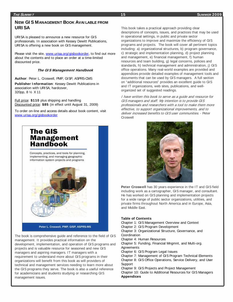
NEW GIS MANAGEMENT BOOK AVAILABLE FROM URISA URISA is pleased to announce a new resource for GIS professionals. In association with Kessey Dewitt Publications, URISA is offering a new book on GIS management. Please visit the site, www.urisa.org/gisbookorder, to find out more about the contents and to place an order at a time-limited discounted price.
The GIS Management Handbook
Author: Peter L. Croswell, PMP, GISP, ASPRS-CMS Publisher Information: Kessey Dewitt Publications in association with URISA, hardcover, 320pp, 8 ½ X 11 Full price: $110 plus shipping and handling Discounted price: $85 (in effect until August 31, 2009)
To order on-line and access details about book content, visit www.urisa.org/gisbookorder
The book is comprehensive guide and reference to the field of GIS management. It provides practical information on the development, implementation, and operation of GIS programs and projects and is valuable resource for seasoned and new GIS managers and aspiring managers. IT managers with a requirement to understand more about GIS programs in their organizations will benefit from this book as will providers of technical and management services needing to learn more about the GIS programs they serve. The book is also a useful reference for academicians and students studying or researching GIS management issues.
This book takes a practical approach providing clear descriptions of concepts, issues, and practices that may be used in operational settings, in public and private sector organizations to improve and maximize the efficiency of GIS programs and projects. The book will cover all pertinent topics including: a) organizational structures, b) program governance, c) strategic and implementation planning, d) project planning and management, e) financial management, f) human resources and team building, g) legal concerns, policies and standards, h) technical management and administration, j) GIS office operations. Many real-world examples are provided and appendices provide detailed examples of management tools and documents that can be used by GIS managers. A full section on “additional resources” provides an excellent guide to GIS and IT organizations, web sites, publications, and well-organized set of suggested readings.
I have written this book to serve as a guide and resource for GIS managers and staff. My intention is to provide GIS professionals and researchers with a tool to make them more effective, to support organizational improvements, and to deliver increased benefits to GIS user communities. - Peter Croswell
Peter Croswell has 30 years experience in the IT and GIS field including work as a cartographer, GIS manager, and consultant. He has worked on GIS planning and implementation projects for a wide range of public sector organizations, utilities, and private firms throughout North America and in Europe, Asia, and Middle East.
Table of Contents Chapter 1: GIS Management Overview and Context Chapter 2: GIS Program Development Chapter 3: Organizational Structure, Governance, and Coordination Chapter 4: Human Resources Chapter 5: Funding, Financial Mngmnt, and Multi-org. Agreements Chapter 6: GIS Program Legal Issues Chapter 7: Management of GIS Program Technical Elements Chapter 8: GIS Office Operations, Service Delivery, and User Support Chapter 9: GIS Projects and Project Management Chapter 10: Guide to Additional Resources for GIS Managers Appendices

THE SUMMIT 16 SUMMER 2009
2009 ANNUAL URISA CONFERENCE & EXPOSITION
This is No Time for Business As Usual
URISA's 47th Annual Conference & Exposition
The Premier Conference for the GIS Professional About the Conference Today's GIS Professionals have to accomplish more with fewer resources and less support. Budgets are tight and resources are scarce. The 2009 URISA Annual Conference is focused on delivering solutions to your challenges. Choose URISA in Anaheim to learn from and connect with the leaders in the community!
URISA Certified Preconference Workshops – included with registration! GIS Strategic Planning Crime Mapping & Analysis Field Automation and Mobile GIS Introduction to Agile: Project Management & Development An Overview of Open Source GIS Software LIDAR Concepts, Principals and Applications 3D Geospatial Cartography and Map Design
Peer Presentations within these Program Tracks: GIS for Best-Managed Communities GIS for Growing Communities GIS for Safe Communities GIS for Educated Communities GIS for Healthy Communities Professional Development & GIS Leadership
Outstanding Sessions Opening Keynote Address - Dr. Barry Wellar, MCIP, GISP Interactive Issues Discussions – challenges & solutions! URISA Quick Hits – 7 minutes maximum – targeted & concise! Closing Plenary Session - Michael Byrne, GISP, CA's State GIO
Events to Help you Connect and Learn Interactive sessions throughout the conference program First-Time Attendee Meeting – helpful hints, introductions Solutions Luncheon – Why reinvent the wheel? Networking Reception & Events in the URISA Exposition Conference Social Event – always memorable, informal and fun!
Peer Recognition- URISA Awards Breakfast 2009 GIS Hall of Fame 2009 Inductees URISA Volunteer Award Winners Exemplary Systems in Government Award Winners Student Paper Competition Winners
http://urisa.org/conferences/aboutannual __________________________________________
2009 GIS IN TRANSIT CONFERENCE – November 16-18, 2009 in St Petersburg, Florida Presented in partnership with the National Center for Transit Research (NCTR) this conference is themed: The Route to Success in Transit GIS. Both the Transportation Research Board and the American Public Transportation Association have recently endorsed the conference. Read through the detailed presentation descriptions online and register today!
http://urisa.org/gis_transit
URISA LEADERSHIP ACADEMY
URISA Leadership Academy
December 7-11, 2009 - Seattle, WA
Registration for the 2009 ULA Is now OPEN!
www.urisa.org/ula
"This was the best training/conference opportunity I have been privileged to attend"
- Lane A. DeLarme, IS Manager, City of Lakewood, WA
Course Outline for ULA - Seattle Courses are taught by proven leaders in the profession, with materials reviewed and enhanced by a team of reviewers and editors. Each course will include numerous interactive exercises, team-building tools, and opportunities to delve into topics in a way you cannot do at large conferences. Course attendance is limited in size to encourage such interaction. Click on each day heading below for details about each session. Monday, December 7, 2009 Session 1: Introduction to Leadership and Management Welcome Reception Tuesday, December 8, 2009 Session 2: Building a Successful Team Wednesday, December 9, 2009 Session 3a: GIS and Organizational Capacity Building: How May I Help You? Session 3b: Show Me the Money - An Introduction to Budgeting & Finance for GIS Seattle Night Life Launch Pad Reception! Thursday, December 10, 2009 Session 4: GIS Politics and Change Management Friday, December 11, 2009 Session 5: Putting It All Together – Evaluating Where You Are and Planning Where You’re Going Luncheon Keynote - Cy Smith, GISP
THE SUMMIT 17 SUMMER 2009

THE SUMMIT 18 SUMMER 2009
WWW.ESRI.COMH
UWWW.KINGCOUNTY.GOV/GISH
UWWW.ESM.COMH
UWWW.GEOLINE.COMH
U WWW.SKAGITCOUNTY.NET/GIS H
UWWW.LIZARDTECH.COMH
UWWW.ELECDATA.COMH UWWW.PACIFICAD.COMH
In addition to the paid sponsors listed on this page, WAURISA acknowledges support from the following agencies that provide chapter board members:
Save the Date
2010 WASHINGTON GIS CONFERENCE: Rise to the Challenge
April 19-21, 2010 Tacoma Convention Center
• City of Bellingham • CH2M Hill • City of Des Moines • City of Seattle • ESRI • Port Madison GIS • City of Olympia • Pierce County • Douglas County • Wendt GIS • King County GIS Center
WAURISA SPONSORS WAURISA thanks the following sponsors for their generous support….
THE SUMMIT 19 SUMMER 2009
The Summit is published by WAURISA. To encourage the discussion of issues and ideas of importance to the Washington GIS community we welcome letters to the editor or opinion essays. Letters to the editor should be a maximum of 100 words and essays should be limited to 500 words. Chief Editor: Greg Babinski Interview Editor: Effie Moody Interview Editor Michelle Lortz Olympia Area Editor: Whitney K. Bowerman West Sound Area Editor: Eadie Kaltenbacher For subscriptions, content, comments, or suggestions, email: [email protected]
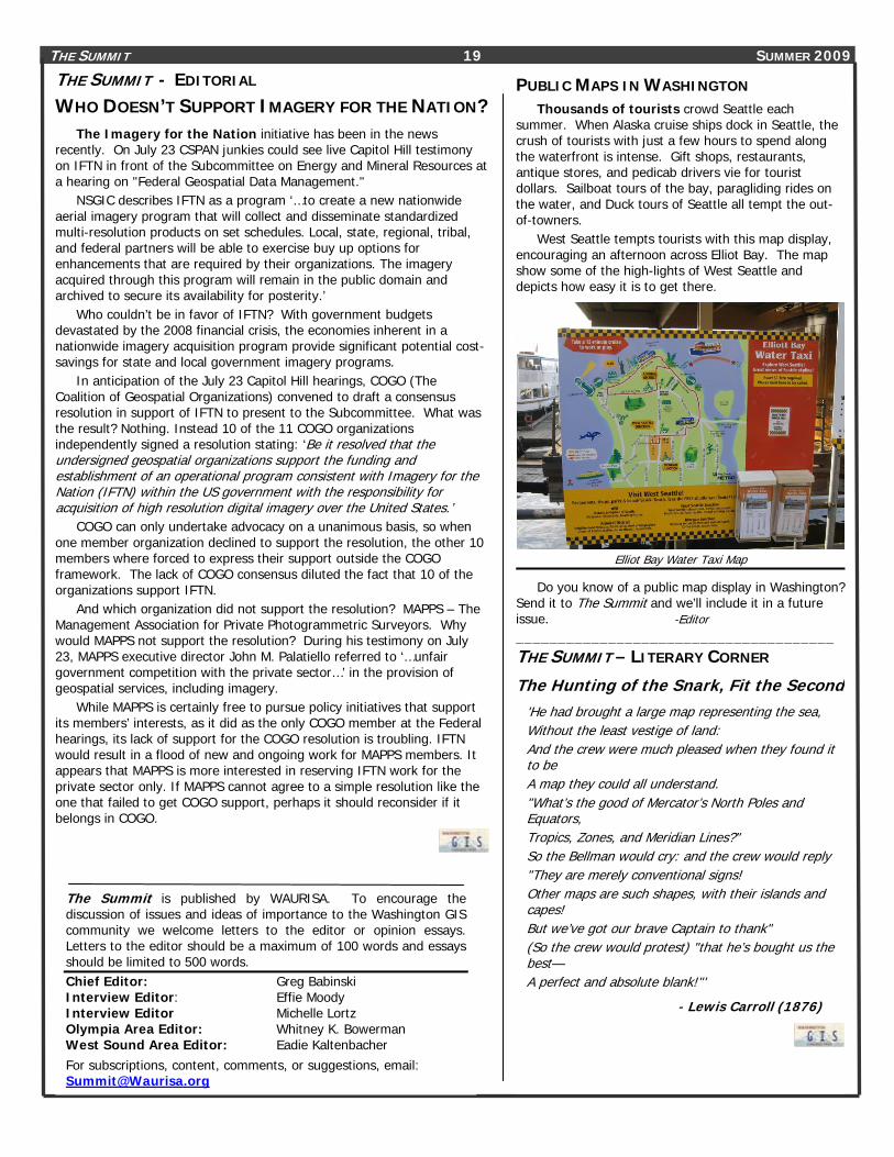
PUBLIC MAPS IN WASHINGTON Thousands of tourists crowd Seattle each
summer. When Alaska cruise ships dock in Seattle, the crush of tourists with just a few hours to spend along the waterfront is intense. Gift shops, restaurants, antique stores, and pedicab drivers vie for tourist dollars. Sailboat tours of the bay, paragliding rides on the water, and Duck tours of Seattle all tempt the out-of-towners.
West Seattle tempts tourists with this map display, encouraging an afternoon across Elliot Bay. The map show some of the high-lights of West Seattle and depicts how easy it is to get there.
Elliot Bay Water Taxi Map
Do you know of a public map display in Washington? Send it to The Summit and we’ll include it in a future issue. -Editor ______________________________________ THE SUMMIT – LITERARY CORNER
The Hunting of the Snark, Fit the Second'He had brought a large map representing the sea, Without the least vestige of land: And the crew were much pleased when they found it to be A map they could all understand. "What’s the good of Mercator’s North Poles and Equators, Tropics, Zones, and Meridian Lines?" So the Bellman would cry: and the crew would reply "They are merely conventional signs! Other maps are such shapes, with their islands and capes! But we’ve got our brave Captain to thank" (So the crew would protest) "that he’s bought us the best— A perfect and absolute blank!"'
- Lewis Carroll (1876)
THE SUMMIT - EDITORIAL WHO DOESN’T SUPPORT IMAGERY FOR THE NATION?
The Imagery for the Nation initiative has been in the news recently. On July 23 CSPAN junkies could see live Capitol Hill testimony on IFTN in front of the Subcommittee on Energy and Mineral Resources at a hearing on "Federal Geospatial Data Management."
NSGIC describes IFTN as a program ‘…to create a new nationwide aerial imagery program that will collect and disseminate standardized multi-resolution products on set schedules. Local, state, regional, tribal, and federal partners will be able to exercise buy up options for enhancements that are required by their organizations. The imagery acquired through this program will remain in the public domain and archived to secure its availability for posterity.’
Who couldn’t be in favor of IFTN? With government budgets devastated by the 2008 financial crisis, the economies inherent in a nationwide imagery acquisition program provide significant potential cost-savings for state and local government imagery programs.
In anticipation of the July 23 Capitol Hill hearings, COGO (The Coalition of Geospatial Organizations) convened to draft a consensus resolution in support of IFTN to present to the Subcommittee. What was the result? Nothing. Instead 10 of the 11 COGO organizations independently signed a resolution stating: ‘Be it resolved that the undersigned geospatial organizations support the funding and establishment of an operational program consistent with Imagery for the Nation (IFTN) within the US government with the responsibility for acquisition of high resolution digital imagery over the United States.’
COGO can only undertake advocacy on a unanimous basis, so when one member organization declined to support the resolution, the other 10 members where forced to express their support outside the COGO framework. The lack of COGO consensus diluted the fact that 10 of the organizations support IFTN.
And which organization did not support the resolution? MAPPS – The Management Association for Private Photogrammetric Surveyors. Why would MAPPS not support the resolution? During his testimony on July 23, MAPPS executive director John M. Palatiello referred to ‘…unfair government competition with the private sector…’ in the provision of geospatial services, including imagery.
While MAPPS is certainly free to pursue policy initiatives that support its members’ interests, as it did as the only COGO member at the Federal hearings, its lack of support for the COGO resolution is troubling. IFTN would result in a flood of new and ongoing work for MAPPS members. It appears that MAPPS is more interested in reserving IFTN work for the private sector only. If MAPPS cannot agree to a simple resolution like the one that failed to get COGO support, perhaps it should reconsider if it belongs in COGO.

THE SUMMIT 20 SUMMER 2009 WAURISA BOARD OF DIRECTORS
President: Don Burdick: [email protected] Vice President Greg Babinski: [email protected] Secretary Karl Johansen: [email protected] Treasurer Steve Schunzel: [email protected] Past President Angela Johnson: [email protected] Board Members At-Large:
Neil Berry: [email protected] Whitney Bowerman: [email protected] Cort Daniel: [email protected] H Heather Glock: [email protected] Amanda Taub [email protected] Donna Wendt: [email protected]
WAURISA COMMITTEE VOLUNTEERS Marty Balikov: [email protected] Randy Bracket [email protected] Daryn Brown: [email protected] Dave Brown: [email protected] Chuck Buzzard: [email protected] Jaime Crawford: [email protected] Jennifer Cutler [email protected] Starla DeLory: [email protected] Mike Dana: [email protected] Tonya Elliott: [email protected] Melissa Faga: [email protected] Bryan Fiedor [email protected] Byron Gessel: [email protected] Holly Glaser: [email protected] Tami Griffin: [email protected] Tony Hartrich: [email protected] Eadie Kaltenbacher: [email protected] Tom Kimpel [email protected] Jitka Kotelenska: [email protected] Rick Lortz: [email protected] Michelle Lortz: [email protected] Reily Love: [email protected] Effie Moody: [email protected] Jill Oliver: [email protected] Chris Owen: [email protected] Heather Spates: [email protected] Lurleen Smith: [email protected] Ann Stark [email protected] Matt Stull: [email protected] Cathy Walker [email protected] Bob Wendt: [email protected] Walker Willingham [email protected]
GIS USER GROUPS IN WASHINGTON ACSM – Washington State Section http://www.wss-acsm.org/
ASPRS Puget Sound Region http://www.photogrammetry.com/ASPRS-PSR/
CCascadia Users of Geospatial Open Source http://groups.google.com/group/cugos/ Contact Karsten Venneman at: [email protected]
Central Puget Sound GIS User Group http://waurisa.org/phpBB2/viewforum.php?f=24 Contact Nora Gierloff at: [email protected]
entral Washington GIS User Group Meets the 2nd Wednesday of each month at the Super China Buffet in East Wenatchee, WA at 12:00 noon. For information contact Amanda Taub at: [email protected]
King County GIS User Group http://www.kingcounty.gov/operations/GIS/UserGroups.aspx Meets 1st Wednesday every other month at 11:00am at the KCGIS Center, 201 S. Jackson Street, Seattle WA, Conf Room 7044/7045.
Northwest Washington GIS User Group http://www.acadweb.wwu.edu/gis/nwgis_mtgs.htm
Washington Geographic Information Council (WAGIC) http://wagic.wa.gov/ Join Listserve at: http://listserv.wa.gov/archives/wagic.html
Washington Hazus Users Group http://www.usehazus.com/wahug Contact Gathy Walker at: [email protected]
To have your GIS related group or event listed in future issues of The Summit, notify the editor at: [email protected]. _________________________________________________________________________________________
To be added to The Summit mailing list, contact: [email protected] Back issues of The Summit are available at: Uhttp://waurisa.org/thesummit/ Interested in volunteering your time to help WAURISA? Contact Angela Johnson or any Board member listed above.
WAURISA 1402 AUBURN WAY NORTH PBN 158 AUBURN WA 98002