the roach valley way - essexhighways.org · the roach valley way is clearly waymarked in both...
TRANSCRIPT

The Roach Valley Way
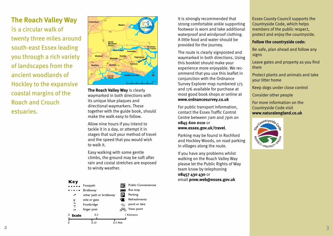
The Roach Valley Way is a circular walk of
twenty three miles around
south-east Essex leading
you through a rich variety
of landscapes from the
ancient woodlands of
Hockley to the expansive
coastal margins of the
Roach and Crouch
estuaries.
2 3
The Roach Valley Way is clearly waymarked in both directions with its unique blue plaques and directional waymarkers. These together with the guide book, should make the walk easy to follow.
Allow nine hours if you intend to tackle it in a day, or attempt it in stages that suit your method of travel and the speed that you would wish to walk it.
Easy walking with some gentle climbs, the ground may be soft after rain and costal stretches are exposed to windy weather.
Essex County Council supports the Countryside Code, which helps members of the public respect, protect and enjoy the countryside.
Follow the countryside code:
Be safe, plan ahead and follow any signs
Leave gates and property as you find them
Protect plants and animals and take your litter home
Keep dogs under close control
Consider other people
For more information on the Countryside Code visit www.naturalengland.co.uk
FP
FP
FP
FP
FP
FPFP
FP
A
A
FP
FPFP
FP
FP
A
AA
FP
FPFP
FP
FP
FP
FP
FP
FP
FP
FP
FP
FP
FP
FP
TimberYard
Riverside Village HolidayPark
River Crouch
Cliff Reach
TheCliff
Tideways
Lower Raypit's Nature Reserve
Althorne Creek
LandsEnd
LowerRaypits
Lion CreekNature Reserve
bird hide
LionWharf
LionHouse
Saltings Poultry Farm
Raymonds Farm
Creek
drain
Creeksea Road
Wades
TakeleyLambourne Hall
Road
LoftmansCorner
Loftmans
LoftmansFarm
PagleshamChurchend
St PetersChurch Church
Hall
Winton Haw
Ingulfs
ClaverhamCottage Jubilee
CottagesPaglesham Road
Chapel
East Hall
East Hall Road
South Hall
OBS Cottages
Lion
Cree
ksea
Ro
ad
drain
drai
n
LambourneMead Cottages
drain
Paglesham RoadSouthHallFarm
Glenthorpe New Cotts
Stannetts
drain
Paglesham Creek
WallaseaIsland
LambourneHall
MHW
mud
Bridgemarsh IslandBlack Point
Easter ReachRaypits Reach
UpperRaypits
drain
drai
n
MHW
mud
drain
MHW
mudmud
mud
drai
n
drain
drain
drain
Old Fleet
Butts Hill
Market Hill
Beacon Hill
MillHatch
CanewdonHall Farm
CANEWDON
High Street
Gay
s La
ne
villagegreen
Syca
mor
eW
ay Anch
or
Anchor LaneWhite HouseFarm
Scot
t's H
all
Road
Gardener's Lane
pill box
New Hall
pill box
Note: The gates to St Nicholas Church are locked at dusk. school
Lane
Church
TheHaven
drain
River Roach
mud
mud
mud
mud
BartonhallCreek
Stannetts Creek
BartonHall
HamptonBarns
drain
TroutFisheries
BrickHouse
The OldRectory
Stam
brid
ge R
oad
church
school
mud
mudWaldens
drain
drain
mud
MHW
MHW
Great Stambridge Hall
moat
drain
Winter's
CoombesFarm
cricketground
Mill
Lan
e
Broomhills
StambridgeMills
mud
Rochehall Way
BoatYard
MillHead
Purdey'sFarm
Fleethall Creek
River Roach
Roche Way
South St
ROCHFORD
GreatStambridge
schoolIronwell Lane
Station
Ashingdon Road
West St
Bradley Way
Tinker's Lane
Sutton Road
Southend Road
Watt'sLane
drain
River Roach
Back La
NewHouse
St AndrewsChurch
RochfordHall
Golf Course
Hall RoadEast S
t
Southend AirportCherryOrchard
Airport Works
Cherry Orchard W
ay
BrickWorks
River Roach
The Glebe
B101
3
Cherry
Orchard La
StroudGreen Pelham's
Farm
EvansFarm
River RoachBlatches
Blatches Chase
Cottons
PrimroseWood
Potash Wood
The Lawn
Hall Road
Ark Lane
TheScrubs
GustedhallWoods
BlackCottage
NewEngland
Gusted Hall
Lane
GustedHall
HockleyWoods
Parson'sSnipe
River Roach
Mount Bovers LaneMount
Bovers
HOCKLEY Spa Road
Station
Bullwood Hall
WhitbredsWood
BeechesWood
Aldermans Hill Main Road
Great BullWood
PeartreeCottage
school
Claybrick Cl
Hockley Rise
KilnwoodAve
Woo
dlan
ds R
oad
Southend Rd
Main Road
HAWKWELL
Bullw
ood
Rd
ThePriory
Whit
e Hart
Lane
church
Victor Gardens
Clements H
all
Lane
Whi
te H
art
Lan
e
Greens
ward La
ne
Kennels
Dur
ham
Rd
The Nest
RadioMast Rouncefall
RainbowCottage
HomefieldFarm
TrinityWood
The Chase
ASHINGDON
Road
Ashingdon
Clifton Road
St AndrewsChurch
Church
Road
Highsteppers
Moon'sFarm
Moon's
GlazebrookFarm
power line
MinkFarm Woodside
HydewoodFarm
HydeWood
Canewdon Road
Moon'sCottage H
ydewood Lane
Lark Hill RoadSunriseFarm
NewholmeFarm
CampFarm Scaldhurst
Farm
Pudsey Hall Lane
PudseyHall
Larkhill Ave
BoltHall
Glenesk
Lark Hill Road
'Green Lane'
power lines
Stambridge Road
MarketSquare
Footpath
Bridleway
other path or bridleway
stile or gate
Footbridge
finger post
KeyPublic Conveniences
Bus stop
Parking
Refreshments
pond or lake
View pointFP
0 0.5 1 Kilometre
0 0.25 0.5 Mile
Scale
A
START
It is strongly recommended that strong comfortable ankle supporting footwear is worn and take additional waterproof and windproof clothing. A little food and water should be provided for the journey.
The route is clearly signposted and waymarked in both directions. Using this booklet should make your experience more enjoyable. We rec-ommend that you use this leaflet in conjunction with the Ordnance Survey Explorer map numbered 175 and 176 available for purchase at most good book shops or online at www.ordnancesurvey.co.uk
For public transport information, contact the Essex Traffic Control Centre between 7am and 7pm on 0845 600 0110 or www.essex.gov.uk/travel.
Parking may be found in Rochford and Hockley Woods, on road parking in villages along the route.
If you have any problems whilst walking on the Roach Valley Way please let the Public Rights of Way team know by telephoning 08457 430 430 or email [email protected]
Maldon
Rayleigh
CanveyIsland
Rochford
Burnhamon Crouch
SouthWoodhamFerrers
Wickford
Benfleet
Chelmsford
Southend on Sea
Basildon
Hockley
Canewdon
Paglesham
River Crouch
River Roach
A12
A130
A414
A127
A13
A13
A12
A130
B1013
A127
0 2 4 6 8 10 Km

FP
FP
FP
FP
FP
FPFP
FP
A
A
FP
FPFP
FP
FP
A
AA
FP
FPFP
FP
FP
FP
FP
FP
FP
FP
FP
FP
FP
FP
FP
TimberYard
Riverside Village HolidayPark
River Crouch
Cliff Reach
TheCliff
Tideways
Lower Raypit's Nature Reserve
Althorne Creek
LandsEnd
LowerRaypits
Lion CreekNature Reserve
bird hide
LionWharf
LionHouse
Saltings Poultry Farm
Raymonds Farm
Creek
drain
Creeksea Road
Wades
TakeleyLambourne Hall
Road
LoftmansCorner
Loftmans
LoftmansFarm
PagleshamChurchend
St PetersChurch Church
Hall
Winton Haw
Ingulfs
ClaverhamCottage Jubilee
CottagesPaglesham Road
Chapel
East Hall
East Hall Road
South Hall
OBS Cottages
Lion
Cree
ksea
Ro
ad
drain
drai
n
LambourneMead Cottages
drain
Paglesham RoadSouthHallFarm
Glenthorpe New Cotts
Stannetts
drain
Paglesham Creek
WallaseaIsland
LambourneHall
MHW
mud
Bridgemarsh IslandBlack Point
Easter ReachRaypits Reach
UpperRaypits
drain
drai
n
MHW
mud
drain
MHW
mudmud
mud
drai
n
drain
drain
drain
Old Fleet
Butts Hill
Market Hill
Beacon Hill
MillHatch
CanewdonHall Farm
CANEWDON
High Street
Gay
s La
ne
villagegreen
Syca
mor
eW
ay Anch
or
Anchor LaneWhite HouseFarm
Scot
t's H
all
Road
Gardener's Lane
pill box
New Hall
pill box
Note: The gates to St Nicholas Church are locked at dusk. school
Lane
Church
TheHaven
drain
River Roach
mud
mud
mud
mud
BartonhallCreek
Stannetts Creek
BartonHall
HamptonBarns
drain
TroutFisheries
BrickHouse
The OldRectory
Stam
brid
ge R
oad
church
school
mud
mudWaldens
drain
drain
mud
MHW
MHW
Great Stambridge Hall
moat
drain
Winter's
CoombesFarm
cricketground
Mill
Lan
e
Broomhills
StambridgeMills
mud
Rochehall Way
BoatYard
MillHead
Purdey'sFarm
Fleethall Creek
River Roach
Roche Way
South St
ROCHFORD
GreatStambridge
schoolIronwell Lane
Station
Ashingdon Road
West St
Bradley Way
Tinker's Lane
Sutton Road
Southend Road
Watt'sLane
drain
River Roach
Back La
NewHouse
St AndrewsChurch
RochfordHall
Golf Course
Hall RoadEast S
t
Southend AirportCherryOrchard
Airport Works
Cherry Orchard W
ay
BrickWorks
River Roach
The Glebe
B101
3
Cherry
Orchard La
StroudGreen Pelham's
Farm
EvansFarm
River RoachBlatches
Blatches Chase
Cottons
PrimroseWood
Potash Wood
The Lawn
Hall Road
Ark Lane
TheScrubs
GustedhallWoods
BlackCottage
NewEngland
Gusted Hall
Lane
GustedHall
HockleyWoods
Parson'sSnipe
River Roach
Mount Bovers LaneMount
Bovers
HOCKLEY Spa Road
Station
Bullwood Hall
WhitbredsWood
BeechesWood
Aldermans Hill Main Road
Great BullWood
PeartreeCottage
school
Claybrick Cl
Hockley Rise
KilnwoodAve
Woo
dlan
ds R
oad
Southend Rd
Main Road
HAWKWELL
Bullw
ood
Rd
ThePriory
Whit
e Hart
Lane
church
Victor Gardens
Clements H
all
Lane
Whi
te H
art
Lan
e
Greens
ward La
ne
Kennels
Dur
ham
Rd
The Nest
RadioMast Rouncefall
RainbowCottage
HomefieldFarm
TrinityWood
The Chase
ASHINGDON
Road
Ashingdon
Clifton Road
St AndrewsChurch
Church
Road
Highsteppers
Moon'sFarm
Moon's
GlazebrookFarm
power line
MinkFarm Woodside
HydewoodFarm
HydeWood
Canewdon Road
Moon'sCottage H
ydewood Lane
Lark Hill RoadSunriseFarm
NewholmeFarm
CampFarm Scaldhurst
Farm
Pudsey Hall Lane
PudseyHall
Larkhill Ave
BoltHall
Glenesk
Lark Hill Road
'Green Lane'
power lines
Stambridge Road
MarketSquare
Footpath
Bridleway
other path or bridleway
stile or gate
Footbridge
finger post
KeyPublic Conveniences
Bus stop
Parking
Refreshments
pond or lake
View pointFP
0 0.5 1 Kilometre
0 0.25 0.5 Mile
Scale
A
START
Rochford is a medieval market town, where Henry III granted market and fair rights to Guy de Rochford in 1257. There were two market squares, though only one remains today. The market ran for four centuries and was later revived in the eighteenth century. In 1707 a guildhall was built in the centre of the square to house pigs, the village fire engine and a barber shop and wool was weighed upstairs. The guildhall sadly fell into disrepair and was demolished in 1861. More demolition followed when an earthquake ruined a row of market side shops in 1884. The existing square was last used for cattle trading in 1959.
Nearby was the parish pump which supplied the whole village with water at one farthing a pailful. This was superceded by a horse drawn cart which carried water from Southend to be sold in Rochford at half a penny a pailful.
The Square has also been the scene of an execution. You can see a plaque on the corner of Market Alley, by the bakery, commemorating the martyrdom of John Simpson, a farm labourer who worked at Great Wigborough, burnt at the stake in the square in 1555 for not conforming to the Roman Catholic church.
Broomhills was formerly the home of the 18th century magistrate, Captain John Harriott, founder of the Thames River Po-lice. Despite his position, he made use of the illegal activity of smuggling, prevalent in the area at this time. In his ‘Struggles through Life’ he records how in 1786 he sought out smugglers at an inn in Dunkirk to obtain a boat ride home to England, knowing it would land within a few miles of his home at Stambridge.
Peculiar People - a unique religious sect indigenous to Essex, originated in Rochford. Their names come from the Book of Deuteronomy, chapter 14, “The Lord hath chosen thee to be a peculiar people unto himself”. James Banyard, a Rochford shoe maker founded the sect in 1838. His congregation endured widespread hostility as their practices were regarded with suspicion. Their attire made them readily identified as the men were clean shaven and wore bowler hats, whilst the ladies wore black bonnets. They re-jected orthodox medicine and were frequently in court on charges of manslaughter, however many cures were reported to occur in the homes and chapels of the Peculiars by anointing with oil and the laying on of hands.4 5
Bartonhall Creek
River Roach
FP
FP
FP
FP
FP
FPFP
FP
A
A
FP
FPFP
FP
FP
A
AA
FP
FPFP
FP
FP
FP
FP
FP
FP
FP
FP
FP
FP
FP
FP
TimberYard
Riverside Village HolidayPark
River Crouch
Cliff Reach
TheCliff
Tideways
Lower Raypit's Nature Reserve
Althorne Creek
LandsEnd
LowerRaypits
Lion CreekNature Reserve
bird hide
LionWharf
LionHouse
Saltings Poultry Farm
Raymonds Farm
Creek
drain
Creeksea Road
Wades
TakeleyLambourne Hall
Road
LoftmansCorner
Loftmans
LoftmansFarm
PagleshamChurchend
St PetersChurch Church
Hall
Winton Haw
Ingulfs
ClaverhamCottage Jubilee
CottagesPaglesham Road
Chapel
East Hall
East Hall Road
South Hall
OBS Cottages
Lion
Cree
ksea
Ro
ad
drain
drai
n
LambourneMead Cottages
drain
Paglesham RoadSouthHallFarm
Glenthorpe New Cotts
Stannetts
drain
Paglesham Creek
WallaseaIsland
LambourneHall
MHW
mud
Bridgemarsh IslandBlack Point
Easter ReachRaypits Reach
UpperRaypits
drain
drai
n
MHW
mud
drain
MHW
mudmud
mud
drai
n
drain
drain
drain
Old Fleet
Butts Hill
Market Hill
Beacon Hill
MillHatch
CanewdonHall Farm
CANEWDON
High Street
Gay
s La
ne
villagegreen
Syca
mor
eW
ay Anch
or
Anchor LaneWhite HouseFarm
Scot
t's H
all
Road
Gardener's Lane
pill box
New Hall
pill box
Note: The gates to St Nicholas Church are locked at dusk. school
Lane
Church
TheHaven
drain
River Roach
mud
mud
mud
mud
BartonhallCreek
Stannetts Creek
BartonHall
HamptonBarns
drain
TroutFisheries
BrickHouse
The OldRectory
Stam
brid
ge R
oad
church
school
mud
mudWaldens
drain
drain
mud
MHW
MHW
Great Stambridge Hall
moat
drain
Winter's
CoombesFarm
cricketground
Mill
Lan
e
Broomhills
StambridgeMills
mud
Rochehall Way
BoatYard
MillHead
Purdey'sFarm
Fleethall Creek
River Roach
Roche Way
South St
ROCHFORD
GreatStambridge
schoolIronwell Lane
Station
Ashingdon Road
West St
Bradley Way
Tinker's Lane
Sutton Road
Southend Road
Watt'sLane
drain
River Roach
Back La
NewHouse
St AndrewsChurch
RochfordHall
Golf Course
Hall RoadEast S
t
Southend AirportCherryOrchard
Airport Works
Cherry Orchard W
ay
BrickWorks
River Roach
The Glebe
B101
3
Cherry
Orchard La
StroudGreen Pelham's
Farm
EvansFarm
River RoachBlatches
Blatches Chase
Cottons
PrimroseWood
Potash Wood
The Lawn
Hall Road
Ark Lane
TheScrubs
GustedhallWoods
BlackCottage
NewEngland
Gusted Hall
Lane
GustedHall
HockleyWoods
Parson'sSnipe
River Roach
Mount Bovers LaneMount
Bovers
HOCKLEY Spa Road
Station
Bullwood Hall
WhitbredsWood
BeechesWood
Aldermans Hill Main Road
Great BullWood
PeartreeCottage
school
Claybrick Cl
Hockley Rise
KilnwoodAve
Woo
dlan
ds R
oad
Southend Rd
Main Road
HAWKWELL
Bullw
ood
Rd
ThePriory
Whit
e Hart
Lane
church
Victor Gardens
Clements H
all
Lane
Whi
te H
art
Lan
e
Greens
ward La
ne
Kennels
Dur
ham
Rd
The Nest
RadioMast Rouncefall
RainbowCottage
HomefieldFarm
TrinityWood
The Chase
ASHINGDON
Road
Ashingdon
Clifton Road
St AndrewsChurch
Church
Road
Highsteppers
Moon'sFarm
Moon's
GlazebrookFarm
power line
MinkFarm Woodside
HydewoodFarm
HydeWood
Canewdon Road
Moon'sCottage H
ydewood Lane
Lark Hill RoadSunriseFarm
NewholmeFarm
CampFarm Scaldhurst
Farm
Pudsey Hall Lane
PudseyHall
Larkhill Ave
BoltHall
Glenesk
Lark Hill Road
'Green Lane'
power lines
Stambridge Road
MarketSquare
Footpath
Bridleway
other path or bridleway
stile or gate
Footbridge
finger post
KeyPublic Conveniences
Bus stop
Parking
Refreshments
pond or lake
View pointFP
0 0.5 1 Kilometre
0 0.25 0.5 Mile
Scale
A
START
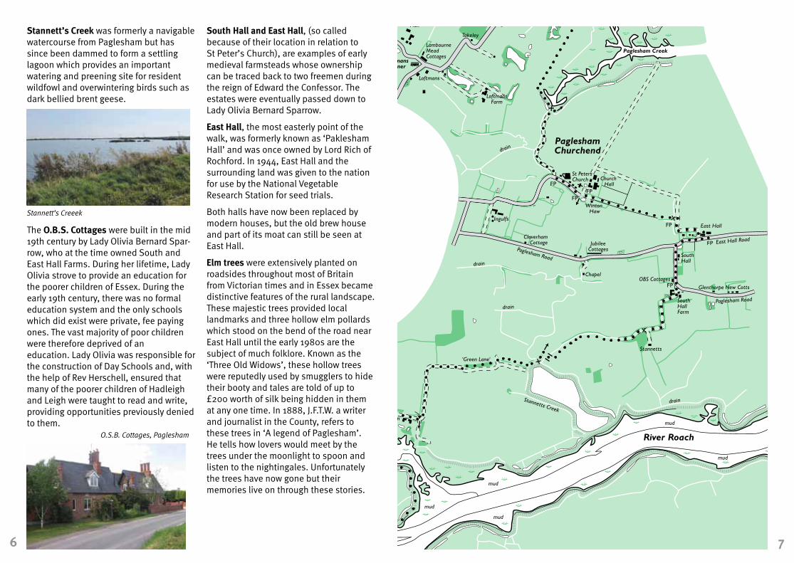
Stannett’s Creek was formerly a navigable watercourse from Paglesham but has since been dammed to form a settling lagoon which provides an important watering and preening site for resident wildfowl and overwintering birds such as dark bellied brent geese.
The O.B.S. Cottages were built in the mid 19th century by Lady Olivia Bernard Spar-row, who at the time owned South and East Hall Farms. During her lifetime, Lady Olivia strove to provide an education for the poorer children of Essex. During the early 19th century, there was no formal education system and the only schools which did exist were private, fee paying ones. The vast majority of poor children were therefore deprived of an education. Lady Olivia was responsible for the construction of Day Schools and, with the help of Rev Herschell, ensured that many of the poorer children of Hadleigh and Leigh were taught to read and write, providing opportunities previously denied to them.
South Hall and East Hall, (so called because of their location in relation to St Peter’s Church), are examples of early medieval farmsteads whose ownership can be traced back to two freemen during the reign of Edward the Confessor. The estates were eventually passed down to Lady Olivia Bernard Sparrow.
East Hall, the most easterly point of the walk, was formerly known as ‘Paklesham Hall’ and was once owned by Lord Rich of Rochford. In 1944, East Hall and the surrounding land was given to the nation for use by the National Vegetable Research Station for seed trials.
Both halls have now been replaced by modern houses, but the old brew house and part of its moat can still be seen at East Hall.
Elm trees were extensively planted on roadsides throughout most of Britain from Victorian times and in Essex became distinctive features of the rural landscape. These majestic trees provided local landmarks and three hollow elm pollards which stood on the bend of the road near East Hall until the early 1980s are the subject of much folklore. Known as the ‘Three Old Widows’, these hollow trees were reputedly used by smugglers to hide their booty and tales are told of up to £200 worth of silk being hidden in them at any one time. In 1888, J.F.T.W. a writer and journalist in the County, refers to these trees in ‘A legend of Paglesham’. He tells how lovers would meet by the trees under the moonlight to spoon and listen to the nightingales. Unfortunately the trees have now gone but their memories live on through these stories.
6 7
Stannett’s Creeek
O.S.B. Cottages, Paglesham

FP
FP
FP
FP
FP
FPFP
FP
A
A
FP
FPFP
FP
FP
A
AA
FP
FPFP
FP
FP
FP
FP
FP
FP
FP
FP
FP
FP
FP
FP
TimberYard
Riverside Village HolidayPark
River Crouch
Cliff Reach
TheCliff
Tideways
Lower Raypit's Nature Reserve
Althorne Creek
LandsEnd
LowerRaypits
Lion CreekNature Reserve
bird hide
LionWharf
LionHouse
Saltings Poultry Farm
Raymonds Farm
Creek
drain
Creeksea Road
Wades
TakeleyLambourne Hall
Road
LoftmansCorner
Loftmans
LoftmansFarm
PagleshamChurchend
St PetersChurch Church
Hall
Winton Haw
Ingulfs
ClaverhamCottage Jubilee
CottagesPaglesham Road
Chapel
East Hall
East Hall Road
South Hall
OBS Cottages
Lion
Cree
ksea
Ro
ad
drain
drai
n
LambourneMead Cottages
drain
Paglesham RoadSouthHallFarm
Glenthorpe New Cotts
Stannetts
drain
Paglesham Creek
WallaseaIsland
LambourneHall
MHW
mud
Bridgemarsh IslandBlack Point
Easter ReachRaypits Reach
UpperRaypits
drain
drai
n
MHW
mud
drain
MHW
mudmud
mud
drai
n
drain
drain
drain
Old Fleet
Butts Hill
Market Hill
Beacon Hill
MillHatch
CanewdonHall Farm
CANEWDON
High Street
Gay
s La
ne
villagegreen
Syca
mor
eW
ay Anch
or
Anchor LaneWhite HouseFarm
Scot
t's H
all
Road
Gardener's Lane
pill box
New Hall
pill box
Note: The gates to St Nicholas Church are locked at dusk. school
Lane
Church
TheHaven
drain
River Roach
mud
mud
mud
mud
BartonhallCreek
Stannetts Creek
BartonHall
HamptonBarns
drain
TroutFisheries
BrickHouse
The OldRectory
Stam
brid
ge R
oad
church
school
mud
mudWaldens
drain
drain
mud
MHW
MHW
Great Stambridge Hall
moat
drain
Winter's
CoombesFarm
cricketground
Mill
Lan
e
Broomhills
StambridgeMills
mud
Rochehall Way
BoatYard
MillHead
Purdey'sFarm
Fleethall Creek
River Roach
Roche Way
South St
ROCHFORD
GreatStambridge
schoolIronwell Lane
Station
Ashingdon Road
West St
Bradley Way
Tinker's Lane
Sutton Road
Southend Road
Watt'sLane
drain
River Roach
Back La
NewHouse
St AndrewsChurch
RochfordHall
Golf Course
Hall RoadEast S
t
Southend AirportCherryOrchard
Airport Works
Cherry Orchard W
ay
BrickWorks
River Roach
The Glebe
B101
3
Cherry
Orchard La
StroudGreen Pelham's
Farm
EvansFarm
River RoachBlatches
Blatches Chase
Cottons
PrimroseWood
Potash Wood
The Lawn
Hall Road
Ark Lane
TheScrubs
GustedhallWoods
BlackCottage
NewEngland
Gusted Hall
Lane
GustedHall
HockleyWoods
Parson'sSnipe
River Roach
Mount Bovers LaneMount
Bovers
HOCKLEY Spa Road
Station
Bullwood Hall
WhitbredsWood
BeechesWood
Aldermans Hill Main Road
Great BullWood
PeartreeCottage
school
Claybrick Cl
Hockley Rise
KilnwoodAve
Woo
dlan
ds R
oad
Southend Rd
Main Road
HAWKWELL
Bullw
ood
Rd
ThePriory
Whit
e Hart
Lane
church
Victor Gardens
Clements H
all
Lane
Whi
te H
art
Lan
e
Greens
ward La
ne
Kennels
Dur
ham
Rd
The Nest
RadioMast Rouncefall
RainbowCottage
HomefieldFarm
TrinityWood
The Chase
ASHINGDON
Road
Ashingdon
Clifton Road
St AndrewsChurch
Church
Road
Highsteppers
Moon'sFarm
Moon's
GlazebrookFarm
power line
MinkFarm Woodside
HydewoodFarm
HydeWood
Canewdon Road
Moon'sCottage H
ydewood Lane
Lark Hill RoadSunriseFarm
NewholmeFarm
CampFarm Scaldhurst
Farm
Pudsey Hall Lane
PudseyHall
Larkhill Ave
BoltHall
Glenesk
Lark Hill Road
'Green Lane'
power lines
Stambridge Road
MarketSquare
Footpath
Bridleway
other path or bridleway
stile or gate
Footbridge
finger post
KeyPublic Conveniences
Bus stop
Parking
Refreshments
pond or lake
View pointFP
0 0.5 1 Kilometre
0 0.25 0.5 Mile
Scale
A
START
PagleshamThe Roach Valley Way passes through many historic villages including Paglesham Churchend and Canewdon. In the 19th century, many of the residents of these two villages were employed in either agriculture, the oyster trade or boat building. However the mosaic of rivers and creeks provided a land and sea pattern ideal for one of the most lucrative occupations – smuggling! This ‘free trade’ reached its height in the late 18th to early 19th century when almost the entire local population seems to have been implicated to a greater or lesser extent.
The most notorious Paglesham smuggler was William Blyth, aka ‘Hard Apple’. He was a churchwarden and grocer in the village and used pages torn from the parish registers to wrap up butter and bacon! He is renowned not only for his exploits with Custom officials but also for consuming whole kegs of brandy and eating wine glasses!
The oyster has throughout history played an important role in the coastal diet and economy, and no more so than at Paglesham. While in early history, oysters would simply be dredged straight from the mud flats or layings, of rivers and estuaries, by the 18th century the cultivation of oysters had become an increasingly specialised and large scale industry. This culminated in the 19th century with the establishment of large companies such as the Roach River Company. The peak of oyster cultivation came in the mid nineteenth century, at a time when oysters were considered the common food of poor Londoners. During its heyday there were approximately 80 to 100 boats and 160 to 200 people engaged in the industry on the Crouch and Roach estuaries. The industry began to decline at the beginning of the 20th century and despite many attempts to revive it, it has never really recovered.
As you walk along the seawall from Lion Creek to Lower Raypits Farm it may seem quite remote and isolated but you are not alone. The patch of salt marsh, sea walls, mudflats and grazing marsh supports an abundance of wildlife and, as a result, both the Roach and Crouch Estuaries have been designated Sites of Special Scientific Interest by Natural England.
The estuary provides a valuable feeding ground and roosting area for visiting wildfowl and waders including the dark bellied brent geese now present in internationally important numbers. Other birds to look out for include blacktailed godwits, shovelers, shelducks, redshanks and dunlin, so don’t forget your binoculars.
It is not only birds that make the Crouch and Roach special. The dykes and seawalls support nationally scarce plants such as beaked tassel weed and sea barley and more than 50 insects and spiders which are scarce or rare in Britain have been recorded, for example, the scarce emerald damselfly and Roesel’s bush cricket. The grazing marsh and grassy seawalls are home to small mammals and birds of prey such as hen harriers and short eared owls can be seen hunting over the grassland in winter.
8 9Roesel’s Bush Cricket. (David Warner/EWT)
Paglesham Churchend
Adder (David Warner/EWT)
FP
FP
FP
FP
FP
FPFP
FP
A
A
FP
FPFP
FP
FP
A
AA
FP
FPFP
FP
FP
FP
FP
FP
FP
FP
FP
FP
FP
FP
FP
TimberYard
Riverside Village HolidayPark
River Crouch
Cliff Reach
TheCliff
Tideways
Lower Raypit's Nature Reserve
Althorne Creek
LandsEnd
LowerRaypits
Lion CreekNature Reserve
bird hide
LionWharf
LionHouse
Saltings Poultry Farm
Raymonds Farm
Creek
drain
Creeksea Road
Wades
TakeleyLambourne Hall
Road
LoftmansCorner
Loftmans
LoftmansFarm
PagleshamChurchend
St PetersChurch Church
Hall
Winton Haw
Ingulfs
ClaverhamCottage Jubilee
CottagesPaglesham Road
Chapel
East Hall
East Hall Road
South Hall
OBS Cottages
Lion
Cree
ksea
Ro
ad
drain
drai
n
LambourneMead Cottages
drain
Paglesham RoadSouthHallFarm
Glenthorpe New Cotts
Stannetts
drain
Paglesham Creek
WallaseaIsland
LambourneHall
MHW
mud
Bridgemarsh IslandBlack Point
Easter ReachRaypits Reach
UpperRaypits
drain
drai
n
MHW
mud
drain
MHW
mudmud
mud
drai
n
drain
drain
drain
Old Fleet
Butts Hill
Market Hill
Beacon Hill
MillHatch
CanewdonHall Farm
CANEWDON
High Street
Gay
s La
ne
villagegreen
Syca
mor
eW
ay Anch
or
Anchor LaneWhite HouseFarm
Scot
t's H
all
Road
Gardener's Lane
pill box
New Hall
pill box
Note: The gates to St Nicholas Church are locked at dusk. school
Lane
Church
TheHaven
drain
River Roach
mud
mud
mud
mud
BartonhallCreek
Stannetts Creek
BartonHall
HamptonBarns
drain
TroutFisheries
BrickHouse
The OldRectory
Stam
brid
ge R
oad
church
school
mud
mudWaldens
drain
drain
mud
MHW
MHW
Great Stambridge Hall
moat
drain
Winter's
CoombesFarm
cricketground
Mill
Lan
e
Broomhills
StambridgeMills
mud
Rochehall Way
BoatYard
MillHead
Purdey'sFarm
Fleethall Creek
River Roach
Roche Way
South St
ROCHFORD
GreatStambridge
schoolIronwell Lane
Station
Ashingdon Road
West St
Bradley Way
Tinker's Lane
Sutton Road
Southend Road
Watt'sLane
drain
River Roach
Back La
NewHouse
St AndrewsChurch
RochfordHall
Golf Course
Hall RoadEast S
t
Southend AirportCherryOrchard
Airport Works
Cherry Orchard W
ay
BrickWorks
River Roach
The Glebe
B101
3
Cherry
Orchard La
StroudGreen Pelham's
Farm
EvansFarm
River RoachBlatches
Blatches Chase
Cottons
PrimroseWood
Potash Wood
The Lawn
Hall Road
Ark Lane
TheScrubs
GustedhallWoods
BlackCottage
NewEngland
Gusted Hall
Lane
GustedHall
HockleyWoods
Parson'sSnipe
River Roach
Mount Bovers LaneMount
Bovers
HOCKLEY Spa Road
Station
Bullwood Hall
WhitbredsWood
BeechesWood
Aldermans Hill Main Road
Great BullWood
PeartreeCottage
school
Claybrick Cl
Hockley Rise
KilnwoodAve
Woo
dlan
ds R
oad
Southend Rd
Main Road
HAWKWELL
Bullw
ood
Rd
ThePriory
Whit
e Hart
Lane
church
Victor Gardens
Clements H
all
Lane
Whi
te H
art
Lan
e
Greens
ward La
ne
Kennels
Dur
ham
Rd
The Nest
RadioMast Rouncefall
RainbowCottage
HomefieldFarm
TrinityWood
The Chase
ASHINGDON
Road
Ashingdon
Clifton Road
St AndrewsChurch
Church
Road
Highsteppers
Moon'sFarm
Moon's
GlazebrookFarm
power line
MinkFarm Woodside
HydewoodFarm
HydeWood
Canewdon Road
Moon'sCottage H
ydewood Lane
Lark Hill RoadSunriseFarm
NewholmeFarm
CampFarm Scaldhurst
Farm
Pudsey Hall Lane
PudseyHall
Larkhill Ave
BoltHall
Glenesk
Lark Hill Road
'Green Lane'
power lines
Stambridge Road
MarketSquare
Footpath
Bridleway
other path or bridleway
stile or gate
Footbridge
finger post
KeyPublic Conveniences
Bus stop
Parking
Refreshments
pond or lake
View pointFP
0 0.5 1 Kilometre
0 0.25 0.5 Mile
Scale
A
START
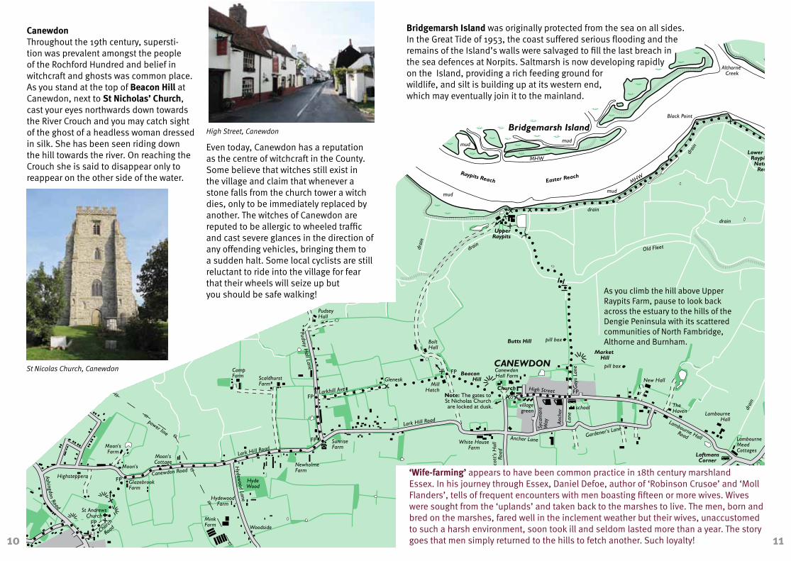
Canewdon Throughout the 19th century, supersti-tion was prevalent amongst the people of the Rochford Hundred and belief in witchcraft and ghosts was common place. As you stand at the top of Beacon Hill at Canewdon, next to St Nicholas’ Church, cast your eyes northwards down towards the River Crouch and you may catch sight of the ghost of a headless woman dressed in silk. She has been seen riding down the hill towards the river. On reaching the Crouch she is said to disappear only to reappear on the other side of the water.
Even today, Canewdon has a reputation as the centre of witchcraft in the County. Some believe that witches still exist in the village and claim that whenever a stone falls from the church tower a witch dies, only to be immediately replaced by another. The witches of Canewdon are reputed to be allergic to wheeled traffic and cast severe glances in the direction of any offending vehicles, bringing them to a sudden halt. Some local cyclists are still reluctant to ride into the village for fear that their wheels will seize up but you should be safe walking!
Bridgemarsh Island was originally protected from the sea on all sides. In the Great Tide of 1953, the coast suffered serious flooding and the remains of the Island’s walls were salvaged to fill the last breach in the sea defences at Norpits. Saltmarsh is now developing rapidly on the Island, providing a rich feeding ground for wildlife, and silt is building up at its western end, which may eventually join it to the mainland.
‘Wife-farming’ appears to have been common practice in 18th century marshland Essex. In his journey through Essex, Daniel Defoe, author of ‘Robinson Crusoe’ and ‘Moll Flanders’, tells of frequent encounters with men boasting fifteen or more wives. Wives were sought from the ‘uplands’ and taken back to the marshes to live. The men, born and bred on the marshes, fared well in the inclement weather but their wives, unaccustomed to such a harsh environment, soon took ill and seldom lasted more than a year. The story goes that men simply returned to the hills to fetch another. Such loyalty!10 11
High Street, Canewdon
St Nicolas Church, Canewdon
As you climb the hill above Upper Raypits Farm, pause to look back across the estuary to the hills of the Dengie Peninsula with its scattered communities of North Fambridge, Althorne and Burnham.

FP
FP
FP
FP
FP
FPFP
FP
A
A
FP
FPFP
FP
FP
A
AA
FP
FPFP
FP
FP
FP
FP
FP
FP
FP
FP
FP
FP
FP
FP
TimberYard
Riverside Village HolidayPark
River Crouch
Cliff Reach
TheCliff
Tideways
Lower Raypit's Nature Reserve
Althorne Creek
LandsEnd
LowerRaypits
Lion CreekNature Reserve
bird hide
LionWharf
LionHouse
Saltings Poultry Farm
Raymonds Farm
Creek
drain
Creeksea Road
Wades
TakeleyLambourne Hall
Road
LoftmansCorner
Loftmans
LoftmansFarm
PagleshamChurchend
St PetersChurch Church
Hall
Winton Haw
Ingulfs
ClaverhamCottage Jubilee
CottagesPaglesham Road
Chapel
East Hall
East Hall Road
South Hall
OBS Cottages
Lion
Cree
ksea
Ro
ad
drain
drai
n
LambourneMead Cottages
drain
Paglesham RoadSouthHallFarm
Glenthorpe New Cotts
Stannetts
drain
Paglesham Creek
WallaseaIsland
LambourneHall
MHW
mud
Bridgemarsh IslandBlack Point
Easter ReachRaypits Reach
UpperRaypits
drain
drai
n
MHW
mud
drain
MHW
mudmud
mud
drai
n
drain
drain
drain
Old Fleet
Butts Hill
Market Hill
Beacon Hill
MillHatch
CanewdonHall Farm
CANEWDON
High Street
Gay
s La
ne
villagegreen
Syca
mor
eW
ay Anch
or
Anchor LaneWhite HouseFarm
Scot
t's H
all
Road
Gardener's Lane
pill box
New Hall
pill box
Note: The gates to St Nicholas Church are locked at dusk. school
Lane
Church
TheHaven
drain
River Roach
mud
mud
mud
mud
BartonhallCreek
Stannetts Creek
BartonHall
HamptonBarns
drain
TroutFisheries
BrickHouse
The OldRectory
Stam
brid
ge R
oad
church
school
mud
mudWaldens
drain
drain
mud
MHW
MHW
Great Stambridge Hall
moat
drain
Winter's
CoombesFarm
cricketground
Mill
Lan
e
Broomhills
StambridgeMills
mud
Rochehall Way
BoatYard
MillHead
Purdey'sFarm
Fleethall Creek
River Roach
Roche Way
South St
ROCHFORD
GreatStambridge
schoolIronwell Lane
Station
Ashingdon Road
West St
Bradley Way
Tinker's Lane
Sutton Road
Southend Road
Watt'sLane
drain
River Roach
Back La
NewHouse
St AndrewsChurch
RochfordHall
Golf Course
Hall RoadEast S
t
Southend AirportCherryOrchard
Airport Works
Cherry Orchard W
ay
BrickWorks
River Roach
The Glebe
B101
3
Cherry
Orchard La
StroudGreen Pelham's
Farm
EvansFarm
River RoachBlatches
Blatches Chase
Cottons
PrimroseWood
Potash Wood
The Lawn
Hall Road
Ark Lane
TheScrubs
GustedhallWoods
BlackCottage
NewEngland
Gusted Hall
Lane
GustedHall
HockleyWoods
Parson'sSnipe
River Roach
Mount Bovers LaneMount
Bovers
HOCKLEY Spa Road
Station
Bullwood Hall
WhitbredsWood
BeechesWood
Aldermans Hill Main Road
Great BullWood
PeartreeCottage
school
Claybrick Cl
Hockley Rise
KilnwoodAve
Woo
dlan
ds R
oad
Southend Rd
Main Road
HAWKWELL
Bullw
ood
Rd
ThePriory
Whit
e Hart
Lane
church
Victor Gardens
Clements H
all
Lane
Whi
te H
art
Lan
e
Greens
ward La
ne
Kennels
Dur
ham
Rd
The Nest
RadioMast Rouncefall
RainbowCottage
HomefieldFarm
TrinityWood
The Chase
ASHINGDON
Road
Ashingdon
Clifton Road
St AndrewsChurch
Church
Road
Highsteppers
Moon'sFarm
Moon's
GlazebrookFarm
power line
MinkFarm Woodside
HydewoodFarm
HydeWood
Canewdon Road
Moon'sCottage H
ydewood Lane
Lark Hill RoadSunriseFarm
NewholmeFarm
CampFarm Scaldhurst
FarmPudsey H
all Lane
PudseyHall
Larkhill Ave
BoltHall
Glenesk
Lark Hill Road
'Green Lane'
power lines
Stambridge Road
MarketSquare
Footpath
Bridleway
other path or bridleway
stile or gate
Footbridge
finger post
KeyPublic Conveniences
Bus stop
Parking
Refreshments
pond or lake
View pointFP
0 0.5 1 Kilometre
0 0.25 0.5 Mile
Scale
A
START
Hockley Woods This is one of the most extensive areas of ancient woodland in south Essex which has existed since about 12,000 BC when primeval woods covered the county after the last ice age. The name ‘Hockley’ includes the Saxon term ‘ley’ meaning ‘woodland clearing’. Hockley Woods still span over 130 hectares and have a network of over 20km of ancient earth banks within them, marking boundaries between Saxon landowners and medieval parishes. The woods have been designated a Site of Special Interest (SSSI), by Natural England because of the variety of plants which grow in there. Oak and sweet chestnut prefer the higher ground, hornbeam grows in the wet clay, birch in the more acidic soil, and willows, hazel and ash line the streams. Many ground flora species such as dog’s mercury, bluebell and wood anemone, will only thrive in the undisturbed soil of ancient woodlands. Hockley Woods are now managed by Rochford District Council using tradi-tional woodland management techniques such as coppicing to conserve the diversity of plants and animals.
Ashingdon Formerly ‘Assandune’, ‘Asses Hill’ or ‘Hill of Assa’. Ashingdon church was built on the site of a battle fought between King Canute and Edmond Ironside in 1016.
Canute, the Viking king, was victorious and built a minster of stone and lime on the hill for the souls of those who were slain. Today St Andrews Church stands on this site, housing a Danish flag and a model of a Viking ship both gifts from the Danish Embassy.
St Andrew’s also features an old sundial carved into its wall by the south entrance and an unusual clock commemorating King Edward VII, try reading the time.
12 13
Hockley Woods
St Andrews Church, Ashingdon
Leaf identification
Common Beech Pedunculate Oak
Field Maple Hornbeam
Holly Hazel
Common Hawthorn

FP
FP
FP
FP
FP
FPFP
FP
A
A
FP
FPFP
FP
FP
A
AA
FP
FPFP
FP
FP
FP
FP
FP
FP
FP
FP
FP
FP
FP
FP
TimberYard
Riverside Village HolidayPark
River Crouch
Cliff Reach
TheCliff
Tideways
Lower Raypit's Nature Reserve
Althorne Creek
LandsEnd
LowerRaypits
Lion CreekNature Reserve
bird hide
LionWharf
LionHouse
Saltings Poultry Farm
Raymonds Farm
Creek
drain
Creeksea Road
Wades
TakeleyLambourne Hall
Road
LoftmansCorner
Loftmans
LoftmansFarm
PagleshamChurchend
St PetersChurch Church
Hall
Winton Haw
Ingulfs
ClaverhamCottage Jubilee
CottagesPaglesham Road
Chapel
East Hall
East Hall Road
South Hall
OBS Cottages
Lion
Cree
ksea
Ro
ad
drain
drai
n
LambourneMead Cottages
drain
Paglesham RoadSouthHallFarm
Glenthorpe New Cotts
Stannetts
drain
Paglesham Creek
WallaseaIsland
LambourneHall
MHW
mud
Bridgemarsh IslandBlack Point
Easter ReachRaypits Reach
UpperRaypits
drain
drai
n
MHW
mud
drain
MHW
mudmud
mud
drai
n
drain
drain
drain
Old Fleet
Butts Hill
Market Hill
Beacon Hill
MillHatch
CanewdonHall Farm
CANEWDON
High Street
Gay
s La
ne
villagegreen
Syca
mor
eW
ay Anch
or
Anchor LaneWhite HouseFarm
Scot
t's H
all
Road
Gardener's Lane
pill box
New Hall
pill box
Note: The gates to St Nicholas Church are locked at dusk. school
Lane
Church
TheHaven
drain
River Roach
mud
mud
mud
mud
BartonhallCreek
Stannetts Creek
BartonHall
HamptonBarns
drain
TroutFisheries
BrickHouse
The OldRectory
Stam
brid
ge R
oad
church
school
mud
mudWaldens
drain
drain
mud
MHW
MHW
Great Stambridge Hall
moat
drain
Winter's
CoombesFarm
cricketground
Mill
Lan
e
Broomhills
StambridgeMills
mud
Rochehall Way
BoatYard
MillHead
Purdey'sFarm
Fleethall Creek
River Roach
Roche Way
South St
ROCHFORD
GreatStambridge
schoolIronwell Lane
Station
Ashingdon Road
West St
Bradley Way
Tinker's Lane
Sutton Road
Southend Road
Watt'sLane
drain
River Roach
Back La
NewHouse
St AndrewsChurch
RochfordHall
Golf Course
Hall RoadEast S
t
Southend AirportCherryOrchard
Airport Works
Cherry Orchard W
ay
BrickWorks
River Roach
The Glebe
B101
3
Cherry
Orchard La
StroudGreen Pelham's
Farm
EvansFarm
River RoachBlatches
Blatches Chase
Cottons
PrimroseWood
Potash Wood
The Lawn
Hall Road
Ark Lane
TheScrubs
GustedhallWoods
BlackCottage
NewEngland
Gusted Hall
Lane
GustedHall
HockleyWoods
Parson'sSnipe
River Roach
Mount Bovers LaneMount
Bovers
HOCKLEY Spa Road
Station
Bullwood Hall
WhitbredsWood
BeechesWood
Aldermans Hill Main Road
Great BullWood
PeartreeCottage
school
Claybrick Cl
Hockley Rise
KilnwoodAve
Woo
dlan
ds R
oad
Southend Rd
Main Road
HAWKWELL
Bullw
ood
Rd
ThePriory
Whit
e Hart
Lane
church
Victor Gardens
Clements H
all
Lane
Whi
te H
art
Lan
e
Greens
ward La
ne
Kennels
Dur
ham
Rd
The Nest
RadioMast Rouncefall
RainbowCottage
HomefieldFarm
TrinityWood
The Chase
ASHINGDON
Road
Ashingdon
Clifton Road
St AndrewsChurch
Church
Road
Highsteppers
Moon'sFarm
Moon's
GlazebrookFarm
power line
MinkFarm Woodside
HydewoodFarm
HydeWood
Canewdon Road
Moon'sCottage H
ydewood Lane
Lark Hill RoadSunriseFarm
NewholmeFarm
CampFarm Scaldhurst
Farm
Pudsey Hall Lane
PudseyHall
Larkhill Ave
BoltHall
Glenesk
Lark Hill Road
'Green Lane'
power lines
Stambridge Road
MarketSquare
Footpath
Bridleway
other path or bridleway
stile or gate
Footbridge
finger post
KeyPublic Conveniences
Bus stop
Parking
Refreshments
pond or lake
View pointFP
0 0.5 1 Kilometre
0 0.25 0.5 Mile
Scale
A
START
Gusted Hall was named after Peter Grist-ede in the early fourteenth century. It passed to William Harrys in 1558, whose family attained great wealth and importance and was connected with the Percys, Earls of Northumberland.
In 1840, Gusted Hall estate contained 135 acres of woodland and pasture and was sold to George Wood, a solicitor from Rochford, who built up a valuable library of 3,250 books. He was also a keen horticulturist who planted orchards and shrubs on the estate. Some of his specimen trees can be seen today lining the northern boundary of The Scrubs.
Brick Works Brick making is one of the world’s most ancient crafts with sun dried bricks being made in the Middle East over 10,000 years ago. The Romans introduced brick making to England during the first century AD producing tile like bricks 1” to 2” thick and up to 24” square.
Following the fall of the Roman Empire, brick making in England lapsed until the twelfth century when Essex and Suffolk pioneered its revival. The lack of natural building stone and expansive clay soils led to extensive use of brick in Essex. It was also relatively cheap compared to building stone, strong and more durable than wood. The old brick works are long gone and the site redeveloped.
Rochford Hall dates back to the twelfth century and has been home to many noblemen, including the Earls of Ormond, Warwick and Wiltshire, Lord Rich, a tudor Chancellor of England and Thomas Boleyn, father of ill fated Anne. The Hall was once one of the greatest houses in the county, with walls up to 2’6” thick and between 3 to 4 courtyards.
The Hall suffered a turbulent history; the original stone manor house being demolished in the fifteenth century and rebuilt by Thomas Earl of Ormond. Further destruction was inflicted by fire when a candle was left on the altar in the private chapel. Between 1429 and 1433, Mathew Brykmason and his ’Brekman’ were paid for building the vault of a new chapel, repairing walls, underpinning a new barn and making the end of the old parlour next to the moat with stones called Bryke. It was restored again by Thomas Boleyn and later improved by Lord Rich
during Henry VIII’s reign. The ill fated hall caught fire once again in 1760 and remained in ruins for some time. Eventually its Elizabethan windows were replaced and Tudor brickwork plastered over. The Hall is now home to a golf club and private residencies.
As you pass under the railway bridge to walk up West Street, note the culvert which carries a tributary of the River Roach and opposite the almshouses given by Richard Lord Rich in his will of 1567 but not built until the 17th century.
14 15
Gustedhall Wood Primrose Wood
Rochford Hall
This booklet is issued byEssex County Council, Environment, Sustainability and Highways, Public Rights of Way Team.
You can contact us in the following ways:
By telephone:0845 603 7631
By post:Essex County Council, Environment, Sustainability and Highways
Public Rights of Way
County Hall, Chelmsford, Essex CM1 1QH
By email:[email protected]
Visit our website:www.essex.gov.uk/prow
The information contained in this document can be translated, and/or made available in alternative formats, on request.
Published October 2010
100% recycled paper
DS
10 2
351