the kent compendium of historic parks and gardens … kent compendium of historic parks and gardens...
TRANSCRIPT

The Kent Compendium of Historic Parks and Gardens
for Tunbridge Wells Borough
Danemore Park, Speldhurst
May 2009


Danemore Park
Speldhurst, Kent
INTRODUCTION
SITE DESCRIPTION
LIST OF FIGURES
FIGURE 1: Boundary map.
FIGURE 2: Key views map.
FIGURE 3: Key features map.
FIGURE 4: Aerial photograph.
FIGURE 5: Map of listed buildings at Danemore Park.
FIGURE 6: Listed buildings at Danemore Park
FIGURES ONLY ON CD
FIGURE 7: Edward Hasted map Speldhurst 1778.
FIGURE 8: William Mudge, An Entirely new and accurate survey… 1801.
FIGURE 9: Charles Greenwood, Map of the County of Kent 1821.
FIGURE 10: Ordnance Survey 1st edn 25” map (1870).
FIGURE 11: Ordnance Survey 2nd edn 6” map (1897).
FIGURE 12: Ordnance Survey 3rd edn 25” OS map (1909).
FIGURE 13: Ordnance Survey revd edn 25” OS map (1936).
FIGURE 14: Jellicoe’s design for Danemore Park terrace garden 1986.
FIGURE 15: 4 colour photographs of the newly completed terrace 1991.
FIGURE 16: Census data 1861-1901
FIGURE 17: Michael Spens, The Complete Landscape Designs and Gardens of
Geoffrey Jellicoe (Thames & Hudson, 1994), p. 202.
FIGURE 18: Photographs of Danemore Park January 2009.

ACKNOWLEDGEMENTS
With many thanks to the owner for allowing access to the gardens and sharing
knowledge of the garden’s history.

INTRODUCTION This site dossier and description has been prepared as part of the Review of The Kent Compendium of Historic Parks and Gardens for Tunbridge Wells Borough 2009, and should be read in conjunction with the full project report which can be found at http://www2.tunbridgewells.gov.uk/. This site is one of many sites that have been researched, visited and written about across the Borough and as a consequence has been included in the revised list of Historic Parks and Gardens covered by the Borough Councils Planning Policies. The list is not conclusive and further gardens may be added over time as research continues or information comes to light The review for Tunbridge Wells Borough was a pilot project to establish a partnership and methodology for the review of the compendium across Kent and provide an example of good practice across the County and the region. The research was largely carried out by volunteers of the Kent Gardens Trust with support and training from the project consultants Virginia Hinze and Dr Barbara Simms. The extent of the area identified represents the remains of the designed landscape and does not necessarily cover all remaining elements or the historical extent of landscape changes and takes no account of current ownership. Further Information is available from the contacts listed below. The partnership would like to thank the volunteers and owners who have participated in this project and given so much of their time, effort and hospitality to complete this challenging and rewarding task. Planning Services Tunbridge Wells Borough Council Town Hall Royal Tunbridge Wells Kent TN1 1RS 01892 526121 www.tunbridgewells.gov.uk
Kent County Council Heritage Conservation Invicta House County Hall Maidstone ME14 1XX 01622 696918 www.kent.gov.uk
Kent Gardens Trust www.kentgardenstrust.org.uk
High Weald AONB Unit Woodland Enterprise Centre Hastings Road Flimwell East Sussex TN5 7PR 01580 879500 www.highweald.org/

SITE DESCRIPTION KENT DANEMORE PARK TUNBRIDGE WELLS SPELDHURST TQ 5448 4113 SUMMARY OF THE HISTORIC INTEREST Gardens and lawns laid out on the north and west sides of an early C19 house and set in parkland with mature oak and beech trees. The landscape architect Sir Geoffrey Jellicoe (1900-96) was commissioned to design a raised terrace garden in 1986 and the plans were implemented in 1991. CHRONOLOGY OF THE HISTORIC DEVELOPMENT In 1778 the site now occupied by Danemore Park is shown as woodland with a few farm houses on the periphery (Hasted), but by the early decades of the C18 further tracts of land had been cleared and new houses built (Mudge, Greenwood). A house was probably first built on the site of Danemore Park in the 1830s (listed building description); the Tithe Map of 1840 shows a house on the present site set in an estate of 65ha comprising mixed woodland and pasture and a small garden area. In 1861 a Geoffrey Adair and his family were in residence and the 1830s house had been enlarged to a mansion with a park, ornamental gardens, woodland walks and two kitchen gardens (Census; 1st edn OS map). A James Bowles Reeves owned the property in 1899 and he may have been responsible for building a lodge and stable block before selling to the Misses Langemore who were in residence in 1918 (Kelly’s Directory; 2nd edn OS map). The garden appears to have remained unchanged from 1860 until 1929 when a rhododendron walk extending north-west from the mansion is shown on the 3rd edn OS map. This was probably under Edwin John King’s ownership who was in occupation in 1927 (Kelly’s Directory). During World War Two Danemore Park was requisitioned by the Civil Defence, immediately following which it was bought by a Sir Hubert Pitman who sold off some of the land. When he died in 1986, the ornamental gardens and the kitchen gardens had been laid to lawn and the lodge and further land had been sold (Kent Compendium). His nephew, Julian Harrison, and his wife June inherited the property and Mrs Harrison, a landscape architect in Geoffrey Jellicoe’s practice, asked him to redesign the terraces on the north and north-west sides of the mansion. The property remains in single private ownership. SITE DESCRIPTION LOCATION, AREA, BOUNDARIES, LANDFORM, SETTING Danemore Park occupies land that slopes gently to the north with views to the undulating, pastoral, farmed landscape and ancient woodland of the Kentish

High Weald. It lies some 2km north-west of Langton Green, 3km south-west of Speldhurst and 4km west of Royal Tunbridge Wells. The c.42ha site is bordered to its south-east by Burnt Wood, to its north-east by Toll Wood and to its south, north and west by pasture and woodlands, all part of the wider Danemore Park Estate. ENTRANCES AND APPROACHES Danemore Park is approached from the west side of Speldhurst Road through an entrance immediately north of a C19 lodge (listed grade II). The lodge, a single-storey building with an attic, is built of local sandstone ashlar in an ‘idiosyncratic Tudor style’ (listed building description). It has been in separate, private ownership since the mid-C20. A narrow rolled gravel drive lined by a mixed avenue of chestnut, oak and lime trees planted in the mid-C19 (1st edn OS map) bears in a north-westerly direction for 500m through parkland to pass through a five-bar, wooden gate to arrive on a gravelled forecourt on the principal, east front of the mansion. The forecourt is bounded to its north by a lawn backed by mature rhododendrons. Extending from the north-east corner of the mansion is a 2m high yew hedge with a gap that leads to a terrace on the north-west front. On the south side of the forecourt, beyond a further lawn, a fork from the main drive leads 30m in a south-westerly direction to a former service courtyard (now unused) built onto the mansion’s south end. The present route of the drive survives from at least 1862 (1st edn OS map), although until 1936 or later a grassed circle formed the centre of the forecourt (revd edn OS map). One hundred and fifty metres south-east of the mansion is a late C19 stable block built around a courtyard (2nd edn OS map). It was sold off after World War Two and was converted to a private house. It remains in separate, private ownership. PRINCIPAL BUILDING Danemore Park mansion (listed grade II) was probably built in the 1830s and enlarged in the 1850s (listed building description). It is a two-storey house faced in grey render under a hipped, slate roof. A service wing with a cellar beneath extends 20m south from its south-west end. The building (now, 2009, in need of repair) was probably originally stone coloured and ‘lightly blocked-out in imitation of ashlar masonry’. The entrance porch has Tuscan columns and a parapet surmounted by pineapple finials at first floor level. GARDENS AND PLEASURE GROUNDS The ornamental gardens lie on the north and west sides of the mansion and comprise a continuous, L-shaped terrace and lawns with shrubberies. The terrace, which is raised above the gentle, northward slope of the ground and is paved in York stone, runs around the entire north and north-west fronts and affords fine views over the surrounding lawns which are enclosed from the parkland by a boundary fence. On the north-west front doors opening onto the terrace are flanked by 0.3m high, planted, concrete, raised beds that abut the mansion wall.

The whole length of the eastern edge of the terrace is lined by a 1.5m wide gravel path edged on its lawn side by a low (0.5m) clipped box hedge. Six stone steps at the terrace’s northern end lead down onto the surrounding lawns while at its southern end, the terrace is enclosed by a high yew hedge with a gap allowing access from the gravel path onto the lawns. The length of the terrace on the north front is enclosed by a low (0.3m), rendered, concrete wall (parts now, 2009, in need of repair) that allows views to the north-west along an early C20 rhododendron walk (40m from the mansion) and to Avery Wood further to its north. The walk is terminated by a balustrade with a seat at its foot. At the west end of the terrace shrubs surround a fountain and a large-scale garden chessboard while its eastern end is planted as a spring garden with three climber-covered pergola arches above a gravel path. By 1986, the terrace and garden had become neglected (personal communication) and Jellicoe’s 1986 plans were complete for a redesign of the existing terrace. These were not implemented until 1991, by which time he had added features such as the fountain and the chessboard terrace (photographs). The planting scheme was designed by Valerie Winter (Spens). The lawns to the mansion’s north, west and south-west contain some surviving mature rhododendrons, beech, Scots pine and oak trees from the mid C19 and C20 garden layouts. OS maps of this period show a circuitous walk laid out on the south-west lawn, the outline of the paths surviving visibly beneath the grass. PARKLAND Parkland surrounds the gardens on all sides and is managed as grazed pasture with many mature trees surviving from the C19 (2009). It is bounded by Burnt Wood to its east, Toll Wood to its north and Avery Wood to its west, all these lying within the wider Danemore Park estate. Twenty metres to the mansion’s north-west an 80m long, narrow, path lined with mature rhododendrons crosses the parkland in a north-westerly direction to reach a metal gate on the edge of Avery Wood. On the west side of the gate steep, rocky steps descend to a woodland walk that winds to the valley bottom and then continues as a series of walks northwards and southwards in the wider woodland. The pathway and system of walks survive from the mid-C19 and are shown on maps from 1862. KITCHEN GARDEN Two kitchen gardens to the immediate south of the mansion’s service courtyard are shown on OS maps from 1862, but had been laid to lawn by 1986 and are now open fields. The two enclosed (possibly walled) gardens were aligned on an approximately north-south axis with an acute angle between them forming a triangular-shaped frame yard. The northernmost garden (c.40m x 40m) was divided vertically into two sections with perimeter paths and in the 1860s was planted with fruit trees. By 1909, a glasshouse (c.10m x 6m) had been built against its exterior north-west wall and a number of glasshouses are shown in the frameyard (2nd edn OS map). In 1936 two long glasshouses are also shown built against the exterior south side of the service courtyard.

The southernmost garden (c.50m x 35m) was divided horizontally into two sections with perimeter paths and is shown with trees planted in the four corners of each section. There were probably slip gardens immediately outside its east and west walls. REFERENCES Books and articles Hasted, Edward, ‘Parishes: Speldhurst’, The History and Topographical Survey of the County of Kent: Volume 3 (1797), pp. 275-300. Kelly’s Directories 1899-1934. Michael Spens, The Complete Landscape Designs and Gardens of Geoffrey Jellicoe (Thames & Hudson, 1994), p. 202. Maps Edward Hasted map Speldhurst 1778. William Mudge, An Entirely new and accurate survey of the county of Kent 1801. Charles Greenwood, Map of the County of Kent 1821. Tithe map 1840 OS maps 1st edn 6” 1862
2nd edn 6” 1897 3rd edn 6” 1907 4th edn 6” 1929
OS maps 1st edn map 1870 Sheets 60/0 & 60/10
2nd edn 25” 1898 Sheets 60/0 & 60/10 3rd edn 25” 1909 Sheets 60/0 & 60/10 Revd edn 25” 1936 Sheets 60/0 & 60/10
Jellicoe’s design for Danemore Park terrace garden 1986 (private collection). Modern Mastermap 1:2,500 2007 Map showing listed buildings within Danemore Park boundaries 1:5,000 Illustrations 7 colour photographs of the newly completed garden 1991 (private collection) Aerial photograph 2003 Archival items Census data 1861-1901 Kent Compendium notes (pre 1986) Kent Compendium entry 1996 English Heritage Listed Buildings entries: undated. Tunbridge Wells Borough, Local Development Framework. Supplementary Planning Document. Speldhurst Conservation Area Appraisal (June 2006) Research by Barbara Piper Description written by Barbara Simms

Edited by Virginia Hinze May 2009

Kent Compendium of Historic Parks & Gardens – 2009 review of Tunbridge Wells Borough Fig. 1 Boundary map

Kent Compendium of Historic Parks & Gardens – 2009 review of Tunbridge Wells Borough Fig. 2 Key views map

Kent Compendium of Historic Parks & Gardens – 2009 review of Tunbridge Wells Borough Fig. 3 Key features map

Kent Compendium of Historic Parks & Gardens – 2009 review of Tunbridge Wells Borough Fig. 4 Aerial photograph

Kent Compendium of Historic Parks & Gardens – 2009 review of Tunbridge Wells Borough Fig. 5 Map of listed buildings at Danemore Park
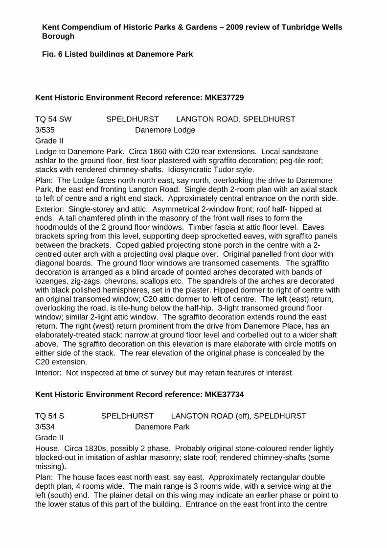
Kent Compendium of Historic Parks & Gardens – 2009 review of Tunbridge Wells Borough Fig. 6 Listed buildings at Danemore Park
Kent Historic Environment Record reference: MKE37729 TQ 54 SW SPELDHURST LANGTON ROAD, SPELDHURST 3/535 Danemore Lodge Grade II Lodge to Danemore Park. Circa 1860 with C20 rear extensions. Local sandstone ashlar to the ground floor, first floor plastered with sgraffito decoration; peg-tile roof; stacks with rendered chimney-shafts. Idiosyncratic Tudor style. Plan: The Lodge faces north north east, say north, overlooking the drive to Danemore Park, the east end fronting Langton Road. Single depth 2-room plan with an axial stack to left of centre and a right end stack. Approximately central entrance on the north side. Exterior: Single-storey and attic. Asymmetrical 2-window front; roof half- hipped at ends. A tall chamfered plinth in the masonry of the front wall rises to form the hoodmoulds of the 2 ground floor windows. Timber fascia at attic floor level. Eaves brackets spring from this level, supporting deep sprocketted eaves, with sgraffito panels between the brackets. Coped gabled projecting stone porch in the centre with a 2-centred outer arch with a projecting oval plaque over. Original panelled front door with diagonal boards. The ground floor windows are transomed casements. The sgraffito decoration is arranged as a blind arcade of pointed arches decorated with bands of lozenges, zig-zags, chevrons, scallops etc. The spandrels of the arches are decorated with black polished hemispheres, set in the plaster. Hipped dormer to right of centre with an original transomed window; C20 attic dormer to left of centre. The left (east) return, overlooking the road, is tile-hung below the half-hip. 3-light transomed ground floor window; similar 2-light attic window. The sgraffito decoration extends round the east return. The right (west) return prominent from the drive from Danemore Place, has an elaborately-treated stack: narrow at ground floor level and corbelled out to a wider shaft above. The sgraffito decoration on this elevation is mare elaborate with circle motifs on either side of the stack. The rear elevation of the original phase is concealed by the C20 extension. Interior: Not inspected at time of survey but may retain features of interest. Kent Historic Environment Record reference: MKE37734 TQ 54 S SPELDHURST LANGTON ROAD (off), SPELDHURST 3/534 Danemore Park Grade II House. Circa 1830s, possibly 2 phase. Probably original stone-coloured render lightly blocked-out in imitation of ashlar masonry; slate roof; rendered chimney-shafts (some missing). Plan: The house faces east north east, say east. Approximately rectangular double depth plan, 4 rooms wide. The main range is 3 rooms wide, with a service wing at the left (south) end. The plainer detail on this wing may indicate an earlier phase or point to the lower status of this part of the building. Entrance on the east front into the centre

room of the main block, which contains the stair. Principal rooms heated by 3 axial stacks and a right end stack; service wing heated by a left end (south) stack. Exterior: 2 storeys with a cellar under part of the service wing. Hipped slate roof. The main block has elaborate classical detail in the render; the ground floor bays divided by pilasters (some paired) with an entablature with a moudled cornice at first floor level and a deep platband above in imitation of a parapet. Above this band the angles of the first floor have rusticated quoins. Deep eaves, those of the main block carried on scroll-shaped brackets. Asymmetrical 1:3:1:2-bay front, one bay to the service block to the left; a projecting single-storey canted bay to the right; one bay to the entrance block and 2 bays to the left. The rendered entablature feature of the main block is carried across as the entablature of the porch, which has Tuscan columns in antis and a parapet surmounted by pineapple finials. Original tall glazed 4-panel front door with an overlight and an ornamental grille behind the glazed panels. The ground floor windows to the main block are 2-pane horned plate glass sashes, the 2 right hand windows with vallances for external blinds. The 3 first floor windows to the main block are similarly-glazed with rendered projecting architraves. The service wing, to the left has one first and one ground floor tripartite sash with vertical margin panes; shutters and rendered projecting architraves. Continuous sill band below the ground floor window; moulded band at first floor level. Rendered stacks with projecting cornices above a modillion frieze and C19 flared chimney pots. The other elevations of the main block continue in the same style with a 2-storey canted bay on the north elevation, which has a panel with armorial bearings on the first floor; tall tripartite sashes on the west elevation. The service wing has an external bell fixed to the south wall. Interior: Very complete including a good open string stair with slender turned balusters, a mahogany handrail and curtail step. Other features include panelled doors and moulded plaster cornices. A well-preserved gentleman's villa of the C19 with good classical detail.