the first mile project -- rotary club of toledo
TRANSCRIPT

The First MileExpanding Coverage of the Nation’s Water Monitoring Network
Jerry W. Wicks, Ph.D. Professor Emeritus Bowling Green State University Bowling Green, Ohio 43403 USA [email protected]

The last ten years were declared the United Nations’ International Decade for Action ‘WATER FOR LIFE’ 2005-2015.
Has the UN’s decade-long call for action been met or is there still a need to strengthen the world’s
water monitoring network?
2

The growing problem of heavy nutrient loads in the world’s waterways has been mapped. Based on data assembled by the United Nations, it is clear that in many parts of the world water problems persist and are growing.
Furthermore, evidence shows the existing water monitoring network cannot provide enough data to assess the situation in much of the world. This latest information from the UN’s Global Environment Monitoring System illustrates the need for an expanded water quality collection and reporting network.
http://www.un.org/waterforlifedecade/quality.shtml
3

To improve water monitoring, a more comprehensive information network is required.
It will take the addition of many more reporting sites, incorporating the latest telecommunications and information technology, and sampling at or near water’s First Mile to realize a significant improvement in water monitoring.
Models of social information processing http://www-personal.umich.edu/~ladamic/courses/
4
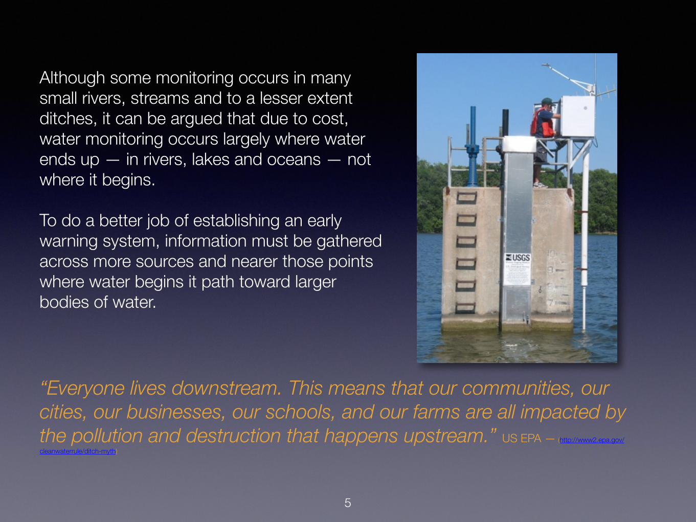
Although some monitoring occurs in many small rivers, streams and to a lesser extent ditches, it can be argued that due to cost, water monitoring occurs largely where water ends up — in rivers, lakes and oceans — not where it begins.
To do a better job of establishing an early warning system, information must be gathered across more sources and nearer those points where water begins it path toward larger bodies of water.
“Everyone lives downstream. This means that our communities, our cities, our businesses, our schools, and our farms are all impacted by the pollution and destruction that happens upstream.” US EPA — (http://www2.epa.gov/cleanwaterrule/ditch-myth)
5
6
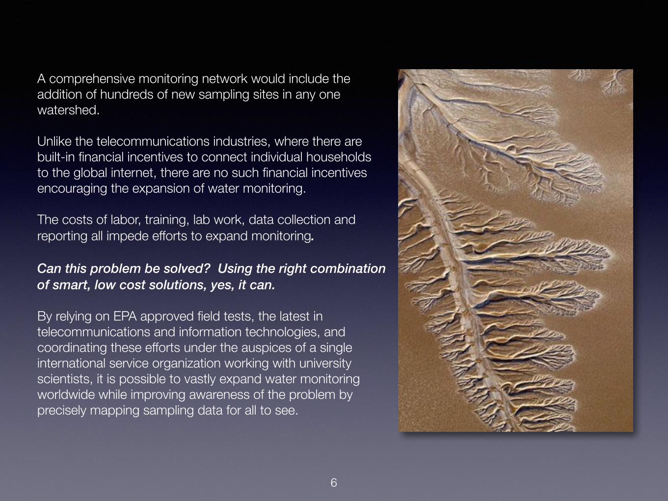
A comprehensive monitoring network would include the addition of hundreds of new sampling sites in any one watershed.
Unlike the telecommunications industries, where there are built-in financial incentives to connect individual households to the global internet, there are no such financial incentives encouraging the expansion of water monitoring.
The costs of labor, training, lab work, data collection and reporting all impede efforts to expand monitoring.
Can this problem be solved? Using the right combination of smart, low cost solutions, yes, it can.
By relying on EPA approved field tests, the latest in telecommunications and information technologies, and coordinating these efforts under the auspices of a single international service organization working with university scientists, it is possible to vastly expand water monitoring worldwide while improving awareness of the problem by precisely mapping sampling data for all to see.

There are four roadblocks to the expansion of water monitoring:
• Testing Costs • Data Collection & Reporting • Volunteers and Training • Organizational Coordination
Growing the network can be a difficult and expensive task, but there are ways around these roadblocks. Two of the solutions are technological, the other two organizational.
7

There is a low-cost, easily learned and simple-to-use field test solution (~$20 per annum for 25 tests).
The Hach test kit includes the essential measures: water temperature, pH, total orthophosphate, turbidity and dissolved oxygen.
Adopting a research design focusing on simple, inexpensive field measurements has its advantages: 1) kits are well known, EPA approved, and used worldwide, 2) volunteers obtain benchmark measures in the field, acting as an early warning system, and 3) significantly lowers the normally high costs of training, supplies, time and labor.
Learning to use the test kit is easy. Measurements take less than 20 minutes to complete and with the use of modern telecommunications data can be uploaded immediately to the Internet from the field.
Solution to Roadblock #1 - Testing Costs
(http://www.hach.com/phosphorus-orthophosphate-reactive-test-kit-model-po-19a/product?id=7640214959&callback=qs)
8

Solution to Roadblock #2 - Data Collection & Reporting
Three sets of interconnected technologies now make it possible to significantly extend the reach of data collection and reporting.
• Smart phones and tablets
• Mobile telecommunications
• And the integration of new web technologies
“For the first time, more than one-quarter of the global population will use smartphones in 2015, and by 2018, eMarketer estimates, over one-third of consumers worldwide, or more than 2.56 billion people, will do so.” http://www.emarketer.com/Article/2-Billion-Consumers-Worldwide-Smartphones-by-2016/1011694#sthash.HkqmPMTm.dpuf
9

Using volunteer-supplied and project-approved smartphones and tablets, simple data entry forms can be designed for mobile telecommunication devices for use in the field.
Forms would accept data and photos for uploading to the Internet, including date- and time-stamp, and GPS coordinates.
And by using push technology, volunteers agreeing to participate in push notification could be prompted to collect additional samples at a specific time and date, coinciding, for example, with a satellite flyover or meteorological event.
Solution to Roadblock #2 - Data Collection & Reporting, cont.
10

Uploaded field data would be mapped within minutes and viewable anywhere in the world via a web browser.
Maps would be interactive. As illustrated, clicking on a site icon displays date, time, site coordinates, measurements and photos.
Groups of sites can be selected by date, time or measurement values and mapped, making it possible to highlight watershed trouble spots and patterns. Summary results can also be obtained in tabular format.
Solution to Roadblock #2 - Data Collection & Reporting, cont.
11
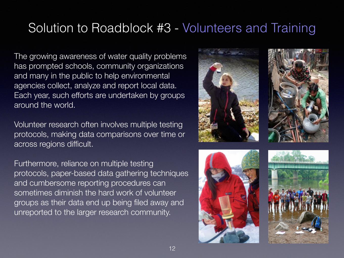
The growing awareness of water quality problems has prompted schools, community organizations and many in the public to help environmental agencies collect, analyze and report local data. Each year, such efforts are undertaken by groups around the world.
Volunteer research often involves multiple testing protocols, making data comparisons over time or across regions difficult.
Furthermore, reliance on multiple testing protocols, paper-based data gathering techniques and cumbersome reporting procedures can sometimes diminish the hard work of volunteer groups as their data end up being filed away and unreported to the larger research community.
Solution to Roadblock #3 - Volunteers and Training
12

13
All necessary administrative forms, mobile apps, training videos and protocols will be available on the web, making it possible for anyone with an approved mobile device, Rotary-conducted training and accepted project application form to 1) obtain a test kit and 2) begin contributing to the First Mile Project.
Environmental and educational organizations involved in ongoing global water monitoring projects can participate without detracting from their own research. And since measures are gathered in the field and reported directly to the web, all First Mile participants receive immediate feedback on their efforts and that of other participants around the globe.
The First Mile Project creates the first water monitoring network capable of mapping and reporting water quality data collected anywhere in the world, in near real-time.
Solution to Roadblock #3 - Volunteers and Training cont.
In addition to the participation of schools, environmental groups and the general public, a partnership will be sought with one of the world’s largest and most highly regarded service organizations - Rotary.
Rotary has identified sustainable water and sanitation as an issue of critical importance to the more than 2.5 billion people worldwide who are without access to clean water. Being able to pinpoint and measure the quality of local water sources is essential to Rotary’s sustainable water initiative.
Rotary is an international organization consisting of nearly 35,000 clubs and over 1.2 million members situated in nearly every country of the world.
Rotary clubs, with the encouragement and advice of their national and international leaders, would serve as ideal local organizations capable of generating sustained interest and support in the community, provide training to volunteers while raising the funds needed to purchase testing kits.
Rotary is a global network of community volunteers. The participation of this international service organization is instrumental to the building of a comprehensive network capable of monitoring water quality anywhere in the world.
Solution to Roadblock #3 - Volunteers and Training, cont.
14

Solution to Roadblock #4 - Organizational Coordination
Overall coordination of research, training, supply logistics, data warehousing and software design will be handled by scientists in the Departments of Geological Sciences and Computer Sciences at Bowling Green State University.
Administration of budgets and liaison with Rotary International will be coordinated through BGSU’s G-eco Remote Sensing Lab.
15
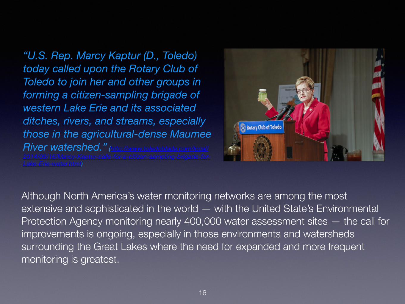
Although North America’s water monitoring networks are among the most extensive and sophisticated in the world — with the United State’s Environmental Protection Agency monitoring nearly 400,000 water assessment sites — the call for improvements is ongoing, especially in those environments and watersheds surrounding the Great Lakes where the need for expanded and more frequent monitoring is greatest.
“U.S. Rep. Marcy Kaptur (D., Toledo) today called upon the Rotary Club of Toledo to join her and other groups in forming a citizen-sampling brigade of western Lake Erie and its associated ditches, rivers, and streams, especially those in the agricultural-dense Maumee River watershed.” (http://www.toledoblade.com/local/2014/09/15/Marcy-Kaptur-calls-for-a-citizen-sampling-brigade-for-Lake-Erie-water.html)
16

“Across the country, trained volunteers are monitoring the condition of their local streams, lakes, estuaries and wetlands. EPA encourages all citizens to learn about their water resources and supports volunteer monitoring because of its many benefits. Volunteer water monitors build community awareness of pollution problems, help identify and restore problem sites, become advocates for their watersheds and increase the amount of needed water quality information available on our waters.” http://water.epa.gov/type/rsl/monitoring/index.cfm
The First Mile Project ultimately extends the work of the US Environmental Protection Agency’s extensive monitoring and assessing water quality program by encouraging further community involvement in water research, adding to the agency’s National Directory of Volunteer Monitoring Programs while serving as a model and global extension of world water quality monitoring
17

SummaryWater quality monitoring must be expanded, especially in those watersheds experiencing sudden and unusual stress, such as the environments surrounding the Great Lakes.
To address this need, development of a water monitoring early warning system is proposed.
The project relies largely on the help of volunteers, most of whom will be organized and trained through participating Rotary clubs.
Field measurements will be obtained using reliable, low cost Hach field water test kits.
The real-time reporting and mapping of test results, GPS coordinates and photographs of sample sites will be accomplished using volunteer supplied smart mobile devices, the latest mobile telecommunication networks, smart phone apps, and database and web mapping systems.
Under the leadership of scientists at Bowling Green State University’s Geology Remote Sensing Lab and the Rotary Club of Toledo, the First Mile Project will create a low cost, real-time water quality monitoring and reporting system capable of being replicated and deployed worldwide.
18

Funding: Phase I - Assemble Year One funding for personnel, supplies, design work and pilot testing, $120,000. Phase II - Year Two expansion to additional watersheds worldwide, $80,000.
Personnel: Dr. Jerry Wicks, Project Director Dr. Anita Simic, Director of G-eco lab, BGSU Dr. Robert Vincent, Rotary Liaison and Remote Sensing Advisor Biology Field Advisor, to be named Video Producer/Director, Jeffrey Betts, Producer One Media LLC Software Design and Engineering, Dr. Wicks and AGILE Software, BGSU Computer Science Dept.
Supplies: 150 tests kits @ ~$20 each
Software Development: Mobile App (iOS and Android), web design and database engineering
Training Materials and Video Production: Planning, design and video production of field training modules and documentation for use at participating Rotary Clubs in the Maumee and Sandusky River watersheds
Field Test: Proof of concept field pilot projects among participating Rotary Clubs in the Maumee & Sandusky River watersheds
Report and Presentation: Evaluation and presentation of First Mile Project data at the 2017 Rotary Lake Erie Crisis Conference
19
Action Plan

For Further Information:
Jerry W. Wicks, PhD Professor Emeritus, BGSU
Bowling Green, Ohio [email protected]
20