the evolution of africa on early maps: part i ancient period summary · 2017-11-12 · the...
TRANSCRIPT
1
The Evolution of Africa on Early Maps: Part I Ancient Period Summary To summarize this “ancient cartographic period”, no contemporary world maps from the ancient Greeks, Romans, Arabs or Chinese showing any part of Libya/Africa has survived. All of these geographical texts were produced in Western Europe, primarily in Greece and the Roman Empire. That said, many of the ancient geographical writings describing contemporary concepts of the world, including Africa, have survived and the maps presented here are interpretations of these texts by modern 19th and 20th century scholars, and, in case of Pomponius Mela 16th century and Ptolemy, 15th and 16th century cartographers. Again, except Ptolemy, all of the Greek writers depicted an Africa surrounded by water, limited to roughly north of the equator and separated from Asia by the Red Sea. The Nile River was displayed running south to north from the Mountains of the Moon in most texts, or, according to Herodotus, running westward to the Atlas Mountains. Those writers who engaged in describing the world limited their descriptions to the oikoumene [known inhabited earth]. Writers like Crates and others certainly accepted the fact that there were other large land areas on the spherical-shaped earth, but nothing was known about them or their potential population. Some philosophers speculated that access to these other unknown landmasses could not be attempted due to extreme weather conditions in the Torrid Zone and the Frigid Zones. As a result, with respect to Africa, only the northern portion, above the equator, was described, despite the story published by Herodotus of the Phoenician expedition that circumnavigated Africa in a counterclockwise direction in 600 B.C. Monographs on this website referenced herein: #105 Homer #106 Greek Views #108 Hecatæus #109 Herodotus #112 Eratosthenes #113 Crates #115 Strabo #116 Pomponius Mela #118 Orbis Terrarum #119 Ptolemy
2
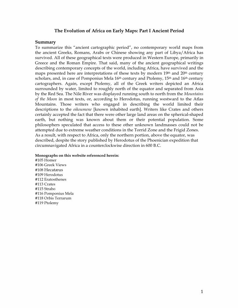
Homer’s world concept 900 B.C.
AreconstructionbyW.A.Heidel(The Frame of the Ancient Greek Maps), oftheconceptual
frameoftheGreeks’viewoftheoikumene[inhabitedworld].
3
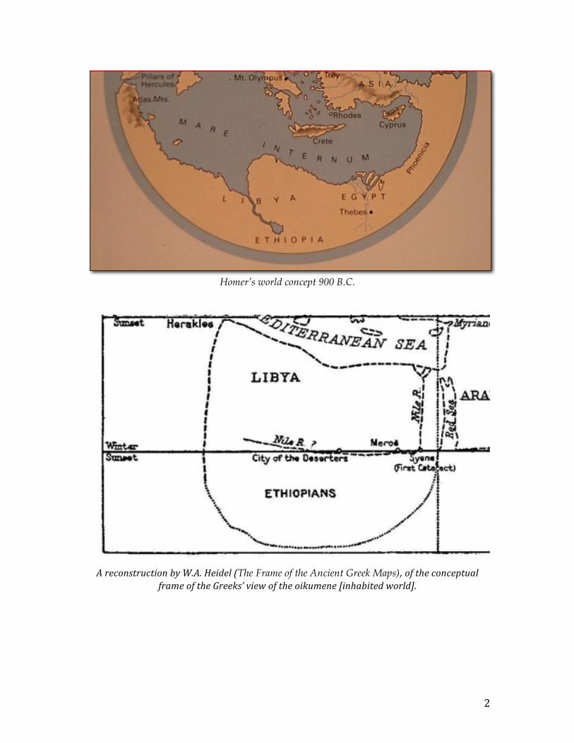
Reconstruction of Hecatæus’ World Map 500B.C.
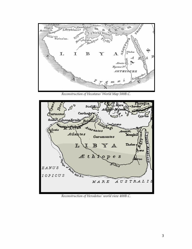
Reconstruction of Herodotus’ world view 400B.C.
4
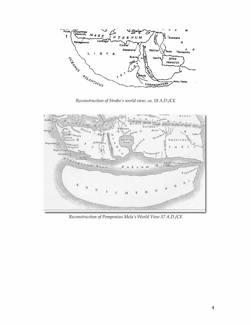
Reconstruction of Strabo’s world view, ca. 18 A.D./CE
Reconstruction of Pomponius Mela’s World View 37 A.D./CE
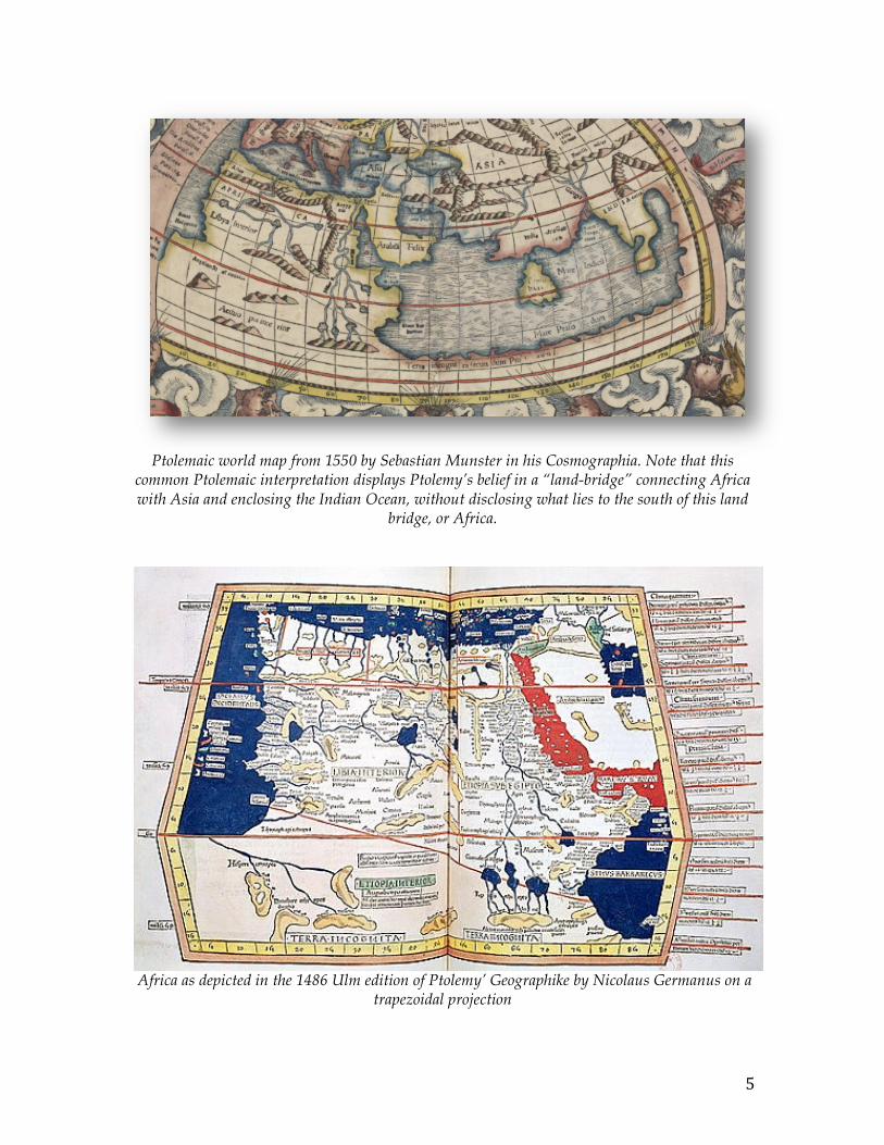
5
Ptolemaic world map from 1550 by Sebastian Munster in his Cosmographia. Note that this common Ptolemaic interpretation displays Ptolemy’s belief in a “land-bridge” connecting Africa with Asia and enclosing the Indian Ocean, without disclosing what lies to the south of this land
bridge, or Africa.
Africa as depicted in the 1486 Ulm edition of Ptolemy’ Geographike by Nicolaus Germanus on a trapezoidal projection