tennessee common core reading unit for grades 2-3: oceans ... · tennessee common core reading unit...
TRANSCRIPT
Tennessee Common Core Reading Unit for Grades 2-3:
Oceans and Continents
Learning Objective: The goal of this unit is to teach 2nd and 3rd grade students to read closely and critically in order to comprehend complex informational text. In this unit, the teacher uses a variety of strategies to actively engage students in analyzing vocabulary, answering text-dependent questions, and summarizing the text. Students learn to take notes using a graphic organizer and to use those notes to develop a deeper understanding of the text and for later use in writing. Discussions and writing exercises help students to construct meaning of the texts in a way that “sticks.” Reading Tasks: The first text, “Ocean” will be read aloud in its entirety for the first read. The text is then read multiple times with guiding questions for teachers. The Lexile level is 570. The second text, “Water, Water Everywhere: Facts About the Ocean” will be read aloud in its entirety for the first read. The text is then read multiple times with guiding questions for teachers. The Lexile level is 840. The third text, “Continents” will be read aloud in its entirety for the first read. The text is then read multiple times with guiding questions for teachers. The Lexile level is 600. The fourth text, “Seven Special Places” will be read aloud in its entirety for the first read. The text is then read multiple times with guiding questions for teachers. The Lexile level is 840. All full texts are included in this unit. These texts are also located in the Tennessee Electronic Library (www.tntel.tnsos.org). The qualitative measure for all of the texts is moderately complex, as measured by the Informational Text Qualitative Measures Rubric as found at http://www.tncore.org/english_language_arts/curricular_resources/text_complexity.aspx. These texts are moderately complex based on the language features and knowledge demands. Please note that some words have been glossed and are provided in a brief glossary at the end of each text. The glossed words have an asterisk (*). Generally, these are words that can’t be defined by context. Discussion/Language Tasks: The text is presented and explored orally. Collaborative conversations about the content from the texts form the foundation of the lessons. Writing Tasks: All the writing tasks created for this unit are highly guided and scaffolded. In many lessons, teachers use modeled writing to show students how to write. Students learn to take notes using a graphic organizer and to use those notes to develop a
1
deeper understanding of the text. Students create a written summary of “Oceans” and “Continents”. Then students write an informative/explanatory essay in which they compare and contrast oceans or continents, citing evidence and examples from the texts. Note: These units are peer-reviewed and have been vetted for content by experts. However, it is the responsibility of local school districts to review these units for social, ethnic, racial, and gender bias before use in local schools. Common Core Standards: Strand 2nd Grade 3rd Grade Reading: Informational Text RI.2.1 Ask and answer such questions as who, what,
where, when, why, and how to demonstrate understanding of key details in a text. RI.2.2 Identify the main topic of a multi-paragraph text as well as the focus of specific paragraphs within the text. RI.2.4 Determine the meaning of words and phrases in a text relevant to a grade 2 topic or subject area. RI.2.9 Compare and contrast the most important points presented by two texts on the same topic. RI.2.10 By the end of year, read and comprehend informational texts, including history/social studies, science, and technical texts, in the grades 2–3 text complexity band proficiently, with scaffolding as needed at the high end of the range.
RI.3.1 Ask and answer questions to demonstrate understanding of a text, referring explicitly to the text as the basis for the answers. RI.3.2 Determine the main idea of a text; recount the key details and explain how they support the main idea. RI.3.4 Determine the meaning of general academic and domain-specific words and phrases in a text relevant to a grade 3 topic or subject area. RI.3.9 Compare and contrast the most important points and key details presented in two texts on the same topic. RI.3.10 By the end of the year read and comprehend informational texts, including history/social studies, science, and technical texts, at the high end of the grades 2–3 text complexity band independently and proficiently.
Writing W.2.2 Write informative/explanatory texts in which they introduce a topic, use facts and definitions to develop points, and provide a concluding statement or
W.3.2 Write informative/explanatory texts to examine a topic and convey ideas and information clearly.
2
section. W.2.7 Participate in shared research and writing projects (e.g., read a number of books on a single topic to produce a report; record science observations). W.2.8 Recall information from experiences or gather information from provided sources to answer a question.
a. Introduce a topic and group related information together; including illustrations when useful to aiding comprehension. b. Develop the topic with facts, definitions, and details. c. Use linking words and phrases (e.g. also, another, and, more, but) to connect ideas within categories of information. d. Provide a concluding statement or section. W.3.7 Conduct short research projects that build knowledge on a topic. W.3.8 Recall information from experiences or gather information from print and digital sources; take brief notes on sources and sort evidence into provided categories.
Speaking and Listening SL.2.1 Participate in collaborative conversations with diverse partners about grade 2 topics and texts with peers and adults in small and larger groups. SL.2.2 Recount or describe key ideas or details from a text read aloud or information presented orally or through other media.
SL.3.1 Engage effectively in a range of collaborative discussions (one-on-one, in groups, and teacher-led) with diverse partners on grade 3 topics and texts, building on others’ ideas and expressing their own clearly. SL.3.2 Determine the main ideas and supporting details of a text read aloud or information presented in diverse media and formats, including visually, quantitatively, and orally.
Language L.2.1 Demonstrate command of the conventions of standard English grammar and usage when writing. L.2.2 Demonstrate command of the conventions of standard English capitalization, punctuation, and spelling when writing. L.2.4a Determine or clarify the meaning of unknown and multiple-meaning words and phrases based on
L.3.1 Demonstrate command of the conventions of standard English grammar and usage when writing or speaking. L.3.2 Demonstrate command of the conventions of standard English capitalization, punctuation, and spelling when writing. L.3.4a Determine or clarify the meaning of unknown
3
grade 2 reading and content, choosing flexibly from an array of strategies.
and multiple-meaning word and phrases based on grade 3 reading and content, choosing flexibly from a range of strategies.
Social Studies (TN Social Studies Standards 2014-2015)
2.13 Compare how maps and globes depict geographical information in different ways. 2.14 Construct a globe depicting the four hemispheres, seven continents, and five oceans using the equator and prime meridian. 2.15 Create a map depicting the current boundaries of the United States, Canada, and Mexico and recognize they are part of the North American continent. 2.17 Locate major cities, bodies of water, mountain ranges and rivers in the United States (Atlantic and Pacific Oceans).
3.1 Process and report information identifying, locating, comparing, and contrasting the major continents and oceans: North America, South America, Europe, Africa, Australia, Asia, Antarctica, Arctic, Atlantic, Indian, Pacific and Southern using maps, globes, and other technologies. 3.2 Interpret maps and globes using common terms, including country, region, mountain, hemisphere, latitude, north pole, south pole, equator, time zones, elevation, approximate distances in miles, isthmus, and strait. 3.3 Use cardinal directions, map scales, legends, titles, and longitude and latitude to locate major cities and countries in the world.
A Note on the Standards: This unit is not designed to emphasize Foundational Skills Standards. Teachers are encouraged to address any Foundational Skills standards that they feel are needed or will enhance this unit.
4
First Full Text:
Oceans
Oceans are large bodies of saltwater. They cover almost three-fourths of Earth's surface. The oceans contain 97 percent of all the water on Earth. Earth has five oceans. The largest ocean is the Pacific Ocean. It is located between North and South America and Asia. The Atlantic Ocean is located between North and South America and Europe and Africa. The Indian Ocean is located between Africa and Australia. The Southern Ocean (Antarctic Ocean) surrounds Antarctica. The Arctic Ocean is the smallest of the five oceans. It is located above the Arctic Circle.
The oceans help control Earth's climate*. In summer, the oceans absorb heat from the sun. In winter, the oceans release this heat into the air. When the sun heats the surface of the oceans, water evaporates. It turns into vapor. This vapor rises into the air. Water vapor forms clouds. When these clouds cool off, they release rain. Almost all of the rain that falls on Earth comes from the oceans.
Ocean water moves in patterns called currents. Some currents carry warmer water toward the North or South poles. Other currents carry cold water toward places. Ocean currents help to cool off places that are very hot. They also help to warm up areas that are very cold.
Many plants and animals live in the ocean. They include plankton. Some plankton are plants. Some are animals. Most plankton are so small they can only be seen with a microscope. Plankton are food for larger animals. Many kinds of fish live in the ocean. They include eels, sharks, swordfish, and tuna. Shellfish also live in the oceans. They include shrimps, crabs, and lobster. Other ocean animals are mammals, like dolphins, seals, walruses, and whales.
Source Citation: "Oceans." Kids InfoBits Presents: Biology and Life Sciences. Gale, 2009. Reproduced in Kids InfoBits. Detroit: Gale, 2013. http://galenet.galegroup.com/servlet/KidsInfoBits Document Number: BX3201350075 Glossary:
Climate- the usual weather in a place or region
5
Second Full Text:
Water, Water Everywhere: Facts About the Ocean
If you've been to the beach, you probably know a few things about the ocean. It's huge, the water tastes salty, and the waves never stop. There's more to learn about the ocean, though. Did you know that...
Almost three-quarters of earth's surface is covered by salt water--one enormous world ocean. Geographers have named four parts of this global ocean: the Atlantic Ocean, the Pacific Ocean, the Indian Ocean, and the Arctic Ocean.
The world ocean is not only big. It is deep, too often several miles deep. The deepest spot on earth is the Mariana Trench in the Pacific--almost seven miles down!
The "salt" in ocean water is actually several different kinds of minerals. The minerals come from rocks and soil on land. For millions of years, rivers and the wind have carried minerals into the sea.
Waves are caused by wind pushing the surface of the water. Ocean water is always moving. Currents carry seawater for thousands of miles around the globe.
The ocean is home to all kinds of life forms--from tiny creatures that float on the surface to giant whales that dive to great depths.
The ocean supplies the moisture for most of our rainfall. In summer, the ocean absorbs extra heat from the sun, and in winter, it releases heat back into the air. Without the oceans, life could not exist on earth.
The Pacific Ocean is the largest and deepest of the world's oceans. It is bigger than the entire landmass of earth--covering nearly one-third of earth's surface. It contains about half of all the seawater in the world. Surrounding the Pacific are a series of volcanoes, known as the Ring of Fire. Despite all this, the name Pacific means "peaceful."
The Atlantic Ocean is about one-half the size of the Pacific. The Sargasso Sea, a large area within the Atlantic, is marked by calm
6
water and lots of brown seaweed. American eels, which live in inland streams and rivers, swim out into the Atlantic to the Sargasso Sea to give birth to their young.
The Arctic Ocean is the smallest of the world's oceans. (In fact, some geographers say it is of the Atlantic Ocean.) Located near the North Pole, it is almost entirely covered by ice in winter. The ice is thick enough to trap large ships and prevent them from moving. Huge chunks of ice break apart and float into the Atlantic Ocean as icebergs. The ice prevents sunlight from reaching the water, so it is the most barren (empty of life) of the world's oceans.
The Indian Ocean has reliable winds, and because of this, sailors crossed the Indian Ocean before other oceans. About 2,000 years ago, traders were sailing from eastern Africa to India to the East Indies islands. The winds in the Indian Ocean are called monsoons. In summer, they bring drenching rains to southern Asia.
Sometimes people call the ocean "the sea." To geographers, though, a sea is a part of the ocean that is partially or wholly enclosed by land. There are more than 50 seas.
Source Citation: “Water, Water Everywhere: facts about the ocean” Appleseeds, May 2001 v3 i9 p2 COPYRIGHT 2001 Cobblestone Publishing, Co. Document Number: A74398028
7
Third Full Text
Continents Continents are the largest landmasses on Earth. There are seven of them. From largest to smallest, they are: Asia, Africa, North America, South America, Antarctica, Europe, and Australia. Europe and Asia together are called Eurasia. Russia has land in both Europe and Asia. Russians think of Eurasia as one continent rather than two. Turkey is also in Europe and Asia. North America and South America are connected by Central America. All the lands of the Western Hemisphere together are called the Americas.
Islands* are usually considered part of the continent that they are closest to. For example, Greenland is an island north of North America. It is considered to be part of the North American continent. Many islands are not part of any continent. Some examples are New Zealand, French Polynesia, and the Hawaiian Islands.
The continents are very different in size. Asia is at least five times larger than Australia. The number of people who live on each continent also varies. Asia has the largest population. Antarctica has the smallest. There are no permanent residents in Antarctica.
In Asia the city with the largest population is Shanghai, China. In Africa it is Lagos, Nigeria. The city with the largest population in Europe is Istanbul, Turkey, and in Australia it is Sydney. North America's city is Mexico City, Mexico, and South America's is São Paulo, Brazil. The largest city in Antarctica is McMurdo Station.
Each continent has a different number of countries*. Currently, Africa has the most with 54. Europe is next with 47. Asia has 44, North America has 23, and South America has 12. Australia is one country. There are no countries in Antarctica.
Source Citation: "Continents." Kids InfoBits Presents: Geography. Gale, 2012. Reproduced in Kids InfoBits. Detroit: Gale, 2013. http://galenet.galegroup.com/servlet/KidsInfoBits Document Number: BX3201367051 Glossary: Countries- an area or land that is controlled by its own government Islands- areas of land surrounded by water
8
Fourth Full Text
Seven Special Places
Home, Sweet Home!
North America is where we live. It is the continent that produces corn. Corn is used to feed people and animals. It can also be used as fuel to heat homes and help automobiles run.
An Ancient City
South America is the site of Machu Picchu. That city was built hundreds of years ago by people called the Incas. That ancient city is high in the Andes Mountains in Peru.
Tilting Tower
Europe is home to the Leaning Tower of Pisa. That is a famous tower in Italy. The tower was built on soil made up of sand and clay. Some parts of the building have sunk into the ground more than others.
A Salty Sea
Asia is the largest continent and is the site of the salty Dead Sea. That body of water is a lake not a sea. Nothing can live in the water because it is so salty. The high levels of salt help people float easily.
That's Hot!
Africa is the hottest continent. It is also home to some of the biggest animals in the world. The African elephant is the largest living land mammal, and the ostrich is the largest living bird. Those animals can really take the heat!
9
The Big Chill
Antarctica is the coldest place on Earth. Animals in Antarctica, such as penguins, whales, and seals, have a thick layer of fat called blubber. That helps them survive the cold weather.
A New Name
Australia is a place that has two names. Some geography experts call it Oceania! They want to use that different name to include Australia plus the tiny nearby islands. Australia also is the only natural home to some of the world's most unusual animals. Kangaroos, koalas, and duck-billed platypuses live there.
Source Citation: “Seven special places: look at the map as you read seven special facts about seven special continents” Weekly Reader, Edition 2 (including Science Spin), Jan 5, 2007 v76 i15 p2(3) COPYRIGHT 2007 Weekly Reader Corp. Document Number: A157097969
10
Unit Overview This is a suggested timeline in which to teach this unit. Times can be flexible to meet the needs of the students and schedules. Teachers are encouraged to support the learning of students by using pictures of the oceans and continents. Further, maps, globes, and other technologies should be used to enhance comprehension. Day 1: Read the first text (“Oceans”) aloud in its entirety. Discuss the main idea. Write a summary. Day 2: Re-read the first text in sections focusing on vocabulary and text dependent questions. Day 3: Students re-read the first text silently. Use a graphic organizer to gather information. Day 4: Read the second text (Water, Water Everywhere: Facts About the Ocean”) aloud in its entirety. Discuss the main idea. Day 5: Re-read the second text in sections focusing on vocabulary and text dependent questions. Day 6: Students re-read the second text silently. Use a graphic organizer to gather information. Day 7: Read the third text (“Continents”) aloud in its entirety. Discuss the main idea. Write a summary. Day 8: Re-read the third text in sections focusing on vocabulary and text dependent questions. Day 9: Students re-read the third text silently. Use a graphic organizer to gather information. Day 10: Read the fourth text (“Seven Special Places”) aloud, in its entirety. Discuss the main idea. Day 11: Re-read the fourth text in sections focusing on vocabulary and text dependent questions. Day 12: Students re-read the fourth text silently. Use a graphic organizer to gather information. Day 13: Students use the evidence gathered from all texts to write to inform/explain. Day 14: Continue writing as needed.
At the end of the unit are extension ideas for Social Studies. There are also suggestions for how to support struggling
readers and writers. Finally, there are suggestions for formative assessments to use with this unit.
11
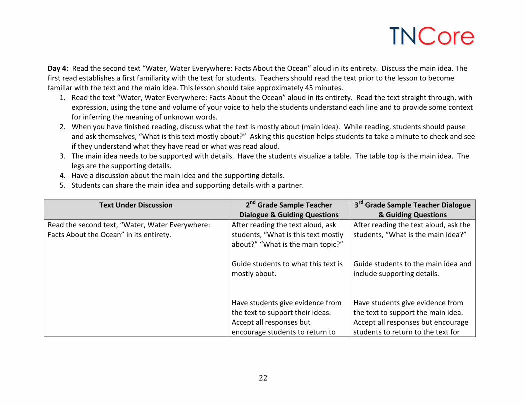
Directions for Teachers Day 1: Read the first text “Oceans” aloud in its entirety. Discuss the main idea. Write a summary. The first read establishes a first familiarity with the text for students. Teachers should read the text prior to the lesson to become familiar with the text and the main idea. This lesson should take approximately 45 minutes.
1. Read the text “Oceans” aloud in its entirety. Read the text straight through, with expression, using the tone and volume of your voice to help the students understand each line and to provide some context for inferring the meaning of unknown words.
2. When you have finished reading, discuss what the text is mostly about (main idea). While reading, students should pause and ask themselves, “What is this text mostly about?” Asking this question helps students to take a minute to check and see if they understand what they have read or what was read aloud.
3. The main idea needs to be supported with details. Have the students visualize a table. The table top is the main idea. The legs are the supporting details. Either draw the main idea graphic organizer (provided on the following page) on chart paper or project it. If the teacher chooses, students may record the information on individual graphic organizers.
4. Have a discussion about the main idea. The teacher records what the text is mostly about (main idea) using the main idea graphic organizer.
5. Have a discussion about the supporting details. The teacher records the supporting details using the main idea graphic organizer. The graphic organizer is designed for four details. The text may have more or less.
6. Have a discussion about a conclusion. The teacher records the conclusion using the main idea graphic organizer. 7. Before students write the summary, they should “Talk the Writing”. Students will talk through what the text is mostly about
(main idea), the supporting details and the conclusion with a partner using the notes from the main idea graphic organizer. This gives students confidence and helps students to organize their thinking before writing.
8. The teacher will create a chart that details the key points in writing a summary. This chart can become an anchor chart for future summary writing. A sample of the chart is below. Teachers may elaborate on this chart as needed.
9. Using the notes from the main idea graphic organizer, students will work collaboratively to write a brief summary. For students who need more support, the teacher may want to talk through the writing steps below and then write the summary on chart paper. Students can then copy the summary. For more advanced students, the teacher may allow them to write the summary independently. Teachers may decide to do this part of the unit in a whole group setting or in small groups to better individualize the learning and support.
Summary Writing Chart 1. State the main idea 2. Support with details 3. Sum it up with a conclusion
12

Text Under Discussion 2nd Grade Sample Teacher Dialogue & Guiding Questions
3rd Grade Sample Teacher Dialogue & Guiding Questions
Read the first text, “Oceans” in its entirety. After reading the text aloud, ask students, “What is this text mostly about?” “What is the main topic?” Guide students to what this text is mostly about. Have students give evidence from the text to support their ideas. Accept all responses but encourage students to return to the text for details. Examples of teacher questions that draw students back into the text: “Why?” “Where did you see that?” “What lines in the text support your ideas?” “Let me see if we can find that part and read it again.” “How do you know?” “What words in the text make you think that?”
After reading the text aloud, ask the students, “What is the main idea?” Guide students to the main idea and include supporting details. Have students give evidence from the text to support the main idea. Accept all responses but encourage students to return to the text for details. Examples of teacher questions that draw students back into the text: “Why?” “Where did you see that?” “What lines in the text support your ideas?” “Let me see if we can find that part and read it again.” “How do you know?” “What words in the text make you think that?”
13
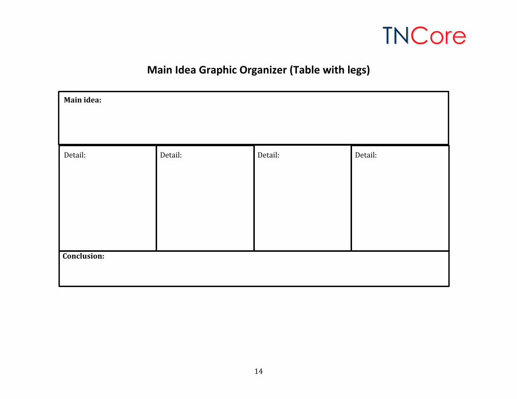
Main Idea Graphic Organizer (Table with legs)
Main idea:
Detail: Detail: Detail: Detail:
Conclusion:
14
Day 1 Extension Ideas:
1. Teachers may wish to create an essential question for each day of the unit or for the unit as a whole. An example essential question might be, “In what ways are the major continents and oceans similar and different?”
2. For more advanced students, Day 1 can be modified so that students: • Read the text again silently or with a partner. • Complete the graphic organizer with a partner or independently. • Write a summary independently or with a partner.
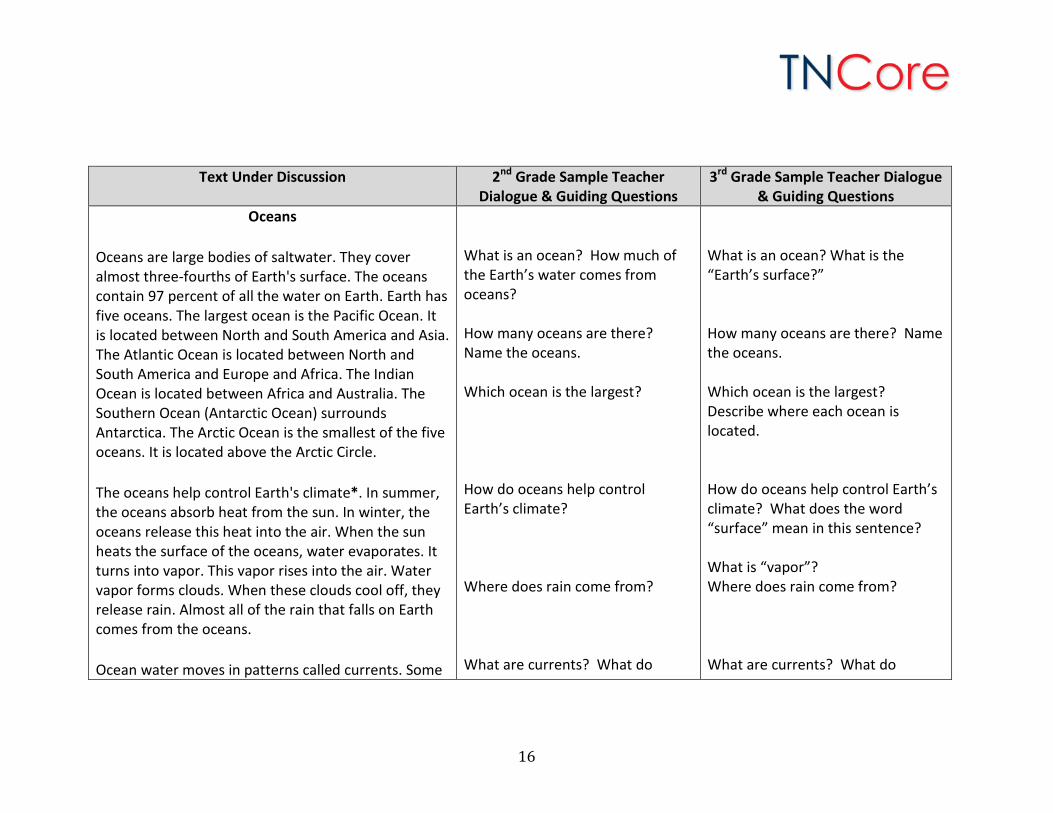
Day 2: Re-read the first text in sections focusing on vocabulary and text dependent questions. In the second read, the teacher guides students slowly and carefully through the text, prodding their thinking with text-dependent questions. Sample text-dependent questions can be found in the table below. Teachers are encouraged to ask additional questions, as well as higher-order questions, that may enhance comprehension. This lesson will take approximately 45 minutes.
1. Begin by re-reading the main idea, supporting details and conclusion from the graphic organizer. Take a few minutes to discuss.
2. Read sections of the text and use the sample questions provided in the table below. 3. Allow students to discuss ways in which the five oceans are similar and different. 4. Use maps and globes to locate the five oceans. Discuss ways in which the oceans look similar and different on maps and
globes.
15
Text Under Discussion 2nd Grade Sample Teacher Dialogue & Guiding Questions
3rd Grade Sample Teacher Dialogue & Guiding Questions
Oceans
Oceans are large bodies of saltwater. They cover almost three-fourths of Earth's surface. The oceans contain 97 percent of all the water on Earth. Earth has five oceans. The largest ocean is the Pacific Ocean. It is located between North and South America and Asia. The Atlantic Ocean is located between North and South America and Europe and Africa. The Indian Ocean is located between Africa and Australia. The Southern Ocean (Antarctic Ocean) surrounds Antarctica. The Arctic Ocean is the smallest of the five oceans. It is located above the Arctic Circle.
The oceans help control Earth's climate*. In summer, the oceans absorb heat from the sun. In winter, the oceans release this heat into the air. When the sun heats the surface of the oceans, water evaporates. It turns into vapor. This vapor rises into the air. Water vapor forms clouds. When these clouds cool off, they release rain. Almost all of the rain that falls on Earth comes from the oceans.
Ocean water moves in patterns called currents. Some
What is an ocean? How much of the Earth’s water comes from oceans? How many oceans are there? Name the oceans. Which ocean is the largest? How do oceans help control Earth’s climate? Where does rain come from? What are currents? What do
What is an ocean? What is the “Earth’s surface?” How many oceans are there? Name the oceans. Which ocean is the largest? Describe where each ocean is located. How do oceans help control Earth’s climate? What does the word “surface” mean in this sentence? What is “vapor”? Where does rain come from? What are currents? What do
16
Day 2 Extension Idea: Teachers may wish to create a class chart with essential vocabulary. This chart could include words that capture the essence of the meaning of each text. Or this chart could contain vocabulary words that are new to students. Students can be encouraged to use the words from the chart in their speaking and writing. Additionally, students could create a collection of vocabulary words using a graphic organizer. A sample vocabulary graphic organizer using the Frayer Model is included below.
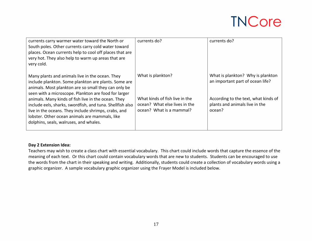
currents carry warmer water toward the North or South poles. Other currents carry cold water toward places. Ocean currents help to cool off places that are very hot. They also help to warm up areas that are very cold.
Many plants and animals live in the ocean. They include plankton. Some plankton are plants. Some are animals. Most plankton are so small they can only be seen with a microscope. Plankton are food for larger animals. Many kinds of fish live in the ocean. They include eels, sharks, swordfish, and tuna. Shellfish also live in the oceans. They include shrimps, crabs, and lobster. Other ocean animals are mammals, like dolphins, seals, walruses, and whales.
currents do? What is plankton? What kinds of fish live in the ocean? What else lives in the ocean? What is a mammal?
currents do? What is plankton? Why is plankton an important part of ocean life? According to the text, what kinds of plants and animals live in the ocean?
17
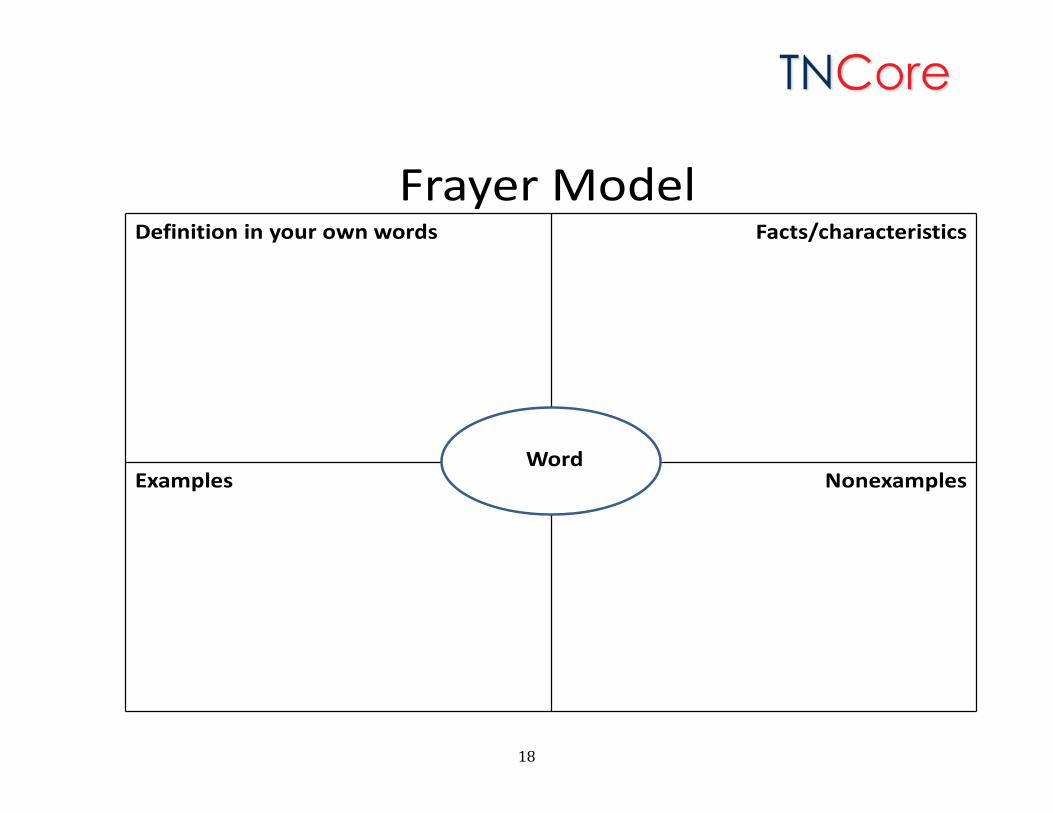
Frayer ModelDefinition in your own words Facts/characteristics
Examples NonexamplesWord
18
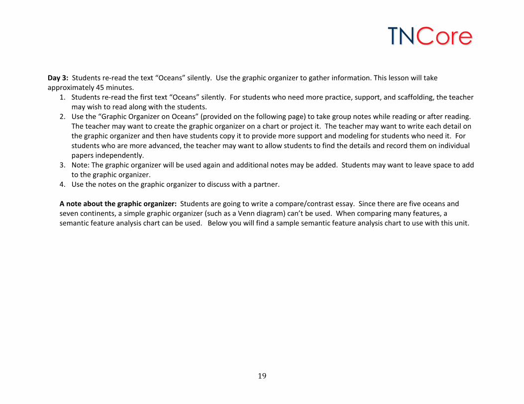
Day 3: Students re-read the text “Oceans” silently. Use the graphic organizer to gather information. This lesson will take approximately 45 minutes.
1. Students re-read the first text “Oceans” silently. For students who need more practice, support, and scaffolding, the teacher may wish to read along with the students.
2. Use the “Graphic Organizer on Oceans” (provided on the following page) to take group notes while reading or after reading. The teacher may want to create the graphic organizer on a chart or project it. The teacher may want to write each detail on the graphic organizer and then have students copy it to provide more support and modeling for students who need it. For students who are more advanced, the teacher may want to allow students to find the details and record them on individual papers independently.
3. Note: The graphic organizer will be used again and additional notes may be added. Students may want to leave space to add to the graphic organizer.
4. Use the notes on the graphic organizer to discuss with a partner. A note about the graphic organizer: Students are going to write a compare/contrast essay. Since there are five oceans and seven continents, a simple graphic organizer (such as a Venn diagram) can’t be used. When comparing many features, a semantic feature analysis chart can be used. Below you will find a sample semantic feature analysis chart to use with this unit.
19
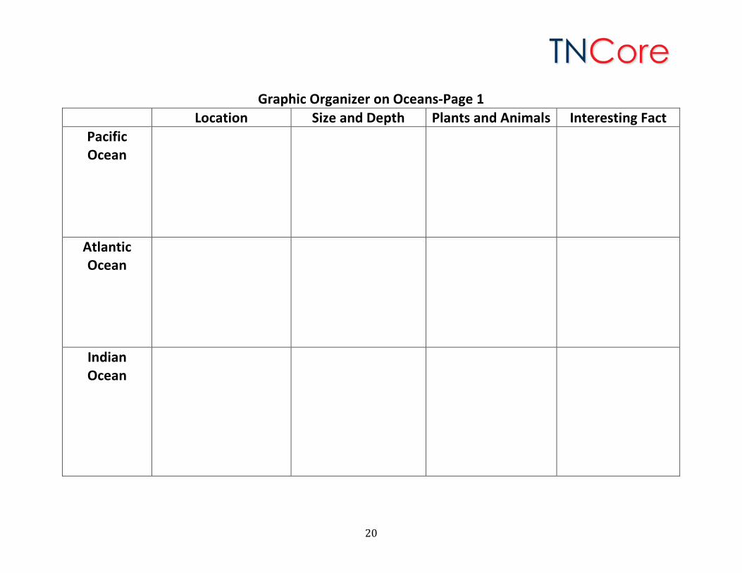
Graphic Organizer on Oceans-Page 1 Location Size and Depth Plants and Animals Interesting Fact
Pacific Ocean
Atlantic Ocean
Indian Ocean
20
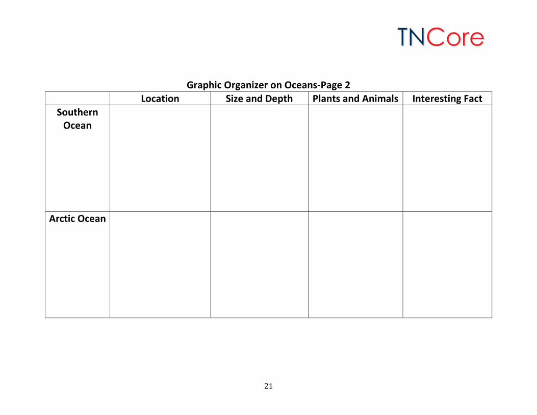
Graphic Organizer on Oceans-Page 2 Location Size and Depth Plants and Animals Interesting Fact
Southern Ocean
Arctic Ocean
21
Day 4: Read the second text “Water, Water Everywhere: Facts About the Ocean” aloud in its entirety. Discuss the main idea. The first read establishes a first familiarity with the text for students. Teachers should read the text prior to the lesson to become familiar with the text and the main idea. This lesson should take approximately 45 minutes.
1. Read the text “Water, Water Everywhere: Facts About the Ocean” aloud in its entirety. Read the text straight through, with expression, using the tone and volume of your voice to help the students understand each line and to provide some context for inferring the meaning of unknown words.
2. When you have finished reading, discuss what the text is mostly about (main idea). While reading, students should pause and ask themselves, “What is this text mostly about?” Asking this question helps students to take a minute to check and see if they understand what they have read or what was read aloud.
3. The main idea needs to be supported with details. Have the students visualize a table. The table top is the main idea. The legs are the supporting details.
4. Have a discussion about the main idea and the supporting details. 5. Students can share the main idea and supporting details with a partner.
Text Under Discussion 2nd Grade Sample Teacher
Dialogue & Guiding Questions 3rd Grade Sample Teacher Dialogue
& Guiding Questions Read the second text, “Water, Water Everywhere: Facts About the Ocean” in its entirety.
After reading the text aloud, ask students, “What is this text mostly about?” “What is the main topic?” Guide students to what this text is mostly about. Have students give evidence from the text to support their ideas. Accept all responses but encourage students to return to
After reading the text aloud, ask the students, “What is the main idea?” Guide students to the main idea and include supporting details. Have students give evidence from the text to support the main idea. Accept all responses but encourage students to return to the text for
22
the text for details. Examples of teacher questions that draw students back into the text: “Why?” “Where did you see that?” “What lines in the text support your ideas?” “Let me see if we can find that part and read it again.” “How do you know?” “What words in the text make you think that?”
details. Examples of teacher questions that draw students back into the text: “Why?” “Where did you see that?” “What lines in the text support your ideas?” “Let me see if we can find that part and read it again.” “How do you know?” “What words in the text make you think that?”
Day 5: Re-read the second text in sections focusing on vocabulary and text dependent questions. In the second read, the teacher guides students slowly and carefully through the text, prodding their thinking with text-dependent questions. Sample text-dependent questions can be found in the table below. Teachers are encouraged to ask additional questions, as well as higher-order questions, that may enhance comprehension. This lesson will take approximately 45 minutes.
1. Take a few minutes to discuss the main idea and supporting details. 2. Read sections of the text and use the sample questions provided in the table below. 3. Discuss new information learned about the oceans.
23
Text Under Discussion 2nd Grade Sample Teacher Dialogue & Guiding Questions
3rd Grade Sample Teacher Dialogue & Guiding Questions
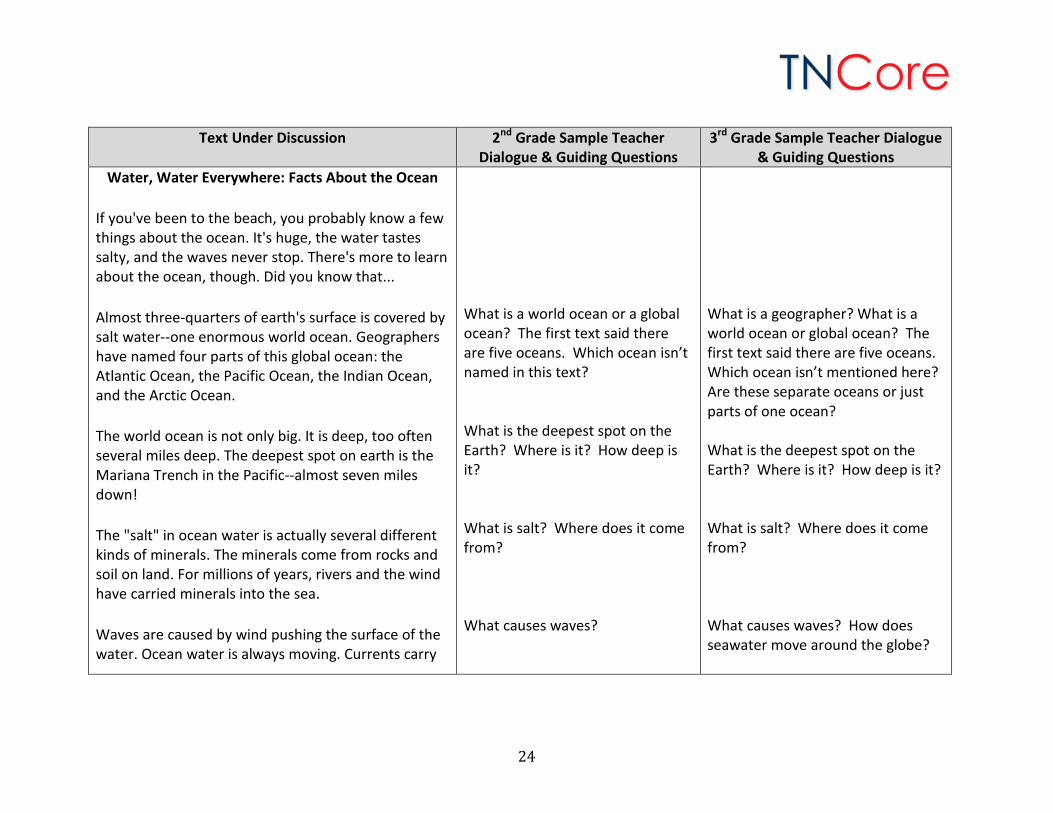
Water, Water Everywhere: Facts About the Ocean
If you've been to the beach, you probably know a few things about the ocean. It's huge, the water tastes salty, and the waves never stop. There's more to learn about the ocean, though. Did you know that...
Almost three-quarters of earth's surface is covered by salt water--one enormous world ocean. Geographers have named four parts of this global ocean: the Atlantic Ocean, the Pacific Ocean, the Indian Ocean, and the Arctic Ocean.
The world ocean is not only big. It is deep, too often several miles deep. The deepest spot on earth is the Mariana Trench in the Pacific--almost seven miles down!
The "salt" in ocean water is actually several different kinds of minerals. The minerals come from rocks and soil on land. For millions of years, rivers and the wind have carried minerals into the sea.
Waves are caused by wind pushing the surface of the water. Ocean water is always moving. Currents carry
What is a world ocean or a global ocean? The first text said there are five oceans. Which ocean isn’t named in this text? What is the deepest spot on the Earth? Where is it? How deep is it? What is salt? Where does it come from? What causes waves?
What is a geographer? What is a world ocean or global ocean? The first text said there are five oceans. Which ocean isn’t mentioned here? Are these separate oceans or just parts of one ocean? What is the deepest spot on the Earth? Where is it? How deep is it? What is salt? Where does it come from? What causes waves? How does seawater move around the globe?
24
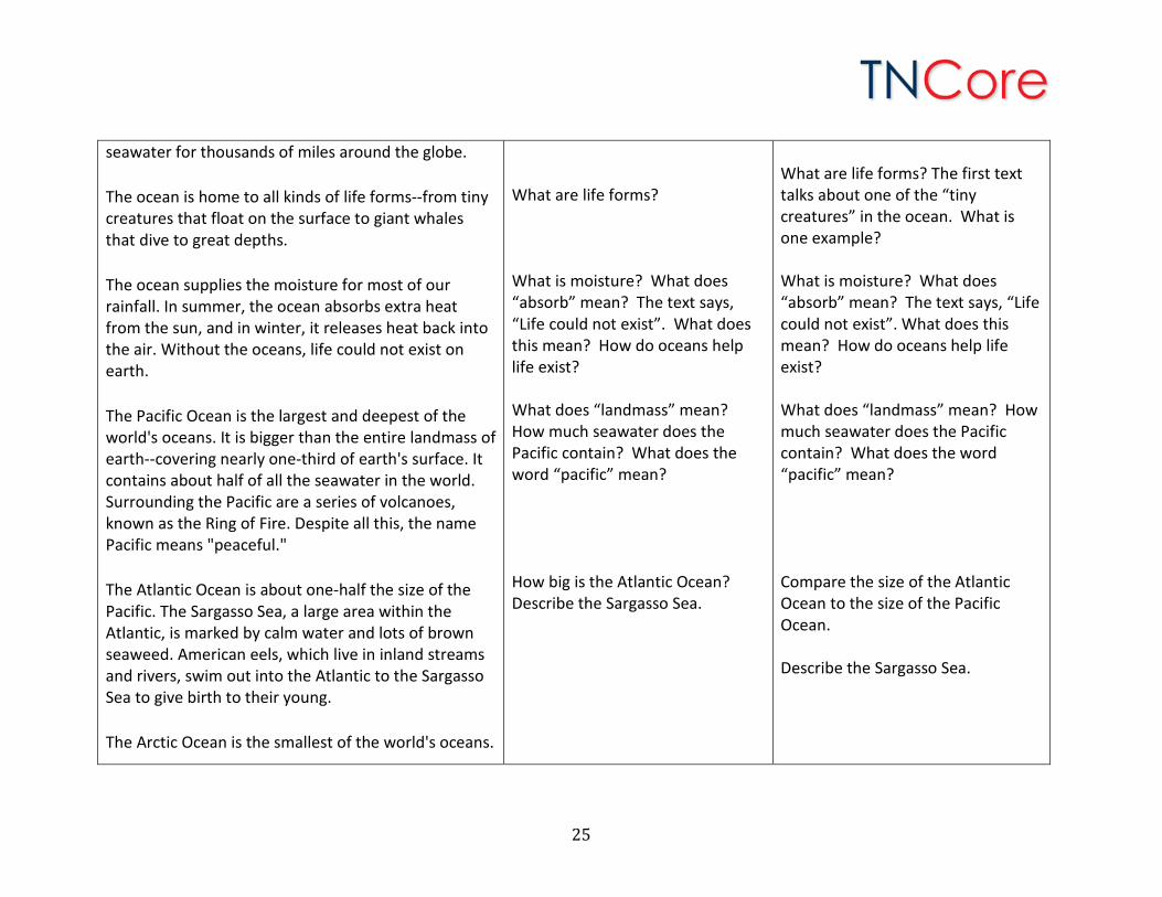
seawater for thousands of miles around the globe.
The ocean is home to all kinds of life forms--from tiny creatures that float on the surface to giant whales that dive to great depths.
The ocean supplies the moisture for most of our rainfall. In summer, the ocean absorbs extra heat from the sun, and in winter, it releases heat back into the air. Without the oceans, life could not exist on earth.
The Pacific Ocean is the largest and deepest of the world's oceans. It is bigger than the entire landmass of earth--covering nearly one-third of earth's surface. It contains about half of all the seawater in the world. Surrounding the Pacific are a series of volcanoes, known as the Ring of Fire. Despite all this, the name Pacific means "peaceful."
The Atlantic Ocean is about one-half the size of the Pacific. The Sargasso Sea, a large area within the Atlantic, is marked by calm water and lots of brown seaweed. American eels, which live in inland streams and rivers, swim out into the Atlantic to the Sargasso Sea to give birth to their young.
The Arctic Ocean is the smallest of the world's oceans.
What are life forms? What is moisture? What does “absorb” mean? The text says, “Life could not exist”. What does this mean? How do oceans help life exist? What does “landmass” mean? How much seawater does the Pacific contain? What does the word “pacific” mean? How big is the Atlantic Ocean? Describe the Sargasso Sea.
What are life forms? The first text talks about one of the “tiny creatures” in the ocean. What is one example? What is moisture? What does “absorb” mean? The text says, “Life could not exist”. What does this mean? How do oceans help life exist? What does “landmass” mean? How much seawater does the Pacific contain? What does the word “pacific” mean? Compare the size of the Atlantic Ocean to the size of the Pacific Ocean. Describe the Sargasso Sea.
25
Day 5 Extension Idea: The first text says there are five oceans and the second text says there are four oceans. To learn more about why the texts are different, students can read this entry from the National Ocean Service website: http://oceanservice.noaa.gov/facts/howmanyoceans.html.
(In fact, some geographers say it is of the Atlantic Ocean.) Located near the North Pole, it is almost entirely covered by ice in winter. The ice is thick enough to trap large ships and prevent them from moving. Huge chunks of ice break apart and float into the Atlantic Ocean as icebergs. The ice prevents sunlight from reaching the water, so it is the most barren (empty of life) of the world's oceans.
The Indian Ocean has reliable winds, and because of this, sailors crossed the Indian Ocean before other oceans. About 2,000 years ago, traders were sailing from eastern Africa to India to the East Indies islands. The winds in the Indian Ocean are called monsoons. In summer, they bring drenching rains to southern Asia.
Sometimes people call the ocean "the sea." To geographers, though, a sea is a part of the ocean that is partially or wholly enclosed by land. There are more than 50 seas.
Where is the Arctic Ocean? What is the water like in the Arctic Ocean? What does barren mean? Why is the Arctic Ocean barren? What is the wind like on the Indian Ocean? What is a monsoon? Where is the Indian Ocean? What is a sea? How many seas are there?
Where is the Arctic Ocean? What is the water like in the Arctic Ocean? What does barren mean? Why is the Arctic Ocean barren? What is the wind like on the Indian Ocean? What is a monsoon? Where is the Indian Ocean? What is the difference between an ocean and a sea? How many seas are there? Use a map to locate some seas.
26
Day 6: Students re-read the text “Water, Water Everywhere: Facts About the Ocean” silently. Use the “Graphic Organizer on Oceans” to gather additional information. This lesson will take approximately 45 minutes.
1. Students re-read the text “Water, Water Everywhere: Facts About the Ocean” silently. For students who need more practice, support, and scaffolding, the teacher may wish to read along with the students.
2. Complete the “Graphic Organizer on Oceans.” Teachers will need to gauge how much support and scaffolding is needed. Some students may need teachers to model going back into the text. Students may need to highlight or underline the evidence first and then write it on the graphic organizer. More advanced students may be able to find the evidence and record it independently. Teachers may decide to do this part of the unit in a whole group setting or in small groups to better individualize the learning and support.
3. Use the notes on the graphic organizer to discuss with a partner. Day 7: Read the third text “Continents” aloud in its entirety. Discuss the main idea. Write a summary. The first read establishes a first familiarity with the text for students. Teachers should read the text prior to the lesson to become familiar with the text and the main idea. This lesson should take approximately 45 minutes.
1. Read the text “Continents” aloud in its entirety. Read the text straight through, with expression, using the tone and volume of your voice to help the students understand each line and to provide some context for inferring the meaning of unknown words.
2. When you have finished reading, discuss what the text is mostly about (main idea). While reading, students should pause and ask themselves, “What is this text mostly about?” Asking this question helps students to take a minute to check and see if they understand what they have read or what was read aloud.
3. The main idea needs to be supported with details. Have the students visualize a table. The table top is the main idea. The legs are the supporting details. Either draw the main idea graphic organizer on chart paper or project it. If the teacher chooses, students may record the information on individual graphic organizers.
4. Have a discussion about the main idea. The teacher records what the text is mostly about (main idea) using the main idea graphic organizer.
5. Have a discussion about the supporting details. The teacher records the supporting details using the main idea graphic organizer.
6. Have a discussion about a conclusion. The teacher records the conclusion using the main idea graphic organizer.
27
7. Before students write, they should “Talk the Writing”. Students will talk through what the text is mostly about (main idea), the supporting details and the conclusion with a partner using the notes from the main idea graphic organizer. This gives students confidence and helps students to organize their thinking before writing.
8. The teacher will create a chart that details the key points in writing a summary. This chart can become an anchor chart for future summary writing. A sample of the chart is below. Teachers may elaborate on this chart as needed.
9. Using the notes from the main idea graphic organizer, students will work collaboratively to write a brief summary. For students who need more support, the teacher may want to talk through the writing steps below and then write the summary on chart paper. Students can then copy the summary. For more advanced students, the teacher may allow them to write the summary independently. Teachers may decide to do this part of the unit in a whole group setting or in small groups to better individualize the learning and support.
Text Under Discussion 2nd Grade Sample Teacher Dialogue & Guiding Questions
3rd Grade Sample Teacher Dialogue & Guiding Questions
Read the third text, “Continents” in its entirety.
After reading the text aloud, ask the students, “What is this text mostly about?” “What is the main topic?”
After reading the text aloud, ask the students, “What is the main idea?” Guide students to the main idea and
Summary Writing Chart 1. State the main idea 2. Support with details 3. Sum it up with a conclusion
28
Guide students to what this text is mostly about. Have students give evidence from the text to support their ideas. Accept all responses but encourage students to return to the text for details. Examples of teacher questions that draw students back into the text: “Why?” “Where did you see that?” “What lines in the text support your ideas?” “Let me see if we can find that part and read it again.” “How do you know?” “What words in the text make you think that?”
include supporting details. Have students give evidence from the text to support the main idea. Accept all responses but encourage students to return to the text for details. Examples of teacher questions that draw students back into the text: “Why?” “Where did you see that?” “What lines in the text support your ideas?” “Let me see if we can find that part and read it again.” “How do you know?” “What words in the text make you think that?”
29

Main Idea Graphic Organizer (Table with legs)
Main idea:
Detail: Detail: Detail: Detail:
Conclusion:
30
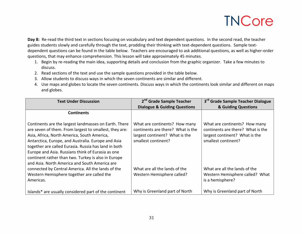
Day 8: Re-read the third text in sections focusing on vocabulary and text dependent questions. In the second read, the teacher guides students slowly and carefully through the text, prodding their thinking with text-dependent questions. Sample text-dependent questions can be found in the table below. Teachers are encouraged to ask additional questions, as well as higher-order questions, that may enhance comprehension. This lesson will take approximately 45 minutes.
1. Begin by re-reading the main idea, supporting details and conclusion from the graphic organizer. Take a few minutes to discuss.
2. Read sections of the text and use the sample questions provided in the table below. 3. Allow students to discuss ways in which the seven continents are similar and different. 4. Use maps and globes to locate the seven continents. Discuss ways in which the continents look similar and different on maps
and globes.
Text Under Discussion 2nd Grade Sample Teacher Dialogue & Guiding Questions
3rd Grade Sample Teacher Dialogue & Guiding Questions
Continents Continents are the largest landmasses on Earth. There are seven of them. From largest to smallest, they are: Asia, Africa, North America, South America, Antarctica, Europe, and Australia. Europe and Asia together are called Eurasia. Russia has land in both Europe and Asia. Russians think of Eurasia as one continent rather than two. Turkey is also in Europe and Asia. North America and South America are connected by Central America. All the lands of the Western Hemisphere together are called the Americas.
Islands* are usually considered part of the continent
What are continents? How many continents are there? What is the largest continent? What is the smallest continent? What are all the lands of the Western Hemisphere called? Why is Greenland part of North
What are continents? How many continents are there? What is the largest continent? What is the smallest continent? What are all the lands of the Western Hemisphere called? What is a hemisphere? Why is Greenland part of North
31
that they are closest to. For example, Greenland is an island north of North America. It is considered to be part of the North American continent. Many islands are not part of any continent. Some examples are New Zealand, French Polynesia, and the Hawaiian Islands.
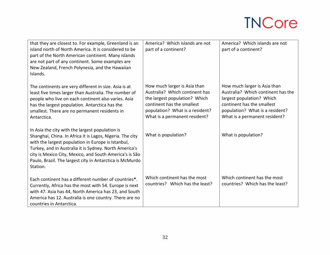
The continents are very different in size. Asia is at least five times larger than Australia. The number of people who live on each continent also varies. Asia has the largest population. Antarctica has the smallest. There are no permanent residents in Antarctica.
In Asia the city with the largest population is Shanghai, China. In Africa it is Lagos, Nigeria. The city with the largest population in Europe is Istanbul, Turkey, and in Australia it is Sydney. North America's city is Mexico City, Mexico, and South America's is São Paulo, Brazil. The largest city in Antarctica is McMurdo Station.
Each continent has a different number of countries*. Currently, Africa has the most with 54. Europe is next with 47. Asia has 44, North America has 23, and South America has 12. Australia is one country. There are no countries in Antarctica.
America? Which islands are not part of a continent? How much larger is Asia than Australia? Which continent has the largest population? Which continent has the smallest population? What is a resident? What is a permanent resident? What is population? Which continent has the most countries? Which has the least?
America? Which islands are not part of a continent? How much larger is Asia than Australia? Which continent has the largest population? Which continent has the smallest population? What is a resident? What is a permanent resident? What is population? Which continent has the most countries? Which has the least?
32
Day 9: Students re-read the text “Continents” silently. Use the graphic organizer to gather information. This lesson will take approximately 45 minutes.
1. Students re-read the text “Continents” silently. For students who need more practice, support, and scaffolding, the teacher may wish to read along with the students.
2. Use the “Graphic Organizer on Continents” to take group notes while reading or after reading. The teacher may want to create the graphic organizer on a chart or project it. The teacher may want to write each detail on the graphic organizer and then have students copy it to provide more support and modeling for students who need it. For students who are more advanced, the teacher may want to allow students to find the details and record them on individual papers independently.
3. Note: The graphic organizer will be used after the next reading as well. Students may want to leave space to add more notes after the next reading.
4. Use the notes on the graphic organizer to discuss with a partner. A note about the graphic organizer: Students are going to write a compare/contrast essay. Since there are five oceans and seven continents, a simple graphic organizer (such as a Venn diagram) can’t be used. When comparing many features, a semantic feature analysis chart can be used. Below you will find a sample semantic feature analysis chart to use with this unit.
33
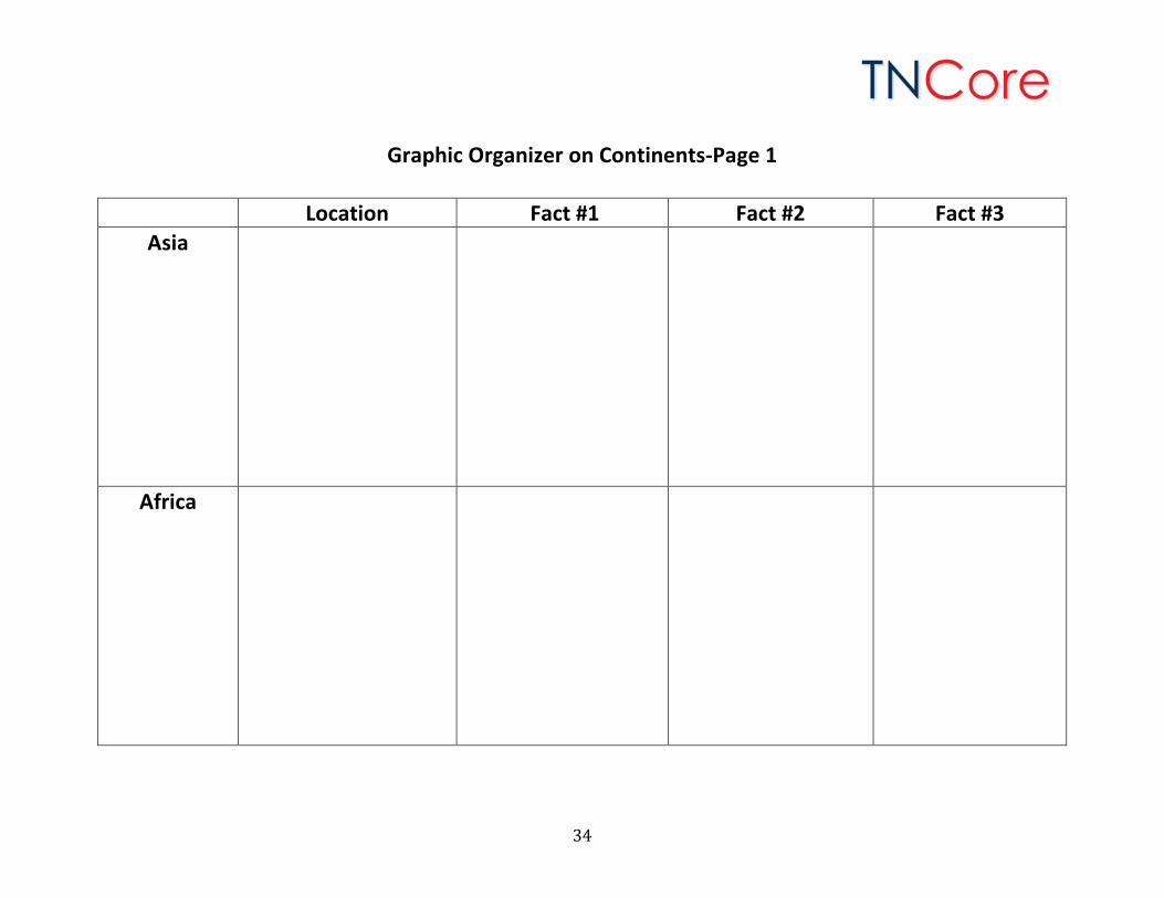
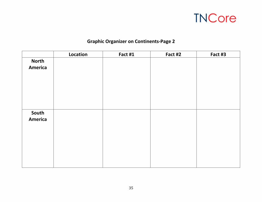
Graphic Organizer on Continents-Page 1
Location Fact #1 Fact #2 Fact #3 Asia
Africa
34
Graphic Organizer on Continents-Page 2
Location Fact #1 Fact #2 Fact #3 North
America
South America
35
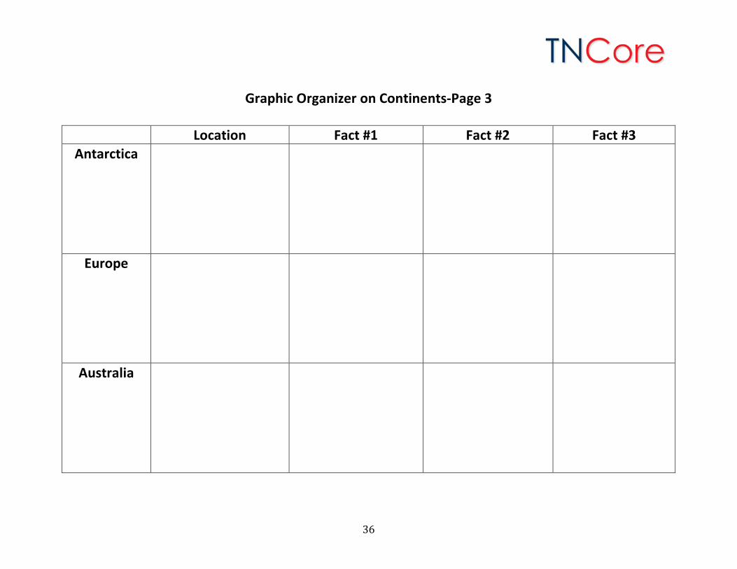
Graphic Organizer on Continents-Page 3
Location Fact #1 Fact #2 Fact #3 Antarctica
Europe
Australia
36
Day 10: Read the fourth text “Seven Special Places” aloud in its entirety. Discuss the main idea. The first read establishes a first familiarity with the text for students. Teachers should read the text prior to the lesson to become familiar with the text and the main idea. This lesson should take approximately 45 minutes.
1. Read the text “Seven Special Places” aloud in its entirety. Read the text straight through, with expression, using the tone and volume of your voice to help the students understand each line and to provide some context for inferring the meaning of unknown words.
2. When you have finished reading, discuss what the text is mostly about (main idea). While reading, students should pause and ask themselves, “What is this text mostly about?” Asking this question helps students to take a minute to check and see if they understand what they have read or what was read aloud.
3. The main idea needs to be supported with details. Have the students visualize a table. The table top is the main idea. The legs are the supporting details.
4. Have a discussion about the main idea and the supporting details.
Text Under Discussion 2nd Grade Sample Teacher Dialogue & Guiding Questions
3rd Grade Sample Teacher Dialogue & Guiding Questions
Read the fourth text, “Seven Special Places” in its entirety.
After reading the text aloud, ask students, “What is this text mostly about?” “What is the main topic?” Guide students to what this text is mostly about. Have students give evidence from the text to support their ideas. Accept all responses but encourage students to return to the text for details.
After reading the text aloud, ask the students, “What is the main idea?” Guide students to the main idea and include supporting details. Have students give evidence from the text to support the main idea. Accept all responses but encourage students to return to the text for details.
37
Examples of teacher questions that draw students back into the text: “Why?” “Where did you see that?” “What lines in the text support your ideas?” “Let me see if we can find that part and read it again.” “How do you know?” “What words in the text make you think that?”
Examples of teacher questions that draw students back into the text: “Why?” “Where did you see that?” “What lines in the text support your ideas?” “Let me see if we can find that part and read it again.” “How do you know?” “What words in the text make you think that?”
Day 11: Re-read the fourth text in sections focusing on vocabulary and text dependent questions. In the second read, the teacher guides students slowly and carefully through the text, prodding their thinking with text-dependent questions. Sample text-dependent questions can be found in the table below. Teachers are encouraged to ask additional questions, as well as higher-order questions, that may enhance comprehension. This lesson will take approximately 45 minutes.
1. Begin by re-reading the main idea, supporting details and conclusion from the graphic organizer. Take a few minutes to discuss.
2. Read sections of the text and use the sample questions provided in the table below. 3. Discuss new information learned about continents.
38
Text Under Discussion 2nd Grade Sample Teacher Dialogue & Guiding Questions
3rd Grade Sample Teacher Dialogue & Guiding Questions
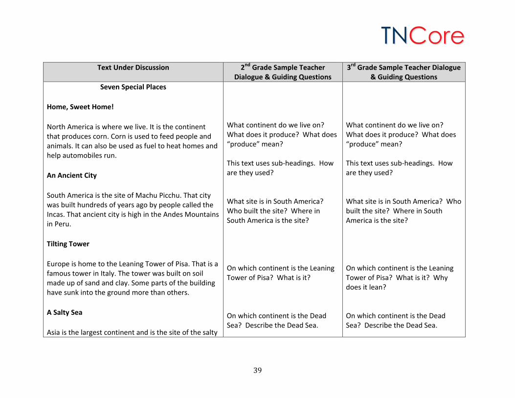
Seven Special Places
Home, Sweet Home!
North America is where we live. It is the continent that produces corn. Corn is used to feed people and animals. It can also be used as fuel to heat homes and help automobiles run.
An Ancient City
South America is the site of Machu Picchu. That city was built hundreds of years ago by people called the Incas. That ancient city is high in the Andes Mountains in Peru.
Tilting Tower
Europe is home to the Leaning Tower of Pisa. That is a famous tower in Italy. The tower was built on soil made up of sand and clay. Some parts of the building have sunk into the ground more than others.
A Salty Sea
Asia is the largest continent and is the site of the salty
What continent do we live on? What does it produce? What does “produce” mean? This text uses sub-headings. How are they used? What site is in South America? Who built the site? Where in South America is the site? On which continent is the Leaning Tower of Pisa? What is it? On which continent is the Dead Sea? Describe the Dead Sea.
What continent do we live on? What does it produce? What does “produce” mean? This text uses sub-headings. How are they used? What site is in South America? Who built the site? Where in South America is the site? On which continent is the Leaning Tower of Pisa? What is it? Why does it lean? On which continent is the Dead Sea? Describe the Dead Sea.
39
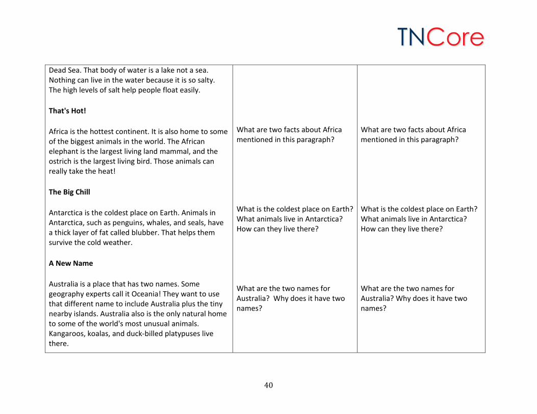
Dead Sea. That body of water is a lake not a sea. Nothing can live in the water because it is so salty. The high levels of salt help people float easily.
That's Hot!
Africa is the hottest continent. It is also home to some of the biggest animals in the world. The African elephant is the largest living land mammal, and the ostrich is the largest living bird. Those animals can really take the heat!
The Big Chill
Antarctica is the coldest place on Earth. Animals in Antarctica, such as penguins, whales, and seals, have a thick layer of fat called blubber. That helps them survive the cold weather.
A New Name
Australia is a place that has two names. Some geography experts call it Oceania! They want to use that different name to include Australia plus the tiny nearby islands. Australia also is the only natural home to some of the world's most unusual animals. Kangaroos, koalas, and duck-billed platypuses live there.
What are two facts about Africa mentioned in this paragraph? What is the coldest place on Earth? What animals live in Antarctica? How can they live there? What are the two names for Australia? Why does it have two names?
What are two facts about Africa mentioned in this paragraph? What is the coldest place on Earth? What animals live in Antarctica? How can they live there? What are the two names for Australia? Why does it have two names?
40
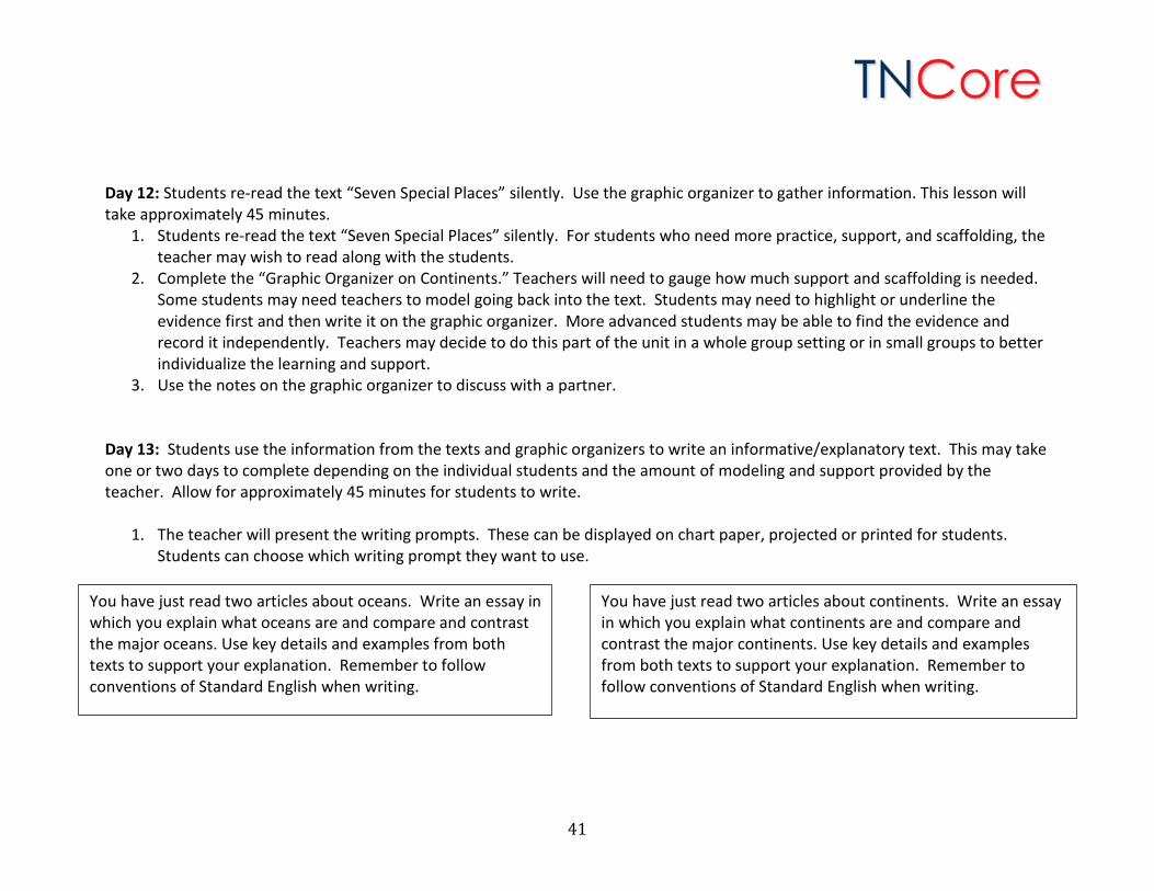
Day 12: Students re-read the text “Seven Special Places” silently. Use the graphic organizer to gather information. This lesson will take approximately 45 minutes.
1. Students re-read the text “Seven Special Places” silently. For students who need more practice, support, and scaffolding, the teacher may wish to read along with the students.
2. Complete the “Graphic Organizer on Continents.” Teachers will need to gauge how much support and scaffolding is needed. Some students may need teachers to model going back into the text. Students may need to highlight or underline the evidence first and then write it on the graphic organizer. More advanced students may be able to find the evidence and record it independently. Teachers may decide to do this part of the unit in a whole group setting or in small groups to better individualize the learning and support.
3. Use the notes on the graphic organizer to discuss with a partner. Day 13: Students use the information from the texts and graphic organizers to write an informative/explanatory text. This may take one or two days to complete depending on the individual students and the amount of modeling and support provided by the teacher. Allow for approximately 45 minutes for students to write.
1. The teacher will present the writing prompts. These can be displayed on chart paper, projected or printed for students. Students can choose which writing prompt they want to use.
You have just read two articles about oceans. Write an essay in which you explain what oceans are and compare and contrast the major oceans. Use key details and examples from both texts to support your explanation. Remember to follow conventions of Standard English when writing.
You have just read two articles about continents. Write an essay in which you explain what continents are and compare and contrast the major continents. Use key details and examples from both texts to support your explanation. Remember to follow conventions of Standard English when writing.
41
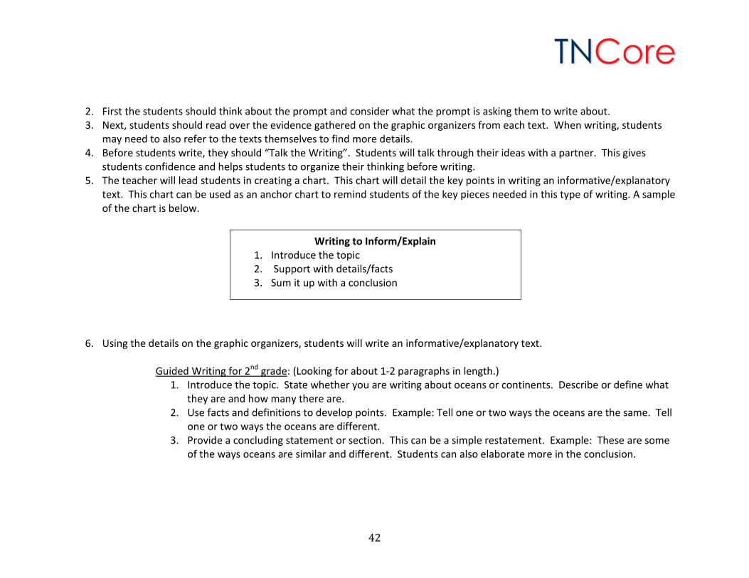
2. First the students should think about the prompt and consider what the prompt is asking them to write about. 3. Next, students should read over the evidence gathered on the graphic organizers from each text. When writing, students
may need to also refer to the texts themselves to find more details. 4. Before students write, they should “Talk the Writing”. Students will talk through their ideas with a partner. This gives
students confidence and helps students to organize their thinking before writing. 5. The teacher will lead students in creating a chart. This chart will detail the key points in writing an informative/explanatory
text. This chart can be used as an anchor chart to remind students of the key pieces needed in this type of writing. A sample of the chart is below.
6. Using the details on the graphic organizers, students will write an informative/explanatory text.
Guided Writing for 2nd grade: (Looking for about 1-2 paragraphs in length.) 1. Introduce the topic. State whether you are writing about oceans or continents. Describe or define what
they are and how many there are. 2. Use facts and definitions to develop points. Example: Tell one or two ways the oceans are the same. Tell
one or two ways the oceans are different. 3. Provide a concluding statement or section. This can be a simple restatement. Example: These are some
of the ways oceans are similar and different. Students can also elaborate more in the conclusion.
Writing to Inform/Explain 1. Introduce the topic 2. Support with details/facts 3. Sum it up with a conclusion
42
Guided Writing for 3rd grade: (Looking for about 2 or 3 paragraphs in length.)
1. Introduce the topic. State whether you are writing about oceans or continents. Describe or define what they are and how many there are.
2. Group related information together. Example: Tell a few ways the oceans are the same. Tell a few ways the oceans are different. This could be done in separate paragraphs.
3. Develop the topic with facts, definitions, and details. Use the details in the graphic organizers. These can be included in each of the compare/contrast paragraphs.
4. Use linking words and phrases (e.g., also, another, and, more, but) to connect ideas within categories of information.
5. Provide a concluding statement or section.
For students who need more scaffolding and support, the teacher may wish to model the thinking and writing with one of the prompts first. Then, have the students write independently with the other prompt. Day 14: Continue writing as needed. The teacher should monitor and give specific feedback to advance student’s writing. As students complete their writing, encourage them to re-read to check their writing for meaning and conventions.
43
Possible Writing Extensions:
1. Read writing with a partner and exchange feedback on meaning and conventions. 2. Students can edit and revise their papers on their own, in collaboration with their peers or based on teacher corrections. 3. Student papers can be scored using the rubrics found here:
http://tncore.org/english_language_arts/assessment/scoring_resources/2013-14scoringresources.aspx 4. Papers can be published digitally and enhanced with graphics and/or photographs.
Possible Social Studies Extensions for Second Grade:
1. Use a map and a globe to examine oceans and continents. Compare how the maps and globes depict the geographical information in different ways. Create a Venn diagram (or other graphic organizer) to report the findings. This activity addresses Tennessee Social Studies (2014-2015) standard 2.13.
2. Construct a globe depicting the four hemispheres, seven continents, and five oceans using the equator and prime meridian. This activity addresses Tennessee Social Studies (2014-2015) standard 2.14.
3. Create a map depicting the current boundaries of the United States, Canada, and Mexico and recognize they are part of the North American continent. This activity addresses Tennessee Social Studies (2014-2015) standard 2.15.
4. Locate the Atlantic and Pacific Oceans on a map. This activity addresses Tennessee Social Studies (2014-2015) standard 2.17. Possible Social Studies Extensions for Third Grade:
1. Identify and locate the major continents and oceans using maps, globes and other technologies. This activity addresses Tennessee Social Studies (2014-2015) standard 3.1.
2. Use maps and globes to locate the oceans and continents. Use common terms (country, region, mountain, hemisphere, latitude, longitude, north pole, south pole, equator, time zones, elevation, approximate distances in miles, isthmus, and strait). This activity addresses Tennessee Social Studies (2014-2015) standard 3.2.
3. The text “Continents” lists several cities. Use cardinal directions, map scales, legends, titles and longitude and latitude to locate these cities and countries on a map. This activity addresses Tennessee Social Studies (2014-2015) standard 3.3.
44
Ways to Support Struggling Readers and Writers: This unit is designed to be taught in a whole group setting with many scaffolds and supports throughout. The reading and thinking are modeled through the asking of text dependent questions and repeated readings. The writing can be modeled by the teacher so that students can co-create or copy the writing. Teachers should have a plan for releasing more and more of the writing to students. Oral language is essential for language comprehension growth. Teachers should continuously engage students in higher levels of oral language throughout the unit. Teachers should use content specific vocabulary in conversations with students. Students should use the content specific vocabulary in collaborative conversations with the teacher and peers as they build off of comments. Ways to Support Advanced Readers and Writers: Throughout this unit, there are examples of places where more advanced students can read or write independently. Advanced students may work through the unit at a more rapid pace by combining some of the activities and eliminating the repeated readings. Advanced students could write to all four texts. A sample prompt could be: Write an essay describing the entire surface of the earth. Describe both oceans and continents. Write about how they all fit together to create the globe. Formative Assessment Ideas: Formative assessment is ongoing assessment that is used to inform and improve instruction throughout the teaching and learning process. Generally following formative assessment, teachers will talk to students and provide feedback and direction. Typically, formative assessment is not used for a performance or academic grade. Formative assessment usually is contrasted with summative assessment.
1. Quick Write: Before students read the text on Day 1 of the unit, ask them to do a quick write. A quick write is when students write everything they know about a topic in a short amount of time. During a quick write, students should not worry about handwriting, grammar, or punctuation. A quick write topic for this unit might be: Write everything you know about oceans. Teachers should read the quick writes before beginning instruction on Day 1. This quick write will help teachers assess the level of knowledge on the topic as well as formatively assess basic writing skills. The quick write can be repeated before instruction on Day 7 and students can write about continents.
2. Exit Tickets/Slips: Exit Tickets/Slips are typically written responses to questions the teacher poses at the end of a lesson or a class to assess student understanding of key concepts. They are designed to take only a few minutes to complete and are
45
taken up as students leave the classroom. The teacher can quickly determine which students have the key concept, which ones need a little help, and which ones are going to require much more instruction on the concept. In this unit, at the end of each first text reading, students are asked to talk with a partner about something learned from the text. Teachers could follow up this partner discussion with an Exit Ticket/Slip.
3. Windshield Check: This formative assessment can be used to have students check their own understanding of a concept just taught in a lesson. This assessment can quickly let the teacher know if there are major or minor misunderstandings, and help him/her design instruction to clarify any misconceptions before moving on. Using the analogy of a windshield, students will decide which of the following best describes what they know about the concept:
CLEAR = I get it! I thoroughly understand the concept. BUGGY = I understand it for the most part, but a few things are still unclear. MUDDY = I don’t get it at all.
4. Mind Maps: Before beginning this unit, have students draw “mind maps” of the world. A mind map shows what students
already know about the location, size and identity of each ocean and continent.
5. Summary Writing: Two summaries are written during this unit. If the summaries are done independently, or with little assistance, they can be used for formative assessment. Teachers can provide students with feedback on the writing itself and help to clarify any misunderstanding about the content.
Summative Assessment Ideas: The final writing task can be used for summative assessment in two ways. First, if the writing was modeled and/or done collaboratively using the “Ocean” prompt, students can write independently with the “Continents” prompt (or vice versa). Second, if students wrote independently with the “Ocean” prompt, students can write independently with the “Continents” prompt (or vice versa). Teachers can give students a set amount of time to complete the writing and provide no guidance or support while students are writing. Student papers can be scored using the rubrics found here: http://tncore.org/english_language_arts/assessment/scoring_resources/2013-14scoringresources.aspx
46