teaching geographic information systems in the high school john p. bayerl michael berry career...
TRANSCRIPT


Teaching Geographic Teaching Geographic Information Systems in the Information Systems in the
High SchoolHigh School
John P. BayerlJohn P. Bayerl
Michael Berry Career CenterMichael Berry Career Center
Dearborn Public SchoolsDearborn Public Schools
[email protected]@dearborn.k12.mi.us


GIS Jobs in the NewsGIS Jobs in the News
“Listen to geospatial technology proponents and you may hear a shared concern -- applications for the technology are outstripping the development of its workforce… the U.S. Department of Labor (DoL) has been quietly working with the industry, business associations, and academic institutions to address this looming shortage of qualified spatial workers.”
Seitzen, F. (2004) Seitzen, F. (2004) High growth jobs initiativeHigh growth jobs initiative, Retrieved January 26, 2006 from , Retrieved January 26, 2006 from http://www.geospatial-online.com/geospatialsolutions/article/articleDetail.jsp?id=96795

GIS Jobs in the NewsGIS Jobs in the News
“In May 2004, the independent research group Management & Training Corporation of Centerville, Utah, recommended the STARS Certification to Department of Labor for use in Job Corps in a report entitled "Industry-Recognized Certificate Programs and Job Corps: Working Toward a Skilled and Qualified Workforce." The report, which states that the geospatial field is one of the high growth industries that will be affected by critical shortages in trained personnel, lists only the STARS certification for a GIS/Remote Sensing Technician.”
Digital Quest, Inc.. (2004) Mississippi Company Recognized For Workforce Training in High Tech Field, Retrieved January 26, 2006 from http://digitalquest.com/press/LizardTech0712.pdf

What is GIS?What is GIS?
GGeographic eographic IInformation nformation SSystemystem ““A computer information system that A computer information system that
stores, analyses and displays spatial and stores, analyses and displays spatial and geographic data”geographic data”
What it isn’t…What it isn’t…GGlobal lobal PPositioning ositioning
SSystem (GPS)ystem (GPS)

Three Core Components:Three Core Components:
Satellite TechnologySatellite Technology
Remote SensingRemote Sensing
Geographic Information Geographic Information Systems (GIS)Systems (GIS)
Distribution of African Americans and Churches in Wayne County
î
î
î
î
î
î
î
îî
î
î
î
î
î
î
î
î
î
î
î
î
î
î
î
îî
î
î
î
î
î
î
î
î
î
î
î
î
î
î
î
î
î
î
î
î
î
îî
î
î
î
N
9 0 9 18 Miles
Race: Black0 - 414415 - 12221223 - 22782279 - 35493550 - 5925
Waterbodiesî Landmarks: Churches

Satellite TechnologySatellite Technology
Satellites have become part of our lives.Satellites have become part of our lives.Pure research: Hubble, Space Shuttle, Pure research: Hubble, Space Shuttle,
International Space Station, Cassini, Mars International Space Station, Cassini, Mars Rovers, etc.Rovers, etc.
Communications: TV, Radio, Cell Phones all Communications: TV, Radio, Cell Phones all rely on satellites.rely on satellites.
Monitoring our earth: Weather Forecasting, Monitoring our earth: Weather Forecasting, Environmental Monitoring, Military Environmental Monitoring, Military Applications.Applications.
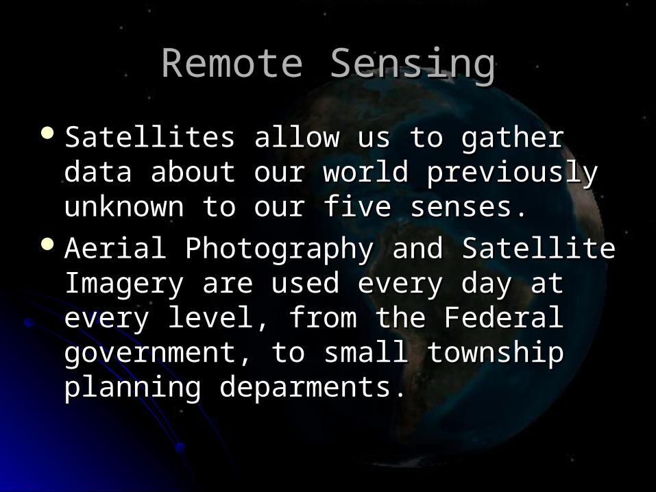
Remote SensingRemote Sensing
Satellites allow us to gather data about our Satellites allow us to gather data about our world previously unknown to our five world previously unknown to our five senses.senses.
Aerial Photography and Satellite Imagery Aerial Photography and Satellite Imagery are used every day at every level, from the are used every day at every level, from the Federal government, to small township Federal government, to small township planning deparments.planning deparments.
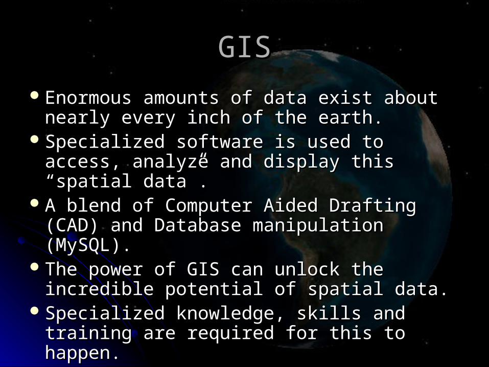
GISGIS
Enormous amounts of data exist about Enormous amounts of data exist about nearly every inch of the earth.nearly every inch of the earth.
Specialized software is used to access, Specialized software is used to access, analyze and display this “spatial data”.analyze and display this “spatial data”.
A blend of Computer Aided Drafting (CAD) A blend of Computer Aided Drafting (CAD) and Database manipulation (MySQL).and Database manipulation (MySQL).
The power of GIS can unlock the The power of GIS can unlock the incredible potential of spatial data.incredible potential of spatial data.
Specialized knowledge, skills and training Specialized knowledge, skills and training are required for this to happen.are required for this to happen.

Dearborn Public SchoolsDearborn Public Schoolswww.dearbornschools.org
Located in Wayne County in the Detroit Located in Wayne County in the Detroit Metropolitan Area.Metropolitan Area.
Total enrollment is Approximately 17,500 Total enrollment is Approximately 17,500 students.students.
Nearly 2000 Instructional Personnel.Nearly 2000 Instructional Personnel.Recently completed deployment of an $85 Recently completed deployment of an $85
million dollar technology bond providing million dollar technology bond providing computers in each classroom, computers in each classroom, infrastructure updates and the completion infrastructure updates and the completion of a new Technology Career Center.of a new Technology Career Center.

Michael Berry Career CenterMichael Berry Career Centerberry.dearborn.k12.mi.us
The mission of the Michael Berry Career The mission of the Michael Berry Career Center is to partner with the community, Center is to partner with the community,
industry, and local colleges and industry, and local colleges and universities to provide innovative, rigorous universities to provide innovative, rigorous
and engaging curricula, along with the and engaging curricula, along with the specialized skills training necessary for specialized skills training necessary for
students to excel in diverse post-students to excel in diverse post-secondary endeavors. secondary endeavors.

Michael Berry Career CenterMichael Berry Career Center
Courses organized into four clusters.Courses organized into four clusters. Health SciencesHealth Sciences Pre-Engineering / Pre-Engineering /
DesignDesign Hospitality & TourismHospitality & Tourism Information TechnologyInformation Technology
Half-day program drawing students from Half-day program drawing students from all three high schools.all three high schools.
A mixture of 3-, 2-, and 1- hour classes, A mixture of 3-, 2-, and 1- hour classes, including social studies and math including social studies and math alternatives.alternatives.
Capacity of approximately 400 students Capacity of approximately 400 students per session.per session.

Michael Berry Career CenterMichael Berry Career Center
Several existing programs / courses Several existing programs / courses moved to the center from the high schools.moved to the center from the high schools.
Many new courses adopted or developed Many new courses adopted or developed from the ground up.from the ground up.
Information Technology cluster inherited Information Technology cluster inherited two very strong programs: CISCO two very strong programs: CISCO networking and web-design.networking and web-design.
There was a perceived need for a software There was a perceived need for a software specialist course and GIS was proposed specialist course and GIS was proposed as a logical addition. as a logical addition.
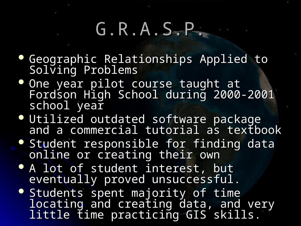
G.R.A.S.P.G.R.A.S.P. Geographic Relationships Applied to Solving Geographic Relationships Applied to Solving
ProblemsProblems One year pilot course taught at Fordson High One year pilot course taught at Fordson High
School during 2000-2001 school yearSchool during 2000-2001 school year Utilized outdated software package and a Utilized outdated software package and a
commercial tutorial as textbookcommercial tutorial as textbook Student responsible for finding data online or Student responsible for finding data online or
creating their owncreating their own A lot of student interest, but eventually proved A lot of student interest, but eventually proved
unsuccessful.unsuccessful. Students spent majority of time locating and Students spent majority of time locating and
creating data, and very little time practicing GIS creating data, and very little time practicing GIS skills.skills.

A complete “turnkey” GIS curriculum A complete “turnkey” GIS curriculum which culminates in a GIS certification.which culminates in a GIS certification.
Developed by Digital Quest Inc. and the Developed by Digital Quest Inc. and the Berkley Geo-Research Group.Berkley Geo-Research Group.
Complete package of software, data, Complete package of software, data, textbooks and curriculum materials textbooks and curriculum materials including professional development for including professional development for teachers.teachers.

SoftwareSoftware Satellite Tool Kit (STK) is used to study Satellite Tool Kit (STK) is used to study
satellites and their orbits through 3D satellites and their orbits through 3D animation, simulations and report animation, simulations and report generation.generation.
GEODESY (GEODESY (GeoGeographic graphic DDevelopment: An evelopment: An EEducational ducational SeSeries for ries for YYouth ) is used to outh ) is used to explore GIS data and perform very limited explore GIS data and perform very limited analysis (Includes a custom data set).analysis (Includes a custom data set).
ArcView is the GIS program from ArcView is the GIS program from Environmental Systems Research Institute Environmental Systems Research Institute (ESRI) used to run GEODESY.(ESRI) used to run GEODESY.
ArcGIS is the current state-of-the art GIS ArcGIS is the current state-of-the art GIS package of programs package of programs
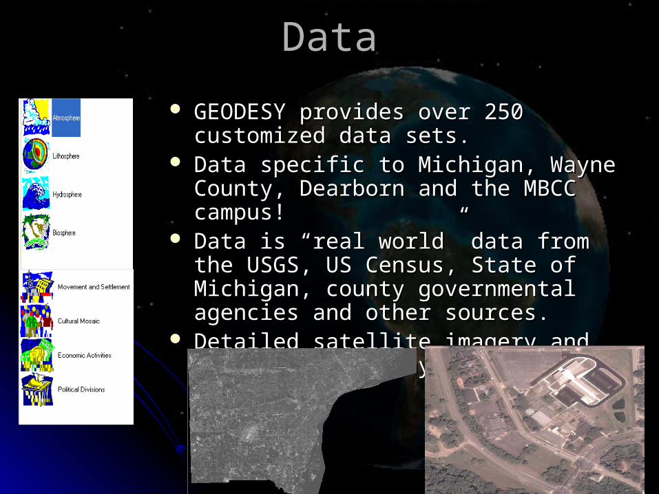
DataData
GEODESY provides over 250 customized GEODESY provides over 250 customized data sets.data sets.
Data specific to Michigan, Wayne County, Data specific to Michigan, Wayne County, Dearborn and the MBCC campus!Dearborn and the MBCC campus!
Data is “real world” data from the USGS, Data is “real world” data from the USGS, US Census, State of Michigan, county US Census, State of Michigan, county governmental agencies and other sources.governmental agencies and other sources.
Detailed satellite imagery and aerial Detailed satellite imagery and aerial photography is included.photography is included.

TextbooksTextbooks
Textbooks are customized to our program.Textbooks are customized to our program. Includes screen shots of each step Includes screen shots of each step
performed by students.performed by students.Black and white or color copies may be Black and white or color copies may be
ordered by students or they may use an ordered by students or they may use an electronic copy allowing for a “paperless” electronic copy allowing for a “paperless” course format if you desire.course format if you desire.
Students are provided a bin containing all Students are provided a bin containing all instructional materials, except a pencil and instructional materials, except a pencil and notebook!notebook!

Instructor MaterialsInstructor Materials
Complete lesson plans.Complete lesson plans.Power Point presentations including Power Point presentations including
“scripts” to read for each slide.“scripts” to read for each slide.Customized assessments for every Customized assessments for every
chapter.chapter.One week of training at Digital Quest One week of training at Digital Quest
provided in the cost of the program.provided in the cost of the program.All instructional materials provided.All instructional materials provided.Online and phone-based technical support Online and phone-based technical support
provided free of charge.provided free of charge.

Embedded FeaturesEmbedded Features
Teaches Microsoft Office Applications Teaches Microsoft Office Applications (Word, PowerPoint, Excel).(Word, PowerPoint, Excel).
Teaches fundamental skills applicable to Teaches fundamental skills applicable to any I.T. job field (project management, any I.T. job field (project management, data handling, security practices, data handling, security practices, teamwork, time management, etc.)teamwork, time management, etc.)
Enables students to develop the “soft” Enables students to develop the “soft” skills necessary in the workplace.skills necessary in the workplace.

Course Format at MBCCCourse Format at MBCC
First class offered Fall 2005.First class offered Fall 2005.Four course / Two year sequence Four course / Two year sequence
culminating in a certification test and culminating in a certification test and student project.student project.
Currently a two hour block.Currently a two hour block.Partnerships forming with city government Partnerships forming with city government
local universities. local universities. Has spawned two pilot courses Has spawned two pilot courses
(Cartography and Basic GIS)—both one (Cartography and Basic GIS)—both one hour / one semester exploratory courses.hour / one semester exploratory courses.

Lab Space and HardwareLab Space and Hardware
21 student PCs and one Teacher station21 student PCs and one Teacher station P4 processor, 1GB ram, video adaptor, WinXPP4 processor, 1GB ram, video adaptor, WinXP
Two laser printers*Two laser printers*High volume B&W, ColorHigh volume B&W, Color
One LCD projector One LCD projector Classroom Classroom Video Display Classroom Classroom Video Display
(DVD, VHS, Streaming Video)(DVD, VHS, Streaming Video)Microsoft Office XP (Word, Excel, Power Microsoft Office XP (Word, Excel, Power
Point.Point.Monitoring Software (NetOps)Monitoring Software (NetOps)

Partnerships with local GIS usersPartnerships with local GIS users
In our first semester, we have been In our first semester, we have been approached by both the local police approached by both the local police department and local universities department and local universities interested in working with our students.interested in working with our students.
We have begun a working relationship We have begun a working relationship with the City of Dearborn Department of with the City of Dearborn Department of Management Information Systems (MIS) Management Information Systems (MIS) resulting in the following student project:resulting in the following student project:

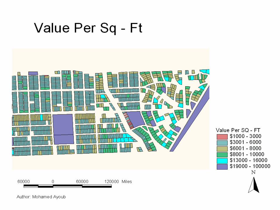
The information provided in the next slide is from 1995.
It is a map of a neighborhood in Dearborn (Wayne County) and displays value of each property by square foot
The value is labeled by colors

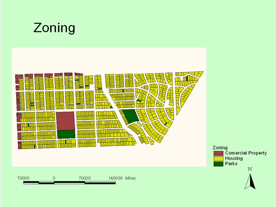
What is Zoning? Zoning is governments control over the physical development of land and the kinds of uses to which each individual property may be put.
The map in the next slide will provide zoning properties for the same neighborhood.
Commercial zoning is the places that are used by companies gas stations or your local liquor store.
Housing is housing unites throughout the neighborhood such as yours and mine.
Parks are the neighboring parks surrounding the neighborhood

This map will show you construction for year each property.
Most properties were built in 1946 thru 1954.


The Assessed Value as adjusted by the direction of the county and state. SEV and Assessed Value are the same when using an equalization factor of 1.0000.
State Equalized Value, is the price of the house.
These prices are not current since 1995.

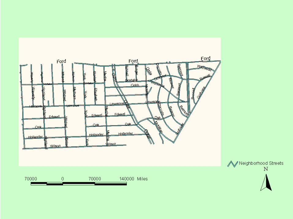
Ford Road
Outer Dr.
This map shows the streets around the neighborhood.

Closing DemonstrationsClosing Demonstrations
Projects completed by first semester Projects completed by first semester students.students.
Question and Answer session.Question and Answer session.Software demonstrations.Software demonstrations.DVD presentation by Digital Quest.DVD presentation by Digital Quest.