surveying by sandeep jyani sir - wifistudy.com · chain surveying •it is the branch of surveying...
TRANSCRIPT

SurveyingBy Sandeep Jyani Sir
27-06-2019
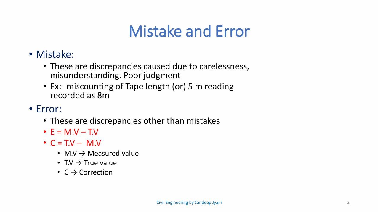
Mistake and Error• Mistake:
• These are discrepancies caused due to carelessness, misunderstanding. Poor judgment
• Ex:- miscounting of Tape length (or) 5 m reading recorded as 8m
• Error:• These are discrepancies other than mistakes• E = M.V – T.V • C = T.V – M.V
• M.V → Measured value• T.V → True value• C → Correction
2Civil Engineering by Sandeep Jyani
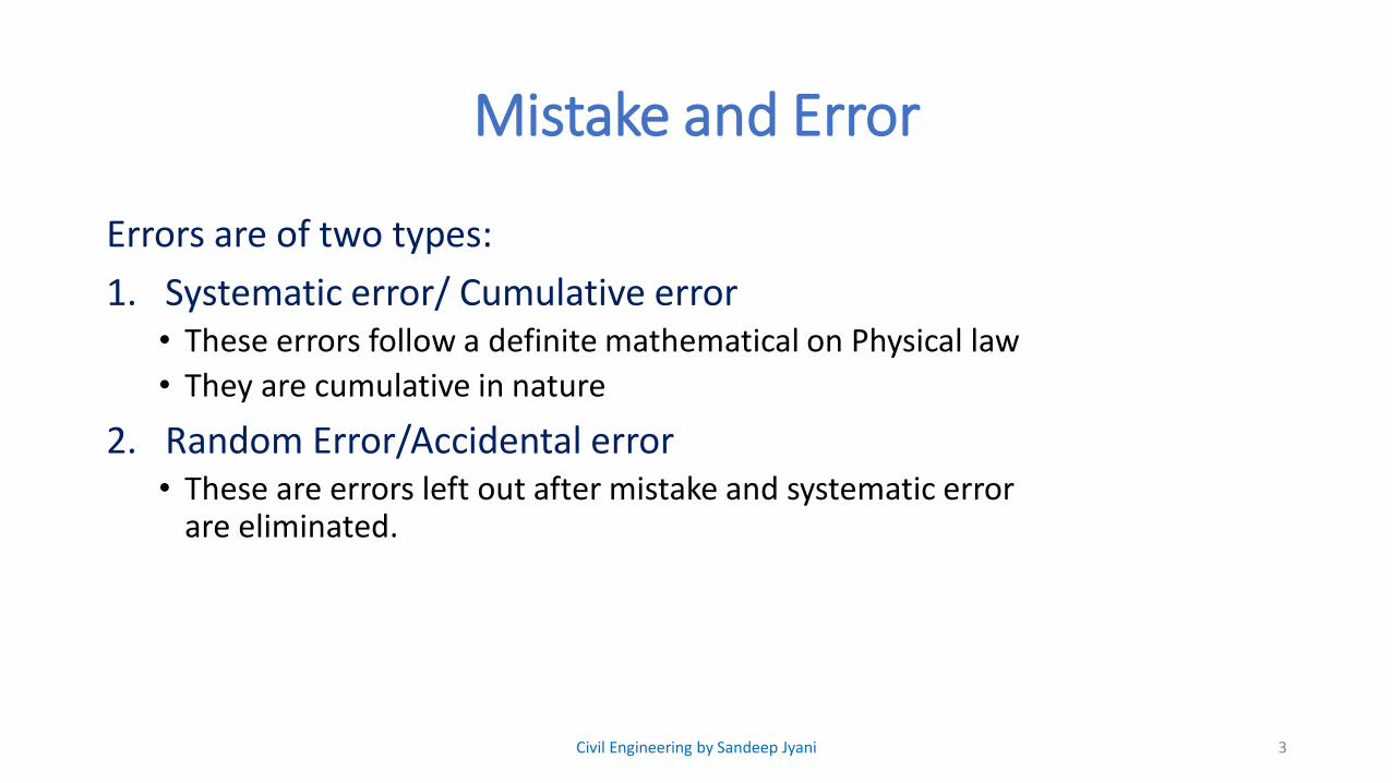
Mistake and Error
Errors are of two types:
1. Systematic error/ Cumulative error• These errors follow a definite mathematical on Physical law
• They are cumulative in nature
2. Random Error/Accidental error• These are errors left out after mistake and systematic error
are eliminated.
3Civil Engineering by Sandeep Jyani
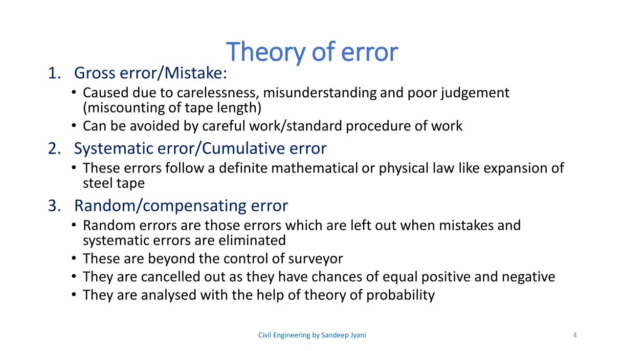
Theory of error1. Gross error/Mistake:
• Caused due to carelessness, misunderstanding and poor judgement (miscounting of tape length)
• Can be avoided by careful work/standard procedure of work
2. Systematic error/Cumulative error• These errors follow a definite mathematical or physical law like expansion of
steel tape
3. Random/compensating error• Random errors are those errors which are left out when mistakes and
systematic errors are eliminated • These are beyond the control of surveyor• They are cancelled out as they have chances of equal positive and negative• They are analysed with the help of theory of probability
4Civil Engineering by Sandeep Jyani
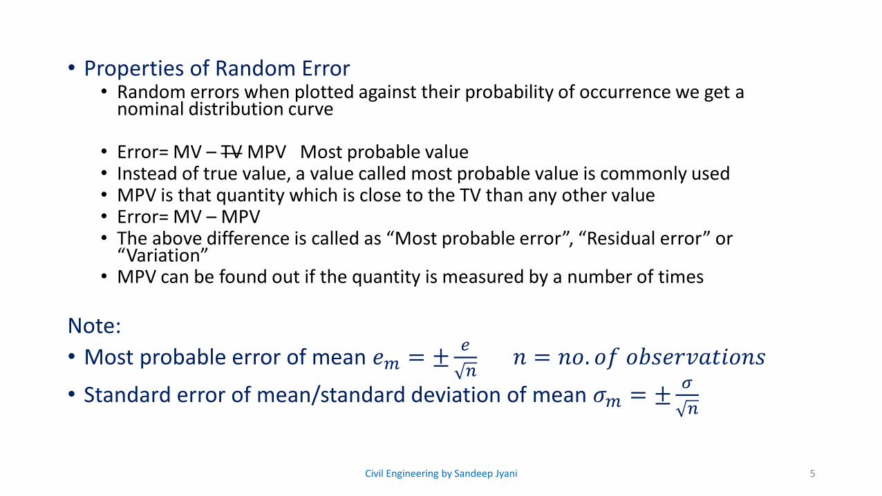
• Properties of Random Error• Random errors when plotted against their probability of occurrence we get a
nominal distribution curve
• Error= MV – TV MPV Most probable value• Instead of true value, a value called most probable value is commonly used• MPV is that quantity which is close to the TV than any other value• Error= MV – MPV• The above difference is called as “Most probable error”, “Residual error” or
“Variation”• MPV can be found out if the quantity is measured by a number of times
Note:
• Most probable error of mean 𝑒𝑚 = ±𝑒
𝑛𝑛 = 𝑛𝑜. 𝑜𝑓 𝑜𝑏𝑠𝑒𝑟𝑣𝑎𝑡𝑖𝑜𝑛𝑠
• Standard error of mean/standard deviation of mean 𝜎𝑚 = ±𝜎
𝑛
5Civil Engineering by Sandeep Jyani
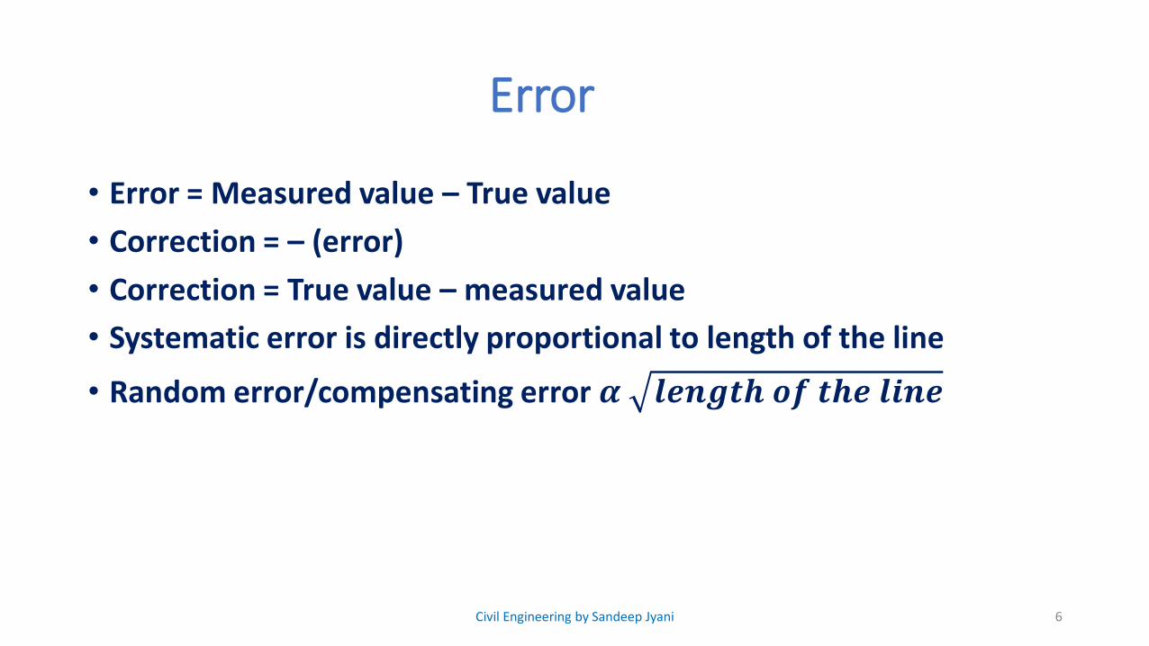
Error
• Error = Measured value – True value
• Correction = – (error)
• Correction = True value – measured value
• Systematic error is directly proportional to length of the line
• Random error/compensating error 𝜶 𝒍𝒆𝒏𝒈𝒕𝒉 𝒐𝒇 𝒕𝒉𝒆 𝒍𝒊𝒏𝒆
6Civil Engineering by Sandeep Jyani
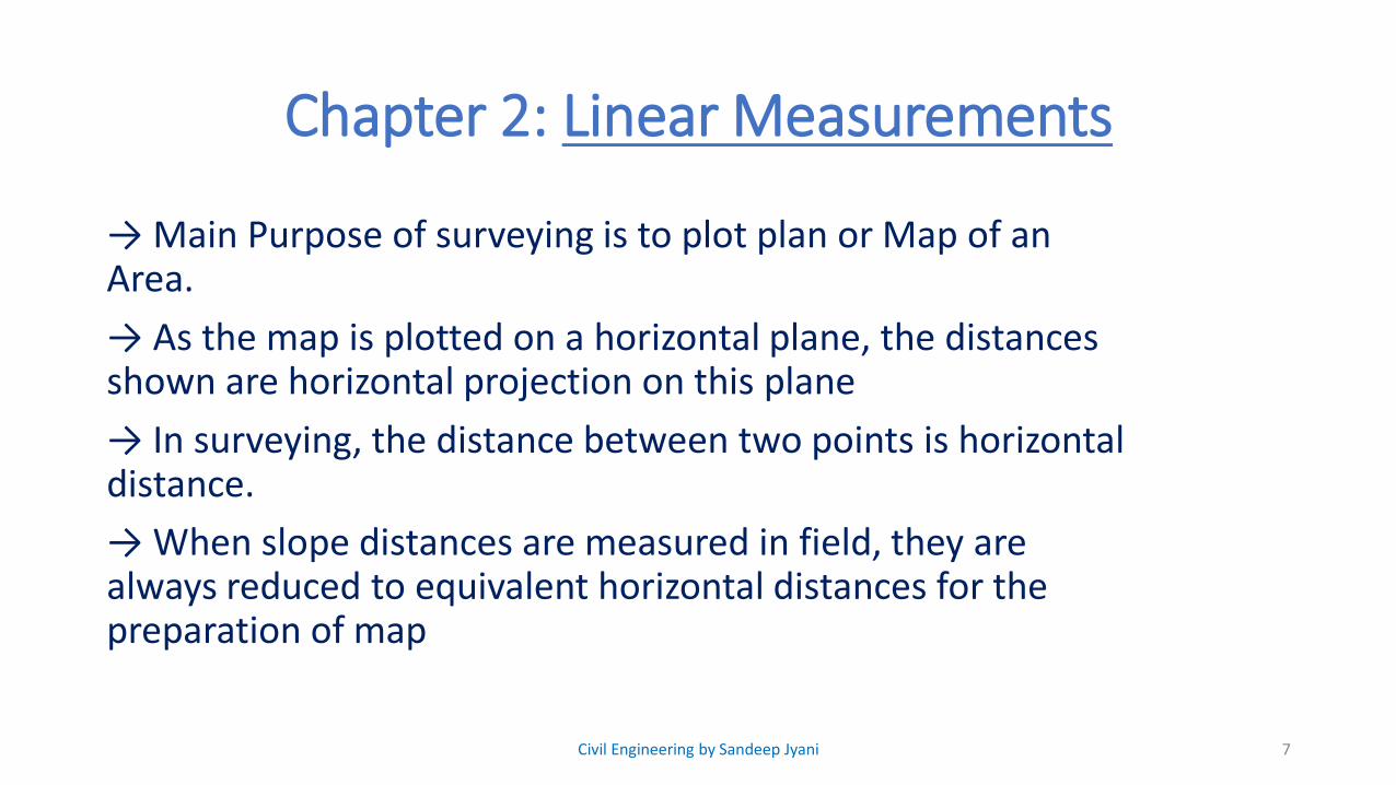
Chapter 2: Linear Measurements
→ Main Purpose of surveying is to plot plan or Map of an Area.
→ As the map is plotted on a horizontal plane, the distances shown are horizontal projection on this plane
→ In surveying, the distance between two points is horizontal distance.
→ When slope distances are measured in field, they are always reduced to equivalent horizontal distances for the preparation of map
7Civil Engineering by Sandeep Jyani
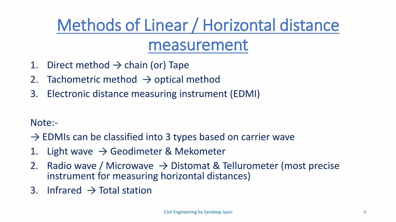
Methods of Linear / Horizontal distance measurement
1. Direct method → chain (or) Tape
2. Tachometric method → optical method
3. Electronic distance measuring instrument (EDMI)
Note:-
→ EDMIs can be classified into 3 types based on carrier wave
1. Light wave → Geodimeter & Mekometer
2. Radio wave / Microwave → Distomat & Tellurometer (most precise instrument for measuring horizontal distances)
3. Infrared → Total station
8Civil Engineering by Sandeep Jyani
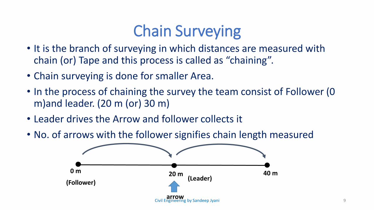
Chain Surveying• It is the branch of surveying in which distances are measured with
chain (or) Tape and this process is called as “chaining”.
• Chain surveying is done for smaller Area.
• In the process of chaining the survey the team consist of Follower (0 m)and leader. (20 m (or) 30 m)
• Leader drives the Arrow and follower collects it
• No. of arrows with the follower signifies chain length measured
9
0 m 20 m 40 m
arrow
(Follower)(Leader)
Civil Engineering by Sandeep Jyani

Chain SurveyingProcedure in chain surveying:-
• In chain surveying various points are located by measuring distance is the help of chain (or) Tape
• For smaller Area, details of various points can be collected using ties and offset.
• Note: → Offsets are lateral distances measured from a survey line to the point to information is to be collected.
10
Perpendicular offsetTie lines
Civil Engineering by Sandeep Jyani
• But when Area is large, error introduced due to large offset will be more, therefore to overcome this difficulty large area is first of all converted into Network of small triangles and then these details are collected using ties and offset.
11Civil Engineering by Sandeep Jyani
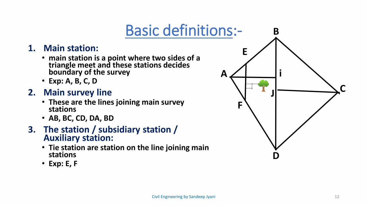
Basic definitions:-1. Main station:
• main station is a point where two sides of a triangle meet and these stations decides boundary of the survey
• Exp: A, B, C, D
2. Main survey line• These are the lines joining main survey
stations• AB, BC, CD, DA, BD
3. The station / subsidiary station / Auxiliary station:• Tie station are station on the line joining main
stations• Exp: E, F
12Civil Engineering by Sandeep Jyani
A
B
C
D
E
F
i
J
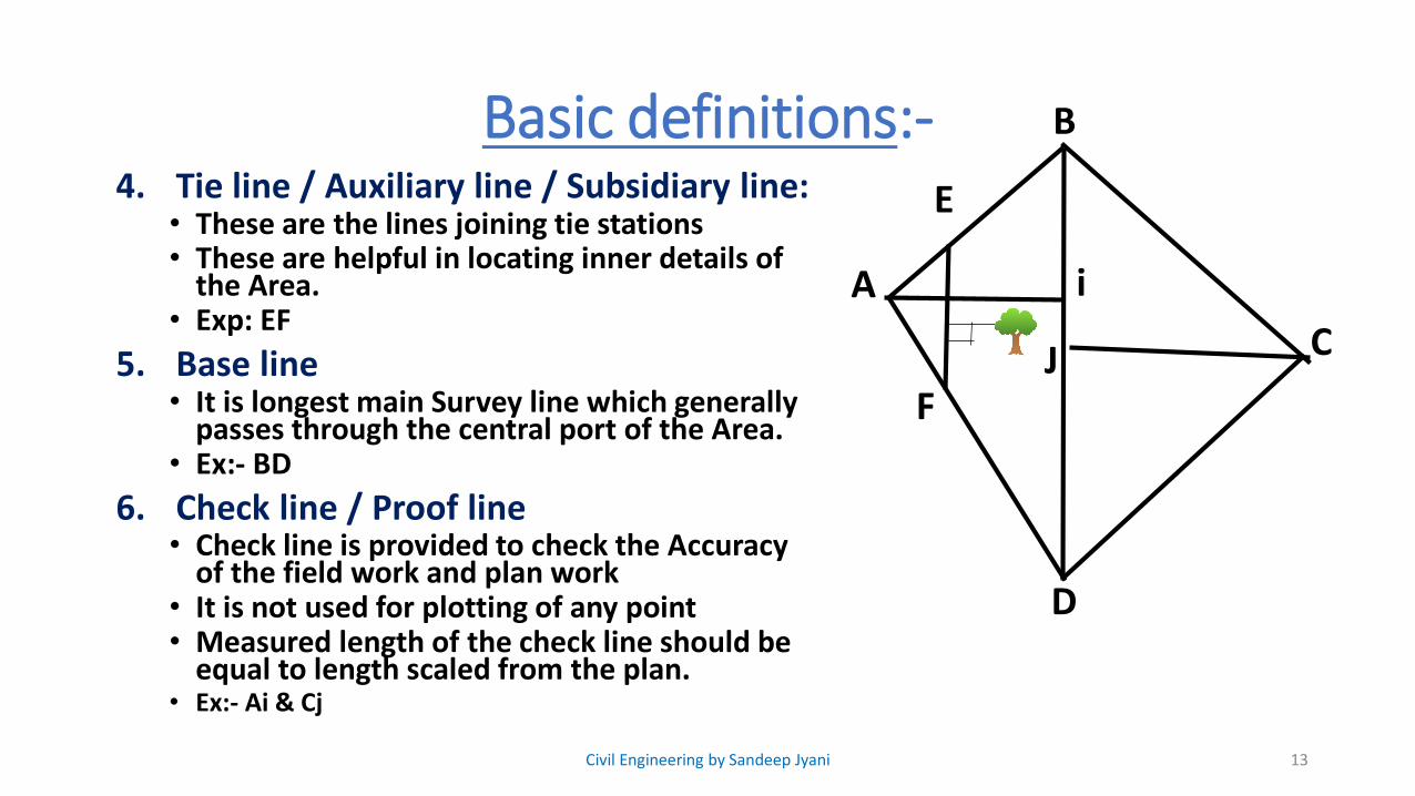
Basic definitions:-4. Tie line / Auxiliary line / Subsidiary line:
• These are the lines joining tie stations• These are helpful in locating inner details of
the Area.• Exp: EF
5. Base line• It is longest main Survey line which generally
passes through the central port of the Area.• Ex:- BD
6. Check line / Proof line• Check line is provided to check the Accuracy
of the field work and plan work• It is not used for plotting of any point • Measured length of the check line should be
equal to length scaled from the plan.• Ex:- Ai & Cj
13Civil Engineering by Sandeep Jyani
A
B
C
D
E
F
i
J
Basic definitions:-7. Chainage:
• Chainage is the distance measured along the direction of progress of survey
• It is the distance of a well defined point from the starting point.
• Word Chainage is generally used in linear projects.
• Ex:- Railway, Highway, Canal etc.
• They are used to represent important features in the work
14Civil Engineering by Sandeep Jyani
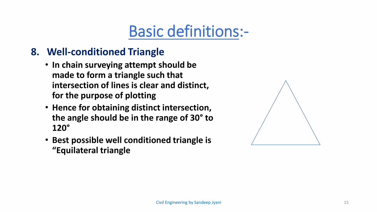
Basic definitions:-8. Well-conditioned Triangle
• In chain surveying attempt should be made to form a triangle such that intersection of lines is clear and distinct, for the purpose of plotting
• Hence for obtaining distinct intersection, the angle should be in the range of 30° to 120°
• Best possible well conditioned triangle is “Equilateral triangle
15Civil Engineering by Sandeep Jyani
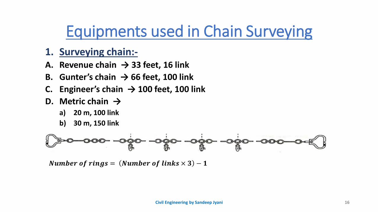
Equipments used in Chain Surveying1. Surveying chain:-A. Revenue chain → 33 feet, 16 link
B. Gunter’s chain → 66 feet, 100 link
C. Engineer’s chain → 100 feet, 100 link
D. Metric chain →a) 20 m, 100 link
b) 30 m, 150 link
16Civil Engineering by Sandeep Jyani
𝑵𝒖𝒎𝒃𝒆𝒓 𝒐𝒇 𝒓𝒊𝒏𝒈𝒔 = 𝑵𝒖𝒎𝒃𝒆𝒓 𝒐𝒇 𝒍𝒊𝒏𝒌𝒔 × 𝟑 − 𝟏
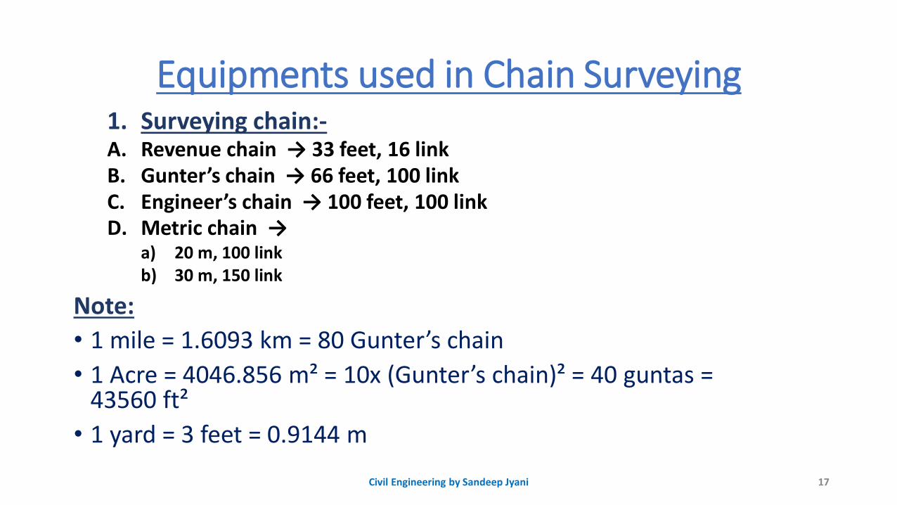
Equipments used in Chain Surveying1. Surveying chain:-A. Revenue chain → 33 feet, 16 linkB. Gunter’s chain → 66 feet, 100 linkC. Engineer’s chain → 100 feet, 100 linkD. Metric chain →
a) 20 m, 100 link b) 30 m, 150 link
Note:
• 1 mile = 1.6093 km = 80 Gunter’s chain
• 1 Acre = 4046.856 m² = 10x (Gunter’s chain)² = 40 guntas = 43560 ft²
• 1 yard = 3 feet = 0.9144 m
17Civil Engineering by Sandeep Jyani
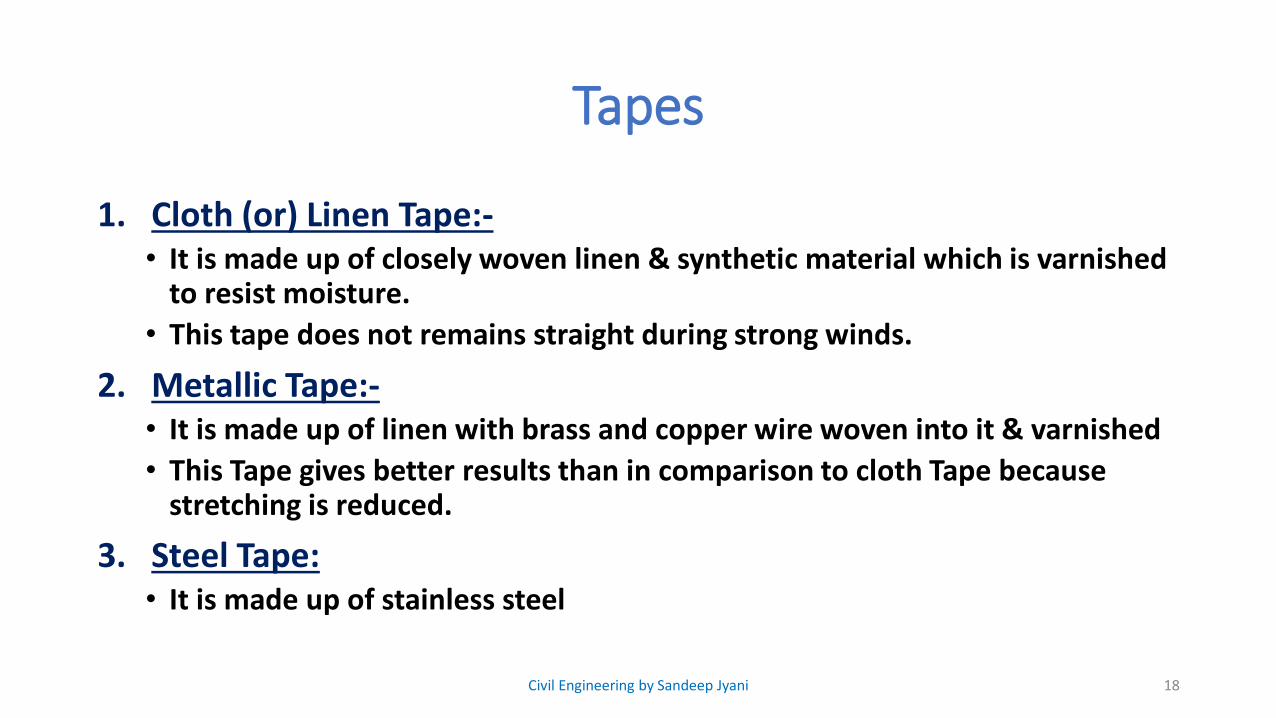
Tapes
1. Cloth (or) Linen Tape:-• It is made up of closely woven linen & synthetic material which is varnished
to resist moisture.
• This tape does not remains straight during strong winds.
2. Metallic Tape:-• It is made up of linen with brass and copper wire woven into it & varnished
• This Tape gives better results than in comparison to cloth Tape because stretching is reduced.
3. Steel Tape:• It is made up of stainless steel
18Civil Engineering by Sandeep Jyani
Tapes
4. Invar Tape• Nickel : 36 %
• Steel : 64 %
• This Tape is highly accurate and have very small thermal coefficient of linear expansion
• But these tapes require much attention in the field because it is soft and deforms easily.
19Civil Engineering by Sandeep Jyani
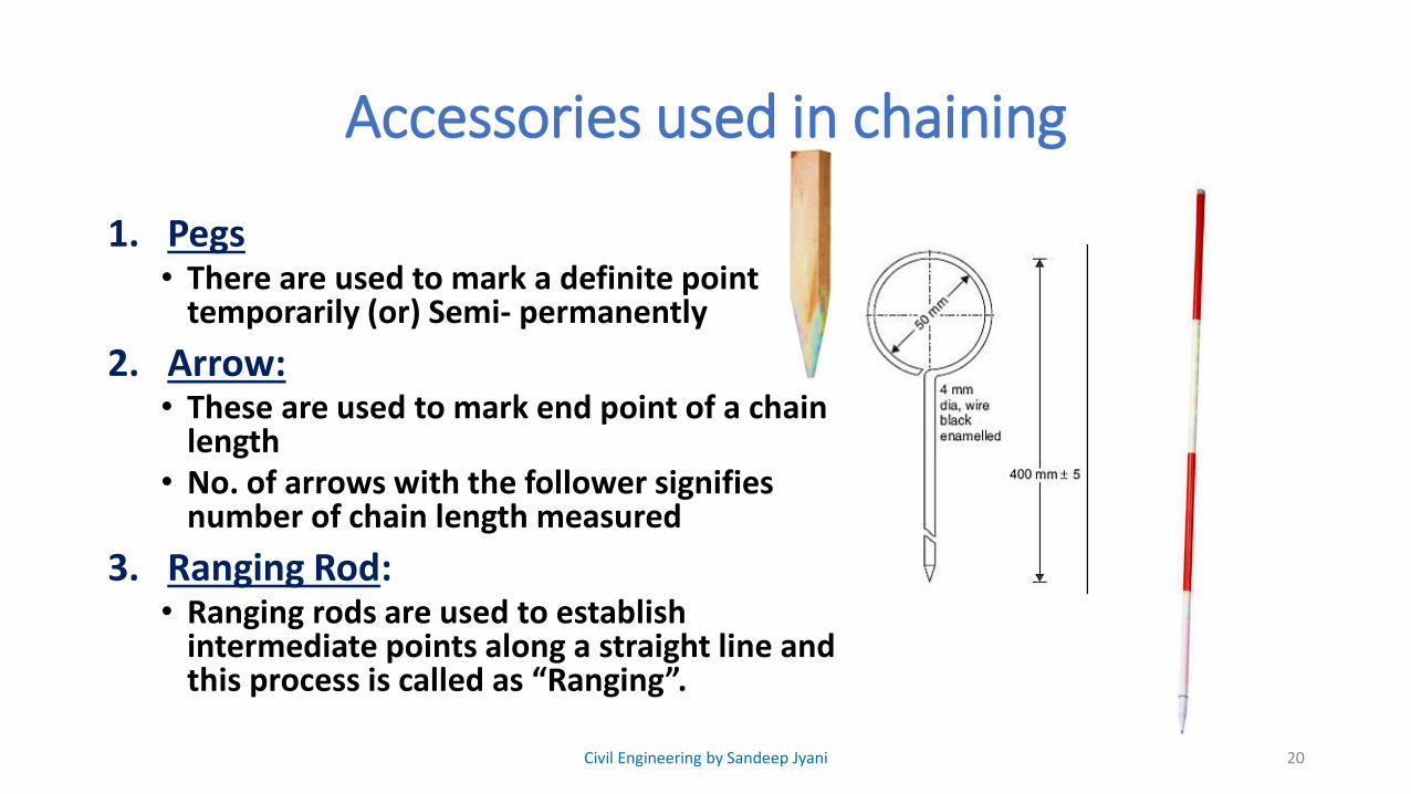
Accessories used in chaining
1. Pegs• There are used to mark a definite point
temporarily (or) Semi- permanently
2. Arrow:• These are used to mark end point of a chain
length• No. of arrows with the follower signifies
number of chain length measured
3. Ranging Rod:• Ranging rods are used to establish
intermediate points along a straight line and this process is called as “Ranging”.
20Civil Engineering by Sandeep Jyani
Accessories used in chaining
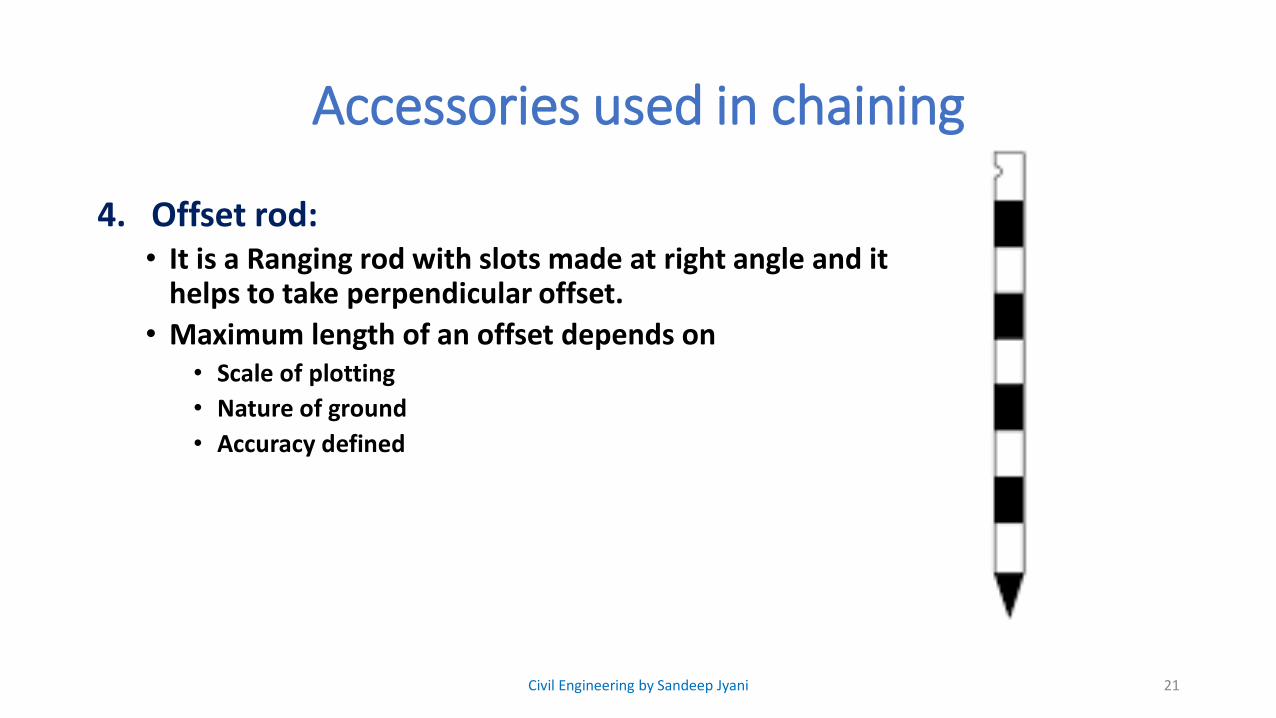
4. Offset rod:• It is a Ranging rod with slots made at right angle and it
helps to take perpendicular offset.
• Maximum length of an offset depends on• Scale of plotting
• Nature of ground
• Accuracy defined
21Civil Engineering by Sandeep Jyani
Accessories used in chaining
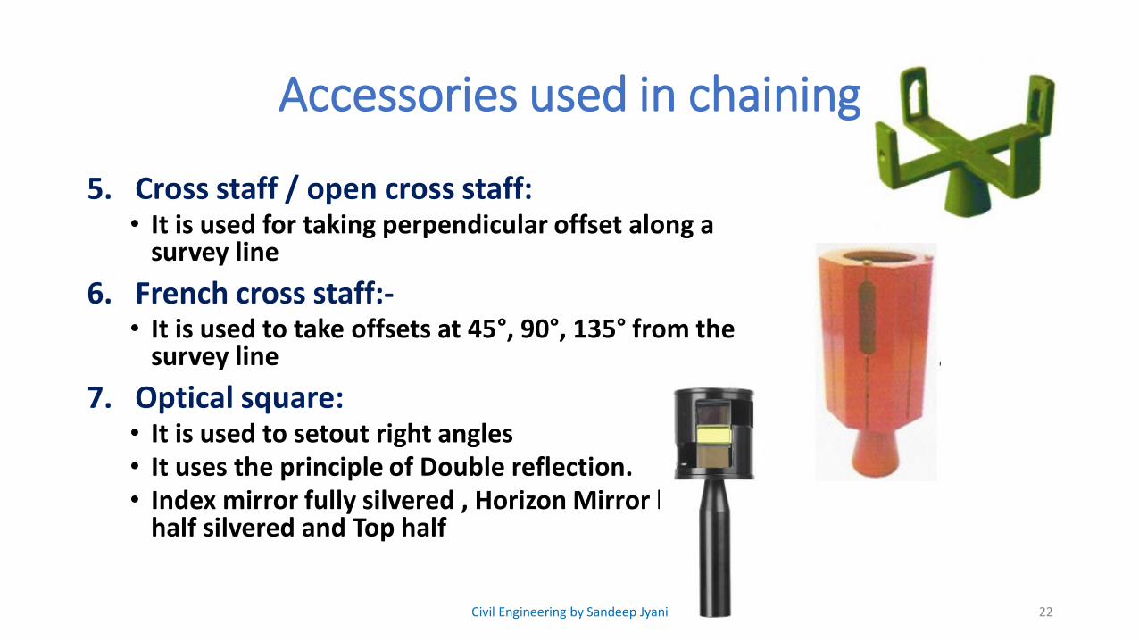
5. Cross staff / open cross staff:• It is used for taking perpendicular offset along a
survey line
6. French cross staff:-• It is used to take offsets at 45°, 90°, 135° from the
survey line
7. Optical square:• It is used to setout right angles• It uses the principle of Double reflection.• Index mirror fully silvered , Horizon Mirror bottom
half silvered and Top half
22Civil Engineering by Sandeep Jyani
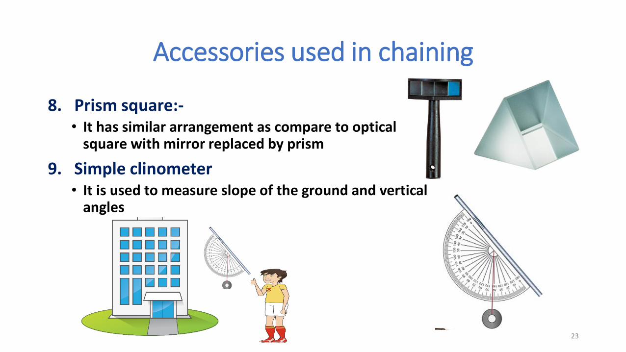
Accessories used in chaining
8. Prism square:-• It has similar arrangement as compare to optical
square with mirror replaced by prism
9. Simple clinometer• It is used to measure slope of the ground and vertical
angles
23
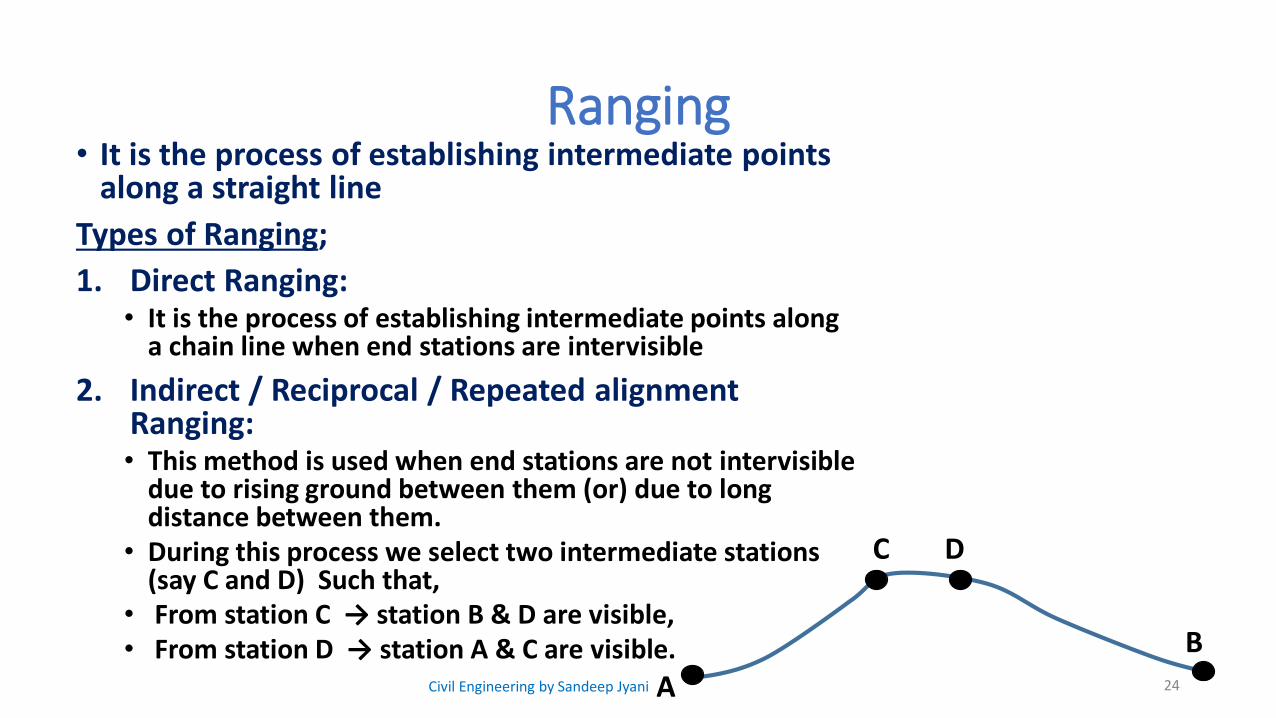
Ranging• It is the process of establishing intermediate points
along a straight line
Types of Ranging;
1. Direct Ranging:• It is the process of establishing intermediate points along
a chain line when end stations are intervisible
2. Indirect / Reciprocal / Repeated alignment Ranging:• This method is used when end stations are not intervisible
due to rising ground between them (or) due to long distance between them.
• During this process we select two intermediate stations (say C and D) Such that,
• From station C → station B & D are visible,• From station D → station A & C are visible.
24A
B
C D
Civil Engineering by Sandeep Jyani