statistical analysis of geospatial information and...
TRANSCRIPT
Statit
Statistical analysis of geospatial information and relevance of SDI’s Standards
The Brazilian case
Claudio StennerCoordinator of Geography
Brazilian Institute of Geography and Statistics - IBGE
International Workshop on Integrating Geospatial and Statistical Information Beijing-China, 9-12 June 2014

BRASIL
Land area 8 515 767 km2
Sea area 3 600 000 km2
States 27
Municipalities 5 570
Population(2010 Demographic Census)
190 755 799
ABOUT BRAZIL
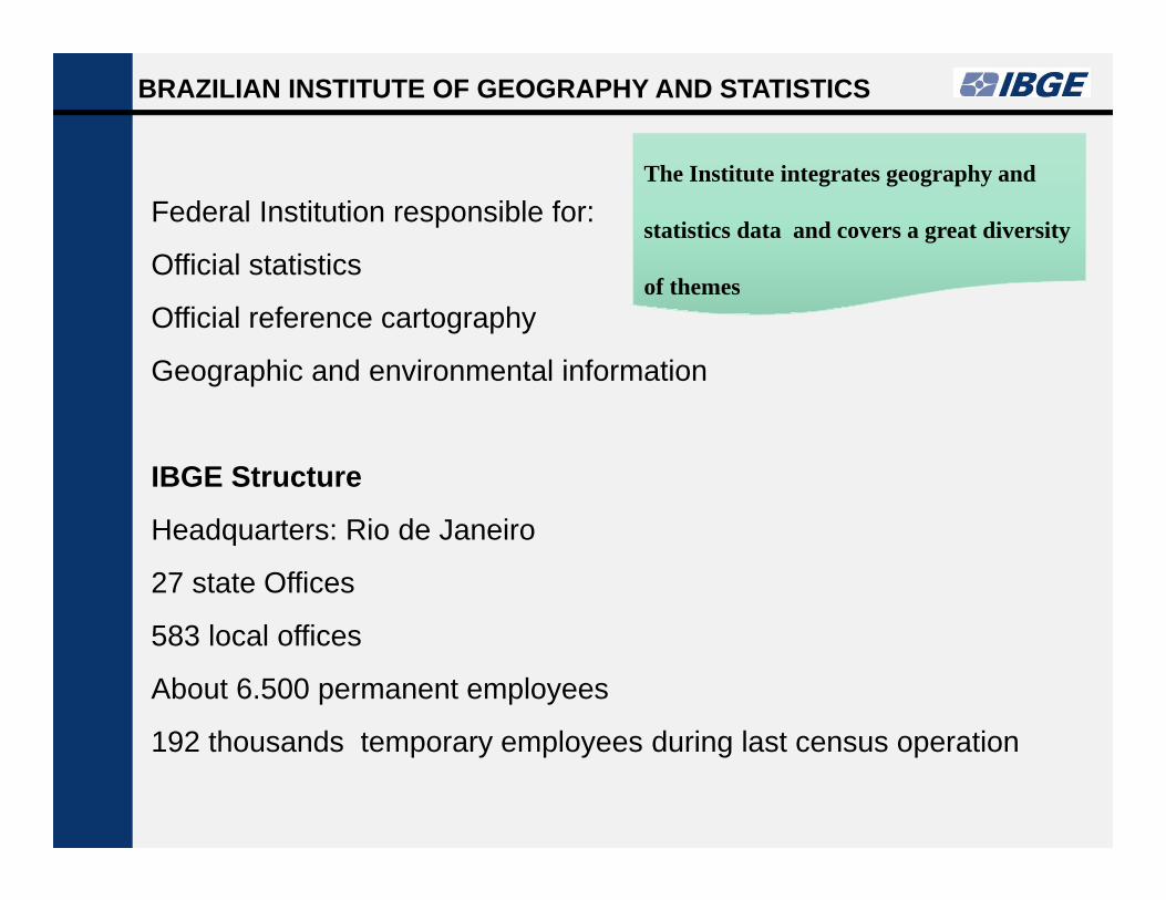
Federal Institution responsible for:
Official statistics
Official reference cartography
Geographic and environmental information
IBGE Structure
Headquarters: Rio de Janeiro
27 state Offices
583 local offices
About 6.500 permanent employees
192 thousands temporary employees during last census operation
BRAZILIAN INSTITUTE OF GEOGRAPHY AND STATISTICS
The Institute integrates geography and
statistics data and covers a great diversity
of themes
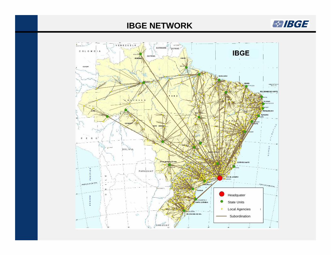
IBGE NETWORK
Headquater
State Units
Local Agencies
Subordination

DIVERSITY OF USERS
o Governmental planning and decision making (Federal, state
and municipal levels).
o Academic community.
o Service companies, market assessment, locational decisions
of enterprises etc.
o Press.
o Private citizens.
DATA TO THE SOCIETY

o Easy access to statistical and geographical data, in compatible
formats with the most popular mapping software;
o Availability of statistical and geographical metadata;
o Possibility to compare different scales (several territorial levels);
o Possibility to relate information from different sources;
o Possibility to create custom thematic maps;
o Access to statistical and geographical synthetic analysis (edited
maps);
MISCELLANEOUS DEMANDS
DATA TO THE SOCIETY

NACIONAL SPATIAL DATA INFRASTRUCTURE OF BRAZIL - INDE
Established by Presidential Decree 6.666 of November 27/ 2008
To promote the use of standards and specifications certified by the National Commission on Cartography –CONCAR
To avoid duplication of efforts and waste of resources in obtaining geospatial data by public administration bodies
To promote the proper generation, storage, access, share, dissemination and use of geospatial data produced at federal, state, and municipal level

NATIONAL SPATIAL DATA INFRASTRUCTURE OF BRAZIL - INDE
INDE Organizations - 20
8.520 metadata in IBGE GeoNetwork only
592 layers published in geoserver
317 layers published in the viewer
IBGE is in charge of INDE's organization
and functional aspects

Metadatabase (Geonetwork) runs on free software
http://www.metadados.inde.gov.br/geonetwork/srv/por/main.home
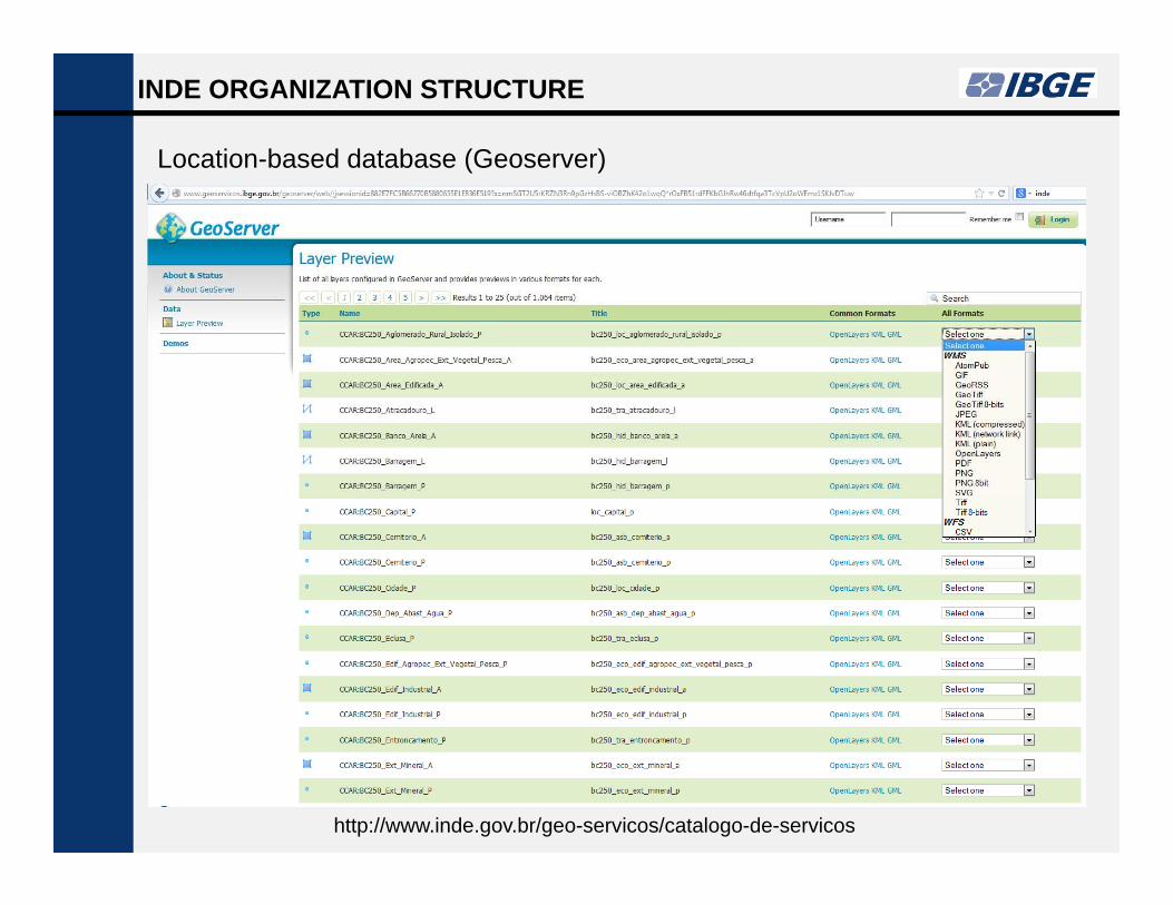
INDE ORGANIZATION STRUCTURE

Location-based database (Geoserver)
INDE ORGANIZATION STRUCTURE
http://www.inde.gov.br/geo-servicos/catalogo-de-servicos
Location-based database (Geoserver)
INDE ORGANIZATION STRUCTURE
http://www.inde.gov.br/geo-servicos/catalogo-de-servicos
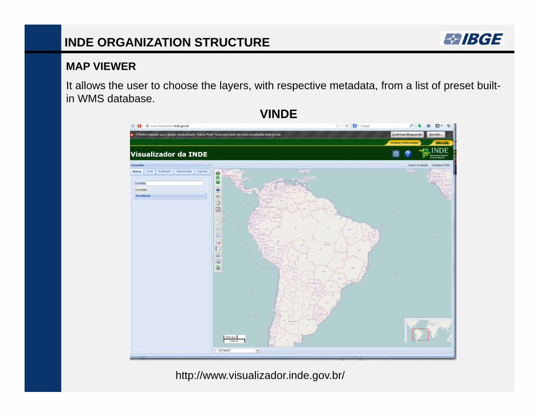
MAP VIEWER
INDE ORGANIZATION STRUCTURE
It allows the user to choose the layers, with respective metadata, from a list of preset built-in WMS database.
VINDE
http://www.visualizador.inde.gov.br/
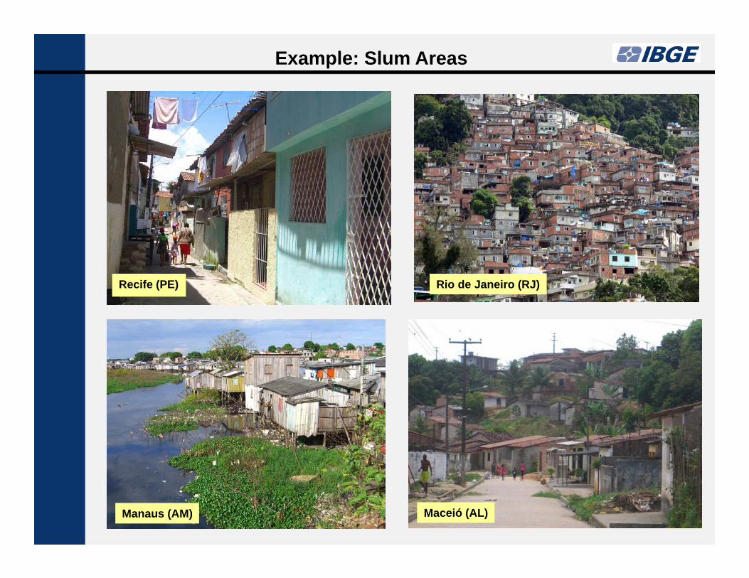
Recife (PE) Rio de Janeiro (RJ)
Maceió (AL)Manaus (AM)
Example: Slum Areas

Example: Slum Areas
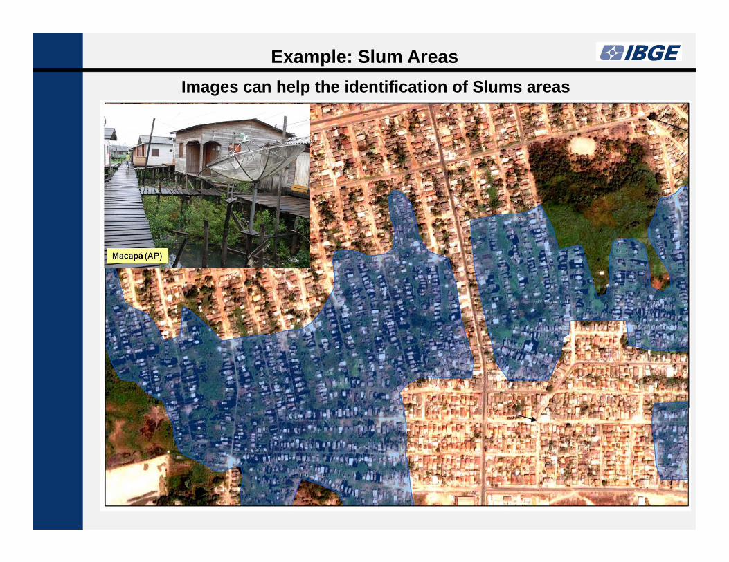
Example: Slum AreasImages can help the identification of Slums areas

POSSIBILITY OF RELATE INFORMATION FROM DIFFERENT SOURCES
Slum area in Salvador municipality (IBGE) and subway line under construction (Ministry of Planning)
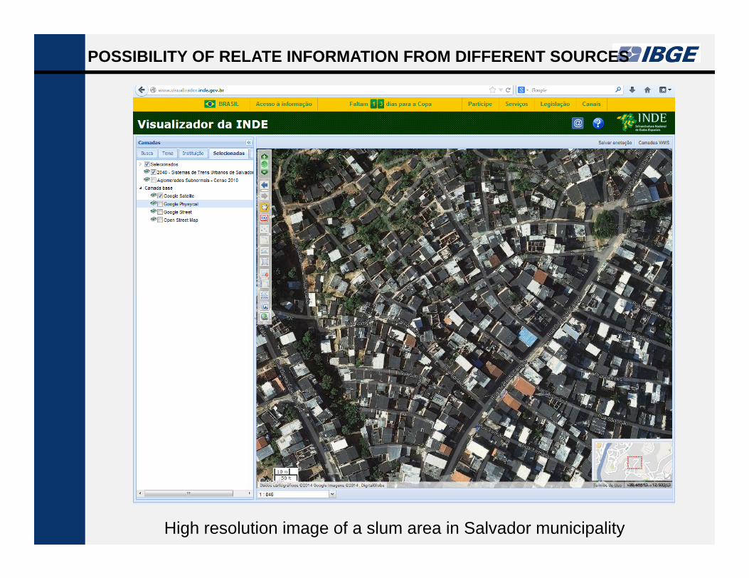
POSSIBILITY OF RELATE INFORMATION FROM DIFFERENT SOURCES
High resolution image of a slum area in Salvador municipality
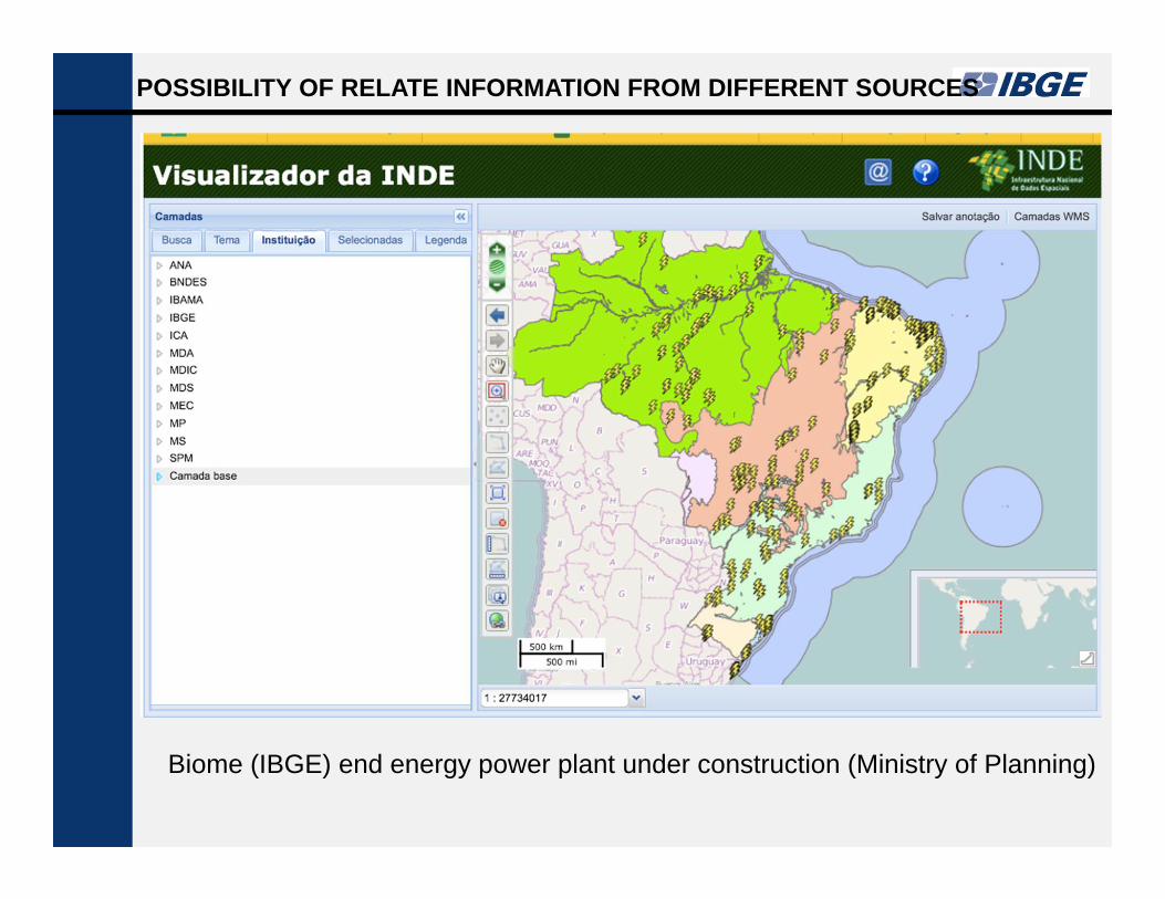
POSSIBILITY OF RELATE INFORMATION FROM DIFFERENT SOURCES
Biome (IBGE) end energy power plant under construction (Ministry of Planning)
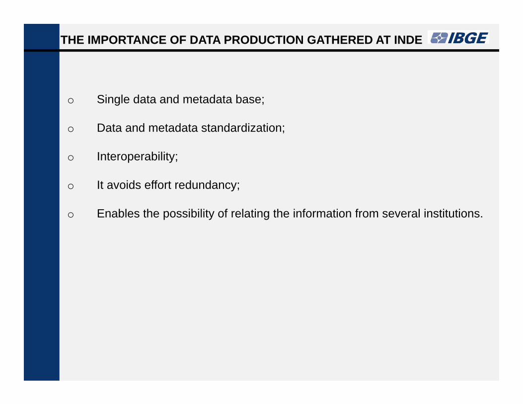
o Single data and metadata base;
o Data and metadata standardization;
o Interoperability;
o It avoids effort redundancy;
o Enables the possibility of relating the information from several institutions.
THE IMPORTANCE OF DATA PRODUCTION GATHERED AT INDE

IBGE PRODUCTION AND DISSEMINATION POLICYTO GEOGRAPHIC INFORMATION
1. Grant public and free access to geographical and statistical
databases;
2. Disclosure of tables and statistics custom retrieval systems;
3. Disclosure of edited maps;
3. Disclosure of the databases of all created maps;
4. Statistical and geographical metadata integration.
IBGE PRODUCTION AND DISSEMINATION POLICY TOGEOGRAPHIC INFORMATION
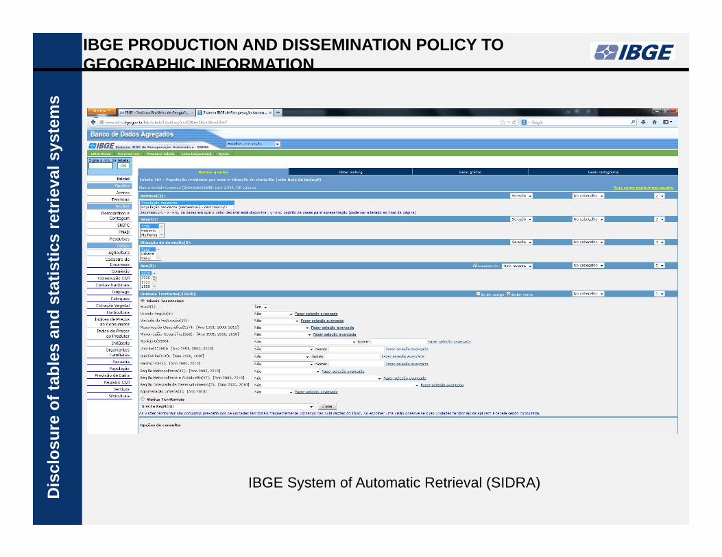
IBGE System of Automatic Retrieval (SIDRA)
Dis
clos
ure
ofta
bles
and
stat
istic
sre
trie
vals
yste
ms
CREATING CUSTOM TABLES ON SIDRAD
iscl
osur
eof
tabl
esan
dst
atis
tics
retr
ieva
lsys
tem
s
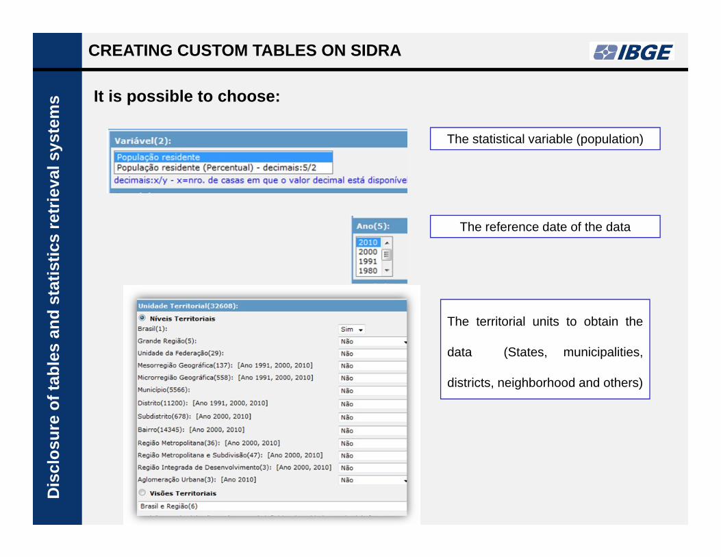
The statistical variable (population)
The reference date of the data
The territorial units to obtain the
data (States, municipalities,
districts, neighborhood and others)
It is possible to choose:
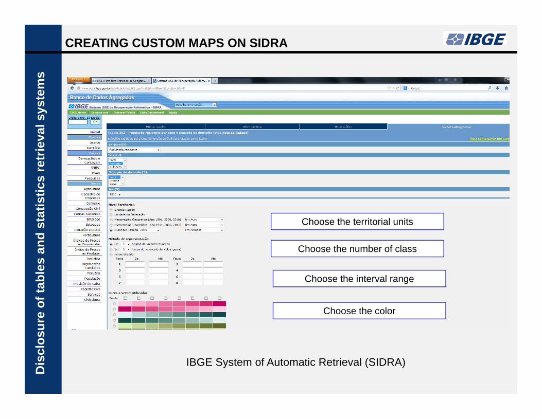
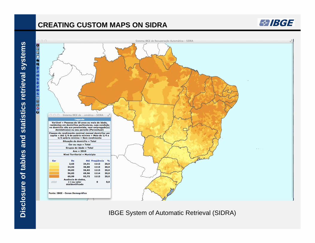
CREATING CUSTOM MAPS ON SIDRA
IBGE System of Automatic Retrieval (SIDRA)
Dis
clos
ure
ofta
bles
and
stat
istic
sre
trie
vals
yste
ms
Choose the territorial units
Choose the number of class
Choose the interval range
Choose the color
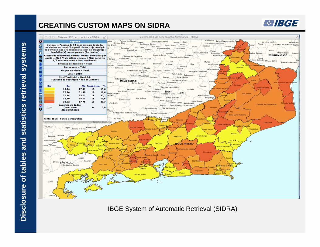
IBGE System of Automatic Retrieval (SIDRA)
Dis
clos
ure
ofta
bles
and
stat
istic
sre
trie
vals
yste
ms
CREATING CUSTOM MAPS ON SIDRA
IBGE System of Automatic Retrieval (SIDRA) Dis
clos
ure
ofta
bles
and
stat
istic
sre
trie
vals
yste
ms
CREATING CUSTOM MAPS ON SIDRA

IBGE PRODUCTION AND DISSEMINATION POLICY TOGEOGRAPHIC INFORMATION
Dis
clos
ure
ofed
ited
map
s
Dis
clos
ure
ofta
bles
and
stat
istic
sre
trie
vals
yste
ms
Since 2013 all geographical products released by IBGE are conform toINDE's standards and they are disseminated as location-baseddatabases.
MAJOR EXAMPLES
• Demographic Census Atlas 2010• Territory Management 2014• Commerce and Service National Atlas• Sustainable Development Index
• International chart of the World on themillionth scale• 250 thousand continuous chart of Brazil
• Vegetation• Geomorphology• Biome• Land use• Geology
IBGE PRODUCTS WITH INDE STANDARDS
Reference cartography
Integration of geography and statistic
Environmental information

Geographic analysis instrument and dissemination of the 2010
Demographic Census
The Atlas approaches several dimensions of the populational dynamics and the
demographic profile of Brazilian society, with emphasis on regional and local
peculiarities.
DEMOGRAPHIC CENSUS ATLAS - 2010

DEMOGRAPHIC CENSUS ATLAS - 2010
Thematic Structure
1. Brasil and the world.
2. Territorial division of Brazil.
3. Demographic carachteristics.
4. Spatial distribution of population.
5. Population flow in the territory.
6. Urbanization.
7. Housing conditions.
8. Social and economic profile of the population.
9. Cultural diversity.
DEMOGRAPHIC CENSUS ATLAS - 2010
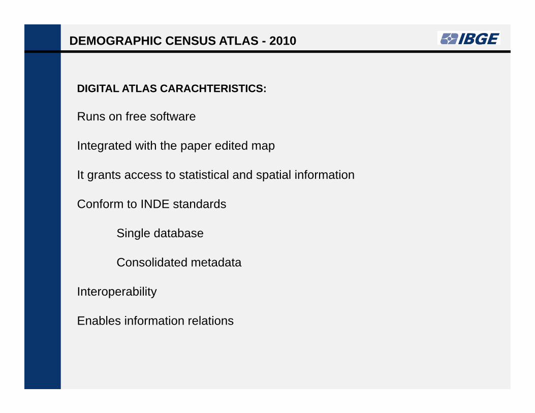
DIGITAL ATLAS CARACHTERISTICS:
Runs on free software
Integrated with the paper edited map
It grants access to statistical and spatial information
Conform to INDE standards
Single database
Consolidated metadata
Interoperability
Enables information relations

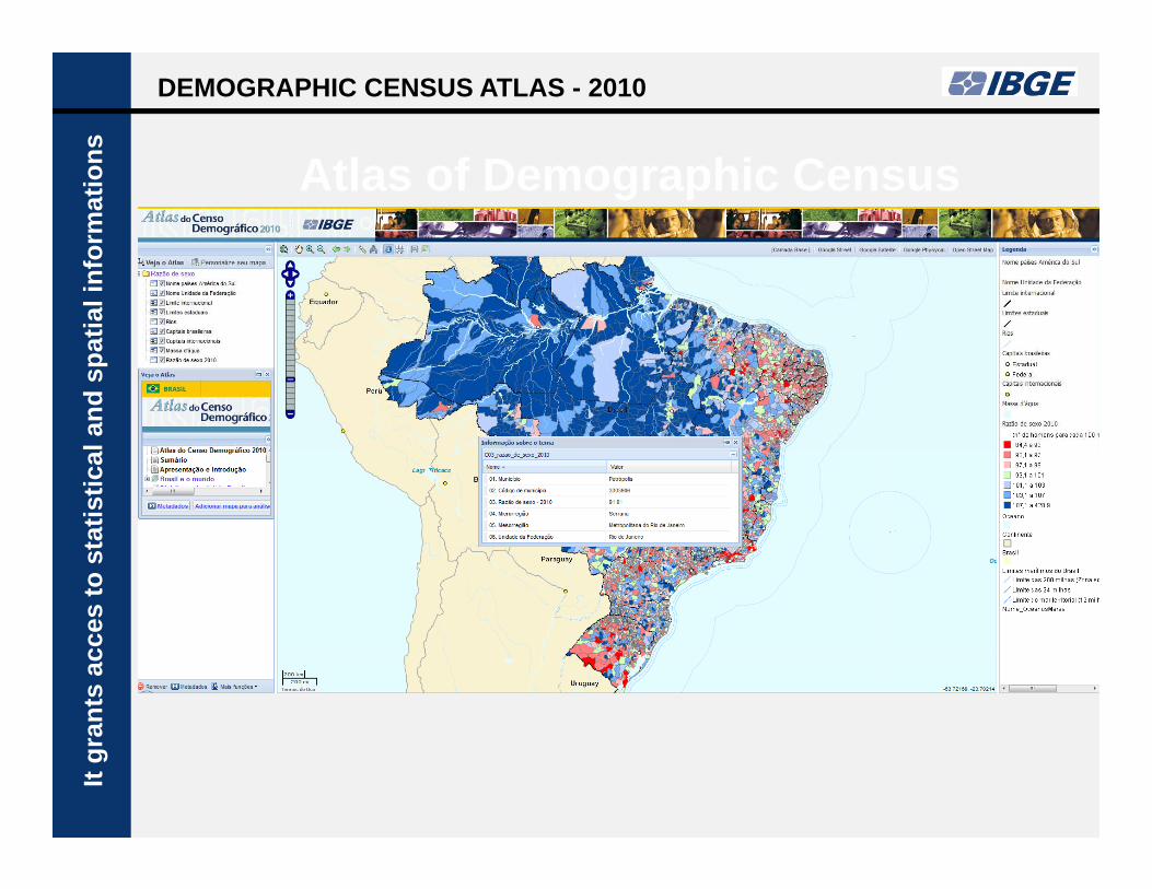
Atlas of Demographic Census
DEMOGRAPHIC CENSUS ATLAS - 2010In
tegr
ated
with
the
edite
dm
ap
ad the map for analyses
Atlas of Demographic Census
DEMOGRAPHIC CENSUS ATLAS - 2010It
gran
tsac
ces
tost
atis
tical
and
spat
iali
nfor
mat
ions
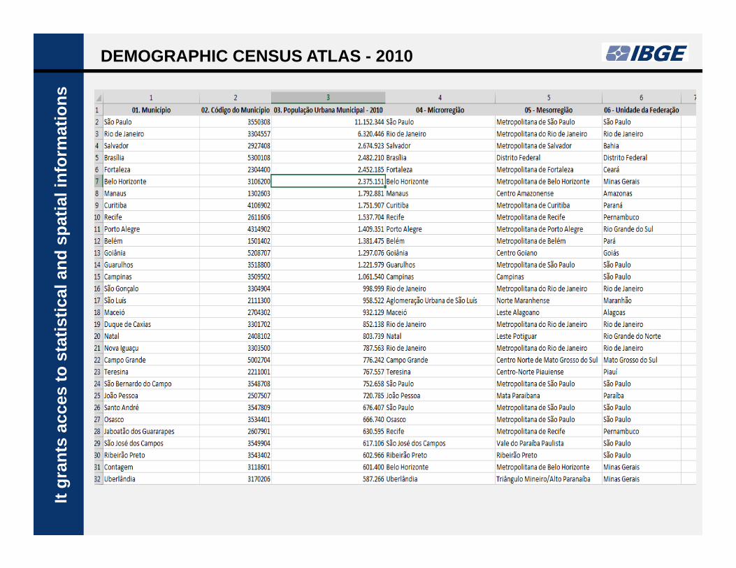
Atlas of Demographic Census
Itgr
ants
acce
sto
stat
istic
alan
dsp
atia
linf
orm
atio
nsDEMOGRAPHIC CENSUS ATLAS - 2010
Atlas of Demographic Census
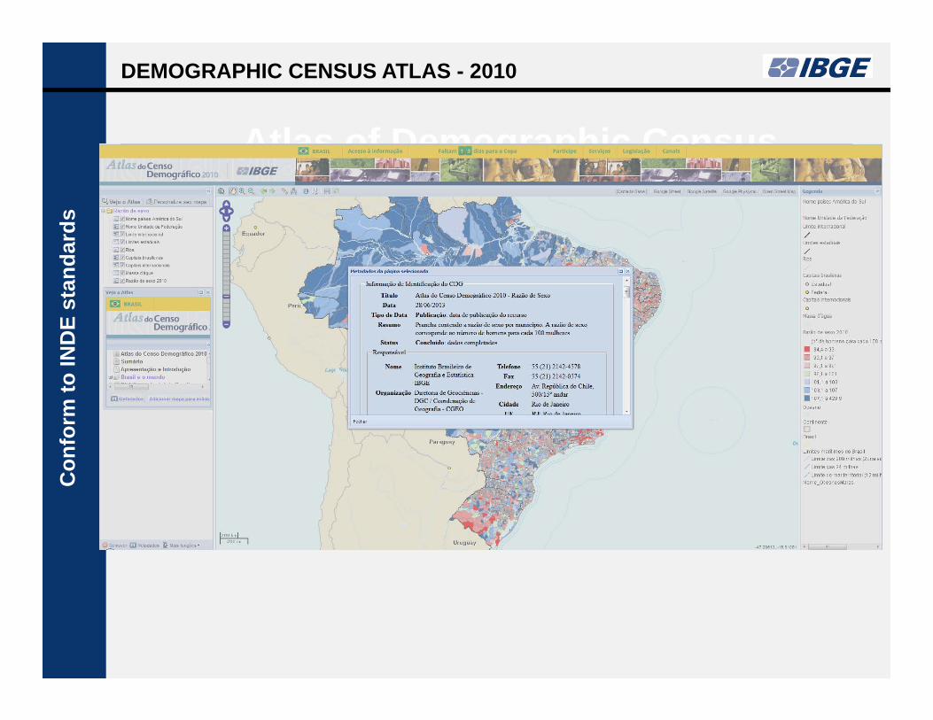
Con
form
toIN
DE
stan
dard
sDEMOGRAPHIC CENSUS ATLAS - 2010

DATA AND METADATA INTEGRATION
The summarized MGB profile is used to the thematic information, which is
conformed to the ISO 19.115 normatization.
The file comprises:
Title
Reference date
Summary
Statistical metadata
Spatial metadataCon
form
toIN
DE
stan
dard
s
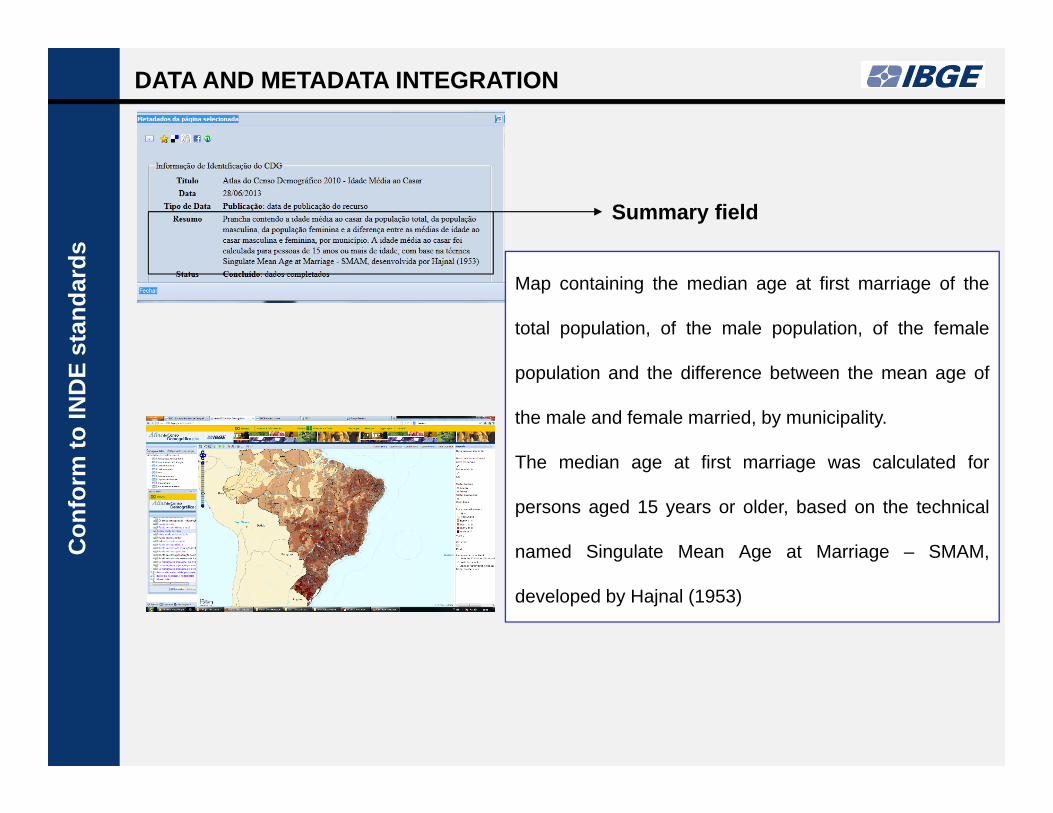
DATA AND METADATA INTEGRATION C
onfo
rmto
IND
Est
anda
rds
Map containing the median age at first marriage of the
total population, of the male population, of the female
population and the difference between the mean age of
the male and female married, by municipality.
The median age at first marriage was calculated for
persons aged 15 years or older, based on the technical
named Singulate Mean Age at Marriage – SMAM,
developed by Hajnal (1953)
Summary field
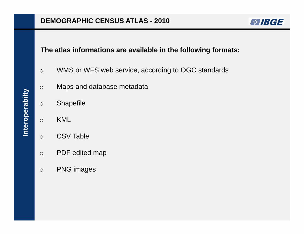
o WMS or WFS web service, according to OGC standards
o Maps and database metadata
o Shapefile
o KML
o CSV Table
o PDF edited map
o PNG images
The atlas informations are available in the following formats:
DEMOGRAPHIC CENSUS ATLAS - 2010In
tero
pera
bilty

Atlas of Demographic Census
DEMOGRAPHIC CENSUS ATLAS - 2010In
tero
pera
bilty
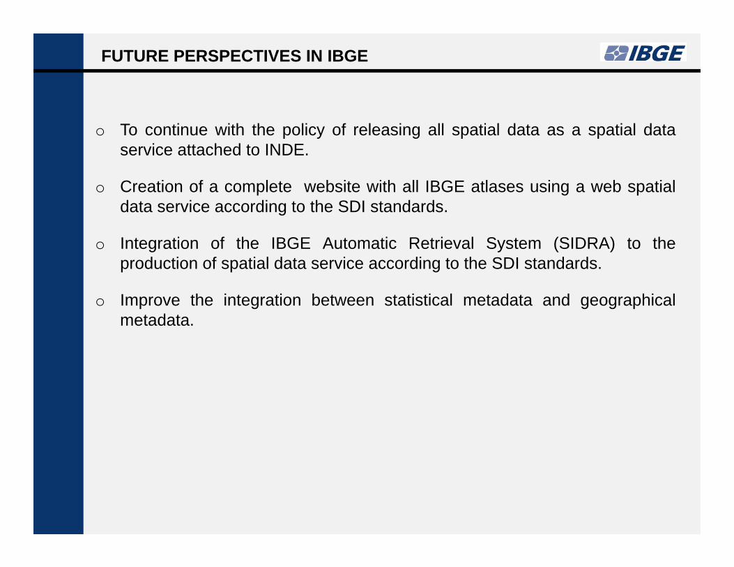
FUTURE PERSPECTIVES IN IBGE
o To continue with the policy of releasing all spatial data as a spatial dataservice attached to INDE.
o Creation of a complete website with all IBGE atlases using a web spatialdata service according to the SDI standards.
o Integration of the IBGE Automatic Retrieval System (SIDRA) to theproduction of spatial data service according to the SDI standards.
o Improve the integration between statistical metadata and geographicalmetadata.

SOME KEY POINTS
o The integration of geography and statistics may starts with simple andinexpensive actions. It can grow step by step.
o SDIs are the best and inexpensive way to put different kinds of informationtogether and to create new information, new value.
o With the SDIs approach is easier to create new statistics based in differentkinds of geographic features, included environmental features.
o The SDIs approach in the integration of geography and statistics makeeasier the international data share and integration.
o Disclosure the integrated geographic-statistics information through a OGCstandards web services is a good way to guarantee an easy access andthe data interoperability.
o Challenge: the creation of a international standard of a integrated statisticaland geographical metadata;

www.ibge.gov.br
Claudio [email protected]
Thank you for your attention!Thank you for your attention!