state geological and natural history survey of connecticut · superintendent of the state...
TRANSCRIPT

STATE GEOLOGICAL AND
NATURAL HISTORY SURVEY
OF CONNECTICUT
NATURAL RESOURCES CENTER
DEPARTMENT OF ENVIRONMENTAL PROTECI’ION
A HISTORY OF THE STATE GEOLOGICAL AND
NATURAL HISTORY SURVEY OF CONNECTICUT
By ROBERT J. ALTAMURA
Reprint from
THE STATE GEOLOGICAL SURVEYS - A HISTORY
Published by the Association of American State Geologists
1988, p.48-69
1989

Directors of the State Geological andNatural Histo~, Survey of Connecticut (-established in 1903)
William North Rice, Superintendent, 1903-1916Herbert Ernest Gregory, Superintendent, 1916-1921Henry Hollister Robinson, Superintendent, 1921-1925Wilton Everett Britton, Superintendent, 1925-1939Edward Leffinwell Troxell, Director, 1939-1954John Becker Lucke, Director, 1954-1960Joe Webb Peoples, Director, 1960-1974Hugo Frederick Thomas, State Geologist, 1974-
Early Official Geological Surveys of the State
James Gates Percival (Geological survey of Connecticut with map) 1835-1842Charles Upham Sbepard (Mineralogical survey of Connecticut) 1835-1837
NOTE FOR THE READER
This history of the State Geological and Natural History Survey of Connecticut is areprint of an article that was prepared for a volume containing the history of each of thefifty state geological surveys. Space limitations for this volume necessitated that thishistory of the Connecticut Survey be somewhat abbreviated, and greater detail is providedon geologic topics than on natural history (biology) topics.
Reprinted from
THE STATE GEOLOGICAL SURVEYS - A HI~IX)RY 1
1988
A HISTORY OF THE STATE GEOLOGICAL
AND NATURAL HISTORY SURVEY
BY ROBERT J. ALTAMURAConnecticut Geological & Natural History Survey
165 Capitol AvenueHartford, CT 06106
FOUNDATIONS OF THE SURVEY
There was a growing interest ingeology in the early part of the 19thcentury, not only in Connecticut, butelsewhere. By that time, James Hutton,the founder of modern geology, hadpresented his epoch-making Theory ofthe Earth to the Royal Society ofEdinburgh in 1785. Europeans, who hadstudied the natural sciences for sometime, continued to pursue the subject ofgeology. Here in the United States,foreign literature stimulated interest innatural science, including geology andbiology, and people were becomingincreasingly aware of the natural world.
In 1802, the President of YaleCollege in New Haven, Connecticut,hired Benjamin Silliman, who just hadcompleted his training in law, to head adepartment and offer courses in science.Before he began teaching, Sillimanattended lectures in chemistry at amedical school in Philadelphia and hadstudied natural science in Europe. By1806, Silliman had published a sketch ofthe mineralogy of New Haven and in1818 he founded The American Journal
of Science. The early volumes ofSilliman’s Journal, as it was thenknown, contained a number of papers onConnecticut mineralogy and geology,many by Silliman himself.
Silliman’s students carried theirknowledge to other parts of the country.In 1824, Denison Olmsted went to headthe North Carolina Survey. EdwardHitchcock went to Amherst College inMassachusetts and conducted the geo-logical survey of that state beginning in1830, which ~nspired and stimulatedother states to get surveys under way.Amos Eaton went to Williams College inMassachusetts and later to RensselaerPolytechnic Institute in Troy, New York,where he worked on a geological surveyin eastern New York, and James GatesPercival stayed in Connecticut to leadthe state’s first systematic geologicalsurvey.
In the United States, the period from1830-80 has been referred to as the "Eraof the State Surveys" (Merrill, 1924}.William W. Mather, who taught atWesleyan University in Middletown,Connecticut from 1833-34, was one offour state geologists who mapped New
1This paper was written for inclusion in The Stale Geological Surveys - A History. a 500-page volume includingpapers on the histoties of state geological surveys of the fifly states. ~’his project ~,as edited by Arthur A. Socolowand published by the Association of American State Geologisis (AAS G) in 1988. The Connecticut chapter isreproduced here with the permission of the AASG as a Connecticut Geological & Natural History Survey reprint~

49
York State from 1836-42, and in 1841Edward Hitchcock completed thegeological survey of Massachusetts:
The first systematic study of thegeology of Connecticut was made when asurvey of the state was authorized by theLegislature on June 15, 18~35. JamesGates Percival was placed in charge ofthe geology and Charles UphamShepard, the mineralogy. A passagefrom the Annual Message of 1835 fromGovernor Henry Edwards may provideinsight into the thinking of the times,which led to the birth of that firstgeological survey of the state.
The mineralogical treasures which have beendeveloped within a few years and which areconstantly coming to light in different partsof our country, give us reason to believe, thatwe have not as yet availed ourselves to theextent that we might of this source of wealth,and suggests the expediency of a movesystematic examination than has hithertotaken place.. ~ (from Shepard, 1837).
Shepard’s A Report of the GeologicalSurvey of Connecticut was published in1837, but it wasn’t until 1842 thatPercival published his Report on theGeology of the State of Connecticut,which was a comprehensive geologicalinvestigation. By 1841, Percival (fig. 1)had surveyed the entire state in E-Wtraverses at 2-mile intervals, whichmeans that he touched every square mileof the state. By the time Percivalaccomplished this task, the Legislatureand new governor William Ellsworthbecame impatient for a final report.Requests for further appropriations weredenied, and Percival was forced to reporthis work in "a hasty outline" of 495pages with a map (the first stategeological map, scale 1:250,000).
Percival’s report on the geology ofConnecticut delineates all the majorrock types with particular attention todetail. His observations are descriptivewith little interpretative bias. Geologicboundaries key to some of the moderninterpretations as shown on the mostrecent state map were delineated onPercival’s 1842 map. As an example of
Figure 1.--James Gates Percival--student ofBenjamin Silliman and author of the firstgeological map of Connecticut, which waspublished in 1842.
the value of Percival’s observations, inpreparing the 1985 Bedrock GeologicalMap of Connecticut, John Rodgers ofYale used Percival’s map to help resolveconflicts.
From 1842 to 1903, the Stateinitiated no new geological investiga-tions. However, studies were conductedby various university and federalgeologists. In the last half of the 19thcentury, instruction and investigationsin geology were conducted primarily atthree Connecticut universities. At Yale,Benjamin Silliman, James DwightDana, his son Edward S. Dana, andGeorge Brush, made early contributionsto the geology and mineralogy of thestate. At the Peabody Museum ~)f Yale,Othniel C. Marsh made colle~ions ofdinosaur bones from the western UnitedStates, competing with Edward
Drinkwater Cope of the Academy ofNatural Sciences in Philadelphia. Alsoat this time, geological instruction andinvestigations were under way by JohnJohnston and William North Rice atWesleyan. Rice had received a Ph.D.from Yale in 1867. This was the firstPh.D. in geology given by an Americanuniversity. The title of his dissertationwas The Darwinian Theory of the Originof Species. Rice, a graduate of Wesleyanin 1865, returned to become professor ofgeology and in 1903 became the firstSuperintendent of the State Geologicaland Natural History Survey ofConnecticut. Rice was also an ordainedminister. Charles Upham Shepardtaught and conducted numerousinvestigations at Washington College(later to become Trinity College) inHartford during this time. Keycontributions to Connecticut geology andmineralogy appeared in The AmericanJournal of Science.
Shortly after its formation in 1879,the U.S. Geological Survey (USGS)began work in Connecticut. WilliamMorris Davis, who was a professor atHarvard and also worked for the USGS,studied and mapped the Mesozoic rocksof Connecticut. Davis accomplished partof this work by leading the HarvardCollege summer geology school to theMeriden area for geological mapping.Later, Davis worked with S. Ward Loper,a farmer who later became curator of thegeology museum at Wesleyan. Loperhelped confirm Davis’ structural modelsfor block faulting in the Connecticutvalley b~ locating specific fossil fish andfossil plant marker horizons.
One of Davis’ geological assistantswas William North Rice (fig. 2). Anotherwas Lewis Gardner Westgate, also agraduate of Wesleyan, who didconsiderable mapping in the crystallinerocks near Middletown.
In 1891, W. F. Hillebrand, a chemistwith the USGS, studied uraninite(essentially UO2) from Portland,Connecticut, and noticed during the
5O
preparation for analysis that a gas wasbeing emitted. Several years later,helium was isolated as a stable decayproduct of uranium. In 1904, ErnestRutherford of McGill University pre-sented ideas on how progressive accumu-lation of daughter products might beused to measure geologic time. Thoseideas were put to use by Bertram B.Boltwood of Yale, who, in 1906,following a suggestion made byRutherford, looked at analyses of urani-um minerals, including Hillebrand’suraninite analyses, and made the firstradiometric age determinations. Radio-metric age dating indicated that theexpanse of geologic time was muchgreatdr than geologists previouslythought.
Around the turn of the century,William H. Hobbs of the USGS con-ducted pioneering lineament studies inConnecticut, a field that today receives asignificant amount of attention.
During the 19th century, people inConnecticut also turned their attentionto biology. For example, around the timeof Percival and Shepard, Eli Ives of Yale,a professor of botany and medicine,published three papers on plants inSilliman’s Journal. Ives later made a listthat included the names of more than athousand plants growing near NewHaven (Troxell, unpub, ms.). Troxell alsore~orts that Amos Eaton and JohnPierce Brace pursued similar interests.Brace later studied plant life in theLitchfield, Connecticut, region, and hisherbarium was donated to WilliamsCollege.
About 1856, professor Daniel CadyEaton and other members of theSheffield Scientific School of Yaleproduced a catalog of the higher plantsfound in the vicinity of New Haven,listing about 1,230 species (Troxell,unpub, ms.). In 1885, James W. Bishoppresented a catalog of plants for all ofConnecticut which included contribu-tions from many naturalists throughoutthe state.

51 52
Figure 2,--William North Rice (first Superintendent of the Connecticut Geological and Natural HistorySurvey) (left) and William Morris Davis of the U.S. Geological Survey (right) ~teast" in the field.(Department of Earth and Environmental Sciences, Wesleyan University.)
In 1903, the Connecticut BotanicalSociety was founded, and a goal was tocatalog all the higher plants growingnaturally in the state. That same yearthe State Geological and NaturalHistory Survey of Connecticut (alsoreferred to as the Connecticut Geologicaland Natural History Survey) wasfounded.
FORMATION OF THECONNECTICUT GEOLOGICAL
AND NATURAL HISTORYSURVEY
The Act establishing the StateGeological and Natural History Surveywas approved by the Legislature on June3, 1903. The Commissioners, underwhose direction the Survey was placed
by the terms of the Act, appointedWilliam North Rice (fig. 3), Professor ofGeology at Wesleyan,to beSuperintendent of the Survey.
The first Biennial Report of theCommissioners states that equalattention be paid "both to the rockyframework of the state and to itsvegetable and animal life--both to theGeology of the state and to its Botanyand Zoology." The report also states thatthe Survey has three distinct aims.These are:
First the advancement of our knowledge ofthe geology, botany, and zoology of the stateas a matter of pure science; second, theacquisition and publication of s~chknowledge of the resources and products ofthe state as will serve its industrial andeconomic interest; third, the presentation ofthe results of investigation in such form as to
Figure 3.--William North Rice--FirstSuperintendent of the Connecticut Geologicaland Natural History Survey and Professor ofGeology at Wesleyan. (Wesleyan UniversityArchives.)
be useful in the educational work carried onin the various schools of the state. Thesethree aims, the purely scientific, theeconomic, and the educational, we haveendeavored constantly to keep in mind in allplans which have been made.
It may have been Professor HerbertErnest Gregory of Yale and also of theU.S, Geological Survey who eventuallybrought the elements together to formthe Survey. Troxel! (unpub. ms.) impliesthat Gregory, who took many trips backand forth to Hartford, was the mainorganizer. Gregory met frequently withother scientists, with administrativeofficers, and with politicians whose finalconsent needed to be won.
On the occasion of the 25thanniversary of the Connecticut Survey,Gregory wrote a letter, dated December30, 1927, in which he states that his deepand continuing interests made him feelthat the time he gave to the Survey’sorganization, along with its adminis-tration and ~cientific studies, wasprofitably spent. He further states, ’~Myreason for urging the establishment ofthe SurveY was the belief that such anorganization would fill a useful place inthe educational system of the state."Education may have been Gregory’sprimary incentive.
Practical Organization
Th~ Connecticut Survey consisted ofa board of commissioners, who weremade up of the presidents of the state’sprincipal colleges. These institutionswere the Connecticut AgriculturalCollege (later to become the Universityof Connectlcut) in Storrs, Trinity Collegein Hartford, Wesleyan University inMiddletown, and Yale University inNew Haven. Later Connecticut Collegein New London was represented on theCommission. The Governor was an exofficio member of the board. ASuperintendent, who was a scientist andnot necessarily a college president, wasappointed by the Commission to directthe work of the Survey.
The organization of the Survey wasintended to be simple and, following thisreasoning, the Commissioners decidedthat no promises of position or supportwould be implied beyond the currentbiennial term. The exception to this rulewas the Superintendent, who wasappointed by the Commission to serveuntil removed for valid reason. TheSurvey’s office was based at theinstitution where the Superintendentwas employed.
The initial biennial appropriationfor the Connecticut Survey was $3,000."Scientific men" employed to investigatespecific sul~jects and to prepare reportswere paid a sum when their report was

53 54
accepted. The Commission, in addition,would allocate funds for travel expenses,services of stenographers and otherassistants, and to purchase materials asneeded. Only the Superintendent waspaid a regular salary, an~ this wasprovided in quarterly installments. Inthe early years, the Superintendent’sannual salary was $400.
Once under way, the Survey quicklyundertook several studies in the fields ofgeology, botany, and zoology.
Publication
Each report was published as aseparate bulletin in paper cover. Whenseveral bulletins were completed, boundvolumes were then prepared. Thedistribution and exchange of publica-tions was conducted by the StateLibrarian, a function now provided bythe Natural Resources Center. Pub-lications received from other geologicalsurveys ’rand from various learnedsocieties and scientific institutions" weredeposited in the State Library.
From the beginning, the Survey hadto deal with inadequate means forpublishing. At the time the ConnecticutSurvey was founded, the general law ofthe State limited the editions of printedmatter to 1,375 copies. The Surveyimmediately saw the need to acquireagreement for larger printing runs of3,000 to 8,000 copies. At the recom-mendation of the Survey, the GeneralAssembly adopted a resolutionauthorizing the printing of the necessarynumber of copies.
Every 2 years, Biennial Reportsdutifully cited work undertaken,accomplished, and proposed for thefuture. Superintendent Rice suggestedthat these reports include proposedfuture work, so that members of theGeneral Assembly would be "betterprepared to reach wise conclusions inregard to the continuation of appropri-ation for the Survey." The Legislatureappropriated funds on a biennial basis.
ERA OF COLLEGE PRESIDENTSAS COMMISSIONERS: 1903-45
During the first 42 years of theGeological and Natural History Survey,scientific research in the geological andbiological sciences was undertaken andreports written at a remarkable pace andquality.
Generally the Survey encouragedwork on the geology and biology of thestate through the support and/orpublication of work conducted byuniversity faculty and graduatestudents. Where need was determined toexist, selected studies were stronglyurged and researchers sought for thoseprojects. Appropriations were applied toprojects where the need was judged to begreatest and where there was thelikelihood of the greatest success.
Geology
The first geological work undertakenincluded a manual on the geology of thestate. Since the publication of Percival’sReport on the Geology of the State ofConnecticut in 1842, a good deal ofgeological work was done partly by theU.S. Geological Survey, and partly bythose working at universities. Theresults of these studies were scattered invarious publications. Rice (1904)recognizing this wrote,
In this condition they are almost inaccessibleto the great number of teachers in our highschools and other intelligent people in thestate, who are not geologists by profession,but who desire to know something of thegeological structure and history of the state.
Superintendent Rice and ProfessorGregory (second Superintendent of theConnecticut Survey) undertook theresponsibility for the Manual of theGeology of Connecticut which waspublished as Bulletin No. 6 in 1906. Inadditional work, Professors Gregory andHenry Hollister Robinson (also of Yaleand third Superintendent of the Survey)prepared the second state geologicalmap, which was in color and at the scaleof 1:250,000. An investigation called The
Clays and Clay Industries of Connecticutby Gerald Francis Loughlin waspublished in 1905. Joseph Barrell andLoughlin wrote The Lithology ofConnecticut (1910), and Barrell preparedCentral Connecticut in the Geologic Past(1915) (fig. 4).
Aside from Rice and Gregory’smanual of geology, which rapidly wentout of print, one of the most widely readgeologic reports was published in 1929--Bulletin No. 47, The Glacial Geology ofConnecticut by Richard Foster Flint.This comprehensive and popular bulle-tin includes many landscape photo-graphs plus the first glacial geologic mapof the state, which is in color at1:125,000 scale. Flint, in putting
together the report and map, synthesizedmuch information about the glacialgeology of the state and developed manyof his ideas about glacial processes.
In addition, the Survey’s List ofPublications for this period includesreports on fossil fishes and otherMesozoic life, a physical history ofConnecticut’s shoreline, the mineralogyof the state, an investigation on themarbles of Connecticut, and variousother studies of both regional and localnature.
Natural History
One of the first botanical worksundertaken by the Connecticut Surveywas ~n annotated list of the state’s
STRUCTUR~ SECTIONS of CENTRAL CONNECTICUT
Figure 4.l-Structural sections across central Connecticut showing the Mesozoic age Hartford basin (NewarkSupergroup). These and other sections appeared in Survey Bulletin No, 23, Central Connecticut in theGeologic Past by Joseph Barrell ( 1915 ).

55
vascular flora. The Commissionersbelieved that having such a list was inthe interest of pure science. One of thecriteria for the report was to giveattention to the economic relation ofplants "valued for their beauty or fortheir useful products, and to those whichare troublesome weeds, or which possesspoisonous or other injurious properties."Such a work already was begun by theConnecticut Botanical Society, whichresponded "most cordially" to asuggestion that the Survey act as thevehicle to publish the work (Rice, 1904).Subsequently, this list was published asBulletin No. 14, Catologue of theFlowering Plants and Ferns ofConnecticut, Growing Without Cultiva-tion by C.B. Graves, E.H. Eames, C.H.Bissel, L. Andrews, E.B. Harger, andC.A. Weatherby (see fig. 5) in 1910 andadded to in 1926 as Bulletin No. 48,Additions to the Flora of Connecticut.
Concurrently, reports on certaingroups of fungi in Connecticut wereundertaken by Professor E. A. White ofthe Connecticut Agricultural Collegeand G. P. Clinton of the ConnecticutAgricultural Experiment Station.Cllnton’s report on smuts had economicimportance, because among them aremany plant diseases caused by fungithat destroy agricultural crops.
During this era, botanical reportsalso were published concerning fresh~water algae, bryophytes (mosses andliverworts), and lichens.
In the field of vertebrate zoology, theSurvey’s first undertaking was a list ofConnecticut’s birds. "Their migration,their food, and other matters bearing ontheir economic relations" were ofinterest to the Survey. John S. Sage, abanker and early member of theAmerican Ornithologists’ Union and Dr.L. B. Bishop of New Haven were theinvestigators, and in 1913, theypublished The Birds of Connecticut asBulletin No. 20.
Planned in the first Biennial Reportwas a systematic study of the micro-
scopic life of the fresh waters of the state.The study satisfied all the scientific,educational, and economic aims of theSurvey. Considered economically impor-tant, the study explored the possibility ofcontamination of reservoirs by~’injurious or disagreeable organisms."The investigation was undertaken ’byProfessor Henry William Conn ofWesleyan and published as Bulletin No.2, A Preliminary Report on the Protozoaof the Fresh Waters of Connecticut. Itmarked the first scientific investigationpublished by the Survey.
Other zoological work during thisperiod included initiation of an entireseries (9 fascicles) on insects, publicationof reports on shrimp- and sowbugllikeinvertebrates, fish, amphibians, reptiles,and mammals.
Of the zoological work, perhaps thepublication The Birds of Connecticut bySage and Bishop is significant enough tobe singled out. The information includedin this long-awaited document wascarefully collected. Sage and Bishop,using a method common forornithologists of that time, shot thespecimens to make a ’~bird in hand"identification.
In addition, the series of guides tothe insects of the state, which hascontinued to the present, has beenparticularly responsive to people’s needs.For example, after World War I, a studyof inosquitoes was done with attention todiseases that might be transmitted byreturning soldiers.
The Survey’s List of Publication~grew rapidlyl and by 1945, more than 68bulletins had been published.
Early U.S. GeologicalSurvey Cooperatives
In the 1890’s, prior to the founding ofthe Connecticut Geological and NaturalHistory Survey, the State of Connecticutcooperated with the relatively newlyformed USGS to create a 15-mlnuteseries of topographic maps of the state.In 1893, the first state topographic map
Figure 5.--Charles Burr Graves, Una F. Weatherby, and Charles Alfred Weatherby pose in front of a largeoak tree in Ledyard, Connecticut. C. Weatherby and Graves collaborated with others in the publication ofBulletin 14, Catalogue of the Flowering Plants and Ferns of Connecticut, Growing Without Cultivation in1910.
was compiled at a scale of 1:125,000. Thepopular topographical atlas of the state(a book made from the 1:62,500 scale 15-minute quadrangle sheets) was out ofprint by 1908, and the State Legislatureruled that the Survey was responsiblefor supplying bound copies of the atlas.This was an early example of the State
Legislature relying on the Survey toprovide map information.
The Biennial Report for 1927-28(Bulletin No. 45) states that the Surveyhad proposed new topographical surveysfor funding by the State Legislature asthe obsolescence of the 1890’s map serieshad been recognized for some time. Arevised 1:125,000 scale map was needed
57 58
for the glacial geology by Flint, whof’mally had to use the 1893 map. Theproposal for new mapping was submittedbiennium after biennium withoutreceiving favorable action. New surveyswere indeed needed, but it wasn’t untilthe late 1940’s that new 7.5-minutetopographic mapping at a scale of1:31,680 (later changed to 1:24,000)began under a USGS cooperativeagreement.
During the Survey’s early yearsscientific investigation proceeded inmany directions. In 1911, the StateGeological and Natural History Su.rveyentered into a cooperative agreementwith the USGS to study the waterresources of Connecticut under thedirection of George Otis Smith, Directorof the USGS and William North Rice,Superintendent of the State Survey.Professor Gregory was placed in chargeof the USGS effort. The agreement,made and entered on May 31, 1911, isreported to be the first cooperativeagreement between the USGS and astate geological survey. The project wassuccessful and produced a number ofUSGS Water-Supply Papers that focusedon ground water and included theoccurrence of water in crystalline rocksand the study of coastal ground water.
Some fundamental ideas concerningsalt water intrusion came from thecoastal ground-water work by John S.Brown of the USGS, who was assisted byHarold T. Stearns, a former student ofRice, and Wilber G. Foye at Wesleyan.
Another type of cooperation occurredin 1911-12 when T. Nelson Dale of theUSGS was assisted by Gregory inwriting a chapter for a book on granitesin Connecticut. Gregory wrote about thegeology of the state and Dale focused onthe more utilitarian aspects of quarryrock, operations, and products. Thereport was published as USGS BulletinNo. 484 in 1911. Dale prepared a reporton the commercial granites of NewEngland some years later.
This era of the Connecticut Surveyexperienced two world wars. From 1917-18, the Survey assisted the Council onNational Defense through the NationalResearch Council by taking the respon-sibility of providing reliable informationregarding earth materials for rohdmaking and fortification constructionalong the Atlantic seaboard. DuringWorld War II, work was directed alongthree lines: forest study, search forstrategic minerals (primarily mica andsome beryl), and areal geology and fieldwork in southern Connecticut. GeneralSurvey work was hampered by verylimited appropriations during theDepression and World War II.
Following World War II, a changewas made to switch the appointment ofCommissioners of the Survey fromcollege presidents to scientists who wereon the faculties of the respectivecolleges. The Survey’s characterchanged, and its activities evolved tomove forward into a new era.
ERA OF SCIENTISTS ASCOMMISSIONERS: 1945-71
During this period, the Commissionwas composed of members selected fromthe science faculties by their collegepresidents, together with the Superin-tendent, and Governor, who served exofficio.
Troxell (unpub. ms.), Superinten-dent of the Survey from 1939-54, wrotethat the spirit and attitude of the Surveychanged with the transition from collegepresidents to scientists as Commis-sioners--a move that inspired andinvigorated. One example of the changeis that individual members of theCommission frequently visited investi-gators in the field, not merely to checkon progress, but to lend assistance insolving difficult problems.
Troxell lists the personnel of theSurvey at that time (circa 1953) as: theCommissioners; the Director (the titleSuperintendent had been changed toDirector--apparently by Troxelrs usage);
the professional specialists orresearchers; the State Librarian; and aneditor, a new position at the time.
Natural History
During the era of scientists asCommissioners, publications in naturalhistory included 5 fascicles (primarily onflies) in the series Guide to the Insects ofConnecticut; a bulletin on The Flora ofWindham County: A Check List;bulletins on the fresh water and saltwater fishes pf the state, and the firstpublication with color photographicplates--Connecticut’s Venomous Snakes.
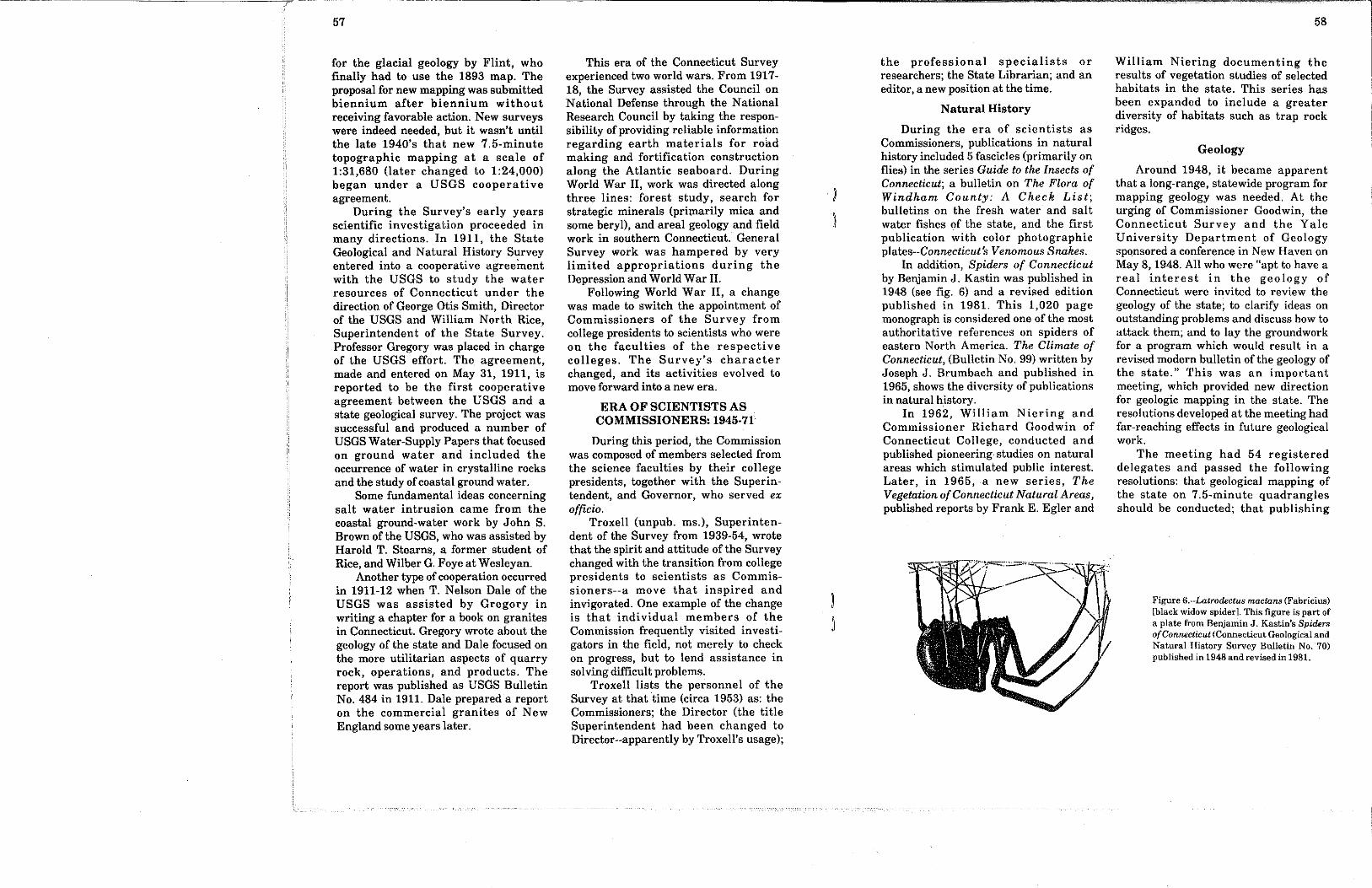
In addition, Spiders of Connecticutby Benjamin J. Kastin was published in1948 (see fig. 6) and a revised editionpublished in 1981. This 1,020 pagemonograph is considered one of the mostauthoritative references on spiders ofeastern North America. The Climate ofConnecticut, (Bulletin No. 99) written byJoseph J. Brumbach and published in1965, shows the diversity of publicationsin natural history.
In 1962, William Niering andCommissioner Richard Goodwin ofConnecticut College, conducted andpublished pioneering studies on naturalareas which stimulated public interest.Later, in 1965, a new series, TheVegetation of Connecticut Natural Areas,published reports by Frank E. Egler and
William Niering documenting theresults of vegetation studies of selectedhabitats in the state. This series hasbeen expanded to include a greaterdiversity of habitats such as trap rockridges.
Geology
Around 1948, it became apparentthat a long-range, statewide program formapping geology was needed. At theurging of Commissioner Goodwin, theConnecticut Survey and the YaleUniversity Department of Geologysponsored a conference in New Haven onMay 8, 1948. All who were "apt to have areal interest in the geology ofConnecticut were invited to review thegeology of the state; to clarify ideas onoutstanding problems and discuss how toattack them; and to lay the groundworkfor a program which would result in arevised modern bulletin of the geology ofthe state." This was an importantmeeting, which provided new directionfor geologic mapping in the state. Theresolutions developed at the meeting hadfar-reaching effects in future geologicalwork.
The meeting had 54 registereddelegates and passed the followingresolutions: that geological mapping ofthe state on 7.5-minute quadranglesshould be conducted; that publishing
Figure 6.--Latrodectus rnactans (Fabricius)[black widow spider]. This figure is part ofa plate from Benjamin J. Kastin’s Spidersof Connecticut (Connecticut Geological andNatural History Survey Bulletin No. 70)published in 1948 and revised in 1981.

59
these maps and reports was importantand the necessary publication fundsshould be sought; and that southwesternConnecticut should have new topo-graphic maps prepared. Earller maps ofsouthwestern Connecticut, which weremade during World War I!~by privatecontractors, were inaccurate and belowthe high standards of the USGS.
Because of his strong interest inConnecticut geology and in the proposedmapping program, Professor JohnRodgers of Yale was regularly invited toattend the meetings of the Survey,although he was not a Commissioner atthat time. In the early 1960’s, Rodgerswas made a Commissioner. Anotherinterested party was Robert Gates of theUniversity of Wisconsin, who, alongwith his students, began mappinggeology in western Connecticut as earlyas 1948.
Delays, unfortunately, forced alandmark piece of work in sedimen-tology to be published later than it mighthave been. Petrology, Stratigraphy, andOrigin of the Triassic Sedimentary Rocksof Connecticut by Paul D. Krynine wasprinted by the Survey in 1950, nearly 14years after the study had been completedas a dissertation for a Ph.D. at Yale. Thispaper remains a classic in the field ofsedimentary petrography, in paleo-climatology, and in redbed studies. Thework shows careful assembly of data(often from diverse sources), drawntogether in an exciting, forceful style,and directed toward support of hisargument on a controversial issue, theorigin of redbeds.
At this time, the Connecticut Surveyalso published posthumously a report byWilber G. Foye of Wesleyan, TheGeology of Eastern Connecticut. This,like Krynine’s paper, had been delayed.In addition, the catalog of minerals ofConnecticut was updated, and RichardSwarm Lull of the Yale PeabodyMuseum revised his classic work,Triassic Life of the Connecticut Valleynearly 36 years after its initial
publication (Lull cites Krynine’s ideason Mesozoic climate as an impetus forthe revision).
The 50th anniversary of theConnecticut Geological and NaturalHistory Survey (1953) occurred duringthis period. To celebrate, the AmericanAssociation of State Geologists (AASG)held a special meeting at Trinity Collegein Hartford. This was also to honor Dr.Troxell, who had been President of theAASG. The meeting was marked by anumber of geological field tripsthroughout the state. Also, a biologicalsymposium was held at ConnecticutCollege in New London in recognition ofthe anniversary.
Publication formats other than theState Survey Bulletin were ddveloped toallow for more varied types of reportsand maps. The new formats included aReport of Investigation series, whichcovered less comprehensive studies thanBulletins; Guidebooks; a series on theVegetation of Connecticut NaturalAreas; and a Miscellaneous Series.
Shortly after the Connecticut Surveymarked its 50th year, systematicgeologic mapping on 7.5-minute quad-rangles was initiated with the help of theUSGS. Robert Gates was the author ofthe first quadrangle geologic map, whichcarried forward the thrust of the Yalemeeting of 1948. This work, The BedrockGeology of the Litchfield Quadrangle waspublished in 1951 under the Miscellane-ous Series. Five years later, a prelimi-nary state geologic map (1:253,440 scale)and text were prepared by Rodgers,Gates, and others, which helped to focusthe statewide quadrangle mapping. Alsoin 1956, under a cooperative agreement,the USGS began systematic geologicquadrangle mapping.
The Connecticut Geological andNatural History Survey at firstpublished quadrangle maps with reportsunder the Miscellaneous Series, andlater under a new specialized series--theQuadrangle Report (QR). Maps werepublished by the USGS under the
Geologic Quadrangle Map (GQ) series.For the most part, two maps wereprepared for each quadrangle--onedelineating the bedrock geology and theother the surficial geology. In somecases, both bedrock and surficial geologyare shown on the same map. During thisera of scientists as Commissioners, morethan 100 7.5-minute geologic quad-rangle maps were published andmapping was started on many others.
By 1968, both Rodgers and Flint hadstate compilations at the scale of1:125,000 under way. These compila-tions used a 1:125,000 scale topographicbase map. This base map had beenprepared by the USGS as a result ofefforts by Director Peoples, whosuccessfully gained appropriations for itspreparation from the State Legislature.The bas~ map has been used to present avariety of information (e.g. regionalgeology and ground-water availability)published under the Natural ResourcesAtlas Series. In 1988, there are ten mapsin this series.
In addition to the bedrock and surfi-cial maps, other geological products pre-pared during this time were aeromag-netic maps (1:24,000; 1:125,000 scales), agravity map (1:125,000), along with anaeroradioactivlty map (1:250,000), andone of the first examples of side-lookingairborne radar imagery (1:500,000).Some of these products were developedusing advances in geophysical tech-nology developed during World War II.
In 1959, reorganization of Stateagencies placed the Survey within thenewly organized Department ofAgriculture and Natural Resources. Theadministrative structure of the Surveyremained essentially the same, but nowcame under the authority of a newdepartment. A representative from theDepartment of Agriculture and NaturalResources would frequently attend theSurvey Commissioners’ meetings.
During the 1960’s and 1970’s, whengeologic quadrangle mapping wasparticularly active, important changes
were taking place in geologic sciencethat would profoundly affect the laterquadrangle mapping and especially thestate bedrock and surficial map com-pilations. In bedrock geology, thedevelopment of the theory of platetectonics brought new significance to thestructure and stratigraphy ofConnecticut, as it lies in the center of theAppalachian orogen. The state bedrockmap, published in 1985, used a platetectonics conceptual model.
In surficial geology, work in NewEngland that was led in part by USGSgeologists resulted in a new conceptualmodel for regional deglaciation. The newmodel, termed ~’stagnation zone retreat,"differed significantly from Flint’s modelof"regional stagnation." Flint’s compila-tion work of the state surficial map washalted by his death in 1976. Subsequentwork by USGS personnel on a new statesurficial compilation is based on the newmodel of glacial retreat.
During this period of increasedactivity, Joe Webb Peoples was Directorof the Survey (1960-74). He conductedannual summer field conferences inMiddletown to allow geologists to meetto discuss common issues and futureplans, and to resolve correlationproblems (especially at quadrangleboundaries). At the conferences, reportsand compilations were presented infor-mally. These events, which were well-established by the mid-1960’s, are fondlyremembered by those who participatedin both the technical conference and theevening comradery that followed atDirector Peoples’ home overlooking theConnecticut River in Middle Haddam.
In time, the summer conferenceswere attended by other interestedpeople, including planners, waterresource managers, soil scientists andtopographic mappers. As a result,participants recognized the need forinterdisciplinary cooperation in theearth sciences, and in 1969 with the helpof Harold Bannerman, a consultant forthe Survey who was retired from the

61
USGS, the Connecticut Geology-SoilsTask Force was developed. Bannermanconvened the Geology-Soils Task Forceto bring the appropriate branches ofscience together to address howgeoscience information cou~ld best beapplied in land- and water-uSe planning.The Task Force included John Baker ofthe Water Resources Division of theUSGS, David Hill of the ConnecticutAgricultural Experiment Station, andHugo Thomas of the University ofConnecticut.
A major result of the work of theTask Force was the publication of areport by Hill and Thomas: Use ofNatural Resource Data in Land andWater Planning. The report discusseshow separately mapped resourceparameters (e.g. surficial geology;bedrock geology; slope; drainage; soils;depth to ground water,.., or what theycalled "single factor maps") could beused to improve land and water useanalysis and decision making.
They presented, as an example,plans for a hypothetical solid wastedisposal site in a trial map area. Theneed for the standardization of mapscales and map units was clearlyidentified. Their suggested land- andwater-use analysis process began toidentify which were the most importantpieces of geologic resource informationfor modern society.
Also during the later part of this era,the State Survey acquired its first full-time geologist. Until that time, work hadbeen conducted for the Survey throughpart-time employment and volunteerefforts. The appointment came after anunusual set of circumstances whichincreased the responsibilities of theSurvey and necessitated the creation ofthe position.
In 1966, during excavation for the¯ foundation and basement of a HighwayDepartment testing laboratory on a sitein the central lowlands, a bulldozeroperator recognized dinosaur tracks inrocks several feet below the natural
surface of the ground. Because of theextent and number of tracks, GovernorJohn Dempsey announced that the sitewould be set aside as a state park.Investigations by scientists from thePeabody Museum (Yale), the Survey, theUniversity of Connecticut, andWilllmantic State College (now EasternConnecticut State University) hadestablished the significance of the area.Dinosaur State Park today is a verypopular educational site for natura!sciences.
The government agencies respondedquickly to a situation requiring rapiddecision-making. They delayed andultimately halted the construction of theHighway Department building anddedicated the area as an educationalsite. Much of the credit for this was dueto the skill and determination ofDirector Peoples (fig. 7). Sidney Quarrierwas completing a master’s degree inearth science education at Wesleyan,when he was assigned to work at thePark. As the Survey’s first full-timeemployee, Quarrier helped to initiate anew direction for the agency, and thisincluded entering public education,increasing public awareness of thegeology of the state, and maintainingcontact with other State departments.Tl~e Park was extensively used byschools in the area, and programs weredesigned as such. By 1970, the Surveyhired current Park manager RichardKrueger as ~eologist. Krueger ran thePark, relieving Quarrier to performother Survey work. In 1971, the Parksand Forests division of the State tookover all Park operations.
The 34th Biennial Report (1969-71}(Bulletin No. 104) outlined a cooperativeagreement with the U.S. GeologicalSurvey in which the Connecticut valleyis chosen for an interdisciplinary studyto develop new ways to presentgeoscience data to be used by planners,engineers, and the general public. Theconcept of the project must, with littledoubt, have been influenced by the
62
Figure 7.--Joe Webb Peoples, Professor of Geolog:~ at Wesleyan University and seventh Director of theConnecticut Geological and Natural History Survey, shows colleagues the extent of the dinosaur footprinttrack-way near the town of Rocky Hill at the site that is now Dinosaur State Park. Tracks of the dinosaurEubrontes appear in the foreground. (From left to right: Joe Webb Peoples, Lawrence Frankel of theUniversity of Connecticut, Elwyn Simons of the Peabody Museum of Yale University, and Hugo F. Thomasof the University of Connecticut and current State Geologist.) (Photo by John Howard.)
summer conferences and the Geology-Soils Task Force. This project, directedby Frederick Pessl of the USGS, cameunder the heading of the ConnecticutValley Urban Area Project (CVUAP).Members of the Geology-Soils TaskForce and CVUAP worked closely as acooperative spirit existed between thevarious groups of geologists andhydrologists.
The project began developing andproducing applied geologic quadranglescale products for a one hundredquadrangle area of Connecticut andMassachusetts. Among the innovativeproducts created by this project wereindividual maps at the scale of1:125,000, showing textures of uncon-solidated materials, thickness of fine-grained deposits, slopes, and ground-

63
water availability. A surficial materialsmap (a derivative from the glacialgeological map), a depth to bedrock mapand a standardized quadrangle drainagearea map were produced for many 7.5-minute quadrangles in the pr~ect area.
Economic Geology
As shown over the ConnecticutSurvey’s 85-year existence, economicsplayed an important role in manyaspects of the scientific investigations.Loughlin reported on clays and clayindustries in Bulletin No. 4 in 1905, awork still prized by one of the tworemaining clay-mining operations in thestate. Also, Gregory and Nelson reportedon The Granites of Connecticut, whileFred Holmsley Moore, a graduatestudent at Yale, investigated Marblesand Limestones of Connecticut, whichwas published as Bulletin No. 56 in1935.
Although Connecticut is not thoughtof as a mining state, it ranked numbereight in the country in 1986 for dollarvalue of nonfuel mineral production persquare mile. The State Survey has givenattention to economic geology inquadrangle reports and GQs, whichtypically discuss or note mines orquarries of both historic and currentinterest, especially on surficial maps.
In some cases, papers on Connecticuteconomic geology published elsewherehave been outgrowths of work conductedfor the Survey. For example, CrawfordFritts reported on the barite depositsthat occur near the town of Cheshirewithin the Mount Carmel quadrangle,¯ which he had mapped as part of thequadrangle mapp!ng project.
As part of a strategic mineralsinvestigation of the nation during WorldWar II, State and Federal surveysinvestigated the occurrence of mica andberyl within some of the graniticpegrnatites in Connecticut, particularlywithin the Middletown PegmatiteDistrict. Connecticut investigations are
reported in USGS Professional PaperNo. 255.
Today, the Connecticut Surveyunder the Natural Resources Centerregularly cooperates with the U.S.Bureau of Mines (USBM) to prepare TheMineral Industry of Connecticut, whichis published in the USBM MineralsYearbook. Recently, as part of its AtlasSeries, the Natural Resources Centerpublished a map, Bedrock Mines andQuarries of Connecticut, which locatesand identifies the more than 600 historicand active mines and quarries. TheCenter also keeps records of activeoperations and regularly responds toinquiries concerning the miningindustry in the state.
The era of the scientists asCommissioners is brought to a close byanother change for the State Survey. Aspart of a State agency reorganization,the Survey joined the newly formedDepartment of Environmental Pro-tection (DEP).
DEPANDTHENATURALRESOURCESCENTERYEARS:
1971-PRESENT
During the 1960’s, as a result ofconcern about the environment, a num-ber of state governments reorganizedtheir offices to more efficiently manageland, water, and air resources. Manystates created departments of environ-mental conservation and environmentalprotection and the federal governmentformed the Environmental ProtectionAgency. The State Legislature passedthe Act creating Connecticut’s Depart-ment of Environmental Protection in1971, and in 1972, the new departmentbegan setting up shop.
DEP absorbed about 15 differentboards and commissions. The StateGeological and Natural History Survey,which had been part of the formerDepartment of Agriculture and NaturalResources, was included in the new DEP.Survey Director Peoples became anemployee of the DEP, and the other
Commissioners of the Survey were askedto serve in an advisory capacity.
DEP’s first Commissioner, DanielLufldn, was responsible for developingthe new department and coordinatingthe many separate elements from whichhis agency was formed. He wasparticularly interested in the Geologicaland Natural History Survey’s record ofcollecting and publishing naturalscience information. He and his staffrecognized that geology, hydrology, andbiology had a vital role in environmentalmanagement.
The State Survey had been involvedin two projects that were significant atthis point, the Connecticut Geology-SoilsTask Force and the Connecticut ValleyUrban Area Project (CVUAP). Bothprojects used resource information. TheCVUAP developed new, more usableformats for geological and hydrologicalinformation, and the Geology-Soils TaskForce developed the methodology to useresource information for environmentaldecision-making. The Task Forcepublication, Use of Natural ResourceData in Land and Water Planning, hadprovided new direction for methods ofenvironmental management (fig. 8).
Commissioner Lufkin saw the valueof, and need for, such resource informa-tion in his new Department. Hearranged to have Hugo Thomas, amember of the Geology-Soils Task Force,develop a central office within DEP tocoordinate collection, interpretation andpublication of natural resources infor-mation. This central office, called theNatural Resources Center, started witha staff of several geologists andhydrologists.
The Natural Resources Center beganto function as a repository and clearinghouse for information on earth sciencesand biology. Early on, the Center’s staffbecame involved in the DEP’senvironmental management activities,providing technical advice to the DEPand to local town governments.
64
The Survey provided much of thebasic information for the thrust of theNatural Resources Center. Work in DEPsoon became a focus of the Survey’sactivities. In 1974, the State Geologicaland Natural History Survey and theNatural Resources Center were officiallymerged. The State Survey office atWesleyan was moved to the DEP officesin Hartford and Survey staff wastransferred to the Natural ResourcesCenter. The State Geological andNatural History Survey became thetechnical resources investigation arm ofthe Center. At this time, Dr. Peoplesretired and Dr. Thomas, Director of theCenter, became the State Geologist.
As ~he Natural Resources Centerbegan to function, several goal~ weredeveloped, and these included managingcomprehensive basic data collectionprograms in earth sciences and biology;establishing a working reference libraryserving users of resource maps andinformation; developing methods ofapplying resource information to land-and water-use planning and environ-mental management decisions; andproviding technical assistance to DEPand local governments in the use ofresources information in their planningand decision-making.
The Natural Resources Centerexpanded its programs and staff to moreuniformly address topics in geology,hydrology, and biology as well as todevelop applied methodologies for use ofresource data for planning andmanagement. A major effort was madeto centralize the management of USGScooperative programs for topographicmapping, water resources, and geology.In the related area of soils mapping, theLegislature approved a 6-yearappropriation for DEP to supportcompletion of detailed soils mapping ofthe state by the U.S. Department ofAgriculture, Soil Conservation Service.Among other things, this provided mapsfor the DEP’s inland wetlands program.In biology, a program was initiated to

65
GEOLOGY
SOIL
LAND
WAT E R
HYDROLOGY
LAND USE
Figure 8.--Separately mapped resource parameters or "single factor maps" for land- and water-use analysisbecame a theme for the Natural Resources Center. Figure is from Use of Natural Resources Data in Landand Water Planning by Hill and Thomas, which was published in 1972 as Connecticut Agricultural
Experiment Station Bulletin 733.
collect information on rare andendangered species. The state low-altitude air photo flights were conductedby the Center on a regular 5-year basis.An important step was to standardizemap scales at 1:24,000, 1:50,000 and1:125,000 for all types of mappedresource information.
Eventually, the Center added a salesoffice. This function formerly wascarried out at the State Library. At thisnew sales office, anyone could buy mapsand publications and get informationand technical assistance about the
meaning and use of the resc.urceinformation.
The Center began to providetechnical assistance to regulatory andmanagement units bf DEP on topics suchas water resources, waste disposal,ecological habitats, and earth materials.These units of DEP became increasinglyaware of their need for trained technicalstaff. They rapidly began to hiretechnical staff, some of whom wereinitially trainees at the Center. DEPunits began to use more naturalresources information, and the demandfor additional coverage and new
information mounted, driving forwardthe Center’s data collection program.The Natural Resources Center quicklybrought the value of resourceinformation, concepts, and resource staffout of the academic institutions and intothe forefront of the decision-makingprocess of a state governmentdepartment.
Through the late 1970’s,environmental management inConnecticut passed from merely usingresource information, to basing long-term environmental management on"resource system concepts." Forexample, DEP’s water managementprograms changed from the previousmethod of simply using hydrologicinformation as one technical element ofwater management, to newly designedprograms managing ground and surfacewater of each drainage basin. This morecomprehensive and integrated approachto resource management was based onsound hydrologic principles and onunderstanding of the water resourcesystem for each basin.
Interaction between the Center’sstaff and scientists and plannerscontinued at the federal, state, and locallevels. The emphasis was oninterdisciplinary involvement. This wasthe theme of the Geology-Soils TaskForce and CVUAP. The NaturalResources Center played a leadershiprole in coordinating the collection,dissemination, and use of the resourceinformation.
The period since 1974, when theGeological and Natural History Surveywas combined with the NaturalResources Center, has been especiallyproductive. Programs of longstandinginterest to the Survey have beenpursued, and a number of new programshave been initiated. The followingselection gives highlights for this periodand gives an overview of the Survey’scurrent program.
66
Earth Sciences
Statewide low-altitude aerial photosurveys are conducted on a regular 5-year schedule, and an air photo lendinglibrary that contains all 5-year flightshas been established.
The Natural Resources Centermanages a USGS cooperative to producerevised 7.5-minute topographic quad-rangle maps and to routinely updateregional and state base maps. Recentlyacquired digital 1:24,000 scale quad-rangle data will be used for a statewidegeographic information system (GIS}.
The Center also has beencooperating with the U.S. Department ofAgricul~u~:e’s Soil Conservation Serviceto complete detailed statewide soilmapping. A project has been initiated torectify and digitize detailed soils mapsfor inclusion in the DEP’s geographicinformation system (GIS).
In the field of geology, severalprojects continued during this periodincluding management of thecooperative geologic mapping programwith the USGS. This included thequadrangle mapping that started in the1950’s and completion of thecompilations of the state bedrock andsurficial maps. The state bedrockcompilation by John Rodgers (fig. 9) waspublished in 1985 at a scale of 1:125,000.Both Rodgers’ map and The Face ofConnecticut: People, Geology, and theLand, a general introduction to thegeology of the state by Michael Bell,were prepared for the 77th annualmeeting (1985) of the AmericanAssociation of State Geologists inMystic, Connecticut. Compilation for thestate bedrock and surficial maps hasproduced a complete set of 7.5-minutebedrock and surficial quadrangle sheetswith consistent map units. Thisquadrangle scale geologic information isbeing entered ia the GIS. In addition, a10-year program to study the marinegeology of Long Island Sound is underway.

67
Figure 9.-~lohn Rodgers, Professor of Geology at Yale University and former Commissioner of the Survey,working on a draft of the state bedrock geological map of Connecticut. The published map was firstpresented to the geological community at the annual meeting of the American Association of StateGeologists in 1985 at Mystic, Connecticut. (Photo by T. Charles Erikson.)
In the field of hydrology, acooperative water resources investiga-tion program with the USGS WaterResources Division continues. As aresult, inventories of the state’s surfaceand ground-water inventories have beencompleted. The Center continues tooperate an integrated ground- andsurface-water quality monitoringnetwork. A statewide map showingstratified drift aquifers, compiled byDaniel Meade, was published in 1978. Inaddition, detailed mapping of drainagebasins has been completed delineatingbasins with drainage areas greater thanone square mile. This information hasbeen published on a state map, andentered in the GIS. The data has allowedDEP to develop a statewide waterquality classification and managementsystem.
Biology
A major part of the biology programis the Natural Diversity Data Base, acomputer inventory of the occurrenceand distribution of critical biologicalresources, including both species andhabitats. The Data Base is used to guidebiological protection programs and toevaluate potential negative impacts tobiota during land-use change ordevelopment. Systematic mapping ofcritical habitat information is beingprepared for the GIS. Bulletin No. 70,Spiders of Connecticut has been revisedand reprinted.
Geographic Information System(GIS)
A statewide computer mappingsystem for natural resources and relateddata is being completed. The interactivesystem will permit spatial analysis of
resource data bases. Data sets beingcompiled at 1:24,000 include: USGSquadrangle bases, surficial and bedrockgeology, drainage basins, public watersupply sources and distribution systems,waste water discharges and waterpollution sources, soils, land use andland cover, zoning, open space lands andselected biological information. The DEPuses the GIS for environmental planningand management.
Publications and Outreach
All in-print maps and otherpublications can be bought at theCenter’s sales office. This office serves asa resources center where the Center’sstaff is available to assist people inunderstanding and using the informa-tion. Regular educational workshops arerun for local town officials to train themto use the information.
GEOLOGICALANDNATURALHISTORYSURVEYAND NATURAL
RESOURCESCENTER
85 Years of Natural Science Serviceto the State of Connecticut
The Natural Resources Centerserves as a central office for collectingand distributing information about thestate’s physical and biological resources.The Center also develops methods ofusing resource information forenvironmental management. Theseactivities compare favorably with thethree goals set out for the StateGeological and Natural History Surveyin the first Biennial Report (1904)--toadvance knowledge for pure science; toserve economic needs, and to educate.
The data collection movement ofPercival and Shepard (1835-42) hasgrown into something larger and moredirectly functional to the State thanperhaps could have been imagined bythe Survey founders. The StateGeological and Natural History Surveyof 1903 t.o 1974 became part of a natural
68
resources center for an environmentalprotection department.
In 1903, there was only one regularemployee of the Survey--SuperintendentRice--who worked only part-time alongwith the voluntary Commissioners.Eighty-five years later, in 1988, theNatural Resources Center employsabout 30 people in all fields of naturalresources investigations and appli-cations.
Acknowledgments
A number of people and sourcesprovided information and assistanceduring the preparation of thismanuscript. Joe Webb Peoples took aparticular interest in the project andprovided much information about theSurvey, its work with the localuniversities, and with the U.S.Geological Survey. An unpublishedmanuscript and notes on the Survey’shistory by E. L. Troxell was aninvaluable resource. Sidney Quarrierprovided direction, encouragement, andassistance throughout the project.Richard Hyde, Leslie Mehrhoff, JoeWebb Peoples, Sidney Quarrier, JohnRodgers, and Hugo Thomas read themanuscript and provided helpfulcomments. Elizabeth Swaim providedaccess to information on William NorthRice from the Wesleyan archives. LindaRancourt worked with patience and skillto edit the manuscript.
REFERENCES CITED ANDSELECTED PUBLICATIONS
Barrell, Joseph, 1915, Central Connecti-cut in the geologic past: StateGeological and Natural HistorySurvey of Connecticut Bulletin No.23, 44 pages.
Bell, Michael, 1985, The face of Connec-ticut, people, geology, and the land:State Geological and NaturalHistory Survey of ConnecticutBulletin No. 110, 192 pages.
Flint, Richard Foster, 1929, The glacialgeology of Connecticut: State

69
Geological and Natural HistorySurvey of Connecticut Bulletin No.47,294 pages.
Hill, David E. and Thomas, Hugo F.,1972, Use of natural resource data inland and water planning:Connecticut Agricultura~l Experi-ment Station Bulletin 733, 47 pages.
Kastin, Benjamin Julian, 1981, Spidersof Connecticut: State Geological andNatural History Survey ofConnecticut Bulletin No. 70, 1020pages.
Krynine, Paul I)., 1950, Petrology, stra-tigraphy, and origin of the Triassicsedimentary rocks of Connecticut:State Geological and NaturalHistory Survey of ConnecticutBulletin No. 73,248 pages.
Lull, Richard Swann, 1953, Triassic lifeof the Connecticut valley: StateGeological and Natural HistorySurvey of Connecticut Bulletin No.81,336 pages.
Merrill, George P., 1924, The first onehundred years of American geology:Yale University Press, New Haven,Conn., 773 pages.
Peoples, Joe Webb, 1971, Thirty-fourthbiennial report of the Commissionersof the State Geological and NaturalHistory Survey, 1969-71: StateGeological and Natural HistorySurvey of Connecticut Bulletin No.104, 30 pages.
Percival. James G.. 1842, Report on thegeology of the state of Connecticut:New Haven, 495 pages plus map(scale, 1:250,000).
Prosser. L. J. and Altamura, R. J., 1987,The mineral industry of Connecticut[for 1985]: U.S. Bureau of MinesMineral Yearbook. Volume 2, pages119-131
Rice, William North. 1904, First bien-nial report of the Commissioners ofthe State Geological and NaturalHistory Survey, 1903-1904: StateGeological and Natural HistorySurvey of Connecticut Bulletin No.1, 18 pages.
Rice, William North and Gregory, Her-bert Ernest. 1906. Manual of thegeology of Connecticut: SlateGeological and Natural HistorySurvey of Connecticut Bulletin No. 6,273 pages.
Rodgers, John, 1985, Bedrock geologicalmap of Connecticut: ConnecticutGeological and Natural HistorySurvey Natural Resources AtlasSeries map, scale 1:125,000, 2 sheets.
Shepard, Charles Upham, 1837, A reporton the geological survey ofConnecticut: New Haven, 188 pages.
Troxell, Edward L., unpublished manu-script and notes. A history of theSurvey: fifty years of its service andone hundred fifty years of naturalscience in Connecticut.