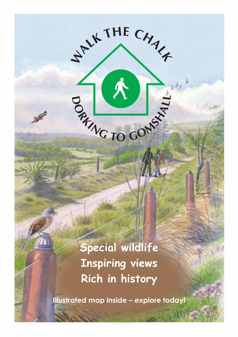
special wildlife inspiring views rich in history · special wildlife inspiring views rich in...
TRANSCRIPT
DO
RKING TO GOMSHA
LL
WALK
THE CHALK
Special wildlife Inspiring viewsRich in history
Illustrated map inside – explore today!
The walk starts at Dorking Railway Station, where there is a pay and display car park, grid ref: TQ170504. It finishes at Gomshall Railway Station, where there is limited car parking, grid ref: TQ089478.
This 7-mile, 11km walk takes you through the Surrey Hills Area of Outstanding Natural Beauty. This is one of England’s finest landscapes, one of 36 nationally protected landscapes equal in status and protection to a National Park. For more information, please visit www.surreyhills.org
Part of the route runs along the North Downs Way. One of 15 National Trails in England and Wales, the North Downs Way offers 153 miles of spectacular downland walking from Farnham to Dover. For more information, please visit www.national trail.co.uk/northdowns or telephone 01622 221525
Part of the route runs through Hackhurst Downs, a Site of Special Scientific Interest (SSSI) and a Local Nature Reserve, managed by The Surrey Wildlife Trust. Surrey Wildlife Trust’s mission is to protect and regenerate Surrey’s wildlife. For more information, please visit www.surreywildlifetrust.org or telephone 01483 795440
D
ORKING TO GOMSHALL
WALK THE CHALK
For up-to-date public transport information, contact Surrey Traveline
on 0871 200 2233 or visit www.traveline.info
This leaflet is best used with OS maps:
1:25,000 Explorer 146 (Dorking, Box Hill and Reigate)
1:25,000 Explorer 145 (Guildford and Farnham)
SuitabilityThis walk has a number of hills and is steep
in places, which makes it unsuitable for wheelchairs and buggies.
FootwearChalk paths can be slippery, especially during
the winter months and after rain – walking boots with good treads are recommended.
RefreshmentsRefreshments are only available at the start
and end of the walk.
TransportFor up to date public transport information
contact Traveline on 0871 200 2233 or visit www.traveline.info
Dog WalkersSheep and cattle may be seen on this walk.
They are helping to manage the chalk grassland by controlling the growth of coarse grasses
and scrub.
Please keep your dog under close control when walking near livestock.
A “station to station” walk, through some of the finest chalk grassland in Surrey.
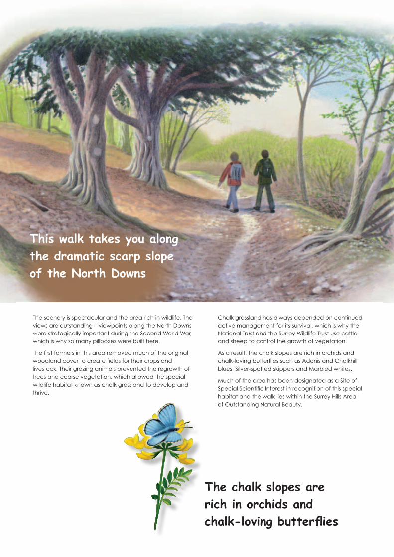
The scenery is spectacular and the area rich in wildlife. The views are outstanding – viewpoints along the North Downs were strategically important during the Second World War, which is why so many pillboxes were built here.
The first farmers in this area removed much of the original woodland cover to create fields for their crops and livestock. Their grazing animals prevented the regrowth of trees and coarse vegetation, which allowed the special wildlife habitat known as chalk grassland to develop and thrive.
Chalk grassland has always depended on continued active management for its survival, which is why the National Trust and the Surrey Wildlife Trust use cattle and sheep to control the growth of vegetation.
As a result, the chalk slopes are rich in orchids and chalk-loving butterflies such as Adonis and Chalkhill blues, Silver-spotted skippers and Marbled whites.
Much of the area has been designated as a Site of Special Scientific Interest in recognition of this special habitat and the walk lies within the Surrey Hills Area of Outstanding Natural Beauty.
This walk takes you along the dramatic scarp slope of the North Downs
The chalk slopes are rich in orchids and chalk-loving butterflies

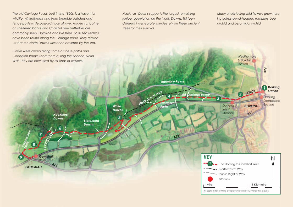
Welcome to this new walk, from Dorking to Gomshall railway stations, via some of the finest chalk grassland in Surrey.
1 This walk starts at the Pay & Display Car Park at
Dorking railway station (located at the edge of the
car park, opposite the Lincoln Arms). Walk down the
subway and up the right hand steps at the end, then
turn left and walk towards the traffic lights. At the
traffic lights, turn left and walk up Ashcombe Road
(A2003), keeping Ashcombe School on your left.
2 Continue along Ashcombe Road (crossing over
Chalkpit Lane) until you reach a T-junction. (Dorking
West railway station is to your left, just past St Martin’s
C of E Primary School. Note: there is no parking at
Dorking West – street parking may be possible.) At the
T-junction, cross over the road and turn right. (This is
Ranmore Road, although it is not signed here.) Continue
up the road, passing St Martin’s School on your left,
and then turn left by a speed limit sign onto a public
footpath that skirts the school grounds. (You will pass
by a bank with yew and box trees growing on it –
sure signs that there is chalk below your feet.)
3 Turn left by the National Trust sign onto another
path, leading to Denbies Hillside. Follow the path until
you reach a track and turn left. (This is an old carriage
road built in the 1890s by William Joseph Denison, who
owned Denbies House and Estate.) Ignore any paths
to the left and right and carry on along the track for
the next two miles.
4 The track ends at a T-junction. Turn right onto the
path, which runs along the foot of the North Downs.
(On your left this path leads downhill to Landbarn Farm
where the National Trust Surrey Hills North Downs West
Team is based.) Continue straight on for a mile, ignoring
all paths to the left and right. Where the switchback
path joins from the right, go right and follow this up
the hill, with a bank of yew trees on your left. Near the
top of the hill is ‘God’s seat’. Stop here for a break
and admire the stunning view.
5 Turn left onto the North Downs Way (NDW) and
follow this until you meet a road (White Down Lane).
Turn right onto the road, and then almost immediately
turn left off the road to rejoin the NDW. Continue
following the NDW (you will soon see another National
Trust sign; you are now on Blatchford Down). Continue
past the Second World War pillbox on your right. At the
National Trust information panel cross over the public
bridleway and continue following the NDW.
6 When you meet an ancient byway, known as
Beggars Lane, cross over and continue straight on.
At the first kissing gate on your left, turn left, through
the woodland and follow the public footpath signs
diagonally across the hillside. (You are now leaving
the NDW and entering Hackhurst Downs. You will pass
juniper trees that have been enclosed with tree guards
to protect them from grazing animals.) Go through
a gate and onto National Trust land, and carry on
following the public footpath diagonally down the hill.
7 Go through another gate and you will see the
picturesque Colekitchen Farm to your right. Follow
the path downhill, bearing right where it splits in two
(ignore the gate on your right). (You will pass a huge
ancient ash tree on your left and some tall redwoods.)
Open pasture appears, and a substantial ditch and
bank now runs along the left-hand side of the path.
8 Go through two kissing gates, crossing over a track
that leads to Churchfield Farm, part of the Wotton Estate.
The path sinks between steep banks and meets a road
called Colekitchen Lane. Turn left and walk along this
ancient sunken land until you meet another road, which
is the A25. (Note the badger setts along the bank as you
pass, but also look out for traffic.)
9 When you meet the A25, turn left and walk along
this main road through Gomshall, where you will find a
number of pubs, restaurants and shops. Carry on until you
reach Station Approach on your left (there is a bus stop
here where you can catch a bus back to Dorking). This
will take you to Gomshall railway station and the end of
the walk. (Note: there is some car parking here.)
Congratulations! You have now walked the chalk from Dorking to Gomshall, a distance of 7 miles.
1
A25
A25
A25
A24
A2003
Ranmore Road
North Downs Way
White Downs
Col
ekitc
hen
Lane
Hackhurst Downs
Blatchford Downs
GOMSHALL
DORKING
Gomshall Station
Westhumble & Box Hill Station
Dorking West Station
Dorking Deepdene Station
234
5
6 7
8
9
Old Carriage Road
Landbarn Farm
Beg
gar
s La
ne
KEY NThe Dorking to Gomshall Walk
North Downs Way
Public Right of Way
Stations
1 Kilometre1 Mile
The scales indicated here are approximate and only intended as a guide.
1
The old Carriage Road, built in the 1820s, is a haven for
wildlife. Whitethroats sing from bramble patches and
fence posts while buzzards soar above. Adders sunbathe
on sheltered banks and Chalkhill Blue butterflies are
commonly seen. Dormice also live here. Fossil sea urchins
have been found along the Carriage Road. They remind
us that the North Downs was once covered by the sea.
Hackhurst Downs supports the largest remaining
juniper population on the North Downs. Thirteen
different invertebrate species rely on these ancient
trees for their survival.
Many chalk-loving wild flowers grow here,
including round-headed rampion, bee
orchid and pyramidal orchid.
Cattle were driven along some of these paths and
Canadian troops used them during the Second World
War. They are now used by all kinds of walkers.
Dorking Station

This leaflet was produced by the Old Surrey Downs Project,
in partnership with the National Trust.
w
ww.oldsurreydowns.o
rg.u
k
Restoring our beautiful chalk grasslandWe restore our beautiful chalk grassland through
practical management.
We raise awareness of the importance of chalk grassland as part of our natural heritage.
We encourage others to take part in discovering its past and securing its future.
For information, telephone: 01737 733933email: [email protected]
or visit: www.oldsurreydowns.org.uk
Much of this route runs over land owned or managed by the National Trust.
The National Trust is an independent conservation charity that manages this beautiful countryside for the
benefit of wildlife and visitors.
Landbarn Farm, near Westcott, provides a base for staff and volunteers working on the Trust’s
North Downs West properties.
For more information, telephone 01306 887485 or visit www.nationaltrust.org.uk