spatial familiarity as a dimension ... - thesis.bilkent.edu.tr
TRANSCRIPT
SPATIAL FAMILIARITY AS A DIMENSION OF WAYFINDING
A THESIS SUBMITTED TO
THE INSTITUTE OF ECONOMICS AND SOCIAL SCIENCES
OF BİLKENT UNIVERSITY
IN PARTIAL FULLFILLMENT OF THE REQUIREMENTS
FOR THE DEGREE OF
DOCTOR OF PHILOSPHY
IN ART, DESIGN AND ARCHITECTURE
By
Güler Ufuk Doğu Demirbaş
September, 2001
ii
I certify that I have read this thesis and that in my opinion it is fully adequate in scope and in
quality as athesis for the degree of Doctor of Philosophy in Art, Design and Architecture.
Assoc. Prof. Dr. Feyzan Erkip (Supervisor)
I certify that I have read this thesis and that in my opinion it is fully adequate in scope and in
quality as a thesis for the degree of Doctor of Philosophy in Art, Design and Architecture.
Prof. Dr. Mustafa Pultar
I certify that I have read this thesis and that in my opinion it is fully adequate in scope and in
quality as a thesis for the degree of Doctor of Philosophy in Art, Design and Architecture.
Assoc. Prof. Dr. Cengiz Yener
I certify that I have read this thesis and that in my opinion it is fully adequate in scope and in
quality as a thesis for the degree of Doctor of Philosophy in Art, Design and Architecture.
Assoc. Prof. Dr. Halime Demirkan
I certify that I have read this thesis and that in my opinion it is fully adequate in scope and in
quality as a thesis for the degree of Doctor of Philosophy in Art, Design and Architecture.
Assoc. Prof. Dr. Çiğdem Erbuğ
Approved by the Instituted of Fine Arts.
Prof. Dr. Bülent Özgüç, Director of the Institute of Fine Arts
iii
ABSTRACT
SPATIAL FAMILIARITY AS A DIMENSION OF WAYFINDING
Güler Ufuk Doğu Demirbaş
Ph.D. in Interior Architecture and Environmental Design
Supervisor: Assoc. Prof. Dr. Feyzan Erkip
September 2001
Spatial familiarity is a significant, yet insufficiently investigated factor that
affects wayfinding. The aim of this thesis is to explore spatial familiarity as a
dimension of wayfinding, and explain how it affects human behavior within
the built environment. Factors affecting wayfinding are defined under two
categories; environmental information and individual characteristics. Spatial
familiarity is a concept that comprises these two characteristics and thus, is
analyzed separately. Factors affecting spatial familiarity apart from those
mentioned above are defined as experience, spatial ability, meaning and
expectancy, and environmental complexity. The effects of individual and
group differences on spatial familiarity are identified and assessed through
an empirical study conducted in two buildings of the Faculty of Art, Design,
and Architecture, of Bilkent University. Spatial ability tests, wayfinding tasks,
and interviews were administered to subjects from the Department of Interior
Architecture and Environmental Design and the Department of Graphic
Design. The findings indicate that spatial and individual factors affect spatial
familiarity with the built environment.
Keywords: Wayfinding, spatial familiarity, environmental information, individual characteristics.
iv
ÖZET
YOL BULMA BAĞLAMINDA MEKANSAL TANIŞIKLIK
Güler Ufuk Doğu Demibaş
İç Mimarlık ve Çevre Tasarımı Bölümü Doktora Çalışması
Danışman: Doç. Dr. Feyzan Erkip
Eylül, 2001
Mekansal tanışıklık yol bulmayı etkileyen önemli, ancak yeterince
araştırılmamış bir etkendir. Bu tezin amacı, mekansal tanışıklığı yol bulma
bağlamında araştırmak ve iç mekanlarda insan davranışını nasıl
etkilediğini incelemektir. Yol bulmayı etkileyen etkenler iki başlık altında
incelenmiştir: mekansal bilgilendirme ve kişisel özellikler. Mekansal
tanışıklık bu iki konuyu birleştiren bir kavramdır ve deneyim, mekansal
beceri, anlam ve beklenti, ve mekansal karışıklık kavramlarıyla birlikte ele
alınacaktır. Kişisel ve grup farklılıklarının mekansal tanışıklık üzerindeki
etkileri Güzel Sanatlar, Tasarım ve Mimarlık Fakültesinde yürütülen bir
alan çalışması sonucunda belirlenmiş ve değerlendirilmiştir. İç Mimarlık ve
Çevre Tasarımı ile Grafik Bölümlerinden öğrencilerle mekansal beceri
testleri, yol bulma çalışmaları ve karşılıklı görüşmeler yapılmıştır. Bulgular,
mekansal ve kişisel etkenlerin iç mekanlarla olan tanışıklığı etkilediğini
göstermektedir.
Anahtar Kelimeler: Yol bulma, mekansal tanışıklık, mekansal bilgilendirme,
kişisel özellikler.

v
ACKNOWLEDGEMENTS
I would like to thank Assoc. Prof. Dr. Feyzan Erkip for her guidance, support,
and invaluable supervision throughout the preparation of this thesis.
I would also like to thank to my husband Osman Demirbaş for his incredible
support, encouragement, and patience. Without him this thesis would not
become what it is. In addition, I would like to thank him for the magnificent
photographs he took for me.
Finally, I would like to thank my family for being there for me whenever I
needed them.
vi
TABLE OF CONTENTS
SIGNATURE PAGE………………………………………………………………... ii
ABSTRACT…………………………………………………………………………. iii
ÖZET…………………………………………………………………………………. iv
ACKNOWLEDGEMENTS…………………………………………………………. v
TABLE OF CONTENTS…………………………………………………………… vi
LIST OF FIGURES…………………………………………………………………. x
LIST OF TABLES…………………………………………………………………... xi
1. INTRODUCTION………………………………………………………………… 1
2. WAYFINDING……………………………………………………………………. 4
2.1. Spatial Cognition…………………………………………………………. 5
2.1.1. Landmark knowledge……………………………………………… 5
2.1.2. Route Knowledge….……………………………………………….. 6
2.1.3. Survey Knowledge…………………………………………………. 7
2.2. Dimensions of Wayfinding……………………………………………… 9
2.2.1. Cognitive Mapping.………………………………………………… 9
2.2.2. Legibility……………………………………………………………… 16
2.3. Factors Affecting Wayfinding………………………………………….. 22
2.3.1. Environmental Information……………………………………….. 25
2.3.1.1. Visual Accessibility………………………………………….. 30
2.3.1.2. Building Configuration………………………………………. 34
2.3.1.3. Architectural Differentiation………………………………... 38
2.3.1.4. Signage System………………………………………………. 40
vii
2.3.2. Individual Characteristics………………………………………… 46
3. SPATIAL FAMILIARITY………………………………………………………... 54
3.1. Theories of Perception………………………………………………….. 59
3.2. Factors Affecting Spatial Familiarity…………………………………. 64
3.2.1. Experience…………………………………………………………… 66
3.2.2. Spatial Ability……………………………………………………….. 73
3.2.3. Meaning and Expectancy…………………………………………. 77
3.2.4. Environmental Complexity……………………………………….. 82
4. RESEARCH……………………………………………………………………… 86
4.1. Research Questions and Hypotheses………………………………... 86
4.2. Setting and Subjects…………………………………………………….. 88
4.2.1. Building Descriptions……………………………………………… 89
4.2.1.1. IAED Building…………………………………………………. 89
4.2.1.2. GRA Building ………………………………………………... 93
4.2.2. Subjects……………………………………………………………… 95
4.3. Procedure………………………………………………………………….. 96
4.4. Statistical Analyses and Results……………………………………… 97
4.5. Observations on Wayfinding and Evaluations of the Buildings .. 105
5. CONCLUSION…………………………………………………………………… 115
6. REFERENCES…………………………………………………………………… 120
7. APPENDICES.…………………………………………………………………… 128
APPENDIX A Examples of Signs…………………………………………….. 129
APPENDIX B Examples of Directories and You-Are-Here Maps...…….. 130
APPENDIX C ………………………………...………………………………….. 131
APPENDIX C1 Exterior View of IAED Building……….……………….. 131
viii
APPENDIX C2 Interior View of IAED Building….….………………….. 131
APPENDIX D…………………………………………………………………….. 132
APPENDIX D1 Floor Plan of IAED Building...………………………….. 132
APPENDIX D2 Sections of IAED Building…..………………………….. 133
APPENDIX E…………………………………………………………………….. 134
APPENDIX E1 A View from Studio Floors…...…..…………………….. 134
APPENDIX E2 A View from Office Floors.……………………………... 135
APPENDIX E3 Entrances to the Spiral Staircases.…………………... 136
APPENDIX E4 A View to the Stairs Transforming into the Ramp..... 137
APPENDIX E5 Stairs Located Next to the Studios.…………………... 138
APPENDIX E6 Elevator Located Across the Main Entrance………... 139
APPENDIX E7 Elevator Located Parallel to the Entrance Axis…….. 140
APPENDIX E8 A View from the Entrance Area………………………... 141
APPENDIX E9 A View from the Third Floor…………………..………... 142
APPENDIX E10 Staff Room………………………….……………………. 142
APPENDIX E11 Fifth Office Floor…...……………………..……………. 143
APPENDIX F Directories Used in IAED Building..………………….…….. 144
APPENDIX G…………………………………………………………………….. 145
APPENDIX G1 Floor Plan of GRA Building…………………………….. 145
APPENDIX G2 Section of GRA Building.……………………………….. 146
APPENDIX H……………………………………………………………….……. 147
APPENDIX H1 Entrance to A Block.…………………………………….. 147
APPENDIX H2 Entrance to B Block and C Block.…………………….. 147
APPENDIX H3 Main Staircase in GRA Building……………………….. 148
APPENDIX H4 Stairs Connecting the Floors in GRA Building…….. 148
ix
APPENDIX H5 Student Works in GRA Building...…………………….. 149
APPENDIX H6 Student Works in GRA Building...…………………….. 150
APPENDIX H7 Installations in GRA Building………………………….. 151
APPENDIX I……………………………………………………………….……... 152
APPENDIX I1 List of Questions..……………………………………….. 152
APPENDIX I2 List of Questions…..…………………………………….. 153
APPENDIX J List of Variables………………………………………….…….. 154

x
LIST OF FIGURES
Figure 2.1. Examples of Map styles.................................................................. 11
Figure 3.1. Perceptual Processes..................................................................... 60
Figure 4.1. Signage in IAED and GRA Buildings............................................. 107
Figure 4.2. Plan Configuration of IAED and GRA Buildings……................... 112
Figure 4.3. Types of Elements Recalled in IAED and GRA Buildings........... 113
xi
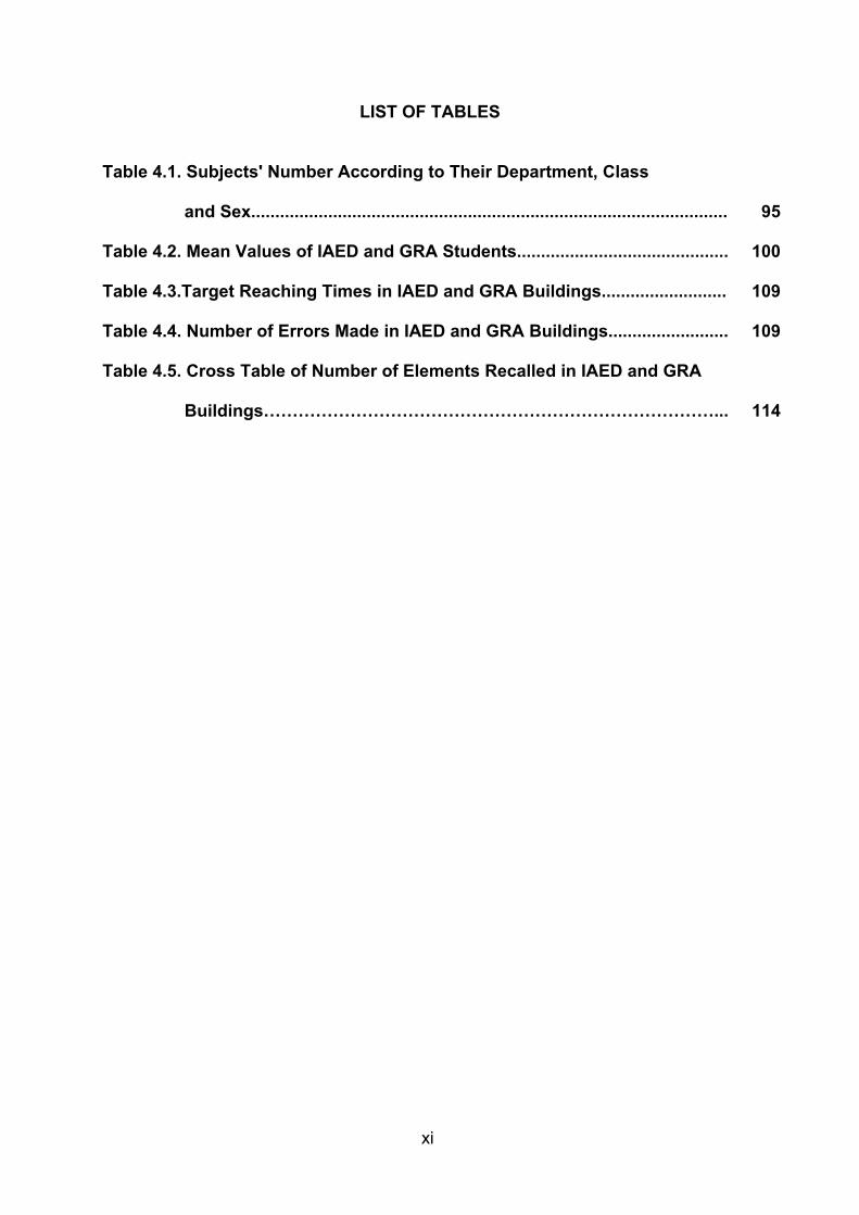
LIST OF TABLES
Table 4.1. Subjects' Number According to Their Department, Class
and Sex................................................................................................... 95
Table 4.2. Mean Values of IAED and GRA Students............................................ 100
Table 4.3.Target Reaching Times in IAED and GRA Buildings.......................... 109
Table 4.4. Number of Errors Made in IAED and GRA Buildings......................... 109
Table 4.5. Cross Table of Number of Elements Recalled in IAED and GRA
Buildings……………………………………………………………………... 114
1
SPATIAL FAMILIARITY AS A DIMENSION OF
WAYFINDING
1. INTRODUCTION
Seldom do we think about the cognitive processes undertaken as we move
about in the environment. This daily routine, wayfinding in particular, in its
smallest scale begins as we move around in our homes, and continues as we
leave for work or school, as we walk through buildings, and as we return to
home. During these activities, we receive environmental information, decode
and process them, and recall them when necessary. Most of the time, this
routine activity is an unconscious process and we tend to ignore the fact that
even the simplest decisions we make to reach a destination are determined
by our wayfinding ability. This ability affects us physically and psychologically
as the brain and body reacts to stimuli emitted from the environment.
Most of our activities take place in large-scale built environments where
wayfinding becomes an important design issue. Sometimes it can be quite
difficult to find our way in such settings. Four characteristics of the built
environment generally accepted to affect wayfinding are visual accessibility,
sign system, architectural differentiation, and building plan configuration.
Another factor affecting wayfinding is the degree of familiarity one has with
the setting. How well we know the environment that surrounds us clearly is
2
an important factor that affects our wayfinding behaviour and the perception
of the setting as well as the facilities it offers. Throughout this dissertation the
term “Spatial Familiarity” will be used in order to emphasise the difference
between general familiarity that includes activities such as the habit of
chewing a gum or being accustomed to a certain computer program and
having knowledge about a particular environment or setting.
Spatial familiarity is basically how well we know a place. When we have prior
knowledge about an environment, we eliminate most of the cognitive
processes that are necessary to find our way within novel settings. Despite
the fact that spatial familiarity is commonly accepted to be an important
aspect of wayfinding, research on the subject remains limited. This study
focuses on the concept of spatial familiarity and investigates its dimensions in
relation to wayfinding.
Chapter 2 compiles a literature review on wayfinding. In the first section of
this chapter, spatial cognition, the psychological concepts underlying the
representations we have about our environments, and types of environmental
knowledge will be discussed. The second section explores the dimensions of
wayfinding: cognitive mapping and legibility and makes a brief introduction to
wayfinding styles. Factors affecting wayfinding constitutes the third section,
this section investigates environmental information, namely, the impact of
visual accessibility, building configuration, architectural differentiation, and
signage. The last section focuses on individual characteristics affecting
wayfinding and its styles such as age, gender and disabilities.
3
Chapter 3 reviews the literature on spatial familiarity, and discusses the
importance of spatial familiarity in relation to wayfinding. In the first section of
this chapter, theories of perception are discussed in relation to spatial
familiarity. The second section explores the dimensions of spatial familiarity
and focuses on experiences, spatial ability, meaning and expectancy and
environmental complexity.
Chapter 4 aims to explore spatial familiarity as a dimension of wayfinding,
and to categorise factors affecting spatial familiarity through a case study.
This study was held in two buildings with different spatial characteristics,
namely, the building of the Department of Interior Architecture and
Environmental Design, and the building of the Department of Graphic Design
at the main campus of University of Bilkent, Ankara. Subjects were requested
to take spatial ability tests and participate in a target-reaching task, followed
by interviews where they were asked questions regarding the spatial and
individual factors affecting their spatial familiarity with the built environment.
The dissertation concludes with Chapter 5, wherein the findings of the
research are discussed and implications for future studies are given.
4
2. WAYFINDING
Wayfinding is the ability to identify one’s location and arrive at destinations or
navigate in spatial environments, both cognitively and behaviourally (Passini,
1984a; Rovine and Weisman, 1989). We select the necessary bits of
information among a vast amount of stimuli consciously or unconsciously
going through some cognitive processes. During the wayfinding activity, we
extract information from the environment, store it, process it, and recall it
when necessary. Wayfinding ability which is based on three distinct
performances, decision-making, decision execution and information
processing, is a spatial problem solving ability, and is essential for everyday
living, as almost everyone has a need to find their way to a new location,
such as a classroom, store, or school (Passini, 1995). All of the information
we receive from the environment during the wayfinding activity is called
environmental information. In recent years, the effects of environmental
information on people’s wayfinding behaviour in complex buildings have been
subject to numerous research studies (see Doğu and Erkip, 2000; Passini et
al., 1998; Abu - Ghazzeh, 1996; Wright et al., 1993; O’Neill, 1991a; Garling et
al., 1983). Environmental information is the architectural and graphic
expression of information necessary to solve the wayfinding problems
(Passini et al., 1998). Both decision-making and decision execution are
based on environmental information. Information has to be identified in the
setting and has to be understood and used in the decision - related
processes. For a thorough understanding of the processes we go through
5
during wayfinding, it is essential to understand the cognitive and
environmental factors that influence it.
2.1. Spatial Cognition
Much of our environmental perception and knowledge derive from external
information from the environment, this is just as true for the required actions.
Thus the durable theme of spatial cognition plays a central role in the study
of person-environment compatibility (S. Kaplan, 1983). “Spatial cognition” is
the term introduced to explore the cognitive processes we undertake during
our activities such as navigation. The study of spatial cognition, particularly
when addressing representations of macro-spaces, has always been closely
associated with spatial orientation and wayfinding. In respect to spatial
cognition, it is possible to identify three different types of environmental
knowledge: landmark, route, and survey knowledge.
2.1.1. Landmark knowledge
There are different ways of coping with the environments in which our
activities take place. Experience of a space differs according to the
information resources we have at hand and the ones the environment
provides us with. During our exposure to a new space, we learn to recognise
landmarks or salient features in the environment (Golledge, 1991). Properties
such as the texture, shape and orientation of certain objects are stored in
declarative knowledge structures, allowing us to access this knowledge (Bliss
et. al, 1997). For example, when arriving at a new college campus, students
may learn how to identify the library, administrative and important classroom
6
buildings.
As our experience in the new environment increases, we may learn how to
identify these landmarks from new perspectives, essentially building our
ability to mentally rotate them to visualise how we expect them to look from
different viewpoints. However, their initial formation is linked to the
perspective from which we are most familiar.
2.1.2. Route Knowledge
Declarative landmark knowledge becomes increasingly valuable as we learn
to relate spatially individual landmarks to others in the environment. In so
doing, we construct distance and orientation relationships that enable us to
identify routes connecting landmarks. In essence, we systematise and build
upon the declarative knowledge as we learn the interconnections thereby
forming new knowledge structures in stimulus-response pairings or event-
action formats (Golledge, 1991; Thorndyke and Hayes-Roth, 1982). Route
(or procedural) knowledge typically refers to knowledge about the
movements necessary to get from one point to another (Rossano et al.,
1999).
Since navigation is usually purposeful, it may be asserted that route
knowledge is probably more valuable than landmark knowledge because it
helps people accomplish desired tasks. Key features of route knowledge
representations are: 1) they are learned in the context of accomplishing
specific tasks (ie. getting from the library to the classroom), 2) they are
7
represented from the egocentric perspective (left and right turns are learned
with respect to the body’s orientation and direction of travel), 3) they are
perspective-dependent, meaning that they are most useful when employed
from the same viewing perspective as they are learned (usually from the
ground-plane for the pedestrian travel). Finally, when faced with the task of
finding alternative routes to destinations, we rely on informal algebraic and
geometric computations, based upon the directional changes and distances
that describe the known routes.
The creation of decision plans during wayfinding and the identification of the
organisation principle underlying complex settings allow a person to structure
environmental information spatially and thereby facilitate storage and
retrieval. Decision plans are the basis of linearly and temporally organised
route-type representations, while spatial organisation principles lead to
spatial and survey-like representations (Passini, 1995).
2.1.3. Survey Knowledge
As familiarity with an environment is gained, a more flexible, configurational
representation of that space can be developed (Golledge, 1991). This new
structure spatially relates landmarks independently of the routes that connect
them, converting the mathematical, route-defined representations into more
globally defined relationships, based upon a world coordinate system
(Golledge, 1991). Breaking the route knowledge dependencies on ground-
based and egocentric perspectives, survey representations of a space are
typically described from a “bird’s eye” viewpoint as if the person builds a
8
cognitive map of the environment. Rather than structuring the relationship
between the college library and classroom in terms of the connecting legs of
the route between them, the student may regard the spatial relationships
between the buildings as, “the classroom is located about 200m, as a crow
flies, to the southwest of the library”. Since the world coordinates are
references for the knowledge, the ability to use survey knowledge is referred
to as one’s sense of direction.
This kind of representation can be built through two primary methods
differentiated by the perspective used during learning (Darken, 1996;
Golledge, 1991). The first method occurs when spatial representations are
learned through map study, where the viewpoint is not ground-based but
from an altitude above the environment. The second method is described by
the continued exploration and navigation of the space from the pedestrian’s
viewpoint. While both methods result in survey representations, when
employed to serve wayfinding tasks, the latter method results in more robust,
useable knowledge (Tlauka and Wilson, 1996). Oftentimes, it seems that the
development of survey knowledge is not required for satisfactory and
completely efficient travels. Route knowledge suffices for this purpose
(Peterson, 1998).
Because survey knowledge is more flexible than route knowledge, in that its
employment is not as rigidly perspective-based, it can be more valuable for
certain wayfinding tasks. The practical value of survey representations is
evident in cases when the wayfinding task requires the person either to find
9
alternative routes through familiar territory, to find primary routes through
unfamiliar territory, or when task performance requires route optimisation
through familiar and unfamiliar territory.
Survey representations facilitate spatial influences that can be quite useful
during wayfinding through large spaces (Infield, 1991). The content of large
spaces cannot be viewed from one viewpoint, while the content of small
spaces can be (Peterson, 1998). Survey knowledge refers to an integrated
understanding of the layout of a space and the interrelationships of the
elements contained therein (Rossano et al., 1999).
So, in essence, the relative value of survey representations compared to
route representations depends upon many factors, still in many cases survey
development is desirable and will not detract from the use of route
representations. The development of survey representations is most
worthwhile and therefore likely under the following circumstances: when the
learned routes are very complex, the learned routes are blocked, and the
learned routes are suboptimal.
2.2. Dimensions of Wayfinding
The following sections analyse cognitive mapping and legibility as the
indications of individual and physical factors in wayfinding respectively.
2.2.1. Cognitive Mapping
Cognitive mapping is a major component of spatial knowledge that comprises
10
the processes an individual must undertake consciously or unconsciously
during wayfinding. At this stage, information extracted from space and
architecture is used not only for decision-making, decision execution, and the
interpretation of environmental situations. The information may also be
incorporated into an overall cognitive map that allows the person to
understand the place he is in with regard to space. Cognitive mapping
subsumes an additional information-processing capacity that is particular to
the spatial representation of places not perceived at once. Environmental
information extracted from a cognitive map allows a person to develop
decision plans in accordance to routes chosen. In order to be of maximum
use, cognitive maps must represent a spatial ensemble in a continuous
manner. Frequently, images do not exist as an integrated whole, but as
disparate, unrelated elements or partial maps. Spatial correspondence
summarises the environmental characteristics that facilitate the development
of comprehensive cognitive maps reflecting the continuity of space. There
are a variety of maps developed by people and they are usually categorised
as sequential and spatial (see Figure 2.1. for the examples of the map
styles).

11
Figure 2.1. Examples of Map Styles (Kaplan, S. and Kaplan, R., 1982: 75).
12
Finding one’s way around with the aid of cognitive map requires several
things such as the development of landmark, route or survey knowledge
according to the degree of information one has about the setting. It should
first be recognised that, in general, movement in an environment is goal-
directed and thus should be pre-planned to some degree. The cognitive map,
then, should help the traveller to plan his movement ahead. In order to do
that, the cognitive map must be keyed to the environment (ie. features of the
environment represented in the cognitive map must be recognised in some
way and the cognitive map translated into the environment). When the
traveller then moves about, he or she needs to keep track of the movements
that have taken place. This task of maintaining one’s orientation in the
environment may be accomplished by recognising places, but should also
involve the ability to keep track of one’s location relative to points or systems
of reference (Garling et al., 1984).
Cognitive maps also reflect information about the hierarchical arrangement of
points in space, with respect to relative distance and size. They also contain
information about the degree of interconnectedness among points in the
geographic environment (Stea, 1969). Montello (1991) states that spatial
orientation typically depends on perception of the structure of the
environment, on knowledge stored in memory, and on processes used to
access that knowledge. The structure of the environment must influence the
structure of perception and memory; otherwise, stored knowledge would be
of little use for locomotion and other forms of orientational behaviour.
Conversely, memory will influence attention to and of various aspects of
13
environmental structure. Both memory and environmental structure influence
the ease and accuracy with which people acquire new spatial knowledge.
Two types of spatial representations should be distinguished; the
representation of a space perceived from one vantage point and the
representation of a space that cannot be seen from a vantage point alone,
but has to be composed of a number of views perceived at different points in
a setting (ie. survey knowledge). Cognitive maps refer to the latter.
Combining different views requires a mental structuring process. The
representation of a city or a complex building cannot usually be obtained
from a single vantage point, but it has to be structured into an ensemble from
independent views (Passini, 1996).
Some people find their way efficiently on the basis of what appears to be
rudimentary or cartographically distorted representations of spatial settings.
This is explained by the fact that decision making on new routes tends to be
an ongoing process, which relies not only on spatial representations but also
on information perceived or recognised during the trip and similar
experiences of previous trips. Decision execution, the only operation required
on familiar trips, relies on recognition rather than recall (Passini, 1995). When
individuals draw maps of familiar settings, certain systematic distortions
occur, which suggests the influence of prototypic biases in the configuration
of geographic settings. Among some of the more commonly noted distortions
are the straightening of long, gradual curves, the squaring of non-
perpendicular intersections, and the aligning of non-parallel streets
14
(Appleyard, 1969, 1970; Lynch, 1960). Evans et al. (1981) assessed changes
in adults’ sketch maps of their residential environment over a one-year
period. Subjects from two independent samples recalled significantly more
paths and nodes after one year’s residence but the same number of
landmarks. The landmarks recalled were nearly identical to those recalled
during the first week. Furthermore, path systems were elaborated with the
initial landmark structure with most of the increases in paths reflecting
alternative routes between already established landmarks.
The individual differences that appear in people's cognitive representations of
the real-world and the strategies they devise to cope with wayfinding
problems necessitate a better understanding of the issue. Basic cognitive
structures are understood to be common to all human beings although the
level of performance with respect to cognitive operations varies and people
have preferences in dealing with particular issues such as spatial
representations. In other words, people have different wayfinding styles. The
idea of wayfinding styles is supported by the research on cognitive mapping.
Map typology reflects important differences in the representation of macro-
spaces, one type being linearly organised, the route map, the other type
being spatially organised, the survey map, as mentioned in the previous
sections (see also Figure 2.1.). While cognitive maps relate the organisation
and the structure of the environmental information retained, wayfinding styles
specify the information a person seeks and uses when solving wayfinding
problems. The link between the two is established if one remembers that
people actively and selectively seek information. What is newly acquired has
15
to make sense with what is known. The selection criterion will be the
relevance of that information to the body of knowledge already acquired,
which, in terms of the physical environment, is characterised by the cognitive
map. If wayfinding styles are indeed linked to a typology of cognitive maps,
certain aspects of wayfinding behaviour could be anticipated on the basis of
a person’s type of cognitive map. Wayfinding styles will be discussed further
within the section on individual characteristics (see section 2.3.2.).
There are some quite persuasive reasons for geographers to study cognitive
mapping not least its basic appeal to understand how and why people
behave in space as they do. Other applications include the planning of
environments that are easy to remember, improving the teaching of
wayfinding and orientation skills, and general classroom geographically-
based exercises such as map reading, improving geographic material such
as You-Are-Here maps so they are more easily understood, and improving
the databases and interfaces of geographical information systems (Kitchin,
1994a, p. 47).
Kitchin (1994a) distinguishes nine main groups of variables that can affect
cognitive mapping ability:
1. environmental deterministic sources (unalterable, eg. general physicaltopography)
2. environmental deterministic sources (alterable, eg. number of turnsand intersections along a route)
3. environmental interaction sources (eg. familiarity, mode of travel,travel time)
4. social circumstances and interaction sources (eg. education,socioeconomic status, media, experience of map use)
16
5. perceptual filters, perceptual context and anticipatory schemata (eg.senses current emotion state, expectancy)
6. characteristics of the mapper (determined, eg. age, gender)7. characteristics of the mapper (undetermined, eg. beliefs, needs,
emotions, personality, self-confidence)8. cognitive style (ie. how a subject approaches a problem of wayfinding)9. the form, function, structure, and contents of the information in the
brain.
2.2.2. Legibility:
Lynch’s (1960) concept of legibility has had a profound influence on the fields
of planning and architecture. Legibility is “the ease with which its [the city’s]
parts can be recognised and can be organised into a coherent pattern”
(Lynch, 1960, pp. 2-3). A person’s information-processing capabilities can be
identified as it relates to architectural elements and space. Difficulties may
arise when a person is taking in information from the environment, trying to
comprehend/decipher, then process the acquired information. Wayfinders
trying to reach their destinations are often confronted with complex,
ambiguous or irrelevant information within buildings too large to be perceived
in their entirety. Although the architecture itself, ie. the spatial configuration of
a structure may contain the information to generate a “wayfinding” system,
certain spaces lend themselves better to extracting and comprehending the
relevant information. This quality is referred to as “legibility”. A place that
facilitates obtaining and understanding of environmental information has a
high legibility factor. O’Neill and Jasper (1992, p. 411) define architectural
legibility as “the degree to which the designed features of the environment
aid people in creating an effective mental image or “cognitive map” of the
spatial relationships within a building, and the subsequent ease of wayfinding
within the environment".

17
The legibility of key architectural elements, such as entrances, horizontal and
vertical circulation, the ability to see through the building and major
landmarks are a pre-requisite to understanding the spatial organisation of a
building. If the space does not have a clear spatial organisation, it is not
understood, hence has a low legibility factor and does not help with
wayfinding. The principle of the spatial organisation has to be communicated
to the wayfinding users (Arthur and Passini, 1992). The legibility of an
architectural environment has been found to affect the usefulness of a wide
range of building types. It’s effect goes beyond mere “ease-of-use” of a
building but includes other variables such as personal comfort. Legibility of a
place can be manipulated by the addition or deletion of certain architectural
elements (ie. Signage). However, even the graphics of signage systems, the
choice of lettering, the contrast created by black, white, and coloured
elements, the size, the position and illumination of a sign all contribute to its
comprehension, hence to the legibility of a space (Passini, 1984b). Arthur
and Passini (1992) state that the articulation of paths is a fundamental aspect
of wayfinding communication. Proper articulation not only indicates the
direction of movement and facilitates an understanding of the circulation
system, it also gives users an indication of the importance of the destination
and whether or not they have access to it.
The legibility of the architectural environment is an important design issue
that influences the ease of wayfinding for many people. Evans (1982) noted
that the illegibility of a setting may induce stress by producing confusion and
a feeling of incompetence, and suggested that legibility should be
18
“considered a criterion for useable habitats” for all users (p.94). Wener and
Kaminoff (1983) found that legibility in a correctional centre significantly
reduced user confusion, anger, perceived crowding, and overall emotional
discomfort.
Weisman (1987) suggested that the degree of architectural legibility can
affect the degree of activity, sense of control, and safety in emergency
situations for institutionalised elderly. For wayfinding at the building scale, it is
important to know the connections between places, because this information
is necessary for selecting successful routes from start to destination (O’Neill,
1991b). A number of design features are thought to influence legibility, such
as signage, visual access to the outside, architectural differentiation, and
floor plan configuration (Weisman, 1981). Garling et al. (1983) state that
orientation within a building is likely to be much easier if visual accessibility is
provided.
Furthermore, building designs with greater visual differentiation among
various subsections and with more regular floor plans (eg., interior hallways
and stairs parallel on all floors) are more easily remembered by adults
(Weisman, 1981). Colour-coding of building interiors also enhances legibility.
Individuals who learned the interior of an unfamiliar building that had been
colour-coded performed better on actual wayfinding tasks in the building,
floor plan recall and recognition tasks, and target sighting tasks using a
surveyors transit than did persons who learned the building interior without
colour-coding (Evans et al., 1980).
19
Lynch (1960), an urban planner, reasoned that cognitive maps of cities
function primarily as orientation aids and reflect basic elements of the
physical city form. His own research and that of several other planners
(Appleyard, 1969, 1970; De Jonge, 1962; Francescato & Mebane, 1973)
suggested five key features that comprise cognitive maps of urban settings:
paths, nodes (intersections), landmarks, districts, and boundaries (edges).
“Paths” at the city scale are defined as “the channels along which the
observer customarily, occasionally, or potentially moves” by Lynch (1960,
p. 47). Passini (1984a) found corridors, promenades, walks on galleries etc.
to be equivalent at the building scale. Specific to buildings was vertical
circulation: stairs, escalators, and elevators.
“Landmarks” at the city scale are defined as “a type of point-reference, …a
rather simply defined object: building, sign, store or mountain” (Lynch, 1960,
p. 48). Appleyard (1969, 1970, 1976) stated that landmarks are often noticed
and remembered because of dominance of visible form, peculiarity of shape
or structure, or because of socio-cultural significance. Golledge (1999) states
that some places and features accrue landmark significance in an
idiosyncratic way (eg, one’s home or place of work). In other words, places or
features may accrue salience for an individual at a level equivalent to the
salience attached to the most widely known and recognised landmark in the
area.
20
Indoors, Passini (1984a) found much information that fitted the landmark
definition as being at the same time a clearly remembered element that is
well-localised in space. The high number of indoor reference points can be
explained by reduced visual accessibility of major landmarks. Examples of
landmarks in buildings are particular shops, bars, cinemas, information
booths, sculptures, and also structural and decorative elements. Sometimes
there are not so many objects in space but the space itself serves as a
reference point. The characteristic that would give a space landmark value is
its distinctive character from other spaces. Evans et al. (1982) suggest that
landmarks are used as initial anchor points in the environment, followed by
paths that link the landmarks into a network.
“Nodes” are “the strategic spots in a city into which an observer can enter,
and which are the intensive foci to and from which he is travelling” (Lynch,
1960, p. 47). The equivalent points at the building scale are important
circulation intersections, halls, and indoor squares.
“Edges” are “the linear elements not used or considered as paths by the
observer. They are boundaries…edges may be barriers” (Lynch, 1960,
p. 47). Walls appear to be the building equivalents, as they have the
impermeability of edges. Doors represent points where the barriers are
broken and can take on the character of a landmark or a path.
“Districts” are described as “medium to large sections of the city, conceived
of as having a two-dimensional extent…which are recognisable as having
21
some common identifying character” (Lynch, 1960, p. 47). Equivalent
homogeneous areas are also found in buildings. A public shopping zone, an
office zone, or a residential zone are the examples of uniform district-like
areas. In buildings, changes in function and floor numbers often coincide. In
such cases, district-like characteristics may be associated with floors.
The distinction between these five elements is not always easy; furthermore,
certain features of the environment may take on more than one meaning. If
five key elements are extracted from the environment and used to construct a
cognitive map of a city or a building, the planner should take care to
emphasise them in his spatial conceptions. In doing so, he would increase
the quality of legibility and imageability of a place (Passini, 1984a). Provision
of these qualities is essential to create comprehensive and satisfying
environments for users with different physical and mental capabilities.
Finally, when “legibility is just measured as a spatial or functional form, it fails
to analyse the influence of social meanings on spatial cognition because
investigations generally isolate the social or cultural context of the
relationship between individuals and surroundings” (Ramadier and Moser,
1998, p. 317). Along with various spatial characteristics, it is necessary to
analyse the person-environment relationship also with the social and
individualistic dimensions. Familiarity is also an important factor that may
shed light on how and why some aspects of environments are recalled easily
and some are not.
22
2.3. Factors Affecting Wayfinding
We can identify two distinct dimensions of wayfinding. The first dimension is
of a functional nature; it corresponds to the reaching of destinations within
acceptable limits of time and energy. The aim of wayfinding design in this
respect is to provide the environmental information necessary for decision
making and decision execution while respecting user ability to deal with basic
perceptual and cognitive tasks. The second dimension is of an evaluative
nature; it corresponds to the experience gained during wayfinding. We
evaluate most things we do, and we like or dislike certain activities and
situations, finding them more or less satisfying in retrospect (Passini, 1984a).
A wayfinding experience is somewhat different. It establishes a very strong
relation with the environment and the spatial characteristics distinguishing it.
Wayfinding is a fundamental key to environmental appreciation. Wayfinding
is an activity that, like few others, demands a complete involvement with the
environment. Perceptual and cognitive processes are constantly in action
when a person sets out to reach a destination. The environment is
scrutinised in order to extract information selectively. The information
describing the setting is not just passively retained, it is interpreted,
structured, and integrated to the already existing body of knowledge.
Sometimes, information is extrapolated from inconclusive evidence and
verified at a later stage. This is particularly true when trying to gain an overall
representation of complex layouts. It is important to stress that the
environment in this process is not just “seen” but dealt with, subjugated, and
above all experienced (Passini, 1984a).
23
In relation to the environment, the wayfinding person tries to understand the
setting she/he is in, and then uses the information obtained; makes decisions
and structures these into an overall plan of action. She/he will predict the
consequences of certain decisions and assess their merits. In executing the
decisions, she/he will formulate predictions about the environmental features
and compare them with the information she/he obtained. She/he will do all
things while moving through the environment and experiencing its character
in an active, participatory and dynamic fashion (Passini, 1984a). Therefore, it
can be said that the processes involved in the wayfinding activity becomes
an organic development, fed by information which, in turn, returns the
absorbed information as the achievement of a task.
It is commonly agreed that in many cases, it would benefit both employees
and employers to know which factors best predict wayfinding ability, so that
an employee may be matched with an appropriate job position or vice versa.
However, it is difficult to predict a person’s ease at wayfinding because many
factors, both individual (internal) and spatial (external), contribute to
wayfinding ability (Garling et al., 1986; Kitchin, 1994b).
Spatial factors include characteristics of a situation or environment such as
the density of buildings in the area, the availability of meaningful landmarks,
and the pattern of streets and intersections. Individual factors include
characteristics of people, such as age, gender, familiarity with the
environment, and the types of strategies one typically uses to navigate
through an environment. Unfortunately, there is little agreement in the
24
literature about which factors may be most important for predicting
wayfinding ability (Prestopnik and Roskos-Ewoldsen, 2000). Therefore, it
seems important to analyse the concept of spatial familiarity as it is involved
in many factors mentioned above.
It is assumed that most architectural settings, as with larger scale
environments, are too extensive to be perceived in their entirety from any one
location. In those circumstances, information regarding specific locations,
spatial relationships among those locations, and those locations in
relationship to the rest of the building must be stored easily in one’s head.
These spatial factors which people rely on differ from one individual to
another. Factors such as age, gender, occupation, individual psychology,
familiarity with the environment etc. have also been found to affect the way
people find their way and orient themselves in the environment (see
Prestopnik and Roskos- Ewoldsen, 2000; O’Neill, 1991a; Peponis et al.,
1990; Mainardi-Peron et al., 1990; Moeser, 1988; Weisman, 1981; etc). It
would be appropriate to note that processing the information received from
the environment is a stage where the environmental and individual attributes
are comprised all together in order to solve the wayfinding problem. Thus,
individual factors affecting wayfinding are also analysed in the following
section 2.3.2.
Almost all the difficulties a person may experience in wayfinding have their
sources in some phase of this information processing. The problems with
finding relevant information in public settings like hospitals, shopping
25
complexes or schools etc. at the urban scale are common impediments to
efficient wayfinding. The information can be ambiguous or incomplete, or it
may not be appropriate for individuals coming from different backgrounds,
requiring a particular effort of interpretation. Even if the information is
obtained and the message understood, the wayfinding person is not
necessarily safe. Part of the information might be forgotten when it comes to
be reused after a certain lapse of time (Passini, 1996, p. 89).
2.3.1. Environmental Information
All relevant information available to a person when completing a wayfinding
task may be described by the term “Environmental Information”.
Environmental information includes a descriptive, a locational, and a time
component. Environmental information plays a central role in the
conceptualisation of wayfinding. It is used in all phases of spatial problem
solving; it contributes to the identification of a wayfinding problem and to the
elaboration of the solution. Environmental information is fundamental in the
making of decisions and decision plans as well as in their execution.
Furthermore, the provision of adequate environmental information is a crucial
design issue. Signs, maps, verbal descriptions, as well as architectural and
urban space can be seen as information support systems to wayfinding
(Passini, 1996). The existence or inexistence of these aids contributes
significantly to efficient wayfinding in the environment as well as safety and
satisfaction.
In respect to a completed wayfinding task, the information a person needs is
26
contained in the decision plans. If the information perceived and not
perceived in the setting is analysed with respect to these plans, an interesting
correspondence emerges. While a person executes part of a decision plan,
he tends to perceive information relevant to that part of the plan. Any
information relevant to a more general task that does not apply to the
immediate plan being executed has much less chance of being seen. For
example, a person looking for a telephone booth will be scanning through
signs for either the word “telephone” or the pictograph of a telephone, while
eliminating all other types of information that may be necessary later on.
A wayfinding task is affected by two major physical factors; the layout of the
setting and the quality of the environmental communication. Form, spatial
content, organisation, and circulation are the elements that define the layout
of an environment. Environmental communication includes all of the
architectural, audible, and graphic expressions that provide the essential
information for wayfinding (Arthur and Passini, 1992). Weisman (1981) has
identified the spatial factors that affect wayfinding in four categories: 1) the
ability to see through or out of a setting, 2) type of signage provided, 3) the
extension one location looks different from others, and 4) the overall plan or
layout of a setting.
Wayfinding design is described as a set of tools devised to help people reach
their destination in an unfamiliar environment. With the emergence of large
public spaces that are above the scale of human perception, the need for
wayfinding designs has increased greatly. Information can be obtained from
27
various wayfinding support systems such as information booths, signs, maps,
as well as the architectural and spatial characteristics of a setting (Passini,
1984a). Although it is universally acknowledged that putting up signs is an
acceptable effort to prevent people from getting lost, it does not always get
the desired result. People can often be as lost with the signs, as they are
without them for a variety of reasons. In respect to wayfinding, the form of a
building’s volume is particularly instructive. It provides the users with cues
about the internal organisation and the circulation system. The circulation is
of course the key organising force of a layout; it is also the space in which
people move and in which they have to find their way. Thus, it is this space
that we try to understand and it is in this space that we have to make our
wayfinding decisions (Arthur and Passini, 1992).
Despite the fact that wayfinding design is basically a design tool and guide
for architects, environmental and urban designers that should be taken into
consideration in the early steps of the design process, it is still an issue
recognised only when confronted with the complaints received through post-
occupancy evaluations. As Abu-Ghazzeh (1996) states, most of the extant
studies consider the specific environmental context within which visual/spatial
features of architectural settings may contribute to, or help resolve, problems
of wayfinding. The ease and accuracy of finding one’s way within and out of
the built environment is an important criterion that should overrule the design
of complex buildings. If the spatial organisation and the circulation system of
a complex building is the core of the problems wayfinders have to solve,
environmental information provides the aid necessary to solve these
28
problems. Wayfinding can be enhanced by the use of orientation aids such
as cartographic maps and (road) signs.
Wayfinding difficulties are usually explained by inadequate signage. Quite
often, though, the deficiency is architectural. Wayfinding difficulties might be
due to a confusing layout that cannot be understood and no signage can fully
remedy that shortcoming. Wayfinding difficulties may also be due to poor
articulation of architectural features such as the indication of entrances, exits,
horizontal paths, stairs, lifts and elevators, landmarks serving as anchor
points and the circulation system which cannot always be compensated by
signage systems (Passini, 1996).
Environmental information may be divided into four categories:
a) Architectural information is contained or inherent in the built environment,
whether the user is in the building or outside.
b) A building shape or layout may be difficult or easy to read. However even
difficult buildings have a wealth of information present in its details such as
stairs, lifts, corridors, doorways, floor finishing are all landmarks used to
determine the way to a given destination (Sims, 1991).
c) Graphic information may be further subdivided into general information
about building tenants, directions to destinations in a building and the
identification of those destinations.
d) Verbal information includes the sorts of information that can be conveyed
to passers-by, security guards, and occupants through the use of self-help
telephones.
29
Also, Passini (1996) states that wayfinding design concerns all features of
the environment which are related to purposeful circulation of people and
their ability to mentally situate themselves in a setting. He categorises these
design features as spatial layouts, architectural features related to circulation
and graphic displays including audible and tactile supports. To pick up
existing wayfinding information in highly active and complex settings may
cause considerable difficulty. The factors responsible are in summary:
1) a general overload of stimuli and information;
2) insufficient distinctiveness among signs that have different functions or
that address different populations;
3) inconsistent placement of wayfinding signs; and
4) inconsistent use of recognisable design characteristics.
A most important part of understanding people’s information-processing
behaviour is to conceptualise perception as an interactive relation between a
person and his environment. The viewer not only receives but also looks for
information. If a person knows what to look for, she/he will be able to proceed
by a matching process similar to the one proposed for decision execution.
This will spare the person the effort of scrutinising a multitude of potentially
relevant signs. If a person knows where to look for the desired information,
she/he will simply reduce his field of search in space. Instead of having to
sample the whole setting, she/he will be able to focus on a particular area,
such as the ceilings of corridors, on particular architectural elements, such as
columns, panels on kiosks. Visual accessibility is one of the factors that

30
contribute to accessing the desired information.
2.3.1.1. Visual Accessibility
As buildings become larger, some architectural impediments due to the
complexity of spatial organisations such as intersections, dead-ends,
obstacles preventing visual accessibility to see through and out of the
building arise. Visual accessibility is an important dimension of wayfinding in
the built environment as it provides the users with information about the
circulation system, the horizontal (ie. corridors) and vertical paths (ie. stairs,
elevators, escalators), spaces adjacent to these paths, etc. The legibility of
key architectural elements is a prerequisite to understanding the spatial
organisation. It is obviously not enough - even if possible - to have a clear
spatial organisation if it is not understood. The principle of the organisation
has to be communicated to the wayfinding users (Arthur and Passini, 1992).
Visual accessibility gains an important role at this point. Openings and
galleries are instructive about the interior systems. Buildings containing a
central open space are generally well understood and lead to clean
representations, they have the advantage of providing the users with a visual
and sometimes auditory access to the form of the circulation system. Visual
access to different floors of the building allows one to sense at least part of
the building volume. A single perspective of the space may contain so much
information in an enclosed floor arrangement that it has to be organised from
a number of separate experiences at individual floors due to corners and
walls that prevent visual access to the other side. When visual information is
easily accessible, the legibility of the space is enhanced. In addition, much of
31
the mental organisation and map building becomes redundant. The person
already perceives a spatially organised entity of at least a section of the
building. Buildings that are accessible only in parts tend to leave
disconnected images and a generally confused cognitive map. Even a strong
barrier between two sections of a building can leave unincorporated images.
The school of architecture at the University of Montreal that is housed in an
old convent is a good example for this (Passini, 1984a). During a transition
period, the school and the religious order shared the building. All links
between the section occupied by the school and the one occupied by the
order were walled in. When the school expanded and took over the whole
building, the two sections remained separate. In order to go from the
administration area to the studios located on the same floor, it was necessary
to go up or down one level to make the link. Even after using the building for
five years, instructors still thought they were going up or down to the studios.
After some reflection, they could figure out that both must be at the same
level. Nevertheless, the initial reaction shows that their cognitive map of that
floor is discontinuous (Passini, 1984a). Passini (1996) also found that
interconnected buildings, typical of large hospitals and educational settings,
were generally not understood as forms.
In addition, Lawton et al. (1996) state that factors found to affect acquisition
of configurational knowledge in buildings include design features such as the
degree of visual access and floor plan complexity (see also Garling et al.,
1983; Moeser, 1988; O’Neill, 1991b). Orientation in a building is likely to be
much easier if every part of a building can be seen from every other part.
32
Obviously, visual accessibility communicates important information within a
building.
Garling et al. (1983) examined the influence of visual access, familiarity, and
availability of a floor plan map on measures of orientation within a university
building. The setting afforded a high level of visual access. A low visual
access condition was created by artificially restricting participants' vision. The
low visual access group learned significantly more slowly than people with
visual access. When given access to a floor plan map, the low visual access
group learned as quickly as the visual access group. Accuracy in locating
“building targets” was positively correlated with familiarity and with “free-
viewing-access”. They (1983) suggested that You-Are-Here maps are able to
overcome the negative effects of buildings designed with low visual access.
Buildings with external forms that architecturally express the interior system
are particularly instructive for users once they enter inside. Arthur and
Passini (1992) claim that settings underground, including garages, subways,
and shopping malls are among the most difficult to understand because
these types of settings do not have an object-like character to tell people
about what is going on inside. It may be easier for people to orient
themselves according to the direction they enter from especially when they
can maintain visual access from the inside of the building to the outside.
Butcher and Parnell (1983, p. 307) claim that "people normally try to leave a
building by the way they came in unless there are strong visual clues to an
alternative - such as a door in a wall which also has window through which
33
the ground outside can be seen". In addition, Peponis et al. (1990) suggest
that after relatively brief exposure to a building, people tend to consistently
direct themselves toward spaces from which the rest of the building is more
easily accessible. Thus, they seem to acquire an understanding of
configurational properties rather than merely relying on landmarks, signs, or
other cues.
Visual accessibility may also provide information about the physical
accessibility of a space as well as the continuity and transition of the
circulation system. Barriers may be created to partially restrict the perception
of an area (ie. plants, stained glass, etc.) implying the privacy of a space
relatively to other parts of the building. Feelings such as mystery and
excitement can be architecturally expressed with the provision of visual
accessibility in different ways. For example, luminous openings that give
clues about a space which can be perceived from a relatively darker space
may become mystical, if it is not directly accessible but the circulation system
allows the viewer with information just enough to reach it.
Visual accessibility also has a major role in emergency conditions, being able
to see signs, landmarks and certain parts of the built environment is an
important factor that affects the behaviours of wayfinders. Stress and panic
are feelings often accompanying people trying to exit a setting in a hurry. In
case of a fire, for example, smoke is most likely to hinder the visibility of the
circulation system to a certain degree. The existence of visual accessibility to
alternative routes and sign systems that are not obstructed by architectural
34
barriers such as walls and corners hiding possible exits should be
prerequisites for design. Without visual access to a certain degree, interiors
are nothing more than labyrinths.
2.3.1.2. Building Configuration
Configuration refers to the way in which spaces are related to one another as
well as with respect to the overall pattern that they constitute. Overall
configuration is influential in wayfinding and understanding of configuration is
often the final developmental stage of learning of settings (Peponis et al.,
1990). The organisation principle has an important role in the construction of
a cognitive map at the building scale. To establish such an organisation
principle is a means to come cognitively to grips with the quantity of
information contained in the environment, that is, to make sense of that
information, and to retain what is needed and thus, to become familiar with
that setting. Peponis et al. (1990) claim that navigation through any complex
architectural environment cannot depend wholly upon direct visual perception
which is comparatively localised but requires a more abstract understanding
of the way in which local parts are interrelated into a whole pattern.
The perception of an organisation principle provides a person with the
possibility of reducing the amount of information to be retained at a particular
moment, and it establishes a rule by which to retrieve that information. It is no
doubt easier to retain the position of some key elements in conjunction with a
rule by which other subordinate elements can be reached than to remember
the position of each and every element individually.
35
Weisman (1981) states that the overall plan configuration of a building,
particularly the ease and accuracy with which one can build a mental image
of it has some considerable impact on wayfinding behaviour. Passini, (1984a)
also claims that the comprehension of the principle by which spaces are
organised appears as the most important factor in facilitating image formation
of a building. A number of studies suggest that the complexity of a floor plan
configuration is the primary influence on wayfinding performance (O’Neill,
1991a; Peponis et al., 1990). Weisman (1981) found that students reported
being lost less frequently in university buildings whose floor plans they
judged “simpler” and more “legible”. This effect remained consistent even for
people who were very familiar with the buildings. Bronzaft and Dobrow
(1984) suggest that simplicity and regularity of floor plans aid people in
learning about the layout of a setting. However, it is common among
wayfinders to get lost in spaces that are too much alike and hard to
differentiate. On the other hand, O’Neill (1991a) found that even with
incremental increases in floor plan complexity, people have significantly
greater problems with understanding spatial layout, and reduced wayfinding
performance. He suggested that the complexity of a floor plan form
influences wayfinding performance negatively. Additionally, Weisman (1981)
found that the most serious disorientation problems occurred in buildings
judged as being complex and difficult to describe by user groups.
O’Neill (1991a) conducted an experiment to evaluate the influence of
topological floor plan complexity on measure of accuracy of the cognitive
map and actual wayfinding performance. As topological floor plan complexity
36
increased, people tended to experience greater difficulty in terms of absolute
performance as measured by the amount of time it took to reach the
destination and accuracy in map sketches decreased. As people experience
an environment, topological knowledge about the connections between
places is acquired prior to an understanding of the distance and direction
between locations (O’Neill, 1991a).
The main assumption behind floor plans (as in the case of You-Are-Here
maps) is that they convey information about the layout of a building that
cannot be mentally represented until the building is repeatedly traversed, or
until the individual traversing the paths gets familiar with the built
environment. A floor plan must be read correctly and translated to the
building, since the plan is usually stationary, the information obtained must
be remembered (Garling et al., 1983). Levine et al. (1984) point out the
importance of placing You-Are-Here maps so that they are aligned with the
terrain, because aligned maps are easier to use and understand.
Evans and Mc Coy (1998) state that exposure to visual and acoustic
information is strongly influenced by layout, circulation systems, and the
individual's location in space. The shape and orientation of an interior space
directly influence stimulation levels. Adjacencies to sources of stimulation
and proximity to circulation paths can influence the amount of information
obtained. Paths are important elements that constitute the internal
organisation of the built environment. Regarding this aspect, Arthur and
Passini (1992) distinguish between two aspects in wayfinding
communication; perception of a path, its use, and accessibility and
37
understanding the configuration of the circulation system. The articulation of
paths facilitates an understanding of the circulation system and gives users
an indication of the direction of movement and the importance of the
destination and whether or not there is access to it (Arthur and Passini,
1992). Proper articulation of paths is a fundamental aspect of wayfinding
communication. A path is perceived by markings on the ground, a guiding
structure on the side or above, or by a combination of these elements. The
path defining elements can be continuous or repetitive. The textured marking
improves the legibility of the key paths and allows them to be used by the
visually impaired population for whom open-space arrangements are
particularly difficult (Arthur and Passini, 1992, p. 127).
The form of the circulation system may not necessarily be visible to the users
of a setting. Buildings organised around an open core have the advantage of
providing the users with access to the form of the circulation system (Arthur
and Passini, 1992). The architectural expression of the circulation system
makes a building easier to understand. The building form can express the
spatial organisation of the setting and also the connecting circulation system.
The well-articulated buildings tell us everything about the internal central
organisation. A person perceiving a well-articulated building is in possession
of valuable wayfinding information. The perceived spatial organisation serves
as a framework for constructing a cognitive map and, for integrating
information that will be obtained once inside (Arthur and Passini, 1992).
According to Gestalt way of thinking, regular, symmetric and continuous
rectilinear floor plans are good forms that are easier to remember, and which
38
are believed to facilitate forming cognitive maps and to aid people’s
orientation (Abu-Obeid, 1998).
2.3.1.3. Architectural Differentiation
People find their way in complex settings by trying to understand what the
setting contains and how it is organised. As buildings become larger in scale
and their complexity increase, it becomes difficult to perceive the setting as a
whole. In order to form a mental map of the setting, spatial clues must be
identified. Among the basic building blocks of cognitive mapping are spatial
entities. People can only map these spatial entities if they are distinct, ie. if
they have an identity that distinguishes them from surrounding spaces
(Arthur and Passini, 1992). Decision-making can only be sustained if
destinations and intermediate sub-destinations have an identity distinguishing
them from other spaces. The same applies to decision execution. A place
has to be recognised before a decision can be transformed into behaviour.
Distinctiveness giving places their identity, thus is a major requirement for
wayfinding. Distinctiveness can be achieved by the form and volume of the
space that define architectural and decorative elements, by the use of
finishes, providing visual impact by structural and decorative elements of
walls, columns, ceilings and floors, creating special illumination, colours, and
graphics (Arthur and Passini, 1992).
Although, Darken (1996) states that organisational principles are intended to
provide the necessary structure by which an observer can mentally organise
the environment into a spatial hierarchy capable of supporting wayfinding
39
tasks, different parts of the environment become increasingly difficult to recall
and differentiate especially when they follow the same organisational
principle without any differentiation among them. In such environments,
architectural differentiation becomes a major factor that influences wayfinding
positively or negatively. Arthur and Passini (1992) state that using colour,
material and texture differences in spatial features such as structures above
or below paths articulate the building organisation. Colour helps with the
differentiation between elements in a setting and / or between settings
themselves (Lang, 1987). To make perception of objects easier they can be
of a contrasting colour to their backgrounds. On the other hand, large brightly
coloured areas may fatigue the eye and produce after images, especially
when there is variation in the brightness of the surfaces of the environments
(Peponis et al., 1990).
Monotony in architectural composition leading to repetitive environments,
even if they are simple, is another factor that renders wayfinding more
difficult. Labyrinths are difficult because of their repeated sameness (Passini
et al., 2000). Thus, a certain degree of environmental complexity is required.
Uniform corridors and lack of landmarks to enhance the legibility of decision
points have a negative impact on wayfinding. Wright et al. (1993), state that
finding a particular destination can be difficult in many modern building
complexes, where the corridors on different floors and the offices on different
corridors can look very much alike. Passini et al. (1998) emphasise the
importance of distinguishing a zone; they suggest that a zone with a strong
character might favour a certain spatial identification, if only in the sense of
40
being somewhere distinct. Uniformity, after all, is the secret of labyrinths and
getting people lost. An additional point worth mentioning is that uniformity
alone does not create wayfinding problems, lack of distinction between
elements used in a setting does. De Jonge (1962) showed that even in rather
uniform residential environments, where no major landmarks are apparent,
people pick up small details like the colour of curtains, a particular design of
doors, or trees, and use these as landmarks. As long as the environment has
some distinct features, it is possible for the person to create his own
landmarks.
It should be noted that exaggeration of architectural differentiation can be as
perilous as the lack of it. Designers in favour of extravagant, interesting,
unique, and exciting public spaces need to be cautious of the dilemma of
creating ambiguous, labyrinth-like configurations where spaces merge into
each other without appropriate indication of what is where, namely, sign
systems or sufficient visual accessibility. Architectural differentiation is a
means of conveying environmental information to users, to prevent the
mishap of getting confused between spaces with different functions, not to
create misconceptions about the accessibility or privacy of spaces.
2.3.1.4. Signage System
Signs communicate environmental information, they tell the viewer what is
where and, when they refer to an event, signs may also specify when and
how likely it is to occur. Graphic information includes directional signs
designating a place, an object, or event in the form of names, symbols,
41
pictographs, and arrows; or reassurance signs (see Appendix A for examples
of signs) providing the environmental information needed to make wayfinding
decisions presenting a message verbally, symbolically, or pictorially (Passini,
1984a).
Directional signs are the most common process descriptions. They typically
designate a place, an object, or an event in form of a name, a symbol, or a
pictograph and an arrow. A process description is composed of a coherent
ensemble of directional signs positioned on a path to a destination (such as a
corridor). Such a description of location is the equivalent of a decision plan
spaced along a path, with each directional sign corresponding to a decision
that leads directly or indirectly to behavioural action (Passini, 1984a).
Passini (1984a) states that identification signs are the most important state
description of location. They identify an object, a place, or a person in space.
The advertising sign above a creamery and the increasingly used letter i that
indicates an information booth, are examples of such state descriptions.
Identification signs are only one form of state description. Once they are
perceived, the destination is usually reached. Other state descriptions
provide the information necessary to develop decision plans. This information
has to be read within some generally understood reference system. An
example of a state description based on an abstract reference system is the
commonly accepted numbering of doors and floors in high-rise buildings.
State descriptions are meaningful only if the reference system is shared and
comprehended by people receiving that information.
42
The key function of signs is to provide the environmental information needed
to make wayfinding decisions. Some signs address themselves to the post-
decision phase, when they act as checkpoints. These signs are referred as
reassurance signs, and they are frequently encountered on highways, where
they reassure the traveller that he is still on the right road (Passini, 1984a).
The capacity to process information naturally has a limit that may vary
according to the individual, to his disposition at a particular time, and the
perceptual channels involved. Conditions of stimulation that exceed
processing capacities are referred to as “stimulation overloads”. Excessive
stimulation can inhibit information processing. Public settings typically exhibit
a variety of signs for different functions. The wayfinding person must extract
from this display of information that relevant to his task. A factor facilitating
the discovery of wayfinding information in a complex setting is the consistent
location signs. A certain predictability of the sign’s location is an important
factor in efficient information processing (Passini, 1984a). Sign perception is
further improved if the person is familiar with its overall form and design. The
act of becoming familiar with a sign is an act of learning that occurs without
effort if the same sign type is frequently encountered. Application and design
standards are most important to get people to understand, use, and depend
on the signage system. Standardisation of signs is still far from being
implemented. The common confusion created by floor identifications of
ground levels, split levels, as well as by array of symbols used for buildings
on slopes that have more than one ground floor is an indication for urgent
need to develop and implement a generally recognised nomenclature
43
(Passini, 1984a).
The graphic conception of signs, the choice of lettering, the contrast created
by black, white, and coloured elements, the size of signs, their position and
illumination, all these factors contribute to legibility and to the relative ease of
finding information (Passini, 1984a). Time spent on reading a sign is an
important aspect. Passini (1996) notes that people are annoyed and
frequently become impatient when they have to read through lists of names
or study unstructured information on signs and maps. Often they give up
looking even if they believe the required information to be there. If signs are
provided, the information they try to convey should surely be presented so as
to facilitate easy detection. Glances are of very short duration. Attached to a
glance is a short-term visual memory. This memory, which is referred to as
an iconic memory, may last from one to two seconds only. For the
information to be retained, it has to be coded into a memory of longer
duration, and that is where the problems occur. In fact, people are only
capable of coding three to four elements in that particular context.
Difficulties in interpreting sign messages are due to a number of factors,
which can be summarised as;
1) imprecise information on signs with respect to what they mean and whom
they concern;
2) inconsistent application of sign type and symbol;
3) application of sign elements, generally understood in a familiar context to
new situations in which part of the original meaning is no longer relevant;
44
and
4) introduction of new symbols, codes, and sign systems without accounting
for the learning process necessary to efficiently use an innovation.
When building directories are a part of a particular wayfinding system, they
are generally and properly associated with maps. Too often however, they
compound to wayfinding difficulties instead of helping solve them (Arthur and
Passini, 1992). They may, for example, be organised by bureaucratic
hierarchy in the structure of departments ie. largest stores being number “1”
etc. and not by shopper needs.
Directories, You-Are-Here maps, and information boards as well as
emergency and utility signs are also part of the graphic information (see
Appendix B for examples of directories and You-Are-Here maps). Devlin and
Bernstein (1997), draw attention to the presentation of the visual display of
information. The use of colour, level of detail represented, and location of
information are among important variables of graphic information. They make
the following statements; legibility varies with type styles, the contrast of dark
on light background is more legible than the reverse, italics are difficult to
read, perceptibility of print increases with increasing thickness to a point and
then declines, the use of colour is complicated and poorly understood. The
use of colour to transmit information in maps and graphs has a mixed
reputation. While the use of colour has potential benefits, it has been called a
complex symbol for map use. The use of colour is still debated, but Devlin
45
and Bernstein (1997) note that people like colour displays better than those
in black and white.
Overall, people make fewer wrong turns in settings with signage than in
those without (O’Neill, 1991a). Findings suggest that graphic and textual
signage may be applied to optimise different aspects of wayfinding. As
buildings get larger and more complex, it becomes increasingly difficult to
provide adequate wayfinding simply with signs and other cues, if the
suggested pattern of movement ignores the ways people use and understand
the configuration of the space.
Hirtle and Sorrows (1998) address the importance of constructing a tool that
allows individuals of different cognitive abilities to exert necessary information
that would aid wayfinding and orientation. Environmental graphic designers
and architects need to work together as wayfinding designers. On a practical
level architecture should not be considered as one element, and signage
quite another, but the role should be complementary. Contrary to the belief of
many architects, the addition of signs to an environment is not consistent with
a lack of architectural integrity or design failure (Sims, 1991). As Peponis et
al. (1990) suggest wayfinding, assisted by proper signage and considerations
of parameters, seems natural rather than forced when important facilities and
key points, such as the entrance, are carefully positioned with respect to the
integration core and when the latter is carefully designed. Graphic
information has to be designed for adequate environmental perception that
consists of the scanning and glancing processes. People tend to ignore
46
information displays that are not designed appropriately, or to walk away
from such displays after spending a minimum of time in futile search (Arthur
and Passini, 1992). Graphic standards aim to provide an optimum level of
information to serve the maximum amount of individuals with different types
of information processing capacities and knowledge structures.
2.3.2. Individual Characteristics
Apart from the spatial characteristics of the built environment, individual
factors such as gender, age, cultural background, and disability affect
wayfinding and its styles. Spatial ability is another factor that affects
wayfinding; the impact of this factor will be discussed in the following chapter
in respect to spatial familiarity.
People proceed and behave in environments in different manners and the
information they use differ for a variety of reasons. Among the individual
factors, wayfinding styles affect the way people cognitively structure a
representation of the environment. We can assume that certain places lend
themselves better to cognitive mapping than others; comprehension and
representation in the form of a cognitive map or an overall image require the
organisation of bits and pieces of environmental information gathered at
various points over an extended period of time. If cognitive maps require an
organisation or structuring of information, it can be assumed that not
everything seen and heard is used but that a selection process takes place
through which a certain type of information becomes more important and
generally relied upon. Thus, the type of information relied upon can vary
47
according to the wayfinding style of the individual as mentioned previously.
In terms of wayfinding styles, conflicting data suggest two hypotheses on the
physical cues people use to learn to orient in a new setting. Some studies
(see Appleyard, 1969; Siegel and White, 1975; Evans et. al, 1981) suggest
initial reliance on landmarks as orientation aids with subsequent path
learning embedded within the initial landmark network. Other researchers
(see Thorndyke and Hayes-Roth, 1982; Garling et. al, 1982) have found the
opposite sequence. At least two logical possibilities for resolving the
contradictory data are apparent. First, the type of orientation cues used to
learn a setting may depend on the physical configuration of the physical
environment itself. Certain physical cues in a setting may direct our spatial
learning strategies by the opportunities they provide. For example, visually
distinctive buildings placed near major path intersections may lend
themselves to a landmark-dominant learning strategy. A second logical
possibility for resolving the competing learning hypothesis is that perhaps
some people are landmark dependent in their learning strategies, whereas
others are path dependent (Evans, 1980).
In having people compare buildings in terms of wayfinding difficulties, Passini
(1984a) found strong opposing views among the sample of subjects. A
compilation of assessments and their underlying reasons led to the
identification of two independent groups, one stressing the problem of
obtaining information from the sign system and the difficulties in
understanding the meaning of the messages contained; and the other
48
relating their problems to the understanding of the spatial properties of the
setting and their position within it. Both groups were equally familiar with the
buildings visited and generally agreed on the level of sign quality. The
assessment of the two groups can be seen to reflect the difficulty each group
experienced in finding the information it was looking for. It can therefore be
assumed that some people rely on linearly organised information as it is
presented by directional signing, while other people tend to rely on spatially
organised information that permits an understanding of the setting as a
spatial ensemble. The tendency to rely on one type of information more than
another marks two distinct wayfinding styles. The first can be called linear,
the second spatial.
People adhering to a spatial style may find a setting difficult although the
signs are considered adequate. At the same time, it has also been observed
that people who adhere to a linear style may find a setting difficult, even if the
spatial properties are readily accessible. Wayfinding is therefore facilitated if
both types of information are accessible to the user. As a general rule, it is
suggested that designers plan information systems of a spatial nature as well
as a sign system of a linear nature to facilitate both styles of wayfinding
(Passini, 1984a).
It is of interest to determine whether gender differences occur in wayfinding
behaviour. Many researchers are interested in the differences in wayfinding
styles and behaviour between males and females (see Lawton, 1994, 1996;
Malinowski and Gillespie, 2001). Popular stereotype holds that men are
49
superior to women in navigational ability. While some studies indicate that
gender differences favour men in two types of spatial ability, mental rotation
and spatial perception (see Bryant, 1982; Lawton, 1996; 1994), some studies
report slight gender differences only in confidence ratings (Cornell et al.,
1999). Studies (Bryant, 1982; Golledge, 1991; Lawton, 1994) that have found
a relationship between gender and directional knowledge, report that males
show higher accuracy than females. Lawton (1996) found gender to be one
type of individual difference associated with wayfinding strategy, pointing
accuracy and anxiety. Women tended to have less confidence in their spatial
abilities than did men. Malinowski and Gillespie (2001) also found sex
differences in their experiment where males found, on average, more points
than females overall, within time quartiles, within lanes, within similar levels
of previous experience, and within the same category of map reading skill.
But, they still state that the results do not answer the question of whether
these differences are originated from sex or gender differences. Differential
performance of men and women may suggest different wayfinding strategies
used. Lawton (1996) notes that biological factors may be included in the
explanation of these differences. Evolutionary psychologists claim that this
characteristic is due to the traditional role of men as explorers and hunters of
game – activities that often took them to distant unfamiliar places and
required large-scale environmental knowledge acquisition. In comparison, the
traditional gathering activities of women produced very detailed local area
knowledge, but little experience with distant places except when tribal
seasonal wanderings occurred (Golledge, 1999).
50
The effects of age on difference in wayfinding behaviour and mental
processes taking place during this activity has been subject to numerous
studies (see Weisman, 1987; Lawton, 1994; Cornell et al., 1999; Passini et.
al, 1995; 1998; 2000) over the years. For example, Lawton (1996) found that
orientation strategies differed among older and younger subjects. On the
other hand, Evans (1980) reported that with greater experience, the age
differences diminished significantly in wayfinding accuracy. Studies indicate
wayfinding behaviour and accuracy are affected by the outcomes of aging
such as lack of concentration and memory disorders as in dementia of
alzheimer type (DAT) (see Passini et al., 1998; 2000).
Background is also influential in wayfinding. People are socialised differently,
growing up as they do in different geographical and social environments, the
way they perceive and use the environment differ according to their cultural
backgrounds. Evans (1980) states that few gender or class / cultural
differences found in the environmental knowledge may be explained by
individuals’ daily activity patterns. Differences in wayfinding behaviour may
also be due to factors such as education, occupation, and previous
experiences in different types of settings, or different modes of travelling. A
taxi driver, for instance, is a person who is professionally engaged with
travelling. Because his route changes daily, he has a broad knowledge about
streets and districts compared to people with different occupations (i.e.
housewife, teacher, etc.).
51
Asking and receiving directions from others may, however, present a problem
to those newcomers who have some language difficulties (Ng, 1998).
Education, prior experience, language abilities, and urban - living
experiences have been predictors of low stress (Berry and Kostovich, 1983).
Those with more education may have more resources to deal with the
changes (Ng, 1998).
Research indicates that wayfinding difficulties in the built environment are
magnified for the handicapped population (Arthur and Passini, 1992, Kitchin,
1994a). Wheelchair users, visually impaired or blind people, and DAT
patients partially represent the population which require special aids within
the built environment. Generally, the built environment is designed with little
consideration for people with different capabilities and this becomes a major
problem. The routes provided for wheelchair users for example, may become
the reason of negative experiences such as stress, anxiety and loss of time.
Visually impaired or blind people also demand special treatment in the built
environment in order to find their way around it. Signs that are hung from the
ceilings that only the visually able can make use of, and interiors with no
tactile support are insufficient orientation aids. People with mental disabilities
are easily disoriented and need reassurance in the built environment with the
use of distinct elements and signage.
The case of mental disabilities is an important issue in the study of
wayfinding. Many people around the world suffer dementia that restricts the
cognitive abilities of patients. Disorientation and loss of memory are the two
52
key factors to interfere with social adaptation of DAT. They are also
considered among the first and clearest signs of dementia (Passini et. al,
1995). DAT renders the ability to recall and memorise even the most crucial
events and places. Therefore, the effect of spatial familiarity with the setting
varies among the patients, as well as daily and even during the day for each
individual (Passini et. al, 1998).
It is obvious that the built environment has a different impact on wayfinding
for the handicapped population in terms of accessing the environmental
information. This is true for familiarising with the setting as well. Without the
information provided in the correct format, it is almost impossible for a
handicapped person to become spatially oriented and thus, familiar with a
setting. People with different disabilities require different orientation aids
within the environments provided for all of us. Fortunately, studies are
conducted to eliminate problems the handicapped population has to bare
within the built environment. Buildings are becoming more accessible to the
handicapped by the use of regulations and building codes. Although the use
of tactile and verbal signage is not widely spread, designers are becoming
more conscious and aware of the demand.
In sum, although a variety of guidance instruments and materials are
available for users with different abilities and disabilities, humans tend to use
cognitively stored and recalled information more than anything else for
assistance in wayfinding. This is because the majority of trips are made in
familiar or partly familiar environments as Golledge (1999) states. When new
53
to an environment, an individual will tend to use information from other
people and from common representations (maps, photographs, etc.) to begin
and facilitate the process of accumulating environmental information. The key
processes relate to skills and abilities to read maps, to match
real-world features against knowledge schemas of those features (or vice
versa), to comprehend scale transforms and to understand the symbols
commonly used to represent real features on maps or models (Golledge,
1999). As familiarity with an environment increases, there develops a
tendency to use cognitively stored information. As one learns a chosen route,
the tendency to use a map or to ask for directions decreases. More reliance
is therefore placed on a cognitive representation of an environment. This
representation may be incomplete and may include many errors, but human
competence is often great in terms of their wayfinding ability (Golledge,
1999).
Thus, spatial familiarity in the context of wayfinding gains importance in terms
of differences that occur in the knowledge acquisition and strategies followed
when the environment is learned more and more and becomes familiar to the
user. In search of a detailed interpretation of wayfinding and all factors
affecting it, the following chapter focuses on spatial familiarity.
54
3. SPATIAL FAMILIARITY
Spatial familiarity is a poorly defined term in the geography and
environmental psychology literature and has received relatively little research
attention. Spatial familiarity is interpreted as simply “how well a place is
known” (Chalmers and Knight, 1985), and being familiar with an environment
asserts that one has increased knowledge concerning objects or locations in
the environment, relative to unfamiliar environments (Thorndyke and Hayes –
Roth, 1982). As familiarity with an environment increases, performances on
wayfinding and spatial orientation tasks improve both in accuracy and
latency, and the degree of complexity of the layout of the environment
becomes less important (O’Neill, 1992).
The acquisition of spatial knowledge in large-scale environments is of interest
to both environmental and cognitive psychologists. Until recently, studies of
spatial learning have generally used either maps or direct experience as the
primary means of exposure to an environment. Although a number on studies
have documented the differences associated with the modes of experience
(see Thorndyke and Hayes-Roth, 1982; Appleyard, 1969 for example), few
empirical data are available at present on possible differences in the
cognitive representation of large-scale environments of different degrees of
familiarity. Gale et al (1990b) state that there appears to be no adequate
substitute for field work, without field testing one can never really know how
behaviour in the lab relates to behaviour in actual large-scale environments.
55
This is due to the fact that familiarity is a poorly defined concept, as Gale et
al. (1990a, 1990b) have stressed. They present both a theoretical and
experimental contribution to the definition of spatial familiarity, which appears
to have four main dimensions; locational knowledge, visual recognition, place
name recognition, and interaction with the place. With respect to the last
dimension, the authors argue that “the most familiar places may be those that
people visit or use most often’’ (1990a, p. 67). But people do not always
have an excellent memory of places even if they visit them on a daily basis.
As for the last issue, Mainardi-Peron et al. (1985) distinguish between what
they call ‘acquaintance’ familiarity and ‘functional’ familiarity. The first refers
to repeated exposures to a place not linked to a specific aim (ie. when a
person has to cross a square in order to reach the work place or students
passing in front of a lecture room, to reach another room). Functional
familiarity, on the other hand, refers to coming into contact with a place in
order to reach one’s goals through some activity occurring in that place. Such
is the case, for example, when a person sweeps that same square as part of
his/her daily work (Mainardi-Peron et al., 1990).
Spatial familiarity is a judgment that may express “the degree to which
residents feel that they have control of their local environment” (Beguin and
Romero, 1996, p. 687). Knowledge of a place may be measured in terms of
spontaneous recalls as in the case of items included in a sketch-map, or in
terms of recognition, as in the identification of scenes represented by
photographs (Chalmers and Knight, 1985). Evans (1980) has identified two
major issues. One of these issues is concerned with changes that occur in
56
the accuracy of cognitive maps as familiarity for an environment increases.
The second issue concerns the kinds of physical elements relied upon by
individuals when learning new environments. There are two positions
concerning the physical elements; one argues that “paths” play a dominant
role in this regard, with “landmarks” taking on greater importance as
familiarity increases. The other argues the reverse. Chalmers and Knight
(1985) argue that knowledge of what physical elements people rely on to
learn an environment is not sufficient to explain why certain locations become
familiar and others not. Appleyard (1969, p. 113) discovered some attributes
of the environment “that capture attention and hold a place in the inhabitant’s
mental representation of his city”. He examined four factors that he
hypothesised would be involved in the recall of places: distinctiveness of
physical form, visibility, use, and cultural significance. The attributes of
physical form that were found to correlate most significantly with recall were
those associated with movement, contrast with surroundings, height and
bulk, complexity of shape, and brightness, coarseness, and complexity of
surface. Evans et al. (1982) confirmed the findings of Appleyard (1969) and,
also found that building complexity, naturalness of surroundings, uniqueness
of architectural style, and directness of access all correlate significantly with
recall.
Spatial familiarity is complex in nature; it is difficult to identify and measure
because it contains spatial and non-spatial components. Familiarity goes
beyond just an awareness of a place as it also contains affective components
such as feelings of warmth, safety, and security that complicate its meaning.
57
Some people claim to be familiar with a place if they know its name, others if
they recognise images of it, others if they have visited or passed through a
place frequently, and others if they know about a places geographic position
or history. Due to this complex nature, spatial familiarity is thought to be
multi-dimensional (Gale et. al, 1990a; in Kitchin, 1994a).
Finally, two additional familiarity issues warranting research should be
discussed. The first issue concerns the operationalisation of environmental
familiarity. Many researchers have equated familiarity with time periods
(months, years), ignoring experiential differences in setting exposure across
different persons. We need to examine more carefully the relationships
between actual setting contact and the acquisition of knowledge. It is the
actual amount and kind of setting exploration that really matters and not
simply how long we have lived in a place (Evans et al., 1980). Second, most
of the familiarity research to date has examined large cross-sectional
differences in time (see Banerjee, 1971; Appleyard, 1969; Gale et. al,
1990a,1990b; Kitchin, 1994a; Mainardi-Peron et. al, 1990,1984,1985). There
is need for more fine-grained, longitudinal analysis that examines the same
individual’s environmental learning over smaller periods of time.
Concerning the validity and reliability of spatial familiarity, familiarity with the
built environment is certainly a factor affecting wayfinding, but we are unsure
of how to measure this factor and the degree of its influence. Some buildings
are easier to become familiar with, while some others are not; also some
people are better at learning new places than others. It is the potential multi-
58
dimensional nature which makes spatial familiarity difficult to study and
operationalise to use as a variable in other studies. Gale et al. (1990a)
hypothesised that there were four dimensions of familiarity which can be
used to aid research design by making the term operational. The first of
these is the ability to identify a place by recognising its name. Knowing a
place name though carries no spatial identity. Second is the ability to
recognise a place when shown a picture of it. This requires no locational
reference, no background information. The third type of familiarity is knowing
where a place is located. This can be either egocentric (in relation to one’s
self), topological (relative to other places), or Euclidean (in relation to
coordinates or another abstract system). Fourth, is being familiar through
frequent interaction. A fifth dimension which Gale et al. (1990a) have not
considered is the familiarity gained through having additional knowledge
about the place such as the history and current affairs, and these can be
acquired from secondary sources such as media and education (Kitchin,
1994a).
Kitchin (1994a) tested whether spatial familiarity is a significant factor in
configurational knowledge using a filter in conventional bi-dimensional
regression of respondents’ configurational exercises. He found that spatial
familiarity is a significant variable; although he points out that only with
additional analyses can it be determined if it is the most influential factor,
although it seems likely. The conclusions that can be drawn from Kitchin’s
work (1994a) is that spatial familiarity is a multifaceted concept which can be
successfully studied through the use of surrogate measures, although it is
59
difficult to define and operationalise. These measures although measuring
slightly different facets of familiarity are interchangeable and valid as reliable
measures of spatial familiarity (Kitchin, 1994a).
3.1. Theories of Perception
In order to gain a better understanding of how we become familiar with the
environment, it is necessary to understand the perceptual and cognitive
processes that take place. Theories of perception shed a light on the issue of
spatial familiarity as they explain the way we acquire and recall information.
Knowledge of the environment (degree of spatial familiarity) that may be
expressed in verbal form or in images and cognitive maps directs a person’s
perception, his information processing. The perception of the environment is
directed by what a person knows (previous experience) as well as by what he
needs. Environmental information is obtained through perceptual processes
that are guided by schemata motivated by needs (see Figure 3.1.). These
schemata are partially innate and partially learned (Lang, 1987). They form
the linkage between perception and cognition. They guide not only the
perceptual processes but also emotional responses and actions, which in
turn affect the schemata as the outcomes of behaviour that are discerned.
Human feelings and actions are limited by the affordances of the natural and
built environments, the cultural environment, and the intrapsychic states of
the people concerned. The explanation of these processes of behaviour is
guided by an overall concept called the “environmental perception and
behaviour approach”. Within this approach there are different theories of
perception. Three major interpretations of the processes of perception are
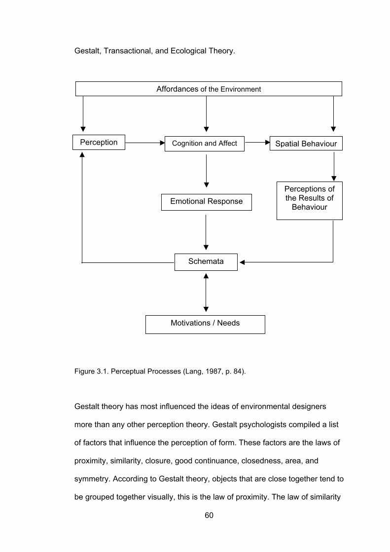
60
Gestalt, Transactional, and Ecological Theory.
Figure 3.1. Perceptual Processes (Lang, 1987, p. 84).
Gestalt theory has most influenced the ideas of environmental designers
more than any other perception theory. Gestalt psychologists compiled a list
of factors that influence the perception of form. These factors are the laws of
proximity, similarity, closure, good continuance, closedness, area, and
symmetry. According to Gestalt theory, objects that are close together tend to
be grouped together visually, this is the law of proximity. The law of similarity
Affordances of the Environment
Perception Cognition and Affect Spatial Behaviour
Emotional Response
Schemata
Perceptions ofthe Results of
Behaviour
Motivations / Needs
61
applies if elements have similar qualities - size, texture, colour, and so forth.
The law of closure states that optical units tend to be shaped into closed
wholes. The law of good continuance states that people tend to perceive
continuous elements as single units. The law of area suggests that the
smaller a closed area the more it tends to be seen as a figure. The law of
symmetry claims that the more symmetrical a closed area the more it tends
to be seen as a figure. The law of closedness suggests that areas with
closed contours tend to be seen as units more generally than those without
them (Lang, 1987).
Transactional theory emphasises the role of experience in perception and
focuses on the dynamic relationship between person and environment.
Perception is considered to be a transaction in which the environment, the
observer, and the perception are mutually dependent on each other (Lang,
1987). Transactional theory makes a number of assumptions about the
processes of perception. These are as follows:
1) perception is multi-modal,2) perception is an active process,3) perception cannot be explained by separating behaviour into the
perceiver and the perceived,4) perception cannot be explained in terms of conditioned responses to
stimuli,5) the person - environment relationship is a dynamic one,6) the image of the environment that an observer depends on past
experiences as well as on present motives and attitudes,7) past experiences are projected onto the present situation in relationship
to one’s needs,8) perception is governed by expectancies and predispositions (Lang, 1987, p. 90).
62
The important contribution of transactional theory to environmental design
theory is the recognition that experience shapes what people pay attention to
in the environment and what is important to them.
The ecological approach to perception contradicts with Gestalt theory and the
transactional interpretation of the role of experience in perception. Instead of
considering the senses as channels of sensation, it regards the senses as
perceptual systems (Lang, 1987). People explore the environment to
perceive the finer details by moving their eyes, heads, and bodies. With
experience, a person is able to identify the finer details of the world and
broader relationships, and learns to pay attention to details of the world that
were not attended to before. In order to perceive the structure of the
environment, it is important to recognise that some surfaces of the world hide
others. When a person moves through the environment, one vista after
another is seen. This occurs in moving from room to room in a building, or
when reaching the corner of a street. The psychological analysis of the role
of movement is one of Gibson's major contribution to ecological perception
theory (see Gibson, 1979).
Lang (1987) notes that the ability to perceive some of the affordances of the
environment seems to be innate or a function of physiological maturation of
people. Others are learned through experience or by having one’s attention
brought to them. To detect meaning, an observer does not have to attend to
every variable contained in the optic array. Attention is selective, people
attend to what they know about and what they are motivated to recognise.
63
This depends on prior experiences. The linkages of the processes of
perception to cognition are unclear in transactional theory of perception. It is
believed that the cognitive structures crucial for perception are anticipatory
schemata. People can only perceive what they know how to find.
Cognitive psychology deals with the acquisition, organisation, and storage of
knowledge. It focuses on issues of thinking, learning, remembering, and
mental development. Human behaviour is highly plastic. People have a large
capacity to adapt to new built environments, to adapt the built environments
to their needs, and to learn new aesthetic values. The processes central to
this adaptive ability are learning, remembering, and generalising. Learning
takes place when an individual associates a new response to a given
stimulus, resulting in a permanent change in behaviour (Lang, 1987). What
we learn involves either internal or external reinforcement. This applies to
environmental attitudes that affect future behaviour as well as to activity
patterns. Some things are forgotten while others endure in memory.
Remembering and forgetting are serious concerns; the way we use buildings
and cities depends partially on how well their structures are remembered
from past visits (Lynch, 1960; Appleyard, 1969; Passini, 1984a). Lang (1987)
states that some things are easier to remember than others; the rate at which
we forget things depends on their importance to us, how well categorised or
organised they are, and how deviant they are from the norm. Also, the way
we categorise things can either aid or distort memory; and the ability to learn
how to use categories depends on the cognitive processes of generalisation
64
made from past experiences. Golledge (1999) states that repeated path-
following facilitates remembering the path components and recalling them for
later use (ie, route learning). Paths or routes are represented as one-
dimensional linked segments or, after integration with other paths, as
networked configurations. The latter, along with landmarks, the spatial
relations among them, and other spatial and non-spatial features of places,
make up the remembered layout of an experienced environment. In terms of
spatial familiarity, how well we remember features of the built environment
depends on the design principles considered in the setting, as well as our
individual ability to learn, memorise, categorise, and generalise what we have
learnt previously.
3.2. Factors Affecting Spatial Familiarity
The positive effect of enhancing the knowledge an individual has about the
environment is of common knowledge. As the number of travels within the
space increase, the individual is expected to gain experience and knowledge
about certain cues the space lends. Evans et al. (1982) report that the ability
of people to recall a building and its location in an urban context depends on
a wide range of factors including shape, the number of persons moving
around the building (ie. crowd), the physical properties and height of spaces.
This variety may also be due to factors such as age, gender, experience,
interest, and attention etc. But the degree of their effects, and how they affect
familiarity need to be further investigated.
65
Wayfinders traversing within the built environment pick cues about the spatial
organisation, these cues are stored in one’s head and recalled during the
decision-making or execution process. One important point is that humans do
not necessarily “know” an environment through which a learned route
passes. Only some features of the route itself may be learned, stored, and
used; the traveller may be ignorant of the environmental surrounds. Such a
traveller would not be able to make accurate judgements about the location,
distribution, pattern, connectivity, or other spatial relations of features
occurring within such an environment. Once an environment has been
experienced either partly or completely, fragments of environmental
information (including locations and connections between places) are
encoded, stored, decoded, recalled, and used in various tasks. Memories
may be fuzzy and imprecise or extremely inaccurate. Different degrees of
precision may be evidence when different spatial products are developed to
externally summarise what is known (Golledge, 1999).
It is important to identify the differences among individuals generated from
their familiarity with the built environment in order to find design solutions that
will be of use to all individuals within the same setting. There are two
categories of influence on spatial familiarity that are also valid for wayfinding:
influence of environmental information and that of individual characteristics.
Environmental information includes visual accessibility, architectural
differentiation, sign systems, and building configuration; and individual
characteristics include gender, spatial ability, disabilities concerning mental
processes and psychological bonds the individuals develop, as discussed in
66
sections 2.3. and 2.4. Amount of experience with the environment is probably
the most important factor that affects spatial familiarity. This factor falls
between spatial and individual characteristics because it is the outcome of
the interaction between the two. The role of experience is discussed in the
following section.
In the context of spatial familiarity, experience, spatial ability, meaning and
expectancy, and environmental complexity become important factors that
determine the amount of environmental knowledge as well as the experience
with place. In order to conduct a thorough investigation on spatial familiarity,
the influence of these attributes on individuals should be analysed.
3.2.1. Experience
The degree of familiarity an individual has with a given setting is an obvious
influence on wayfinding. Familiarity with a setting is gained by experiencing it
in a systematic fashion, either consciously or unconsciously. When in a new
environment, we gather information with all our senses and then code and
sort them into meaningful categories. At the beginning, we learn about our
new environment by associating cues with choice-points and in a chain-like
manner, ie., response learning. Over time, an integrated knowledge of the
spatial relations between many starting points and destinations is developed.
This is place learning, which is a superior and more flexible approach to
spatial problem solving (Downs and Stea, 1977). The graduation from
response to place learning is influenced by several major factors such as
67
structure of the physical environment, type of spatial experience, and length
of experience.
Spatial knowledge is acquired by individuals as a function of their experience
within a given environment. At the simplest level, an individual must have
knowledge of important objects and/or places, generally referred to as
landmark knowledge (Heft, 1979). This knowledge includes the ability to state
with certainty that an object or place exists and the ability to recognise it
when it is within the perceptual field. Spatial knowledge also includes
information about the relationships among objects, procedures (ie. landmark,
route or survey knowledge) for moving from a given location to another
location, and an ability to identify the routes that facilitate such actions (Gale
et al., 1990b).
In the earlier stages of acquisition, keeping track of one’s location, predicting
where one is heading (ie., anticipating), and trying to restore one’s orientation
are likely to dominate. However, later, when the environment has become
familiar, it seems likely that places are easily recognised and that the number
of known places (reference points) increases to the point where it is almost
superfluous for the traveller to monitor his or her location. The traveller then
has a great deal of space capacity, may engage in other mental activities,
and as a consequence, is only dimly aware of monitoring the execution of a
travel plan (Garling et al., 1984).
68
The acquisition of spatial knowledge is based, for the most part, upon direct
environmental experience. Indirect experience may occur through a variety of
media, such as maps, graphic or visual representations (such as
photographs), verbal or written descriptions (Gale et al., 1990a), or by
learning the layout from an overlooking vantage point (Golledge, 1999). But
direct experience with the large-scale environment is usually sustained by
actually moving through it. The role of travel, and by necessity route
navigation, are therefore considered fundamental in the process of the
development and acquisition of a spatial knowledge base (Gale et al.,
1990b).
It is now established that people are able to accurately recall the spatial
layout of their environments, but there may also be an upper limit to how
much information they manage to represent. Accuracy has furthermore been
found to increase with the amount of previous experience (Evans et al., 1981;
Garling et al., 1982), and there are possibly qualitative changes in the
cognitive maps as a function of previous experience (Garling et al., 1984).
Cognitive maps tend to become similar to cartographic maps when an
environment becomes more familiar (Evans et al., 1981; Garling et al., 1982),
and this is likely to take place earlier in the acquisition process if the
environment to be learned is more limited.
Experiencing an environment will result in some spatial information being
stored in long-term memory. Although there is ongoing debate about how
and when such information is stored, accessed, and used, it does appear
69
that spatial learning corrects errors and inconsistencies in initially encoded
spatial information. It further appears that the degree of knowledge about
places, locations, or points along a route varies among people, that is, there
are individual differences in the context of environmental knowing. Further, it
seems that humans do not all behave the same in the same environments,
that different people have different levels of familiarity with different
environmental settings, and that they give salience to different environmental
features. Often the result is that different spatial products of the same area
can incorporate substantially different features and produce different types of
errors; for example, one person may have dominantly direction errors,
another dominantly inter-point distance errors, and yet another predominantly
locational errors. Greater knowledge is achieved by actively rather than
passively experiencing a space through You-Are-Here maps, photographs,
verbal descriptions, etc.
Past experience in visiting new places helps to develop a set of useful rules
for learning to map new places cognitively and for solving a range of spatial
problems. Such heuristics, once formed, can be transferred from one place to
another sharing some common structural characteristics, eg. a grid pattern
(Downs and Stea, 1977). Length of experience is another factor, as people
spend their time in an environment, their spatial knowledge about it grows.
Not only does the amount of information about the setting increase, but the
accuracy of locations as well (Evans et al., 1981).
70
Amount of experience in a setting is an important variable and many of the
gender and cross-cultural differences found in environmental cognition
research can be more parsimoniously explained by the extent of actual
setting exploration permitted to various subgroups of populations. Although it
is clear that we gain knowledge of a place with continued exposure through
perception, we cannot precisely describe these increments in knowledge.
Most studies of cognitive mapping bare on the question of how orientation is
maintained in familiar environments (see Aitken et. al, 1990; 1993). Their
relevance is, however, in most cases only indirect because in these studies
subjects have been interviewed in a neutral setting rather than being
requested to demonstrate how they use the cognitive map for navigation and
orientation (Evans, 1980). It is plausible to assume that recognition plays a
more important role for orientation in familiar environments. Reference points
presumably are recognised so that their spatial relations to other reference
points are stored in the cognitive map become available systems of
reference. They are also likely to be employed more often than single points
of reference, because the points of reference are spatially interrelated in the
cognitive map. Monitoring movement may still play a role. Few environments
are altogether familiar, and there are sometimes extreme conditions, such as
darkness, fog, or noise, making monitoring movement necessary (Garling et
al., 1984). Maps, sign posting, and other media may, however, play an
important role for orientation in such environments. The use of media in such
cases is likely to involve recognition processes. Familiar examples are
recognition of places specified by path descriptions, translating symbols in
maps to the environment, and so forth (Garling et al., 1984).
71
The environmental learning sequences posited by Hart and Moore (1973)
and Siegel and White (1975) may be extended to shifts in accuracy with
experience that resemble the ontogenesis of spatial cognition. Preliminary
contact with an environment provides comprehension of the relative positions
and items in space with respect to the body. Thus the relative location of
objects close in space can be correctly processed, provided no perspective
shifts are demanded. Projective accuracy follows with items comprehended
in terms of their relative positions with respect to various fixed points in
space. Finally, Euclidean comprehension emerges wherein space is encoded
as a unit in which items are located with respect to their position in two-or
three-dimensional space.
Thorndyke and Hayes-Roth (1982) compared subjects with up to 2 years of
direct experience working inside an office building with those who studied a
floor-plan map of the building. Map subjects were generally better at
Euclidean distance and object location judgments, while direct learners were
better at route distance estimates and orientation (see also Rossano et al.,
1999). Here, lies a question in regard to the comparability of the two groups,
because the map-studying group had a motive to learn the building, while the
direct experience group did not have such a motive. Such a motive would
direct the attention of the direct experience group as well as the map learner
group. Also, is there a limit for direct experience, how would subjects perform
if they had 4 years of experience in the building?
72
The relative locations of home, work, schools, and shopping areas strongly
affect the extent of individuals’ knowledge of the immediate geographic
environment. There is also evidence that recognition memory for components
of settings is related to actual experience as well as to general residential
history. Banerjee (1971) reported that the longer a person lived in Boston, the
greater the number of photographs of the city they could correctly identify
and locate.
Montello (1991) measured pointing speed and direction to establish the
possible disorienting effects of oblique routes in a field study. He asserted
that direction is a measure of the accuracy of spatial behaviour, and pointing
speed was included as a response measure because response time reflects
the accessibility of stored information, including the strength of its encoding in
long-term memory and the occurrence of any working-memory processes
that must be brought to bear on the information to produce a behavioural
response. Results of the study indicated that subjects who claimed to know
the area better responded faster, and that subjects who had lived in the area
for a longer period of time responded both faster and pointed with greater
accuracy. The latter finding replicates a relationship between length of
residency and metric accuracy of environmental knowledge found by several
investigators (Evans et al., 1981; Garling et al., 1982), and it adds to the
existing literature a relationship between long-term residency and the speed
with which environmental knowledge is accessed.
73
The main outcome is the differentiation of familiar and unfamiliar subjects in
recalling the different types of environmental elements. Familiar subjects, in
fact, recalled structural elements better than movable objects and also better
than fixed objects. According to Axia et al. (1988), when asked to recall a
known place, subjects are more likely to report elements which are more
strictly connected with the place schema and which are fixed constraints to
action in space; that is to say, for instance, corridors and doors in an interior,
and pavement and gates in an exterior.
3.2.2. Spatial Ability
It is obvious that one’s capacity to perceive the visual world accurately is
directly related with the wayfinding activity, and the amount of experience
with the built environment has considerable impact on this activity. Obviously,
wayfinding as purposive behaviour involves interactions between attributes of
the traveller and attributes of the environment. Because of short-term
variations and long-term changes in these attributes, it is reasonable to posit
that at some level of consideration no two wayfinding attempts are exactly
alike, even those involving repeated travel between familiar destinations.
Ultimately, successful wayfinding is reflected in the traveller’s ability to
achieve a specific destination within the confines of pertinent spatial or
temporal constraints and despite the uncertainty that exists (Allen, 1999,
p. 47). Therefore, as the wayfinder in the built environment receives
information, the information is transformed into knowledge according to the
degree of spatial ability. This does not mean that one with a low level of
spatial ability is incapable of wayfinding, but it refers to the idea that high
74
spatial ability eliminates loss of time caused by trying to process
environmental information over and over again. Also, spatial ability may not
be sufficient to assess the awareness of the wayfinder. One may get around
using environmental information – that is if the environmental aids provided
are sufficient – without major problems. Briefly, as Satalich (1996, p. 4)
defines, “spatial ability is perceiving the environment through our senses, the
cognitive process of how we learn our environment, and the relationships
between objects. Wayfinding is the dynamic process of using our spatial
ability and navigational awareness of an environment to reach a desired
destination”.
Allen (1999) states that an examination of individual differences in wayfinding
will necessarily focus on the attributes of the traveller and that this focus is
not meant to downplay the role of environmental attributes or to suggest an
oversimplification of wayfinding tasks. Indeed, it is the case that the abilities
exhibited by humans and other species are quite obviously adaptations to
environmental demands and opportunities.
The term spatial ability carries with it a variety of connotations because this
rubric has been used in different empirical traditions that are tangentially
related at all. Seeking common conceptual or empirical threads among these
traditions is a formidable challenge. The study of spatial abilities has long
been part of the psychometric tradition in psychology. This tradition, which is
the conceptual home of the term “individual differences”, has provided a
delineation of abilities using factor analysis and various schemes derived
75
through multi-dimensional scaling or cluster analyses to explicate how
abilities are related to each other. Psychometric research has clearly
identified a domain of spatial ability consisting of a number of different
factors, all reflecting facility in perceiving, remembering, or mentally
transforming figure stimuli (Allen, 1999).
Gardner (1983) argues that there exist several ways to assess one’s spatial
intelligence using a variety of tasks. He states that central to spatial
intelligence are the capacities to perceive the visual world accurately to
perform transformations and modifications upon one’s initial perceptions, and
to be able to recreate aspects of one’s visual experience, even in the
absence of relevant physical stimuli.
It should be noted that the nature of spatial ability may be affected by age,
experience, culture and all individual characteristics mentioned before. The
transition from childhood to adulthood involves changes in spatial skills, and
we can improve our skills over time with experience. Also, culture influences
our activities, and sometimes sets the boundaries of our lives, determining
what we may or may not do, or which skills we may improve (ie. cooking for
women, driving for men). Lang (1987) states that much of our behaviour is
culture-bound and depends on how we have been socialised to like and
dislike patterns of the environment and the successes that we have had in
the past in dealing with them.
The preceding overview of spatial abilities suggests a potentially informative
76
adaptation of an interactive sources framework that would include perceptual
capabilities, fundamental information-processing capabilities, previously
acquired knowledge, and motor capabilities. Perceptual capabilities refer to
sensitivity to visual, auditory, vestibular, tactile, and proprioceptive sources of
information about self-produced movement or environmental structure.
Fundamental information-processing capabilities include speed, internal
timing, and working memory, both spatial and verbal. Previously acquired
knowledge can serve as a resource in several ways. Obviously, memory of
specific environments and memory for specific routes can be considered
resources. In addition, there are generalisable concepts, strategies, and skills
that can be pressed into service during various wayfinding tasks (Allen,
1999).
Findings suggest that high spatial ability leads to greater participation in
spatial activities (Newcomb and Dubas, 1992). For example, travellers who
are good at attending to events along a route may also be good at navigation
based on immediate cues. The identification of such general spatial abilities
is important for applications in personnel selection, training, environmental
design, and robotics (Cornell et al., 1999).
Allen (1999) states that few studies have been concerned directly with
relationships among spatial abilities, spatial knowledge, and wayfinding
behaviour. The typical finding is that spatial abilities as measured with
psychometric tests have little in common with spatial performance on tasks in
large-scale space. The studies that have been done have not sampled
77
spatial abilities or wayfinding tasks in an ordered or systematic way. Filling
this research void represents an informative future research agenda. Such
research will be most useful if it involves a comprehensive framework
featuring a taxonomy of abilities and tasks (Allen, 1999).
Several authors (Malinowski and Gillespie, 2001; Golledge and Stimpson,
1997; Self et al., 1992) characterise three major dimensions of spatial ability.
These are the spatial visualisation, the ability to mentally rotate, invert or
otherwise manipulate two-dimensional or three-dimensional objects
presented visually; spatial orientation, the ability to imagine how an object
would look from different perspectives; and spatial relations, which includes
relational or associational components of spatial ability covering tasks such
as wayfinding, shortcutting, and sketch-mapping (Malinowski and Gillespie,
2001). Basically, research in spatial aptitude seems to indicate that,
theoretically at least, spatial abilities can be summarised by two dominant
dimensions – spatial rotation and spatial orientation (Golledge, 1999).
3.2.3. Meaning and Expectancy
The meaning attached to a setting is an important factor that varies from one
individual to another, and determines the amount and detail of information
stored in one’s memory that may be used later on. The amount and detail of
knowledge stored affects spatial familiarity, therefore it is important to
understand how this is maintained.
Moore (1979) suggests that different social groups conceive space
78
differently. Some research on spatial cognition has examined social factors.
Stokols and Schumaker (1981) propose a concept that they call “social
imageability”, which suggests that the perception of the environment is
altered by the social function that occur there, goals of the group, and their
evaluations of the place. Lang (1987) states that the built environment
communicates a variety of meanings, from its utility to its symbolism. The
symbolism of the built environment is a major concern of environmental
designers for it is an important factor in people’s liking or disliking their
surroundings (Lang, 1987). For example, it is possible that hospital staff
actually perceive and structure their work environment differently than
patients or visitors. The staff may attend to objects in the hospital
environment that visitors never notice, for instance, using the staff meeting
room as a functional landmark (O’Neill and Jasper, 1992). The way students
and instructors perceive the built environment may also differ. For instance,
the emotional response of students to the school environment may vary from
unwillingly attending classes, to anticipating the hours spent with classmates
outside the classroom. The instructors may conceive the built environment
quite differently too, their offices may become depicters of status.
Although the physical and spatial characteristics of an environment are
foremost in clear image formation, the rather neglected dimension of
environmental meaning has been recognised to be an important contributor
to imageability (Appleyard, 1969). Certain places stand out in people’s minds
because of their meaning and not their architectural features. Meaning can
be of a functional nature. A post office, or a restaurant might be remembered

79
for their use significance. Meaning can also be of a socio-symbolic nature.
Another form of meaning derives from a person’s sensory experience of a
place. An interesting setting is more imageable than a dull, monotonous one.
Curiosity is more stimulating to the cognitive abilities than boredom.
Expectancies also affect the way we behave in the environment.
Expectancies during travel can take a variety of forms, but a useful distinction
is between general and specific expectancies. General expectancies are
based on world knowledge, such as the expectancy that parks have trees,
and that suburbs have rows of similar houses. General expectancies can be
used to check that travel is appropriate in a new area, and seem especially
prominent when an unusual environmental feature is encountered.
Expectancies during travel can be much more specific, based on memories
of map study, verbal directions, or direct experience. When repeating a
previously travelled route, a basic example is the recall of a right turn that is
cued prior to arrival at the intersection where alternative paths can be seen.
In this case, anticipatory recall indicates knowledge about the identity of an
action and knowledge of its serial or spatial position along the route. Another
form of expectancy occurs when a landmark is recognised with more
confidence because its memory has been primed by a preceding landmark
(Cornell et al., 1999)
There is evidence that familiarity with places accrues even when attention
has been divided during route learning (Lindberg and Garling, 1982) and that
wayfinding can often be accomplished by approaching familiar places
80
(Cornell et al., 1999). This evidence suggests that feelings of knowing when
events along the route are encountered may serve to guide travel when
explicit memories – verbal descriptions, images, or other symbolic
representations of the route – are incomplete.
It seems likely that expectancies can be constructed as a back-up strategy,
establishing predictions when immediate recognition is uncertain. The role of
expectancies in this view is to provide associations that can be confirmed or
corrected during navigation. Route expectancies may often be inadequate for
wayfinding along an incidentally learned route, or one that has been planned
from maps or directions. Hence, several processes may account for variance
in measures of navigation accuracy. As an example, certain events along a
route may not trigger clear expectancies of what lies ahead, but may provide
immediate information for recognising that the route is familiar (Cornell et al.,
1999). The process of confirming and elaborating details of expectations
would help travellers stay on route and could subsequently be reflected in the
explicitness of their route descriptions.
Delving into the factors influencing memory for places, three broad classes of
variables may be distinguished: variables concerning the person, variables
concerning the environment and variables concerning the interaction
between the two. Without attempting to provide an exhaustive taxonomy,
within each of the above classes further distinctions may be possible
(Mainardi-Peron et al., 1985). For the variables concerning the person,
memory structure and processes, attention, and motivation, along with other
81
psychological factors play certainly a role. Motivation to learn affects
environmental learning which is a goal-directed process. When one is
motivated, the spatial properties of large-scale environments may be
acquired very quickly (Garling et al., 1981) by paying more attention to the
environment (Cohen et al., 1979). As far as the environment is concerned,
two main distinctions seem psychologically salient. One arises from
functional and/or structural factors and on this basis we may distinguish, for
example, internal vs. external places, or different types of internal (eg.
corridors vs. living rooms) and external (eg. streets vs. courtyards) places;
distinctions can also be made with reference to dimensions, form and
location, either jointly or singly considered (eg. balcony vs. terrace, basement
vs. attic). The other distinction arises from the places’ conceptual definitions.
On this basis, we can distinguish between places at different levels of
abstraction in environmental taxonomy (a high level 'house’ vs. a low level
‘Mr. Smith’s living room’), or places with typically associated elements (eg. a
stove in a kitchen, trees in a park), and places for which this is true to a
lesser extent (eg. an esplanade) (Mainardi-Peron et al., 1985). As far as the
interaction between persons and environments is concerned, familiarity and
subject’s aims are relevant. The two cannot easily or always be separately
considered, as familiarity is often the result of reaching one’s goals through
some activity occurring in a given place. Taking familiarity in this sense, one
could argue that the functional aspects of the place in question – and
consequently items related to them – should become more available for the
subject.
82
Hayes-Roth and Hayes-Roth (1979) proposed a model that accounts for
planning as a cognitive activity. They define planning as the predetermination
of a course of action having some specified goal. It is assumed that people
form travel plans with the general goal of reaching desired destinations
without having to invest too much effort. To attain this goal, information about
important properties of the environment must be gained. These properties
include the functions of places, where the places are located, and how one
can travel to the places. This information may often be obtainable from media
(eg., street maps, face-to-face communications, and such written texts as
brochures). If the environment is familiar, it should be possible to retrieve the
information from the cognitive map (Garling et al., 1984). In this context, the
goals that motivate people to go to a place are important because of the
different levels of attention devoted to the place itself. For example, a goal
can be achieved within a certain place, as is the case when one buys
something in a shop; or it can be achieved in a different place which can be
reached only by passing through another one, as is the case when one has
to cross a square in order to reach the shop where one wants to buy
something. As a consequence, one should expect to find a better memory for
the place where the goal is achieved than for the one where it is not.
3.2.4. Environmental Complexity
The components of environmental complexity in relation to wayfinding should
also be discussed in relation to spatial familiarity. When one thinks about an
interesting, complex environment, the first image to emerge is probably
composed of an intricate arrangement of space highlighted by unusual
83
architectural features, executed with a tasteful use of material and colour. An
additional component of environmental complexity, which is most important in
experiencing a setting, is density and depth of meaning. Meaning can take
many forms. It can express a function, a social and cultural identity, a
historical heritage; it can also communicate political, religious, and life-style
values. It is argued that ambiguity, which is defined as the multiple
interpretation of architectural form, assures density of meaning and through
it, environmental complexity (Passini, 1984).
Learned routes vary in complexity, and as this complexity increases so does
the mental effort required to utilise the route knowledge. The route complexity
increases as each of the following factors increases – the length of each
component leg; the magnitudes of the directional changes required at each
decision point; the quantity of connecting route legs; cumulative directional
changes required along the route (Bliss et al., 1997). As the route’s mental
effort requirement increases, a survey representation of the same space can
be more useful.
A place that is used and appropriated by its occupants is enriched by a
meaning that represents the nature of the users as well as their activities.
Environmental complexity in its full sense has to include people and all the
signs that are associated with the relations they establish with a place over
time. New developments are often architecturally innovative and spatially
diverse, but without human activity and involvement, they tend to be
perceived as dead and sterile.
84
The opportunity and ability to solve problems, which are fundamental to
wayfinding, are sources of satisfaction in themselves. The motivation derived
from successful problem solving is evident in much of our working life. We
are generous with the time we allocate to problem solving; the writing of a
book is a good example. Wayfinding is problem solving. In order to be
rewarding the problem has to be of a certain interest. This interest is
achieved if the setting reflects a certain architectural and spatial complexity,
which explains a first link between complexity and the satisfaction derived
from wayfinding. Wayfinding might be a game at times, but once you have
had enough, you can put a game away, whereas in wayfinding, you have to
stick with it until a destination is reached.
A second major source of satisfaction linking wayfinding to environmental
complexity is exploration, which motivates much of our endeavours. We may
explore in order to seek change and break with the familiar. We may also
explore to seek new information and acquire knowledge. The pleasure of
solving problems, the pleasure of being entertained, and the pleasure of
acquiring new knowledge are three major sources of satisfaction derived
from wayfinding in complex environments (Passini, 1984b). The experience
associated with wayfinding is a deeply felt one. Satisfaction is derived from
problem solving and from exploration. When the wayfinder is satisfied, he
attributes certain meanings to the environment that may become of key
importance in becoming familiar with the setting, thus providing a clear
representation for other episodes of wayfinding in the same setting.
85
Under emergency conditions, such as fire evacuation, the only thing that
counts is reaching the destination as fast and as easily as possible. Lack of
time, stress and the possible impairment of information-processing and
decision-making capacities, determine that nothing can be too simple or too
“straightforward” (Sime, 1985). Most wayfinding does not take place under
emergency conditions; even so, efficiency in reaching destinations is
required. Meeting a person at a given address, finding a restaurant or a hotel,
doing the shopping, in fact, most of our daily tasks can be regrouped into
what may be called a resolute wayfinding condition. The feelings experienced
when reaching a destination is as important as the functional aspect of
wayfinding that usually has priority. Environmental complexity is desirable as
long as the design of the setting, including the wayfinding support systems,
guarantees efficient information processing performances (see Evans and
Mc Coy, 1998). The motivation gained from an enriching experience
facilitates the wayfinding process. Thus, it is not necessarily the
oversimplified, dull building that is most successful for efficient wayfinding.
After all, interest and curiosity lead to a heightened understanding and easy
learning, whereas boredom does not.
86
4. RESEARCH
The issue of wayfinding incorporates a variety of factors that affect the
behaviours of individuals. Spatial familiarity is one important, yet insufficiently
investigated variable in the field of environmental behaviour that has no well-
defined technical interpretation, and is directly related to the wayfinding
behaviour.
As the main aim of this thesis is to explore spatial familiarity and to
investigate its dimensions in relation to wayfinding, assessment of individual
and group differences, the identification of these differences and their effect
on spatial familiarity are considered as an important step in understanding
the process of wayfinding. Thus, spatial familiarity has been tested and
assessed in an empirical study by performance on navigation, wayfinding
tasks in real environments, spatial ability tests, and interviews. Individual and
group differences have been investigated through statistical tests.
4.1. Research Questions and Hypotheses
Research Questions:
1. What are the factors affecting spatial familiarity? In particular;
1.1. Do the spatial characteristics of the building affect spatial
familiarity?
1.2. Does spatial ability affect spatial familiarity? (ie. Does high spatial
87
ability predict high self-rated spatial familiarity and wayfinding
performance?)
1.3. Do meaning and purpose affect spatial familiarity?
1.4. Does gender affect spatial familiarity?
1.5. Does the length of time spent in the built environment affect the
level of spatial familiarity?
1.6. Does time and amount of trials in the built environment affect
spatial familiarity?
2. Does spatial familiarity affect wayfinding?
Hypotheses:
1. SPATIAL CHARACTERISTICS OF BUILDINGS AFFECT SPATIAL
FAMILIARITY
1.1. Legibility (spatial organisation) affects level of spatial familiarity.
1.1.1. Landmarks affect level of spatial familiarity.
1.1.2. Signage affects level of spatial familiarity.
1.1.3. Visual accessibility affects spatial familiarity.
2. INDIVIDUAL CHARACTERISTICS AFFECT SPATIAL FAMILIARITY
2.1. Spatial ability (scores of subjects categorised as: above the
average / average / below the average) affects spatial
familiarity.
2.2. Spatial ability affects amount and type of elements recalled in
the built environment.
88
2.3. Type of education (Interior Architecture / Graphic Design)
affects spatial familiarity and types of elements recalled.
2.4. Meaning and purpose affect spatial familiarity (students of
Interior Architecture/ students of Graphic Design).
2.5. Gender affects spatial familiarity.
3. INTERACTION WITH SPACE AFFECTS SPATIAL FAMILIARITY
3.1. The total amount of time spent in an environment (in months or
years) since the first encounter affects spatial familiarity.
3.2. Interaction frequency (total amount of visits per week) with the
built environment affects spatial familiarity.
4. SPATIAL FAMILIARITY AFFECTS WAYFINDING PERFORMANCE
4.1. Spatial familiarity affects wayfinding performance. (Subject’s
familiarity with the built environment predicts wayfinding
performance.)
4.2. Self-evaluation of subjects’ familiarity predicts wayfinding
performance.
4.3. Subject’s evaluation of buildings from wayfinding point of view
predicts wayfinding performance.
4.2. Setting and Subjects
In order to test and observe different levels of spatial familiarity and assess
wayfinding behaviour under these conditions, two buildings on the campus of
89
Bilkent University in Ankara, Turkey were chosen as the settings for the
study. In order to provide a better understanding of the buildings, the building
profiles have been described below.
4.2.1. Building Descriptions
4.2.1.1. IAED Building
The first building (designated IAED) is occupied by the department of Interior
Architecture and Environmental Design and Communication and Design of
the Faculty of Art, Design, and Architecture. The IAED building is a multi-
storey large-scale building(see Appendix C1 for exterior and C2 for interior
view). It has two almost symmetrical wings which are interconnected by 4
corridors (see Appendix D1 for floor plans and D2 for sections). These four
corridors are repeated on each floor in a uniform manner. The corridors on
the first floor are dead-ends. There are two separate main entrances to each
wing. Apart from the main entrance, one wing has a second entrance which
links the building to the academic parking lot (see Appendix D1). Although
there is a third entrance to the building on the same wing, it is locked at all
times therefore it is not used. One other difference between the two wings is
that the spiral staircase on one wing goes down to the basement whereas the
other does not.
Each wing has three floors on one side, and five floors on the other (see
Appendix C2). These two parts serve for different purposes. The part that is
90
three storey - high has the studios, classrooms, elevators, and toilets used by
the students (designated studio floors) (see Appendix E1). The offices are
located in the five storey high part (designated office floors) (see Appendix
E2). Here are 12 offices (six on one wing and six on the other), one toilet on
each floor and an elevator used only by the academic and administrative
staff. There are three studios, four classrooms, two toilets on each studio
floor and one elevator on each wing used by the students. The connection
between the office and studio floors are maintained through intersections on
which the corridors of the office floors join the spiral staircases at the far end
of each wing. In order to pass from an office floor to a studio floor one has to
ascend or descend half a level except for the third floor; this is the only floor
that has no level difference between the two parts of the building.
The spiral staircases are not visually accessible from the studio floors, they
are placed behind walls and one has to walk close enough to perceive the
entrance (see Appendix E3). Also, they are hidden behind the doors at the
end of each wing on the office floors. Although these stairs are the only
nodes where the offices, studios and the vertical access to all floors intersect,
there is no indication of this important function. There are also stairs on the
studio floors, the main staircases are at the entrance of each wing, and
connect the ground floor to the first floor. They are visually accessible
because the stairs transform into ramps half way to the first floors and cross
the space diagonally (see Appendix E4). On the first and second floor, the
stairs are located next to the studios (see Appendix E5) and are not as
significant as the main staircases. This is because they are not well
91
illuminated and are hidden behind 1m high parapets that are the same colour
with the walls. The elevators, on the other hand, are not placed symmetrically
on each wing. One of the elevators is located straight across the main
entrance and therefore is visually accessible (see Appendix E6), whereas the
elevator on the other wing is located parallel to the entrance axis and
therefore is more difficult to perceive (see Appendix E7).
The entrance area of each wing has a high vaulted ceiling (almost 20
meters), and has visual accessibility to two of the studio floors (see Appendix
E8), the third studio floor of one wing has a circular opening which has a
partial view of the studio floors below (see Appendix E9). There are square
shaped openings on the wall that divides the studio and office floors from the
first floor to the third floor. These openings provide partial visual accessibility
from the office corridors to the studio floors, and are used for display
purposes from time to time (see Appendix E2 and E8). When viewed from
the studio floors, these openings suggest that there is a space behind the
walls, but not the purpose of those spaces. As mentioned before, the
intersections of the two spaces are not visually accessible, therefore, there is
no indication of how connection is maintained from the studios to the offices.
It should also be mentioned that there is no indication that one can pass from
one wing to the other through the office corridors.
From the architectural differentiation point of view, uniform floor patterns are
repeated on almost every floor. There is no colour or formally applied code to
provide architectural differentiation of the spaces with different functions or a
92
hierarchical system for the use of the studios, classrooms or offices in the
building. For instance, the first and fourth year studios are on one wing and
the second and third year studios are on the other wing. This also applies for
the classrooms and the offices. A third year studio instructor’s room can be
located on the fifth floor.
The signage system lacks an organisational principle. Door numbers do not
follow a systematic order, studio and classroom numbers do not follow each
other although they are on the same floor, but they continue from one wing to
the other. For example, there is a staff room on the third studio floor; it is at
the centre of the two wings. The studio F309 is the last studio on the third
floor and is followed by the staff room where no students are allowed (see
Appendix E10). F310 is the studio that follows this room on the other wing
but there is no indication of this fact. There are no You-Are-Here Maps or
directories at the entrance areas but there are computer output directories
beside the doors that open to the office corridors (see Appendix F and E11).
As the floor plans are uniform, it is difficult to understand which floor it is
when one gets off the elevator, and there are no signs placed across the
elevators.
The ramps, the BCC labs, a painting on the first studio floor, the skylights and
plants (see Appendix E11) on the fifth office floor are referred as landmarks
in the building. This is because they are unique and eye-catching but from
the wayfinding point of view, they are not clear reference points and do not
correspond to specific areas.
93
4.2.1.2. GRA Building
The second building (designated GRA) is a three - storey high large-scale
building that integrates three blocks and is occupied by three departments:
Landscape Architecture and Urban Design (LAUD), Graphic Design (GRA),
and Fine Arts (FA). The LAUD department is located on A-Block. A-Block is
connected to B-Block through staircases where the GRA department is
located. Finally, C-block, where the FA department is located, is once again
connected to B-Block through staircases. Two of the blocks (A Block and B
Block) are almost identical (see Appendix G1 for floor plans and G2 for
sections). The plan configuration is repeated on each floor in a uniform
manner. There are three main entrances to each block (see Appendix H1
and H2). One of the differences between the three blocks is that only A block
has access to the basement floor.
Each block is separated into two parts that serve for different purposes. The
studios, classrooms, and toilets used by the students (designated studio
floors) are on one side and the offices are located on the other side
(designated office floors). Here are 6 offices, and one toilet at the end of each
office corridor used only by the academic and administrative staff. There are
three or four studios, two or three classrooms depending on the floor they are
on, and a toilet on the mid-level in each block used by the students. The
connection between the office and studio floors are maintained through the
main staircase (see Appendix H3). In order to pass from an office floor to a
studio floor one has to ascend or descend half a level except for the third
floor because there is no level difference on the last floor.
94
The entrances of A block and B block are beneath the main staircases. The
main staircase in C block is located across the entrance. These staircases
and the office floors are visually accessible from the studio floors. There are
also staircases on the studio floors other than the three main staircases. Two
of these staircases connect the three blocks to each other (A block to B
block, and B block to C block), and three of them are the vertical paths that
connect the three floors to each other as well as being the only access to the
toilets (see Appendix H4). They are not visually accessible because they are
around the corners of each block.
From the architectural differentiation point of view, uniform floor patterns are
repeated on almost every floor. There is no colour or formally applied code to
provide architectural differentiation of the spaces with different functions. But,
there is a hierarchical system for the use of the studios and offices in the
building. For instance, the first and fourth year studios are on the ground
floor, the second year studios are on the second floor, and the third year
studios are on the third floor. This also applies for the offices. The first and
fourth year studio instructors’ rooms are located on the first floor, and second
year studio instructors’ rooms are on the second office floor, and the third
year studio instructors’ rooms are on the third floor.
The signage system follows an order; the offices, studios and classroom
numbers follow each other except for the storage rooms. Although they are
on the same floor, their door numbers do not follow the correct sequence.
There are no You-Are-Here Maps or directories at the entrance areas or on
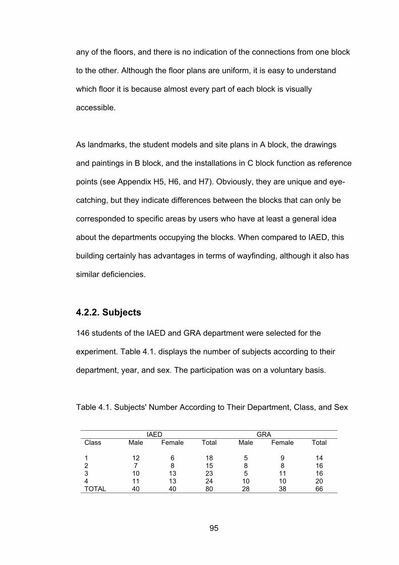
95
any of the floors, and there is no indication of the connections from one block
to the other. Although the floor plans are uniform, it is easy to understand
which floor it is because almost every part of each block is visually
accessible.
As landmarks, the student models and site plans in A block, the drawings
and paintings in B block, and the installations in C block function as reference
points (see Appendix H5, H6, and H7). Obviously, they are unique and eye-
catching, but they indicate differences between the blocks that can only be
corresponded to specific areas by users who have at least a general idea
about the departments occupying the blocks. When compared to IAED, this
building certainly has advantages in terms of wayfinding, although it also has
similar deficiencies.
4.2.2. Subjects
146 students of the IAED and GRA department were selected for the
experiment. Table 4.1. displays the number of subjects according to their
department, year, and sex. The participation was on a voluntary basis.
Table 4.1. Subjects' Number According to Their Department, Class, and Sex
IAED GRAClass Male Female Total Male Female Total
1 12 6 18 5 9 142 7 8 15 8 8 163 10 13 23 5 11 164 11 13 24 10 10 20TOTAL 40 40 80 28 38 66
96
4.3. Procedure
Initially, all subjects were required to complete two tests. The first test (Cards
Rotation Test) is a test of ability to see differences in figures; it is used to test
spatial orientation, a factor used to determine the subjects’ ability to perceive
spatial patterns or to maintain orientation with respect to objects in space.
The second test (Maze Tracing Speed Test) tests the ability of subjects to
find a path through a maze quickly; it is used to test the spatial scanning
factor which determines subjects’ speed in exploring visually a wide or
complicated spatial field space (Kit of Factor-Referenced Cognitive Tests,
1976). Each test took 6 minutes at most, thus a maximum of 12 minutes were
spent to complete the tests in total.
Following the tests, the subjects were interviewed in correspondence to a list
of specified questions (See Appendix I1 and I2 for the questions). They were
asked to rate their familiarity for both buildings on a 7-point scale; to rate both
buildings regarding ease of wayfinding on a 7-point scale, how long they
have been using each building, and their interaction frequency with each
building. In order to gain a better understanding of spatial familiarity, subjects
were asked to specify the areas and floors they used most frequently in each
building. In addition, they were asked to recall as many items as they could
that belonged to the IAED building and the GRA building.
When the tests were completed, two tasks of reaching a specific destination
in IAED and GRA were given to the subjects. The subjects were asked to find
97
the room F311 in IAED (see Appendix C) and the room B322 in GRA (see
Appendix G). These rooms were selected in order to avoid unfairness
regarding the number of floors subjects had to climb, and number of turns
around corners taken to reach them. Subjects’ wayfinding behaviours were
recorded and timed, the shortest trial took one minute, and the longest took
six minutes. During the trials, comments made by subjects in regard to the
ease or difficulty of wayfinding, and means of aiding the difficulties in the two
buildings were noted. Subjects’ performance differences were marked and
evaluated on the basis of
a) initial preference for the direction to follow,
b) total number of errors and backtracking subjects made,
c) indications of confusion and uncertainty,
d) and shortcutting.
4.4. Statistical Analyses and Results
In the search for an answer to the question of how spatial familiarity affects
wayfinding, spatial familiarity that has a multi-dimensional nature, must be
decomposed into its units. As a result of the information gathered from tests,
interviews and wayfinding tasks, a total of 39 variables were specified for the
sample group. These variables were determined in order to acquire
information about sex, age, department, class, frequency of visit to each
building, areas most used in each building, rating of wayfinding and familiarity
for each building, number and type of elements recalled in each building,
98
number of errors in each building, time taken to reach target rooms in each
building, results of spatial ability tests, etc. (see Appendix J for the list of
variables).
For the first hypothesis considering the buildings, t-tests reveal a significant
difference between the mean of evaluation of IAED building (µIAED=1.81)
and the mean of evaluation of GRA building (µGRA= 1.29) by most of the
subjects (t=10.469, df= 290, p= .000). IAED building was mostly rated as
complex, while GRA building was evaluated as simple. t-tests also reveal
significant differences between the two buildings for type of elements
recalled , where landmarks were recalled more for IAED building (µIAED=
1.62), and paths were more frequently recalled for GRA building ( µGRA=
2.08). There was a significant difference between the types of elements
recalled (t= -3.90, df= 290, p= .000) for each building in general. In terms of
visual accessibility, subjects stated that it existed in IAED building (µIAED=
1.41) significantly (t= 3.01, df= 290, p= .003) more than it existed in GRA
building (µGRA= 1.25) although the results indicate that visual accessibility is
found insufficient by a majority. The evaluation of sufficiency of signage in
IAED (µIAED= 1.74), and GRA buildings (µGRA= 1.35) was significantly
(t= 7.26, df= 290, p=.000) different. Likewise, architectural differentiation was
found to exist in IAED (µIAED= 1.65) significantly more (t= 4.61, df= 290,
p= .000), than in GRA building (µGRA= 1.35). Number of elements recalled
in IAED (µIAED= 2.01) was significantly higher (t= 3.52, df= 290, p= .000)
than the number of elements recalled in GRA building (µGRA= 1.69) by the
subjects in general. The reason for this is because despite its complexity,
99
IAED building has considerably more elements to remember.
The t- tests (see Table 4.2.) also display a significant mean difference for
IAED and GRA students regarding the following variables. The mean
familiarity ratings of IAED students (µIAED= 4.58) is significantly higher
(t= 6.585, df= 144, two-tailed p= .000) than that of GRA students
(µGRA= 2.95) for IAED building. Unsurprisingly, the mean familiarity ratings
of GRA students (µGRA= 5.25) is significantly higher (t= -3.222, df= 144,
2-tailed p= .002) than that of IAED students (µIAED= 4.08) for GRA building.
Regarding wayfinding ratings, the only significant difference was for IAED
building where IAED students rated significantly higher than GRA students
for wayfinding (2-tailed p < 0.05, µIAED= 1.82, µGRA= 1.59, t= 2.228,
df= 144, p= .027).
The mean number of elements recalled by IAED students (µIAED= 10.68) in
IAED building were significantly different (t= 4,133, df=144, 2-tailed p= .000)
from that of GRA students (µGRA= 8.60). And as expected, number of
elements recalled in GRA building by GRA students (µGRA= 9.78) were
significantly different (t= -4.168, df= 144, 2-tailed p=0.00) from that of IAED
students (µIAED= 7.45).
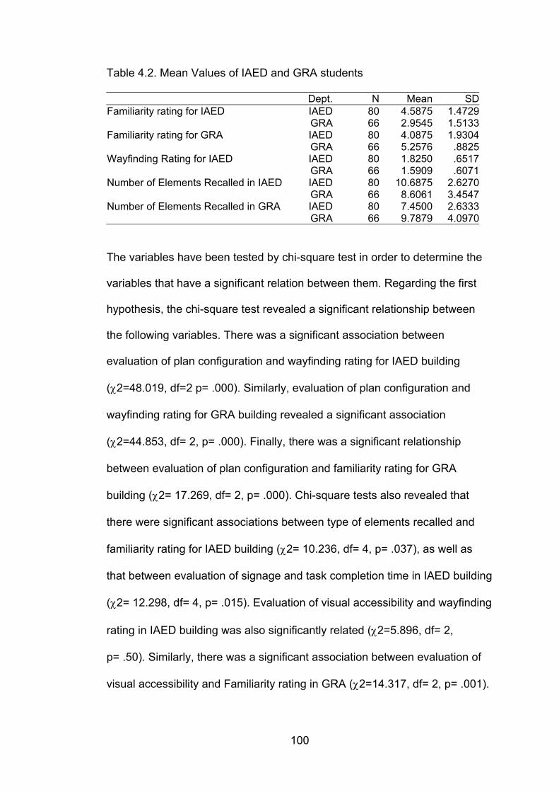
100
Table 4.2. Mean Values of IAED and GRA students
Dept. N Mean SDFamiliarity rating for IAED IAED 80 4.5875 1.4729
GRA 66 2.9545 1.5133Familiarity rating for GRA IAED 80 4.0875 1.9304
GRA 66 5.2576 .8825Wayfinding Rating for IAED IAED 80 1.8250 .6517
GRA 66 1.5909 .6071Number of Elements Recalled in IAED IAED 80 10.6875 2.6270
GRA 66 8.6061 3.4547Number of Elements Recalled in GRA IAED 80 7.4500 2.6333
GRA 66 9.7879 4.0970
The variables have been tested by chi-square test in order to determine the
variables that have a significant relation between them. Regarding the first
hypothesis, the chi-square test revealed a significant relationship between
the following variables. There was a significant association between
evaluation of plan configuration and wayfinding rating for IAED building
(χ2=48.019, df=2 p= .000). Similarly, evaluation of plan configuration and
wayfinding rating for GRA building revealed a significant association
(χ2=44.853, df= 2, p= .000). Finally, there was a significant relationship
between evaluation of plan configuration and familiarity rating for GRA
building (χ2= 17.269, df= 2, p= .000). Chi-square tests also revealed that
there were significant associations between type of elements recalled and
familiarity rating for IAED building (χ2= 10.236, df= 4, p= .037), as well as
that between evaluation of signage and task completion time in IAED building
(χ2= 12.298, df= 4, p= .015). Evaluation of visual accessibility and wayfinding
rating in IAED building was also significantly related (χ2=5.896, df= 2,
p= .50). Similarly, there was a significant association between evaluation of
visual accessibility and Familiarity rating in GRA (χ2=14.317, df= 2, p= .001).
101
Findings reveal that familiarity rating for IAED building and evaluation of
atmosphere in IAED building are significantly associated (χ2=10.828, df=4,
p= .029).
These findings reveal that there are significant relations between individual
perception and judgements of the built environment and self-evaluation of
familiarity and wayfinding. Interestingly, although ratings for wayfinding and
evaluation of plan configuration are significantly associated for both buildings,
this is not valid for the association between familiarity and plan configuration.
Evaluation of plan configuration and familiarity ratings of the subjects for
IAED building was not statistically related. This may be because subjects
evaluated the building as complex in general, but this evaluation is not
necessarily an indication of familiarity. Therefore self-judgement of familiarity
is not a sufficient criterion to determine how well a place is known, other
factors must be included as well.
The second hypothesis was that individual characteristics affect spatial
familiarity. Related findings gained from t-test and chi square test reveal
significant relations for the following variables:
The results of the spatial aptitude tests were analysed using t-test to see
whether there existed a significant difference between the means of male vs.
female, IAED vs. GRA students, and different classes (i.e. IAED 1st year
students vs. IAED 2nd year students). The results of the t-tests revealed a
significant difference (t= 3.126, df = 144, two tailed p= .002) between the
102
means of males (M= 32.897, SD= 7.27) and females (M= 28.898, SD= 8.07)
for the maze tracing speed test, and a significant difference (t= 4.529, df=
144, two tailed p= .000) for means of males (M= 121.29, SD= 25.36) and
females (M= 101.13, SD= 28.06) for the cards rotation tests. Maze tracing
speed test and evaluation of signage in GRA building was significantly
related (χ2=6.096, df= 2, p= .047) and also, there was a significant
relationship between "Cards rotation test" and evaluation of architectural
difference in IAED building (χ2=11.386, df= 4, p= .023). Department was a
variable that was significantly related to many variables. Department and
familiarity rating for both IAED (χ2=28.366, df= 2, p= .000) and GRA
(χ2=19.122, df= 2, p= .000) buildings were significantly related. Also, there
was a significant association between department and number of elements
recalled in both IAED (χ2= 26.672, df= 2, p= .000) and GRA (χ2= 17.534,
df= 2, p= .000) buildings. Department and types of elements recalled in IAED
(χ2= 15.369, df= 2, p= .000), and GRA (χ2= 20.373, df= 2, p= .000) buildings
were also among those that were significantly associated. Department and
evaluation of plan configuration of GRA building was significantly associated
(χ2=3.936, df= 1, p= .047). An additional finding revealed a significant
relationship (χ2= 32.40, df= 4, p= .000) between number of elements recalled
in IAED and GRA building.
Sex was another variable that accounted for differences between individuals.
There was a significant relation between sex and familiarity rating for IAED
building (χ2=7.990, df= 2, p= .018), as well as sex and types of elements
103
recalled in IAED building (IAEDχ2=6.537, df= 2, p= .038). Also, sex and
shortcuts taken in IAED was significantly related (χ2=10.371, df= 1, p= .001).
Sex and number of errors in IAED building (χ2= 6.737, df= 2, p= .034), sex
and evaluation of atmosphere in IAED building (χ2= 6.242, df= 2, p= .044),
sex and wayfinding rating in IAED building (χ2=9.221, df= 2, p= .010), and
finally sex and Cards rotation test (χ2=8.570, df= 2, p= .014) were all
significantly associated. Except for the last one, all of the associations
regarding sex have appeared in the IAED building.
This is an interesting finding because it draws attention to the effect of
complexity of the built environment on perception of spatial familiarity and
wayfinding among different sexes. Obviously, sex differences are revealed in
the building that is evaluated as complex. This means that as complexity
increases, sex becomes a predicting variable for the factors mentioned
above.
The third hypothesis is that interaction with space affects spatial familiarity.
Chi-square tests were conducted and significant relations were found for the
variables listed below.
Frequency of visit and familiarity rating for both IAED (χ2=28.442, df=4,
p= .000), and GRA (χ2=16.566, df= 4, p= .002) buildings were significantly
related. Frequency of visit and number of elements recalled in both IAED
(χ2= 30.608, df= 4, p= .000) and GRA (χ2=19.603, df= 4, p= .001) buildings
104
were significantly related. Also, there was a significant association between
frequency of visit and types of elements recalled in both IAED (χ2= 16.168,
df= 4, p= .003) and GRA (χ2= 14.270, df= 4, p= .006) buildings. Class was
significantly associated with familiarity rating for GRA building regardless of
department difference (χ2=30.682, df= 6, p= .000), this proved that
regardless of their background, the more time they spent in the faculty, the
more subjects rated themselves familiar with the building evaluated as
"simple". In addition, there was significant association between class and
number of elements recalled in IAED (χ2= 17.491, df= 6, p= .008) and GRA
(χ2= 15.838, df=6, p= .015) buildings. Years spent in the environment also
affects wayfinding rating and evaluation of plan configuration, but not for all
settings, our findings reveal that class is significantly associated with
wayfinding rating (χ2=19.135, df= 6, p= .004) and evaluation of plan
configuration (χ2=18.153, df=3, p= .000) only for GRA but not for IAED
building.
The last hypothesis is that spatial familiarity affects wayfinding. This
hypothesis was tested by chi-square test and there were significant relations
between the following variables regarding this final hypothesis. Familiarity
rating for IAED building and wayfinding rating for IAED building was
significantly associated (χ2= 28.712, df= 4, p= .000). Also, familiarity rating
for GRA building and wayfinding rating for GRA building was significantly
associated (χ2= 48.513, df=4, p= .000). Familiarity rating for GRA building
and number of elements recalled in GRA building (χ2=20.322, df=4, p= .000)
105
and familiarity rating for GRA building and initial preference for GRA building
(χ2=15.749, df= 2, p= .000) were significantly related.
The results seem to point to an important aspect of spatial familiarity that
does not necessarily reveal the true knowledge the subjects have about their
environment, but rather their “perception” of spatial familiarity. As the
environment becomes complex, users rate themselves on the lower part of
the familiarity scale. Definitely, one factor alone cannot predict spatial
familiarity.
4.5. Observations on Wayfinding and Evaluations of
the Buildings
As the last part of the procedure, destinations were given in both of the
buildings. F311 - a room used by part-time instructors - was the target in
IAED building (see Appendix C for its location), and B322 - a storage room -
was the target in GRA building (see Appendix G). It is believed that legibility
has a profound affect on spatial familiarity. Passini (1984) explored additional
and alternative factors increasing legibility. He identified buildings or sections
of buildings that led to very clear or very confused images and tried to find
out what each group had in common. Secondly, he asked each subject to
comment on the environmental characteristics they thought had facilitated
image formation or rendered it more difficult. A similar experiment was
conducted in this study. Passini (1984) observed that some subjects on the
underground metro level, assumed that their destination - the offices - were
106
generally higher up than shops. They took the escalators to reach the upper
floors. On the ground level they passed under a sign pointing to the offices
without seeing it. They perceived only the information relevant to their plan to
go higher in the buildings. All subjects who at that time had not formulated a
specific plan, saw the sign. The subjects of the first group, when returning to
the ground floor after a fruitless search perceived the sign without any
difficulty. A similar observation was made among subjects in the present
study in the IAED building. When given a specific destination (F311 in IAED
building), it was assumed that subjects rating themselves on the upper half of
the familiarity scale would at least be able to locate F311 within general
areas such as “it is on this wing of the building”, even though they did not
know exactly where it was. On the contrary, subjects who had more
experience with the building assumed that the destination was on the office
floors, thus, they disregarded the letter “A” following F311 written on the
entrance of each office floor, whereas what was asked (F311) was on the
studio floor, without the letter ”A”. It was observed that less familiar subjects
were more selective in the information processing. They were open to the
possibility that they could be mistaken, so most of them asked more than
once if the destination was F311 and not F311A; they proceeded after F311
was confirmed.
This observation has design implications. Signs, plans, and indeed all types
of environmental information can be placed so that they are directly relevant
to the wayfinding plan. Passini (1984b) states that if the information pertains
to a higher-order decision, that is, to a task or subtask, it should occur once
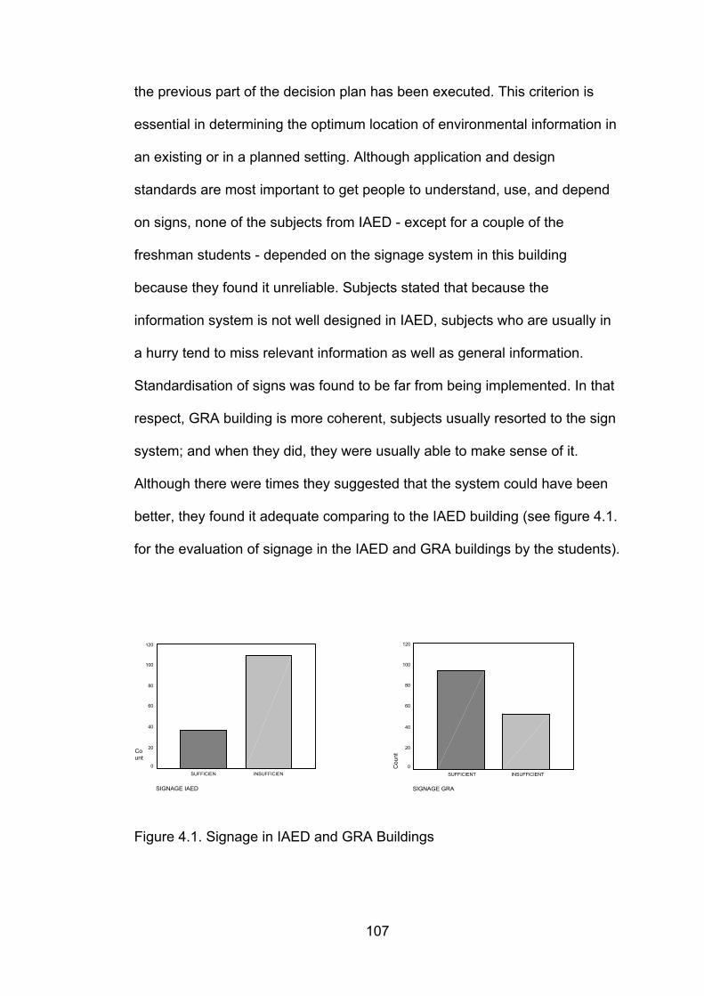
107
the previous part of the decision plan has been executed. This criterion is
essential in determining the optimum location of environmental information in
an existing or in a planned setting. Although application and design
standards are most important to get people to understand, use, and depend
on signs, none of the subjects from IAED - except for a couple of the
freshman students - depended on the signage system in this building
because they found it unreliable. Subjects stated that because the
information system is not well designed in IAED, subjects who are usually in
a hurry tend to miss relevant information as well as general information.
Standardisation of signs was found to be far from being implemented. In that
respect, GRA building is more coherent, subjects usually resorted to the sign
system; and when they did, they were usually able to make sense of it.
Although there were times they suggested that the system could have been
better, they found it adequate comparing to the IAED building (see figure 4.1.
for the evaluation of signage in the IAED and GRA buildings by the students).
Figure 4.1. Signage in IAED and GRA Buildings
SIGNAGE GRA
INSUFFICIENTSUFFICIENT
Cou
nt
120
100
80
60
40
20
0
SIGNAGE IAED
INSUFFICIENSUFFICIEN
Count
120
100
80
60
40
20
0
108
Findings indicate that spatial characteristics of the built environment affect
the level of spatial familiarity one has with the setting. It seems that spatial
familiarity also affects the amount and type of information received from the
environment. It is generally believed that people who are more familiar with a
setting are more selective and seek for particular information at certain
phases of their search, and they disregard general information about the
overall plan configuration.
The observations made in IAED building suggest that subjects who rated
themselves more familiar usually created a decision plan and followed it
either until they reached the target, or until they realised they were wrong.
Thus, there were no statistically significant differences between the fourth
year students and the first, second, and third year students, with respect to
the number of errors made. There were only slight differences among the
groups (1st year, 2nd year, 3rd year, and 4th year) regarding the errors made
during the tours, where freshman students made less errors than senior
students. This is because less familiar subjects spent more time deciding
which way to go, while more familiar subjects did not. Familiar subjects were
sure they knew where F311 was, so they kept on moving in the environment,
until they realised they were far from reaching the target. This has equated
the time it took to reach the target, there were no significant differences
between the subjects considering the time factor. Considering the time it took
to reach the target B322 in GRA building, regardless of the department, 4th
year subjects reached the target faster than the rest of the subjects which
indicates the role of increasing familiarity with the time spent. However, the
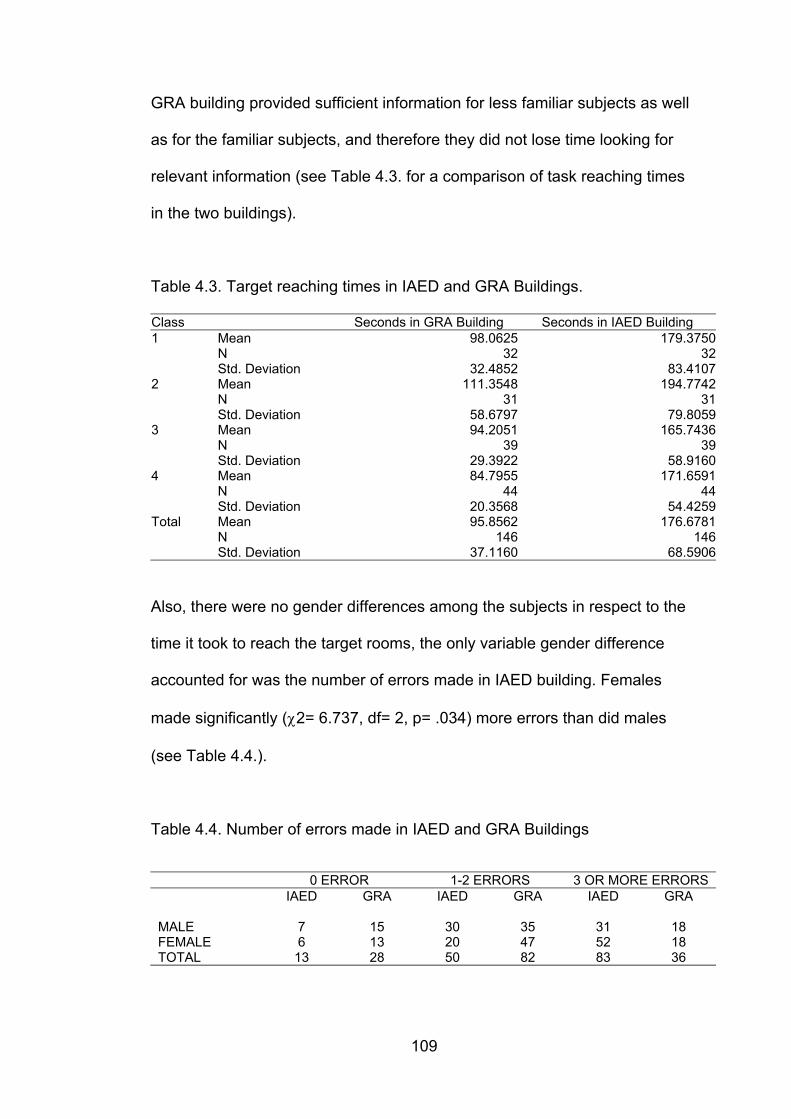
109
GRA building provided sufficient information for less familiar subjects as well
as for the familiar subjects, and therefore they did not lose time looking for
relevant information (see Table 4.3. for a comparison of task reaching times
in the two buildings).
Table 4.3. Target reaching times in IAED and GRA Buildings.
Class Seconds in GRA Building Seconds in IAED Building1 Mean 98.0625 179.3750
N 32 32Std. Deviation 32.4852 83.4107
2 Mean 111.3548 194.7742N 31 31Std. Deviation 58.6797 79.8059
3 Mean 94.2051 165.7436N 39 39Std. Deviation 29.3922 58.9160
4 Mean 84.7955 171.6591N 44 44Std. Deviation 20.3568 54.4259
Total Mean 95.8562 176.6781N 146 146Std. Deviation 37.1160 68.5906
Also, there were no gender differences among the subjects in respect to the
time it took to reach the target rooms, the only variable gender difference
accounted for was the number of errors made in IAED building. Females
made significantly (χ2= 6.737, df= 2, p= .034) more errors than did males
(see Table 4.4.).
Table 4.4. Number of errors made in IAED and GRA Buildings
0 ERROR 1-2 ERRORS 3 OR MORE ERRORSIAED GRA IAED GRA IAED GRA
MALE 7 15 30 35 31 18FEMALE 6 13 20 47 52 18TOTAL 13 28 50 82 83 36
110
People do not automatically acquire survey knowledge. Researchers have
found that even after years of daily navigation through environments,
individuals may not develop survey representations (Moeser, 1988). In cases
when the learned routes are open, optimal and simple, there is likely little
need for the development of a survey representation. This is similar to the
case in IAED building where subjects learn the basic routes, but not the
general layout. In case of a fire, what would happen if the familiar routes
were trapped? Thus, the sign system must provide a clear representation of
the setting for alternative routes in case of emergency. Even in those cases
where a survey representation would prove beneficial, it may never develop.
When a person is travelling in familiar territory, and the learned routes are
always accessible, route knowledge may be highly appropriate, making the
development of survey representations both less valuable and less likely.
Subjects in the IAED building seem to use route knowledge, because it is a
complex setting and it is easier for the subjects to learn the paths that lead to
their own classrooms and studios rather than the overall configuration.
It has been stated previously that as the route’s mental effort requirement
increases, a survey representation of the same space can be more useful. In
the IAED building, this is almost certainly a necessity, but still even the 4th
year students do not develop survey knowledge. That is, they either rate
themselves on the lower half of the familiarity scale, or they reach the
destination in the IAED building after many errors and back tracking. In the
GRA building the only prerequisite in order to find B322 was to understand
that the starting point was in A block and the target was in B block which was
111
the adjacent block. Subjects seemed to experience either little or no trouble
at all in GRA building (see Table 4.4. for a comparison of number of errors
made in IAED and GRA buildings).
Although the familiarity ratings of IAED students were generally on the lower
half of the scale (µIAED= 4.58), there were no significant differences
between the students of the other department (µGRA= 4.08).
O’Neill and Jasper (1992) state that the amount of knowledge possessed by
the consumer in a shopping environment influences spatial behaviour. Thus,
shopping patterns are initially restricted to areas on which information is
available. The scope of this pattern enlarges as the consumer learns more
about the environment. Consumers are thought to have a certain territory, or
area containing stores that they are familiar with and might patronise (O’Neill
and Jasper, 1992). The same approach may be used to explain how students
familiarise with a certain setting. Students of certain departments have
certain territories in buildings, and also students of different years (ie.
freshman vs. senior) use different parts of buildings. Preference is an
important variable although only a few studies have attempted to link
environmental preference to the processes of spatial cognition and
wayfinding (Kaplan, R., 1975,1977). People are thought to prefer
environmental features that aid spatial understanding and provide cues for
additional learning about the environment (Kaplan, S. 1975), although there
is little empirical work to substantiate this notion (see O’Neill and Jasper,
1992).

112
Acredolo (1982) suggests that high emotional arousal is related to the degree
of attention paid to the spatial information in the environment. This idea may
be applied to the university students; complex built environments may
become extremely stressing for students who are stressed most of the time
struggling with their homework and exams.
When they were asked to comment on the atmosphere of each building,
most subjects regarded IAED as monumental, luxurious, well illuminated, but
also complex and labyrinth-like. Some of the less general comments were
cold and uninviting, probably by subjects who associated crowding in spaces
with a sense of warmth and hospitality. And the GRA building was referred as
a dull, dark and old as well as cosy and simple in that respect (see figure 4.2.
for comparison of plan configuration of IAED and GRA buildings).
Figure 4.2. Plan Configuration of IAED and GRA Buildings.
Subjects tended to comment on the housekeeping and maintenance of the
WC’s, how dark the studios were, and the heating of the building although
Evaluation of Plan Configuration GRA
COMPLEXSIMPLE
Cou
nt
140
120
100
80
60
40
20
0
Evaluation of Plan ConfigurationIAED
COMPLEXSIMPLE
Cou
nt
140
120
100
80
60
40
20
0
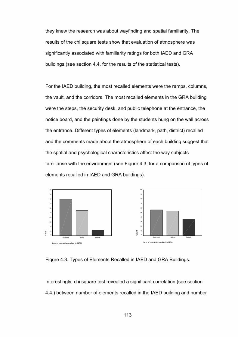
113
they knew the research was about wayfinding and spatial familiarity. The
results of the chi square tests show that evaluation of atmosphere was
significantly associated with familiarity ratings for both IAED and GRA
buildings (see section 4.4. for the results of the statistical tests).
For the IAED building, the most recalled elements were the ramps, columns,
the vault, and the corridors. The most recalled elements in the GRA building
were the steps, the security desk, and public telephone at the entrance, the
notice board, and the paintings done by the students hung on the wall across
the entrance. Different types of elements (landmark, path, district) recalled
and the comments made about the atmosphere of each building suggest that
the spatial and psychological characteristics affect the way subjects
familiarise with the environment (see Figure 4.3. for a comparison of types of
elements recalled in IAED and GRA buildings).
Figure 4.3. Types of Elements Recalled in IAED and GRA Buildings.
Interestingly, chi square test revealed a significant correlation (see section
4.4.) between number of elements recalled in the IAED building and number
type of elements recalled in GRA
districtspathslandmark
Cou
nt
100
90
80
70
60
50
40
30
20
10
0
type of elements recalled in IAED
districtspathslandmark
Cou
nt
100
90
80
70
60
50
40
30
20
10
0
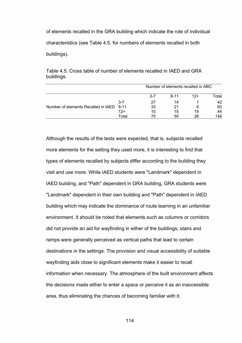
114
of elements recalled in the GRA building which indicate the role of individual
characteristics (see Table 4.5. for numbers of elements recalled in both
buildings).
Table 4.5. Cross table of number of elements recalled in IAED and GRAbuildings.
Number of elements recalled in ABC
3-7 8-11 12+ Total3-7 27 14 1 42
Number of elements Recalled in IAED 8-11 33 21 6 6012+ 10 15 19 44Total 70 50 26 146
Although the results of the tests were expected, that is, subjects recalled
more elements for the setting they used more, it is interesting to find that
types of elements recalled by subjects differ according to the building they
visit and use more. While IAED students were "Landmark" dependent in
IAED building, and "Path" dependent in GRA building, GRA students were
"Landmark" dependent in their own building and "Path" dependent in IAED
building which may indicate the dominance of route learning in an unfamiliar
environment. It should be noted that elements such as columns or corridors
did not provide an aid for wayfinding in either of the buildings, stairs and
ramps were generally perceived as vertical paths that lead to certain
destinations in the settings. The provision and visual accessibility of suitable
wayfinding aids close to significant elements make it easier to recall
information when necessary. The atmosphere of the built environment affects
the decisions made either to enter a space or perceive it as an inaccessible
area, thus eliminating the chances of becoming familiar with it.
115
5. CONCLUSION
This thesis has aimed to explore spatial familiarity to define factors affecting it
in relation to wayfinding in real environments. It has been found that the
complexity, visual accessibility and the amount of interaction with the built
environment have influence on spatial familiarity and thus wayfinding. It has
also been found that the type of elements (i.e. landmarks, paths, districts,
etc.) differ according to the building design; the adequacy of the signage
system can be compensated by the plan configuration; and spatial ability as
a factor influencing spatial familiarity also affects evaluation of the buildings.
It can be suggested that spatial familiarity can be distinguished into three
main parts:
1. spatial characteristics of the built environment (existence of useful
landmarks, signage, and visual accessibility),
2) individual characteristics (gender, spatial ability, field of education),
3) and interaction with the built environment (amount of time spent in the
built environment and frequency of interaction).
The results of the study have pointed out that spatial familiarity has a
complicated structure that affects the way individuals perceive the space
surrounding them and that these individual differences cannot be explained
by the self-evaluations of the subjects alone. It is necessary to take into
account the individual evaluations (familiarity ratings, evaluation of building
116
configuration, etc.) as well as the demographic (age, sex, etc.) means to
assess spatial familiarity. Familiarity ratings for the buildings were
significantly correlated with wayfinding ratings, number of elements recalled
and initial preference in the GRA building, and evaluation of the atmosphere
of the IAED building.
The findings of this study have interesting implications for further studies. For
example, although the skylights, plants and paintings on the fifth office floor
in IAED building were thought as landmarks prior to the study, they were not
recognised as reference points by most of the subjects. A reason for this may
be that this floor is not visited by the majority of the subjects, it is visually
inaccessible, and is mostly used by the instructors. Here the question of
whether this is a design impediment or not arises. Is it a necessity for the
users to know the building by all means? When one rates him or her self as
“very familiar” or “not familiar at all” with a setting, is this a plausible
statement? Are we using the same criteria for the evaluation of spatial
familiarity? The findings seem to indicate that we are not. Self-evaluation for
familiarity did not predict number of errors made during the target reaching
task; it only predicted number of elements recalled for IAED building, but not
for GRA building. On the other hand, frequency of visit and number and type
of elements recalled were significantly correlated. Once again, there were
differences between the subjects of the two different departments regarding
the number and type of elements recalled in each building due to variables
such as frequency of visit and time spent in each building. These findings
point that spatial familiarity cannot be evaluated strictly through subjects’ self-
117
evaluation, because ratings are not objective. People can under - or over-
estimate their performances when confronted with the idea of being tested.
Also, the ramps at the entrances of the two wings of IAED building were
recalled as a landmark by most of the subjects because they were unique
and visually accessible. But, because they did not lead the subjects to any
specific destination, they did not meet the exact function of a landmark.
Therefore, it is suggested that all aspects of a built environment that are
unique and well remembered do not serve as a functional wayfinding aid.
The atmosphere of the built environment can be interpreted in different ways
by the users, sometimes appealing, inviting, encouraging to investigate, and
sometimes aversive, restrictive, distant and inaccessible. Materials, colours,
plan configuration and boundaries of the built environment impose different
feelings on the users. These feelings are part of the cognitive process that
take place during wayfinding and affect the individuals’ decision plans. During
the task reaching experiments a majority of the subjects did not use the
tearoom used by the instructors although it was a shortcut to the final
destination either because they knew (students of IAED) or felt (students of
GRA) that the area was restricted (see Appendix E10). Another interesting
point that deserves attention is that the majority of the subjects that used the
tearoom as a shortcut were females, it seems necessary to focus on why
more females than males have intruded a restricted space. Most studies (see
Lawton, 1994; Malinowski and Gillespie, 2001) point that males are superior
to females in wayfinding tasks, this study did not find such a result.
118
The interviews revealed that most of the subjects referred to the IAED
building as a luxurious setting. While some of the subjects suggested that
this characteristic created a warm and inviting atmosphere, some stated that
the very same characteristic made them feel unwanted. One common point
about the building was that most of the subjects rated the building as
complex and difficult from wayfinding point of view. These different feelings
about this setting may explain the differential results obtained from the
experiment regardless of the frequency of interaction with the building.
Although the GRA building was usually referred as a dark and dull
environment, it was still evaluated as easy for wayfinding, and simple from
plan configuration point. It is not possible to make a final statement how the
atmosphere of the built environment affects wayfinding. It is obvious that the
atmosphere creates different feelings for individuals, but the degree of this
effect on spatial familiarity and thus wayfinding needs further investigation.
The issue of repetitive floor plans in the built environments is quite
interesting; while it is accepted as a positive design decision to provide
uniform plans on different floors of a setting, it is also perilous to create
standard configurations for spaces with different functions. This study took
place in two different settings with a common point of having uniform floor
plans; subjects reported that the uniformity of the office floors of IAED made
it difficult to differentiate, while the same design attitude did not create too
many problems in GRA building comparing to IAED. Student paintings,
sculptures, models etc. were found beneficial in creating architectural
differentiation between the spaces in the GRA building. Visual accessibility
119
was also found a positive attribute of the GRA building that provided a
wayfinding aid when architectural differentiation of the spaces were less.
The analyses and results of the study suggest that spatial familiarity with the
built environment is a complex issue that cannot be measured by self-
evaluations of subjects alone. Rather, the issue should be handled in
collaboration with a variety of factors such as spatial ability, experience in
related tasks, sex, frequency of visit to the space, plan configuration, amount
of useful landmarks, architectural differentiation, visual accessibility and
atmosphere of the building. Designers should provide the users with
psychologically and physically satisfying, comfortable, and safe
environments. Of course not all users have to become spatially familiar with
the spaces they use, but aiming for environments that are browsed without
getting lost and easily remembered create spaces that prevent unnecessary
loss of time caused by trying to reach a destination and are easy to exit at
times of emergency. This is a hard task to be accomplished when the issue
of creating a satisfactory design solution for the built environment from the
aesthetical and functional point of view is considered. Designing a legible and
appealing environment all together requires a deeper consideration of many
issues, including spatial familiarity and wayfinding. An optimum level of
design solutions for spatial familiarity and wayfinding can be achieved by
simultaneously involving the interior architects and graphic designers along
with the architects in the beginning of the design phase of settings.
120
6. REFERENCES
Abu-Ghazzeh, T. M. (1996). Movement and Wayfinding in the King Saud UniversityBuilt Environment: A look at Freshman Orientation and EnvironmentalInformation. Journal of Environmental Psychology, 16, 303-318.
Abu-Obeid, N. (1998). Abstract and Scenographic Imagery: The Effect ofEnvironmental Form on Wayfinding. Journal of Environmental Psychology, 18,159-173.
Acredolo, L. P. (1982). The Familiarity Factor in Spatial Research. In R. Cohen (Ed.),Children’s Conceptions of Spatial Relationships. San Francisco: Josey-Bass.
Aitken, S. C. and Prosser, R. (1990). Residents’ spatial knowledge of neighbourhoodcontinuity and form. Geographical Analysis, 22 (4), 301-325.
Aitken, S. C., Stutz, F., Prosser, R., and Chandler, R. (1993). Neighbourhood integrityand residents’ familiarity: Using geographic information system to investigateplace identity. Tijdschrift voor Economische en Sociale Geographie, 84 (1),2-12.
Allen, G. L. (1999). Spatial Abilities, Cognitive Maps and Wayfinding: Bases forIndividual Differences in Spatial Cognition and Behavior. In R. G. Golledge(Ed.), Wayfinding Behavior: Cognitive Mapping and Other Spatial Processes(pp. 46-80). Baltimore: The Johns Hopkins University Press.
Appleyard, D. (1969). Styles and Methods of Structuring a City. Environment andBehavior, 2, 100-117.
Appleyard, D. (1970). Why Buildings are Known: A Predictive Tool for Architects andPlanners. Environment and Behavior, 1, 131-156.
Appleyard, D. (1976) Planning a Pluralistic City: Conflicting Realities in CiudadGuyana. Cambridge, MA: MIT Press.
Arthur, P, and R. Passini. (1992). Way-finding: People, Signs and Architecture.New York : Mc. Graw-Hill.
Axia, G., Baroni, M. R., and Mainardi Peron, E. (1988). Representation of familiarplaces in children and adults: Verbal reports as a method for studyingenvironmental knowledge. Journal of Environmental Psychology, 8, 123-139.
Banerjee, T. K. (1972). Urban Experience and the Development of City Image: Astudy in Environmental Perception and Learning. (Doctoral Dissertation,Massachusetts Institute of Technology, 1971). Dissertation AbstractsInternational, 32.335.
121
Beguin, H. and , L. V. Romero. (1996). Individual Cognition of Urban NeighbourhoodsOver Space and Time: A Case Study. Environmental and Planning A,28, 687-708.
Berry, J. W. and N. Kostovich. (1983). Psychological Adaptation of Malay Students inCanada. Paper presented at third Asian Regional Conference of IACCP, KualaLumpur.
Bliss, J. P., Tidwell, P. D., and Guest, M. A. (1997). The effectiveness of virtual realityfor administering spatial navigation training for firefighters. Presence, 6, 73-86.
Bronzaft, A and S. Dobrow. (1984). Improving Transit Information. Journal ofEnvironmental Systems, 13, 365-375.
Bryant, K. J. (1982). Personality Correlates of Sense of Direction and GeographicalOrientation. Journal of Personality and Social Psychology, 43, 1318-1324.
Butcher, E. G. and Parnell, A. C. (1983). Designing for Fire Safety. New York: JohnWiley.
Chalmers, D. J. and Knight, R. G. (1985). The Reliability of Ratings of Familiarity ofEnvironmental Stimuli: A Generalizability Analysis. Environment and Behavior,17 (2), 223-238.
Cohen, R., D. L. Weatherford, T. Lomenick and Koeller, K. (1979). Development ofSpatial Representations: Role of Task Demands and Familiarity with theEnvironment. Child Development, 50, 1257-1260.
Cornell, E. H., C. D. Heth, and Skoczylas, M. J. (1999). The Nature and Use of RouteExpectancies Following Incidental Learning. Journal of EnvironmentalPsychology, 19, 209-229.
Darken, R. P. and Sibert, J. L. (1996). Wayfinding Strategies and Behaviors in LargeVirtual Worlds. submitted to ACM SIGCHI. Retrieved November 9, 1999, fromhttp://www.seas.gwu.edu/faculty/sibert/d...ublications/strategies_CHI96/method.html.
De Jonge, D. (1962). Images of Urban Areas: Their Structure and PsychologicalFoundations. Journal of American Institute of Planners, 28, 266-276.
Devlin, A. S. and Bernstein, J. (1997). Interactive Way-finding: Map Style andEffectiveness. Journal of Environmental Psychology, 17, 99-110.
Doğu, U. and Erkip, F. (2000). Spatial Factors Affecting Wayfinding and Orientation: ACase Study in a Shopping Mall. Environment and Behavior, 32 (6), 731-755.
Downs, R. M. and Stea, D. (1977). Maps in Minds: Reflections on Cognitive Mapping.New York: Harper and Row.
122
Evans, G. W. (1980). Environmental Cognition. Psychological Bulletin, 88 (2),259-287.
Evans, G. W. (1982). Environmental Stress. New York: Cambridge University Press.
Evans, G. W. and Mc Coy, J. M. (1998). When Buildings Don't Work: The Role ofArchitecture in Human Health. Journal of Environmental Psychology,18, 85-94.
Evans, G W, Smith, C., and Pezdek, K. (1982). Cognitive Maps and Urban Forms.Journal of the American Planning Association, 48, 232-244.
Evans, G. W., Marrero, D. G., and Butler, P. A. (1981). Environmental Learningand Cognitive Mapping. Environment and Behavior, 13 (1), 232-244.
Evans, G. W., Fellows, J., Zorn, M., and Doty, K. (1980). Cognitive Mapping andArchitecture. Journal of Applied Psychology, 65 (4), 474-478.
Francescato, D. and Mebane, W. (1973). How Citizens View Two Great Cities: Milanand Rome. In R. Downs and D. Stea (Eds.), Image and Environment. Chicago:Aldine.
Gale, N., Golledge, R. G., Halperin, W. C., and Couclelis, H. (1990a). ExploringSpatial Familiarity. Professional Geographer, 42 (3) 299-313.
Gale, N., Golledge, R. G., Pellegrino, J. W., and Doherty, S. E. (1990b). TheAcquisition and Integration of Route Knowledge in an UnfamiliarNeighbourhood. Journal of Environmental Psychology, 10, 3-25.
Gardner, H. (1983). Frames of Mind. New York: Basic Books.
Garling, T., Book, A., and Ergezen, N. (1982). Memory for Spatial Layout of theEveryday Physical Environment: Differential Types of Information. Journal ofEnvironmental Psychology, 23, 23-35.
Garling, T., E. Lindberg, and Mantyla, T. (1983). Orientation in Buildings: Effects ofFamiliarity, Visual Access, and Orientation Aids. Journal of AppliedPsychology, 68, 177-186.
Garling, T., Book, A., and Lindberg, E. (1984). Cognitive Mapping of Large-scaleEnvironments: The Interrelationship of Action Plans, Acquisition, andOrientation. Environment and Behavior, 16 (1), 3-34.
Garling, T., Book, A., and Lindberg, E. (1986). Spatial Orientation and Wayfinding inthe Designed Environment. Journal of Architectural Planning Research,3, 55-64.
Gibson, J. J. (1979). The Ecological Approach to Visual Perception. Boston:Houghton Mifflin.
123
Golledge, R. G. (1991). Cognition of physical and built environments. In T. A.Garling and W. Evans (Eds.), Environment, Cognition and Action: An IntegratedApproach. (pp. 35-62). New York: Oxford University Press.
Golledge, R. G. (1999). Human Wayfinding and Cognitive Maps. WayfindingBehavior: In R. G. Golledge (Ed.), Cognitive Mapping and Other SpatialProcesses. Baltimore: The Johns Hopkins University Press.
Golledge, R. G. and Stimpson, R. J. (1997). Spatial Behavior: A GeographicPerspective. New York: Guild Press.
Hart, R. and Moore, G. T. (1973). The Development of Spatial Cognition: A Review.In R. M. Downs and D. Stea (Eds.), Image and Environment (pp. 246-288).Chicago: Aldine.
Hayes-Roth, B. and Hayes-Roth, F. (1979). A Cognitive Model of Planning.Cognitive Science, 3, 275-310.
Heft, H. (1979). Wayfinding as the Perception of Information over time. Populationand Environment, 6, 133-150.
Hirtle, S. C. and Sorrows, M. E. (1998). Designing a Multi-Modal Tool for LocatingBuildings on a College Campus. Journal of Environmental Psychology, 18,265-276.
Infield, S. D. (1991). An Investigation into the Relationship Between Navigation Skilland Spatial Abilities. Doctoral Dissertation. University of Washington.
Kaplan R. (1975). Some Methods and Strategies in the Prediction of Preference. In E.Zube, R. O. Brush, and J. G. Fabos (Eds.), Landscape Assessment: Values,Perceptions, and Resources (pp. 118-129). Stroudsburg, PA: Dowden,Hutchinson and Ross.
Kaplan, R. (1977). Preference and the Everyday Nature: Method and Application. InD. Stockols (Ed.), Perspectives on Environment and Behavior: Theory,Research, and Application (pp. 235-250). New York: Plenum.
Kaplan, S. (1975). An Informal Model for the Prediction of Preference. In E.Zube, R. O. Brush, and J. G. Fabos (Eds.), Landscape Assessment: Values,Perceptions, and Resources (pp. 130-145). Stroudsburg, PA: Dowden,Hutchinson and Ross.
Kaplan, S. (1983). A Model of Person – Environment Compatibility. Environment andBehavior, 15 (3), 311-332.
Kaplan, S. and Kaplan, R. (1982). Humanscape: Environments for people. AnnArbor, MI: Ulrich’s Books, Inc.
Kit of Factor-Referenced Cognitive Tests. (1976). Princeton, NJ: EducationalTesting Service.
124
Kitchin, R. M. (1994a). Spatial Familiarity as a Variable in Cognitive Mapping.Swansea Geographer, 31, 42-52.
Kitchin, R. M. (1994b). Cognitive Maps: What Are They and Why Study Them?Journal of Environmental Psychology, 14, 1-19.
Lang, J. (1987). Creating Architectural Theory. New York: Van Nostrand Reinhold.
Lawton, C. A. (1994). Gender Differences in Way-finding strategies: Relationship toSpatial Ability and Spatial Anxiety. Sex Roles, 30 (11/12), 177-193.
Lawton, C. A. (1996). Strategies for Indoor Way-finding: The Role of Orientation.Journal of Environmental Psychology, 16, 137-145.
Lawton, C. A., Charleston, S. I., and Zieles, A. S. (1996). Individual -and Gender-Related Differences in Indoor Wayfinding. Environment and Behavior,16 (2), 139-157.
Levine, M., Marchon, I., and Hanley, G. (1984). The Placement and Misplacement ofYou-Are-Here Maps. Environment and Behavior, 28 (2), 204-219.
Lindberg, E. and Garling, T. (1982). Acquisition of Locational Information AboutReference Points During Locomotion: The Role of Central InformationProcessing. Scandinavian Journal of Psychology, 23, 207-218.
Lynch, K. (1960). The Image of the City. Cambridge, MA: The Technology Press andHarvard University Press.
Mainardi-Peron, E., Baroni, M. R., Job, R., and Salmaso, P. (1984). CognitiveStrategies in Remembering and Describing Unfamiliar Places. Paper presentedat IAPS 8 (International Association for the Study of People and Their PhysicalSurroundings), West Berlin.
Mainardi-Peron, E., Baroni, M. R., Job, R., and Salmaso, P. (1985). Cognitive Factorsand Communicative Strategies in Recalling Unfamiliar Places. Journal ofEnvironmental Psychology, 5, 325-333.
Mainardi-Peron, E., Baroni, M. R., Job, R., and Salmaso, P. (1990) Effects ofFamiliarity in Recalling Interiors and External Places. Journal of EnvironmentalPsychology, 10, 255-271.
Malinowski, J. C. and Gillespie, W. T. (2001). Individual Differences in Performanceon a Large-scale, Real-world Wayfinding Task. Journal of EnvironmentalPsychology, 21, 73-82.
Moeser, S. D. (1988). Cognitive Mapping in a Complex Building. Environment andBehavior, 20 (1), 21-49.
Montello, D. (1991). Spatial Orientation and the Angularity of Urban Routes: A FieldStudy. Environment and Behavior, 23 (1), 47-69.
125
Moore, G. T. (1979). Knowing About Environmental Knowing: The Current State ofTheory and Research on Environmental Cognition. Environment and Behavior,11, 33-70.
Newcomb, N. and Dubas, J. S. (1992). A Longitudinal Study of Predictors of SpatialAbility in Adolescent Females. Child Development, 63, 37-46.
Ng, C. F. (1998). Canada as a New Place: The Immigrants’ Experience. Journal ofEnvironmental Psychology, 18, 55-67.
O’ Neill, M. J. (1992). Effects of Familiarity and Plan Complexity on Wayfinding inSimulated Buildings. Journal of Environmental Psychology, 12, 319-327.
O’ Neill, M. J. (1991a). Effects of Signage and Floor Plan Configuration on Way-finding Accuracy. Environment and Behavior, 23 (5), 553-574.
O’ Neill, M. J. (1991b). Evaluation of a Conceptual Model of Architectural Legibility.Environment and Behavior, 23 (3), 259-284.
O`Neill, M. J. and Jasper, C. R. (1992). An Evaluation of Models of Consumer SpatialBehaviour Using the Environment-Behaviour Paradigm. Environment andBehaviour, 24 (4), 411-440.
Passini, R. (1984a). Way-finding in Architecture New York: Van Nostrand Reinhold.
Passini, R. (1984b). Spatial Representations: A Wayfinding Perspective. Journal ofEnvironmental Psychology, 4, 153-164.
Passini, R. (1995). Spatial representations, a Wayfinding Perspective. In T. Garling(Ed.), Readings in Environmental Psychology: Urban Cognition (pp. 139-150).London: Academic Press.
Passini, R. (1996). Wayfinding Design: Logic, Application and Some Thoughts onUniversality. Design Studies, 17, 319-331.
Passini, R., Joanette Y., Rainville C., and Marchand, N. (1995). Dementia of theAlzheimer Type and spatial disorientation. Brain and Cognition, 28, 109-117.
Passini, R., Pigot, H., Rainville, C., and Tetreault, M. H. (2000). Wayfinding in aNursing Home for Advanced Dementia of the Alzheimer’s Type. Environmentand Behavior, 32 (5), 684-710.
Passini, R., Rainville, C., Marchand, N., and Joanette, Y. (1998). Wayfinding andDementia: Some Research Findings and a New Look at Design. Journal of Architectural and Planning Research, 15 (2), 133-151.
Peponis, J., Zimring, C., and Choi, Y. K. (1990). Finding the Building in Way-finding.Environment and Behavior, 22, 555-590.
126
Peterson, B. (1998). The Influence of Whole-Body Interaction of Wayfinding in VirtualReality. Masters Thesis, University of Washington: Seattle.
Prestopnik J. L. and Roskos-Ewoldsen, B. (2000). The Relations Among WayfindingStrategy Use, Sense of Direction, Sex, Familiarity, and Wayfinding Ability.Journal of Environmental Psychology, 20, 177-191.
Ramadier, T. and Moser, G. (1998). Social Legibility, The Cognitive Map and UrbanBehaviour. Journal of Environmental Psychology, 18, 307-319.
Rossano, M. J., West, S. O., Robertson, T. J., Wayne, M. C., and Chase, R. B. (1999).The Acquisition of Route and Survey Knowledge from Computer Models.Journal of Environmental Psychology, 19, 101-115.
Rovine, M. and Weisman, G. D. (1989). Sketch-map Variables as Predictors ofWayfinding Performance. Journal of Environmental Psychology, 9, 217-232.
Satalich, G. A. (1996). Navigation and Wayfinding in Virtual reality: Finding ProperTools and Cues to Enhance Navigation Awareness. Retrieved November 9,1999, fromhttp://www.hitl.washington.edu/publications/satalich/home.html.
Self, C. M., Gopal, S., Golledge, R. G. and Fenstermaker, S. (1992). Gender-relateddifferences in spatial abilities. Progress in Human Geography, 16, 315-342.
Siegel, A. and White, S. (1975). The Development of Spatial Representations ofLarge-Scale Environments. Advances in Child Development and Behavior. Ed.H. W. Reese. New York: Academic Press, 10, 9-55.
Sime, J. (1985). Movement Toward the Familiar: Person and Place Affiliation in a FireEntrapment Setting. Environment and Behavior, 17 (6), 697-724.
Sims, M. (1991). Sign Design – Graphics, Materials, Techniques. New York: Thamesand Hudson.
Stea, D. (1969). Environmental Perception and Cognition: Toward a Model for MentalMaps. In G. Coates, and K. Moffett (Eds.), Response to Environment. Raleigh:North Carolina State University Press.
Stockols, D. and Schumaker, S. A. (1981). People in Places: A Transactional View ofSettings. In J. Harvey (Ed.), Cognition and Social Behavior, and theEnvironment. Hillsdale, NJ: Erlbaum.
Thorndyke, P. W. and Hayes-Roth, B. (1982). Differences in Spatial KnowledgeAcquired From Maps and Navigation. Cognitive Psychology, 14, 560-589.
Tlauka, M. and Wilson, P. N. (1996). Orientation-Free Representations fromNavigation Through a Computer-Simulated Environment. Environment andBehavior, 28, 647-664.
127
Weisman, J. (1981). Evaluating Architectural Legibility. Environment and Behavior,13 (2), 189-204.
Weisman, J. (1987). Improving Way-finding and Architectural Legibility in Housing forthe Elderly. In V. Regnier and J. Pynoos (Eds.), Housing the Aged: DesignDirectives and Policy Considerations (pp.441-464). New York: Elseiver.
Wener, R. and Kaminoff, R. (1983). Improving Environmental Information: Effects ofSigns on Perceived Crowding and Behaviour. Environment and Behavior, 15,3-20.
Wright, P., Hull, A. J., and Lickorish, A. (1993). Navigating in a Hospital Outpatients’Department: The Merits of Maps and Wall Signs. Journal of Architectural andPlanning Research, 10 (1), 76-89.

APPENDICES
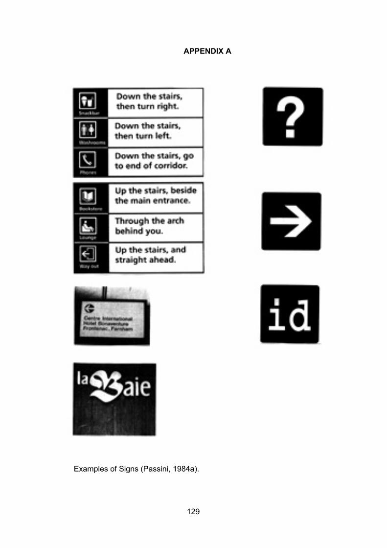
129
APPENDIX A
Examples of Signs (Passini, 1984a).
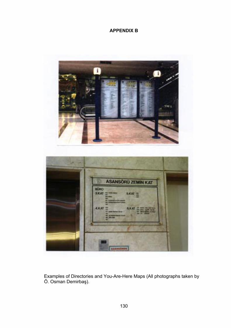
130
APPENDIX B
Examples of Directories and You-Are-Here Maps (All photographs taken byÖ. Osman Demirbaş).
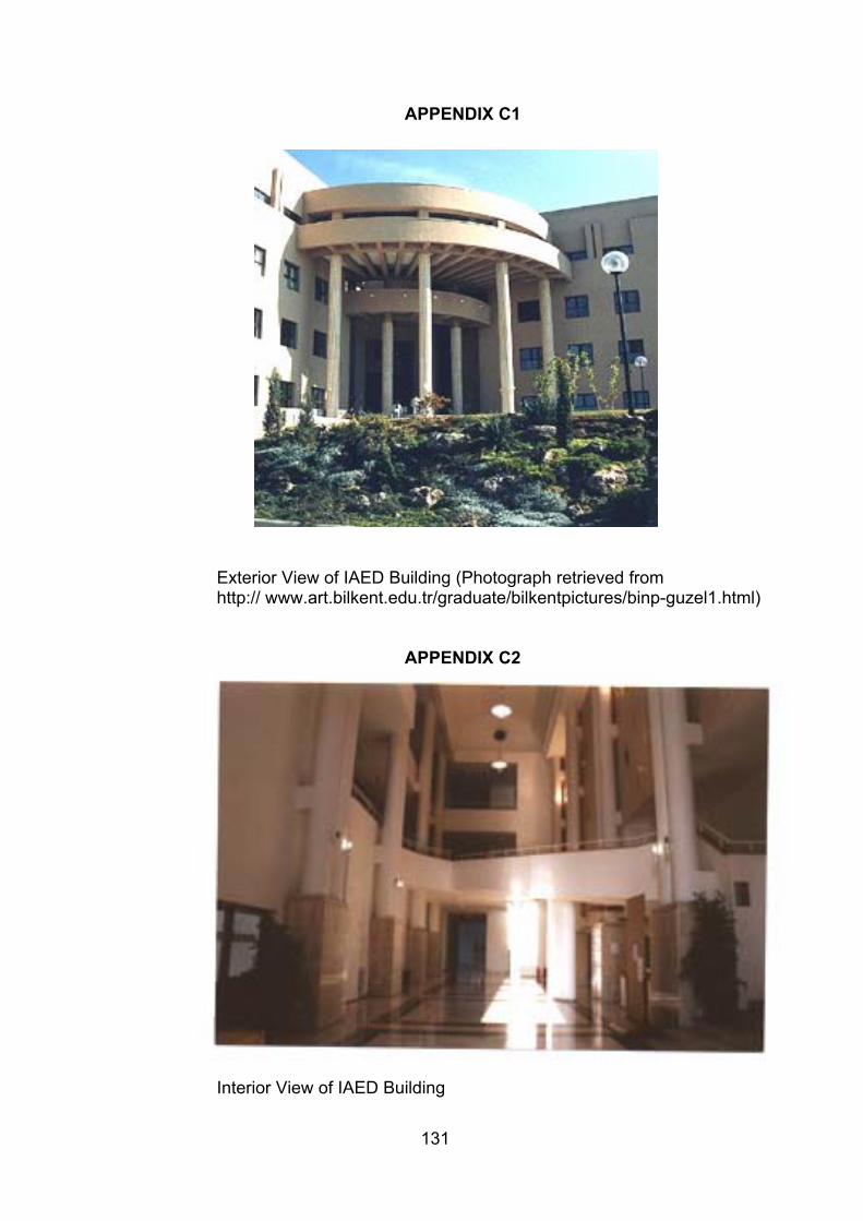
131
APPENDIX C1
Exterior View of IAED Building (Photograph retrieved fromhttp:// www.art.bilkent.edu.tr/graduate/bilkentpictures/binp-guzel1.html)
APPENDIX C2
Interior View of IAED Building
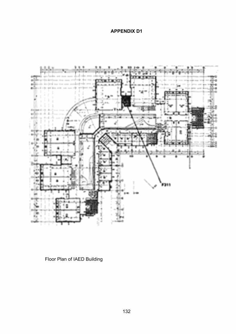
132
APPENDIX D1
Floor Plan of IAED Building
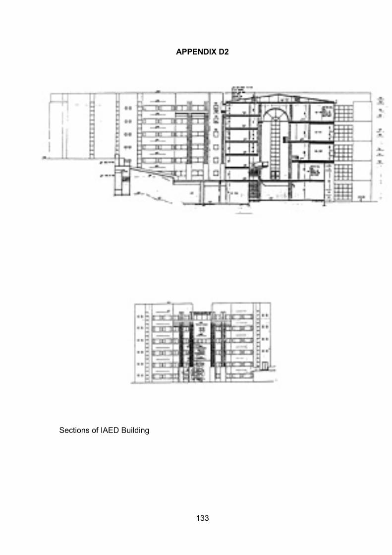
133
APPENDIX D2
Sections of IAED Building
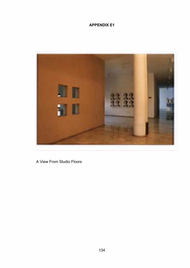
134
APPENDIX E1
A View From Studio Floors
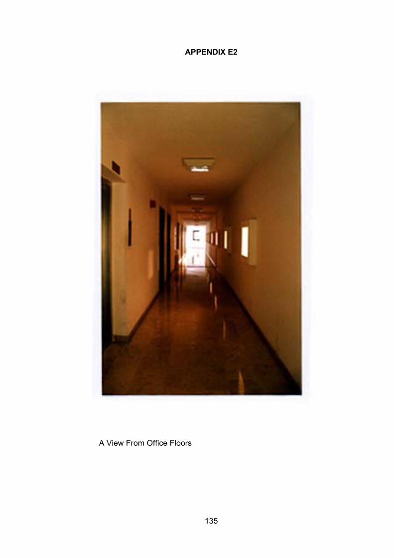
135
APPENDIX E2
A View From Office Floors
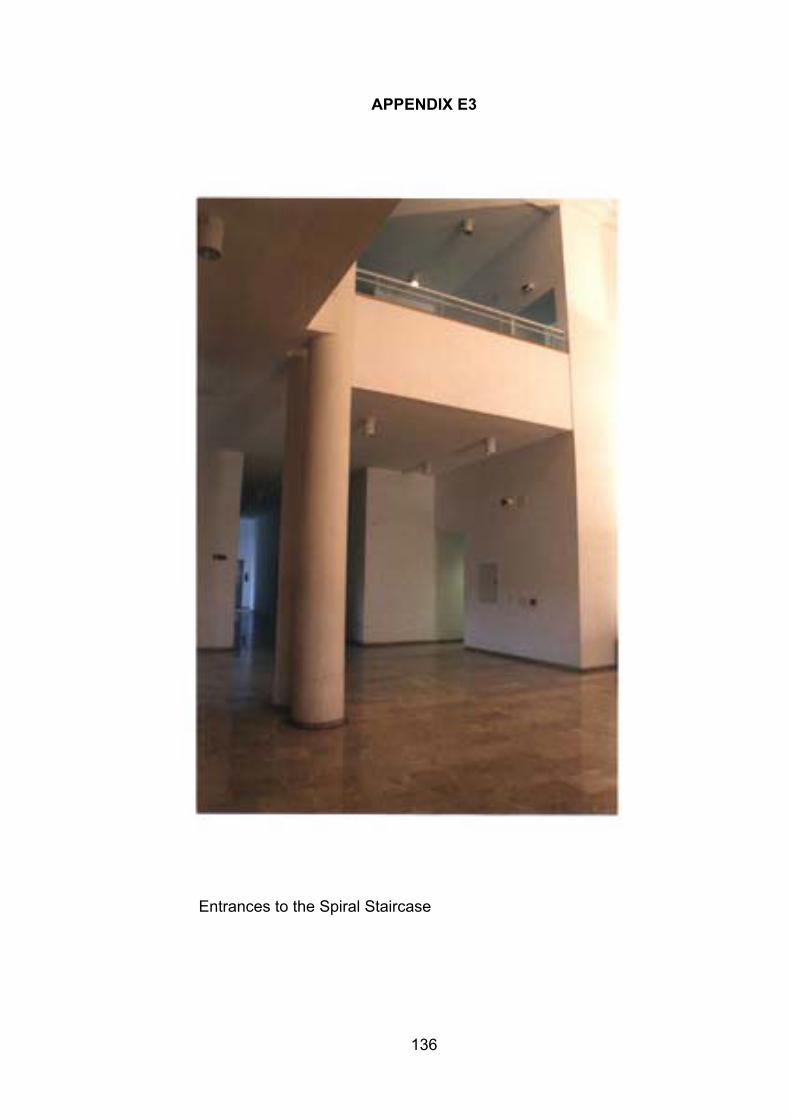
136
APPENDIX E3
Entrances to the Spiral Staircase
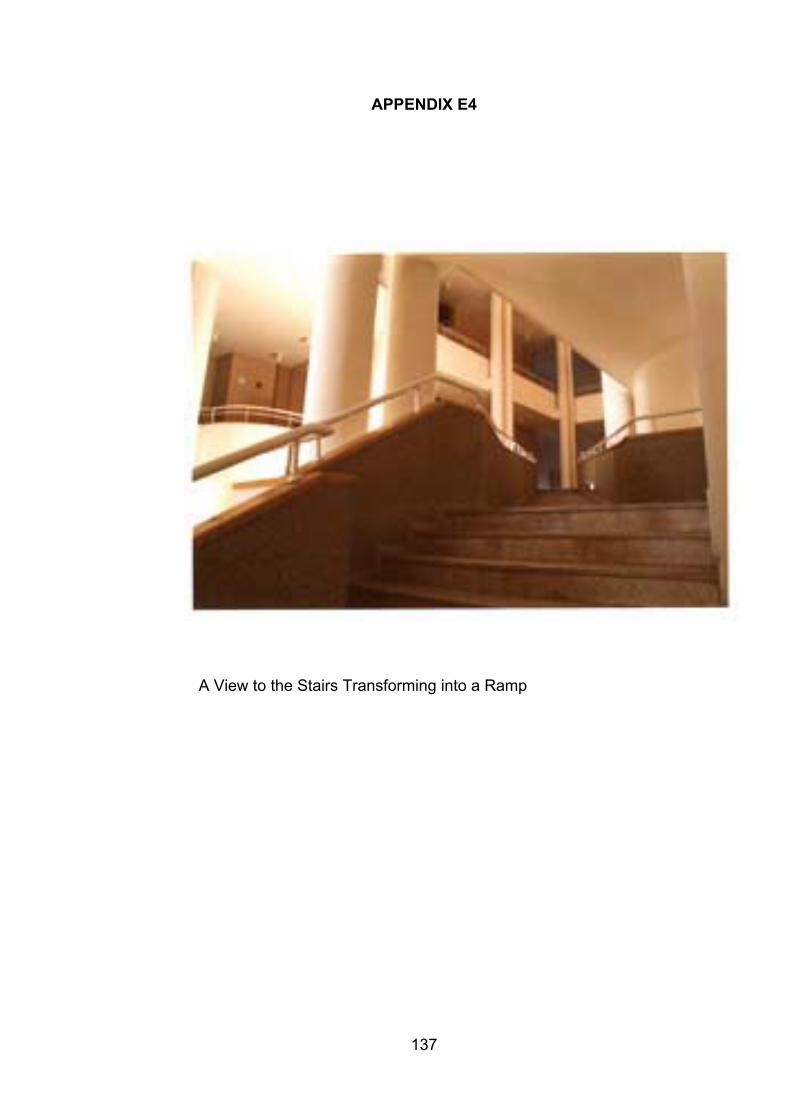
137
APPENDIX E4
A View to the Stairs Transforming into a Ramp
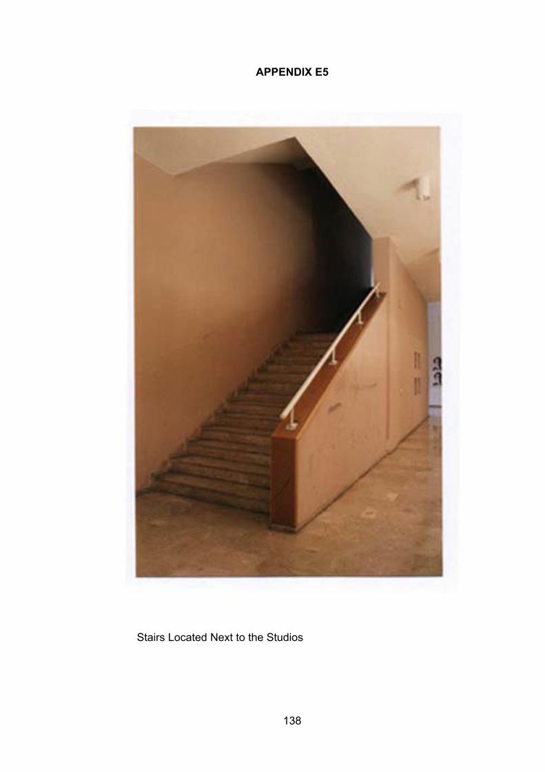
138
APPENDIX E5
Stairs Located Next to the Studios
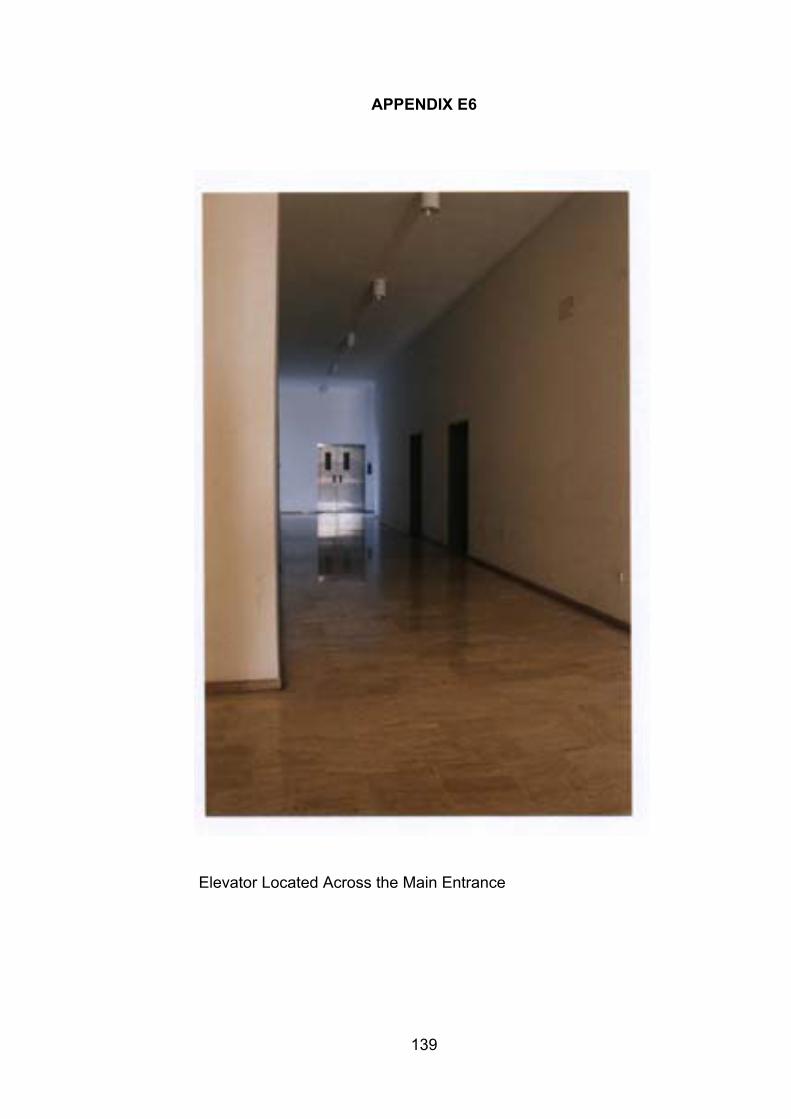
139
APPENDIX E6
Elevator Located Across the Main Entrance
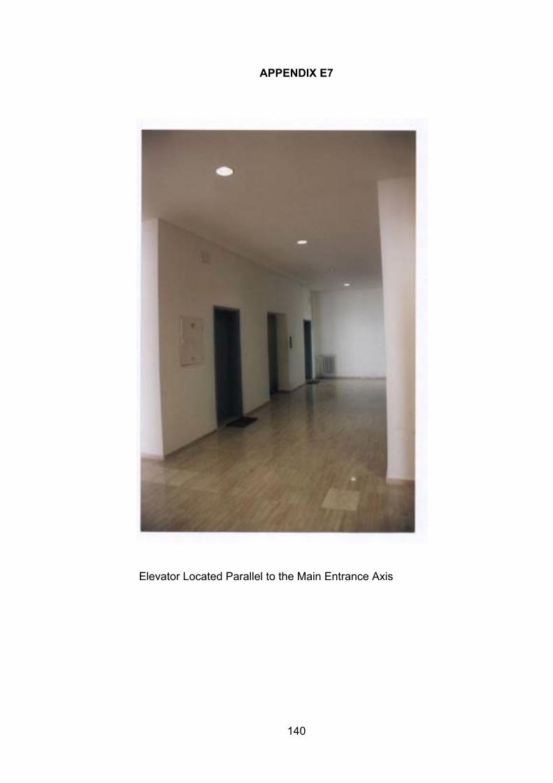
140
APPENDIX E7
Elevator Located Parallel to the Main Entrance Axis
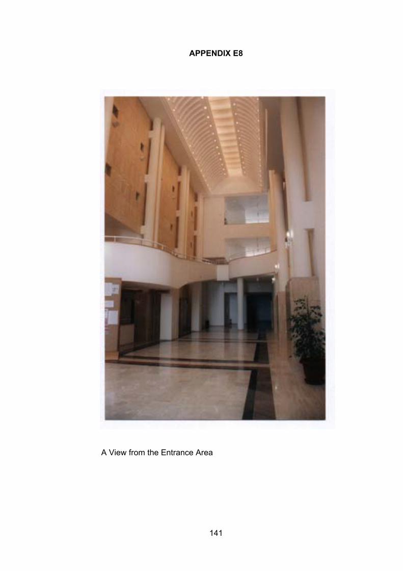
141
APPENDIX E8
A View from the Entrance Area
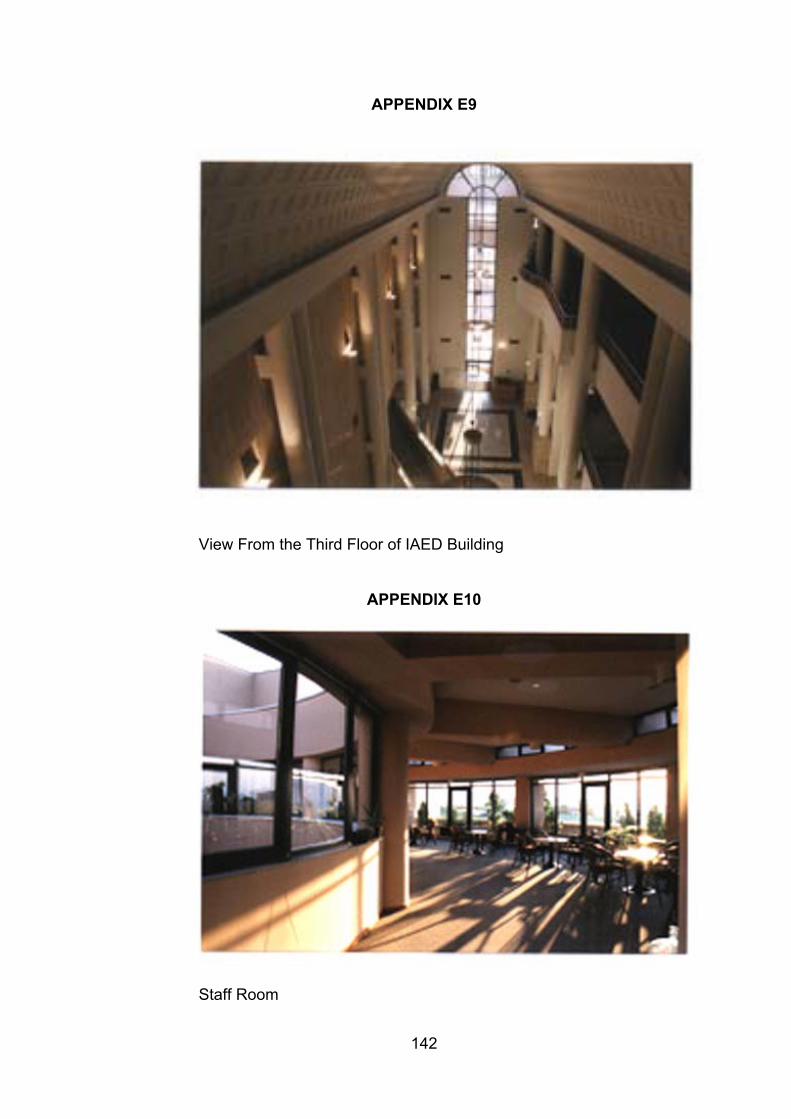
142
APPENDIX E9
View From the Third Floor of IAED Building
APPENDIX E10
Staff Room
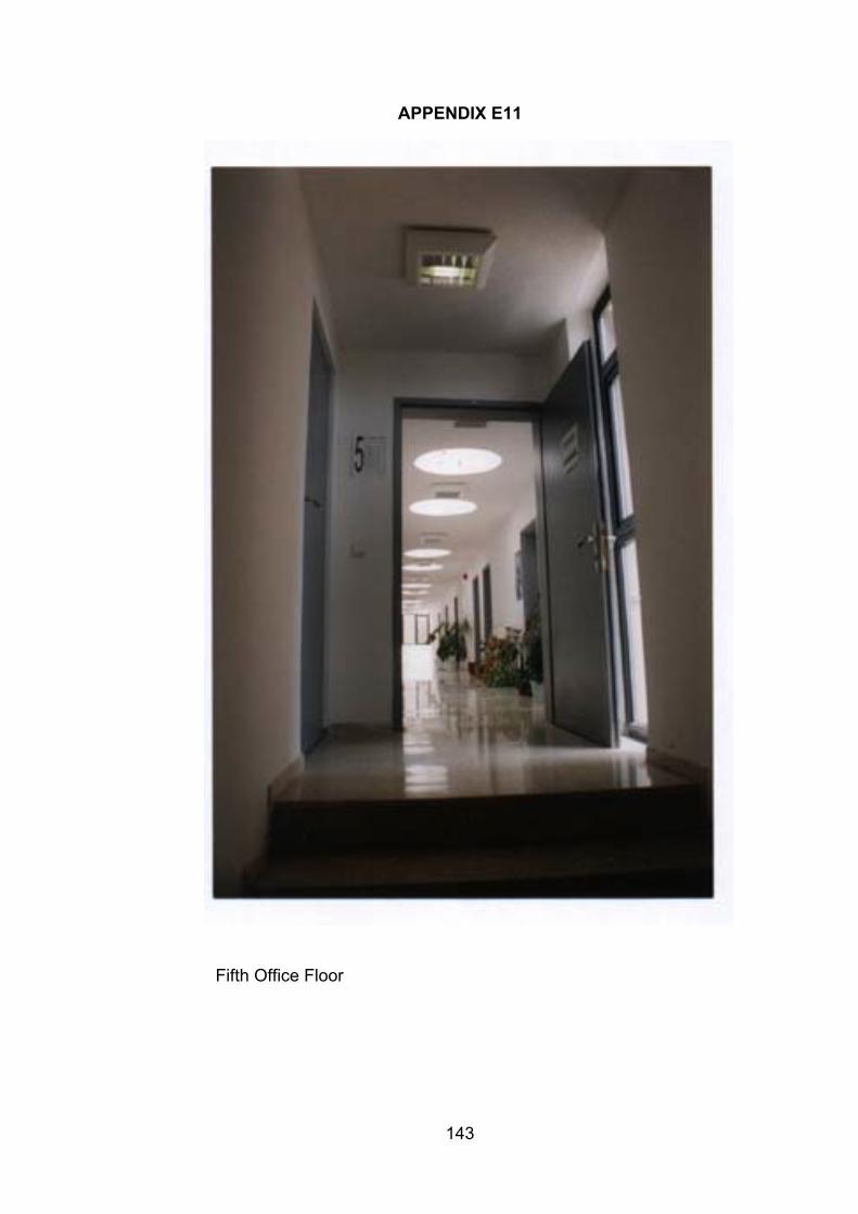
143
APPENDIX E11
Fifth Office Floor
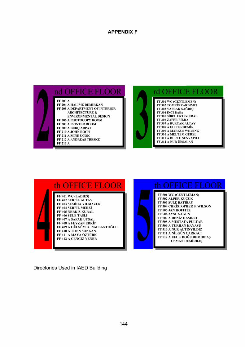
144
APPENDIX F
Directories Used in IAED Building
2 nd OFFICE FLOORFF 203 AFF 204 A HALİME DEMİRKANFF 205 A DEPARTMENT OF INTERIOR
ARCHITECTURE &ENVIRONMENTAL DESIGN
FF 206 A PHOTOCOPY ROOMFF 207 A PRINTER ROOMFF 209 A BURÇ ARPATFF 210 A JOHN ROCHFF 211 A MİNE ÜÇOKFF 212 A ANDREAS TRESKEFF 213 A
3 rd OFFICE FLOORFF 301 WC (GENTLEMEN)FF 302 TOMRİS YARDIMCIFF 303 YAPRAK SAĞDIÇFF 304 İNCİ BASAFF 305 SİBEL ERTEZ URALFF 306 ZAFER BİLDAFF 307 A BURÇAK ALTAYFF 308 A ELİF ERDEMİRFF 309 A MARKUS WILSINGFF 310 A MELTEM GÜRELFF 311 A BURCU ŞENYAPILIFF 312 A NUR ÜNSALAN
4th OFFICE FLOOR
FF 401 WC (LADIES)FF 402 SERPİL ALTAYFF 403 SEMİHA YILMAZERFF 404 SERPİL MERZİFF 405 NERKİS KURALFF 406 ŞULE TAŞLIFF 407 A ŞAFAK UYSALFF 408 A FEYZAN ERKİPFF 409 A GÜLSÜM B. NALBANTOĞLUFF 410 A TİJEN SONKANFF 411 A MAYA ÖZTÜRKFF 412 A CENGİZ YENER 5
th OFFICE FLOORFF 501 WC (GENTLEMAN)FF 502 ALPER KÜÇÜKFF 503 ŞULE BATIBAYFF 504 CHRİSTOPHER S. WILSONFF 505 JAN HOFFITZFF 506 AYSU SAGUNFF 507 A DENİZ HASIRCIFF 508 A MUSTAFA PULTARFF 509 A TURHAN KAYASÜFF 510 A NUR ALTINYILDIZFF 511 A NİLGÜN ÇARKACIFF 512 A UFUK DOĞU DEMİRBAŞ
OSMAN DEMİRBAŞ
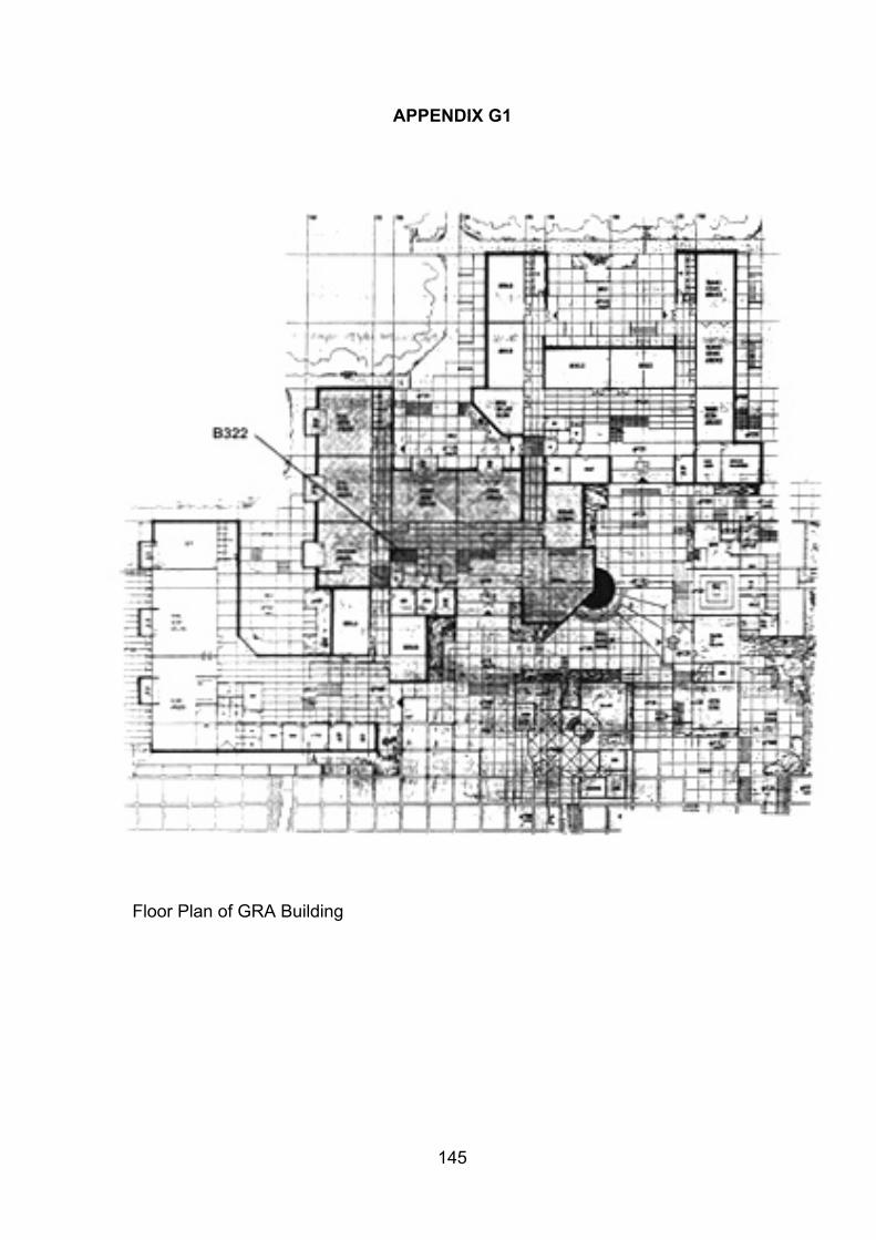
145
APPENDIX G1
Floor Plan of GRA Building
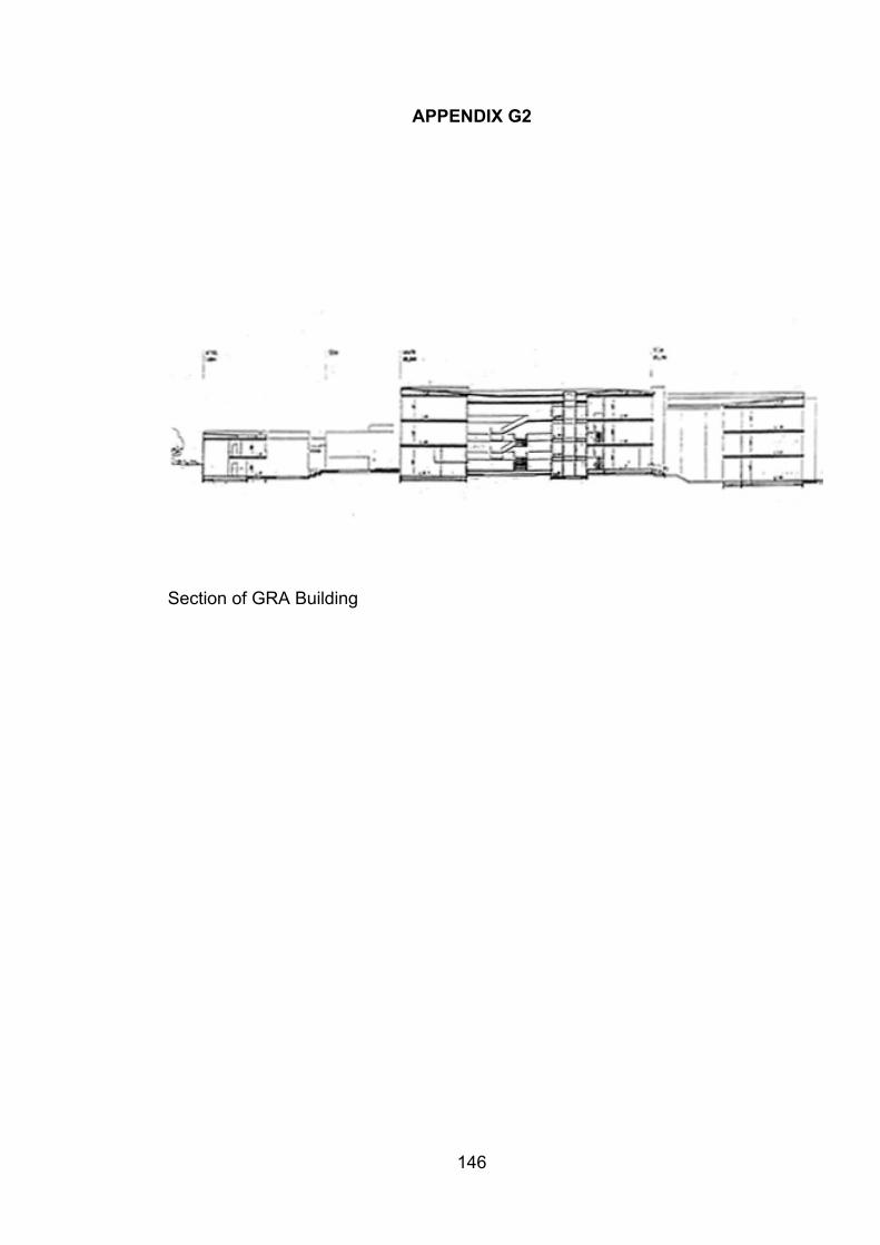
146
APPENDIX G2
Section of GRA Building
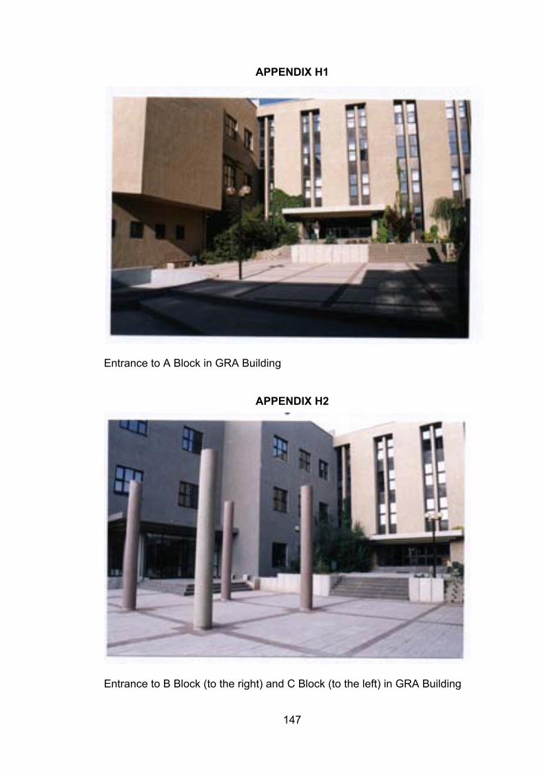
147
APPENDIX H1
Entrance to A Block in GRA Building
APPENDIX H2
Entrance to B Block (to the right) and C Block (to the left) in GRA Building
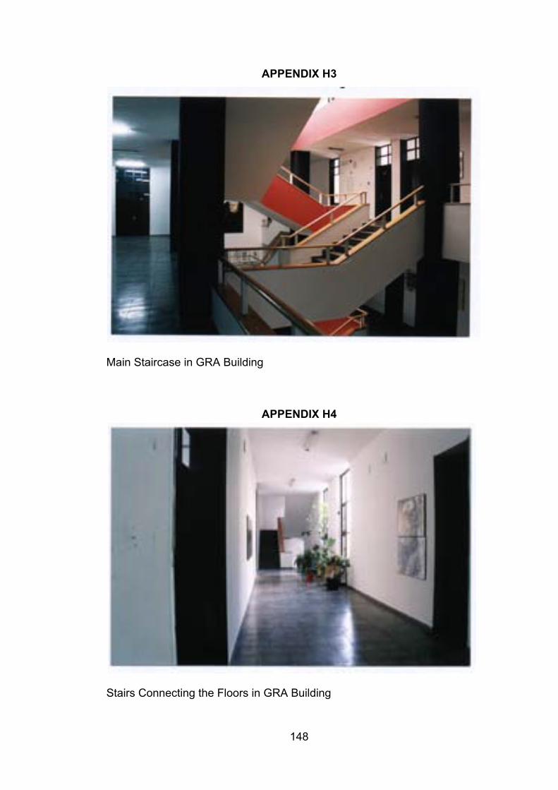
148
APPENDIX H3
Main Staircase in GRA Building
APPENDIX H4
Stairs Connecting the Floors in GRA Building
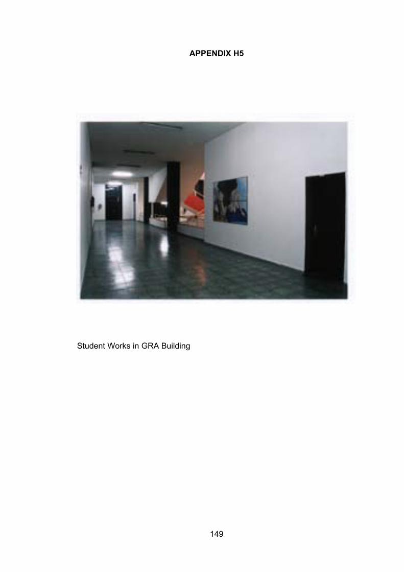
149
APPENDIX H5
Student Works in GRA Building
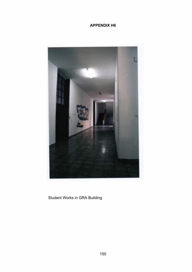
150
APPENDIX H6
Student Works in GRA Building
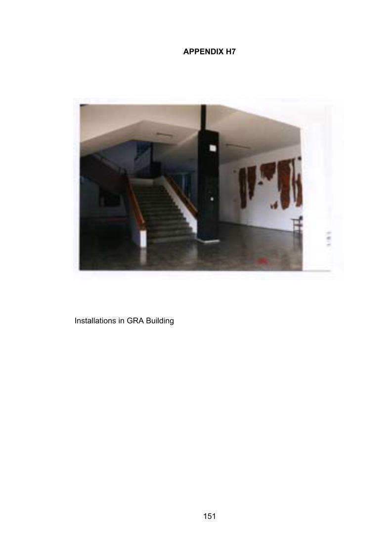
151
APPENDIX H7
Installations in GRA Building

152
APPENDIX I1
LIST OF QUESTIONS
1. Age:2. Sex:3. Department:4. Year:
5. When was the first time you visited a) IAED? b) ABC?6. How often do you visit:
a) IAED ?b) ABC ?
7. Which area of the building do you use most often in:a) IAED ?b) ABC ?
8. Which floor do you use most often in:a) IAED ?b) ABC ?
9. Rate your familiarity over 7 (1 being “not familiar at all”, 7 being “extremelyfamiliar”) witha) IAEDb) ABC
10. Evaluate the buildings over 7 in terms of wayfinding (1 being “extremely poor”,7 being “excellent”)a) IAEDb) ABC
11. What kind of information do you generally use when you enter a building youhave never been to before?
12. Describe the buildings naming as many spatial features as possible:a) in IAEDb) in ABC
13. Please comment on the atmosphere of:a) IAEDb) ABC
14. Do you think that visual accessibility exists in:a) IAED ?b) ABC ?
15. Is signage sufficient in:a) IAED ?b) ABC ?
16. Is the building configuration simple or complex in:a) IAEDb) ABC
17. Does architectural differentiation among different parts of the building exist in:a) IAED ?b) ABC ?
153
APPENDIX I2
TASK:
F311
TIME:INITIAL PREFERENCE:ROUTE DESCRIPTION:
SHORTCUT:NUMBER OF ERRORS:
FB322
TIME:INITIAL PREFERENCE:ROUTE DESCRIPTION:
SHORTCUT:NUMBER OF ERRORS:
154
APPENDIX J
List of Variables
1. Sex2. Age3. Department4. Class5. Familiarity Rating for IAED6. Familiarity Rating for GRA7. Number of Elements Recalled in IAED8. Number of Elements Recalled in GRA9. Type of Elements Recalled in IAED10. Type of Elements Recalled in GRA11. Frequency of Visit to IAED12. Frequency of Visit to GRA13. Areas Used Most in IAED14. Areas Used Most in GRA15. Floors Used Most in IAED16. Floors Used Most in GRA17. Elements Used Generally18. Number of Errors in IAED19. Number of Errors in GRA20. Initial Preference in IAED21. Initial Preference in GRA22. Shortcuts Taken in IAED23. Shortcuts Taken in ABC24. Time IAED25. Time GRA26. Wayfinding Rating for IAED27. Wayfinding Rating for GRA28. Atmosphere IAED29. Atmosphere GRA30. Cards Rotation Test31. Maze Tracing Speed Test32. Visual Accessibility IAED33. Visual Accessibility GRA34. Signage IAED35. Signage GRA36. Plan Configuration IAED37. Plan Configuration GRA38. Architectural Differentiation IAED39. Architectural Differentiation GRA